Landscape & Development Checklist
15
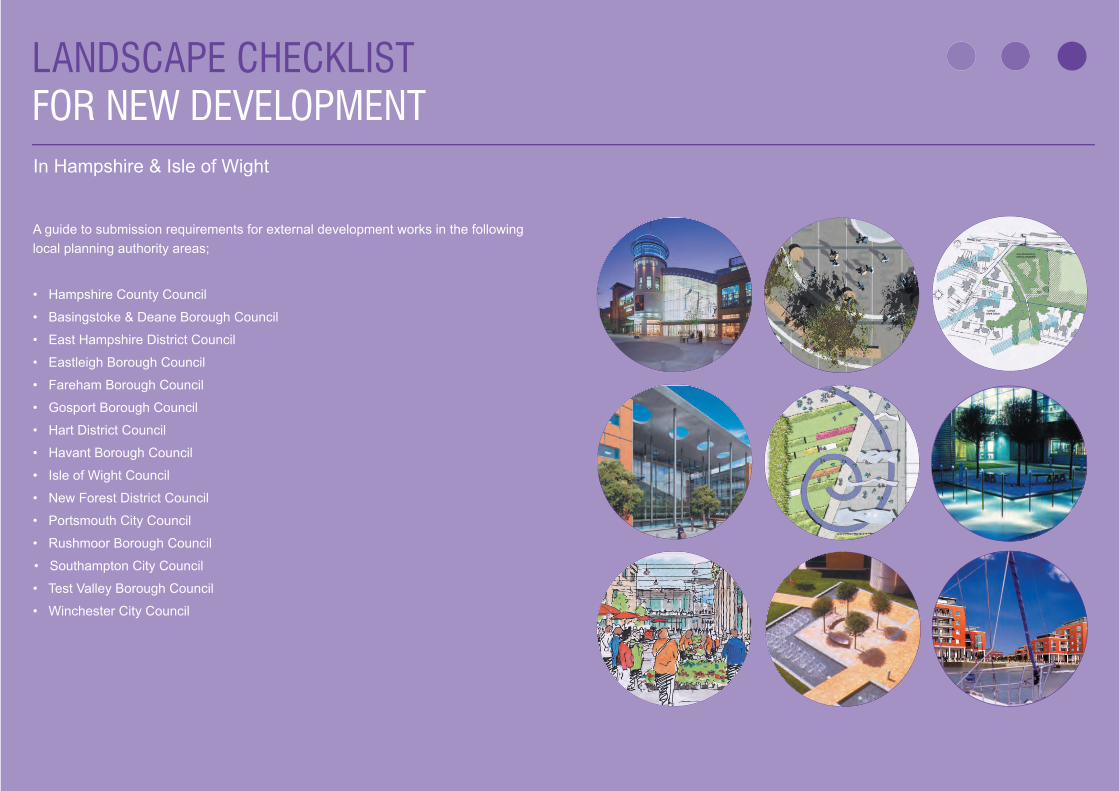
LANDSCAPE CHECKLIST FOR NEW DEVELOPMENT A guide to submission requirements for external development works in the following local planning authority areas; • Hampshire County Council • Basingstoke & Deane Borough Council • East Hampshire District Council • Eastleigh Borough Council • Fareham Borough Council • Gosport Borough Council • Hart District Council • Havant Borough Council • Isle of Wight Council • New Forest District Council • Portsmouth City Council • Rushmoor Borough Council • Southampton City Council • Test Valley Borough Council • Winchester City Council In Hampshire & Isle of Wight
Transcript of Landscape & Development Checklist
11
LANDSCAPE CHECKLIST FOR NEW DEVELOPMENT
A guide to submission requirements for external development works in the following local planning authority areas;
• Hampshire County Council
• Basingstoke & Deane Borough Council
• East Hampshire District Council
• Eastleigh Borough Council
• Fareham Borough Council
• Gosport Borough Council
• Hart District Council
• Havant Borough Council
• Isle of Wight Council
• New Forest District Council
• Portsmouth City Council
• Rushmoor Borough Council
• • Southampton City Council
• Test Valley Borough Council
• Winchester City Council
In Hampshire & Isle of Wight
Landscape Checklist for New Development
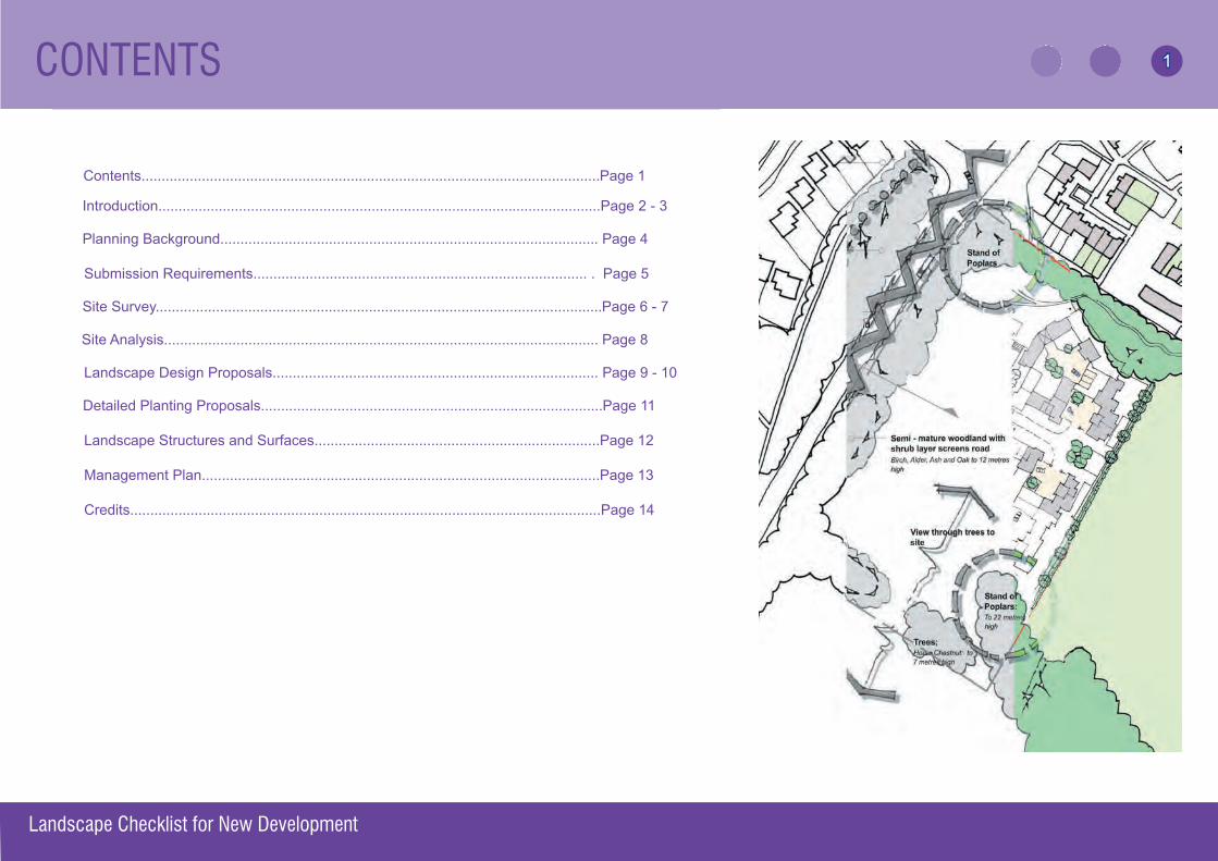
Contents..................................................................................................................Page 1
Introduction..............................................................................................................Page 2 - 3
Planning Background.............................................................................................. Page 4 Submission Requirements................................................................................... . Page 5
Site Survey...............................................................................................................Page 6 - 7
Site Analysis............................................................................................................ Page 8
Landscape Design Proposals................................................................................. Page 9 - 10
Detailed Planting Proposals.....................................................................................Page 11
Landscape Structures and Surfaces.......................................................................Page 12
Management Plan...................................................................................................Page 13 Credits.....................................................................................................................Page 14tations..........................................................................................................Page 13
CONTENTS 1
INTRODUCTION
Landscape Checklist for New Development
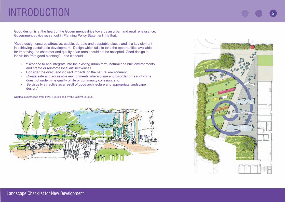
Good design is at the heart of the Government’s drive towards an urban and rural renaissance. Government advice as set out in Planning Policy Statement 1 is that;
“Good design ensures attractive, usable, durable and adaptable places and is a key element in achieving sustainable development. Design which fails to take the opportunities available for improving the character and quality of an area should not be accepted. Good design is indivisible from good planning”... and it should;
• “Respond to and integrate into the existing urban form, natural and built environments and create or reinforce local distinctiveness
• Consider the direct and indirect impacts on the natural environment. • Create safe and accessible environments where crime and disorder or fear of crime does not undermine quality of life or community cohesion; and, • Be visually attractive as a result of good architecture and appropriate landscape
design.”
Quotes summarised from PPS 1, published by the ODPM in 2005
2
INTRODUCTION
OBJECTIVESThis checklist aims to:
• Ensure that developers and their agents are aware of the high importance of the external aspects of development as defi ned by relevant Local Plan policies and implement the requirements of these policies appropriately.
• Ensure that all appropriate information is submitted and clearly presented as part of the planning process, thus avoiding unnecessary and potentially costly delays.
• Improve the quality of the environment in areas undergoing change.
GUIDANCE NOTES• Early discussion between applicant and appropriate local authority offi cer is advisable,
to provide the opportunity for clarifi cation of submission requirements.•
•
Appropriate professional advice should always be sought. Where the proposed development is environmentally signifi cant (by virtue of its size, prominence or degree of impact on the locality), the local planning authority will expect the applicant to employ a chartered landscape architect from the outset. Sources of professional consultancy advice are available from the Landscape Institute (L.I) at www.landscapeinstitute.org or via the L.I South West Branch at www.lisw.org.uk
• Indicative landscape proposals should be included with applications for outline permission where site layout is shown. Detailed landscape proposals should form part of applications for full permission, or reserved matters where appropriate.
•
•
This guide applies to all scales and types of development and not every item on the checklist will be relevant to every application. There may be other items required for some applications; for example those subject to environmental impact assessment.This document is to be found on the Hampshire Local Government Landscape Group (HLGLG) website at www.hiow.gov.uk/offnet/hlg/hlgind.htm
Landscape Checklist for New Development
3
PLANNING BACKGROUND
The planning background of the site should be fully investigated before the design stages and submission of a planning application.
Consult the Regional Spatial Strategy (or Structure plan), Local Development Framework (or Local plan), Local authority landscape/townscape assessments, and existing site development/design briefs and identify the following:
• Site or area designations with boundaries (see below* for examples)• Site status (common land etc.)• Planning history• Land use constraints, including covenants, easements, height restriction
zones, aquifer protection zones, safeguarding areas and areas liable to fl ooding.
The Planning Authority may require an assessment of the Environmental Impact of proposals, for major projects, in accordance with current legislation.
* Site or area designations: National Park, Scheduled Ancient Monument, Area of Outstanding Natural Beauty, Area of Special Landscape Quality, Conservation Area, Environmentally Sensitive Area, Heritage Area, Heritage Site, Historic Parks and Garden Register, Listed Buildings, Areas of Archaeological Potential, Landfi ll Site, Nature Reserve, Site of Special Scientifi c Interest, Special Protection Areas, Ramsar Sites, Sites of Importnace for Nature Conservation, Tree Preservation Orders. The Local Planning Authority will advise on specifi c planning issues relevant to the site.
Useful sources of information include: Local Planing Authority, “The Hampshire Landscape” by Hampshire County Council, Hampshire Records Offi ce,Winchester, (tel: 01962 846145). Aerial photographs, background papers to local plans, local amenity, wildlife and history groups and societies. Model Landscape Conditions for development control, published by HLGLG.
Landscape Checklist for New Development
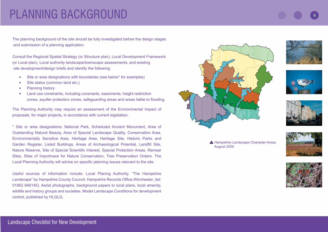
Hampshire Landscape Character Areas Aug 2000
Hampshire Landscape Character AreasAugust 2000
4
SUBMISSION REQUIREMENTS
Landscape Checklist for New Development
SPECIFIC SUBMISSION REQUIREMENTS
• Site Survey • Site Analysis
• Landscape Design Proposals
• Detailed Planting Proposal
• Landscape Structures and Surfaces
All drawings including standard details should address the context. Thus all examples of plans in this guide are indicative.
GENERAL SUBMISSION REQUIREMENTS
• The applicant must present all necessary information in a clear and understandable form. Some authorities may accept digital submissions.
• Ensure all plans are accurate to an appropriate metric scale clearly marked on each plan.
•
•
Service information, sightlines, levels and all relevant site layout details should normally be presented on the same plan as the landscape information (or alternatively, where this is not possible, on separate cross-referenced plans.)If plans are unclear, or the information ambiguous, delays are likely whilst clarifi cation is sought.
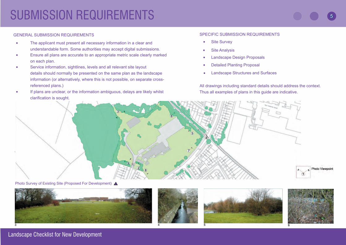
Photo Survey of Existing Site (Proposed For Development)
5
SITE SURVEY
The following should be considered before the design stage and details may be required with the submission, or in advance of the submission of a planning application, as part of a design statement. For all sites (including small ones) a survey will be required, but the information may be presented as part of the Site Design or Planting Plans:
SITE SURVEY Physical characteristics of the site and its setting:
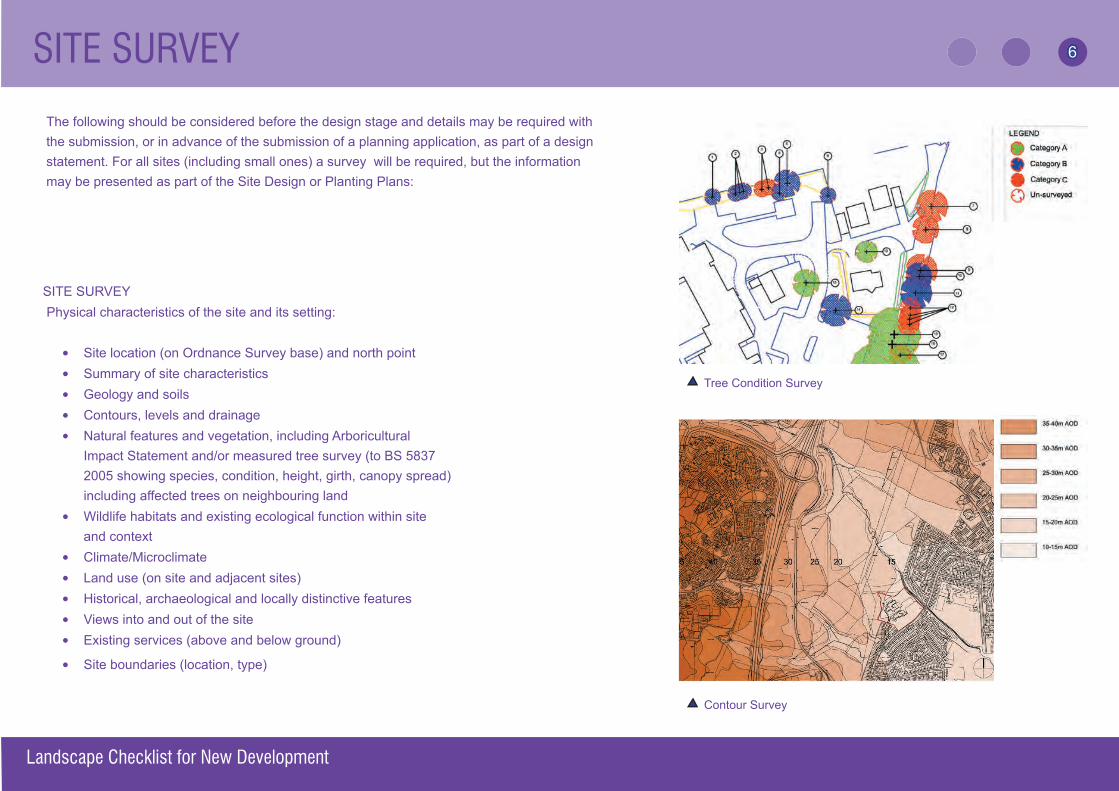
• Site location (on Ordnance Survey base) and north point• Summary of site characteristics• Geology and soils• Contours, levels and drainage • Natural features and vegetation, including Arboricultural
Impact Statement and/or measured tree survey (to BS 5837 2005 showing species, condition, height, girth, canopy spread) including affected trees on neighbouring land
• Wildlife habitats and existing ecological function within site and context
• Climate/Microclimate• Land use (on site and adjacent sites)• Historical, archaeological and locally distinctive features• Views into and out of the site• Existing services (above and below ground)
• Site boundaries (location, type)
Tree Condition Survey
Contour Survey
Landscape Checklist for New Development
6
SITE SURVEY
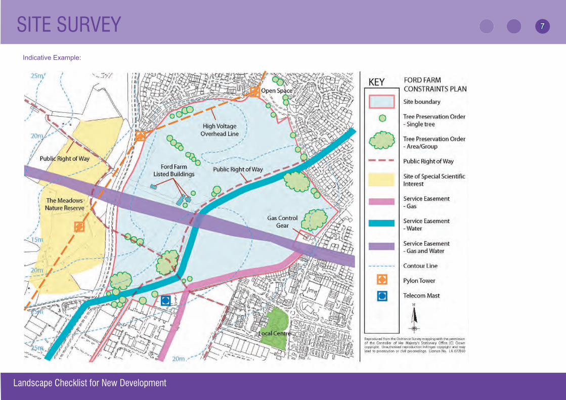
Indicative Example:
• Phasing and programmingLandscape Checklist for New Development
7
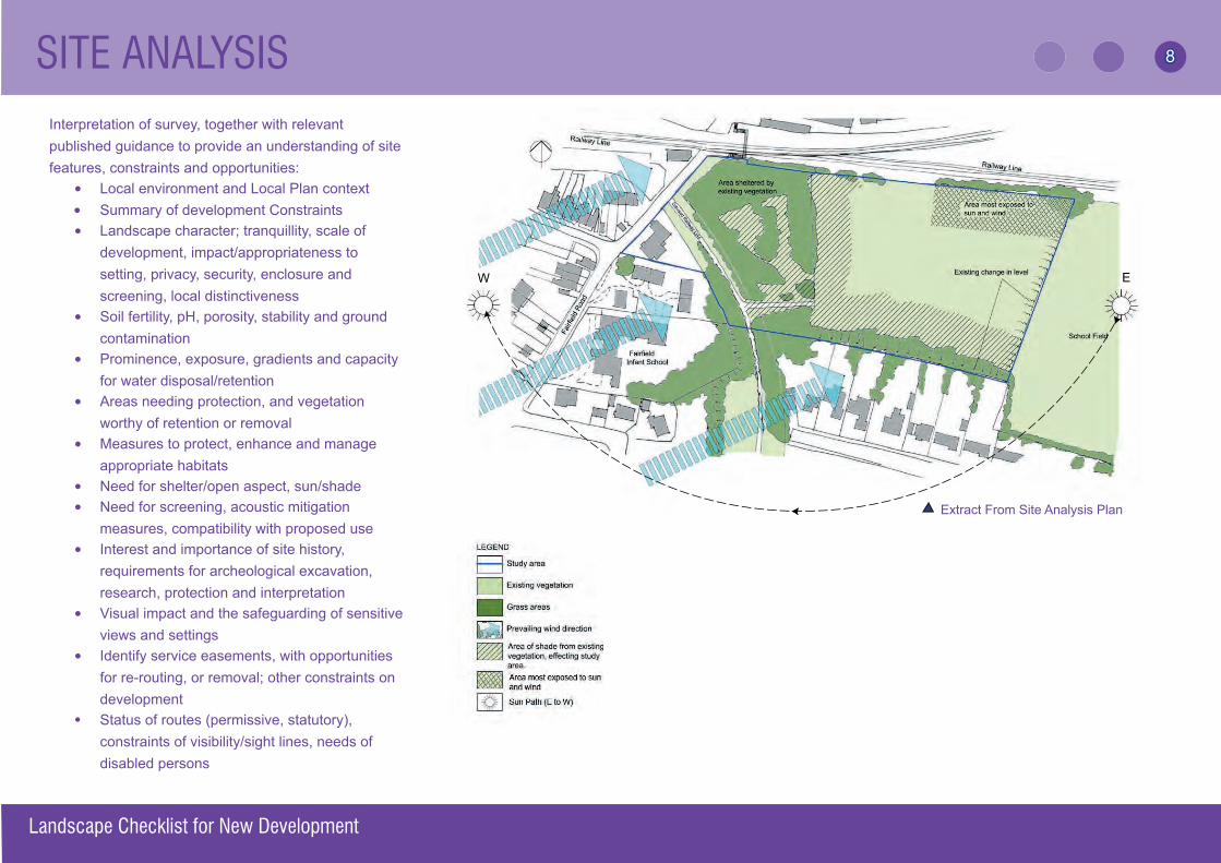
SITE ANALYSIS
Interpretation of survey, together with relevant published guidance to provide an understanding of site features, constraints and opportunities:
• Local environment and Local Plan context • Summary of development Constraints
• Landscape character; tranquillity, scale of development, impact/appropriateness to setting, privacy, security, enclosure and screening, local distinctiveness
• Soil fertility, pH, porosity, stability and ground contamination
• Prominence, exposure, gradients and capacity for water disposal/retention
• Areas needing protection, and vegetation worthy of retention or removal
• Measures to protect, enhance and manage appropriate habitats
• Need for shelter/open aspect, sun/shade• Need for screening, acoustic mitigation
measures, compatibility with proposed use• Interest and importance of site history,
requirements for archeological excavation, research, protection and interpretation
• Visual impact and the safeguarding of sensitive views and settings
• Identify service easements, with opportunities for re-routing, or removal; other constraints on development
• Status of routes (permissive, statutory), constraints of visibility/sight lines, needs of disabled persons
EW
Extract From Site Analysis Plan
Landscape Checklist for New Development
8
The applicant should submit drawings or documents identifying (as appropriate):
• Overall design concept (for larger sites only; response to analysis should also be explained/illustrated)
• Soft landscape elements (areas of: woodland, shelterbelts, specimen plants, shrubs, ground cover, grass; native/ornamental; existing condition and treatment of retained vegetation)
• Area and type of hard surfaces including access and site circulation
(urban plazas, playing surfaces, street furniture, roads, footpaths, cycleways, bridleways, including links to adjoining land)
• Buildings and relationship to external space
(doors, ground fl oor windows fronting onto shrub beds, roof heights above ground level of buildings may be required; compatibility of building foundations with planting)
• Use/function of different areas (for example play provision, private amenity and public open space)
• Contours and levels (existing, proposed, areas of cut and fi ll, identify any surplus, spoil for disposal)
• Services – above and below ground
(existing, proposed, including zones of restriction imposed by statutory undertakers affecting planting, land use and manholes)
• Land drainage (existing, proposed; streams, ponds, ditches, water features)
• Phasing and programming (of implementation, including storage and plant)
• Boundary treatment (long-term design intentions, Section 106 Agreement, public/private responsibilities)
Indicative Landscape Concept Plan
LANDSCAPE DESIGN PROPOSALS
Landscape Checklist for New Development
9
LANDSCAPE DESIGN PROPOSALS
Landscape Checklist for New Development
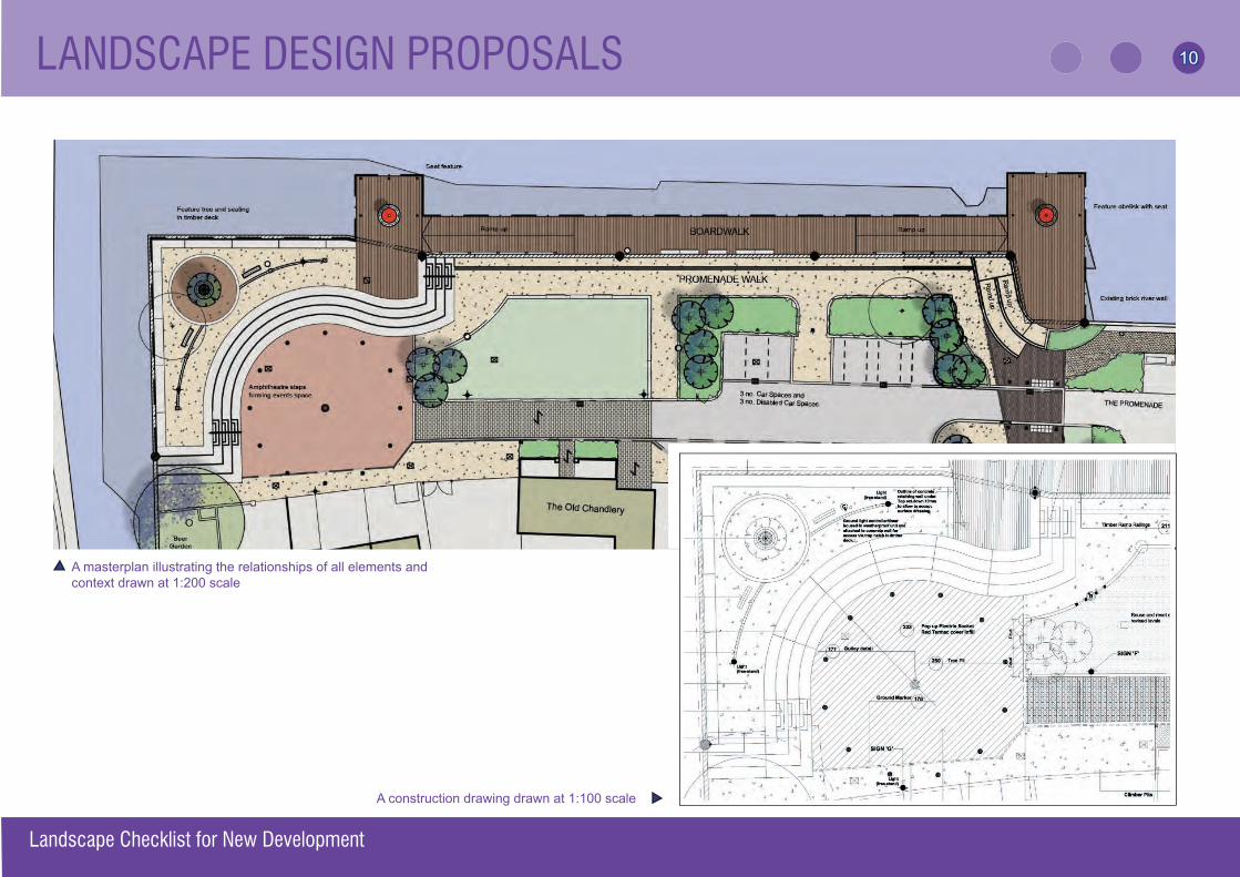
A masterplan illustrating the relationships of all elements and context drawn at 1:200 scale
A construction drawing drawn at 1:100 scale
10
DETAILED PLANTING PROPOSALS
10
•
•
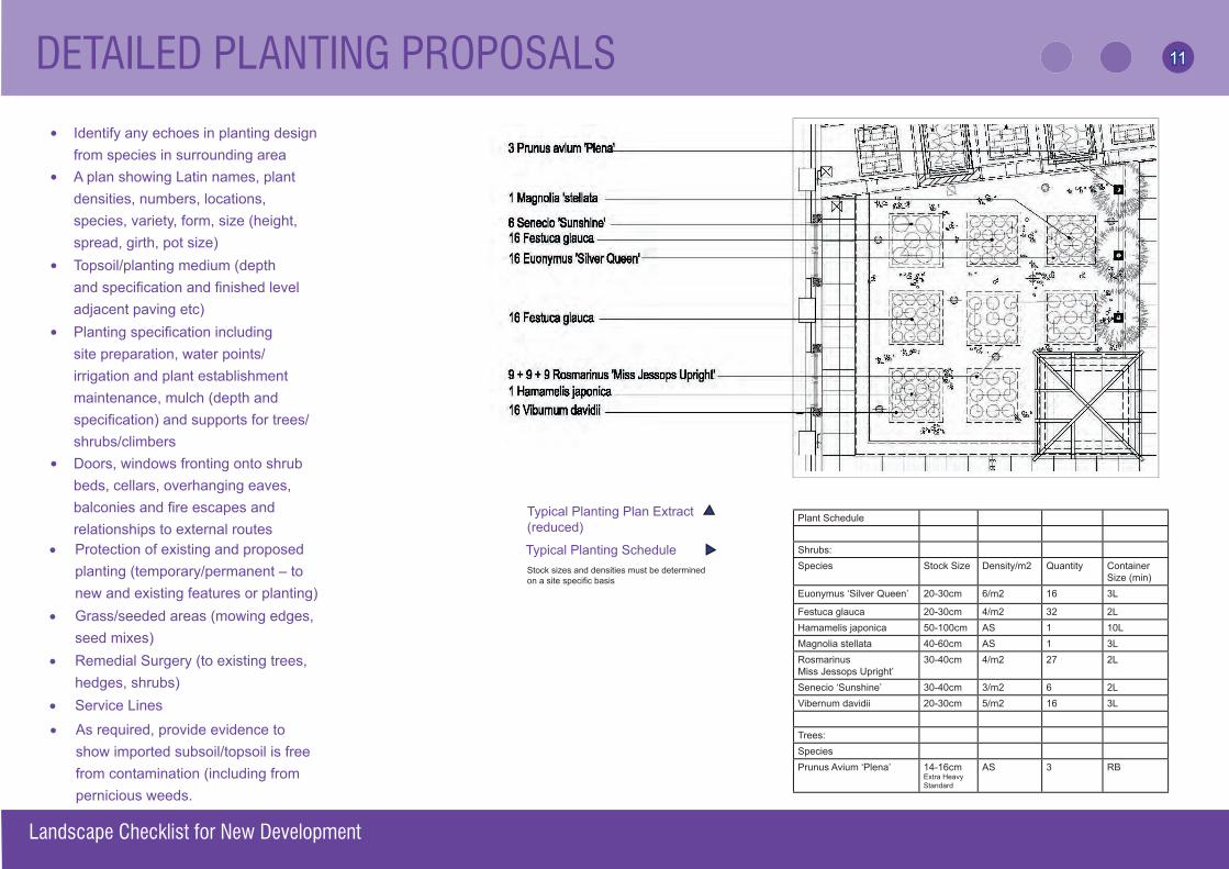
Identify any echoes in planting design from species in surrounding areaA plan showing Latin names, plant densities, numbers, locations, species, variety, form, size (height, spread, girth, pot size)
• Topsoil/planting medium (depth and specifi cation and fi nished level adjacent paving etc)
•
•
Planting specifi cation including site preparation, water points/irrigation and plant establishment maintenance, mulch (depth and specifi cation) and supports for trees/shrubs/climbers Doors, windows fronting onto shrub beds, cellars, overhanging eaves, balconies and fi re escapes and relationships to external routes
• Protection of existing and proposed planting (temporary/permanent – to new and existing features or planting)
• Grass/seeded areas (mowing edges, seed mixes)
• Remedial Surgery (to existing trees, hedges, shrubs)
• Service Lines
• Protection of existing and proposed planting (temporary/permanent – to new and existing features or planting)
• Grass/seeded areas (mowing edges, seed mixes)
• Remedial Surgery (to existing trees, hedges, shrubs)
• As required, provide evidence to show imported subsoil/topsoil is free from contamination (including from pernicious weeds.
Landscape Checklist for New Development
Typical Planting Plan Extract (reduced)
Plant Schedule
Shrubs:Species Stock Size Density/m2 Quantity Container
Size (min)Euonymus ‘Silver Queen’ 20-30cm 6/m2 16 3L
Festuca glauca 20-30cm 4/m2 32 2LHamamelis japonica 50-100cm AS 1 10LMagnolia stellata 40-60cm AS 1 3LRosmarinus Miss Jessops Upright’
30-40cm 4/m2 27 2L
Senecio ‘Sunshine’ 30-40cm 3/m2 6 2LVibernum davidii 20-30cm 5/m2 16 3L
Trees:SpeciesPrunus Avium ‘Plena’ 14-16cm
Extra HeavyStandard
AS 3 RB
Stock sizes and densities must be determined on a site specifi c basis
Typical Planting Schedule
11
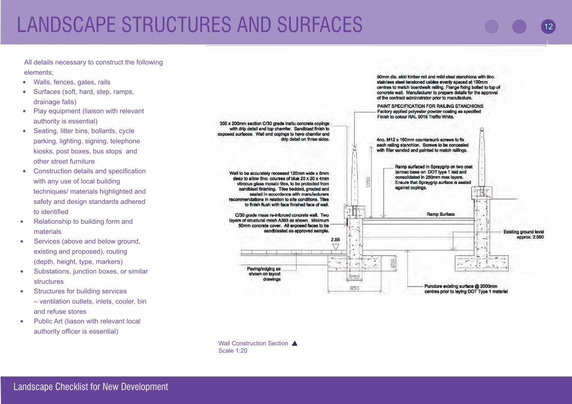
All details necessary to construct the following elements;
• Walls, fences, gates, rails• Surfaces (soft, hard, step, ramps,
drainage falls)• Play equipment (liaison with relevant
authority is essential)• Seating, litter bins, bollards, cycle
parking, lighting, signing, telephone kiosks, post boxes, bus stops and other street furniture
• Construction details and specifi cation with any use of local building techniques/ materials highlighted and safety and design standards adhered to identifi ed
• Relationship to building form and materials
• Services (above and below ground, existing and proposed), routing (depth, height, type, markers)
• Substations, junction boxes, or similar structures
• Structures for building services – ventilation outlets, inlets, cooler, bin and refuse stores
• Public Art (liason with relevant local authority offi cer is essential)
Landscape Checklist for New Development
Wall Construction SectionScale 1:20
LANDSCAPE STRUCTURES AND SURFACES
12
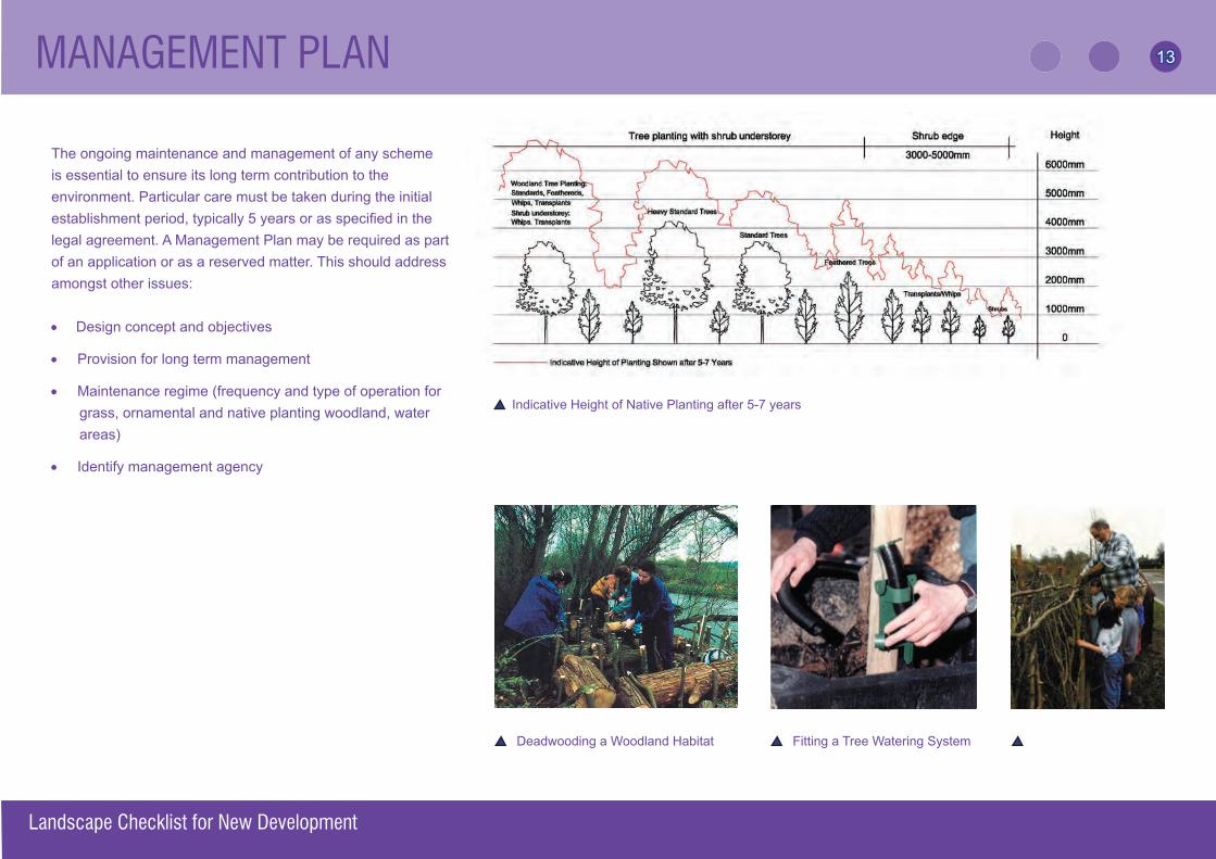
MANAGEMENT PLAN
The ongoing maintenance and management of any schemeis essential to ensure its long term contribution to the environment. Particular care must be taken during the initial establishment period, typically 5 years or as specifi ed in the legal agreement. A Management Plan may be required as part of an application or as a reserved matter. This should address amongst other issues:
• Design concept and objectives
• Provision for long term management
• Maintenance regime (frequency and type of operation for grass, ornamental and native planting woodland, water areas)
• Identify management agency
Indicative Height of Native Planting after 5-7 years
Deadwooding a Woodland Habitat Fitting a Tree Watering System
Landscape Checklist for New Development March 2005
13
Prepared jointly by and for the planning authorities in Hampshire in 2006.
Graphic design by Hyland Edgar Driver Landscape Architects. All images supplied by Hyland Edgar Driver with the exception of Page 4 + 7 (supplied by Hampshire County Council, Southampton City Council and Eastleigh Borough Council) and pages 10 + 12 (supplied by The Landscape Practice.)
CONTACTS
- HLGLG Hampshire Local Government Landscape Group www.hiow.gov.uk/offnet/hlg/hlgind.htm
- LI The Landscape Institute www.landscapeinstitute.org
-LISW The Landscape Institute South West Branch www.lisw.org.uk
CREDITS
Landscape Checklist for New Development
14CREDITS 1144