DRAFT VILLAGE ENHANCEMENT PLANS – LACHLAN SHIRE BURCHER · · 2017-08-16draft village...
11
DRAFT VILLAGE ENHANCEMENT PLANS – LACHLAN SHIRE BURCHER PAGE | 1 AUGUST 2017 – DRAFT FOR CONSULTATION BURCHER
Transcript of DRAFT VILLAGE ENHANCEMENT PLANS – LACHLAN SHIRE BURCHER · · 2017-08-16draft village...
DRAFT VILLAGE ENHANCEMENT PLANS – LACHLAN SHIRE BURCHER
PAGE | 1
AUGUST 2017 – DRAFT FOR CONSULTATION
BU
RC
HE
R
DRAFT VILLAGE ENHANCEMENT PLANS – LACHLAN SHIRE BURCHER
PAGE | 2
AUGUST 2017 – DRAFT FOR CONSULTATION
1. Settlement Overview
1.1. Location & Distances
Burcher is a settlement located in the south-eastern part of the
Lachlan Shire. Driving distances are approximately:
a) 45km (~40 mins) from Ungarie (outside Shire);
b) 63km (~50 mins) from West Wyalong (outside Shire);
c) 63km (~50 mins) from Condobolin (via The Gipps Way);
d) 120km (~1.5 hours) from Lake Cargelligo.
1.2. Brief History
Burcher is likely to have grown from the construction of the rail line from
Wyalong that was authorised in 1923 with the line opening on 16 December
1929. Originally the terminus was called 'Euglo' but the name changed to
Burcher on 4 August 1936 (Wikipedia / Australian Railway Historical Society
Bulletin (Sept 1972) p.176-184)). Further information should be sought from
the local museum. The village has been a winner and placed several times in
the Tidy Towns Competitions. It is also the closest settlement to Lake Cowal
and is close proximity to the Lake Cowal Gold Mine. Lake Cowal is the largest
inland lake in NSW. The gold mine is held by Evolution Mining and has been
producing gold since 2006 (Wikipedia).
1.3. Population & Demographics
Burcher's Census District is only defined by a State Suburb (SSC 10692) that
includes the surrounding rural areas. As at the 2016 Census there were 82
people in this catchment district; 39 private dwellings; a median age of 54, 15
families but due to the small population limited information has been
provided. The area that forms part of the Village Zone would be only a
portion of these figures. The community would like to see more population
growth / opportunities for the village.
DRAFT VILLAGE ENHANCEMENT PLANS – LACHLAN SHIRE BURCHER
PAGE | 3
AUGUST 2017 – DRAFT FOR CONSULTATION
2. Planning Controls & Growth
2.1. Zoning (Land Use)
The key planning controls are in Lachlan Local Environmental
Plan 2013 that applies Zone RU5 Village to the settlement with
Zone SP2 Infrastructure at the Waste Depot (as the rail line is
not active it is not in Zone SP2). A Village Zone is a suitable
category at this time. The settlement has a minimum lot size of
4000m2 for subdivision.
The settlement is surrounded by Zone RU1 Primary Production
(that includes the golf course) with Zone RU3 Forestry to the
north of the golf course. There are no Zone R5 Large Lot
Residential areas around or near the settlement.
2.2. Crown Land & Growth Opportunities
This Plan does not consider changes to zoning or lot size
boundaries but it is assumed there is sufficient area for
residential and other land use growth at this time.
However, as the diagram above shows, a large amount of
Burcher's Village Zone is actually Crown land. It may be worth
approaching the Crown Lands Department to see if some crown
lands can be released for private development (if required)
particularly along Bena and Curran Streets where there are
existing road frontages.
The aerial photo does not accurately align with lot boundaries so
the village may need to be resurveyed by the NSW
Government.
3. Access & Utilities
3.1. Rail & Road
Burcher is located on Burcher Road / Lake Cowal Road
approximately 10km to the east of The Gipps Way (known as the
West Wyalong Road). As the village is not located on a major
route it has limited passing traffic which means tourist
opportunities need clear signage/communication (see Signage
Section) but this also means it does not need additional traffic
calming for safety/amenity.
Burcher is located at the terminus of the Burcher Branch Rail
Line which connects by Lake Cowal to Wyalong Junction. The
station is closed. ARTC officially 'closed' the line on 30 June 2005
(Wikipedia / The Railway News (August 2005 p.109)).
3.2. Roads (Quality)
All roads in and immediately around Burcher are local roads (not
RMS funded). The Gipps Way is likely to be a classified / RMS
road.
Burcher Road to the west of the settlement is sealed but the seal ends as it
becomes Lake Cowal Road to the east. The community has suggested that
Lake Cowal Road could be sealed to the Forbes Road (42km) as it is used to
take stock to Forbes saleyards – but this may be a longer-term project
(subject to Council funding / not costed).
Within the settlement, only Bena Street (east-west) is sealed. The
community would like to see roadside edges fixed and widened. Specific
areas for these works need to be identified before this can be costed.
It has a unique split road system with a main two-way road and then an
adjacent local road along the southern edge. For visitors some additional
signage of the traffic priority of the split-roads may be required (but doesn't
appear to have caused an issue so far / not costed). See Main Street Section
below for additional works.
The community has not raised a concern with sealing of other local roads but
ideally in the medium to longer term Kurrajong Street and then parts of
Myall and Curran Streets should have a narrow seal (not costed).
3.3. Drainage
Burcher is not in close proximity to Sharpless or Humbug Creeks to the west
(near The Gipps Way) or Lake / Nerang Cowal (to the east) but it is very flat
and low-lying so there is likely to still be a risk of overland flooding during
peak rainfall events (not confirmed). However, drainage does not appear to
be a major issue for this settlement.
However, the town relies on the water reservoir for non-potable water. The
drainage channel to the water reservoir is silted up and need cleaning. In
the medium to longer term it probably needs upgrading to improve collection
and may require sealing to increase water collection and minimise siltation.
3.4. Utilities
Burcher relies on rainwater for individual buildings/lots. The reticulated
supply is non-potable as it comes from the reservoir. This is a potential
limitation to growth. The community has expressed a desire for potable
water supply, possibly from bore water (suggestion of Les Gould's property
near waste depot) but bore water may be brackish. Further investigation
required as this may be a longer-term objective (not costed).
Burcher also does not have access to reticulated sewerage so it is reliant on
on-site sewage management systems such as septic systems – but there was
no comment these are not working.
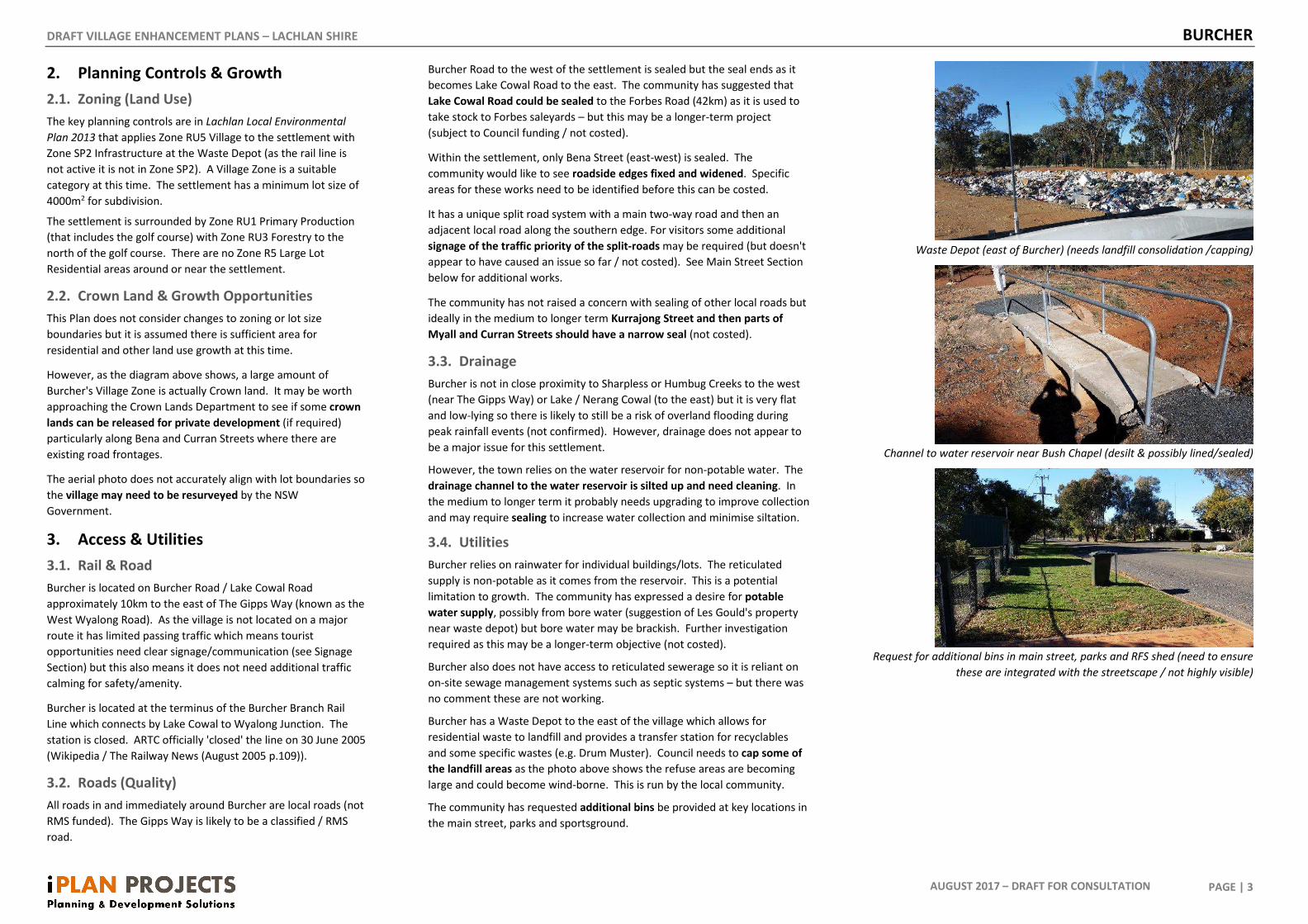
Burcher has a Waste Depot to the east of the village which allows for
residential waste to landfill and provides a transfer station for recyclables
and some specific wastes (e.g. Drum Muster). Council needs to cap some of
the landfill areas as the photo above shows the refuse areas are becoming
large and could become wind-borne. This is run by the local community.
The community has requested additional bins be provided at key locations in
the main street, parks and sportsground.
Waste Depot (east of Burcher) (needs landfill consolidation /capping)
Channel to water reservoir near Bush Chapel (desilt & possibly lined/sealed)
Request for additional bins in main street, parks and RFS shed (need to ensure
these are integrated with the streetscape / not highly visible)
DRAFT VILLAGE ENHANCEMENT PLANS – LACHLAN SHIRE BURCHER
PAGE | 4
AUGUST 2017 – DRAFT FOR CONSULTATION
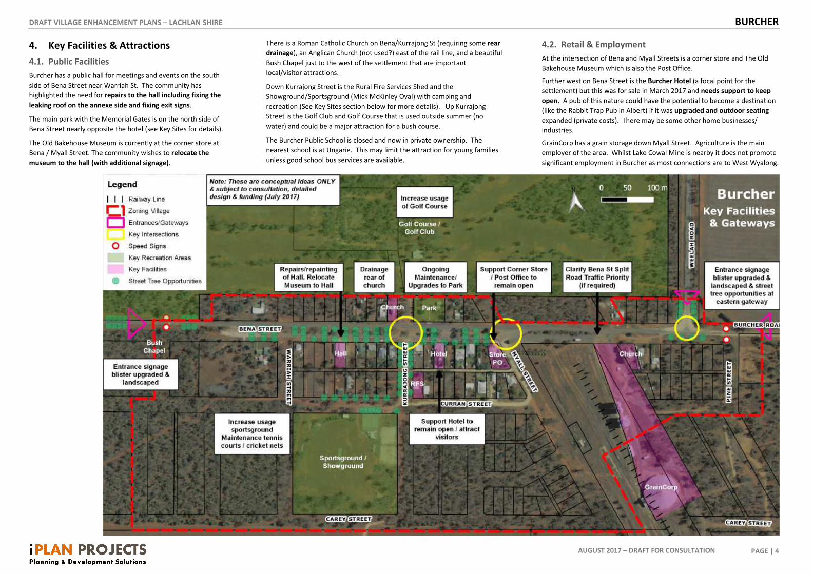
4. Key Facilities & Attractions
4.1. Public Facilities
Burcher has a public hall for meetings and events on the south
side of Bena Street near Warriah St. The community has
highlighted the need for repairs to the hall including fixing the
leaking roof on the annexe side and fixing exit signs.
The main park with the Memorial Gates is on the north side of
Bena Street nearly opposite the hotel (see Key Sites for details).
The Old Bakehouse Museum is currently at the corner store at
Bena / Myall Street. The community wishes to relocate the
museum to the hall (with additional signage).
There is a Roman Catholic Church on Bena/Kurrajong St (requiring some rear
drainage), an Anglican Church (not used?) east of the rail line, and a beautiful
Bush Chapel just to the west of the settlement that are important
local/visitor attractions.
Down Kurrajong Street is the Rural Fire Services Shed and the
Showground/Sportsground (Mick McKinley Oval) with camping and
recreation (See Key Sites section below for more details). Up Kurrajong
Street is the Golf Club and Golf Course that is used outside summer (no
water) and could be a major attraction for a bush course.
The Burcher Public School is closed and now in private ownership. The
nearest school is at Ungarie. This may limit the attraction for young families
unless good school bus services are available.
4.2. Retail & Employment
At the intersection of Bena and Myall Streets is a corner store and The Old
Bakehouse Museum which is also the Post Office.
Further west on Bena Street is the Burcher Hotel (a focal point for the
settlement) but this was for sale in March 2017 and needs support to keep
open. A pub of this nature could have the potential to become a destination
(like the Rabbit Trap Pub in Albert) if it was upgraded and outdoor seating
expanded (private costs). There may be some other home businesses/
industries.
GrainCorp has a grain storage down Myall Street. Agriculture is the main
employer of the area. Whilst Lake Cowal Mine is nearby it does not promote
significant employment in Burcher as most connections are to West Wyalong.
DRAFT VILLAGE ENHANCEMENT PLANS – LACHLAN SHIRE BURCHER
PAGE | 5
AUGUST 2017 – DRAFT FOR CONSULTATION
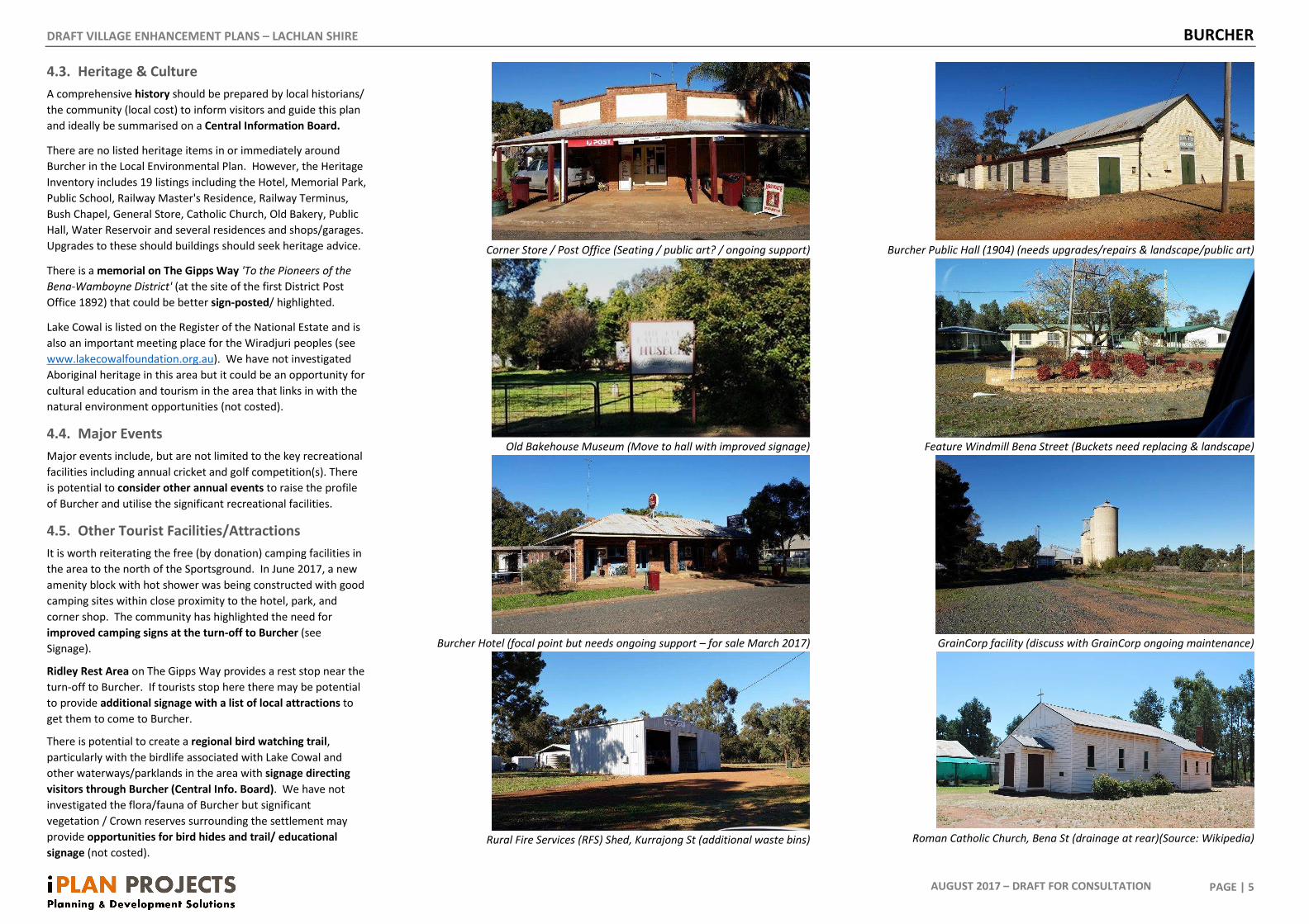
4.3. Heritage & Culture
A comprehensive history should be prepared by local historians/
the community (local cost) to inform visitors and guide this plan
and ideally be summarised on a Central Information Board.
There are no listed heritage items in or immediately around
Burcher in the Local Environmental Plan. However, the Heritage
Inventory includes 19 listings including the Hotel, Memorial Park,
Public School, Railway Master's Residence, Railway Terminus,
Bush Chapel, General Store, Catholic Church, Old Bakery, Public
Hall, Water Reservoir and several residences and shops/garages.
Upgrades to these should buildings should seek heritage advice.
There is a memorial on The Gipps Way 'To the Pioneers of the
Bena-Wamboyne District' (at the site of the first District Post
Office 1892) that could be better sign-posted/ highlighted.
Lake Cowal is listed on the Register of the National Estate and is
also an important meeting place for the Wiradjuri peoples (see
www.lakecowalfoundation.org.au). We have not investigated
Aboriginal heritage in this area but it could be an opportunity for
cultural education and tourism in the area that links in with the
natural environment opportunities (not costed).
4.4. Major Events
Major events include, but are not limited to the key recreational
facilities including annual cricket and golf competition(s). There
is potential to consider other annual events to raise the profile
of Burcher and utilise the significant recreational facilities.
4.5. Other Tourist Facilities/Attractions
It is worth reiterating the free (by donation) camping facilities in
the area to the north of the Sportsground. In June 2017, a new
amenity block with hot shower was being constructed with good
camping sites within close proximity to the hotel, park, and
corner shop. The community has highlighted the need for
improved camping signs at the turn-off to Burcher (see
Signage).
Ridley Rest Area on The Gipps Way provides a rest stop near the
turn-off to Burcher. If tourists stop here there may be potential
to provide additional signage with a list of local attractions to
get them to come to Burcher.
There is potential to create a regional bird watching trail,
particularly with the birdlife associated with Lake Cowal and
other waterways/parklands in the area with signage directing
visitors through Burcher (Central Info. Board). We have not
investigated the flora/fauna of Burcher but significant
vegetation / Crown reserves surrounding the settlement may
provide opportunities for bird hides and trail/ educational
signage (not costed).
Corner Store / Post Office (Seating / public art? / ongoing support)
Old Bakehouse Museum (Move to hall with improved signage)
Burcher Hotel (focal point but needs ongoing support – for sale March 2017)
Rural Fire Services (RFS) Shed, Kurrajong St (additional waste bins)
Burcher Public Hall (1904) (needs upgrades/repairs & landscape/public art)
Feature Windmill Bena Street (Buckets need replacing & landscape)
GrainCorp facility (discuss with GrainCorp ongoing maintenance)
Roman Catholic Church, Bena St (drainage at rear)(Source: Wikipedia)
DRAFT VILLAGE ENHANCEMENT PLANS – LACHLAN SHIRE BURCHER
PAGE | 6
AUGUST 2017 – DRAFT FOR CONSULTATION
5. Entrance Design & Signage
5.1. Shire Tourist Trails
There are limited tourist, heritage, or environmental attractions
(at this time) at Burcher but it is a good stopping point on the
way to Lake Cowal and could form part of a regional bird-
watching trail (see above) with additional Aboriginal heritage
cultural education opportunities and potentially visits to the
Lake Cowal gold mine.
The free (donation) camping combined with some local services
and recreation needs to be highlighted. RMS brown tourist trail
signs should be investigated.
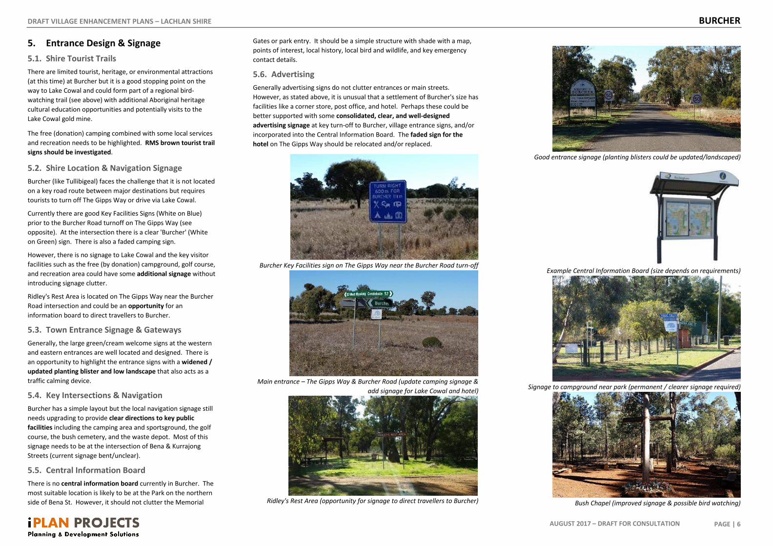
5.2. Shire Location & Navigation Signage
Burcher (like Tullibigeal) faces the challenge that it is not located
on a key road route between major destinations but requires
tourists to turn off The Gipps Way or drive via Lake Cowal.
Currently there are good Key Facilities Signs (White on Blue)
prior to the Burcher Road turnoff on The Gipps Way (see
opposite). At the intersection there is a clear 'Burcher' (White
on Green) sign. There is also a faded camping sign.
However, there is no signage to Lake Cowal and the key visitor
facilities such as the free (by donation) campground, golf course,
and recreation area could have some additional signage without
introducing signage clutter.
Ridley's Rest Area is located on The Gipps Way near the Burcher
Road intersection and could be an opportunity for an
information board to direct travellers to Burcher.
5.3. Town Entrance Signage & Gateways
Generally, the large green/cream welcome signs at the western
and eastern entrances are well located and designed. There is
an opportunity to highlight the entrance signs with a widened /
updated planting blister and low landscape that also acts as a
traffic calming device.
5.4. Key Intersections & Navigation
Burcher has a simple layout but the local navigation signage still
needs upgrading to provide clear directions to key public
facilities including the camping area and sportsground, the golf
course, the bush cemetery, and the waste depot. Most of this
signage needs to be at the intersection of Bena & Kurrajong
Streets (current signage bent/unclear).
5.5. Central Information Board
There is no central information board currently in Burcher. The
most suitable location is likely to be at the Park on the northern
side of Bena St. However, it should not clutter the Memorial
Gates or park entry. It should be a simple structure with shade with a map,
points of interest, local history, local bird and wildlife, and key emergency
contact details.
5.6. Advertising
Generally advertising signs do not clutter entrances or main streets.
However, as stated above, it is unusual that a settlement of Burcher's size has
facilities like a corner store, post office, and hotel. Perhaps these could be
better supported with some consolidated, clear, and well-designed
advertising signage at key turn-off to Burcher, village entrance signs, and/or
incorporated into the Central Information Board. The faded sign for the
hotel on The Gipps Way should be relocated and/or replaced.
Burcher Key Facilities sign on The Gipps Way near the Burcher Road turn-off
Main entrance – The Gipps Way & Burcher Road (update camping signage &
add signage for Lake Cowal and hotel)
Ridley's Rest Area (opportunity for signage to direct travellers to Burcher)
Good entrance signage (planting blisters could be updated/landscaped)
Example Central Information Board (size depends on requirements)
Signage to campground near park (permanent / clearer signage required)
Bush Chapel (improved signage & possible bird watching)
DRAFT VILLAGE ENHANCEMENT PLANS – LACHLAN SHIRE BURCHER
PAGE | 7
AUGUST 2017 – DRAFT FOR CONSULTATION
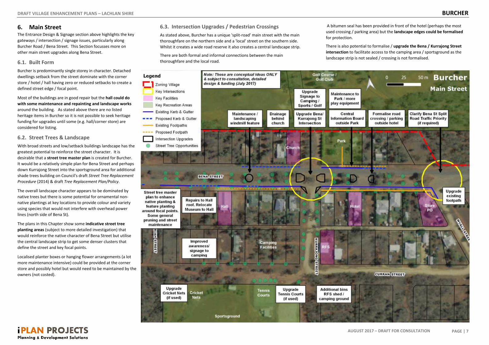
6. Main Street The Entrance Design & Signage section above highlights the key
gateways / intersection / signage issues, particularly along
Burcher Road / Bena Street. This Section focusses more on
other main street upgrades along Bena Street.
6.1. Built Form
Burcher is predominantly single storey in character. Detached
dwellings setback from the street dominate with the corner
store / hotel / hall having zero or reduced setbacks to create a
defined street edge / focal point.
Most of the buildings are in good repair but the hall could do
with some maintenance and repainting and landscape works
around the building. As stated above there are no listed
heritage items in Burcher so it is not possible to seek heritage
funding for upgrades until some (e.g. hall/corner store) are
considered for listing.
6.2. Street Trees & Landscape
With broad streets and low/setback buildings landscape has the
greatest potential to reinforce the street character. It is
desirable that a street tree master plan is created for Burcher.
It would be a relatively simple plan for Bena Street and perhaps
down Kurrajong Street into the sportsground area for additional
shade trees building on Council's draft Street Tree Replacement
Procedure (2014) & draft Tree Replacement Plan/Policy.
The overall landscape character appears to be dominated by
native trees but there is some potential for ornamental non-
native plantings at key locations to provide colour and variety
using species that would not interfere with overhead power
lines (north side of Bena St).
The plans in this Chapter show some indicative street tree
planting areas (subject to more detailed investigation) that
would reinforce the native character of Bena Street but utilise
the central landscape strip to get some denser clusters that
define the street and key focal points.
Localised planter boxes or hanging flower arrangements (a lot
more maintenance intensive) could be provided at the corner
store and possibly hotel but would need to be maintained by the
owners (not costed).
6.3. Intersection Upgrades / Pedestrian Crossings
As stated above, Burcher has a unique 'split-road' main street with the main
thoroughfare on the northern side and a 'local' street on the southern side.
Whilst it creates a wide road reserve it also creates a central landscape strip.
There are both formal and informal connections between the main
thoroughfare and the local road.
A bitumen seal has been provided in front of the hotel (perhaps the most
used crossing / parking area) but the landscape edges could be formalised
for protection.
There is also potential to formalise / upgrade the Bena / Kurrajong Street
intersection to facilitate access to the camping area / sportsground as the
landscape strip is not sealed / crossing is not formalised.
DRAFT VILLAGE ENHANCEMENT PLANS – LACHLAN SHIRE BURCHER
PAGE | 8
AUGUST 2017 – DRAFT FOR CONSULTATION
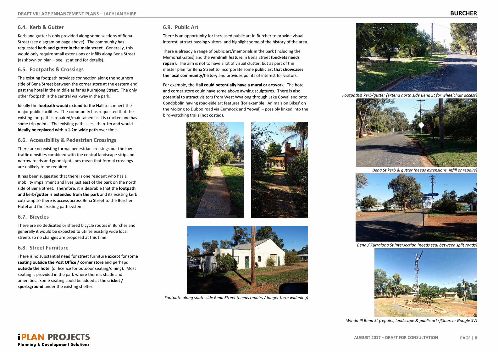
6.4. Kerb & Gutter
Kerb and gutter is only provided along some sections of Bena
Street (see diagram on page above). The community has
requested kerb and gutter in the main street. Generally, this
would only require small extensions or infills along Bena Street
(as shown on plan – see list at end for details).
6.5. Footpaths & Crossings
The existing footpath provides connection along the southern
side of Bena Street between the corner store at the eastern end,
past the hotel in the middle as far as Kurrajong Street. The only
other footpath is the central walkway in the park.
Ideally the footpath would extend to the Hall to connect the
major public facilities. The community has requested that the
existing footpath is repaired/maintained as it is cracked and has
some trip points. The existing path is less than 1m and would
ideally be replaced with a 1.2m wide path over time.
6.6. Accessibility & Pedestrian Crossings
There are no existing formal pedestrian crossings but the low
traffic densities combined with the central landscape strip and
narrow roads and good sight lines mean that formal crossings
are unlikely to be required.
It has been suggested that there is one resident who has a
mobility impairment and lives just east of the park on the north
side of Bena Street. Therefore, it is desirable that the footpath
and kerb/gutter is extended from the park and its existing kerb
cut/ramp so there is access across Bena Street to the Burcher
Hotel and the existing path system.
6.7. Bicycles
There are no dedicated or shared bicycle routes in Burcher and
generally it would be expected to utilise existing wide local
streets so no changes are proposed at this time.
6.8. Street Furniture
There is no substantial need for street furniture except for some
seating outside the Post Office / corner store and perhaps
outside the hotel (or licence for outdoor seating/dining). Most
seating is provided in the park where there is shade and
amenities. Some seating could be added at the cricket /
sportsground under the existing shelter.
6.9. Public Art
There is an opportunity for increased public art in Burcher to provide visual
interest, attract passing visitors, and highlight some of the history of the area.
There is already a range of public art/memorials in the park (including the
Memorial Gates) and the windmill feature in Bena Street (buckets needs
repair). The aim is not to have a lot of visual clutter, but as part of the
master plan for Bena Street to incorporate some public art that showcases
the local community/history and provides points of interest for visitors.
For example, the Hall could potentially have a mural or artwork. The hotel
and corner store could have some above awning sculptures. There is also
potential to attract visitors from West Wyalong through Lake Cowal and onto
Condobolin having road-side art features (for example, 'Animals on Bikes' on
the Molong to Dubbo road via Cumnock and Yeoval) – possibly linked into the
bird-watching trails (not costed).
Footpath along south side Bena Street (needs repairs / longer term widening)
Footpath& kerb/gutter (extend north side Bena St for wheelchair access)
Bena St kerb & gutter (needs extensions, infill or repairs)
Bena / Kurrajong St intersection (needs seal between split roads)
Windmill Bena St (repairs, landscape & public art?)(Source: Google SV)
DRAFT VILLAGE ENHANCEMENT PLANS – LACHLAN SHIRE BURCHER
PAGE | 9
AUGUST 2017 – DRAFT FOR CONSULTATION
7. Key Sites
7.1. Management Plan(s)
For all Crown Lands (and also Council Community lands) ideally
there would be a Plan of Management prepared that would
guide all future decision making in these areas and include the
community and Crown Lands Division in their preparation.
Whilst there is a more generic Parks and Reserves Five Year
Improvement Plan (2008) – site specific studies should be
conducted where possible. As upgrades in Burcher are of a
limited impact/scale this may not be a priority but should remain
a longer-term goal.
7.2. Burcher (Memorial) Park
The main park and Memorial Gates are an important outdoor
community focal point and event space. The community
obviously spends a great deal of effort in maintaining the park
and have added their own memorials and achievements of the
community. Council's role should be to facilitate the community
to manage the park.
A small master plan / planting plan for this park may be
worthwhile to ensure that there is a longer-term plan for desired
projects and landscape so they don't create an inconsistent
'cluttering' effect and are suitable for its mixed-use.
Whilst it is part of the character to re-use and recycle park
furniture – attempts should be made to replace furniture over
time with compatible and robust materials in similar colour
schemes. The old BBQs should be removed and/or consolidated
with the newer electric BBQ or enclosed for table space with
improved seating.
The community have requested updated play equipment. The
current equipment looks in reasonable condition but some
additional pieces could be added where they don't create clutter
and are safe for children. Shade for the play area is also needed
and currently in Council 2022/2023 budget.
This is often the first stop point for tourists to Burcher so either
here (or outside the Hotel) would be an ideal place for a small
Central Information Board with a short history of Burcher,
explanation of the points of interests / services / facilities, and
key emergency contact numbers.
Council should continue to support small villages with an
outdoors crew attending a minimum of two (2) times a year
working with the community for a couple of days on
maintenance, repainting and vegetation management/
replanting.
Burcher Park (opportunity for history / central information board)
Memorial Gates to Park
Play facilities in park (opportunity to upgrade/new equipment/shade cover)
BBQs shelter (integrate electric BBQ into old structure/picnic table seating)
Commemorative plaques create sense of place/achievement (but need to
watch clutter / impact on recreation activities)
BBQ shelter (new BBQ to be integrated)
DRAFT VILLAGE ENHANCEMENT PLANS – LACHLAN SHIRE BURCHER
PAGE | 10
AUGUST 2017 – DRAFT FOR CONSULTATION
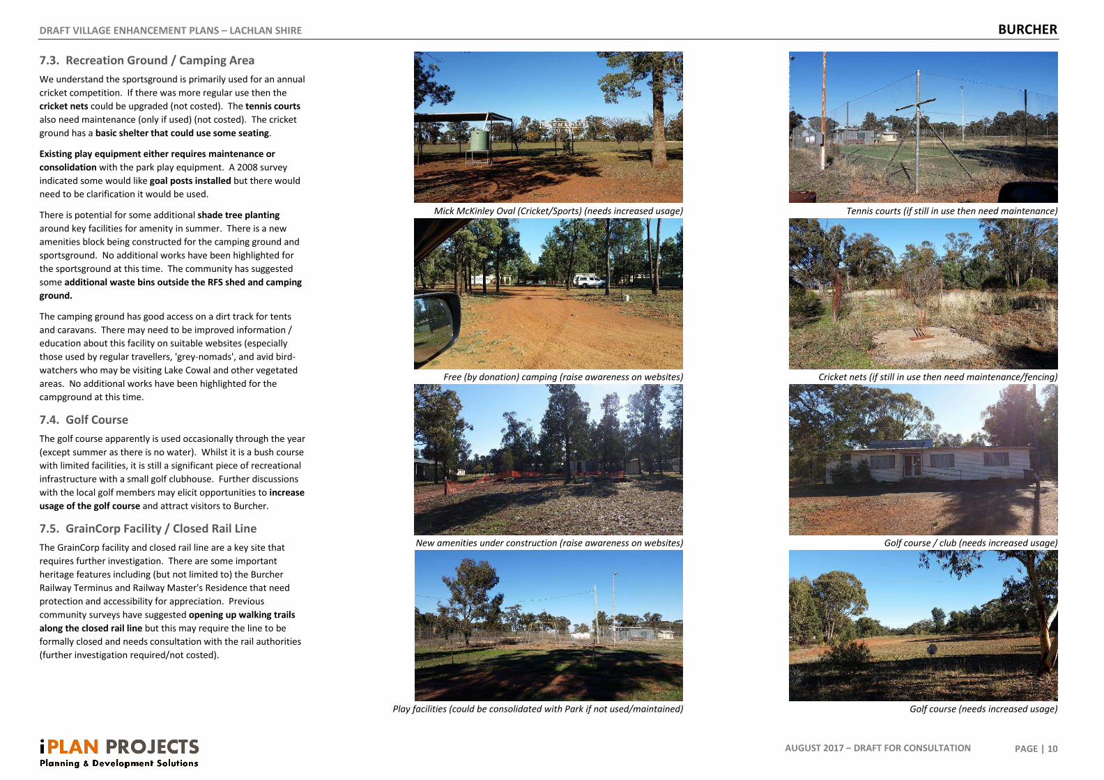
7.3. Recreation Ground / Camping Area
We understand the sportsground is primarily used for an annual
cricket competition. If there was more regular use then the
cricket nets could be upgraded (not costed). The tennis courts
also need maintenance (only if used) (not costed). The cricket
ground has a basic shelter that could use some seating.
Existing play equipment either requires maintenance or
consolidation with the park play equipment. A 2008 survey
indicated some would like goal posts installed but there would
need to be clarification it would be used.
There is potential for some additional shade tree planting
around key facilities for amenity in summer. There is a new
amenities block being constructed for the camping ground and
sportsground. No additional works have been highlighted for
the sportsground at this time. The community has suggested
some additional waste bins outside the RFS shed and camping
ground.
The camping ground has good access on a dirt track for tents
and caravans. There may need to be improved information /
education about this facility on suitable websites (especially
those used by regular travellers, 'grey-nomads', and avid bird-
watchers who may be visiting Lake Cowal and other vegetated
areas. No additional works have been highlighted for the
campground at this time.
7.4. Golf Course
The golf course apparently is used occasionally through the year
(except summer as there is no water). Whilst it is a bush course
with limited facilities, it is still a significant piece of recreational
infrastructure with a small golf clubhouse. Further discussions
with the local golf members may elicit opportunities to increase
usage of the golf course and attract visitors to Burcher.
7.5. GrainCorp Facility / Closed Rail Line
The GrainCorp facility and closed rail line are a key site that
requires further investigation. There are some important
heritage features including (but not limited to) the Burcher
Railway Terminus and Railway Master's Residence that need
protection and accessibility for appreciation. Previous
community surveys have suggested opening up walking trails
along the closed rail line but this may require the line to be
formally closed and needs consultation with the rail authorities
(further investigation required/not costed).
Mick McKinley Oval (Cricket/Sports) (needs increased usage)
Free (by donation) camping (raise awareness on websites)
New amenities under construction (raise awareness on websites)
Play facilities (could be consolidated with Park if not used/maintained)
Tennis courts (if still in use then need maintenance)
Cricket nets (if still in use then need maintenance/fencing)
Golf course / club (needs increased usage)
Golf course (needs increased usage)
DRAFT VILLAGE ENHANCEMENT PLANS – LACHLAN SHIRE BURCHER
PAGE | 11
AUGUST 2017 – DRAFT FOR CONSULTATION
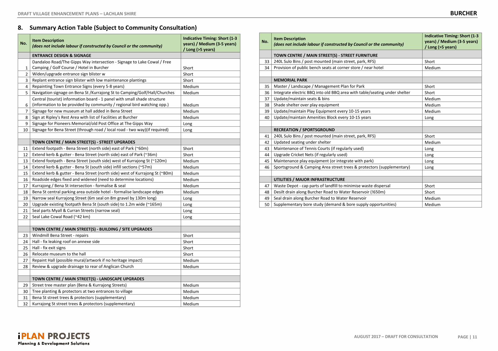
8. Summary Action Table (Subject to Community Consultation)
No. Item Description
(does not include labour if constructed by Council or the community)
Indicative Timing: Short (1-3
years) / Medium (3-5 years)
/ Long (>5 years)
ENTRANCE DESIGN & SIGNAGE
1
Dandaloo Road/The Gipps Way intersection - Signage to Lake Cowal / Free
Camping / Golf Course / Hotel in Burcher Short
2 Widen/upgrade entrance sign blister w Short
3 Replant entrance sign blister with low maintenance plantings Short
4 Repainting Town Entrance Signs (every 5-8 years) Medium
5 Navigation signage on Bena St /Kurrajong St to Camping/Golf/Hall/Churches Medium
6
Central (tourist) information board - 1 panel with small shade structure
(information to be provided by community / regional bird watching opp.) Medium
7 Signage for new museum at hall added in Bena Street Medium
8 Sign at Ripley's Rest Area with list of Facilities at Burcher Medium
9 Signage for Pioneers Memorial/old Post Office at The Gipps Way Long
10 Signage for Bena Street (through road / local road - two way)(if required) Long
TOWN CENTRE / MAIN STREET(S) - STREET UPGRADES
11 Extend footpath - Bena Street (north side) east of Park (~60m) Short
12 Extend kerb & gutter - Bena Street (north side) east of Park (~36m) Short
13 Extend footpath - Bena Street (south side) west of Kurrajong St (~120m) Medium
14 Extend kerb & gutter - Bena St (south side) infill sections (~57m) Medium
15 Extend kerb & gutter - Bena Street (north side) west of Kurrajong St (~80m) Medium
16 Roadside edges fixed and widened (need to determine locations) Medium
17 Kurrajong / Bena St intersection - formalise & seal Medium
18 Bena St central parking area outside hotel - formalise landscape edges Medium
19 Narrow seal Kurrajong Street (6m seal on 8m gravel by 130m long) Long
20 Upgrade existing footpath Bena St (south side) to 1.2m wide (~165m) Long
21 Seal parts Myall & Curran Streets (narrow seal) Long
22 Seal Lake Cowal Road (~42 km) Long
TOWN CENTRE / MAIN STREET(S) - BUILDING / SITE UPGRADES
23 Windmill Bena Street - repairs Short
24 Hall - fix leaking roof on annexe side Short
25 Hall - fix exit signs Short
26 Relocate museum to the hall Short
27 Repaint Hall (possible mural/artwork if no heritage impact) Medium
28 Review & upgrade drainage to rear of Anglican Church Medium
TOWN CENTRE / MAIN STREET(S) - LANDSCAPE UPGRADES
29 Street tree master plan (Bena & Kurrajong Streets) Medium
30 Tree planting & protectors at two entrances to village Medium
31 Bena St street trees & protectors (supplementary) Medium
32 Kurrajong St street trees & protectors (supplementary) Medium
No. Item Description
(does not include labour if constructed by Council or the community)
Indicative Timing: Short (1-3
years) / Medium (3-5 years)
/ Long (>5 years)
TOWN CENTRE / MAIN STREET(S) - STREET FURNITURE
33 240L Sulo Bins / post mounted (main street, park, RFS) Short
34 Provision of public bench seats at corner store / near hotel Medium
MEMORIAL PARK
35 Master / Landscape / Management Plan for Park Short
36 Integrate electric BBQ into old BBQ area with table/seating under shelter Short
37 Update/maintain seats & bins Medium
38 Shade shelter over play equipment Medium
39 Update/maintain Play Equipment every 10-15 years Medium
40 Update/maintain Amenities Block every 10-15 years Long
RECREATION / SPORTSGROUND
41 240L Sulo Bins / post mounted (main street, park, RFS) Short
42 Updated seating under shelter Medium
43 Maintenance of Tennis Courts (if regularly used) Long
44 Upgrade Cricket Nets (if regularly used) Long
45 Maintenance play equipment (or integrate with park) Long
46 Sportsground & Camping Area street trees & protectors (supplementary) Long
UTILITIES / MAJOR INFRASTRUCTURE
47 Waste Depot - cap parts of landfill to minimise waste dispersal Short
48 Desilt drain along Burcher Road to Water Reservoir (!650m) Short
49 Seal drain along Burcher Road to Water Reservoir Medium
50 Supplementary bore study (demand & bore supply opportunities) Medium