VFR-guide vår 2009 - Norges...
39
VFR-guide 2009
-
Upload
truongcong -
Category
Documents
-
view
218 -
download
0
Transcript of VFR-guide vår 2009 - Norges...
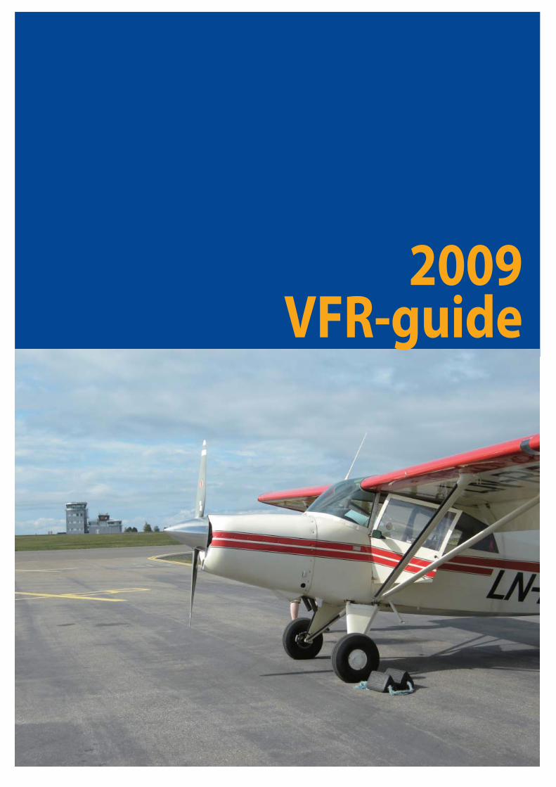
VFR-guide2009
Written by Sverre H. Falkenberg
Updated by Avinor and Norwegian Civil Aviation Authority (NCAA) - 2009
Photos by Anders Hamre, Anders Forseth and Thomas Hytten
Questions about this publication may be directed to:
Luftfartstilsynet/ Norwegian Civil Aviation Auhority
Allmennfl yseksjon / General Avation Section
P.O.Box 243
N-8003 BODØ
NORWAY
Tel. +47 75 58 50 00
Fax. +47 75 58 50 05
Be aware that the information given is for guidance only and that there may have been up-dates since this guide was published. Pilots are individually responsible for keeping them-selves posted on all current regulations within the area. They are also responsible for all actions taken before and while operating in Norwegian area.
IntroductionWelcome to Norway and Norwegian Airspace! This booklet is made for the purpose of assisting you, as a VFR pilot, in your planning and conduct of fl ight within Norwegian Airspace.
The vast majority of the Norwegian land masses consist of mountainous terrain with countless valleys and deep fj ords. You will enjoy a spectacular scenery and great fun while fl ying in these areas, but you should also bear in mind that the environment may suddenly “bite” you during un-favourable fl ight conditions. This booklet tries to raise the awareness of such unfavourable fl ight conditions. Relevant rules and regulations applicable to VFR fl ights within Norway are covered and so is other information necessary for safe planning and conduct of fl ight. Set your own limitations and prepare for the expected so you do not have to recover from the unexpected!
2
Table of contents
INTRODUCTION 2 FLIGHT PLANNING 5TAKE CHARGE OF FLIGHT SAFETY 5RISK TAKING 5RISK FACTORS 6PERSONAL MINIMUMS CHECKLIST 6GETTING AHEAD 7AIRCRAFT PERFORMANCE 7PERFORMANCE TABLE 8TYPES OF MANUALS AND CHARTS AVAILABLE 9CRUISING LEVELS 11PRE-FLIGHT MET BRIEFING AND VOLMET BROADCASTS 11GO/NO-GO WEATHER CRITERIA 11VISUAL METEOROLOGICAL CONDITIONS (VMC) 12WEATHER MINIMA FOR SPECIAL VFR FLIGHTS 12VFR FLIGHTS BETWEEN SUNSET AND SUNRISE 13VFR ON TOP 13OPERATIVE FLIGHT PLAN 13FUEL PLANNING 13ICAO FLIGHTPLAN 14DEPARTURE MESSAGE 14ARRIVAL REPORT 15
FLIGHTS IN MOUNTAIN AND REMOTE AREAS 16MOUNTAIN FLYING 17TAKEOFF 18DOWNDRAFTS 18WIND SHEAR 18ICING 19ENROUTE 20LANDING 22WIRES 22AUTOMATIC OBSTACLE WARNING SYSTEMS 23WHITEOUT AND BRIGHTOUT 23SVALBARD 24AREAS WITH SENSITIVE FAUNA 24SURVIVAL AND PERSONAL EQUIPMENT 25
3
COMMUNICATION 26LANGUAGE REQUIREMENTS 26SSR TRANSPONDER 26AERODROME FLIGHT INFORMATON SERVICE (AFIS) 26AIRPACE 26OPERATIONS IN CLASS D aIRSPACE OUTSIDE ATC OPERATIONAL HOURS 27 ESTABLISHED AS CONTROL ZONE (CTR) 27ESTABLISHED AS TERMINAL CONTROL AREA (TMA) 27AIRSPACE INFRINGEMENT 27
EMERGENCIES 29SEARCH AND RESCUE SERVICES (SAR) 29EMERGENCY/PRECAUTIONARY LANDING 30USE OF EMERGENCY LOCATOR TRANSMITTER (ELT) 30
OTHER INFORMATION 31RECOMMENDED ENTRY AIRPORTS TO NORWAY 31TRAFFIC BETWEEN NORWAY AND SCHENGEN COUNTRIES 31AIRCRAFT ENTERING OR LEAVING NORWAY 32ANIMALS AND PETS 32CUSTOMS AND IMMIGRATIONS 32NORWEGIAN INTERNATIONAL AERODROMES 32AIRCRAFT WITHOUT STANDARD CERTIFICATE OF AIRWORTHINESS 33 CHARGES/WEEKLY SEASON CARD 33ISOLATED- AND HOME FIELD USAGE RESTRICTIONS 33 BIRD HAZARDS 34BIRD MIGRATION ROUTES AND CONCENTRATION AREAS 34 PROTECTION OF REINDEER AGAINST NOISE FROM LOW FLYING AIRCRAFT 35 PHOTOGRAPHING 35USE OF INTOXICATING LIQUOR, NARCOTICS OR DRUGS 35 CHARTS AND FLIGHT EQUIPMENT 36YOUR PERSONAL IMSAFE CHECKLIST 37
4
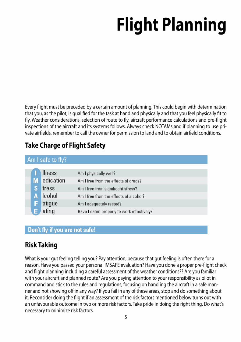
Flight Planning
Every fl ight must be preceded by a certain amount of planning. This could begin with determination that you, as the pilot, is qualifi ed for the task at hand and physically and that you feel physically fi t to fl y. Weather considerations, selection of route to fl y, aircraft performance calculations and pre-fl ight inspections of the aircraft and its systems follows. Always check NOTAMs and if planning to use pri-vate airfi elds, remember to call the owner for permission to land and to obtain airfi eld conditions.
Take Charge of Flight Safety
Risk Taking
What is your gut feeling telling you? Pay attention, because that gut feeling is often there for a reason. Have you passed your personal IMSAFE evaluation? Have you done a proper pre-fl ight check and fl ight planning including a careful assessment of the weather conditions?? Are you familiar with your aircraft and planned route? Are you paying attention to your responsibility as pilot in command and stick to the rules and regulations, focusing on handling the aircraft in a safe man-ner and not showing off in any way? If you fail in any of these areas, stop and do something about it. Reconsider doing the fl ight if an assessment of the risk factors mentioned below turns out with an unfavourable outcome in two or more risk factors. Take pride in doing the right thing. Do what’s necessary to minimize risk factors.
5
Risk Factors
Pilot
How current are you?Do you feel rested and fi t for fl ight?Do you have experience with the type of airspace you will be fl ying in?Experience with the terrain and type of airfi elds to use?
Aircraft
Is it properly equipped?Any maintenance problems that should be taken care of?
Performance
Fuel ConsumptionWeight and balanceField elevation and runway length available
Environment
What is the weather like?Day or Night operations?What type of terrain and airfi elds are involved?
External pressure
Why are you making the trip?What outside forces are pushing you?Are you pressed for time?
Personal Minimums Checklist
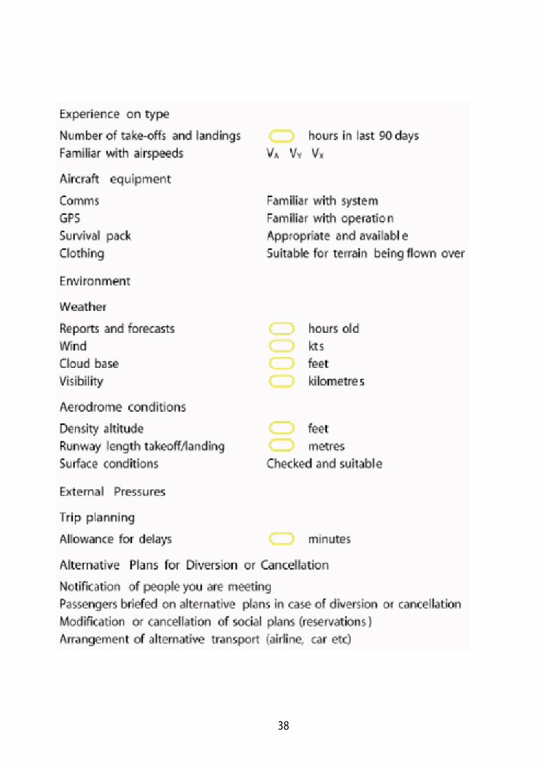
The use of checklist in general is very important and they will help you to remember every impor-tant item. Even very experienced pilots do errors and they too get distracted or fall into the trap of being complacent. The conscious use of checklists is the only way you can be certain that you do things by the book, time after time.
6
Getting ahead
The use of mnemonics, as a substitute for checklists while in fl ight can sometimes be more conve-nient. Regardless of either method, you must ascertain that you actually carry out the procedure steps by confi rming them either by eyesight and/or touch.It is a fact that most errors that lead to incidents are made prior to takeoff , so it is important to iden-tify and minimize risk factors during your pre-fl ight planning. This can be done by making your own Personal Minimums Checklist, listing the sequence of actions necessary to prevent you from forget or overlook anything that may jeopardize fl ight safety. Such a checklist should also include personal minima based on your own experience and skills. Set your own personal minima, not 5 minutes be-fore a fl ight, but when you are not infl uenced by any pressure, and write it down. Use these minima as a guide in your planning and decisions. A Personal Minima Checklist will help you make sure you have thought through your most important pre-fl ight and in-fl ight decisions. It will also make you more alert when these minima are approached. If you should choose, for some reason, to operate under marginal conditions, you have been alerted by your checklist to get whatever information or help necessary to make you more capable of handling these. Such information or help could be a more thorough briefi ng of your fl ight route or practicing crosswind landings with an instructor.To minimize the risk factor and operate safely, do your homework and don’t take any shortcuts. Learn from other pilots experiences, always have an alternative plan and be conservative in your decision making. Please use the form and fi ll in your own personal minima.
Aircraft Performance
To know your aircraft performance capabilities is paramount for fl ight safety, especially during fl ights at high density altitudes and from marginal takeoff and landing sites. Remember that Altitude + Power = Performance, and hence are directly dependent on each other. Become familiar with alti-tude and power settings for the fl ight-path (performance) you want to achieve in your aircraft. Fly the numbers and you will achieve maximum performance and also become more easily alerted to environmental eff ects acting on your aircraft, such as downdrafts. You need to have the ability to use and fully understand takeoff and landing performance charts. Every pilot have been planning and executing short- and soft-fi eld takeoff s and landings during their training, but how often are you practicing these skills? Another important consideration is what kind of performance charts you are using. Do they calculate with a built-in margin for error or do they refl ect the best performance you could hope to achieve in a new airplane, in ideal conditions? Do they account for runway slope and surface type? Many performance charts don’t have this built-in safety margins. What about your performance charts?
7

FLIGHT PATH/CONDITION
PERFORMANCE IAS
POWER RPM ALTITUDE
BEST RATE OF CLIMB SPEED
BEST ANGLE OF CLIMB SPEED
NORMAL CLIMB SPEED
FAST CRUISE
SLOW CRUISE
CRUISE DESCENT
BEST GLIDE SPEED - HEAVY
BEST GLIDE SPEED - LIGHT
MANOEUVRING SPEED - HEAVY
MANOEUVRING SPEED - LIGHT
SHORT FIELD TAKEOFF SPEED
SHORT FIELD LANDING SPEEDFLAPLESS LANDING SPEEDNORMAL LANDING SPEED
8
Performance Table
Fill in the numbers for your aircraft.Fly the numbers and you will achieve maximum performance!
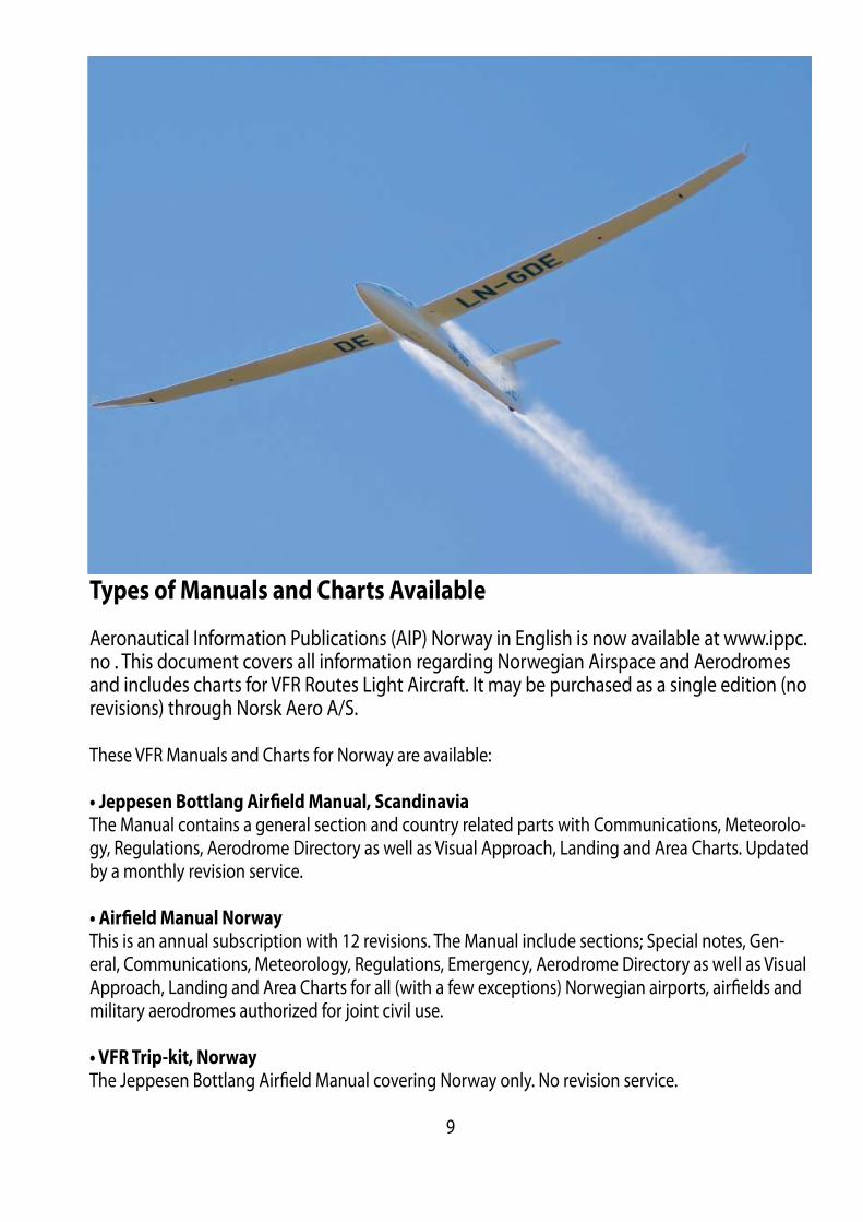
Types of Manuals and Charts Available
Aeronautical Information Publications (AIP) Norway in English is now available at www.ippc.no . This document covers all information regarding Norwegian Airspace and Aerodromes and includes charts for VFR Routes Light Aircraft. It may be purchased as a single edition (no revisions) through Norsk Aero A/S.
These VFR Manuals and Charts for Norway are available:
• Jeppesen Bottlang Airfi eld Manual, Scandinavia
The Manual contains a general section and country related parts with Communications, Meteorolo-gy, Regulations, Aerodrome Directory as well as Visual Approach, Landing and Area Charts. Updated by a monthly revision service.
• Airfi eld Manual Norway
This is an annual subscription with 12 revisions. The Manual include sections; Special notes, Gen-eral, Communications, Meteorology, Regulations, Emergency, Aerodrome Directory as well as Visual Approach, Landing and Area Charts for all (with a few exceptions) Norwegian airports, airfi elds and military aerodromes authorized for joint civil use.
• VFR Trip-kit, Norway
The Jeppesen Bottlang Airfi eld Manual covering Norway only. No revision service.
9

• www.norskefl yplasser.no
This is an unoffi cial website in Norwegian covering both the major airfi elds as well as most of the small dirt and grass fi elds around.
• Aeronautical Chart ICAO, 1:500 000
These charts are often preferred by pilots for VFR cross-country fl ights.
3 charts covering Norway:Southern NorwayCentral NorwayNorthern NorwayThese charts may not be available due delivery problems.
• M517 Air Aeronautical Charts, 1:250 000
Provides higher detail level.
16 charts covering Norway:Kristiansand BergenRjukanOsloFørdeOttaMoldeTrondheimNamsosMosjøenBodøNarvikTromsøKautokeinoHammerfestKirkenes
VFR-fl ights operating in Norwegian airspace are specially warned against obstructions to air naviga-tion. Some aeronautical charts covering Norway may show obstructions to air navigation. No chart, however, is necessarily complete in regard to obstructions in the area covered. Please note that positions may only be approximates. Caution should be exercised when fl ying in fj ords and valleys, as well as in the vicinity of islands along the coast.
10
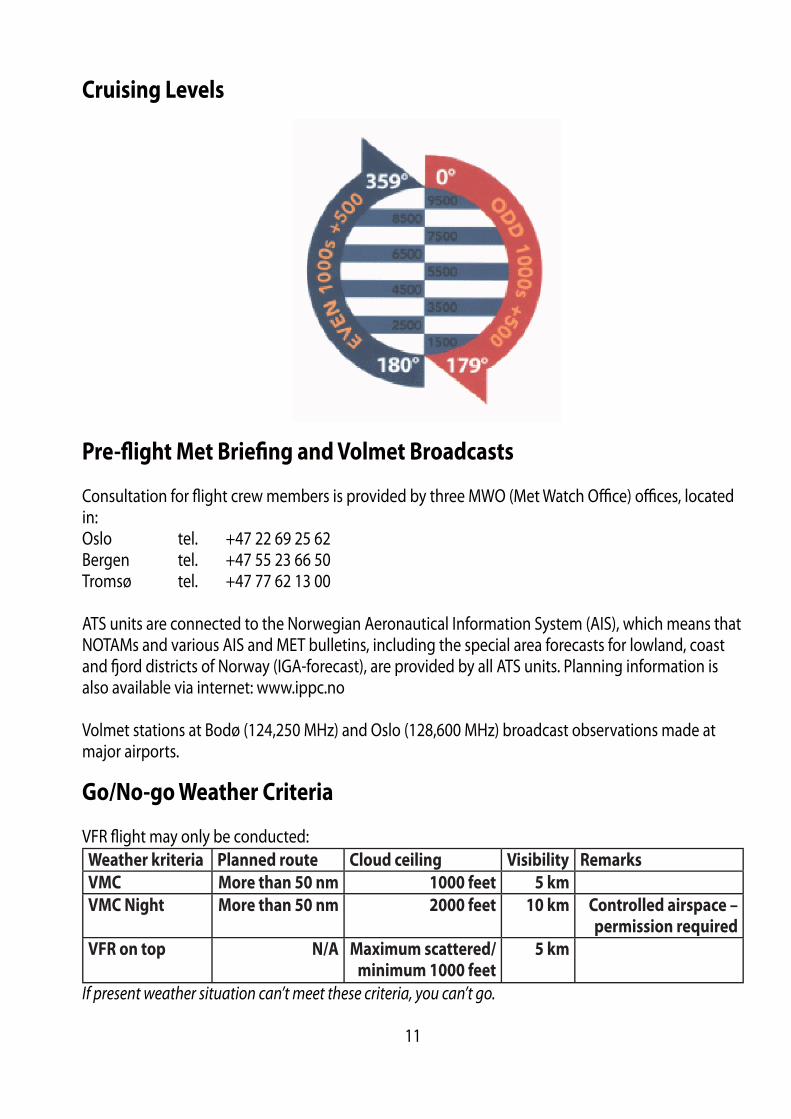
Cruising Levels
Pre-fl ight Met Briefi ng and Volmet Broadcasts
Consultation for fl ight crew members is provided by three MWO (Met Watch Offi ce) offi ces, located in:Oslo tel. +47 22 69 25 62 Bergen tel. +47 55 23 66 50 Tromsø tel. +47 77 62 13 00 ATS units are connected to the Norwegian Aeronautical Information System (AIS), which means that NOTAMs and various AIS and MET bulletins, including the special area forecasts for lowland, coast and fj ord districts of Norway (IGA-forecast), are provided by all ATS units. Planning information is also available via internet: www.ippc.no
Volmet stations at Bodø (124,250 MHz) and Oslo (128,600 MHz) broadcast observations made at major airports.
Go/No-go Weather Criteria
VFR fl ight may only be conducted:Weather kriteria Planned route Cloud ceiling Visibility Remarks
VMC More than 50 nm 1000 feet 5 km
VMC Night More than 50 nm 2000 feet 10 km Controlled airspace –
permission required
VFR on top N/A Maximum scattered/
minimum 1000 feet
5 km
If present weather situation can’t meet these criteria, you can’t go.
11
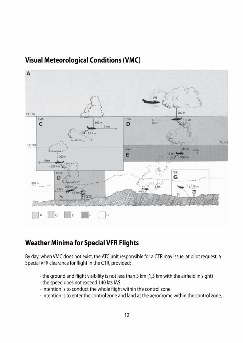
Visual Meteorological Conditions (VMC)
Weather Minima for Special VFR Flights
By day, when VMC does not exist, the ATC unit responsible for a CTR may issue, at pilot request, a Special VFR clearance for fl ight in the CTR, provided:
- the ground and fl ight visibility is not less than 3 km (1,5 km with the airfi eld in sight) - the speed does not exceed 140 kts IAS - intention is to conduct the whole fl ight within the control zone - intention is to enter the control zone and land at the aerodrome within the control zone,
12
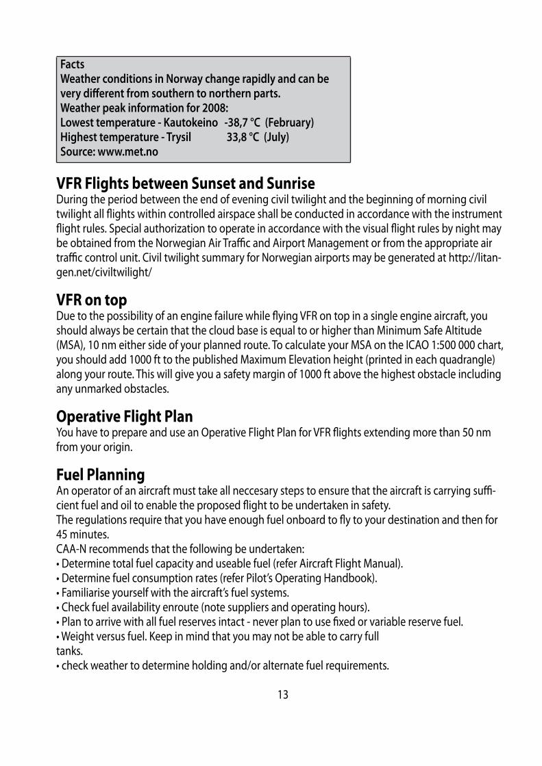
Facts
Weather conditions in Norway change rapidly and can be
very diff erent from southern to northern parts.
Weather peak information for 2008:
Lowest temperature - Kautokeino -38,7 °C (February)
Highest temperature - Trysil 33,8 °C (July)
Source: www.met.no
VFR Flights between Sunset and SunriseDuring the period between the end of evening civil twilight and the beginning of morning civil twilight all fl ights within controlled airspace shall be conducted in accordance with the instrument fl ight rules. Special authorization to operate in accordance with the visual fl ight rules by night may be obtained from the Norwegian Air Traffi c and Airport Management or from the appropriate air traffi c control unit. Civil twilight summary for Norwegian airports may be generated at http://litan-gen.net/civiltwilight/
VFR on topDue to the possibility of an engine failure while fl ying VFR on top in a single engine aircraft, you should always be certain that the cloud base is equal to or higher than Minimum Safe Altitude (MSA), 10 nm either side of your planned route. To calculate your MSA on the ICAO 1:500 000 chart, you should add 1000 ft to the published Maximum Elevation height (printed in each quadrangle) along your route. This will give you a safety margin of 1000 ft above the highest obstacle including any unmarked obstacles.
Operative Flight PlanYou have to prepare and use an Operative Flight Plan for VFR fl ights extending more than 50 nm from your origin.
Fuel PlanningAn operator of an aircraft must take all neccesary steps to ensure that the aircraft is carrying suffi -cient fuel and oil to enable the proposed fl ight to be undertaken in safety.The regulations require that you have enough fuel onboard to fl y to your destination and then for 45 minutes. CAA-N recommends that the following be undertaken:• Determine total fuel capacity and useable fuel (refer Aircraft Flight Manual).• Determine fuel consumption rates (refer Pilot’s Operating Handbook).• Familiarise yourself with the aircraft’s fuel systems.• Check fuel availability enroute (note suppliers and operating hours).• Plan to arrive with all fuel reserves intact - never plan to use fi xed or variable reserve fuel.• Weight versus fuel. Keep in mind that you may not be able to carry fulltanks.• check weather to determine holding and/or alternate fuel requirements.
13
ICAO FlightplanFor your own safety, you should always fi le a fl ight plan with ATS. You may do so to the centralized AIS/NOF at ENGM, tel. +47 64 81 90 00, free of charge. When calling, be sure to have your completed FPL handy and ready to read to the AIS-operator. When operating entirely in Norwegian airspace, the FPL should be delivered at the latest 30 min prior to departure. If you are unable to fi le a FPL, you should give a person on the ground your fl ight details, so if circumstances dictate, SAR will be able to get information about the fl ight.
A complete fl ight plan is mandatory for:
• All fl ights when a national border crossing is required.• All fl ights within EN-R402 (Finnmark).• All fl ights where Search and Rescue (SAR) is requested.
If a complete fl ight plan has not been fi led, an abbreviated fl ight plan should be forwarded to ATC by RTF in order to obtain clearance to operate in airspace class C and D. Clearance request to oper-ate in controlled airspace shall be forwarded not later than 5 min or 10 NM outside the boundary of controlled airspace.
Departure MessageDeparting from an airfi eld where ATS is not provided, the pilot must transmit a departure message by one of the following means:
• Telephone from a person on the ground as arranged between the pilot-in-command and the per-son involved.• A statement by the pilot-in-command to the ATS that EOBT (Estimated Off -block Time) in the fl ight plan shall be considered as ATD.• By giving the time, considered to be ATD, to ATS on telephone immediately prior to taxing out for take off .• By RTF to ATS after departure.
The fl ight plan will not be activated unless one of the above procedures has been complied with.
14
Arrival ReportArrival report and closure of the fl ight plan must be made within 30min after ETA, or else will SAR procedures will be initiated. If an arrival report is not expected to reach the appropriate ATS unit within 30 minutes after ETA, item 18 in the fl ight plan shall contain the latest time at which an arrival report can be expected. The pilot or the operator may be charged for the total costs of SAR opera-tions if the pilot has failed to comply with the appropriate rules for notifi cation to ATC of:
• Deviations from the fl ight plan, or• not closing the fl ight plan, resulting in initiation of SAR operations.
Note: If you are planning to use Oslo airport, Gardermoen, allocation of departure and arrival times (Slot time) are compulsory. For slot time, contact the Scheduling Coordinator at Oslo airport, Gardermoen on:
Tel: +47 64819050Fax: +47 64819051
Completing a Flight Plan
This guideline will cover most conditions regarding completing and submitting a complete Flight Plan for an ordinary day VFR fl ight within Norwegian borders.
The Flight Plan is to be submitted to ATS not later than 30 minutes prior to taxiing for takeoff . If you are submitting by fax, remember to call ATS to have receipt and content confi rmed.
A fl ight plan provides you with automatic Search and Rescue services if needed!
15

Flights in Mountain and Remote Areas
Norway mainly consists of mountainous terrain, deep fj ords often encircled by sharply rising terrain and remote areas. Adding Norwegian weather conditions, which often change rapidly from good to worse resulting in conditions such as fog, low cloud base, precipitation, icing and strong winds, will necessitate for special planning considerations, safety/survival equipment and fl ying skills. You should always have planned for alternatives while fl ying in such areas. Because of Norwegian topography and settlement, remote areas are not easily defi ned, but good examples are Hardan-gervidda, Jotunheimen, Finnmarksvidda and of course Svalbard.
16
Mountain FlyingThe purpose of this section is not to give you a comprehensive lecture on how to fl y in the moun-tains. The purpose is rather to give you some appreciations on what is involved, and to raise your alertness of unsafe conditions. Deteriorating weather conditions and winds above 15 knots will have a greater eff ect on you and your aircraft in the mountains than over fl atland. Seek local knowledge and by all means, get some mountain fl ying instructions if possible. If you are inexperienced in mountain fl ying and prevailing and/or forecast weather are marginal or winds are close to 20 knots or more, please consider an-other time or route to fl y. Even though there are mountainous terrain with “Glittertind” (Galdhøpiggen?) as the highest (8110 ft), the vast majority of airfi elds listed in “Airfi eld Manual Norway”, are situated in the valleys and fj ords. Not many airfi elds are above 2000 ft with “Wadahl” as the highest (at 3150 ft). What is of con-cern is that many of these airfi elds have high and sharply rising terrain close by, which could create turbulence, downdrafts and wind shear in windy conditions. Especially during low visibility and low cloud base, extra care should be taken while approaching and departing such airfi elds. Study the Approach and Landing Chart for the airfi eld carefully and pay extra attention to Caution notes.Even though the vast majority of airfi elds are situated at lower elevations where density altitude will not normally be of major concern (depending on the nature of the surrounding terrain), attention to high altitude techniques is important to consider when operating at landings sites such as small private airfi elds, lakes and snow airfi elds.Even “Wadahl” airfi eld (3150 ft) with its 500m gravel runway, will on a hot summer day of 25ºC, give a density altitude of 4840 ft. This will undoubtedly have an impact on your aircrafts performance. For example, a normally aspirated engine will loose about 3% of its power per thousand feet of den-sity altitude increase.
17
Takeoff Starting and taxi at high density altitudes are performed as you would at sea level, except you must lean the mixture signifi cantly to avoid fouling the spark plugs. Run-up is also normal except a full power run-up of non-turbocharged engines should be used to set mixture for takeoff power.If you are planning to take off heavy, remember that 10 % increase in weight, increases the stall speed by 5 %, and since lift-off speed is generally about 15% above the stall speed, this increase in weight will result in a higher lift-off speed. Since your true airspeed increases with increasing den-sity altitude for a given indicated airspeed (add 2% to TAS per 1000 feet of altitude), the visual cues of higher ground speed on takeoff at a high density airport can make a pilot to rotate too early. You should also be aware of the temptation to over-rotate to try to compensate for the reduced climb performance resulting from higher density altitude.
As a rule of thumb, you should achieve lift-off speed by half runway length. This will give you the option to abort the takeoff at lift-off speed if necessary and also give you an adequate airborne distance after rotation to climb clear of obstacles in front of you. You should also bear in mind that several Norwegian airfi elds have sharply rising terrain close by, which during windy conditions could call for a spiral climb above the airfi eld instead of a straight climbing departure towards rising terrain.
DowndraftsDowndrafts aff ect the climbing capability of your aircraft. To demonstrate this, let’s say a wind of 25 kts is blowing down a mountain side of 20 degrees. The vertical component will equal 9kts. 1 kts is 1nm/hrs, which again equal 6080 ft/hrs or approx. 100 ft/min. This means that your aircraft under these conditions are subject to a vertical force pushing your aircraft down with a speed of 900 ft/min. This force can easily overcome your aircraft climb performance, especially at higher density alti-tudes. This is especiallyimportant to have in mind before takeoff where you have a head wind blowing over rising terrain in front of you.
WindshearMost of the windshear that occur in Norway during winter are caused by temperature-inversions at ground level. These windshears are usually long lasting and may be detected by measuring the wind at higher levels (mountain peaks) above the runway level.
Wind gauges for this purpose are installed at the following
aerodromes:
ALTA (ENAT)BANAK (ENNA)BERGEN/Flesland (ENBR)HARSTAD/NARVIK/Evenes (ENEV)KIRKENES/Høybuktmoen (ENKR)MOSJØEN/Kjærstad (ENMS).
18
In windshear situations these wind observations will be included in the METARs from the aero-dromes. Information on forecast/reported wind shear will be passed on radiotelephony by use of the phraseologies listed below, having the meaning stated. The information is included in ATIS broadcasts at aerodromes where this service has been established.
PHRASEOLOGY MEANING
WINDSHEAR FORECASTTHE WEATHER SITUATION INDICATES THAT WINDSHEAR MAY BE PRESENT BELOW 3000 FT AAL.
WINDSHEAR FORECAST AND REPORTED
THE WEATHER SITUATION INDI-CATES THAT WINDSHEAR MAY BE PRESENT BELOW 3000 FT AAL, AND THAT AT LEAST ONE AIRCRAFT, WITHIN THE LAST 30 MINUTES, HASREPORTED WINDSHEAR DURING APPROACH OR DEPARTURE.
WINDSHEAR REPORTEDAT LEAST ONE AIRCRAFT HAS, WITHIN THE LAST 30 MINUTES, RE-PORTED WINDSHEAR DURING AP-PROACH OR DEPARTURE, BUT THEBASIS FOR FORECASTING WINDS-HEAR IS NOT PRESENT.
Sign of possible windshears outside of aerodromes, may be drifting snow off mountain peaks.Please note that windshears of course may occur during all seasons.
IcingAn aircraft shall not take-off for the purpose of making a fl ight into known or expected icing condi-tions unless the aircraft is adequately equipped with de-icing or anti-icing equipment of the type and quantities required to handle such conditions.Please note that in some areas, like over or nearby larger glaciers as Svartisen or Folgefonna, severe carburettor icing may occur. This is due to the local temperature drop the glaciers will induce.
19

EnrouteRoute selection over mountainous terrain does often involve more than drawing a straight line be-tween your origin and the destination. Wind conditions, cloud base and proper emergency landing sites along your route, often dictate your route selection. For some areas in Norway, the only suit-able emergency landing sites may be to ditch along the shore in the fj ords. Therefore, a map study with emergencies in mind, choosing an alternative plan goes hand in hand with the selection of the main route.
Weather conditions along your route must be checked before take off and monitored constantly to detect deteriorating weather as soon as possible. Especially during winter, the weather conditions may change extremely quickly, from a nice sunny day to dense snow showers in a matter of min-utes. Some of these extreme weather conditions, like the Polar Lows, are intense and very hard to forecast. Rapidly deteriorating weather and windy conditions is what makes mountain fl ying so challenging and sometimes dangerous. If you start to feel uncomfortable due to uncertainty of where you are, clouds forcing you down, reduced visibility, increasing turbulence or downdrafts, take action and make precautionary mea-sures. You may turn around and go back or choose an alternate route, but most importantly, do it in time!
A few points on mountain fl ying techniques:
Air will in many ways fl ow like water. So when air moves along, it will change directions, decelerate or accelerate, move up and down like waves or tumble around when it hits obstructions or being squeezed through mountain passes. In windy conditions (in this context, meaning more than 15 knots at ground level and increasing with altitude), turbulence, updrafts and downdrafts will start to have an impact on fl ight conditions. If you decide to fl y at high altitudes under such conditions, add a safety margin of at least 1000 feet above the peaks along the route to stay away from mountain waves.
Positioning to one side of the valley leaves maximum room to turn.
20
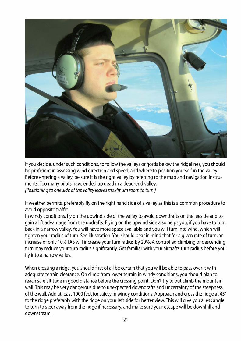
If you decide, under such conditions, to follow the valleys or fj ords below the ridgelines, you should be profi cient in assessing wind direction and speed, and where to position yourself in the valley. Before entering a valley, be sure it is the right valley by referring to the map and navigation instru-ments. Too many pilots have ended up dead in a dead-end valley.[Positioning to one side of the valley leaves maximum room to turn.]
If weather permits, preferably fl y on the right hand side of a valley as this is a common procedure to avoid opposite traffi c.In windy conditions, fl y on the upwind side of the valley to avoid downdrafts on the leeside and to gain a lift advantage from the updrafts. Flying on the upwind side also helps you, if you have to turn back in a narrow valley. You will have more space available and you will turn into wind, which will tighten your radius of turn. See illustration. You should bear in mind that for a given rate of turn, an increase of only 10% TAS will increase your turn radius by 20%. A controlled climbing or descending turn may reduce your turn radius signifi cantly. Get familiar with your aircrafts turn radius before you fl y into a narrow valley.
When crossing a ridge, you should fi rst of all be certain that you will be able to pass over it with adequate terrain clearance. On climb from lower terrain in windy conditions, you should plan to reach safe altitude in good distance before the crossing point. Don’t try to out climb the mountain wall. This may be very dangerous due to unexpected downdrafts and uncertainty of the steepness of the wall. Add at least 1000 feet for safety in windy conditions. Approach and cross the ridge at 45º to the ridge preferably with the ridge on your left side for better view. This will give you a less angle to turn to steer away from the ridge if necessary, and make sure your escape will be downhill and downstream.
21
LandingIf you are intending to land at an airfi eld you are unfamiliar with, you should make a pass and have a closer look at the airfi eld and its surroundings. Make an assessment of the airfi elds length and surface, wind, terrain and check for wires. Plan your departure track and look for escape routes and emergency landing sites in the event of an engine failure shortly after takeoff . In windy and gusty conditions and if there is a chance of downdrafts, aim for a touchdown one quarter down the runway, which will ensure some extra height above the threshold. Keep some power in and use full fl aps. If the eff ective length is limited but adequate, you should make a normal approach to your se-lected touchdown point, but during this phase do not look at the strip length. Doing so will almost certainly cause you to overshoot. An airfi eld looks shorter on approach compared to when fl ying over it, so concentrate on getting the aircraft down where you want it and then concentrate on the landing ground roll after touchdown.
WiresWhen you fl y along valleys or fj ords and during takeoff s and landings, you should pay extra at-tention to the possible presence of wires. Wires often run across valleys and fj ords between poles situated on the ridgelines. The lowest part of the span may be several hundred feet above ground depending on the steepness and height of the mountains and the width of the valley. Wires are often almost impossible to see in time, so in your search for wires you should look for the poles. The fi rebreak along the path of high voltage wires is also a good indication of the presence of wires. If you encounter wires, you should try to cross at a height equal to or above the height of the poles or even better above the poles it selves. High voltage spans, which can be easier to see, often have a much thinner earth wire running from the top of the poles, which are not that easy to spot.
Facts
There are approximately 73000 wires in
Norway which are 15 meters or higher.
Only 1-2% of these are marked with high
intensity lights, fl uorescent paint, wire
markers or a combination of these mea-
sures.
Note: Not all wires are depicted on the charts, so to be safe, you should not fl y below the ridgeline or minimum altitude of 500 feet if you are not absolutely certain about wire locations.
Wires kill!
22
Automatic obstacle warning systemsSome wires are equipped with a warning system for airborne vehicles. The system is designed to eliminate collisions between aircraft and wires or obstacles. One such system is the Obstacle Collision Avoidance System (OCAS). A continuous wave 360 de-grees, 3D synthetic radar system is used for detection. The radar has a nominal output of 1-2 watts and its emitter is not harmful to man. The OCAS system is a “sleeping system” until a target is detect-ed. A warning zone is defi ned inside the radar coverage area, which has a hard altitude and variable range size. The range size is speed dependent and increases with increasing speed and vice versa. If a targets track enters the warning zone (30 sec fl ight time to impact) wireless links activates strobe lights (20 000 candela) installed on the obstruction. The warning lights represent the fi rst line of de-fence. If no evasive action is performed a second line of defence is activated (20 sec to impact). The second line of defence is an aural warning transmitted over the VHF band. The OCAS System inter-nal radio has the capacity to transmit simultaneously on all 720 channels (25 KHz spacing) or 2 160 channels (8,33 KHz spacing) thus warning pilots irrespectively of channel selected, but the system is for the time being restricted to only transmit on 6 frequencies. Information about these systems is available on NOTAM. We realize it may be tempting to investigate how this system works. If you can’t resist the tempta-tion, please take extreme care and cross above the poles as mentioned above!
Whiteout and BrightoutIf you are going to fl y over areas covered by snow or ice you may be exposed to the phenomenon called whiteout. Whiteout is a situation where you loose the ability to see surface texture, shadows and hollows. In conditions where the light is reduced by an overcast sky, the result may be that everything turns into a fl attened white surface. You can easily loose your horizon under such condi-tions and the ability to judge height and distance become impossible. Patches of clouds beneath the overcast sky may also blend in with the background and become invisible. This may result in in-advertently entering IMC conditions, and may be a very dangerous situation during low level fl ying. This is one reason why you should not try to climb up a snow covered mountain hill or glacier head on. Brightout will give the same fl attening white surface appearance with no visible defi nitions, and happens often when bright sunlight from a clear sky shines on a white unmarked surface.
If you feel you loose your outside references, immediately initiate a climb, using your fl ight
instruments to verify a positive climb attitude!
23

SvalbardIf you are planning to fl y to Svalbard/Spitsbergen, an application has to be submitted to reach the Civil Aviation Authorities (CAA-Norway) at least two working days prior to the planned arrival at the islands. Fuel and oil may only be available if arranged specifi cally. You shall, when fl ying over the high seas, carry a minimum of one portable ELT, life raft(s) able to carry all occupants, survival suits, emergency rations, fi rst aid kits and blankets. Weather conditions at Svalbard can be very unstable and local variations prominent. Reliable weather reports/info may sometimes be hard to obtain, which calls for considerable attention while assessing fl ight condi-tions in these areas. Larger fj ords are often ice-free, even during winter, due to strong currents. This often results in frost mist and/or low dense fog. During winter, winds of more than 20 kts will always result in drifting snow, due to the fi ne-grained and dry snow. The danger of whiteout is always pres-ent. You have to be familiar with Polar Region navigation when fl ying in Svalbard and its surround-ings. According to the Norwegian Operational Regulations (BSL D), aircraft operating in Svalbard and its surroundings shall be of such colour that it will give good contrast to over-fl own terrain. Otherwise the aircraft shall be marked with fl uorescing paint or adhesive folio in colour of red, yellow or or-ange. On airplanes, these markings shall be placed on both sides of the wings, airframe or tail sec-tion. Total marked area shall not be less than 2 m2.
Flying with Ultra light aircraft to/from Svalbard is prohibited.
Areas with Sensitive FaunaThere are three National Parks and two Nature Reserves established at Svalbard, in addition to several smaller Protected Areas. Approximately 50% of the land areas are aff ected by Conservation Rules. In addition there are also several vulnerable areas of birds and mammals. A number of provi-sions apply to the use of aircraft in these areas. The above-mentioned areas are shown on 1:500 000 scale maps over Svalbard, and the rules applying to the use of aircraft in these areas are also stated. A brief summary of the Provisions states that it is prohibited for aircraft to land within National Parks and Reserves. Visitors (including pilots) must pay particular attention to plants, wildlife and areas of special importance to wildlife, particularly to areas shown on Norsk Polarinstitutt’s pilot map series. During the period 1st of April – 31st of August an aircraft are prohibited to be fl own closer than 500m from bird cliff s. Pilots in command are obliged to know the Conservation rules and maps, and to confi rm this by signing a protocol in the tower at SVALBARD/Longyear aerodrome.
24
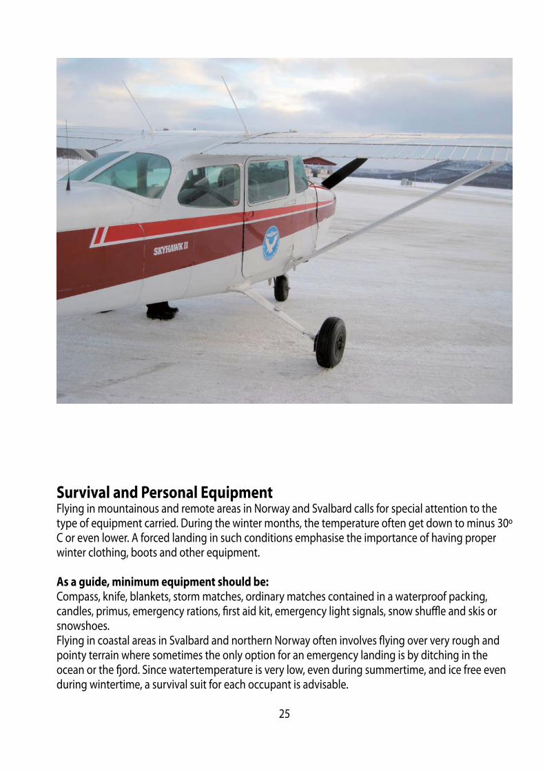
Survival and Personal EquipmentFlying in mountainous and remote areas in Norway and Svalbard calls for special attention to the type of equipment carried. During the winter months, the temperature often get down to minus 30º C or even lower. A forced landing in such conditions emphasise the importance of having proper winter clothing, boots and other equipment.
As a guide, minimum equipment should be:
Compass, knife, blankets, storm matches, ordinary matches contained in a waterproof packing, candles, primus, emergency rations, fi rst aid kit, emergency light signals, snow shuffl e and skis or snowshoes.Flying in coastal areas in Svalbard and northern Norway often involves fl ying over very rough and pointy terrain where sometimes the only option for an emergency landing is by ditching in the ocean or the fj ord. Since watertemperature is very low, even during summertime, and ice free even during wintertime, a survival suit for each occupant is advisable.
25
Communication
Language requirementsUse of standard phrases for radio telephony communication between aircraft and ground stations is essential to avoid misunderstanding the intent of messages and to reduce the time required for communication.Users of airband radios are required to hold a valid Radio Telephone licence. These documents shall confi rm language profi ciency level equal to ICAO standards. Primary language for aviation commu-nication is English, but Norwegian may of course also be used.
SSR TransponderAircraft fl ying VFR within Norwegian Flight Information Regions (FIR) must in airspace class A, C and D, and in airspace class G above FL 195, carry and use an SSR-transponder.Transponder equipped VFR-fl ights are recommended to select mode A/3 code 7000, unless other-wise instructed by the appropriate air traffi c services unit. SSR transponder mode S is not manda-tory in Norway. It is recommended to always keep your transponder on.
Always use Mode C for vertical separation purposes if installed.
Aerodrome Flight Information Service (AFIS)
Traffi c Information Areas (TIA) and Traffi c Information Zones (TIZ), both G-Airspace, are established at airports where the traffi c is relatively light and therefore only AFIS is provided (call sign + INFOR-MATION). Hence, the responsibility for avoiding collisions solely rests with the pilots when fl ying in to or out from these airports. Two-way radio contact with AFIS is mandatory, while fl ying within TIA and TIZ. The AFIS unit will state runway in use, weather, time and traffi c situation considered.
Phraseologies used exclusively while fl ying at an AFIS aerodrome:
“RUNWAY FREE” means that the runway is clear of other traffi c and usable for taxiing, takeoff or landing.“RUNWAY OCCUPIED” means that the runway is occupied by other traffi c and not usable for taxiing, takeoff or landing.“INFORM (ME)…..” is a request to the pilot to inform AFIS ofPASSING (or PASSING OVER or ON or AT), POSITION and/or ALTITUDE. Pilots report their whereabouts, intentions, position in the circuit, and AIRBORNE (time) and LAND-ED (time).
AirpaceIn Norway we have standard class A, C, D, E and G airspace.
26
Operations in class D Airspace outside ATC operational hours
Established as Control Zone (CTR)No clearance is required to operate as a VFR fl ight in class D airspace, established as a CTR outside the published hours of service of the unit responsible for providing service in the CTR. Flights are, however, in such period required to maintain listening watch on the control frequency and blind transmitting of position and intention is recommended. Flights are, however, not permitted to take off or land at state owned controlled aerodromes unless ATC is provided, and not to operate within a CTR between the end of evening civil twilight and the beginning of morning civil twilight unless a clearance has been obtained from an appropriate ATS unit.
Established as Terminal Control Area (TMA)A clearance to operate in class D airspace, established as a TMA, outside the published hours of service of the ATC unit normally providing service within the airspace, may be obtained from the ap-propriate ACC which may specify conditions to be complied with.
Airspace InfringementUnknown aircraft stray into some of the busiest areas of Europe’s airspace at least once a day. This happens mostly in airport control zones and TMAs. To avoid that you cause airspace infringement, the following recommendations, based on good airmanship and common sense, should be consid-ered:
27

1. PLANNINGa. Plan your fl ight! Where possible, avoid fl ying close to controlled airspace boundaries. A small navigational error or distraction of any sort may lead to an infringement.b. Read NOTAMs and check weather charts closely. The weather changes rapidly in Norway, and pilot workload rises rapidly in bad weather.c. File a fl ightplan – an opened FPL is mandatory to receive SAR services.d. If your aircraft carries a GPS, be sure to have current electronic maps and latest update avail able.
2. COMMUNICATIONa. You are more than welcome to contact Air Traffi c Services, even in uncontrolled airspace. If communication is established, you’ll get fl ight information and may request to be transferred to the next ATS-unit when approaching sector boundaries. b. Communication established well in advance, facilitates a request to enter controlled airspace as well as makes it easier to get assistance eg. if the weather deteriorates. c. Remember that communication with AFIS is mandatory before entering airspace class G+ or G* (Traffi c Information Zones)
3. PHRASEOLOGYa. Use standard phraseology.b. Your fi rst transmission should be e.g: ”Kjevik Tower – D-EEMH – on VFR fl ightplan.” This gives ATS time to fi nd your fl ightplan in the system and generate an SSR code for Your fl ight.
4. CLEARANCEa. If there is any doubt whether you have received a clearance to enter controlled airspace or not – ask for confi rmation.b. If you need to deviate from your clearance to remain VMC –Take necessary action immedi ately, but advise ATC as early as possible. c. STAND BY is not a clearance to enter controlled airspace.d. Be aware that a clearance through controlled airspace may take you away from your planned route, due to traffi c patterns and other traffi c.
5. TRANSPONDERa. Use the transponder, if equipped. It will help ATC identify you in case you need assistance and may also prevent an infringement.
28
Emergencies
Search and Rescue Services (SAR)The services are provided by two Rescue Co-ordination Centres. In addition 16 Rescue Sub-centres, associated to air traffi c services units, have been established, being responsible for initiating search and rescue actions.
Rescue Coordination Centres are:
Stavanger Rescue Co-ordination Centre, Sola (South of 65N):
Tel: +47 51517000Fax: +47 51652334Hours of services: 24H.
SAR area:
Bodø Oceanic FIR south of 6500NOslo FIRStavanger FIR south of 6500NTrondheim FIR south of 6500N
Bodø Rescue Co-ordination Centre, Bodø (North of 65N):
Tel: +47 75559000Fax: +47 75524200Hours of service: 24H.
SAR area:
Bodø FIRBodø Oceanic FIR north of 6500NTrondheim FIR north of 6500N
SAR Helicopters are stationed at the following aerodromes: Banak (ENNA), Bodø (ENBO), Ørland (ENOL), Stavanger/Sola (ENZV), and Rygge/Moss (ENRY). These are able to reach any destination within mainland Norway within 90 min direct fl ight from its home bases. In addition, several emer-gency medical helicopters as well as off shore SAR helicopters are staioned at locations both off – and onshore all over Norway. Emergency frequencies are: 121.50 MHz and 243.00 MHz. In addition the international maritime distress frequencies 500 KHz and 2182 KHz are guarded by coastal radio stations.
29
If an emergency landing becomes necessary and there are no means available to contact ATC/ATS, the following procedure is recommended:By the use of any available aircraft radio, call and listen out on 121.5 MHz for the fi rst 5 minutes after full and half hours. ATC will be requesting other aircraft along your planned route to call and listen out on this frequency on these specifi c times as an additional aid to locate you. If a mobile telephone is available, You should try to make contact with ATC/ATS .
Emergency/Precautionary Landing
If you are forced down due to engine failure, preserve altitude by selecting best glide speed. The best glide ratio for a traditional single engine aircraft is about 12:1, which will give you about 2 nm gliding distance per 1000 feet height AGL. So your best friend during an engine failure is height, which will give you time and distance. Trim your aircraft to maintain your best glide speed and to ensure control of the aircraft. Aim for best suitable fi eld for an emergency landing and go through your engine failure check list, and then communicate with ATC.
Remember to fi rst aviate, navigate, then communicate!
Use of Emergency Locator Transmitter (ELT)
An ELT is a valuable search aid if your aircraft is forced down and is mandatory while fl ying in Nor-wegian airspace. Proper use and activation of your ELT can be paramount for your survival. It might be advisable to activate the ELT as early as possible to make use of the longer range at higer al-titude. Early activation may be the only chance you’ll have to alert anyone before the mountains block your distress signal. This is also advisable for the radio distress call for the same reason.ELT transmitting on both 406 MHz and 121,5 MHz will be required from 1. July 2009.
A few guidelines:
• If you are forced down: Ensure that the ELT is activated.• If in water and the beacon is fl oating, the ELT should be activated in the water and allowed to fl oat to the end of the lanyard with the aerial vertical. Do not hoist the ELT up a mast. As the ELT may use the water as a ground plane, the performance may be degraded if it is raised above the water surface.
Use of Emergency Locator Transmitter (ELT)
• If on land and your ELT is portable, place the ELT on the ground on an earth mat. If an earth mat is not available, place the ELT on the wing of the aircraft or another metal refl ective surface.• Make sure the ELT remains vertical by securing it with rocks, tape etc.• Do not deactivate the ELT even if it is damaged.• In many cases a portable ELT standing on an earth mat will increase eff ective range by 50 %. Such an earth mat may easily be made by using household aluminium foil to make a 120 cm square. Fold it and tape it to the unit. To use the earth mat, unfold it and place the ELT on top.
30

Other Information
Recommended entry airports to NorwayFirst landing in Norway shall normally be done at airports where custom services are available (You will fi nd more information under summary of airports with customs services - Norwegian interna-tional airports). Following airports are recommended for fi rst entry:• Moss airport, Rygge (ENRY)
• Sandefj ord airport, Torp (ENTO)
• Kristiansand airport, Kjevik (ENCN)
• Trondheim airport, Værnes (ENVA)
• Bodø airport (ENBO)
• Tromsø airport, Langnes (ENTC)
• Kirkenes airport, Høybuktmoen (ENKR)
These airports will have hardcopies of the VFR guide available, free of charge. Please check the AIP available at www.ippc.no for further local airport information.
TRAFFIC BETWEEN NORWAY AND SCHENGEN COUNTRIES Aircraft holding a normal EASA type certifi cate and valid Air Review Certifi cate (ARC) may operate unrestricted between Norway and the rest of the Schengen countries. This is limited to private and taxi fl ights with aircraft with MTOM 5700 kg and not approved for more than 10 persons. This do
not apply to fl ights to or from international airports in Norway.
The following applies:
The fully completed FPL shall be completed as a notifi cation to the Directorate of Customs and • Excise at the latest 4 hours prior to the time of entering/departing Norwegian territory. If it is desireable to change the stated arrival/departure times, the Directorate of Customs and Excise shall be notifi ed ASAP (Fax: +47 22 86 08 00). Departing aircraft shall not leave the landing area prior to the time stated in the FPL without • prior permission from the Customs service.Persons who arrive with the aircraft shall not leave the aircraft prior to the arrival time stated in • the FPL.Goods carried on board shall not be removed from arrived aircraft prior to the arrival time stated • in the FPL.Aircraft shall only carry goods which:•
- can be imported/exported free of tax and toll according to existing rules of execptions from these Regulations, - are not included in the import/export restrictions, and - not require clearance.
31

Aircraft Entering or Leaving NorwayThe CAA may in certain cases grant permission for single fl ights or a series of fl ights to and from aerodromes which do not have status as international aerodromes. Permission may be obtained from Civil Aviation Authority - Norway by ordinary mail or e-mail to [email protected] or fax +47-7558 5005.
Pilots requesting customs shall in item 18 of the fl ight plan include the abbreviation “RMK”, followed by the words;”REQUEST CUSTOMS”.
When the customs authorities have approved an exemption for an aircraft from the requirement to use an international aerodrome, this shall be indicated in item 18 of the fl ight plan by inserting the abbreviation “RMK”, followed by the words “CUSTOMS ARRANGED”.
Animals and petsNo animal may be brought into Norway without an import licence from:Norwegian Animal Health AuthoritiesTel: +47 [email protected]
Customs and ImmigrationsAircraft fl ying into or leaving Norwegian territory shall, for the purpose of customs and immigration clearances, make their fi rst landing or last takeoff from an international aerodrome as listed below, unless exemption from this rule has been granted in special cases by the authorities concerned.
Norwegian International Aerodromes
BERGEN/Flesland
FAGERNES/Leirin
HARSTAD/NARVIK/Evenes
HAUGESUND/Karmøy
KIRKENES/Høybuktmoen
MOLDE/Årø
MOSS/Rygge
NARVIK/Framnes
OSLO/Gardermoen
RØROS
SANDEFJORD/Torp
STAVANGER/Sola
TROMSØ/Langnes
TRONDHEIM/Værnes
ÅLESUND/Vigra
BODØ
KRISTIANSAND/Kjevik
SVALBARD/Longyear
32

Aircraft without standard certifi cate of airworthinessIn accordance with European Civil Aviation Council (ECAC) recommendation INT.S/11-1 Norway accepts fl ights over Norwegian territory by homebuilt aircraft with a Certifi cate of Airworthiness or a “permit to fl y” issued by the Civil Aviation Authority of another ECAC member state. The fl ight test programme must be completed. Homebuilt aircraft in the class experimental from other than ECAC member states can not fl y over Norwegian territory without special permission.
Aircraft not holding a standard certifi cate of airworthiness or operated on a “permit to fl y” (except homebuilt aircraft from a ECAC member state) must apply for a prior permission to operate within Norwegian airspace. Permission may be obtained from Civil Aviation Authority - Norway by ordinary mail or e-mail to [email protected] or fax +47-7558 5005.
The application shall contain the following information:
• Name/address/phone/telefax/e-mail of the Operator • Purpose of the fl ight• Area of planned operations • Timeframe of operations• Documentation of airworthiness (copy of permit to fl y with fl ight restrictions and fl ight conditions)• Certifi cate of registration• Valid maintenance documentation• Relevant pages of fl ight manual (Information which verify fl ight manual for this particular aircraft)• Certifi cate of Insurance
Charges/Weekly Season CardUpdated charges are available at www.ippc.no. Published under Aeronautical information publica-tion A (AIC A)
Isolated- and Home Field Usage RestrictionsBy law, it is not allowed to commit power driven traffi c in isolated fi elds. Isolated fi elds of concern in relation to the conduct of fl ight, is frozen and open lakes. This means that it is not allowed for air-craft to land or takeoff from lakes, neither frozen nor open.
33

Exemption can be given for special cases where one decisive criterion must be that the usage will have some sort of utilitarian value. Contact the local community in question for clarifi cation on permission to use the lake. Landing and takeoff s from home fi elds can only be conducted by prior permission from the land owner.
Bird HazardsThe risk of strikes between aircraft and birds should be taken into concern. The risk for bird-strikes is higher during migration where the autumn migration, peaking from mid August until mid Octo-ber, involves a high number of birds where many are young and inexperienced as regards to aircraft encounter. Spring migration involves less numbers of birds and the peak period is from mid April to the end of May. Migration altitude during daytime varies from 500 feet to 3000 feet, and during night varies from 2000 feet to 5000 feet. Bird concentration areas are often located on or close to airfi elds and during local movements birds may fl y as high as 3000 feet. Remember that birds have a tendency to dive when disturbed in fl ight, so if on a collision course, try to pass over them if time and circumstances permit.
Bird Migration Routes and Concentration Areas
34
Protection of Reindeer against Noise from low fl ying aircraftObservation of reactions amongst reindeer being exposed to noise from aircraft operating at low altitudes - also at altitudes above the minimum prescribed altitude - has shown that the eff ects are unwanted and may be harmful whether the fl ying takes place over herds of reindeer or over a single animal. During the calving-, mating- and hunting season, which normally occurs from approxi-mately 15th of April to 15th of June and from approximately 25 August to 31 October, the eff ects are particularly noticeable. During the periods mentioned above, operations should be conducted at altitudes no lower than 1000 feet above ground or water. Chasing reindeer or any other animal by aircraft is considered a very cruel act and is a violation of the provisions in the Norwegian Rules of the Air.
PhotographingThere are in general no restrictions regarding non-commercial photographing from the air when the purpose is of a strictly private nature. It is not allowed to take pictures of military installations or facilities without permission from Headquarter Defence Command,
You may contact Headquarters Defence Command by calling +47 2309 8000, if you have any enqui-ries regarding the limitations mentioned.
Use of Intoxicating Liquor, Narcotics or DrugsThe Norwegian Aviation Act contains the following provision: No person shall serve as a crew member when under the infl uence of intoxicating liquor or other stimuli or narcotics or when he or she, as a result of illness or fatigue or for other reason, is unable to perform his duties safely. In any event a person is considered to be under infl uence of alcohol as far as the law is concerned, when the alcohol concentration in the blood is in excess of 0.2 per mill or the amount of alcohol in the body is large enough to lead to 0.2 per mill. Error regarding the extent of alcohol concentration in the blood shall not exclude liability for punishment. A person having served as a crew member shall not during the fi rst 6 hours after completing a tour of duty consume alcohol or other stimuli if he or she knows or suspects that police investigation concerning his or her duties as a crew member is pendent; except if a blood test already has been taken or the police authorities have decided that such test is unnecessary. When there is reason to believe that the regulations above have been violated, the police authorities may order a medical examination, which may include a blood test of the person responsible for the violation. The appropriate department will issue detailed regulations dealing with such examination and matters related thereto.
35
Charts and fl ight equipment
Norsk Aero A/S, NAK Shop Air Traffi c Map Svalbard.P.O. Box 826 Sentrum This chart may be purchased from:NO-0104 Oslo, Norway Norsk PolarinstituttOffi ce: Wergelandsveien 1, Oslo NO-9170 Longyearbyen NorwayTel. +47 23 10 29 03 Tel. +47 79 02 26 00Fax. +47 23 10 29 02 Fax. +47 79 02 26 04E-mail: [email protected] Web: http://www.nakshop.no OSL Slot (Gardermoen) Tel. +47 64 81 90 00AVINOR (AIS/NOF) Fax. +47 64 81 90 01PO. Box. 150NO-2061 Gardermoen, Norway Directorate of Customs and ExciseTel. +47 64 81 90 00 P.O.Box 8122 Dep.Fax. +47 64 81 90 01 NO-0032 Oslo, Norwaye.mail: [email protected] Tel. + 47 22 86 03 00 Fax. + 47 22 17 54 85OSL Customs (Gardermoen) e.mail: [email protected]. +47 64 82 10 00Fax. +47 64 82 10 01 Met: Main Offi ce: Tel. +47 22 69 25 62Directorate of ImmigrationP.O. Box 8108 Dep. Norwegian Aero Club:N0032 Oslo, Norway P.O. Box 383Tel. + 47 23 35 15 00 N-0102 Oslo, NorwayFax. + 47 23 35 15 04 Tel. +47 23 01 04 50E.post: [email protected] Fax. +47 23 01 04 51
AVINOR Civil Aviation Authorities - Luftfartstilsynet:Tel. +47 81 53 05 50 P.O.Box 243Fax. +47 64 81 20 01 N-8003 BODØE-mail: [email protected] NORWAY Tel. +47 75 58 50 00Luftfartsskolen (Flight School) Fax. +47 75 58 50 05P.O.. Box 826 Sentrum E-mail: [email protected] Oslo, NorwayTel. +47 23 10 29 04Fax. +47 23 10 29 01E-mail: [email protected] Web: http://www.luftfartsskolen.no
36

Your Personal IMSAFE Checklist
Use the form and fi ll in your own personal minimums.
37
38
Civi l Aviation Authorit ies - Nor wayOlav Vs gate 56 - 58
B ox 2438001 B o dø