Transportation is a way of moving people or things from one place to another.
43
CE 408 Highway and Traffic Engineering
-
Upload
avis-phelps -
Category
Documents
-
view
223 -
download
0
Transcript of Transportation is a way of moving people or things from one place to another.

CE 408 Highway and Traffic Engineering

Transportation is a way of moving people or things from one place to another.
What is Transportation?

Land (roads and railways)
Water(seaports)
Air(airports)
Modes of Transportation

Modes of Transportation
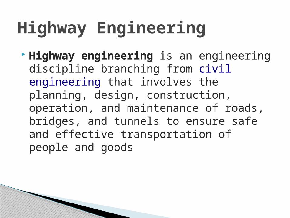
Highway engineering is an engineering discipline branching from civil engineering that involves the planning, design, construction, operation, and maintenance of roads, bridges, and tunnels to ensure safe and effective transportation of people and goods
Highway Engineering

Traffic engineering is a branch of civil engineering that uses engineering techniques to achieve the safe and efficient movement of people and goods on roadways.
It focuses mainly on research for safe and efficient traffic flow, such as road geometry, sidewalks and crosswalks, segregated cycle facilities, shared lane marking, traffic signs, road surface markings and traffic lights.
Traffic engineering deals with the functional part of transportation system, except the infrastructures provided.
Traffic Engineering

There are three main elements of automobile transportation: The road users (Drivers and pedestrians) The vehicle The road way and geometric design of roads
Elements of Transportation
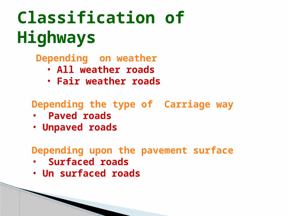
Classification of Highways
National highway act ( 1956 )
Depending on weather• All weather roads• Fair weather roads
Depending the type of Carriage way• Paved roads• Unpaved roads
Depending upon the pavement surface• Surfaced roads• Un surfaced roads

Based on the Traffic Volume Heavy Medium Light
Cont…,

Based on modified system of Highways classification Primary
Expressways National Highways
SecondaryState Highway Major District Roads
TertiaryOrdinary district Roads Village Roads

Expressways Heavy traffic at high speed (120km/hr) Land Width (90m) Connects major points of traffic generation No slow moving traffic allowed No loading, unloading, parking.

National Highways The National Highways of Pakistan consists of all
public highways maintained by National Highways Authority under the Ministry of Transport.
It maintains over 12,000 kilometres (7,500 mi) of roadways organised into various classifications which crisscross the country and provide access to major population centres..
All national highways in Pakistan are pre-fixed with the letter 'N' (for "National") followed by the unique numerical designation of the specific highway (with a hyphen in the middle), e.g. "N-5". Each numerical designation is separated by five numerals, i.e. N-5, N-10, N-15, etc.

State Highways
They are the arterial roads of a state, connecting up with the national highways of adjacent states, district head quarters and important cities within the state.

Major District Roads
Important roads with in a district serving areas of production and markets , connecting those with each other or with the major highways.

Other district roads
Roads serving rural areas of production and providing them with outlet to market centers or other important roads like MDR or SH.

Village roads They are roads connecting villages or group
of villages with each other or to the nearest road of a higher category like ODR or MDR.
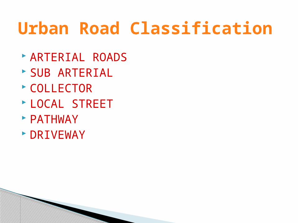
Urban Road Classification ARTERIAL ROADS SUB ARTERIAL COLLECTOR LOCAL STREET PATHWAY DRIVEWAY
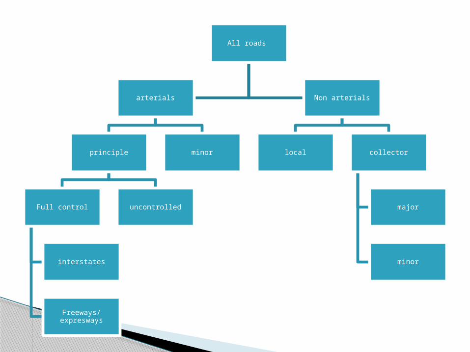
All roads
arterials
principle
Full control
interstates
Freeways/expresways
uncontrolled
minor
Non arterials
local collector
major
minor

ARTERIAL
Arterials primarily serve long-distance travel and are typically designed as either access controlled or partially access controlled facilities with limited locations at which vehicles can enter or exit the roadway (typically via on- or off-ramps).
Design Speed : 80km/hr Land width : 50 – 60m Divided roads with full or partial parking Pedestrian allowed to walk only at
intersection

SUB ARTERIAL
Less mobility than arterial. Design speed : 60 km/hr Land width : 30 – 40 m
Collector Street As their name implies, Collectors “collect” traffic
from Local Roads and connect traffic to Arterial roadways.
Collector routes are typically shorter than Arterial routes but longer than Local Roads.
(Collects and distributes traffic from local streets Provides access to arterial roads Located in residential, business and industrial
areas. Full access allowed. Parking permitted. Design speed : 50km/hr Land Width : 20-30m

Local Street
Design Speed : 30km/hr. Land Width : 10 – 20m. Primary access to residence, business or
other abutting property Less volume of traffic at slow speed Origin and termination of trips. Unrestricted parking, pedestrian
movements. (with frontage access, parked vehicle, bus stops and no waiting restrictions)

1) Provisional alignment Identification ( Map study)
2) Reconnaissance survey
3) Preliminary survey
4) Final location to determine center line and detailed survey
Engineering Surveys for Highway locations

Art of observing and making measurements of relative portions of natural and manmade features on the surface of earth and plotting these measurements to some suitable scale to form a map.
SURVEY

Highway surveys involve measurement and calculation of distances, angles (horizontal andvertical) and elevations. The data is then used to form a base map
with contour lines and longitudinal cross-sections.
SURVEY FOR A HIGHWAY

Three major categories1. Ground SurveysBasic equipment is used for location survey Measuring Tape. Levels. Theodolite. Electronic distance measuring devices
(EDM’s).
SURVEYING TECHNIQUES
2. Remote Sensing Measurement of distances and elevations
by using devices located above the surface of earth.
Data is collected through airplanes and satellites using global positioning systems (GPS).
Photogrammetry (data is obtained with the help of aerial photographs) is the most commonly used technique.
Cont..,

3. Computer Graphics Available/collected data is compiled and
stored in the electronic form. Photogrammetric and general survey data
is combined digitally with the help of softwares.
The files can then be plotted in the form of maps.
Cont..,
Location controls are basically the factors that effects the selection of location of a highwayMajor factors are: Topography. Soil Characteristics. Environmental factors (noise and air
pollution). Economic factors.
LOCATION CONTROLS
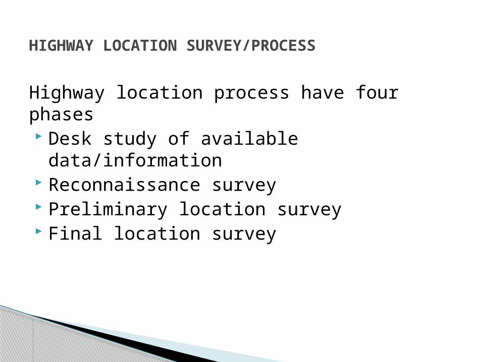
Highway location process have four phases Desk study of available data/information Reconnaissance survey Preliminary location survey Final location survey
HIGHWAY LOCATION SURVEY/PROCESS

Available data in the form of reports, maps,aerial photographs and charts is studied.
Data is obtained form government authorities e.g. transport department (NHA), geological survey of Pakistan etc.
Similarly, information is required to be obtained on hydrology, mining, agriculture and weather.
DESK STUDY OF AVAILABLE DATA

Data is obtained on the following characteristics: Engineering (topography, geology, traffic
volume and climate) Social (land use trends and zoning) Environmental (air, noise and water
pollution, wildlife, historic and archaeological sites)
Economic (construction cost, agricultural, commercial and industrial trends)
Cont..,
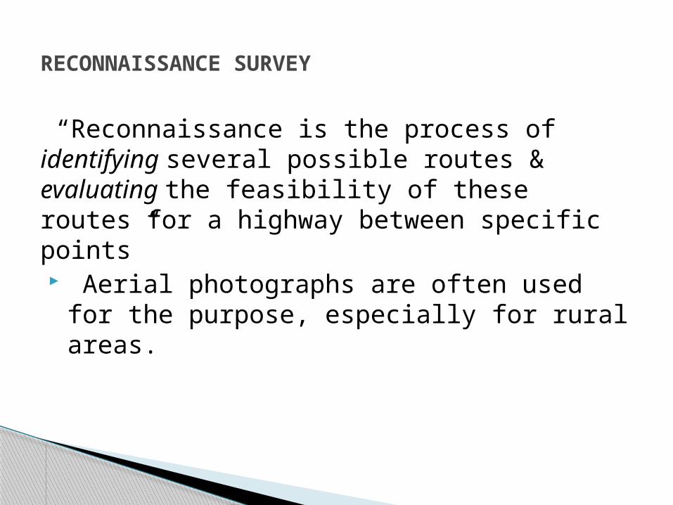
“Reconnaissance is the process of identifying several possible routes & evaluating the feasibility of these routes for a highway between specific points” Aerial photographs are often used for the
purpose, especially for rural areas.
RECONNAISSANCE SURVEY

Feasible routes are identifies by keeping in mind the following factors Terrain and soil conditions. Serviceability of route to industrial and
residential areas. Crossing of other transportation facilities
like rivers, rail and highways. Route directness.
Cont..,

Identification of control points for each feasible/selected route.
Routes are then plotted on a map.
Cont..,

The position of the feasible routes are set as closely as possible by Establishing all control points. Determining preliminary vertical and
horizontal alignments of each control point Economic and environmental feasibility of
the routes The best route is then selected as the
preliminary alignment for the highway.
PRELIMINARY LOCATION SURVEY

Initial cost of the project and future economic effects
Road user cost Construction cost Road user benefits Economic drawbacks from the projectInformation also helps in deciding the type of highway for a particular route.
Economic Evaluation

Environment Includes plant animals Human community Effects on quality of life for all (animals and
human being)
Environmental Evaluation

An environmental impact statement should be submitted which should include Available alternatives Assessment of all positive and negative
impacts Short and long term effects Unavoidable adverse environmental effects Use of natural resources Each route should be studied
e.g. Positive and negative effects of at grade or grade seperated intersection.
Environmental Evaluation

Detailed layout of the selected route is carried out at this stage Centreline of the road. Horizontal and vertical alignment. Property lines. Intersecting roads. Position of structures and drainage
channels.
FINAL LOCATION SURVEY
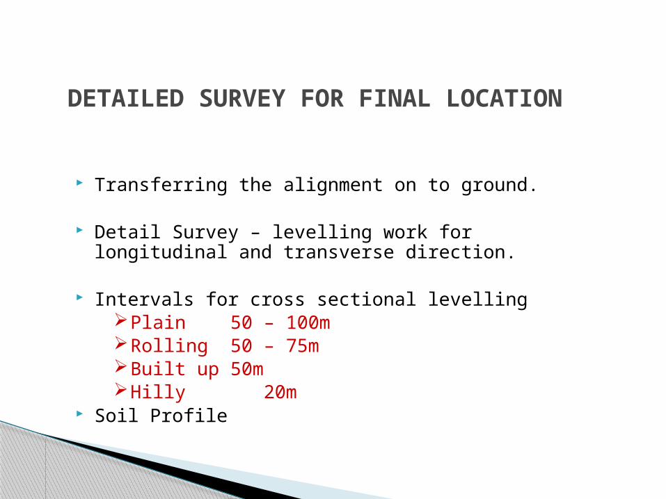
DETAILED SURVEY FOR FINAL LOCATION
Transferring the alignment on to ground.
Detail Survey – levelling work for longitudinal and transverse direction.
Intervals for cross sectional levellingPlain 50 – 100mRolling 50 – 75mBuilt up 50mHilly 20m
Soil Profile

Factors that effect location of highway in urban areas Connection to local streets (which street to
connect,traffic flow) Right-of-way acquisition (land cost, road on
elevated structures, noise and aesthetics) Coordination with other transportation systems Provisions for bicycles and pedestrians
(sidewalks,crosswalks, traffic control devices, ramps, bicycle path)
LOCATION OF HIGHWAY IN URBAN AREAS

Comparison of Conventional and Modern Methods of SurveyingElements of comparison
Conventional Modern
Maps- Base material
Topo sheets RS data, Aerial Photos, Satellite Imageries
Instruments Chains, Tapes, Theodolite, Dumpy levels
EDM, Total Station, GPS, Auto and Digital Level, Photogrammetry.
Accuracy Chain/Tape 1 in 3000 to 1 in 30,000Tacheometer 1 in 1000 to 1 in 10,000
EDM/TS 1 in 10000 to 1 in 1,00,000Photogrammetry. 1 in 10000 to 1 in 1,00,000
Plotting CAD Systems Software
Errors Human errors Closing Errors hence re measuring is required.