Intro to Geography: North america
53
North America
-
Upload
katherine-roman -
Category
Education
-
view
52 -
download
0
Transcript of Intro to Geography: North america

North America


Copyright © 2014 John Wiley & Sons, Inc. All rights reserved.

Physiographic Boundaries
• West- Pacific Ocean• Southeast- Gulf of Mexico• East- Atlantic Ocean• Northeast- Great Lakes• Northwest and Southwest- no clear
physiographic boundaries

Physiographic Regions

Climate
• Wide range of climate zones• Rain shadow effect significant in the Midwest • Generally arid in the west and humid in the east• Extremes in the continental interior

Tectonic Setting

Tectonic Setting
• San Andreas Fault– Lots of earthquakes

Tectonic Setting
• Cascade Mountains– Volcanic Mt. Range• Home to Mt. St. Helens

Physiographic Features
• The Grand Canyon– Formed by the Colorado River– Geologically significant• Exposed strata

Physiographic Features
• The Great Lakes– Group of freshwater lakes– 20% of Earth’s Freshwater– Influences climate• “Lake Effect” Snow

Physiographic Features• Mississippi River– Largest drainage basin in North America– Delta in the Gulf of Mexico

Geologic Resources
• Reserves are being depleted– Coal mining in Appalachia– Oil drilling in Alaska and
the Gulf of Mexico
• Imports are necessary to meet demand
• Renewable energy is not yet well implemented

Geologic Resources
• Tar Sands in Alberta, Canada– Oil mixed with sand– Expensive to extract– Large deposits, may
exceed Saudi Arabia– Open pit mining

Resources
• Water supply in the southwest and great plains is being used at an unsustainable rate
• Ogallala Aquifer– Underground freshwater
supply– Being used faster than it
can be replenished

Human Geography
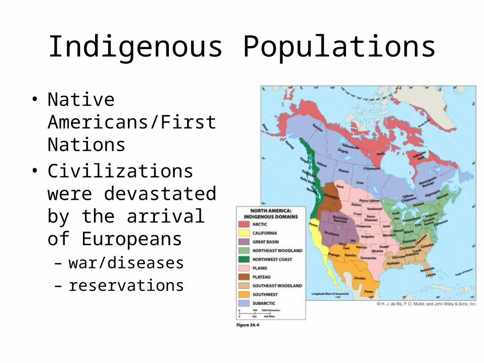
Indigenous Populations
• Native Americans/First Nations
• Civilizations were devastated by the arrival of Europeans– war/diseases– reservations

Colonial Period
• United States• Dominated by Britain– Colonies developed
between “discovery” and the American Revolution
– Jamestown, 1607– 13 original colonies
along the coast

Colonial Period
• Canada• Dominated by France
– Quebec City, 1608– Capital of New France– Centered on the Fur Trade
• Britain gained control after the 7 Years War
• Many loyalists fled to Canada after the American revolution

Westward Expansion
• Expansion after the Revolutionary War• Louisiana Territory in 1803• Manifest Destiny

Copyright © 2014 John Wiley & Sons, Inc. All rights reserved.

Civil War
• A group of southern states declared secession from the United States– Based on extension of
slavery into the west– Confederacy- south– Union- the north
• Confederacy collapsed and slavery was abolished

Industrialization/ Urbanization
• Crossed the Atlantic in the 1870’s– Expansion of railroad
network across the country
– Used mostly for transport of goods and raw materials

Industrialization/ Urbanization
• American Manufacturing Belt
• Expansion of cities based on specializations– i.e. Detroit Auto Industry

Suburbanization
• Large scale highway construction in the 1950’s
• More affordable automobiles
• Lead to the development of “outer cities”

Deindustrialization
• Automated manufacturing
• Manufacturing jobs sent overseas for cheaper wages
• Recovery through the growth of the information economy

Immigration
• 40% of growth is a result of immigration• “land of opportunity”• “melting pot” is more of a mosaic culture

Copyright © 2014 John Wiley & Sons, Inc. All rights reserved.

Copyright © 2014 John Wiley & Sons, Inc. All rights reserved.
Regional Issue:Immigrants: How Many Can North America Accommodate?
Immigration Brings Benefits• It is part of the region’s
history and has never been heartily welcomed.
• It fuels economic growth.• It is not just unskilled, but also
skilled and educated.• Native population is aging,
and immigration brings youth.• Illegal immigration should be
curbed.
Limit Immigration Now• High level of legal
immigrants is unsustainable.• Demands for social services
strain state budgets.• Immigrants displace
working- class Americans by accepting lower wages.
• Amnesty for illegal immigrants attracts more, and that’s a security issue.

Population

Population Growth
Regions of North America

Federal Map
• Canada- provinces• United States- States
– Boundaries follow geographic features to the east, but are more straight lined to the west
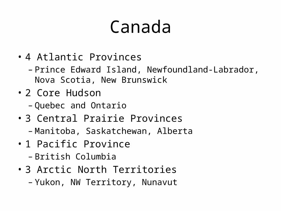
Canada
• 4 Atlantic Provinces– Prince Edward Island, Newfoundland-Labrador, Nova Scotia,
New Brunswick• 2 Core Hudson
– Quebec and Ontario• 3 Central Prairie Provinces
– Manitoba, Saskatchewan, Alberta• 1 Pacific Province
– British Columbia• 3 Arctic North Territories
– Yukon, NW Territory, Nunavut

Canada

Regions of North America

North American Core
• Political capitals – Ottawa and Washington
D.C.
• Largest cities– Megalopolis- coalescing
metropolitan areas
• 1/3 of populations• Economic center• Impacted by
deindustrialization

Cities
• New York– Population > 21 million– Global city– Hudson River

Cities
• Toronto– Population > 5 million– Largest city in Canada– Lake Ontario

Maritime Northeast
• New England and Atlantic Provinces
• Historic cultural center• Economy– Coastal/Fishing– Tourism– Offshore oil in Canada

French Canada
• French speaking– Strong nationalism
• Montreal• St. Lawrence River

The Southeast
• “New South” and “Old South”
• Sunbelt migration• Uneven development– Wide income gap
• Warm and humid– Hurricane region

United States (NC)
$341.98

Southwest
• TX, AZ, NM• Climate- steppe and
desert• Texas is the center of
economic growth for this region
• Mexican immigration and cultural integration– Tex-Mex

United States (TX)
$242.48
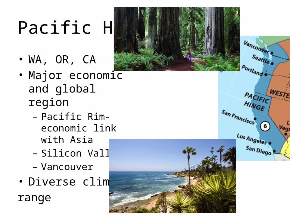
Pacific Hinge
• WA, OR, CA• Major economic and
global region– Pacific Rim- economic
link with Asia– Silicon Valley– Vancouver
• Diverse climate range

Cities
• Los Angeles– Population > 13 million– Urban sprawl– Hollywood

United States (CA)
$159.18

Western Frontier
• Rugged and dry region– Rain shadow– Intermontane- Between
mountains
• Sparsely populated– growing
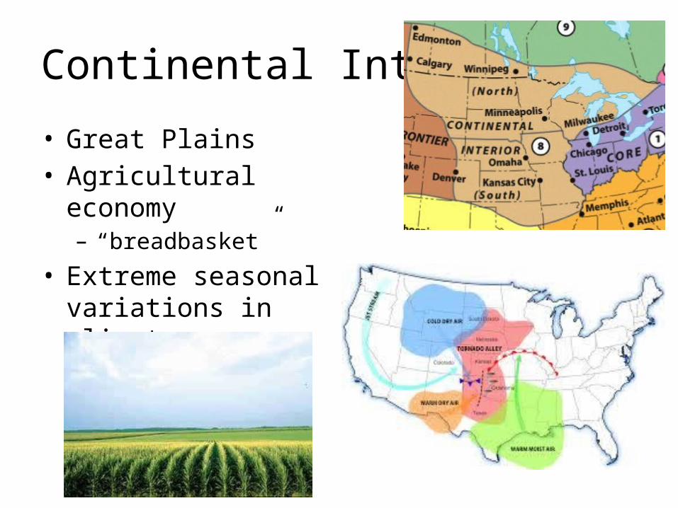
Continental Interior
• Great Plains• Agricultural economy– “breadbasket”
• Extreme seasonal variations in climate– Tornado Alley
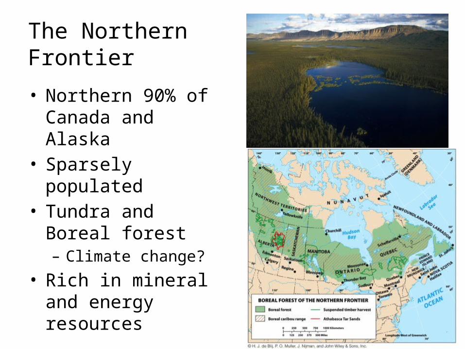
The Northern Frontier• Northern 90% of
Canada and Alaska• Sparsely populated• Tundra and Boreal
forest– Climate change?
• Rich in mineral and energy resources

Canada
$345
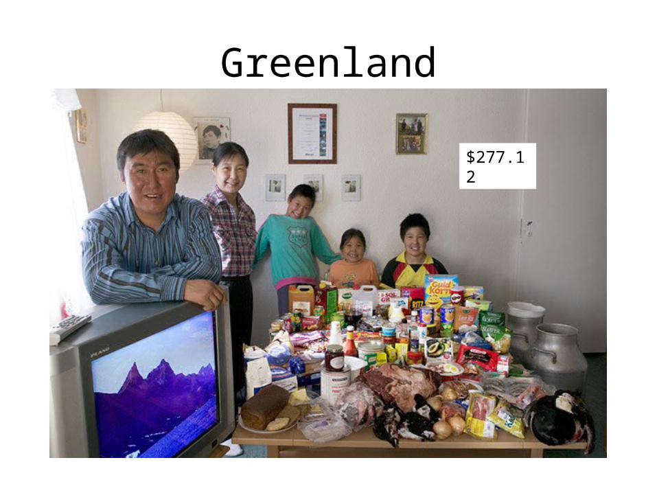
Greenland
$277.12