พายุหมุนเขตร้อน (Tropical Cyclone): กรณีภาคใต้ · พายุหมุนเขตร้อน (Tropical Cyclone): กรณีภาคใต้

History of Tropical Cyclone Forecasting and Modeling--
and Future OutlookRichard A. Anthes
2012 APEC Typhoon SymposiumTaipei
4 June 2012
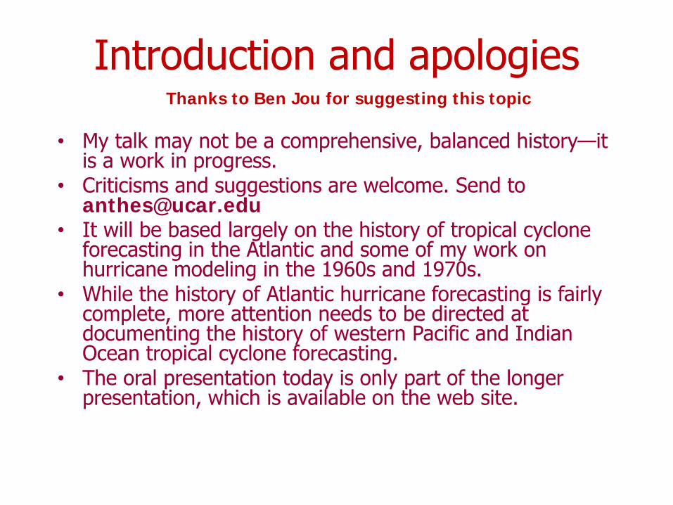
Introduction and apologies
• My talk may not be a comprehensive, balanced history—it is a work in progress.
• Criticisms and suggestions are welcome. Send to [email protected]
• It will be based largely on the history of tropical cyclone forecasting in the Atlantic and some of my work on hurricane modeling in the 1960s and 1970s.
• While the history of Atlantic hurricane forecasting is fairly complete, more attention needs to be directed at documenting the history of western Pacific and Indian Ocean tropical cyclone forecasting.
• The oral presentation today is only part of the longer presentation, which is available on the web site.
Thanks to Ben Jou for suggesting this topic
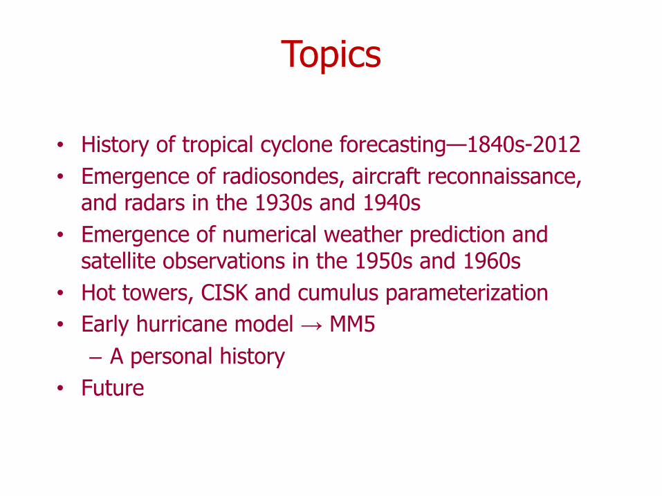
Topics
• History of tropical cyclone forecasting—1840s-2012• Emergence of radiosondes, aircraft reconnaissance,
and radars in the 1930s and 1940s• Emergence of numerical weather prediction and
satellite observations in the 1950s and 1960s• Hot towers, CISK and cumulus parameterization• Early hurricane model → MM5
– A personal history• Future
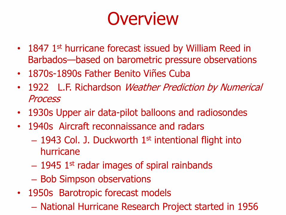
Overview• 1847 1st hurricane forecast issued by William Reed in
Barbados—based on barometric pressure observations• 1870s-1890s Father Benito Viñes Cuba• 1922 L.F. Richardson Weather Prediction by Numerical
Process• 1930s Upper air data-pilot balloons and radiosondes• 1940s Aircraft reconnaissance and radars
– 1943 Col. J. Duckworth 1st intentional flight into hurricane
– 1945 1st radar images of spiral rainbands– Bob Simpson observations
• 1950s Barotropic forecast models– National Hurricane Research Project started in 1956
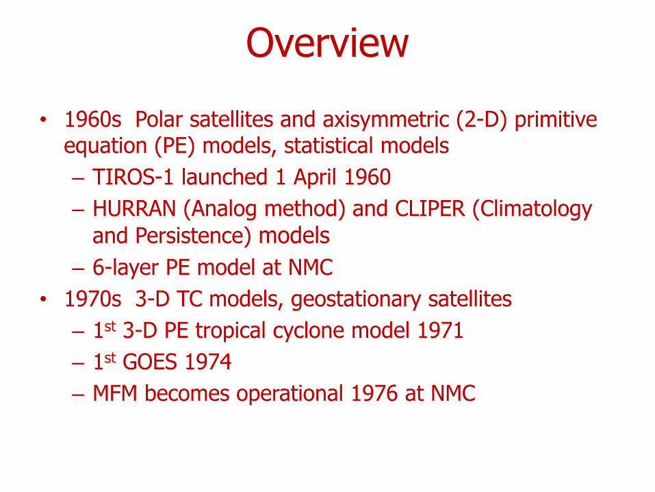
Overview
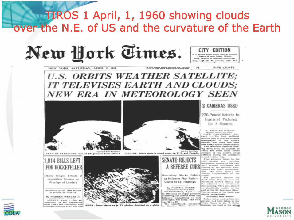
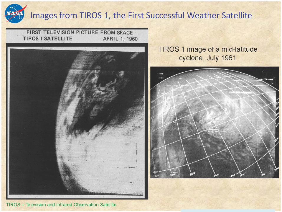
• 1960s Polar satellites and axisymmetric (2-D) primitive equation (PE) models, statistical models– TIROS-1 launched 1 April 1960– HURRAN (Analog method) and CLIPER (Climatology
and Persistence) models– 6-layer PE model at NMC
• 1970s 3-D TC models, geostationary satellites– 1st 3-D PE tropical cyclone model 1971– 1st GOES 1974– MFM becomes operational 1976 at NMC
Overview
• 1980s-1990s Operational TC models, dynamical-statistical models using global model output– GFDL model becomes operational 1992– MM5 model used worldwide
• 2000-present Higher resolution global models, multiple nested grid TC models, ensemble model forecasts, effective assimilation of satellite and other data, emergence of WRF model

Japan
• 1875 JMA (Tokyo Met Observatory) formed• 1884 1st forecast issued• 1938 Radiosondes begin• 1954 Radar observations begin• 1959 NWP begins• 1950s-1960s Many Japanese TC scientists• UNESCO Symp. On Typhoons. Nov. 1954 Tokyo• 1960 International Symposium on Numerical Weather
Prediction, Tokyo• 1977 GMS-L-1st geostationary satellite launched
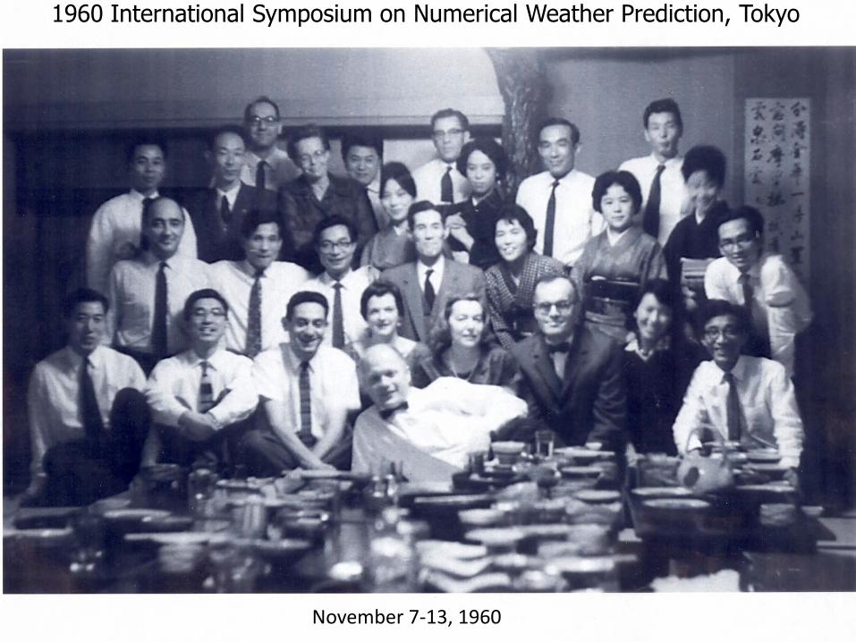
November 7‐13, 1960
1960 International Symposium on Numerical Weather Prediction, Tokyo
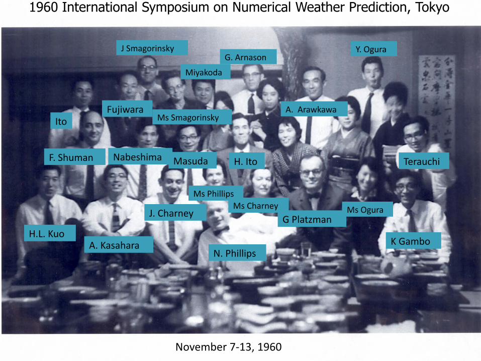
November 7‐13, 1960
N. Phillips
H.L. KuoA. Kasahara
J. Charney
Ms PhillipsMs Charney
G PlatzmanMs Ogura
K Gambo
F. Shuman Nabeshima Masuda H. Ito Terauchi
ItoFujiwara
J Smagorinsky
Miyakoda
Ms Smagorinsky
G. Arnason
A. Arawkawa
Y. Ogura
1960 International Symposium on Numerical Weather Prediction, Tokyo

Leadership of Japan Scientists 1950s-60s
• Arakawa• Fujita• Fujiwara• Gambo• Kasahara• Kurihara• Matsuno
• Miyakoda• Ogura• Ooyama• Sasaki• Syōno• Yamasaki• Yanai
Philippines and Hong Kong
• 1865-Philippines-Francisco Colina, Jesuit scholar, regular observations begin at Observatorio de Manila became official in 1894, became Weather Bureau in 1901
• July 7 1879—early forecast of typhoon crossing Northern Luzon
• 1883 Hong Kong Observatory established
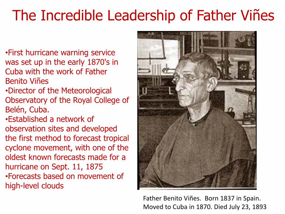
Father Benito Viñes. Born 1837 in Spain. Moved to Cuba in 1870. Died July 23, 1893
•First hurricane warning service was set up in the early 1870's in Cuba with the work of Father Benito Viñes•Director of the Meteorological Observatory of the Royal College of Belén, Cuba.•Established a network of observation sites and developed the first method to forecast tropical cyclone movement, with one of the oldest known forecasts made for a hurricane on Sept. 11, 1875•Forecasts based on movement of high-level clouds
The Incredible Leadership of Father Viñes
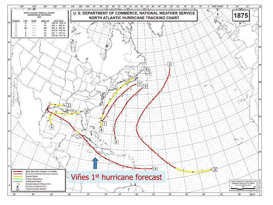
Viñes 1st hurricane forecast
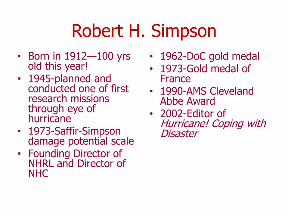
Robert H. Simpson• Born in 1912—100 yrs
old this year!• 1945-planned and
conducted one of first research missions through eye of hurricane
• 1973-Saffir-Simpson damage potential scale
• Founding Director of NHRL and Director of NHC
• 1962-DoC gold medal• 1973-Gold medal of
France• 1990-AMS Cleveland
Abbe Award• 2002-Editor of
Hurricane! Coping with Disaster
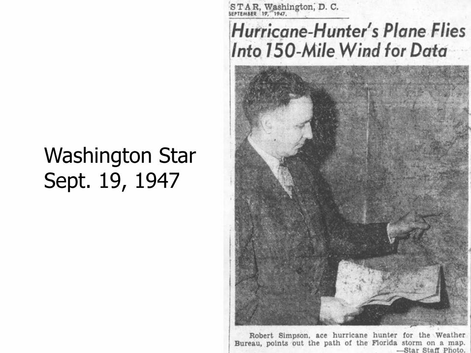
Washington StarSept. 19, 1947
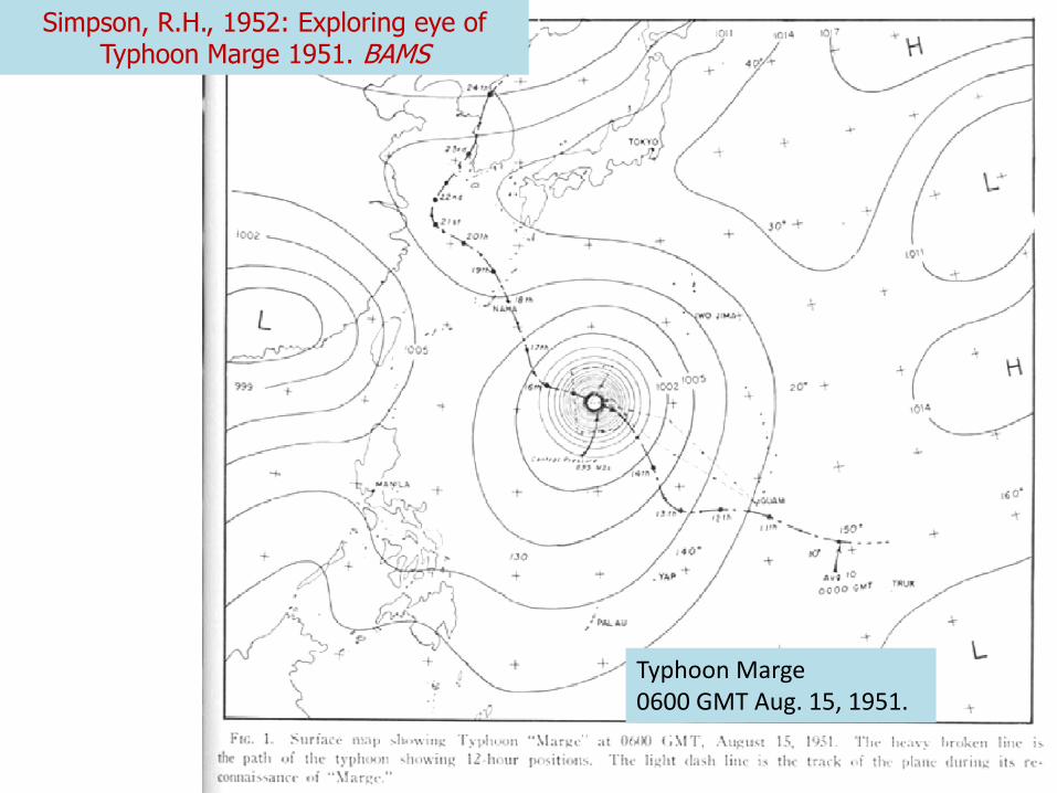
Typhoon Marge0600 GMT Aug. 15, 1951.
Simpson, R.H., 1952: Exploring eye of Typhoon Marge 1951. BAMS

Inside the eye of Typhoon Marge
Simpson, R.H., 1952: Exploring eye of Typhoon Marge
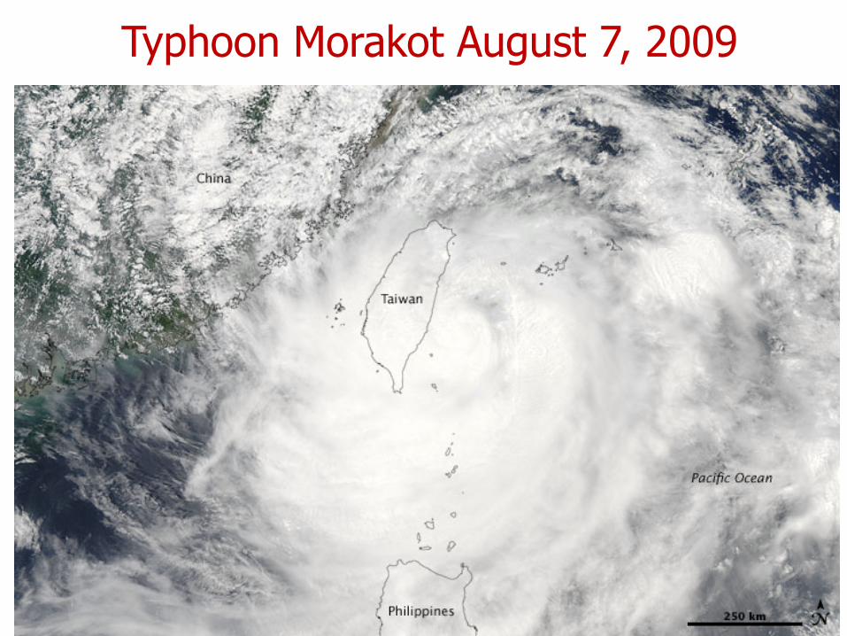
Typhoon Morakot August 7, 2009
OPAC 2010 Rick Anthes
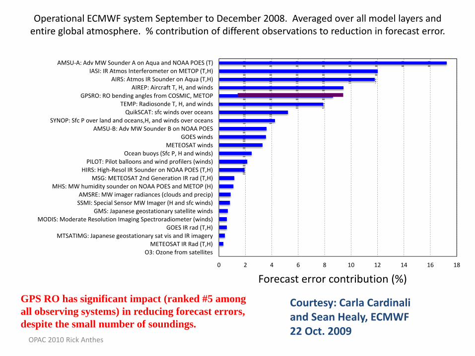
Operational ECMWF system September to December 2008. Averaged over all model layers and entire global atmosphere. % contribution of different observations to reduction in forecast error.
GPS RO has significant impact (ranked #5 amongall observing systems) in reducing forecast errors, despite the small number of soundings.
Courtesy: Carla Cardinaliand Sean Healy, ECMWF22 Oct. 2009
Forecast error contribution (%)0 2 4 6 8 10 12 14 16 18
O3: Ozone from satellitesMETEOSAT IR Rad (T,H)
MTSATIMG: Japanese geostationary sat vis and IR imageryGOES IR rad (T,H)
MODIS: Moderate Resolution Imaging Spectroradiometer (winds)GMS: Japanese geostationary satellite winds
SSMI: Special Sensor MW Imager (H and sfc winds)AMSRE: MW imager radiances (clouds and precip)
MHS: MW humidity sounder on NOAA POES and METOP (H)MSG: METEOSAT 2nd Generation IR rad (T,H)
HIRS: High‐Resol IR Sounder on NOAA POES (T,H)PILOT: Pilot balloons and wind profilers (winds)
Ocean buoys (Sfc P, H and winds)METEOSAT winds
GOES windsAMSU‐B: Adv MW Sounder B on NOAA POES
SYNOP: Sfc P over land and oceans,H, and winds over oceansQuikSCAT: sfc winds over oceans
TEMP: Radiosonde T, H, and windsGPSRO: RO bending angles from COSMIC, METOP
AIREP: Aircraft T, H, and windsAIRS: Atmos IR Sounder on Aqua (T,H)
IASI: IR Atmos Interferometer on METOP (T,H)AMSU‐A: Adv MW Sounder A on Aqua and NOAA POES (T)
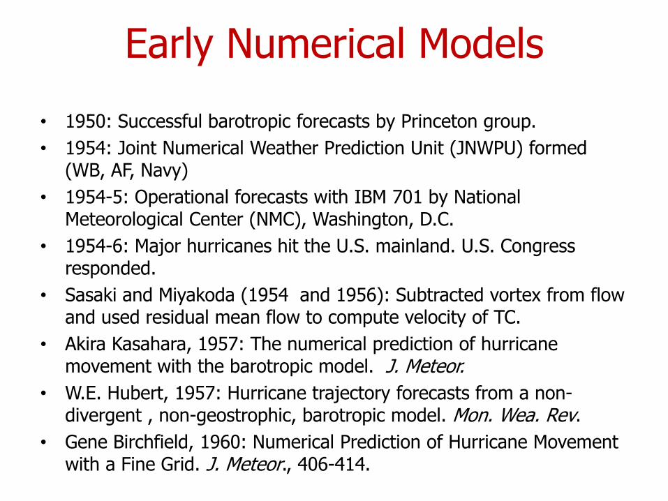
Early Numerical Models
• 1950: Successful barotropic forecasts by Princeton group.• 1954: Joint Numerical Weather Prediction Unit (JNWPU) formed
(WB, AF, Navy)• 1954-5: Operational forecasts with IBM 701 by National
Meteorological Center (NMC), Washington, D.C.• 1954-6: Major hurricanes hit the U.S. mainland. U.S. Congress
responded.• Sasaki and Miyakoda (1954 and 1956): Subtracted vortex from flow
and used residual mean flow to compute velocity of TC. • Akira Kasahara, 1957: The numerical prediction of hurricane
movement with the barotropic model. J. Meteor.• W.E. Hubert, 1957: Hurricane trajectory forecasts from a non-
divergent , non-geostrophic, barotropic model. Mon. Wea. Rev.• Gene Birchfield, 1960: Numerical Prediction of Hurricane Movement
with a Fine Grid. J. Meteor., 406-414.
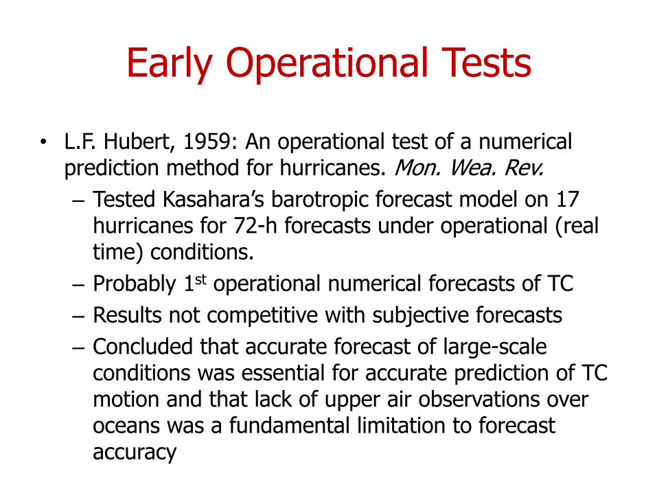
Early Operational Tests
• L.F. Hubert, 1959: An operational test of a numerical prediction method for hurricanes. Mon. Wea. Rev.– Tested Kasahara’s barotropic forecast model on 17
hurricanes for 72-h forecasts under operational (real time) conditions.
– Probably 1st operational numerical forecasts of TC– Results not competitive with subjective forecasts– Concluded that accurate forecast of large-scale
conditions was essential for accurate prediction of TC motion and that lack of upper air observations over oceans was a fundamental limitation to forecast accuracy
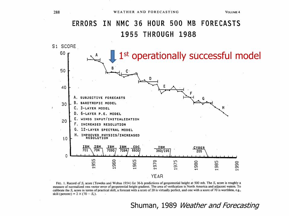
Shuman, 1989 Weather and Forecasting
1st operationally successful model

Kasahara, 1957 computationaldomain. Note large spacingbetween grid points (300 km)
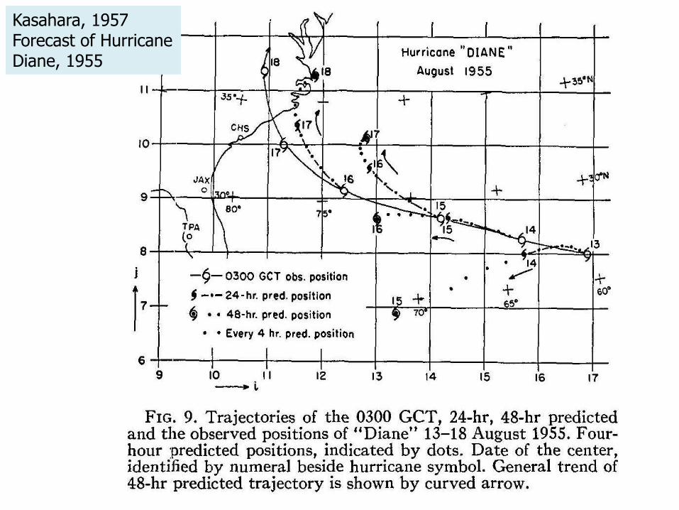
Kasahara, 1957Forecast of HurricaneDiane, 1955
Hot Towers, Cumulus Parameterization and CISK
Major topics of research and theory in the 50s and 60s!
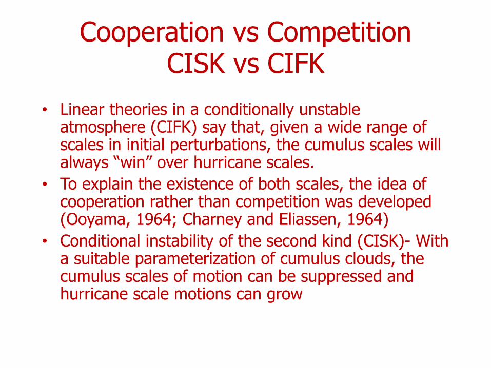
Cooperation vs CompetitionCISK vs CIFK
• Linear theories in a conditionally unstable atmosphere (CIFK) say that, given a wide range of scales in initial perturbations, the cumulus scales will always “win” over hurricane scales.
• To explain the existence of both scales, the idea of cooperation rather than competition was developed (Ooyama, 1964; Charney and Eliassen, 1964)
• Conditional instability of the second kind (CISK)- With a suitable parameterization of cumulus clouds, the cumulus scales of motion can be suppressed and hurricane scale motions can grow
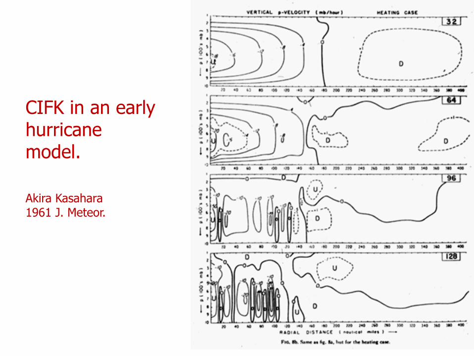
CIFK in an earlyhurricanemodel.
Akira Kasahara1961 J. Meteor.
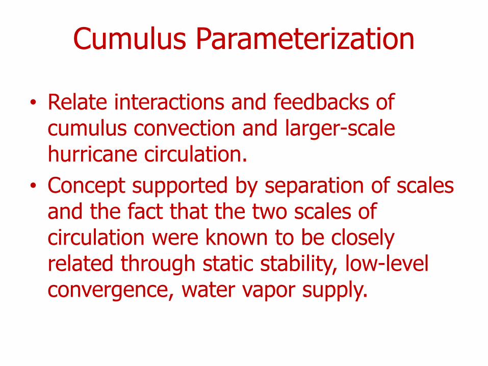
Cumulus Parameterization
• Relate interactions and feedbacks of cumulus convection and larger-scale hurricane circulation.
• Concept supported by separation of scales and the fact that the two scales of circulation were known to be closely related through static stability, low-level convergence, water vapor supply.
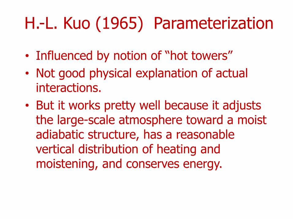
H.-L. Kuo (1965) Parameterization
• Influenced by notion of “hot towers”• Not good physical explanation of actual
interactions.• But it works pretty well because it adjusts
the large-scale atmosphere toward a moist adiabatic structure, has a reasonable vertical distribution of heating and moistening, and conserves energy.
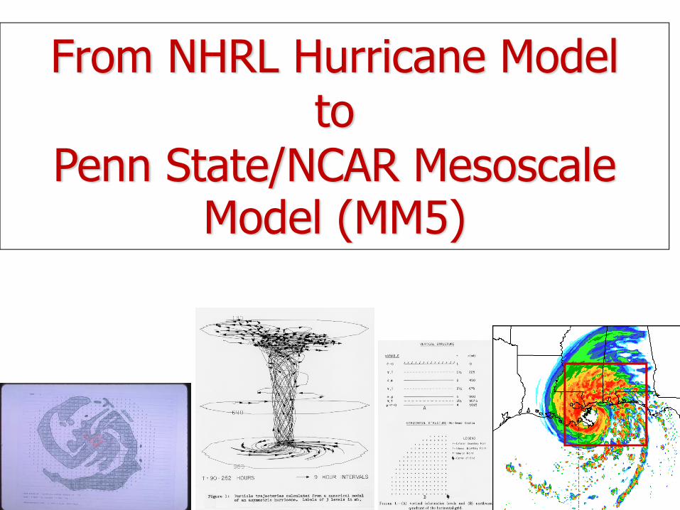
From NHRL Hurricane Modelto
Penn State/NCAR Mesoscale Model (MM5)
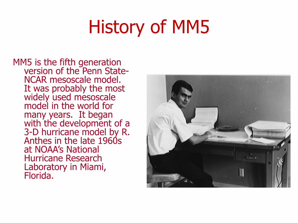
History of MM5
MM5 is the fifth generation version of the Penn State-NCAR mesoscale model. It was probably the most widely used mesoscale model in the world for many years. It began with the development of a 3-D hurricane model by R. Anthes in the late 1960s at NOAA’s National Hurricane Research Laboratory in Miami, Florida.
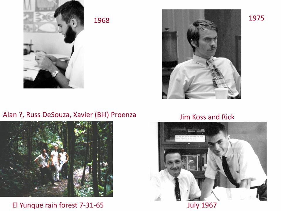
El Yunque rain forest 7‐31‐65
1968 1975
July 1967
Jim Koss and RickAlan ?, Russ DeSouza, Xavier (Bill) Proenza
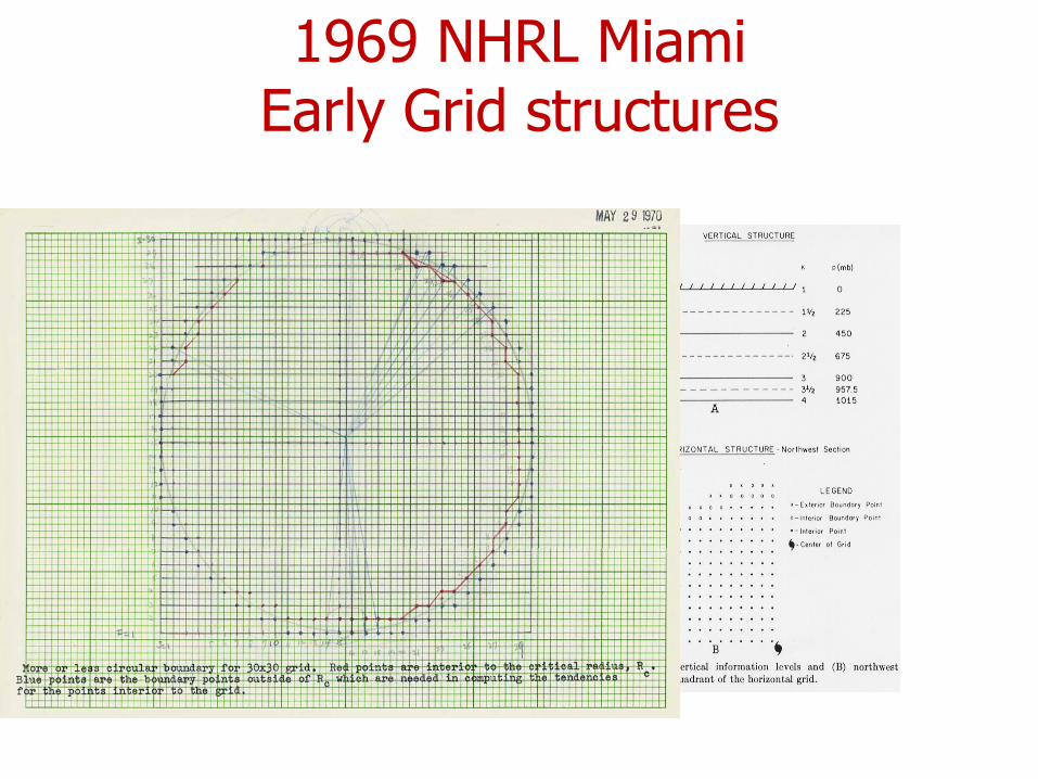
1969 NHRL MiamiEarly Grid structures
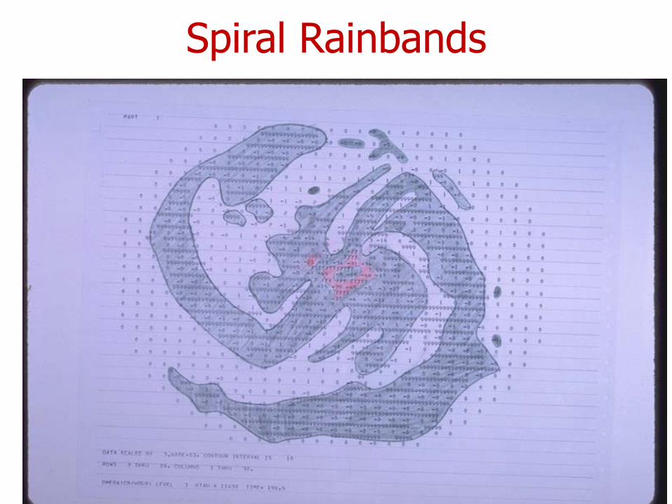
Spiral Rainbands

3-D Trajectories
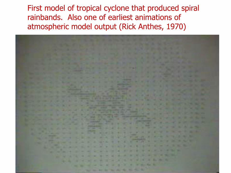
First model of tropical cyclone that produced spiral rainbands. Also one of earliest animations of atmospheric model output (Rick Anthes, 1970)
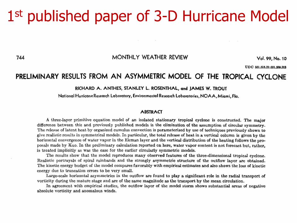
1st published paper of 3-D Hurricane Model
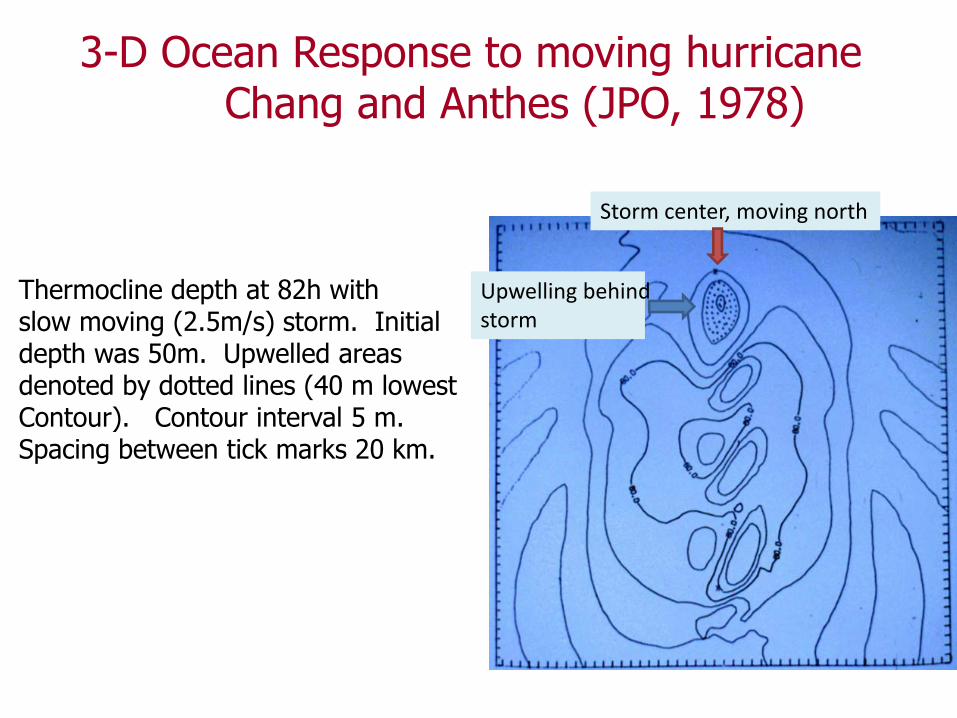
3-D Ocean Response to moving hurricaneChang and Anthes (JPO, 1978)
Thermocline depth at 82h withslow moving (2.5m/s) storm. Initialdepth was 50m. Upwelled areasdenoted by dotted lines (40 m lowestContour). Contour interval 5 m.Spacing between tick marks 20 km.
Storm center, moving north
Upwelling behindstorm

MM5 Developers in 1999Nelson Seaman, Dave Stauffer, Tom Warner, Rick Anthes,George Grell, Jimy Dudhia, Bill Kuo. June 1999
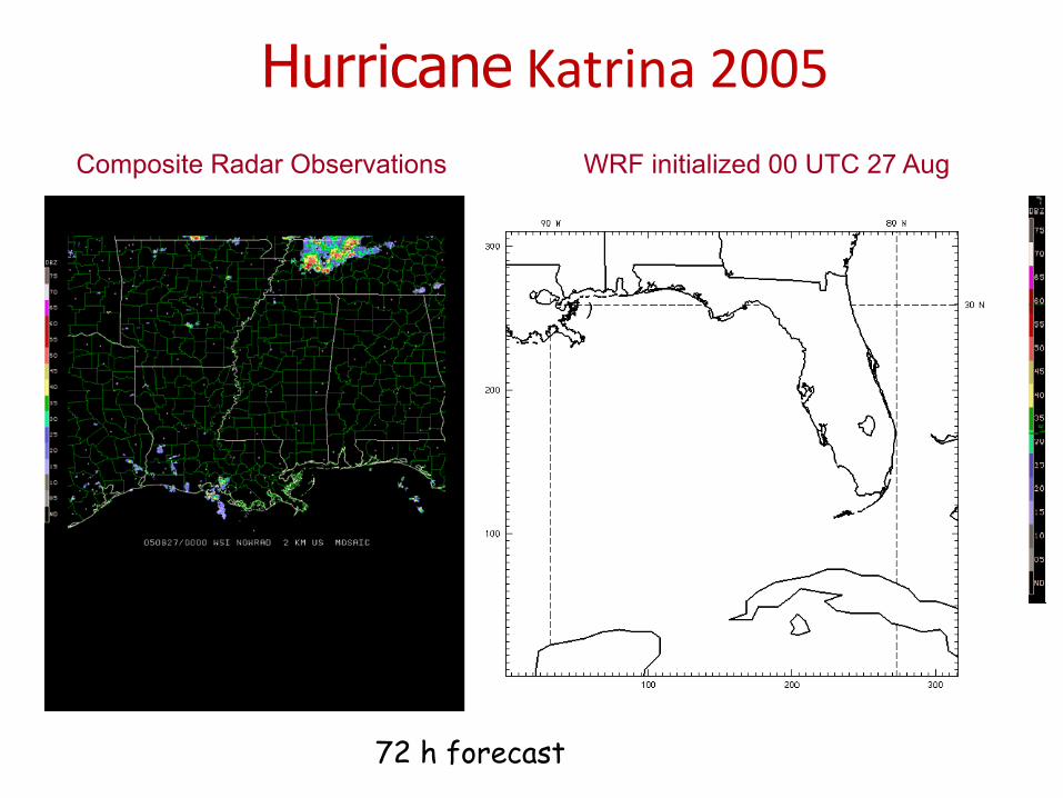
Hurricane Katrina 2005Composite Radar Observations WRF initialized 00 UTC 27 Aug
72 h forecast
We have come a long way
• Observations– Personal, in situ, aircraft, radar, satellites
• Theory (mathematics, physics, atmospheric sciences)
• Numerical models• Sponsorship—mostly by governments• Dedicated people
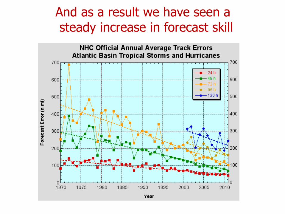
And as a result we have seen asteady increase in forecast skill
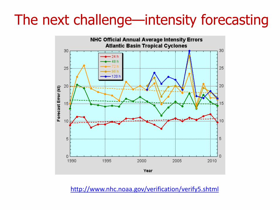
http://www.nhc.noaa.gov/verification/verify5.shtml
The next challenge—intensity forecasting
Rick’s Future Outlook
• Forecast models will interact with ocean, contain explicit cloud physics, resolve clouds, rainbands and eyewall(∆s~500m)
• Track accuracy will continue to improve, especially beyond three days
• Tropical cyclogenesis will be routinely and correctly predicted by operational global models
• A dramatic increase in accuracy of TC intensity forecasts is imminent (within 5 years). FORMOSAT-7/COSMIC-2 will play a major role.
• The relationship between TC formation and intensity and climate change will continue to be an important topic of research for many years.
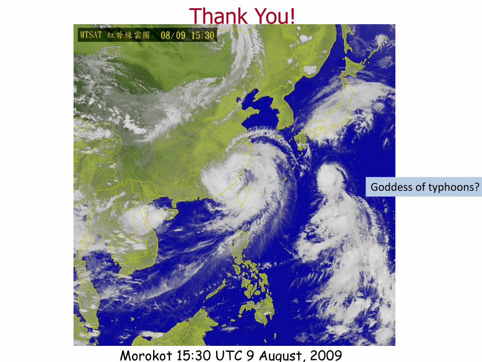
Thank You!
Morokot 15:30 UTC 9 August, 2009
Goddess of typhoons?