GREENCASTLE HILL, ANTIGUA: A POSSIBLE MEGALITHIC...
4
GREENCASTLE HILL, ANTIGUA: A POSSIBLE MEGALITHIC MONUMENT OF A PREHISTORIC CIVILIZATION Al Hajji Talib Ahmad Dawud One of the most beautiful sights to be seen in Antigua, West Indies, is from the top of Greencastle Hill. The hill is the remains of an isolated extinct volcano with several lengthy spurs. From there can be seen a range of volcanic hills with low lines forming the background, an extensive alluvial plain profuse in canefields, and the ocean from three directions. Greencastle Hill (Fig. 1) is situated about latitude 17.3° north, longitude 61. 5° west. The north portion of the hill is about 400 feet high as far as the middle where it slopes up- ward toward the highest point at 596 feet in the extreme south and then descends into the valley below at a high angle. During the commencement of the Oligocène period 28 million years ago when the subsidence of the whole island took place, ancient volcanoes in the proximity of present Greencastle Hill were truncated and greatly reduced in girth by wave action which explains the occurrence of vertical cliffs on most of them. The discovery of the megaliths was made by Mr. W.R. Forrest early in 1930 and the information was communicated to Mr. Lewis Spence, the author of "The Problem of Atlantis", and the late Professor Elliot Smith who stated that the archaeological evidence submitted by Mr. Forrest confirmed his opinion that the direction of civilization round the world was from west [the Americas] to east [Mesopotamia, Egypt, China]. The surface of the imposing plateau (Greencastle Hill), on which evidently were cen- tered the scenes of former ceremonies and phallic worship, is strewn with the remains of locations of circles of various diameters, altars, sacrificial slabs, and columns. Some are rounded, others squared, polygonal and irregular or in the rough, some isolated and others in circles or in alignment. Many groups are partly intact and in all stages of aban- donment, particularly on the steep inclines. These remains are not only confined to the plateau surface but are also found on the steep sides of the same, as well as on the slopes of the background, and are most abundant on sites with south-southwest or west exposures. A slight elevation of the ground divides the plateau into north and south sections and extends from the middle of the west side, 270 feet in a southeasterly direction towards the highest point, increasing in height as it nears the latter. The north and south sections slope in a series of circular terraces, towards their respective margins, where the min- imum height is about 215 feet. The sides of the plateau are steep with evidence on the west and south of having been stopped with horizontal rows of rounded boulders, averaging 18-24 inches high, and the gentler slopes with their contours lined in similar manner are sugges- tive of a pyramid. An alternative practical view is that the rows of boulders were intended to prevent erosion of the soil on the slopes. Observation Post The dominant feature of the whole plateau is situated near the west end of the central elevation and might be termed the "Observation Post. "' Apparently every important group of megaliths, even the distant ones in the valley below and concealed from the line of vision, 126
Transcript of GREENCASTLE HILL, ANTIGUA: A POSSIBLE MEGALITHIC...

GREENCASTLE HILL, ANTIGUA:
A POSSIBLE MEGALITHIC MONUMENT OF A PREHISTORIC CIVILIZATION
Al Hajji Talib Ahmad Dawud
One of the mos t beautiful sights to be seen in Antigua, West Indies , is from the top of Greencas t le Hill . The hil l is the r ema ins of an isolated extinct volcano with seve ra l lengthy s p u r s . F r o m there can be seen a range of volcanic hi l ls with low l ines forming the background, an extensive al luvial plain profuse in canefields , and the ocean from three d i r ec t ions .
Greencas t le Hill (Fig. 1) is si tuated about latitude 17 .3° nor th , longitude 61 . 5° west . The nor th por t ion of the hi l l is about 400 feet high as far as the middle where it slopes upward toward the highest point at 596 feet in the ex t reme south and then descends into the val ley below at a high angle. During the commencement of the Oligocène per iod 28 million y e a r s ago when the subsidence of the whole island took p lace , ancient volcanoes in the proximi ty of p r e s e n t Greencas t le Hill were t runcated and great ly reduced in gir th by wave act ion which explains the occu r rence of ve r t i ca l cliffs on m o s t of them.
The d i scovery of the megal i ths was made by Mr . W . R . F o r r e s t e a r l y in 1930 and the information was communicated to Mr . Lewis Spence, the author of "The Prob lem of At l an t i s " , and the late P r o f e s s o r Ell iot Smith who stated that the a rchaeo log ica l evidence submit ted by Mr . F o r r e s t confirmed his opinion that the di rect ion of civi l izat ion round the world was from wes t [the A m e r i c a s ] to eas t [Mesopotamia, Egypt, China].
The surface of the imposing plateau (Greencast le Hill) , on which evidently were cent e red the scenes of fo rmer ce remonies and phallic worsh ip , is s t rewn with the r e m a i n s of locations of c i r c l e s of var ious d i a m e t e r s , a l t a r s , sacr i f ic ia l s l abs , and co lumns . Some a r e rounded, o the r s squared, polygonal and i r r e g u l a r or in the rough, some isolated and o thers in c i r c l e s or in al ignment . Many groups a r e par t ly intact and in al l s tages of abandonment, pa r t i cu l a r ly on the steep incl ines . These r ema ins a r e not only confined to the p la teau surface but a r e a lso found on the s teep sides of the s ame , as wel l as on the slopes of the background, and a r e mos t abundant on s i tes with south-southwest or wes t exposures .
A slight elevation of the ground divides the plateau into nor th and south sect ions and extends from the middle of the west s ide, 270 feet in a sou theas te r ly d i rec t ion towards the highest point, increas ing in height as it n e a r s the l a t t e r . The nor th and south sect ions slope in a s e r i e s of c i r cu la r t e r r a c e s , towards the i r respec t ive m a r g i n s , where the minimum height is about 215 feet. The sides of the plateau a r e steep with evidence on the west and south of having been stopped with hor izonta l rows of rounded bou lde r s , averaging 18-24 inches high, and the gentler slopes with thei r contours lined in s imi l a r manner a r e suggestive of a pyramid . An a l te rna t ive p rac t i ca l view is that the rows of boulders were intended to prevent e ros ion of the soil on the s lopes .
Observat ion P o s t
The dominant feature of the whole plateau is s i tuated near the wes t end of the cen t ra l elevation and might be t e r m e d the "Observat ion Pos t . "' Apparent ly every impor tan t group of mega l i th s , even the distant ones in the val ley below and concealed from the line of vision,
126
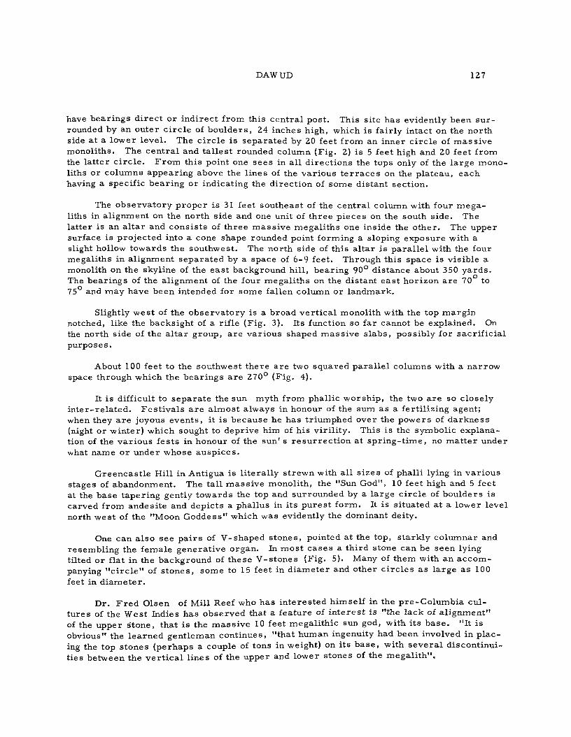
DAWUD 127
have bear ings d i r ec t or ind i rec t from this cen t ra l post . This site has evidently been s u r rounded by an outer c i r c l e of bou lde r s , 24 inches high, which is fair ly intact on the nor th side at a lower level . The c i r c l e is separa ted by 20 feet from an inner c i rc le of m a s s i v e monoli ths. The cen t r a l and t a l l es t rounded column (Fig. 2) is 5 feet high and 20 feet from the la t ter c i r c l e . F r o m this point one sees in all d i rec t ions the tops only of the la rge monoliths or columns appear ing above the l ines of the var ious t e r r a c e s on the pla teau, each having a specific bear ing or indicating the d i rec t ion of some distant sect ion.
The obse rva to ry p rope r is 31 feet southeast of the cen t ra l column with four m e g a liths in al ignment on the nor th side and one unit of th ree p ieces on the south s ide. The lat ter is an a l t a r and cons i s t s of th ree mass ive megal i ths one inside the o ther . The upper surface is pro jec ted into a cone shape rounded point forming a sloping exposure with a slight hollow towards the southwest . The north side of this a l ta r is pa ra l l e l with the four megali ths in al ignment separa ted by a space of 6-9 feet. Through this space is visible a monolith on the skyline of the eas t background hi l l , bear ing 90° dis tance about 350 y a r d s . The bear ings of the al ignment of the four megal i ths on the distant eas t hor izon a r e 70 to 75 and may have been intended for some fallen column or landmark .
Slightly wes t of the obse rva to ry is a broad ve r t i ca l monolith with the top marg in notched, like the backsight of a rifle (Fig. 3). Its function so far cannot be explained. On the north side of the a l t a r group, a r e var ious shaped mass ive s l abs , possibly for sacr i f ic ia l purposes .
About 100 feet to the southwest the re a r e two squared pa ra l l e l columns with a narrow space through which the bear ings a r e 270° (Fig. 4).
It is difficult to sepa ra t e the sun myth from phallic worsh ip , the two a re so closely in t e r - r e l a t ed . Fes t i va l s a r e a lmos t always in honour of the sum as a fert i l izing agent; when they a r e joyous events , it is because he has t r iumphed over the powers of da rkness (night or winter) which sought to deprive him of his v i r i l i ty . This is the symbolic explanation of the va r ious fes ts in honour of the sun' s r e s u r r e c t i o n at sp r i ng - t ime , no m a t t e r under what name or under whose ausp ices .
Greencas t l e Hill in Antigua is l i te ra l ly s t rewn with al l s izes of phalli lying in va r ious stages of abandonment. The ta l l mass ive monolith, the "Sun God", 10 feet high and 5 feet at the base taper ing gently towards the top and surrounded by a la rge c i rc le of boulders is carved from andesi te and depicts a phallus in i ts pu res t form. It is situated at a lower level north west of the "Moon Goddess" which was evidently the dominant deity.
One can a lso see p a i r s of V-shaped s tones , pointed at the top, s ta rk ly columnar and resembling the female genera t ive organ. In mos t cases a th i rd stone can be seen lying tilted or flat in the background of these V-s tones (Fig. 5). Many of them with an a c c o m panying " c i r c l e " of s tones , some to 1 5 feet in d iamete r and other c i r c l e s as large as 100 feet in d i ame te r .
Dr . F r e d Olsen of Mill Reef who has in te res ted himself in the p re -Co lumbia cultu res of the West Indies has observed that a feature of i n t e re s t is "the lack of a l ignment" of the upper s tone , that is the mass ive 10 feet megal i thic sun god, with i ts b a s e . "It is obvious" the l ea rned gent leman cont inues , "that human ingenuity had been involved in p l ac ing the top stones (perhaps a couple of tons in weight) on its ba se , with s eve ra l d iscont inuit ies between the v e r t i c a l l ines of the upper and lower stones of the megal i th" .

128 GREENCASTLE HILL
About t h e Moon Goddess , Dr . Olsen said, "The Moon Goddess is the stone which has a t t r ac ted m o r e local i n t e re s t than any of the o t h e r s . I t is one of the l a rges t of the megal i ths and is located on the highest point of the p la teau. The upper stone of the Moon Goddess is curved at the top showing what a r e desc r ibed as the ' h o r n s of the moon ' . "
The d i s cove re r of the p r eh i s t o r i c s i te , the late Dr . F o r r e s t has drawn attention to the fact that "the ancient Akkadians [ North Babylonians] used these same symbols; they have been found in thei r t emp le s . The "Sun God" was called Tammuz; the "Moon G o d d e s s , " I s h t a r . They had a legend t h a t l s h t a r wedded Tammuz; on the la t t e r descending into the lower r eg ions , I s h t a r went in s ea r ch of h i m . " This legend may pe r haps explain the or ientat ion of the "Sun God" to the "Moon Goddess" on Greencas t le Hill.
According to the late Char leswor th Ross , "it is worth to note that a min ia ture rep l ica of the 'Moon Goddess ' on the plateau group was found in a k i tchen-midden west of El l io t ' s Es ta te about ten to twelve mi l e s away from Greencas t le Hill . It was made of ha rd l imestone and was exactly to scale in th ree d imensions of the c ra f tmen ' s m e a s u r e r s of p r eh i s to r i c t i m e s . " Another symbol of the "Moon Goddess" was found on Yepton' s E s t a te . I t is a perfect work of a r t made to p reh i s to r i c m e a s u r e , from da rk volcanic rock, pe rhaps ande s i te .
Dr . F o r r e s t said "As r e g a r d s objects of a c o m m e r c i a l nature or those which have been made for se rv ice in some r i tua l , I would r eca l l the fact that m e a s u r e s have been sac red from t ime i m m e m o r i a l . This is brought out emphat ica l ly in the Bible. " The p r e h i s to r ic m e a s u r e s r e f e r r e d to a re a d i scovery of the late Ludovic Mann, once eminent cha i rman of the Glasgow Archaeological Society.
The question a r i s e s : Were these megal i ths the work of human or ig in , or a r e they na tu ra l outcrops of rock? Dr. F o r r e s t a n s w e r s , "On the occasion of my f i r s t contact with the s i te , I exposed the foundations of s eve ra l megal i ths on the s teep s lopes , in o rde r to a s ce r t a in this point and found that they were res t ing on or ' packed ' with sma l l flat fragments of a different type of rock. " There a r e numerous ins tances of s eve ra l types of rock occurring in the group of mega l i ths . "Worked" megal i ths (shaped and smoothed) can be readi ly dis t inguished. " Their function as l andmarks is ve ry apparent . Some a r e perfec t ly rounded and taper ing , o thers cyl indr ica l . Minor "worked" megal i ths have the i r t e r m i n a l s varying from acutely pointed to an a lmos t mushroom shape.
The l e s s spectacular but unmistakeable handiwork of man exemplified in the elaborate t e r r a c i n g of the extensive eas t slopes mus t not be forgotten. For tuna te ly , the re is further evidence on the site of the actual p re sence of man in kitchen midden r e m a i n s found on the surface of the south s lopes . "These r ema ins compr i se of pot tery f r agmen t s , worked flints, two smal l animal bones , a smal l per fora ted mar ine sp i r a l shell and a number of shel l fragments of va r ious species of Modusca, Lucina, Turbon, Chiton" Dr . F o r r e s t concludes.
In 1930 photo p r in t s and a sketch plan of Greencas t le megal i ths w e r e sent to Mr . Ludovic Mann, a fo rmer eminent cha i rman of the Glasgow Archaeologica l Society, by the Dr. F o r r e s t . After having studied the compass bear ings of the var ious groups on the Greencas t le pla teau and eas t hil l (including the fallen groups on the plateau) Mr . Ludovic Mann gave the following reply, dated October 1, 1930: "I am unable to p r e s e n t to devote intensive study to your excellent and highly scientific account of this scientific find. . .Meant ime I may draw your at tention to a str iking feature . . . . the close r e semb lance of the group of s i t e s on your map to the pr inciple s t a r s in the constel lat ion Sagi t t a r ius . These s t a r s com-

DAWUD 129
prise of that sect ion of the Zodiac which culminates at midnight of F e b r u a r y 19 between the yea r s 8600 B . C . Thus you see the megal i thic monument in Antigua may be dated about the middle of the Neolithic (per iod) as indeed somewhat s imi la r in this country may be s imi la r ly dated. I venture the suggestion that the megali thic monument, like many others , was a lmos t exclusively concerned with the t ime reckoning. You have a splendid opportunity of giving to science a body of data with the aid of which we could now throw a world of light upon ea r ly civil izat ion in the West Indies. "
For a comprehens ive study of the s i tes a ground plan and an ae r i a l view of the megaliths are essen t i a l . Excavat ion ought to be fruitful in bringing to light r emains of this ancient civil izat ion which may prove invaluable !