EFSG – SUSTAINABILITY REPORT Creating a Neighbourhood Plan...
59
Eynsham Neighbourhood Plan 2017 – 2031 Superseded Document. This is not the current version of the Eynsham Neighbourhood Plan Document. Please use the current version which can be found on the Eynsham Parish Council web-site 5 Jul 2017 Creating a Neighbourhood Plan for Eynsham
Transcript of EFSG – SUSTAINABILITY REPORT Creating a Neighbourhood Plan...
EFSG – SUSTAINABILITY REPORT
Eynsham Neighbourhood
Plan 2017 – 2031
Superseded Document.
This is not the current version of the EynshamNeighbourhood Plan Document.
Please use the current version which can be found on theEynsham Parish Council web-site
5 Jul 2017
Creating a Neighbourhood Plan for Eynsham
EFSG Neighbourhood Plan.
V2.10 Submission to WODC 10 Mar 2017 Page 1 of 58
Eynsham NeighbourhoodPlan 2031
Draft for submission to West OxfordshireDistrict Council, March 2017.
Creating a Neighbourhood Plan for Eynsham
REPLACED BY NEW VERSION
REPLACED BY NEW VERSION
INDEX
Table of Contents01 INTRODUCTION..................................................3
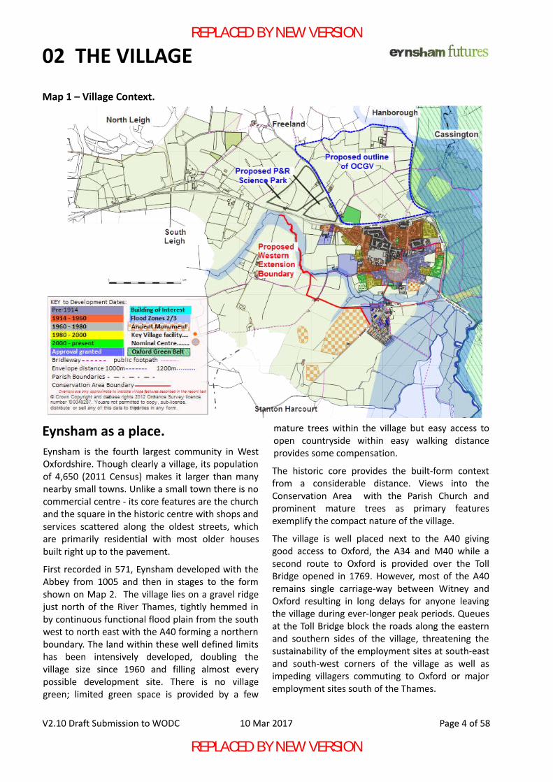
Map 1 – Village Context.......................................402 THE VILLAGE.......................................................5
Map 2 – Village Development..............................503 VISION and OBJECTIVES.....................................8
ENV 1 Housing: ....................................................8ENV 2 Design:.......................................................8ENV 3 Community facilities:.................................8ENV 4 Natural Environment:................................8ENV 5 Transport and parking:...............................8ENV 6 Economy – industry, commerce and retail:8ENV 7 Sustainability and climate change:............8ENV 8 A new Garden Village:...............................8
04 POLICIES.............................................................9ENP1 Housing.......................................................9Note A: A reasonable walking distance.............10Note B: The village centre..................................11Footpaths, cycle-paths and mobility vehicle
access...........................................................12ENP2 Design.......................................................13ENP3 Community facilities including
Infrastructure and Utilities...........................15ENP4 Green Infrastructure – the setting for new
developments..............................................18ENP5 Sustainability: Climate Change..................20ENP6 Education..................................................22ENP7 Sustainable Transport...............................24ENP8 Connected Place – integration of new
developments with the village.....................26ENP9 Parking......................................................27
ENP10 Building a strong sustainable economy.. .29ENP11 Retail.......................................................31ENP12 Local Green Space...................................33Map 3 – Local Green Space proposals. ..............34ENP13 Trees.......................................................35
05 SPATIAL POLICIES..............................................37ENP14 Sustainable Growth................................37ENP15 Eynsham Village Centre .........................40ENP16 North of the A40.....................................41ENP17 Development of a western extension to
the village.....................................................47Map 4: Chil Brook Linear Park concept..............48ENP18 Southern Industrial Area.........................50
06 APPENDIX A......................................................51Appendix A: WODC SHELAA Site proposals........51Map 5: Sites proposed for development to
WODC, March 2016.....................................5107 APPENDIX B......................................................54
Appendix B. Public Realm Projects.....................5408 APPENDICES.....................................................55
Appendix C. Explanatory Notes..........................55Appendix D – Road types...................................56Appendix E – abbreviations................................56
REFERENCES..........................................................57ACKNOWLEDGEMENTS.........................................58
V2.10 Draft Submission to WODC 10 Mar 2017 Page 2 of 58
Other documents to support the Neighbourhood Plan are available from Eynsham Parish Council web-site.
ENP Basic Conditions Statement
ENP Site Assessments
ENP Sustainability Assessment Scoping Report Rural Community Profile for Eynsham
ENP Consultation Statement Initial community engagement findings,Pre-submission consultation feedback report.ENP Supplementary Consultation Documents
ENP Local Green Space Designation
ENP Maps
For a print version of the Eynsham Neighbourhood Plan all these documents should be printed.
REPLACED BY NEW VERSION
REPLACED BY NEW VERSION
01 INTRODUCTION
INTRODUCTIONThis draft plan has been prepared by the EynshamFutures Steering Group (EFSG) on behalf of EynshamParish Council (EPC) who are the qualifying body des-ignated for the purpose of preparing the EynshamNeighbourhood Plan (ENP) and will approve the planbefore formal submission. Following a 6 week statutory consultation it will besubmitted to the Local Planning Authority (LPA), WestOxfordshire District Council (WODC), who haveprovided technical support along with OxfordshireCounty Council (OCC). WODC will then considerwhether the plan complies with all relevant statutoryrequirements and publish it for a further period of 6weeks before sending it for independent examination.
This document inevitably includes jargon andabbreviations. Help for those unfamiliar withplanning terms can be found in Appendix C and D.
Policies in the ENP relate closely with those set outin the emerging West Oxfordshire Local Plan (WOLP)of the Local Planning Authority, West OxfordshireDistrict Council. The Plan has been written to con-form with the National Planning Policy Framework(NPPF), March 2012 and with a presumption ofachieving sustainable development in Eynsham.Policies are clearly indicated in blue boxes ; theyare identified by numbers, e.g. ENP1, with policysubclauses identified by letters, e.g. ENP1.A. Reas-ons for policies which follow are identified by para-graph numbers, e.g. ENP1.1 for reference and areintended to clarify the purpose, intent and extent ofthe policies. For matters outside the control of theENP, recommendations are in green boxes.
The ENP applies to the Parish of Eynsham withemphasis on the areas where development is pro-
posed. All development, including those areas notspecifically mentioned in the ENP will be subject toWODC planning policy set out in the WOLP. EFSG has three Parish Council members and other vil-lage residents and representatives of the local com-munity. Consultation with local residents and otherstakeholders, such as schools and businesses, hastaken place using public events and surveys. Resultsare reported in the ENP Consultation Statement.The evidence base of the ENP, summarised in theSustainability Assessment Scoping Report (SA), in-cluded the Eynsham Design Statement (2001), Eyn-sham Parish Plan (2006) and official data presentedin “Rural community profile for Eynsham”a. This andall other Neighbourhood Plan documents listed onthe opposite page are available from EynshamParish Council web-site and as links from within thisdocument wherever reference is made to them. A comprehensive set of maps is also available to beused alongside ENP documents to supplement theindicative maps within each document.
Note on names used to identify the two separatesettlements within the WODC Local Plan.
'Eynsham' refers to the existing village south ofthe A40 within the Parish of Eynsham.
'OCGV' or 'Garden Village' refers to an entirelynew settlement north of the A40 within thecurrent Parish of Eynsham, now awarded officialGarden Village status by DCLG.
References to 'the village' or similar makes refer-ence to both settlements.
V2.10 Draft Submission to WODC 10 Mar 2017 Page 3 of 58
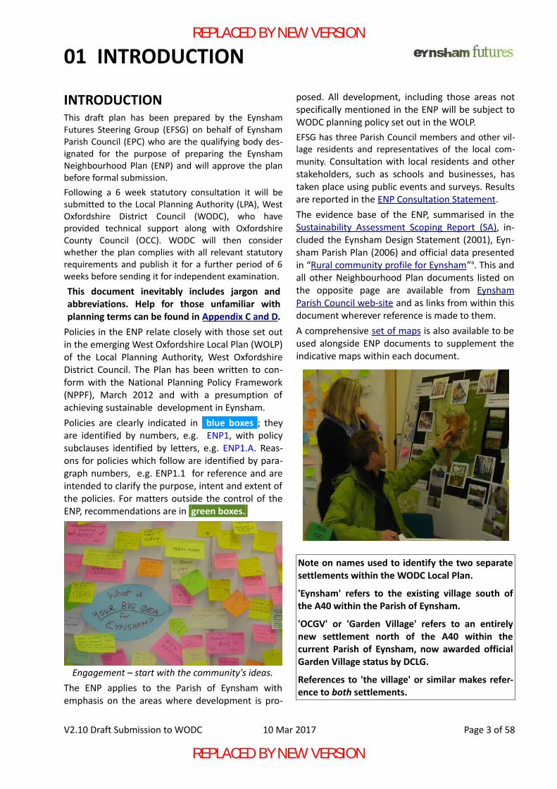
Engagement – start with the community's ideas.
REPLACED BY NEW VERSION
REPLACED BY NEW VERSION
02 THE VILLAGE
Eynsham as a place.Eynsham is the fourth largest community in WestOxfordshire. Though clearly a village, its populationof 4,650 (2011 Census) makes it larger than manynearby small towns. Unlike a small town there is nocommercial centre - its core features are the churchand the square in the historic centre with shops andservices scattered along the oldest streets, whichare primarily residential with most older housesbuilt right up to the pavement.
First recorded in 571, Eynsham developed with theAbbey from 1005 and then in stages to the formshown on Map 2. The village lies on a gravel ridgejust north of the River Thames, tightly hemmed inby continuous functional flood plain from the southwest to north east with the A40 forming a northernboundary. The land within these well defined limitshas been intensively developed, doubling thevillage size since 1960 and filling almost everypossible development site. There is no villagegreen; limited green space is provided by a few
mature trees within the village but easy access toopen countryside within easy walking distanceprovides some compensation.
The historic core provides the built-form contextfrom a considerable distance. Views into theConservation Area with the Parish Church andprominent mature trees as primary featuresexemplify the compact nature of the village.
The village is well placed next to the A40 givinggood access to Oxford, the A34 and M40 while asecond route to Oxford is provided over the TollBridge opened in 1769. However, most of the A40remains single carriage-way between Witney andOxford resulting in long delays for anyone leavingthe village during ever-longer peak periods. Queuesat the Toll Bridge block the roads along the easternand southern sides of the village, threatening thesustainability of the employment sites at south-eastand south-west corners of the village as well asimpeding villagers commuting to Oxford or majoremployment sites south of the Thames.
V2.10 Draft Submission to WODC 10 Mar 2017 Page 4 of 58
Map 1 – Village Context.
REPLACED BY NEW VERSION
REPLACED BY NEW VERSION
02 THE VILLAGE
Eynsham is located close to the arc that makes upthe West Oxford 'knowledge spine' running fromHarwell and Didcot in the south through Abingdonto Begbroke and Bicester, which poses a significantopportunity for enhancing economic activity withhigh value jobs. Eynsham has been unable to capitalise on its prox-imity to that spine due to poor transport access aswell as high property prices due to the closeness ofOxford city. This makes the village unaffordable foreven highly qualified graduate staff and is currentlyholding back local high-tech firms that wish toexpand. There are limited suitable premises for newfirms – something the plan wishes to rectify.Oxfordshire County Council (OCC) has publishedplans for a roundabout giving access to a new Parkand Ride, on land it owns just north of Eynsham,
which should improve access to the A40 from thewest side of the village.Most land east of the village is Flood Zone 2/3 andgreen belt, precluding development in that direc-tion. Land south of the village is also affected byflood risk, though to a lesser degree. Traditionallythe A40 has been viewed as a barrier to develop-ment to the north and WODC have resisted devel-opment west of the village as they valued the waythe village blends into the open countryside of ruralWest Oxfordshire. We now recognise that at leastone of these perceived barriers needs to bebreached.Almost all the land surrounding the village has beenput forward for inclusion in the emerging WODCLocal Plan. EFSG once considered development tothe west to be more immediately practical as it is
V2.10 Draft Submission to WODC 10 Mar 2017 Page 5 of 58
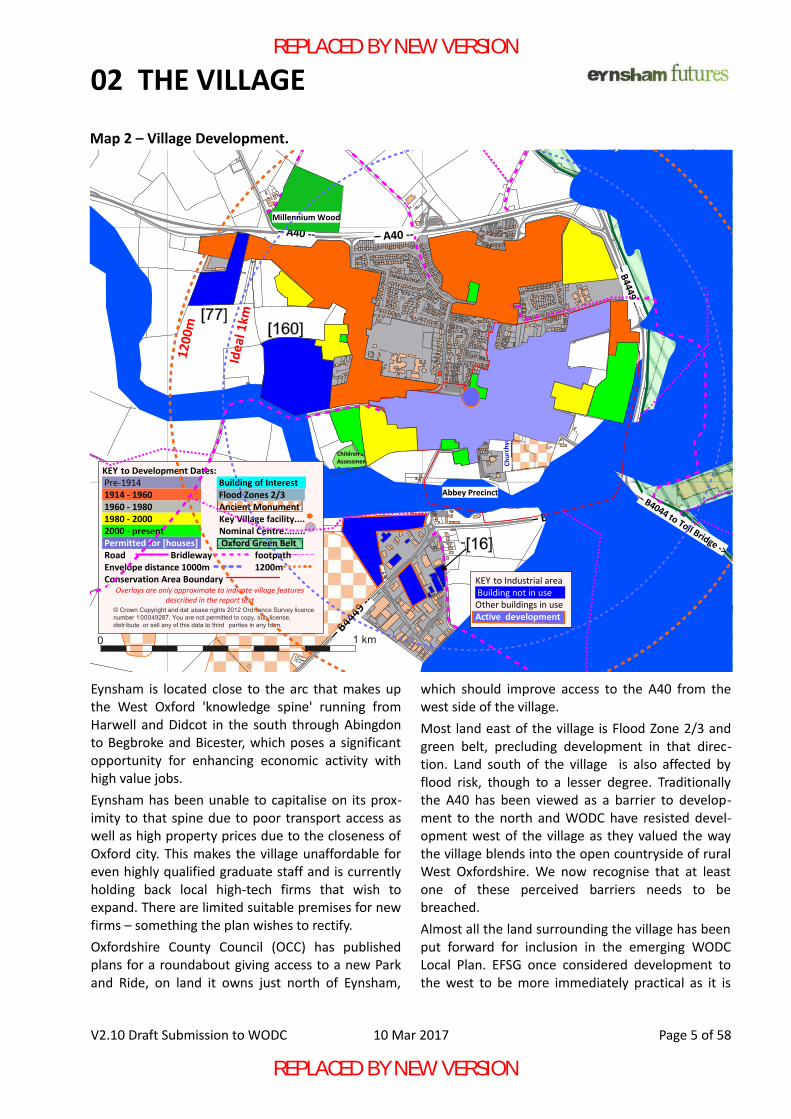
Map 2 – Village Development.
Children’sAssessmentCentre
KEY to Industrial area Building not in use Other buildings in use Active development
© Crown Copyright and dat abase rights 2012 Ord nance Survey licence number 100049287. You are not permitted to copy, sub-license, distr ibute or sell any of this data to third parties in any form.
KEY to Development Dates: Pre-1914 Building of Interest 1914 - 1960 Flood Zones 2/3 1960 - 1980 Ancient Monument 1980 - 2000 Key Village facility.... 2000 - present Nominal Centre........ Permitted for [houses] Oxford Green Belt Road Bridleway footpath Envelope distance 1000m 1200m Conservation Area Boundary
Overlays are only approximate to indicate village features described in the report text
Abbey Precinct
Millennium Wood
1 km0
REPLACED BY NEW VERSION
REPLACED BY NEW VERSION
02 THE VILLAGE
not affected by what might happen to the A40. Sitesnorth of the village were originally identified asreserves for this plan and for possible developmentat some future date when the situation of the A40was clearer.
More recently, the requirement to accommodateOxford City's unmet housing need has promptedWODC to propose a Garden Village(GV) style devel-opment, on the same scale as Eynsham, located inthe Parish north of the A40.
As a result of these changes, emphasis has shiftedto placing development to the north of the A40where rapid development would ensure funding forthe infrastructure of what is intended to be anentirely new, free-standing settlement, currentlyreferred to as Oxfordshire Cotswolds Garden Village(OCGV). The ENP is still relevant to any such devel-opment which is within the Neighbourhood Planarea and its vision is the same for a new village asthe existing one.
While the emphasis is on the main settlements, therest of the parish is, and will remain, protected frominappropriate development by WODC Local Planpolicy on development in the open countryside.
Eynsham as a community.Eynsham is more than just a location – it is a com-munity which - according to our consultation re-sponses - is much appreciated by existing residentswho are determined to ensure it will be equally val-ued by future generations of residents. Locationand structure of the village are major contributorsto this sense of a good community which the planseeks to protect and enhance.The village is very compact, allowing residents to ac-cess shops, pubs, places of worship and events andmeetings that take place in various venues on foot.A wide range of house type results in a very mixedcommunity with a good range of ages and back-ground who can and do work together. The village islarge enough to sustain a good range of shops andretail businesses as well as the many societies, clubsand sports teams based here.This compact layout has a cost – the village has verylittle open space with most of the 'green' providedby a small number of mature trees that are clearlyvisible amongst the roof-tops from outside the
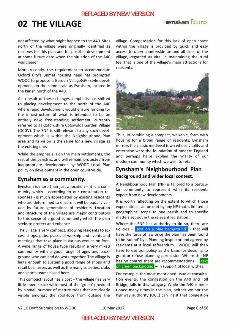
village. Compensation for this lack of open spacewithin the village is provided by quick and easyaccess to open countryside around all sides of thevillage, regarded as vital in maintaining the ruralfeel that is one of the village's main attractions forresidents.
Thus, in combining a compact, walkable, form withhousing for a broad range of residents, Eynshammirrors the classic medieval town whose vitality andenterprise were the foundation of modern Englandand perhaps helps explain the vitality of ourmodern community which we wish to retain.
Eynsham's Neighbourhood Plan -background and wider local context.A Neighbourhood Plan (NP) is tailored to a particu-lar community to represent what its residentsexpect from new developments. It is worth reflecting on the extent to which thoseexpectations can be met by any NP that is limited ingeographical scope to one parish and to specificmatters set out in the relevant legislation.Where the ENP has authority to do so, there arePolicies – text on a blue background - that willhave the force of law once the plan has been foundto be 'sound' by a Planning Inspector and agreed byresidents at a local referendum. WODC will thenhave to use our policy as the basis for deciding togrant or refuse planning permission Where the NPhas no control there are recommendations – texton green background – in support of local wishes.
For example, the most-mentioned issue at consulta-tion events, the congestion on the A40 and TollBridge, falls in this category. While the A40 is men-tioned many times in the plan, neither we nor thehighway authority (OCC) can insist that congestion
V2.10 Draft Submission to WODC 10 Mar 2017 Page 6 of 58
REPLACED BY NEW VERSION
REPLACED BY NEW VERSION
02 THE VILLAGE
be resolved before further development occurs. The ENP can require safe crossings and measuressuch as minimising extra junctions to maintaintraffic flow on the A40 because these will be put inby the developer specifically to enable the housingdevelopment. The ENP also recommends that landwhich will be needed to widen the A40 is protectedagainst any form of development so it is available inthe future.
Residents find this lack of joined-up thinking incom-prehensible but the legal situation is that WODC areduty-bound to plan homes while OCC have no stat-utory duty to ensure the A40 has enough capacity.
One element of joined-up thinking is the 'master-planb' referred to many times within the ENP. Thisis the first stage of planning a large project to en-sure everything will work as a unified whole.When agreed, it should have the same weight as a'Supplementary Planning Document' so that it isproperly and fully implemented in detailed designand construction stages.
By law, the ENP has to fit into the planning contextset by the West Oxfordshire Local Plan which is notyet in place. Eynsham is required (NPPF 184) to ac-cept the total number of new homes ENP14.1 alloc-ated to the parish, although residents have beenshocked as this number has risen from 250 to 3200while the ENP has been in progress. The ParishCouncil representations to WODC ask for less rigidallocation of houses to specific sites and this is re-flected in the ENP with supporting reasons to makeits case for focussing development north of the A40in the first instance and protecting a particularlyvaluable open space to the south-west of the vil-lage.
The planning context is further complicated by con-tinual changes. There are now two Garden Villageproposals within 5km of Eynsham (one in the neigh-bouring parish and therefore beyond the ENP remit)so the plan focusses on policies applicable to anydevelopment while offering a reasoned assessmentof the likely sites with 'spatial policies' relating tothe centre and sites north and west of the village.
Considerable local consultation has identified themain issues of concern to residents. Infrastructurecomes high on the list so that adequate school
places, health care, allotments, water and sewerageand similar services are available. The ENP includespolicies (ENP3.1) to ensure that the physical facilit-ies are in place before occupation.
Some matters are statutory considerations underplanning law and the ENP does not duplicate suchrequirements although it does note matters of spe-cific concern to residents. Surface water floodingand sewerage are specifically mentioned but theENP does not go into technical requirements whereadequate national standards exist.
Where standards are currently weak, technical mat-ters are included such as ENP5 but it is noted thatthe ENP cannot enforce such standards unless thelaw is changed to encourage developers to aspire tobuild exceptional homes or ask them to explain whythis isn't a viable option.
Other matters, such as mineral (gravel) extraction,are specifically excluded from Neighbourhood Plansalthough they could clearly impact the area.
Within these limitations the ENP is responding tomany of the concerns of residents by addressing thefollowing issues - the right type of well-designedhomes, keeping the village compact, requiringhealth-care and other services to be built on time,providing green spaces and increasing bio-diversity,specifying low energy homes, enough school places,transport, foot, cycle and mobility vehicle access,parking, retail shops and employment.
The ENP has selected sites for protection as LocalGreen Spaces and recommends Tree Preservationorders be made on key sites. The spatial policieshave already been noted and the many sites putforward for development have been assessed.
One benefit of a NP is that more money for localprojects is provided and various projects are recom-mended. A number of Answers to FrequentQuestions, definitions and abbreviations concludethe ENP.
Development will happen but must be done well to:
“ensure that the benefits of living in Eynshamare preserved or enhanced for the benefit ofexisting and future residents.”
This, then, is the guiding principle to our vision forEynsham over the next 15 years.
V2.10 Draft Submission to WODC 10 Mar 2017 Page 7 of 58
REPLACED BY NEW VERSION
REPLACED BY NEW VERSION
03 VISION and OBJECTIVES
A Vision for Eynsham Parish 2031:Our vision for the Parish of Eynsham at the end ofthe plan period is that both new and existingresidents will be enjoying the same benefits ofliving in the village as current residents do in 2017and that the area will be an even more attractivecommunity in which to live and work.Eynsham is primarily a community, rather than justa settlement, with a wide range of people living to-gether in a large but compact village. At consulta-tion events and during surveys, residents regularlycommend the village for its 'strong community spir-it' and 'rural village character', which they want toprotect and enhance. We see no reason why thesame vision should not apply to any new settlementbuilt within the parish boundary.Our vision will be made reality through meeting eight primary objectives.ENV 1 Housing:
New development shall ensure a mix of hous-ing types and tenures to make a balancedcommunity suitable for this area of WestOxfordshire close to the city of Oxford. Theideal community will have a range of ages,incomes, education and skills so that the com-munity could be largely self-sustaining.
ENV 2 Design:New development shall be visually attractiveand in harmony with its immediate setting andcharacter. It shall provide a pleasant and safeplace for all residents to live. Developmentsshould achieve a Building for Lifec or equivalentd
accreditation and developers should aspire toachieve national recognition for excellence byattaining a 'green' in all categories.
ENV 3 Community facilities:New development shall ensure that new resid-ents have at least the same access to com-munity facilities as existing residents and newdevelopments shall, as far as reasonably prac-ticable, contribute to the facilities of the entirecommunity. Eynsham is successful as a com-munity because it is compact and people canaccess schools, employment and other facilitieswithout the use of a private car. New develop-ments shall maintain this compact and well-connected feature of the village.
ENV 4 Natural Environment:New developments shall bring together allaspects of design, connectivity and naturalenvironment that constitute the landscapesetting of the new (and existing) development,closely linking village and countryside. Quickand easy access to countryside and retainingtrees, hedgerows and footpaths is a vital ele-ment in retaining a village feel, in some meas-ure compensating for the lack of a village greenor park within the existing village.
ENV 5 Transport and parking:New development shall be planned and con-structed to ensure that all residents haveready access to local transport networks byprivate car, bicycle or public transport and thatexcellent paths are created for pedestrianscyclists and mobility vehicles. New develop-ments should not exacerbate existing parkingproblems within the village centre and shallensure adequate and appropriate parking fornew residents.
ENV 6 Economy – industry, commerce and retail:New developments shall ensure that Eynshamcontinues to offer a range of employmentopportunities that reflects its location on theedge of the 'knowledge spine' around Oxfordcity and that potentially utilises a full range ofskills from manual through to post-graduatelevels. Development should also ensure thecontinued viability of the excellent range oflocal shops that allow residents to shop for dayto day needs within the village.
ENV 7 Sustainability and climate change:New development shall be sustainable nowand in the long term without compromisingone for the other. Homes of a standard com-patible with the intentions of the ClimateChange Act are likely to be commercially viablein Eynsham and offer benefits to be reaped bythe many generations that will live in them.
ENV 8 A new Garden Village:ENV1-7 shall be shared by the new settlement,which shall be built according to Garden Vil-lage principles as a new, separate, community.Neither settlement should be dependent onthe other; any shared facilities shall be formutual benefit and without harm to either.
V2.10 Draft Submission to WODC 10 Mar 2017 Page 8 of 58
REPLACED BY NEW VERSION
REPLACED BY NEW VERSION
04 POLICIES
ENP1 Housing.
Reasons:1.1 Evidence presented in SA Scoping Report
S2(SA S2) and consultation with residents andbusinesses indicates that Eynsham is particu-larly in need of smaller homes, typically 2bedrooms for the following groups:• those on a waiting list for affordable housing.• young families who want open-market
starter homes.• junior skilled staff required by high-tech
businesses, health & education institutions.• older people looking for somewhere smaller
and better adapted to their needs.1.2 Data from “Rural Community profile for Eyn-
sham” (SA ref 4) indicates the existing housingmix is in reasonable balance with localdemand apart from the need for smallerhouses noted above. Proposals suggesting ahigher proportion of larger homes (4 or morebedrooms) on the basis that this will 'releasesmaller homes as residents upgrade' must bejustified by evidence before acceptance bythe Local Planning Authority (LPA).
1.3 The proportion of houses on each site shouldmatch the needs assessment as far as is prac-tical. Sites of 30 or more houses should offer areasonable balance of property types; above50 properties the balance should match theneeds quite accurately. Market housing in par-ticular should match the needs – it will not beacceptable to have all the small houses associal housing while the need for smaller mar-ket houses remains acute.
1.4 For developments offering open-markethouses for sale, the WODC target of 50% af-fordable housing shall be adhered to. Wherealternative forms of tenure for market hous-ing are offered to meet the needs of localbusinesses to attract and retain junior skilledstaff who would not otherwise be able to af-ford housing in the area, the LPA should con-sider a different proportion on its meritsprovided it is satisfied that the alternativeoffered meets the specific local needs and isprotected by an adequate long-term legalagreement.
1.5 Self-build home sites should be made availableon larger developments in accordance withWODC policy.
1.6 It is expected that developers and HousingAssociations will see and meet the need forhomes suitable for older residents to down-size intoe. These may have larger rooms thanthose offered as starter homes reflecting theability of existing home-owners to pay ahigher price when they sell a larger house.They may also be single-storied for easieraccess. Residents do regard the availability ofhousing for older people as important in anarea with a more than average older popula-tion (SA 4.1.G) so all developments subject toa masterplan should have a proportion of at
V2.10 Draft Submission to WODC 10 Mar 2017 Page 9 of 58
New development shall ensure that each villagehas a mix of housing types and tenures to make abalanced community. The ideal community willhave a range of ages, incomes, education andskills so that the community could be largely self-sustaining.This shall be achieved by:A The range of house types/sizes in each village
should reflect the most recent OxfordshireStrategic Housing Market Assessment(OSHMA) as far as is practical and shall applyto both market, affordable and social housing.
B Exceptions to the requirement for 50% afford-able housing shall only be permitted wheresome alternative benefit to the wider localcommunity, or that this level of affordablehousing is not viable, can be demonstrated.
C Developments shall include a mix of 2 bedunits to meet the different requirements ofstarter homes and for older residents todownsize into.
D Residential development should normally belocated within 1000m* of the village centre tomaintain the compact, walk-able, nature ofthe village. Exceptions shall only be made forproperties where being further away from thevillage centre can be justified and it can bedemonstrated that they are in character withtheir location.
* indicates distance on a map – see Note A
REPLACED BY NEW VERSION
REPLACED BY NEW VERSION
04 POLICIES
least 15% constructed to Lifetime Homesf
standard or equivalent to meet the needs ofolder or less-able residents. This requirementapplies to market and appropriate affordablehousing. See also ENP 9.5/9.6
1.7 Development should normally be within reas-onable walking distance of the Village Centre
(see Note B), to ensure the village feel isretained and to achieve the social and phys-ical benefits set out in NPPF 69. The maximumdistance to the nominal centre should be1000m*, but up to 1200m* will be acceptedfor Eynsham as the nominal centre is so farsouth of the geographical centre for reasonsof history. Homes intended for older or less-able residents should be as close as practical,certainly within 800m*.
1.8 Homes intended as 'extra care' housing forolder or less-able residents should be as closeas practical to the village centre. This is noteasy to achieve within the existing village sosuch housing should be prioritised close tothe centre of the new settlement north of theA40 but only after appropriate infrastructureis ready to support these vulnerable resid-ents. See also ENP16.17
1.9 The targets of Note A are an objective meas-ure aimed at preserving the compact natureof Eynsham. Development may be permittedbeyond this limit if it can be demonstratedthat it offers particular benefits while notdetracting significantly from the compactnature of the village. Two such cases areoffered in the following sections.
1.10 Exceptions may be permitted beyond this dis-tance for smallholdings or a community farmoutside the village envelope, but in each caseconsent should only be given where propertiesadequately blend into their landscape contextand are subject to legal agreement that theyremain as exceptions and solely for the origin-ally permitted purpose.
1.11 'Rural Exception' sites that permit allocationof properties to people with a local connec-tion should be encouraged on the fringes ofthe village, as the benefit of affordableaccommodation for local people outweighsany concerns about such locations being isol-ated for people who will usually have someexisting connection with the village to justifybeing allocated such a property.* this mark is used throughout to indicate a'crow-flight' straight-line distance (Note A).
V2.10 Draft Submission to WODC 10 Mar 2017 Page 10 of 58
Note A: A reasonable walking distance
Retaining the perception of Eynsham as a villageis considered essential by residents; a measure ofthis is the possibility for people to walk to villagefacilities. Furthermore, the physical and socialbenefits of walking and meeting with others isrecognised in NPPF 69. A definition of 'reasonablewalking distance' is therefore necessary to guidedecision-making. See also Appendix C
Normal walking speed is generally taken as 400min 5 minutes. Guidance in NPPF is not specificabout distance though a figure of 800m (10 mins)seems to be commonly used as an acceptablewalking distance, a figure published in Providingfor Journeys on Foot by the Institution ofHighways & Transportation in 2000 and thereforewith some pedigree. This same document lists1200m as the maximum for normal journeys,allowing 2000m for commuting and walking tosenior school.
Based on plotting typical journeys across Eynshamon a map, a 20% uplift is required from direct'crow-flight' distances to walking distance,therefore the target for maximum distances tonew development shown on Map 2 and identifiedby a * is :
from the village centre 1000m*from a convenience store 800m*from Primary School 800m*
Selection of a nominal 'village centre', roughlyequidistant from the Village hall, Post Office,Pharmacy and Co-op, is covered in Note B. For comparison almost all existing homes arewithin 700m* of a convenience store. Some par-ents manage 1000m to Primary School but manywith young children may be put off by such a longtrek which should not be necessary when a newschool is being built as part of a development.
REPLACED BY NEW VERSION
REPLACED BY NEW VERSION
04 POLICIES
V2.10 Draft Submission to WODC 10 Mar 2017 Page 11 of 58
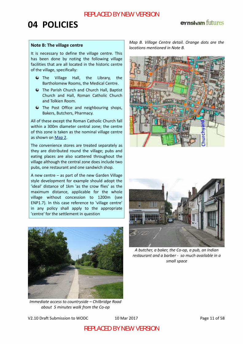
Map B. Village Centre detail. Orange dots are thelocations mentioned in Note B.
A butcher, a baker, the Co-op, a pub, an Indianrestaurant and a barber - so much available in a
small space
Immediate access to countryside – Chilbridge Roadabout 5 minutes walk from the Co-op
Note B: The village centre
It is necessary to define the village centre. Thishas been done by noting the following villagefacilities that are all located in the historic centreof the village, specifically:
The Village Hall, the Library, theBartholomew Rooms, the Medical Centre.The Parish Church and Church Hall, BaptistChurch and Hall, Roman Catholic Churchand Tolkien Room.The Post Office and neighbouring shops,Bakers, Butchers, Pharmacy.
All of these except the Roman Catholic Church fallwithin a 300m diameter central zone; the centreof this zone is taken as the nominal village centreas shown on Map 2.
The convenience stores are treated separately asthey are distributed round the village; pubs andeating places are also scattered throughout thevillage although the central zone does include twopubs, one restaurant and one sandwich shop.
A new centre – as part of the new Garden Villagestyle development for example should adopt the'ideal' distance of 1km 'as the crow flies' as themaximum distance, applicable for the wholevillage without concession to 1200m (seeENP1.7). In this case reference to 'village centre'in any policy shall apply to the appropriate'centre' for the settlement in question
REPLACED BY NEW VERSION
REPLACED BY NEW VERSION
04 POLICIES
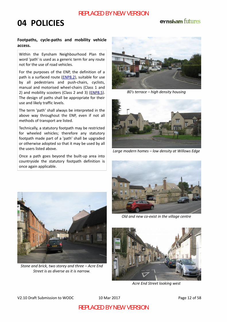
Footpaths, cycle-paths and mobility vehicleaccess.
V2.10 Draft Submission to WODC 10 Mar 2017 Page 12 of 58
Within the Eynsham Neighbourhood Plan theword 'path' is used as a generic term for any routenot for the use of road vehicles.
For the purposes of the ENP, the definition of apath is a surfaced route (ENP8.2), suitable for useby all pedestrians and push-chairs, cyclists,manual and motorised wheel-chairs (Class 1 and2) and mobility scooters (Class 2 and 3) (ENP8.5).The design of paths shall be appropriate for theiruse and likely traffic levels.
The term 'path' shall always be interpreted in theabove way throughout the ENP, even if not allmethods of transport are listed.
Technically, a statutory footpath may be restrictedfor wheeled vehicles; therefore any statutoryfootpath made part of a 'path' shall be upgradedor otherwise adopted so that it may be used by allthe users listed above.
Once a path goes beyond the built-up area intocountryside the statutory footpath definition isonce again applicable.
Stone and brick, two storey and three – Acre EndStreet is as diverse as it is narrow.
80's terrace – high density housing
Large modern homes – low density at Willows Edge
Old and new co-exist in the village centre
Acre End Street looking west
REPLACED BY NEW VERSION
REPLACED BY NEW VERSION
04 POLICIES
ENP2 Design.
Reasons:2.1 The Eynsham Neighbourhood Plan (ENP) will
exist alongside the WODC Local Plan. WODC'sDesign Guide shall be the starting point forthe design of properties within Eynsham, andshould be considered mandatory where newbuilding is in or affects the setting of the Con-servation Area or listed building unless excep-
tional circumstances can be demonstrated.Additional design requirements in the ENP arespecific to the locality of Eynsham and OCGV.
2.2 Sites allocated through the WODC Local Planreferred to as 'larger developments / sites'throughout the rest of the ENP, capable oftaking 100 or more homes, shall have a mas-terplan prepared to ensure that such largedevelopments are properly integrated intothe village and landscape. Masterplans, whichshould include locally-led consultation in theirpreparation, shall ideally be approved inadvance by WODC or as part of a planningapplication; such plans shall include a viabilityassessmentg of appropriate detail showinghow the infrastructure will be funded in theperiod before revenues are being receivedfrom the sale of houses to meet the require-ments of ENP3.1
2.3 Particular emphasis should be placed on theimmediate setting of any development so thatthere is a blending of old and new, with greatcare taken to achieve an aesthetically pleasingcombination both within a new developmentand in relation to its setting.
2.4 Developments should aim for a consistent andharmonising style for each visually-distinctgroup of buildings. Trees and green space,which are also considered essential to gooddesign, should be used to soften and disguisethe transition between styles so that distinctstyles do not clash. Variation in detailing isencouraged to prevent uniformity.
2.5 Attempts to use a mix of styles in close prox-imity to each other has resulted in groups ofbuildings that appear an untidy and contrivedjumble, even where each individual stylereflects an existing historical property in thevillage. Developments where a passer-by seesonly one consistent style, such as MertonClose or Star Close, present a more pleasingview, even though the buildings individuallyare mainstream.
2.6 Achievement of a high density using the ter-raced form may be acceptable. Houses of thistype have been traditional throughout villagehistory and have the added advantage ofinherently better energy efficiency and land
V2.10 Draft Submission to WODC 10 Mar 2017 Page 13 of 58
New development shall be well related to, and inkeeping with, its immediate setting and characterand to the wider village and landscape context.Any new development shall provide a pleasantand safe place for all residents to live.This shall be achieved by:A Proposals for development within the conser-
vation area or in its setting that do not sustainor, where practicable, enhance its character orappearance and do not conform to the WODCdesign guide will not be supported. ENP15.
B Building styles shall always be used with dueconsideration of their immediate setting andlocation. Where the context permits, goodmodern design is to be encouraged.
C A mix of different styles, particularly pasticherenditions of local styles, in close proximityshould not be used. The height of buildingsshall suit their location.
D Streets and public areas shall be planned anddesigned to be aesthetically pleasing and con-structed using materials that will ensure longlife and low maintenance costs. Street treesand appropriate planting are encouraged asan integral element of the design.
E The use of a widely accepted design standardsuch as Building for Life (BfL12) should formthe reference point for planning and determ-ining of new developments.
F Appropriate use shall be made of well-designed Green Infrastructure in creating anattractive setting – see also ENP4.
G A Master Plan shall be agreed with the LPA forlarger developments where a site has beenallocated through the Local Plan for morethan 100 homes.
REPLACED BY NEW VERSION
REPLACED BY NEW VERSION
04 POLICIES
utilisation although modern standards ofparking and waste collection will need to beaddressed as set out in BfL12:Q10 and 12.
2.7 Three-storey houses have been used in Eyn-sham in the past, but buildings of this heightare very urban in form and not suitable fornew sites at the edge of the village. Theheight of new buildings should reduce at theedge of the village to ensure the requiredblending of the urban and the rural environ-ments.
2.8 Given that each period of Eynsham's history isrepresented in its buildings, modern housedesigns, especially so-called eco-homes cap-able of operating with little or no net energyinput, should be used in these 21st centurydevelopments where the context (landscapeor existing buildings) makes this appropriate.(See also ENP5)
2.9 Streets and other areas visible to the publicshall be planned, designed and constructedusing materials that will ensure long life andlow maintenance costs.
2.10 Green Infrastructure shall have a mainten-ance plan in place before planning consent isgiven to ensure that it remains attractive inperpetuity; ideally the Parish Council or otherbody representing local residents will agree totake on this work to ensure long-term main-tenance.
2.11 Green Infrastructure is considered in furtherdetail in ENP4, which emphasises the need fora maintenance plan before consent is given.
2.12 Areas for recycling bins, public and private,should be screened to prevent litter andensure they do not become unsightly as indic-ated in BfL12:Q12. Space should be providedfor waste and recycling to be placed on collec-tion day so that paths and pavements are notobstructed.
2.13 Sustainable Urban Drainage (SUDS) shall beincorporated in accordance with WODC andnational policy to prevent flooding, particu-larly where sites adjoin areas subject to flashflooding such as the Chil Brook.
V2.10 Draft Submission to WODC 10 Mar 2017 Page 14 of 58
REC 2 - RECOMMENDATION: Design quality and innovation should be encour-aged on strategic sites. This could involve a com-petition to seek out designs which will go wellbeyond a standard 'housing estate' and create atruly innovative and integrated Garden Village.
REPLACED BY NEW VERSION
REPLACED BY NEW VERSION
04 POLICIES
ENP3 Community facilities including Infrastructure and Utilities.
Reasons:3.1 All developments shall contribute to extra fa-
cilities through S106 and CIL payments (seeAppendix E) as appropriate according to theWODC schedule of charges and in accordancewith regulation 122h of the CIL Regulations.Essential facilities necessary for each newhome should be provided at the time of occu-
pation and shall be adequate to meet theneeds of all residents at all times during andafter completion of the development. Plan-ning agreements should include appropriatetemporary or compensatory measures bothfor residents and the community in general tobe implemented if adequate facilities are notavailable at the time of occupation. ENP2.2
3.2 Larger developments, specifically those requir-ing a masterplan under ENP2.2, should con-tribute appropriately both financially and byproviding land for the infrastructure necessaryto support the new community. Such develop-ment that extends beyond the existing built-up area of the village in particular should con-tribute land for these facilities in proportionto the size of the development.
3.3 A community building should typically provide300 m2 of floor space with kitchen area, toi-lets and storage to be suitable for communityactivities such as play-groups, older personsday-centres, clubs and societies.
3.4 Results of residents surveys (2015) indicatethat pre-school provision is barely adequatefor the existing village population. It is partic-ularly important that purpose-built nurseryand pre-school space is provided, offeringbefore- and after-school care for children ofworking parents/carers, alongside a newPrimary School or separately as appropriate.
3.5 Current provision of 1 allotment to 24 homeshas fallen just short of village needs for someyears and a small increase in take-up is anti-cipated in future. New developments shouldcontribute typically 1 per 20 houses, a watersupply on-site and vehicle access. Featuressuch as secure gate, deer-proof fencing anelectricity supply and a secure communalbuilding are suitable uses for CIL funding.
3.6 Play Areas shall be provided with features forages from toddler to 14 years to match exist-ing provision in the village. Play areas shouldbe integrated with community open spacewhere the play area can be overlooked to pre-vent unintended use and prevent anti-socialbehaviour, but not so close to homes as topresent a potential noise nuisance, especiallywhere high-excitement equipment is to be
V2.10 Draft Submission to WODC 10 Mar 2017 Page 15 of 58
Development shall ensure that new residentshave at least the same access to community facil-ities as existing residents and new developmentsshall, as far as is reasonably practicable, preserveor enhance the facilities of the entire community.This shall be achieved through contribution offunding and, where appropriate, land in propor-tion to the size of each new development toensure:A Essentials such as utility services, schools, and
health-care shall be available when needed.B Easy access to facilities including health-care,
schools, pre-schools and nurseries, sportsfacilities and allotments, play areas, pubs, res-taurants and places of worship.
C Easy access to a multi-functional communitybuilding suitable for activities such as play-groups, older persons day-centres, clubs andsocieties and in accord with NPPF 38, 58 & 69.
D Access to local pre-schools / nurseries provid-ing before- and after-school care as necessary.
E Primary Healthcare facilities within an appro-priate distance within each community.
F Provision is made in land or funding to satisfylocal demand for allotments.
For larger developments:G Developers shall contribute to a community
building and pre-school as appropriate to thescale of the development to ensure it iswithin 1000m of new homes in accordancewith Note A.
H Land shall be made available to ensure thatSports facilities, Allotments, Play Areas and,where appropriate, a Burial Ground, can beprovided.
REPLACED BY NEW VERSION
REPLACED BY NEW VERSION
04 POLICIES
installed. Attention is drawn to BfL12:Q2 andWest-Oxfordshire-open-space-study-2013.
3.7 A new village burial-ground is urgentlyrequired. Various sites at the fringes of newdevelopments beyond the normal limit forresidential development have been noted andthe inclusion of such an area in any largedevelopment proposal is considered a pre-re-quisite.
3.8 Developers should contribute the necessaryland for the required facilities in agreementwith the LPA. Full financial justification shallbe presented, explaining what is and what it isnot possible in each particular case. The LPAshall decide if these reasons constitute a caseacceptable to residents.
See also ENP 6 Education.
ENP 3a Health Care Facilities
Reasons:3.9 Provision of adequate Primary Health Care,
particularly the opportunity for a routineappointment within a few days, has been aregular concern raised during our consulta-tions. While the ENP cannot resolve a nationalGP shortage, it can ensure that adequateinfrastructure is in place for patients to beseen and treated within the local community.
3.10 Currently the Eynsham Medical Centre (EMC)operates as part of a two-surgery practicewith the other site in Long Hanborough.
3.11 An estimate based on current numbers indic-ates that at least 2 extra consulting rooms andan extra treatment room would be requiredto cope with another 1000 homes in Eynshamand a new surgery with 4 consulting and 2treatment rooms would be required for a newsettlement of 2200 homes.
3.12 An additional Primary Health Care facilitywould be expected as part of the infrastructureof a new Garden Village settlement. However,it is not clear if EMC would be in a position tooperate a third premises and the site is belowthe threshold of 10,000 people normally usedby a Clinical Commissioning Group (CCG) totrigger the creation of a new practice. In thisuncertain situation the LPA shall ensure thatPrimary Health Care provision is agreed withthe CCG as part of the masterplan for a newsettlement or other major development.
3.13 A major concern for Eynsham is that a newHealth Centre will be built in a separate set-tlement north of the A40 and the Eynsham
V2.10 Draft Submission to WODC 10 Mar 2017 Page 16 of 58
Eynsham Medical Centre serves 8500 patients
REC 3a - RECOMMENDATION: To ensure adequate health-care facilities areavailable the LPA shall consult with the bodyresponsible for heath-care provision (e.g. Oxford-shire Clinical Commissioning Group). The LPAshould ensure that adequate provision is madefor additional health-care infrastructure throughthe grant of land and funding through an appro-priate legal agreement before granting planningconsent.
I Adequate Primary Health Care shall be avail-able within the local community, ideallywithin the 1000*m walking/riding distance(ENP1 Note A).
J If a new settlement is built north of the A40,adequate Primary Health Care facilities shallbe provided both there and in Eynsham inproportion to the numbers in each com-munity such that there need be no reductionin the services available locally in Eynsham.This shall be included in the masterplan.
K It is acceptable for facilities offering addi-tional diagnostic and treatment services forthe whole sub-region to be built in only onelocation.
REPLACED BY NEW VERSION
REPLACED BY NEW VERSION
04 POLICIES
Medical Centre closed, causing particularhardship to those least able to make the carjourney to the new site. Planning consent fora Health Centre north of the A40 largeenough to serve two settlements should berefused unless the requirement of ENP3J isguaranteed by legally enforcible agreement.
3.14 A benefit of building a new Health Centrewould allow space for additional services andminor procedures of the type that are increas-ingly being devolved from hospitals toPrimary Care. These additional services wouldbe available to many nearby communitiesfrom a new purpose-built premises that couldbe provided in the new settlement and would,to some extent, mitigate the inefficiency ofoperating three sites. The provision of addi-tional services only in a new Health Centrewould not constitute a reduction in service forEynsham and is therefore both acceptableand to be encouraged.(ENP16.15).
ENP 3b Infrastructure and Utilities
Reasons:3.15 Water and Sewerage: Developers shall carry
out appropriate studiesi to ascertain whetherthe proposed development will lead to over-loading of existing water & sewerage infra-structure, demonstrating that adequate capa-city exists on and off the site without leadingto problems for existing users. Where capacityproblems are identified and no improvementsare planned by the water company, agree-ment must be reached with the water com-pany on improvements required and howthey will be funded prior to any occupation ofthe development.
3.16 Surface Water Drainage and flood risk shallalso be assessed to demonstrate that drain-
age and flood water will be adequately con-trolled on site and will not pose a problem tosites downstream.
3.17 Electricity and gas networks shall be assessedto demonstrate that adequate capacity existsor how necessary improvements will be com-pleted before occupation.
3.18 The telecommunications network – voice andbroadband data – shall be assessed to demon-strate that adequate capacity, including theprovision of super-fast broadband, exists orhow the necessary improvements will becompleted before occupation. New develop-ments should aspire to provide 'fibre to thehome' and shall present costed justification ifthis is not being provided.
V2.10 Draft Submission to WODC 10 Mar 2017 Page 17 of 58
Eynsham Allotments – fully utilised andwith a waiting list
Utility networks shall have adequate capacity tomeet the needs of new developments withoutleading to problems elsewhere.L It shall be demonstrated before planning con-
sent is given that each network has or willhave adequate capacity before occupation.
M No occupation will be permitted unless thenecessary services are in place.
REPLACED BY NEW VERSION
REPLACED BY NEW VERSION

04 POLICIES
ENP4 Green Infrastructure – the setting for new developments.
Reasons:4.1 A 'green' setting for the village, including exist-
ing and newly developed areas, is seen as vitalto preserving and enhancing the village 'feel'of Eynsham and will allow new developmentto co-exist with adjoining open countryside. Itshould also be recognised that increasing bio-diversity is a good thing in its own right, notjust a benefit to residents (ENP4a).
4.2 Green infrastructure, particularly trees, is con-sidered essential in softening the built environ-ment while providing both a link and a screenbetween the village and countryside, but care-ful design is required with the followingguidelines applicable to both residential andnon-residential locations, see ENP10.
4.3 Sites that form a significant feature visiblefrom the public realm shall be protected fromunsympathetic development so that theirvalue as open space, screening or otherwisesetting the context for the built or naturalenvironment is retained. Such locationsinclude village entrance points, public foot-paths and near public buildings.
4.4 Hedgerows with occasional specimen trees arethe predominant local form of field boundaryand the presumption should be to preserveand enhance these and other significant land-scape features where they exist. Continuousgreen space and hedgerows are an essentialconduit for wildlife and strongly encouragedas an ideal opportunity for bio-diversity gain(ENP5.11).
4.5 A balance between the benefits of publicaccess and prevention of habitat disturbanceshall be demonstrated in development plans.
4.6 The appropriate use of street trees is encour-aged as part of the overall design.
4.7 Careful choice of species – preferably native tothe area - and planting distance is importantin any planting scheme, such as a screeningbelt, to ensure that they are well suited to thesite in terms of drainage, lighting, etc., andwill not overhang gardens or excessivelyobstruct natural light to properties as theymature.
4.8 Facilities such as Allotments and Play Areasthat are fenced and actively maintained aregood ways to bring green space into an other-wise developed area; they should be over-looked as this reduces the incidence of anti-social behaviour. Alternatively, the necessarydistance from house to trees could be main-tained by the use of long, narrow gardens typ-ical of medieval Eynsham.
4.9 Paths and anywhere else that people need to
V2.10 Draft Submission to WODC 10 Mar 2017 Page 18 of 58
New developments shall integrate all aspects ofdesign, connectivity and natural environment tocreate a landscape setting for the newdevelopment. Due consideration shall be givento the environmental relationship between thevillage and countryside. This shall be achieved for both residential andnon-residential development by:A Appropriate and carefully planned landscap-
ing including the creation of appropriatevisual buffers between the edges of develop-ments and open countryside by the plantingof suitable hedgerows and trees.
B Inclusion of open spaces within and, whereappropriate, at the edges of developments.
C Planting shall use appropriate species andplanting distances for their location. Publicamenity and bio-diversity shall be balancedappropriately.
D Planting adjacent to paths and other areaswhich the public will use after dark shall bedesigned so path users feel secure at all timesand to minimise anti-social behaviour.
E Existing Green Infrastructure shall be protec-ted, particularly where it is prominent in thepublic realm, particularly the specific loca-tions set out in ENP12, 13. Exceptions shouldonly be made where public amenity benefitor bio-diversity gain can be clearly demon-strated (see also ENP4a)
F A plan shall be agreed with an appropriateorganisation for the long-term maintenanceof Green Infrastructure before planning con-sent is granted.
REPLACED BY NEW VERSION
REPLACED BY NEW VERSION
04 POLICIES
go after dark to access community facilitiesneeds to include suitable measures to ensureusers feel safe – these are detailed in ENP8.
4.10 Development designs may include open areassuch as front gardens, parking spaces and thelike to contribute to the sense of open space.Where openness of a private area forms partof the design, this feature shall be legally pro-tected against inappropriate enclosure.
4.11 Developers are encouraged to use alternat-ives to grass where appropriate – particularlyplanting locally-native wild-flower meadows -offering an attractive and ecologically stimu-lating environment that may be easier tomaintain under the agreed maintenance plan.
4.12 Green infrastructure with public accessshould include accessibility for the less-able.
4.13 A maintenance plan shall be agreed with Eyn-sham Parish Council or other body represent-ative of local residents for all areas of greeninfrastructure as part of planning consent, seealso ENP 2.10
ENP 4a Enhancing Biodiversity.
4.14 Section 40 of the Natural Environment andRural Communities (NERC) Act 2006 requiresthe LPA to conserve biodiversity. Paragraph109 of the National Planning Policy Frame-work requires that biodiversity net gains j
should be provided by the planning system.4.15 Protected and priority species (NERCk S41)
shall not be disturbed except with the agree-ment of Natural England. Loss of locally signi-
ficant species should be compensated by thesuccessful re-establishment of the same spe-cies on a suitable site close by.
4.16 Used correctly, areas alongside watercoursespresent a opportunity for bio-diversity gainbut plans for these and other areas to mitig-ate loss or provide gain shall be approved byNatural England or suitably qualified body. Forexample see ENP17.9. Attention is also drawnto the designation of the Chil Brook and MeadDitch as 'major rivers' requiring an 8m zone toprotect the natural ecosystem.
4.17 Design features to benefit wildlife such asswift and bat boxes is encouraged.
V2.10 Draft Submission to WODC 10 Mar 2017 Page 19 of 58
Preserving the natural environment andincreasing biodiversity is a positive benefit bothto the human population and its own right. This shall be achieved for both residential andnon-residential development by :E All new development shall result in demon-
strable net bio-diversity gain for the parish.F Measures shall ensure areas close to water-
courses are protected to preserve the sensit-ive environment on site and downstream.
G Development shall seek to protect 'Best andMost Versatile' agricultural land (see ENP14 I).
Summer alongside Chilbridge Road
REPLACED BY NEW VERSION
REPLACED BY NEW VERSION
04 POLICIES
ENP5 Sustainability: Climate Change.
Reasons5.1 This is our contribution to implementing the
Climate Change Act of 2008, which requiresthat carbon emissions in 2050 will be reducedby 80% below 1990 levels. These require-ments are the minimum necessary to makethe transition to a low-carbon future a realitywhile ensuring that home-owners have good-value and properly sustainable homes.
5.2 WODC notes that the Eynsham area has someof the highest property prices in the District.This, together with the fact that developmentwill be on green-field land whose value isprimarily the difference between the sale
price and the build cost, should ensure theviability of developments built to the higheststandards of energy efficiency, local energygeneration or water conservation.
5.3 Developers should aspire to achieve these highstandards as a selling point for new homes.Where developers consider that these fea-tures make delivery of new homes unviablethey shall present the economic case whenapplying for planning consent justifying whythe listed features of ENP5 cannot beincluded. The level of detail should not be tooburdensome, especially for small develop-ments, but should demonstrate that the addi-tional build costs have been considered andhow they make the development unviable.
5.4 Scottishl standards for sustainability representan achievable UK standard. Building to a veryhigh standard for insulation and air-tightnessis relatively inexpensive but is very expensiveand difficult to achieve retrospectively. Thesame is true of the ducting for MechanicalHeat Recovery Ventilation, which is a betteralternative to trickle vents where constructionis well sealed. Ideally, developers will aspire tooffer properties to standards such asPassivhausm but, where they can show this isnot technically or economically viable, provid-ing the necessary fabric to achieve the Goldlevel Scottish standard will permit easierupgrading as the need or opportunity arises.
5.5 Local energy generation is important to meet-ing low-carbon targets (NPPF 17, 97). Com-bined Heat and Power should be practical onsites subject to a masterplan (ENP2.2). Anaverage of 3 kW PV generation capability perproperty is realistic. Buildings should bealigned to improve the efficiency of solar col-lection and maximise passive solar gainwherever practical. Given the low cost ofinstallation when scaffolding is already inplace during build, developers should aspireto install solar PV but as a minimum shalldemonstrate that retrofit installation will becost-effective.
5.6 Community energy generation projects havealready been implemented successfully inEynshamn. Further projects will be supported,
V2.10 Draft Submission to WODC 10 Mar 2017 Page 20 of 58
New Development shall be designed and built inaccordance with the goals set by the ClimateChange Act 2008 and the principles set out in theNPPF for ensuring the transition to a low-carbonfuture.When these additional technical requirementsare permitted, the following shall apply. Whensuch requirements are not enforcible, developersshould aspire to achieve these high standards forthe benefit of their customers and the com-munity . When they consider these standards arenot viable, developers shall provide justificationfor their decision:A All homes should be constructed with a very
high standard (such as the Scottish 2015 'gold'standard) of insulation and air-tightness andbe fitted with the internal ducting necessaryfor Mechanical Heat Recovery Ventilation.
B Combined Heat and Power schemes should beimplemented where practical and viable.
C All homes on a development site shall have anaverage of 3 kW PV generation capability.
D New homes shall at least have the capabilityof adding a charging point suitable for differ-ent types of electric vehicles.
E New homes shall have water-saving fittings asstandard for toilets and showers.
F Other measures to mitigate the effects of cli-mate change will be supported.
REPLACED BY NEW VERSION
REPLACED BY NEW VERSION
04 POLICIES
particularly on commercial and civic buildings.5.7 Electric vehicles are expected to achieve cost-
parity with petrol during the lifetime of thisplan, therefore the capability of adding acharging point of at least 7kW capacity is con-sidered necessary. House-builders maychoose to fit charging points as a marketingfeature. See also ENP9.6 and NPPF 35.
5.8 Recognised water-saving fittings for toilets andshowers add virtually no cost to a new buildand are particularly important as all newhomes should have water meters as standard.
5.9 Rainwater harvesting is encouraged, particu-larly along-side a Sustainable Urban DrainageSystem (ENP2.13) to optimise local watermanagement.
5.10 Use of suitableo green roofs and walls isencouraged for their insulation, local bio-di-versity, run-off control and similar benefits.
5.11 Attention is drawn to the need to protectGreen Infrastructure and habitat (NPPF 99)from the effects of climate change, e.g. theconnected green space of ENP4.4 or ENP17.9to provide wildlife corridors.
Despite the core principle of the NPPF (NationalPlanning Policy Framework), current regulationp
(Autumn 2016) does not permit the application of'additional technical standards' (of which energyefficiency requirements beyond the current buildingregulations minimum is deemed to be one) to newhouses on sites allocated in the West OxfordshireLocal Plan in order to meet the district's 5 year landsupply. Developments that do not come within thisregulation shall conform to ENP5.Clearly, this restriction against enforcing higherenvironmental impact standards must be atemporary measure as the Climate Change Actremains on the statute books, a fact reinforced bythe government signing the Paris Agreementendorsing a maximum 1.5°C rise and therefore theENP is ready for a future change in policy. As a result, all properties commenced after thelimitation on 'additional technical standards' iswithdrawn shall conform to ENP 5.
V2.10 Draft Submission to WODC 10 Mar 2017 Page 21 of 58
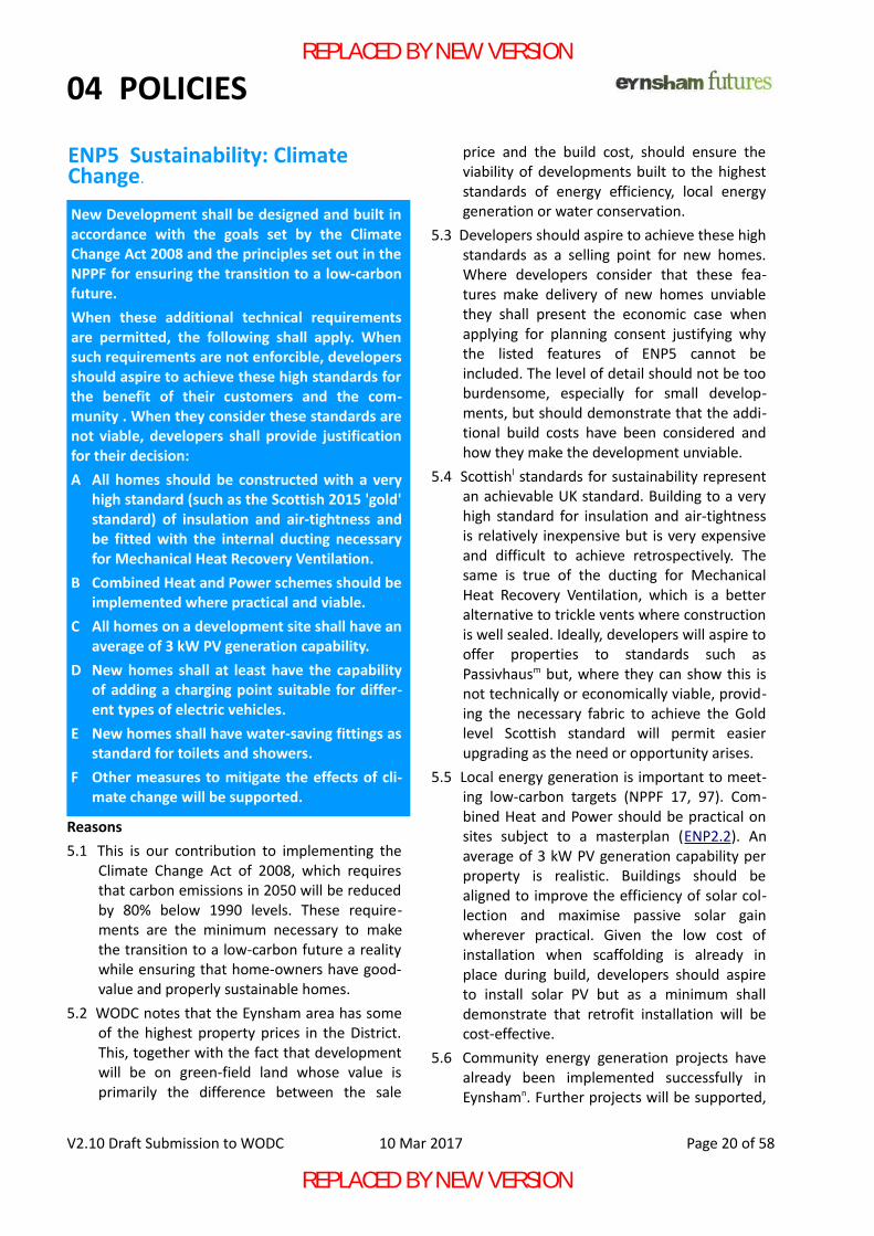
Behind the rear entrance to Bartholomew Schooland the Sports Centre, the Village Hall hosts a 12kW
solar installation community energy scheme
REPLACED BY NEW VERSION
REPLACED BY NEW VERSION
04 POLICIES
ENP6 Education.
Contextual Note: Education in Eynsham Is currentlyprovided by the Eynsham Partnership Academy(EPA) consisting of Bartholomew School (senior &sixth form, Ofsted assessed 'outstanding') and sixprimary feeder schools, including Eynsham Com-munity Primary.Responsibility for ensuring education provisionrests with OCC; the choice of education providerrests with the Regional Schools Commissioner(RSC). In future, EPA and/or another approved pro-vider will be responsible for delivering education.Names change regularly: within this policy abbre-viations indicate whoever performs the function atthe time, not a particular organisation.
Reasons:
6.1 Providing children and young people with aca-demic, vocational and life-skills is vital to thesocial and economic future of the village andis such a critical issue given the physical condi-tion and lack of capacity of the Primary Schoolthat a separate policy is dedicated to it.
6.2 Developers and LPA shall consult closely withOCC and EPA (or other approved provider) toensure that land, access and financial contri-bution is available from development sites toallow them to meet their responsibility toeducate the village's children. OCC shall signoff any masterplan before implementation.
6.3 The Primary School is already close to capacityand the prospect of 'bussing' of primary-agechildren to schools outside the village is par-ticularly undesirable. Therefore, developmentshould only be permitted when it can beshown that there are (or will be at the time ofcompletion) enough school places available tomeet the demand predicted for the numberand type of homes to be built according toOCC's schedule. This shall apply to Eynshamand OCGV separately for primary schoolingand in combination for secondary schoolingalthough it must be recognised that theremay also be some cross-over in primaryschooling location.
6.4 Small infill developments giving rise to a fewextra school places should be acceptable onpayment of the CIL contribution for educa-tion.
V2.10 Draft Submission to WODC 10 Mar 2017 Page 22 of 58
New developments shall contribute to theexpansion or new building of educationalfacilities to ensure that there is the opportunityfor the local community to maintain an excellenteducation for its children from pre-school tosixth-formers.This shall be achieved by:A Demonstrating, before planning consent is
given, how places will be provided within therelevant village primary school for each newhome as it is completed.
B Demonstrating, before planning consent isgiven, how places will be provided within thelocal secondary school for each new home asit is completed.
C New developments shall contribute to thebuilding of a new school or the expansion ofan existing school in proportion to the pre-dicted number of school places.
D Larger allocated sites will be expected to con-tribute land for a new or expanded schoolthrough the masterplanning process wherethe authority with responsibility for ensuringsufficiency of school places confirms that anew school will be necessary.
E The masterplan setting the context of schoolpremises shall have regard for appropriateaccess, ideally emphasising walking to schoolbut also making provision for safe drop-offand pick-up by car.
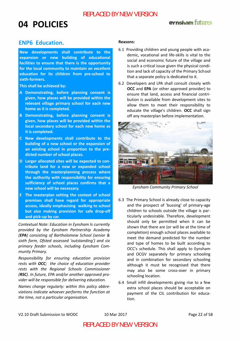
Eynsham Community Primary School
REPLACED BY NEW VERSION
REPLACED BY NEW VERSION
04 POLICIES
6.5 Larger allocated sites giving rise to a significantnumber of new school places (e.g. thoserequiring a masterplan as ENP 2.2) should, asappropriate to the size of the site, contributeto or completely fund the provision of educa-tion.Close cooperation with providers will be neces-sary to ensure the reasonable phasing-in of new students as new homes are occupied.
6.6 Developments or combinations of develop-ments that contribute adequate land or fundsto meet educational needs will be supportedand prioritised.
6.7 If a new settlement close to Eynsham is cre-ated whose students will attend BartholomewSchool, a suitable expansion of secondaryschool capacity in a manner approved by theRegional Schools Commissioner and/or otherauthority as required by the relevant legisla-tion shall be funded from an S106 agreementfor this new settlement so no Eynsham orOCGV students are required to attend anothersenior school.
6.8 Development giving rise to a new PrimarySchool should all be within 800m* of it. Allnew development should be within 2000m*of the local secondary school (Note A). Pur-poseful activity such as walking to school isconsidered an important factor in enhancingthe health, well-being and even academicachievement of pupils. This is supported by
NPPF para 35 and 38.6.9 Notwithstanding the value of walking to
school, this is not practical for everyone andtraffic congestion near existing schools can bea significant hazard. Therefore a masterplanwhich includes a new school shall include pro-vision for safe drop-off and collection ofpupils including appropriate space for parentsto wait without causing nuisance or hazard toother road users.
V2.10 Draft Submission to WODC 10 Mar 2017 Page 23 of 58
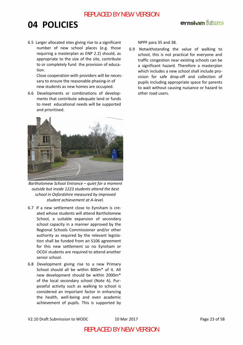
Bartholomew School Entrance – quiet for a momentoutside but inside 1223 students attend the best
school in Oxfordshire measured by improvedstudent achievement at A-level.
REPLACED BY NEW VERSION
REPLACED BY NEW VERSION
04 POLICIES
ENP7 Sustainable Transport.
Reasons: 7.1 Making the most use of public transport, cyc-
ling and walking and addressing traffic con-gestion in and around Eynsham are issues ator near the top of concerns raised by resid-ents at consultation events and are NPPFrequirements for sustainable development.
7.2 To prevent further congestion within the vil-lage, new developments should only connectvehicle access with existing main roads (A40,B4044/4449) and at only a few places to min-imise delays to through traffic on theseroutes. Exceptions may be justified for infilldevelopments where no reasonable alternat-ive exists and the main routes identified
above may be reached without going throughany significant part of the village.Additional gated access points for emergencyservice vehicles are permitted. It may also beacceptable for traffic to filter into the villagecentre to give access for local people toservices and for through routes for publictransport. These access points shall be closelycontrolled through enforcible means to ensurethey are not used by through traffic which doesnot need to be within the village centre
7.3 Heavy construction traffic causes more dis-tress to residents than private cars. Therefore,no traffic relating to the construction of anynew development should be permittedthrough the existing village roads (except asnoted in 7.2) as part of LTP4 Routing Agree-ments with OCC. All building work must bepreceded by the construction of access roadsdirect to the main routes such as the A40.
7.4 New Link Roads between main routes neces-sary for and passing through/past new devel-opments should be designed according toOCC Residential Road Design Guide for a limitof no more than 40mph and, unless recom-mended otherwiseq by OCC, be provided witha combined cycle way and pedestrian pathalong their full length. Due to their use forthrough and HGV traffic, such roads shouldnot normally provide access to individualproperties and should have appropriate noise-reduction features. For ENP definition of roadtypes - see Appendix D.
7.5 Eynsham Parish Council has agreed in principlethat the entire built-up area of the villageshould have a 20mph limit. Therefore, 'Resid-ential Streets' giving access to individual prop-erties within new developments shall alsohave a 20mph speed limit and be designed soas to ensure self-enforcement of this limitbased on the design principles set out in suchguides to good practice as Manual for Streetsr.Home Zones principles or even the full HomeZone designation may also be used to providea safe environment for non car-users.
V2.10 Draft Submission to WODC 10 Mar 2017 Page 24 of 58
In support of WODC Policy T1, new developmentshall have ready access to local transportnetworks by private car and public transport.This shall be achieved by:A New developments shall only be accessed by
motor vehicle from existing main roads (A40,B4044/4449) and not through existing villagevillage roads except as noted in 7.2. This pro-vision shall apply to both construction andresidential traffic.
B Link Roads between main roads or connectingmain roads to residential streets intended formore than 20mph use shall have pedestrianand cycle paths where appropriate and suit-able noise-reduction measures to protect res-idents from noise pollution.
C Residential streets, those giving access to indi-vidual properties, shall be designed and con-structed in accordance with best practice suchas Manual for Streets and to ensure a 20mphspeed limit or on 'Home Zone' principles tocomplement other village streets that willalso have the same speed limits in force.
D Measures to utilise and improve Eynsham'sexisting good Public Transport shall beincluded in all masterplans, particularly toensure an equally good service within a newsettlement.
Non motor vehicle access is detailed in ENP8.
REPLACED BY NEW VERSION
REPLACED BY NEW VERSION
04 POLICIES
7.6 Crossing points for the heavily used A40 arediscussed under ENP 16 .
7.7 Developments shall encourage the use ofalternatives to the private car particularly byproviding pedestrian and cycle paths thatprovide the shortest practical routes to busstops, long-distance cycle paths and the like.Active transport infrastructure such as foot andcycle paths shall be put in place before nearbyhomes are occupied to ensure the immediateopportunity for people to adopt thesehealthier modes of transport in accordancewith NPPF para 177.
V2.10 Draft Submission to WODC 10 Mar 2017 Page 25 of 58
REC 7 - RECOMMENDATION: To ensure safety of users, especially the youngand the old, OCC should insist that new junctionson main and link routes shall incorporate safecrossing places for cycles and pedestrians.
“At grade” crossing points should include a cent-ral reservation and user-activated lights accord-ing to highway design guidance specified for thespeed limit and flow rate of the road whereverpossible.
The LPA should seek contributions fromdevelopers to improve the wider transport net-work as part of any site Transport Plan.
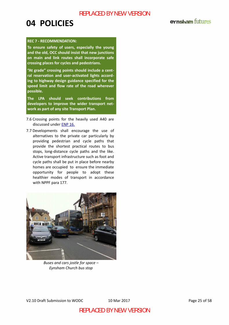
Buses and cars jostle for space –Eynsham Church bus stop
REPLACED BY NEW VERSION
REPLACED BY NEW VERSION
04 POLICIES
ENP8 Connected Place – integration of new developments with the village.
Reasons:
8.1 All developments shall be able to demonstratethe presence of designated routes for direct,secure, safe and 24/7 access to the relevantvillage centre and to both primary and sec-ondary schools for pedestrians, cycles, push-chairs and mobility vehicles. Paths, as definedearlier, should comply with SustransHandbook for Cycle-friendly Design or recog-nised equivalent. *Reasonable walking distance - see Note A.
8.2 Paths from larger allocated sites subject to amasterplan (ENP 2.2) may only use existingpaths to connect with the village centre whenthey are brought up to the standard of ENP8.1. Smaller developments may include anyexisting surfaced path as part of their chosenroute to the village centre.
8.3 All paths on designated routes, shall be prop-
erly surfaced, open in aspect and integratedinto the green infrastructure to make themattractive and secure places for all users. Fea-tures to be avoided include blind corners, nar-row passageways between hedges, shrubberyor fences and paths that are not overlooked.
8.4 Lighting on designated routes should beprovided for 24/7 operation and should bespecified to minimise light pollution andenergy consumption.
See also ENP 4 Green Infrastructure.8.5 Paths of designated routes shall be wide
enough for use by mobility vehicles. Where itis not practical to have paths wide enough fortwo motorised buggies to pass, places shall beprovided which are wide enough for two suchvehicles to pass so that a passing place isalways in sight and never further away than30m so that there is no need for users to'back up' to allow others to pass.
8.6 Paths of designated routes shall be construc-ted so they are easily maintained in a safe andusable state. Provision shall be made for theirlong-term maintenance including the cuttingof verges as part of a maintenance plan (ENP4.9).
8.7 All developments shall, wherever practical,provide access to the countryside throughlinks to existing footpaths or bridleways andthe creation of new routes is strongly encour-aged to provide easy access to open coun-tryside identified as an important part ofretaining the rural feel of the village. See alsoENP7.7
V2.10 Draft Submission to WODC 10 Mar 2017 Page 26 of 58
New development shall be within reasonablewalking distance (ideally 1000m* see Note A andENP 1) of local services such as schools, shops,doctors, dentists, buses and community facilitieswithin the village.This shall be achieved by:A New developments shall demonstrate at least
one 'Designated Path' providing direct,secure, safe and 24/7 access to the villagecentre for pedestrians, cycles, push-chairs andmobility vehicles. These designated routesshall be constructed to standards compatiblewith their purpose and have provision forongoing maintenance.
B Paths within new developments or necessaryto connect new developments to existingpaths shall be wide enough for concurrent useby permitted wheeled equipment and pedes-trians in accordance with guidance from OCC.
C Paths shall be designed to provide, whereverpractical, a green corridor to the open coun-tryside and link up with existing footpathsand bridleways.
REC 8 - RECOMMENDATION: Paths that are not adopted as highway should beadopted as bridleways or taken into ownershipof the Parish Council to ensure they are retainedand maintained.
REPLACED BY NEW VERSION
REPLACED BY NEW VERSION
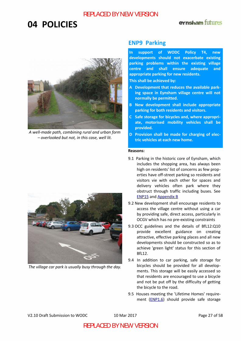
04 POLICIES
ENP9 Parking
Reasons:
9.1 Parking in the historic core of Eynsham, whichincludes the shopping area, has always beenhigh on residents' list of concerns as few prop-erties have off-street parking so residents andvisitors vie with each other for spaces anddelivery vehicles often park where theyobstruct through traffic including buses. SeeENP15 and Appendix B
9.2 New development shall encourage residents toaccess the village centre without using a carby providing safe, direct access, particularly inOCGV which has no pre-existing constraints
9.3 OCC guidelines and the details of BfL12:Q10provide excellent guidance on creatingattractive, effective parking places and all newdevelopments should be constructed so as toachieve 'green light' status for this section ofBfL12.
9.4 In addition to car parking, safe storage forbicycles should be provided for all develop-ments. This storage will be easily accessed sothat residents are encouraged to use a bicycleand not be put off by the difficulty of gettingthe bicycle to the road.
9.5 Houses meeting the 'Lifetime Homes' require-ment (ENP1.6) should provide safe storage
V2.10 Draft Submission to WODC 10 Mar 2017 Page 27 of 58
A well-made path, combining rural and urban form– overlooked but not, in this case, well lit.
The village car park is usually busy through the day.
In support of WODC Policy T4, newdevelopments should not exacerbate existingparking problems within the existing villagecentre and shall ensure adequate andappropriate parking for new residents.This shall be achieved by:A Development that reduces the available park-
ing space in Eynsham village centre will notnormally be permitted.
B New development shall include appropriateparking for both residents and visitors.
C Safe storage for bicycles and, where appropri-ate, motorised mobility vehicles shall beprovided.
D Provision shall be made for charging of elec-tric vehicles at each new home.
REPLACED BY NEW VERSION
REPLACED BY NEW VERSION
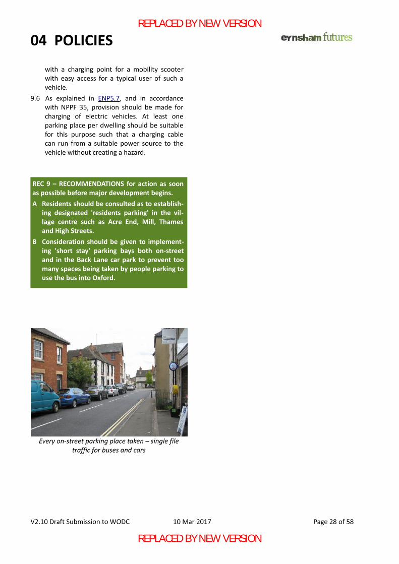
04 POLICIES
with a charging point for a mobility scooterwith easy access for a typical user of such avehicle.
9.6 As explained in ENP5.7, and in accordancewith NPPF 35, provision should be made forcharging of electric vehicles. At least oneparking place per dwelling should be suitablefor this purpose such that a charging cablecan run from a suitable power source to thevehicle without creating a hazard.
V2.10 Draft Submission to WODC 10 Mar 2017 Page 28 of 58
Every on-street parking place taken – single filetraffic for buses and cars
REC 9 – RECOMMENDATIONS for action as soonas possible before major development begins.A Residents should be consulted as to establish-
ing designated 'residents parking' in the vil-lage centre such as Acre End, Mill, Thamesand High Streets.
B Consideration should be given to implement-ing 'short stay' parking bays both on-streetand in the Back Lane car park to prevent toomany spaces being taken by people parking touse the bus into Oxford.
REPLACED BY NEW VERSION
REPLACED BY NEW VERSION
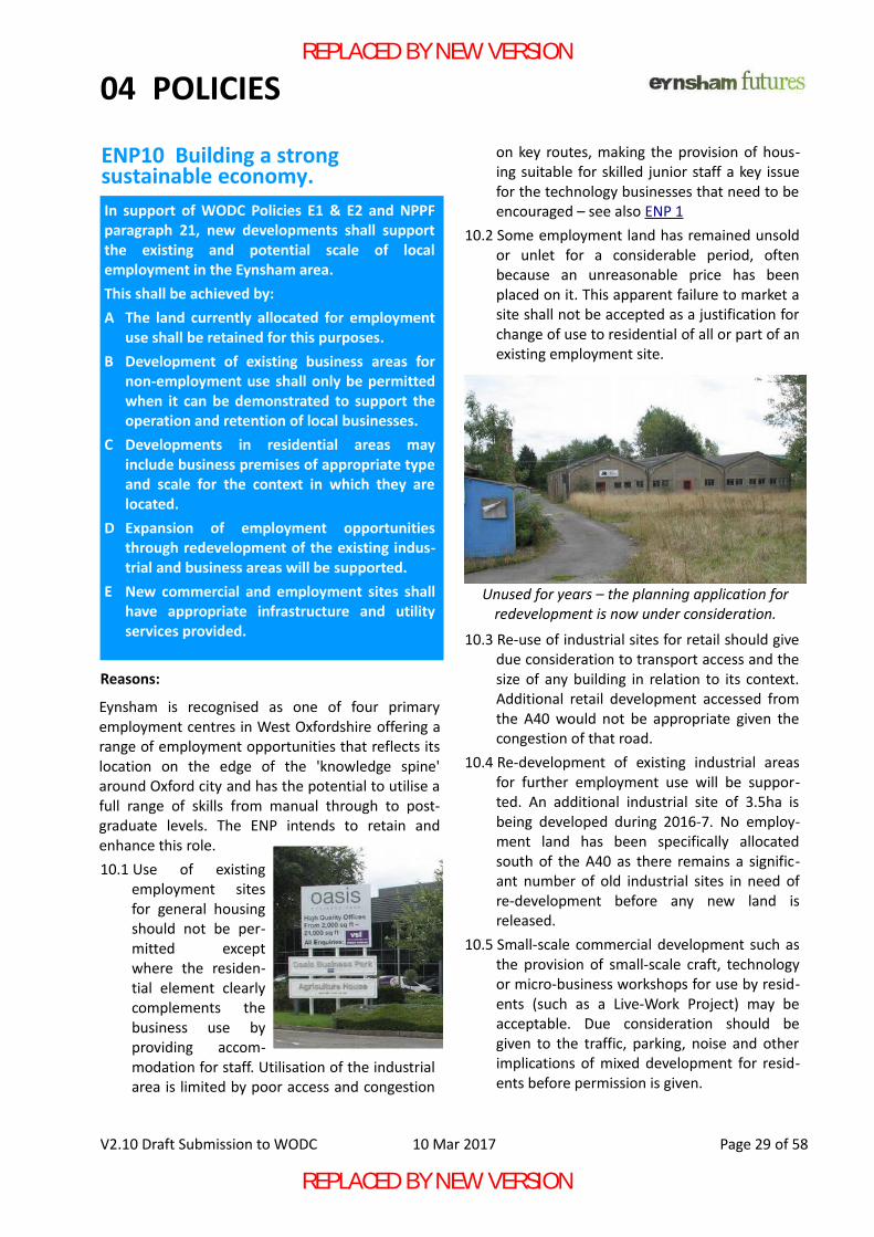
04 POLICIES
ENP10 Building a strong sustainable economy.
Reasons:
Eynsham is recognised as one of four primaryemployment centres in West Oxfordshire offering arange of employment opportunities that reflects itslocation on the edge of the 'knowledge spine'around Oxford city and has the potential to utilise afull range of skills from manual through to post-graduate levels. The ENP intends to retain andenhance this role. 10.1 Use of existing
employment sitesfor general housingshould not be per-mitted exceptwhere the residen-tial element clearlycomplements thebusiness use byproviding accom-modation for staff. Utilisation of the industrialarea is limited by poor access and congestion
on key routes, making the provision of hous-ing suitable for skilled junior staff a key issuefor the technology businesses that need to beencouraged – see also ENP 1
10.2 Some employment land has remained unsoldor unlet for a considerable period, oftenbecause an unreasonable price has beenplaced on it. This apparent failure to market asite shall not be accepted as a justification forchange of use to residential of all or part of anexisting employment site.
10.3 Re-use of industrial sites for retail should givedue consideration to transport access and thesize of any building in relation to its context.Additional retail development accessed fromthe A40 would not be appropriate given thecongestion of that road.
10.4 Re-development of existing industrial areasfor further employment use will be suppor-ted. An additional industrial site of 3.5ha isbeing developed during 2016-7. No employ-ment land has been specifically allocatedsouth of the A40 as there remains a signific-ant number of old industrial sites in need ofre-development before any new land isreleased.
10.5 Small-scale commercial development such asthe provision of small-scale craft, technologyor micro-business workshops for use by resid-ents (such as a Live-Work Project) may beacceptable. Due consideration should begiven to the traffic, parking, noise and otherimplications of mixed development for resid-ents before permission is given.
V2.10 Draft Submission to WODC 10 Mar 2017 Page 29 of 58
In support of WODC Policies E1 & E2 and NPPFparagraph 21, new developments shall supportthe existing and potential scale of localemployment in the Eynsham area.This shall be achieved by:A The land currently allocated for employment
use shall be retained for this purposes.B Development of existing business areas for
non-employment use shall only be permittedwhen it can be demonstrated to support theoperation and retention of local businesses.
C Developments in residential areas mayinclude business premises of appropriate typeand scale for the context in which they arelocated.
D Expansion of employment opportunitiesthrough redevelopment of the existing indus-trial and business areas will be supported.
E New commercial and employment sites shallhave appropriate infrastructure and utilityservices provided.
Unused for years – the planning application forredevelopment is now under consideration.
REPLACED BY NEW VERSION
REPLACED BY NEW VERSION
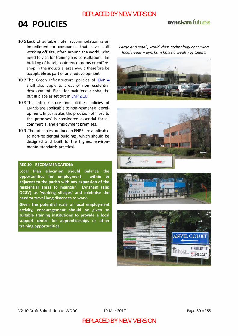
04 POLICIES
10.6 Lack of suitable hotel accommodation is animpediment to companies that have staffworking off site, often around the world, whoneed to visit for training and consultation. Thebuilding of hotel, conference rooms or coffee-shop in the industrial area would therefore beacceptable as part of any redevelopment
10.7 The Green Infrastructure policies of ENP 4shall also apply to areas of non-residentialdevelopment. Plans for maintenance shall beput in place as set out in ENP 2.10.
10.8 The infrastructure and utilities policies ofENP3b are applicable to non-residential devel-opment. In particular, the provision of 'fibre tothe premises' is considered essential for allcommercial and employment premises.
10.9 .The principles outlined in ENP5 are applicableto non-residential buildings, which should bedesigned and built to the highest environ-mental standards practical.
V2.10 Draft Submission to WODC 10 Mar 2017 Page 30 of 58
Large and small, world-class technology or servinglocal needs – Eynsham hosts a wealth of talent.
REC 10 - RECOMMENDATION: Local Plan allocation should balance theopportunities for employment within oradjacent to the parish with any expansion of theresidential areas to maintain Eynsham (andOCGV) as 'working villages' and minimise theneed to travel long distances to work.Given the potential scale of local employmentactivity, encouragement should be given tosuitable training institutions to provide a localsupport centre for apprenticeships or othertraining opportunities.
REPLACED BY NEW VERSION
REPLACED BY NEW VERSION
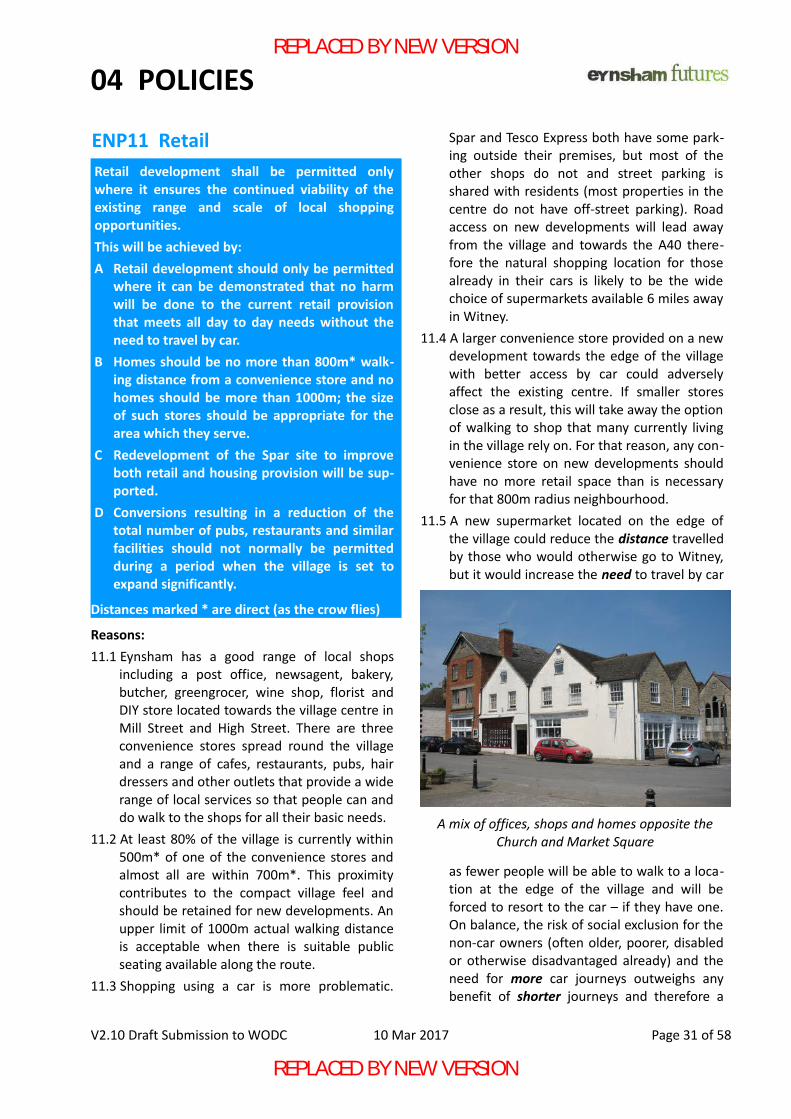
04 POLICIES
ENP11 Retail
Reasons:11.1 Eynsham has a good range of local shops
including a post office, newsagent, bakery,butcher, greengrocer, wine shop, florist andDIY store located towards the village centre inMill Street and High Street. There are threeconvenience stores spread round the villageand a range of cafes, restaurants, pubs, hairdressers and other outlets that provide a widerange of local services so that people can anddo walk to the shops for all their basic needs.
11.2 At least 80% of the village is currently within500m* of one of the convenience stores andalmost all are within 700m*. This proximitycontributes to the compact village feel andshould be retained for new developments. Anupper limit of 1000m actual walking distanceis acceptable when there is suitable publicseating available along the route.
11.3 Shopping using a car is more problematic.
Spar and Tesco Express both have some park-ing outside their premises, but most of theother shops do not and street parking isshared with residents (most properties in thecentre do not have off-street parking). Roadaccess on new developments will lead awayfrom the village and towards the A40 there-fore the natural shopping location for thosealready in their cars is likely to be the widechoice of supermarkets available 6 miles awayin Witney.
11.4 A larger convenience store provided on a newdevelopment towards the edge of the villagewith better access by car could adverselyaffect the existing centre. If smaller storesclose as a result, this will take away the optionof walking to shop that many currently livingin the village rely on. For that reason, any con-venience store on new developments shouldhave no more retail space than is necessaryfor that 800m radius neighbourhood.
11.5 A new supermarket located on the edge ofthe village could reduce the distance travelledby those who would otherwise go to Witney,but it would increase the need to travel by car
as fewer people will be able to walk to a loca-tion at the edge of the village and will beforced to resort to the car – if they have one.On balance, the risk of social exclusion for thenon-car owners (often older, poorer, disabledor otherwise disadvantaged already) and theneed for more car journeys outweighs anybenefit of shorter journeys and therefore a
V2.10 Draft Submission to WODC 10 Mar 2017 Page 31 of 58
A mix of offices, shops and homes opposite theChurch and Market Square
Retail development shall be permitted onlywhere it ensures the continued viability of theexisting range and scale of local shoppingopportunities.This will be achieved by:A Retail development should only be permitted
where it can be demonstrated that no harmwill be done to the current retail provisionthat meets all day to day needs without theneed to travel by car.
B Homes should be no more than 800m* walk-ing distance from a convenience store and nohomes should be more than 1000m; the sizeof such stores should be appropriate for thearea which they serve.
C Redevelopment of the Spar site to improveboth retail and housing provision will be sup-ported.
D Conversions resulting in a reduction of thetotal number of pubs, restaurants and similarfacilities should not normally be permittedduring a period when the village is set toexpand significantly.
Distances marked * are direct (as the crow flies)
REPLACED BY NEW VERSION
REPLACED BY NEW VERSION
04 POLICIES
larger out-of-centre supermarket will beharmful to the sustainability of local shopsand should be resisted.
11.6 Additional convenience stores are encour-aged, but relocation of stores to largerpremises shall not result in poorer coverageor contravene ENP11B.
11.7 The Spar site is unattractive with poor accessfor deliveries; the residential accommodationis of poor quality. Redevelopment that bringssignificant improvement to the facade presen-ted to Spareacre and Back Lanes and makebetter use of the area for both retail and res-idential use will be supported.
11.8 Pubs and eating places are an important partof the social fabric of Eynsham. As the num-ber of residents is expected to increase signi-ficantly during the validity of this plan, anyfurther reduction in the overall provision ofsuch premises should be resisted unless it canbe clearly demonstrated that there is no reas-onable chance of the business being viablewithin the foreseeable future. It may beacceptable for existing premises to bereplaced by equivalent ones on new develop-ments.
V2.10 Draft Submission to WODC 10 Mar 2017 Page 32 of 58
Not a great example of building design either – butthe Flower Shop, Post Office, Greengrocers and Off-
licence all contribute to making Eynsham largelyself-sufficient for anyone's day to day needs
Although it provides a valuable service, SPAR is abuilding of its time which was not a time of good
buildings. A hair salon and the village Fish and Chipshop share the same location.
REPLACED BY NEW VERSION
REPLACED BY NEW VERSION
04 POLICIES
ENP12 Local Green Space
12.1 These sites have been identified and assessedas potentially meeting the requirements ofLGS and in need of preservation as such fol-lowing consultation with the community.
12.2 More detail of the significance of the LocalGreen Spaces and how they meet the criteriaset out in the NPPF, paras 76 to 78, is given inthe following supporting documents“Local Green Space (LGS) Designation”“Checklist and Criteria for Local Green SpaceDesignation in Eynsham Neighbourhood Plan”document for each LGS. These documentsinclude site plans with exact boundaries, pho-tographs, documents and correspondencerelating to each LGS.
12.3 Development within any LGS will only be per-mitted where it forms part of a landscapedesign to enhance community enjoyment ofthe green space and contribute to improve-ment of the character, bio-diversity, appear-ance and general quality or amenity value ofthe space. For example, this could be throughappropriate planting, preferably of native spe-cies or local varieties of fruit trees, throughimprovements to local drystone walls, restora-
tion or planting of native hedgerows, creationof natural pathways, restoration or construc-tion of small structures, such as a field shelteror shed, appropriate to existing use and man-agement of the space. Any other development will not be normallybe allowed.
12.4 Eynsham is fortunate in having public openspace to the south of the village - the playingfields, the former Abbey Fishponds, now anature reserve and part of the Abbey HeritageTrail, and the St. Leonard's and St Peter'sChurchyard. These spaces reflect the historicpast of the village and provide excellent spacefor public recreation and reflection. They forma link with the countryside beyond. They havebeen repeatedly identified by residents inresponse to consultations as of great value tothe community. They add greatly to the qual-ity of the local environment in terms of herit-age and bio-diversity.LGS designations will protect some smallspaces in private ownership that surround thisimportant place and contribute to both itssetting and the setting of important heritageassets such as the Eynsham ConservationArea, St Leonard's Parish Church (Listed Grade2*) and Churchyard, the Scheduled AncientMonument next to it (site of part of EynshamAbbey), the Abbey Farm site with its Grade 2Listed Barn and the Abbey Fishponds undesig-nated heritage asset. These are LGS7, LGS8,LGS11, LGS12 and LGS14.
12.5 The fairly densely built up areas of the village,especially in the Conservation Area, benefitfrom a few green oases, on public and privateland, that local people value for their beautyor historic associations or biodiversity or,where there is public access, for their recre-ational value. These are designated as LocalGreen Spaces- LGS 2, LGS 3, LGS 4, LGS 5, LGS6 and LGS 10.
12.6 Fruitlands Wood, LGS 10, includes an oldorchard. If the current planning applicationfor 6 bungalows on the site is refused, thewhole wood is designated as a LGS. If plan-ning permission is granted, the southern sec-tion of the wood, including a “Traditional
V2.10 Draft Submission to WODC 10 Mar 2017 Page 33 of 58
The sites listed below and identified on Map 3are all designated as Local Green Space:LGS 1 Eynsham Millennium WoodLGS 2 Witney Road GreenLGS 3 A40/B4449 barrier strip / village entranceLGS 4 Dovehouse Close open spaceLGS 5 Hazeldene Close open spaceLGS 6 The Gables – paddock and orchardLGS 7 Abbey site groundsLGS 8 Abbey Farm Barns orchard & meadowLGS 9 Old railway line – beside footpath 206/30LGS 10 Fruitlands WoodLGS 11 LitchfieldLGS 12 Abbey Farm Barns fieldLGS 14 Land north of B4449 southern bypassLGS 15 Land south of B4449 southern bypassLGS 16 Land south of B4449 southern bypass.
REPLACED BY NEW VERSION
REPLACED BY NEW VERSION
04 POLICIES
Orchard UK BAP Priority Habitat”, and a smallnorthern patch of woodland, which are bothoutside the area to be developed in the cur-rent proposal, are designated as Local GreenSpace.
12.7 Residents have repeatedly said how muchthey enjoy local walks around the rural fringesof the village especially for the views and thewildlife. Local Green Space designations atLGS1, LGS 9, LGS 15 and LGS 16 will protectsome of the valued scenery and biodiversity.
12.8 A recent Planning Application has been madefor 52 dwellings on LGS15b. If it is approvedthe LGS designation will apply to LGS15a only.If permission is refused, the whole site shouldbe designated as LGS15.
12.9 New green spaces on allocated developmentsites are dealt with in ENP4.
V2.10 Draft Submission to WODC 10 Mar 2017 Page 34 of 58
Map 3 – LocalGreen Spaceproposals.
Map3 is only anindication of thesite locations –a more accuratemap willidentify exactsite boundariesas part of thesupportingdocument.
REPLACED BY NEW VERSION
REPLACED BY NEW VERSION
04 POLICIES
ENP13 Trees
Reasons:
13.1 Trees in the flat landscape of Eynsham aredominant features that create the green andrural setting so important to local residents.
13.2 Trees that are lost through developmentshould be replaced with similar species and ofas similar maturity as can be reasonablyachieved.
13.3 Tree Preservation Orders (TPO) are requiredwhere trees have no other protection such asConservation Area status. There are so fewtrees in the built-up village that all matureexamples should be preserved or replaced.
13.4 Mature hedgerow trees are such a significantfeature of the local landscape that theyshould be preserved. A TPO should be placedon trees within sites that are offered fordevelopment to ensure that trees are notremoved prematurely before they can be pro-tected by planning conditions.
See also ENP4
V2.10 Draft Submission to WODC 10 Mar 2017 Page 35 of 58
Existing Trees within the Parish shall beprotected and maintained in good health:A Trees that are lost through development shall
be replaced on site or nearby.B New developments shall make provision for
planting additional trees in proportion to thesize of the development.
REC 13 RECOMMENDATION: Tree PreservationOrders be placed on the mature trees at sitesidentified on Map 3 and in the table below: LGS 2 Trees at Witney Road Green.LGS 4 Trees along the entire northern border of the Primary School (including those alongside Dovehouse Close open space)
Trees located in hedgerows of fields north of A40 and west of the village that are proposed as sites for possible development.
WODC should instigate a survey to register all village trees with a view to including the most important specimens in the proposed TPO. Local residents are already creating such a register of existing trees to support this work.
Trees dominate the view where Witney Road joinsAcre End Street, Merton Close and Chilbridge Road
REPLACED BY NEW VERSION
REPLACED BY NEW VERSION
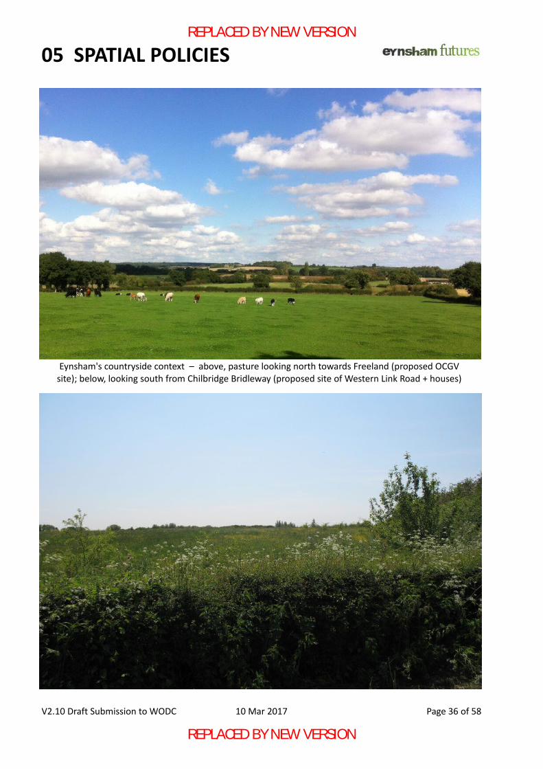
05 SPATIAL POLICIES
V2.10 Draft Submission to WODC 10 Mar 2017 Page 36 of 58
Eynsham's countryside context – above, pasture looking north towards Freeland (proposed OCGVsite); below, looking south from Chilbridge Bridleway (proposed site of Western Link Road + houses)
REPLACED BY NEW VERSION
REPLACED BY NEW VERSION
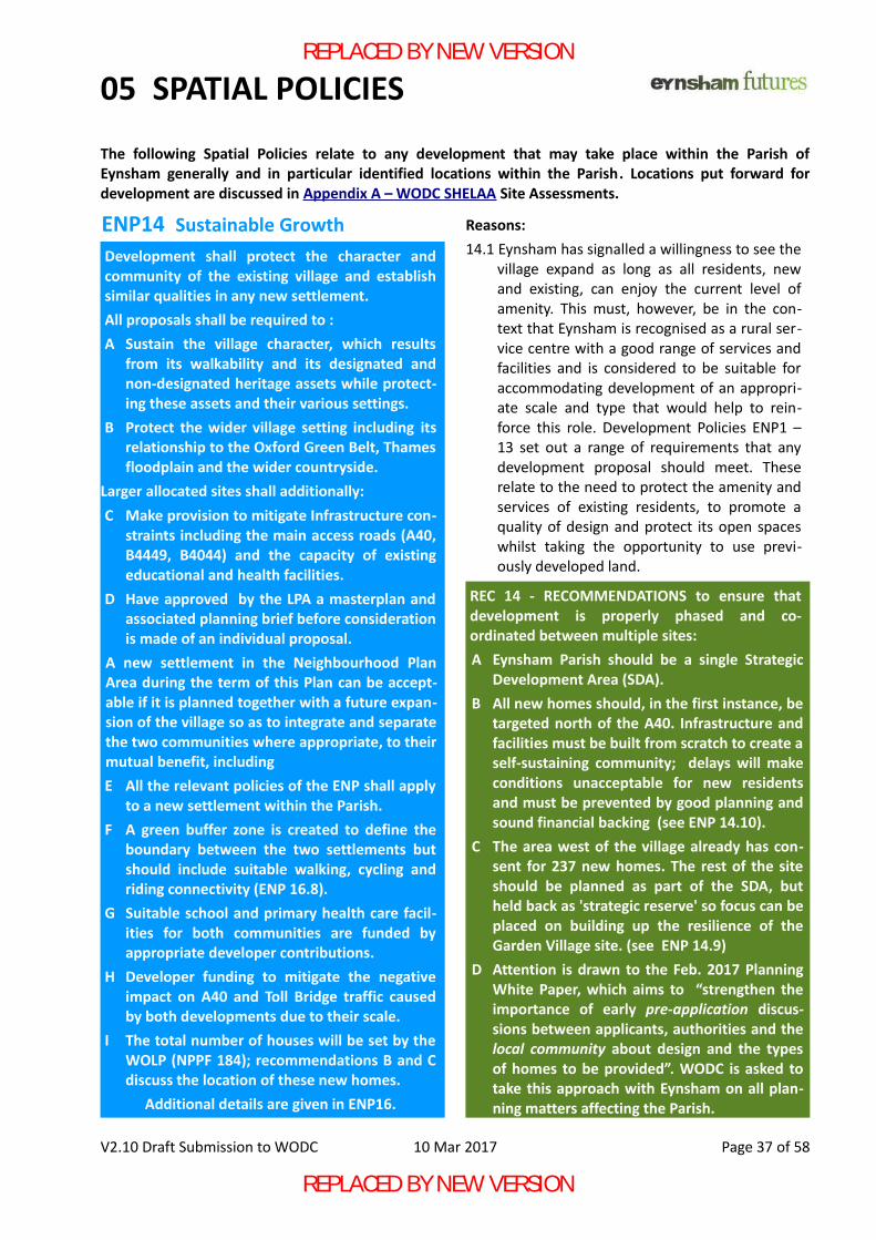
05 SPATIAL POLICIES
ENP14 Sustainable Growth Reasons:14.1 Eynsham has signalled a willingness to see the
village expand as long as all residents, newand existing, can enjoy the current level ofamenity. This must, however, be in the con-text that Eynsham is recognised as a rural ser-vice centre with a good range of services andfacilities and is considered to be suitable foraccommodating development of an appropri-ate scale and type that would help to rein-force this role. Development Policies ENP1 –13 set out a range of requirements that anydevelopment proposal should meet. Theserelate to the need to protect the amenity andservices of existing residents, to promote aquality of design and protect its open spaceswhilst taking the opportunity to use previ-ously developed land.
V2.10 Draft Submission to WODC 10 Mar 2017 Page 37 of 58
The following Spatial Policies relate to any development that may take place within the Parish ofEynsham generally and in particular identified locations within the Parish. Locations put forward fordevelopment are discussed in Appendix A – WODC SHELAA Site Assessments.
Trees form the entrance to the Abbey Fishponds
Development shall protect the character andcommunity of the existing village and establishsimilar qualities in any new settlement.All proposals shall be required to :A Sustain the village character, which results
from its walkability and its designated andnon-designated heritage assets while protect-ing these assets and their various settings.
B Protect the wider village setting including itsrelationship to the Oxford Green Belt, Thamesfloodplain and the wider countryside.
Larger allocated sites shall additionally:C Make provision to mitigate Infrastructure con-
straints including the main access roads (A40,B4449, B4044) and the capacity of existingeducational and health facilities.
D Have approved by the LPA a masterplan andassociated planning brief before considerationis made of an individual proposal.
A new settlement in the Neighbourhood PlanArea during the term of this Plan can be accept-able if it is planned together with a future expan-sion of the village so as to integrate and separatethe two communities where appropriate, to theirmutual benefit, includingE All the relevant policies of the ENP shall apply
to a new settlement within the Parish.F A green buffer zone is created to define the
boundary between the two settlements butshould include suitable walking, cycling andriding connectivity (ENP 16.8).
G Suitable school and primary health care facil-ities for both communities are funded byappropriate developer contributions.
H Developer funding to mitigate the negativeimpact on A40 and Toll Bridge traffic causedby both developments due to their scale.
I The total number of houses will be set by theWOLP (NPPF 184); recommendations B and Cdiscuss the location of these new homes.
Additional details are given in ENP16.
REC 14 - RECOMMENDATIONS to ensure thatdevelopment is properly phased and co-ordinated between multiple sites: A Eynsham Parish should be a single Strategic
Development Area (SDA).B All new homes should, in the first instance, be
targeted north of the A40. Infrastructure andfacilities must be built from scratch to create aself-sustaining community; delays will makeconditions unacceptable for new residentsand must be prevented by good planning andsound financial backing (see ENP 14.10).
C The area west of the village already has con-sent for 237 new homes. The rest of the siteshould be planned as part of the SDA, butheld back as 'strategic reserve' so focus can beplaced on building up the resilience of theGarden Village site. (see ENP 14.9)
D Attention is drawn to the Feb. 2017 PlanningWhite Paper, which aims to “strengthen theimportance of early pre-application discus-sions between applicants, authorities and thelocal community about design and the typesof homes to be provided”. WODC is asked totake this approach with Eynsham on all plan-ning matters affecting the Parish.
REPLACED BY NEW VERSION
REPLACED BY NEW VERSION
05 SPATIAL POLICIES
14.2 The appropriateness of development dependshowever not only on the impact of individualproposals but also on the cumulative impactof developments over the life time of the planand in the longer term. There are four over-arching considerations that are critical indelivering a sustainable approach to determ-ining the appropriate overall scale and form ofany major extension of Eynsham, namely, • the village character, • the wider landscape setting,• the constraints on physical and social
infrastructure of the village,• identified housing needs. The more specific spatial implications are considered in Appendix A, SA 1-4.
14.3 The village character has been noted in Sec-tion 02 – The Village – including:• compact and walkable form,• quick and easy access to open countryside,• opportunity to buy all day-to-day
necessities within the village,• educational, sporting and health facilities
within walking distance,• venues close at hand to support many
groups, clubs and societies.These characteristics should be retained for newdevelopments and the existing village alike.
14.4 The wider village setting has been noted inSection 02 and Policies ENP 2,3,12,13.
14.5 Infrastructure limitation and needs have beennoted in ENP 3, 6 and 7.
14.6 Larger sites allocated for development underthe WODC Local Plan shall be regarded as onesite for the purpose of the ENP and subject toa unified masterplan even though subsequentconstruction may be undertaken by differenthouse-builders. This is to preclude subdivisioninto smaller sites below the 'cut-off' for theapplication of 'larger site' requirements.
14.7 Road Transport (ENP7) is a major issue thataffects the whole West Oxfordshire district.Travel Plans (NPPF 36) should be prepared toOCC guidelines and independently audited tomake allowance for worst-case conditionswhen Oxford University and Schools, publicand private, are in term-time operation. Travel
Plans shall be based on the time taken toreach a reasonable destination such as OxfordCity or the A34 Trunk Route, not just the timetaken to exit the village and take into accountother developments allocated under the cur-rent Local Plan.
14.8 For the existing village there is a number ofnew homes or residents beyond which pointthere will be significant loss of amenity forboth new and existing residents. The ENPprefers to set the upper limit on size by defin-ing a maximum distance from the centre forresidential development (ENP 1, Note A andB) to maintain a village environment and feel.
14.9 On the basis of the criteria set out in ENP17, itis considered that a future expansion to thewest of Eynsham for 600* homes could beacceptable. Expansion south of the ChilbridgeRoad could have an adverse impact on the set-ting of the village.
*A note on the number of houses: In compliance withthe WODC Local Plan, numbers for the west ofEynsham do not include those on the former NurserySite (77), but do include those on the site accessedfrom Thornbury Road (160). Thus a future expansionof 600 homes would actually result in 160 homesdefinitely being built in the near future (as planningconsent has already been granted) while theremainder would be held in reserve for developmentat some future date, when the necessaryinfrastructure such as road access from A40, PrimarySchool and local shop to support the new homes mustbe constructed.
14.10 However, given the very high allocationmade to the sub-region to meet Oxford'sunmet housing need, it is apparent that a newsettlement is required as a priority. It is con-sidered that all new homes allocated to thearea in the emerging WOLP should be concen-trated on the new settlement. Building up thatpopulation quickly will fund the necessaryinfrastructure and ensure that a sustainablecommunity is rapidly established. ENP 16 givesmore details.
14.11 Land to the west of Eynsham should remainas a reserve site, something that the emergingWOLP noticeably lacks at present.
14.12 Significant employment land is underused orin need of redevelopment; 3.5ha has recently
V2.10 Draft Submission to WODC 10 Mar 2017 Page 38 of 58
REPLACED BY NEW VERSION
REPLACED BY NEW VERSION
05 SPATIAL POLICIES
been permitted for employment use, preclud-ing the need for further employment landwithin the existing village. However ENV1 and ENP10 envisage the provi-sion of employment to match new housingand the building of a campus-style SciencePark to accompany a new settlement wouldbe in full accord with Eynsham's aspiration tobecome part of the Oxford Knowledge Spine.
14.13 The spatial policies of the ENP are applicablewhether or not the much needed improve-ments to the A40 are completed during thecurrency of this Plan. However, no planningdecision shall be made which impedes or pre-vents the possibility of improving the A40 atsome future date.
14.14 NPPF 100-103 requires Sequential Testing ofsites to minimise Flood Risk. It is also recom-mended that Sequential Testing of landscapeand biodiversity impact be used when choos-ing sites for development.
14.15 NPPF 112 requires the preferential use ofless valuable agricultural land. The sequentialassessment and hence choice of sites fordevelopment should include the preservationof the best agricultural land as a significantcriterion as this is not easily replicated else-where. Similarly, demonstrable opportunityfor bio-diversity gain shall be a significant cri-terion in any such assessmentt
Protecting the Historic Environment:
14.16 The parish’s designated historic heritageassets and their settings, both above andbelow ground including listed buildings,scheduled monuments and conservationareas will be conserved and enhanced fortheir historic significance and their importantcontribution to local distinctiveness, characterand sense of place as indicated by feedbackfrom residentsu.
14.17 Proposals for development that affect non-designated historic assets will be consideredtaking account of the scale of any harm or lossand the significance of the heritage asset asset out in the National Planning Policy Frame-work (NPPF 2012)
14.18 Where developments could affect heritage
assets, either directly or indirectly, a heritagestatement clearly describing the developmentsite’s contribution to the significance of theseheritage assets will be expected to accompanyany application for development, including adescription of the measures taken to avoid orminimise harm and any measures that havespecifically been included to enhance heritageassets. Where proposals would neverthelessresult in unavoidable harm, this should beclearly identified along with and any publicbenefit that could not otherwise be deliveredand is considered to justify that harm.
14.19 Recommendations to the LPA follow below.
V2.10 Draft Submission to WODC 10 Mar 2017 Page 39 of 58
REC 14 – RECOMMENDATIONS (cont.) to ensurethat development retains or enhances amenityfor new and existing residents alike: E Planning consent shall be dependent on the
provision of necessary infrastructure andenforcement action shall be taken to preventhouses being occupied until agreed provisionis completed.
F Larger sites shall be allocated as a whole andsubject to one masterplan.
G Improvement of the A40 and Toll Bridge con-gestion shall be sought as a matter of urgency.
H Given the serious economic impact of A40congestion, Transport Assessments shouldtake into account the ability of main roads toabsorb traffic, not just the technical capacityof local roads.
I Flood risk, landscape and bio-diversity shouldfeature in any sequential assessment of thesuitability of sites for development. (ENP4a)
J If a separate community is formed within thearea covered by this Neighbourhood Plan, thisPlan shall remain applicable to the new com-munity until they are in a position to revise it.
K A formal revision of the Eynsham Neighbour-hood Plan will be supported if a significantchange to village circumstances takes placeduring the lifetime of this plan.
REPLACED BY NEW VERSION
REPLACED BY NEW VERSION
05 SPATIAL POLICIES
ENP15 Eynsham Village Centre
Reasons:
15.1 The village square is the main focal point ofthe village. It needs to be looked after and tobe available as open space and for markets orother public events while setting the contextfor the Bartholomew Rooms, Parish Churchand other historic buildings around it.
15.2 The wide range of retail outlets and publicvenues within the central zone should beretained. Access by pedestrians should bepreserved while access using mobility vehiclesneeds improvement. Note B
15.3 Parking presents a significant issue for resid-ents and many shops have little or no nearbyparking.
15.4 Enhancement of the public realm should be apriority when considering the uses to whichCIL funds should be put. See Appendix B
15.5 Bus stops in the village centre have no shel-ters and no seating, which must prevent somewho have the option of using bus or car,choosing to use the bus, not the car.
15.6 Currently conversion from family home to
House in Multiple Occupation (HMO) doesnot require planning consent. If it is con-sidered that too many homes will be conver-ted to HMOs, the LPA may make an 'Article 4'order restoring the need for consent to berequired for a particular area to prevent thecharacter of the area being changed.
*Some of these cannot be enforced by aNeighbourhood Plan, therefore the followingrecommendations are made to those bodiesresponsible for these areas of activity, includingOCC, WODC and the Parish Council.Recommendations
V2.10 Draft Submission to WODC 10 Mar 2017 Page 40 of 58
The Bartholomew Room takes central locationopposite the Church in the Market Square
Development proposals shall have regard to theneed to sustain and to create opportunities toimprove the character, quality, vitality andviability of Eynsham and particularly its HistoricCentre and Conservation Area. This will be achieved through:A Maintaining and enhancing the effectiveness
of the Conservation Area*.B Preserving and enhancing the Village Square
as a space for markets and public events andas the context for its historic buildings.
C Retention of retail and other public facilities.D Preserving and enhancing the public realm to
allow people to move around easily and makeuse of any open spaces.
E Improving the experience of bus users toencourage use of public transport.
F Consider if it is necessary for houses beingconverted to multiple occupancy to requireplanning permission*.
REC 15 - RECOMMENDATIONS to preserve andenhance the Village Centre: A A Conservation Area appraisal should be car-
ried out and consultations made as to anyextension to the CA that may be appropriate.
B Establish the number of HMOs and consultwith the Parish Council as to whether an Art-icle 4 order is appropriate or necessary.
REPLACED BY NEW VERSION
REPLACED BY NEW VERSION
05 SPATIAL POLICIES
ENP16 North of the A40
The West Oxfordshire Local Plan (WOLP) at thetime of public consultation includes a large-scaledevelopment north of the A40 as a separate“Garden Village” settlement.
It is appropriate for the Eynsham NeighbourhoodPlan to apply to a new settlement within theNeighbourhood Plan Area to safeguard theinterests of residents of both settlements. Thisshall apply in the interim period whilst residents ofthe new village temporarily depend on someservices in Eynsham and until the new settlement'sfacilities are ready and it has its ownNeighbourhood Plan in place.The relationship between the two settlementsshould always be a mutually beneficial one andthe impact on the other shall always be taken intoaccount when making planning decisions. Resid-ents serious concern that the separation is notenough is partly based on lack of trust that theinfrastructure will not be built as promised, leav-ing OCGV residents dependent on Eynsham with itslimited parking and facilities already near to capa-city. In practice, too much separation could reducepedestrian and cycle journeys and result in morecar journeys to Bartholomew School; ENP16.16 pri-oritises building a new village centre first to min-imise any dependency on Eynsham.There should be flexibility in the number of housesbuilt north and south of the A40 consistent withachieving the total allocated to Eynsham in theWest Oxfordshire Local Plan . See ENP14.10-12 andthe Site Assessments Option N3 for maps
V2.10 Draft Submission to WODC 10 Mar 2017 Page 41 of 58
The area north of the A40 shall be safeguardedso that it remains available for the number ofresidential units set out in ENP16.1 and associ-ated employment, educational, cultural andsocial facilities. Due regard shall be given to theimportance of the A40 as a vital link betweenWest Oxfordshire as a whole and the City ofOxford and beyond.Development of this area shall be in accordancewith a masterplan approved by WODC and inconsultation with the Parish Council. Require-ments for supporting infrastructure and servicesshall be established through the masterplan and,where necessary, through legally binding agree-ments, and shall include the following:A Appropriate connectivity with and separation
from Eynsham including the provision of safecrossing places of the A40 for students andother residents accessing services in Eynshamvillage (ENP16.2, 16.8).
B Careful assessment of the positive and negat-ive impacts on residents of Eynsham Village.
C Vehicular access designed to minimise delaysto through traffic on the A40 and make provi-sion for future improvements to the A40
D The timely provision of adequate facilities,including a neighbourhood centre, to meetthe social, educational, religious and culturalneeds of the new community.
E The provision of appropriate employmentopportunities as part of or adjacent to thedevelopment (ENP 16.11, 12).
In the case of a new separate community the fol-lowing shall also apply:F The application of the principles of a ‘Garden
Village’ in terms of its built form, interconnec-ted green spaces, infrastructure, layout andimpact on the wider countryside.
G The provision of a wide choice of house typeand tenure as set out in ENP1.
REC 16 – RECOMMENDATION A: The LPA should have continuing regard for theunusual situation of two communities with theircentres very closely located to ensure that theimpact on the other shall always be taken intoaccount when making planning decisions. The LPA should continue to work with EynshamParish Council as the local representatives of thenew settlement until such time as there isadequate infrastructure on site so that the settle-ment is truly independent of Eynsham.
The LPA should always consult with both settle-ments on any planning application which affectseither one of them The LPA shall take into consideration the impacton existing residents and businesses adjacent tothe proposed GV together with the listed heritageassets, bio-diversity assets and the flood zonepresent on the proposed GV site.
REPLACED BY NEW VERSION
REPLACED BY NEW VERSION
05 SPATIAL POLICIES
More recently, an alternative site has beenproposed nearby that may be easier to deliver andcould be adopted as an alternative to OCGV.In this case, north of the A40 should be protectedso that it may be used as an integrated extensionto the village at some point in the future, ideally atthe same time as the A40 is upgraded and routedround the north of the extension, which will thenbe much better connected to the village. The newroad should allow residential development up to1100m from the centre, a little more than theideal village size due to the southerly location ofthe historic centre, plus another 100m Buffer Zoneseparation between homes and the new road.Typically, the area could accommodate 1000 newhomes along with a local shop, primary school andextra public amenities in keeping with a 50%increase in the population of Eynsham.Eynsham has very limited spare capacity inprimary education and the Medical Centre; thedevelopment should therefore be planned andconstructed as a whole, ensuring that thenecessary infrastructure is provided for residentsand contributing to the costs of the A40 workwhich is necessary to permit a fully integratedextension. Site Assessments Option N1/2 for maps
There are two quite distinct northern developmentcases which the Reasons reference by suffix:
Paragraphs referring to a separate settlement (e.g.OCGV) are identified by suffix (a), e.g. 16.1 (a).
Paragraphs referring to an integrated northern ex-tension are identified by suffix (b), e.g. 16.1 (b).
Paragraphs applicable to both have no suffix, e.g.16.2.
When the masterplan is created, the reasons givenin the following paragraphs, which represent localrequirements and aspirations today, should under-pin the decisions necessary to create a practical andsustainable design. Locally-led consultation shouldinform decisions when the inevitable technical needto alter some detail occurs as plans mature.
Reasons:
16.1 (a) A separate community of up to 3200dwellings should be in the form of a GardenVillage according to the principles set out in
'Locally-Led Garden Villages, Towns and Cit-iesv' published by DCLG in March 2016 and inWODC's Expression of Interest submitted toDCLG in July 2016. The name OCGV is usedwithin this plan to identify this new settle-ment.
16.1 (b) An integrated extension of Eynsham may have up to 1000 dwellings and conform to the requirements of this Neighbourhood Plan
16.2 (a) Separation and connection of two separ-ate settlements shall be made as necessaryfor mutual benefit and to ensure no signific-ant long-term harm will be caused by onecommunity to the other. For example, it would be harmful to the exist-ing village if lack of a particular facility in thenew settlement forced many new residents todrive into Eynsham where parking and traffichas been identified as an existing problem onnarrow village streets. Conversely, sharing some facilities will bemutually beneficial. For example a HealthCentre in the new settlement would offerappointments to Eynsham residents as a bet-ter alternative to the longer journey to LongHanborough and provide additional treatmentcapability not currently offered within theexisting practice so saving journeys to Witneyor Oxford for minor procedures (See ENP3a).
16.3 (a) Connecting two communities with pathsfor walking, cycling and riding utilising thegreen infrastructure between and withinthem is entirely acceptable and supportive ofGarden Village principles. (ENP8)
16.3 (b) A northern extension to Eynsham shall bewell connected by paths for non-vehicle trafficto minimise the need to use cars to accessfacilities in the existing village. (ENP8)
16.4 The A40 is already hopelessly congested atpeak times and should not have extra junc-tions, roundabouts or traffic lights to slowdown this arterial route to most of WestOxfordshire. Existing junctions should berationalised so that the net number of junc-tions does not increase or slip-roads may beused to achieve the same end.
16.5 Access to a northern development from the
V2.10 Draft Submission to WODC 10 Mar 2017 Page 42 of 58
REPLACED BY NEW VERSION
REPLACED BY NEW VERSION
05 SPATIAL POLICIES
existing Eynsham roundabout via an improvedand realigned Lower Road should be soughtto minimise congestion and improve safety onthis section of Lower Road.
16.6 Improving the A40 is critical to Eynsham andthe whole of West Oxfordshire. Ideally, a dual-carriageway re-alignment should be built onthe northern edge of the buffer zone, provid-ing an unobstructed route for through traffic.A suitable route for a dual-carriagewayupgrade to the A40 shall be included in themasterplan and protected by legal agreement.The LPA shall actively seek developer contri-butions to improving the A40.
16.6 (a) A route on the northern edge of the bufferzone between Eynsham and OCGV should beprotected in the case of a separate settlementnorth of the A40.
16.6 (b) A route beyond the northern edge bufferzone of the development should be protected inthe case of an integrated extension north of theA40.
16.7 Pedestrian and cycle connections are particu-larly important to ensure the safety of pupilsof Bartholomew School who will have to crossthe A40 daily and to ensure that residents arenot car-dependent to visit specialist shops,pubs and places of worship that are located inthe existing village and will not be exactlyduplicated north of the A40.As a basic principle – it should be easier touse the designated safe crossing places thanattempt to cross the carriageway elsewhere.
16.8 (a) In the case of a separate settlement,Garden Village design principles require thatthere be a structural landscape bufferbetween the new and existing villages, rein-forcing the separate identity of the two settle-ments and reducing the impact of the A40,Therefore, this area shall not include anydevelopment and should be heavily plantedwith appropriate species and depth of treesand hedgerows to complement the existinglandscape and minimise the nuisance of roadnoise to either community (ENP 14F).
16.9 The allocated site area is crossed by PublicFootpaths and Bridleways which shall be
retained; they should be incorporated into thelandscape design, re-routed only whereappropriate and unavoidable, and incorpor-ated into the connective and green infrastruc-tures while remaining rural in character toprovide continued access to countryside northof the residential area.
16.9 (a) The site area referred to above includes thebuffer zone between the two settlements.
16.10 The existing light-controlled crossing at theend of Witney Road should be retained; thecrossing is essential to allow cyclists to crossto the Eynsham - Witney Cycle Path on thenorth side of the A40 and also to access thePark and Ride bus terminal.
16.11 Local employment site(s) will minimise theneed to commute to work, particularly if sens-itively mixed in with residential developmentas outlined in ENP10.5. The ENP supports high-value technology businesses but out-of-centreretail use is not supported because of itsadverse impact on local retail provision andits out-of-context urban form and character inthis village location. The site size should berelated to the size of the working population ofthe adjacent settlement(s).
16.11 (b) Employment shall be located to minimiseintrusion into the environmentally sensitive oroccupied areas such as Wintles and City Farms.
16.12 Non-residential developments north of theA40 should be screened from the A40 and beset out at low density with appropriate greeninfrastructure to make the most of the ruralsetting of the site and in accordance with allprovisions of ENP4 and ENP2.7.
16.13 Advertising hoardings and similar signage onthe A40 should be minimised to be in keepingwith a rural location.
16.14 (a) The housing and design standards pro-posed in the West Oxfordshire Local Plan(e.g. EW1a) are supported with additionaldetail by ENP1 and ENP2. The site has beenallocated for development according toGarden Village principles and these shall beapplied at both masterplan and Planning Con-sent /Enforcement stages. Developments that
V2.10 Draft Submission to WODC 10 Mar 2017 Page 43 of 58
REPLACED BY NEW VERSION
REPLACED BY NEW VERSION
05 SPATIAL POLICIES
could affect heritage assets directly or indir-ectly require a heritage statement – seeENP14.17 Attention is drawn to the listed her-itage assets at City Farm (ENP2.1)
16.14 (b) The housing and design standards are set out in ENP1 and ENP2. The site requires a single masterplan in accordance with ENP2F.
16.15 (a) The provision of new community facilitiesin EW1a is supported by ENP3 with particularattention given to ENP3a, which addresses thePrimary Health Care provision for both the newcommunity and the rest of Eynsham.
16.15 (b) The provision of new community facilitiesare set out on ENP3 and ENP3a. A new HealthCentre may be acceptable provided that morehomes are closer to it than would be from theexisting Medical Centre and a significantlyextended and enhanced range of health-careservices is available within the community.
16.16 Necessary infrastructure shall be available atthe time each house is first occupied (ENP3.1).
16.16 (a) Building the new 'centre' of OCGV shouldbe prioritised. This may best be done by buildingsocial housing first, which can usually beconstructed faster than market housing as thereis no reason to drag-out the build to maintainprices. A 'traffic free' pedestrianised area as part of thecivic/public amenity area, sadly impractical inEynsham, should be incorporated in the designof OCGV to complement its traffic-free paths.
16.17 Housing for extra elderly care and disabledshould also be prioritised close to the localfacilities as most will also be social housing andneeds to be located near shops andcommunity buildings. ENP1.8.
16.18 The green Infrastructure requirements ofENP4 and ENP4a are applicable.
16.18 (a) The Green Infrastructure requirement ofEW1a are supported in detail by ENP4, notingthat the connection points between the twosettlements will pass through one such areawhile other areas provide an important linkfrom Eynsham itself to countryside to the north.It should be noted that there are significant bio-diversity assets at the north of the site area
(City Farm) and the need to achieve significantbio-diversity gain here ( ENP4a)
16.19 ENP5 encourages a high standard of sustain-able design.
16.19 (a) EW1a encourages a high standard of sus-tainable design supported in detail by ENP5.
16.20 Such a large development will require theexpansion of Bartholomew School or alternat-ive secondary school provision. This shall befunded as part of the new development's S106agreement and any additional buildings shallbe located so as to be readily and safelyaccessed from both communities. Provision foruse of the additional facilities for adult educa-tion is encouraged. ( ENP6 )
16.21 New facilities provided should not under-mine the role of the centre of the existing vil-lage at the historic core of Eynsham as set outin Note B, e.g. ENP11.
16.21 (a) Facilities provided in OCGV should use the distances from the new school, shops and otherfacilities set out in Note A, relative to its own facilities, to ensure that it too retains a village form. See also ENP11B.
16.21 (b) Distances from the local primary school and local shop should be as set out in Note A. The distance from the historic centre with its shared facilities of 1100m rather than the 1000m ideal is acceptable to ensure a viable de-velopment.
Proposals have been made by OCC for a number ofoptions to improve the A40 beyond that for thePark and Ride, which is due to be implementedearly in the currency of this Neighbourhood Plan.
Eynsham residents are highly supportive inprinciple of improvements to the A40, which mayinvolve bus lanes and/or dualling and/or re-sitingof the road to increase its capacity in which casethe following shall apply :
16.22 Residents shall be protected from noise pol-lution by the construction of Acoustic Fencing(Noise Barrier) and/or low noise road surfacealong the entire route adjacent to houses.Appropriate planting shall be included toensure the fencing blends into the landscapeand is not itself an intrusive feature.
V2.10 Draft Submission to WODC 10 Mar 2017 Page 44 of 58
REPLACED BY NEW VERSION
REPLACED BY NEW VERSION
05 SPATIAL POLICIES
16.23 The Park and Ride will be a significant land-scape feature. Its layout and buildings shouldbe designed to complement and enhance therural location and include full screening fromall sides with trees and hedgerows typical of itslocation.
16.24 The Park and Ride should be promoted as atransport hub for the district with good publictransport and cycle links to Hanborough RailStation and buses to both the central and east-ern areas of Oxford. Local bus routes both onthe A40 and through the largest practical num-bers of local residential areas should be
provided as part public transport infrastruc-ture.
16.25 The LPA should seek to rationalise the junc-tions on the A40 associated with residential,business and the Park and Ride developmentsas part of the masterplan / AAP process.Ideally the development should fund a realign-ment of the A40 as this is the most appropriateway to ensure good access to the site withoutcausing further chaos during rush-hours whileproviding safe crossing for path users. If theLPA fails to negotiate funding, the line of anupgraded A40 shall still be fully planned andagreed with the highway authority and thenprotected by legal agreement as part of themasterplan.
If the road remains along its current course thefollowing should be applied to ensure safe cross-ing of this fast and busy road.
16.26 An “at grade” crossing would only be con-sidered “safe” with pedestrian controlled lightsand full pedestrian priority, otherwise a longdelay will result in school pupils simply ignor-ing the lights and crossing anyway. Pedestrianpriority is unlikely to be acceptable on such abusy main road, even if the speed limit isreduced to 40 or even 30mph. A bridge of the height necessary to clear thetraffic of this arterial route will be an eye-soreand is likely to require so much extra effort togo up and then down that people will riskcrossing the carriageway instead of using it.
16.27 Well-designed underpasses offer the safestcrossings with minimum effort. Underpassesare routinely used on the continent where theyare well-used because they are designed withclear sight-lines and good lighting to makeusers feel safe. Due to continuous housingbetween Spareacre Lane and the A40 there area very limited number of places where anyonewould want to cross, making the provision of afew safe crossing points a practical possibility.Unless technical reasons can be demonstratedthat make an underpass impossible to con-struct, this is the preferred method of provid-ing safe crossings of the A40.
V2.10 Draft Submission to WODC 10 Mar 2017 Page 45 of 58
REC 16 – RECOMMENDATIONS B - F:To ensure that space is retained to improve theA40, when funds become available, it is recom-mended that:B WODC/OCC should seek developer funding
for improvement of the A40, particularly theprovision of good access to both residential,employment and the Park and Ride whileminimising delay to traffic from the rest ofWest Oxfordshire.
C WODC shall ensure that adequate land is pro-tected from development as part of the mas-terplanning process to allow the A40 to bedual-carriageway through to Duke's Cut andto ensure all local residents are adequatelyprotected from the incessant road noiseexperienced by Eynsham residents today.
D Air and noise pollution adjacent to the A40should be monitored to ensure that nationalguidelines are not breached.
E WODC/OCC shall ensure that sufficient safeand well designed paths crossing the A40, forpedestrians, cyclists and mobility scooterusers, are provided at key points to connectEynsham and the new settlement.
F Local employment is supported (ENP16.12)and is shown in Option N3 as a single separatesite. To minimise additional car journeys towork, every encouragement should be givenfor residents to work locally. To this end,some mixing of houses and employment atthe masterplan stage may be appropriate.(e.g. ENP10C)
REPLACED BY NEW VERSION
REPLACED BY NEW VERSION
05 SPATIAL POLICIES
16.28 To achieve the goal of ensuring that the easi-est place to cross is also the safest, a crossingpoint should be provided at the cut-throughfrom Spareacre Lane (opposite Tesco Express)as this provides one route from a developmentnorth of the A40 to Bartholomew School.
16.29 If the area directly to the east of the Millen-nium Wood is used for housing, the crossing atthe end of Witney Road will become theshortest route to school for those living to thewest of the present Mead Lane bridleway. Itwill then be necessary to install a suitablecrossing at this location as it would now be theshortest route for students living west of thebridleway to cross to Bartholomew School.
16.30 An additional crossing for pedestrians andcycles should be provided at the cut-throughfrom Hanborough Road where more space willallow cycles to be ridden through the under-pass. This additional crossing point will havethe added benefit of providing access from thenorth-east corner of Eynsham (where bus ser-vice is least frequent) to buses operating thePark and Ride service, which it is expected willalso include direct services to Hanborough RailStation and the major employment sites ofHeadington and Cowley.
Please see Site Assessments OptionsN1-3 for fur-ther background and maps relating to thesepolicies.Attention is also drawn to ENP4a / ENP14.16given the significant ecological merit of parts ofthe north of the GV site.
V2.10 Draft Submission to WODC 10 Mar 2017 Page 46 of 58
REPLACED BY NEW VERSION
REPLACED BY NEW VERSION
05 SPATIAL POLICIES
ENP17 Development of a western extension to the village.
Reasons:
17.1 The additional road traffic generated by thenew development should not add directly tovillage centre traffic problems, but residentsshall have easy access by car to the transportnetwork outside the village (ENP7.2).
17.2 Access to developments should not cause ex-tra delay to A40 traffic. This may be achieved
through the consolidation of existing nearbyjunctions or other means to minimise delaysto both through and local traffic, which shallbe demonstrated by traffic modelling.
17.3 Road access to any new development shouldnot normally use the existing village roads,although such access for pedestrians, cyclesand mobility vehicles shall be provided inaccordance with 7 Transport and 8 ConnectedPlace. Chilbridge Road and Thornbury Roadshould provide emergency access and the lat-ter should be open to buses and local trafficaccessing the village facilities, but should berestricted to prevent through traffic in the vil-lage centre, particularly at key times such asschool start and finish times.
17.4 Developments that could affect heritageassets directly or indirectly require a heritagestatement – see ENP14.17.
17.5 Adequate school places for new residents areessential before any major development cango ahead and the provision of appropriateland will be significant in achieving this goal.
17.6 Chilbridge Road (public bridleway) provides apopular access point to the countryside; theshort time it takes to walk from the 'urban'roundabout at the end of Acre End Street intoopen countryside, contributes to the percep-tion of a rural location and makes up to somedegree for the lack of any significant greenspace within the village such as a village greenor local park.
17.7 It has been an aspiration of WODC policy formany years to seamlessly blend the villageinto the open countryside beyond it to thewest. Views west into open countryside andeast back to the Parish Church and WythamHill are important features of this popular loc-ation that contribute significantly to the ruralfeel of the village that is highly valued by res-idents. Housing development south of the ChilBrook could be particularly detrimental in thisregard. The methodology used in ‘OxfordView Cones Assessmentw’ is recommended inassessing the impact of any development.
17.8 New developments should encourage easyaccess to the public bridleway for walkers,
V2.10 Draft Submission to WODC 10 Mar 2017 Page 47 of 58
Development to the west of Eynsham shallensure ease of access for new residents andensure that the sensitive transition from humanhabitation to open countryside protects andenhances the perception of Eynsham as a villagein a rural setting.Development of this area shall be in accordancewith a masterplan approved by WODC and inconsultation with the Parish Council. Require-ments for supporting infrastructure and servicesshall be established through the masterplan and,where necessary, through legally binding agree-ments, and shall include the following:A Developments west of Eynsham shall have
vehicular access from the A40 and at only onepoint. Vehicular access through the villageshall be strictly limited ENP 7.2.
B Development should sustain or better revealthe significance of designated and non–desig-nated heritage assets and avoid harm to themand their settings, and safeguard existingtrees and hedgerows.
C Developments shall ensure that the rural set-ting of the village is retained in terms of thelong-term quality and stability of any newUrban – Countryside boundary.
D The form of any development alongside Chil-bridge Road should have particular regard toits impact on the view from the bridlewayover open fields towards the historic villagecentre and Wytham Hill beyond and from thesouth & western road approaches.
E Adequate Primary and Secondary Schoolcapacity shall be provided.
REPLACED BY NEW VERSION
REPLACED BY NEW VERSION
05 SPATIAL POLICIES
cyclists and mobility vehicles from andthrough the new development. The continu-ous hedge along the north side of the bridle-way benefits wildlife and should be retainedand enhanced to screen off the developmentto retain the countryside feel as much as pos-sible.
17.9 Carefully designed landscaping of the environ-mentally sensitive course of the Chil Brookshall be undertaken in accordance withENP4a. The Chil Brook is designated by theEnvironment Agency as a 'Main River' subjectto an 8m undeveloped buffer zone to protectthe river ecology. A linear park, incorporatingflood attenuation ponds/swales running thewhole length of the Chil Brook from the A40to Station Road and through the Fishpondsarea, including appropriate public access,offers an excellent opportunity for bio-di-versity gain. See Map 4.
17.10 Developments north of Chilbridge Road shallbe screened so that they blend into the land-
scape while protecting and enhancing bio-di-versity of the sensitive watercourse area.
17.11 Similar landscape design for developmentsouth of Chilbridge Road is more problematic.Development in this raised location will bepredominantly urban, making the countrysideseem much further away from the village.Keeping the south side of the bridleway asopen countryside and keeping developmenton the north side behind (existing) high hedgescreening will allow the perception of opencountryside to be retained along the bridle-way. Housing south of the bridleway and theproposed Link Road necessary to support itwill dominate the scene and render it whollyurban, not rural, in form. This area alsoincludes locally scarce Grade 2 agriculturalland - see ENP4a / ENP14.16.
17.12 Care should also be taken with any embank-ment, should a major crossing of the ChilBrook be made, to ensure it does not becomea dominant feature out of place in its 'rolling
V2.10 Draft Submission to WODC 10 Mar 2017 Page 48 of 58
Map 4: Chil Brook Linear Park conceptAn opportunity forbio-diversity gainand public amenitySuggested Linear Parkoccupies the floodzone and will includefeatures necessary forflood control. Fieldsouth of the ChillBrook has good bio-di-versity and may offerscope for further de-velopment as a localwildlife reserve.
School is sited forgood access to thisnatural environment.
Map is illustrative ofthe concept of integ-rating public spaceand new footpathwith wildlife corridor.
REPLACED BY NEW VERSION
REPLACED BY NEW VERSION
05 SPATIAL POLICIES
landscape' setting.17.13 A new small convenience store on a western
development would maintain an ideal walkingdistance of less than 800m to a store for newresidents. The size of such a store shall be inkeeping with its function to serve the popula-tion within that 800m distance. ( ENP11B )
17.14 The village has been searching for a suitablesite for a new burial ground with funds setaside for this purpose. This would be an idealuse for land that is too far from the villagecentre for residential development and couldbe integrated with necessary planting forvisual barriers and the landscaping (but notthe burial ground itself) could merge with thefloodplain.
*Please see Site Assessments Options W1 andW2 for further background and maps.
V2.10 Draft Submission to WODC 10 Mar 2017 Page 49 of 58
Looking west from Chilbridge Road in winter with Parish Church (centre) and Wytham Hill (right). Nearestbuilding is the newly completed OCC Children's Assessment Centre across the Chil Brook
Thornbury Road from Chilbridge – existing tree andhedge boundary just about retains a rural character.
But on the other side of the road, rising land willmake houses hard to disguise.
REC 17 - RECOMMENDATIONS: A Development west of Eynsham should not be
allowed to dilute the rate of building of a sep-arate settlement (ENP14 Recommendation B).
B Development north of Chilbridge Road shouldbe planned alongside any other developmentof the A40 to minimise junctions and con-sequent traffic delays should a western devel-opment take place in the future. Option W1*.
C Creation of a Link Road and developmentsouth of Chilbridge Road (Option W2*) havesignificant drawbacks as noted in ENP17.8 to11. Although they recognise that a westernlink road may reduce through traffic on Wit-ney, Acre End and Station Roads, EynshamParish Council considers that the harm due tothe loss of such a significant area of greenspace so close to the village with ready publicfootpath access outweighs any benefit thatcan been demonstrated at present.
REPLACED BY NEW VERSION
REPLACED BY NEW VERSION
05 SPATIAL POLICIES
ENP18 Southern Industrial Area
18.1 Eynsham is identified as an important locationfor business and industrial development.There is general agreement that the IndustrialArea should be retained as a place of eco-nomic activity and not used for housing devel-opment.Although it has proved difficult to let commer-cial property due to economic conditions andpoor access due to congestion on the A40,this is likely to improve in the first few years ofthe plan and shall not be used as a reason tojustify general house-building on the indus-trial area. One large site has permission toexpand, and another is currently seeking plan-ning consent to redevelop; occupancy isincreasing in the office spaces. Realistic prices and rents will allow sites to beused and owners should not hold out in theexpectation that the land will be reallocatedfor more lucrative housing during the cur-rency of this plan.
18.2 Some mixed development may be acceptable,particularly where it can be seen to addressthe problem of lack of housing for key skilledstaff by providing accommodation 'over theshop' or by providing accommodation duringthe working week. ( ENP10B,C )
18.3 Provision of a small hotel to provide much-needed accommodation for business visitorsand to provide a social hub (e.g. coffee-shop)could also be seen as supporting the develop-ment of high-value businesses and will besupported..
See also ENP10
V2.10 Draft Submission to WODC 10 Mar 2017 Page 50 of 58
The Southern Industrial Area shall continue asone of four main employment areas for WestOxfordshire, ensuring that Eynsham remains athriving and economically active place with workopportunities for local people. Policies to achieve this are found in ENP10 andENP14.13 that highlights the need to regenerateexisting employment sites wherever possiblebefore further green-field land is used foremployment.
REPLACED BY NEW VERSION
REPLACED BY NEW VERSION
06 APPENDIX A
SA1 Site proposals - East.SA1.1 Development to the east of the village is
limited by the extensive area of Flood Zones 2and 3 and the Oxford Green Belt that extends upto the B4449.
SA1.2 Two small sites (227 and 426) and a largersite, 140 have been put forward. All are in the
Green Belt and only 426 is outside a flood zone.140 requires direct access from the B4449.
SA1.3 None of these sites would normally be givenplanning consent for the reasons given above.
SA2 Site proposals - South.SA2.1 The area to the south-west, off the Stanton
Harcourt Road is allocated for employment use
V2.10 Draft Submission to WODC 10 Mar 2017 Page 51 of 58
Appendix A: WODC SHELAA Site proposals.At this time the Eynsham Neighbourhood Plan (ENP) does not seek to pre-empt the WODC Local plan byallocating sites. However, this appendix discusses the attributes of each site included in WODC's map ofsites put forward for possible development, published in Dec. 2016 and reproduced in part as Map 5 below,in relation to the policies within the ENP.
Map 5: Sites proposed for development to WODC, March 2016
Children’sAssessmentCentre
150
205
436c436b436a
Extent of site considered suitablefor integrated extension
179
223227
426
187b
187a
180411
205
437435
209210
347
411b
140
SchoolPlaying Field
Probable sitefor EynshamPark and Ride
© Crown Copyright and dat abase rights 2012 Ordnance Survey licence number 100049287. You are not permitted to copy, sub-license, distr ibute or sell any of this data to third parties in any form.
KEY SHELAA Development Sites:
Building of Interest Flood Zones 2/3 Ancient Monument
SHELAA site boundaries
Oxford Green Belt Road Bridleway footpath
Overlays are only approximate to indicate village features
described in the report text
REPLACED BY NEW VERSION
REPLACED BY NEW VERSION
06 APPENDIX A
as set out in ENP 10 and 14. SA2.2 Site 209 has recently had an appeal
dismissed against refusal to allow developmentof 49 houses; adjacent site 210 is alreadycompleted except for a small area next toStation Road. 210 affects the setting of theConservation Area that caused the appeal on209 to be dismissed so should not be developedeither. See ENP12, LGS11 and 12.
SA2.3 Site 411b south of 209 is almost entirely Zone3 and includes a flood defence area to preventflooding of properties in Station Road andshould not be developed.
SA3 Site proposals - North.SA3.1 Development north (or west) of the existing
settlement depend on two major considerations– vehicle and pedestrian access and theprovision of adequate Primary School places.
SA3.2 Site 436a looks set to be the location of theEynsham Park and Ride with associated roads. Itwould be too far from the centre of the villageto be suitable for housing (ENP1D). Use as thePark and Ride would be well accepted as itoffers to prospect of a public transport hub withlinks to Hanborough Rail station and to thebusinesses and hospitals of East Oxford.
SA3.3 The other sites should all be seen as a wholeand be subject to one masterplan (ENP2F).There are currently three options for this area.
The Options mentioned in subsequent paragraphsrefer to the Site Assessments.
SA3.4 Although WODC latest draft Local Plan thewhole area north of the A40 for development asa new settlement, the possibility of an alternat-ive site south of Barnard Gate means that thereis still a possibilty of an integrated extension toEynsham.. Therefore Options N1 and 2 will beretained in the supporting document.
SA3.5 Option N3 is for a completely separate devel-opment such as a 'Garden Village' where all thenecessary facilities are replicated on the newsite so that impact on the existing village is min-imal. This has local support if such a large devel-opment accommodates all new housing for Eyn-sham, taking pressure off the western edge andvillage resources.
SA3.6 Conversely, building new communities fromscratch is notoriously difficult and it is unlikelythat our vision for new residents enjoying thesame benefits as existing residents could beachieved unless very considerable expenditureon community-building was made by thelandowners who would have to sell at wellbelow free-market rates (as actually envisagedfor Garden Villages)
SA4 Site proposals - West.SA4.1 Site 223 is part of the School Playing Field
and is not available for development.SA4.2 Site 180 has been rejected for development
on appeal once but a new application has beenmade.
SA4.3 Site 187 has now been given planningconsent on appeal.
SA4.4 Site 179 has been given planning consent for160 houses.
SA4.5 Site 411 north and east of the Chil Brook andsite 347 could be developed with access directfrom the A40 at the site proposed for theroundabout feeding the Park and Ride. Thenorth-western corner of the site is outside thenormal envelope for residential development asit is so far from the village centre (ENP1D). Withcareful design to screen it from the A40 thiscorner of the site may still be suitable forhousing particularly if used for 'rural exception'housing as explained in ENP1.9). The area southof the Chil Brook protrudes into opencountryside but could still be suitable for lowprofile buildings such as the new Primary Schooland for allotments and burial-ground
SA4.6 Site 437 is south of Chilbridge Road onground which is mostly higher than surroundingland making it difficult to screen from this verypopular bridleway and having a marked impacton the village edge as spelled out in ENP17C andD. This site should be included within a westernextension as it has potential for significantcommunity and bio-diversity benefit as greeninfrastructure including the SUDS that will benecessary to prevent flooding from the rest ofthe site into the Chil Brook. A Linear Park alongthe course of the Chil (ENP17.9) would be oneway of delivering these benefits. However, the
V2.10 Draft Submission to WODC 10 Mar 2017 Page 52 of 58
REPLACED BY NEW VERSION
REPLACED BY NEW VERSION
06 APPENDIX A
possible benefit of a Link Road should also beexplored during the masterplan stage whenmore detailed plans can be compared (REC 17C)
SA4.7 Option W1 only has housing north ofChilbridge Road, an area that should be easyenough to blend into the countryside using thecontours of the land and using the Chil Brookflood zone as a location for planting, with duecare, a screening belt of trees (ENP17.10). Thisoption now includes the prospect of up to 600new homes. The most sensitive area at thesouth of the site is ideal for a new PrimarySchool, allotments and a burial ground as theselow-profile developments will have less visualimpact and allow better blending of the urbanextension into the open countryside. Cost ofaccess from the A40 is minimised using a minorroad that merges with the existing ChilbridgeRoad to give access to the farm and otherexisting rural houses.
SA4.8 Option W2 shows the effect of additionaldevelopment south of Chilbridge Road (on afield whose management has created a diversehabitat that would justify further investigation)increasing the number of houses to a level wellbeyond the minimum required to meetEynsham's housing target. However, the sitesouth of Chilbridge Road will not be easy toscreen and will block any views back towardsthe village from this popular bridlewayeffectively extending the 'urban' village foranother 700m. This urbanising effect will becompounded by the need to cross the ChilBrook with a bridge or embankment that couldbe both expensive and visually intrusive and isexpected to continue all the way to the B4449opposite the Southern Industrial Area. Given the extra cost of access and the extraurbanising effect for a limited number of extrahouses, this option is less preferred than W1.
SA4.9 There may be proposals for overturning therestriction that prohibits upgrading of ChilbridgeRoad from bridleway to adopted road, thusgiving access to the site from the village withoutthe cost of a link to the A40. This would becontrary to ENP7A as all the new traffic usingthis route would now flow through the villagealthough this link is ideal as an emergency
access route for the western site.
These options have been set out in detail – see Site Assessments
V2.10 Draft Submission to WODC 10 Mar 2017 Page 53 of 58
REPLACED BY NEW VERSION
REPLACED BY NEW VERSION
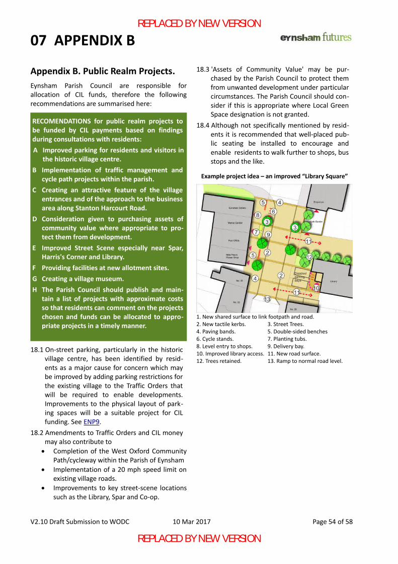
07 APPENDIX B
Appendix B. Public Realm Projects.Eynsham Parish Council are responsible forallocation of CIL funds, therefore the followingrecommendations are summarised here:
18.1 On-street parking, particularly in the historicvillage centre, has been identified by resid-ents as a major cause for concern which maybe improved by adding parking restrictions forthe existing village to the Traffic Orders thatwill be required to enable developments.Improvements to the physical layout of park-ing spaces will be a suitable project for CILfunding. See ENP9.
18.2 Amendments to Traffic Orders and CIL moneymay also contribute to Completion of the West Oxford Community
Path/cycleway within the Parish of Eynsham Implementation of a 20 mph speed limit on
existing village roads. Improvements to key street-scene locations
such as the Library, Spar and Co-op.
18.3 'Assets of Community Value' may be pur-chased by the Parish Council to protect themfrom unwanted development under particularcircumstances. The Parish Council should con-sider if this is appropriate where Local GreenSpace designation is not granted.
18.4 Although not specifically mentioned by resid-ents it is recommended that well-placed pub-lic seating be installed to encourage andenable residents to walk further to shops, busstops and the like.
V2.10 Draft Submission to WODC 10 Mar 2017 Page 54 of 58
Example project idea – an improved “Library Square”
1. New shared surface to link footpath and road.2. New tactile kerbs. 3. Street Trees.4. Paving bands. 5. Double-sided benches6. Cycle stands. 7. Planting tubs.8. Level entry to shops. 9. Delivery bay.10. Improved library access. 11. New road surface.12. Trees retained. 13. Ramp to normal road level.
RECOMENDATIONS for public realm projects tobe funded by CIL payments based on findingsduring consultations with residents: A Improved parking for residents and visitors in
the historic village centre.B Implementation of traffic management and
cycle path projects within the parish.C Creating an attractive feature of the village
entrances and of the approach to the businessarea along Stanton Harcourt Road.
D Consideration given to purchasing assets ofcommunity value where appropriate to pro-tect them from development.
E Improved Street Scene especially near Spar,Harris's Corner and Library.
F Providing facilities at new allotment sites.G Creating a village museum.H The Parish Council should publish and main-
tain a list of projects with approximate costsso that residents can comment on the projectschosen and funds can be allocated to appro-priate projects in a timely manner.
REPLACED BY NEW VERSION
REPLACED BY NEW VERSION
08 APPENDICES
Appendix C. Explanatory Notes.A Neighbourhood Plan has to be accepted byresidents through a referendum and therefore mustbe accessible to all residents, not just those whounderstand the planning terminology that is used ofnecessity in a document that will be used byplanners. These notes form an integral part of theNeighbourhood Plan and take the form of questionand answer.Q. Do developers have to follow the plan?A. The policies (in blue) must be followed. Theterms 'shall' and 'should' are often used with thefollowing meanings:
Shall or must – indicates a requirement critical toachieving an objective of the Eynsham Neighbour-hood Plan (ENP). Often relating to a required pro-cess or principle, failure to comply will result ininevitable refusal of permission except underexceptional circumstances where it can be demon-strated that the community will suffer a more seri-ous loss if the requirement is not complied with.Should - indicates a requirement that is con-sidered very important to achieving an objectiveof the ENP. Failure to meet such requirements willgive grounds for refusal of permission unless aclear, perhaps alternative but comparable, benefitcan be shown to outweigh the negative effects offailing to meet each requirement.
Q. Why do you include 'get-outs' like the 'exceptwhere...' comments above?A. The policies are implemented by elected (WODC)representatives who need to have some discretionwhen deciding what is the best option for thecommunity they represent as it isn't possible towrite rules which cover every circumstance.Q. Why have so many policies that areprescriptive; what about market-forces?A. Eynsham is well placed between Oxford City andthe countryside of West Oxfordshire and as a resulthouse prices are high and in no way limited by thecost of building which is typically less than 50% ofthe price of each dwelling. Under these circumstances developers are able tosell anything they put up. Homes built in Eynshamshould possess an excellent standard of design,energy efficiency and landscaping but there isn'tany market pressure to 'build better' as anything will
sell. We believe it is necessary to establish high butrealistic standards to ensure that responsibledevelopers are not undercut by those who are lessconcerned with building long-term, sustainablehomes. Q. Why don't you insist that every house is an eco-home then?A. Currently, national policy doesn't allow that as itmight prevent house building in places where thecost of building is a much higher portion of the totalcost. In our case, the cost could be taken off theextra value of land when it is given planning consentwhich is a windfall profit given to private owners.Homes that do not fuel climate change are a benefitto the whole community and so we hope thatlandowners and developers will use their windfall tobuild really excellent houses and benefit the wholecommunity, but we cannot force the issue as thelaw stands today. Q. Why are you so keen on large developments –many residents want lots of smaller ones?A. Large developments are often associated withstandard house designs that lack much 'soul' andoften don't seem to fit with what's already there.We think this should be addressed by policies thatapply to all developments, not just some; we hopeour policies will prevent poor developments.However, large developments built to a masterplan,which integrates homes with infrastructure inconsiderable detail, are the only way to ensure thatlarge infrastructure such as new roads, schools andpublic buildings can be delivered. Developers would love lots of small sites as theywould not have to provide these facilities. For thisreason our policies insist that large sites aredeveloped as an integrated whole.Q. Why does ENP1/Note A emphasise a 1200mlimit for development? Why not 1150 or 1250m?A. Residents have often stressed the need to keepEynsham feeling like a village. When we unpack this'feeling' the main spatial element is the closeness tothe countryside. Given Eynsham's near-circular formwe have sought an objective measure to judge howeasy it is for people to walk from the edge to villagefacilities and from the built-up centre to the opencountryside. As there isn't a clear commercialcentre, we have identified a nominal centre with
V2.10 Draft Submission to WODC 10 Mar 2017 Page 55 of 58
REPLACED BY NEW VERSION
REPLACED BY NEW VERSION
08 APPENDICES
reference to public facilities in use on a regular basisin Note B. We consulted published guides on what isa walkable distance; these include 2000m forstudents to senior school and 1200m as themaximum for normal journeys. The nextcomplication is that walking is rarely possible in astraight line so an allowance for that has to be madein defining a zone which can be part of the built-upvillage and what should be open countryside.We have taken our 1200m walking distance andreduced that to a distance of 1000m 'as the crowflies' from the centre to where we think the ideallimit to the urban extent of Eynsham should be.Almost all of the existing village is within that areaso we consider this a fully justifiable choice.We have added a second zone of 1200m radiuswhich we regard as less than ideal but tolerable fordevelopment given the pressing need for homes;beyond that, development should only be permittedunder exceptional circumstances, two of which aresuggested in the ENP.There will always be arguments about precisenumbers but we believe the ENP offers objectiveand justifiable figures to guide the LPA in makingthe final decision in each case.
Appendix D – Road types.
ENP7 – Transport describes a hierarchy of three road types – this is the definition of each type.
'Main Roads' are A40, B4449 and B4044 used bytraffic to and from the village providing links toneighbouring villages, towns and the the nationalroad network. If these roads are blocked traffic willnot be able to come or go to the village or its associ-ated employment sites; the ENP endeavours not toadd any requirements which would slow downtraffic on these roads which affect a far wider areathan just Eynsham.
'Link Roads' connect new residential or employ-ment sites to the Main Roads. They will be designedto a suitable standard for through (including HGV)traffic and to enable access to the new develop-ments and designed to provide quick, safe routeswith minimal, if any, homes directly onto them sothey may have speed limits of 30-40 mph. Safety ofpedestrians and cyclists would be ensured by cycle
lanes and suitable crossings provided at naturalcrossing places
'Residential Streets' should be places primarily forpeople where vehicles are also permitted. It is cur-rently the Parish Council's intention that all residen-tial streets throughout the village have a 20 mphspeed limit and measures are planned for existingroads to bring speeds down to this level. Therefore,unless a 20 mph limit is not generally adoptedwithin the village, all new streets should bedesigned to keep speeds below 20 mph.
Developers will be expected to show appropriatereferences to standard design guides such as the'Manual for Streets' and the Sustrans 'Handbook ofCycle-friendly Design' to demonstrate that transportinfrastructure has been well designed as part oftheir planning submission.
Similar standards would also be expected withinemployments sites where appropriate.
Developers are encouraged to adopt the 'HomeZone' standard which offers an even higher standardof pedestrian safety where they consider this prac-tical.
Appendix E – abbreviations.
Abbreviations are defined where first used – see link
ENP Eynsham Neighbourhood Plan.EFSG Eynsham Futures Steering Group.EPC Eynsham Parish Council.WODC West Oxfordshire District Council.OCC Oxfordshire County Council.LPA Local Planning Authority – currently WODC.LDP (WODC) Local Development Plan.NPPF National Planning Policy FrameworkSA Sustainability Assessment.SEA Strategic Environmental Assessment.HGV Heavy Goods VehicleS106 Section 106 agreement... and....CIL Community Infrastructure Levy … methods
by which developers pay to ensure necessaryservices are provided, from schools to allotments
V2.10 Draft Submission to WODC 10 Mar 2017 Page 56 of 58
REPLACED BY NEW VERSION
REPLACED BY NEW VERSION
REFERENCESa “Rural community profile for Eynsham” prepared by ACRE for ORCC, November 2013
b For more details see Creating Successful Masterplans published by CABE
c As set out in the Building for Life 12 (BfL12), 3rd Edition, Design Council CABE/Home Builders Federation, Jan 2015, http://www.designcouncil.org.uk/resources/guide/building-life-12-third-edition
d An updated version of BfL12 should be used when available or an equivalent verifiable third-party comprehensive quality standard may be used at the LPA's discretion.
e For example using standards such as HAPPI - http://www.housinglin.org.uk/Topics/browse/Design_building/HAPPI
f Homes capable of easy adaption for the less able http://www.lifetimehomes.org.uk/
g More detail than the district-wide assessment would be appropriate at masterplan stage but not the level expectedof a full planning application. See West Oxfordshire CIL and Local Plan Viability Final Report Feb 2015 section 10
h * Regulation 122 of the Community Infrastructure Levy Regulations (as amended)
i Further information for Developers on sewerage and water infrastructure can be found on Thames Water’s websiteat: https://developers.thameswater.co.uk/
j Natural England recommends the use of one or other of the following bio-diversity impact calculators: https://www.gov.uk/government/collections/biodiversity-offsetting#guidance-for-offset-providers-developers-and-local-authorities-in-the-pilotareas or http://www.environmentbank.com/impact-calculator.php. Note; the ‘Guidance for developers’ and ‘Guidance for offset providers’ documents provide a calculation method.
k Schedule 41 lists priority species http://publications.naturalengland.org.uk/publication/4958719460769792
l Scottish standards set out in section 7.1 : http://www.gov.scot/Resource/0050/00501006.pdf ENP5.
m Until CABE code is replaced, Passivhaus is one accepted zero-carbon standard http://www.passivhaustrust.org.uk
n e.g. Solar installation on Eynsham Village Hall financed by Oxford Low Carbon Hub (www.lowcarbonhub.org) in co-operation with Eynsham's Transition Town group GreenTEA (https://greenteaoxon.net ).
o Advice from Natural England indicates that sedum matting is not an ideal green roof and makes reference to http://livingroofs.org/ as a source of suitable information. ENP5.10.
p These derive from a Written Ministerial Statement dated 25 March 2015
q OCC are preparing a cycling design guide due Spring 2017 which should be consulted when available.
r Manual for Streets 2014, https://www.gov.uk/government/publications/ manual-for-streets
s Home Zone Design Guidelines www.theihe.org/wp-content/uploads/2013/08/ HomeZone Gudelinesv2.pdf
t Natural England draws attention to http://publications.naturalengland.org.uk/publication/35012
u Resident's responses on local history are recorded in http://eynsham-pc.gov.uk/variable/organisation/173/attachments/history_theming_final.pdf
v https://www.gov.uk/government/publications/locally-led-garden-villages-towns-and-cities
w See https://www.oxford.gov.uk/info/20064/conservation/876/oxford_views_study
These external links are offered in good faith but may be changed or removed at any time by the website owner.
V2.10 Draft Submission to WODC 4 Feb 2017 Page 57 of 58
REPLACED BY NEW VERSION
REPLACED BY NEW VERSION
ACKNOWLEDGEMENTS
AcknowledgementsThe Eynsham Neighbourhood Plan has been prepared thanks to the help of many people.
Particular thanks go to members of EFSG and especially to
Posy Parrinder, Chair of EFSG for organising us and leading on Local Green Space.Angie Titchen for leading the community involvement and organising the data collected.Nina Turner for leading on priority projects and preparing maps and display posters.Angie, Nina and Sandy Hellig for collating all the data collected from public event and email feedback.
and to others who have been a regular part of the EFSG committee
Dennis Stukenbroeker, Eleanor Chance, Jon Bright, Marie Mills, Paddy Coulter, Jane Osborne, Rolando Medina, Sue Chapman, Peter Emery, Charles Mathew.
We also acknowledge with thanks the help and feedback provided by WODC and OCC officers and the support given by Eynsham Parish Councillors and our elected representatives on WODC and OCC.
We also thank the people of Eynsham who have provided help, support and feedback throughout the process of preparing the plan, during a time when the planning context seems to have been constantly changing.
Front Cover Artwork courtesy of Jane Tomlinson.
Eynsham Futures logo designed by Lorna Marrison
Thanks also to Katy Crowe for proof-reading the document and all the others who have helped with the details of text and presentation.
Richard Andrews, Editor, March 10th, 2017
V2.10 Draft Submission to WODC 4 Feb 2017 Page 58 of 58
REPLACED BY NEW VERSION
REPLACED BY NEW VERSION