Conflicts of Shared Resources: A Case Study of River Nile · CONFLICTS OF SHARED RESOURCES: A CASE...
38
Conflicts of Shared Resources: A Case Study of River Nile by Colonel Charles M. Kang’ethe Kenya Army United States Army War College Class of 2012 DISTRIBUTION STATEMENT: A Approved for Public Release. Distribution is Unlimited. COPYRIGHT STATEMENT: The author is not an employee of the United States government. Therefore, this document may be protected by copyright law. This manuscript is submitted in partial fulfillment of the requirements of the Master of Strategic Studies Degree. The views expressed in this student academic research paper are those of the author and do not reflect the official policy or position of the Department of the Army, Department of Defense, or the U.S. Government.
-
Upload
nguyenduong -
Category
Documents
-
view
214 -
download
0
Transcript of Conflicts of Shared Resources: A Case Study of River Nile · CONFLICTS OF SHARED RESOURCES: A CASE...
Conflicts of Shared Resources: A Case Study of River Nile
by
Colonel Charles M. Kang’ethe
Kenya Army
United States Army War College Class of 2012
DISTRIBUTION STATEMENT: A Approved for Public Release.
Distribution is Unlimited.
COPYRIGHT STATEMENT: The author is not an employee of the United States government.
Therefore, this document may be protected by copyright law.
This manuscript is submitted in partial fulfillment of the requirements of the Master of
Strategic Studies Degree. The views expressed in this student academic research paper are those of the author and do not reflect the official policy or position of the
Department of the Army, Department of Defense, or the U.S. Government.

The U.S. Army War College is accredited by the Commission on Higher Education of the Middle States Association of Colleges and Schools, 3624 Market Street, Philadelphia, PA 19104, (215) 662-5606. The Commission on Higher Education is an institutional accrediting agency recognized by the U.S. Secretary of Education and the
Council for Higher Education Accreditation.
REPORT DOCUMENTATION PAGE Form Approved
OMB No. 0704-0188 Public reporting burden for this collection of information is estimated to average 1 hour per response, including the time for reviewing instructions, searching existing data sources, gathering and maintaining the data needed, and completing and reviewing this collection of information. Send comments regarding this burden estimate or any other aspect of this collection of information, including suggestions for reducing this burden to Department of Defense, Washington Headquarters Services, Directorate for Information Operations and Reports (0704-0188), 1215 Jefferson Davis Highway, Suite 1204, Arlington, VA 22202-4302. Respondents should be aware that notwithstanding any other provision of law, no person shall be subject to any penalty for failing to comply with a collection of information if it does not display a currently valid OMB control number. PLEASE DO NOT RETURN YOUR FORM TO THE ABOVE ADDRESS.
1. REPORT DATE (DD-MM-YYYY) 22-03-2012
2. REPORT TYPE Strategy Research Project
3. DATES COVERED (From - To)
4. TITLE AND SUBTITLE
5a. CONTRACT NUMBER
Conflicts of Shared Resources: A Case Study of River Nile 5b. GRANT NUMBER
5c. PROGRAM ELEMENT NUMBER
6. AUTHOR(S)
5d. PROJECT NUMBER
Colonel Charles M. Kang’ethe Kenya Army
5e. TASK NUMBER
5f. WORK UNIT NUMBER 7. PERFORMING ORGANIZATION NAME(S) AND ADDRESS(ES)
AND ADDRESS(ES)
8. PERFORMING ORGANIZATION REPORT NUMBER
Dr. Steven K. Metz Strategic Studies Institute
9. SPONSORING / MONITORING AGENCY NAME(S) AND ADDRESS(ES) 10. SPONSOR/MONITOR’S ACRONYM(S) U.S. Army War College 122 Forbes Avenue 122 Forbes Avenue Carlisle, PA 17013
122 Forbes Avenue
Carlisle, PA 17013
11. SPONSOR/MONITOR’S REPORT
NUMBER(S)
12. DISTRIBUTION / AVAILABILITY STATEMENT
Distribution: A
13. SUPPLEMENTARY NOTES
14. ABSTRACT
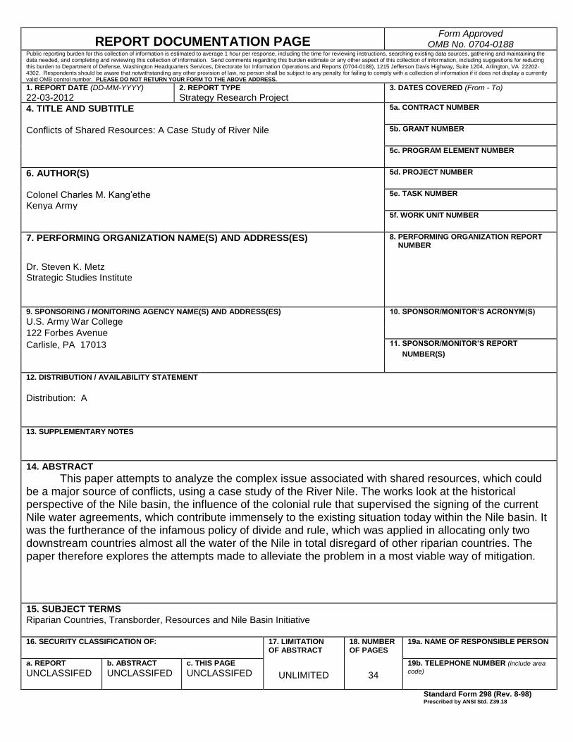
This paper attempts to analyze the complex issue associated with shared resources, which could be a major source of conflicts, using a case study of the River Nile. The works look at the historical perspective of the Nile basin, the influence of the colonial rule that supervised the signing of the current Nile water agreements, which contribute immensely to the existing situation today within the Nile basin. It was the furtherance of the infamous policy of divide and rule, which was applied in allocating only two downstream countries almost all the water of the Nile in total disregard of other riparian countries. The paper therefore explores the attempts made to alleviate the problem in a most viable way of mitigation.
15. SUBJECT TERMS Riparian Countries, Transborder, Resources and Nile Basin Initiative
16. SECURITY CLASSIFICATION OF:
17. LIMITATION OF ABSTRACT
18. NUMBER OF PAGES
19a. NAME OF RESPONSIBLE PERSON
a. REPORT
UNCLASSIFED b. ABSTRACT UNCLASSIFED
c. THIS PAGE UNCLASSIFED
UNLIMITED
34
19b. TELEPHONE NUMBER (include area
code) Standard Form 298 (Rev. 8-98)
Prescribed by ANSI Std. Z39.18


USAWC STRATEGY RESEARCH PROJECT
CONFLICTS OF SHARED RESOURCES: A CASE STUDY OF RIVER NILE
by
Colonel Charles M. Kang’ethe Kenya Army
Dr. Steven K. Metz Project Adviser
This SRP is submitted in partial fulfillment of the requirements of the Master of Strategic Studies Degree. The U.S. Army War College is accredited by the Commission on Higher Education of the Middle States Association of Colleges and Schools, 3624 Market Street, Philadelphia, PA 19104, (215) 662-5606. The Commission on Higher Education is an institutional accrediting agency recognized by the U.S. Secretary of Education and the Council for Higher Education Accreditation.
The views expressed in this student academic research paper are those of the author and do not reflect the official policy or position of the Department of the Army, Department of Defense, or the U.S. Government.
U.S. Army War College
CARLISLE BARRACKS, PENNSYLVANIA 17013


ABSTRACT
AUTHOR: Colonel Charles M. Kang’ethe TITLE: Conflicts of Shared Resources: A Case Study of River Nile
FORMAT: Strategy Research Project DATE: 22 March 2012 WORD COUNT: 8,385 PAGES: 34 KEY TERMS: Riparian Countries, Transborder, Resources and Nile Basin
Initiative CLASSIFICATION: Unclassified
This paper attempts to analyze the complex issue associated with shared
resources, which could be a major source of conflicts, using a case study of the River
Nile. The works look at the historical perspective of the Nile basin, the influence of the
colonial rule that supervised the signing of the current Nile water agreements, which
contribute immensely to the existing situation today within the Nile basin. It was the
furtherance of the infamous policy of divide and rule, which was applied in allocating
only two downstream countries almost all the water of the Nile in total disregard of other
riparian countries. The paper therefore explores the attempts made to alleviate the
problem in a most viable way of mitigation.


CONFLICTS OF SHARED RESOURCES: A CASE STUDY OF RIVER NILE
Natural resources are materials and components that can be found within the
environment. Examples of natural resources include water masses, oil fields, minerals
and precious metals. There is much debate worldwide over natural resource allocations.
The debate is partly due to increasing scarcity caused by general environmental
changes and economic gain from the exportation of natural resources to developed
nations for industrial use. Natural resources are found everywhere within the
environment, some within one country while some extend beyond international
boundaries to neighboring country(s). Natural resources have become major sources of
both inter-states and intra-state conflicts. “Of the world’s major oil-producing areas, the
Persian Gulf region is one of the most likely to experience conflict in the next century.”1
Recent resource cases include tension between Uganda and Democratic Republic of
Congo following recent oil discovery in western Uganda, very close to the common
border, the unresolved dispute between Kenya and Uganda over the ownership of
Migingo Island, which revolves primarily the control of rich fishing waters around
the strategic island in Lake Victoria and the issue of Abyei, which is oil rich region
between Sudan and South Sudan, which is still unsolved.
Water is a vital resource for the survival of human kind. Water is in short supply
due to climate change, human activities and increasing demand. It is estimated that
nearly 3 billion, about 40% of the world population, will be experiencing water shortage
by 2025. This will have a very big impact on most of the developing countries whose
economies are based on agriculture. There are over 260 international water basins,
which comprise about 60% of the earth’s fresh water supply. Management of this vital

2
resource is of extreme importance, yet overall international water law remains largely
undeveloped. “Water’s myriad uses and finite nature, coupled with the fact that it is
quintessential “transboundary” resource, makes it difficult for states to agree upon
distribution and utilization.”2 As the human population increases, a corresponding need
arises for fresh water for domestic consumption, agricultural and industrial uses. The
demand of water has increased rapidly in the last few years, especially in urban areas
due to industrial development and movement of population from rural to urban areas.
With the continuous increase of demand for water, we cannot rule out potential
wars over water. A historic example is the Six Days War between Israel and her
neighbors when Jordan and Syria attempted to dam River Jordan. Currently, Turkish
dams on the upper Euphrates and Tigris Rivers, the source of water for the
Mesopotamian basin, pose a similar problem between Syria and Iraq. There is
therefore, need to understand the dynamics of factors responsible for the scarcity of
water, which include climate change, environmental degradation, poor land use policies
and others. “If the resources are scarce relative to the demand for those resources,
nations are most likely to conflict, since the imbalance will impinge on economic health
or basic level of human well-being.”3
Water masses, which include lakes, rivers, oceans and seas also hold other
resources like fish, maritime wildlife, minerals, under water oil and natural gas, which
are not only important protein source for domestic consumption and income earning,
but also a valuable resource for export. Increasingly, fish resources have dwindled, and
the competition for fishing rights may often result in conflicts. Most of the world’s largest
rivers are international, and with the formation of new independent states, the chances

3
of water resource conflicts are growing. Nearly 40 % of the world’s population is
dependent on about 43 international rivers in the Americas, 20 in Europe, 27 in Africa
and 50 in Asia. It is therefore crucial to discuss the potential for conflict caused by these
shared waters. At the beginning of this millennium, in Africa alone about 300 million
people, which constitutes a third of the continent’s population living in thirteen countries,
were reported to be living under severe water scarcity. Unless something is done to
address the problem, many African countries will be suffering from scarcity by 2025.
The problem of the Nile waters is historical and has been present for centuries,
especially for the Eastern Nile countries, that include Egypt, Sudan and Ethiopia.
The Aim of the Paper
The aim of this paper is to discuss the current complex situations associated with
shared resources, which could be a major source of potential conflict, using the case
study of the Nile River. This paper will look at the historical perspective and address
current legal framework and the political arrangements that dominate the Nile. It will
provide important insights on how resource conflicts manifest themselves, their
wider regional implications, and their effects on regional integration and cross border
cooperation amongst states. It is important to understand the wider implications of water
resources to countries located in deserts, such as Egypt, Sudan, and perennial drought
stricken Ethiopia. The paper will specifically address the historical background of the
Nile, earlier treaties, divergent interest of the riparian states and possible conflicts in the
region. The recommendations of the paper may assist to form strategies to mitigate the
effect of factors that may cause future conflicts within the Nile Basin region.

4
The Nile
“Nile is the greatest natural and romantic wonders of the world. It is the longest
river flowing south to north 6,825 km (4,238 miles) over 35 degrees of latitude through
civilizations of great antiquity.”4 Its waters are shared by eleven countries. These
countries include Kenya, Uganda, Tanzania, Rwanda, Burundi, DR Congo, Ethiopia,
Sudan, South Sudan, Eritrea and Egypt. Other shared water sources in the region
include lakes Albert, Turkana, Kivu, Edward and Tanganyika to name but a few.
For centuries, there has been no accurate information on the source of the Nile.
“Lake Victoria has only one outlet situated on its northern shore, at Njinja, 5,611 KM
from the Mediterranean Sea. Here on 28 July 1862 John Hannington Speke stood to
watch the Nile flow out of the lake between high cliffs to drop suddenly 5 meters through
three separate channels to disintegrate below in white, turbulent water.”5 However, in
1937, a German explorer Bruckhart Waldekker claimed to have finally discovered the
source of the Nile in Burundi. The argument of Bruckhart could have been in line with
historical perspective, according to the writings of Herodotus, a Greek historian, 460
BC, who wrote that the Nile's source was a deep spring between two tall mountains.
However, the truth remains that the White Nile originates from the Great Lakes region,
where Kagera River from Rwanda and Burundi empties into Lake Victoria together with
other several rivers from Kenya and Tanzania.
The White Nile flows from Lake Victoria to the north through Owen Falls Dam to
Lake Albert, where it is joined by the Semliki River from Democratic Republic of Congo
before entering South Sudan. The White Nile traverses through the Sudd region in
South Sudan before entering Sudan, where it is joined by Sobat River from Ethiopia.
“The Blue Nile, which is known as Abbay in Ethiopia, has its source at Lake Tana in

5
north western Ethiopia.”6 The two tributaries meet just North of Khartoum, from where
the river is known as the Nile. The combined White and Blue Nile meet their final major
tributary, the Atbara which also has its source in Ethiopian highlands. The River Nile
basin covers approximately one-tenth of the African continent with its riparian states
possessing 40 % of Africa’s population. “In 1990, the population of the Nile Basin was
245 million. It is estimated that if the current rate of population growth remains
unaltered, the total population will climb up to 859 million by the year 2025.”7
Background
In the history of the Nile, it assumed that the river may have gotten its name from
"nahal" which means "river valley" in Semitic, later "neilos" in Greek and "nilus" in Latin.
In ancient Egypt, the Nile, and its delta, was worshiped as a god. The god Hapi, who
came in the shape of a frog, represented the Nile delta. Several times in history, Egypt
has tried to monopolize the control of Nile by conquering Sudan and has always paid
attention to activities along the Nile basin at the southern Egyptian border. The Sudan
was invaded during the reigns of Queen Sheba, the Roman rule of Nero, and other
countless times. This is because the Egyptians have lived with fear that one day the
Nile's waters will not reach their country. They believe that development of the upper
riparian states could affect the flow of the Nile through Egypt. “James Bruce of Kinnaird,
a Scottish traveler who lived in Ethiopia from 1769 to 1771, recounts a letter from the
King of Ethiopia to the Pasha King of Egypt in 1704 threatening to cut off the water.
With this kind of tension it is quite natural that the Nile countries desire to secure their
water.”8 (See the Nile Basin Map).

6
Figure1. The Nile Basin
The modern history of the Nile conflict began with the 20th century and the
British were quick to realize the importance the river would have for their colonies.
When Sudan was conquered by the British in 1898, Navigation in the Nile upstream was
almost impossible due to natural dams in the swamps of the Sudd made up of plants
7
and soil due to strong winds and the speed of the river. On conquering Sudan, the
British began to clear the Nile off the vegetation which was obstructing the passage of
ships, which ended in 1904. By the time of completion, they had already begun drawing
up massive alternative drainage plans in order to improve the flow of the Nile. However,
the British had no control over the Ethiopian portion of the Nile, from which over 80% of
the Nile's waters come from. The British signed an agreement with the Ethiopians in
1902 in order to assure themselves that the Nile would not be interfered with. They also
had to assert a significant amount of pressure on the Italians and the Egyptians, who
were most problematic.
In 1929, the British government sponsored the Nile Water Agreement, which
regulated the flow of the Nile and apportioned its use. “In July 1931 the idea of an
authority to supervise Nile water development re-emerged on a British initiative
following the impetus given to development by the Nile water agreement of 1929.”9 The
British government later commissioned a hydrological study of the whole Nile Basin but
did not cover the Ethiopian area of the Nile due to political problems. The report of the
study was finally released in 1958 and came up with various recommendations to
increase the amount of water which reached Egypt. Of all the recommendations, the
most important was the construction of the Jonglei Canal, which would divert the flow of
the Nile in southern Sudan to avoid much evaporation losses which take place when the
White Nile traverse the area. The report treated the entire Nile Basin as if it falls under
one country and never considered other interested parties. Hence it was unacceptable
by the newly independent African states.
8
By the time of releasing the report of the Nile plan, the Egyptians had already
planned a major construction project, High Aswan Dam, in order to control the yearly
floods of the Nile and to harvest the hydroelectric power of the river. However, this
project was to have major repercussions on the lands of northern Sudan. Building this
dam would mean that whole sections of northern Sudan would be inundated by what
was to be Lake Nasser. There were also severe environmental concerns as to how the
dam would change life on the banks of the Nile.
Treaties
“The history of international water law, for example, dates back at least 2500 BC,
when the two Sumerian city-states of Lagash and Umma crafted an agreement ending a
water dispute along a tributary of the Tigris River.”10 Due to continuous tension, as
mentioned earlier, the first Nile treaty was signed in 1929 by Egypt and Britain, which
formalized Egyptian monopoly over the Nile waters. The treaty apportioned Sudan only
4 billion cubic meters of water annually. After attaining its independence in 1956, the
Sudan government rejected the treaty which led to a period of conflict between the two
nations. In 1958 Egypt sent troops into disputed territory pending new Nile negotiations.
In 1959 Egypt and Sudan renegotiated the Nile Water Agreement. “On 8th November
1959, after less than a month of negotiations, an agreement was signed for full
utilization of the Nile waters."11 The agreement stipulated that Sudan's yearly water
allotment would rise from the 4 billion cubic meters allotted in the 1929 agreement to
18.5 billion cubic meters. The Sudan was also allowed to undertake a series of Nile
development projects, such as the Rosieres Dam and the Jonglei Canal. Egypt, as
mentioned earlier was allowed to build a huge dam near the Sudanese border to

9
regulate the flow of the Nile. The treaty also formed a joint committee to be in charge of
supervising and directing all development projects which affected the flow of the river.
The 1959 Nile agreement was only bilateral and did not include any of the other
riparian countries of the Nile basin despite the fact that it portioned out all of the Nile's
water. Ethiopia, from which over 80% of the waters come from, was not even consulted.
No other upstream country except Sudan was allotted water for future usage. All of the
Nile's average water flow was therefore divided between the two most downstream
countries. In 1993, Ethiopia agreed, through a general framework with Egypt, that they
would not interfere with the Nile in a way that may harm the interests of the other party,
but the agreement is not bound by international law. The 1959 agreement, however, did
not put an end to the conflict over the rights to the Nile waters. A strong tension still
exists between the Nile basin countries whenever a new Nile development project is
proposed. The water needs of all of the countries are barely met and the shortage will
probably continue in the future, especially in view of the development plans in Ethiopia
and Sudan.
Use of the Nile
Following signing of the1959 Nile Water Agreement, Egypt has extensively been
using the Nile waters while Sudan has also attempted to undertake some water
projects. Construction of the High Dam at Aswan began in 1959 as soon the agreement
with Sudan was signed. It was completed in 1970 and stretches 4 kilometers across the
river's path, rises over 100 meters from its base, and is almost a kilometer wide. Behind
it, the waters have formed Lake Nasser, which is 600 kilometers long and 50 kilometers
wide in some places. “Egypt relies completely on the water storage of Lake Nasser to
sustain its annual share of Nile water, fixed at 55.5 billion cubic meters (bcm) annually

10
under the 1959 Nile Waters Agreement with Sudan.”12 The reservoir is the second
largest man-made lake in the world. The Aswan Dam is arguably one of the great
architectural accomplishments of the 20th century. The construction of the dam is
estimated to have costed one billion US dollars; Egypt had to seek external funding,
which was provided by the Soviet Union, after refusal by the United States and the
World Bank.
Sudan and Egypt jointly began the construction of the Jonglei Canal in the
1970's. The canal was meant to increase the flow of the Nile waters by diverting it away
from an area where much of water is lost by evaporation in South Sudan. The project,
which was funded in large part by the World Bank, stalled in 1983 at about one hundred
kilometers short of completion when the civil war between North and South Sudan
started. In 1997, Egypt began the construction of the New Valley Canal, which created a
new, self-sustaining, river which flow through the Western Desert. The New Valley
Project (Toshka Project) involved building a system of canals to carry water from Lake
Nasser to irrigate the sandy Western Desert, which is part of the Sahara Desert. The
canal inlet starts from a site lying 8 km to the north of Toshka Bay (Khor) on Lake
Nasser and covers a distance of 310 km. This has allowed Egypt to settle a large
population far from the Nile.
“Egypt developed National Water Resources Plan (NWRP) in January 2005, in
keeping with current global thinking on how to face the dual challenge posed by current
water-resource problems and the Integrated Water Resources Management (IWRM)
approach.”13 In 2007, the population with access to an improved water source in Egypt
was estimated to be 98% compared to 70% in Sudan and only 42% in Ethiopia. While

11
Egypt and Sudan have historically maintained that Ethiopia should be excluded from
Nile negotiations because its people can sustain themselves through rain-fed
agriculture, almost 60% of Ethiopians lack access to an improved water source and the
country has been plagued by decades of successive famines brought about by
droughts.
Ethiopia and other basin countries have not been utilizing the Nile except for a
few hydropower projects due to the 1959 agreement, which gave usage to Egypt and
Sudan. Ethiopia suffered from a massive famine between 1984 and 1985, during which
about 1 million people are estimated to have died.14 Another famine followed in 2003, in
which about a fifth of the population had no food, resulting in the death of thousands of
people. The country had also suffered from long famines between1973 and 1974, 2003,
and as recently as 2006. The droughts illustrate the volatility when Ethiopia faces major
food deficiency because of its heavy reliance on rain water driven agriculture and limited
access to the Nile waters.
Egypt and the Nile
The geographical position and access to the Nile gives Egypt more advantages
in utilizing the water of the river than any other riparian state. Situated as the last
downstream country in the Nile River system, Egypt receives 65.5 of 88 cubic
kilometres of renewable surface water, which is the highest volume of Nile water among
basin countries. Egypt is totally dependent on the Nile; hence it does not welcome any
interference by other countries. “Egypt often proclaims its historic right to utilize the
waters of the Nile, and regularly threatens armed action to stop ambitions of upstream
countries in encroaching the Nile waters.”15 The country has always been very sensitive
as far as the issue of the Nile water is concerned. Its argument is that other riparian

12
states have alternative sources of water while Egypt entirely relies on the Nile. It is in
this regard that Egypt has previously warned that it is ready to go to war with any
country interfering with the waters of the Nile.
The population of Egypt stands at 84.5 million with an annual growth of 1.96%
and it is estimated to hit 114.8 million by 2026.16 Most of the population live within
irrigated and urban areas. The country is currently importing about half of its food grain
to meet the demand of the population. Egypt is also planning to create more urban
centres and industrial areas to increase more living space for the growing population.
“Additionally, Egypt has built several irrigation projects such as Isna Barrage, Asyut
Barrage, Damietta and Rosetta Deltas, Zifta Barrage, Idfina Barrage and Damietta Dam
in the river’s downstream, which is certainly affected by decreasing flow from Aswan.”17
With steady population increase, and new industrial and urban area developments,
water demand will increase and scarcity will continue while the country maintains the
condition of non interference with the Nile by upstream countries. (See figure 2)
Ethiopia and the Nile
Ethiopia’s interest with the Nile water has been due to its national concern for
food security. It has been the most affected among the basin countries by Egypt’s
position. For a long time, due to droughts that results in famine, Ethiopia has been
forced to depend on food aid for survival. Whereas 86% of the Nile waters come from
Ethiopia, the country is completely forbidden by the Nile treaties to use the river in any
way for irrigation. It therefore poses as the major challenge to Egypt’s Nile water
access. Despite having high irrigation potential, Ethiopia is unable to harness the Nile
River water resources to benefit its own population. “Ethiopia has 123 billion cubic

13
meters (bcm) of surface water on annual basis. Of this amount a mere 3 per cent
remains in the country, while the rest flow to neighbouring countries.”18
Ethiopia is basically an agricultural country. Agriculture sector accounts for 40 %
of the Ethiopia’s GNP, 90 % of its export and is the source of employment to 85 % of
the population. Ethiopia’s largest agricultural sector is concentrated in the high-rainfall,
highland areas, which forms 44 % of the land area of the country. Almost 88 %t of the
country’s population resides in the highlands. Beside depending on rainfall, Ethiopia has
only managed to cultivate 290,000 hectares of irrigated land, which counts for only 11 %
of the country irrigation potential. With unreliable rainfall, Ethiopia is permanently short
of food to feed its people. The population of Ethiopia stands at 90.8 million with an
annual growth rate of 3.1 %. With such high base population and growth rate, Ethiopia
is seriously planning how to alleviate perennial food shortage by using the Blue Nile and
other tributaries to cultivate more land for irrigation.
Ethiopia has approximately 2.3 million hectares of potential land for irrigation
within its area of the Nile Basin. Ethiopia considers the Blue Nile, which is monopolized
by Egypt, as one of its natural resources. It is in this regard that in February 2005, the
Ethiopian Prime Minister, Meles Zenawi told the BBC: “While Egypt is taking the Nile
waters to transform the Sahara into something green, we in Ethiopia-which is the source
of 85 percent of that water, are denied the possibility of using it to feed ourselves. And
we are being forced to beg for food every year.”19 Unlike the oil-rich Sudan, which is
able to import food to cover the deficiency, Ethiopia has no alternative resources and it
is therefore determined to make use of the Nile water to address food shortage.

14
Ethiopia is also currently using the Nile for hydro power production, which Egypt
considers to be helpful in reducing sediments entering Nasser Dam. (See figure 2)
Sudan and the Nile
“The Sudan occupies a middle position of the Nile basin between the upstream
and Egypt. All major tributaries of the main Nile - the White, and the Blue and the Atbara
– flow through the country.”20 It was the largest country in the whole of African continent
that connects the sub-Saharan Africa with the Arab world. The situation has however
changed following the succession of South Sudan. Sudan has high potentials of
developing its agricultural potential, which it has not been able to do. Firstly, because of
the long civil war before South Sudan succeeded; thus an economic crisis, and
secondly, due to the 1959 agreement with Egypt which restricts its use of the Nile
waters. While 70% of the population is dependent on agriculture, most of Sudan is
desert and only receive 25mm of rainfall and sometimes goes without rain throughout
the year. The population of Sudan now stand at 35 million with an annual growth rate of
2.5 %.21 The country has only managed to irrigate 1.9 million hectares out of the 2.8
million hectares of land with potential of irrigation.
Sudan built the Jebel Anlia Dam on the White Nile even before Egypt constructed
the Aswan High Dam. The country also built other dams following the 1959 agreement
with Egypt on full utilization of the Nile waters. “The most prominent dams are Roseires
Dam and Sennar Dam on the Blue Nile, and Kashm el Girba on Atbara River.”22 There
is also Siteit Dam on upper Atbara and Merowe Multi-Purpose Hydro Project. With the
current high rate of population growth, the demand of water will continue growing and
the scarcity will also persist. It is in this regard that Sudan is planning to build more
dams on the Nile in order to achieve food security and meet other essential needs.

15
Following the recent independence of South Sudan, other natural resources like oil will
drastically reduce and affect the purchasing power of food, hence, Sudan needs to
increase its own food production. (See figure 2)
South Sudan and the Nile
South Sudan is the youngest nation in the world having attained its
independence on 9th July 2011. The country was in conflict with the Arabic aligned
Northern half of Sudan for two decades, since 1983. The level of development in the
young nation is therefore minimal. After attaining independence, South Sudan will take
control of all the natural resources within the country. The River Nile, which traverses
the country from Uganda before entering Sudan, is one of the resources that South
Sudan is likely to use for irrigation to boost food production to feed the hungry
population. Although the country gets 1600mm of rainfall annually, it is also entitled to
use the Nile as one of the riparian states.
The population of South Sudan is about 9 million, with an annual growth rate of
1.9 percent. Naturally, the population growth is likely to rise after coming out of war due
to improved living conditions. The immediate task of the new government is to create a
development plan. It is therefore likely to come up with irrigation and hydro power
projects using the White Nile waters. Considering that South Sudan is now a sovereign
state, such projects are going to complicate the position of Egypt on use of the Nile.
Kenya, Uganda and Tanzania and the Nile
Kenya and Uganda are former British colonies, and Tanzania was under
Germany until 1922 when it became a League of Nations mandate and later UN
protectorate. The three East African countries lie within the Nile basin and they are all
connected to the Nile by Lake Victoria, which is the second largest fresh water lake by

16
surface area in the world after Lake Superior, in North America. “The lake is relatively
shallow, with maximum depth of 80-90 m an average depth of 40 m, and has a volume
of 2,760 Sq km.”23 For a long time the three original members of the East African
Community were not much concerned with the Nile water issues. During the British rule
the three countries were not in a position to raise objections when the Nile treaties were
signed. Furthermore, the countries also receive high rainfalls compared to the riparian
states at the eastern region. However the three countries have now become the most
vocal in agitating equal distribution of the Nile waters among the riparian countries.
“The rainfall in Kenya varies widely by region. The coastal and highlands regions
receive between 1,000mm to 1,250mm per year, but the equatorial plateau receives
only 250mm per year.”24 The main rivers in Kenya are the Tana, Galana and others
which are medium size. Apart from sharing a small portion of Lake Victoria, there is
also Lake Turkana and other small lakes in Kenya. Despite having numerous rivers
within its Nile Basin, only about 387,000 ha are under irrigation. The country has only
developed hydropower generation on Sondu Miriu River, which terminates at Lake
Victoria.
Almost the whole of Uganda is located within the Lake Victoria Basin, and it is at
Njinja, that the White Nile flows out of Lake Victoria and meanders in the country before
entering South Sudan. Rainfall in Uganda is between 1000mm to 1500mm a year, with
15 % of the country being open water. Apart of having a big share of Lake Victoria,
Uganda is also the home to Lake George and Lake Kyoga, and parts of Albert and
Edward. The climate is fairly mild due to a relatively high altitude. The country has
therefore never experienced water shortage and the situation is likely to remain the
17
same in years to come. “Uganda’s main interest in utilization of the Nile resources,
unlike most other riparian countries, has always focused on hydropower development
for her social economic development.”25 While Kenya and Tanzania are interested in
inter- basin water transfer to meet their domestic, irrigation and industrial water needs,
Uganda advocates for uninterrupted flow of water in to Lake Victoria to support its
hydropower production at Owen falls and Kiira dam.
Tanzania occupies 49 % of the surface area of Lake Victoria while Uganda and
Kenya occupy 45& and 6 % respectively. “Tanzanian rivers that flows into the lake
make up about 61 per cent of the long-term average river discharge into Lake Victoria’s
catchment area; Kenyan and Ugandan rivers make up 37.5% and 1.5 % respectively.”26
In Tanzania, rainfall on the coastal plain of the mainland is between 1016mm and
1930mm, while the inland plateau receives only 508mm to 762mm per year. Tanzania
has many other water resources, such as three of the great lakes of Africa- Lake
Victoria, Lake Malawi and Lake Tanganyika. Following the challenge by first president
of Tanzania, Mwalimu Julius Nyerere, on the monopoly of Nile waters by Egypt given by
the 1929 agreement, Tanzania is using its Nile water for domestic supply, hydropower
production and mining industry. (See figure 2)
Rwanda and Burundi
The two countries which recently joined the East African Community are
connected to the Nile by River Kagera, which deposits its load in Lake Victoria, one
major source of the Nile. They have tropical climate moderated by altitude. Rwanda has
an average rainfall of 1000mm to 1500mm annually, and many lakes along the Kagera
River, the watershed between the Nile and Congo rivers, such as Lake Kivu. Rwanda
joined the earlier Nile basin project, Hydromet, in 1967, with the support on the UNDP.

18
Although the country does not experience water scarcity, it is currently involved in the
general negotiation of the Nile basin.
“Burundi covers 6 percent of the total surface area of the Nile basin countries and
represents 22 %of the Kagera basin area; 75 % of the Burundian marshlands are
located in Kagera basin.”27 Kagera basin in Burundi is occupied by about 14 million
people. The climate in Burundi has average annual rainfall ranging from 1000mm
to1500mm. The main rivers that traverse through Burundi are the Ruzizi, Malagarasi
and Ruvuvu. However, Lake Kivu, has experienced a 1cm per year decrease in average
water level which has resulted to a huge decrease in power production at Ruzizi.
Furthermore, in recent years there have been a general decline of rain fall and the
country is likely to face future water scarcity. (See figure 2)
Democratic Republic of Congo
Democratic Republic of Congo is connected to the Nile by River Semliki at Lake
Albert. “The Semliki has a catchment of 23,621 sq km, and is the net recipient of
discharges from all rivers and lakes draining Ruwenzori and the surrounding region.”28
The country receives a lot of rainfall ranging from 1524mm in the northern to 1270mm in
the south. The Congo River basin accounts for 60% of the country, with many tributaries
throughout the country as well as Lake Albert. The climate is generally hot and humid,
yet rainfall is experienced throughout the year. The country has interests in shipping
and fishing rights on Lake Albert, which is part of the Nile basin and forms part of the
border between Congo and Uganda.

19
Country Total Area
of the
Country
Area of the
Country Within
the Basin
% of
Total
Area of
Basin
% of Total
Area of
Country
Average Annual
Rainfall in the Basin
Area
(MM)
(KM2) (KM
2) (%) (%) Min. Max. Mean
Burundi 27, 834 13, 260 0.4 47.6 895 1,570 1, 110
Rwanda 26, 340 19, 876 0.6 75.5 840 1, 935 1, 105
Tanzania 945, 090 84, 200 2.7 8.9 625 1, 630 1, 015
Kenya 580, 370 46, 229 1.5 8.0 505 1, 790 1, 260
Zaire 2, 344, 860 22, 143 0.7 0.9 875 1, 915 1, 245
Uganda 235, 880 231, 366 7.4 98.1 395 2, 060 1, 140
Ethiopia 1, 100, 010 365, 117 11.7 33.2 205 2, 010 1, 125
Eritrea 121, 890 24, 921 0.8 20.4 240 665 520
Sudan 2, 505, 810 1, 978, 506 63.6 79.0 0 1, 610 500
Egypt 1, 001, 450 326, 751 10.5 32.6 0 120 15
Nile
Basin
3, 112, 369 100 0 2, 060 615
Figure2. Nile Basin: Areas and Rainfall by Country (Source: FAO – Irrigation Potential in Africa)
Although late President Mobutu threatened to divert the river course in 1960s if Egypt
and Sudan continued to threaten his government, DRC has never initiated
comprehensive water development plan since its independence. (See figure 2)
Eritrea
Eritrea is outside the Equatorial Lakes region, but does have several rivers
running throughout its boundaries including the Gash, Baraka, Anseba, Falkat, Laba

20
and Alighede. The country has maintained an observer status since the Nile Basin
Initiative was established in 1999. It has been difficult to have Eritrea join the NBI unless
its dispute with Ethiopia is resolved, which is a big challenge for the NBI.
The Problem in the Nile and Possible Conflict
The problem of the Nile waters has been there for over two hundred years.
Several times in history, Egypt has tried to monopolize the control of Nile and has
always paid attention to activities going on within upstream countries. The modern
history of the Nile conflict began with the 20th century and as mentioned earlier, the
British were quick to realize the importance the river. In the recent past the Egypt and
Sudan defined the Nile waters as a vital national priority and have always been ready to
go to war over the issue. Most parts of the two countries, if not all, are in the desert. The
perennial droughts in Ethiopia cause continuous food shortage due to crop failure. The
Lake Region Equatorial countries have also become very vocal agitating for equal
shares of the Nile water. This has been brought about by global warming and general
climate change due to environmental degradation and, population growth. While the
majority of African states economies are agricultural based, the governments of the
riparian states have realized that they cannot totally rely on rain, for reliable food
production. They are therefore looking for alternative ways to enhance food production
by using the Nile waters for irrigation, which will subsequently affect the volume of water
flowing to Egypt.
The main problem with the Nile has been the access, utilization and equitable
distribution of the waters amongst the countries within the basin. Furthermore, the
management of the Nile has not been possible due to the institutional mechanisms that
have been put in place to regulate this use, especially, the 1929 and the 1959 Nile
21
Treaties. In August 1994, it was reported that Egypt had planned and subsequently
canceled an air raid on Khartoum, Sudan, where a dam was under construction. There
was also a long tension between the two countries over the attempted assassination of
President Mubarak in the 1995. Border clashes became common between the two
neighbors and conflict seemed probable. In the early 1990's, it is believed that Egypt
blocked an African Development Bank loan to Ethiopia for a project which could have
reduced the flow of the Nile's water into Egypt. “In summary, Ethiopia poses a larger
and more complicated problem for Egypt’s water security than Sudan. Ethiopia simply
does not possess alternative resources to mitigate its severe food shortage, unlike oil-
rich Sudan which can opt for food imports.”29
From the aforesaid, it is evident that water scarcity within the Nile basin is on the
rise. The demand highly exceeds the supply due to the fact that the two downstream
riparian countries mostly rely on the Nile waters for agricultural irrigation. The demand is
even likely to go higher following the recent independence of South Sudan, which is
likely to plan for the use of the Nile. Going by the history, the Africa’s colonial legacy
imposed artificial state borders, which has been mostly the main source of conflicts.
This also set stage for the Nile basin to be a flashpoint for conflict. During the colonial
era, the British controlled the Nile by effective use of military and political control over
most of the riparian countries. The treaties that were signed during the colonial era
involved Egypt and Sudan and were only favorable to Egypt. The colonial era tensions
were carried over to post colonial era. Now that there is increased demand of water
even by those countries that were never interested, and the insistence of Egypt that

22
situation should remain status quo, the tension is likely to remain high and could be a
major source of conflict.
Attempts towards Peace and Co-operation
Hydromet. In 1967, with the assistance of the United Nations Development
Program (UNDP) and the World Meteorological Organization (WMO), Egypt, Kenya,
Sudan, Tanzania and Uganda launched the Hydromet Survey project to regulate the
water level of the Nile.”30 Rwanda joined later while Ethiopia never joined during the
twenty five years that the program lasted. Its main purpose was to study, analyze and
disseminate to member countries meteorological data on the equatorial lakes and
rivers. The Hydromet Survey Project operated from 1967 to 1992. This was one of the
most successful institutions of the basin, being the first forum for Nile co-operation.
However, the program only covered the lake catchments of the equatorial region.
Kagera Basin Organisation. Kagera Basin Organization was launched on 24
August 1977, when the heads of state of Burundi, Rwanda, Uganda and Tanzania
signed the agreement creating the organization for the management and development
of the Kagera River Basin. “The aim of Kagera Basin Organization was to operationalize
the concept of regional planning. At this end it would conduct studies for implementing
14 priority projects in transport and communication, energy, agriculture, and information
and training.”31 This was seen by many observers as one of the most ambitious river
organizations in Africa, if not in the world. The KBO with its headquarters at Kigali in
Rwanda still exists, while its projects exist only in papers. This is mainly due to political
instability that led to civil wars in three of the four member states, and limited resources.
23
Undugu. Undugu, which means brotherhood in Swahili, was established in 1983
during a meeting in Khartoum. “The founding members were Egypt, Sudan, Uganda,
Rwanda, Burundi, the Democratic Republic of Congo (DRC) and Central African
Republic. Ethiopia, Kenya and Tanzania had observer status.”32 The main objective was
to forge co-operation amongst its countries, in areas of infrastructure, environmental co-
operation, culture and trade. The group held sixty-six meetings at the technical and
ministerial level between 1977 and 1992, but nothing came out of it. The organization
was therefore disbanded without achieving its objectives.
TECCONILE. “The Hydromet survey was completed 1992, the same year the
water resource ministers from Egypt, the Sudan, Rwanda, Tanzania, Uganda and
Democratic Republic of Congo created a new organization, the Technical Co-operation
Committee for Promotion of Development and Environmental Protection of the Nile
Basin (TECCONILE), with a signing of an agreement at Kampala, Uganda. The rest of
the four riparian states participated as observers.”33 Its main objective was to coordinate
interests and objectives of the basin countries. Despite the commitments made, not all
the planned projects were implemented due to lack of funding, delayed funding or
insufficient funding from what was promised by the donors. It was under these
circumstances that the 2nd Nile Technical Advisory Committee (Nile - TAC) meeting was
held in Arusha, Tanzania in September 1998 where an agreement was reached on a
plan for action and on policy guidelines for the establishment of the Nile Basin Initiative
(NBI) and take over pending projects.
Nile Basin Initiative (NBI). The Nile Basin Initiative (NBI) was launched in
February 1999, and it was the first time that all the riparian countries came together in

24
formalized talks. It is the most important and currently the only Nile-basin initiative of its
kind. The NBI is composed of a council of the water ministers from each of the basin
countries (Nile COM), and the technical advisory committee which has two
representatives from each country (Nile TAC). The NBI is comprised of the Strategic
Action Program (SAP) which is divided into two complementary components, one based
on a shared vision and the other focused on action on the ground. These two
components are embodied in the Shared Vision Program (SVP) to create an enabling
environment for cooperation, trust and skill building, and the Subsidiary Action Program
(SAP), which plans and implements investments and projects on the ground beginning
at the most basic levels of society.
The NBI has formulated two action projects with an aim of translating the vision
into a reality. The projects include the Eastern Nile Subsidiary action Project (EN-SAP)
composed of Egypt, Sudan and Ethiopia and the Nile Lake Equatorial Region
Subsidiary action Project (NEL-SAP) consisting of all other riparian countries, with
exemption of Eritrea. The World Bank took the lead in funding the organization through
Consortium for Cooperation on the Nile (ICCON). The council of ministers promised to
pursue the establishment of a permanent River Commission in 2007 to be coordinating
projects but that seems to be a pipe dream since most of the members have continued
to promote hydrological projects within their countries.
Whereas Establishing the NBI has helped to ease the tension within the basin,
there are key issues that are yet to be addressed. It has postponed the most burning
controversial issues of water allotment especially between Egypt, Sudan and Ethiopia.
These controversial issues exist because of the colonial agreements of the Nile water
25
allotment, which favor Egypt at the expense of their riparian countries. The NBI has
been dormant due to legal implications and it is even referred to as “a water ministers’
club”, since it has failed to bring together the political leadership of the riparian countries
to address the controversial issues. While Egypt has remained adamant to maintain
status quo, other riparian countries are all aggressively seeking the review of the
colonial agreement in order to have equal allotment of the Nile waters.
There are reportedly two main points of contention preventing agreement on a
permanent body. The first one is between the upper and lower riparian countries, with
the former wishing to nullify all previous agreements on Nile waters. The other riparian
countries contend that Egypt and Sudan have a disproportionate share of Nile waters,
exceeding their needs. Egypt and Sudan do not want to forgo their exclusive rights to
the majority share of the waters, which they have enjoyed under the current
arrangement. During original deliberations for of the NBI’s Cooperative Framework in
1999, Ethiopia and the other upper riparian countries wanted the new agreement to
supersede any old agreement, but Egypt and Sudan attempted to add an alternative
provision reading “The principles and framework are without prejudice to existing
agreements”, which was rejected.
The second point is the issue of notification, which Egypt and Sudan insist that
they have to be given detailed notification by all countries undertaking projects on the
Nile. The riparian countries have failed to agree on these two points and they are
struggling to have consensus. The failure to come to agreement has adversely affected
development within the Nile Basin due to lack of funding. Under the current structure of
the NBI, individual countries cannot secure funding for projects and development

26
without the consensus of NBI participants. “The World Banks Operational Policy 7.50
requires consent from all riparian countries potentially affected by a project on an
international river before funding is granted.”34
Within the NBI, every country has its own inherent expectations, but Egypt and
Ethiopia have the most contesting interests. The two countries are therefore leading
advocates of two divergent causes. Egypt has been a major supporter of the Technical
Cooperation Committee for Promotion of the Development and Environmental
Protection of the Nile Basin (TECCONILE) and its action plan, where the agenda
focuses on regional cooperation. Conversely, Ethiopia is more interested in the Panel
of Experts and its cooperative framework, which is working towards coming up with a
legal document to serve as a basis for the equitable utilization of the waters. The
difference in priority on cooperation versus allocation is a divisive issue which the NBI is
not currently addressing and it will continue to intensify. “Despite worrying geopolitical
trends, several analysts insist that the potential conflict over the Nile will be mitigated by
the fact that governments realize that they have more to gain from cooperation than
vitriol confrontation.”35
Possible Solution to Avert Conflict
Many other recommendations have been given about what the NBI can do to
address the Nile water conflicts effectively. Some experts call for convening more
conferences and negotiating more treaties. Some support strengthening existing
institutions, while others prefer the establishment of new institutions. There are also
calls to expand the NBI’s work in new areas, such as energy, fresh water resources,
and sustainable tourism.

27
“Understanding the potential for resource conflict and conflict mitigation requires
an understanding of both the resource supply and the institutional capacity available for
managing the supply.”36 Interstate resource conflicts will therefore occur when a
managing institute does not exist, has been destroyed or does not have the capacity for
proper management. The NBI was established to manage River Nile, which is shared
by eleven countries. However, the institution is lacking the legal framework to make it
more effective in managing the Nile. A legal and institutional regime for utilization of the
Nile waters needs to be established to create a sustainable basis for the equitable and
reasonable entitlement of all the water resources. This can likely be achieved with
involvement of respective country leadership other than leaving it to Water Ministers.
When well established, NBI should take a sub region approach since the
Equatorial Lake countries and the eastern Nile countries have divergent interests.
Two leading Nile scholars, Ashok Swain and John Waterbury, support the formation of a
Sub - basin agreement between the three key Nile states before moving on to basin-
wide commitments. As Swain argues in his paper, “Mission Not Yet Accomplished:
Managing Water Resources in the Nile River Basin”, the Equatorial Lakes countries are
primarily dependent on Lake Victoria for fresh water, so their interest in the Nile River is
less considerable than the Eastern riparian countries. He explains that the best way to
progress would be to first address the issue of water management between Egypt,
Sudan and Ethiopia, which are widely considered most susceptible to conflict. On
achieving the objective of cooperation among the three countries, the NBI can then
extend the negotiations to all the basin countries. The sub-basin approach is supported
by the theory of negotiation described by Wolf in “Patterns in International Water

28
Resource Treaties”, which asserts that the difficulty of negotiations increases with the
number of parties involved.
Conclusion
This paper has attempted to discuss the possible conflicts of shared resources
with a case study of the Nile River. As stated earlier, natural resources are a natural
heritage within a country that is typically exploited for economic gain. Natural resources
that extend or transit beyond international borders require agreements or cooperation
between countries on their fair use and management. Such resources are likely to be
major source of conflicts if there are no agreements or institutions to manage the
exploitation.
Sharing of the Nile waters among the basin countries is a long outstanding case
which echoes the bitter memories of British colonial legacy. The signing of the Nile
water agreements, currently in use, was supervised by the British in furtherance of their
policy of divide and rule. That is why the 1959 agreement allocated almost all the Nile
waters to Egypt and Sudan, in a total disregard of the upstream countries. The NBI and
all other stake holders should prevail on Egypt to consider its stand and accept a new
agreement over the Nile water sharing that includes all the basin countries. As
recommended earlier, they should apply sub-basin approach and build up to a basin
wide approach. They should first bring together the 3 Eastern Nile countries, Egypt,
Sudan and Ethiopia, and then incorporate all the basin countries. When all is said and
done, it will go a long way in improving NBI institutional capacity and prevent possible
future inter-state conflicts.

29
Endnotes
1 Michael T Klare, Resource Wars: Oil Conflict in the Persian Gulf, (Metropolitan Books Henry Holt and Company, 2001): 51.
2 Fasil Amdetsion, “Arguments in Favor of the Continued Relevance of International Law and a Multidisciplinary Approach to Resolving the Nile Dispute” Scrutinizing the Scorpion Problematique, No 44 (Fall; 2008): 3.
3 Mark F.Giordano, Maredith A. Giordano and Aaron T. Wolf “International Resources Conflict and Mitigation,” Journal of Peace a Research Vol42, No 1 (Jan, 2005): 48.
4 Robert O. Collins, The Waters of the Nile: The Nile, (Marcus Wiener Princeton, 1996):1.
5 Ibid, 8.
6 Dahilion Y Mohamoda, Nile Basin Cooperation: Introduction, (Elanders Digitaltryck AB, Goteborg, 2003): 7.
7 http://www.faonile.org
8 Collins, The Waters of the Nile: 4.
9 Ibid, 148.
10 Giordano, Giordano, and Wolf “International Resources Conflict and Mitigation.” 53.
11 Terje Tvedt, The Nile in the Post-Colonial Age: The History of the Nile Waters in the Sudan, (I.B. Tauris, London): 196.
12 Ibid, 219.
13 Ibid, 218.
14 http://www.bbc.co.uk/news/
15 Ashok Swain, “Mission Not Yet Accomplished: Managing Water Resources in the Nile River Basin,” Journal of International affairs 61, No2 (Spring 2008): 203.
16 CIA, The World Factbook: https://www.cia.gov/library/publications/the-world/geos/eg.html
17 Swain, Mission Not Yet Accomplished: 204.
18 Tvedt, The Nile in the Post-Colonial Age: 261.
19 BBC, Feb 2005.
20Tvedt, The Nile in the Post-Colonial Age: 179.
21 CIA, The World Factbook.
22Swain, Mission Not Yet Accomplished: 205.

30
23 Tvedt, The Nile in the Post-Colonial Age: 94.
24 BBC, 2009.
25 Tvedt, The Nile in the Post-Colonial Age: 134.
26 Ibid, 58.
27 Ibid, 25.
28 Ibid, 78.
29 Swain, Mission Not Yet Accomplished: 209.
30 Ibid, 208-209.
31 Tvedt, The Nile in the Post-Colonial Age: 68.
32 Ibid, 67
33 Swain, Mission Not Yet Accomplished: 209.
34 World Bank, Managing World’s Water Resources Requires Partnership, 1994.
35 Amdetsion, “Arguments in Favor of the Continued Relevance of International Law and a Multidisciplinary Approach to Resolving the Nile Dispute.” 37.
36 Giordano, Giordano and Wolf, “International Resources Conflict and Mitigation.” 54.