


Languages
Pages
Legal

Satellite Detection of
AIS-SART-EPIRB Sea Trials
2010 Beacon Manufacturers Workshop
San Diego, 21 May 2010
Jim King

Automatic Identification System (AIS)
• AIS Transponders emit VHF signal
• Automated
• Dynamic
• Short range (50 nm)
• Standard message content includes:
• Vessel Identification
• GPS Position
• Course and Speed
Source: USCG Navigation Center
• Collision Avoidance and Traffic
Management System
• Installed on more than 70,000
vessels
• AIS carriage requirements
increasing
Satellite AIS shifts detection of
signals into space, extending range
of the system and creates new
applications
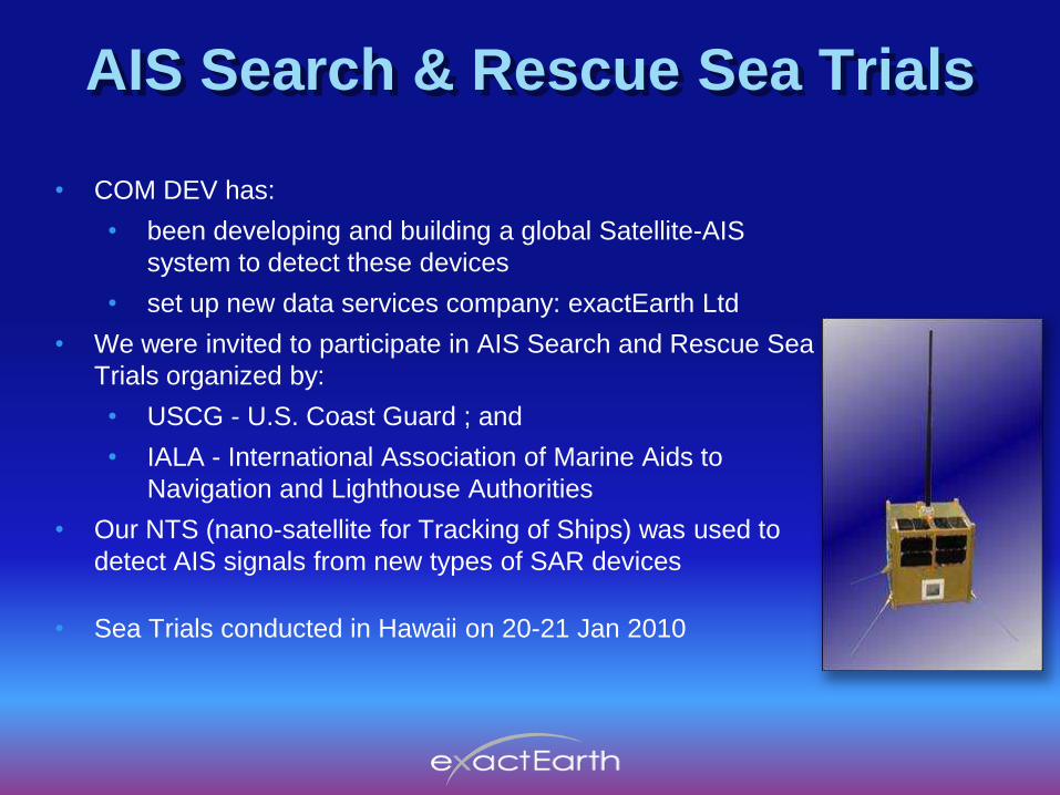
AIS Search & Rescue Sea Trials
• COM DEV has:
• been developing and building a global Satellite-AIS
system to detect these devices
• set up new data services company: exactEarth Ltd
• We were invited to participate in AIS Search and Rescue Sea
Trials organized by:
• USCG - U.S. Coast Guard ; and
• IALA - International Association of Marine Aids to
Navigation and Lighthouse Authorities
• Our NTS (nano-satellite for Tracking of Ships) was used to
detect AIS signals from new types of SAR devices
• Sea Trials conducted in Hawaii on 20-21 Jan 2010

AIS-SART Transmissions•For 20 years, SARTs were SAR “Radar Transponders” for use in life rafts
•AIS Search and Rescue Transmitters : AIS-SARTs :
•new devices authorized by IMO from 1 Jan 2010
•Low-power, battery operated devices
•designed for use in life raft or in water by users in distress
•Intended for detection by nearby vessels to assist in rescue
• Only 1/10 as strong as regular Class A AIS on a vessel (1 Watt vs 12.5 Watts)
• AIS-SART antenna usually near the water, and bobbing in the waves
• Adding AIS transmitter in a 406 MHz EPIRB could facilitate homing
• Transmits a special message defined by ITU: 8 quick bursts each minute,
alternating on channels AIS 1 & AIS 2:
Ch
1
Ch
2
Tim
eT
o
To +
1 min
To +
7 min
To + (8 min ±6s)
8
Frames
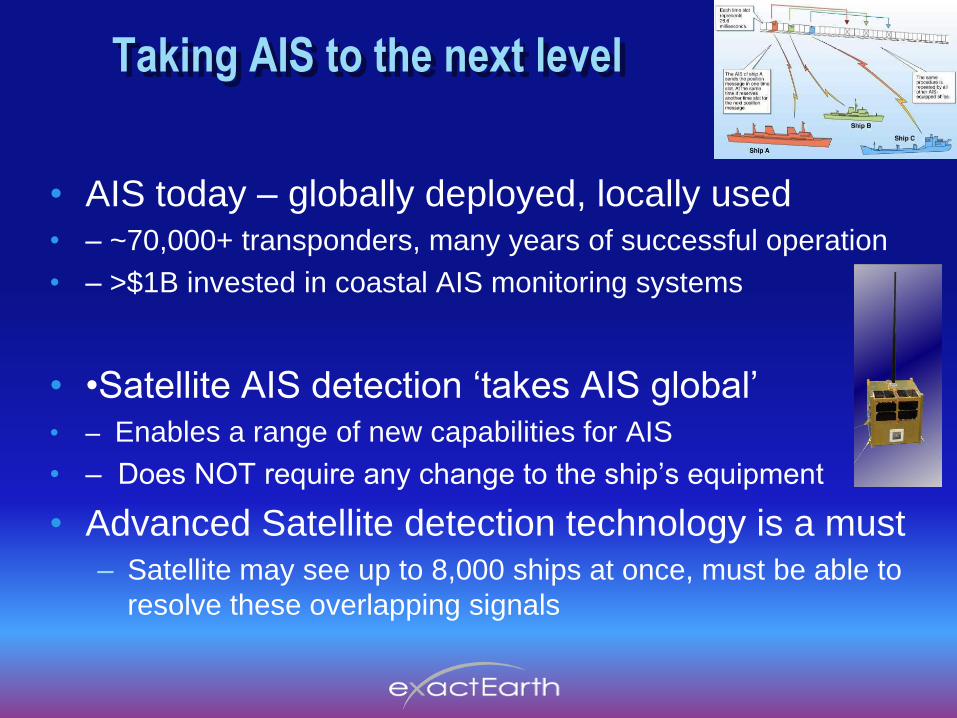
Taking AIS to the next level
• AIS today – globally deployed, locally used
• – ~70,000+ transponders, many years of successful operation
• – >$1B invested in coastal AIS monitoring systems
• •Satellite AIS detection „takes AIS global‟
• – Enables a range of new capabilities for AIS
• – Does NOT require any change to the ship‟s equipment
• Advanced Satellite detection technology is a must
– Satellite may see up to 8,000 ships at once, must be able to
resolve these overlapping signals

The Results – from NTS Demo Sat
Figure 3. Plot of AIS messages collected over first 6 months of NTS operations (Image
courtesy of AGI).
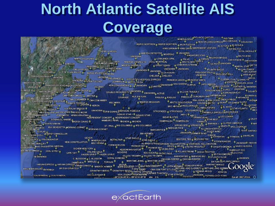
North Atlantic Satellite AIS
Coverage

Northern Australia

Our Satellites for AIS
• Satellites pass over North and South
Poles, like C-S LEOSAR system
• at 850 km altitude, satellite circles
the globe in 100 minutes
• Moving satellite “footprint” is about
the size of a continent (~5,000 km dia)
• From Earth, satellite moves across
the sky in about 10 minutes
• Satellite remains in one orbital plane
and the Earth rotates beneath it
• Therefore, one satellite scans the
entire globe in less than half a day
• More satellites coming soon...

Our S-AIS Principle of Operation
• Each satellites continually receives
AIS signals from all ships in its
footprint (1000‟s of ships !)
• Signals stored in satellite memory
• Memory data is encrypted & replayed
as satellite passes over next ground
receiving station
• Encrypted data is fed to the Data
Processing Centre where AIS signals
are extracted and forwarded to
authorized users
• Soon will have multiple satellites for
faster coverage (3 plus 3 more)
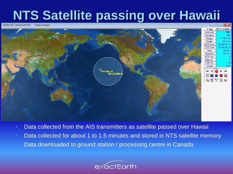
NTS Satellite passing over Hawaii
• Data collected from the AIS transmitters as satellite passed over Hawaii
• Data collected for about 1 to 1.5 minutes and stored in NTS satellite memory
• Data downloaded to ground station / processing centre in Canada

AIS Test Signals
• 5 different test units activated for sea trials near
Hawaii:
•1 AIS-EPIRB at 1 Watt
•3 AIS-SARTs at 1 Watt
•1 AIS Class A at 12.5 Watt (that incremented
its MMSI number every 2 sec)
•AIS devices deployed in water, above water, on
floating lifejacket or on vessel
•In addition, many ships in the Pacific Ocean were
transmitting regular AIS signals

AIS-EPIRB Floating in water

AIS-SART- On life jacket in water
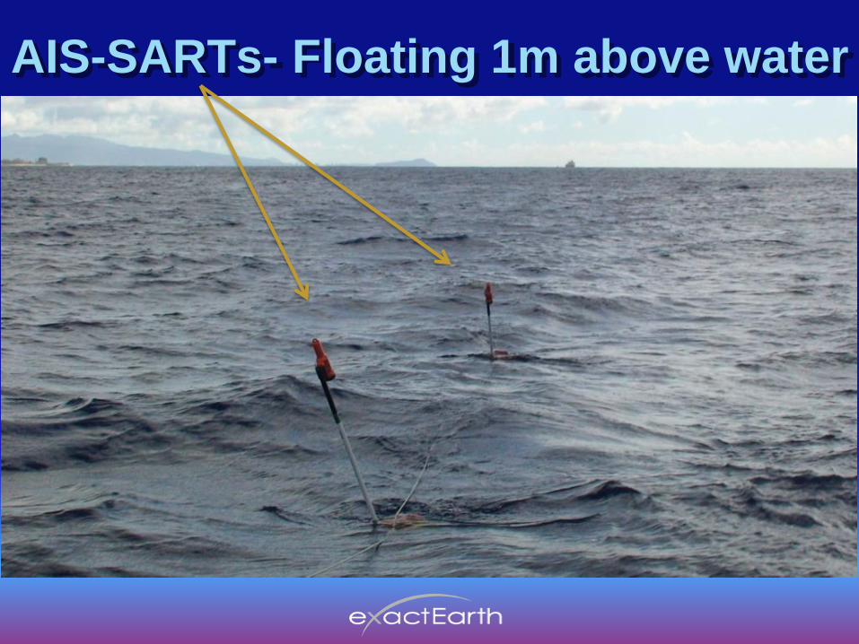
AIS-SARTs- Floating 1m above water
• 5 different test units activated for sea trials near
Hawaii:
•1 AIS-EPIRB at 1 Watt
•3 AIS-SARTs at 1 Watt
•1 AIS Class A at 12.5 Watt (that incremented
its MMSI number every 2 sec)
•AIS devices deployed in water, above water, on
floating lifejacket or on vessel
•In addition, many ships in the Pacific Ocean were
transmitting regular AIS signals

AIS-SARTs- on vessel railing
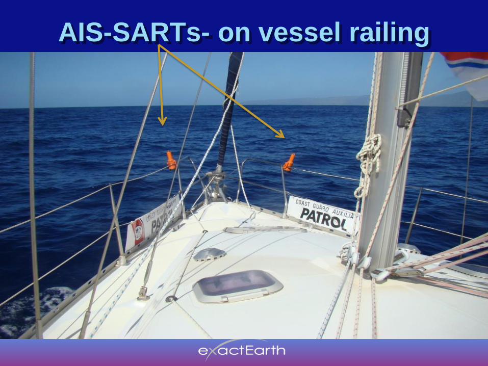
AIS-SARTs- on vessel railing
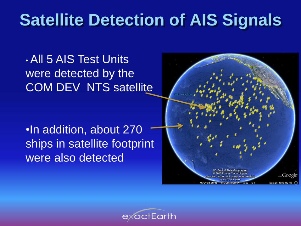
Satellite Detection of AIS Signals
• All 5 AIS Test Units
were detected by the
COM DEV NTS satellite
•In addition, about 270
ships in satellite footprint
were also detected

Satellite Detection of AIS Signals
Zooming in shows the unique MMSI number of
each ship‟s AIS transmitter:

NTS Satellite Passes
•NTS satellite passes during test period:
•Day 1: 20 Jan 2010 at 19:34:54 UTC (= 09:34:54 Hawaii time)
•Satellite collected AIS data for 90 seconds
•Elevation angle to the satellite = 14 degrees
•Distance to the satellite = 1,800 km
•Day 2, 21 Jan 2010 at 19:53:54 UTC (=09:53:54 Hawaii time)
•Satellite collected AIS data for 60 seconds
•Elevation angle to the satellite = 25 degrees
•Distance to the satellite = 1,300 km
•Multiple AIS bursts received from each Test Unit, approx equal number on
each AIS channel (AIS 1 & AIS 2)
•GPS position encoded in each message was plotted on map
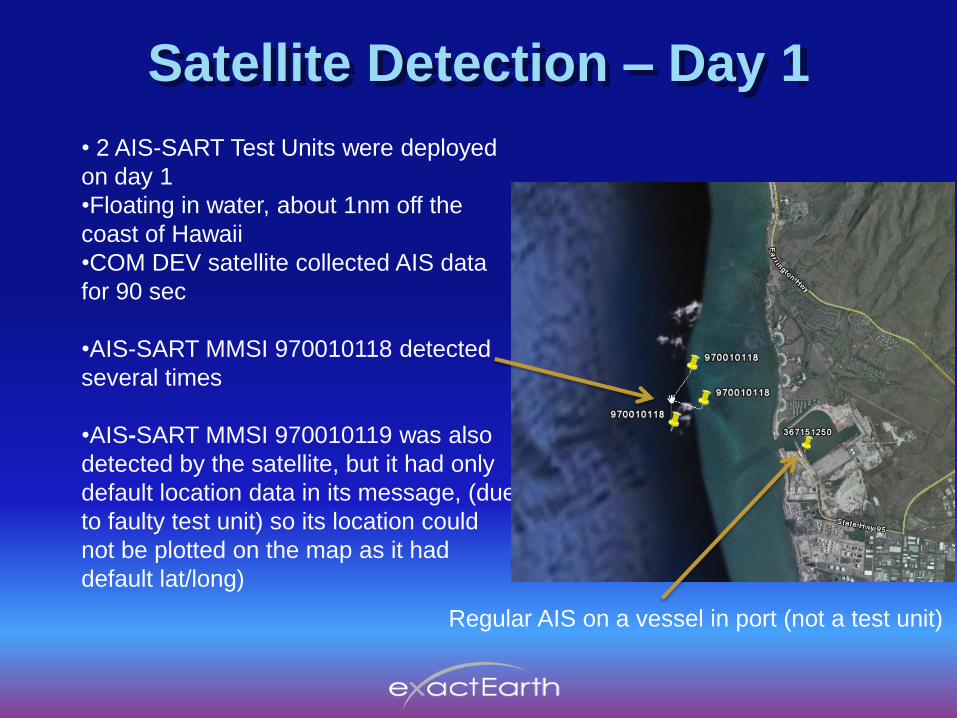
Satellite Detection – Day 1
• 2 AIS-SART Test Units were deployed
on day 1
•Floating in water, about 1nm off the
coast of Hawaii
•COM DEV satellite collected AIS data
for 90 sec
•AIS-SART MMSI 970010118 detected
several times
•AIS-SART MMSI 970010119 was also
detected by the satellite, but it had only
default location data in its message, (due
to faulty test unit) so its location could
not be plotted on the map as it had
default lat/long)
Regular AIS on a vessel in port (not a test unit)

Satellite Detection – Day 2
• 5 AIS-SART Test Units were activated
on day 2 while vessel in marina
•COM DEV satellite collected AIS data
for 60 sec
• All 4 low-power AIS-SARTs detected:
• 1 W in EPIRB- 970010117 and
• 1 W in SARTs- 970010118, 19 & 20
• Also detected 12.5 W Class A onboard
vessel

Satellite Detection – Day 2 (con’t)
Zooming in shows EPIRB & SARTs and cluster of multiple
bursts from Class A onboard vessel , with ID number changing
every 2 sec (...1515, 1516.... to 1544) during satellite‟s 60 sec

Satellite Detection – Day 2 (con’t)
Further zooming on ID number changing every 2 sec (...1515,
1516.... to 1544) during satellite‟s 60 sec data collection

SAR Aircraft ‘Homing’ Trials(from previous year sea trials-Florida -2009
0
20
40
60
80
100
120
140
160
406 EPIRB 121.5 Homer Radar SART A AIS EPIRB AIS SART AIS PLB AIS SART on VESSEL
Dete
cti
on
Ran
ge i
n N
M
20,000 ft
10000 ft
5000 ft
1000 ft
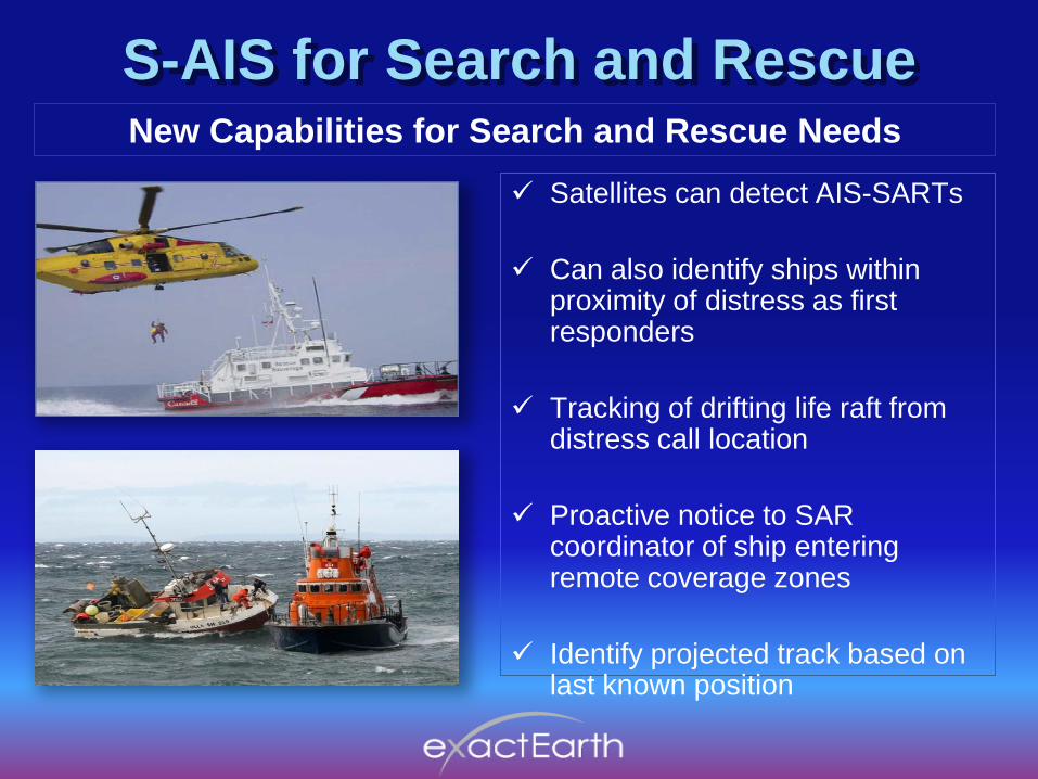
S-AIS for Search and RescueNew Capabilities for Search and Rescue Needs
Satellites can detect AIS-SARTs
Can also identify ships within proximity of distress as first responders
Tracking of drifting life raft from distress call location
Proactive notice to SAR coordinator of ship entering remote coverage zones
Identify projected track based on last known position

Satellite-AIS sees Vessels in Vicinity

Summary
• AIS-SART Sea Trials were a challenging environment:
– Low power transmitter (1/10 power of Class A)
– Device bobbing in waves and antenna near water
• Sea Trials demonstrated that AIS-SART signals are
detected by SAR a/c & vessels, ships in vicinity & satellites
• „Homing‟ distance far more than 121.5 MHz or Radar SART
• Satellite-AIS can also provide local and global coverage of
maritime traffic
• S-AIS data can be valuable tool for SAR forces
• exactEarth Ltd is pleased to be building this new tool and to
working with SAR forces
“Every Ship, Every Time”

T h a n k y o u
Need more information?
Website: www.exactearth.com
Phone: +1-519-622-4445
Email: [email protected]
“Every Ship, Every Time”
Top Related