VFR GUIDE FOR NORWAY - easa.europa.eu 2017... · A few points on mountain flying techniques _39 ......
52
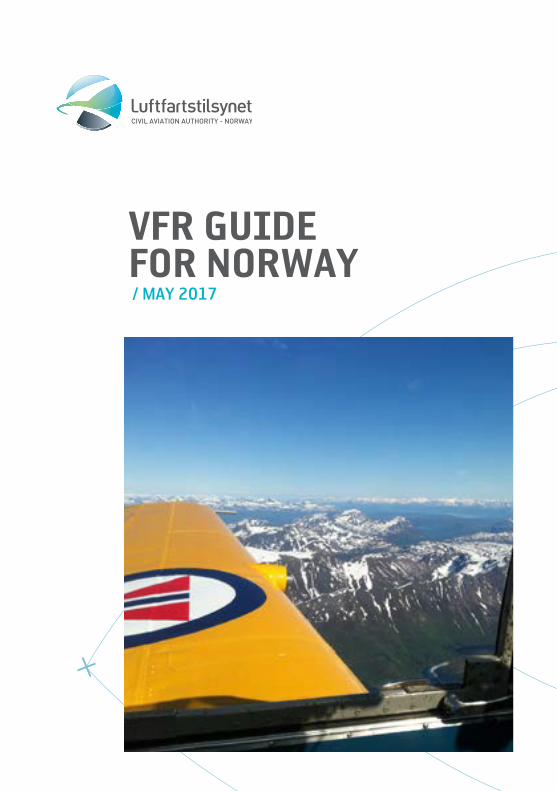
CIVIL AVIATION AUTHORITY - NORWAY VFR GUIDE FOR NORWAY / MAY 2017
Transcript of VFR GUIDE FOR NORWAY - easa.europa.eu 2017... · A few points on mountain flying techniques _39 ......
CIVIL AVIATION AUTHORITY - NORWAY
VFR GUIDE FOR NORWAY/ MAY 2017

1
1. INTRODUCTION
This booklet is made for the purpose of assisting you, as a VFR pilot, in your planning and conduct of flight within Norwegian Airspace. The information relates, in general to Lower Airspace. Lower Airspace is defined as that airspace up to Flight Level 195 (FL195).
Pilots of VFR flights within Norwegian Airspace below FL 195 are invited to consult this guidance material on the understanding that it does not represent a substitute for the more comprehensive information contained in the AIP. In the event of conflicting information in this guide, information in the AIP should be regarded as the authoritative source.
Please note that the Norway AIP can be viewed at: www.ippc.no
The vast majority of the Norwegian land masses consist of mountainous terrain with countless valleys and deep fjords.You will enjoy a spectacular scenery and great fun while flying in these areas, but >>>
you should also bear in mind that the environment may suddenly “bite” you during unfavorable flight conditions. During low level flight, obstacles like power spans and masts, some of them not or only partly marked, will also pose a significant threat to you and your air-craft.
This booklet tries to raise the awareness of such unfavorable flight conditions. Relevant rules and regulations applicable to VFR flights within Norway are covered and so is other information necessary for safe planning and conduct of flight.
Set your own limitations and prepare for the expected so you do not have to recover from the unexpected!
Welcome to Norway and Norwegian Airspace!
>

2
2. TABLE OF CONTENTS
INTRODUCTION _____________________________ 1
TABLE OF CONTENTS _______________________ 2
AIRCRAFT ENTERING NORWAY __________ 3Aircraft without standard certificate of airworthiness ___________________ 4Microlight entering /flying in Norway _______________________________ 5ICAO Flight plan________________________________ 5Mandatory flightplan for ENGM and ENBR ___ 5Slot requirements _____________________________ 6Parking charges _______________________________ 6Animals and pets ______________________________ 6Flights to Svalbard/Spitsbergen ______________ 8
FLIGHTPLANNING __________________________ 9Some risk factors ______________________________ 9Types of Manuals and Charts Available for Norway FIR ______________________10Chart updates __________________________________11Electronic flight bag ___________________________11Go/ No-go weather criteria ____________________12Visual Meteorological Conditions (VMC) _____13Weather minima for Special VFR Flights ____________________________13VFR night _______________________________________13VFR on top ______________________________________13Pre-flight Met Briefing ________________________14Autometar ______________________________________14Fuel Planning __________________________________15ICAO Flight plan________________________________15
AIRSPACE AND COMMUNICATION _____19Airspace ________________________________________20Operations in class D Airspace outside ATC operational hours ________________21Radio mandatory zone( RMZ) _________________22Aerodrome Flight Information Service (AFIS) __________________________________22Phraseology at airports where AFIS is provided ________________________22VFR routes inside CTR/TMA ___________________23Cruising levels _________________________________23Prohibited, restricted and danger areas _____24Language requirements _______________________25SSR Transponder ______________________________25
VFR-flights under Oslo TMA ___________________26Use of frequency 123.500 ____________________26Airspace Infringement ________________________27Mandatory Occurrence reporting _____________28The new regulation ____________________________28Who – is required to report ___________________28What – shall be reported ______________________28How – to file a report __________________________28How soon – the report must be filed _________29Why – occurrence reporting __________________29Just Culture ____________________________________29What will the information be used for ________29Aeronautical information ______________________29
EMERGENCIES ______________________________31Search and Rescue Services (SAR) ___________31SAR helicopters ________________________________31Use of ELT and Personal Locator Beacon ( PLB) _________________________32
FLIGHTS IN MOUNTAIN AND REMOTES AREAS ____________________________33Short field operations _________________________35Balked Landing lights __________________________35Takeoff _________________________________________36Downdrafts _____________________________________36Windshear _____________________________________37Wind ____________________________________________38Icing ____________________________________________38Enroute _________________________________________38A few points on mountain flying techniques _39Landing _________________________________________39Wires ___________________________________________40Automatic obstacle warning systems _________41Whiteout and Brightout _______________________41
OTHER INFORMATION _____________________43Bird Hazards ___________________________________43Protection of Reindeer against Noise from low flying aircraft _________________44Drones __________________________________________44Photographing _________________________________45Use of Intoxicating Liquor, Narcotics or Drugs _____________________________45Useful telephone numbers ____________________46

3
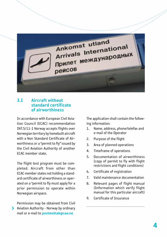
3. AIRCRAFT ENTERING NORWAY
Aircraft entering or leaving NorwayFirst landing in Norway shall be done at airports where custom services are available.
NORWEGIAN INtERNAtIONAlAERODROmEs
BERGEN/Flesland FAGERNES/LeirinHARSTAD/NARVIK/Evenes HAUGESUND/Karmøy KIRKENES/Høybuktmoen MOLDE/ÅrøMOSS/RyggeNARVIK/FramnesOSLO/GardermoenRØROS SANDEFJORD/TorpSTAVANGER/Sola TROMSØ/Langnes TRONDHEIM/Værnes ÅLESUND/VigraBODØ KRISTIANSAND/KjevikSVALBARD/Longyear
Aircraft entering Norway has to file flightplan at least 60 minutes before departure. Private operated aircraft with MTOW 5700 kg and a maximum of 10 passengers may also use other airfields, it that case, a complete ICAO flight plan shall be sent to the Directorate of Customs and Excise at the latest 4 hours prior entering or leaving Norwegian territory. AIS/NOTAM may help you to forward a copy of your flight plan to the Directorate of Customs and Excise upon request.
If stated arrival/departure times has to be changed, the Directorate of Customs and Excise shall be notified ASAP: Fax: (+47) 22 86 08 00 or [email protected]
Aircraft shall not depart before the time stated in the FPL without prior permission from the Customs service.Persons who arrive with the aircraft shall not leave the aircraft prior to the arrival time stated in the FPL.
Goods carried on board shall not be removed from arrived aircraft prior to the arrival time stated in the FPL.
Aircraft shall only carry goods which: 1. Can be imported/exported free of tax and toll
according to existing rules of exceptions from these Regulations,
2. Are not included in the import/export restrictions, and not require clearance.
4
3.1 Aircraft without standard certificate of airworthiness
In accordance with European Civil Avia-tion Council (ECAC) recommendation INT.S/11-1 Norway accepts flights over Norwegian territory by homebuilt aircraft with a Non Standard Certificate of Air-worthiness or a “permit to fly” issued by the Civil Aviation Authority of another ECAC member state.
The flight test program must be com-pleted. Aircraft from other than ECAC member states not holding a stand-ard certificate of airworthiness or oper-ated on a “permit to fly must apply for a prior permission to operate within Norwegian airspace.
Permission may be obtained from Civil Aviation Authority - Norway by ordinary mail or e-mail to [email protected]
The application shall contain the follow-ing information: 1. Name, address, phone/telefax and
e-mail of the Operator
2. Purpose of the flight
3. Area of planned operations
4. Timeframe of operations
5. Documentation of airworthiness (copy of permit to fly with flight restrictions and flight conditions)
6. Certificate of registration
7. Valid maintenance documentation
8. Relevant pages of flight manual (Information which verify flight manual for this particular aircraft)
9. Certificate of Insurance
>

5
3.2 microlight entering / flying in Norway
In order to cross the border and fly mi-crolight in Norway, you will need a permis-sion from from Civil Aviation Authority –Norway.
Permission may be obtained from Civil Aviation Authority - Norway by ordinary mail or e-mail to [email protected]
The application shall contain the follow-ing information: 1. Name, address, phone/telefax and
e-mail of the Operator
2. Purpose of the flight
3. Area of planned operations
4. Timeframe of operations
5. Certificate of registration
6. Certificate of Airworthiness
7. Valid maintenance documentation
8. Certificate of Insurance
9. Pilot license
10. Medical certificate
11. Radio license+ documentation for English language proficiency
3.3 ICAO Flight plan
Aircraft entering Norway has to file a flightplan at least 60 minutes before the departure. See page 3 for information regarding flightplans and customs.
For your own safety, you should always file a flight plan with ATS. This can be
done via www.ippc.no A flight plan may also be filed by phone to the national AIS/NOTAM office located at ENGM, tel. (+47) 64 81 90 00.
When calling, be sure to have your com-pleted FPL handy and ready to read to the AIS-operator. The FPL should be delivered within Norway: 60 minutes prior to ETD.
A complete flight plan is mandatory for: • All flights when a national border
crossing is required. • All flights within EN-R402
(Finnmark). • All flights where Search and Rescue
(SAR) is requested.
3.4 mandatory flightplan for ENGm and ENBR
Bergen Flesland ( ENBR)A complete ICAO FPL is mandatory for all flights (IFR and VFR) to/from the aerodrome. ATC is authorized to make exemptions from this requirement.
Oslo Gardermoen (ENGM)The following regulations are in force for both IFR and VFR flights within ENGM CTR:a. Carriage and use of SSR transpond-
er is mandatoryb. A complete ICAO FPL shall be sub-
mitted prior to flightc. School flights/training flights are
not permitted
>
>
>

6
3.5 slot requirements
Allocation of departure and arrival times is compulsory for all flights at Oslo airport, Gardermoen. At Oslo airport, Gardermoen, applica-tion for “slot-time” shall be submitted to Avinor scheduling coordinator:tel. (+47) 64 81 90 00E-mail: [email protected].
At Bergen airport, Flesland, Prior approv-al (”slot-time”) is mandatory for all flights, except:• aircraft using the aerodrome as
alternate due to meteorological,• technical or safety reasons• aircraft on ambulance-, search- or
rescue mission• helicopters• VFR-flightsAt Bergen airport, Flesland, application
>>>
for “slot-time” shall be submitted to Air-craft Parking Office, preferably via e-mail: [email protected]. (+47) 67 03 15 70
3.6 Parking charges
All aircraft parking on Avinor airports are subject to parking charges, except air-craft operated by flight schools and flying club members ( AOPA/ IAOPA members included).
These aircraft are exempted provided they are operated on a non-commercial basis and have MTOM 2730 Kg or less.
3.7 Animals and pets
No animal may be brought into Norway without an import license from the Norwegian Animal Health Authorities:tel: +47 23216800 [email protected]
>
>
>

7
8
3.8 Flights to svalbard/spitsbergen
If you are planning to fly to Svalbard/Spitsbergen, an application has to be submitted to reach the Civil Aviation Authorities (CAA-Norway) at least two working days prior to the planned arrival at the islands. Same information recuired as described in 3.1.
Please observe that flights for sight-see-ing purposes are prohibited on Svalbard, and private flights may require special permission from the Governor of Svalbard (Sysselmannen). Fuel and oil may only be available if arranged specifically.
You shall, when flying over the high seas, carry a minimum of one portable ELT, life raft(s) able to carry all occupants, sur-vival suits, emergency rations, first aid kits and blankets.
Weather conditions at Svalbard can be very unstable and local variations prom-inent. Reliable weather reports/info may sometimes be hard to obtain, which calls for considerable attention while assess-ing flight conditions in these areas.
Larger fjords are often ice-free, even during winter, due to strong currents.This often results in frost mist and/or low dense fog.
During winter, winds of more than 20 kts will always result in drifting snow, due to the fine-grained and dry snow. The
danger of whiteout is always present. You have to be familiar with Polar Region navigation when flying in Svalbard and its surroundings.
According to the Norwegian Operational Regulations (BSL D), aircraft operating in Svalbard and its surroundings shall be of such colour that it will give good con-trast to over-flown terrain.
Otherwise the aircraft shall be marked with fluorescing paint or adhesive folio in colour of red, yellow or orange.
On airplanes, these markings shall be placed on both sides of the wings, air-frame or tail section. Total marked area shall not be less than 2 m².
Flying with Ultra-light aircraft to/from Svalbard is prohibited.>

9
4. FLIGHTPLANNING
4.1 some risk factors
Aircraft Equipment and maintenance? Any main-tenance problems that should be taken care of?
Performance Fuel Consumption, weight and balance, field elevation and runway length avail-able.
EnvironmentHow is the weather? Day or Night oper-ations? What type of terrain and airfields are involved?
External pressureWhy are you making the trip? Limited on time or demanding passengers? Have an alternative travel plan been discussed before the trip started?
FlightplanningEvery flight must be preceded by a certain amount of plan-ning. This could begin with determination if you are fit to fly. Weather considerations, selection of route to fly, aircraft performance calculations and pre-flight inspections of the aircraft and its systems follows.
Always check NOTAMs and if planning to use private airfields, remember to call the owner for permission to land and to obtain airfield conditions.
10
4.2 types of manuals and Charts Available for Norway FIR
Aeronautical Information Publication (AIP) Norway in English is available at: https://avinor.no/en/ais/aipnorway
IPPC – Internet Pilot Planning Center: www.ippc.no is the internet address for Avinor’s web-based information and flightplanning tool.
The site is linked to NAIS, Norwegian Aeronautical Information System. Here you can obtain briefings, weather reports and forecasts, map-updates and also check AIP-Norway online.
Jeppesen Bottlang Airfield Manual, ScandinaviaThe Manual contains a general section and country related parts with Commu-nications, Meteorology,Regulations, Aerodrome Directory as well as Visual Approach, Landing and Area Charts. Updated by a monthly revision service.
VFR Trip-kit NorwayThe Jeppesen Bottlang Airfield Manual covering Norway only. No revision service.
www.norskeflyplasser.noThis is an unofficial website in Norwegian covering both the major airfields as well as most of the small dirt and grass fields around.
Warning: This is a private web-page and data published here is NOT verified and/or checked by the Norwegian authorities. Norwegian language only.
Aeronautical Chart ICAO, 1:500 000 These charts are often preferred by pilots for VFR cross-country flights. 3 charts covering Norway:
• Southern Norway• Central Norway • Northern Norway
>>>
>
>

11
M517 Air Aeronautical Charts, 1:250 000 Provides higher detail level. 16 charts covering Norway:
• Kristiansand • Bergen
• Rjukan • Oslo
• Førde • Otta
• Molde • Trondheim
• Namsos • Mosjøen
• Bodø • Narvik
• Tromsø • Kautokeino
• Hammerfest • Kirkenes
4.3 Chart updates
At www.ippc.no, under AIS publications –CHAD NOR, you will find the latest chart updates for 1:500 000, and 1:250 000 series.
4.4 Electronic flight bag
The technological evolution has intro-duced several types of electronic equip-ment for aiding the pilot during flight. Most aircraft today are equipped with some type of GPS for aiding in navigation, and several types of situational aware-ness systems are being introduced in even the smallest of aircraft.
For permanently installed equipment, updating procedures are usually in place, while that may not be the case for non-permanent equipment. Several types >>>
of handheld pads are available with more or less professional software and apps, that the pilot himself need to update.
Although these “low-cost” solutions may work excellently for most situations, they are more vulnerable than permanent solutions and updated paper maps.
It is good airmanship to come prepared, and paper maps should be available cov-ering the planned route.
CAUTION:Please beware of obstacles that might not be shown on your map. Masts and high- tension power lines are constant-ly being build and caution is especially advised when flying along fjords, valleys and in the vicinity of islands along the coast. Especially power lines are almost impossible to see, and they frequently cross fjords and inlets.
>

12
4.5 Go/ No-go weather criteria
(***) Flight visibilities reduced to not less than 1500 m may be permitted for flights operating:a. At speed of 140 kts IAS or less to
give adequate opportunity to observe other traffic or any obsta-cles in time to avoid collision;
b. Or, in circumstances in which the probability of encounters with other traffic would normally be low, e.g in areas of low volume traffic and for aerial work at low levels;
c. Helicopter can operate in less than 1500 m but not less than 800 m flight visibility, if maneuvered at a speed that will give adequate op-portunity to observe other traffic or any obstacles in time to avoid collision. Flight visibilities lower than 800 m may be permitted for special cases, such as medical flights search and rescue operations and firefighting.
ALTITUDE BAND AIRSPACE CLASS
FLIGHT VISIBILITY
DISTANCE FROM CLOUD
At and above 3050 m (10000 ft) AMSL B C D E F G 8 km 1 500 m horizontally,300 m (1000 ft) vertically
Below 3050 m (10000 ft) AMSL and above 900 m (3000 ft) AMSL, orabove 300 m (1000 ft) above terrain, whichever is the higher
B C D E F G 5 km 1 500 mhorizontally,300 m (1000 ft) vertically
At and belov 900 m (3000 ft) AMSL, or 300 m (1000 ft) above terrain, which-ever is the higher
B C D E 5 km 1 500 mhorizontally,300 m (1000 ft) vertically
F G 5 km(***) Clear of cloud and with the surface in sight
13
4.6 Visual meteorological Conditions (VmC)
4.7 Weather minima for special VFR Flights
Upon request to TWR, a clearance to fly special-VFR within the CTR may be ob-tained, provided:
• Day or night conditions• the ground and flight visibility is not
less than 3 km (1,5 km with the air-field in sight)
• the speed does not exceed 140 kts IAS
• intention is to conduct the whole flight within the control zone
• intention is to enter the control zone and land at the aerodrome within the control zone.
4.8 VFR night
During the period between the end of evening civil twilight and the beginning of morning civil twilight, VFR night can be done according to SERA 5005 c.
Civil twilight summary for Norwegian airports may be generated at www.civiltwilight.me
4.9 VFR on top
Due to the possibility of an engine failure while flying VFR on top in a single engine aircraft, you should always be certain >>>
>

14
that the cloud base is equal to or higher than Minimum Safe Altitude (MSA), 10 nm either side of your planned route.
To calculate your MSA on the ICAO 1:500 000 chart, you should add 1000 ft to the published Maximum Elevation height (printed in each quadrangle) along your route.
This will give you a safety margin of 1000 ft above the highest obstacle including any unmarked obstacles.
4.10 Pre-flight met Briefing
Met briefings can be obtained from the following three MWO’s:Oslo tel. (+47) 22 69 25 62Bergen tel. (+47) 55 23 66 50 tromsø tel. (+47) 77 62 13 00
In addition the following local MET offices are available:Bardufoss - ENDU (+47) 67 03 44 85Bodø - ENBO (+47) 75 53 72 80 >>>
METAR, TAF,SIG-WX, SIGMET, ICE AIRMET, IGA-prognosis and NOTAMS can be obtained from all ATS-units.
RMK: IGA-prog, a special forecast pro-vided mainly for VFR-flights below FL100, are available for most areas of Norway.
ATS units are connected to the Norwe-gian Aeronautical Information System (NAIS), which means that NOTAMs and various AIS and MET bulletins, including the special area forecasts for lowland, coast and fjord districts of Norway (IGA-forecast), are provided by all ATS units.
Planning information is also available via internet: www.ippc.no
4.11 Autometar
The use of Autometar is approved by CAA-Norway on airports where the AWOS - Automatic Weather Observation System is currently used. This is an automatic weather report based on the AWOS observations, and used outside the ATS-unit opening hours.
In non-significant weather conditions there are normally not any difference between Autometar and manual Metar.
In significant weather conditions there are quite often differences between measured and actual visibility, both >>>
>
>
>

15
horizontal and vertical, and in the present of the weather phenomena.
The following codes are used exclusively by Autometar and will not occur on the official Metar:
The suffix /// is used after all clouds, i.e: FEW040///NCD – No Clouds DetectedNDV – No Directional VariationsUP – Unidentified Precipitation
An Autometar will always be identified by the term AUTO, i.e:ENAl 060250Z AUtO 24010Kt 9999...
4.12 Fuel Planning
An operator of an aircraft must take all necessary steps to ensure that the air-craft is carrying sufficient fuel and oil to enable the proposed flight to be under-taken in safety. The regulations require that you have enough fuel onboard to fly to your destination and then for 30 minutes.
CAA-Norway recomends the following practice to achieve safe fuel planning:
• Make sure you know the aircrafts total fuel capacity and usable fuel.
• Check weight and balance, you might not be able to depart with full tanks.
• Determine fuel consumption and >>>
make sure you take any headwind component into consideration as well.
• Check Notams to make sure you know the status of fuel supply on aerodromes along your route. Note that opening hours for fueling may vary from ATS opening hours. Also note that 100LL might not be available on all aerodromes.
• Always plan to arrive with your fuel reserve intact, never plan to use any reserve to get to your destination.
• Keep the weather in mind, sudden changes are common in Norway. Holding or diversion might become necessary. Make sure you are pre-pared for this eventuality.
4.13 ICAO Flight plan
For your own safety, you should always file a flight plan with ATS. This can be done via www.ippc.no
A flight plan may also be filed by phone to the national AIS/NOTAM office located at ENGM, tel. (+47) 64 81 90 00. >>>
>
>

16
When calling, be sure to have your com-pleted FPL handy and ready to read to the AIS-operator.
The FPL should be delivered no later than 60 minutes before EOBT.
Filing a flightplan via ippc.no: For access to the flight planning tool you need a username and password.
You choose the username and password yourself and apply for access by complet-ing and submitting the form under “Logon to Flightplanning – New User” window at IPPC. This is subsequently authorized by the AIS-office located at Oslo-Gardermoen airport.
Due to capacity limitations in the flight plan processing, foreign users will be granted access for a limited time, and only flight plans into, out of or within Norway will be accepted.
Taking off or landing on airstrips without a four letter ICAO designator; field 13 and/ or 16.With effect 18 OCT 2012 departure and/or arrival aerodromes without an ICAO 4-letter code shall be filed in a FPL as follows:
• If the flight departs from an aero-drome without an ICAO 4-letter code, ZZZZ shall be entered infield 13 in the FPL. Enter DEP/ followed by geographical name and lat/long >>>
• position in field 18 of the FPL.• If the flight arrives at an aerodrome
without an ICAO 4-letter code, ZZZZ shall be entered in field 16 of the FPL. Enter ARR/ followed by geo-graphical name and lat/long position in field 18 of the FPL.
• If alternate aerodrome(s) without an ICAO 4-letter code are filed, ZZZZ shall be entered in field 16 of the FPL. Enter ALTN/ followed by geo-graphical name and lat/long position in field 18 of the FPL. If more than one alternate is filed in the FPL, use ALTN1/ and/or ALTN2/ respectively.
Routing; field 15.Although legal, the use of DCT in the route-field is not recommended.
ATC prefers to have a reasonable clue to where you intend to fly and i.e an ap-proach controller will not necessarily know exactly where you will enter a TMA if you are on a long DCT route between two other airports and happens to transit a TMA in between.
Of course, you may still fly on a direct track, but please file a point on the route for at least every 30 mins. flight time.
This can be filed either a geographical name, a lat/long position, a Navaid, a five-letter Sigpoint or a fix given as a VOR radial and DME. (I.e. FLO065040 –a point on FLO radial 065 at DME 40 from FLO.) >>>

17
NOTE:DO NOT use the four-letter ICAO desig-nator for airports you overfly along the route as a point in the in the routing filed under item 15 in the flightplan. This is to avoid confusion as to whether you will be landing at these airports. Please use a Navaid at the airport or the airport name instead in the routing.
The term “coastwise” will sometimes be used by both ATC and pilots to describe a routing along the coast. In some places this may be very accurate, but due to the amount of fjords, inlets and islands along Norway’s coastline we would like you to file a few points along the route instead. Thereby we avoid confusion about your intended route.
Changing the EOBT.If you like to bring your EOBT forward or delay your flightplan, this is not a problem.
Notify ATC or call AIS (tel. (+47) 64 81 90 00 (H24)) if you change the EOBT more than 30 mins. either way.
Please bear in mind that some airports are slot-restricted and make sure your slot time is adjusted accordingly.
Departure messageDeparting from an airfield where ATS is not provided, the pilot must transmit a departure message by one of the follow-ing means: >>>
• Telephone from a person on the ground as arranged between the pilot-in-command and the person involved.
• A statement by the pilot-in-com-mand that EOBT (Estimated Off-block Time) in the flight plan shall be considered as ATD.
• By giving the time, considered to be ATD, to AIS/ NOTAM by phone immediately prior to departure. (tel. (+47) 64 81 90 00)
• By radiotelephony to ATS after de-parture.
• The flight plan will not be activated unless one of the above procedures has been complied with.
Delays and/or changes to flightplanIf a delay of more than 30 mins. occur or you have to make a planned change to your FPL, notify the local ATS-unit or AIS/NOTAM in order to send a DLA or CHG message.
Arrival reportArrival report and closure of the flight plan must be made within 30 minutes after ETA, or else SAR procedures will be initiated.
If an arrival report is not expected to reach the appropriate ATS unit within 30 minutes after ETA, item 18 in the flight plan shall contain the latest time at which an arrival report can be expected.
The pilot or the operator may be charged >>>

18
for the total costs of SAR operations if the pilot has failed to comply with the appropriate rules for notification to ATC of:
• Deviations from the flight plan, or • Not closing the flight plan, resulting
in initiation of SAR operations.
Note: If you are planning to use Oslo airport, Gardermoen, allocation of departure and arrival times (Slot time) are compulsory.
Application for slot time for AD Hoc busi-ness, MIL and general aviation flights, shall be submitted to Avinor scheduling coordinator: tel: (+47) 64 81 90 00E-mail: [email protected]
>

19
AIRsPACE AND COmmUNICAtION
5. AIRSPACE AND COMMUNICATION

20
5.1 Airspace
In Norway we have standard class C, D, and G airspace. Class E and F not in use. In general separation standards are not applied by ATC to or between VFR flights and therefore separation from other aircraft remains the responsibility of the pilot in command of a VFR flight.
The exception to this applies in Class C Airspace – where ATC will separate VFR from IFR but not VFR from VFR.
When flying through class C and D air-space it is mandatory to obtain an ATC-clearance.
When flying through class C and/or D airspace you will be given a clearance from the appropriate ATS-unit.
Please note that a clearance given by one ATS-unit is not automatically a clear-ance to continue into a neighboring ATS- unit’s area. Always check before flying into the next area.
NOTE:Prior to departure, TWR will issue a clear-ance to leave the CTR. This will normally contain a routing, altitude limit and a transponder code. This is NOT a depar-ture clearance or clearance to enter any taxiways or runways!

21
5.2 Operations in class D Airspace outside AtC operational hours
Established as Control Zone (CTR) No clearance is required to operate as a VFR flight in class D airspace, established as a CTR outside the published hours of service of the unit responsible for pro-viding service in the CTR.
Flights are, however, in such period re-quired to maintain listening watch on the control frequency and blind transmitting of position and intention is recommend-ed.
Flights are, however, not permitted to take off or land at state owned controlled aerodromes unless ATC is provided, and not to operate within a CTR between the end of evening civil twilight and the be-ginning of morning civil twilight unless a clearance has been obtained from an appropriate ATS unit.
Established as Terminal Control Area (TMA) A clearance to operate in class D airspace, established as a TMA, outside the pub-lished hours of service of the ATC unit normally providing service within the airspace, may be obtained from the ap-propriate ACC which may specify condi-tions to be complied with.
Use of aerodromes outside published opening hours >>>
Avinor allows use of most of their aerodromes outside published opening hours for non-commercial flights, in accordance with specific terms and con-ditions, except ultralight aircraft.
The PIC must hold a valid Avinor ID-card and submit a flight plan. The flight must be in accordance with VFR during the period of 0600 – 2200UTC.MTOM of the aircraft must not exceed 2730 KG.
The aerodrome will not be manned outside published opening hours, and it is the PIC’s responsibility that the flight is conducted in a safe manner, cfr. BSL D 1-2 4-1. The permission only allows for take off and landing, alternatively touch and go.
Use of an aerodrome as destination must be conducted during published opening hours and aircraft parking must be ar-ranged prior to arrival at most airports.ENGM, ENZV, ENBR, ENVA, ENTC, ENSB and ENVR is excepted from the general permission to use Avinor aerodromes outside published opening hours. Pre-flight procedures by the PIC, by obtain-ing a Avinor ID-card and submitting a flight plan is required.
In case of questions, please contact the AD in question, or use [email protected] and the subject “Outside HR of OPR”
>

22
5.3 Radio mandatory zone ( RmZ)
TIA and TIZ, and CTR outside the opening hours of the ATC unit, are classified as RMZ. Pilots shall maintain continuous air-ground voice communication watch and establish two-way communication, as necessary, on the appropriate com-munication channel in RMZ.
Before entering a radio mandatory zone, an initial call containing the designation of the station being called, call sign, type of aircraft, position, level, the intentions of the flight and other information as prescribed by the competent authority, shall be made by pilots on the appropri-ate communication channel.
5.4 Aerodrome Flight Information service (AFIs)
Traffic Information Areas (TIA) and Traffic Information Zones (TIZ), both G-class airspace, are established at air-ports where the traffic is relatively light and therefore only AFIS is provided (call sign + INFORMATION).
Hence, the responsibility for avoiding collisions solely rests with the pilots when flying in to or out from these airports.
Two-way radio contact with AFIS is man-datory, while flying within TIA and TIZ. >>>
The AFIS unit will state runway in use, weather conditions, time and traffic in-formation.
5.5 Phraseology at airports where AFIs is provided
An AFIS unit shall be identified by the name of the aerodrome followed by the word INFORMATION, e.g. VALAN INFOR-MATION.
At airports where AFIS is established, the AFIS unit shall use relevant phrase-ology from ICAO Doc 4444, PANS-ATM Chapter 12 and BSL G 8-1. When AFIS relays ATC clearances the name of the ATC unit shall be included.
Requirements for read-back to an AFIS unit are described in BSL G 8-1, refer-ence is made to AIP GEN 1.7. In addition the following phraseologies are available:
• RUNWAY IN USE (number)• RUNWAY FREE• RUNWAY OCCUPIED (reason)• (reason for why the runway is not
free) RUNWAY AVAILABLE FOR LINE UP (or TAXI, or TOWING)
• REPORT POSITION (or ALTITUDE, or LEVEL)
• REPORT PASSING (altitude)
Phraseologies used exclusively while flying at an AFIS aerodrome: “RUNWAY FREE” means that the runway >>>

23
is clear of other traffic and usable for taxiing, takeoff or landing.
“RUNWAY OCCUPIED” means that the runway is occupied by other traffic and not usable for taxiing, takeoff or landing.
“INFORM (ME)…..” is a request to the pilot to inform AFIS of PASSING (or PASSING OVER or ON or AT), POSITION and/or ALTITUDE.
Pilots report their whereabouts, intentions, position in the circuit, AIR-BORNE (time) and LANDED (time).
5.6 VFR routes inside CtR/tmA
These published VFR-routes are to be used for flight planning purposes and the clear-ances issued will state the reporting points to identify the route.
The cleared route with specified altitude limitations and related procedures shall be complied with unless weather conditions necessitate to divert from the clearance.
The diversion or need for a diversion from the clearance shall be transmitted to ATC as soon as possible.
5.7 Cruising levels
24
5.8 Prohibited, restricted and danger areas
Prohibited AreasProhibited areas are not established in Norwegian airspace.
Restricted AreasRestricted areas and restricted areas which are active only as notified by NOTAM are promulgated in AIP Norway.
Restrictions concerning EN R402 - Fin-nmark County Non-scheduled and private flights may only take place within the area provided a complete flight plan has been filed prior to departure. The route to be flown must be specified.
For VFR-flights entirely within the CTR or TIZ only, it is sufficient to give the ATS-unit information regarding the flight prior to departure.
VFR-flights operating entirely within the TIZ outside ATS opening hours may do so, given certain criterias have been fulfilled and prior permission has been arranged with Bodø ATCC: (+47) 75 58 29 57
Danger AreasDanger areas which are continuously active, and danger areas which are active only as notified by NOTAM - are promul-gated in AIP Norway. In other cases danger areas are promulgated by NOTAM only.
Based on information given by the agency responsible for the activity, the upper limits of danger areas are promulgated as:
• an altitude (FT AMSL), when the upper limit is at 10000 FT or below, or
• a flight level (FL), when the upper limit is above 10000 FT.
By promulgation of the upper limits as a flight level (see para b above) due regard is taken to possible deviations from the standard atmosphere. The promulgated upper limit of a danger area can always be considered as safe.
In addition to the upper limit of the ac-tivity, a “buffer” of 1000 FT (2000 FT above 25000 FT) is included. It is the pilots responsibility to avoid all danger areas, however ATC can give advise and guidance regarding the circumnavigation of these.
ATC will also order a stop in the activity if a controlled flight has to be cleared closer to a danger area than the pre-scribed minimum.
Real time activationFor a few of the danger areas - promul-gated as continuously active - a real time activation is practiced. >>>
>

25
Hence all activity in the danger area con-cerned is coordinated between ATC and the agency responsible for the activity.
The agency responsible for the activity will inform ATC prior to the activation. Based on this information, ATC will always be able to inform the pilot in command regarding the status of a real time acti-vated area, whether it is active or non-ac-tive.
Information regarding a non-active area is valid for a limited period of time only, normally 30 MIN.
Unless the pilot in command has obtained information on a danger area being non-active, the area shall be considered as continuously active within the prom-ulgated time period.
Danger Areas - Continuously activesee AIP Norway ENR 5-1.
5.9 language requirements
Use of standard phrases for radio teleph-ony communication between aircraft and ground stations is essential to avoid misunderstanding the intent of messag-es and to reduce the time required for communication.
Users of air band radios are required to hold a valid Radio Telephone license. These documents shall confirm language >>>
proficiency level equal to ICAO standards. Primary language for aviation communi-cation is English, but Norwegian may of course also be used.
5.10 ssR transponder
Transponder equipped VFR-flights shall select code 7000, unless otherwise in-structed by the appropriate air traffic services unit. SSR transponder mode S is not manda¬tory in Norway. Always use Mode C for vertical separation purposes.
Transponder operating proceduresWhen an aircraft carries a serviceable transponder, the pilot shall operate the transponder at all times during flight, regardless of whether the aircraft is within or outside airspace where SSR is used for ATS purposes.
Except emergency or communication failure, the pilot shall:
• Operate the transponder and select codes as individually directed by the ATS unit with which contact is being made.
• Unless otherwise directed by ATS, operate the transponder on the last assigned code, until aircraft has landed.
• In the absence of any ATS direc-tions, select code as follows: VFR-flights: Code 7000.
>>>
>

26
When the aircraft carries serviceable Mode C equipment, the pilot shall con-tinuously operate this mode, unless otherwise directed by ATS.
If you are flying in a formation, only the formation leader shall operate the tran-sponder, unless otherwise directed by ATS.
Pilots shall not SQUAWK IDENT unless requested by ATS.
Emergency proceduresThe pilot of an aircraft encountering a state of emergency shall set the tran-sponder to Code 7700 except when previously directed by ATS to operate the transponder on a specified code.
In the latter case the pilot shall maintain the specified code unless otherwise in-structed.
Notwithstanding the procedures above, a pilot may select Code 7700 whenever there is a specific reason to believe that this would be the best course of action.
Communication failure procedures The pilot of an aircraft losing two-way communications shall set the transpond-er to Code 7600.
Note: A controller observing a response on the communications failure code 7600 will ascertain the extent of the failure by
>>>
instructing the pilot to SQUAWK IDENT or to change code.
Where it is determined that the aircraft receiver is functioning, further control of the aircraft will be continued using code changes or IDENT transmission to acknowledge the receipt of clearances issued.
5.11 VFR-flights under Oslo tmA
When flying in the G-class airspace un-derneath Oslo TMA close to Oslo city you should tune in frequency 122.000 and transmit call sign, position, altitude and intensions blind on that frequency. For more information (in Norwegian only) AIC-N 21/13
122.000 is a Unicom pilot-to-pilot fre-quency and there is no ATS service provided. Beware of the restriction area R 102 over the city center. Tune to the appropriate local frequency when approaching local airfields.
5.12 Use of frequency 123.500
Pilots flying in G-class airspace may use 123.500 for blind reporting. This fre-quency is a general pilot to pilot frequen-cy used all over Norway outside con-trolled airspace.
>>>

27
Always make sure you tune to the appro-priate ATS-frequency before entering controlled airspace or TIA/TIZ.
5.13 Airspace Infringement
Unknown aircraft stray into some of the busiest areas of Europe’s airspace at least once a day.
To avoid that you cause airspace infringe-ment, the following recommendations, based on good airmanship and common sense, should be considered:
Planning• Plan your flight! Where possible,
avoid flying close to controlled air-space boundaries. A small naviga-tional error or distraction of any sort may lead to an infringement.
• Read NOTAMs and check weather charts closely. The weather changes rapidly in Norway, and pilot workload rises rapidly in bad weather.
• File a flight plan – an opened FPL is mandatory to receive SAR services.
• If your aircraft carries a GPS, be sure to have current electronic maps and latest update available.
• Have updated charts available for the planned flight.
Communication• You are more than welcome to
contact Air Traffic Services, even in uncontrolled airspace. If communi-cation is established, you’ll get flight
>>> information and may request to be transferred to the next ATS unit when approaching sector bounda-ries.
• Communication established well in advance facilitates a request to enter controlled airspace as well as makes it easier to get assistance for example, if the weather deteri-orates.
• Remember that communication with relevant ATS-unit is mandatory before entering air space class G.
Phraseology• Use standard phraseology. • Your first transmission should be
e.g.: ”Kjevik Tower – D-EEMH – on VFR flight plan.” This gives ATS time to find your flight plan in the system and generate an SSR code for your flight.
Clearance• If there is any doubt whether you
have received a clearance to enter controlled airspace or not – ask for confirmation.
• If you need to deviate from your clearance to remain VMC – Take necessary action immediately, but advise ATC as early as possible. STAND BY is not a clearance to enter controlled airspace. Be aware that a clearance through controlled air-space may take you away from >>>

28
• your planned route, due to traffic patterns and other traffic.
Transponder• Use the transponder, it will help ATC
identify you in case you need assis-tance and may also prevent an in-fringement.
5.14 mandatory Occurrence reporting
The new regulationREGULATION (EU) No 376/2014 covers everything regarding occurrence report-ing, and is now in effect in the European Union, Norway and some other countries as well.
Who, What, When and How is clearly stated in the regulation. Here we focus on the key content that applies to General Aviation.
Who – is required to reportAll occurrences during non-pleasure type of operation shall be reported via your organization.
But as a private pilot, you shall report occurrences directly to the state of your pilot’s license. However, in some cases, the country in which the occur-rence took place would appreciate a copy of the report.
In Norway, please send a copy to [email protected].
Occurrences that are important in this context are especially matters regarding traffic conflicts and deviations from clearances and/or procedures. Also, we appreciate reports on occurrences in-volving Norwegian aircraft (your own or other’s).
What – shall be reportedOccurrence Reporting is considered in two categories: MOR, mandatory, and VOR, voluntary. These are only differen-tiated when deciding if you are required to submit a report.
If your occurrence is covered in the mandatory list, you shall report it. General aviation is covered in Annex 5 (starts at page 14) of the Regulation.
For manual lookup, the document name is: “IMPLEMENTING REGULATION (EU) 2015/1018.” Sanctions are available if the reporting requirements are not met.
If your occurrence is not covered by the mandatory list, but you consider it to be a hazard or to have had an impact on safety, you should also file a report.
How – to file a reporthttp://www.aviationreporting.eu/ is normally a good start if you are new to reporting.
This portal will guide you to the appro-priate reporting destination for your
>>> >
>

29
state of license. You can always go di-rectly if you know where to file the report.
In Norway, for example, it links to the state portal www.altinn.no form: “NF-2007”. Other countries link to their method of reporting.
How soon – the report must be filedFrom the time of the occurrence, you have 72 hours to file the report to the appropriate authority.
It is highly recommended that you im-mediately write down a description of the occurrence to not forget the details. The human memory about details fades quickly.
Why – occurrence reportingFirst of all, it is the law. But more importantly, there is a need to learn from accidents and incidents so as to take appropriate action to prevent the repetition of such events.
Apparently minor occurrences are also important, in order to prevent catalysts for major accidents.
Analysis and investigations are necessary and effective means of improving safety, by learning the appropriate lessons from occurrences and adopting preventative actions.
Just CultureThe new regulation specifically requires >>>
Just Culture as the mentality regarding information in reported occurrences. This means that you are protected from sanctions and repercussions by filing a report. Note that this does not apply, and sanctions are available, if occurrences are unreported.
Read more about just culture on the webpage: www.aviationreporting.eu.
What will the information be used forOccurrence reporting is essential in the work to improve aviation safety. Filed reports are subject to confidentiality, and are not available to the media or other parties in aviation (or elsewhere).
Reported occurrences will be made anon-ymous and filed in the national databas-es, where they will be included in statis-tics and summaries to improve aviation safety. Accidents and serious incidents will be investigated by the Accident In-vestigation Board in the country of oc-currence.
5.15 Aeronautical information Where to find information:Norway Aeronautical Information Publi-cation (Norway AIP) Static information, updated every 28 days, containing infor-mation of lasting (permanent) character essential to air navigation: www.ippc.no >>>
>
>
>

30
GEN - General operational, legal and administrative information. ENR - En-route airspace information, including airspace classifications and types of airspace or airspace restrictions, operation of equipment, etc.AD - Information pertaining to Norway licensed aerodromes.
AIP SupplementsTemporary changes to the AIP, usually of long duration, containing comprehen-sive text and/or graphics.
Aeronautical Information Circulars (AICs)AICs are notices relating to safety, nav-igation, technical, administrative or legal matters. These are issued whenever it is necessary to promulgate information that does not qualify for inclusion in the AIP or as an AIP supplement.
Circulars are published on Thursdays every 28 days.

31
6. EMERGENCIES
6.1 sAR helicopters
SAR Helicopters are stationed at the following aerodromes: Banak (ENNA), Bodø (ENBO), Ørland (ENOL), Stavanger/Sola (ENZV), Florø (ENFL) and Rygge/Moss (ENRY). These are able to reach any destination within mainland Norway within 90 min direct flight from its home bases.
In addition, several emergency medical helicopters as well as offshore SAR hel-icopters are based at locations both off – and onshore all over Norway.
Emergency frequencies are: 121.50 mHz and 243.500 mHz.
If an emergency landing becomes nec-essary and there are no means available to contact ATS, the following procedure is recommended: By the use of any avail-able aircraft radio, call and listen out on 121.5 MHz for the first 5 minutes after full and half hours.
ATC will be requesting other aircraft along your planned route to call and listen out on this frequency on these specific times as an additional aid to locate you.
If a mobile telephone is available, you should try to make contact with ATS.
EmERGENCIEsSearch and Rescue Services (SAR) The services are provided by two Rescue Co-ordination Centres. In addition 16 Rescue Sub-centres, associated to air traffic services units, have been established, being re-sponsible for initiating search and rescue actions.
Rescue Coordination Centres are: Stavanger Rescue Co-ordination Centre, Sola (South of 65N): tel. (+47) 51 51 70 00 Fax. (+47) 51 65 23 34 Hours of services: 24H.
Bodø Rescue Co-ordination Centre, Bodø (North of 65N): tel. (+47) 75 55 90 00 Fax. (+47) 75 52 42 00 Hours of service: 24H.
> >
>
32
Remember to first aviate, navigate, then communicate
Use of ELT and Personal Locator Beacon ( PLB)An ELT or a PLB is a valuable search aid if your aircraft is forced down and is mandatory, except for ultralights while flying in Norwegian airspace.
Proper use and activation of your ELT/ PLB can be paramount for your survival. It might be advisable to activate the ELT/ PLB as early as possible to make use of the longer range at higher altitude.
Early activation may be the only chance you’ll have to alert anyone before the mountains block your distress signal.
This is also advisable for the radio dis-tress call for the same reason. An ELT/ PLB transmitting on both 406 MHz and 121,5 MHz is mandatory.
>>>
A few guidelines: • If you are forced down: Ensure that
the ELT/ PLB is activated. • If in water and the beacon is float-
ing, the ELT/ PLB should be activat-ed in the water and allowed to float to the end of the lanyard with the aerial vertical. Do not hoist the ELT/ PLB up a mast.
• Always position the PLB so that the antenna stands vertical Tree canopy degrades performance. Find a clear-ing with as much sky view as possi-ble. Ravines, canyons, caves and overhangs should be avoided if at all possible.
• If on land and your ELT is portable, place the ELT on the ground on an earth mat. If an earth mat is not available, place the ELT on the wing of the aircraft or another metal reflective surface.
• Make sure the ELT remains vertical by securing it with rocks, tape etc.
• Do not deactivate the ELT/ PLB even if it is damaged.
>

33
Deteriorating weather conditions and winds above 15 knots will have a greater effect on you and your aircraft in the mountains than over flat land.
Seek local knowledge and by all means, get some mountain flying instructions if possible.
If you are inexperienced in mountain flying and prevailing and/or forecast weather is marginal or winds are 20 knots or more, please consider another time or route to fly.
Even though there are mountainous terrain with “Galdhøpiggen” as the highest (8100 ft), the vast majority of airfields listed in “Airfield Manual >>>
Norway”, are situated in the valleys and fjords. Not many airfields are above 2000 ft with “Wadahl” as the highest (at 3150 ft).
What is of concern is that many of these airfields have high and sharply rising terrain close by, which could create tur-bulence, downdrafts and wind shear in windy conditions.
Especially during low visibility and low cloud base, extra care should be taken while approaching and departing such airfields. Study the Approach and Landing Chart for the airfield carefully and pay extra attention to Caution notes.
Even though the vast majority of airfields >>>
7. FLIGHTS IN MOUNTAIN AND REMOTES AREAS
FlIGHts IN mOUNtAIN AND REmOtEs AREAs
The purpose of this section is not to give you a comprehen-sive lecture on how to fly in the mountains. The purpose is rather to give you some appreciations on what is involved, and to raise your alertness of unsafe conditions.

34
are situated at lower elevations where density altitude will not normally be of major concern (depending on the nature of the surrounding terrain), attention to high altitude techniques is important to consider when operating at landings sites such as small private airfields, lakes and snow airfields. Even “Wadahl” airfield (3150 ft) with its 500m gravel runway, will on a hot summer day of 25ºC, give a density altitude of 4840 ft.
This will undoubtedly have an impact on your aircraft performance. For example, a normally aspirated engine will lose about 3% of its power per thousand feet of density altitude increase.
Norway mainly consists of mountainous >>>
terrain, deep fjords often encircled by sharply rising terrain and remote areas.
Adding Norwegian weather conditions, which often change rapidly from good to worse resulting in conditions such as fog, low cloud base, precipitation, icing and strong winds, will necessitate for special planning considerations, safety/survival equipment and flying skills.
You should always plan for alternatives while flying in such areas.
Because of Norwegian topography and settlement, remote areas are not easily defined, but good examples are Hardangervidda, Jotunheimen, Finn-marksvidda and of course Svalbard.

35
7.1 short field operations
Norway has a unique system of short airfields operated by scheduled services.
These airfields are mainly located along the coast from the west coast north of Stavanger to the Russian/Norwegian border in the extreme northeast part of the country. On average these airports have a runway length of 800 m. They are fully equipped for IFR operations (CAT I landings).
Pilots should be aware that these air-ports often had to be constructed in a non-standard way due to limitations given by surrounding terrain, obstacles and available land area. Safety zones surrounding the runways are often limited.
Many of these airports are very close to the sea. For some of these airports wind from certain directions cause turbulence and downdrafts that can make a flight impossible or very hazardous. Especial-ly for small aircraft with low performance.
Even light wind you would consider no problem at airports located at flat terrain you may experience hazardous condi-tions, making the aircraft difficult to control. Therefore you should seek infor-mation on local conditions for all of these airports.
A few of these airports to mention is Hammerfest, Honningsvaag and Stokka/Sandnessjøen where certain wind con-ditions can make a flight an extremely unpleasant experience.
We advise you to contact the AIS/NOTAM Office (tel. (+47) 64 81 90 00) before departure when operating on the AFIS network of airports. They will transfer your call to the local AFIS unit . They will be able to give you the latest weather updates and how this affects local flight conditions.
7.2 Balked landing lights
On most short field airports there are balked landing lights, or “Go-around” >>>
>

36
lights. They consist of a group of two lights on each side of the runway, nor-mally around 300 M from THR.
Their purpose is to give the pilot a re-minder that more than 1/3 of the runway has been used. Unless the A/C is firmly on the ground a go-around is advised.
7.3 takeoff
Starting and taxi at high density altitudes are performed as you would at sea level, except you must lean the mixture signif-icantly to avoid fouling the spark plugs. Run-up is also normal except a full power run-up of non-turbocharged engines should be used to set mixture for takeoff power.
If you are planning to take off heavy, remember that 10 % increase in weight, increases the stall speed by 5 %, since lift-off speed is generally about 15% above the stall speed, this increase in weight will result in a higher lift-off speed.
Since your true airspeed increases with increasing density altitude for a given indicated airspeed (add 2% to TAS per 1000 feet of altitude), the visual cues of higher ground speed on takeoff at a high density airport can make a pilot to rotate too early. You should also be aware of the temptation to over-rotate to try to
compensate for the reduced climb >>>
performance resulting from higher density altitude. As a rule of thumb, you should achieve lift-off speed by half runway length.
This will give you the option to abort the takeoff at lift-off speed if necessary and also give you an adequate airborne distance after rotation to climb clear of obstacles in front of you.
You should also bear in mind that several Norwegian airfields have sharply rising terrain close by, which during windy con-ditions could call for a spiral climb above the airfield instead of a straight climbing departure towards rising terrain.
7.4 Downdrafts
Downdrafts affect the climbing capabil-ity of your aircraft. To demonstrate this, let’s say a wind of 25 kts is blowing down a mountain side of 20 degrees. The ver-tical component will equal 9kts. 1 kts is 1nm/hrs, which again equal 6080 ft/hrs or approx. 100 ft/min. This means that your aircraft under these conditions are subject to a vertical force pushing your aircraft down with a speed of 900 ft/min.
This force can easily overcome your air-craft climb performance, especially at higher density altitudes. This is especial-ly important to have in mind before takeoff where you have a head wind blowing over rising terrain in front of you.

37
7.5 Windshear
Most of the windshear that occur in Norway during winter are caused by temperature-inversions at ground level. These windshears are usually long lasting and may be detected by measuring the wind at higher levels (mountain peaks) above the runway level.
Wind gauges for this purpose are in-stalled at the following aerodromes: • ALTA (ENAT)• BANAK (ENNA) • BERGEN/Flesland (ENBR)• HARSTAD/NARVIK/Evenes (ENEV)• KIRKENES/Høybuktmoen (ENKR) • MOSJØEN/Kjærstad (ENMS)• HAMMERFEST (ENFH)• SVALBARD/Longyear (ENS
In windshear situations these wind ob-servations will be included in the METARs from the aerodromes.
Information on forecast/reported wind shear will be passed on radiotelephony by use of the phraseologies listed below, having the meaning stated.
The information is included in ATIS broadcasts at aerodromes where this service has been established.
PHRASEOLOGY MEANING
WINDSHEAR FORECAST THE WEATHER SITUATION INDICATES THAT WINDSHEAR MAY BE PRESENT BELOW 3000 FT AAL.
WINDSHEAR FORECAST AND REPORTED
THE WEATHER SITUATION INDICATES THAT WINDSHEAR MAY BE PRESENT BELOW 3000 FT AAL, AND THAT AT LEAST ONE AIRCRAFT, WITHIN THE LAST 30 MINUTES, HAS REPORTED WINDSHEAR DURING APPROACH OR DEPARTURE.
WINDSHEAR REPORTED AT LEAST ONE AIRCRAFT HAS, WITHIN THE LAST 30 MINUTES, REPORTED WINDSHEAR DURING APPROACH OR DEPARTURE, BUT THE BASIS FOR FORECASTING WINDSHEAR IS NOT PRESENT.

38
7.6 Wind
Wind and turbulence forecast are pub-lished for 20 airports in Norway, maps with both horizontal and vertical view. www.ippc.no
7.7 Icing
An aircraft shall not take-off for the purpose of making a flight into known or expected icing conditions unless the aircraft is adequately equipped with de-icing or anti-icing equipment of the type and quantities required to handle such conditions.
Please note that in some areas, like over or nearby larger glaciers as Svartisen or Folgefonna, severe carburettor icing may occur.
7.8 Enroute
Route selection over mountainous terrain does often involve more than drawing a straight line between your origin and the destination. Wind conditions, cloud base and proper emergency landing sites along your route, often dictate your route selection.
For some areas in Norway, the only suit-able emergency landing sites may be to >>> ditch along the shore in the fjords.
Therefore, a map study with emergencies in mind, choosing an alternative plan goes hand in hand with the selection of the main route.
Weather conditions along your route must be checked before take off and monitored constantly to detect deterio-rating weather as soon as possible.
Especially during winter, the weather conditions may change extremely quickly, from a nice sunny day to dense snow showers in a matter of minutes.
Some of these extreme weather condi-tions, like the Polar Lows, are intense and very hard to forecast.
Rapidly deteriorating weather and windyconditions is what makes mountain flying so challenging and sometimes danger-ous.
If you start to feel uncomfortable due to uncertainty of where you are, clouds forcing you down, reduced visibility, in-creasing turbulence or downdrafts, take action and make precautionary measures.
You may turn around and go back or choose an alternate route, but most importantly, do it in time!
>

39
7.9 A few points on mountain flying techniques
Air will in many ways flow like water. So when air moves along, it will change directions, decelerate or accelerate, move up and down like waves or tumble around when it hits obstructions or being squeezed through mountain passes.
In windy conditions (in this context, meaning more than 15 knots at ground level and increasing with altitude), tur-bulence, updrafts and downdrafts will start to have an impact on flight condi-tions.
If you decide to fly at high altitudes under such conditions, add a safety margin of at least 1000 feet above the peaks along the route to stay away from mountain waves.
If you decide, under such conditions, to follow the valleys or fjords below the ridgelines, you should be proficient in assessing wind direction and speed, and where to position yourself in the valley.
Before entering a valley, be sure it is the right valley by referring to the map and navigation instruments. Too many pilots have ended up dead in a dead-end valley.
If weather permits, preferably fly on the right hand side of a valley as this is a common procedure to avoid opposite traffic.
In windy conditions, fly on the windward/updraft side of the valley to avoid >>>

40
turbulence from rotors and downdrafts on the leeward/downdraft side, and to gain a lift advantage from the updrafts.
Flying on the windward/updraft side also helps you, if you have to turn back in a narrow valley. You will have more space available and you will turn into wind, which will tighten your radius of turn. See illustration on page 39.
You should bear in mind that for a given rate of turn, an increase of only 10% TAS will increase your turn radius by 20%. A controlled climbing or descending turn may reduce your turn radius significantly.
Get familiar with your aircrafts turn radius before you fly into a narrow valley.
When crossing a ridge, you should first of all be certain that you will be able to pass over it with adequate terrain clear-ance. On climb from lower terrain in windy conditions, you should plan to reach safe altitude in good distance before the crossing point.
Don’t try to out climb the mountain wall. This may be very dangerous due to un-expected downdrafts and uncertainty of the steepness of the wall. Add at least 1000 feet for safety in windy conditions.
Approach and cross the ridge at 45º to the ridge preferably with the ridge on your left side for better view. This will give you a less angle to turn to steer away >>>
from the ridge if necessary, and make sure your escape will be downhill and downstream.
7.10 landing
If you are intending to land at an airfield you are unfamiliar with, you should make a pass and have a closer look at the air-field and its surroundings. Make an assessment of the airfield length and surface, wind, terrain and check for wires. Plan your departure track and look for escape routes and emergency landing sites in the event of an engine failure shortly after takeoff.
In windy and gusty conditions and if there is a chance of downdrafts, aim for a touchdown one quarter down the runway, which will ensure some extra height above the threshold. Keep some power in and use full flaps.
If the effective length is limited but adequate, you should make a normal approach to your selected touchdown point, but during this phase do not look at the strip length. Doing so will almost certainly cause you to overshoot.
An airfield looks shorter on approach compared to when flying over it, so con-centrate on getting the aircraft down where you want it and then concentrate on the landing ground roll after touch-down.

41
7.11 Wires
When you fly along valleys or fjords and during takeoffs and landings, you should pay extra attention to the most likely presence of obstacles, like power lines (wires) masts and a variety of other man-made obstacles.
Wires often run across valleys and fjords between poles situated on the ridgelines. The lowest part of the span may be several hundred feet above ground de-pending on the steepness and height of the mountains and the width of the valley.
Some wires are crossing valleys and fjords with a height of up to 1600 feet above the terrain or water. Some of the wires are NOT, or only PARTLY marked. Low level flying therefore pose a signif-icant threat to you, your passengers and your aircraft. Wires are often almost impossible to see in time, so in your search for wires you should look for the poles.
The firebreak along the path of high voltage wires is also a good indication of the presence of wires. If you encounter wires, you should try to cross at a height equal to or above the height of the poles, or even better above the poles them-selves.
High voltage spans, which can be easier to see, often have much thinner earth wires running from the top of the poles, which are not that easy to spot.
At norgeskart.no you will find a nation-al register of aviation obstacles (In Norwegian only)
Note: Not all wires are depicted on the charts, so to be safe, you should not fly below the ridgeline or minimum altitude of 1500 feet if you are not absolutely certain about wire locations.
In order for you to have a safe flight over Norwegian territory: stAY HIGH – WIREs KIll
FACts: There are approximately 73000 wires in Norway which are 15 meters or higher. Only 1-2% of these are marked with high intensity lights, fluorescent paint, wire markers or a combination of these measures.
7.12 Automatic obstacle warning systems
Obstacle Collision Avoidance System (OCAS) is established for some obstacles en-route. This is a ground based noise and/or light warning system, including radar detection, used for marking of en-route obstacles.
The radar detection works from GND up to the elevation stated for each obstacle in the RMK column. OCAS transmits on VHF 122.500, 123.250, 123.450, 123.500, 123.650 and 130.750 MHZ. >>>
>

42
If the radar unit fails, the warning light(s) will flash continuously for 24 hours (40-60 times/second). NOTAM will be issued if an installation is U/S.
7.13 Whiteout and Brightout
If you are going to fly over areas covered by snow or ice you may be exposed to the phenomenon called whiteout.
Whiteout is a situation where you loose the ability to see surface texture, shadows and hollows.
In conditions where the light is reduced by an overcast sky, the result may be that everything turns into a flattened white surface. You can easily loose your horizon under such conditions and the ability to judge height and distance become im-possible. Patches of clouds beneath the overcast sky may also blend in with the background and become invisible.
This may result in in advertently entering IMC conditions, and may be a very dan-gerous situation during low level flying. This is one reason why you should not try to climb up a snow covered mountain hill or glacier head on.
Brightout will give the same flattening >>> white surface appearance with no visible definitions, and happens often when
bright sunlight from a clear sky shines on a white unmarked surface.
If you feel you loose your outside ref-erences, immediately initiate a climb, using your flight instruments to verify a positive climb attitude!

43
8.1 Bird Hazards
The risk of strikes between aircraft and birds should be taken into concern.
The risk for bird-strikes is higher during migration where the autumn migration, peaking from mid-August until mid- October, involves a high number of birds where many are young and inexperienced as regards to aircraft encounter.
Spring migration involves less numbers of birds and the peak period is from mid-April to the end of May. Migration altitude >>>
during daytime varies from 500 feet to 3000 feet, and during night varies from 2000 feet to 5000 feet.
Bird concentration areas are often located on or close to airfields and during local movements birds may fly as high as 3000 feet. Remember that birds have a tendency to dive when disturbed in flight, so if on a collision course, try to pass over them if time and circumstances permit.
Bird migration routes and concentration areas:
8. OTHER INFORMATION
OtHER INFORmAtION
>

44
8.2 Protection of Reindeer against noise from low flying aircraft
Observation of reactions amongst rein-deer being exposed to noise from aircraft operating at low altitudes - also at alti-tudes above the minimum prescribed altitude - has shown that the effects are unwanted and may be harmful whether the flying takes place over herds of rein-deer or over a single animal.
During the calving-, mating- and hunting season, which normally occurs from ap-proximately 15th of April to 15th of June and from approximately 25 August to 31 October, the effects are particularly no-ticeable. During the periods mentioned above, operations should be conducted at altitudes no lower than 1000 feet above ground or water.
Chasing reindeer or any other animal by aircraft is considered a very cruel act and is a violation of the provisions in the Norwegian Rules of the Air.
8.3 Drones
Operations of drones in Norway have expanded dramatically in recent years.
There are both commercial operators, but most private operators that use these for various purposes, primarily for >>>
filming of various kinds. In addition, flying drones where the vessel serves as a real-time simulator with image transfer to the ground is increasingly popular, called First Person View (FPV). These may be flown far from the operator at differ-ent heights, but by law are supposed to be flown under 400 feet and within line of sight.
Generally, there is a relatively high model airplane activity in Norway, but please note that it is not only the established model airfields that are used for these activities. The models can be quite large, with the corresponding size of employed airspace.
At some locations towing of model sail-planes is quite popular, where gliders from 4 to 9 meter wingspan are operat-ed, with weights up to 30 kilograms.
Flights of this kind might be executed at high altitudes, sometimes up to 2 or 3,000 feet, and these operations are usually done from established grass airfields or frozen lakes.
Such special activities should be notified to the closest ATC or by NOTAM.

45
8.4 Photographing
There are in general no restrictions re-garding non-commercial photographing from the air when the purpose is of a strictly private nature.
It is not allowed to take pictures of mil-itary installations or facilities without permission from the Norwegian National Security Authority (NSM).
You may contact Headquarters Defence Command by calling (+47) 23 09 80 00, if you have any enquiries regarding the limitations mentioned.
8.5 Use of Intoxicating liquor, Narcotics or Drugs
The Norwegian Aviation Act contains the following provision: No person shall serve as a crew member when under the influ-ence of intoxicating liquor or other stimuli or narcotics or when he or she, as a result of illness or fatigue or for other reason, is unable to perform his duties safely.
In any event a person is considered to be under influence of alcohol as far as the law is concerned, when the alcohol concentration in the blood is in excess of 0.2 per mill or the amount of alcohol in the body is large enough to lead to 0.2 per mill. Error regarding not knowing the extent of alcohol
concentration in the blood shall not exclude liability for punishment.
A person having served as a crew member shall not during the first 6 hours after completing a tour of duty consume alcohol or other stimuli if he or she knows or suspects that police investigation concerning his or her duties as a crew member is pendent; except if a blood test already has been taken or the police authorities have decided that such test is unnecessary.
When there is reason to believe that the regulations above have been violated, the police authorities may order a medical examination, which may include a blood test of the person responsible for the violation.
The appropriate department will issue detailed regulations dealing with such examination and matters related thereto.
>

46
8.6 Useful telephone numbers
CIVIL AVIATION AUTHORITIES /LUFTFARTSTILSyNET:P.O.Box 243N-8003 BODØ, NorwayTel. +(47) 75 58 50 00E-mail: [email protected]
AVINOR (AIS/NOTAM):PO. Box. 150NO-2061 GardermoenTel. (+47) 64 81 90 00Fax. (+47) 64 81 90 01E-mail: [email protected]
ACCIDENT INVESTIGATION BOARD NORWAy (AIBN):P.O. Box 213NO-2001 LILLESTRØM, NorwayTel. (+47) 63 89 63 00 (Switch board)Fax. (+47) 63 89 63 01E-mail: [email protected] Web: www.aibn.no
NOTIFICATION OF AIRCRAFT ACCIDENT OR SERIOUS INCIDENT (H24): Tel. (+47) 63 89 63 20
OSL SLOT (GARDERMOEN): Tel. (+47) 64 81 90 19Fax. (+47) 64 81 90 01E-mail: [email protected]
MET: Tromsø: (+47) 77 62 13 00Bergen: (+47) 55 23 66 50Oslo: (+47) 22 69 25 62
PILOTBUTIkkEN ASDyrløkkeveien 27 1448 DrøbakTel. (+47) 23 10 29 30E-mail: [email protected] Web: www.pilotbutikken.no
NORWAy DIRECTORATE OF CUSTOMS AND ExCISE:P.O.Box 8122 Dep.NO-0032 Oslo, NorwayTel. (+47) 22 86 03 00 Fax. (+47) 22 17 54 85E-mail: [email protected] OSL CUSTOMS (GARDERMOEN):Tel. (+47) 64 82 10 00 Fax. (+47) 64 82 10 01
DIRECTORATE OF IMMIGRATION: P.O. Box 8108 Dep.N-0102 Oslo, NorwayTel. (+47) 23 35 15 00 E-mail: [email protected]
AVINOR:Tel. (+47) 81 53 05 50Fax. (+47) 64 81 20 01E-mail: [email protected]
NORWEGIAN AIRSPORT FEDERATION (NLF):Møllergata 39, 0179 OsloE.mail: [email protected] Fax (+47) 23 01 04 51Produced by The Norwegian Civil Aviation

47
Notes

48
49
Notes
Authority( CAA-Norway) © 2017
Photos by: Coulorbox.com, Thomas Hytten, Avinor/Bernt Olsen-Hagen, Ole Åsheim, Trond Markussen, Flynytt/Torkell SætervadetFrontpage photo: Thomas Hytten
Inqueries about this publication may be directed to:Luftfartstilsynet/Norwegian Civil Aviation AuthorityAllmennflyseksjon/General Aviation SectionP.O.Box 243N-8001 BODØNORWAYTel. (+47) 75 58 50 00E-mail: [email protected]
Be aware that the information given is for guidance only and that there may have been updates since this guide was published.