USGS 3DEP : A Tennessee...
27
OIR – GIS Services 1 Tennessee Base Mapping Program • Tennessee Department of Finance and Administration • Office for Information Resources – GIS Services • Dennis Pedersen, Director • October 25, 2016 USGS 3DEP : A Tennessee Perspective
Transcript of USGS 3DEP : A Tennessee...

OIR – GIS Services 1
Tennessee Base Mapping Program
• Tennessee Department of Finance and Administration
• Office for Information Resources – GIS Services
• Dennis Pedersen, Director
• October 25, 2016
USGS 3DEP :A Tennessee Perspective

OIR – GIS Services 2
Tennessee Base Mapping Program
OIR – GIS Services 3
Tennessee Base Mapping Program
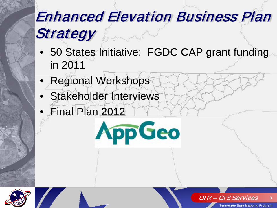
• 50 States Initiative: FGDC CAP grant funding in 2011
• Regional Workshops• Stakeholder Interviews• Final Plan 2012
Enhanced Elevation Business P lan Strategy

T D E C , S l i d e 4
Tennessee Enhanced Elevation Business PlanEnvironment and Conservation Applications Needing Better Terrain Data
SEE THE BUSINESS PLAN DOCUMENT FOR DETAILS
NHD Program Determining elevation, slope, and aspect
Identifying man-altered, channelized waterways
Finding mineral resources
Finding topographic depressions
Elevation at “top of hole”
Searching for species habitat Finding seeps and catchment areas
Identifying small water bodies Identifying upper extent of streams
Land reclamation –abandoned mines
Native American burial sites
Finding geologic strikes and dips
Civil War battlefields
Landslide risk assessment Solar Energy Potential (R&D)
Stormwater Management Seismic risk zones

OIR – GIS Services 5
Tennessee Base Mapping Program


OIR – GIS Services 7
Tennessee Base Mapping Program
DOI – Office of Surface MiningAbandoned Mine Lands Grant

OIR – GIS Services 8
Tennessee Base Mapping Program

OIR – GIS Services 9
Tennessee Base Mapping Program

OIR – GIS Services 10
Tennessee Base Mapping Program

T D E C , S l i d e 1 1
TNBMP – Elevation (DTM)


OIR – GIS Services 14
Tennessee Base Mapping Program
• Approximately 20% coverage in the state
• Estimated cost of remaining 80% is: $7-8 million
LiDAR coverage prior to 3DEP

OIR – GIS Services 15
Tennessee Base Mapping Program
• Perfect timing for Tennessee !!• Program began in 2014, entering 3rd year of awards• USGS QL 2 (2 pt/sq. meter and 10cm vertical)
• DEM• Hydro-flattened breaklines• Unclassified and classified point cloud (.las files)• Building footprints
• 2014 Award – acquired December 2015 (Woolpert)• 2015 Award – acquired Spring 2016 (Woolpert)• Leveraging the USGS GPSC contract
USGS 3DEP Program/ Timeline

OIR – GIS Services 16
Tennessee Base Mapping Program

OIR – GIS Services 17
Tennessee Base Mapping Program
• TN Dept. of Transportation – 25% ($670,000)• US DOI. – Office Surface Mining – 25% ($670,000)
• Other government sources – 25%• USDA/NRCS – ($75,000)
• TVA – ($50,000)• Hamilton Co./City of Chattanooga – ($71,000)
• DOE – Oak Ridge Office – ($25,000)• TN Dept. of F&A – GIS Services – ($450,000)
• USGS 3DEP Funding – 25% ($670,000)• Estimated 27 county total cost - $2.7 million
2014-15 TN 3DEP Partnership Funding Model

OIR – GIS Services 18
Tennessee Base Mapping Program

OIR – GIS Services 19
Tennessee Base Mapping Program
• TN Dept. of Transportation – 30% ($600,000)• Other government sources – 40%
• USDA/NRCS – ($300,000)• TVA – ($50,000)
• US Forest Service – ($40,000)• 10 Local Governments – ($377,600)
• Proposed USGS 3DEP Funding – 30% ($600,000)• Estimated 18 county total cost - $2.0 million
2015-16 TN 3DEP Partnership Funding Model
OIR – GIS Services 20
Tennessee Base Mapping Program
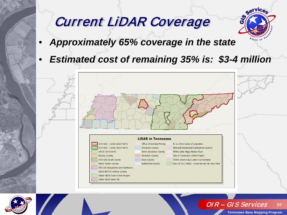
• Approximately 65% coverage in the state
• Estimated cost of remaining 35% is: $3-4 million
Current LiDAR Coverage
OIR – GIS Services 21
Tennessee Base Mapping Program

OIR – GIS Services 22
Tennessee Base Mapping Program
• TN Dept. of Transportation – 35% ($501,725)• Other government sources – 40%
• USDA/NRCS – ($300,000)• TVA – ($50,000)
• Dept of F&A, GIS Services - ($80,050)
• USGS 3DEP Funding – 35% ($501,725)• Estimated 11 county total cost - $1.4 million
2016-17 TN 3DEP Partnership Funding Model
OIR – GIS Services 23
Tennessee Base Mapping Program

OIR – GIS Services 24
Tennessee Base Mapping Program
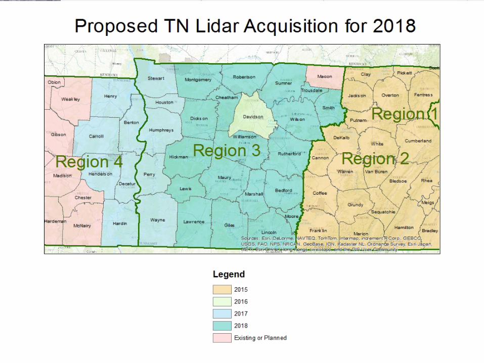
• USGS BAA – Summer 2017• Local Funding Commitment – Aug 2017• State Proposal Submission – Sept 2017• USGS Awards – Nov 2017• LiDAR Acquisition (leaf-off) – Feb/March 2018• Data Deliveries – Late fall 2018
• STATEWIDE COVERAGE COMPLETE !!
2017-18 Timeline/ Acquisition:

OIR – GIS Services 25
Tennessee Base Mapping Program

OIR – GIS Services 26
Tennessee Base Mapping Program
• Develop a business plan and identify stakeholders• Find an ‘anchor institution’ for funding (TDOT)• Economies of Scale – large geographic areas drive
down costs• Don’t ask USGS for too much funding – average
awards were around 35% of project total• Have a statewide goal in mind• Persistence pays off – 5 year effort to date
Lessons Learned:
OIR – GIS Services 27
Tennessee Base Mapping Program
Questions???