Urban Heat Island and Urban Form in Durham, NC Levers for ...
46
Urban Heat Island and Urban Form in Durham, NC & Levers for Change 1 Carolina Climate Resilience Conference September 12-14, 2016 Charlotte, North Carolina Elizabeth M. B. Doran, Ph.D. Division of Earth & Ocean Sciences
Transcript of Urban Heat Island and Urban Form in Durham, NC Levers for ...

Urban Heat Island and Urban Form in Durham, NC
&
Levers for Change
1
Carolina Climate Resilience Conference
September 12-14, 2016
Charlotte, North Carolina
Elizabeth M. B. Doran, Ph.D.
Division of Earth & Ocean Sciences

Levers of Change
2
Challenge(e.g. Urban Heat Island)
TechnologyEconomic
IncentivesPolicy
Behavior
Change
Goal #1: Assess magnitude of the global challenge of urban climate at the local scale
in Durham, North Carolina, USA.
Physical observations and experiments
Goal #2: Link physical science to local planning and development objectives to
enable resilience in the face of change.
Address gap in methods for translation to practiceDoran, 2016

Urbanization Trends: World
3UN, 2011

Urbanization Trends: World
4
UN, World Urbanization Prospectus, 2014

Urbanization Trends: World
5
UN, World Urbanization Prospectus, 2014

Urbanization and GeomorphologyTransition from native materials, and low engineered land-uses and land covers
To highly engineered materials, highly engineered land uses and land covers
6Stewart & Oke, 2012
HOTTER!

Urban Heat Island
7Oke, 1982
R R
UQuantified using
ground based
Meteorological Station
Networks
Definition:
Closed isotherms indicating an
area of the surface that is relatively
warm; most commonly associated
areas of human disturbance such
as towns and cities.
The physiographic analogy derives from the
similarity between the pattern of isotherms and
height contours of an island on a topographic map.
Heat islands commonly also possess "cliffs" at the
urban–rural fringe and a "peak" in the most built-
up core of the city. The annual mean temperature
of a large city (say 106 inhabitants) may be 1°–
2°C warmer than before development, and on
individual calm, clear nights may be up to 12°C
warmer. The warmth extends vertically to form an
urban heat dome in near calm, and an urban heat
plume in more windy conditions.
American Meteorological Society Glossary of
meteorology, 2012

Urban Heat Island: 3 Types
Planetary Boundary Layer UHI
(BLUHI)
(CLUHI)
(SUHI)8
Voogt; Oke, 1997

Prior Work
9

Prior Work
10

Prior Work
11

Prior Work
12

My ResearchAddressing Gaps in the UHI Literature and Developing Methods for Translation
to Practice
13
Question #1
Meso-scale
UHI
• What is the intensity and distribution of the UHI in the Raleigh-Durham Region, North Carolina
• Methods: Extensive climatic data + Remote Sensing
Question #2
Local-scale
UHI
• What is the intensity and dynamic behavior of the local scale UHI in the study area of Durham, North Carolina?
• Methods: Sensor Networks + Mobile Transects
Question #3
Urban Form
• Can urban form be used to help explain the intensity and distribution of the nocturnal UHI in the study area?
• Methods: Urban Form Characterization Methods + UHI

Urbanization Trends: Southeast
14EPA, 2009; Carlyle, 2014; Todorovich et al., 2011
2010 U.S. Housing Density Map
Raleigh, NC
2nd Fastest rowth, 2014
Charlotte, NC
8th Fastest Growth, 2014
Atlanta, GA
12th Fastest Growth, 2014
Piedmont
Megalopolis
South:
2005: 36.9% of US Population
2030: ~40% of US Population

Site Selection Rationale• Raleigh-Durham is part of the fastest growing region in the country (EPA, 2009; Carlyle,
2014; Todorovich et al., 2011)
• Previous research on UHI in Raleigh-Durham is limited (King & Davis, 2007)
• Sits at the boundary between increased cooling and decreased heating from UHI (Sun, Augenbroe, 2014)
• Local research means infrastructure is highly accessible for sensor deployment
and observation & access to willing partners and collaborators
Piedmont
MegalopolisUS Census Bureau; Capitol Area Metropolitan Planning
Organization (CAMPO)Durham City: 251,893
Raleigh City: 439,896
Wake-Durham-Orange Counties:
1,466,504US Census Population Estimates, 2015
1 Million

UHI Observations Methods Overview
16
Mesoscale(1-100km)
Local scale (100m -1km)
2. Satellite Remote Sensing
Landsat-8 OLI-TIRS (USGS)
Day + special request night campaign
Processed to land surface temperature (SUHI)
& vegetative indices
3. Transects
Onset HOBO U23-002 (Temp/RH)
Custom test rig vehicle mounted (CLUHI)
64km transect in < 2hrs
Transects every 4hrs for 72hrs(Sun et al., 2009; Voogt, 2000)
1. Standard Weather Stations
Historical Record (1945-2015)
Hourly weather observations (CLUHI)
Focus on optimal conditions
4. Field Sites
(Non-Standard Weather Stations)
Onset HOBO U23-001 (Temp/RH)
12 sites; 15 minute sampling rate;
3m height(Coseo & Larsen, 2014;
Schatz & Kucharik, 2014;
Oke, 2004, 2006)

My ResearchAddressing Gaps in the UHI Literature and Developing Methods for Translation
to Practice
17
Question #1
Meso-scale
UHI
• What is the intensity and distribution of the UHI in the Raleigh-Durham Region, North Carolina
• Methods: Extensive climatic data + Remote Sensing
Question #2
Local-scale
UHI
• What is the intensity and dynamic behavior of the local scale UHI in the study area of Durham, North Carolina?
• Methods: Sensor Networks + Mobile Transects
Question #3
Urban Form
• Can urban form be used to help explain the intensity and distribution of the nocturnal UHI in the study area?
• Methods: Urban Form Characterization Methods + UHI

Meso Scale
18
91mASL
11/1/55
COOP-TP
LCZsc D
112mASL
1/25/03
AWOS-III
LCZsc D
79mASL
1/1/1893
COOP-TP
LCZsc 9D
76mASL
8/2/03
ECONet –Tower
LCZsc 9D
133mASL
7/1/48
ASOS-Standard
LCZsc 6D
172mASL
3/30/00
RAWS
LCZsc D
186mASL
12/14/00
AWOS-III
LCZsc D
Standard
Weather Stations
/
U
R
R
R
R

19
UHI = 5.2°C (9.4°F)
R2pop = 0.36R2
LULC = 0.36

20
UHI = 5.2°C (9.4°F)
R2pop = 0.36R2
LULC = 0.36

21
UHI = 5.2°C (9.4°F)
R2pop = 0.36R2
LULC = 0.36

22
Landsat-8 Scene Capture Time: 21 June 2015 10:52:44 EST
UHI = 8°C (14.4°F)
UHI = 2°C (3.6°F)

23
UHI magnitude depends on method (CLUHI: 1.2°C vs. 5.2°C;
SUHI: 2°C)
Passive control of climatological conditions accounts for ~3°C
UHI is growing over time, best correlated with population growth
and land use change
Urban areas are warmer than rural areas, but significant variation
exists across the urban fabric
Doran, E.M.B. & Golden, J. S. (IN REVIEW). Climate & Sustainability Implications of Land Use Alterations in
an Urbanizing Region: Raleigh-Durham, North Carolina. Special Feature on Land Use Management and
Sustainability; Journal of Environmental Protection.
Question #1
Meso-scale
UHI
• What is the intensity and distribution of the UHI in the Raleigh-Durham Region, North Carolina
• Methods: Extensive climatic data + Remote Sensing

My ResearchAddressing Gaps in the UHI Literature and Developing Methods for Translation
to Practice
24
Question #1
Meso-scale
UHI
• What is the intensity and distribution of the UHI in the Raleigh-Durham Region, North Carolina
• Methods: Extensive climatic data + Remote Sensing
Question #2
Local-scale
UHI
• What is the intensity and dynamic behavior of the local scale UHI in the study area of Durham, North Carolina?
• Methods: Sensor Networks + Mobile Transects
Question #3
Urban Form
• Can urban form be used to help explain the intensity and distribution of the nocturnal UHI in the study area?
• Methods: Urban Form Characterization Methods + UHI

25
UHImax = 6.9°C (12.4°F) UHImax = 8.7°C
(15.6°F)

26
UHImax = 6.9°C (12.4°F) UHImax = 8.7°C
(15.6°F)

27
UHImax = 6.9°C (12.4°F) UHImax = 8.7°C
(15.6°F)

28
CLUHI = 8.7°C (field sites) 6.9°C (transects)
Nocturnal Maximum UHI 1-3 hrs after sunset
Evapotranspiration dominant UHI driver
High dewpoint (>20°C threshold for human
thermal comfort) observed during daylight hours
Doran, E.M.B. & Golden, J. S. (IN REVIEW). Multi-method Local Scale Characterization of the
Urban Heat Island in Durham, North Carolina, USA. Journal of Applied Meteorology and
Climatology
Question #2
Local-scale
UHI
• What is the intensity and dynamic behavior of the local scale UHI in the study area of Durham, North Carolina?
• Methods: Sensor Networks + Mobile Transects

My ResearchAddressing Gaps in the UHI Literature and Developing Methods for Translation
to Practice
29
Question #1
Meso-scale
UHI
• What is the intensity and distribution of the UHI in the Raleigh-Durham Region, North Carolina
• Methods: Extensive climatic data + Remote Sensing
Question #2
Local-scale
UHI
• What is the intensity and dynamic behavior of the local scale UHI in the study area of Durham, North Carolina?
• Methods: Sensor Networks + Mobile Transects
Question #3
Urban Form
• Can urban form be used to help explain the intensity and distribution of the nocturnal UHI in the study area?
• Methods: Urban Form Characterization Methods + UHI

30Stewart & Oke, 2012; Coseo & Larsen, 2014; Wilson & Song, 2009; Homer et al. 2015

31Stewart & Oke, 2012; Coseo & Larsen, 2014; Wilson & Song, 2009; Homer et al. 2015

32Stewart & Oke, 2012; Coseo & Larsen, 2014; Wilson & Song, 2009; Homer et al. 2015
33Stewart & Oke, 2012; Coseo & Larsen, 2014; Wilson & Song, 2009; Homer et al. 2015

Mean Urban Form Characterization Method by Census Block Group, and Nocturnal
SUHI in Durham, NC 21 June 2015, 20:04:45
34

Mean Urban Form Characterization Method by Census Block Group, and Nocturnal
SUHI in Durham, NC 21 June 2015, 20:04:45
35
Mean UHI by
Urban Form
Characterization
Method

Linear regression model summary: UCA for CLUHI Evening
Category Variable UCA NLCD B SE beta B SE beta B SE beta B SE beta
TreeCanopy x -0.36 0.33 -0.07
OpenArea x 0.78 0.67 0.05
ResidentialLandUse x -2.52*** 0.29 -0.46
CommercialLandUse x 1.72 0.93 0.17
IndustrialLandUse x 23.85*** 3.46 0.37
Multi-familyResidentialLandUse x -1.92 1.12 0.16MeanBlockSize(perimeter) x -0.01*** 0.001 -0.16
MeanResidentialLotSize x -48.30** 16.62 -0.14
Busstops x 0.10*** 0.01 0.68
ModifiedAndersonLandCover
ClassificationSystem(1976)x
SingleFamilyResidentialLots x -0.003*** 0 -0.32
Intersections x 0.05*** 0.002 1
Cul-de-sacs x -0.05*** 0.01 0.23
Streetlength x
Sidewalk x
(Constant) 3.92*** 0.27 4.65*** 0.12 3.3.2*** 0.09
n 222 234 234
AdjustedR2 0.74*** 0.40*** 0.70***
Notes: *p<0.05
**p<0.01
***p<0.0005
UrbanFormVariablesUrbanForm
Method
CLUHIEvening
Model1 Model2
LandUse
andLandCover
Building
Configur-
ation
Model3 Model4
36
Linear regression model summary: LCZ and MLCZ for CLUHI Evening
Category Variable LCZ MLCZ B SE beta B SE beta B SE beta B SE beta
ImperviousSurface x x 3.74*** 0.66 0.75
PerviousSurface x 0.94 0.63 0.17
BuildingSurface x x 6.03* 2.56 0.35
ImperviousSurfaceBuilding x -3.02*** 0.81 -0.21
TreeCanopy x -0.22 0.48 -0.04 -3.29*** 0.23 0.68
AspectorUrbanCanyonRatio x x 1.09 1.28 0.33
HeightofRoughnesselements
(inclbuildings)x x
0.03 0.05 0.22
SiteOrientation x 0.16 0.42 0.12
SurfaceAlbedo x 9.10*** 1.82 0.32
DistancetoDowntown x -0.39*** 0.06 -0.62
DistancetoWater x -0.57 0.48 -0.10
NearbyUpwindIndustrial x 0.01 0.26 0.004
NearbyUpwindPark x 0.23* 0.1 0.13
NearbyUpwindFreeway x -0.44*** 0.11 -0.22
(Constant) 2.56*** 0.36 4.6*** 0.48 5.73*** 0.56 5.87*** 0.13n 226 12 84 234
AdjustedR2 0.79*** 0.03 0.80*** 0.47***
Notes: *p<0.05**p<0.01
***p<0.0005
UrbanFormVariablesUrbanForm
Method
CLUHIEvening
Model2 Model3 Model4
LandUse
andLand
Cover
Building
Configur-
ation
Thermal
Properties
Model1

37
NLCD 2011 best correlated to UHI intensity and distribution in study area; LCZ
methods also useful
UCA method not useful, but variables hold promise for better model generation
and interdisciplinary translation
Land cover (e.g. impervious surface fraction, pervious surface fraction &
albedo) consistently highly correlated across methods, thermal properties also
useful; building configuration requires additional attention
Doran, E.M.B. & Golden, J. S. (IN REIVEW). Evaluating Urban Form Characterization Methods in the Context
of the Urban Heat Island. Landscape and Urban Planning
Question #3
Urban Form
• Can urban form be used to help explain the intensity and distribution of the nocturnal UHI in the study area?
• Methods: Urban Form Characterization Methods + UHI

Policy Levers
38Doran, 2016

Policy Levers
39Doran, 2016
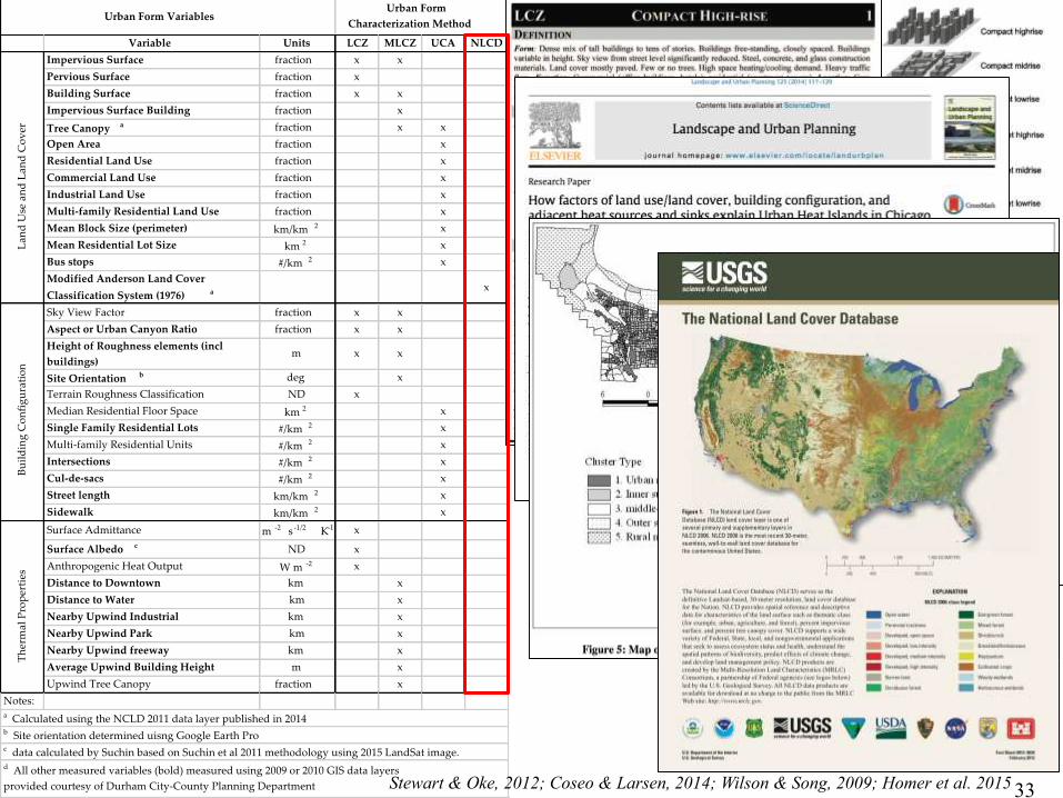
Summary& Conclusions
40
What we’ve learned… Significant UHI magnitude and
growing over time
Dominated by evapotranspiration
and land cover including the
balance of impervious and pervious
surface covers
Potential exists to leverage the
urban form characterization
methods from diverse research
communities to translate the science
of UHI to practice
Policy levers in the local context
have been identified
Future Work Impact of UHI to energy use in
buildings
Impact on human health and
comfort
Mitigation techniques in context
Socio-economic factors and
distribution
Effect of urban agglomeration on
UHI
Novel observation techniques

Levers of Change
41
Challenge(e.g. Urban Heat Island)
TechnologyEconomic
IncentivesPolicy
Behavior
Change

Levers of Change
42
Challenge(e.g. Urban Heat Island)
TechnologyEconomic
IncentivesPolicy
Behavior
Change
AcknowledgementsCommittee:
Lincoln F. Pratson, EOS, Chair
Jay S. Golden, EOS, Co-Chair, Advisor
Timothy L. Johnson, EOS
Billie L. Turner, II, ASUDurham City & County Government
Tobin Fried, Director of Sustainability
Pete Nicholas, Transportation Engineer
Aaron Cain, Hannah Jacobs, Planning Department
Patrick McDonough, Go Triangle
Technical Support
Adrienne Wootten, NC State Climate Office
Gene Fosnight, USGS
William Stefanov, NASA
Crystal Schaaf & Shuai Yanmin, UMass Boston
Peter Haff, Duke
Brandon Morrison, Duke
Financial Support
Center for Sustainability & Commerce
Division of Earth & Ocean Sciences
Nicholas School of the Environment
43

“Durham’s vitality is built upon
The health of our residents
And the capacity of our community
To foster and enhance
The wellbeing of every citizen.”
—Durham County Human Services
44

QUESTIONS?
45

Elizabeth M. B. Doran(née Elizabeth M. Bloomhart)
Education
M.S., Duke University, 2011
Mechanical Engineering
B.S., Tufts University, 2005
Environmental Engineering
Committee
Lincoln F. Pratson, EOS, Chair
Jay S. Golden, EOS, Co-Chair, Advisor
Timothy L. Johnson, EOS
Billie L. Turner, II ASU, Minor Area Representative (via
teleconference)46