
Unit 3 weather_and_climate
59
WEATHER AND CLIMATE
-
Upload
sergiohistoria -
Category
Education
-
view
206 -
download
0
Transcript of Unit 3 weather_and_climate
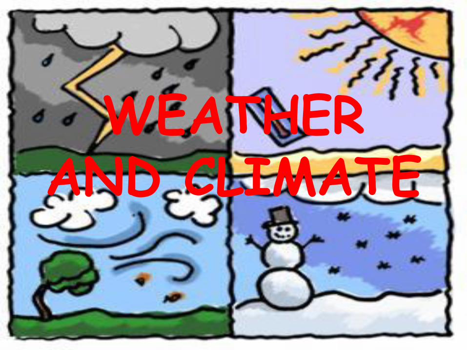
WEATHER AND CLIMATE

1. THE MOVEMENTS OF THE EARTH
•The Earth has 2 movements:
-Rotation movement;
-Revolution around the Sun.

1)Rotation movement(movimiento de rotación): The Earth spins on its axis in an anticlockwise direction. It completes its rotation every 24 hours.
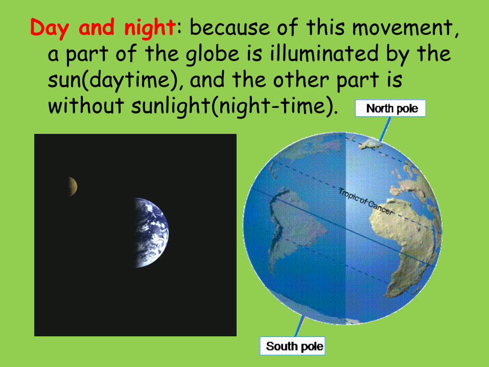
Day and night: because of this movement, a part of the globe is illuminated by the sun(daytime), and the other part is without sunlight(night-time).
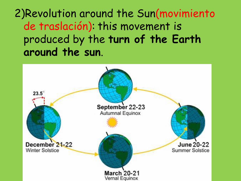
2)Revolution around the Sun(movimiento de traslación): this movement is produced by the turn of the Earth around the sun.
This turn in an anticlockwise direction, is completely made in 365 days, 6 hours and 9 minutes(one year). As a normal year has only 365 days, the extra time, is added, and every 4 years there is a leap year(año bisiesto).
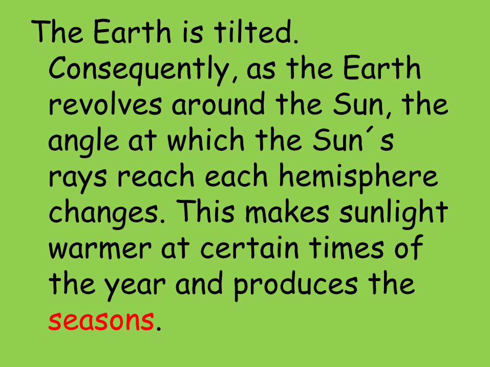
The Earth is tilted. Consequently, as the Earth revolves around the Sun, the angle at which the Sun´s rays reach each hemisphere changes. This makes sunlight warmer at certain times of the year and produces the seasons.

Summer solstice
The Sun and the Earth
in June
The Sun’s rays are
almost perpendicular
at the Tropic of Cancer.
It is summer in the
northern hemisphere.

Winter solstice
The Sun and Earth
in December
The Sun’s rays are
almost vertical at the
Tropic of Capricorn.
It is summer in the
southern hemisphere.

2.WEATHER AND CLIMATE
• Climate(clima) is the general weather conditions usually found in a particular place(in Valencia the climate is mediterranean).
• Weather(tiempo atmosférico) is the state of the atmosphere in a place at a specific time(today is cold and rainy).

• In the climates we have:
-Elements: measurable components of the atmosphere like temperature, precipitation, atmospheric pressure and wind.
-Factors: variables which exert influence over the elements. They are latitude, height, distance from the sea and sea currents.

TEMPERATURE
• Concept: measured amount of heat in the air.
• Measurement: we measure it in degreescentigrade(ºC). To study this element we use the annual average temperature and thermal amplitude. The annual average temperature is made by adding every monthly average temperature and dividing the total by 12. The thermal amplitude is made subtracting the lowest temperature from the highest one.
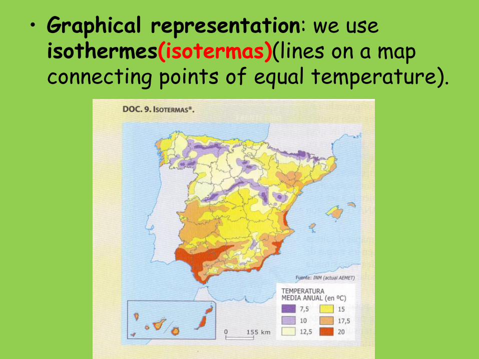
• Graphical representation: we use isothermes(isotermas)(lines on a map connecting points of equal temperature).

• Factors: latitude, height, distance from the sea and sea currents influence over the temperature.
-Latitude: if we go to the Equator the temperature rises; if we go to the Poles the temperature goes down.

-Altitude: temperature dicreases 0´5ºC every 100 m.

-Distance from the sea: temperatures are softer on the coast than inland, where summer is hotter and winter colder(ocean heats up and cool down sooner than continents).

-Sea currents: cold sea currents make a cooler climate; hot sea currents make a hotter climate.

PRECIPITATION
• Concept: deposition of water from the atmosphere, in the form of dew, frost, rain, snow or hail.
• Measurement: we measure it in milimetres(mm) or litres/m2. Annual precipitation is used to study this element. We get it by adding every monthly total precipitation(they are 12).
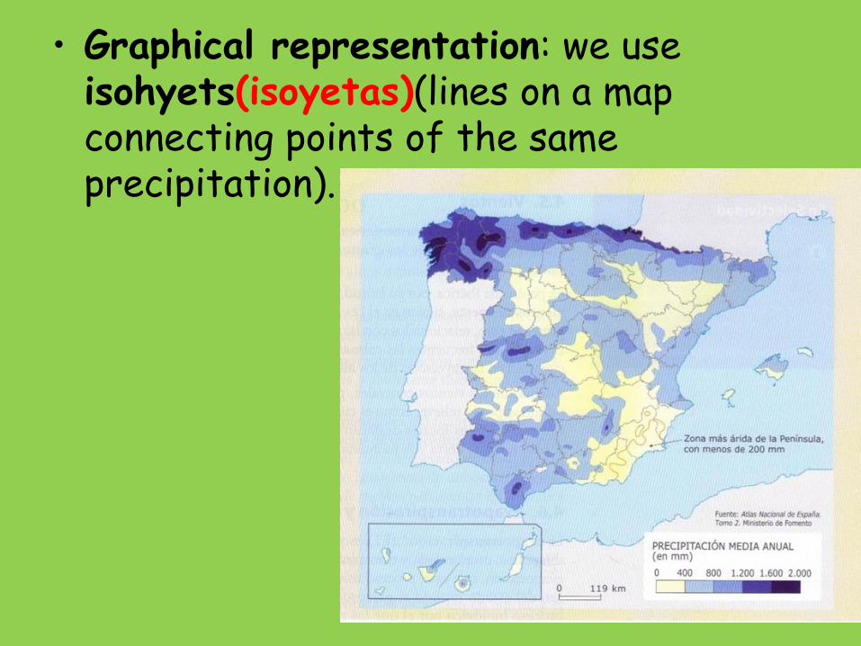
• Graphical representation: we use isohyets(isoyetas)(lines on a map connecting points of the same precipitation).

• Factors: latitude, height and distance from the sea influence over the temperature.
-Latitude: there is more precipitation over the Equatorial zone, and less preci-
pitation over the other areas of the world.
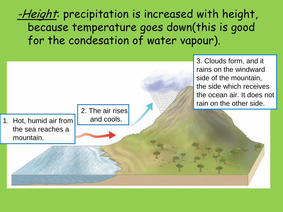
-Height: precipitation is increased with height, because temperature goes down(this is good for the condesation of water vapour).
1. Hot, humid air from
the sea reaches a
mountain.
3. Clouds form, and it
rains on the windward
side of the mountain,
the side which receives
the ocean air. It does not
rain on the other side.2. The air rises
and cools.
-Distance from the sea: precipitation on the coast is higher than inland(here there is less humidity).

ATMOSPHERIC PRESSURE: WIND
• Concept: is the pressure of the air over the Earth´s surface. The differences in atmospheric pressure make wind.
• Measurement: we use milibars(mb). The average pressure is 1,015 mb. So if the pressure is higher we have an anticyclone(calm weather), and if the pressure is lower we have a depression(windy and rainy weather).
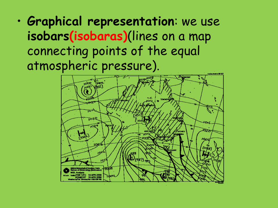
• Graphical representation: we use isobars(isobaras)(lines on a map connecting points of the equal atmospheric pressure).
• Factors: latitude and height influence over this element.
-Latitude: there are more low pressure areas over the Equator; there are more high pressure areas over the Tropics and the Poles.
-Height: atmospheric pressure is lower if we are in a higher area(the air layer is thinner here).
Activities
2.1. Give an example about the difference between weather and cllimate.
2.2. How can you find out low pressures and high pressures on a map?
2.3. Look at the map and try to guess the weather. Explain your reasons.

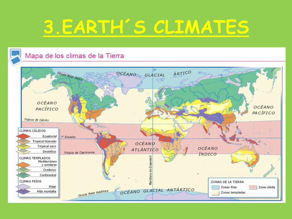
3.EARTH´S CLIMATES
The combination of elements and factors makes three big climatic areas:
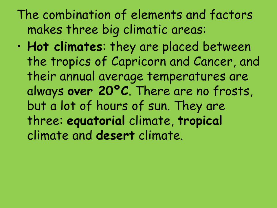
• Hot climates: they are placed between the tropics of Capricorn and Cancer, and their annual average temperatures are always over 20ºC. There are no frosts, but a lot of hours of sun. They are three: equatorial climate, tropicalclimate and desert climate.
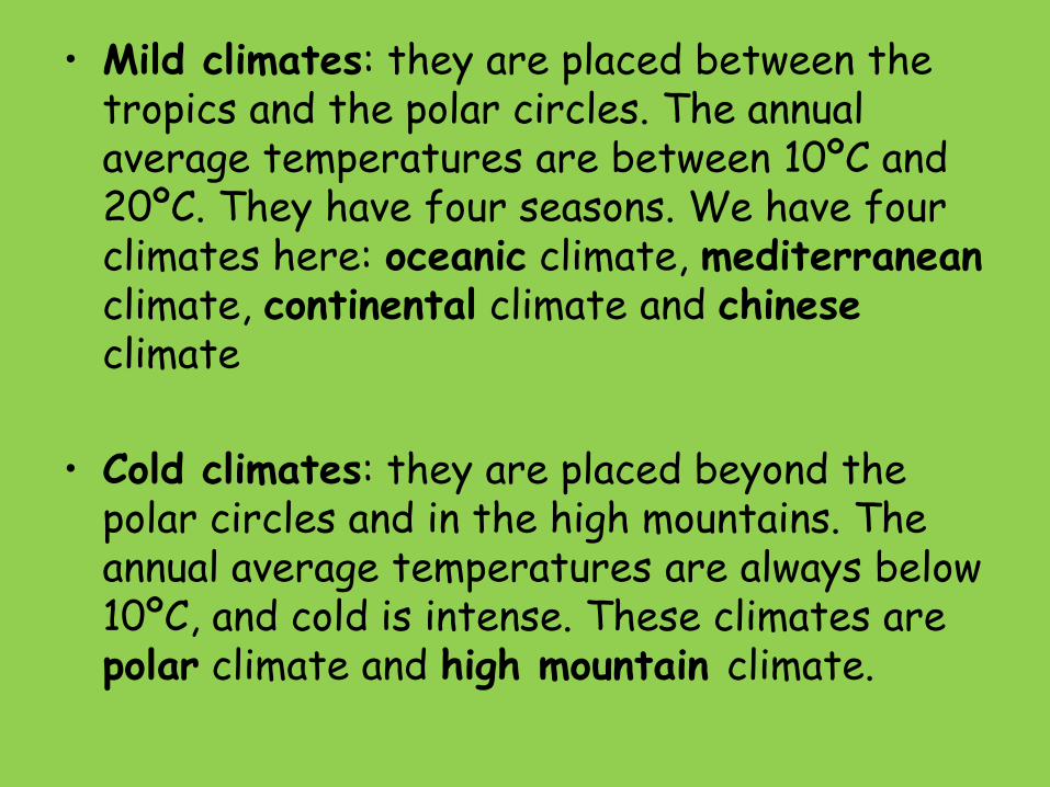
• Mild climates: they are placed between the tropics and the polar circles. The annual average temperatures are between 10ºC and 20ºC. They have four seasons. We have four climates here: oceanic climate, mediterraneanclimate, continental climate and chineseclimate
• Cold climates: they are placed beyond the polar circles and in the high mountains. The annual average temperatures are always below 10ºC, and cold is intense. These climates are polar climate and high mountain climate.
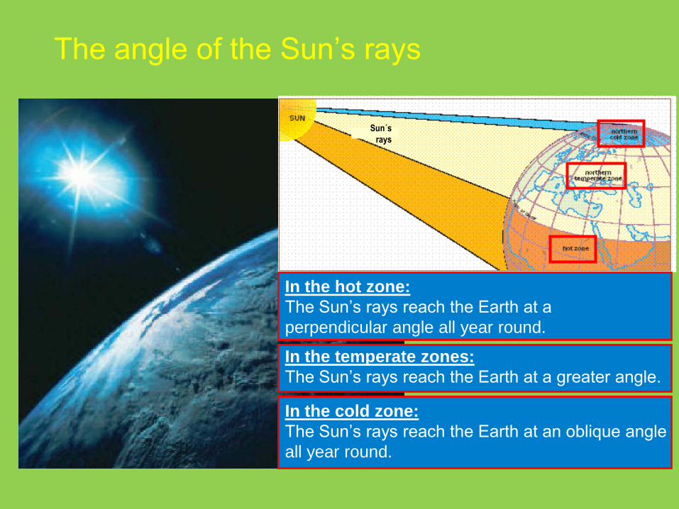
The angle of the Sun’s rays
In the hot zone:
The Sun’s rays reach the Earth at a
perpendicular angle all year round.
In the cold zone:
The Sun’s rays reach the Earth at an oblique angle
all year round.
In the temperate zones:
The Sun’s rays reach the Earth at a greater angle.
Sun´s
rays
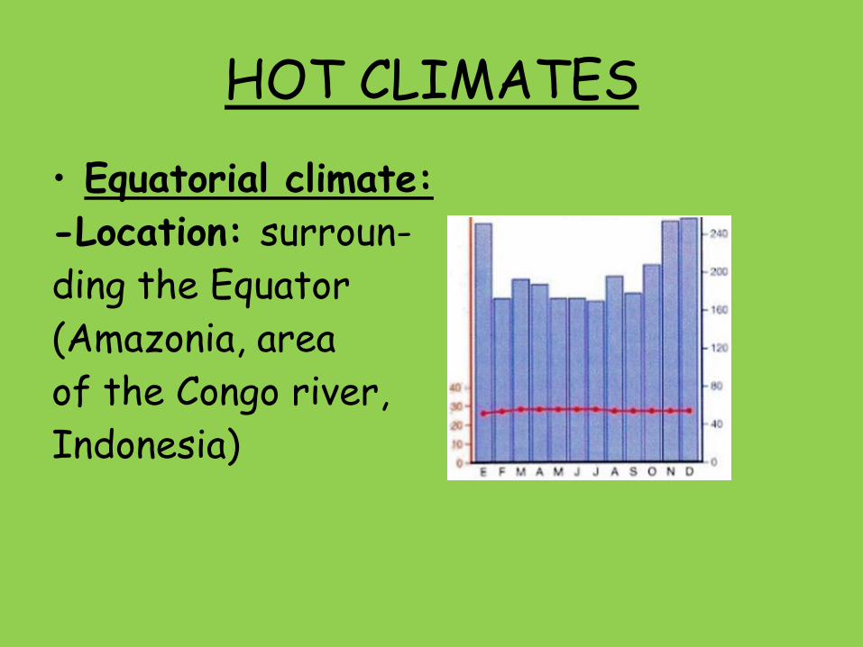
HOT CLIMATES
• Equatorial climate:
-Location: surroun-
ding the Equator
(Amazonia, area
of the Congo river,
Indonesia)

– Temperature: every monthly average temperature is over 20ºC. The thermal amplitude is between 1 and 3ºC(24-27ºC), so the temperature is constant all over the year.
– Precipitation: is very high(the total annual precipitation is over 1,500 mm per year), and is well distributed(every month has a precipitation of 60 mm or more).
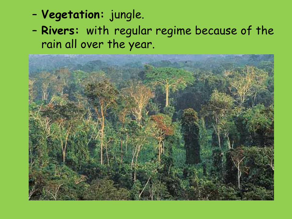
– Vegetation: jungle.
– Rivers: with regular regime because of the rain all over the year.
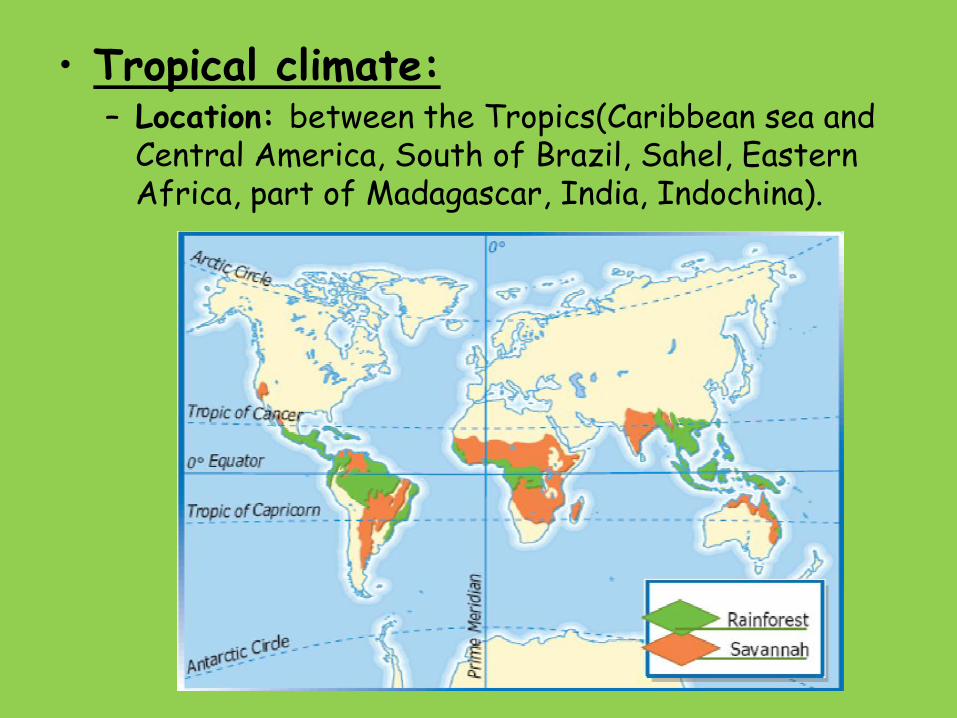
• Tropical climate:– Location: between the Tropics(Caribbean sea and
Central America, South of Brazil, Sahel, Eastern Africa, part of Madagascar, India, Indochina).

– Temperature: the monthly average temperature is never below 18ºC. The thermal amplitudeis below 10ºC.
– Precipitation: it ishigh, between 750 mm and 1,500 mm. Its dis-tribution is irre-gular, because there is a rainy season and a dry season.

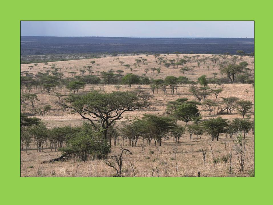
– Vegetation: where the rainy season is longer, the vegetation is a jungle less thicker than the equatorial one; where the rainy season is shorter there is savannah(large flat area of land covered with grass, usually with few trees).
– Rivers: with irregular regime because of the long dry season.
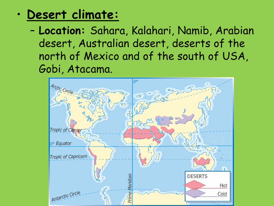
• Desert climate:– Location: Sahara, Kalahari, Namib, Arabian
desert, Australian desert, deserts of the north of Mexico and of the south of USA, Gobi, Atacama.

– Temperature: daily temperatures suffer strong oscilations between day and night(it is due to the lack of humidity, which provokes an
important heatup during the day time, and an strong cold down during night time).– Precipitation:below 150 mm per year.
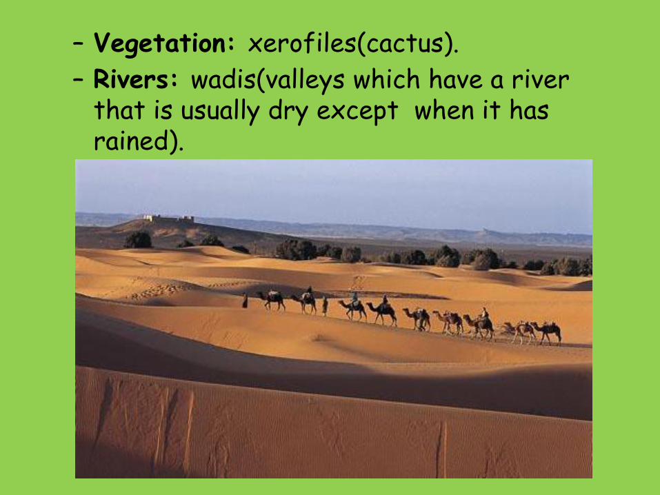
– Vegetation: xerofiles(cactus).
– Rivers: wadis(valleys which have a river that is usually dry except when it has rained).

MILD CLIMATES• Oceanic climate:
– Location: Western and Nothern Europe, south of Chile, west of USA.

– Temperature: cool summers(no month over 22ºC), and warm winters(no months below 10ºC). The thermal amplitude is low(10-12ºC).
– Precipitation: is high(more than 800 mm per year), and
well distribu-
ted(there are
no dry months,
but the maxi-
mum of rain is
in winter).

– Vegetation: decidous forest(oak, beech tree,...). There is an important amount of meadows.
– Rivers: with regular regime, because there are no dry months.

• Mediterranean climate:– Location: zones surrounding the
Mediterranean sea, north of Chile, California, south of Southafrica and south of Australia.

– Temperature: hot summers(at least one month over 22ºC), and warm winters(no months below 10ºC).
– Precipitation: between 300 and 800 mm. The maximum is in
autumn and spring,
and in summer there
is drought.
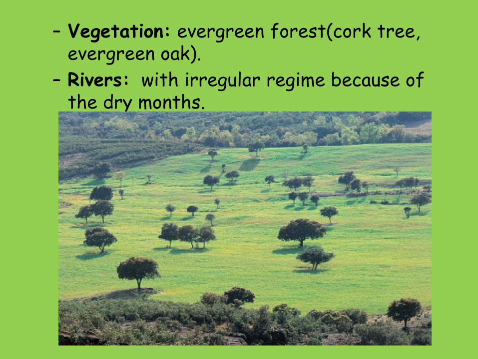
– Vegetation: evergreen forest(cork tree, evergreen oak).
– Rivers: with irregular regime because of the dry months.
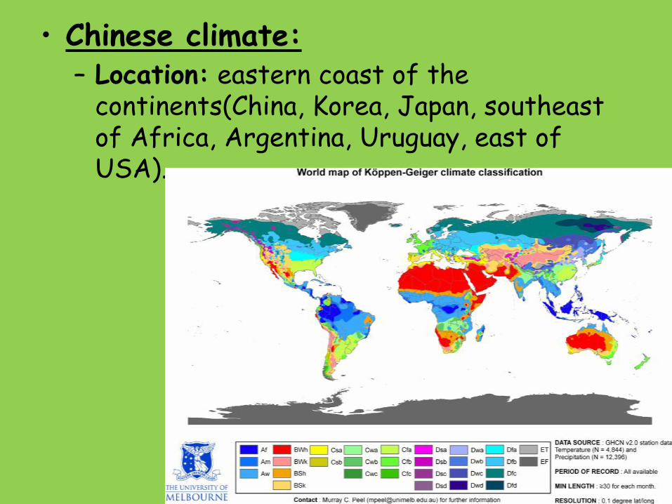
• Chinese climate:– Location: eastern coast of the
continents(China, Korea, Japan, southeast of Africa, Argentina, Uruguay, east of USA).
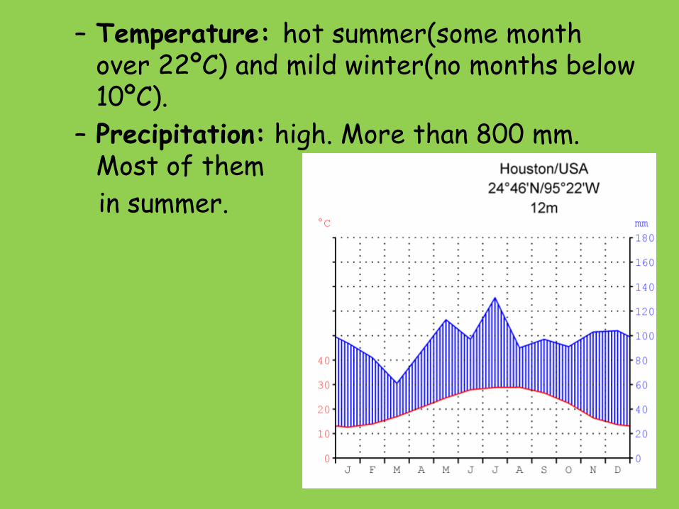
– Temperature: hot summer(some month over 22ºC) and mild winter(no months below 10ºC).
– Precipitation: high. More than 800 mm. Most of them
in summer.
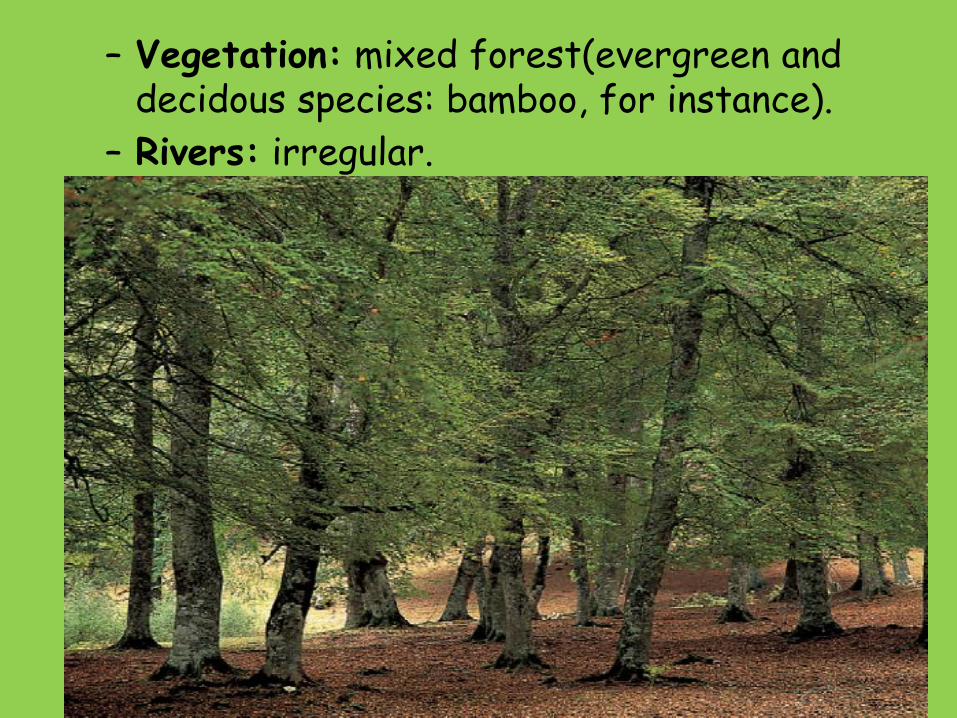
– Vegetation: mixed forest(evergreen and decidous species: bamboo, for instance).
– Rivers: irregular.

• Continental climate:– Location: inland zones of North America,
Central and Eastern Europe, Central and Northen Asia, Patagonia.
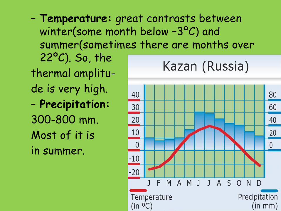
– Temperature: great contrasts between winter(some month below –3ºC) and summer(sometimes there are months over 22ºC). So, the
thermal amplitu-
de is very high.
– Precipitation:
300-800 mm.
Most of it is
in summer.

– Vegetation: taiga(coniferous forest), and meadows(steppe).
– Rivers: irregular.
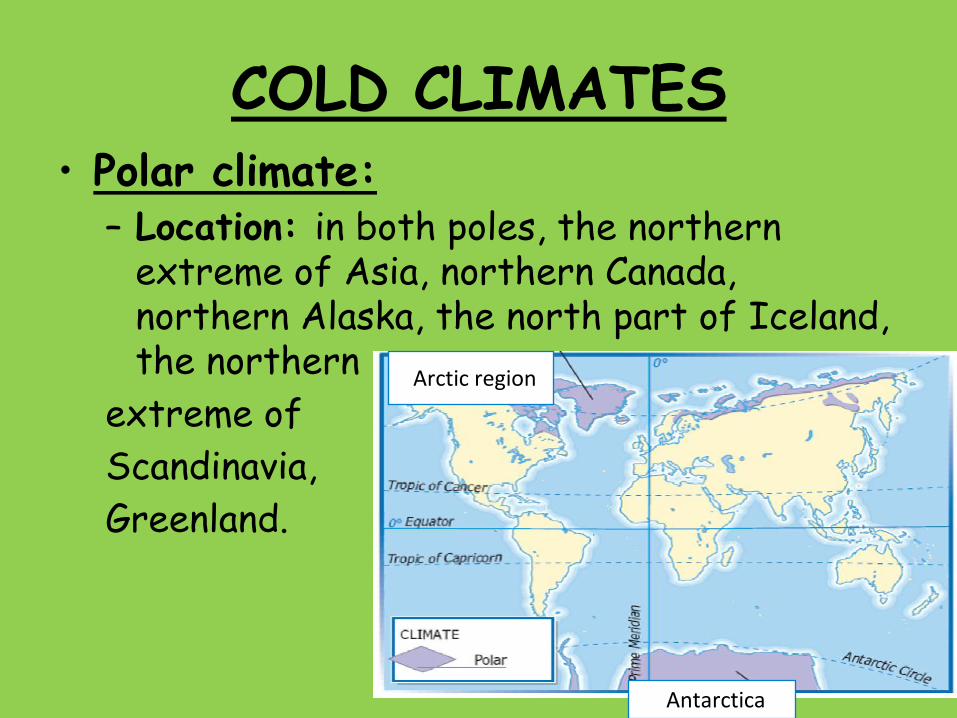
COLD CLIMATES• Polar climate:
– Location: in both poles, the northern extreme of Asia, northern Canada, northern Alaska, the north part of Iceland, the northern
extreme of
Scandinavia,
Greenland.
Antarctica
Arctic region

– Temperature: very cold all over the year(many months below 0ºC).
– Precipitation: it is not very high(less than 250 mm), and it always falls as snow.

– Vegetation: tundra(moss and lichens).
– Rivers: they are frosted(glaciers).
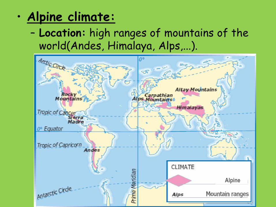
• Alpine climate:– Location: high ranges of mountains of the
world(Andes, Himalaya, Alps,...).
Alpine

– Temperature: very cold winter(some months below 0ºC), and cool summer. Temperature goes down 0´5ºC every 500 m that we rise.
– Precipitation: more
than 800 mm. As
you ascend the
mountain, the
amount of rain is
bigger

-Vegetation: stepped because of the elevation.
-Rivers: very eroding.


![Unit 1 Unit 2 Unit 3 Unit 4 Unit 5 Unit 6 Unit 7 Unit 8 ... 5 - Formatted.pdf · Unit 1 Unit 2 Unit 3 Unit 4 Unit 5 Unit 6 ... and Scatterplots] Unit 5 – Inequalities and Scatterplots](https://static.fdocuments.net/doc/165x107/5b76ea0a7f8b9a4c438c05a9/unit-1-unit-2-unit-3-unit-4-unit-5-unit-6-unit-7-unit-8-5-formattedpdf.jpg)


