Travel Demand Modeling At NCTCOG Presentation For IOWA TMIP Peer Review March 30 – April 1, 2004.
49
Travel Demand Modeling At NCTCOG Presentation For IOWA TMIP Peer Review March 30 – April 1, 2004
-
Upload
ami-wiggins -
Category
Documents
-
view
217 -
download
2
Transcript of Travel Demand Modeling At NCTCOG Presentation For IOWA TMIP Peer Review March 30 – April 1, 2004.

Travel DemandModeling At NCTCOG
Presentation For
IOWA TMIP Peer Review
March 30 – April 1, 2004

Agenda
Background
DFW Regional Model Structure
Traffic Assignment
Calibration/Validation Issues
Texas Statewide Analysis Model
Next Steps


4,536,010
6,671,351
4,848,237
5,650,339
7,952,0708,503,146
0
1,000,000
2,000,000
3,000,000
4,000,000
5,000,000
6,000,000
7,000,000
8,000,000
9,000,000
10,000,000
1995 2000 2005 2010 2015 2020 2025 2030 2035 2040
Previous Plan Demographics (Mobility 2025 Update) New Plan Demographics (Mobility 2025, 2004 Update)
(Previous Plan)
(New Plan)
Total Population Within The Dallas – Fort Worth Metropolitan Planning Area

NCTCOG Departments (9)
Executive Director’s OfficeAgency AdministrationCommunity ServicesEmergency PreparednessEnvironment And DevelopmentPublic AffairsResearch And Information ResourcesTransportation (Also Serves As The MPO)Workforce Development

Transportation DepartmentProgram Areas (6)
Administration (Michael Morris And Dan Kessler)
Air Quality Planning And Operations (Chris Klaus)
Information Systems (Ken Cervenka)
Strategic Initiatives And Community Outreach (Mike Sims)
Transportation Planning (Dan Lamers)
Transportation Programming And Operations (Dan Rocha)

Information Systems
Transportation Data Management (Including Web-Based Activities And GIS Support)
Vehicle Operations (e.g., Traffic Simulation)
Development, Maintenance, And Support Of Travel Demand Forecasting Tools

Modeling Environment
NCTCOG-Developed FORTRAN Programs (Mainframe)MOBILE5A Emissions AnalysisLatest Mobility Plan Update (Last Year)For Legacy Applications
TRANPLAN (PC)Subarea Traffic Modeling (Legacy Applications)
TransCAD (PC-Windows)MOBILE6 Emissions AnalysisFuture 2030 Mobility PlanAll New Travel Modeling Activities

Four-Step TRANSCAD Modeling Process
TRIP GENERATION
TRIP DISTRIBUTION
MODE CHOICE
ROADWAY ASSIGNMENT
TRAVEL TIMECONVERGENC
E
TRANSIT ASSIGNMENT
NO
YES
ZONE LAYERDEMOGRAPHIC INFORMATION
ROADWAY NETWORK
TRANSIT NETWORK
LOOPROADWAY SKIMS
TRANSIT SKIMS
INPUT
PROCESS
DECISION

TRANSCAD Model Size
4874 Zones Retained For ALL Modeling StepsFrom Trip Generation To Traffic/Transit Assignment4813 Internal + 61 ExternalNumber Of Zone-To-Zone Pairs = 23.8 Million
Year 2025: 27,000 Roadway Links+ 9,600 Zone Connectors
Over 36,000 Coded Links22,000 Network Nodes
2025 Transit410 Coded One-Way Bus Lines And 36 Rail Lines14,500 Bus Stops And 171 Rail Stations


Transition To Reality
Actual Scope Of Human Behavior Model Scope
– All Person Trips Motorized Person Trips
– All Travel Purposes HBW, HNW, NHB, And Truck Purpose Categories
– All Occupations Basic, Retail, And Service Jobs
– All Households Income And Household Size Categories (Plus Auto Ownership Breakdowns)
– All Streets Non-Local Streets
Individual Data Aggregate Data (Zones)


Model Run Times(For 3.2 GHz PC)
Full “No Feedback” Model Run = 647 Minutes (10.8 Hours)Trip Generation = 1.0 minuteRoadway Skimming (4) = 11 minutesTrip Distribution = 11 minutesMarket Segmentation = 6 minutesTransit Prep And Skimming (4) = 77 minutesMode Choice (13) = 65 minutesMatrix Preparations (For Transit Assignment) = 10 minutesTransit Assignment (4) = 21 minutesMatrix Preparations (For Traffic Assignment) = 98 minutesTraffic Assignment (3) = 347 minutes (5.8 hours)

AUTOMATED NETWORK CONVERSION
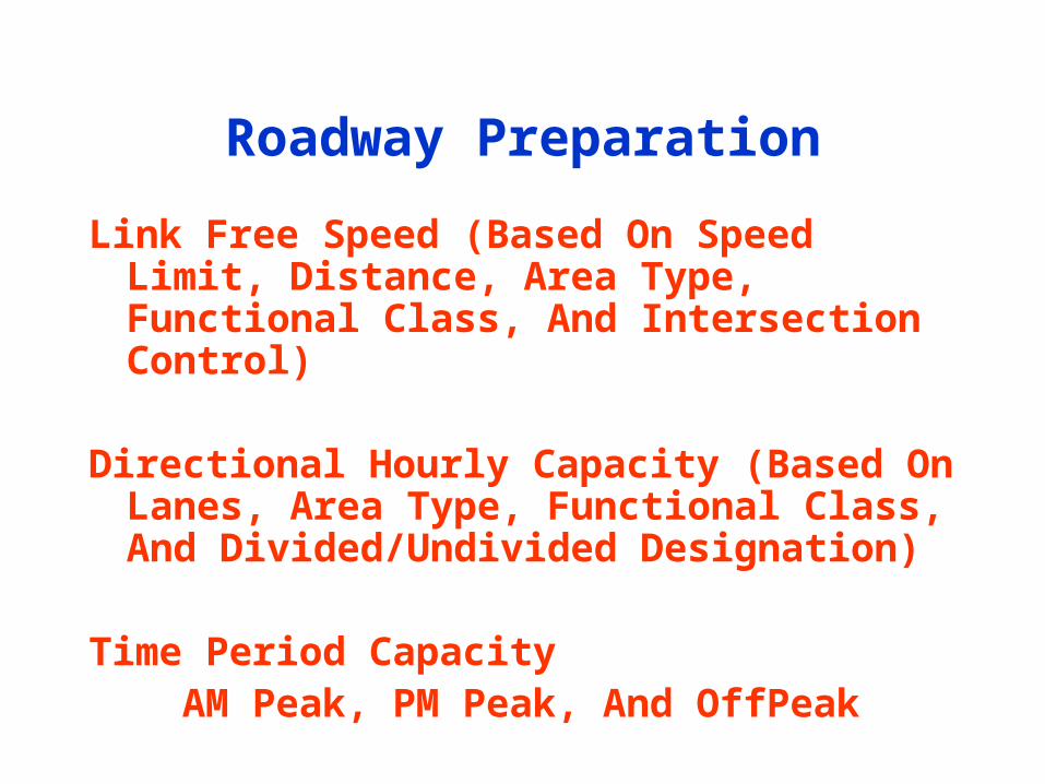
Roadway Preparation
Link Free Speed (Based On Speed Limit, Distance, Area Type, Functional Class, And Intersection Control)
Directional Hourly Capacity (Based On Lanes, Area Type, Functional Class, And Divided/Undivided Designation)
Time Period Capacity AM Peak, PM Peak, And OffPeak

Trip Generation
GISDK Macro Language Seven “Regular” Internal-Internal Trip Purposes 4 HBW, 1 HNW, 1 NHB, And 1 Truck
Inputs Population, Households, Income, And Basic/Retail/Service Jobs Special Generators (Shopping Malls, Colleges, Hospitals, Airports)

Household Income Distribution
0
0.2
0.4
0.6
0.8
1
1.2
0 0.5 1 1.5 2 2.5 3 3.5 4 4.5
Average Zone Income / Regional Median Income
Inco
me
Gro
up
Po
rtio
ns
in Z
on
e
Qrtl. 1
Qrtl. 2
Qrtl. 3
Qrtl. 4
Total = 1
0.11
0.13
0.19
0.57

Household Size Distribution
0
0.2
0.4
0.6
0.8
1
1.2
1 1.5 2 2.5 3 3.5 4 4.5 5 5.5
Avg. Zone Household Size
Hous
ehol
d Si
ze p
ortio
ns in
Zon
e HH1
HH2
HH3
HH4
HH5
HH6+

Demographics ForSpecial Generators
Current Special Generators Regional Shopping Malls With Over 500,000 Square Feet (20) Colleges/Universities With Over 1,500 Enrolled Students (27) Hospitals With Over 300 Service Employees (42) DFW And Love Field Airport Terminals (Special Treatment)
Special Input Data Fields (e.g., For Shopping Malls) SGRETAIL = Number of Jobs In Zone That Relate To The Shopping Mall SGUNIT = Total Leasable Square Footage (Thousands Of Square Feet) HBW, HNW, NHB, And Truck Trip Rates Per Thousand Square Feet

External Station Trip Tables
Internal-External And External-Internal (IE/EI) Weekday Passenger Vehicles (Total Trip Ends)
External-External (EE) Weekday Passenger Vehicles
IE/EI Weekday Trucks (Six Or More Tires)
EE Weekday Trucks (Six Or More Tires)

Trip Distribution
Gamma-Format Gravity Model (7 Purposes)Four HBW Groups (Income Quartiles) – AM Peak SkimsHNW (Non-Airport) -- OffPeakNHB (Non-Airport) -- OffPeakTrucks (Vehicles With Six Or More Tires) -- OffPeak
Base Year Trip Table Factoring (6 Purposes)HNW And NHB Airport TripsFour External-Related Auto/Truck Trips

Zone To Zone Skim TablesFor Mode Choice
Four AM Peak Skims (6:30a – 8:59a)Roadway – Without HOV Links Available (Drive Alone)Roadway – With HOV Links Available (Shared Ride 2 And 3+)Transit – Drive Access (PA Format)Transit – Walk Access (PA Format)
Four OffPeak SkimsRoadway Is 18-hour Offpeak
Without HOV Links Available (Drive Alone)With HOV Links Available (Shared Ride 2 And 3+)
Transit Is 6-hour Mid-Day Offpeak (9:00a – 2:59p)Drive Access (PA Format)Walk Access (PA Format)


Mode Choice InputsAuto Travel Roadway Travel Time
Roadway Length (Operating Cost)
Daily Parking Cost
Transit Travel In-Vehicle Transit Travel Time (Includes Dwell)
Walk (Or Drive) Access Time
Walk Transfer And Egress Time
Initial And Transfer Wait Time
Transit Fare
Market Segment And Area Type Constants

Market Segmentation
Objective: To Account For Differences In Commuter Behavior
Segmentation Basis (6 HBW And 6 HNW)
– Household Income (3)• Low
• Medium
• High
– Vehicle Availability For A Household (2)• Vehicles Less Than Persons
• Vehicles Greater Than Or Equal To Persons

HBW Mode Choice:Mainframe vs. TRANSCAD
Choice
Drive Alone Shared Ride 3+Shared Ride 2 Transit Drive Transit Walk
Choice
Drive Alone Shared Ride 3+Shared Ride 2
Transit Drive Transit WalkAuto

HNW Mode Choice:Mainframe vs. TRANSCAD
Choice
Drive Alone Shared Ride 2+ Transit Drive Transit Walk
Choice
Shared Ride 3+Shared Ride 2 Transit Drive Transit Walk
Shared RideDrive Alone Transit Drive

NHB Mode Choice:Mainframe vs. TRANSCAD
Choice
Drive Alone Shared Ride 2+ Transit Drive Transit Walk
Choice
Drive Alone Shared Ride 3+Shared Ride 2 Transit Drive Transit Walk

Transit Assignment
Four Multi-Path (Pathfinder) Production-Attraction Assignments
For All HBW Transit Trips Peak Transit-Initial Drive Access (Park-and-Ride) Peak Transit-Initial Walk Access (No Park-and-Ride)
For All HNW And NHB Transit Trips Offpeak Transit-Initial Drive Access (Park-and-Ride) Offpeak Transit-Initial Walk Access (No Park-and-Ride)

Traffic Assignment Preparation
PA To OD Trip Table Transposing, Time-Of-Day Factoring, And Aggregation Of Trip PurposesAM Peak Period (2.5 Hours)PM Peak Period (3.5 Hours)Off Peak Period (18 Hours)
K Factoring Of OD Trip Tables (Post Mode Choice)Compensate For Gravity Model LimitationsOD Estimation Procedure To Help With Problem IdentificationAdjustments/Checks Based On Screenline Results

Traffic Assignment
User Equilibrium Generalized Cost (Three 30-Iteration Assignments) A.M. Peak (6:30a – 8:59a: 2.5 hours) P.M. Peak (3:00p – 6:29p: 3.5 hours) OffPeak (18 hours)
Four Vehicle Classes Loaded Simultaneously Drive Alone Shared-Ride “Sees” HOV Lanes Shared-Ride “Doesn’t See” HOV Lanes Trucks (Vehicles With 6 Or More Tires)


Speed vs. V/C Ratio (Example)
0
10
20
30
40
50
60
70
0.10 0.40 0.70 1.00 1.30 1.60 1.90
V/C Ratio
Sp
eed
(m
ph
)
Assignment Speed Post Process Speed

Post-Processing Of Link Speeds
Example: AM Peak Directional Link Speeds
Allocate (Based on Observed Time-Of-Day Factors) The 2.5-Hour AM Peak Assignment Volume Into Three Sub-Periods
6:30a – 6:59a (30 Minutes)7:00a – 7:59a (60 Minutes)8:00a – 9:00a (60 Minutes)
Calculate V/C ratios For Each Sub-PeriodNote: Capacity for 30-minute period is ½ the hourly capacity
Apply The “Post Process” Volume Delay Curves

Traffic Model Limitations
Ideally, the peak and offpeak congested speeds directly from traffic assignment should be used in trip distribution—but we “post process” because the assignment-calibrated parameters do not give us realistic speeds
Related to above: “Peak Spreading” is not directly considered; in the future, we may consider peak hour and “shoulder of the peak” assignments
We have no observed data to directly calibrate HOV-Toll usage; instead, we have to rely on our separately-calibrated HOV modeling and “toll road value of time” modeling

Traffic Model Limitations(Cont.)
The Offpeak assignment represents 18 hours of the day—perhaps a future breakdown into Mid-Day Offpeak (9:00 a.m. – 2:59 p.m.) and Evening/Night Offpeak (6:30 p.m. to 6:29 a.m.)
All passenger vehicles are assumed to have the same value of time

Calibration/Validation Issues(Transit)
Reasonableness Of Peak and Offpeak Transit Speeds Used InSkimming For Mode Choice (Observed And Future)
Coded vs. Observed Bus And Train VMT
Modeled vs. Observed Weekday Riders By Bus Route AndRail Route (Route-Level RMSE And Percent Error)
Modeled vs. Observed Weekday Rail Station Boardings(Station-Level RMSE And Percent Error)
Reasonableness Of Modeled vs. Observed Mode Of AccessDistributions To Individual Rail Stations

Calibration/Validation Issues(Traffic--Slide 1)
Current And Future-Year Reasonableness Of Roadway SpeedsUsed In Skimming For Trip Distribution And Mode Choice
Reasonableness Of Modeled vs. Observed Percent IntrazonalTrips By Trip Purpose (DFW = 1.5% For HBW; 8.7% For HNW;9.3% For NHB; And 0.5% For Trucks)
Reasonableness Of Modeled vs. Observed Average PersonTrip Lengths (Or Trip Length Frequency Distributions) By TripPurpose, For Interzonal Trips
Modeled vs. Observed Weekday Link Volumes By FunctionalClass (RMSE And Percent Error)

Calibration/Validation Issues(Traffic—Slide 2)
Modeled vs. Observed Weekday Screenline Volumes (OverallMagnitude And % Error); DFW = 1262 Links On 89 Screenlines
Modeled vs. Observed AM Peak, PM Peak, And OffPeak AutoAnd Truck VMT By Functional Class (% Error)
Check Very High And Very Low AM, PM, And OffPeak V/C Ratios
Checks Of The “Hundred Largest Link Errors” Report Magnitude And % Error

Calibration/Validation Issues(Traffic—Slide 3)
“True” Validation Requires Calibration Sensitivity TestsAND Forecast Sensitivity (Or Sensibility?) Tests
Calibrated Model “Backcast” Checks Would Be Nice, Although Historical Model Validity Is Still No Guarantee Of Forecastability
Individual Capacity-Per-Lane Changes To Improve Validation? No, But Consider More Functional Classes Keep In Mind The Prime Objectives For Modeling Link-Specific Changes Are Problematic For New Links

Calibration/Validation Issues(Traffic—Slide 4)
Individual Link Speed/Impedance Changes To Improve Validation? No, But Check Speed Limits And Functional Class Check Reasonableness Of Free And Congested Speeds Try To Find The Underlying Cause
Change Centroid Connectors To Improve Validation? Sure (But Apply Modifications In Some Logical Manner) Don’t Forget “Forecastability” Of The Connectors Caution On Zone Sizes
Factor Trip Tables To Improve Screenline Validation Results? Yes—But Exercise Due Caution On Forecastability Not Theoretically Elegant! Check First For Trip Generation Problems

The Texas StatewideAnalysis Model
Covers Entire State, Plus “Buffer” Counties4,742 Model Zones1998 Calibration/Validation (19.8 Million People In State)2025 Forecast (31.2 Million People)
Single Multi-Year Coded NetworkEach Record Contains Separate Link Attributes For 1998 And 2025
(Lanes, Speed Limit, Estimated Congested Time, Capacity)

The Texas StatewideAnalysis Model – Trip Types
Passenger TravelVehicle Trips By AutoPerson Trips By AirPerson Trips By Rail (AMTRAK)Placeholder For High-Speed Rail
Freight TravelCommodities By TruckCommodities By RailCommodities By Water

The Texas StatewideAnalysis Model:
Potential NCTCOG Uses
Use Forecast Traffic Volumes For Our External Stations
Traffic Studies In Areas Outside Our 5,000 Square-Mile Urban Model (But Within Our 16-County NCTCOG Area)
e.g., Parker County Thoroughfare Plan
Commodity Flow Studies/Freight Bottleneck Studies

What Happens Next For NCTCOG
Training Of “TransCAD Model Application Champions”NCTCOG StaffDART Transit StaffOther Agencies (???)Certification Of Consultants (???)
Prepare Additional Roadway/Transit “Supply And Demand”Performance Reports
Model DocumentationInclude The “What” As Well As The “Why” Of What We Now Have

What Happens Next (Cont.)
Greater Focus On The Underlying Information System
Improvements/Updates To Modeling ProceduresLOGSUM Consistencies Destination Choice Instead Of Gravity Model Trip DistributionExpansion Of Modeled AreaSensitivity Tests Of Person Tour (e.g., Activity-Based) ModelsNew Travel Surveys In 2006
Coordination With TxDOT Statewide Analysis Model
Traffic Microsimulation For Operations Analysis

Recommendations For ModelApplications Work At NCTCOG
Every Modeling Study Needs “Direct Oversight”By A TransCAD Model Applications Champion-- So, What Is A Champion?
Is Very “Hands-On” Experienced With TransCAD We Can Test People On This, Too!
Has A Good Understanding Of GIS And TravelModel Theory Maybe We Should Give An Oral Certification Test!
…And (Ideally) Spends Over 70% Of His/Her Time On Model Applications Work