Transport and Mobility - dlrcoco.ie
20
Transport and Mobility 5
Transcript of Transport and Mobility - dlrcoco.ie

Transport and Mobility
5

Vico Road
98
dlrcoco | County Development Plan 2022-2028 | Draft Plan
5.1 IntroductionA key strategic objective of this Plan as set out in Chapter 1 is the creation of a compact and connected County. One way to achieve this objective is by integrating land use and transport policy, thus promoting compact growth and ensuring that people can easily access their homes, employment, education and the services they require by means of sustainable transport. A holistic approach to transport is required with the aim to reduce dependency on the private car in favour of walking, cycling and public transport.
This Chapter sets out the overall policy approach and more detailed policy objectives to achieve this aim. The overall policy approach is:
M To adopt the ‘Avoid-Shift-Improve Approach’ to transport (see definition below).
M To integrate land use and transport policies. M To support the demand management approach
which focuses on moving people from the private car to more sustainable modes.
M To improve permeability for the pedestrian and cyclist.
M To provide attractive high-quality inclusive and connected walking and cycling networks with direct routes to local destinations and public transport hubs.
M To adopt a balanced approach to road and street design in accordance with the four core principles of the ‘Design Manual for Urban Roads and Streets’ (2019) (DMURS) - connected networks, multifunctional streets, pedestrian focus and a multi-disciplinary approach -
resulting in a more place based/integrated street design.
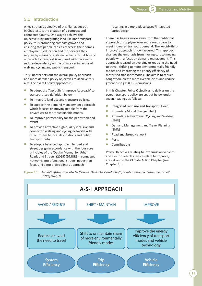
There has been a move away from the traditional approach of supplying ever more road space to meet increased transport demand. The ‘Avoid–Shift-Improve’ approach is now favoured. This approach changes the emphasis from moving cars to moving people with a focus on demand management. This approach is based on avoiding or reducing the need to travel, shifting to more environmentally friendly modes and improving the energy efficiency of motorised transport modes. The aim is to reduce congestion, create more liveable cities and reduce greenhouse gas (GHG) emissions.
In this Chapter, Policy Objectives to deliver on the overall transport policy are set out below under seven headings as follows:
M Integrated Land use and Transport (Avoid)M Promoting Modal Change (Shift)M Promoting Active Travel: Cycling and Walking
(Shift)M Demand Management and Travel Planning
(Shift)M Road and Street NetworkM PortsM Contributions
Policy Objectives relating to low emission vehicles and electric vehicles, which relate to Improve, are set out in the Climate Action Chapter (see Chapter 3).
Figure 5.1: �Avoid-Shift-Improve�Model�(Source:�Deutsche�Gesellschaft�für�Internationale�Zusammenarbeit�(DGIZ)�GmbH)
Reduce or avoidthe need to travel
Shift to or maintain shareof more environmentally
friendly modes
Improve the energy
modes and vehicletechnology
AVOID / REDUCE SHIFT / MAINTAIN IMPROVE
A-S-I APPROACH
System Trip Vehicle
99
Transport and MobilityChapter 5

5.2 Nati onal and Regional Planning ContextIn terms of the hierarchy of plans the NPF and RSES sets out the overarching policy directi on which aims to achieve compact growth and sustainable mobility by way of the integrati on of land use and transport policy together with healthy placemaking. The contributi on of acti ve travel (walking and cycling) to improve public health in the Region is also recognised in the RSES and the NPF.
The Local Authority is also required to ensure that the CDP is consistent with the Nati onal Transport Agency’s (NTA) ‘Transport Strategy for the Greater Dublin Area 2016-2035’ (review scheduled to begin in 2020). The Local Authority plays a dual role by providing for the elements of infrastructure delivery that are within its own remit and also encouraging the development of other infrastructure projects delivered by external agencies, such as the NTA and Transport Infrastructure Ireland (TII).
100
dlrcoco | County Development Plan 2022-2028 | Draft Plan
5.3 Integrated Land use and Transport
5.3.1 Policy Objective T1: Integration of Land Use and Transport Policies
It is a Policy Objective to actively support sustainable modes of transport and ensure that land use and zoning are aligned with the provision and development of high quality public transport systems. (Consistent with NSO 1, NPO 26 of the NPF, 64, RPO 4.40, 5.3, 8.1 and Guiding Principles on Integration of Land Use and Transport of the RSES)
Fundamental to future land use planning in the County is the consolidation of development into the appropriate areas that can enable such development to be well served by sustainable modes of travel. This reflects National Strategic Outcome (NSO) 1 of the NPF which promotes compact growth. From a transport perspective, the most efficient settlement and land use patterns are those that locate the largest proportion of the population within walking and cycling distance of their work, schools, shops and other services. The need to consolidate and concentrate development in a manner that allows the effective provision of, and ready access to, public transport is a central and reoccurring theme throughout this Plan. It also delivers on the Avoid–Shift-Improve’ approach by reducing the need to travel.
The Metropolitan Area Strategic Plan (MASP) as set out in the RSES identifies strategic residential and employment corridors (see Section 1.5.2.5). Two of these corridors are within DLR: -the North-South Corridor along the DART line; and the Metrolink/Luas Green Line Corridor. Capacity for growth will be supported by a new station at Woodbrook-Shanganagh and the westward expansion of Bray to Fassaroe and Old Conna linked to public transport improvements. Further growth will be supported at Sandyford, Ballyogan and Cherrywood by capacity enhancements to the Luas Green Line and improvements to the network.
The Council recognises the fundamental link between mobility and land use so as to reduce reliance on car-based travel for daily journeys and to ensure more sustainable patterns of travel, transport and development. An essential element of this is the need to plan to integrate spatial planning policies with key mobility requirements, mainly through such mechanisms such as higher development densities and mixed-use development within walking and cycling distance of high quality public transport corridors.
The Council will support the use of Area Based Transport Assessments (ABTAs) which integrate national and regional transport policies and
objectives into local level land use plans and significant development areas in the preparation of Local Area Plans in the County.
5.3.2 Policy Objective T2: Delivery of Enabling Transport Infrastructure
It is a Policy Objective to support the delivery of enabling transport infrastructure so as to allow development take place in accordance with the Core Strategy of this Plan and the settlement strategy of the RSES. (Consistent with RPO 4.40, 10.2, 10.3, 10.11, 10.16 of the RSES)
In tandem with the build out of land for development as set out in the Core Strategy there will be an element of enabling transport infrastructure that will also be delivered. Such transport Infrastructure includes the Luas Green Line Enhancement Project, Luas Green Line Extension to Bray, BusConnects, the improvements set out in the ‘Bray and Environs Transport Study’ (2019) and other projects as set out in the 6 year Road Objectives, subject to detailed design having regard to environmental and appropriate assessment, public consultation, approval, finance and resources. Requirements will also take into account the finding of any Area Based Transport Assessment (ABTA) prepared as part of the Old Connaught Local Area Plan process.
With regard to the expansion of Bray – Fassaroe, the Council will collaborate with Wicklow County
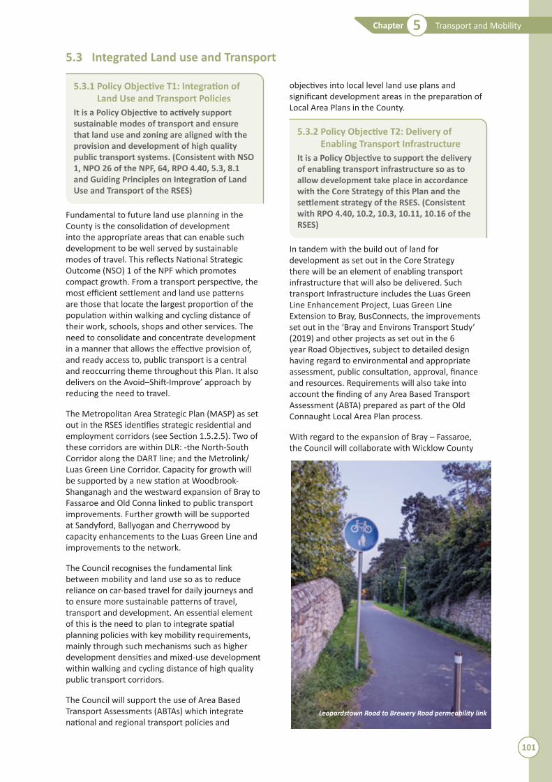
Leopardstown Road to Brewery Road permeability link
101
Transport and MobilityChapter 5
Council, the NTA and the TII to facilitate the delivery of enabling transport infrastructure to facilitate this area including Old Connaught (consistent with RPO 4.40 of the RSES).
The Bray and Environs Transport Study emphasises the need to reduce the overall demand for travel, prioritise pedestrians and cyclists including the implementation of the Greater Dublin Area Cycle Network Plan, prioritise public transport increasing the frequency of Dart and bus services, support the Metrolink to Sandyford and Luas to Bray, protect the national road network facilitating demand management on the N11/M11 and minimise road construction. The Bray and Environs Transport Study sets out enabling Infrastructure as follows:
M Woodbrook Dart Station.M Strategic Park and Ride.M Bus Connects/Core Bus Corridor.M Busway from Fassaroe to Old Connaught over
the County Brook at Ballyman Glen (which also facilitates walking and cycling).
M Support the delivery of a bus service from Sandyford via Rathmichael and Old Connaught
to Bray Dart Station until the Luas Green Line extension to Bray is suitably advanced.
M Facilitate the implementation of demand management measures on the N/M11 and M50.
M Upgrade of the road system in Rathmichael and Old Connaught in order to facilitate the safe, convenient and reliable movement of public transport vehicles, cyclists and pedestrians – including:
N Upgrade of Ferndale Road.N Development of a new link road from
Ferndale Road to Dublin Road.N M50 Cherrywood Interchange to
Rathmichael Link Road.
M Delivery of Metro to Sandyford and Luas Green Line extension to Bray.
M N11/M11 upgrade.
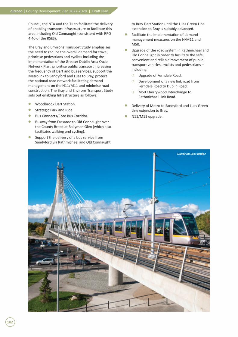
Dundrum Luas Bridge
102
dlrcoco | County Development Plan 2022-2028 | Draft Plan

5.4 Promoting Modal Change
5.4.1 Policy Objective T3: Development of Sustainable Travel and Transport
It is a Policy Objective to promote, facilitate and cooperate with other transport agencies in securing the implementation of the transport strategy for the County and the wider Metropolitan Area as set out in Department of Transport’s ‘Smarter Travel, A Sustainable Transport Future 2009 –2020’ including the modal share targets and the NTA’s ‘Greater Dublin Area Transport Strategy 2016-2035’, the RSES and the MASP. (Consistent with NPOs 26, 64 of the NPF and RPOs 5.2, 5.3, 8.4, 8.7, 8.8 and 8.9 of the RSES)
Sustainable travel is about the movement of people and goods in a manner that engenders quality of life and ease of access for all and seeks to encourage a modal shift in favour of public transport and other active modes. Key to the Avoid–Shift-Improve approach is the shift to more sustainable modes. The increase in active travel modes contributes to healthy lifestyles and is an essential response to climate change.
The Department of Transport’s ‘Smarter Travel, A Sustainable Transport Future 2009-2020’ and the NTA’s Greater Dublin Area Transport Strategy 2016-2035 set out an integrated and balanced sustainable transport strategy for the wider Dublin Region dealing with all sustainable travel modes (bus, rail, Luas, cycling and walking) and road transport as well as issues such as road safety, traffic management, accessibility, enforcement, social inclusion and guidance on complementary land use policies. The review of these two strategies is to begin in 2020. The Council, acting primarily as facilitator rather than the direct provider of some sustainable transport networks, will have a significant role to play both in the development of an efficient transport system and in planning for the future transport needs of the County. In pursuing the objective of encouraging modal shift the Council will co-operate closely with other relevant agencies and stakeholders, including the NTA.
5.4.2 Policy Objective T4: Public Transport Improvements
It is a Policy Objective to expand attractive public transport alternatives to car transport as set out in ‘Smarter Travel, A Sustainable Transport Future 2009-2020’, the NTA’s ‘Greater Dublin Area Transport Strategy 2016-2035’ and the NTAs ‘Integrated Implementation Plan 2019-2024’ by optimising existing or proposed transport corridors and interchanges and by developing new park and rides and taxi ranks and cycling network facilities at appropriate locations. (Consistent with NPO64 of the NPF, RPO 4.40, 5.2, 8.3 and 8.8 of the RSES)
The ‘National Development Plan, 2018-2027’ sets out a number of future sustainable transport projects of relevance to DLR including the following:
M The full Dublin Bus Connects programme to include the complete redesign of the bus network and network of ‘next generation’ bus corridors on the busiest routes.
M The complete construction of Metro Link. This includes the line to Sandyford.
M The delivery of priority elements of the DART Expansion programme.
M A Park-and-Ride Programme including sites at Carrickmines and Woodbrook.
M The appraisal, planning and design of the Luas Green Line network expansion to Bray.
It is a policy objective to ensure that such lands as are required for the development of planned public transport facilities (transport corridors) and interchanges are kept free from development.
5.4.3 Policy Objective T5: Quality Bus Network/Bus Connects
It is a Policy Objective to co-operate with the NTA and other relevant agencies to facilitate the implementation of the bus network measures as set out in the NTA’s ‘Greater Dublin Area Transport 2016-2035’ and ‘Draft Integrated Implementation Plan 2019-2024’ and the BusConnects Programme, and to extend the bus network to other areas where appropriate subject to design, environmental assessment, public consultation, approval, finance and resources. (Consistent with RPO 8.9 of the RSES)
Cyclists on coastal mobility route
103
Transport and MobilityChapter 5

The provision of a good quality bus infrastructure and associated services has the potential to provide the capacity needed to move large volumes of people who travel to work, education, shops and leisure facilities around the County and beyond each day.
BusConnects Dublin is a programme of integrated actions which, proposes to overhaul the current bus system in the Dublin Region. BusConnects, includes several parallel strands of activity including infrastructure and bus priority measures, such as the Core Bus Corridors Project. Phase 1 of the Core Bus Corridor Project will deliver the Radial Core Bus Corridors and Phase 2 will deliver the Orbital Core Bus Corridors. There will be 3 Radial Core Bus Corridors and 3 Orbital Core Bus Corridors servicing DLR as follows:
Radial Core Bus CorridorsM No. 13: Bray - City CentreM No. 14: UCD Ballsbridge – City Centre (new
interchange at UCD)M No. 15: Blackrock - Merrion
Orbital Core Bus CorridorsM Dun Laoghaire – Dundrum (new interchange
hub at Dundrum)M Dundrum / UCD – Tallaght M Dundrum – Finglas
The Bus Connects Programme is being led and progressed by the NTA.
5.4.4 Policy Objective T6: Public Transport Interchanges
It is a Policy Objective to facilitate the provision of quality public transport interchanges at strategic rail, Luas stations and Core Bus Corridors within the County in accordance with national and regional guidelines in order to facilitate focussed access to multiple public transport modes and to maximize the movement of people via sustainable modes.
It is essential that public transport interchange facilities, both local and strategic, are integrated into the overall design, layout and development of key central areas as good quality on-street infrastructure may also have the potential to help improve the overall general public realm. In addition, as public transport demand increases so too does the amount of interchange between services. It follows that a larger number of users will benefit from the proposed improvements in these areas. Opportunities for bus and taxi passengers, cyclists and pedestrians to interchange with rail and
Luas services at key stops and stations will greatly increase the opportunity to travel by rail to a wide variety of destinations.
Table 5.1 below identifies the primary public transport interchanges to be developed.
Table 5.1: Public�Transport�Interchanges
Location Public Transport Modes Dundrum Luas - Bus
Dún Laoghaire Suburban Rail – Bus
Blackrock Suburban Rail – Bus
Cherrywood Luas – Bus
Woodbrook Suburban Rail – Bus
Sandyford Luas – Bus
Cycle parking and cycle facilities provision at public transport interchanges shall be in accordance with the requirements in the Council’s ‘Standards for Cycle Parking and associated Cycling Facilities for New Developments’ (2018).
5.4.5 Policy Objective T7: Green Line Capacity Enhancement (GLCE) Project
It is a Policy Objective to promote, facilitate and cooperate with other agencies in supporting the Luas Green Line Capacity Enhancement Project to cater for the demand for Luas trips in the County in the short and medium term.
The Green Line Capacity Enhancement Project has been identified in the NTA’s ‘Transport Strategy for the Greater Dublin Area 2016-2035’ and also the ‘National Development Plan 2018-2027’. As set out in the TII publication ‘Luas Green Line – Peak Hour Capacity Requirements South of Charlemont’ (2019), “The�primary�objective�of�the�GLCE�project�is�to�optimise�the�public�transport�network�along�Dublin’s�southeast�corridor�and�cater�for�the�future�demand�for�services,�ensuring�optimal�use�of�existing�infrastructure�in�advance�of�other�major�public�transport�investments”.
Phase 1, expected to be completed by Q2 2021, involves extending the existing twenty six 43-metre-long trams to 55 metres in length and the delivery of an additional eight 55 metre trams to the fleet. Extending the trams will increase passenger capacity by c. 30%.
Phase 2 involves increasing frequency by operating thirty 55m trams per hour (in each direction) – one every two minutes.
104
dlrcoco | County Development Plan 2022-2028 | Draft Plan

5.4.6 Policy Objective T8: Luas Extension and MetroLink
It is a Policy Objective to promote, facilitate and cooperate with other agencies in securing the extension of the Luas network in the County as set out in the NTA’s ‘Greater Dublin Area Transport Strategy 2016-2035’ and including any future upgrade to Metro. (Consistent with RPO 4.40 and 8.8 of the RSES)
Included in the Greater Dublin Area Transport Strategy 2016-2035 are proposals to extend the Luas Green Line from Brides Glen to the Bray area (Luas Line B2), subject to the timing and scale of new development in this area and appraisal and economic assessment. The National Development Plan 2018-2027 outlines that it is intended to bring forward the appraisal, planning and design of the Green Line Luas network expansion to Bray.
The Council will protect and safeguard the provisional alignment and surrounding lands, of Luas Line B2 as detailed on Map Nos. 10 and 14. The Council will maintain this proposed route free from development and any encroachment by inappropriate uses which could compromise the future development of this rail corridor for public transport facilities.
5.4.7 Policy Objective T9: Rail Stations/Luas Stops
It is a Policy Objective to co-operate with the NTA, Iarnród Éireann, TII and other relevant authorities to secure the improvement and further development of railway stations and Luas stops in the County. (Consistent with RPO 8.8 of the RSES)
This will include the provision of a new railway station at Woodbrook and the upgrading of existing stations/stops, to rectify existing constraints and shortcomings in the network.
The opening of the Racecourse Luas stop is an important policy of the Ballyogan and Environs Local Area Plan 2019-2025.
Access routes to and through all rail stations and Luas stops shall be in accordance with best accessibility practice. Cycle parking and cycle facilities provision at rail stations and Luas stops shall be in accordance with the requirements in the Council’s ‘Standards for Cycle Parking and associated Cycling Facilities for New Developments’ (2018).
Figure 5.2: Luas�Green�Line�Capacity�Enhancement�Project�(source:�NTA)�
Dundrum Main Street
105
Transport and MobilityChapter 5

5.5 Promoti ng Acti ve Travel: Cycling and Walking
5.5.1 Policy Objecti ve T10: Walking and Cycling
It is a Policy Objecti ve to secure the development of a high quality, fully connected and inclusive walking and cycling network across the County and the integrati on of walking, cycling and physical acti vity with placemaking including public realm improvements. (Consistent with NPO 27 and 64 of the NPF and RPO 5.2 of the RSES)
A key aim of Smarter Travel is to ensure that walking and cycling become the mode of choice for local trips. The encouragement of walking and cycling (acti ve mobility) is a climate change miti gati on measure and important for promoti ng healthy communiti es and reducing obesity.
Routes are being retrofi tt ed to all key desti nati ons and public transport hubs in the County. This retrofi tti ng includes placemaking improvements such as cycle parking, urban greening and street furniture.
The implementati on of temporary mobility works has taken place in response to the Covid 19 Pandemic and includes a range of measures which support business acti viti es in towns and villages by creati ng more external space.
DLR are also rolling out a number of initi ati ves on acti ve and smart mobility soluti ons, including promoti ng and facilitati ng safe walking and cycling connecti vity to schools, third-level insti tuti ons and places of work, a residenti al safe and quiet streets initi ati ve and installati on of cycling infrastructure, as well as juncti on re-design.
The design of the pedestrian and cycle networks shall be informed by the four core principles of DMURS which are connected networks, multi functi onal streets, pedestrian focus and a multi -disciplinary approach.
5.5.2 Policy Objecti ve T11: Footways and Pedestrian Routes
It is a Policy Objecti ve to maintain and expand the footway and pedestrian route network to provide for accessible, safe pedestrian routes within the County in accordance with best accessibility practi ce. (Consistent with NPO 27 and 64 of the NPF and RPO 5.3 of the RSES)
The Council will seek to deliver the following in accordance with the requirements set out in the DMURS, for projects/works to be delivered by the Council and also in terms of the development management process:
1. PEDESTRIANS
2. CYCLISTS
3. PUBLIC TRANSPORT
4. PRIVATE MOTOR VEHICLES
CONSIDER FIRST
CONSIDER LAST
Figure 5.3: User�Hierarchy�(Source:�DMURS,�2019)
Blackrock Main Street - Coastal Mobility Route
106
dlrcoco | County Development Plan 2022-2028 | Draft Plan

M Provide improved pedestrian links within town centres and to public transport nodes to and from residential areas.
M Provide wider footpaths and improved footpath quality where pedestrian volumes are high.
M Provide improved pedestrian facilities at traffic signal junctions.
M Provide improved pedestrian links to and from all schools/colleges.
When the opportunity arises and sufficient road width exists, the provision of footways on rural roads to provide for improved pedestrian access to and from villages/towns and public transport will be positively considered by the Council. For new developments in such areas, appropriate setbacks may be required or other measures to achieve this objective. The local character of the road will be a consideration in the design with sensitive boundary treatment and planting used to address any loss of amenity.
Recreational pedestrian routes will also be encouraged and will be developed in accordance with the Green Infrastructure Strategy (refer to Appendix 15).
5.5.3 Policy Objective T12: County Cycle Network
It is a Policy Objective to secure improvements to the County Cycle Network in accordance with the Dún Laoghaire-Rathdown Cycle Network Review whilst supporting the NTA on the development and implementation of the Greater Dublin Area Cycle Network Plan, subject to environmental assessment. (Consistent with RPO 5.2, 5.3 of the RSES)
In 2012, a County Cycle Network was developed following a comprehensive evidence-based review that assessed all cycling routes in the County in terms of quality of service. The Cycle Network, with an associated Cycle Network Map, provides a priority listing for the development of Primary and Secondary Cycle Routes in the County. The delivery of this Network is ongoing.
Cycling infrastructure improvement schemes are at various stages of design and fast-tracking of some elements of the programme as a response to the Covid-19 Pandemic is taking place where feasible. Junction improvements are also being carried out to improve safety.
Walking and cycling infrastructure is a key component of the design and implementation of the 6 Year road proposals/projects. The design of individual roads and the level of segregation of cycle lanes/paths is done on a case-by-case basis in accordance with Design Manual for Urban Roads
and Streets (2019) and the ‘National Cycle Manual’ (2011).
The Core Corridors of the BusConnects programme will provide high quality cycling facilities, segregated from the bus lanes and general traffic lanes as far as is practicable. This will enhance safety for cyclists and provide a network of key cycling routes.
All new development, and changes of use, must demonstrate how they can provide improved linkages to-and-from the County Cycle Network. New cycle tracks or cycle lanes, or upgrades to cycle routes, shall be designed in accordance with the ‘National Cycle Manual’ (2011). Recreational car-free cycle routes, cycle routes to schools and Greenways will also be developed - in accordance with the Green Infrastructure Strategy (refer to Appendix 15) - to promote cycling within the County and such routes will be encouraged as part of larger developments.
With specific reference to the County’s M11/M50 - the two motorway corridors - which undoubtedly create barriers to cycle/pedestrian movements - provision of shared cycle/pedestrian footbridges at key locations will be encouraged to foster increased permeability and mitigate issues of severance and potential traffic hazard. Proposed bridge locations on the motorway network are set out in Table 5.2 below.
The Council supports the continuing development of the Dodder Greenway (Grand Canal to Bohernabreena).
Table 5.2: �Pedestrian/Cycle�Footbridges�over�M50/M11�
Location Ticknock Drive to Ballinteer Road.
Bearna Way to Moreen.
Sandyford pedestrian and cycle bridge, linking Kilgobbin Road to the Drummartin Link Road on the west side of M50 Junction 13.
Murphystown Road to Leopardstown (as part of, or separate to, Murphystown Link Road).
HRI bridge from Ballyogan to South County Business Park/HRI lands.
M50 Carrickmines Junction (east to west).
In the vicinity of Allies River Road.
Love Lane Bridge
5.5.4 Policy Objective T13: Coastal Cycling Infrastructure Objective
It is a Policy Objective of the Council to promote the development of Dublin Bay Trail from the boundary with Dublin City to Wicklow County as a component part of the National East Coast Trail Cycle Route.
107
Transport and MobilityChapter 5

This coastal route will be subject to a feasibility study, including an assessment of the route options. Any development proposals shall be subject to Appropriate Assessment Screening in accordance with the requirements of the EU Habitats Directive to ensure the protection and preservation of all designated SACs, SPAs and pNHAs in Dublin Bay and the surrounding area.
Any proposals will be progressed in conjunction with adjoining Local Authorities and in co-operation with other agencies, including the NTA.
5.5.5 Policy Objective T14: Bike Rental Schemes
It is a Policy Objective to support the provision of bike rental (pedal and e-bike) across the County.
Short term bike rental or sharing schemes are a means of cycling without using your own vehicle. There are very successful schemes already well developed in Dublin City and many UK and European cities with schemes already available in Dún Laoghaire-Rathdown. In more recent times
public electric bike schemes are becoming more common.
The primary aim of providing bike rental schemes for Metropolitan towns outside Dublin City Centre is to:
M Improve accessibility for those travelling to, from and within these towns by increasing the bicycle mode share.
M To improve the bicycle mode share, especially for short trips (pedal bikes) with a longer distance achievable for e-bikes.
M Reduce car use and congestion and subsequently provide more liveable towns through the provision of a healthier mode of transport.
The Council recognises the desirability of facilitating where practicable the integration of bike rental schemes in the County with bike rental schemes in other neighbouring local authority areas, in order to encourage cycling tourism from Dublin City and other neighbouring towns and local authority areas into the County.
108
dlrcoco | County Development Plan 2022-2028 | Draft Plan

5.6 Demand Management and Travel Planning
5.6.1 Policy Objective T15: Travel Demand Management
It is a Policy Objective, in conjunction and co-operation with other agencies, to implement Travel Demand Management measures aimed at reducing the demand for travel and increasing the efficiency of the transport network with due consideration given to the effect of parking controls on nearby residential roads. (Consistent with RPO 8.7 of the RSES)
Traffic Demand Management covers a range of measures aimed at reducing the adverse impacts of car use and promoting the use of sustainable travel modes. It is the implementation of measures that seek to change travel demand patterns and travel behaviour targeted at reducing the need to travel, reducing the amount and length of single occupancy car trips and encouraging walking and cycling and use of public transport, in preference to car based travel and the avoidance of adding more physical capacity for travel (such as more roads, bus and train services etc). It is part of the ‘Shift’ in the ‘Avoid - Shift – Improve’ strategic approach.
5.6.2 Policy Objective T16: Travel PlansIt is a Policy Objective to require the submission of Travel Plans for developments that generate significant trip demand (reference also Appendix 3 for Development Management Thresholds). Travel Plans should seek to reduce reliance on car based travel and encourage more sustainable modes of transport over the lifetime of a development. (Consistent with RPO 8.7 of the RSES)
A Travel Plan is a long-term management strategy employed by an organisation that seeks to promote and deliver sustainable transport objectives through positive action and is articulated in a document that is regularly reviewed. It involves the development of agreed and explicit outcomes, linked to an appropriate package of measures, aimed at encouraging more sustainable travel for people and goods.
5.6.3 Policy Objective T17: Car Sharing Schemes
It is a Policy Objective to support the set up and operation of car sharing schemes to facilitate an overall reduction in car journeys and car parking requirements.
Car sharing schemes involve members pre-booking the use of communal cars for their personal use, thereby reducing the number of cars on the roads
and helping the environment. They allow members access to a car when they need it, from a place near their home or workplace, without the potential difficulties or costs of owning a car. They are an important method of facilitating the reduction of car ownership and supporting the shift to low carbon modes.
The Council will seek - in accordance with the ‘Sustainable Urban Housing: Design Standards for New Apartments Guidelines for Planning Authorities’ (2018) - the provision of car clubs in residential developments particularly where a reduction in car parking is being sought.
5.6.4 Policy Objective T18: Carparking Standards
It is a Policy Objective to manage carparking as part of the overall strategic transport needs of the County in accordance with the parking standards set out in Section 12.4.5.
This Plan includes comprehensive car parking standards which are set out in Section 12.4.5. Four parking zones have been established for the County with the aim of ensuring adequate residential parking/car storage and control of destination carparking (non-residential uses), whilst also allowing greater flexibility in car parking standards on sites well served by public transport.
Zone 1 covers the two Major Town Centres of Dun Laoghaire and Dundrum plus Blackrock District Centre. Zone 2 covers additional areas that are well served by public transport (see Section 12.4.5.1 for detailed parameters pertaining to Zone 2). Zone 3 includes the remaining built up areas of the County whilst Zone 4 is the rural area.
While a maximum standard is provided for non-residential uses (destination parking), the Planning Authority - in recognition of the fact that car usage may be required for non-peak hour trips, resulting in the need for car storage – have retained a standard for residential car parking in areas outside of Zone 1.
5.6.5 Policy Objective T19: Control of On-Street Parking
It is a Policy Objective to regulate and control on-street parking by discouraging commuter parking.
In the control and regulation of on-street car parking, the Council will provide for the short-term and long-term parking needs of local residents, rather than long-term commuter parking requirements and allow for short-term retail
109
Transport and MobilityChapter 5
parking. The Council will extend its current Car Parking Control Scheme into other areas of the County as appropriate through the Parking Control Bye-Laws where such controls will contribute to improved traffic management, reduced traffic congestion and an improvement in the quality of life of the local residents. Areas in the County will be identified for the provision of Heavy Goods Vehicle parking when/if the need arises.
The Council will facilitate the provision of car parking spaces for the charging of electric vehicles at appropriate locations.
5.6.6 Policy Objective T20: Park and RideIt is a Policy Objective to facilitate the provision of Park and Ride facilities, with suitable electric charging structures and adequate cycle parking, in appropriate locations along strategic transport corridors, including Woodbrook and Carrickmines subject to the outcome of environmental assessment and planning approval. (Consistent with RPO 8.14 of the RSES)
The Council will support the provision of a new Park and Ride at Woodbrook and enhanced Park and Ride facilities at Carrickmines in accordance with Table 8.5 and RPO 8.14 of the RSES. In addition, other Park and Ride development and enhancement in appropriate locations will be considered. Any Park and Ride at Woodbrook shall be carried out in tandem with the improvement of the local road network.
Park and Ride sites should be located in more peripheral areas, on the fringes of the Dublin Metropolitan Area, where the road network has capacity to absorb the impact of traffic generated by the Park and Ride and not be located where they might encourage people who would otherwise access public transport locally to drive further to access a site, thereby adding to congestion.
Complementary car parking controls in the environs of key Park and Ride car parks may be required, particularly in the case where the car park is charged for or it is regularly oversubscribed. Consideration should be given to suitable charging structures for Park and Ride facilities to ensure that only those who most need the service - public transport users - obtain parking. Cycle parking and cycle facilities provision at rail-based Park and Ride facilities shall be in accordance with the requirements in the Council’s ‘Standards for Cycle Parking and associated Cycling Facilities for New Developments’ (2018).
5.6.7 Policy objective T21: Taxi/Minibus/Hackney Transport
It is a Policy Objective to facilitate the provision of taxi/minibus/hackney transport as a feeder service to major public transport corridors and to encourage the provision of taxi ranks at DART Stations, Luas stops, key bus stations and at other appropriate locations - including within larger residential, commercial and/or mixed-use developments.
Taxis provide door-to door transport for those without access to a car or a scheduled public transport service. They also provide a means of travel for the mobility impaired or those carrying heavy or bulky luggage that precludes them from using scheduled public transport.
Taxis can enable people at some remove from the scheduled public transport network to access those services, effectively extending the reach of public transport. Taxis can also act as a substitute for scheduled public transport services, particularly in areas of dispersed population or at night. To support these roles, measures to improve the integration of the taxi into the public transport network will continue to be pursued. All new taxi ranks will be made wheelchair accessible.
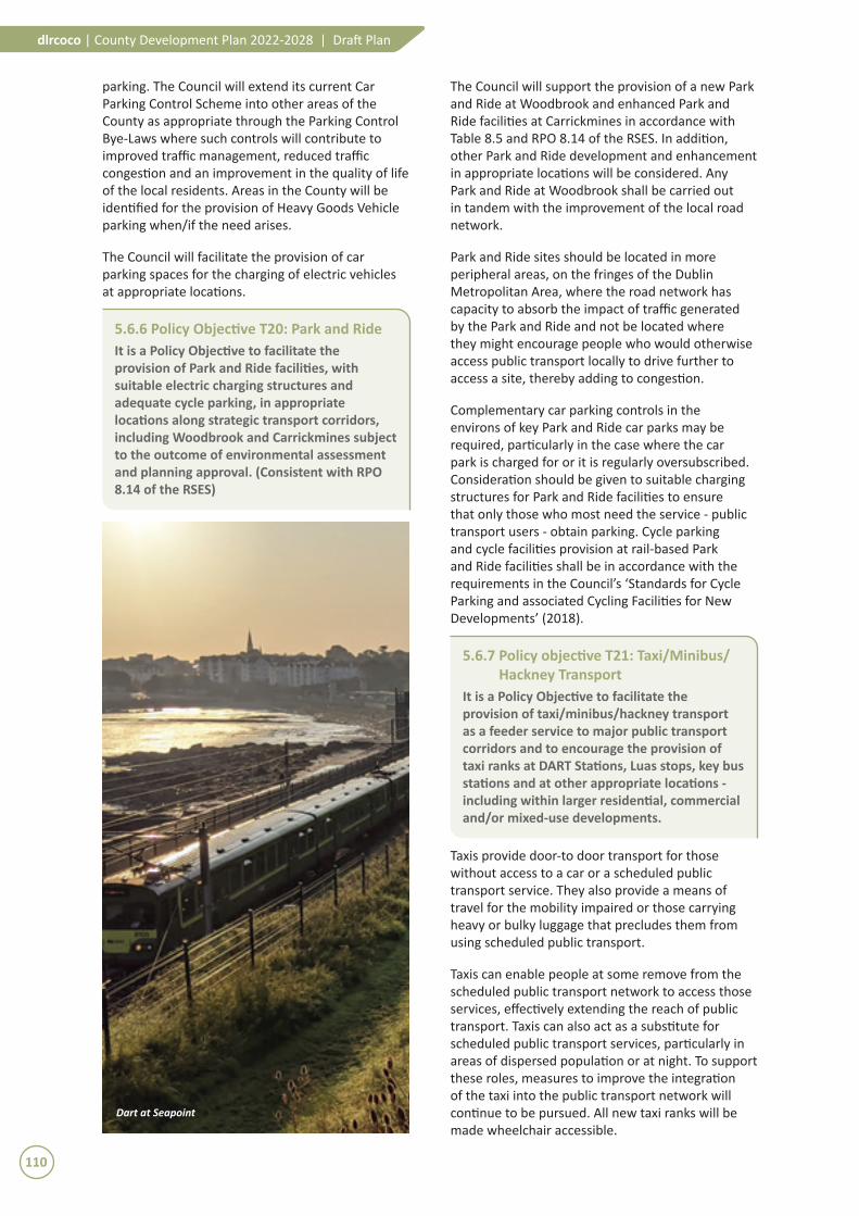
Dart at Seapoint
110
dlrcoco | County Development Plan 2022-2028 | Draft Plan

5.7 Road and Street Network
5.7.1 Policy Objective T22: Roads and Streets
It is a Policy Objective, in conjunction and co-operation with other transport bodies and authorities such as the TII and the NTA, to secure improvements to the County road network – including improved pedestrian and cycle facilities, subject to the outcome of environmental assessment (SEA, EIA and AA), flood risk assessment and the planning process (RPO 8.10, RPO 8.16)
The majority of DLR’s 6 Year road proposals primarily consist of safety and facilities improvements for pedestrians and cyclists. All road
projects listed and unlisted in this Plan will consider all modes (walking, cycling and, if appropriate, bus) in accordance with DMURS and the National Cycle Manual.
The 6 Year and Long Term Roads Objective/Traffic Management/Active Travel Upgrades proposed by the Council are listed in Table 5.3 and Table 5.4 below and most are displayed graphically on the 14 no. Development Plan Maps. Some roads and upgrades will be provided by the Local Authority and others will be provided by developers. It should be noted that the roads shown on the Maps are purely diagrammatic with regard to location and dimensions. Variations and/or adjustments may be necessary as projects progress.
Table 5.3: 6�Year�Road�Objectives/Traffic�Management/Active�Travel�Upgrades
6 Year Road Objectives/Traffic Management/Active Travel Upgrades Local Authority Delivery
Developer Delivery
Ballinteer Road (M50 to Ballinteer Avenue) 3
Blackglen Road 3
Bracken Road Extension to Drummartin Link Road 3
Cherrywood Road 3
Cherrywood SDZ (necessary roads infrastructure as detailed in Cherrywood SDZ Planning Scheme)
In accordance with the Cherrywood Planning Scheme
Cherrywood to Dún Laoghaire Strategic Route (R118, Wyattville Road to Glenageary Roundabout)
3
Clay Farm Loop Road 3
Coal Quay Bridge and Causeway2 3
Glenamuck District Roads Scheme 3
Glenamuck Road South 3
Harolds Grange Road, College Road 3
Hillcrest Road 3
M11 Upgrade (M50 to Fassaroe) 3
Enniskerry Road (Stepaside to Glenamuck District Roads) 3
Kilgobbin Road (Sandyford Hall to Ballyogan Road) 3
M50 Junction 14 diverge, ESB Link Road and link to Arena Road 3
M50 Cherrywood Interchange to Rathmichael – new link road1 3
Ferndale Road1 3 3
Link from Ferndale Road to Dublin Road1 3 3
Rochestown Avenue 3
Sandyford / Enniskerry Road (Coolkill to Aiken’s Village) 3
Shanganagh Road 3
Sunnyhill to the Willows, Loughlinstown 3
The Park, Carrickmines to Ballyogan Road 3
Woodbrook/Shanganagh Access Road 3
Leopardstown Link Road Phase 2 3 3(part)Murphystown Link Road 3 3(part)
1 Not demarcated on the 14 no. County Development Plan maps.2 Demarcated via a Specific Local Objective.
111
Transport and MobilityChapter 5
The priority of certain road schemes in Table 5.3 may be transferable to Table 5.4 and vice versa subject to the availability of resources. In addition, the lists are not intended to be exclusive to the schemes listed, as other supplementary road schemes may require to be introduced as zoned infill sites are developed, in response to changing circumstances and/or as traffic demands require.
Note 1: Smaller-scale schemes, such as minor junction improvements, traffic management improvements and the provision of footpaths, are not shown on the Development Plan Maps nor are they included in the Written Statement.
Note 2: In some instances, delivery will be part Local Authority and part developer driven. This may also be subject to change.
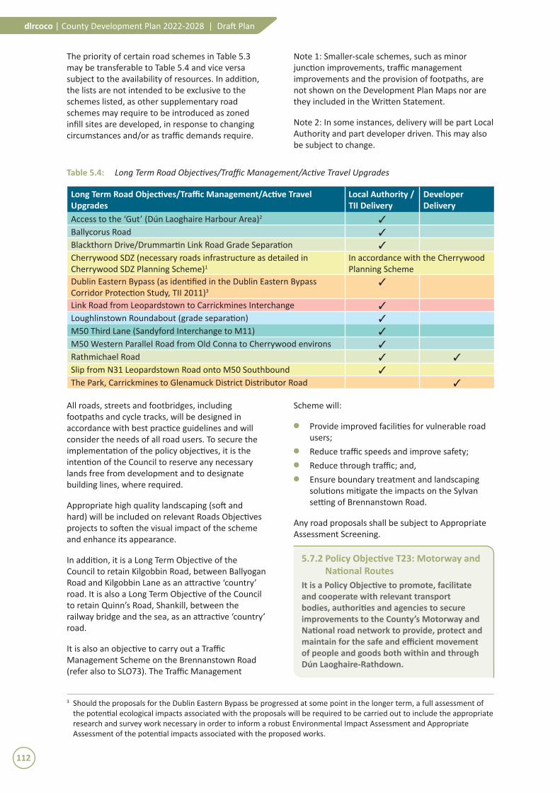
Table 5.4: Long�Term�Road�Objectives/Traffic�Management/Active�Travel�Upgrades
Long Term Road Objectives/Traffic Management/Active Travel Upgrades
Local Authority / TII Delivery
Developer Delivery
Access to the ‘Gut’ (Dún Laoghaire Harbour Area)2 3
Ballycorus Road 3
Blackthorn Drive/Drummartin Link Road Grade Separation 3
Cherrywood SDZ (necessary roads infrastructure as detailed in Cherrywood SDZ Planning Scheme)1
In accordance with the Cherrywood Planning Scheme
Dublin Eastern Bypass (as identified in the Dublin Eastern Bypass Corridor Protection Study, TII 2011)3
3
Link Road from Leopardstown to Carrickmines Interchange 3
Loughlinstown Roundabout (grade separation) 3
M50 Third Lane (Sandyford Interchange to M11) 3
M50 Western Parallel Road from Old Conna to Cherrywood environs 3
Rathmichael Road 3 3
Slip from N31 Leopardstown Road onto M50 Southbound 3
The Park, Carrickmines to Glenamuck District Distributor Road 3
3 Should the proposals for the Dublin Eastern Bypass be progressed at some point in the longer term, a full assessment of the potential ecological impacts associated with the proposals will be required to be carried out to include the appropriate research and survey work necessary in order to inform a robust Environmental Impact Assessment and Appropriate Assessment of the potential impacts associated with the proposed works.
All roads, streets and footbridges, including footpaths and cycle tracks, will be designed in accordance with best practice guidelines and will consider the needs of all road users. To secure the implementation of the policy objectives, it is the intention of the Council to reserve any necessary lands free from development and to designate building lines, where required.
Appropriate high quality landscaping (soft and hard) will be included on relevant Roads Objectives projects to soften the visual impact of the scheme and enhance its appearance.
In addition, it is a Long Term Objective of the Council to retain Kilgobbin Road, between Ballyogan Road and Kilgobbin Lane as an attractive ‘country’ road. It is also a Long Term Objective of the Council to retain Quinn’s Road, Shankill, between the railway bridge and the sea, as an attractive ‘country’ road.
It is also an objective to carry out a Traffic Management Scheme on the Brennanstown Road (refer also to SLO73). The Traffic Management
Scheme will:
M Provide improved facilities for vulnerable road users;
M Reduce traffic speeds and improve safety;M Reduce through traffic; and,M Ensure boundary treatment and landscaping
solutions mitigate the impacts on the Sylvan setting of Brennanstown Road.
Any road proposals shall be subject to Appropriate Assessment Screening.
5.7.2 Policy Objective T23: Motorway and National Routes
It is a Policy Objective to promote, facilitate and cooperate with relevant transport bodies, authorities and agencies to secure improvements to the County’s Motorway and National road network to provide, protect and maintain for the safe and efficient movement of people and goods both within and through Dún Laoghaire-Rathdown.
112
dlrcoco | County Development Plan 2022-2028 | Draft Plan

The introduction of variable speed limits, better incident detection and demand management would protect the national function of these routes. In accordance with RPO 8.10 of the RSES it is a Policy Objective to support the delivery of the appraisal and delivery of the M11 Junction 4 to Kilmacanogue Scheme subject to the outcome of environmental assessment and the planning process (consistent with RPO 8.10 and 8.16 of the RSES).
The Council will support the improvement and protection of the EU TEN-T (Trans-European Network for Transport) network to strengthen access routes to Ireland’s ports, including investment in the ongoing development of the N11/M11 (consistent with RPO 8.16 of the RSES).
The Council will facilitate the protection of all National routes from frontage access and to minimise the number of junctions in accordance with TII’s Policy and the Department of Environment, Community and Local Government’s ‘Spatial Planning and National Roads Guidelines for Planning Authorities’ (2012).
The Council will take due cognisance of the M50 Demand Management Report (April 2014) and work alongside all other stakeholders - including the TII and NTA - in implementing the various measures required to ensure that the strategic function of the M50 is protected and growth in travel demand is managed, as set out in the Report.
5.7.3 Policy Objective T24: Environmental Assessment of New Roads
It is a Policy Objective that where projects for new roads, identified under Section 5.7, are not already provided for by existing plans/programme or are not already permitted, that the feasibility of progressing these projects shall be examined, taking into account environmental sensitivities as identified in the SEA Environmental Report and the objectives of the Plan relating to sustainable mobility. A Corridor and Route Selection Process will be undertaken where appropriate, for relevant new road infrastructure in two stages: Stage 1 – Route Corridor Identification, Evaluation and Selection and Stage 2 – Route Identification, Evaluation and Selection.
5.7.4 Policy Objective T25: Traffic and Transport Assessments and Road Safety Audits
It is a Policy Objective to require Traffic and Transport Assessments and/or Road Safety Audits for major developments – in accordance with the TII’s ‘Traffic and Transport Assessment
Guidelines’ (2014) - to assess the traffic impacts on the surrounding road network and provide measures to mitigate any adverse impacts - all in accordance with best practice guidelines.
Traffic and Transport Assessment is a methodology used to assess the transport impacts of a proposed development, incorporating any subsequent measures necessary to ensure roads and junctions and other transport infrastructure in the vicinity of the development remains fit for purpose and encourages a shift towards sustainable travel modes (refer also to Section 12.4.1 and Appendix 3 ‘Development Management Thresholds’).
5.7.5 Policy Objective T26: Traffic NoiseIt is a Policy Objective to ensure that traffic noise levels are considered as part of new developments along major roads/rail lines in accordance with best practice guidelines.
Along major transport corridors, the effect of traffic noise on the development must be considered and appropriate measures undertaken to mitigate the effect of noise. This should be considered in the context of the ‘Dublin Agglomeration Environmental Noise Action Plan 2018-2023’. The Noise Action Plan is aimed at managing environmental noise and excludes, for the most part, noise from domestic activities, noise created by neighbours, noise at work places or construction noise.
In the planning and design of national road schemes, cognisance must be given to the National Road Authority document ‘Guidelines for the Treatment of Noise and Vibration in National Road Schemes’ (2004) and to the subsequent supplementary document ‘Good Practice Guidance for the Treatment of Noise during the Planning of National Road Schemes’ (2014).
5.7.6 Policy Objective T27: Road SafetyIt is a Policy Objective to implement the Road Safety Authority`s ‘Road Safety Strategy 2013 - 2020’ in conjunction with relevant stakeholders and agencies.
Reducing the risk of collisions for all road users is a key objective of the Council. The Council’s ‘Road Safety Plan 2015-2020’ contains an Action Plan to reduce collisions and casualties based on implementation of ‘Education, Engineering, Enforcement and Evaluation’ measures.
The Road Safety Plan was developed in line with the Road Safety Authority’s ‘Road Safety Strategy 2013 – 2020’. Ireland’s fourth Road Safety Strategy 2013-2020 ‘Closing the Gap’, builds on the progress for pedestrians and cyclists at pedestrian crossings
113
Transport and MobilityChapter 5

and the understanding provided by the fi rst three Strategies with the objecti ve of sustainably improving safety on Irish roads.
School Traffi c Zones (reduced speed limits, speed reducti on measures, road marking, signage etc.) will conti nue to be developed and school wardens provided or retained near schools where warranted in order to encourage good user behaviour for motorists, cyclists and pedestrians on roads, footways and crossing points approaching schools.
5.7.7 Policy Objecti ve T28: Traffi c Management
It is a Policy Objecti ve to introduce Traffi c Management Schemes on parti cular roads and in appropriate areas throughout the County to reduce vehicle speeds to an acceptable level and to reduce the potenti al for traffi c congesti on and associated vehicular emissions in urban areas.
In the design of Traffi c Management Schemes, designers will be encouraged to ensure that the needs of all road users are considered in such schemes and to miti gate any likely possible negati ve eff ects including the potenti al impact of traffi c diverti ng to the surrounding road network.
All new residenti al development must be designed in accordance with the requirements set out in DMURS. This Manual sets out design guidance and standards for constructi ng new, and reconfi guring existi ng, urban roads and streets in Ireland by incorporati ng good planning and design practi ce to create low speed environments in urban areas. A new speed limit of 30 km per hour was introduced for 742 housing estates within the County from July 2017.
5.7.8 Policy Objecti ve T29: Street Lighti ngIt is a Policy Objecti ve to provide and maintain street lighti ng on the public road/footway/cycleways throughout the County in accordance with commonly accepted best practi ce, the Council’s public lighti ng masterplan and the upgrade of sodium lights to LEDs.
To ensure well-lit roads, footways and cycleways, all street lighti ng will be provided in accordance with best practi ce guidelines and standards in terms of the type of lighti ng columns, lantern types, lighti ng class, lux levels and energy effi cient lanterns being provided (refer to Secti on 12.4.4).
The conti nued upgrading of public lighti ng by replacing sodium lights with LEDs and deploying Central Management Systems in the interest of
reducing the energy demand identi fi ed as Acti on E2 in the Council’s ‘Climate Change Acti on Plan 2019-2024’. This is a measure which contributes to the reducti on of GHGs.
5.7.9 Policy Objecti ve T30: AccessibilityIt is a Policy Objecti ve to support suitable access for people with disabiliti es, including improvements to transport, streets and public spaces. Accessibility primarily concerns people with reduced mobility, persons with disabiliti es, older persons and children. (Consistent with RPO 9.1 and 9.10 of the RSES)
Accessibility and inclusivity are vital for the full parti cipati on of all groups in the social and economic life of the County. Disability legislati on places obligati ons on public bodies to ensure their services are accessible to all vulnerable road users. Inclusiveness and accessibility will be key considerati ons in the design of all faciliti es for pedestrians, cyclists and public transport passengers, including people with disabiliti es.
All developments shall be in accordance with Technical Guidance Document M of the Building Regulati ons 2010 and shall meet the accessibility requirements contained within DMURS. Furthermore, the Council should have regard to the obligati ons under Arti cle 9 of the UN Conventi on on the Rights of Persons with Disabiliti es (rati fi ed by Ireland in 2018), “to�enable�persons�with�disabiliti�es�to�live�independently�and�parti�cipate�fully�in�all�aspects�of�life”.
5.7.10 Policy Objecti ve T31: Directi onal/Informati on/ Waymarking Signage
It is a Policy Objecti ve to provide directi onal signage for ameniti es, tourist att racti ons and local att racti ons and along cycle and pedestrian routes (waymarking) at appropriate locati ons throughout the County in accordance with planning and traffi c regulati ons.
In accordance with Council guidelines and subject to Council approval, directi onal signage will be permitt ed at appropriate locati ons for ameniti es, tourist att racti ons, community faciliti es and local att racti ons but not for commercial organisati ons - in order to avoid a proliferati on of signs on public footways leading to street clutt er and existi ng signposts or poles should be used, where possible, in favour of the installati on of new ones. Temporary event signage may be permitt ed in certain cases subject to Council approval. Fingerpost signage is the preferred type of directi onal signage. Signage must be erected such that it does not result in traffi c hazard.
114
dlrcoco | County Development Plan 2022-2028 | Draft Plan

5.8 Ports
5.8.1 Policy Objecti ve T32: Access and PortsIt is a Policy Objecti ve to improve access to and support the conti nued development of Dún Laoghaire Port as a marine related asset in accordance with the 2013 ‘Nati onal Ports Policy’. (Consistent with RPO 8.23 of the RSES)
The Council recognises the importance of Dún Laoghaire Port as a port of regional signifi cance and consequently strongly supports any improvements in terms of accessibility for all modes.
Improvements to the accessibility of Dún Laoghaire Port shall take full cognisance of the need to protect and preserve the historic streetscapes, vistas and built heritage of Dún Laoghaire and the quality of life of local residenti al communiti es adjacent to the Port.
Dun Laoghaire Harbour
115
Transport and MobilityChapter 5

5.9 Contributions
5.9.1 Policy Objective T33: Section 48 and 49 Levies
It is a Policy Objective to utilise, where appropriate, the provisions of Section 48 and 49 of the Planning and Development Act, 2000, to generate financial contributions towards the capital costs of providing local and strategic transport infrastructure, services or projects in the County. This will be carried out in conjunction with adjoining Local Authorities where appropriate.
Financial contributions will be sought - as part of the Development Management process - for certain developments under the provisions of Section 48 and Section 49 of the Planning and Development Act 2000 (as amended).
Section 48 (General) Schemes relate to the existing or proposed provision of public infrastructure and facilities being developed benefiting development within the area of the Planning Authority and are applied as a general levy on development. A ‘special’ contribution under Section 48(2)(c) may be required where specific exceptional costs not covered by a Scheme, but which may benefit the proposed development are incurred by a Local Authority.
Section 49 (Supplementary) Schemes relate to the separately specified infrastructural service or projects – such as roads, rail, or other public transport infrastructure, which benefit the proposed development. Where Schemes overlap with another Local Authority, the Section 49 Scheme will be developed in conjunction with that Local Authority.
Two Section 49 Schemes have already been approved and currently operate in the County, namely:
M Luas Line B1 extension between Sandyford and Cherrywood.
M Glenamuck District Distributor Road linking the Kiltiernan/Glenamuck area to the M50 Motorway network.
To avoid map clutter the two ‘active’ Section 49 Schemes have not been shown on the Development Plan Maps, but are instead detailed on Map No. T3 (refer to Supplementary Mapping Booklet). The Luas Line B1 catchment is defined by an area of 1 kilometer ‘as the crow flies’ distance either side of the light rail alignment. The Glenamuck District Distributor Road Section 49 catchment encompasses the area defined by the Kiltiernan/Glenamuck Local Area Plan boundary.
M50
116
dlrcoco | County Development Plan 2022-2028 | Draft Plan