Transforming the Way the World Works · 2019-09-13 · Transforming the Way the World Works Trimble...
71
Transforming the Way the World Works Sanjeev Trehan Director of Business Development & Sales & Distribution, Govt. & Defence “Advancing Role of Geospatial Knowledge in Digital Economy” Vijayawada, 06.09.2019
Transcript of Transforming the Way the World Works · 2019-09-13 · Transforming the Way the World Works Trimble...
Transforming the Way the World Works
Sanjeev Trehan
Director of Business Development & Sales & Distribution, Govt. & Defence
“Advancing Role of Geospatial Knowledge in Digital Economy” Vijayawada, 06.09.2019
Transforming the
Way the World Works
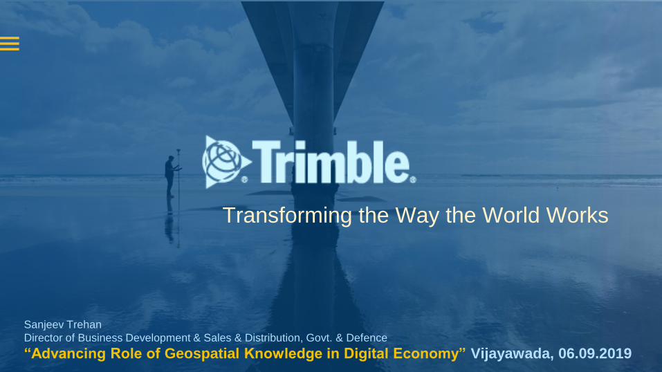
Trimble Inc.
At Trimble, we have been in the
business of crafting confidence for
customers for over 35 years.
Founded on the core principles of
triangulation, we stand for: Position,
Information and Communication.
Where all points unite, you’ll find
Trimble -with innovation and
technology for the future.
Position
Information
Communication
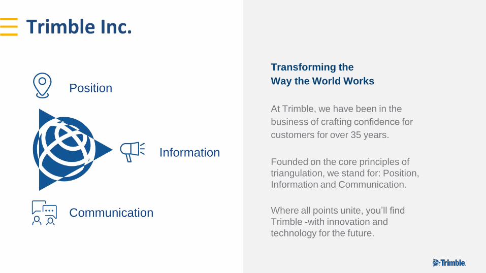
Trimble Snapshot
InnovationCompany
NASDAQ:
TRMB
$3.13B
Revenue (2018 year end)
34%+
Building & Infrastructure
1,200+
Unique Patents
360 Construction Workflow
& Technology Patents
14%
R&D re-invested
People
11,000+ Employees
in 35 Countries
800+ Construction
Professionals
Global Customers
in 150 countries
Trimble - 1200+ People Strong in India
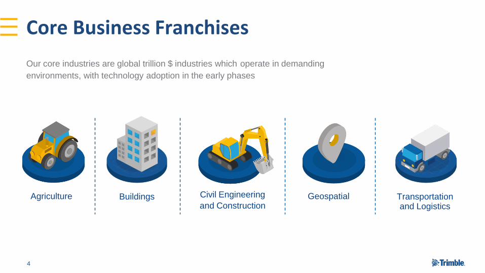
Core Business Franchises
Transportationand Logistics
GeospatialBuildings Civil Engineering
and ConstructionAgriculture
4
Our core industries are global trillion $ industries which operate in demanding
environments, with technology adoption in the early phases
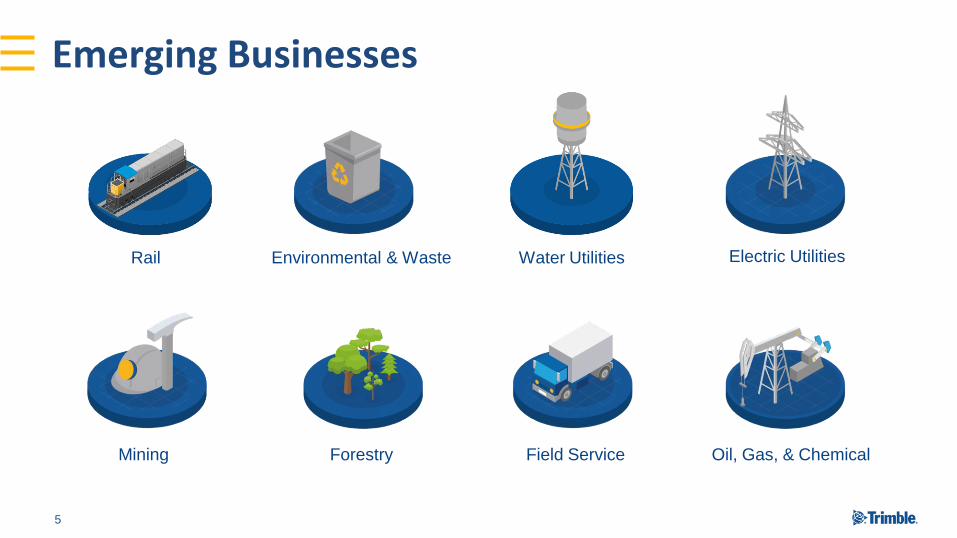
Emerging Businesses
Rail Environmental & Waste Water Utilities Electric Utilities
Mining Forestry Field Service Oil, Gas, & Chemical
5

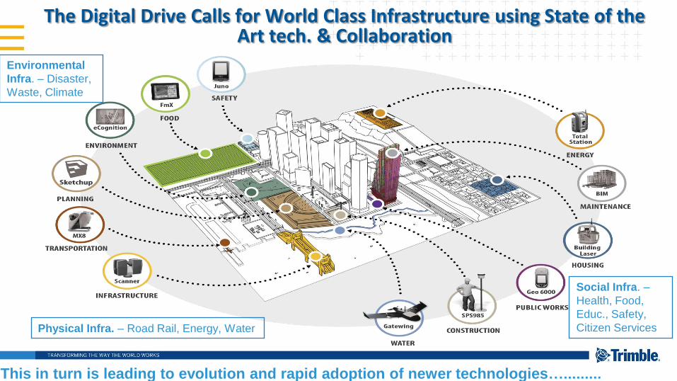
The Digital Drive Calls for World Class Infrastructure using State of the Art tech. & Collaboration
This in turn is leading to evolution and rapid adoption of newer technologies….........
Environmental
Infra. – Disaster,
Waste, Climate
Physical Infra. – Road Rail, Energy, Water
Social Infra. –
Health, Food,
Educ., Safety,
Citizen Services

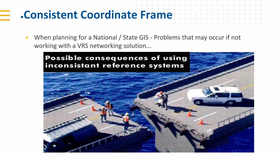
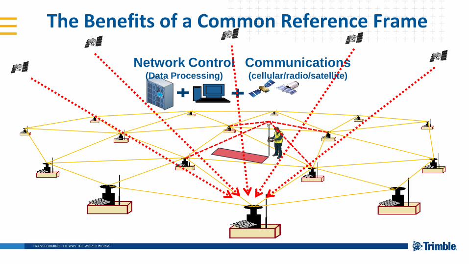
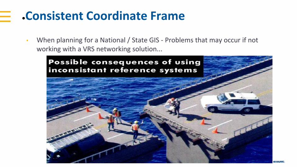
●Consistent Coordinate Frame
When planning for a National / State GIS - Problems that may occur if not working with a VRS networking solution...
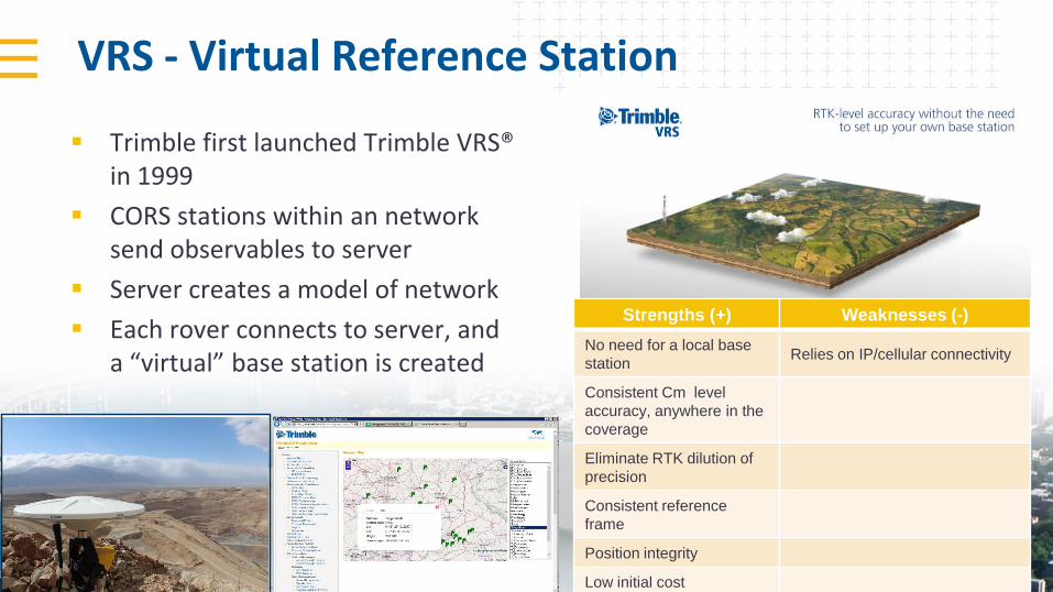
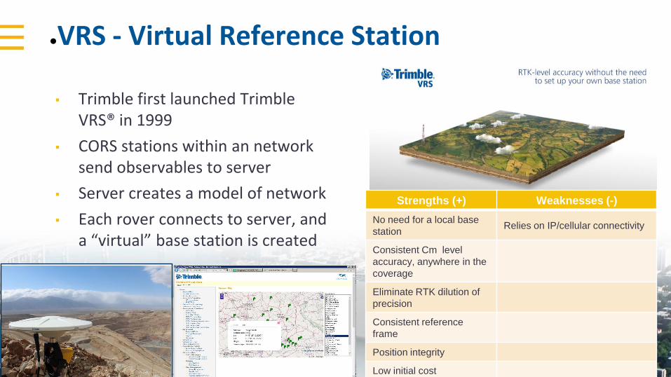
VRS - Virtual Reference Station
Trimble first launched Trimble VRS® in 1999
CORS stations within an network send observables to server
Server creates a model of network
Each rover connects to server, and a “virtual” base station is created
Strengths (+) Weaknesses (-)
No need for a local base
stationRelies on IP/cellular connectivity
Consistent Cm level
accuracy, anywhere in the
coverage
Eliminate RTK dilution of
precision
Consistent reference
frame
Position integrity
Low initial cost
Communications(cellular/radio/satellite)
Network Control(Data Processing)
The Benefits of a Common Reference Frame
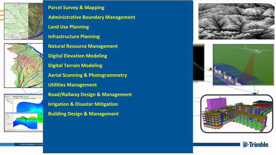
Parcel Survey & Mapping
Administrative Boundary Management
Land Use Planning
Infrastructure Planning
Natural Resource Management
Digital Elevation Modeling
Digital Terrain Modeling
Aerial Scanning & Photogrammetry
Utilities Management
Road/Railway Design & Management
Irrigation & Disaster Mitigation
Building Design & Management

Geodetic Infrastructure, GNSS, and Innovative technologies will revolutionize geospatial data gathering & decision making
This change will happen within government and the private sector, followed by huge innovation and creativity in application and value-generation
The biggest transformation in the transition away from traditional methods is MORE information, FASTER work, EARLIER societal benefit, BETTER living!
Points to be Noted

Thank You
Transforming the Way the World Works
Sanjeev Trehan
Director of Business Development & Sales & Distribution, Govt. & Defence
“New Age Solutions Addressing Digital Age Challanges” Vijayawada, 06.09.2019
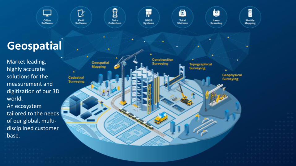
Market leading, highly accurate solutions for the measurement and digitization of our 3D world.An ecosystem tailored to the needs of our global, multi-disciplined customer base.
Geospatial


Geodetic Framework Infrastructure
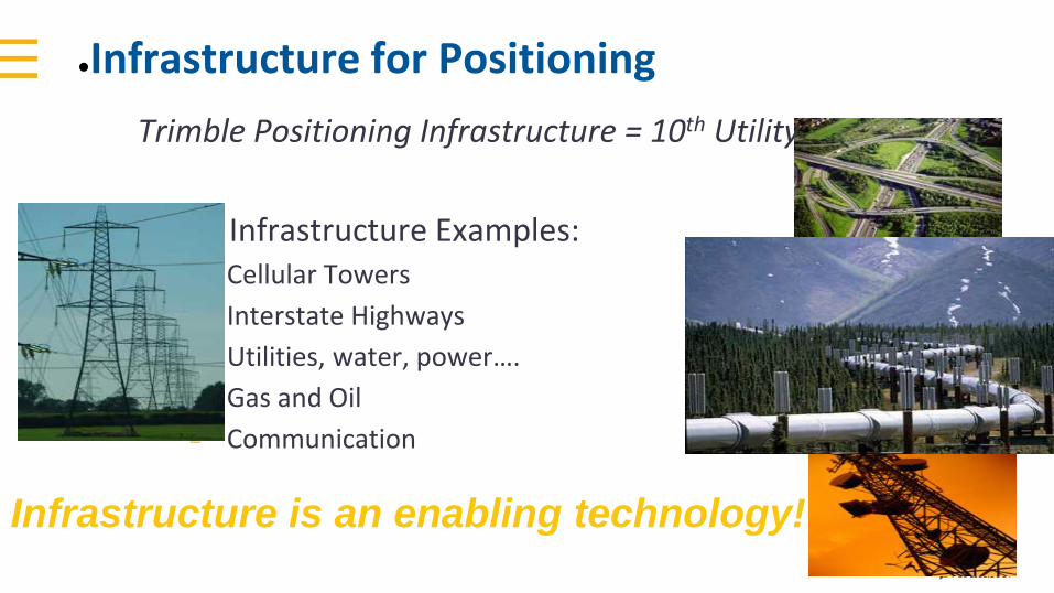
●Infrastructure for Positioning
Trimble Positioning Infrastructure = 10th Utility
▪ Infrastructure Examples:– Cellular Towers
– Interstate Highways
– Utilities, water, power….
– Gas and Oil
– Communication
Infrastructure is an enabling technology!
●Consistent Coordinate Frame
▪ When planning for a National / State GIS - Problems that may occur if not working with a VRS networking solution...
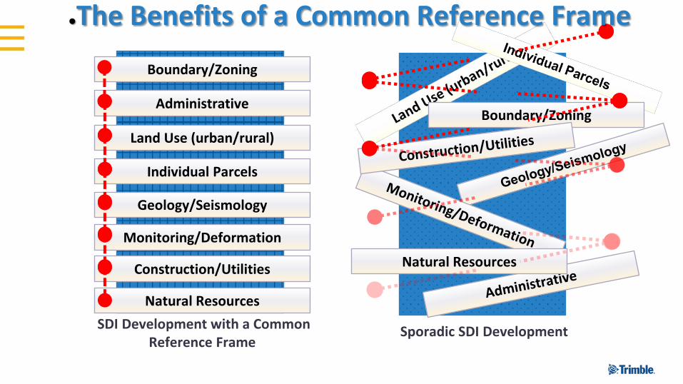
Sporadic SDI Development
Administrative
Land Use (urban/rural)
Individual Parcels
Geology/Seismology
Monitoring/Deformation
Boundary/Zoning
Boundary/Zoning
Construction/Utilities
Natural Resources
Natural Resources
SDI Development with a Common Reference Frame
●The Benefits of a Common Reference Frame
●VRS - Virtual Reference Station
▪ Trimble first launched Trimble VRS® in 1999
▪ CORS stations within an network send observables to server
▪ Server creates a model of network
▪ Each rover connects to server, and a “virtual” base station is created
Strengths (+) Weaknesses (-)
No need for a local base
stationRelies on IP/cellular connectivity
Consistent Cm level
accuracy, anywhere in the
coverage
Eliminate RTK dilution of
precision
Consistent reference
frame
Position integrity
Low initial cost
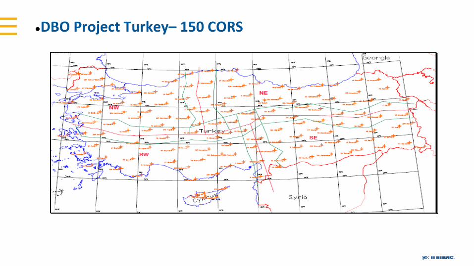
●DBO Project Turkey– 150 CORS
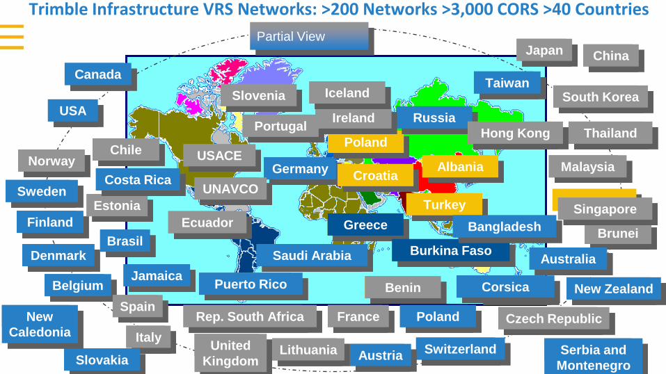
Trimble Infrastructure VRS Networks: >200 Networks >3,000 CORS >40 Countries
out
USA
China
Denmark
Switzerland
Finland
Germany
Sweden
Norway
Italy
Austria
Belgium
United
Kingdom
Slovenia
Serbia and
Montenegro
Canada
Japan
Portugal
Slovakia
New
Caledonia
Partial View
USACE
UNAVCO
Lithuania
Saudi Arabia
KSA
Thailand
Brunei
Rep. South Africa France Poland Czech Republic
South Korea
Croatia
Turkey
Greece
Poland
RussiaIreland
Benin
Estonia
Brasil
Iceland
Albania
Singapore
JamaicaCorsica
Costa Rica
Puerto Rico
Ecuador
Burkina Faso
Chile
Australia
New Zealand
Taiwan
Malaysia
Spain
Hong Kong
Bangladesh
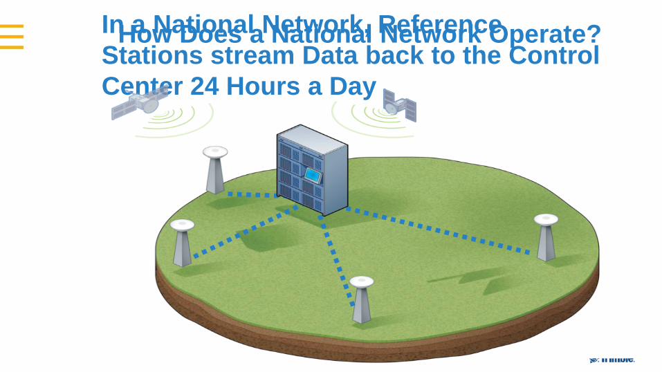
In a National Network, Reference
Stations stream Data back to the Control
Center 24 Hours a Day
How Does a National Network Operate?
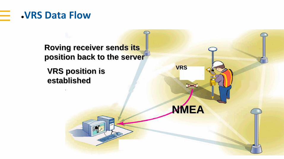
●VRS Data Flow
Roving receiver sends its
position back to the server
NMEA
VRS position is
established
VRS
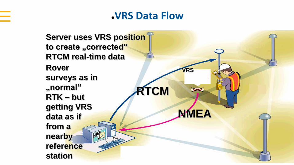
●VRS Data Flow
VRS
NMEA
Server uses VRS position
to create „corrected“
RTCM real-time data
RTCM
Rover
surveys as in
„normal“
RTK – but
getting VRS
data as if
from a
nearby
reference
station
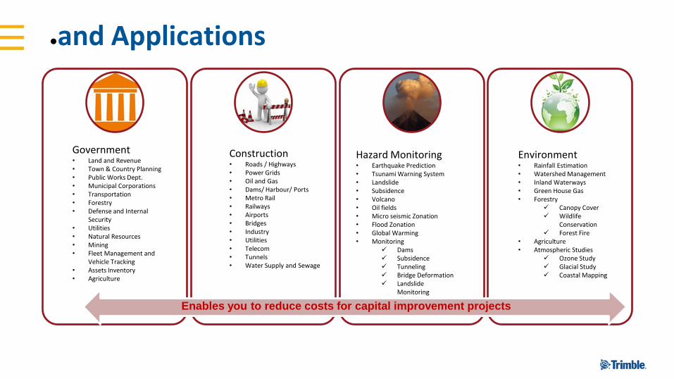
●and Applications
Government• Land and Revenue• Town & Country Planning• Public Works Dept.• Municipal Corporations• Transportation• Forestry• Defense and Internal
Security• Utilities• Natural Resources• Mining• Fleet Management and
Vehicle Tracking• Assets Inventory• Agriculture
Construction• Roads / Highways• Power Grids• Oil and Gas• Dams/ Harbour/ Ports• Metro Rail• Railways• Airports• Bridges• Industry• Utilities• Telecom• Tunnels• Water Supply and Sewage
Hazard Monitoring• Earthquake Prediction• Tsunami Warning System• Landslide• Subsidence• Volcano• Oil fields• Micro seismic Zonation• Flood Zonation• Global Warming• Monitoring
Dams Subsidence Tunneling Bridge Deformation Landslide
Monitoring
Environment• Rainfall Estimation• Watershed Management• Inland Waterways• Green House Gas• Forestry
Canopy Cover Wildlife
Conservation Forest Fire
• Agriculture• Atmospheric Studies
Ozone Study Glacial Study Coastal Mapping
Enables you to reduce costs for capital improvement projects
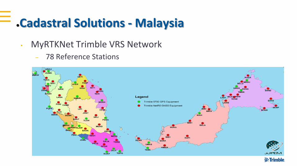
●Cadastral Solutions - Malaysia
▪ MyRTKNet Trimble VRS Network– 78 Reference Stations
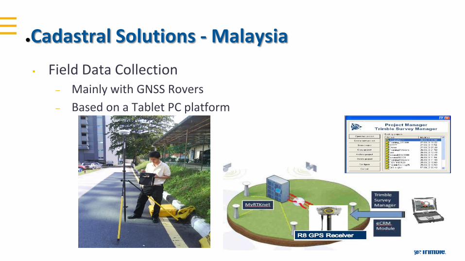
▪ Field Data Collection– Mainly with GNSS Rovers
– Based on a Tablet PC platform
●Cadastral Solutions - Malaysia

Benin Cadastre Overview
▪ Funded Projects (World Bank, MCC…)▪ Current WB Land Admin Projects: around US $1.5 billion
▪ MCC Benin Access to Land Project: $36 million
▪ Purpose of Land Administration Projects:– Stimulate economic and social development
▪ Increasing land transactions and access to credit
▪ Improving productive investments in land
▪ Improving the standard of living of property owners and occupants
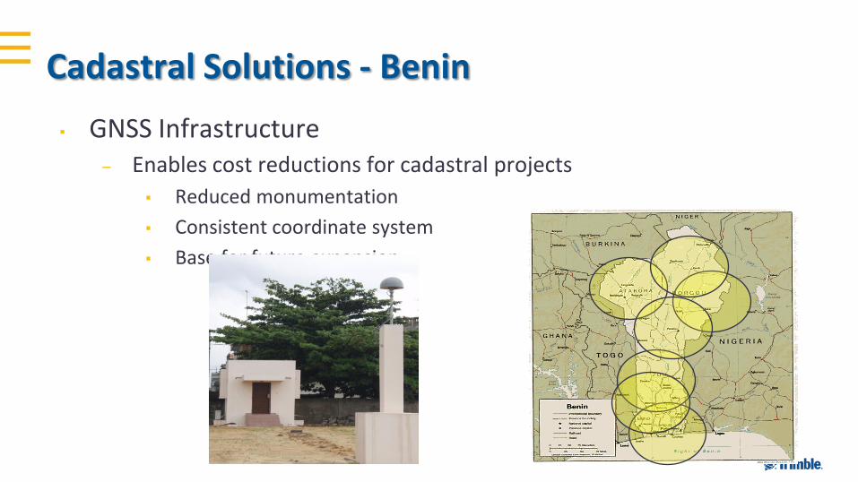
▪ GNSS Infrastructure– Enables cost reductions for cadastral projects
▪ Reduced monumentation
▪ Consistent coordinate system
▪ Base for future expansion
Cadastral Solutions - Benin
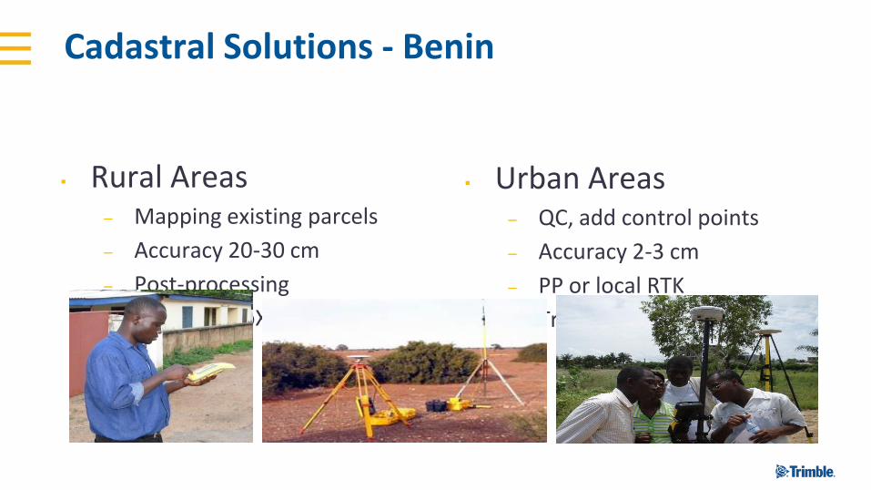
Cadastral Solutions - Benin
▪ Rural Areas– Mapping existing parcels
– Accuracy 20-30 cm
– Post-processing
– Trimble GeoXH
▪ Urban Areas– QC, add control points
– Accuracy 2-3 cm
– PP or local RTK
– Trimble R8GNSS/TSC2
Mass Data Collection Technologies

●New Trimble Mobile Mapping HW
• Large survey projects
• Survey, design, engineering, large corridors
• Planning, utilities
Trimble MX9High-end laser system
• Small(er) survey projects
• Small but complex areas
• Survey and mapping
Trimble MX2Laser scanning system
• Asset management & documentation
• GIS inventory and maintenance
• Digital imaging logs
Trimble MX7Mobile imaging system
ADDRESSING VARIOUS MARKET SEGMENTS WITH APPROPRIATE SOLUTIONS
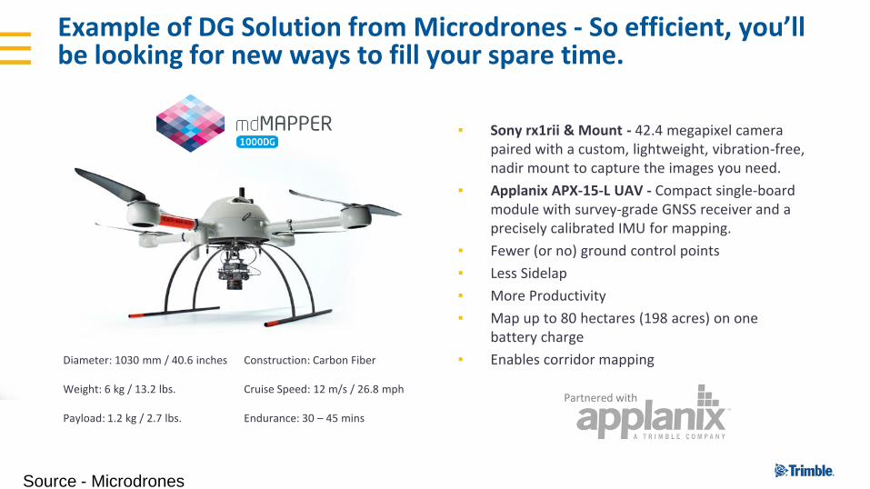
▪ Sony rx1rii & Mount - 42.4 megapixel camera paired with a custom, lightweight, vibration-free, nadir mount to capture the images you need.
▪ Applanix APX-15-L UAV - Compact single-board module with survey-grade GNSS receiver and a precisely calibrated IMU for mapping.
▪ Fewer (or no) ground control points
▪ Less Sidelap
▪ More Productivity
▪ Map up to 80 hectares (198 acres) on one battery charge
▪ Enables corridor mapping
Example of DG Solution from Microdrones - So efficient, you’ll be looking for new ways to fill your spare time.
Diameter: 1030 mm / 40.6 inches
Weight: 6 kg / 13.2 lbs.
Payload: 1.2 kg / 2.7 lbs.
Construction: Carbon Fiber
Cruise Speed: 12 m/s / 26.8 mph
Endurance: 30 – 45 mins
Partnered with
Source - Microdrones
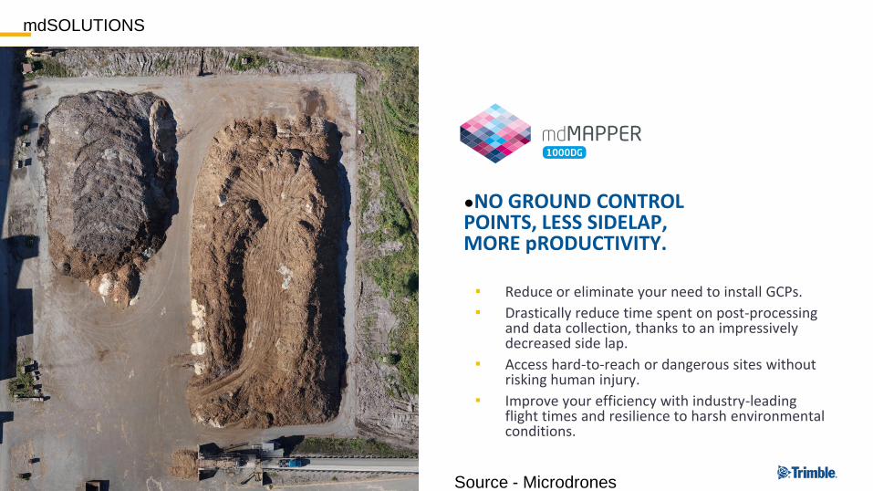
●NO GROUND CONTROL POINTS, LESS SIDELAP, MORE pRODUCTIVITY.
mdSOLUTIONS
▪ Reduce or eliminate your need to install GCPs.
▪ Drastically reduce time spent on post-processing and data collection, thanks to an impressively decreased side lap.
▪ Access hard-to-reach or dangerous sites without risking human injury.
▪ Improve your efficiency with industry-leading flight times and resilience to harsh environmental conditions.
Source - Microdrones

Sensor Fusion & Mixed Reality Technologies
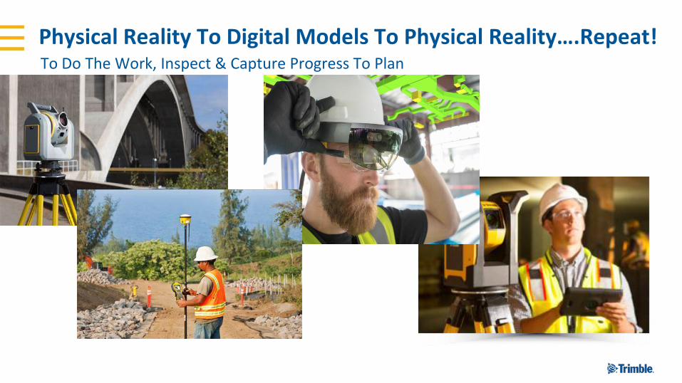
Physical Reality To Digital Models To Physical Reality….Repeat!To Do The Work, Inspect & Capture Progress To Plan
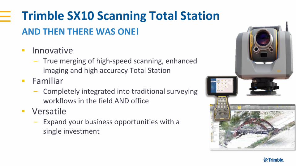
Trimble SX10 Scanning Total Station
▪ Innovative– True merging of high-speed scanning, enhanced
imaging and high accuracy Total Station
▪ Familiar– Completely integrated into traditional surveying
workflows in the field AND office
▪ Versatile– Expand your business opportunities with a
single investment
AND THEN THERE WAS ONE!
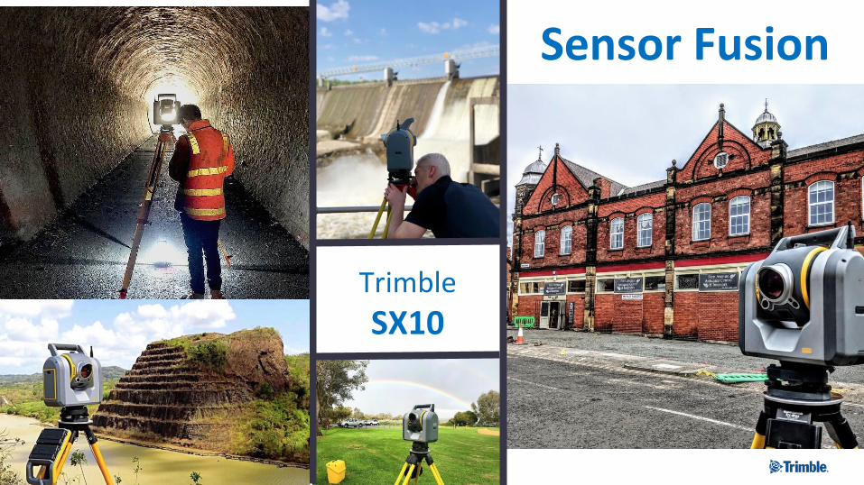
Trimble
SX10
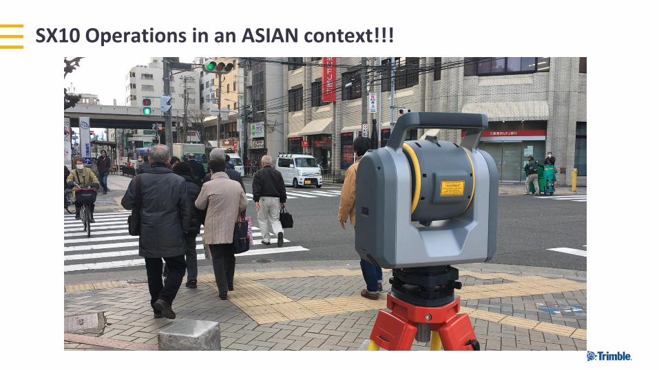
SX10 Operations in an ASIAN context!!!
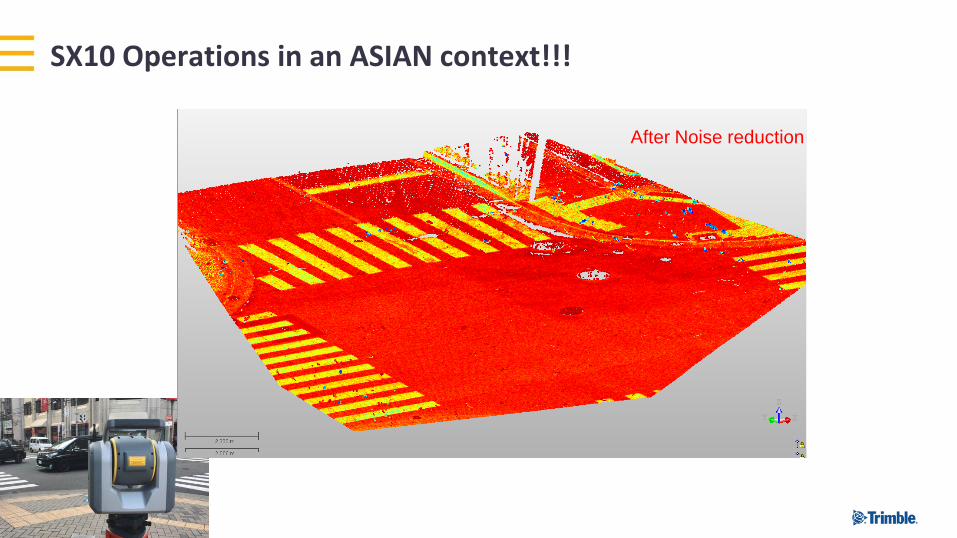
Before Noise reductionAfter Noise reduction
测绘数据采集的创新 Innovation in Data CollectionSX10 Operations in an ASIAN context!!!
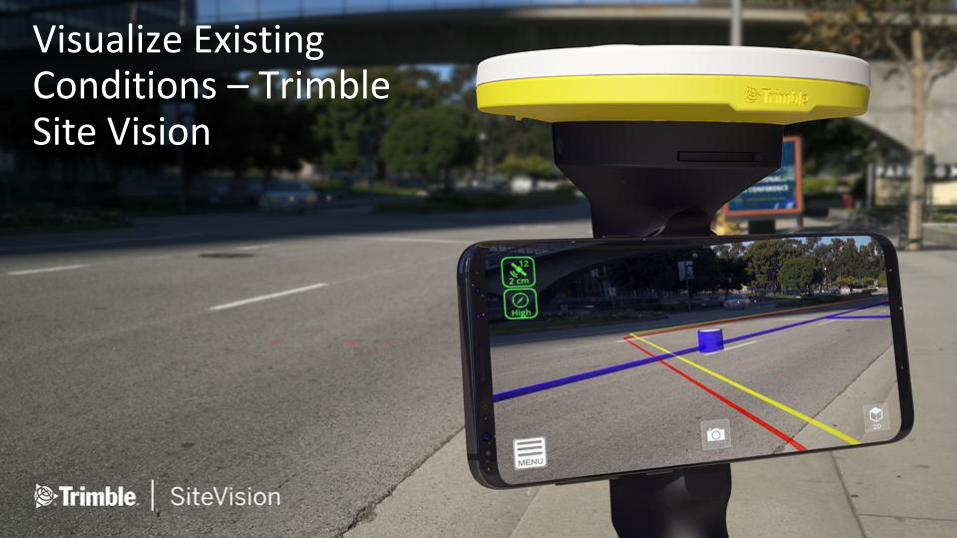
Visualize Existing Conditions – Trimble Site Vision
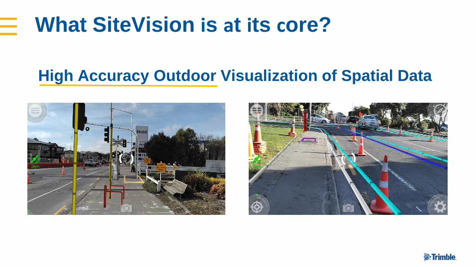
High Accuracy Outdoor Visualization of Spatial Data
What SiteVision is at its core?
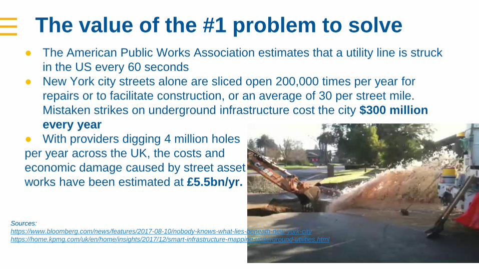
The value of the #1 problem to solve● The American Public Works Association estimates that a utility line is struck
in the US every 60 seconds
● New York city streets alone are sliced open 200,000 times per year for
repairs or to facilitate construction, or an average of 30 per street mile.
Mistaken strikes on underground infrastructure cost the city $300 million
every year
● With providers digging 4 million holes
per year across the UK, the costs and
economic damage caused by street asset
works have been estimated at £5.5bn/yr.
Sources:
https://www.bloomberg.com/news/features/2017-08-10/nobody-knows-what-lies-beneath-new-york-city
https://home.kpmg.com/uk/en/home/insights/2017/12/smart-infrastructure-mapping-underground-utilities.html
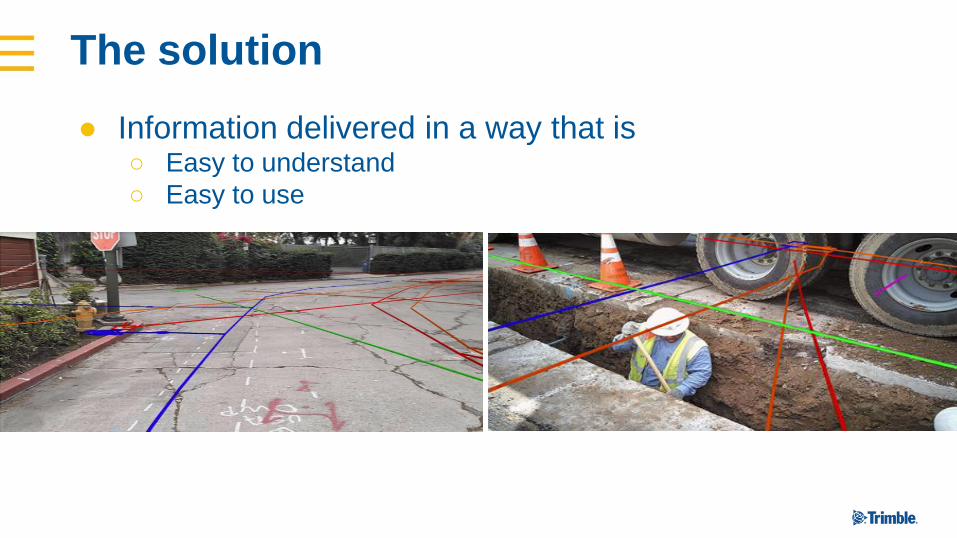
The solution
● Information delivered in a way that is ○ Easy to understand
○ Easy to use

Connected and Integrated Workflows - Field
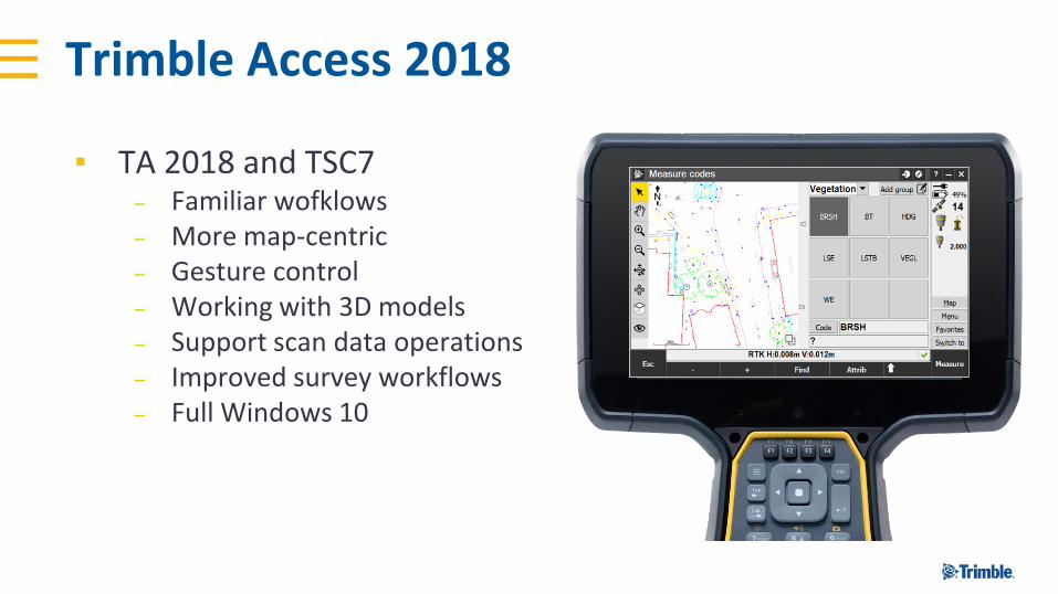
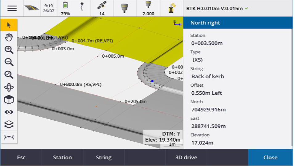
Trimble Access 2018
▪ TA 2018 and TSC7– Familiar wofklows– More map-centric– Gesture control– Working with 3D models– Support scan data operations– Improved survey workflows– Full Windows 10
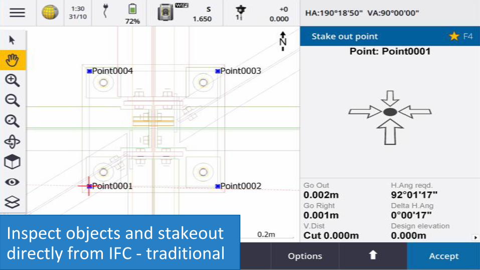
Inspect objects and stakeout directly from IFC - traditional
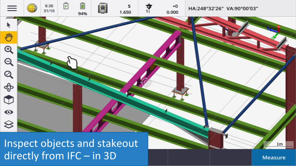
Inspect objects and stakeout directly from IFC – in 3D
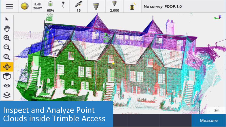
Inspect and Analyze Point Clouds inside Trimble Access
Roads

●Technology Evolution – Snapshot of Today
Connected and Integrated Workflows - Office
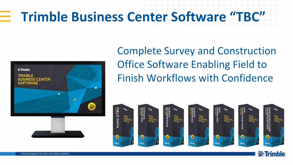
Trimble Business Center Software “TBC”
Complete Survey and Construction Office Software Enabling Field to Finish Workflows with Confidence
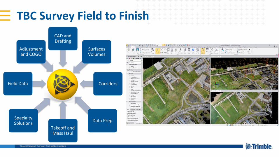
TBC Survey Field to Finish
Field Data
CAD and Drafting
Takeoff and Mass Haul
Corridors
Data PrepSpecialty Solutions
Surfaces Volumes
Adjustment and COGO
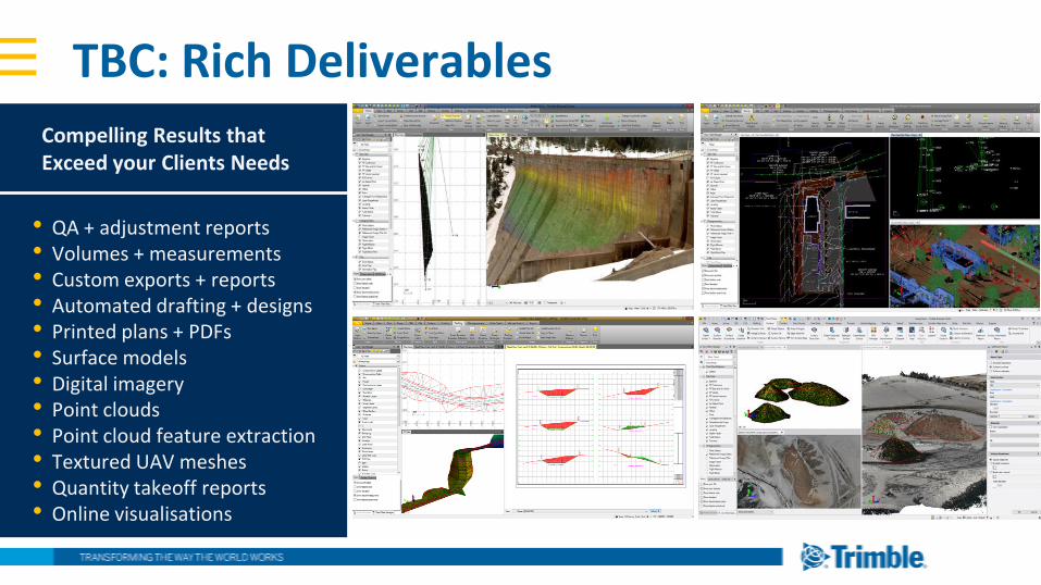
TBC: Rich Deliverables
Compelling Results that Exceed your Clients Needs
• QA + adjustment reports• Volumes + measurements• Custom exports + reports• Automated drafting + designs• Printed plans + PDFs• Surface models• Digital imagery• Point clouds• Point cloud feature extraction• Textured UAV meshes• Quantity takeoff reports• Online visualisations
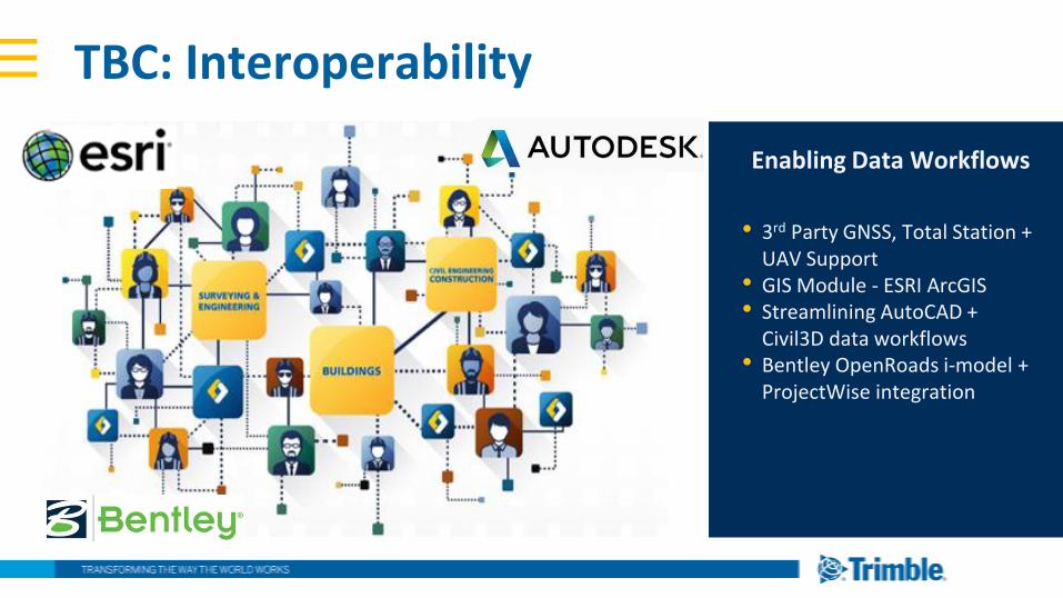
Enabling Data Workflows
TBC: Interoperability
• 3rd Party GNSS, Total Station + UAV Support
• GIS Module - ESRI ArcGIS• Streamlining AutoCAD +
Civil3D data workflows• Bentley OpenRoads i-model +
ProjectWise integration
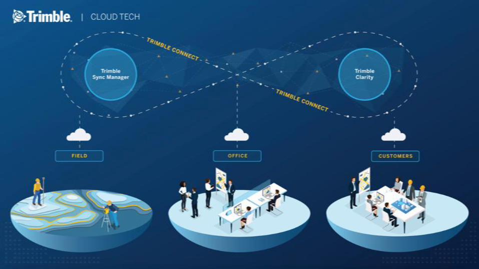
Connected and Integrated Workflows - Cloud
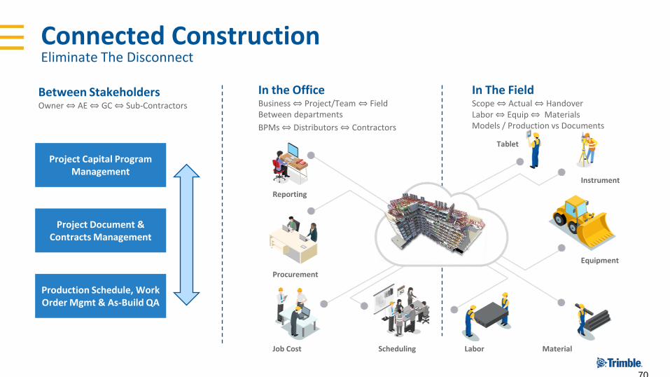
Connected Construction Eliminate The Disconnect
Between StakeholdersOwner ⇔ AE ⇔ GC ⇔ Sub-Contractors
In the OfficeBusiness ⇔ Project/Team ⇔ FieldBetween departments
BPMs ⇔ Distributors ⇔ Contractors
In The FieldScope ⇔ Actual ⇔ Handover Labor ⇔ Equip ⇔ MaterialsModels / Production vs Documents
70
Reporting
Procurement
Job Cost Scheduling Labor Material
Equipment
Instrument
Tablet
Project Capital Program Management
Project Document & Contracts Management
Production Schedule, Work Order Mgmt & As-Build QA
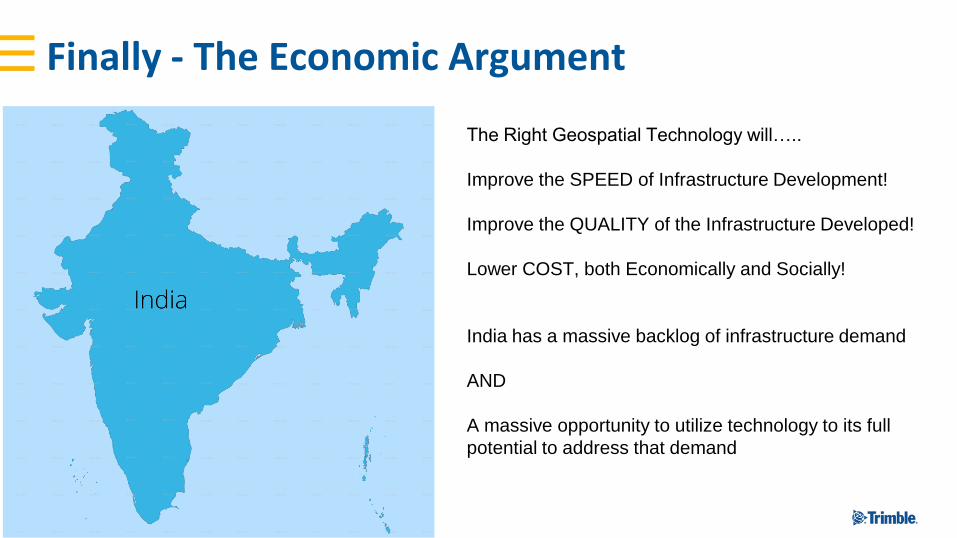
Finally - The Economic Argument
The Right Geospatial Technology will…..
Improve the SPEED of Infrastructure Development!
Improve the QUALITY of the Infrastructure Developed!
Lower COST, both Economically and Socially!
India has a massive backlog of infrastructure demand
AND
A massive opportunity to utilize technology to its full
potential to address that demand

Thank You


Visualize Existing Conditions – Trimble Site Vision