The Tao of Measurement James Kavanagh MRICS C.Geog MCInstCES Director Land & Resources Global Group...
21
The Tao of Measurement James Kavanagh MRICS C.Geog MCInstCES Director Land & Resources Global Group GeoBusiness 2015
-
Upload
asher-newton -
Category
Documents
-
view
215 -
download
2
Transcript of The Tao of Measurement James Kavanagh MRICS C.Geog MCInstCES Director Land & Resources Global Group...

The Tao of Measurement
James Kavanagh MRICS C.Geog MCInstCES
Director Land & Resources Global Group
GeoBusiness 2015
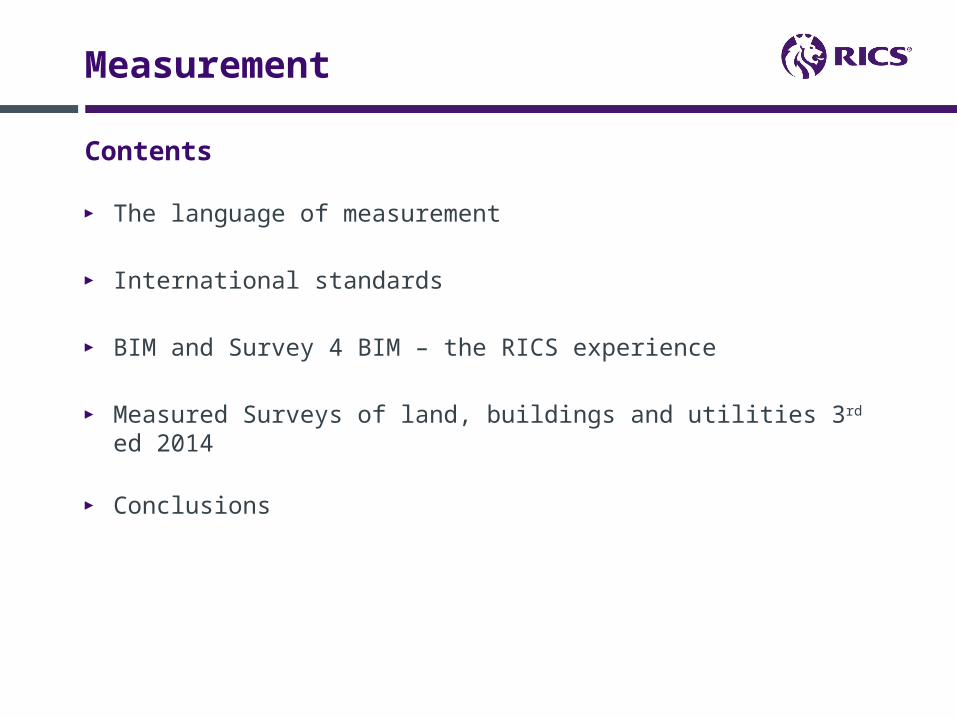
Contents
Measurement
► The language of measurement
► International standards
► BIM and Survey 4 BIM – the RICS experience
► Measured Surveys of land, buildings and utilities 3rd ed 2014
► Conclusions

The language of measurement
Measurement
► Did you really mean that? Just what do you want it for? Fitness for purpose…
► Geo-speak
3 problems, 1 common thread► Valuation ► Development Land► BIM
► Survey Spec

International property measurement standards - IPMS
International Standards
Commonality of language – property components/area registration

Development Land
International Standards
► The ‘inappropriate’ use of measurement depending on development value
► Development that does not fit the ‘site’
► Misunderstanding of survey accuracy and inherent errors
► Misunderstanding of ‘boundary’ issues
► Measured Survey at Development Appraisal stage

BIM – the RICS experience

Lets examine that Elephant …..
Measurement
IPMS► Connecting valuation ‘allowable deviation’ to measured survey accuracy
within IPMS► Depending on purpose $$$$$
Development Land► Appropriate measurement depending on development value
BIM – vender challenge► ‘the spatial integrity of the BIM model was a key issue’► ‘the initial specification of the model is paramount’► ‘there’s needs to be a consistently accurate and continual input to the
model’
The missing link – a coherent, standardised, agreed survey specification

Measured Surveys of land, buildings and utilities 3rd ed 2014
The Tao of Measurement
► Primary focus – client education► Placing the relationship and understanding between client and surveyor at
the core of any survey project
► The Legacy … 2nd ed 1997► Rapid changes in technology and practice► Core survey principles remain► Internationalisation
► New elements:► Survey detail accuracy banding table► Inclusion of survey feature tables► Setting-out, deformation, monitoring► Expanded deliverables

Background, genesis, working group, consultation
► Structure – background information, recommended good practice► Project Information► Survey Accuracy, control, coordinate grid and datum► Topographic surveys► Measured building surveys► Underground utility surveys► Setting out surveys► Monitoring and deformation► Deliverables► Range of Appendixes
Measured Surveys of land, buildings and utilities 3rd ed 2014

Survey detail accuracy band table

Survey detail accuracy and valuation

Control, coordinate grid and datum
Measured Surveys of land, buildings and utilities 3rd ed 2014
► Move towards ppm (in line with GNSS)► Control networks (plan and height)

Measured Surveys of land, buildings and utilities 3rd ed 2014 – topographic survey
► Accuracy band► Emphasis on outputs► Extensive feature table listing

Measured building surveys
Measured Surveys of land, buildings and utilities 3rd ed 2014
► Level of Detail (LoD) – different accuracy bands for different levels of detail
► Output driven► Direct links to IPMS & Code of Measuring Practice► Introduction of BIM as an output► Extensive feature tables
Underground utility surveys► Directly linked to PAS 128► TSA Utility surveys GN
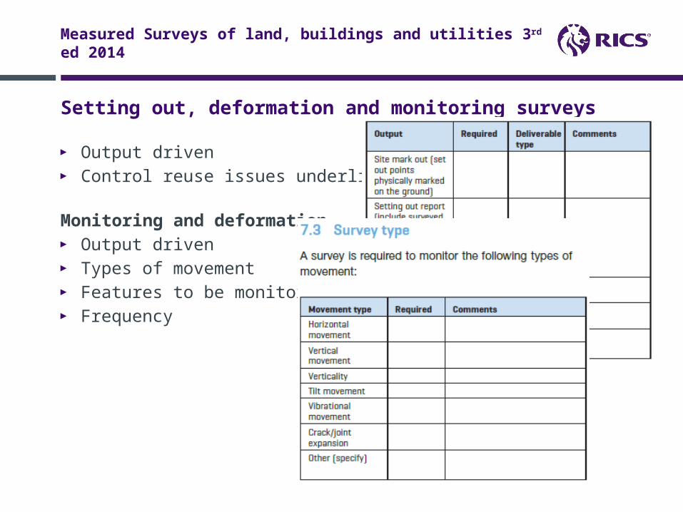
Setting out, deformation and monitoring surveys
Measured Surveys of land, buildings and utilities 3rd ed 2014
► Output driven► Control reuse issues underlined
Monitoring and deformation► Output driven► Types of movement► Features to be monitored► Frequency

Deliverables – the key
Measured Surveys of land, buildings and utilities 3rd ed 2014
► Client requirements► Format and method of delivery► CAD deliverables – client or surveyor defined standards► Digital terrain model (TIN) deliverables and formats► Point Cloud Deliverables (inc. viewer)► GIS► Report deliverables► Imagery, spreadsheet, textual data, survey records, hardcopy► Method of delivery► Receipt► Background information and recommended best practice

BIM as a deliverable
Measured Surveys of land, buildings and utilities 3rd ed 2014
► Connected to employers information requirements (EIR)► BIM execution plan – PAS 1192 -2 (2013)► BIM checklist► Basic survey for BIM specification (connected to accuracy banding and
LOD)

VENDORS
Our mission is to provide a forum for survey organisations and industry professionals to collaborate and share their journey putting
“BIM into practice”, and to provide best practice guidance documents on survey matters relating to BIM.

Get Involved or Contact Us
@Survey4BIM
www.bimtaskgroup.com/survey4bim
Ian Bush: [email protected]
Survey4BIM Group

Conclusions
Measured Surveys of land, buildings and utilities 3rd ed 2014
► Measured Survey specifications and ‘fitness for purpose’ are key to every survey project
► Don’t blind them with Science► Use a language the Client can understand► Do not undersell your skillsets► A common language and known industry
standards/specifications can get surveyors to the top table
► The property profession is vast, an untapped market ….
► The future is bright and shiny and new – and the opportunities for survey, data and measurement Industries are limitless
► Collaboration is everything

Contacts
James Kavanagh MRICS C.Geog MCInstCESDirector Land Group (Environment, Geomatics, Minerals & Waste, Planning & Development, Rural) RICS 12 Great George Street, Parliament Square Parliament Square, London SW1P 3AD T: +44(0) 207 695 1598 Web: http://www.rics.org/land Email: [email protected]: uk.linkedin.com/pub/james-kavanagh/17/48b/654/
Twitter – @jkavanagh99, #RICSland