The House of Oduduwa: An Archaeological Study of Economy and ...
514
The House of Oduduwa: An Archaeological Study of Economy and Kingship in the Savè Hills of West Africa by Andrew W. Gurstelle A dissertation submitted in partial fulfillment of the requirements for the degree of Doctor of Philosophy (Anthropology) in the University of Michigan 2015 Doctoral Committee: Professor Carla M. Sinopoli, Chair Professor Joyce Marcus Professor Raymond A. Silverman Professor Henry T. Wright
Transcript of The House of Oduduwa: An Archaeological Study of Economy and ...

The House of Oduduwa:
An Archaeological Study of Economy and Kingship
in the Savè Hills of West Africa
by
Andrew W. Gurstelle
A dissertation submitted in partial fulfillment
of the requirements for the degree of
Doctor of Philosophy
(Anthropology)
in the University of Michigan
2015
Doctoral Committee:
Professor Carla M. Sinopoli, Chair
Professor Joyce Marcus
Professor Raymond A. Silverman
Professor Henry T. Wright

© Andrew W. Gurstelle 2015
ii
ACKNOWLEDGMENTS
I must first and foremost acknowledge the people of the Savè hills that contributed their
time, knowledge, and energies. Completing this dissertation would not have been possible
without their support. In particular, I wish to thank Oba Adétùtú Onishabe, Oyedekpo II Ola-
Amùsù, and the many balè, balé, and balodè that welcomed us to their communities and
facilitated our research. I also thank the many land owners that allowed us access to
archaeological sites, and the farmers, herders, hunters, fishers, traders, and historians that spoke
with us and answered our questions about the Savè hills landscape and the past. This dissertion
was truly an effort of the entire community.
It is difficult to express the depth of my gratitude for my Béninese collaborators. Simon
Agani was with me every step of the way. His passion for Shabe history inspired me, and I am
happy to have provided the research support for him to finish his research. Nestor Labiyi
provided support during crucial periods of excavation. As with Simon, I am very happy that our
research interests complemented and reinforced one another’s. Working with Travis Williams
provided a fresh perspective on field methods and strategies when it was needed most. We were
supported by an outstanding team of field assistants. One could not ask for a more dedicated and
enthusiastic team. Our research on the ground was made easier by the institutional support of the
Directorate de Patrimoine Culturel as well as the Département d’Histoire et Archéologie at the
iii
Université d’Abomey-Calavi. In particular, my thanks go to Mr. Richard J. V. Sogan, Mr.
Calixte Biah, Dr. Obarè Bagodo, and Dr. Didier N’dah.
I must also acknowledge the unflagging support of my dissertation committee. Carla
Sinopoli was the best chair a dissertator could want, as she provided advice on all aspects of
running an archaeological research project. Her insights on effectively conducting and
communicating research has helped me improve as a scholar. Henry Wright’s vast knowledge of
survey was instrumental in crafting my research design, and I often reflect on the pearls of
wisdom he would casually share as we worked in the Museum of Anthropology. Joyce Marcus
encouraged me to make extensive use of the rich ethnographic and historical record for Shabe, as
well to keep my eye on how the pieces of my research fit together into a larger narrative. Ray
Silverman was always there to provide pratical advice on working closely with the royalty and
elite of African traditional political institutions. I am also grateful to the excellent mentors I’ve
had outside of the University of Michigan: Sissel Schroeder, Ron Schirmer, Phil de Barros, Ann
Stahl, and J. Cameron Monroe.
My fellow graduate students at the University of Michigan provided support in
innumerable ways, both big and small. This dissertation would not have been manageable
without the guidance of the Africanists that came before me: Stephen Dueppen, Daphne
Gallagher, Cameron Gokee, Amanda Logan, and Anne Compton. I am especially grateful to
Amanda Logan for guiding me through my first field seasons in West Africa. My thanks as well
go to my cohort-mate, Ashley Lemke, as well as Casey Barrier, Alice Wright, Colin Quinn,
Howard Tsai, Geoffrey Hughes, and all my other colleagues in the Department of Anthropology
and the Museum Studies Program that supported and, at times, challenged my interests in
political economies, archaeology, and the African past.
iv
My research was supported financially by a Doctoral Dissertation Improvement Grant
from the National Science Foundation (BCS 1322558) and a Fellowship for Doctoral Research in
Museums from the University of Michigan Museum Studies Program. Additional grant support
was received from the University of Michigan through the Rackham School of Graduate Studies,
the departments of Anthropology and Afroamerican and African Studies, the Museum of
Anthropological Archaeology, and the African Studies Center.
Finally, none of this would have been possible without the love of Sarah and Asher
Gurstelle. They supported me on every leg of this journey, even when it took me away from
them for many long months. Their belief in me and in this research was with me always.
v
TABLE OF CONTENTS
ACKNOWLEDGMENTS ii
LIST OF TABLES x
LIST OF FIGURES xii
LIST OF APPENDICES xxiv
ABSTRACT xxvi
CHAPTER
I. Introduction 1
A. Oba Adetutu Onishabe Joins Facebook 1
1. Digital Frontiers 1
2. West African Kingdoms and Long-term Continuity 7
B. The Growth of States in West Africa 11
1. The State in Africa 11
2. Historical Perspectives on West African States 12
3. Archaeological Perspectives on West African States 15
C. The Shabe Kingdom in the West African Political-Economic Mosaic 23

vi
1. Investigating the Shabe Past 23
2. Dissertation Outline 27
II. The Frontiers of Empire 31
A. Imperial Entanglements during the Atlantic Age 31
1. The Atlantic Economy 31
2. Internal African Frontiers 34
3. Wealth in People 35
4. Frontiers, Coasts, Interiors 36
5. The Savanna and the Forest 38
B. The Primacy of Ile-Ife and Divine Yoruba Kingship 45
1. Odùduwà 45
2. Power in the Ife Dynastic Field 47
3. Ile-Ife and the Crowned Kingdoms 50
4. Ile-Ife and Benin 52
C. Yoruba Ethnogenesis and Expansion 54
1. The Alaafin 54
2. Oyo Imperialism 55
3. The Invention of Yoruba 63
III. Landscape and Change in Shabe 66
A. The Savè Hills and Its People 66
1. The Shabe Landscape 66
2. Shabe Lineage 72
3. Shabe Ritual 80
vii
4. Shabe Economy 85
B. The Shabe Kingdom 92
1. The Onishabe 92
2. A Crowned Kingdom 94
3. The Two Kings of Shabe 101
C. The Complicated History of Shabe 104
1. The Early History of Shabe 104
2. The Later History of Shabe 107
IV. The Savè Hills Archaeological Research Project 113
A. The Direct-Historical Approach 113
1. Upstreaming 113
2. Oral Histories 124
3. Archaeological Research 126
B. Reconnaissance Survey 131
1. Study Zone 131
2. Survey Methods 136
3. Problems of Participation 142
C. Transect Survey 145
1. Survey Methods 145
2. Atenro Tract 147
3. Fiditi Tract 149
D. Test Excavations 152
1. Excavation Methods 152
viii
2. Stratigraphic Profile Units 156
3. Feature Exploration Units 158
4. Radiocarbon Dating 160
V. The Shabe Archaeological Landscape 164
A. The Early Shabe Period (1600-1700 CE) 164
1. Settlement Pattern 164
2. Subsistence 179
3. Craft Production 182
4. Exchange 185
5. Political-Economic Organization 186
B. The Middle Shabe Period (1700-1830 CE) 188
1. Settlement Pattern 188
2. Subsistence 206
3. Craft Production 209
4. Exchange 211
5. Political-Economic Organization 213
C. The Late Shabe Period (1830-1894 CE) 217
1. Settlement Pattern 217
2. Subsistence 228
3. Craft Production 228
4. Exchange 231
5. Political-Economic Organization 232
D. The European Colonial Period (1894-1960 CE) 234
ix
1. Settlement Pattern 234
2. Subsistence 237
3. Craft Production 240
4. Exchange 241
5. Political-Economic Organization 242
VI. The Evolution of Shabe Kingship 245
A. Kingship and Settlement in the Save Hills 245
1. Centralizing Power 245
2. Sources of Legitimacy 257
3. Competing Political Institutions 261
B. The Ongoing Transformation of the Shabe Kingdom 264
1. The Northern Landscape 264
2. New Frontiers 269
APPENDICES 272
BIBLIOGRAPHY 452
x
LIST OF TABLES
TABLE
IV.1 Sites documented through the reconnaissance survey were assigned to one or 141
more periods derived from oral history.
IV.2 AMS radiocarbon dates from sites in the Savè hills area, performed at the 163
NOSAMS Laboratory, Woods Hole Oceanographic Institution. Dates are
calibrated with the OxCal v4.2 program using the IntCal 13 calibration curve.
Sites S12-022 and Odo Akaba were excavated independently by Nestor Labiyi
(see Gurstelle et al. in press).
V.1 Area of Early Shabe period sites based on surface artifact scatters. 179
V.2 Artifact classes and subclasses present at Early Shabe period sites. 183
V.3 Area of Middle Shabe period sites based on surface artifact scatters. 206
V.4 Artifact classes and subclasses present at Middle Shabe period sites. 210
V.5 Area of Late Shabe period sites based on surface artifact scatters. 228
V.6 Artifact classes and subclasses present at Late Shabe period sites. 230
A.1 Surface feature classes and subclasses present at all sites. Artifact scatter areas 276
are given in ha and fortification lengths are given in km.
A.2 Artifact classes and subclasses present at all sites. Surface and excavation 278
contexts are separated for sites where excavations took place. At S12-035,
Phase II contexts are all zone 1 contexts from U12-002, U13-006, and U13-007.
Phase I contexts are all other zones from all excavations.
B.1 Counts of body sherds from archaeological sites in the study area. 397
B.2 Counts of diagnostic sherds from archaeological sites in the study area. 407
xi
B.3 Pipe bowl fragments from archaeological sites in the study area. 416
C.1 Lithic artifacts of different manufacturing techniques, materials, and forms 420
recovered from sites in the study area.
D.1 Ferrous artifacts of different types and forms recovered from sites in the study 431
area.
E.1 Glass vessel shards of different colors, vessel types, and manufacturing 442
techniques from archaeological sites in the study area.
F.1 Faunal remains from archaeological sites in the study area. 448

xii
LIST OF FIGURES
FIGURE
I.1 Oba Adétùtú Akénmu, the Onishabe of the Shabe kingdom (2005- ). He bears 3
the primary insignia of his status and office: staff, fly-whisk, glass and coral
beads, and the adé beaded crown representing descent from Odùduwà, the
divine king of Ile-Ife. Behind the Onishabe are his mother (left) and wife (right).
(Photo: Alfred Weidinger, 2013.)
I.2 The present-day commune capital Savè lends its name to the Savè hills area. 7
Savè is itself a Fongbe-language adaptation of Shabe. The distribution of Shabe
settlements in Bénin and Nigeria is shown by the broken line.
II.1 The major vegetation zones of West Africa (adapted from CIA 1986). 39
II.2 Locations of archaeological sites in Africa mentioned in Chapter II. 41
II.3 A copper-alloy head recovered from Ile-Ife, dated to the 12th century CE. 49
(Photo from Wikimedia Commons.)
II.4 Edge-laid potsherd pavement from Olokun Gove, Ile-Ife. The herringbone 52
pattern is characteristic the Ife dynastic field. (Photo by Akin Ogundiran, in
Haour 2013.)
II.5 Flat-laid potsherd pavement from Birnin Lafiya, northern Benin. (Photo by 52
Alexandre Livingstone Smith, in Haour 2013.)
II.6 Approximate boundaries of the Oyo Empire and neighboring polities. 56
II.7 Localities of archaeological sites in the Oyo Empire and Ife dynastic field 60
described in the text.
III.1 The traditional borders of the Shabe kingdom, as defined by geographic 68
features, encompasses most ethnic Shabe-majority settlements
xiii
III.2 Topographic map of the Savè hills area, with the traditional boundaries of the 71
Shabe kingdom represented by the broken line. Darker areas represent lower
elevations, down to about 75 meters above sea level at the confluence of the
Ouémé and Okpara rivers. The highest point is 431 masl reached by the Oke
Shabe hill. (Elevation data from NASA Shuttle Radar Topography Mission.)
III.3 The Oke Shabe hill outside of Savè (Shabe-Idadu) and typical rainy season 72
vegetation surrounding present-day settlements. The Inashabe dome (431 m
above sea level) is the second peak from the left.
III.4 The distribution of Ede language communities in West Africa (thick broken 76
line) shown in relation to the Shabe kingdom (thin broken line). An isolated Ede
language community, Mokole, exists in northern Bénin near Kandi (not pictured).
(Adapted from Kluge 2011a: vii.)
III.5 The Oòduà shrine at Djabata (left) and a mural depicting him on the afin palace 82
wall in Shabe-Idadu (right).
III.6 Archaeologists inspect the balodè of Monka’s rifle outside a hunting association 87
lodge.
III.7 A mural on an exterior wall of the balodè of Kemon’s residence. 88
III.8 Ceramic stoves and ritual vessels for sale in Savè in 2012. 90
III.9 A copper-alloy bracelet found buried below the foundation so current royal 99
palace. The two ends of the bracelet are figured as a right hand and a chameleon
head and are clasped by a bird-shaped pin. Twenty chains hang from the
underside of the bracelet of which eleven attach to small figurative sculptures,
from left to right: missing, missing, quatrefoil ring, cowry, missing, scepter/osé
Sàngó?, cowry, turtle, missing, geometric design/stool?, sword, key, gong,
missing, missing, missing, coin, coin, missing, missing.
III.10 The entrance to the present-day afin of the Onishabe, constructed after 1933 CE 100
when the former palace was razed by the French colonial government. The large
baobab at right was part of the original afin compound.
IV.1 Schematic representation of sources used to investigate the West African 120
showing that the greatest range is available for the most recent periods. The
richness of the sources are graded relative to one another by shades of grey, with
darker shades representing relatively higher levels of detail and coverage of
events and processes. (Adapted from Stahl 2001: 30.)
IV.2 The approximate maximum extent of the Shabe kingdom is shaded grey and 132
shown in relation to major population and political economic centers in West
Africa ca. 1500-1900 CE.
xiv
IV.3 The study zone occupies the central part of the Shabe kingdom’s maximum 134
territorial extent.
IV.4 Topographic features of the study zone divided into 25 m interval classes. 135
(Elevation data from NASA SRTM.)
IV.5 Vegetation groundcover map showing the effect of settlements, as well as the 136
SUCOBE sugarcane plantation and man-made reservoir adjacent to the Ouémé
River. (Vegetation classes derived from multispectral data from NASA & USGS
Landsat 8.)
IV.6 Present-day settlements in the study zone included in the reconnaissance survey. 138
IV.7 Location of sites recorded through the reconnaissance survey. 141
IV.8 The results of the transect survey in the Atenro tract. 149
IV.9 The results of the transect survey in the Fiditi tract, including results of the 151
reconnaissance survey nearby.
IV.10 Simon Agani inspects the 1 m x 2 m excavation of U13-001 at S12-004 (Fiditi 154
1). The soil matrix is excavated by hoe, visible in the excavation unit. A baobab
tree is seen in the background to the south.
IV.11 Screening excavated matrix through 0.25 inch mesh. Two-person shaker screens 156
were used for all excavations.
IV.12 Andrew Gurstelle conducts flotation with buckets and nested sieves. Light 156
artifacts, such as charred plant remains, float to the surface following agitation,
which can then be gently poured into sieves and collected.
V.1 Map of Early Shabe sites identified through reconnaissance survey and 166
associated present-day settlements.
V.2 A complete, overturned ceramic vessel and unmodified stone (above sign) 173
marks the beginning of bivalve shell midden (left).
V.3 Early Shabe period archaeological sites in the Atenro transect survey tract. 176
V.4 Early Shabe period archaeological sites in the Fiditi transect survey tract. 177
V.5 The iron knife from Atenro. 184
V.6 Map of Middle Shabe sites identified through reconnaissance survey and 190
associated present-day settlements.

xv
V.7 A flat-laid potsherd pavement at the site of a former palace in Shabe-Idadu. 193
V.8 The Ogu Tani megalith at Aensin. 195
V.9 The excavated skeleton at Aukpon. Additional fragmentary human bones were 197
collected from the excavated matrix above and level with the burial.
V.10 Possible Middle Shabe period archaeological sites in the Atenro transect survey 202
tract.
V.11 Possible Middle Shabe period archaeological sites in the Fiditi transect survey 204
tract.
V.12 A coarse earthenware potsherd from an everted rim vessel with maize cob 207
impressions. This potsherd was recovered from the excavation at S13-010.
V.13 A coiled length of iron from the excavation at S13-010. 208
V.14 Shallow basin features at Agba (S13-009) created in a natural boulder. 211
V.15 White and red striped bead from Aukpon. 217
V.16 Map of Late Shabe sites identified through reconnaissance survey and 219
associated present-day settlements.
V.17 The highest point of S12-001. The stone wall continues 0.6 km down the hill, 222
enclosing S12-004 and S12-006.
V.18 This miniature bilboes is composed if thee separate iron rods twisted together: 225
one rod forming the shaft and end loop, and two more rods forming each
C-shaped restraint.
V.19 The feldspar granule tempered pottery from Fiditi 1. 230
V.20 A bifacially flaked quartz tool. The trapezoidal form is created by a break on 231
the top portion, obscuring an original form that was possibly triangular.
V.21 Map of European colonial sites identified through reconnaissance survey and 236
associated present-day settlements.
VI.1 Rank-size plots for the Early Shabe through Late Shabe periods. The settlement 250
line (solid black line) is generally convex for each period. A decreases through
time, when in the Late Shabe period the 95% confidence interval (gray shading)
includes the log-normal line (broken line).
xvi
VI.2 Rank-size plot for autochthonous settlements during the Early Shabe period. 251
The settlement line (solid black line) is plotted with its 95% confidence interval
(gray shading) and the log-normal line (broken line).
VI.3 Rank-size plots for villages and refuges during the Late Shabe period. The 252
settlement line (solid black line) is plotted with its 95% confidence interval
(gray shading) and the log-normal line (broken line).
VI.4 Rank-size plots for Atenro tract sites during the Early Shabe and Middle/Late 254
Shabe periods. The settlement line (solid black line) is plotted with its 95%
confidence interval (gray shading) and the log-normal line (broken line).
VI.5 Shabe settlements in the north are characterized by a linear distribution parallel 266
to the Okpara River. The southeastern part of the kingdom is largely an open
frontier, though may have been more densely occupied prior to the Late Shabe
period.
VI.6 A coarse earthenware bead from the Abeokuta refuge site near Kokoro. The 268
bead is asymmetrical along the axis of the borehole, which may have visually
accentuated a pendant on the same string.
A.1 Site map of S12-001. 279
A.2 An endpoint of the stone wall terminating on top of the southwestern summit of 280
the Oke Shabe hill.
A.3 Site map of S12-004. 282
A.4 Stratigraphic cross-section of U12-001, north profile. 282
A.5 Stratigraphic cross-section of U12-001, east profile. 283
A.6 Stratigraphic cross-section of U12-003, east profile. 283
A.7 Stratigraphic cross-section of U13-001, south profile. 284
A.8 Stratigraphic cross-section of U13-001, west profile. 284
A.9 Site map of S12-006. 286
A.10 Site map of S12-007. 287
A.11 The entrances of the two rockshelters that make up Ohi Amon, with the town 287
of Savè visible to west.
A.12 The interior of rockshelter 1 of Ohi Amon. 288
xvii
A.13 Site map of S12-008. 289
A.14 Site map of S12-009. 290
A.15 One of two hard-packed clay surfaces eroding out of the Oke Shabe hill. The 290
two surfaces are on the same plane, and are likely part of the same architectural
complex.
A.16 Site map of S12-012. 291
A.17 The remains of a tripartite cooking feature outlined in red, with the meter tape 292
scaled to 50 cm. The ceramic hemispheres support a cooking vessel above a fire
built underneath. Such cooking features are still used in the present-day, as are
tripartite features using stones instead of ceramic hemispheres.
A.18 Site map of S12-016. 293
A.19 Site map of S12-017. 295
A.20 Stratigraphic cross-section of U13-013, east profile. 296
A.21 Stratigraphic cross-section of U13-013, north profile. 296
A.22 Site map of S12-018. 297
A.23 The western portion of the flat-laid potsherd pavement at S12-018. 298
A.24 Detail of the flat-laid potsherd pavement at S12-018, including quartz pebbles 299
incorporated into pavement.
A.25 The baobab in the courtyard of the present-day Afin of the Onishabe. At over 299
16 m in circumference, it is the largest baobab recorded during the research.
A.26 Site map of S12-021. 300
A.27 Site map of S12-022. 302
A.28 Site map of S12-023. 303
A.29 Site map of S12-024. 304
A.30 Site map of S12-025. 305
A.31 Site map of S12-026. 306
xviii
A.32 Site map of S12-027. 308
A.33 Site map of S12-028. 310
A.34 Site map of S12-029. 311
A.35 Site map of S12-030. 312
A.36 Site map of S12-031. 313
A.37 Site map of S12-032. 315
A.38 Site map of S12-033. 316
A.39 Site map of S12-034. 318
A.40 Granite megalith (Ogu Tani) and associated clothed iroko in Aensin. 318
A.41 Site map of S12-035. 321
A.42 Excavation of U12-002 near the largest baobab at the site. 322
A.43 Stratigraphic cross-section of U12-002, north profile. 323
A.44 Stratigraphic cross-section of U12-006, east profile. 324
A.45 Stratigraphic cross-section of U12-006, south profile. 324
A.46 Stratigraphic cross-section of U12-007, east profile. 325
A.47 Stratigraphic cross-section of U12-007, south profile. 326
A.48 Stratigraphic cross-section of U12-008, north profile. 327
A.49 Stratigraphic cross-section of U12-008, west profile. 327
A.50 Stratigraphic cross-section of U12-009, north profile. 328
A.51 Stratigraphic cross-section of U12-009, west profile. 329
A.52 Stratigraphic cross-section of U12-011, south profile. 329
A.53 Stratigraphic cross-section of U12-011, west profile. 330
A.54 Site map of S12-036. 332

xix
A.55 The sacred grove of Opotoku is maintained through prayers, libations, and 333
offerings made to this baobab.
A.56 The present-day village site near S12-036 was ceded to the Fulani specifically 333
because of the proximity to the sacred grove, as agriculture and hunting are
forbidden but herding is allowed.
A.57 Stratigraphic cross-section of U13-005, north profile. 334
A.58 Stratigraphic cross-section of U13-005, west profile. 334
A.59 Site map of S12-037. 336
A.60 Stratigraphic cross-section of U13-014, north profile. 337
A.61 Stratigraphic cross-section of U13-014, west profile. 338
A.62 Site map of S12-039. 339
A.63 Site map of S12-040. 340
A.64 Site map of S12-043. 342
A.65 Site map of S12-044. 343
A.66 Site map of S13-004. 345
A.67 The skeleton discovered in U13-002 and U13-004. 346
A.68 Stratigraphic cross-section of U13-002, south profile. 347
A.69 Stratigraphic cross-section of U13-002, west profile. 348
A.70 Stratigraphic cross-section of U13-003, north profile. 349
A.71 Stratigraphic cross-section of U13-003, west profile. 350
A.72 Site map of S13-006. 351
A.73 Site map of S13-008. 353
A.74 Site map of S13-009. 354
A.75 Rockshelter and modern hunter furnishings at S13-009. 355
A.76 Site map of S13-010. 356
xx
A.77 Stratigraphic cross-section of U13-015, north profile. 356
A.78 Stratigraphic cross-section of U13-015, west profile. 357
A.79 Site map of S13-011. 359
A.80 Zones 2a and 2b are visible in the southern half of U13-012, while zone 2c is 359
exposed in the northern half.
A.81 Stratigraphic cross-section of U13-012, south profile. 360
A.82 Stratigraphic cross-section of U13-012, west profile. 360
A.83 Site map of S13-012. 362
A.84 Stratigraphic cross-section of U13-010, north profile. 363
A.85 Stratigraphic cross-section of U13-010, west profile. 364
A.86 Site map of S13-033. 365
A.87 Site map of S13-034. 366
A.88 Site map of S12-013. 368
A.89 The architectural remains are being partially subsumed by a termite mound 368
visible in the upper left corner.
A.90 Site map of S12-014. 369
A.91 Site map of S12-015. 370
A.92 Site map of S13-001. 371
A.93 Site map of S13-002. 372
A.94 Site map of S13-003. 373
A.95 Site map of S13-013. 374
A.96 Site map of S13-014. 374
A.97 Site map of S13-015. 375
A.98 Site map of S13-016. 376
xxi
A.99 Site map of S13-017. 377
A.100 Site map of S13-018. 378
A.101 Site map of S13-019. 379
A.102 Site map of S13-020. 379
A.103 Site map of S13-021. 380
A.104 Site map of S13-022. 381
A.105 Site map of S13-023. 381
A.106 Site map of S13-024. 382
A.107 Site map of S13-025. 383
A.108 Site map of S13-026. 383
A.109 Site map of S13-027. 384
A.110 Site map of S13-028. 385
A.111 Site map of S13-029. 386
A.112 Site map of S13-030. 387
A.113 Site map of S13-031. 388
A.114 Site map of S13-032. 388
B.1 Dragged decorations on coarse earthenware pottery are grooving (top row), 409
incising (middle row), and wavy combing (bottom row).
B.2 Impressed decorations on coarse earthenware pottery are circles (top row), 410
triangles impressions (second row), fingernails/shell lips (third row), and
snailshell apices (bottom row).
B.3 Rouletted decorations on coarse earthenware pottery are from braided cords 411
(top row), knotted strips (middle row), and twisted cords (bottom row).
B.4 Rouletted decorations on coarse earthenware pottery are shaped as grids (top 412
row), rectangles (middle row), and parallel lines (bottom row).
xxii
B.5 Rouletted decorations on coarse earthenware pottery are shaped as triangles 413
(top row), chevrons (middle row), and maize impressions (bottom row).
B.6 Formed decorations on coarse earthenware pottery are appliqued bands (top 414
row), figurative elements (middle row), and perforations (bottom row).
B.7 Coarse earthenware beads from S12-035 (top) and S13-004 (middle and 415
bottom).
B.8 Pipe forms from archaeological sites in the study area include cylindrical bowls 417
(top row), everted bowls (middle row), and carinated bowls (bottom row).
B.9 Refined earthenware ceramics from S12-028 demonstrating the range of 418
decoration techniques (annular banding, hand-painting, stenciling, and transfer
printing) and coloring agents (cobalt, metallic oxides, and chrome).
C.1 Granite (top row) and quartz (bottom row) hammers from sites in the study 422
area.
C.2 Granite millstone fragments from sites in the study area. 423
C.3 A concave granite basin from the surface of a fortified hilltop site (S13-009). 424
C.4 Granite basin fragments recovered from excavation contexts at sites in the study 424
area.
C.5 A possible granite anvil from the surface of Atenro (S12-035). 425
C.6 A bifacially flaked quartz object from the surface of S12-006. 426
C.7 The four stone beads, from left to right: opaque quartz disc, semi-translucent 428
quartz disc, bauxite disc, and jasper cylinder (side view).
D.1 Tool attachments from archaeological sites in the study area. 432
D.2 Iron blades from archaeological sites in the study area. 433
D.3 Iron club heads from archaeological sites in the study area. 434
D.4 Iron fish hook from Aukpon (S13-004). 434
D.5 Iron projectile points from S13-010. 435
D.6 Iron fragments from archaeological sites in the study area are categorized 436
according to the general form: rings (left), rods (center), or sheets (right).

xxiii
D.7 Figurative bilboes-style iron manacles from Atenro (S12-035). 437
D.8 Iron slag from archaeological sites in the study area. 439
E.1 Applied finish lip from Fiditi (S12-004). 443
E.2 Select bases from S12-028. 444
E.3 Tableware handles from S12-028 and S12-035. 445
E.4 Glass beads from archaeological sites in the study area. 446
F.1 Cowry shells from archaeological sites in the study area. From the top, rows 450
show knobbed cowries with dorsal modification, rounded cowries with dorsal
modification, intact rounded cowries, and intact rounded cowries with yellow
dorsal rings.
F.2 A shell bead (left) and ivory bead (right) from archaeological sites in the study 451
area.

xxiv
LIST OF APPENDICES
APPENDIX
A. Site Inventory 273
1. Reconnaissance Survey 278
2. Transect Survey – Fiditi Tract 367
3. Transect Survey – Atenro Tract 373
B. Ceramic Artifacts 389
1. Coarse Earthenware Pottery 389
2. Coarse Earthenware Beads 415
3. Coarse Earthenware Pipes 415
4. Refined Earthenware Pottery 417
C. Lithic Artifacts 419
1. Ground Tools 420
2. Flaked Tools 425
3. Beads 427
D. Ferrous Artifacts 430
1. Tools 431
2. Figurative Object 436
3. Slag 438
xxv
E. Vitric Artifacts 440
1. Vessels 440
2. Beads 445
F. Faunal Remains 447
1. Cowry Shells 448
2. Beads 450
xxvi
ABSTRACT
Since at least the late first millennium CE, West African societies have participated in
long-distance trade networks that linked the region with the rest of Africa and beyond. Over the
past half century, archaeological research has documented how African elites actively
manipulated these networks to create powerful states. This work has led to an understanding of
the intersections between trade, centralization and political economy. Comparatively little
attention has been given to the local economies of centralized states: practices such as
agriculture, craft production, and labor organization that formed the basis of economic life and
underwrote participation in long-distance exchange. Even less is known about the economies and
organization of polities not engaged in long-distance exchange.
This dissertation presents the first systematic archaeological research of the Shabe
kingdom of the central Republic of Bénin. Shabe was and continues to be affiliated with the Ife
dynastic field—a network of loosely integrated polities borrowing political symbols and
concepts of kingship from Ile-Ife. Research combined reconnaissance survey, intensive transect
survey, and test excavations to establish a settlement chronology spanning from Shabe’s
foundation around 1600 CE to the end of French colonial rule in 1960. Archaeological evidence
is linked to oral histories to produce a model of political, economic, material culture, and
landscape change across this period.

xxvii
Shabe political legitimacy was achieved both through appeals to external power
structures and control of local economic resources. In both realms, legitimacy was fragile. There
is little evidence that Shabe was directly ruled by any non-local polity. There is more evidence
for interactions between Shabe elites and distant polities, but even this is limited. Similarly, there
is little evidence that Shabe’s rulers exerted centralized control over the local economy. Instead,
the Shabe economy in all periods is typical of a frontier economy, in which migrants replicate
and adapt the practices of the nearby mature economies that they emigrated from. This finding
supports the hypothesis that pre-colonial Shabe political institutions exercised power creatively
rather than instrumentally.. Shabe elites were able to control labor and resources through
consensus-building, rather than coercion, force, or exclusive access to wealth.

1
CHAPTER I
Introduction
A. Oba Adétùtú Onishabe Joins Facebook
1. Digital Frontiers
“Je vous salue au nom de DAÏBI du trone de BABA GIDAÏ, tous les descendants de mère et de
père Tchabè. Que la paix reigne sur mon pays et le Bénin notre chère patrie.”
Oba Adétùtú Onishabe, February 26, 2011
In February of 2011, the king of the Shabe Yoruba joined Facebook. In his first post, sent
out to a handful of online subjects, Oba Adétùtú Onishabe1 echoed the kind of address usually
reserved for formal face-to-face audiences. His post took the form of a greeting, but it was truly
an invitation—an invitation to participate in the new digital court he had created. Just as with the
royal Shabe palace in the small town of Savè, Republic of Bénin, the king charged his digital
1 Yoruba orthography uses diacritic marks to indicate the vowels “e” [ɛ] and “o” [ɔ], as well as the consonant “s” [ʃ]
or [tʃ]. It also uses acute and grave accent marks to indicate tone. Throughout the dissertation, I transcribe foreign
words in Yoruba orthography when appropriate, noting spelling differences relevant to the Shabe dialect. However,
for clarity I’ve retained the English orthography for place names (e.g., Shabe instead of Sàbé, Oyo instead of Oyo)
as well as for the title “Onishabe” (instead of Onísàbé). In the case of settlements, rivers, and administrative
designations in the Republic of Bénin, I use the official French spelling (e.g., Kaboua instead of Kabwa, Ouèssè
instead of Wese). Finally, in the case of the city Savè, I use Savè when referring to the present-day and colonial
settlement, and Shabe-Idadu for the pre-colonial settlement, as it was known at that time.
2
presence with the symbols and metaphors of royal power. His first post invokes each of the key
concepts tied to the monarchy, and so provides a tidy summation of what Shabe kingship had
come to be by 2011.
Oba Adétùtú Onishabe begins his post by speaking for the throne. Like many other West
African monarchies, the king of Shabe distinguishes his office through the use of an elaborate
ritual seat. In years past, the throne took the form of an elaborately carved stool. The most recent
form of the throne, however, takes the form of a high-backed chair. The throne is one of the most
potent symbols of the monarchy. It is highly visible during audiences with the king, making him
appear to be an immovable fixture in the palace (Figure I.1). The throne is where the king
dispenses judgment, makes proclamations, and receives tribute. In short, it is the central locus for
the king’s privileges and responsibilities. Through its highly visible association, the throne
comes to metonymically stand for the monarchy. It is a durable symbol of the institution,
outlasting any single king who sits on it.

3
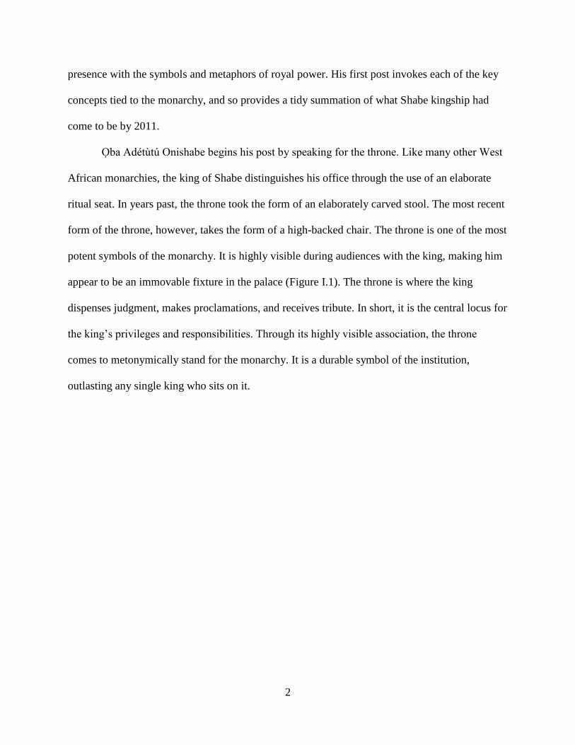
Figure I.1 Oba Adétùtú Akénmu, the Onishabe of the Shabe kingdom (2005- ). He bears the
primary insignia of his status and office: staff, fly-whisk, glass and coral beads, and the adé
beaded crown representing descent from Odùduwà, the divine king of Ile-Ife. Behind the
Onishabe are his mother (left) and wife (right). (Photo: Alfred Weidinger, 2013)
The pedigree of the throne reference by Oba Adétùtú Onishabe is made explicit in his
post: it is the throne of Baba Guidaï. In Oba Adétùtú Onishabe’s perspective, Baba Guidaï was
the first true Shabe king. All subsequent kings were chosen by kingmakers from among his
descendants, alternating between the Ìfàà and Akíkenjú lineages of the royal Otólá dynasty. It is
4
not enough to occupy the Shabe throne, as the occupant is only legitimate if he possesses a direct
connection to historical rulers. The power of the king in the present, then, is cast in terms of the
past—that royal power is a form of tradition.
Yet, the Onishabe’s genealogical connection to the past, though specific, is not unique.
After all, each Shabe subject can trace their lineage to some apical ancestor. As the Onishabe
says, they are all “descendants of Shabe mothers and fathers.” In this way, a widespread sense of
common lineage and descent is as important to maintaining the Shabe kingdom as the
monarchy’s ability to affect political cohesion. The power and relevancy of the Shabe king is
part of a shared cultural memory, a part of an essential Shabe identity that extends deep into the
past.
Though rooted in the past, the Shabe kingdom articulates with the present. A little over a
century ago, the Shabe king was the most important political figure in the area, administering a
relatively autonomous territory. Today, the influence of the king is more circumscribed. The
Republic of Bénin has taken over the powers to create and enforce laws, to tax, and to wage war.
Perhaps in response, the king’s role is now more explicitly concerned with history, in the
capacity that the king is charged with safeguarding Shabe heritage. Indeed, the Republic of
Bénin classifies the Shabe kingdom as a “chefferie traditionelle”—tradition is explicitly linked to
the kingship institution.
The Shabe kingdom is no longer an autonomous political entity. However, the Shabe
king remains a political figure. As the philosopher Kwame Anthony Appiah (2006) points out,
heritage is itself a political resource, one that encapsulates the rights of identity and recognition.
In effect, the political history of the Shabe kingdom has come to stand for the history of an
ethnicity. Much like the metonymic association between throne and king, Shabe is alchemically

5
transmuted from a political structure to a group of people, so that the ancient laws that organized
the Shabe kingdom are repurposed to essentialize ethnicity. Through the logic of ethnicity, it is
self-evident that the king of Shabe should serve as the ethnic figurehead.
The drama of ethnic politics is well-known in Africa. Though peaceful Benin has been
spared the violent ethnic clashes of neighboring Nigeria, ethnicity is similarly a dominant
political organization. This is seen in the Shabe king’s Facebook activity, where his posts
occasionally endorse political candidates. The current president of Bénin, Boni Yayi, was born in
Shabe territory, and so is claimed by the king as one of his kingdom’s native sons. At a more
practical level, the king champions social causes like local development initiatives. Though these
activities may not fall immediately under the banner of heritage, they are reminiscent of the
functions of kingship from before the rise of the nation-state and the colonial order before that.
In this light, there is long-term continuity in Shabe kingship as a political institution.
If history and heritage are the coin of the present-day Shabe king, then his use of social
media may come off as incongruent with the role of the institution. A common discursive trope
is that modernity will displace heritage institutions such as the Shabe monarchy. The
photographer Alfred Weidinger, whose multiyear project to document Africa’s traditional kings
took him throughout the continent, recently opined to CNN:
“When you come to a region [of Africa] and you see that they are working with mobile
phones, it's a kind of sign. If you see mobile phones you definitely know that it's a dying
ethnic group. African culture is changing, there are changes in communication. People
are going to the capitals and living where there is no need for a king anymore.” (quoted in
Todd 2014)
In Weidinger’s view, modernity, in the form of communication technologies, poses a threat to
African kingship by disintegrating ethnicity, its mode of organization. Attached to this is the
notion that kingship is bound to a rural location, and so is equally opposed by the demographic
6
shift in Africa favoring urban settlement. As people and places are transformed by modern life,
the prevailing wisdom predicts a plummeting trajectory of traditional kingship in Shabe and
throughout Africa.
The Shabe king’s presence on Facebook subverts this trajectory. Three years after joining
Facebook, Oba Adétùtú Onishabe has over 1,300 friends. His friends (or are they subjects?) post
messages to his Facebook page beginning with the formal greeting to royalty of “Kabiyesi.” In
return, he posts photos of himself in full regalia presiding over royal ceremonies. He regularly
uses this platform to deliver lectures on Shabe culture and history, which are met by accolades
from Shabe people who have moved to the coastal hubs of Cotonou or Porto Novo, or
internationally to Nigeria, France, or the United States. Rather than shrinking toward irrelevance,
the king is more popular than ever.
I cannot read the future in Ifá’s kola nuts, and so will not attempt to predict what is ahead
for the Shabe king. It may very well be that technology and urbanism will eventually dislodge
traditional African political institutions and deliver them to obscurity. For the moment, however,
Shabe kingship seems to be a cohesive institution articulated through clearly defined
expectations and responsibilities, and empowered by coherent sense of who its constituents are.
At the root of this cohesion is a sense of continuity with the past. This is a past that connects
people and landscape, things and institutions. It is a past geographically located in the Savè hills
area of the central Republic of Bénin (Figure I.2). Through its geography, the Shabe kingdom is
part of a larger history of political institutions in West Africa. West African polities have
certainly changed, but there is a line to the past that underlies their relevance in the present. The
focus of this dissertation is on that continuity. In the following work, I seek to excavate,
7
metaphorically and literally, this line to the past, tracing the evolution of political institutions in
Shabe.
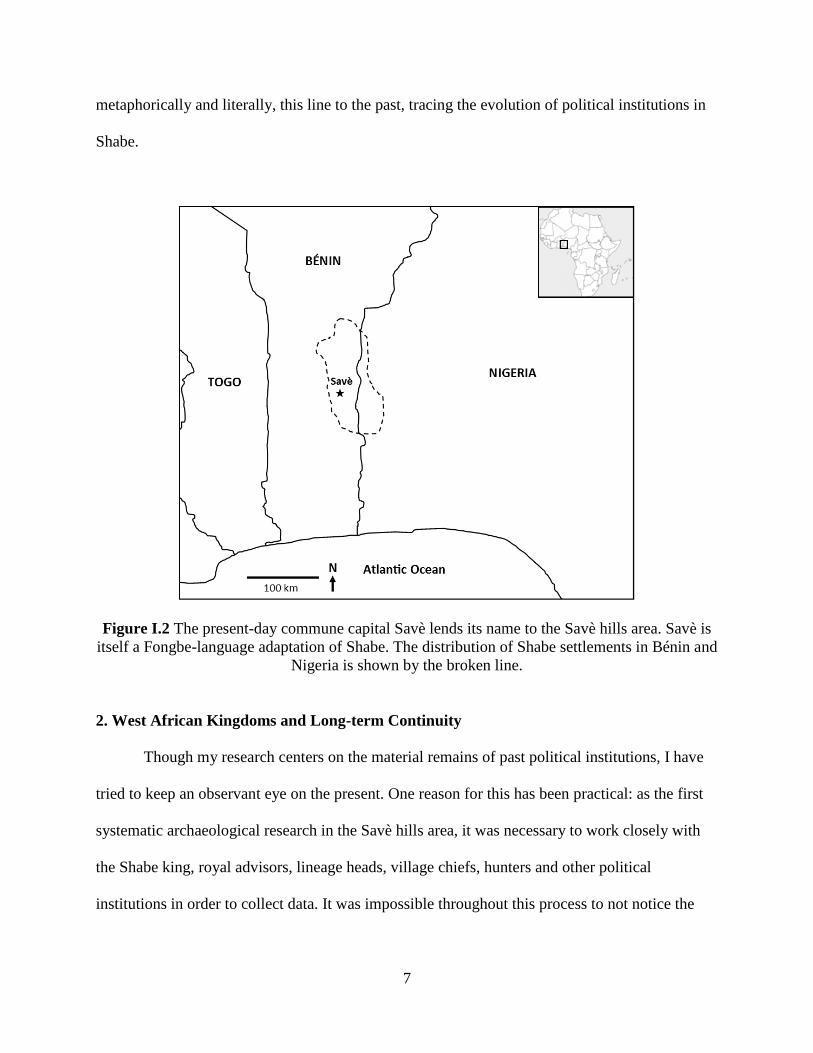
Figure I.2 The present-day commune capital Savè lends its name to the Savè hills area. Savè is
itself a Fongbe-language adaptation of Shabe. The distribution of Shabe settlements in Bénin and
Nigeria is shown by the broken line.
2. West African Kingdoms and Long-term Continuity
Though my research centers on the material remains of past political institutions, I have
tried to keep an observant eye on the present. One reason for this has been practical: as the first
systematic archaeological research in the Savè hills area, it was necessary to work closely with
the Shabe king, royal advisors, lineage heads, village chiefs, hunters and other political
institutions in order to collect data. It was impossible throughout this process to not notice the
8
ways in which these present-day institutions used archaeological remains to frame their
legitimacy through continuity.
A second reason for my interest in the present has been theoretical. As an anthropological
archaeologist interested in the development of political institutions, it has been exciting to work
in a context where the institutions under investigations still exist in some form. Though there has
obviously been change, discontinuity, and innovation as well, the close proximity of
archaeological sites and descent communities empowered a direct-historical approach to
research. Such an approach has been useful in delineating the developmental trajectory of
kingship as well competing political institutions.
A third reason for my interest in the present has been ethical. Recent self-reflective
criticism of archaeological practice in Africa has begun to question the utility of research
programs that fail to engage relevant stakeholders (e.g., Schmidt 2009; Lane 2011; Giblin et al.
2014). By paying attention to the diversity of political institutions in the present, I have been able
to solicit the participation of diverse groups in an attempt to create a more inclusive research
paradigm. In particular, my interest in the development of political institutions dovetails with the
call to recover “usable pasts” (Lane 2011; Stump 2013b). As the Shabe monarchy has become so
closely linked to the identity of modern group, its origins and development have become salient
points in debates over local resources, national policy, and sentiments toward the far-flung
populations of the African diaspora.
Archaeology can make important contributions to the construction of “usable pasts”
through its investigations of material remains—the raw matter of the past that is transformed into
heritage resources. These contributions are substantial in Africa where the 20th century disrupted
many of the continent’s indigenous institutions. In contrast to the popular images of African
9
kingdoms as timeless and static, African states have often been seen as dangerously volatile and
dynamic. The two are related, of course, and the post-colonial history of the Shabe kingdom
bears this out. In 1975, a military coup brought Mathieu Kérékou to power. Kérékou espoused
Marxist-Leninist principles and advocated a strongly centralized government. The centralization
of political power caused a crisis among kings, chiefs, and other ethnicity or lineage-based
political figures as their offices were systematically repressed by the Kérékou regime (Kahn
2011). The legacy of indigenous political institutions was denied in an effort to modernize. The
outcome of this was increasing inequality, with concentrations of wealth and power in the hands
of the political class. Though Benin successfully transitioned to a democracy in 1990, destruction
of tangible and intangible heritage that accompanied this period of ethnic repression is still
apparent. A “usable past” in Shabe should therefore bridge kingship of the present-day with that
of before the interventions of nationalist agendas.
Of course, a “usable past” in Shabe must go back even further. Prior to the wave of
independence in the 1960s, colonial powers throughout Africa had altered existing political
institutions to suit their purposes (Crowder 1964; Mamdani 1996). Rulers who would not support
the colonial regime were exiled and replaced, or had their institutions simply dissolved. This was
the case in Shabe, where the Onishabe Oba Akemún was exiled by the French in 1902 for
refusing to enforce colonial law or contribute local labor to the colonial administration (Palau
Martí 1992a: 254). A “usable past” should extend to and beyond the colonial period.
It is inevitable that a “usable past” of the Shabe kingdom must go back to before
colonization, as the designation “traditional” is essentially synonymous with “pre-colonial.”
However, decades of culture contact studies have shown that there is no bright line separating the
colonial from the pre-colonial, and pre-colonial societies were every bit as dynamic as their

10
better known descendants (Lightfoot 1995; Robertshaw 2000; Stahl 2009). One only need go
back to the mid-19th century CE to find that Shabe was wracked with war and instability (Palau
Martí 1992a; Adediran 1994). Certainly, Shabe kingship had been transformed through its
contacts with other regional polities, participation in trade, adoption of new technologies, and the
agency of its internal actors.
Yet, for something that is at the core of present-day Shabe identity, relatively little is
known about the pre-colonial Shabe monarchy. A chronology of important personae and events
is known, but details of daily life are missing. The economic and settlement practices that shaped
the everyday of ancient Shabe peoples are unknown. It seems the disruptions of the 19th and 20th
centuries CE have taken their toll on Shabe oral history, as much of the efforts of the recent
Onishabes have been to reconstruct Shabe heritage. My dissertation contributes to a usable Shabe
past by documenting its archaeology—giving a material form to Shabe heritage. My focus is on
the political economy: the ways in which institutions produce, manage, and mobilize labor and
resources. Through political economy, my investigations link the material remains of ancient
economies—patterning of abandoned sites, discarded pots and tools, broken trade goods, food
remains—to the institutions, such as kingship, that structured economic differentiation and
inequality.
My research builds on a rich literature on the origins and development of African polities.
This literature dovetails in many areas with a general archaeological interest in the origins of
complex societies, states and empires, but the particularities of African case studies have resulted
in its own array of theories and analytical tools. Below, I sketch the outline of this corpus with
the intent of showing how my investigations of the Shabe kingdom fit within Africanist and
11
global perspectives on the processes of political centralization and the development of political-
economies.
B. The Growth of States in West Africa
1. The State in Africa
The African continent has been extensively studied by scholars interested in the diversity
and development of political forms. Early research, sanctioned by European colonial
governments, was conducted on the form and origin of Africa’s precolonial polities—from
expansive kingdoms to autonomous villages (e.g., Fortes & Evans-Pritchard 1940; Southall
1974: 153). As countries gained independence, researchers documented the growth and trials of
these new nations, noting the common trajectory of colony to democracies to military
dictatorships (Southall 1974: 157). This research has led to the modest conclusion that the
political structure of society is important in African social life (Lonsdale 1981). If not all-
encompassing, the modern nation-state is a powerful force in shaping the structures and practices
of local communities (Ferguson & Gupta 2002: 981).
Were states as central to life in the past as they are today? The modern political borders
of Africa are inherited from the Berlin Conference of 1890 CE and despite more than a century
of modification they continue to shape political discourse. While the political legacies of
colonialism are certainly important influences in African societies today, it is untrue to
characterize African states as a recent development originating at the very end of the 19th
century CE. European colonizers were well aware of the centralized political institutions
indigenous to Africa, and that their political histories stretched back centuries. Nation-state
12
borders today reflect the political hegemony ultimately won by European empires, but the deep
history of African political practice extends much further back into the pre-colonial period
(Bayart 1993; Thornton 1992).
The African kingdoms that European empires overtook were, in many respects, similar to
their own. West African kingdoms had urban settlements, regionally linked economies, and
centralized political institutions (Coquery-Vidrovitch 2005; Hopkins 1973; Herbst 2000; Monroe
2013). There were professional militaries, bureaucracies, and infrastructure (Smith 1989; Wilks
1989; Goody 1971). States had developed in Africa long before European entanglement. To
understand the long-term development of African states, we must look to the pre-colonial period.
In the following section, I describe the historical sources used to investigate pre-colonial West
African states. The use of these sources is contrasted with anthropological perspectives on state
formation that archaeologists have often employed. Though I use the word “state” to emphasize
the continuity between present-day and pre-colonial political structures, it may be preferable to
refer to these as “centralized polities,” as I am most interested in the process of centralization,
rather than the exact form of its end product.
2. Historical Perspectives on West African States
For some pre-colonial African states, historical information is derived from contemporary
written accounts. From the 9th century CE on, Arab chroniclers wrote of large cities, territorial
polities, and expansive trade networks throughout the Sahel of West Africa and extending down
into the equatorial forests (Bovill 1958; Levtzion 1973). Perhaps most famously, the famed
Moroccan explorer Ibn Battuta visited several kingdoms in the mid-14th century CE (Hamdun &
King 2005). In addition to observing the politics and daily life of the places they visited, these
13
chroniclers also recorded information about neighboring states, suggesting a complex political
system that included non-Muslim states (Law 1976). While some intriguing references to these
states still exist, it is likely that the majority of relevant texts have been lost or have not yet been
fully analyzed (Law 1977: 13). What does exist is certainly useful for understanding precolonial
African states, however it is necessary to be aware that such texts present a view of African
societies from an outsider’s perspective. Specifically, Arabic sources present a view of African
political systems filtered through their authors’ interpretations of Islamic law, sometimes
distorting the representation of the subjects they write on (Lovejoy 1978; Garrard 1982).
European writings also provide valuable insights into West African states. Beginning in
the late 15th century CE, European merchants began sailing to the coast of West Africa to engage
in trade. However, like Arabic sources, these accounts are often distorted in service of their
author’s goals and comprehension. Understanding the contexts and limitations of historical texts
is a major concern for a highly politicized and contentious subject like the Atlantic slave trade
(Law 1986). Nonetheless, Europeans did interact with West African states with increasing
intensity over the past 500 years and their writings hold important information. The concerns of
the authors were mostly economic, and this is reflected in the kinds of documents left for
historians: inventories of trade goods, coastal maps, and journals detailing travel itineraries
(Curtin 1972; Lovejoy 1989; Law 1991; Thornton 1992). These accounts do touch on the
political structures of African societies, but are still mainly concerned with how those political
structures affected trade.
Beginning in the 19th century CE, European accounts provided more detailed information
about the operation of African political systems. During the preceding centuries of trade,
Europeans had been confined to the coast, but now missionaries and explorers began to penetrate

14
the African interior. They wrote about the peoples they encountered and began to write on
subjects such as law, religion, and history, in addition to the earlier focus on economy and trade
(Peel 1995). Though these writings provide unique insights, their coverage remained thin. For
the vast majority of African societies, there simply are no written sources.
The precolonial political elites of West Africa were keenly aware of their histories, as
their authority was often couched in a historical context that explained elite access to sources of
power. In most of these societies, histories were not written down but rather recorded in oral
traditions—structured oratory using mnemonic devices to record a range of a chronological and
political information (Finnegan 1970; Biobaku 1973; Law 1984; Vansina 1985). Vansina (1985)
locates oral traditions in the spectrum of verbal messages. It is differentiated from news, in that
the message of oral tradition does not reference an event in the present. It is also differentiated
from the interpretation of experience, because though it similarly deals with something in the
past, experience is a personal message while oral tradition is divorced from its immediate
context. Once removed from the events that inspired it, oral traditions are preserved and
transmitted through a range of verbal techniques and devices.
The reliability of oral traditions was called into question as part of the linguistic turn in
anthropology (Ranger 1993; Vernon 1994). As political charters in the present, oral traditions
were perceived as editable texts that could be modified to serve vested political interests. In this
perspective, traditions reflect invented pasts, rather than lived past, that teleologically supported
power relationships of the present. However, the critique of oral tradition may have gone too far
in denigrating its accuracy. Not any narrative can pass for history, as it must not only
satisfactorily explain the present but also be congruent with the material evidence of the past
(Stahl 2001; Spear 2003). Still, there is always some amount of active silencing and passive loss
15
in the preservation of oral tradition (Vansina 1985). This has led to the supplemental use of
archaeological data to support and contrast historical constructions derived from written and oral
histories (Robertshaw 2000; Schmidt & Walz 2007).
3. Archaeological Perspectives on West African States
Lacking information on the earliest origins of African states, early historians invoked
their conceptions of Mediterranean and Near Eastern origins for African civilizations (Wrigley
1960; Trigger 1969). Defined in terms of traits—divine kingship, agriculture, metallurgy, social
hierarchy—African states were seen as the product of outside influences. Such arguments were
in keeping with colonial rhetoric that non-Europeans were naturally, even rightfully, subject to
imperialism. While diffusion of entire political systems has not been well supported by either
historical or archaeological research in Africa, diffusion remains an important concept in tracing
the spread of ideas, practices, and technologies (Rogers 2010). However, without a consideration
of how non-local products were incorporated into specific local contexts, diffusion has the
potential to be abused as a blanket explanation, particularly where detailed sources accounting
for the spread and development of specific political practices are lacking.
The intense interests in diffusion, technology, trade, and political systems in the
kingdoms of Atlantic Africa mirror the interests of early archaeologists who worked to
reconstruct ancient societies. Early archaeological methods were oriented toward the taxonomic
identification of technologies, facilitating explanations of societal change based on diffusion. To
Childe (1950, 1951), ancient societies were connected by expansive communication networks
through which innovations could spread. The accumulation of innovative technologies leads to
transformations in society, though particular institutions and agencies within a society may try to
16
halt or slow the deployment of new technologies. Though Childe (1951) promoted the diffusion
of technologies as a means for identifying change in the archaeological record at all social scales,
he used technology as an explicit criterion for identifying ancient “civilizations” (1950). While
potentially useful for broad comparisons of societies, later archaeologists eschewed the trait list
definition of states as inadequate to explain the processes of state formation (e.g. Binford 1964:
425). Still, the features of states described by Childe are more applicable as a general model of
the institutions in early states (Smith 2009: 22). That such features can be recognized in complex
societies from varying geographies and distant times is what requires explanation.
However, archaeologists no longer turn to the diffusion alone as the causal mechanism
for societal change. There is enough cultural variability and potential for innovation as to not
presuppose that any distinctive features of a society, such as those described by Childe, must
come from some original source (Rowe 1966: 366). Even when diffusion does seem to
adequately describe the distribution of some feature, it is not itself an explanation, as it does not
elucidate its internal articulation (Childe 1951: 46). Similarly, the presence of trade and
technologies that allow dense populations and state institutions do not explain their deployment
(Wright & Johnson 1975). Instead, explanation must come from the analysis of human agency
and structures. The cultural systemic approaches that developed to explain social process focused
on how structures within societies emerge and change (e.g. Flannery 1972). This emphasis on
large processes and impersonal forces meshed well with earlier historical inquiry into African
political and economic institutions (Robertshaw 1990).
Archaeology has extended the search for the development of West African states in time
and in space. The region has had a long involvement in trade, stemming from trans-Saharan
connections established well before the Atlantic economy (Posnansky 1973). Even earlier trade
17
networks connected West Africa with the rest of the continent, and beyond to the Mediterranean,
the Near East, and South Asia (Mitchell 2005; Kelly 2013; Leone & Moussa 2013). While this
research has shown the time depth of the technological flows between West Africa and the rest
of the world, archaeology has made much more substantive contributions to the comparative
study of states. West African societies show a great deal of variability in how they negotiated
economic networks and political centralization (Posnansky 1982: 352; McIntosh 1999; Stahl
2004; Monroe 2013). The presence of such variability has led Africanists to explore the role that
non-material structures, such as ideology, have had in African societies (e.g. Huffman 1986).
The turn to ideology has pushed political structures to the fore in explaining large scale societal
change. This is particularly true in research on the origins of centralized polities, where social
complexity is often measured by the differentiation of political roles in a society (McIntosh
1999: 9).
The establishment of political roles in any given society is an ongoing and messy process.
Despite the idiosyncrasies of historical circumstance, many anthropologists have shared Childe’s
observations of regularity among societies: that social processes occur in more-or-less patterned
ways due to structural and contextual similarities in the organization of social institutions. Early
social evolutionists theorized that parallel sequences of material traditions, styles, architecture,
and even landscape use could be explained by cultural laws, derived from cultural-ecological
adaptations (Steward 1955). Societies passed through parallel sequences because each stage of
the sequence has its own wholly unique, but strikingly regular, integrative mechanisms centered
on the differentiation of social roles. In proposing these sequential stages, however, early
archaeologists too readily ignored the non-commensurate nature of their typologies. Elman
Service’s (1962) four societal types of bands, tribes, chiefdoms, and states are organized as a
18
series that grades through different population sizes, presenting the illusion that all are defined
according to similar metrics. This is not the case, as Service defined bands primarily by their
demography, tribes by their economic mode, and chiefdoms and states by their political
organization. Each type is defined by a different aspect of societal reproduction, making it
difficult to use in a coherent comparative framework.
Later researchers rejected many of the trappings of this early social evolution, though the
development of political institutions has remained an active focus of study for archaeologists.
Eschewing the linearity of evolutionary schemes, Marxist approaches have proposed that one
operational axis of political development is how labor is managed in society (Yoffee 2005: 33).
While many societies have complex social organizations based on kinship, the crucial moment of
political centralization occurs with the creation of an institution above the level of kinship that
claims authority over labor relations among its differentiated elements. Yet, the specific
institutions can vary tremendously (ibid: 17-19). Some of this institutional variability can be
attributed to the multiple ways in which labor can be manipulated. Thus, it may be more
productive to include the study of labor under a more general focus on power and material
inequality (Peregrine 2012: 168).
The development of supra-kinship institutions corresponds to growing inequality between
social groups, owing to the state’s necessity to continual reinforce social order (Yoffee 2005:
39). Inequality, defined as the unequal distribution of resources in society, has also been a
prominent part of archaeological research (Paynter 1989). Inequality can be identified materially
in the archaeological record, and its presence is generally taken as an indicator of complex social
and/or political structures. The growth of inequality is therefore tied to the development and
manipulation of power in society (Marcus 2008). Drawing from a broad anthropological
19
literature, Flannery and Marcus (2012: 206) proposed that the development of complexity is
linked to social institutions that increase inequality. However, the specific process of
centralization occurs as a result of the unification of competing, parallel institutions (ibid: 362).
Thus, states and other centralized polities are institutionally composed of a kind of compounded
inequality.
Archaeology, with its attention to the diachronic development of inequalities in societies,
is able to address key questions about state formation in West Africa: when did institutional
inequality, in its supra-kinship form, appear as a fundamental political organization in West
Africa and why did it continue to develop into the political-economic mosaic that Europeans
encountered as they sailed the Atlantic coast? The twin questions of ‘when’ and ‘why’ are
inextricably linked, but archaeologists have theorized several ways to productively decouple the
general process of state formation from its specific iterations.
Some scholars have chosen to take a macrosystemic approach to studying early
centralized polities. In this, specialized political institutions emerge as a centralized response to
socio-environmental stresses (Flannery 1972; Haas 1982). Inequality is an outgrowth of the
system due to environmental and demographic discrepancies, potentially with violent
consequences (Carneiro 1970). While the holistic approach to social structures and environment
is compelling, particularly when explaining state formation in contexts of clear environmental
circumscription, it is has been difficult to apply to every case. There often is no clear evidence of
major demographic or environmental changes for many instances of political centralization,
particularly in Africa (McIntosh 1999; Stahl 2004; Monroe 2013; Ogundiran 2013).
Another way archaeologists have explained the origins of centralized polities has been to
focus on the agency of individuals and the institutions they create. These archaeologists have

20
sought to answer the question of how elite strategies differentially influenced the process of state
formation. A productive binary has been to divide power strategies into exclusionary strategies,
those reliant on the control of social networks, and corporate strategies, those reliant on support
from their constituent social groups (Feinman 1995; Blanton et al. 1996). Despite the conceptual
division of power strategies, ancient elites likely enacted and experimented with many kinds of
political practices that drew from multiple sources of power (Earle 1997; Stein 1998; Blanton &
Fargher 2008). This attention to political agency implies that state formation was not the
inevitable outcome of social evolution, but neither does it contradict the general trend recognized
by evolutionary theorists, as political practices can certainly be considered within a larger
systemic framework (Flannery 1999). Indeed, centralization itself, so closely linked to social
complexity, is just one pathway to the establishment of supra-kinship institutions (McIntosh
1999).
While ancient elites were influential in their own manipulation of the political economy,
it is also clear that the agency of elites alone cannot explain the broader social conditions leading
to state formation (Robb 2010: 497). Some conditions would have been outside the control of
any one social actor, let alone macrosystemic influences like climate, technology, and resource
availability. The political changes leading to centralization is not a solely internal process. In
addition to the institutions unified through centralization, political elites operate in a context of
interaction with other regional political institutions often in competitive relationships (Renfrew
& Cherry 1986; Wright 2006). While this competition may eventually lead to unification (see
Flannery & Marcus 2012), the general impression of centralization in West Africa is that states
and other complex polities have always been enmeshed in political economic mosaics with less
complex polities (Stahl 2004). These regional networks are fundamental to how large territorial
21
polities operated in West Africa, variously providing peripheral zones for resource extraction,
frontiers to buffer factional competition, or societal examples that could serve as foils to state
ideology (Monroe & Ogundiran 2012; Davies 2013).
Archaeological research has approached the development of West African political
institutions and centralization through three inter-related lens: the macrosystemic environment
(including both cultural and natural factors), the agency and strategies of individuals and social
groups, and the interaction between societies of various kinds on a regional scale. Each of these
dimensions can be directed to support or resist inequality, and can work in tandem to create
durable, complex sociopolitical formations. The structures of these sociopolitical formations—
states and centralized polities—profoundly shaped the lives of their constituent communities.
Archaeological research has provided useful information about this as well.
States emerge through the confluence of multiple processes, making them not so much a
definitive categorization of society as constellations of mutually reinforcing political-economic
practices—continually evolving “works in progress” (Monroe 2013: 4). Many archaeologists
have worked to identify the general characteristics of these practices, as well as their specific
manifestations. Economic systems are perhaps one of the most intensively studied dimensions of
ancient states (Smith 2004). Appeals to economy are an outgrowth of the evolutionary
perspective that holds social complexity as directly correlated to energy consumption (White
1959). Energy consumption is, however, realized through economic practice, which can vary
substantially based on different state financing strategies (D’Altroy & Earle 1985). Regardless of
how state economies were structured, they were complicit in hierarchical social arrangements
that integrated economic centers with their hinterlands (Johnson 1982: 415; Paynter 1989;
Peregrine 1991; McIntosh & McIntosh 1993).

22
However, complex social organization is not necessarily linked to hierarchical control
over economic practice. Africanist archaeologists, in particular, have demonstrated that
decentralized political institutions do not always develop toward centralization and can instead
be integrated through non-hierarchical arrangements (Stahl 1999). In these societies, complexity
is conceptualized as the degree of internal differentiation generally, rather than specifically
hierarchical differentiation (McIntosh 1999: 11). Such “heterarchical” complex societies consist
of groups that are not intrinsically ranked, or are able to be ranked in different ways along the
same axis of differentiation (Crumley 1995). This more inclusive definition of complexity allows
researchers to acknowledge that state political economic practices may dominate certain areas of
societal reproduction, but parallel and even competing institutions are also important (Brumfiel
1994; Stein 1998). For cases of state formation in Africa, the question of origins has turned to
evaluating how capable elites actually were at transcending decentralized sources of power
(Monroe 2013: 4). Long-distance exchange in African states has been hypothesized as an
economic practice particularly subject to hierarchical control (Goody 1971; Posnansky 1973).
Other practices, such as ritual performance, have proven to be more ambivalent, serving as both
sources of support and resistance to political elites (e.g., Insoll 2003; Stahl 2008; Norman 2009;
Fleisher 2010; Dueppen 2012).
The diversity of political strategies and institutions in Africa—as in other early states and
centralized polities—makes a neo-evolutionary approach difficult. The different scales of
societies, as well as their variability in hierarchical/heterarchical organization, prevents easy
application of centralization models developed elsewhere in the world. To circumvent this
problem, archaeologists have increasingly turned to the analysis of how power was exercised in
society, rather than how it was structured (Fleisher & Wynne-Jones 2010: 180; Monroe 2013).
23
The exercise of power in any centralized polity is situated between two poles along a gradient of
practices, ranging from “instrumental” to “creative” (Schoenburn 1999; Robertshaw 2003;
Fleisher & Wynne-Jones 2010). The difference between the two forms of power is similar to the
exclusionary/corporate divide (see Blanton et al. 1996), where power can be realized through
compelling others to actions (instrumental) or by fostering participation in symbolic practices
(creative). Despite differences in practice, the uniting feature of both instrumental and creative
strategies is that they were used successfully to integrate many societies over a vast region.
Political centralization occurred multiple times in West Africa. Elites in these polities
employed a variety of strategies that exploited and developed different sources of power. It is
tempting to see centralization as linked to the exploitation of long-distance exchange. After all,
the earliest evidence for it is in the West African savanna, near the loci of trans-Saharan trade,
and only later in the forest, once the trans-Atlantic trade had established a regular presence.
However, states and centralized polities articulated in political economies that linked vast
regions, incorporating the savanna and the forest. Further, appeals to exchange ignore the great
ecological and resource variability within West Africa that was central to political-economic
networks. Centralized polities certainly developed around poles for long-distance exchange, but
these were connected to less centralized and decentralized societies too. Power and authority was
not uniformly concentrated across these vast networks.
C. The Shabe Kingdom in the West African Political-Economic Mosaic
1. Investigating the Shabe Past
24
What is the best way to approach the development of Shabe’s institutions and political
economy? As noted above, archaeologists and historians have often emphasized the role of the
trans-Atlantic trade in political centralization in West Africa during the late second millennium
CE. Historical documents, oral histories, and archaeological materials have all been used to
demonstrate that the careful control and manipulation of trade relations with Europeans by
African elites produced powerful political economies, helping to finance royal courts,
bureaucracies, market systems, standing armies, and campaigns of territorial expansion (e.g.,
Goody 1971; Manning 1982; Brooks 1993; Posnansky & DeCorse 1986; Kelly 1997; DeCorse
2001; Ogundiran 2002b; Monroe 2007b; Richard 2010). Europeans on the coast provided new
markets for slaves, gold, and foodstuffs, and simultaneously introduced new prestige goods and
revolutionary technologies, such as firearms. These exchange relationships reshaped political
organization throughout West Africa as coastal polities interacted with inland communities
themselves not in direct contact with Europeans. It is no surprise that scholars have privileged
long-distance trade as a primary catalyst for state formation in West Africa over the past 500
years.
Although the trans-Atlantic trade’s demand for slaves uniquely changed social relations
(Lovejoy 1989; Nunn 2008), researchers also stress the continuity between the trans-Atlantic
trade and earlier long-distance exchange networks in producing centralized polities (e.g., Fage
1969; Posnansky 1973; Garrard 1982; Curtin 1984; Anquandah 1993; Lange 1994; Insoll &
Shaw 1997; Connah 2001; Gronenborn 2001). Global exchange networks have a great time
depth in West Africa and were not products of more recent European interaction (Mitchell 2005).
Emphasizing the connections between polities and earlier global exchange networks reveals that

25
processes of political centralization have a deep history in West Africa. Is it here, entangled in
global exchange systems, that the Shabe past is located?
It is certainly possible. Archaeological research on trade in West Africa has made
critically important contributions to our understanding of the variability and dynamism of
African political forms (e.g., Posnansky 1973; McIntosh & McIntosh 1984; DeCorse 1992; Kelly
1997; Stahl 2004; McIntosh 2005; Ogundiran 2005). However, far less attention has been paid to
local production. Local production was important even within polities heavily engaged in global
exchange and was crucial to elites within trading polities in supplying the necessary surplus
goods and labor for exchange (Wright & Johnson 1975; Johnson 1977; Brumfiel & Earle 1987;
Hirth 1996). In West Africa, long-distance exchange, either across the continent or globally,
supplied exotic trade goods that articulated with, but did not supplant, local modes of production
(Thornton 1992). Archaeological research has demonstrated that even where great quantities of
exotic trade goods were lacking, local production often thrived (Ogundiran 2009; de Barros
2012; MacEachern 2012). Could it be that attention to global currents has obscured the local
origins of African political institutions? Can the Shabe kingdom be explained as a local
phenomenon arising due to conditions unrelated to trade?
This is a perspective worth considering. Expanding the study of the economic
underpinnings of political centralization to include local modes of production, such as settlement
and labor management systems, transportation infrastructure systems, agricultural systems, and
craft production systems will bring West African polities in closer dialogue with research on the
processes of political centralization in other regions (e.g.,, Blanton & Fargher 2008; Flannery &
Marcus 2012; Morrison 2006; Renfrew 2008; A.T. Smith 2003; M.E. Smith 2004; Trigger 2003;
Wright 2005) and will allow us to explain processes of centralization in societies that lay outside

26
global exchange systems. A focus on local production highlights the variability found in the
economic organization of West African polities, contributing to our understanding of the
multiple pathways to political centralization. My dissertation investigates these issues through a
study of local and non-local economic production and processes of political transformation in the
Savè hills.
At the core of my dissertation are three related questions about the Shabe kingdom. These
questions were formulated with the idea of a “usable past” in mind, though were constrained by
the lack of previous research in the area. Thus, the first of my questions simply attempts to
establish the relevant cultural history of the monarchy: how did the institutions of the Shabe
kingdom form? This necessitates answering the question of “when,” of course, but I am most
interested in the “how”—the structural conditions that facilitated the emergence of centralized
authority and the competing institutions that died out, continued alongside, or were subsumed by
the monarchy. I am also interested in the pace: did centralization occur early on, or was it a
gradual development characterized by plateaus and/or cycles of fission and fusion?
My second question expands the focus from the institutions themselves to the practices
that maintained them: what economies supported Shabe institutions? It is now commonly
recognized that ancient economies were not merely adaptive behaviors, but systems that could be
harnessed for social differentiation—that economies are political (Hirth 1996; Stein 1998). How
did Shabe elites harness the economy? Though much of the previous archaeological research in
West Africa has highlighted long-distance exchange, other economic models are possible. In
particular, I am interested in the role that local economic intensification had in supporting the
Shabe kingdom. Under intensification, the political-economy is sustained through a
reorganization of the local economy rather than through the products of neighboring polities.
27
Such reorganization may create centralized authority through the creative renegotiation of
personal relationships, such as the amassing of wealth-in-people (sensu Guyer & Belinga 1995),
or it may create entirely novel structures of control by providing new opportunities for
interaction, as in processes of urban aggregation or synoecism (sensu Connah 2001). Though
examples of intensification economies in African prehistory have been described, such as Ile-Ife
(Eyo 1974; Blier 2012) and Bunyoro-Kitara (Robertshaw 2003), the role of local economic
reorganization has been largely neglected in the study of African political centralization.
My third question seeks to clarify Shabe’s place in the West African political-economic
mosaic: how did contact with the broader region contribute to the development of Shabe political
institutions? The origin narrative of the kingdom, preserved in oral histories, makes it clear that
the conception and form of Shabe kingship was not the emergence of a brand new organizational
structure, but the adaption of existing forms to new peoples and landscapes. There are many
possible candidates for where these structures came from. As a Yoruba kingdom, the Shabe
monarchy traces its dynastic origins to Oduduwa, the mythic king of Ile-Ife. Shabe migration
narratives also point to Oyo in the east and Borgu in the north as sharing political affinities. More
recent histories point to complex interactions with Dahomey to the southwest, as well as with
small groups of refugees and traders from southern and central Bénin, Ghana, Niger, and
southwestern Nigeria. Each group had potential impacts on the political institutions in Shabe,
and my aim is to elucidate these influences.
2. Dissertation Outline
This dissertation works toward answering three questions about the evolution of Shabe
kingship: How did the political institutions of the Shabe kingdom form? What economies
28
supported Shabe political institutions? How did contact with the broader region contribute the
development of Shabe political institutions?
To address these questions, I turn to archaeological data generated through two seasons
of fieldwork conducted in 2012-2013. These data includes spatial information on site location
and size, the formal properties of architectural and landscape features, locally manufactured
artifacts, and imported goods. Through this data, I reconstruct the development of Shabe political
economies: settlement systems, agricultural practices, craft production organization, local and
long-distance exchange networks, and the political institutions that articulated with these. Before
introducing the archaeological data, I contextualize Shabe’s place in the West African political
mosaic of the past 1000 years.
In Chapter II, I review how West African political economies have been conceptualized
in anthropological and historical perspectives. I examine several models of political
organization—Atlantic entrepôts, internal frontiers, and wealth-in-people—to evaluate their
potential applicability to the Shabe kingdom. I then briefly outline case studies of some the
largest centralized polities that were created in West Africa and their role in regional political
economies. From here, I go on to describe the Ife dynastic field: a network of related polities,
including Shabe, which held in common political institutions and symbols originating at Ile-Ife.
These polities have come to be known under the ethnonym “Yoruba,” and I outline the salient
points of over a century of Yoruba ethnographic and oral historical research as they relate to the
political economy of the Shabe kingdom.
My research is aided by excellent political histories of Shabe, painstakingly constructed
through ethnography, oral history, and archival research (e.g., Parrinder 1947; Mouléro 1964;
Schiltz 1985; Palau Martí 1992a, 1992b, 1993; Adediran 1994; Ali Babio 1994; Adam et al.
29
1996; Flynn 1997b; Igué 2005). In Chapter III, I summarize these histories to develop an
ethnographic composite of the Shabe kingdom. I present the oral traditions of the kingdoms and
consider how the projection of language, lineage, and ritual practice into the past has created a
Shabe ethnic identity in the present. I also note disputes between the monarchy and other
institutions over the contours of Shabe history, and how these areas of dissonance might reveal
information about the past.
In Chapter IV, I describe the research methods I employed to collect archaeological data.
My research centered on the contemporary city of Savè, the site of the ancient Shabe capital of
Shabe-Idadu, and included the historically important settlements of Kaboua and Djabata. This
area constitutes the political core of the Shabe kingdom. Three complementary components of
fieldwork collected archaeological data at multiple scales. A multiscalar approach was employed
to address the complexity of interaction between political centralization and economic systems,
as these interactions play out at different spatial, temporal, and social scales. A reconnaissance
survey component and a transect survey component investigated sites in a context of regional
interaction, while an excavation component targeted individual features of sites. As part of my
commitment to constructing a “usable past,” local participation featured prominently in all
components of fieldwork, but especially in the reconnaissance survey.
In Chapter V, I present the results of my archaeological research and interpretations of
the data. This is presented chronologically, beginning with the Pre-Shabe (before 1600 CE) and
Early Shabe (1600-1700 CE) periods, moving through the Middle Shabe (1700-1830 CE) and
Late Shabe (1830-1894 CE) periods, and concluding with the European Colonial (1894-1960
CE) period. For each period, I analyze settlement patterning and evidence of economic
practices—subsistence, craft production, exchange—and their relationship to evidence for

30
different forms of political-economic organization and institutions. The archaeological data that
inform my interpretations are presented in the Appendices.
I conclude my dissertation by drawing a narrative arc between all periods of the Shabe
kingdom. Shabe kingship was a continually evolving institution, one that has been incredibly
adaptive to changing internal and regional conditions. As I shall argue, Shabe kingship has
always been contested and centralization resisted. Nonetheless, it has been effective in
harnessing and manipulating economic systems. Through economic support, political institutions
developed ideologies that reified the positions of Shabe elites. Even in the present, when the
political and economic influence of traditional kings seems waning, the Shabe royalty, noble
lineages, and titled officials draw influence through a line of continuity to the past. From the
deep-time perspective afforded by archaeology, Oba Adétùtú Onishabe’s foray into the digital
frontier of Facebook is seen as only the latest manifestation of the monarchy’s ongoing project of
centralization.

31
CHAPTER II
The Frontiers of Empire
In this chapter, I explore the historical context in which the Shabe kingdom developed. I
begin by laying out a variety of models that scholars have used to characterize political
centralization in West Africa. Each model has the potential to fit the archaeological data
generated through my investigations in the Savè hills area (see Chapters IV and V). These
models have been evaluated by other archaeological case studies of political centralization in
West Africa, and here I limit my focus to some of the best known and most relevant. I conclude
the chapter with a more intensive study of the Ife dynastic field and the Oyo Empire: political
institutions of direct relevance to the Shabe kingdom both in providing models for Shabe
institutions and in influencing the political economic climate that those institutions developed in.
A. Imperial Entanglements during the Atlantic Age
1. The Atlantic Economy
As introduced in Chapter I, decades of research have demonstrated the variability in
pathways to social complexity. To make sense of this variability, particularly when considering a
diachronic swathe of polities, archaeologists Richard Blanton, Gary Feinman, and colleagues
have proposed conceptualizing the elite power strategies that propelled these political systems as
32
being distributed along a corporate-exclusionary axis (Blanton et al. 1996). The difference
between these two poles is conceptualized as “corporate organization [being] broadly associated
with shared power, less ostentatious manifestations of stratification, and an economy focused on
basic/local production, whereas more exclusionary power arrangements are keyed to highly
centralized/individualized rule, networks of personal power, more expressed degrees of
inequality, and an economy heavily unpinned [sic] by long-distance networks and flows”
(Feinman 2012: 31-32).
Political elites draw from a range of strategies at any given time. Perhaps the best studied
strategy of Atlantic West Africa is elite monopolization of long-distance exchange, a
quintessential exclusionary strategy. Participation in and control over long-distance exchange
was certainly an important factor in the growth of many African states, particularly for the period
of the Atlantic trade (Coquery-Vidrovitch 1969; Goody 1971). Even when trade is not elevated
to prime-mover status, it has been widely invoked in discussions of precolonial African life for
nearly all societies of the period, in part because of the source-side economic biases of historical
research (Hopkins 1973; Lonsdale 1981; Law 1993). Archaeologists, with their concerns in the
material, have also focused on economy and long-distance exchange in their treatments of
precolonial West African societies (Posnansky 1973).
The antiquity of long-distance exchange in West Africa is hard to pinpoint, as direct or
down-the-line exchange connecting the region with the rest of the continent and beyond has
likely been a feature of village societies since the advent of iron metallurgy after 1000 BCE
(Mitchell 2005: 14-19). Clear evidence for trans-continental trade comes from Roman North
Africa, where Roman products were traded from throughout the empire, entering West Africa
through the Garamantes in the Sahara (Leone & Moussa 2013: 783). West African gold made its
33
way to Carthage and Alexandria by the end of the 3rd century CE, and continued on after the
Arab conquest in 695 CE (MacDonald 2013: 834). The importance of the trans-Saharan trade is
attested to in written sources beginning in the 9th century CE (ibid: 837). Though the Sahelian
entrepôts are the best known participants in the trade, archaeological evidence from Igbo-Ukwu
in Nigeria suggests that its reach stretched to the more southern parts of West Africa (see below).
Long-distance exchange between Europe and West Africa was mediated by North
African societies until the 15th century CE. Beginning in the 15th century, European maritime
technologies allowed direct interaction between the two regions. The Portuguese were the first to
trade in West Africa, but other European powers quickly entered the field to trade in gold, ivory,
melegueta pepper, and dyes (Thornton 1992: 31; Ogundiran & Falola 2007: 11). In exchange,
Africans received cloth, guns, metals, glass, ceramics, and cowries, among many other
commodities (Alpern 1995). Although Europeans set up permanent forts, trading posts, and
settlements along the Atlantic coast, there is no evidence that they had direct contact with the
majority of West Africans (DeCorse 2001: 7). Instead, European influence was experienced in
many societies via the introduction of new material goods through African trade networks
(Ogundiran 2002b; Stahl 2007: 74; Richard 2012: 100). Of particular importance were New
World foods, which were adopted at varying rates throughout West Africa as tastes and
economies changed (Blench 2006; Logan 2012).
The Atlantic economy had significant effects on the political economy of West Africa as
European demand for slaves intensified after the 16th century. Control over the great profits of
the slave trade led to many elites successfully gaining power through exclusionary strategies.
The focus and volume of the slave trade shifted through time, linking different coasts of Africa
with different ports in North and South America and the Caribbean (Curtin 1972; Lovejoy 1982).

34
In total, at least 12 million Africans were enslaved and sent to the New World (Manning 1990:
63). The combined effects of new trade networks and increased slave-raiding gradually
transformed the political structures of African societies, even those remote from the active ports
of trade (DeCorse 2001: 7).
2. Internal African Frontiers
The divide between corporate strategies based on shared power and exclusionary
strategies based on personal networks is familiar to Africanist scholars. The internal African
frontier model (Kopytoff 1987) of precolonial African societies proposes that the availability of
“politically open areas”—regions without strong political institutions—made exclusionary
strategies ineffective. In this model, new societies form on the frontiers of established metropoles
as political competition drives factions from their homes out into open areas. In their outward
emigration, these factions may settle in areas free of prior inhabitants and reproduce the culture
of the metropoles. More likely, however, the emigrating groups encounter autochthonous
populations with similar technology and institutions but claims to resources as “first-comers” to
the land. If emigrants could not or would not drive the autochthons from the land, then new
societies would be created as the two groups developed new integrative systems of kinship and
reciprocity.
In frontier areas, elite power was curbed by the availability of land for others to emigrate
to. If attempts by leaders to centralize existing institutions, exercise claims to labor and economic
production, or impose new religious practices were unsupported, factions could fission off from
established societies and create new ones in nearby open areas. Corporate strategies, in which
power is shared among complementary groups, would be more effective in such environments.

35
Through these strategies, first-comer and late-comer groups might be integrated into a
decentralized political system through ritual suzerainity—the linking of autochthonous power
and royal power (Southall 1988; Sahlins 2008: 184). Though direct participation in the Atlantic
trade clearly underpinned many exclusionary power strategies, the impact of slavery on the West
African interior may have also led to increased adoption of corporate strategies, given the new
availability of depopulated land.
This frontier model of centralization has been applied to numerous African polities and
scholars have identified regular material associations (Gronenborn 2001; Stahl 2004; Swanepoel
2009; de Barros 2012; Usman 2012). Monroe and Ogundiran (2012) note that while frontiers
have often been perceived as removed from global exchange systems, the landscapes and
material culture they generate indicate they are still quite connected to global currents.
Population density, agricultural intensification, and craft specialization increase over time as
frontiers are settled, as does participation in global exchange systems. Archaeologically, this can
be seen through increases in the size and number of settlements, and potentially the development
of a site size hierarchy visible in inter-site variation (Johnson 1977, 1980; Drennan & Peterson
2004). Specialized craft production and long-distance exchange may develop, but markers of
affiliation with larger states should be absent. In many ways, this is the model most supported by
Shabe oral histories (Adediran 1994; see Chapter III).
3. Wealth in People
The influential “wealth-in-people” model (Guyer & Belinga 1995) considers another
common corporate strategy, in which power stems from the suzerain’s ability to attract followers
with specialized knowledge, skills, and group affiliations. Successful leaders did not compel
36
their follows to act, but rather created incentives to work for the corporate body as a whole. The
boundaries between categories of wealth—material goods, people, knowledge—are blurred in
these societies. The difference between systems of staple and wealth finance conventionally used
in models of political hierarchy and centralization is unwieldy, however, as authority was not
necessarily located in control over the distribution of material resources in society. Thus, the
introduction of new material wealth from the Atlantic trade is not itself an explanation of how
centralized polities developed in West Africa (Connah 2001: 178). Authority was grounded in
the ability to coordinate the productive capacities of various segments of society, even though
leaders did not directly control or monopolize production.
Yet, where the political geography was not open—where people could or would not leave
for a frontier—leaders could more effectively monopolize their followers’ energies. By
centralizing the “intricacy of relations in the system” (McIntosh 1999: 11), leaders could
effectively turn a corporate strategy into an exclusionary strategy. This could mean integrating
first-comers and late-comers into new hierarchical relationships, or it could mean the evolution
of existing complex societies into more centralized forms.
4. Frontiers, Coasts, Interiors
The organizational strategies that integrated West African societies into a mosaic of
political economies, linked by long-distance exchange to the broader world, played out on a pan-
regional scale. This political economic mosaic was durable, dynamic, and incredibly influential
(Stahl 2004). One need only try to imagine the 12 million individuals that were channeled into
the Atlantic slave trade from all over Africa to be struck in awe at the sheer number of societies
connected through networks of trade and political affiliation.
37
Despite its strong influence, the impact of the Atlantic trade on West African societies
was not monolithic. Indeed, archaeologists have come to view the role of the trade in
reorganizing African life as having often been overstated (Connah 2001: 179; Posnansky 2012:
xiii). Political economic networks were not deterministic of life in West Africa, as regions and
polities were affected and responded differentially. Three broad categories of regional
trajectories can be identified for the Atlantic period resulting in the creation of fragmented
landscapes, state-generated landscapes and frontier landscapes (Monroe & Ogundiran 2012: 21).
Fragmented landscapes formed in areas entrenched in Atlantic trade where regional conditions
negated potential exclusionary strategies and political centralization (ibid: 22). State-generated
landscapes, on the other hand, were areas in which centralization occurred, often through
involvement in trade. However, while Atlantic commerce was important, local state ideologies
were more important in enforcing state authority (ibid: 25). Frontier landscapes formed in areas
removed from the trade, and show perhaps the most variability in the kinds of polities that
formed (ibid: 27). In these areas, regional connections to other West African polities were more
important than the machinations of Europeans on the coast.
It is unsurprising that regional connections were important to the precolonial political
economies. After all, the European presence in Africa was limited to just a few hundred posts
spread along a coastalscape stretching over 10,000 km—to say nothing of the interior where
virtually no European settlements were created. Linking these points of contact on the coast to
the interior were expansive networks cross-cutting countless social, political, and economic
institutions. To understand the effect of global trade on African societies, we must first elucidate
the regional polities that it articulated with (Connah 2001; Kusimba et al. 2013: 23).
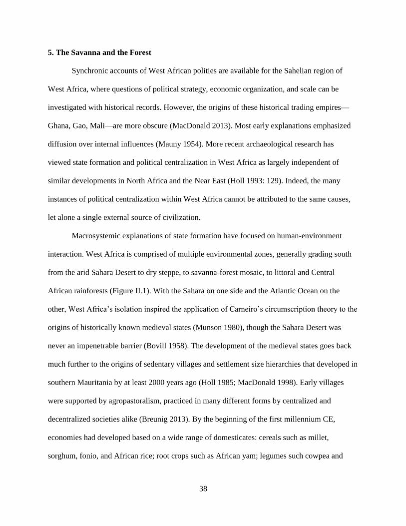
38
5. The Savanna and the Forest
Synchronic accounts of West African polities are available for the Sahelian region of
West Africa, where questions of political strategy, economic organization, and scale can be
investigated with historical records. However, the origins of these historical trading empires—
Ghana, Gao, Mali—are more obscure (MacDonald 2013). Most early explanations emphasized
diffusion over internal influences (Mauny 1954). More recent archaeological research has
viewed state formation and political centralization in West Africa as largely independent of
similar developments in North Africa and the Near East (Holl 1993: 129). Indeed, the many
instances of political centralization within West Africa cannot be attributed to the same causes,
let alone a single external source of civilization.
Macrosystemic explanations of state formation have focused on human-environment
interaction. West Africa is comprised of multiple environmental zones, generally grading south
from the arid Sahara Desert to dry steppe, to savanna-forest mosaic, to littoral and Central
African rainforests (Figure II.1). With the Sahara on one side and the Atlantic Ocean on the
other, West Africa’s isolation inspired the application of Carneiro’s circumscription theory to the
origins of historically known medieval states (Munson 1980), though the Sahara Desert was
never an impenetrable barrier (Bovill 1958). The development of the medieval states goes back
much further to the origins of sedentary villages and settlement size hierarchies that developed in
southern Mauritania by at least 2000 years ago (Holl 1985; MacDonald 1998). Early villages
were supported by agropastoralism, practiced in many different forms by centralized and
decentralized societies alike (Breunig 2013). By the beginning of the first millennium CE,
economies had developed based on a wide range of domesticates: cereals such as millet,
sorghum, fonio, and African rice; root crops such as African yam; legumes such cowpea and
39
groundnut; and semi-wild tree crops such as oil palm and shea (Sowunmi 1985; Neumann 2005;
Logan & D’Andrea 2012; Fuller & Hildebrand 2013). A wide range of domesticated animals
were also present, having been brought to West Africa at multiple times and from several
different origins (Gifford-Gonzalez & Hanotte 2013).
Figure II.1 The major vegetation zones of West Africa (adapted from CIA 1986).
Early evidence of urbanism is found at Jenné-jeno in present-day Mali where tightly
packed compounds appear by the first century CE (McIntosh & McIntosh 1993; McIntosh 2005).
However, despite massive walls and high population densities, there is little evidence for the
development of hierarchical or centralized institutions. Imported objects from the earliest levels
reveal that residents of the city did participate in long-distance exchange, but the location of the
city and the distribution of smaller sites nearby are oriented more toward local production than
trade (McIntosh & McIntosh 1993: 640). Though some societies in the savanna did develop
40
centralized political and economic systems, this trajectory was far from uniform or permanent
(McIntosh 1999; Dueppen 2012: 8). The states that formed in the West African savanna operated
on a landscape populated with many types of societies, suggesting a deep history for the mosaic
quality of West African polities (Stahl 2004).
The earliest states in West Africa appeared in the savanna zone in the first millennium
CE (Figure II.2). The proximity to Roman and, later, Arab North Africa has led to some
historical documentation of these states through the accounts and writings of travelers. The
Ghana Empire is first mentioned in the ninth century CE by the Tarikh of Al-Ya’qubi, where it is
described as a prosperous kingdom based on trade (Levtzion 2000; MacDonald 2013: 837).
Archaeological research at the presumed capital of Koumbi Saleh shows occupation back to the
fourth century (McIntosh & McIntosh 1986: 438; Berthier 1997), contemporary with the growth
of urbanism and complex societies throughout the region (LaViolette & Fleisher 2005). While
some cities, such as Jenné-jeno, remained relatively decentralized, a series of successive polities
followed Ghana by incorporating vast territories into central, hierarchical states (Levtzion 1973).
The centers of these states—Ghana, Mali, Songhai—changed through time, but long-distance
exchange between urban centers was common in each polity (Posnansky 1973; Sutton 1982;
Insoll 1997, 2003).

41
Figure II.2 Locations of archaeological sites in Africa mentioned in Chapter II.
It is tempting to see state formation as stemming from, or at least being reinforced by,
trans-Saharan long-distance exchange; however, similar developments were taking place
contemporaneously in the forests along the Atlantic coast where societies were not directly
involved with the trade to North Africa. The most intriguing example is Igbo-Ukwu, where
chance discovery of an elaborate burial has provided evidence for early social complexity (Shaw
1970, 1977). Several series of radiocarbon dates has firmly places the site in the ninth century
CE (Shaw 1975; Ambers et al. 1985). At Igbo-Ukwu, an individual was buried with an elaborate
assemblage of ivory tusks, copper and bronze objects, and thousands of glass and stone beads.
Almost nothing is known about the larger context of the burial: the size of nearby settlements,

42
the kinds of local economic production, and the distribution of status objects in the society are all
unknown. Yet, the quantity and diversity of grave goods suggests that, whatever the Igbo-Ukwu
society was like, it featured hierarchical status differentiation and participated in a regional
political-economy (Insoll & Shaw 1997).
Even farther from the terminals of the trans-Saharan trade, the Kongo kingdom provides
a clearer example of a centralized polity developing independent of North African influences.
Kongo is well known from historical sources, originating from both Europeans and Kongo,
which give an unparalleled view into the thoughts and ruling strategies of Kongo elites. Kongo
was a hierarchical polity that reproduced itself through taxation and the direct mobilization of
labor and resources, backed up by a powerful military (Hilton 1985). Though sometimes argued
to have been spurred on by trans-Atlantic trade, the Kongo kingdom was already well developed
by the time Europeans arrived in the late 15th century (Thornton 2001). Unfortunately, the area
has long been neglected by archaeological research, but recent work along the coast and at the
provincial capital of Mbanza Nsundi has begun to identify hierarchies in settlement patterns and
differentiation of burials during the initial period of state formation (Clist 2012; Clist et al. 2014;
Denbow 2014).
The singular burial at Igbo-Ukwu and the well-known but poorly-described kingdom of
Kongo are examples of complexity developing in Atlantic Africa due to regional, rather than
global, interactions. This is not to discount the importance of global trade, as it dramatically
changed the economics of the Kongo kingdom and was a contributing factor in its later civil wars
(Thornton 1983). Though so little is known about the society that produced Igbo-Ukwu, the
material culture present in the single grave alone is suggestive of a political system more
centralized than that of the societies in the same region that traded with Europeans in later

43
centuries. It is important to note that long-distance exchange may be as much a destabilizing
factor as it is an incentive for centralization. This is particularly apparent in the foundation of
states after the growth of the trans-Atlantic trade, where strongly centralized polities formed as
older, looser ones disintegrated in the face of new political economic conditions.
During the late first millennium CE, a number of towns formed along the southern fringe
of the forest-savanna zone. The initial character of these towns is poorly understood, but their
locations, ground plans, and material cultures suggest an economy based on the exchange of
gold, ivory, and probably kola nut (Posnansky 1976; Effah-Gyamfi 1985; Gokee 2012). These
towns continued to grow throughout the second millennium CE, with increasing evidence of
territorial integration (Anquandah 1993; Chouin & DeCorse 2010). At their peak, these towns
must have housed more than just traders. Begho is estimated to have had 10,000 residents
(Anquandah 1993: 648), while Bono Manso may have had a similar population in an even more
densely urbanized settlement (Effah-Gyamfi 1985: 215; Compton 2014).
Centralized states were established by the time of European contact in the late 15th
century CE. However, other states continued to form after Europeans arrived on the coast. One
of the the largest and most well-known, Asanteman, developed from the dissolution of previous
polities which then were reincorporated under a centralized kingship institution that subsequently
expanded the emergent state’s territory (McLeod 1981; McCaskie 2003; Logan 2012: 252).
Asanteman’s territory extended to the Atlantic coast, where its elites participated in the trans-
Atlantic trade by exporting gold, agricultural products, and slaves and importing guns, cloth,
currencies, and many other goods (Kea 1982). Asante elites attempted to exercise exclusive
control of this trade, but other polities emerged in this fragmented landscape that also sought to
benefit through trade (e.g. Spiers 2012). Control of long-distance exchange provided many

44
materials for participation in political economic networks. However, these networks were
outgrowths of political systems much older than the trans-Atlantic trade. Initial excavations at
the Asantemanso site, outside the capital of Kumasi, has found evidence for population growth
beginning by 1200 CE (Shinnie 1988; Vivian 1990).
As large urban centers were developing to the west, communities in the Dahomey Gap
region of West Africa were mostly “middle-range” societies (sensu Upham 1990): farming, iron-
producing villages linked in loose political economies (Randsborg & Merkyte 2009). The growth
of trans-Atlantic trade created new opportunities and, beginning in the 16th century CE, urban
settlements were established near the coast. Some of these settlements became the capitals of
small centralized states such as Allada and Hueda (Adandé 1984; Kelly 2001; Law 2004;
Norman 2009). Leaders in these societies adopted exclusionary strategies to create and maintain
their authority, incorporating European goods into their performance of state power (Kelly
1997).
In the late 17th century, the kingdom of Dahomey began to grow, taking over Allada and
Hueda. By integrating its competitors into the hierarchical structure of the state, Dahomean elites
were able to monopolize long-distance exchange in the Slave Coast region and thereby control
the distribution of imported wealth in society (Polanyi 1966; Law 1977; Manning 1982).
However, exclusionary control over long-distance exchange was only one strategy that
Dahomean elites employed. Archaeological research around the capital of Abomey has revealed
a networked systems of palaces, earthworks, and forcibly resettled villages that facilitated elite
control over local craft and agricultural production (Monroe 2007a, 2010, 2014). In addition,
centralized political institutions were supported by novel bureaucratic and military offices that
extended Dahomean power throughout the region (Bay 1998). These strategies are indicative of a

45
state-generated landscape (sensu Monroe & Ogundiran 2012) that draws power through control
of resources within the polity, in addition to the flow of imports.
B. The Primacy of Ile-Ife and Divine Yoruba Kingship
1. Odùduwà
One of the best studied cases of early political centralization in West Africa is Ile-Ife, an
early urban settlement and what is considered by many present-day Yoruba peoples as the
foundational site of the Yoruba ethnicity. The city was first mentioned by Europeans in the mid-
19th century, though oral histories from Ife and surrounding kingdoms claim a much deeper
history (Smith 1988: 16; Blier 2012). Archaeological research at Ile-Ife has largely corroborated
these claims, demonstrating a history of occupation dating back to at least the 10th century CE
(Willett 1971). Monumental sculpture, such as the Opa Oranmiyan megalith, is associated with
the foundation of royal dynasties (Smith 1988: 21). The celebrated copper-alloy and ceramic
heads found in the palace complex in Ile-Ife have been interpreted as royal portraiture and
evidence of early political centralization and economic specialization (Willett 1967; Garlake
1977; Blier 2012). Mosaic potsherd pavements and ancient shrines, dating the 12th century CE at
the latest, have been found below the modern palace (Eyo 1974; Posnansky & McIntosh 1976:
169). Sculptures with similar stylistic features to those from Ile-Ife have been found 200 km
away, suggesting that Ife elites had influence over an expansive territory (Blier 2012: 73). Ife
territorialism has been linked to concern over regional trade (Shaw 1973: 237). The many
spectacular objects found at royal sites, as well as archaeological evidence for large-scale glass
46
bead manufacture (Babalola 2011), suggest that Ife was a major producer of wealth objects that
were subsequently exported to neighboring areas.
The origins of Ile-Ife are poorly understood. Early recorded oral histories of the founding
period dovetail with mythic accounts of the world’s foundation (Smith 1988: 14). In these
accounts, the creator deity of the sky, Olórun, sent lesser deities to create the earth and establish
humankind. The deity Odùduwà (also known as Oòduà in Shabe) eventually succeeded and is
credited with becoming the first divine king. Odùduwà’s suzerainty was materialized by several
badges of office, most importantly the adé, a type of beaded crown with long veils.
Subsequently, Odùduwà’s children inherited his right of kingship, continuing a long line of
divine kings at Ile-Ife as well as founding the dynasties of several other kingdoms as reported in
many versions of the narrative since at least the early 19th century CE (Lander & Lander 1832;
Johnson 1921; Wyndham 1921; Bascom 1969; Falola & Doortmont 1989). There are many other
variations on this narrative, but each provides a similar framework for establishing kingship at
Ile-Ife through divine agency and then regional kingship institutions through association with the
divine. Early 20th century historians interpreted these narratives as numerous, but inaccurate,
recordings of an actual migration to the Ile-Ife area from existing complex polities, such as
Mecca, Egypt, or even Greece (Johnson 1921: 3; see also Law 1977: 27; Smith 1988: 23).
However, there is no convincing evidence that early political traditions at Ile-Ife replicated those
of elsewhere.
The diffusion of political traditions from Ile-Ife to neighboring areas is more contested.
Migration narratives chronicling the dispersal of Odùduwà’s children are numerous, with great
variability in the number of children and timing of the dispersal (Law 1977: 27). In part due to
the disagreement of sources over a possible political diffusion from Ife, scholars have been more

47
united in their interpretations of these accounts. They agree that migration from Ile-Ife is largely
a political fiction that was developed and employed by regional elites to legitimize local
authority in the context of a larger framework of divine kingship, often then corroborated by the
elites of Ile-Ife (Lloyd 1960; Law 1973; Smith 1988: 81; Apter 1992: 22; Pemberton & Afolayan
1996: 28). Whether historically accurate or not, it is the case that descent from Odùduwà is the
central legitimizing principle of divine kingship in much of southwest Nigeria and eastern
Republic of Bénin, including Shabe. Divine kingship was connected to the ownership and
display of the wealth objects imported from Ile-Ife, most notably the adé beaded crowns that
served as material references to Odùduwà (Biobaku 1957: 2; Thompson 1970; Blier 1998: 79).
2. Power in the Ife Dynastic Field
Though the kingdom of Ife was an early centralized polity, its control over neighboring
polities was limited to the ritual sphere (Law 1977: 32; Pemberton & Afolayan 1996: 27).
Though these kingdoms have been variously referred to as operating in empires, networks of
city-states, or affiliated tribes, it is more appropriate to characterize their relationships as the “Ife
dynastic field”— (Bradbury 1973: 10). By field, Bradbury refers to a particular set of political
and ritual practices. It is a shared vocabulary for enacting and legitimating power among many
different polities, though loosely bound together by the elites of Ile-Ife. Foremost in this
conception of political authority is that divine kingship in the region is defined explicitly in terms
of dynastic origins from Ile-Ife. The dynastic field model is very close to the mosaic of African
societies described by Stahl (2004), in that the relationships between polities do not necessarily
unite them into a common polity, but do provide a common language for articulating power
within and between societies, as in peer polity interaction (Renfrew 1986).
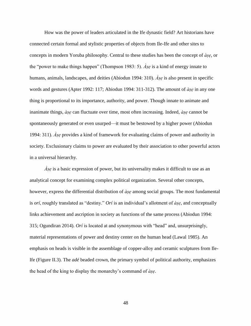
48
How was the power of leaders articulated in the Ife dynastic field? Art historians have
connected certain formal and stylistic properties of objects from Ile-Ife and other sites to
concepts in modern Yoruba philosophy. Central to these studies has been the concept of àse, or
the “power to make things happen” (Thompson 1983: 5). Àse is a kind of energy innate to
humans, animals, landscapes, and deities (Abiodun 1994: 310). Àse is also present in specific
words and gestures (Apter 1992: 117; Abiodun 1994: 311-312). The amount of àse in any one
thing is proportional to its importance, authority, and power. Though innate to animate and
inanimate things, àse can fluctuate over time, most often increasing. Indeed, àse cannot be
spontaneously generated or even usurped—it must be bestowed by a higher power (Abiodun
1994: 311). Àse provides a kind of framework for evaluating claims of power and authority in
society. Exclusionary claims to power are evaluated by their association to other powerful actors
in a universal hierarchy.
Àse is a basic expression of power, but its universality makes it difficult to use as an
analytical concept for examining complex political organization. Several other concepts,
however, express the differential distribution of àse among social groups. The most fundamental
is orí, roughly translated as “destiny.” Orí is an individual’s allotment of àse, and conceptually
links achievement and ascription in society as functions of the same process (Abiodun 1994:
315; Ogundiran 2014). Orí is located at and synonymous with “head” and, unsurprisingly,
material representations of power and destiny center on the human head (Lawal 1985). An
emphasis on heads is visible in the assemblage of copper-alloy and ceramic sculptures from Ile-
Ife (Figure II.3). The adé beaded crown, the primary symbol of political authority, emphasizes
the head of the king to display the monarchy’s command of àse.
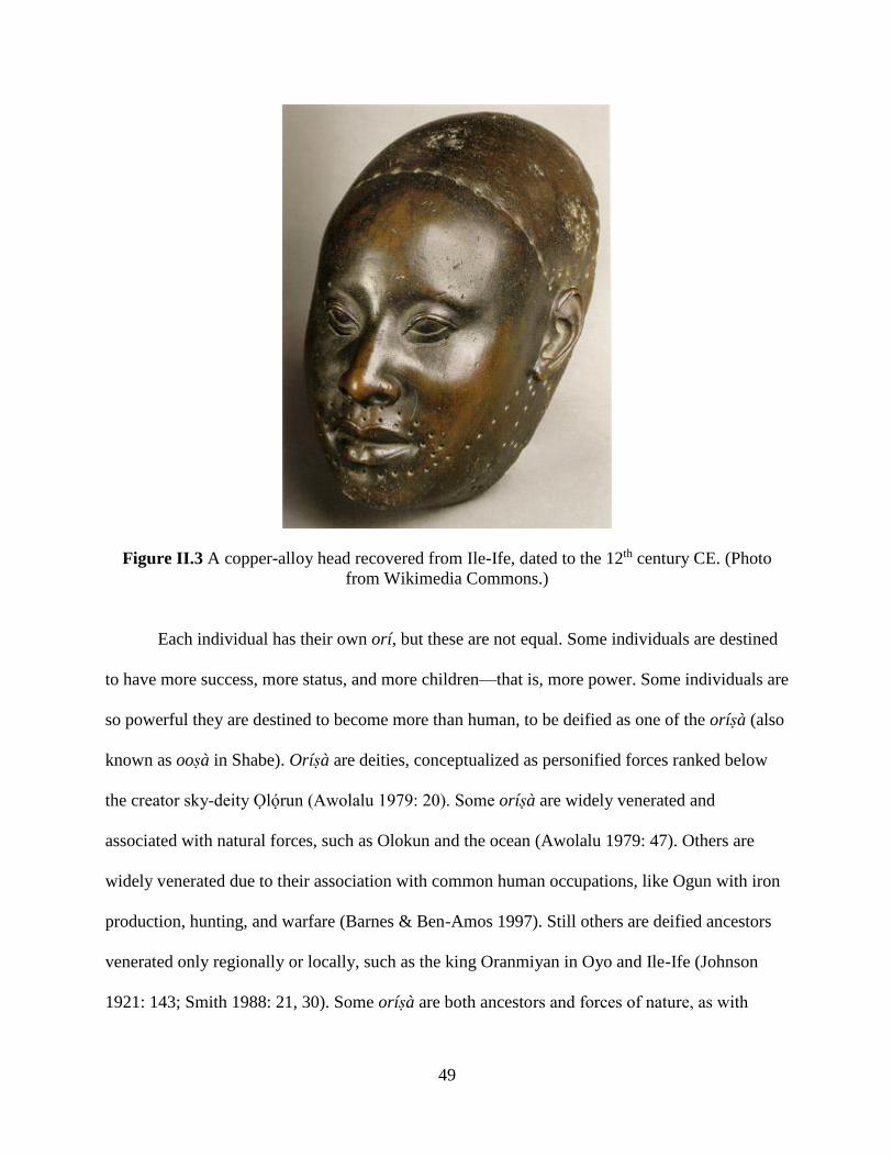
49
Figure II.3 A copper-alloy head recovered from Ile-Ife, dated to the 12th century CE. (Photo
from Wikimedia Commons.)
Each individual has their own orí, but these are not equal. Some individuals are destined
to have more success, more status, and more children—that is, more power. Some individuals are
so powerful they are destined to become more than human, to be deified as one of the orísà (also
known as oosà in Shabe). Orísà are deities, conceptualized as personified forces ranked below
the creator sky-deity Olórun (Awolalu 1979: 20). Some orísà are widely venerated and
associated with natural forces, such as Olokun and the ocean (Awolalu 1979: 47). Others are
widely venerated due to their association with common human occupations, like Ogun with iron
production, hunting, and warfare (Barnes & Ben-Amos 1997). Still others are deified ancestors
venerated only regionally or locally, such as the king Oranmiyan in Oyo and Ile-Ife (Johnson
1921: 143; Smith 1988: 21, 30). Some orísà are both ancestors and forces of nature, as with
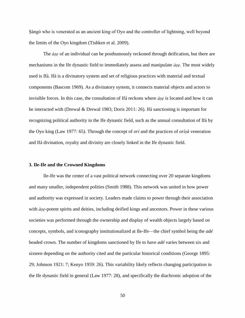
50
Sàngó who is venerated as an ancient king of Oyo and the controller of lightning, well beyond
the limits of the Oyo kingdom (Tishken et al. 2009).
The àse of an individual can be posthumously reckoned through deification, but there are
mechanisms in the Ife dynastic field to immediately assess and manipulate àse. The most widely
used is Ifá. Ifá is a divinatory system and set of religious practices with material and textual
components (Bascom 1969). As a divinatory system, it connects material objects and actors to
invisible forces. In this case, the consultation of Ifá reckons where àse is located and how it can
be interacted with (Drewal & Drewal 1983; Doris 2011: 26). Ifá sanctioning is important for
recognizing political authority in the Ife dynastic field, such as the annual consultation of Ifá by
the Oyo king (Law 1977: 65). Through the concept of orí and the practices of orísà veneration
and Ifá divination, royalty and divinity are closely linked in the Ife dynastic field.
3. Ile-Ife and the Crowned Kingdoms
Ile-Ife was the center of a vast political network connecting over 20 separate kingdoms
and many smaller, independent polities (Smith 1988). This network was united in how power
and authority was expressed in society. Leaders made claims to power through their association
with àse-potent spirits and deities, including deified kings and ancestors. Power in these various
societies was performed through the ownership and display of wealth objects largely based on
concepts, symbols, and iconography institutionalized at Ile-Ife—the chief symbol being the adé
beaded crown. The number of kingdoms sanctioned by Ife to have adé varies between six and
sixteen depending on the authority cited and the particular historical conditions (George 1895:
29; Johnson 1921: 7; Kenyo 1959: 26). This variability likely reflects changing participation in
the Ife dynastic field in general (Law 1977: 28), and specifically the diachronic adoption of the

51
adé as a political symbol. Thus the foundational conceptualization of power is shared between
polities, though the actual political institutions are more heterogeneous (Smith 1988).
The relationship between Ife and these other polities is poorly understood, particularly for
the initial period of state formation. More is known about later periods, where it appears the
polities were relatively autonomous and only ceremonially deferred to Ife, and then only in
limited contexts (Law 1977: 120). Certainly in the 18th and 19th centuries CE these polities had
their own independently administrated territories and militaries (Ogundele & Babalola 2007;
Ogunfolakan e al. 2006; Odunbaku & Alabi 2010). However, material forms like those at Ile-Ife
have been found in other kingdoms in the Ife dynastic field (Agbaje-Williams 1995; Ogundiran
2000; Ige et al. 2009). These include distinctive edge-laid pavements (Figure II.4) which contrast
with the face-laid pavements (Figure II.5) that are found throughout the savanna and savanna-
forest mosaic zones of West Africa (Haour 2013).
52
Figure II.4 Edge-laid potsherd pavement from Olokun Gove, Ile-Ife. The herringbone pattern is
characteristic the Ife dynastic field. (Photo by Akin Ogundiran, in Haour 2013).
Figure II.5 Flat-laid potsherd pavement from Birnin Lafiya, northern Benin. (Photo by
Alexandre Livingstone Smith, in Haour 2013).
4. Ile-Ife and Benin
In addition to their political traditions, many of the polities participating in the Ife
dynastic field show other close affinities to Ile-Ife. The languages spoken in these polities are
closely related to the language spoken at Ile-Ife, and are now considered dialects of Yoruba
(Bamgbose 1966). An important outlier is the kingdom of Benin. The Edo language of Benin is
distinct from the Yoruba dialects spoken in other polities. Further, the material culture of Benin’s
political and religious practices is distinct from the Ife-derived traditions (Ben-Amos 1999). Ife
traditions influenced, but did not supplant, the authorization of power in Benin (Bradbury 1957;
Akintoye 1969). While oral traditions from Benin connect local political authority to Ile-Ife, as
with other polities, it is unlikely that its origins are completely derived from Ife (Ryder 1965).

53
Instead, Benin elites likely adopted the institutions and practices of Ife later in their kingdom’s
development as a way to participate in the regional political economy (Thornton 1988).
Alternatively, elites might have incorporated Ife political practices into existing institutions as a
way of settling internal factional competition.
Archaeological evidence also supports the independent development of the centralized
Benin polity. An extensive system of earthworks and ditches spreads out from the capital Benin
City for more than 16,000 kilometers, enclosing an area of over 6,500 square kilometers (Connah
2001: 162). The oldest part of the system surrounds the capital, dating to the end of the first
millennium CE—before or contemporary with the florescence of political symbolism at Ife
(Darling 1988: 122). This core was expanded and rebuilt several times, with an intensive
construction episode between the 13th and 15th centuries (Sutton 1982: 312). This period
corresponds to the establishment of a palace compound with mosaic potsherd pavements
(Connah 1972: 27) and the initial use of copper alloys in royal arts (Connah 2001: 164).
With this background on political genesis in West Africa generally—and the Ife dynastic
field specifically—demonstrating the multiple pathways to centralization, I turn to the Oyo
kingdom. Oyo was an expansive and strongly centralized polity that participated in the Ife
dynastic field. It grew beyond this, however, to become what some have termed the only true
pre-colonial “empire” that operated in the forest zone of West Africa (Law 1977). Indeed, the
ethnonym Yoruba initially referred to only the residents of Oyo, but through the Oyo Empire’s
dominance in the region came to stand in for many of the related polities in the Ife dynastic field.
The Shabe kingdom is intimately connected to the expansion of Oyo, and so I now turn to a
discussion of Oyo’s development below in order to clarify the political-economic context that
Shabe originated in.
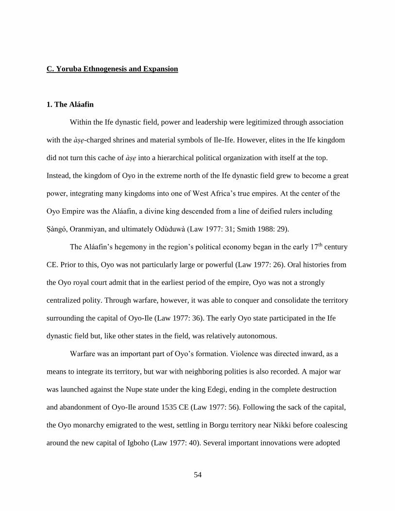
54
C. Yoruba Ethnogenesis and Expansion
1. The Aláafin
Within the Ife dynastic field, power and leadership were legitimized through association
with the àse-charged shrines and material symbols of Ile-Ife. However, elites in the Ife kingdom
did not turn this cache of àse into a hierarchical political organization with itself at the top.
Instead, the kingdom of Oyo in the extreme north of the Ife dynastic field grew to become a great
power, integrating many kingdoms into one of West Africa’s true empires. At the center of the
Oyo Empire was the Aláafin, a divine king descended from a line of deified rulers including
Sàngó, Oranmiyan, and ultimately Odùduwà (Law 1977: 31; Smith 1988: 29).
The Aláafin’s hegemony in the region’s political economy began in the early 17th century
CE. Prior to this, Oyo was not particularly large or powerful (Law 1977: 26). Oral histories from
the Oyo royal court admit that in the earliest period of the empire, Oyo was not a strongly
centralized polity. Through warfare, however, it was able to conquer and consolidate the territory
surrounding the capital of Oyo-Ile (Law 1977: 36). The early Oyo state participated in the Ife
dynastic field but, like other states in the field, was relatively autonomous.
Warfare was an important part of Oyo’s formation. Violence was directed inward, as a
means to integrate its territory, but war with neighboring polities is also recorded. A major war
was launched against the Nupe state under the king Edegi, ending in the complete destruction
and abandonment of Oyo-Ile around 1535 CE (Law 1977: 56). Following the sack of the capital,
the Oyo monarchy emigrated to the west, settling in Borgu territory near Nikki before coalescing
around the new capital of Igboho (Law 1977: 40). Several important innovations were adopted
55
during this period of refuge that would become crucial to the Oyo Empire’s future political
success. The Oyo military adopted horse cavalry, a military technology employed against them
by the conquering Nupe (Law 1977: 43). In addition, it is during this period that Ifá divination
became a widespread practice (Law 1977: 44). These new innovations may be indicative of
political reorganization as well, specifically of Borgu leaders inserting themselves into the Oyo
political structure, perhaps even installing a new dynasty of Aláafins (Law 1977: 41; Stewart
1993: 153).
2. Oyo Imperialism
Many centralized states developed in the Ife dynastic field. However, as alluded to above,
it was the newly reconstituted kingdom at Oyo-Ile that would come to exercise authority over
these peer polities (Figure II.6). From 1600 CE to its collapse in the early 19th century, Oyo
administered a territory stretching from the Atlantic coast north to the Moshi River, and from the
Osin River west to the Ouémé River (Law 1977: 7). Though expansive, the actual administrative
power of the Aláafin varied widely within Oyo’s territory (Law 1977: 96). The Aláafin exercised
direct authority over the core of the kingdom, centered on Oyo-Ile and extending south to the
confluence of the Ogun and Oyan Rivers. Within this core, the Aláafin ruled through a series of
subordinate kings and village heads, usually hereditary positions chosen from lineages with close
associations to the capital (Law 1977: 98). Outside the central core, Oyo exercised less direct
control and subordinate rulers could administer more freely. For example, the western edge of
the Empire was controlled by the kingdom of Ketu (also spelled Kétou), which paid tribute to
Oyo and allowed the Oyo military the right to pass through its lands to wage war against
neighboring Dahomey or to access Atlantic ports (Law 1977; Parrinder 1956).
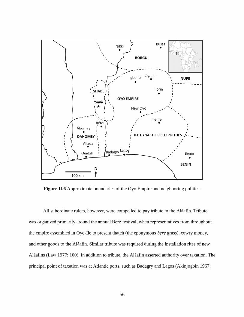
56
Figure II.6 Approximate boundaries of the Oyo Empire and neighboring polities.
All subordinate rulers, however, were compelled to pay tribute to the Aláafin. Tribute
was organized primarily around the annual Bere festival, when representatives from throughout
the empire assembled in Oyo-Ile to present thatch (the eponymous bere grass), cowry money,
and other goods to the Aláafin. Similar tribute was required during the installation rites of new
Aláafins (Law 1977: 100). In addition to tribute, the Aláafin asserted authority over taxation. The
principal point of taxation was at Atlantic ports, such as Badagry and Lagos (Akinjogbin 1967:
57
155), though taxes were also collected at regional markets via town gates, such as at Igboho
(Law 1977: 100).
In addition to economic claims, the Oyo court exerted judicial and religious control over
its territory. Relatively minor civil and criminal cases were handled by local kings and village
heads, or privately if the matter only affected members of the same lineage, but cases could be
appealed directly to the Aláafin. The Aláafin’s court could overrule the decisions of any lower
judicial body or court (Law 1977: 103). Laws were enforced by the constituent rulers and other
representatives of the Aláafin, most notably the ajele, a group of officials stationed throughout
the empire who reported to the Aláafin and ensured the compliance of subordinates (Law 1977:
110). A similar group consisted of the mogba, the head priests of the deity Sàngó. Sàngó is a
deity associated with thunder and lightning, as well as a deified Aláafin. Because of the direct
connection to Oyo sovereignty, Sàngó priests often represented imperial interests in addition to
providing services protecting communities from lightning catastrophes (Schiltz 1985: 70). It has
even been suggested based on oral traditions that Sàngó priests promoted a kind of imperial cult,
as well as being formally appointed as ajele (Biobaku 1957: 60). This intertwining of economic,
judicial, and religious powers in the political office of Aláafin was typical of divine kingship in
the Ife dynastic sphere (Apter 1992). The Aláafin further centralized this confluence of powers
by placing himself above his subordinate rulers.
By the close of the 18th century, the Aláafin controlled a vast territory and demanded
tribute from a network of towns and kingdoms. But how did this occur? Certainly the destruction
of Oyo-Ile by Nupe invaders documents the early fragility of the kingdom. What changed that
allowed Oyo to expand at the expense of its neighbor’s sovereignty?
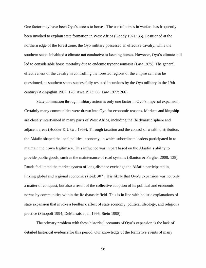
58
One factor may have been Oyo’s access to horses. The use of horses in warfare has frequently
been invoked to explain state formation in West Africa (Goody 1971: 36). Positioned at the
northern edge of the forest zone, the Oyo military possessed an effective cavalry, while the
southern states inhabited a climate not conducive to keeping horses. However, Oyo’s climate still
led to considerable horse mortality due to endemic trypanosomiasis (Law 1975). The general
effectiveness of the cavalry in controlling the forested regions of the empire can also be
questioned, as southern states successfully resisted incursions by the Oyo military in the 19th
century (Akinjogbin 1967: 178; Awe 1973: 66; Law 1977: 266).
State domination through military action is only one factor in Oyo’s imperial expansion.
Certainly many communities were drawn into Oyo for economic reasons. Markets and kingship
are closely intertwined in many parts of West Africa, including the Ife dynastic sphere and
adjacent areas (Hodder & Ukwu 1969). Through taxation and the control of wealth distribution,
the Aláafin shaped the local political economy, in which subordinate leaders participated in to
maintain their own legitimacy. This influence was in part based on the Aláafin’s ability to
provide public goods, such as the maintenance of road systems (Blanton & Fargher 2008: 138).
Roads facilitated the market system of long-distance exchange the Aláafin participated in,
linking global and regional economies (ibid: 307). It is likely that Oyo’s expansion was not only
a matter of conquest, but also a result of the collective adoption of its political and economic
norms by communities within the Ife dynastic field. This is in line with holistic explanations of
state expansion that invoke a feedback effect of state economy, political ideology, and religious
practice (Sinopoli 1994; DeMarrais et al. 1996; Stein 1998).
The primary problem with these historical accounts of Oyo’s expansion is the lack of
detailed historical evidence for this period. Our knowledge of the formative events of many
59
African states is unclear due to a lack of internal documentation, either because of the lack of
writing or poor preservation (Law 1977: 12; Lonsdale 1981; MacCaskie 1983). Even when
available the biases of their authors can limit their utility in reconstructing formative histories.
Oral histories are often more abundant, particularly when concerning institutional practices, but
these too must be carefully scrutinized (Law 1973; Vansina 1985). The lack of sources is further
complicated by attempting to use them to study expansion itself. Expansion is a diachronic and
dynamic process, and rulers are often not concerned with creating the documentation needed for
subsequent historical research. The fragmentary written accounts and revisionary oral histories
from later time periods are poorly suited to addressing questions of the early Oyo Empire.
Historical documents are more useful for charting the dissolution of Oyo. Its decline
began in the late 18th century following a series of succession disputes and weak Aláafins (Law
1977). The constituent political divisions of the empire became increasingly independent. Ilorin
broke away in the early 19th century, becoming an outpost for the Sokoto Caliphate (Usman
2009: 112). At the same time, the more distant polities, such as Dahomey, that Oyo had
subjugated into tributary relationships refused to acknowledge the Aláafin. Oyo sent an army to
Dahomey, possibly passing through Shabe territory, in order to extract tribute, but was defeated,
signaling the end of Oyo’s imperial rule (Palau Marti 1992a: 193; Alpern 1998: 166). The capital
of Oyo-Ile was subjected to repeated raiding by the Fulani and was eventually abandoned in
1837 CE as its occupants fled far to the south to establish New Oyo (Usman 2009: 112).
Archaeological research has investigated many of the questions about Oyo that historians
have not been able to answer. Material remains of Oyo’s imperial expansion trace the spread and
relative influence of Oyo’s political and economic hegemony (Figure II.7). These material
indicators come from multiple periods, allowing a diachronic perspective. This perspective is
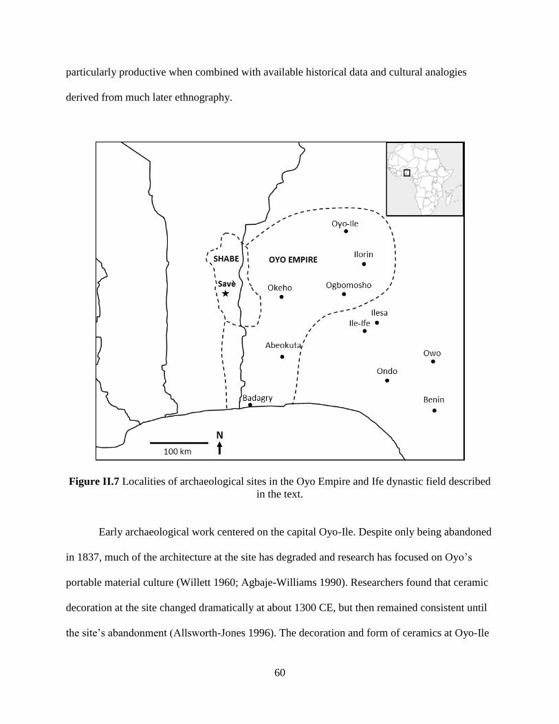
60
particularly productive when combined with available historical data and cultural analogies
derived from much later ethnography.
Figure II.7 Localities of archaeological sites in the Oyo Empire and Ife dynastic field described
in the text.
Early archaeological work centered on the capital Oyo-Ile. Despite only being abandoned
in 1837, much of the architecture at the site has degraded and research has focused on Oyo’s
portable material culture (Willett 1960; Agbaje-Williams 1990). Researchers found that ceramic
decoration at the site changed dramatically at about 1300 CE, but then remained consistent until
the site’s abandonment (Allsworth-Jones 1996). The decoration and form of ceramics at Oyo-Ile
61
were also significantly different than contemporary ceramics from Ile-Ife, suggesting the relative
independence of Oyo during its initial period of expansion (Agbaje-Williams 1983). At its
height, the city’s area was at least 5,000 ha, enclosed by six walls totaling over 75 linear
kilometers (Soper & Darling 1980: 62). The palace was a large and central institution in Oyo-Ile
as evidenced by its ground plan and location within the inner walls (Soper 1992). More recent
phosphate testing of the area surrounding the palace shows that it was sited near a major market
(Folorunso et al. 2006: 3).
It is little surprise that the capital of the Oyo Empire conforms to many of our
archaeological expectations of what a state center should look like (Flannery 1998). Away from
the center, archaeological research has examined how Oyo imperialism manifested itself in more
peripheral areas. In the Igbomina area near Ilorin, the 16th to 18th centuries were a period of
dramatic increases in settlement size and density (Usman 2012: 111). Sites also become more
fortified, with constructions similar to those documented at Oyo-Ile (ibid: 113). Ceramic
decorations also exhibit similarities to those from the capital, indicative of increasing economic
and cultural links between the areas (ibid: 118). Compositional studies show that ceramics
moved throughout the region via trade networks (Usman et al. 2005), but new decorative forms
were also adopted by local potters (Aleru 2006: 183). The material record supports a scenario of
Oyo expansion through warfare and the reorientation of Igbomina’s economy toward Oyo.
In contrast to the imperial strategy of conquest and economic absorption that
characterized Oyo’s relationship with Igbomina, the Upper Osun area to the southeast was
actively colonized by Oyo settlers. Prior to Oyo’s intrusion, the Upper Osun area was a political
frontier located between Ile-Ife and Ilesa. By the 17th century, the Oyo colony of Ede-Ile was
founded in the area at a strategic position in the center of the Ife dynastic field (Ogundiran 2012:
62
230). Ceramics show a very strong affinity to Oyo: nearly one third of vessels from the site
having been directly imported from the Oyo heartland to the north (ibid: 234). The remains of
horses from Ede-Ile show that these animals were brought to the area, likely imported directly
from Oyo (ibid: 237). A large number of mature baobab trees on the site may also reflect Oyo
settlement practices (ibid: 235), though the association between baobabs and settlements is much
more widespread in West Africa than only the Oyo Empire (Blench 2007b; Gurstelle 2013). The
archaeology of Oyo’s more peripheral territories shows that Oyo expansion was well underway
by the 17th century, characterized by the adoption of Oyo building practices, material cultures,
and economic networks.
Other archaeological research in the Oyo Empire has revealed a diverse mosaic of towns,
villages, camps, and refuges. Near Ogbomosho, archaeological survey documented a range of
sites interpreted as part of a modestly centralized polity related to the historically known
chieftancy in the area (Ogunfolakan et al. 2006; Eluyemi et al. 2012). Defensive structures near
Abeokuta have been interpreted as a response to the collapse of Oyo, though they are poorly
dated and may instead relate to resistance to the area’s initial incorporation into the empire
(Odunbaku & Alabi 2010). Similarly, hilltop refuge sites near Okeho are linked to instability
during the 19th century through oral histories, but they may have been occupied multiple times
over the past millennium (Gleave 1963). Near Ondo, elephant remains were excavated in
association with potsherds and a cowry, leading to the interpretation it was a ritual deposit
consistent with offerings to Ogun, the deity of hunting in the Ife dynastic field (Ogunfolakan &
Olayemi 2008). Near Owo, terracotta sculptures have been found that are stylistically similar to
Ife, but unrelated to Oyo (Eyo 1976). These two sites may show the southeastern limits of the
63
Oyo imperialism, as although they have material culture consistent with the Ife dynastic field,
they lack overt Oyo influences.
The Aláafin encouraged the expansion of the Oyo Empire through multiple strategies,
resulting in different levels of regional integration into the state. Ceramic styles, access to
imports, and landscape modification practices are all evidence of this variability. Such variability
in the material record Oyo’s expansion is typical of ancient empires (Sinopoli 1994: 162).
Expansion was an uneven process in ancient states, varying due to limits on the power of rulers
as well the ability of integrated communities to resist or modify imperial rule (Stein 1998: 155;
Given 2004: 10). Though warfare and coercive force could certainly enable expansion, the
involvement of traders and craft producers is also a well-documented feature of many episodes
of ancient imperial expansion, including those from West Africa (Haour 2007, 2013: 155). Some
aspects of Oyo, such as economic opportunities or perceived stability, were probably attractive to
many communities. Indeed, ceramics from both the Igbomina and Upper Osun areas outside the
Oyo core show increased adoption of Oyo material styles, even when goods were produced
locally. However, ceramics from near Badagry show much more localized decorations and
forms, suggesting that colonization differed in its intensity and effect on material culture
(Allsworth-Jones & Wesler 1998). Expansion, however enabled, further centralized the position
of the Aláafin in the political economy.
3. The Invention of Yoruba
How did the polities united by the Oyo Empire think of themselves? Did they recognize
commonality amongst themselves, or “otherness” in Dahomey, Borgu, Nupe, or the Igbo-
speaking societies to the southeast? Since the 19th century, the Ife dynastic field has increasingly

64
become conflated with the modern ethnonym “Yoruba” (Law 1996; Peel 2000: 283). The
referent of Yoruba during the period of Oyo’s imperial expansion was much more restricted: the
subjects of the Oyo core only (Law 1977: 5; Adediran 1984: 57). Other communities likely
identified themselves along a range of organizational principles. Certainly the many oral
histories recorded in the 19th and 20th centuries attest to political affiliations based on kingdoms
within the Ife dynastic sphere (Lloyd 1960), but affiliation also scaled to specific settlements,
compounds, and lineages (Barber 1991: 158; Apter 2013: 358).
In addition to Oyo imperialism, the Yoruba identity is heavily influenced by its legacy
with Christian missionizing (Peel 2003), identity formation in the trans-Atlantic slave trade
(Matory 2005), and the modern politics of ethnic identity (Laitin 1986). These directions would
suggest that a cohesive identity was a relatively late invention of the 19th century CE. However,
it is wrong to conclude that the disparate kingdoms of the Ife dynastic field did not recognize
commonalities among themselves. Indeed, the shared political practices among the kingdoms
likely aided their integration within the expanding Oyo Empire. Oyo must be regarded as a
kingdom drawing from political practices in both the Ife dynastic field, the non-Yoruba societies
to their north, and the local institutions of its own territory.
The composite nature of Oyo political institutions is emblematic of polities throughout
the Ife dynastic field. Each polity draws from the shared political tradition of Ile-Ife, but each is
marked by differences arising from the influence of local and foreign institutions. This is the case
in the Shabe kingdom, which I turn to in the next chapter. The Shabe people now describe
themselves as Yoruba, but how deeply rooted is this appellation? When did they enter Oyo’s
sphere of influence, of the Ife dynastic field? What institutions arose from the local context, or
were imported from non-Yoruba areas to the north and east? These questions have been

65
addressed, but not full answered, by ethnographers and histories of Shabe. In the next chapter, I
survey the existing literature on Shabe in order describe the kingdom’s most recent political
institutions, with the aim of creating an analogue with which to compare my interpretations of
the archaeological record.
66
CHAPTER III
Landscape and Change in Shabe
In this chapter, I address the question of Shabe identity raised in Chapter I by rolling back
the 20th- and 21st-century definition of Shabe as an ethnicity to an earlier manifestation—an
identity centered on political institutions. To do this, I consider Shabe in multiple ways: as an
ethnicity; a landscape; and a set of shared kinship, ritual, and economic practices. Throughout
this chapter, I tack between how Shabe is conceptualized today and how it was in years past
through extensive use of Shabe oral history—both traditions performed and documented during
my fieldwork in 2012-2013 and those recorded by earlier researchers. Particularly important are
the areas of disagreement in the oral traditions, as these potentially reveal crucial transformations
in the Shabe kingdom and its political economy.
A. The Savè Hills and Its People
1. The Shabe Landscape
The Shabe kingdom and people were and continue to be closely aligned linguistically,
culturally, and politically with other Yoruba communities in Bénin and Nigeria. Indeed, the
traditional boundaries of the Shabe kingdom extend from the Ouémé River east to the Oyan
River in Nigeria’s Oyo State. The present political border between Bénin and Nigeria bisects the
67
kingdom, though all the kingdom’s principal towns are in Bénin. This bisection resulted from the
somewhat arbitrary divisions of the 1884-5 Berlin Conference in which the Okpara River was
chosen as the boundary between French and British colonies. Despite having been administered
by different European powers, settlements on the Nigerian side of the border retain very close
connections to Shabe communities in Bénin. This is in some ways a necessity as Nigerian Shabe
communities are woefully underdeveloped, in part because their traditional political leaders can
only exert influence on the Bénin side of the border (Flynn 1997a: 62).
As I explore in subsequent chapters, the borders of the Shabe kingdom have changed
significantly over the past several centuries. At its maximum extent in the early 19th century, the
Shabe kingdom controlled the area between the Ouémé River and the Oyan River in Nigeria, and
from the Ketu kingdom in the south to the Borgu kingdoms in the north (Adam et al. 1996: 7).
This maximum political extent is still seen today in the distribution of ethnic Shabe communities
(Figure III.1). Today, Shabe is an ethnic identity as much as it is a political affiliation. Indeed,
one of the key points of interest of my research is to track the transformation of Shabe from a
marker of political affiliation to one of ethnicity during the late 19th and 20th centuries (see
Chapter V). The Shabe kingdom lost political autonomy during this period, but, as I discussed in
Chapter I, the monarchy survives as a heritage institution promoting the culture of the Shabe
people.
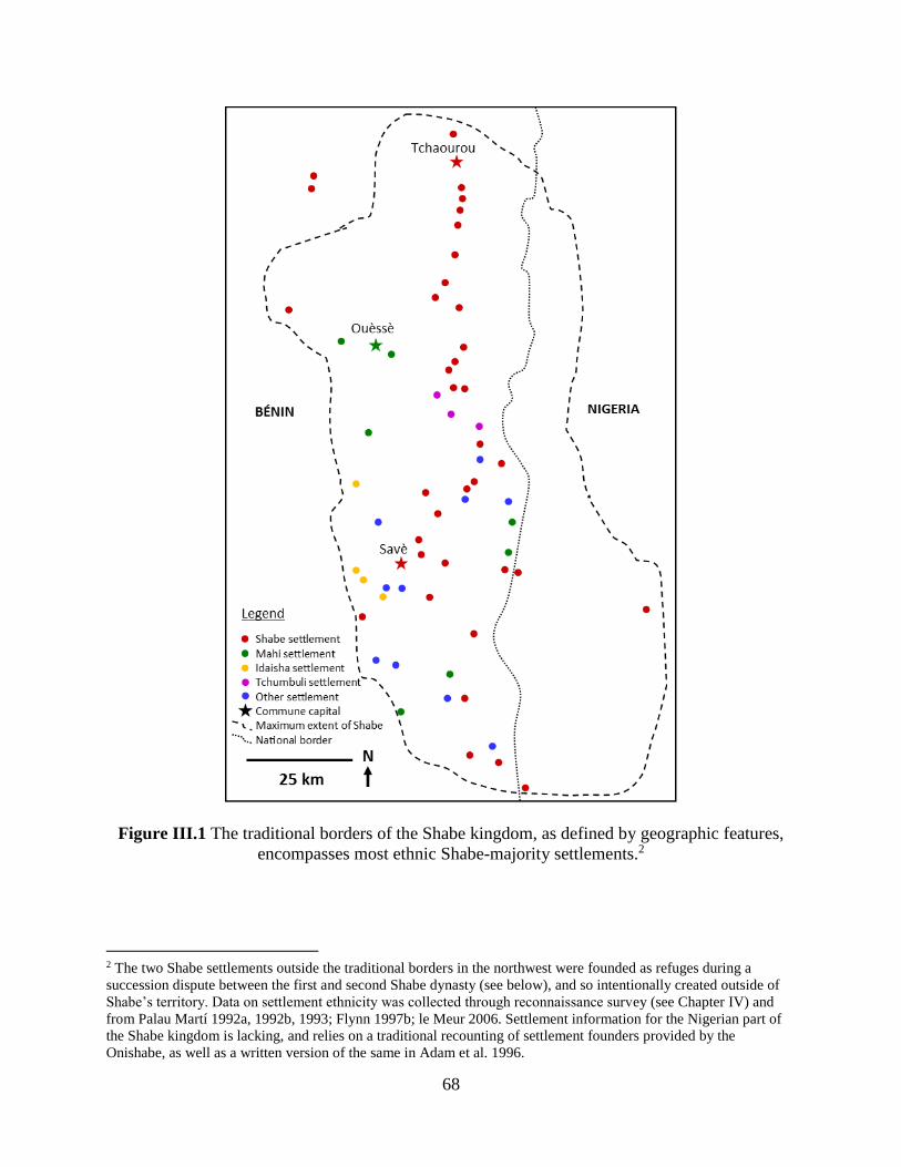
68
Figure III.1 The traditional borders of the Shabe kingdom, as defined by geographic features,
encompasses most ethnic Shabe-majority settlements.2
2 The two Shabe settlements outside the traditional borders in the northwest were founded as refuges during a
succession dispute between the first and second Shabe dynasty (see below), and so intentionally created outside of
Shabe’s territory. Data on settlement ethnicity was collected through reconnaissance survey (see Chapter IV) and
from Palau Martí 1992a, 1992b, 1993; Flynn 1997b; le Meur 2006. Settlement information for the Nigerian part of the Shabe kingdom is lacking, and relies on a traditional recounting of settlement founders provided by the
Onishabe, as well as a written version of the same in Adam et al. 1996.
69
Today, the seat of Shabe culture and heritage is the town of Savè. The name Savè is a
Fongbe-language adaptation of the precolonial kingdom and ethnic autonym Shabe. Savè is also
the name of commune administrative district the town lies in and encompasses much of the
Shabe kingdom. Properly, the town Savè is called Ile-Shabe or Shabe-Idadu, or more commonly
Idadu for short. Shabe-Idadu is the capital of the Shabe kingdom, and also its largest city with
about 33,000 residents—more than a third of the commune’s total population (Direction des
Etudes Démographiques 2002, 2013). It is the location of the royal palace, and political elites
from other Shabe towns and villages maintain compounds here in order to participate in the
political life of the kingdom. It is a major hub for local and regional commerce, particularly
cross-border trade to Nigeria (Flynn 1997b). The French colonial (and later national) railway
stops at Savè on its way from the coast to the northern terminus at Parakou. Pre-colonial trade
relations were more limited, as the Savè area was peripheral to both the southern terminals of the
trans-Saharan trade routes and the coastal ports of the trans-Atlantic trade.
The Savè hills landscape is characterized as gently rolling hills, typically between 130 m
and 230 m above sea level (Figure III.2). Granite inselbergs rise abruptly from these low hills.
The tallest, the Inashabe dome of the Oke Shabe hill, rises to 431 m above sea level (Figure
III.3). The underlying geology is a basement complex of granites and gneisses (Schlüter 2006:
42). Derived soils are lateritic and characteristically red (Couchard 1911: 11). These soils formed
through extensive weathering, leaching them of soluble minerals and leaving behind soils rich in
iron (Aleva 1994). Also important is the aeolian deposition of Saharan dust during the seasonal
Harmattan winds (Faure & Volkoff 1998: 287). The Savè hills area is drained by the Okpara and
Ouémé rivers on the Bénin-side, and by the Okpara and Oyan rivers on the Nigeria-side. Many
streams intersect these basins but only flow during the height of the rainy season between April
70
and October. Climatically, the area is part of the Sudano-Guinean zone with an average annual
rainfall of 1,100 mm (Palau Martí 1992a: 21-22). Phytogeographically, the Savè hills area is part
of the Sudanian center of endemism (White 1983). Thus, the landscape is characterized as a
mosaic of Sudanian wooded grasslands and derived savanna, typical of West Africa landscapes
that have been extensively cultivated over the past several centuries (Fairhead & Leach 1996).
The region also lies at the northern tip of the Dahomey Gap: an expanse of savanna-forest
mosaic that breaks the Atlantic littoral forests in present-day Béenin and Togo (Salzmann &
Hoelzmann 2005).

71
Figure III.2 Topographic map of the Savè hills area, with the traditional boundaries of the Shabe
kingdom represented by the broken line. Darker areas represent lower elevations, down to about
75 meters above sea level at the confluence of the Ouémé and Okpara rivers. The highest point is
431 masl reached by the Oke Shabe hill. (Elevation data from NASA Shuttle Radar Topography
Mission.)

72
Figure III.3 The Oke Shabe hill outside of Savè (Shabe-Idadu) and typical rainy season
vegetation surrounding present-day settlements. The Inashabe dome (431 m above sea level) is
the second peak from the left.
2. Shabe Lineage
Who are the Shabe people? Early definitions offered by colonial administrators and
missionaries (e.g., Couchard 1911; Mouléro 1964) espoused an uncritical essentialist definition:
Shabe people simply were. In the cultural evolutionary framework of the late 19th and early 20th
centuries, the Shabe culture—as defined by particular behaviors, traits, and institutions—was
seen as static, fixed, and uniformly shared by all members of a coherent group. This view has
been repeated by later historians, particularly those working with oral traditions (e.g., Adediran
1994; Adam et al. 1996). In acknowledging the constructivist paradigm that identity is fluid and

73
contextual, I follow Palau Martí’s (1992a: 7-11, 1992b, 1993) definition of Shabe as
simultaneously a political history, a cluster of lineage associations, and a community of ritual
practice. This focus certainly elides some of the symbolic and material resources that are
assembled to construct identity, but has the distinct advantage of linking Shabe to characteristics
that are identifiable in the past. Flynn (1997a) also uses shared kinship and ritual practices to
define a Shabe people, but emphasizes that Savè hills residents also lean on economic pursuits to
create alternate identities that at times overlap with Shabe (ibid: 65; 1997b). My research
supports this view of economics as crucial to the multiplicity of identity in the Save hills; a view
that diverges from those of other scholars working in the area who have typically described
Shabe economics as primarily adaptive behavior determined by macrosystemic forces, such as
the environment or international markets (e.g., Palau Martí 1992a; le Meur 2006; Ceperley et al.
2010).
The focus of this dissertation is the political institutions of the Shabe kingdom, and I am
most interested in how Shabe identity pertains to a political history. However, the intersection of
Shabe kinship, ritual, and economic practices with political institutions must also be addressed in
order to understand how power was constructed, reinforced, and contested over the past 500
years. Focusing on these three elements—kinship, ritual, economy—I draw on a range of 20th
century sources, as well as my own conversations and observations in 2011-2013, to sketch a
composite of Shabe practices in the present and recent past. This sketch serves as an analogue in
the direct-historical approach I employ in my study of the Shabe past (see Chapter IV).
Shabe identity is reproduced through kinship practices, organized primarily along
lineages called èyílé (Palau Martí 1992b). The term èyílé, or ìdílé in Oyo Yoruba, is composed of
the morphemes ìdí and ilé, glossed as root and house respectively (Palau Martí 1968: 64). Taken
74
together, these two words are apt metaphors for the multiple channels that kinship operates on, as
Shabe lineage (and Yoruba, more generally) is both a genealogical relationship and a locational-
residential relationship (Barber 1991).
Genealogically, membership in an ìdílé is patrilineal, so that all children are affiliated
with their father’s lineage (Palau Martí 1992b: 7). Ìdílé are also exogamous and patrilocal,
though women retain their own lineage affiliation throughout their lives (Lloyd 1955: 240;
Schwab 1955: 359). Each ìdílé is associated with an apical ancestor; how far back this ancestor
lived varies from a few generations to a mythologized distant past (Lloyd 1955: 239; Palau Martí
1992b). This lineage genealogy is preserved, modified, and transmitted through formulaic oral
histories and ritual practices (Barber 1991; Palau Martí 1992b: 25-29). Common descent unites
the ìdílé, but it can also be internally segmented by multiple male lines stemming from large
polygynous families (Lloyd 1955: 243). Thus, each ìdílé is able to be divided into more and more
segments with each subsequent male descendant. Though infinitely divisible, the ìdílé as a whole
is conceived of as a bounded and, barring some major catastrophe, permanent entity (Schwab
1955: 353). The ìdílé is headed by a balé who acts as its official representation. The balé is
typically the eldest male; a parallel position, the ìná ilé, is typically assigned to the eldest female
(Palau Martí 1992b: 31).
The ìdílé is structurally centered on the notion of apical ancestors but it is perhaps most
concretely reinforced through everyday language practices. An integral part of a Shabe lineage—
as opposed to a foreign lineage—is that members of the lineage speak the Shabe language.
Though proficiency in multiple spoken languages is common, the Shabe language is what is
taught to young ìdílé members by their relatives and so constitutes their primary community of
practice for inculcating kinship norms, among other social prescriptions.
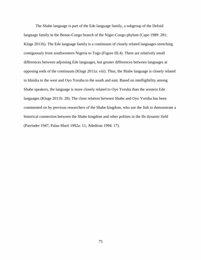
75
The Shabe language is part of the Ede language family, a subgroup of the Defoid
language family in the Benue-Congo branch of the Niger-Congo phylum (Capo 1989: 281;
Kluge 2011b). The Ede language family is a continuum of closely related languages stretching
contiguously from southwestern Nigeria to Togo (Figure III.4). There are relatively small
differences between adjoining Ede languages, but greater differences between languages at
opposing ends of the continuum (Kluge 2011a: viii). Thus, the Shabe language is closely related
to Idaisha to the west and Oyo Yoruba to the south and east. Based on intelligibility among
Shabe speakers, the language is more closely related to Oyo Yoruba than the western Ede
languages (Kluge 2011b: 28). The close relation between Shabe and Oyo Yoruba has been
commented on by previous researchers of the Shabe kingdom, who use the link to demonstrate a
historical connection between the Shabe kingdom and other polities in the Ife dynastic field
(Parrinder 1947; Palau Martí 1992a: 11; Adediran 1994: 17).
76
Figure III.4 The distribution of Ede language communities in West Africa (thick broken line)
shown in relation to the Shabe kingdom (thin broken line). An isolated Ede language community,
Mokole, exists in northern Bénin near Kandi (not pictured). (Adapted from Kluge 2011a: vii)
The Shabe language is subdivided by its speakers into southern and northern dialects,
though the differences are primarily phonological and do not prevent comprehension among
speakers (Kluge 2011b: 11). The southern dialect is generally regarded as more pure than the
northern dialect, as the northern dialect’s phonological and lexical differences are thought to
stem from contact with non-Ede speaking populations to the north (ibid: 11). The geographical
division between the southern and northern dialects is not clear, but generally placed by speakers
somewhere between Kilibo and Tchaourou. The influence of northern languages on the Shabe
language, particularly Baatombu, suggests a close integration of these linguistic populations. A
77
practice known as gonèsí attests to this integration. Gonèsí is a formal joking relationship
between members of different lineages (Palau Martí 1992b: 79). Often, this relationship occurs
between Shabe speaking and Baatombu speaking lineages (Adam et al. 1996: 24).
Idaisha is a closely related Ede language also spoken in the Savè hills (Kluge 2011c). It is
primarily spoken in the Ouémé river valley villages of Atchakpa, Gobe, and Dani. These villages
are relatively recent settlements, founded in the late 19th and early 20th centuries. However,
Idaisha is connected to the Savè hills as the language of its ancient autochthons in Shabe
historical narratives. This ancient connection is used to justify the linguistic similarity between
Shabe and Idaisha today.
Many other languages are spoken in the Savè hills that do not have the associations with
the Shabe kingdom. Mahi, Fongbe Adja, Fulbe, Hausa, and Tchumbuli3 speaking communities
are found in the traditional territory of the kingdom (Palau Martí 1968: 59; Kluge 2011a). These
languages are not seen by Shabe speakers as having had an effect on their language, either
because their speakers exist in too small numbers or have not been there for long. A corollary to
this latter point is that they have not married into Shabe ìdílé and thus have not yet had an effect
on Shabe linguistic communities of practice. Instead, these language communities have retained
distinct identities and kinship practices within the Shabe kingdom.
Membership in an ìdílé through genealogical descent is the ideal form of kinship
organization. This does not always correspond to how the ìdílé recruits and retains members in
practice. Further, it is clear that new ìdílé can form as the result of internal conflict and
segmentation (Schwab 1955: 360). This is certainly the case in Shabe èyílé, where many lineages
3 Many older sources classify Tchumbuli as an Akan language, and so reports of linguistic diversity in the Savè hills
area often claim Akan is spoken here. However, Tchumbuli is more properly classified as a Guang language within
the Tano phylum that also contains Akan (see Blench 2007a: 153).
78
acknowledge distant ancestors in common, but define themselves by more recent segmentation
(Palau Martí 1992b). Though nominally patrilineal, the maternal line is important as a source of
internal segmentation. Recognition of the matrilineage can extend between ìdílé, allowing
cognatic membership to an individual who wishes to “opt” into their mother’s agnatic line
(Lloyd 1966; Apter 2013: 358). While the ìdílé is conceived of as a fixed entity, it is in practice a
fluid organization responsive to changing social contexts (Barber 1991).
In addition to its ideology of descent, the ìdílé has material and spatial components
(Lloyd 1955; Schwab 1955; Eades 1980; Apter 2013). These components are similar to those
described for other Yoruba groups, and include common residence in compounds grouped into
neighborhoods, access to land and its products, and ownership of titles and obligations (Palau
Martí 1968: 65-67). Individual families or segments of the ìdílé live together in rectangular or L-
shaped houses arranged around a central square courtyard. The size of each structure varies
depending on the size of the family, and additional rooms are added to the structure as the family
grows. More houses are constructed around the courtyard as new segments branch off, or locate
nearby if the courtyard is already surrounded. Houses are typically used for sleeping and storage,
while processing, cooking, eating, and socializing activities are conducted in the courtyard.
Cooking is conducted with a metal or ceramic charcoal stove, or occasionally with a cooking
stand of three stones supporting a vessel above a wood fire. Courtyards are typically sited to
include shade trees, or they are planted if absent. Cement blocks are the preferred construction
material today, though balls of earth are also used and were more common in the past (Couchard
1911: 35). In parallel, corrugated metal is preferred for roofs, though bamboo poles and raffia
palm thatch are also used. House construction is performed by the immediate family, the ìdílé,
and by friends, as is typically followed by a celebration. Owè, a system of communal labor for
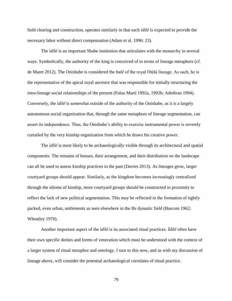
79
field clearing and construction, operates similarly in that each ìdílé is expected to provide the
necessary labor without direct compensation (Adam et al. 1996: 23).
The ìdílé is an important Shabe institution that articulates with the monarchy in several
ways. Symbolically, the authority of the king is conceived of in terms of lineage metaphors (cf.
de Maret 2012). The Onishabe is considered the balé of the royal Otólá lineage. As such, he is
the representative of the apical royal ancestor that was responsible for initially structuring the
intra-lineage social relationships of the present (Palau Martí 1992a, 1992b; Adediran 1994).
Conversely, the ìdílé is somewhat outside of the authority of the Onishabe, as it is a largely
autonomous social organization that, through the same metaphors of lineage segmentation, can
assert its independence. Thus, the Onishabe’s ability to exercise instrumental power is severely
curtailed by the very kinship organization from which he draws his creative power.
The ìdílé is most likely to be archaeologically visible through its architectural and spatial
components. The remains of houses, their arrangement, and their distribution on the landscape
can all be used to assess kinship practices in the past (Davies 2013). As lineages grow, larger
courtyard groups should appear. Similarly, as the kingdom becomes increasingly centralized
through the idioms of kinship, more courtyard groups should be constructed in proximity to
reflect the lack of new political segmentation. This may be reflected in the formation of tightly
packed, even urban, settlements as seen elsewhere in the Ife dynastic field (Bascom 1962;
Wheatley 1970).
Another important aspect of the ìdílé is its associated ritual practices. Ìdílé often have
their own specific deities and forms of veneration which must be understood with the context of
a larger system of ritual metaphor and ontology. I turn to this now, and as with my discussion of
lineage above, will consider the potential archaeological correlates of ritual practice.
80
3. Shabe Ritual
Today, many Shabe identify themselves as practicing Catholicism or Islam, with a
sizeable minority practicing various denominations of Protestantism. However, among these
practitioners are those who combine earlier ritual practices with more recent Abrahamic
monotheism. Even those who eschew syncretism acknowledge the historical importance of such
practices.
The most widespread religious practices are related to egun, the veneration of ancestors.
Egun is routinized prayer and offerings centering on deceased members of the ìdílé (Palau Martí
1993: 124, 237). These ancestors can be specific individuals, but more often are invoked as a
collective entity. Ancestors are fed with food offerings and paid homage to with gifts. They are
considered active participants in society, but can only be approached through specific ritual
secrets.
The management of secret ritual knowledge is fundamental to Shabe ritual practice, as I
will further discuss below. Such secret knowledge can be transmitted through the lineage group,
as is the case for egun. The most important events associated with egun are, unsurprisingly,
connected to death. Three important events occur when an individual dies and the lineage wishes
to commemorate him or her through egun. Immediately following the death, the body is washed,
perfumed, and wrapped in cloth. The body is carried through the village to be greeted by
residents, lineage members, musicians, dancers, and hunters before being placed in a tomb
(Palau Martí 1993: 245). Formal cemeteries are sometimes used by Christians and Muslims, but
it is also common for the deceased to be interred within their house (see Couchard 1911: 49-50).
After four days, a funeral is held for lineage members. However, this event is not a public

81
gathering, as following a death there may be an extended period while its cause is investigated
(Palau Martí 1993: 246). A large, public funeral is held a year or more after the death at the site
of the recently deceased and soon to be ancestor’s tomb (ibid: 250). Lineage groups also control
secret ritual knowledge associated with autochthonous spirits. This is the case for those lineages
claiming pre-Shabe ties to the land (ibid: 134, 147).
Other secret knowledge is created and maintained outside the lineage. Indeed, in the
recent past Shabe political networks were dependent on ritual communities that crosscut lineage
affiliations. Palau Martí (1993: 133) describes these ritual communities as centered on deities of
possession, and organizes them into three major groups, based on their associations with
historical migration episodes: the oosà, the ne nén, and the Boko deities. Regardless of origin,
each community operates similarly: they are independent institutions, but membership between
each can overlap significantly. The deities at the center of each community are associated with
various powers and protections that are invoked through prayers and ritual offerings. Like
lineages, ritual communities are institutions capable of organizing large groups of people spread
over the landscape. Access to these ritual communities is an important source of political power
in Shabe.
The oosà, or orìsà in the standard Oyo Yoruba dialect, deities are associated with various
professions, social roles, and natural phenomena (Verger 1957; Idowu 1962; Morton-Williams
1964; Palau Martí 1993: 187). Their devotees are organized within village communities around
semi-public and private temples, maintained by priests. The distribution of particular oosà
devotees varies greatly in the Savè hills, but many of the same oosà can be found in Ketu,
Idaisha, and southwestern Nigeria. Oosà spread to new areas through migration, but also from
devotees actively establishing of new ritual centers. In general, they are understood as moving
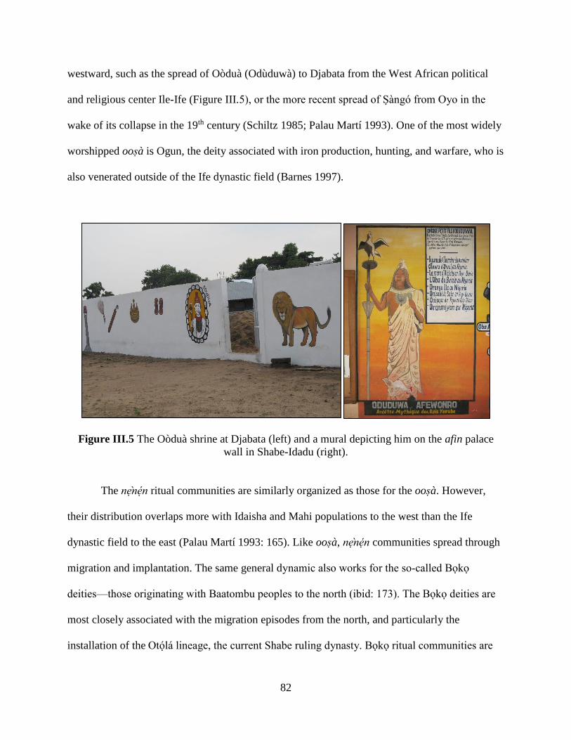
82
westward, such as the spread of Oòduà (Odùduwà) to Djabata from the West African political
and religious center Ile-Ife (Figure III.5), or the more recent spread of Sàngó from Oyo in the
wake of its collapse in the 19th century (Schiltz 1985; Palau Martí 1993). One of the most widely
worshipped oosà is Ogun, the deity associated with iron production, hunting, and warfare, who is
also venerated outside of the Ife dynastic field (Barnes 1997).
Figure III.5 The Oòduà shrine at Djabata (left) and a mural depicting him on the afin palace
wall in Shabe-Idadu (right).
The ne nén ritual communities are similarly organized as those for the oosà. However,
their distribution overlaps more with Idaisha and Mahi populations to the west than the Ife
dynastic field to the east (Palau Martí 1993: 165). Like oosà, ne nén communities spread through
migration and implantation. The same general dynamic also works for the so-called Boko
deities—those originating with Baatombu peoples to the north (ibid: 173). The Boko deities are
most closely associated with the migration episodes from the north, and particularly the
installation of the Otólá lineage, the current Shabe ruling dynasty. Boko ritual communities are

83
open to other lineages, just as ne nén and oosà communities occasionally draw new practitioners.
A highly visible case is the Otólá lineage’s adoption of and reverence for the royal oosà Oòduà.
Other ritual communities are much more locally distributed. Deities and lesser nature
spirits commonly exist in natural features of the Savè hills landscape. Rivers, hills, caves, and
other conspicuous landscape features are cited as being inhabited by personified forces of nature.
In some cases these spirits are former humans, while in others they are actual deities. Trees can
also be inhabited by spirits, though they are more closely linked to ancestors or lesser spirits
(Agbaje-Williams 2005; Gurstelle 2013).
One other important practice that defines the Shabe is the use of Ifá divination. Ifá
divination is practiced by priests called babaláwo, who form a loose association throughout the
Save hills, as well being found in many societies throughout central and southern Bénin and
southwestern Nigeria more generally. Ifá practice is often used as a means of determining the
style, scale, and timing of other ritual practices connected to egun or other deities (Palau Martí
1993: 229). Ifá is also used to determine ritual food prohibitions associated with lineage deities
and ancestors.
Much like the kinship practices that constitute ìdílé, Shabe ritual practices have an
ambivalent relationship with the monarchy. On one hand, the monarchy has been able to
subsume ritual communities by strategically placing the Onishabe at the head of their
organization, such as the genealogical linking of the Onishabe to the deity Oòduà (Johnson 1921;
Palau Martí 1993; see below). In some cases, rituals must be authorized by the Onishabe before
they can be performed, such as with funeral celebrations (Couchard 1911: 50). On the other
hand, ritual communities provide alternative sources of power that cannot easily be usurped by
centralized political authority. The secret knowledge inherent in oosà, ne nén, and Boko deity

84
worship favors a decentralized power base that successful leaders must bring together through
creative strategies that privilege wealth-in-people (Guyer & Belinga 1995; Robertshaw 2010).
Other ritual practices empower altogether different categories of political actors. In the case of
Ifá, diviners hold power over lineage head or political officials by claiming unique knowledge of
divine intentions and future outcomes—allowing them to heavily influence public opinion.
The archaeological visibility of ritual practices will differ depending on their scale.
Individualized forms of offering and veneration may be preserved through small fragments of
portable material culture. Personal charms and talismans may be deposited in middens alongside
other household waste. Cowries, used in the veneration of an individual’s personal deity or orí,
may wind up in the garbage as household spaces are periodically cleaned (Ogundiran 2014). The
composition of faunal remains in household middens could also indicate food choices that may
demonstrate ritual prohibitions. Lineages and larger ritual communities may have more
permanent shrines or other forms of ritual architecture that could leave an archaeological trace
(e.g., Insoll 2011; Norman 2011; Stahl 2013). Burial practices could also be visible, whether
located below a house or in a separate tomb. The elaboration or creation of landscape features
can also indicate ritual practice (Norman & Kelly 2004; Monroe & Ogundiran 2012). Sacred
groves or their remnants are also visible traces of past ritual practice (Fairhead & Leach 1996;
Sheridan & Nyamweru 2007).
The ritual modification of the landscape relates to the more general issue of economic
practices in the Savè hills area. Indeed, both lineage and ritual influence how people extract
resources from the environment. As discussed in Chapter I, these resources are then mobilized to
support labor and wealth creation that supports political differentiation and, potentially,
centralization. I discuss Shabe economic practices and their archaeological correlates below.
85
4. Shabe Economy
Agriculture is the predominant activity of Savè hills residents in the present and
throughout the 20th century (Couchard 1911: 60; Palau Martí 1992a: 41). Cultivation is primarily
on a fallow system with planting preceded by controlled burnings. Common crops include maize,
African yams, cassava, peanuts, cowpeas, soya, sesame, onions, peppers, okra, melons,
pineapples, cabbage, and leafy greens such as patákunpàku (Solanum macrocarpum). Many
other wild plants are also collected (Palau Martí 1992a: 43). Tree crops are widely grown,
managed, and exploited, and include mango, cashew, coconut, rônier, ackee/false cashew,
banana, cola, shea, and oil palm. Millet is not widely grown today, though it was grown in small
quantities to make beer as recently as 1910 (Couchard 1911: 38). By the 1960s, the millet used in
beer brewing had been replaced by maize (Palau Martí 1992a: 44). Indigo was also no longer
being grown by the 1960s, but had been earlier (ibid: 43). Cultivation of cotton and tobacco for
export was encouraged by the French colonial administration. These crops are no longer very
profitable and so are no longer produced today. Similarly, salt is recalled as being locally
produced by sifting plant ash until it became more cost-effective to purchase it from merchants at
markets (ibid: 46). The agricultural season is dictated by a climatic cycle typical of West Africa,
with a rainy season extending from late March to November—punctuated by a brief respite in
August— and a dry season from December to early March. Most agriculture is done by hand on
small-scale farms, though some industrial farming exists, most notably the state-sponsored
SUCOBE sugarcane plantation adjacent to the Ouémé River.
In Johnson’s (1921) epic recounting of political traditions in Oyo and the Ife dynastic
field, the ancestors of Shabe were bequeathed Odùduwà’s cattle. Unlike its peer polities (Oyo
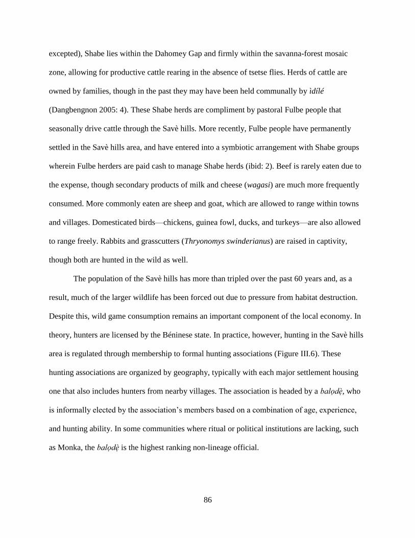
86
excepted), Shabe lies within the Dahomey Gap and firmly within the savanna-forest mosaic
zone, allowing for productive cattle rearing in the absence of tsetse flies. Herds of cattle are
owned by families, though in the past they may have been held communally by ìdílé
(Dangbengnon 2005: 4). These Shabe herds are compliment by pastoral Fulbe people that
seasonally drive cattle through the Savè hills. More recently, Fulbe people have permanently
settled in the Savè hills area, and have entered into a symbiotic arrangement with Shabe groups
wherein Fulbe herders are paid cash to manage Shabe herds (ibid: 2). Beef is rarely eaten due to
the expense, though secondary products of milk and cheese (wagasi) are much more frequently
consumed. More commonly eaten are sheep and goat, which are allowed to range within towns
and villages. Domesticated birds—chickens, guinea fowl, ducks, and turkeys—are also allowed
to range freely. Rabbits and grasscutters (Thryonomys swinderianus) are raised in captivity,
though both are hunted in the wild as well.
The population of the Savè hills has more than tripled over the past 60 years and, as a
result, much of the larger wildlife has been forced out due to pressure from habitat destruction.
Despite this, wild game consumption remains an important component of the local economy. In
theory, hunters are licensed by the Béninese state. In practice, however, hunting in the Savè hills
area is regulated through membership to formal hunting associations (Figure III.6). These
hunting associations are organized by geography, typically with each major settlement housing
one that also includes hunters from nearby villages. The association is headed by a balodè, who
is informally elected by the association’s members based on a combination of age, experience,
and hunting ability. In some communities where ritual or political institutions are lacking, such
as Monka, the balodè is the highest ranking non-lineage official.
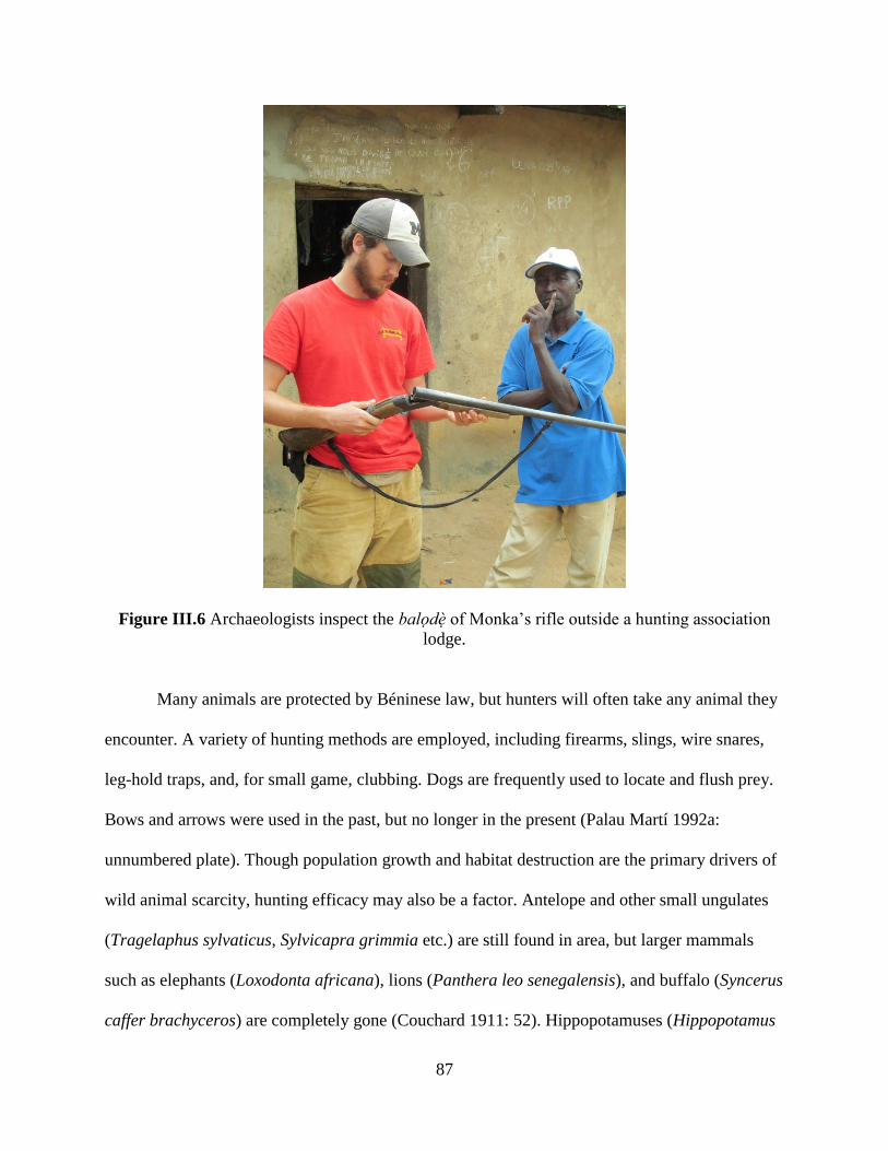
87
Figure III.6 Archaeologists inspect the balodè of Monka’s rifle outside a hunting association
lodge.
Many animals are protected by Béninese law, but hunters will often take any animal they
encounter. A variety of hunting methods are employed, including firearms, slings, wire snares,
leg-hold traps, and, for small game, clubbing. Dogs are frequently used to locate and flush prey.
Bows and arrows were used in the past, but no longer in the present (Palau Martí 1992a:
unnumbered plate). Though population growth and habitat destruction are the primary drivers of
wild animal scarcity, hunting efficacy may also be a factor. Antelope and other small ungulates
(Tragelaphus sylvaticus, Sylvicapra grimmia etc.) are still found in area, but larger mammals
such as elephants (Loxodonta africana), lions (Panthera leo senegalensis), and buffalo (Syncerus
caffer brachyceros) are completely gone (Couchard 1911: 52). Hippopotamuses (Hippopotamus
88
amphibious) remain in the Ouémé River but their numbers have been severely reduced (Sayer &
Green 1984). Crocodiles (Crocodylus niloticus, C. cataphractus, and Osteolaemus tetraspis) are
documented in the Ouémé River (Thorbjarnarson 1992: 14-15). In 2013, hunters from Alafia and
Kaboua in the Savè hills area reported that crocodiles were also common in the Okpara River.
Hunters from Savè, Monka, Alafia, and Kaboua all reported that many kinds of monkeys,
rodents, ground-dwelling birds, lizards, and snakes were commonly encountered and hunted in
the area (Figure III.7). Royal pythons (Python regius) were said to be present in the area, but not
usually hunted. However, this account conflicts with earlier colonial surveys that state pythons
were absent from the area (Couchard 1911: 53). Fishing is a major activity in settlements near
the Okpara and Ouémé rivers, and practiced with lines, nets, and poisons (Ceperely et al. 2010).
Figure III.7 A mural on an exterior wall of the balodè of Kemon’s residence.
89
Agriculture and hunting are performed by all lineages, but craft production has tended to
be more restricted. In the 1960s, Palau Martí (1992b) identified several lineages that were
associated with iron and ceramic production. While members of these lineages were particularly
esteemed in the craft, they were not fulltime specialists. Indeed, many of the iron and ceramic
products used in the Savè hills area at the time were purchased through the regional market
economy. Even more recently, handmade iron and ceramic products have been displaced by
manufactured goods, though some continue to be produced and consumed for ritual purposes
(Figure III.8). Woodworking is recalled as being practiced by adept individuals, rather than
associated with entire lineages. In general, Shabe craft production has recently been a relatively
informal practice, suggesting the dominance of the colonial and post-colonial market economy.

90
Figure III.8 Ceramic stoves and ritual vessels for sale in Savè in 2012.
Markets are an important part of the local and regional economy in the Savè hills area.
Three overlapping market systems operate currently: traditional markets, a daily produce market,
and a weekly “grand” market (Palau Martí 1992a: 51-54). Traditional markets are found in
nearly all settlements. They typically are active once every four days and are staggered
geographically so that traders and consumers can travel to a nearby market nearly any day. These
markets sell agricultural products, domesticated animals, wild game meat, medicines, salt,
clothes, cookware, tools, and other goods. Daily produce markets exist only in Savè, where the
population is large enough to support permanent traders. The weekly “grand” market also occurs
91
in Savè each Monday. This market was instituted during the colonial period in correlation with
the arrival of the railway. The railway created new economic opportunities to purchase goods
from the south and to sell local products, particularly cattle. Though no longer pegged to the
railway, the grand market remains a major regional market attended by travelers from throughout
Bénin, Nigeria, and Togo.
As discussed in Chapter I, political centralization relies on some level of economic
support. At its most basic level, agricultural “staple” surplus can be converted to wealth that
promotes elite institutions and ideologies (D’Altroy & Earle 1985; Brumfiel & Earle 1987).
Exclusionary control over the products of long-distance exchange is also invoked as a route to
power in West Africa (e.g. Posnansky 1973). Yet, the economy can be diverted to contest
political centralization. The hunting associations and office of balodè represent a decentralized
political institution that resists attempts to centralize due to its inherent local character. Like
lineage and ritual sources of power, the economy can produce power sources that have the ability
to either support or resist political centralization.
Economic practices are visible in the archaeological record. The range of cultivated crops
can be discerned from the analysis of botanical remains (e.g. Logan 2012). Evidence for
agricultural intensification that often supports political centralization and social complexity can
be seen through the remains of field systems, agricultural technologies, and settlement patterning
(Stump 2013a). Analogous to agriculture, the range of domesticated and hunted animals can be
discerned from the analysis of faunal remains (Gifford-Gonzalez & Hanotte 2013). The
production of many crafts leaves material indicators through the products themselves (iron tools,
potsherds, etc.) as well as the residues of their production (furnaces, slag heaps, ceramic wasters,
fuel, etc.). Evidence of exchange is also visible, particularly through the availability of material
92
proveniencing studies. In many cases, the raw materials used in producing ceramic, glass, and
copper objects can be sourced to show their movement through local and regional exchange
networks (e.g., Usman et al. 2005; Dussubieux et al. 2009; Thondhlana & Martinón-Torres
2009).
B. The Shabe Kingdom
1. The Onishabe
Thus far, I’ve attempted to delimit the Shabe people in respect to their location and
certain aspects of their kinship, ritual, and economic practices. But, as noted earlier, Shabe is also
a political affiliation. The Shabe monarchy acknowledges the elements described above as
constituting a Shabe identity precisely because they bind communities to their centralized
political authority. Unlike Palau Martí, I do not view lineage and ritual practice as inherently
constitutive of Shabe, but instead, following Comaroff, consider such elements as activated in
order to draw boundaries among populations (2010: 531). Shabe should not be considered an
affective affiliation built from the bottom-up, but instead a form of top-down social organization
that groups opt into to varying degrees.
The keystone of this social organization is the Onishabe. The Onishabe holds the title of
Oba, or king, and is in principal a divine being of near unlimited àse, or power (Abiodun 1994:
315; Palau Martí 1964: 11). In practice, the Onishabe, like other Oba, is a kind of political
negotiator who mediates the competing interests of various ìdílé (Apter 1992; Lloyd 1960; Palau
Martí 1993: 36; Munoz 1981). The Onishabe directly governs only the immediate vicinity of
Shabe-Idadu with other regions operating relatively autonomously (Palau Martí 1993: 35). The

93
Onishabe is chosen from the Ifàà and Akínkanjú lineages of the royal Otólá group by
kingmakers, called the ujoyè oba (Adediran 1994: 23; Adam et al. 1996: 19). The ujoyè oba is a
council of permanent advisors, called agànì, appointed by various titled ìdílé (Palau Martí 1993:
39).
Below the Onishabe and his agànì are village heads, or balè. Each balè has wide-ranging
responsibilities, duties, and civic powers based on the organization of that particular settlement
(Palau Martí 1993: 17). Larger settlements in the Save hills, such as Kaboua, Kokoro, and
Kilibo, have balè that in turn install the balè of smaller villages (ibid: 29). While this political
hierarchy is clearly defined in terms of ceremonial responsibilities and investing legitimacy in
the local political milieu, balè were more autonomous in their organizational and adjudicating
functions (ibid: 25; Couchard 1911). Very small settlements do not have their own balè and are
administered by a nearby balè, usually one with some lineage connection to the settlement’s
founders.
The Onishabe’s legitimacy is derived through his lineage connection to the founder of the
Shabe state, Baba Guidaï. Baba Guidaï led a migration from the Boko area near Nikki to Kaboua
sometime in the 16th or 17th century (Palau Martí 1992a: 137). From Kaboua, his son left to
conquer Shabe-Idadu and subsequently became the first Onishabe of the Otólá dynasty (ibid:
151). Shabe-Idadu grew to become the largest settlement in the region and assimilated the others
into its hierarchy. This hierarchy among settlements is modeled after the Baba Guidaï lineage,
where each settlement is assigned a place within the segmentary structure based on the village
founder’s relationship to Baba Guidaï (Palau Martí 1993: 28). Obligations to provide labor,
resources, or access between communities are therefore modeled after the lineage associations
operating within communities.

94
While the migration of Baba Guidaï is remembered as a relatively recent event, the
Onishabe also draws on descent from Oòduà, the mythical divine king that first established the
Ife dynastic field at Ile-Ife. An important ritual performance during the Onishabe’s installation
rites takes place at the Oòduà shrine in Djabata (Palau Martí 1993: 80). Similarly, the Onishabe
pays homage to the king of Ile-Ife after being installed. Through both acts, the new Onishabe is
incorporated into the line of divine kings that spread out from Ile-Ife. Descent from Oduduwa is
crucial to vest the Onishabe with authority derived from regional legitimacy, beyond his local
legitimacy vis-à-vis descent from Baba Guidaï.
The tight intertwining of political structure, lineage institutions, and ritual practices is the
central thesis of Palau Martí’s ethnography of the Shabe kingdom. Though political power—the
ability of Shabe individuals to organize labor and resources in society—was not the focus of her
work, she repeatedly points out that power could come from many sources. The Shabe political
system, while nominally centralized, could be displaced by more important kinship and ritual
associations. During her fieldwork in the 1950-70s, the Shabe kingdom was no longer
autonomous and its political structure had lost much of its effective power. The Onishabe’s role
in the new political milieu was dramatically altered in the colonial and post-colonial context, as
was the case for Oba throughout the Ife dynastic field (Asiwaju 1976). Palau Martí’s (1992a: 9)
focus on formulaic poetry and historical narratives allowed her to reconstruct some of the ancient
political dynamics, but she admits that much of the oral corpus was likely lost during the wars
that wracked West Africa throughout the 19th century.
2. A Crowned Kingdom
95
With the limitations of historical memory in mind, I turn to the specific domains of the
Onishabe’s authority—the actual ways that the political hierarchy organized labor and resources
in the Savè hills. I identify four major domains based on recent histories and ethnographic
representations of the Shabe kingdom: settlement rights, warfare, infrastructure, and markets. In
addition, the Onishabe’s authority is made material through various symbols that connect it to a
larger regional political landscape. In Chapter V, I will examine how the institution of the
Onishabe developed in these five areas over the course of the past 500 years.
The Onishabe is vested with ultimate ownership of the Savè hills landscape giving him
some ability to control the location of settlements. Settlements—variously called towns, villages,
and hamlets—are the built spaces that Shabe residents occupy throughout the year. They range in
size, but are typically multi-lineage residential sites. Residences are rectangular structures
arranged around courtyards with attached production areas. Settlements are differentiated from
smaller sites, like farmsteads, that are occupied by a few members of a single lineage or are
occupied only periodically. The location of new settlements is negotiated through the Onishabe,
as the authority to partition land and resolve territorial claims ultimately rests with the monarchy.
Once new settlements are established, however, they are assimilated into the regional political
hierarchy. Examples include the administration of Tchumbuli settlements by the balè of Kaboua
and the administration of Idaisha settlements by the basàlé of the Jalumon lineage (Palau Martí
1993: 29).
The right to wage war is the exclusive privilege of the Onishabe (Palau Martí 1993: 31).
While the Shabe kingdom did not historically have a regular army, the Onishabe could levy a
force through his balogun, or war chiefs. Each balè appoints a balogun that then recruit warriors
from their respective settlements (ibid: 33). In addition, the Onishabe also appoints a balogun to

96
command the entire levied force. In at least one case, a balogun served as regent following the
death of an Onishabe (Palau Martí 1992a: 193).
The balogun cooperate with hunters in waging war and defending the Shabe territory.
Hunting in the forests and grasslands, as opposed to “garden hunting” in farm fields, is a
specialized occupation in Shabe society, as discussed above (see Palau Martí 1992a: 47). Hunters
are renowned for their knowledge of the landscape, skill with arms, and proficiency in magic—
all desirable attributes in warriors. Hunters are organized into loose associations headed by a
balodè. Unlike balogun, balodè are not selected by the Onishabe or his balè. In addition there are
more balodè than balè, as settlements of any size typically have a hunters’ association.
Like most forested areas of West Africa, war was waged by warriors on foot with bows
and/or spears and shields (Palau Martí 1993: 33). However, the Savè hills climate is fairly dry
with less risk of trypanosomiasis, allowing horses to be kept (Couchard 1911: 36). Horses were
owned in Oyo by elites who used them as symbols of status, as well as for mounted combat with
lance and shield (Law 1977). Guns are relatively recent introductions into the area and were not
widely used prior to the 20th century, after French colonial rule had been established (ibid; Ajayi
& Smith 1964).
In addition to mobilizing warriors, the Onishabe can organize labor within the Shabe
kingdom to create large public works through a system called owè (Adam et al. 1996: 23).
Laborers are selected by lineage heads to work as directed by the Onishabe without receiving
recompense, though food is often provided. The Onishabe can call on owè labor for any reason,
but the best documented are road construction, palace renovation, and fortification. Today, the
major road in the Shabe kingdom is the Route National 2, which crosses the Ouémé River near
Gobe and runs east to Savè, before turning north and passing near Kaboua, eventually running
97
through Kokoro and Kilibo on its way to Parakou. This road is now maintained through state
workers, but the original road built by the French Colonial government in the early 20th century
relied on labor organized through owè. This road was built on an earlier caravan route, which in
turn is based on the location of Shabe settlements along the ridge between the Ouémé and
Okpara drainages. Smaller roads and pathways are still maintained through owè.
Owè is also used to renovate and build the royal palace. This is similar to the bèrè festival
in the Oyo Empire, where subordinate groups were compelled to enact symbolic labor
relationships with the Alafin by re-thatching the roof of the palace. The balè can also organize
labor in their local communities for smaller scale projects, such as field clearance. In either case,
owè is the manifestation of rights to labor enjoyed by the Onishabe and the political hierarchy
more generally.
Owè is no longer used to create defensive structures, as the Onishabe’s role in defense
has been displaced by Bénin’s military. However, defensive structures are found throughout the
kingdom and are historically linked to the owè system. Defensive structures are made of either
uncoursed dry-stone masonry or rammed earth, with some composite walls made of both. Not all
walls were used strictly for defense, as some of the earthen walls surrounding Shabe-Idadu were
constructed to demarcate its boundaries (Agani 2015: 23).
The offices of the Onishabe, balè, and balogun were financed through the Onishabe’s
rights to tax revenues. As with military functions, these rights have been displaced by the
contemporary nation-state. In the past, the Onishabe could impose taxes on traders moving
through Shabe territory as well as fees on merchants for the right to sell in markets (Palau Martí
1993: 32). Markets and kingship are closely associated throughout West Africa, often with at
least one market held adjacent to the royal residence (Polanyi 1966; Goody 1971). In Savè, two
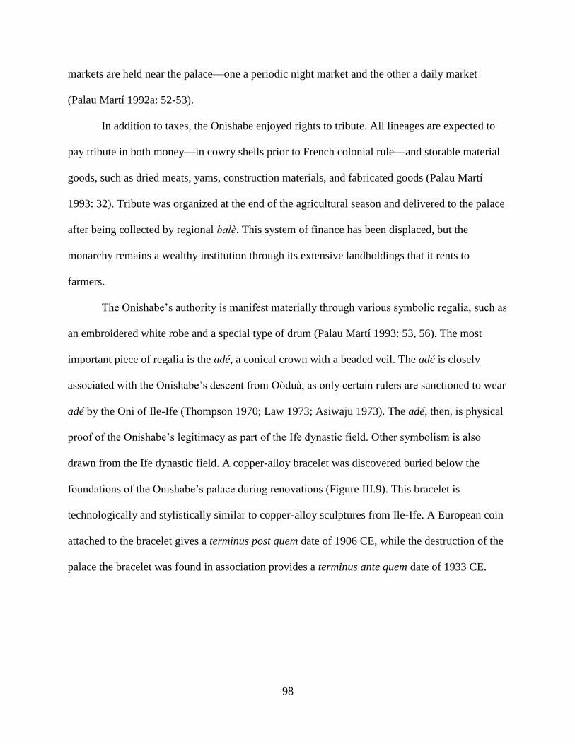
98
markets are held near the palace—one a periodic night market and the other a daily market
(Palau Martí 1992a: 52-53).
In addition to taxes, the Onishabe enjoyed rights to tribute. All lineages are expected to
pay tribute in both money—in cowry shells prior to French colonial rule—and storable material
goods, such as dried meats, yams, construction materials, and fabricated goods (Palau Martí
1993: 32). Tribute was organized at the end of the agricultural season and delivered to the palace
after being collected by regional balè. This system of finance has been displaced, but the
monarchy remains a wealthy institution through its extensive landholdings that it rents to
farmers.
The Onishabe’s authority is manifest materially through various symbolic regalia, such as
an embroidered white robe and a special type of drum (Palau Martí 1993: 53, 56). The most
important piece of regalia is the adé, a conical crown with a beaded veil. The adé is closely
associated with the Onishabe’s descent from Oòduà, as only certain rulers are sanctioned to wear
adé by the Oni of Ile-Ife (Thompson 1970; Law 1973; Asiwaju 1973). The adé, then, is physical
proof of the Onishabe’s legitimacy as part of the Ife dynastic field. Other symbolism is also
drawn from the Ife dynastic field. A copper-alloy bracelet was discovered buried below the
foundations of the Onishabe’s palace during renovations (Figure III.9). This bracelet is
technologically and stylistically similar to copper-alloy sculptures from Ile-Ife. A European coin
attached to the bracelet gives a terminus post quem date of 1906 CE, while the destruction of the
palace the bracelet was found in association provides a terminus ante quem date of 1933 CE.

99
Figure III.9 A copper-alloy bracelet found buried below the foundation so current royal palace.
The two ends of the bracelet are figured as a right hand and a chameleon head and are clasped by
a bird-shaped pin. Twenty chains hang from the underside of the bracelet of which eleven attach
to small figurative sculptures, from left to right: missing, missing, quatrefoil ring, cowry,
missing, scepter/osé Sàngó?, cowry, turtle, missing, geometric design/stool?, sword, key, gong,
missing, missing, missing, coin, coin, missing, missing.
Authority is manifest spatially by the afin, or royal palace (Figure III.10). The palace is
the residence of the king and the locus of political activity in the kingdom. Historically, the king
was confined to the palace by ritual taboo, though this is no longer practiced. This means that in
the past political discourse had to be conducted at the palace and other forms of negotiation were
suspect as treasonous plotting. Visitors to the Onishabe were received in the àkàbà, a semi-
public courtyard within the palace containing various shrines (Palau Martí 1993: 52). The palace
is sited at the foot of the Oke Shabe hill, signaling the Onishabe’s ownership of the hill, the land,
and its people.
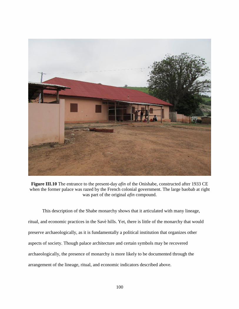
100
Figure III.10 The entrance to the present-day afin of the Onishabe, constructed after 1933 CE
when the former palace was razed by the French colonial government. The large baobab at right
was part of the original afin compound.
This description of the Shabe monarchy shows that it articulated with many lineage,
ritual, and economic practices in the Savè hills. Yet, there is little of the monarchy that would
preserve archaeologically, as it is fundamentally a political institution that organizes other
aspects of society. Though palace architecture and certain symbols may be recovered
archaeologically, the presence of monarchy is more likely to be documented through the
arrangement of the lineage, ritual, and economic indicators described above.
101
Fortunately, the Shabe monarchy is the focus of much of the preserved oral historical
corpus. I offer a thorough critique of Shabe oral history and its use in archaeology in Chapter IV.
In the following sections, however, I return to the state of the Shabe monarchy in the present
before synthesizing the major political events recorded in Shabe oral history. This historical
description of the Shabe kingdom offers a supplementary perspective on political centralization
that can be useful in comparing to the archaeological record.
3. The Two Kings of Shabe
The current Onishabe is Oba Adétùtú Akénmu of the Akíkenjú segment of the Baba
Guidaï lineage. He attained the position in 2005 following the death of Oba Adélékè Akinni. As
discussed, many of the traditional rights and entitlements of the monarchy have been displaced
by the nation-state and as a result Oba Adétùtú has relatively little legal power. Today, the role
of the Onishabe is largely as the head of traditional Shabe culture and history. The Onishabe can
draw attention to the needs of his constituents by appealing to the government on their behalf,
but this is also done by the elected representatives of the area.
The monarchy’s primary role today is as a cultural heritage organization. The Onishabe
promotes a Shabe ethnic identity, as outlined above, while simultaneously promoting an
authoritative version of that ethnicity’s history. To this end, Oba Adétùtú has launched several
projects that promote Shabe ethnicity and history. Taking advantage of new media, Oba Adétùtú
has an active Facebook presence. He regularly posts short essays on Shabe history, both original
compositions based on oral histories and summaries of other published works. Oba Adétùtú has
also worked with the national Directorate of Cultural Heritage to create stops in Savè along the
national “Route of Slaves” tourism project. These stops exhibit aspects of Shabe culture to

102
heritage tourists and teach them about the impact of slave raiding on the Savè hills during the
19th century. Finally, in 2009 Oba Adétùtú revived the installation ceremony of the Onishabe as
an annual ceremony called Odon Fiditi. This ceremony is a simplified version of the more
intricate installation rites observed during the ascension of a new Onishabe. In addition to
displays of music and dancing, the Onishabe and other officials lead a procession through Savè
that spatially links the palace, the site of a sacred iroko tree, and the 19th century refuge of Fiditi
on the Oke Shabe hill. The celebration is linked to the Catholic holiday of Pentecost, but is not
observed as solely a Catholic celebration. Indeed, participation in the event is understood as an
acknowledgment of the Onishabe’s authority, but simply a celebration of Shabe cultural heritage.
In the absence of legally sanctioned political power, the Onishabe’s position today is
based on history. Though not empowered legally to adjudicate disputes or enforce laws, it can
still effectively do so by appealling to a sense of Shabe tradition. The Onishabe, however, is not
unique in his ability to cite history as a precedent for prestige in the present. Freed from the
threat of retaliation, political competitors have more vigorously claimed alternative histories that
negate the claims to title of Oba Adétùtú.
The most serious of these opposing claims is given by Oyedekpo II Ola-Amùsù, the head
of the Amùsù lineage. The Amùsù claim, and indeed are widely recognized, to have been the
kings of the Savè hills before the arrival of the Baba Guidaï lineages (Palau Martí 1992b: 195).
They were ousted by the first king of the Baba Guidaï dynasty, Ola Obe, around 1730 in a long
and bloody war, traces of which can still be found on the landscape (Palau Martí 1992a: 130; see
Chapter V). They were then stripped of office and integrated into the new political hierarchy,
without claim to any of the important agànì titles.
103
Since independence from French colonial rule, members of the Amùsù lineage has sought
to regain its prominence in Shabe society. They have rejected the Onishabe’s legitimacy, stating
that his lineage are usurpers without claim to the heritage of Oduduwa. Oyedekpo II has
materialized this counter-claim by placing placards around Savè directing visitors to the Ola-
Amùsù’s residence as the true palace of the king of Shabe. Oyedekpo II has also begun a massive
renovation of his residence in order to compete with the scale of the Onishabe’s palace.
The claims of both the Onishabe and the Ola-Amùsù are couched in history—that
legitimacy in the present comes from a deep understanding of the past. Through knowing history,
the Onishabe and Ola-Amùsù seek to establish themselves as the true descendants of Oduduwa,
the first divine king. The two versions of history each cite do not actually differ all that much.
Both acknowledge the first-comer status of the Amùsù lineage and its military defeat at the
hands of the Baba Guidaï lineage. Both acknowledge prior residency in the Boko region of
northern Bénin before settling in the Savè hills. It is details of historical minutiae and the deeper
past that divides the two.
It is routine for academics to acknowledge that oral histories are prone to revision for
political gain, often making them poor historical documents (Law 1973; Vansina 1985; Barber
1991). This sentiment is to some degree acknowledged by Shabe historians as well. Politically-
motivated claims to history are seen as such, and so treated with a degree of skepticism,
particularly when they counter one’s own interests. Beyond knowing history, knowing the
landscape is considered crucial by the Onishabe and Ola-Amùsù. Histories can be edited, but the
physical presence of landscape features provides an enduring mnemonic. Abandoned villages,
shrines, and battlefields are pointed to as proof of certain historical variants.
104
Over the course of my archaeological research, members of both lineages were
forthcoming with me regarding their knowledge of history, but were much more excited to share
their knowledge of the landscape. I will return to this in Chapter IV when I discuss my research
methods. Now, however, I will outline the contentious history of the Shabe kingdom to provide
the historical background that my archaeological research tracks.
C. The Complicated History of Shabe
1. The Early History of Shabe
The divergent political narratives of the Onishabe and the Ola-Amùsù emphasize
different aspects of how the Shabe kingdom came into being. Predictably, the Onishabe’s version
of events emphasizes the emigration of Baba Guidaï as the foundational event. Essentially, there
was no centralized kingdom prior to his arrival and the subsequent expulsion of the Amùsù by
Ola Obe. The Ola-Amùsù’s version contests this, stating that the kingdom had already formed by
the time of Baba Guidaï’s arrival.
Despite these differences, both narratives acknowledge that the Savè hills were already
inhabited by the time either lineage arrived. The autochthons are usually identified as ancestral to
the Popo or Idaisha—the western fringes of the Ede language continuum (Palau Martí 1992a: 62,
103). Several of the extant lineages in Shabe claim descent from these autochthons. Examining
their oríkì, or praise poems associated with the lineage, Palau Martí has determined that these
lineages do indeed reference local landscapes rather than the distant places found in migrants’
oríkì (ibid: 189, 236, 240; see also Barber 1991). Some lineages are named for such locales, such
as Eyin-Oke, a lineage that translates to “behind the hill”. The hill referenced is Oke Shabe, and
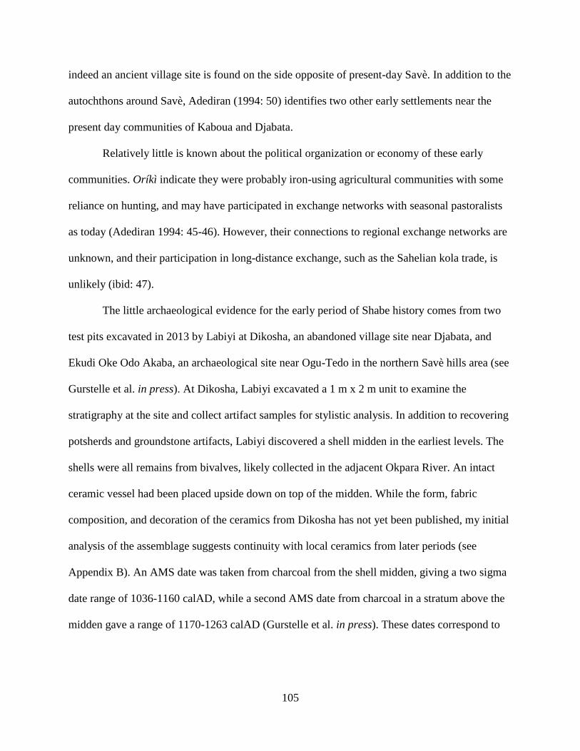
105
indeed an ancient village site is found on the side opposite of present-day Savè. In addition to the
autochthons around Savè, Adediran (1994: 50) identifies two other early settlements near the
present day communities of Kaboua and Djabata.
Relatively little is known about the political organization or economy of these early
communities. Oríkì indicate they were probably iron-using agricultural communities with some
reliance on hunting, and may have participated in exchange networks with seasonal pastoralists
as today (Adediran 1994: 45-46). However, their connections to regional exchange networks are
unknown, and their participation in long-distance exchange, such as the Sahelian kola trade, is
unlikely (ibid: 47).
The little archaeological evidence for the early period of Shabe history comes from two
test pits excavated in 2013 by Labiyi at Dikosha, an abandoned village site near Djabata, and
Ekudi Oke Odo Akaba, an archaeological site near Ogu-Tedo in the northern Savè hills area (see
Gurstelle et al. in press). At Dikosha, Labiyi excavated a 1 m x 2 m unit to examine the
stratigraphy at the site and collect artifact samples for stylistic analysis. In addition to recovering
potsherds and groundstone artifacts, Labiyi discovered a shell midden in the earliest levels. The
shells were all remains from bivalves, likely collected in the adjacent Okpara River. An intact
ceramic vessel had been placed upside down on top of the midden. While the form, fabric
composition, and decoration of the ceramics from Dikosha has not yet been published, my initial
analysis of the assemblage suggests continuity with local ceramics from later periods (see
Appendix B). An AMS date was taken from charcoal from the shell midden, giving a two sigma
date range of 1036-1160 calAD, while a second AMS date from charcoal in a stratum above the
midden gave a range of 1170-1263 calAD (Gurstelle et al. in press). These dates correspond to

106
the classical or pavement period at Ile-Ife—the proposed period for Oduduwa’s reign and
subsequent cult dispersal (Ogundiran 2001, 2003; Blier 2012).
At Ekudi Oke Odo Akaba, Labiyi excavated a 2 m x 2 m unit to investigate an earthen
mound associated with potsherds on the surface. Within the mound, Labiyi found collapsed
earthen architecture and partial remains of a flat-laid potsherd pavement. This pavement is
similar in form to contemporary pavements at the Birnin Lafiya site in northern Bénin (Haour
2013). Labiyi also recovered glass beads similar in form and color to sègi type beads produced at
Ile-Ife and circulated throughout the region (Ogundiran 2003). These material remains suggest
some level of interaction with areas to the north and east of the Savè hills area. Two AMS
radiocarbon dates from the mound give ranges of 1293-1399 calAD and 1311-1434 calAD
(Gurstelle et al. in press).
The general impression from these admittedly scant sources is that prior to the formation
of the Shabe kingdom, the Save hills were sparsely occupied by relatively small, autonomous
villages—though in contact with other areas of West Africa. A potential outlier to this is the
village of Djabata. The present-day lineages of Djabata claim descent from occupants of Dikosha
and thus autochthonous status, and are widely acknowledged as such (Palau Martí 1992b: 236).
However, a shrine at Djabata is dedicated to Oòduà, the mythical divine king of Ile-Ife (Palau
Martí 1993: 187). Djabata narratives claim that this shrine was founded by a hunter that came
from Ile-Ife by way of the Egba kingdom to the south (Palau Martí 1992a: 105). Adediran (1994:
73) posits the 16th century as the date for the Oòduà shrine’s creation based on oral history. The
actual introduction of Oòduà may be even earlier given the 11th-13th century occupation of
Dikosha.
107
Despite this connection, there is no indication in the historical narratives that Djabata was
a kingdom, or even a large town, that participated in the Ife dynastic field. The Oòduà shrine is
not so much an indication of dynastic connection as it is evidence of participation in widespread
religious practices. In addition to being the first divine king, Oòduà is implicated in the creation
of the world, and so his veneration is likely tied to that aspect of his persona. While the early
history of the Savè area is not clearly known, the linguistic and ritual evidence corroborates a
general easterly association prior to the formation of the Shabe kingdom.
Around the time that the Oòduà shrine was installed at Djabata, the kingdom of Oyo to
the east of the Save hills was sacked by the Nupe (Smith 1965). Oyo refugees fled to the site of
Igboho, and from there several groups migrated north to the Borgu kingdoms (Adediran 1994:
91). These groups also thought themselves the children of Oòduà, as Oyo’s political traditions
claimed Oòduà as the ultimate progenitor of the royal line (Johnson 1921; Smith 1988). Coming
from Oyo, they likely brought with them their centralized political institutions and connections to
the Ife dynastic field.
2. The Later History of Shabe
Our knowledge of Shabe history is more detailed following the arrival of several lineages
from the north. Sometime in the 16th or 17th century, the Oyo groups living in the Borgu
kingdoms migrated to the Savè hills (Palau Martí 1992a: 124; Adediran 1994: 43). The reason
for their emigration is unknown, but it may have to do with political instability or persecution in
Borgu. The Oyo groups were joined by Boko peoples indigenous to Borgu, perhaps suggesting
that Nikki’s political troubles at the time were not confined to the recent Oyo arrivals. The
migrants first settled near Tchaourou, but left after an unspecified dispute with the king of Nikki
108
(Mouléro 1964: 53). They then settled at Kilibo, but soon disbanded again after political
infighting (ibid: 54). Finally, the groups settled at the site of Atenro, near the modern village of
Alafia (Palau Martí 1992a: 143; Adediran 1994: 92).
It is at Atenro where the historical narratives diverge. After living at Atenro for an
indeterminate amount of time, more political tensions arose (Palau Martí 1992a: 87; Adediran
1994: 92-93). Two political factions formed, one headed by members of the Amùsù lineage and
the other by the Boko leader Baba Guidaï. Some of the groups left Atenro under Baba Guidaï to
resettle near Kaboua. Eventually, the village was completely abandoned when the remaining
settlers regrouped under Amùsù leadership and migrated south to near Oke Shabe. This dispersal
would set the landscape for the next 300 years of political and economic consolidation.
In the Amùsù tradition, as recorded by Adediran (1994) and recounted by the current
Ola-Amùsù, Oyedekpo II, the groups that left Atenro for Oke Shabe were primarily Oyo
descendants who allied with the Amùsù lineage. They found the hills of Oke Shabe an attractive
settlement for its defensive qualities. They also found that the hills were already occupied. Led
by the Amùsù, the incoming migrants forced the local communities to accept their presence.
This process is identical to the frontier dynamics outlined by Kopytoff (1987), wherein areas
with weakly centralized societies are incorporated into larger polities created by groups that
fissioned off from more centralized polities nearby. While the autochthons’ authority may be left
symbolically intact through titles and ceremonial roles in installation rites, they have little actual
ability to expel the newcomers or resist participating in their political economy. Not all the prior
groups at Oke Shabe were absorbed by the incoming Amùsù migrants. The Amùsù tradition
admits that those groups that would not acknowledge the authority of the Ola-Amùsù left the
area and settled west of the Ouémé River (Palau Martí 1992a: 125; Adediran 1994: 98).

109
Crucially, the Amùsù were able to link themselves to the existing Oduduwa shrine at
Djabata through their claim of descent from the Oyo refugees at Igboho. Around this time (in the
late 17th and early 18th centuries CE), Oyo was reconstituting itself and beginning to participate
much more influentially in the Ife dynastic field. Amùsù traditions also support increased
participation, perhaps reflecting a regional turning to Ife as a central place in the political
economy. There are two early Ola-Amùsù named for ilèkè and sègi, types of glass beads created
at Ile-Ife and widely exchanged throughout the Ife dynastic field (Euba 1982; Eluyemi 1987;
Babalola 2011). During this period, Shabe-Idadu was built up and grew as the center of a
network of affiliated settlements in the area. After the reign of several Ola-Amùsù, descendants
of the faction that had left Atenro for Kaboua attacked the Amùsù, driving them first to the site
of Opotoku near Ouoghi, and then far to the north near the hills around Idadjo (Palau Martí
1992a: 130).
Unsurprisingly, the narrative of the Otólá lineage derived from Baba Guidaï gives a
slightly different recounting. In this tradition, the groups that settled at Kaboua united under
Baba Guidaï, who claimed legitimacy not through Oòduà, but through connections to ruling
dynasties in Borgu. Adediran (1994: 92) argues that the dispersal from Atenro was over whether
the groups should continue to affiliate with groups back in the Borgu kingdoms or with the
newly reconstituted Oyo kingdom.
Like the Amùsù account of settling at Oke Shabe, the Otólá narratives tells us that the
migrants from Atenro incorporated autochthonous communities living near Kaboua into a larger,
more centralized polity (Palau Martí 1992a: 144). Kaboua grew as the center of its own network
of affiliated settlements stretching up toward the Borgu kingdoms its inhabitants had emigrated
from. Eventually, Baba Guidaï’s son Ola Obe was called to Oke Shabe to arbitrate between the
110
Amùsù and autochthonous lineages (Adediran 1994: 99). This was opposed by the Amùsù,
starting the war that would lead to their eventual expulsion from Oke Shabe around 1750 CE
(ibid: 215).
From here the dynasty of Baba Guidaï continued on, taking on the heritage of Oòduà
through marriage, initiation, and resurrection of ancient Oyo connections. Centered at Shabe-
Idadu, Ola Obe’s descendants consolidated the disparate Shabe communities, eventually
incorporating Kaboua, Kokoro, Kilibo, and even Tchaourou into its political hierarchy. It appears
that despite the initial conflict over regional affiliation, the Baba Guidaï lineage did continue to
participate in the Ife dynastic field after their ascension to the office of Onishabe. Later, the
Onishabe would take the title Oba instead of Ola, signifying their claim to descent from Oòduà
and the right to wear the iconic beaded adé crown.
Though the legitimacy of the Onishabe would not be externally challenged by any of
them, many other groups continued to immigrate to Shabe. In addition to groups from the Oyo
and Egba kingdoms to the east, groups from as far west as the Volta Basin settled in the Savè
hills. As discussed above, these small groups were incorporated readily into the existing political
hierarchy and assimilated into the lineage system that structured the Shabe political economy.
This system continued through the collapse of Oyo in 19th century. It was eventually disrupted
by a succession of wars that prevented a new Onishabe from being installed. Many settlements
were destroyed and abandoned over the middle decades of the 19th century, while those near
granite inselbergs actually grew as refugees from the smaller villages fled to fortified sites (Palau
Martí 1992a: 223; Agani 2015). The last of these wars was with Dahomey, which seized on the
vacuum left by Oyo’s collapse to expand into the western edge of the Ife dynastic field
(Akinjogbin 1967; Law 1997). After an interregnum, an Onishabe was again installed. However,
111
several new waves of migration from the west would significantly alter the political economy,
and even autonomy, of the Shabe kingdom.
The first of these waves were Mahi migrants who settled along the Okpara River from its
confluence with the Ouémé River north to the village of Sandéhou (Palau Martí 1992a: 108). The
Mahi may have been fleeing the wars waged by King Ghezo of Dahomey, but their settlement
along the Okpara may have been encouraged by Dahomey as a means for monitoring trade and
exacting taxes and tributes from the Shabe population, as such resettlement practices were part of
Dahomey’s political strategies (Monroe 2011: 775; 2014). Flynn (1997b: 37) recorded a different
tradition of settlement origin linked instead to French colonial resettlement.
The second wave of migration is more firmly linked to French colonial resettlement, when
several Idaisha groups were given land along the Ouémé River, which in the early 20th century
was uninhabited. Despite the loss of autonomy by the Onishabe during this period, the Idaisha
were still incorporated into the Shabe political hierarchy. Indeed, the 20th century has seen
increased regional political interaction among Ede speaking peoples in general, and Yoruba
communities specifically (Peel 2000).
The historical narratives of various lineages, titles, and settlements outlined above
describe an increasing scale of political and economic interaction beginning in the 17th century.
These narratives are crucial for framing the methods of my research, which I turn to in the next
chapter. In my work, I join the many Africanist archaeologists working with historical narratives
in viewing such texts as supplementary data sets to the material record, rather than simply
complimentary (e.g., Robertshaw 2000; Stahl 2001; Schmidt & Walz 2007). This is not least
because as much as the historical narratives are tied to specific places, political centralization
takes place at the scale of entire landscapes (Smith 2003; Monroe & Ogundiran 2012). In the

112
next chapter, I discuss the methods of my multi-component program of reconnaissance survey,
systematic ground survey, excavation, and analysis. These methods outline how the data I
collected will be used to trace the transformations of Savè hills landscape as the Shabe kingdom
coalesced at the western edge of the Ife dynastic field.
113
CHAPTER IV
The Savè Hills Archaeological Research Project
In this chapter, I describe the methods and theoretical underpinnings of my
archaeological research in the Savè hills area. I begin by outlining the history of previous
research on the Shabe kingdom. It is the richness of this research, as well as its deficiencies, that
led to my decision to employ the direct-historical method. I describe the benefits and potential
problems of this approach, as well its specific relevancy to the Shabe kingdom. I then describe
the research methods and rationalize their adoption for each fieldwork component:
reconnaissance survey, transect survey, and excavations. I also describe some of the problems
encountered while conducting research. The direct-historical approach and all three fieldwork
components build from anthropological theorizing on the origins of centralized political
institutions and the history of archaeological research in West Africa. The results of this
research, described in Chapter V, address the development of Shabe institutions and the area’s
political economy.
A. The Direct-Historical Approach
1. Upstreaming
114
In the oral histories of the Shabe kingdom, the coalescence of the monarchy is inevitable
and unproblematic. It arises, as in many narratives of state origins, through the actions of a few
elite agents and is invariably naturalized as a condition of the ruler’s personality, divine right, or
both. Early anthropological models of cultural evolution similarly naturalized the processes of
political centralization. Political centralization occurred as societies acquired successive
technological and cultural traits through diffusion and, occasionally, innovation. This
progression culminated with civilization, defined in terms of Near Eastern prototypes, and its
attendant centralized bureaucratic governments.
As discussed in Chapter II, the monolithic narrative of unilineal evolution characterized
above has been replaced in anthropological archaeology by foci on process and historical
contingency. These new frames of references have proved very useful in highlighting variability
in the pathways to complexity in African societies. The same shift, however, has not occurred in
historical analyses of the Shabe kingdom. In the most complete treatment of Shabe oral histories,
Palau Martí (1992a, 1992b, 1993) simply reports that Shabe kingship was already a feature of
their society prior to their migration to the Savè hills. How the nature of kingship changed as a
result of the migration, implantation in a new landscape, or absorption of autochthonous peoples
is not discussed. Though working in a more processually oriented paradigm, Adediran (1994)
similarly posits Shabe kingship as a direct transplant of pre-existing political traditions. In this
narrative, the founders of Shabe simply transplanted a full formed political system from Oyo to
the Savè hills. Like Palau Martí, Adediran does not consider how local particularities might have
affected the formation of a centralized political institution. Though both researchers contrast
conflicting oral histories to determine changes in dynasty and elaboration in political offices,
115
they uncritically treat these as superficial changes with no bearing on the underlying political
structure. The conflicts and contestations of opposing factions, lineages, and ethnicities are
understood as leading led to changes in who filled a particular office, rather than changes in the
institution itself.
Palau Martí’s and Adediran’s projections of the contemporary Shabe kingdom into the
deep past is likely a condition of the source material: oral histories. Though oral histories can
preserve factual information about past events and processes, they are also political charters in
the present (Vansina 1985). Where legitimacy is derived from the continual enactment of history,
it is little surprise that oral histories claim a continuity with the past that borders on stasis. This
continuity is in step with European colonial ethnography that sought to identify the qualities of
bounded and discrete ethnic groups (e.g., Fortes & Evans-Pritchard 1940; Radcliffe-Brown &
Forde 1950). Once identified, the actual histories of these groups became largely irrelevant to
colonial scholars, as outside of their colonial encounters they were considered to have been
more-or-less fixed in time (Stahl 2001: 19-21). Uncritical analyses of oral history and
ethnography produce the same result: the substitution of an idealized present for the unknown
past.
Archaeology provides an important source of knowledge about the past that complements
that provided by oral history and ethnography. Archaeology can access both continuity and
change between the past and present by investigating the actual residues of past human activity,
rather than the enactment of the past in the present. I am fortunate to be able to assume some
degree of continuity between the present-day Shabe kingdom and the archaeological landscape
under investigation. After all, the existence of a Shabe kingdom necessitates an origin, even if
only in the recent past. This makes a direct-historical approach to the archaeology of the Savè
116
hills appropriate. The direct-historical approach in archaeology was pioneered in the US
Southwest and New York state by archaeologists investigating the origins of contemporary
Native American tribal groups (Steward 1942). Without absolute dating techniques, the age of
sites could be ranked relative to modern groups by the degree of similarity between their
associated material cultures, architecture, and other features. The general underpinning of the
approach is that when a genealogical link can be demonstrated between groups known from
ethnographic and archaeological data, similar structures are likely homologous (Lyman &
O’Brien 2001). In other words, “the direct historical approach involves the elementary logic of
working from the known to the unknown” (Steward 1942: 337). The known present provides an
analogy for interpreting the archaeological remains of the past (Wylie 1985, 1988; Stahl 1993).
Though the direct-historical approach focuses on continuity, it implies a certain amount
change as well. The direct-historical approach in archaeology operates by tracing continuity in
structures—settlement patterns, artifacts, architecture, symbols, etc.—back through time.
Following this, structures unknown in the present but found in the past must be evidence of
change. Indeed, every difference between past and the present must be the result of some kind of
change. Thus, specific historical analogies (sensu Willey 1953) are well suited to highlighting
discontinuity through time, despite change typically not being the focus of the direct-historical
approach (Stahl 2001: 21-22).
The research for this dissertation was conducted in a direct-historical paradigm. As the
central question of this dissertation is the origin and development of the Shabe monarchy, a focus
on continuity is necessary. Further, the progression from the present to successively more
temporally remote periods is also conducive to research in the Savè hills, where little
archaeology has been conducted. Recent archaeological sites are more accessible: their physical

117
dimensions are better defined, their cultural associations better retained and transmitted in oral
history, and, most practically, their features are usually visible on the surface. In addition, by
starting in the recent past I have access to more data sets with which to complement the
archaeological data. These are described in more detail below. Before turning to the specifics of
my research, however, I briefly critique the direct-historical approach and its use of ethnography
to demarcate the limit of analogical reasoning and its use in the interpretation of archaeological
remains.
Taken to its logical conclusion, the direct-historical approach progressively loses its value
as the analogous structures drop out as they are traced backward. Potentially, archaeological
remains from remote periods will not share any features with the known baseline of the present.
At this point, the interpretative power of the specific historical analogy is zero. This is why
direct-historical approaches often focus on continuity, rather than change. Continuous structures
allow for more the confident application of ethnographically and historically informed analogies,
while a focus on change lacks this confidence.
However, it must be recognized that continuity cannot be assumed even on short time
scales. Even when structures are superficially similar, there may be discontinuity in other
practices. Binford (1967) argues that analogy is best employed as a framework to guide new
research, rather than as an interpretive device itself. Though analogy can be used interpretively,
it must be demonstrated that the analogy can explain the observed structure better than
alternative explanations, and that the comprehensiveness of the analogy is not overstated. Indeed,
early use of the direct-historical approach conflated and collapsed ethnographic descriptions and
archaeological cultures, glossing over variability in order to populate the past with the
118
ethnographic present (Stahl 1993; Lightfoot 1995). This has the consequence of producing both
an inaccurate portrayal of the past, as well as an ahistorical representation of the present.
To avoid this pitfall, I follow Stahl (1993, 2001) in adopting a direct-historical approach
sensitive to change, rather than focused solely on continuity. From Shabe oral histories, I assume
some kind of continuity in political economic organization between the present and the past,
though do not assume that this organization has gone unaltered. While aspects of it may be
durable, extending back centuries, other aspects might be recent responses to colonialism or the
result of long-term trends that encourage change, rather than the whole-cloth transmission of
static structures. I am also attentive political and economic practices that have faded through
time, leaving only a faint impression in the ethnographic and oral historical records. Though the
origination of kingship remains the focus of my work, I spotlight the competing institutions
kingship grew out of and developed alongside. Indeed, archaeological research is privileged in
its ability to uncover the physical remains of social structures that have died out. By balancing
continuity and discontinuity, I am able to bring archaeology as a productive mode of
investigating the past that can be used to complement other sources that have focused only on
continuity. In essence, my strategy is to transform the backward looking classic direct-historical
formulation of “how did present-day societies originate?” to the processually oriented “how did
past societies develop into those of the present-day?”
In Chapter III, I summarized the ethnographic and historical research on the Shabe
kingdom. From this research, I created a depiction of present-day Shabe institutions, including
language communities, kinship relations, ritual practices, and political organizations. This
portrayal has several problems. First, ethnographic and historical sources for Shabe were created
at different moments throughout the 20th century CE, in effect creating a synchronic, albeit

119
ahistorical, depiction of Shabe society. Though the institutions portrayed were confirmed by
Shabe residents during my archaeological research, their origins are not necessarily
contemporaneous. Therefore, it is important to not treat the earlier portrait of Shabe as a cohesive
“culture” to which a developmental trajectory can be appended. Instead, it should be regarded as
an attempt to delimit specific institutions operating in the Savè hills area. Together these
institutions are integral to the present-day Shabe identity, but my goal is to trace each separately
to see how they originated and developed in response to each other.
To accomplish this goal, I employ an archaeological program of reconnaissance survey,
transect survey, test excavations, and artifact analyses, described in detail below. In support of
my archaeological research, I also make use of supplementary sources on the West African past
as I work back to successively more ancient periods. The availability and detail of sources for
West Africa is notably uneven as one moves back in time (Stahl 2001: 29-30). As stated, an
advantage of the direct-historical approach is the richness and multiplicity of sources for the
European colonial and modern nation-state periods that can be used to construct analogies for the
more sparsely documented pre-colonial periods (Figure IV.1). Throughout my discussion of the
archaeology of the Shabe kingdom, I will tack between these sources to show arenas of
concordance—aspects of the Shabe political economy where multiple sources come together—as
well as those of dissonance—where sources disagree or are ambiguous.
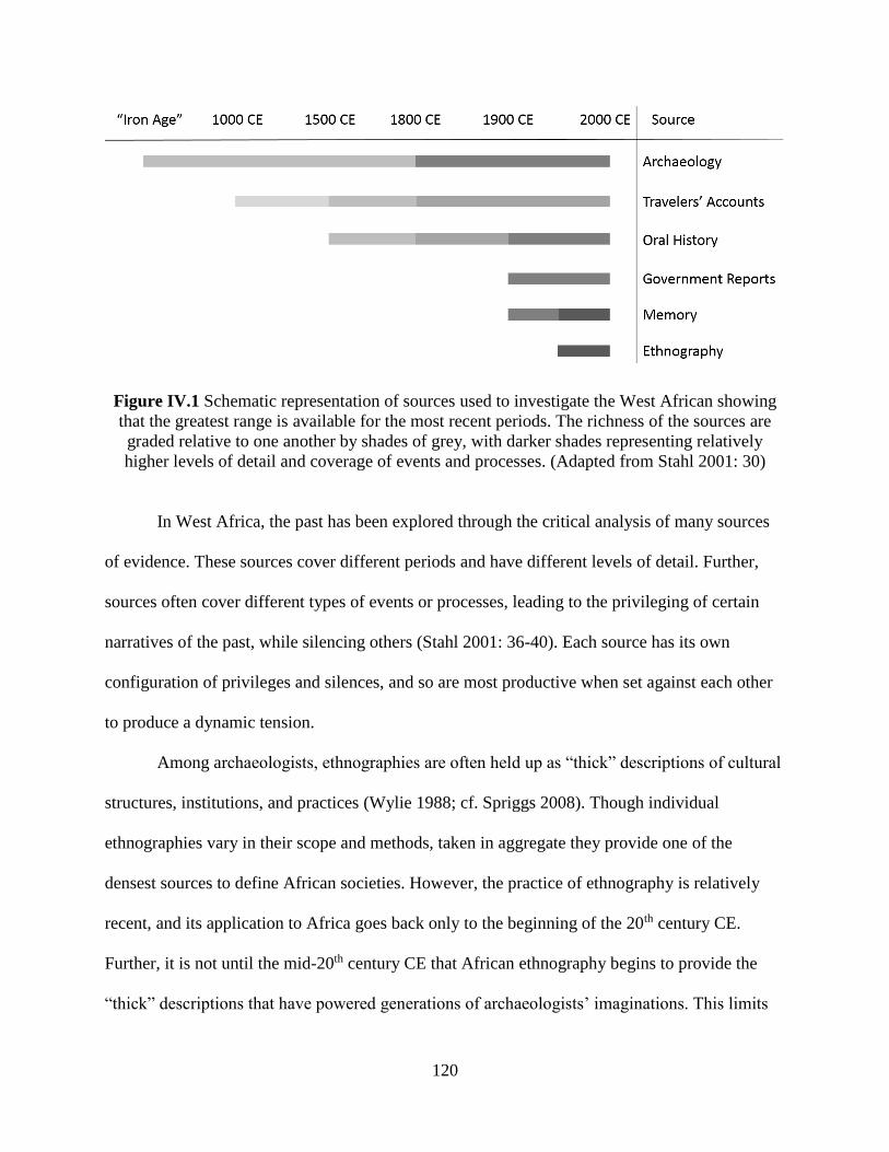
120
Figure IV.1 Schematic representation of sources used to investigate the West African showing
that the greatest range is available for the most recent periods. The richness of the sources are
graded relative to one another by shades of grey, with darker shades representing relatively
higher levels of detail and coverage of events and processes. (Adapted from Stahl 2001: 30)
In West Africa, the past has been explored through the critical analysis of many sources
of evidence. These sources cover different periods and have different levels of detail. Further,
sources often cover different types of events or processes, leading to the privileging of certain
narratives of the past, while silencing others (Stahl 2001: 36-40). Each source has its own
configuration of privileges and silences, and so are most productive when set against each other
to produce a dynamic tension.
Among archaeologists, ethnographies are often held up as “thick” descriptions of cultural
structures, institutions, and practices (Wylie 1988; cf. Spriggs 2008). Though individual
ethnographies vary in their scope and methods, taken in aggregate they provide one of the
densest sources to define African societies. However, the practice of ethnography is relatively
recent, and its application to Africa goes back only to the beginning of the 20th century CE.
Further, it is not until the mid-20th century CE that African ethnography begins to provide the
“thick” descriptions that have powered generations of archaeologists’ imaginations. This limits

121
the applicability of ethnography’s presentist perspective to after midway through the 20th century
CE.
Ethnography has, however, routinely investigated the past and its role in constructing the
present. To this end, ethnographies contain insights derived from their informants’ memories.
Individual memory is, in a sense, the most unfiltered source of the past, being as it is the direct
observations of African people on their past. It is of course circumscribed by each person’s
individual experiences, and edited and transmogrified by their outlook and biases. Further, the
accuracy of memory can be questions on neurological grounds, even when intentional bias is
absent (Koriat et al. 2000). Further, memory only extends to an individual’s life, and so becomes
less and less available as time goes on—back to about the beginning of the 20th century CE.
Government reports are a third source, also produced from the beginning of the 20th
century CE onward. After colonization, colonial administrators that filed reports, wrote
correspondence, and otherwise characterized African societies. The result of these processes
were literal archives of material that intensively documented the intersection of European
colonial interests and African political economies (Stoler 2002; Tough 2009). After
independence, the newly formed African nation-states continued on many of the colonial
bureaucratic practices. Government reports are often directed toward practical concerns of
imperial and national management, but they do provide an abundant, if myopic, information for
African societies. However, most pre-colonial African societies did not keep written records, and
so outside of rare cases in the Sahel, written reports are only available beginning in the 20th
century CE.
Oral history is a particularly valuable source for understanding past African societies.
Oral history is, in a sense, codified memory (Vansina 1985: 147-148). It is the memory of events

122
and processes that have been transformed into a linguistic device, which is then transmitted
through generations. Like other genres of memory, oral history is not a neutral observation, but
inherently conditioned and biased by individuals’ experiences. Further, the codification and
transmission of oral history creates other junctures for the events and processes purported to be
described to be modified. This has led to extreme constructivist paradigm the claims all oral
histories are malleable political charters that bend and shape according to present concerns
(Hobsbawm 1983; Friedman 1992). However, such a view is at odds with “the autonomy of
sociohistorical process” (Trouillot 1995: 6). Not all oral histories can be equally valid, as
narrative abuts other ways of knowing the past, as described here. African peoples are
themselves capable of evaluating the multiple sources of the past, and can discredit those
narratives that are odds with other sources or their lived experiences. In addition, the
transmission of oral history is democratic insofar that the technological requirements for its
transmission require only speech and continuity of transmitting communities. Like memory, oral
history tends to be more reliable for more recent events, where there are simply more
perspectives and less time to accumulate transmission errors. For periods farther back in time,
oral history becomes less and less reliable. Still, even heavily mythologized narratives may
contain valuable information about the African past (Schmidt 2006).
Written histories and accounts of ancient life would seemingly solve the problem of
transmission in oral history. Unfortunately, there is no indigenous tradition of writing in West
Africa. Writing was first introduced around 1000 CE as Arabic script connected to the spread of
Islam. Writing spread overland from North Africa where it was adopted by elites in the the urban
centers of the Sahel. The earliest writings are tomb and stellae inscriptions, providing only a
limited perspective on West Africa. By 1500 CE, many of the Sahelian states had literate elites

123
who produced histories, transcribed oral traditions, and other records (Wilks et al. 1986; Saul
2006). At the same time, Europeans began exploring the Atlantic coast and writing their
observations of the peoples they encountered. Their writings tend to focus on their interests in
trade, politics, and geography, and so rarely provide a multifaceted perspective on African
societies. Further, European accounts are limited to coastal areas, as early Europeans rarely left
their ships let alone penetrate inland. More intensive exploration began in the 19th century CE,
along with a greater missionary presence. This led to an increase in both the quantity and
comprehensiveness of European writing on African societies (Posnansky & DeCorse 1986;
Thornton 1998).
In the Savè hills area, there is a notable lack of written sources. Neither Arabic nor
European chroniclers wrote about the area, either from personal and second-hand experience of
the landscape and its inhabitants. The first primary reference to the area comes from 1894 when
the French military visited the area to ally with Shabe leaders against the Dahomeans. Soon after,
Shabe-Idadu was made a regional administrative center in the newly formed French colony. In
the early 20th century CE, the French built a railway through the Savè hills on the way to
connecting Parakou with the Atlantic coast. These events led to an increased archival footprint of
the Savè hills area beginning with French colonization. Early ethnographic research was
conducted by Thomas Mouléro, a Catholic priest from the nearby Ketu kingdom. Mouléro
(1964) recorded elements of the political history and religious practices. His focus was taken up
by Montserrat Palau Martí, who conducted years of ethnographic research in Shabe-Idadu and
nearby villages. Her three volume ethnography (1992a, 1992b, 1993) added an exhaustive
examination of kinship practices and lineage histories to records of political histories and
religious practices. Included in her ethnographic research are transcripts of oral histories from

124
several lineages in the area. Biodun Adediran (1994) also worked with oral histories to create his
ethnohistory of the Shabe, Ketu, and Dassa kingdoms. Thus, within the Savè hills area, oral
history provides the best recorded and most important source for the Shabe past. I outlined this
history in Chapter III. I now return to it to discuss its relevance in framing archaeological
research, as well potential limitations.
2. Oral Histories
Oral histories are the only textual source that directly comments on the structure of the
nascent Shabe kingdom and what life was like for the early occupants of the Savè hills area. This
make them an invaluable supplement to archaeological research, where the events and processes
described therein can be compared with the material remains of ancient life. However, as has
been vigorously highlighted by the constructivist movement since the 1970s, such oral histories
may be fraught with revisions, omissions, and additions that might not necessarily reflect a lived
past (Vansina 1985; Robertshaw 2000; Stahl 2001; Schmidt & Walz 2007). Fortunately, much of
the previous scholarly research on Shabe and the Savè hills area has actively addressed these
problems. Palau Martí and Adediran use oral histories from multiple lineages and office to show
areas of agreement of dissent. Both also make occasional use of toponymy as a means of tying
events to specific sites on the landscape. In addition, Palau Martí makes extensive use of praise
poetry. Barber (1991) suggests that Yoruba praise poetry is constructed and transmitted
formulaically, and therefore more durable through time. Such praise poetry can point to the
positive presence of personas, events, and more quotidian concerns like economic activities in
the past.

125
Throughout the course of my research, I was able to work with my colleague Simon
Agani, a graduate student in the Department of History and Archaeology at the University of
Abomey-Calavi, to record contemporary oral histories. These histories came from some of the
same titled officials and lineage heads that earlier scholars interviewed; we also recorded oral
histories of untitled hunters, agriculturalists, and religious practitioners that provided unique
perspectives on the past—“micro-histories” that could details parts of the landscape unmentioned
in more official accounts.
Whether verbal and active or transcribed and codified, oral histories are an important
supplement to my archaeological research. However, I use them as a framing device to conduct
archaeological research, rather than an interpretive overlay with which to explain site patterning,
material culture, or other archaeological remains. The oral historical frame is most productive in
the Savè hills area, with its lack or prior archaeological research, as a way to seriate
archaeological sites of unknown absolute age—that is to say, all of them. Seriation can be
performed by linking the occupation of sites to important events recorded in oral histories. The
events chosen are those that have had a major impact on the continuity of Shabe political
economic institutions.
Oral histories claim long-term continuity for many lineages in the Savè hills area, some
even predating the foundation of the Shabe kingdom. This claim for genealogical connection
between present-day Save hills communities and ancient ones underwrites the use of the direct-
historical approach and appeals to specific analogy. The continuity of the monarchy is another
recurring theme in Shabe oral histories. Until the European colonial period, the monarchy was
the highest order of political authority with defined economic privileges and religious duties,
regardless of the specific person bearing the title of Oba.
126
Although not explicitly mentioned in oral histories, place names, or praise poems, many
Savè hills residents assume a continuity between the structure and organization of lineages and
political institutions and present-day economic pursuits. Lineage taboos that prohibit the hunting
and consumption of specific animals often have origin stories that take place in an undefined
past, and are assumed to have been prescribed and followed ever since. Similarly, economic
specialization in potting, brewing, pastoralism, or agriculture in the present-day is thought of as
extending into the past, so that, for example, ancient pottery is regarded as having been probably
manufactured by the ancestors of current potters.
Oral histories stress the long-term continuity of social structures and economic practices,
in a sense normalizing the current and recent political economic relationships of the area. Shabe
oral histories do, however, admit many instances of discontinuity, or change. Outside of the
autochthonous and core Shabe lineages, other lineages are regarded as recent arrivals unrelated
to the internal dynamics of the Shabe kingdom. Similarly, political and religious institutions that
complemented and, at times, competed with the monarchy were introduced at various times into
the Savè hills. In addition, some economic activities that are common place today are
acknowledged as recent adoptions, such as palm oil production.
3. Archaeological Research
In order to investigate the political-economic development in the Shabe past, I conducted
archaeological research in the Savè hills in 2012 and 2013. This research included three
complementary components of fieldwork to collect archaeological data at multiple scales. A
multiscalar approach was employed to address the complexity of interaction between political
centralization and economic systems, as these interactions play out at multiple spatial, temporal,
127
and social scales. Two survey components investigated sites in a context of regional interaction,
while an excavation component targeted individual features of sites.
Since there has been little prior research in the Savè hills, I incorporated a direct-
historical approach into a traditional landscape survey study. Landscape surveys are necessary in
areas where archaeological materials are not yet well described. In addition, recent
archaeological research in other parts of West Africa has emphasized the effect of political
economic organization on landscape (Norman & Kelly 2004; Stahl 2004; McIntosh 2005;
Monroe & Ogundiran 2012; Usman 2012; Monroe 2014). By investigating the continuity and
change of site patterning through time, and sites’ associated material culture, this study reveals
the processes of political centralization in the Shabe kingdom.
Reconnaissance survey was the first survey component conducted for this research. The
survey relied on knowledge of archaeological sites by present-day Savè hills residents to locate
sites. By engaging local communities, I was able to simultaneously collect oral histories
connected to specific sites. In addition, the expedience of reconnaissance survey allowed me to
engage all present-day Shabe settlements in the study zone that are recognized by the monarchy,
as well as several additional settlements not officially counted as part of the Shabe kingdom.
Reconnaissance survey relies on current knowledge about archaeological sites, and so
may have potential biases in the kinds of sites represented—such as over-representing large
and/or recent sites important to contemporary social groups. A second survey method, transect
survey, was also employed with the advantage of documenting sites based purely on location and
preservation, rather than community knowledge. Transect survey provides a useful “correction”
to the reconnaissance survey by systematically documenting sites that may have otherwise been
missed. Excavations were conducted at sites discovered through survey with the goal of

128
obtaining datable material and artifacts that could shed light on political economic organization.
To this end, two excavation strategies were employed: stratigraphic profiles to anchor the
relative dates of settlements described in oral histories to absolute calendar dates; and feature
explorations to investigate the nature of Shabe settlements. Each fieldwork component is
described more thoroughly below. I first return to Shabe oral history and its role in framing my
initial investigation of the settlement history of the area and subsequent reconnaissance survey.
Oral histories proved crucial to my use of the direct-historical approach in Shabe, as they
record crucial events linked to periods of political instability that punctuated the long-term
continuity of the monarchy. These events are ideal for seriating archaeological sites, as the local
histories of individual sites often reckon their occupation as occurring before, after, or during
such periods. Since the relative order of such political events is known from oral history, this
allows for sites of unknown age to be grouped together. Further, putting events and
archaeological remains together can produce more dynamic interpretations of the past (Beck et
al. 2007). Choosing appropriate events relies on several criteria. The first is that the event should
be of enough impact so that social groups of all scales and types would be impacted by it, or at
least aware of it. The event must be important enough that the local histories of individual sites
are known in relation to the event. The second is that events should be chosen so as to have as
narrow a time span as possible. This, however, is constrained by the first criterion, in that if the
time span between events is too narrow it may not be possible to relate local histories to the
events. The third criterion is that the events chosen should be structurally similar. Since the focus
of the present research is on political economy, events should be chosen that had an impact on
the organization of power and authority in the Savè hills. The fourth and final criterion is that
each event should be linked to a landscape feature or archaeological site. This has the advantage
129
of linking periods directly to a site, potentially allowing for it to act as a type site to compare
against others.
Based on these criteria, I have chosen four events from oral history that were
consequential enough to have affected communities throughout the Savè hills, limited to a few
generations in length, and are all relevant to the political economic organization of the kingdom.
These events are the foundation of Atenro, the foundation of Shabe-Idadu, the collapse of Oyo
and subsequent wars with Dahomey, and the colonial annexation by the French. Each event
marks the beginning of a temporal period, which I designate as Early Shabe, Middle Shabe, Late
Shabe, and European Colonial, based on the dominant political organization of the period. In
addition, I recognize a pre-Shabe period for sites already abandoned at the time of Atenro’s
foundation.
As discussed in Chapter III, the origins of the Shabe kingdom (and many of the
contemporary lineage groups) are linked to a migration from Nikki sometime after the sacking of
Oyo by the Nupe around 1535 CE. These migrants traveled southward before settling at a village
that would later be called Atenro. Palau Martí, Adediran, and the present-day Onishabe and Ola-
Amùsù link the founding of Atenro to the foundation of the monarchy. Prior to this, there was no
formal hierarchical political structure among the migrants, nor among the autochthonous
communities the migrants encountered. The political structure of the monarchy during this
period is unclear, though the Ola-Amùsù claims that his lineage comprised the first kings of
Shabe. Palau Martí and Adediran support his claim, and even the Onishabe agrees that there
were kings prior to his lineage assuming the title of Oba. Adediran (1994: 93) gives a range of
1600-1700 CE for the occupation of Atenro, based on hypothesized regency lengths and their
relation to other events in West Africa. Thus, the Early Shabe period includes sites used and

130
occupied concurrently with the site of Atenro. In addition, I include sites that were already
occupied when Atenro was founded and continued to be. Sites that were already abandoned prior
to Atenro’s foundation comprise the pre-Shabe period.
The Middle Shabe period is linked to the founding of Shabe-Idadu. Oral histories state
that Atenro was abandoned following leadership disputes between the ruling Onishabe, then of
the Amushu lineage, and other lineage heads. The Onishabe and his followers left to settle at
Shabe-Idadu near the Oke Shabe hills, while the other lineages left to found Kaboua near Oke
Agbodo. Sometime after the founding of Shabe-Idadu, the lineages at Kaboua, united under the
warrior-king Baba Guidaï, invaded Shabe-Idadu and drove the Amushu from power. They then
installed themselves as Onishabe. It is from this lineage that the current Onishabe claims descent.
Thus, the Middle Shabe period begins after about 1700 CE, and is associated with the transition
between the first Amushu dynasty and the second Baba Guidaï dynasty.
The collapse of the Oyo Empire in the early 19th century CE precipitated a series of
violent conflicts in the Savè hills area. Palau Martí (1992a: 150-153) cross-references this
mention in Shabe oral histories with Dahomean accounts to deduce that Dahomey was the main
antagonist in the conflict, occurring between 1821 and 1832. Adediran (1994: 177) notes that
with Dahomey was only the first in a series of conflicts throughout the rest of the 19th century
CE. Coinciding with these wars, oral histories record an interregnum period where a successor
Onishabe could not be named, possibly due to a lack of confirmation from Oyo. Importantly, the
fortified hilltop refuge of Fiditi is occupied during this period. Late Shabe period begins with the
Dahomean incursions into the Savè hills around 1830 CE and is marked by widespread site
abandonment and political instability in the area.

131
A period of relative peace preceded French colonization, though Dahomey successfully
forced the Shabe monarchy to pay tribute. When the French invaded Dahomey, Shabe sided with
the French and signed a treaty effectively inducting them into the new colony. French
colonization, however, entailed the loss of autonomy of the Shabe monarchy and the
incorporation of Shabe into a much larger political structure. The dates of European colonization
are more securely known, spanning 1894 CE to 1960 CE.
B. Reconnaissance Survey
1. Study Zone
The Shabe kingdom is centered at Shabe-Idadu (Savè), but its territory extends far to the
north and south, incorporating villages throughout the region (Figure IV.2). Though the Shabe
monarchy claims some kind of authority over the encompassing territory, it is unclear how
effective this claim is. In addition, many villages in Shabe “territory” are neither claimed by
Shabe nor play a role in the political system. The autonomous Ouèssè polity is located entirely
within Shabe territory, though its land was officially ceded to it by the Shabe monarchy. This
suggests that the Shabe kingdom exerted influence through a network of affiliation, rather than
by enforcing strict territorial boundaries. This is particularly true for the north and south, where
Shabe villages grade into Borgu in the north and Ketu in the south. However, the present-day
villages of Gini and Iwoye reflect the northernmost and southernmost Shabe villages,
respectively. The eastern and western boundaries of Shabe are more fixed, as they are drawn as
rivers that run longitudinally. The eastern boundary is fixed to the Oyan River in the south and to

132
the Okpara River north of Kokoro. The western boundary is fixed to the Ouémé River. In all, this
maximum extent of the Shabe kingdom is about 7,500 km².
Figure IV.2 The approximate maximum extent of the Shabe kingdom is shaded grey and shown
in relation to major population and political economic centers in West Africa ca. 1500-1900 CE.
It was necessary to limit the area under investigation by my archaeological research given
the large size of the Shabe kingdom. It was simply not feasible with time and budgetary
constraints to include the entire extent of the kingdom, nor was it logistically possible to include
the parts of the Shabe kingdom in present-day Nigeria. To limit my investigation to a
manageable area while still addressing the core question of how Shabe political economic
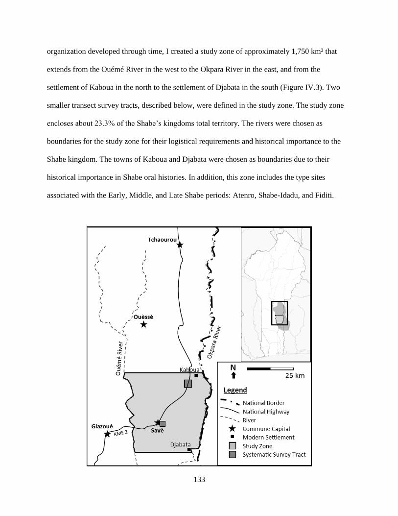
133
organization developed through time, I created a study zone of approximately 1,750 km² that
extends from the Ouémé River in the west to the Okpara River in the east, and from the
settlement of Kaboua in the north to the settlement of Djabata in the south (Figure IV.3). Two
smaller transect survey tracts, described below, were defined in the study zone. The study zone
encloses about 23.3% of the Shabe’s kingdoms total territory. The rivers were chosen as
boundaries for the study zone for their logistical requirements and historical importance to the
Shabe kingdom. The towns of Kaboua and Djabata were chosen as boundaries due to their
historical importance in Shabe oral histories. In addition, this zone includes the type sites
associated with the Early, Middle, and Late Shabe periods: Atenro, Shabe-Idadu, and Fiditi.
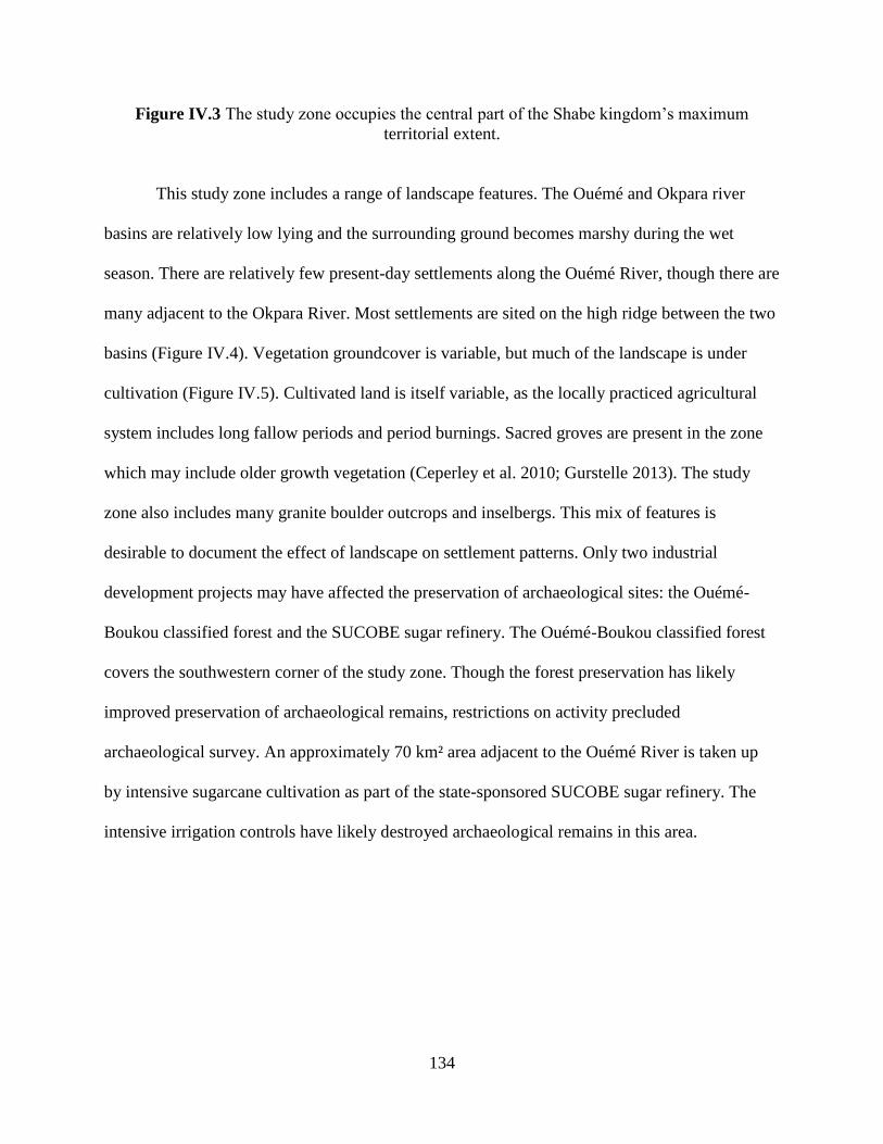
134
Figure IV.3 The study zone occupies the central part of the Shabe kingdom’s maximum
territorial extent.
This study zone includes a range of landscape features. The Ouémé and Okpara river
basins are relatively low lying and the surrounding ground becomes marshy during the wet
season. There are relatively few present-day settlements along the Ouémé River, though there are
many adjacent to the Okpara River. Most settlements are sited on the high ridge between the two
basins (Figure IV.4). Vegetation groundcover is variable, but much of the landscape is under
cultivation (Figure IV.5). Cultivated land is itself variable, as the locally practiced agricultural
system includes long fallow periods and period burnings. Sacred groves are present in the zone
which may include older growth vegetation (Ceperley et al. 2010; Gurstelle 2013). The study
zone also includes many granite boulder outcrops and inselbergs. This mix of features is
desirable to document the effect of landscape on settlement patterns. Only two industrial
development projects may have affected the preservation of archaeological sites: the Ouémé-
Boukou classified forest and the SUCOBE sugar refinery. The Ouémé-Boukou classified forest
covers the southwestern corner of the study zone. Though the forest preservation has likely
improved preservation of archaeological remains, restrictions on activity precluded
archaeological survey. An approximately 70 km² area adjacent to the Ouémé River is taken up
by intensive sugarcane cultivation as part of the state-sponsored SUCOBE sugar refinery. The
intensive irrigation controls have likely destroyed archaeological remains in this area.
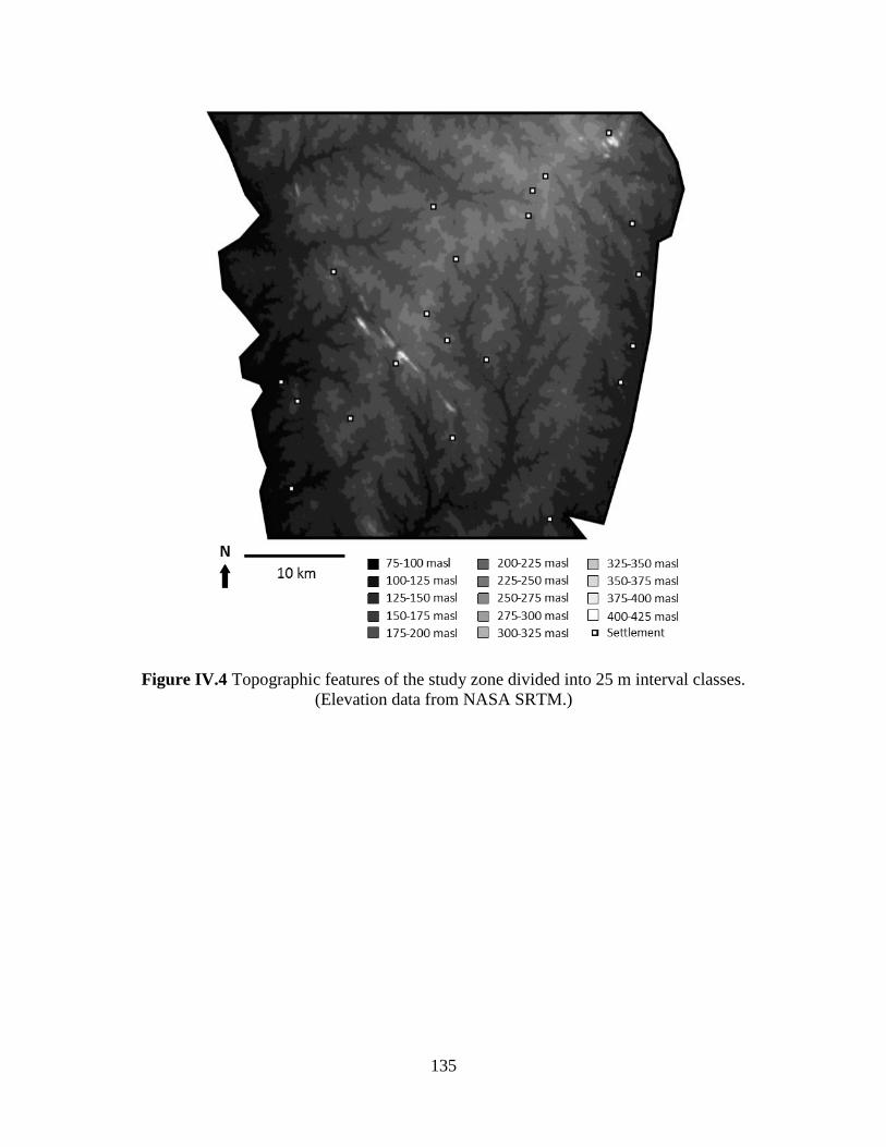
135
Figure IV.4 Topographic features of the study zone divided into 25 m interval classes.
(Elevation data from NASA SRTM.)
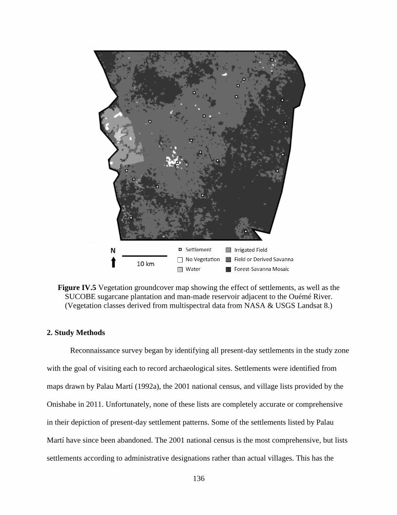
136
Figure IV.5 Vegetation groundcover map showing the effect of settlements, as well as the
SUCOBE sugarcane plantation and man-made reservoir adjacent to the Ouémé River.
(Vegetation classes derived from multispectral data from NASA & USGS Landsat 8.)
2. Study Methods
Reconnaissance survey began by identifying all present-day settlements in the study zone
with the goal of visiting each to record archaeological sites. Settlements were identified from
maps drawn by Palau Martí (1992a), the 2001 national census, and village lists provided by the
Onishabe in 2011. Unfortunately, none of these lists are completely accurate or comprehensive
in their depiction of present-day settlement patterns. Some of the settlements listed by Palau
Martí have since been abandoned. The 2001 national census is the most comprehensive, but lists
settlements according to administrative designations rather than actual villages. This has the

137
effect of often splitting what is in effect a single village into multiple smaller units that do not
reflect historical Shabe settlement patterns. Though reflecting Shabe history, the settlement lists
given by the Onishabe are too narrow in that they include only major villages and ignore smaller,
more recently established settlements. A problem common to all three lists is the omission of
semi-permanent pastoralist camps and recently established pioneering farmsteads not officially
sanctioned by either the Onishabe or Béninese government (see Dangbengon 2005). In the end, a
settlement list was made based off the 2001 national census, but with subdivided villages
recombined according to their designation in the Onishabe’s settlement lists. In total, 21
settlements were visited (Figure IV.6). These included several small villages (Tchintchin, Dèguè-
dèguè, and Atta) that were not on either list, and visited opportunistically.
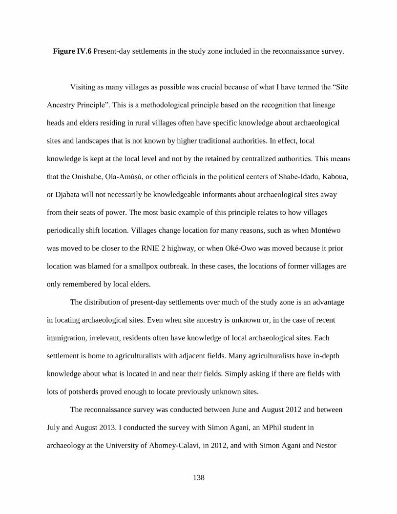
138
Figure IV.6 Present-day settlements in the study zone included in the reconnaissance survey.
Visiting as many villages as possible was crucial because of what I have termed the “Site
Ancestry Principle”. This is a methodological principle based on the recognition that lineage
heads and elders residing in rural villages often have specific knowledge about archaeological
sites and landscapes that is not known by higher traditional authorities. In effect, local
knowledge is kept at the local level and not by the retained by centralized authorities. This means
that the Onishabe, Ola-Amùsù, or other officials in the political centers of Shabe-Idadu, Kaboua,
or Djabata will not necessarily be knowledgeable informants about archaeological sites away
from their seats of power. The most basic example of this principle relates to how villages
periodically shift location. Villages change location for many reasons, such as when Montéwo
was moved to be closer to the RNIE 2 highway, or when Oké-Owo was moved because it prior
location was blamed for a smallpox outbreak. In these cases, the locations of former villages are
only remembered by local elders.
The distribution of present-day settlements over much of the study zone is an advantage
in locating archaeological sites. Even when site ancestry is unknown or, in the case of recent
immigration, irrelevant, residents often have knowledge of local archaeological sites. Each
settlement is home to agriculturalists with adjacent fields. Many agriculturalists have in-depth
knowledge about what is located in and near their fields. Simply asking if there are fields with
lots of potsherds proved enough to locate previously unknown sites.
The reconnaissance survey was conducted between June and August 2012 and between
July and August 2013. I conducted the survey with Simon Agani, an MPhil student in
archaeology at the University of Abomey-Calavi, in 2012, and with Simon Agani and Nestor
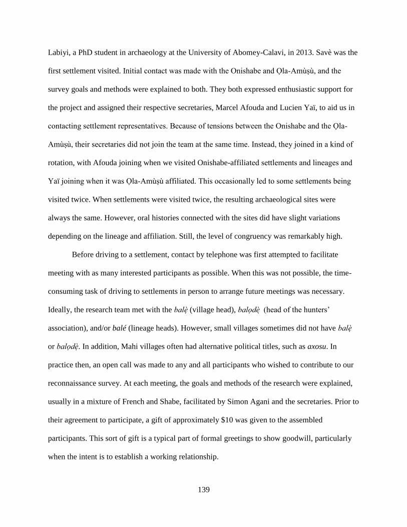
139
Labiyi, a PhD student in archaeology at the University of Abomey-Calavi, in 2013. Savè was the
first settlement visited. Initial contact was made with the Onishabe and Ola-Amùsù, and the
survey goals and methods were explained to both. They both expressed enthusiastic support for
the project and assigned their respective secretaries, Marcel Afouda and Lucien Yaï, to aid us in
contacting settlement representatives. Because of tensions between the Onishabe and the Ola-
Amùsù, their secretaries did not join the team at the same time. Instead, they joined in a kind of
rotation, with Afouda joining when we visited Onishabe-affiliated settlements and lineages and
Yaï joining when it was Ola-Amùsù affiliated. This occasionally led to some settlements being
visited twice. When settlements were visited twice, the resulting archaeological sites were
always the same. However, oral histories connected with the sites did have slight variations
depending on the lineage and affiliation. Still, the level of congruency was remarkably high.
Before driving to a settlement, contact by telephone was first attempted to facilitate
meeting with as many interested participants as possible. When this was not possible, the time-
consuming task of driving to settlements in person to arrange future meetings was necessary.
Ideally, the research team met with the balè (village head), balodè (head of the hunters’
association), and/or balé (lineage heads). However, small villages sometimes did not have balè
or balodè. In addition, Mahi villages often had alternative political titles, such as axosu. In
practice then, an open call was made to any and all participants who wished to contribute to our
reconnaissance survey. At each meeting, the goals and methods of the research were explained,
usually in a mixture of French and Shabe, facilitated by Simon Agani and the secretaries. Prior to
their agreement to participate, a gift of approximately $10 was given to the assembled
participants. This sort of gift is a typical part of formal greetings to show goodwill, particularly
when the intent is to establish a working relationship.
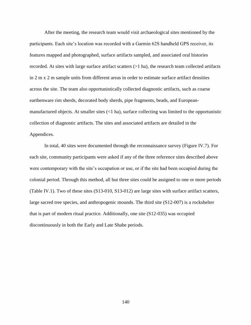
140
After the meeting, the research team would visit archaeological sites mentioned by the
participants. Each site’s location was recorded with a Garmin 62S handheld GPS receiver, its
features mapped and photographed, surface artifacts sampled, and associated oral histories
recorded. At sites with large surface artifact scatters (>1 ha), the research team collected artifacts
in 2 m x 2 m sample units from different areas in order to estimate surface artifact densities
across the site. The team also opportunistically collected diagnostic artifacts, such as coarse
earthenware rim sherds, decorated body sherds, pipe fragments, beads, and European-
manufactured objects. At smaller sites (<1 ha), surface collecting was limited to the opportunistic
collection of diagnostic artifacts. The sites and associated artifacts are detailed in the
Appendices.
In total, 40 sites were documented through the reconnaissance survey (Figure IV.7). For
each site, community participants were asked if any of the three reference sites described above
were contemporary with the site’s occupation or use, or if the site had been occupied during the
colonial period. Through this method, all but three sites could be assigned to one or more periods
(Table IV.1). Two of these sites (S13-010, S13-012) are large sites with surface artifact scatters,
large sacred tree species, and anthropogenic mounds. The third site (S12-007) is a rockshelter
that is part of modern ritual practice. Additionally, one site (S12-035) was occupied
discontinuously in both the Early and Late Shabe periods.
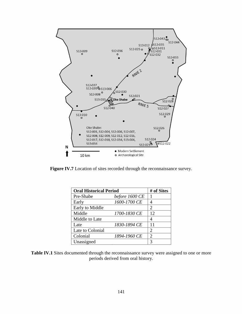
141
Figure IV.7 Location of sites recorded through the reconnaissance survey.
Oral Historical Period # of Sites
Pre-Shabe before 1600 CE 1
Early 1600-1700 CE 4
Early to Middle 2
Middle 1700-1830 CE 12
Middle to Late 4
Late 1830-1894 CE 11
Late to Colonial 2
Colonial 1894-1960 CE 2
Unassigned 3
Table IV.1 Sites documented through the reconnaissance survey were assigned to one or more
periods derived from oral history.
142
The ease with which archaeological sites were assigned to oral historical periods
represents the degree of knowledge held by local participants. Further, it suggests the continuity
between present-day populations and the archaeological communities under investigation.
However, it is also probably the case that archaeological sites without associated oral histories
are simply not remembered by officials, elders, or other local participants. Indeed, the two
unassigned archaeological sites we documented were shown to us by agriculturalists whose land
the sites were on, and not by political leaders or lineage heads. This is the main flaw with the
reconnaissance approach, as it privileges continuity at the expense of change. There are, in
addition, several other more subtle problems that we encountered during the reconnaissance
survey. These problems arise from tension in the present-day social dynamics of the Savè hills
area.
3. Problems of Participation
We made great efforts while conducting the reconnaissance survey to explain our goals
and methods to community residents. We were also sensitive to the desires of communities to
keep sensitive information private. There are often tensions surrounding settlement history, land
rights, and ritual practices that are connected to archaeological sites. We made it clear that if
communities felt their participation would have an ill-effect, we respected their decision to not
participate in the research. At least some participants from most of the settlements surveyed
chose to participate. However, while this participation generally included guided tours of
archaeological sites, sometimes oral histories were not given. The reason for this was often that
the present-day settlements near archaeological sites did not have resident representatives of the
lineages to which the sites were ancestral. In these cases, alternative oral histories from local

143
communities were silenced in favor of authoritative versions, typically given by the either the
Onishabe or Ola-Amùsù. Of the 21 settlements surveyed, residents from two chose not to
participate: Ouoghi and Sandéhou. The reasons for non-participation at Ouoghi and Sandéhou
were specific to each settlement.
Our first visit to Ouoghi was in 2012 with the Onishabe’s secretary, Marcel Afouda. The
balè of Ouoghi was at first supportive of the research, but over the course of recording his
account of Ouoghi’s foundation, he decided to withdraw his support unless we paid him a
substantial fee. The research team decided to not pay the fee, as it might set a precedent that
would not be sustainable. We visited Ouoghi again in 2013, but again the balè and several
lineage heads did not wish to participate. We did learn, however, the part of the reluctance
stemmed from a political dispute and accusation of witchcraft within Ouoghi, and that our
investigations of archaeological sites may have been perceived as having a negative impact on
that.
We visited Sandéhou twice in 2012. During our first visit, the lineage heads decided they
required more time to discuss their participation in the research among themselves. When we
returned, we were told that there was one archaeological site nearby, but it was a sacred site and
not open to outsiders. The research team was deemed outsiders not only because I, the principal
investigator, am an American, but also probably because the research was viewed as being a
Shabe project. As the residents of Sandéhou are primarily Mahi, and not Shabe, the presence of
the Onishabe’s secretary likely signaled—erroneously—that our research was intended to
promote solely a Shabe identity. This is unfortunate, as Sandéhou’s participation could have
contributed a non-Shabe perspective to the Savè hills past and countered that very presupposition
of Shabe ethnic dominance.

144
The non-participation of Sandéhou is a visible symptom of a more insidious problem not
as easy to observe. Since our meetings were conducted in the presence of representatives of the
two most powerful Shabe political figures, there may have been a level of tacit coercion. While
this may have led to communities participating when they might have rather not, and thus
positively affected our coverage of the study zone, it equally could have led to certain
archaeological sites that did not fit official narratives of the past from being mentioned. There is
the very real possibility that at the moment of our meeting, alternative pasts were being silenced
by selectively “forgetting” about archaeological sites. There is, of course, no concrete evidence
that this happened. However, a site that suggests this did happen at least once is one of the
unassigned sites. This site, S13-012, was identified by an agriculturalist in the nearby village of
Alafia in 2013. It was not described by the balè of Alafia when we visited with the Onishabe’s
secretary in 2012. However, when I returned to the balè in 2013 and asked about the site, he
positively identified it by the toponym Oké Awè, or “Hill of the Shack,” referring to an old
farmstead that used to stand there. Though acknowledging it as an ancient site, he could not
relate it to any specific oral historical period. It is possible that the Oké Awè was occupied by
different lineages than those at Alafia currently, and therefore recognition of the site may have
threatened present-day claims to territory by Alafia’s lineages or Shabe more generally.
Though an expedient method for documenting archaeological sites in terra incognita, the
issues described above pose a serious problem to adequately representing settlement patterning
in the Savè hills. Reconnaissance survey relied on current knowledge about archaeological sites,
and so may have potential biases in the kinds of sites represented–such as over-representing large
and/or recent sites important to contemporary social groups. A second survey component
comprised of transect survey, described below, has the advantage of documenting sites based
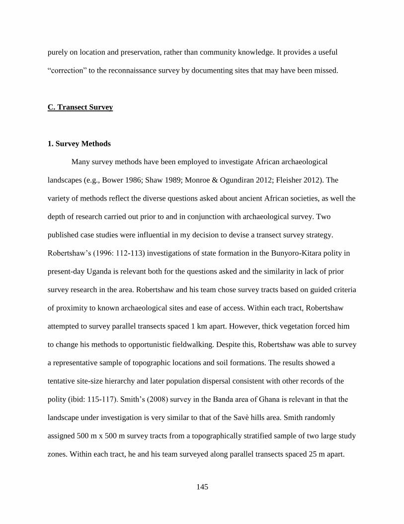
145
purely on location and preservation, rather than community knowledge. It provides a useful
“correction” to the reconnaissance survey by documenting sites that may have been missed.
C. Transect Survey
1. Survey Methods
Many survey methods have been employed to investigate African archaeological
landscapes (e.g., Bower 1986; Shaw 1989; Monroe & Ogundiran 2012; Fleisher 2012). The
variety of methods reflect the diverse questions asked about ancient African societies, as well the
depth of research carried out prior to and in conjunction with archaeological survey. Two
published case studies were influential in my decision to devise a transect survey strategy.
Robertshaw’s (1996: 112-113) investigations of state formation in the Bunyoro-Kitara polity in
present-day Uganda is relevant both for the questions asked and the similarity in lack of prior
survey research in the area. Robertshaw and his team chose survey tracts based on guided criteria
of proximity to known archaeological sites and ease of access. Within each tract, Robertshaw
attempted to survey parallel transects spaced 1 km apart. However, thick vegetation forced him
to change his methods to opportunistic fieldwalking. Despite this, Robertshaw was able to survey
a representative sample of topographic locations and soil formations. The results showed a
tentative site-size hierarchy and later population dispersal consistent with other records of the
polity (ibid: 115-117). Smith’s (2008) survey in the Banda area of Ghana is relevant in that the
landscape under investigation is very similar to that of the Savè hills area. Smith randomly
assigned 500 m x 500 m survey tracts from a topographically stratified sample of two large study
zones. Within each tract, he and his team surveyed along parallel transects spaced 25 m apart.

146
Though Smith’s methods provided excellent coverage within each tract, his choice of randomly
choosing survey tracts resulted in considerable logistical difficulties.
While formulating the transect survey component, my options were between a guided or
random sampling of the landscape, and between extensive or intensive coverage. Robertshaw’s
study employed a guided sample with extensive coverage, while Smith’s study employed a
random sample with intensive coverage. As my research questions on Shabe political economic
centralization are much closer to Robertshaw’s, as are the terra incognita conditions, I chose to
emulate his guided sample centered on known archaeological sites. However, the wetter, more
forested conditions he encountered are not the prevailing conditions in the Savè hills area,
therefore within the survey tracts I emulated the more closely spaced transects employed by
Smith.
Two tracts were selected for transect survey: a 3 km x 3 km tract surrounding Atenro, and
a 2 km x 2 km tract surrounding Fiditi and adjacent to Shabe-Idadu (Savè). These tracts were
chosen due to their proximity to the type sites for the oral historical periods used to create the
relative settlement chronology. Prior to the start of the survey, multi-spectrum satellite imagery
of the Atenro tract was obtained to identify potential features and differences in groundcover that
might affect survey results. Though tall grass made survey cumbersome in some parts of the
tract, archaeological features were identified in all types of groundcover. Within each tract the
research team, comprised of me and three to four local research assistants, walked parallel north-
south transects spaced 10 m apart and recorded sites, features, and surface artifacts as described
for the reconnaissance survey above. Ten meters was selected as transect spacing to provide
intensive coverage in an environment where tall grass could obstruct views of the ground.
Transect walking was not possible in the parts of the Fiditi tract where steep hills made access
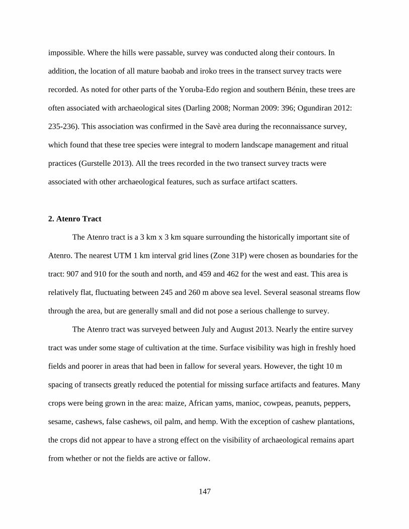
147
impossible. Where the hills were passable, survey was conducted along their contours. In
addition, the location of all mature baobab and iroko trees in the transect survey tracts were
recorded. As noted for other parts of the Yoruba-Edo region and southern Bénin, these trees are
often associated with archaeological sites (Darling 2008; Norman 2009: 396; Ogundiran 2012:
235-236). This association was confirmed in the Savè area during the reconnaissance survey,
which found that these tree species were integral to modern landscape management and ritual
practices (Gurstelle 2013). All the trees recorded in the two transect survey tracts were
associated with other archaeological features, such as surface artifact scatters.
2. Atenro Tract
The Atenro tract is a 3 km x 3 km square surrounding the historically important site of
Atenro. The nearest UTM 1 km interval grid lines (Zone 31P) were chosen as boundaries for the
tract: 907 and 910 for the south and north, and 459 and 462 for the west and east. This area is
relatively flat, fluctuating between 245 and 260 m above sea level. Several seasonal streams flow
through the area, but are generally small and did not pose a serious challenge to survey.
The Atenro tract was surveyed between July and August 2013. Nearly the entire survey
tract was under some stage of cultivation at the time. Surface visibility was high in freshly hoed
fields and poorer in areas that had been in fallow for several years. However, the tight 10 m
spacing of transects greatly reduced the potential for missing surface artifacts and features. Many
crops were being grown in the area: maize, African yams, manioc, cowpeas, peanuts, peppers,
sesame, cashews, false cashews, oil palm, and hemp. With the exception of cashew plantations,
the crops did not appear to have a strong effect on the visibility of archaeological remains apart
from whether or not the fields are active or fallow.

148
Though Atenro is well remembered, few contemporary sites are recalled by Savè hills
residents. Survey was conducted in the tract to understand Atenro’s relationship to other sites on
the landscape. In particular, I wished to understand if and how smaller sites clustered around
Atenro, and if this was different from pre-Shabe patterning. The area around Atenro was
particularly attractive for this as it not only included the type site Atenro, but also the site Igbo
Ilaka—claimed in oral history to pre-date the foundation of Atenro.
Three sites in the survey tract—Atenro (S12-035), Igbo Ilaka (S13-011), and Oké Awè
(S13-012)—were already recorded during the reconnaissance survey. Twenty additional sites
were recorded during the transect survey (Figure IV.8). Of these, one (S13-016) was later
identified as a recently abandoned Fulani pastoralist camp (around 2000 CE). All of the sites
documented through transect survey were identified by the presence of surface artifacts. One site
also had a single baobab tree. The Fulani camp featured a large borrow pit. Other than these, no
other surface features were identified.
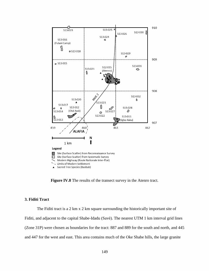
149
Figure IV.8 The results of the transect survey in the Atenro tract.
3. Fiditi Tract
The Fiditi tract is a 2 km x 2 km square surrounding the historically important site of
Fiditi, and adjacent to the capital Shabe-Idadu (Savè). The nearest UTM 1 km interval grid lines
(Zone 31P) were chosen as boundaries for the tract: 887 and 889 for the south and north, and 445
and 447 for the west and east. This area contains much of the Oke Shabe hills, the large granite

150
inselberg that rises abruptly from the surrounding plain. The area surrounding Oke Shabe is
relatively flat, fluctuating between 185 and 200 m above sea level. The Oke Shabe hill itself has
four distinct peaks—Afidifa, Ina-Shabe, Akaafo, and Olupopo. Ina-Shabe, the highest, rises to a
height of 431 m above sea level (Adam et al. 1996: 9). The Ayin River passes to the west of the
survey tract, and several seasonal streams that feed it flow through the tract, but are generally
small and did not pose a serious challenge to survey.
The Fiditi tract was surveyed in July 2012 and August 2013. Except for the granite
hilltop, nearly the entire survey tract was under some stage of cultivation at these times. As in the
Atenro tract, surface visibility was high in freshly hoed fields and poorer in areas that had been
in fallow for several years. Crops under cultivation included: maize, African yams, manioc,
cowpeas, oil palm, and melons. The crops grown in the area did not appear to have a strong
effect on the visibility of archaeological remains apart from whether or not the fields are active
or fallow. Surface visibility was excellent on the granite hilltop as vegetation was minimal.
Survey was conducted in the tract to understand Shabe-Idadu and Fiditi’s relationship
to other sites on the landscape. In particular, I wished to understand if and how smaller sites
clustered around the Oke Shabe hills. Fiditi is well-remembered as a refuge site, but it is possible
that smaller or older refuge sites were similarly sited on the naturally defensible hill.
Nine sites—Fiditi 1 (S12-004, S12-010, S12-011), Fiditi 2 (S12-006), Fiditi 3 (S12-
009), and Aukpon (S13-004), Ohi Amon (an unassigned rockshelter, S12-007), and three
fortification structures (S12-001, S12-008, S13-034)—were recorded during the reconnaissance
survey. Six additional sites were recorded over the course of the transect survey by the presence
of surface artifacts (Figure IV.9). Evidence of floors or structure foundations were found at all
three sites located on the Oke Shabe hill. In addition, one of these sites had two baobab trees.
151
The three sites on the plain did not have any features other than surface artifacts. Interestingly,
no sites were documented in the northeast square kilometer of the tract. This may be due to long
term continuity in site location so that present-day farmsteads are built on top of archaeological
sites.
Figure IV.9 The results of the transect survey in the Fiditi tract, including results of the
reconnaissance survey nearby.
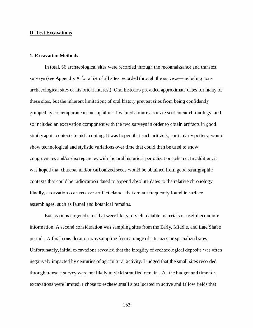
152
D. Test Excavations
1. Excavation Methods
In total, 66 archaeological sites were recorded through the reconnaissance and transect
surveys (see Appendix A for a list of all sites recorded through the surveys—including non-
archaeological sites of historical interest). Oral histories provided approximate dates for many of
these sites, but the inherent limitations of oral history prevent sites from being confidently
grouped by contemporaneous occupations. I wanted a more accurate settlement chronology, and
so included an excavation component with the two surveys in order to obtain artifacts in good
stratigraphic contexts to aid in dating. It was hoped that such artifacts, particularly pottery, would
show technological and stylistic variations over time that could then be used to show
congruencies and/or discrepancies with the oral historical periodization scheme. In addition, it
was hoped that charcoal and/or carbonized seeds would be obtained from good stratigraphic
contexts that could be radiocarbon dated to append absolute dates to the relative chronology.
Finally, excavations can recover artifact classes that are not frequently found in surface
assemblages, such as faunal and botanical remains.
Excavations targeted sites that were likely to yield datable materials or useful economic
information. A second consideration was sampling sites from the Early, Middle, and Late Shabe
periods. A final consideration was sampling from a range of site sizes or specialized sites.
Unfortunately, initial excavations revealed that the integrity of archaeological deposits was often
negatively impacted by centuries of agricultural activity. I judged that the small sites recorded
through transect survey were not likely to yield stratified remains. As the budget and time for
excavations were limited, I chose to eschew small sites located in active and fallow fields that
153
lacked surface features, such as mounds or sacred tree species that could guide excavations
toward productive areas. This strategy was ultimately successful in locating intact deposits. It
also lent itself to inter-site comparison, as all the sampled sites have relatively large surface
scatters (>1 ha) and sacred tree species—indicative of village sites. However, the excavation
strategy did lead to a systematic underrepresentation of small sites and a subsequent lack of
absolute dates for them.
A total of eighteen 2 m x 2 m or 1 m x 2 m units were excavated at nine different sites
(S12-004, S12-017, S12-035, S12-036, S12-037, S13-004, S13-010, S13-011, and S13-012).
Units were oriented to the cardinal directions. The northeast corner of each unit was recorded
with a Garmin 62S handheld GPS receiver. At S12-004 (Fiditi), S12-035 (Atenro), and S13-004
(Aukpon), topographic survey was conducted with a transit and stadia rod to more accurately
document the relationship between excavation units and site features. Units were located on
mounds when present with the expectation that these represented collapsed earthen architecture
and/or midden deposits. When such features were absent, units were located near large sacred
tree species which were hypothesized to be in a similar configuration with architecture as they
are in present-day village layouts (see Agbaje-Williams 2005; Gurstelle 2013).
Units were excavated according to their natural stratigraphy and architectural features,
subdivided into arbitrary 10 cm levels when applicable. Excavation was conducted with hand-
held hoes—the local agricultural implement of choice—and squared and pointed trowels (Figure
IV.10). Excavations levels were recorded according to arbitrarily cited datum points, typically
marked several centimeters above the highest surface elevation. The soil texture of each stratum
was estimated based on visual inspection and manual plasticity examination. Soil textures were
typically sandy, and ranged from loamy sand to sandy clay to clay loam. In addition, the color(s)
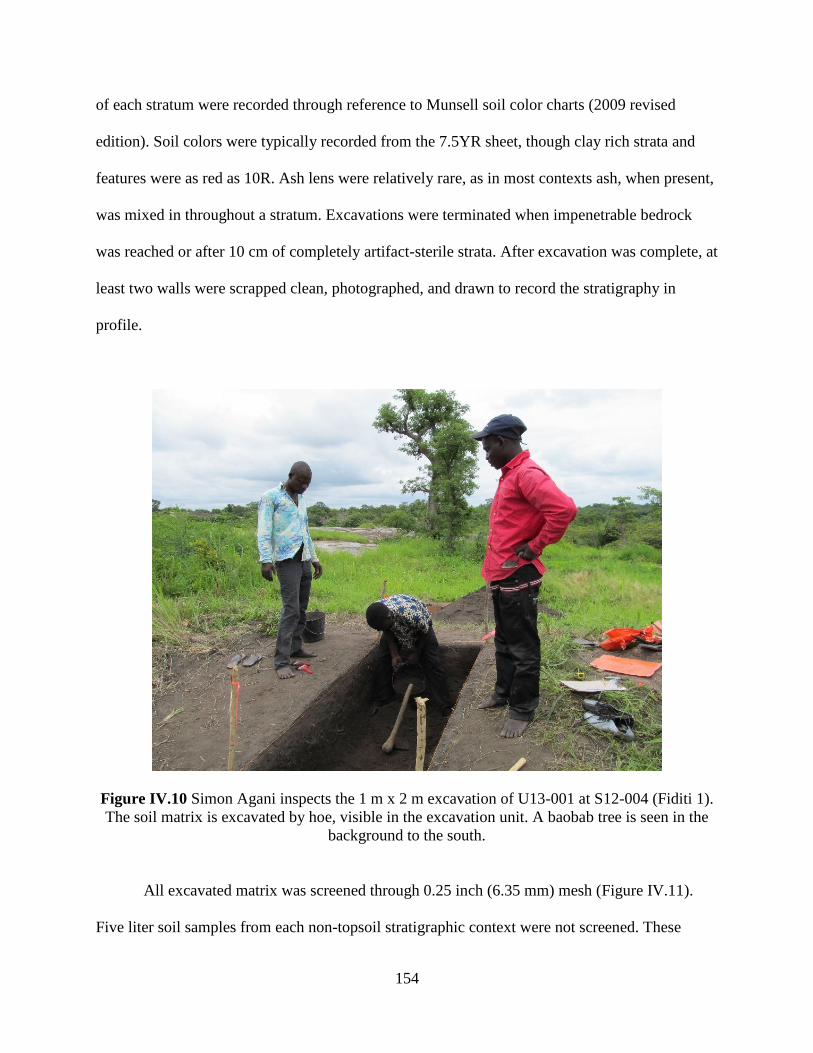
154
of each stratum were recorded through reference to Munsell soil color charts (2009 revised
edition). Soil colors were typically recorded from the 7.5YR sheet, though clay rich strata and
features were as red as 10R. Ash lens were relatively rare, as in most contexts ash, when present,
was mixed in throughout a stratum. Excavations were terminated when impenetrable bedrock
was reached or after 10 cm of completely artifact-sterile strata. After excavation was complete, at
least two walls were scrapped clean, photographed, and drawn to record the stratigraphy in
profile.
Figure IV.10 Simon Agani inspects the 1 m x 2 m excavation of U13-001 at S12-004 (Fiditi 1).
The soil matrix is excavated by hoe, visible in the excavation unit. A baobab tree is seen in the
background to the south.
All excavated matrix was screened through 0.25 inch (6.35 mm) mesh (Figure IV.11).
Five liter soil samples from each non-topsoil stratigraphic context were not screened. These
155
samples were bagged in the field, and then later floated to recover archaeobotanical remains
(Figure IV.12). The topsoil was not retained for flotation due to the likelihood of recent turbation
and contamination. Flotation was performed by the addition of water to soil samples in buckets,
followed by manual agitation and pouring through nested 1.0 and 0.5 mm sieves (see Pearsall
2001; Logan 2012). Light fractions were bagged separately, while heavy fractions were picked
through for visible artifacts which were then added to the unit assemblages. Wood charcoal and
charred seeds were recovered in situ whenever possible for use in radiocarbon dating. With the
exception of coarse earthenware sherds, artifacts were recorded in situ when possible. Coarse
earthenware sherds were the most ubiquitous artifact class, though ground stone, flaked stone,
iron, glass, and refined earthenware artifacts were also recovered. Faunal remains were also
recovered from most units. The presence of daub—hardened conglomerations of clay and sand,
presumed to be used in architecture—was recorded by stratigraphic context, though the daub
itself was not collected. Coarse earthenware body sherds and ground stone artifacts were coded,
counted, weighed, and photographed in the field. These artifacts are in long term storage at the
Abomey Historical Museum in Abomey, Republic of Bénin. Other artifact classes, including
diagnostic sherds such as rims, necks, handles, etc., were bagged and recorded according to
material, and brought back to archaeological laboratories at the University of Abomey-Calavi
and the University of Michigan for additional analyses. After analysis, these artifacts were
returned to the Abomey Historical Museum for permanent curation.
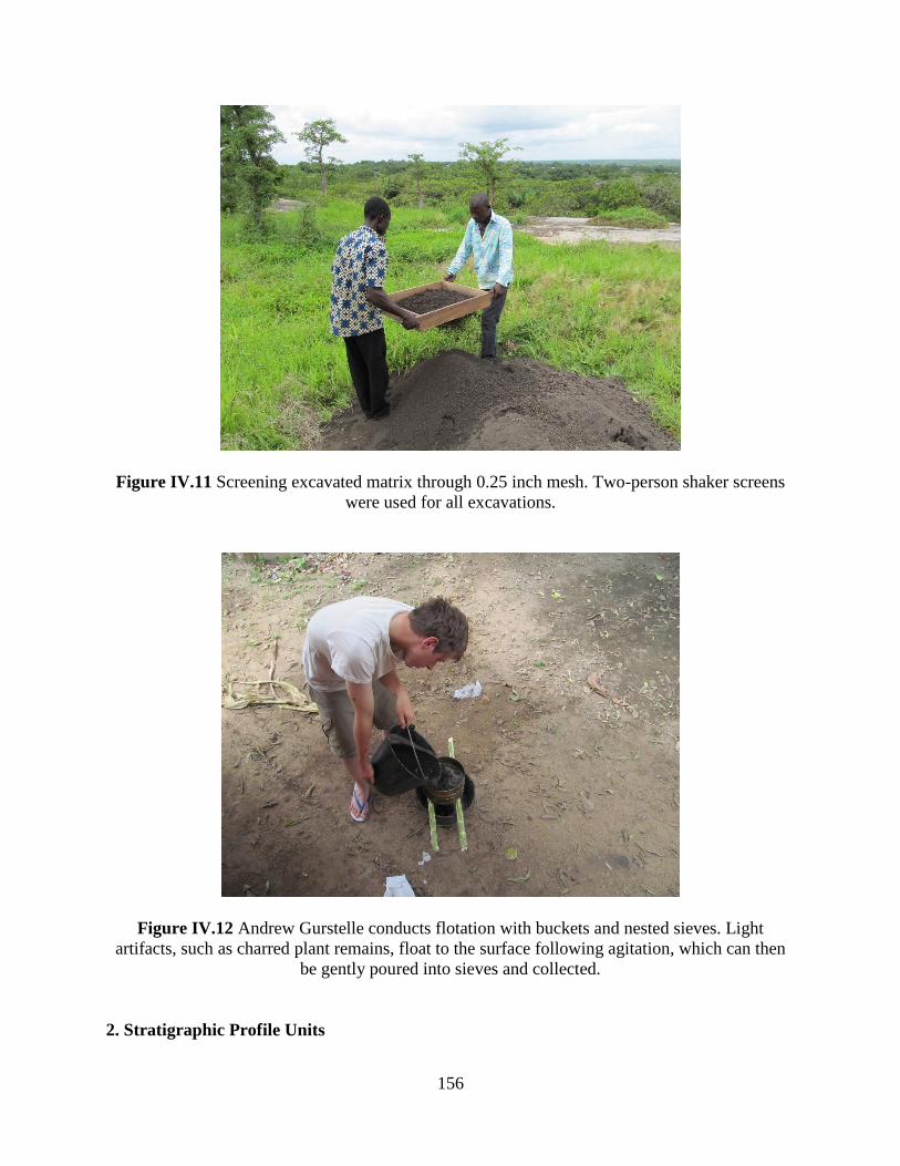
156
Figure IV.11 Screening excavated matrix through 0.25 inch mesh. Two-person shaker screens
were used for all excavations.
Figure IV.12 Andrew Gurstelle conducts flotation with buckets and nested sieves. Light
artifacts, such as charred plant remains, float to the surface following agitation, which can then
be gently poured into sieves and collected.
2. Stratigraphic Profile Units

157
Stratigraphic profile units were excavated at each of the nine sampled sites. These
excavations units were all 1 m x 2 m, and aimed at revealing the integrity and stratigraphy of
sites located through survey. The unit size was chosen to balance the desire for areal contextual
information with the need to expediently access stratigraphic profiles. Excavations were
conducted at the type sites of oral historical periods discussed above in order to provide
information of the technological and stylistic attributes of artifact assemblages and anchor the
relative chronology to absolute dates. Two units (U12-002,U13-011) were excavated at S12-035
(Atenro), the type site for the Early Shabe period. U12-002 was excavated on a large mound in
the center of the site’s surface scatter. U13-011 was excavated toward the eastern side of the site
near a large baobab tree. An excavation was not conducted at Shabe-Idadu, the type site for the
Middle Shabe period, as the site has been continuously occupied and is the present-day location
of Savè, a city of over 30,000 inhabitants. I excavated one unit (U13-005) at S12-036 (Opotoku),
a site founded after Shabe-Idadu and abandoned before the occupation of Fiditi, to substitute as a
typical Middle Shabe site. Unfortunately, no carbonized material was recovered for radiocarbon
dating. One unit (U12-001) was excavated at S12-004 (Fiditi 1) adjacent to the site’s largest
baobab tree. Extremely muddy conditions forced us to terminate the unit prior to reaching a
sterile stratum.
Excavations were conducted at four other sites recorded in oral histories to provide
alternative assemblages and dates that might supplement the perspective gained from the type
site excavations. One unit (U13-002) was excavated at S13-004 (Aukpon) with the goal of
providing information how autochthonous settlements were incorporated into the Shabe kingdom
during the Middle Shabe period. This unit was a stratigraphic profile unit located on the center of
a large mound. During excavations, the mound was revealed to be a midden, prompting the
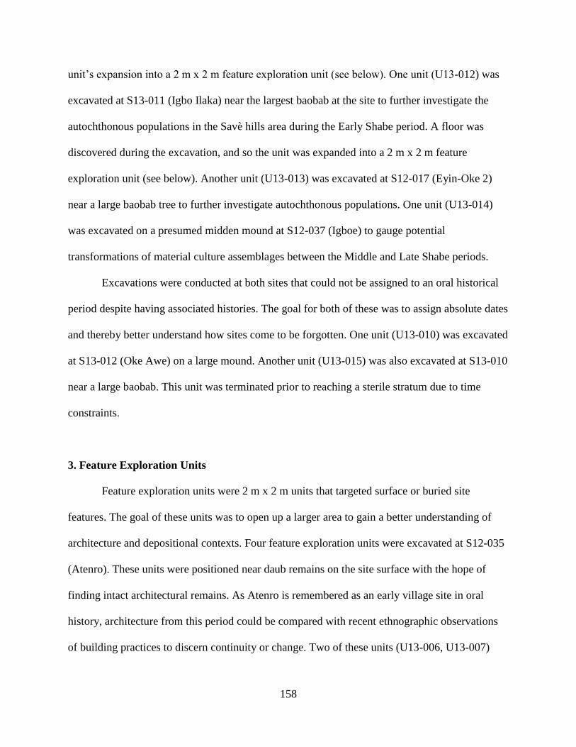
158
unit’s expansion into a 2 m x 2 m feature exploration unit (see below). One unit (U13-012) was
excavated at S13-011 (Igbo Ilaka) near the largest baobab at the site to further investigate the
autochthonous populations in the Savè hills area during the Early Shabe period. A floor was
discovered during the excavation, and so the unit was expanded into a 2 m x 2 m feature
exploration unit (see below). Another unit (U13-013) was excavated at S12-017 (Eyin-Oke 2)
near a large baobab tree to further investigate autochthonous populations. One unit (U13-014)
was excavated on a presumed midden mound at S12-037 (Igboe) to gauge potential
transformations of material culture assemblages between the Middle and Late Shabe periods.
Excavations were conducted at both sites that could not be assigned to an oral historical
period despite having associated histories. The goal for both of these was to assign absolute dates
and thereby better understand how sites come to be forgotten. One unit (U13-010) was excavated
at S13-012 (Oke Awe) on a large mound. Another unit (U13-015) was also excavated at S13-010
near a large baobab. This unit was terminated prior to reaching a sterile stratum due to time
constraints.
3. Feature Exploration Units
Feature exploration units were 2 m x 2 m units that targeted surface or buried site
features. The goal of these units was to open up a larger area to gain a better understanding of
architecture and depositional contexts. Four feature exploration units were excavated at S12-035
(Atenro). These units were positioned near daub remains on the site surface with the hope of
finding intact architectural remains. As Atenro is remembered as an early village site in oral
history, architecture from this period could be compared with recent ethnographic observations
of building practices to discern continuity or change. Two of these units (U13-006, U13-007)
159
were excavated immediately north of the midden mound targeted by the earlier stratigraphic
profile unit described above. The two other units (U13-008, U13-009) were excavated near the
northern edge of the surface scatter. Unfortunately, intact architectural remains were absent from
all units.
Two smaller 1 m x 2 m exploration units were excavated at S12-004 (Fiditi 1). One unit
(U12-003) was excavated on an earthen berm to determine if the feature was part of the site’s
fortifications, a midden, or the collapsed remains of a separate structure. The material of the
berm was very densely packed clay, and so only a 1 m x 2 m unit was excavated for expedience.
The second exploration unit (U13-001) was excavated on a small mound abutting the end of the
S12-001, a stone wall enclosing parts of S12-004 and S12-006 (Fiditi 2). Though excavated by
me and the rest of the SHARP research team, this unit was planned by Simon Agani to collect
data for his thesis (2014) on fortifications in the Savè hills area. Agani determined a 1 m x 2 m
unit was sufficient to address his questions on how earthen architecture with used in conjunction
with stone walls.
As noted above, the 1 m x 2 m stratigraphic profile unit (U13-002) at S13-004 (Aukpon)
was expanded into a 2 m x 2 m feature exploration unit after it became clear that the mound it
was located on was a midden with intact stratigraphy. Because of the size and richness of the
midden deposits, a second 2 m x 2 m unit (U13-003) was excavated at the bottom slope of the
mound. The goal of these excavations was to separate individual deposition strata and associated
material to seriate cultural material over the course of Aukpon’s occupation.
A human burial was encountered in U13-002 approximately 60 cm below the surface.
The pelvis, lower spine, and femurs were found, with the orientation of the bones suggesting
more of the skeleton extended through the southern unit wall and into the unexcavated portion of
160
the mound. Prior to the start of research, I prepared a protocol for documenting human remains
and had it approved by the Directorate du Patrimoine Culturel, the Onishabe, and the Ola-
Amùsù. The protocol called for human remains to be uncovered to determine their completeness,
position, orientation, and relationship to artifacts and strata, but to be left in place and not
collected. Since the upper portion of the burial was not included in U13-002, I determined that it
would be appropriate to excavate an additional 1 m x 2 m unit (U13-004) immediately south of
U13-002 with the specific aim of determining the nature of the burial. No artifacts were collected
from this excavation, and it was only excavated to the level of the burial, not to granite bedrock
as U13-002 and U13-003 were. As suspected, the entire upper part of the skeleton was revealed
in this additional excavation unit. The burial was found to be a relatively intact, extended, supine
burial. It is described further in Appendix A. The bones of the right hand were absent from the
burial, as were the lower leg bones below both patellae. Though human remains were not
purposefully collected, later analysis of artifacts from the site found human tibiae and fibulae
elements mixed with faunal remains.
A stratigraphic profile unit (U13-012) was excavated at S13-011 (Igbo Ilaka). A hard
packed earthen floor was found in the unit, and so I expanded the unit to 2 m x 2 m. Ultimately,
the excavation revealed a series of three packed earthen floors. Each floor was separated by a
thin layer of gravel and crushed potsherds, perhaps added to smooth the surface in preparation
for the next floor.
4. Radiocarbon Dating
A key goal of the excavations was to obtain organic material in good stratigraphic
contexts suitable for radiocarbon dating. Radiocarbon dating has the potential to link settlement
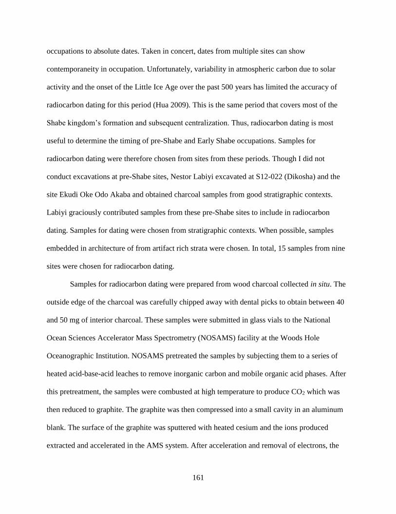
161
occupations to absolute dates. Taken in concert, dates from multiple sites can show
contemporaneity in occupation. Unfortunately, variability in atmospheric carbon due to solar
activity and the onset of the Little Ice Age over the past 500 years has limited the accuracy of
radiocarbon dating for this period (Hua 2009). This is the same period that covers most of the
Shabe kingdom’s formation and subsequent centralization. Thus, radiocarbon dating is most
useful to determine the timing of pre-Shabe and Early Shabe occupations. Samples for
radiocarbon dating were therefore chosen from sites from these periods. Though I did not
conduct excavations at pre-Shabe sites, Nestor Labiyi excavated at S12-022 (Dikosha) and the
site Ekudi Oke Odo Akaba and obtained charcoal samples from good stratigraphic contexts.
Labiyi graciously contributed samples from these pre-Shabe sites to include in radiocarbon
dating. Samples for dating were chosen from stratigraphic contexts. When possible, samples
embedded in architecture of from artifact rich strata were chosen. In total, 15 samples from nine
sites were chosen for radiocarbon dating.
Samples for radiocarbon dating were prepared from wood charcoal collected in situ. The
outside edge of the charcoal was carefully chipped away with dental picks to obtain between 40
and 50 mg of interior charcoal. These samples were submitted in glass vials to the National
Ocean Sciences Accelerator Mass Spectrometry (NOSAMS) facility at the Woods Hole
Oceanographic Institution. NOSAMS pretreated the samples by subjecting them to a series of
heated acid-base-acid leaches to remove inorganic carbon and mobile organic acid phases. After
this pretreatment, the samples were combusted at high temperature to produce CO2 which was
then reduced to graphite. The graphite was then compressed into a small cavity in an aluminum
blank. The surface of the graphite was sputtered with heated cesium and the ions produced
extracted and accelerated in the AMS system. After acceleration and removal of electrons, the

162
emerging positive ions were magnetically separated by mass and the 12C and 13C ions
measured. Simultaneously the 14C ions were recorded in a gas ionization counter, so that
instantaneous ratios of 14C to 13C and 12C were recorded.
The results of the AMS radiocarbon dating are presented in Table IV.2. The results
generally support the assertions from oral history that the Early Shabe period began after 1500
CE. The immense variability in atmospheric carbon at this time accounts for the wide calibration
ranges given for most dates. The pre-Shabe and some Early Shabe sites are more tightly dated,
with occupation dates ranging between approximately 1000 and 1400 CE. Thus, the radiocarbon
dating was useful for determining the pre-Shabe to Early Shabe temporal boundary, as well as
confirming the recent (relative to Ile Ife and Oyo) foundation and centralization of the Shabe
kingdom.
163
Site Oral Historical Period Context Lab # CRA BP Std Err D13C (Measured) Cal. Range (2σ)
S12-022 Pre-Shabe Midden OS-109257 820 25 -24.91 1170-1263 CE
S12-022 Pre-Shabe Shell Midden OS-109256 925 20 -25.41 1036-1160 CE
Odo Akaba Pre-Shabe Midden OS-109258 620 25 -26.6 1293-1399 CE
Odo Akaba Pre-Shabe Floor OS-109259 550 30 -23.6 1311-1434 CE
S13-011 Early Shabe Floor OS-109282 145 25 -24.74 1668-1946 CE
S13-011 Early Shabe Subfloor OS-109283 935 25 -25.86 1031-1157 CE
S12-017 Early Shabe Architecture OS-109284 595 30 -26.68 1298-1410 CE
S12-035 Early Shabe Midden OS-109260 145 25 -26.66 1668-1946 CE
S12-035 Early Shabe Midden OS-109261 240 25 -25.57 1529 CE-modern
S12-035 Early Shabe Subfloor OS-109262 1910 25 -25.69 23-138 CE
S13-004 Early-Middle Shabe Midden OS-109263 225 30 -24.98 1640 CE-modern
S13-004 Early-Middle Shabe Midden OS-109264 240 25 -24.7 1529 CE-modern
S12-037 Middle-Late Shabe Midden OS-109286 145 25 -25.46 1668-1946 CE
S13-010 Unassigned Midden OS-109285 100 35 -25.29 1681-1938 CE
S13-012 Unassigned Midden OS-109265 >Modern -27.5 modern
Table IV.2 AMS radiocarbon dates from sites in the Savè hills area, performed at the NOSAMS Laboratory, Woods Hole
Oceanographic Institution. Dates are calibrated with the OxCal v4.2 program using the IntCal 13 calibration curve. Sites S12-022 and
Odo Akaba were excavated independently by Nestor Labiyi (see Gurstelle et al. in press).
164
CHAPTER V
The Shabe Archaeological Landscape
In this chapter, I present the results of the research conducted as described in the previous
chapter. The program of reconnaissance survey, transect survey, excavations, and analysis
yielded a landscape-scaled perspective on site formation and political-economic development.
This perspective is most clear when approached diachronically, and so the following chapter is
organized sequentially by the oral historical periods described in Chapter IV: Early Shabe (1600-
1700 CE), Middle Shabe (1700-1830 CE), Late Shabe (1830-1894 CE), and European Colonial
(1894-1960 CE). In addition, I briefly describe what is known about the Pre-Shabe period in
order to contrast the developments that took place during the Early Shabe period with the area’s
prior political-economic context. For each period, I model the political-economic organization of
the Shabe kingdom through a focus on four dimensions of economic practice: settlement pattern,
subsistence, craft production, and exchange.
A. The Early Shabe Period (1600-1700 CE)
1. Settlement Pattern
The Early Shabe period begins with the foundation of Atenro. Both Palau Martí (1992a)
and Adediran (1994) identify this as the start of the Shabe kingdom—in as much as the Savè

165
hills area’s communities were drawn into a complex polity headed by a hierarchical kingship
institution. The Shabe migrants that founded Atenro did not move into an uninhabited land,
however. Several established villages were already present in the area. One of these villages,
Bako, has remained inhabited to the present. Each of the other villages that were inhabited at the
time of Atenro’s foundation have since been abandoned, as has Atenro itself. Following
abandonment, these villages are remembered in oral history and experienced as archaeological
remains left in agricultural fields. It is these archaeological remains, aided by oral history, which
I use to construct the settlement pattern of the Early Shabe period (Figure V.1). This pattern is
somewhat distorted by the compression of time in both oral history and artifact chronologies. For
example, it is not necessarily true that all sites occupied contemporaneously with Atenro were
contemporaneous with each other. Thus, for the purpose of analysis I have compressed
diachronic settlement histories into broad synchronic periods. For each period, I include sites that
were either occupied for most of the period or were founded during it. I will discuss each Early
Shabe site identified from the reconnaissance survey before discussing possible Early Shabe sites
identified from the transect survey.

166
Figure V.1 Map of Early Shabe sites identified through reconnaissance survey and associated
present-day settlements.
Atenro (S12-035) looms large in the oral narratives of the Shabe kingdom, and its
archaeological site is fittingly impressive. The site consists of a large scatter of coarse
earthenware potsherds and other artifacts among agricultural fields. There is also one large
167
mound on the site. A 1 m x 2 m excavation was placed on the mound; based on the mound
stratigraphy and density of artifact deposition, the mound is likely a midden. Further, the
excavation revealed two distinct depositional phases separated by a stratum with relatively little
deposition. The second depositional phase likely corresponds to a later reoccupation. Though not
recounted in the narratives of the Onishabe or Ola-Amùsù, the balè of Alafia said that Atenro
was briefly reoccupied in the late 19th century CE. At the time, Atenro was a dense forest, and it
was chosen as a refuge by residents of Alafia to hide during periods of raiding and ware. This
refuge was abandoned at the start of the European Colonial period when residents returned to
Alafia. Two 2 m x 2 m excavation units were sited 60 m north of the midden, and another two 2
m x 2 m excavation units were located a further 50 m northwest of these. Each excavation unit
was placed in an area where fragments of compact earth—probable remains of earthen
architecture—were present on the surface. However, no intact architectural remains other than
additional compact earth fragments were located. Many of these fragments of compact earth had
plant fiber impressions, further suggesting their use as daub for construction purposes. A 1 m x 2
m unit on the far eastern side of the artifact scatter did not locate architectural remains either.
Thus, the household form of the Shabe migrants, and its implications for their social and political
structure, is unknown—though the paucity of evidences suggests that these were fairly
ephemeral structures.
Ethnographic and architectural studies of Yoruba architecture over the past 100 years can
help fill in this gap by providing an architectural model. Though the architectural forms of 20th
century Ile-Ife, Ibadan, and Lagos cannot be taken as the “Yoruba” standard that other areas
adhered to, they do feature the same kind of building materials that would have been available in
the Savè hills area. Further, as the Shabe kingdom shares many political, social, and linguistic
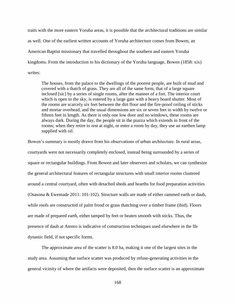
168
traits with the more eastern Yoruba areas, it is possible that the architectural traditions are similar
as well. One of the earliest written accounts of Yoruba architecture comes from Bowen, an
American Baptist missionary that travelled throughout the southern and eastern Yoruba
kingdoms. From the introduction to his dictionary of the Yoruba language, Bowen (1858: xix)
writes:
The houses, from the palace to the dwellings of the poorest people, are built of mud and
covered with a thatch of grass. They are all of the same form, that of a large square
inclosed [sic] by a series of single rooms, after the manner of a fort. The interior court
which is open to the sky, is entered by a large gate with a heavy board shutter. Most of
the rooms are scarcely six feet between the dirt floor and the fire-proof ceiling of sticks
and mortar overhead, and the usual dimensions are six or seven feet in width by twelve or
fifteen feet in length. As there is only one low door and no windows, these rooms are
always dark. During the day, the people sit in the piazza which extends in front of the
rooms; when they retire to rest at night, or enter a room by day, they use an earthen lamp
supplied with oil.
Bowen’s summary is mostly drawn from his observations of urban architecture. In rural areas,
courtyards were not necessarily completely enclosed, instead being surrounded by a series of
square or rectangular buildings. From Bowen and later observers and scholars, we can synthesize
the general architectural features of rectangular structures with small interior rooms clustered
around a central courtyard, often with detached sheds and hearths for food preparation activities
(Osasona & Ewemade 2011: 101-102). Structure walls are made of either rammed earth or daub,
while roofs are constructed of palm frond or grass thatching over a timber frame (ibid). Floors
are made of prepared earth, either tamped by feet or beaten smooth with sticks. Thus, the
presence of daub at Atenro is indicative of construction techniques used elsewhere in the Ife
dynastic field, if not specific forms.
The approximate area of the scatter is 8.0 ha, making it one of the largest sites in the
study area. Assuming that surface scatter was produced by refuse-generating activities in the
general vicinity of where the artifacts were deposited, then the surface scatter is an approximate

169
of Atenro’s original footprint. For means of comparison, the nearby present-day village of Alafia
covers approximately 9.9 ha and had 1,640 residents as of 2002 (Direction des Etudes
Démographiques 2004: 18). Atenro’s original size may have been ever larger than the 8.0 ha
suggested by the surface scatter. The site is dotted by 49 baobab trees, and while many are
present within the surface scatter, mature trees are found both to the east and west. Baobab trees
are often associated with households and compounds in the present and recent past (Darling
2008; Norman 2009: 396; Ogundiran 2012: 235-236, Gurstelle 2013). Further, all other baobabs
located in both of the transect survey tracts were found within artifact scatters or present-day
settlements. This suggests that the true extent of Atenro extended out to these extreme baobabs.
Taking this into account, Atenro’s area is closer to 11.0 ha.
The size of Atenro contrasts with those of other contemporary Early Shabe sites. About
1.1 km south of Atenro is Igbo Ilaka (S13-011). Based on Igbo Ilaka’s surface scatter and
distribution of baobab trees, its size is only 3.6 ha. The balè of Alafia claimed that Igbo Ilaka
was occupied by an autochthonous population when Atenro was founded. Only two other
features are remembered about Igbo Ilaka’s population: it was led by a female chief (remarked
on as very unusual), and it was destroyed after the chief’s brother allied with a foreign power in a
bid to usurp her office. Both of these features are similar to a stereotyped construction of
autochthons in Yoruba oral traditions as female and extinct (e.g. Ogundiran 2009: 43).
A 2 m x 2 m excavation unit was placed near the largest baobab at Igbo Ilaka to explore
the integrity of subsurface architectural features. This succeeded in locating a series of prepared
clay floors. Each floor consisted of a thin lens of clay above a thicker layer of crushed pottery
and gravel. A very hard, reddish clay feature was also discovered, which may be part of a hearth
or burnt architecture. The use of gravel and pottery as a filler to level off the ground before
170
construction or during resurfacing is not included in descriptions of Yoruba architecture. This
may be an architectural technique that has not survived to the ethnographic present.
The site closest to Igbo Ilaka and Atenro is Bako, once a small village at the foot of the
hill Oke Agbodo, but now a neighborhood of the larger town of Kaboua that has grown adjacent
to it. Bako residents claim autochthonous status, stating that the village was already inhabited
when Atenro was founded. Unfortunately for archaeology, Bako has remained inhabited since
the Early Shabe period and the current village sits on top of its former location. The extent of
ancient Bako is unknown, but given the national trend of population increase in Bénin over the
20th century CE, it is probable that Early Shabe period Bako’s extent was less than the present-
day Bako’s footprint of 8.9 ha.
Like Bako, an autochthonous settlement existed at the current town of Shabe-Idadu at the
foot of the hill Oke Shabe. Unlike Bako, the present-day inhabitants of Shabe-Idadu do not claim
descent from the inhabitants of the Early Shabe settlement, as I will describe in more detail when
discussing the Middle Shabe period settlement pattern below. Due to the present-day occupation
of Shabe-Idadu, there are no archaeological indicators of the Early Shabe period settlement.
However, oral histories suggest that the Djangbé neighborhood of Shabe-Idadu, about 4 ha, is
where the original settlement was (Palau Martí 1992a: 125).
On the other side of Oke Shabe are two archaeological sites associated with the Early
Shabe period: Eyin-Oke 1 (S12-016) and Eyin-Oke 2 (S12-017). The name “Eyin-Oke”
translates as “behind the hill”, and is also the name of the lineage associated with these sites.
“Behind” refers to the position relative to the Shabe settlers that moved to the hill during the
Middle Shabe period, and thus the outsider, peripheral status of the autochthonous residents of
Eyin-Oke. Eyin-Oke 1 is a relatively thin scatter of potsherds skirting the steep northeastern face

171
of the Oke Shabe hill. Eyin-Oke 2 slightly to the southeast, and has a denser potsherd scatter
with multiple baobab trees. The oral narratives of the Eyin-Oke lineage state explicitly that Eyin-
Oke 2 is one of their former villages before they were compelled to relocate to Shabe-Idadu in
the Middle Shabe period. As these histories also claim the Eyin-Oke lineage had been living on
the east side of the hill since time immemorial, Eyin-Oke 1 may be another former village
location. Eyin-Oke 1 and 2 have similarly sized surface scatters at 2.9 and 4.5 ha, respectively.
A 1 m x 2 m excavation unit was placed near a large baobab in the surface scatter of
Eyin-Oke 2 to test the integrity of subsurface architectural features. No intact architecture was
discovered, though a compact earthen feature associated with artifacts and charcoal was found.
This feature is similar in composition to collapsed rammed earth architecture, though it is unclear
from the stratigraphic context if that is what it is. Like the daub fragments from Atenro and the
tamped clay floor from Igbo Ilaka, the rammed earth remains at Eyin-Oke 2 are consistent with
general architectural techniques from West Africa (see Denyer 1978).
On the same side of the hill as Shabe-Idadu is the site of Aukpon (S13-004). Aukpon is
claimed by the Omo Agbaa lineage that, like the Eyin-Oke lineage, has autochthonous status
within the Shabe kingdom. Unlike Eyin-Oke, however, the Omo Agbaa lineage was more
intensively drawn into the political hierarchy of the Shabe kingdom during the Middle Shabe
period, even being ceded the high ranking office of Olu Osin. This is also suggested by the
toponym of Aukpon, which refers to a hammock that kings and high ranking officials rode in.
Aukpon remained inhabited even after Shabe migrants settled at Shabe-Idadu at the start of the
Middle Shabe period. The Aukpon site consists of 2.8 ha artifact scatter, four baobab trees, at
least four low mounds, and one large mound. Two 2 m x 2 m and one 1 m x 2 m units were

172
excavated on the large mound, but these deposits date to the Middle Shabe period and so will be
discussed in that section below.
The final Early Shabe period site recorded during the reconnaissance survey is woo
Djabata (S12-024), the former location of the present-day settlement of Djabata. The site is
remembered in oral history and marked by the presence of several large baobab trees. However,
the area surrounding the site has not been actively cultivated in at least the last several decades
and as a result the site is forested and overgrown, making identification of surface features and
artifacts difficult. Still, potsherds and other artifacts were recorded in road cuts and tree falls,
suggesting that these baobab trees do mark an archaeological site.
One other site of interest is Dikosha (S12-022). Dikosha was occupied prior to the Early
Shabe period and is remembered as having long been abandoned by the time Atenro was
founded. It is the only pre-Shabe site known from oral histories in the study area. In 2014, Nestor
Labiyi excavated a 1 m x 2 m unit placed on a low mound, partially cut by a pathway which had
allowed potsherds to erode out of it. The unit was excavated to a depth of 90 cm, and cultural
material was recovered from all strata and levels—primarily coarse earthenware sherds and
faunal remains. The lowest stratum of the excavation contained a large amount of bivalve shell.
The shells were deposited in a mound, which continued into the eastern profile of the excavation
unit. Placed on the western edge of this shell deposit was a complete, over-turned ceramic vessel
ringed by several unmodified stones (Figure V.2). The conspicuous placement of these objects
could indicate an intentional marking of the shell midden, possibly its closure. Unfortunately,
time constraints forced the excavation to stop before reaching a culturally sterile strata. Wood
charcoal was recovered from the shell deposit as well as the overlying stratum above. These
fragments were dated to a ranges of cal. 1036-1160 CE and cal. 1170-1263 CE, respectively.

173
Figure V.2 A complete, overturned ceramic vessel and unmodified stone (above sign) marks the
beginning of bivalve shell midden (left).
In the absence of oral histories, it is very difficult to ascertain where sites of unknown age
fall into the relative chronology of Early Shabe, Middle Shabe, Late Shabe, and European
Colonial periods. As discussed in Chapter IV, radiocarbon dating provides one solution to this
problem by fixing absolute dates to cultural stratum, and therefore the site. While this technique
was applied to two sites of unknown age (S13-010 and S13-012), the costs associated with
excavation and dating and the limited resources available for this project were too prohibitive to
be applied to all sites recorded in the reconnaissance and transect surveys. Further, radiocarbon

174
dating generally does a poor job of discerning between these relative periods, as they all fall
within the last 500 years when fluctuations in atmospheric carbon have made the estimation
ranges of calibration curves greater than the length of the periods.
In addition to oral histories and radiocarbon dates, temporal changes in common artifacts,
such as ceramics, can be used to seriate archaeological sites chronologically. Ceramics from the
study area are discussed in more detail in Appendix B. Here it is necessary to note that three
ceramic assemblage types can be distinguished which I have termed the Pupa Type, Shabe A
Type, and Shabe B Type. These types were derived on the basis of decorative techniques
employed from ceramic assemblages with at least 40 decorated potsherds.
The Pupa Type is an Early Shabe period ceramic assemblage distinguished by its use of
twisted cord roulette as the only texturing technique on the body of ceramic vessels, as well as its
high proportion of vessels with red paint/slip on the vessel exterior. It is derived from excavation
and surface assemblages at both Igbo Ilaka (S13-011) and Eyin-Oke 2 (S12-017), as well as from
the surface assemblage of Eyin-Oke 1 (S12-016).
The Shabe A Type is a second Early Shabe period assemblage. It also distinguished by
twisted cord roulette as the dominant texturing technique, though grid wooden roulettes are also
present. Further, this assemblage is the only to feature braided cord roulettes as a texturing
technique. In addition, it is distinguished from the Pupa Type by the presence of snailshell apex
impressions. The Shabe A Type is derived from excavation assemblages from sub-topsoil strata
at Atenro (S12-035).
These two Early Shabe period types are replaced during the Middle Shabe and
subsequent periods by the Shabe B Type. This assemblage type is distinguished by a higher
proportion of grid wooden roulettes, as well as the use of maize cob and/or snailshell lip (or
175
fingernail) impressions. This type is derived from excavation and surface assemblages from
Aukpon (S13-004), Opotoku (S12-036), Igboe (S12-037), Fiditi (S12-004, S12-006, S12-009,
S12-012), Phase II contexts of Atenro (S12-035), and several unassigned sites (S12-013, S13-
010, S13-012).
The utility of this typology is that sites of unknown age with ceramic assemblages can be
assigned to one of the three types: Pupa, Shabe A, or Shabe B. From this, the oral history period
(or periods) can be derived. However, these derivations should be regarded with caution, as
sample sizes from surface collections tend to be very small and therefore prone to errors in
representation. Despite this limitation, one site of unknown age from the Atenro tract (S13-023)
likely dates to the Early Shabe period, and two sites from the Fiditi tract may tentatively be
assigned to it as well (S12-007 and S12-015).
The ceramic assemblage from the surface of S12-023 includes one body sherd with
markings from a braided cord roulette, indicating it belongs to the Shabe A type. S12-023 is
located between Atenro and Igbo Ilaka. It is smaller than either site at only 0.3 ha. Fifteen other
sites in the Atenro transect survey tract may belong to the Early Shabe period (Figure V.3).
However, their decorative elements are inconclusive, though they are consistent with all three
assemblage types. In the Fiditi transect survey tract, two sites are possibly Early Shabe period
sites based on the lack of ceramic indicators of the Middle Shabe and Late Shabe periods as well
as oral traditions (Figure V.4). S12-007 is a rockshelter site on the Oke Shabe hill that is part of
present-day ritual practice. S12-015 consists of a rockshelter, surface scatter, and baobab trees on
top of the Oke Shabe hill. Though not explicitly linked to any oral narrative, the site is very close
to an active shrine that is associated with Early Shabe period autochthonous populations.

176
Figure V.3 Early Shabe period archaeological sites in the Atenro transect survey tract.
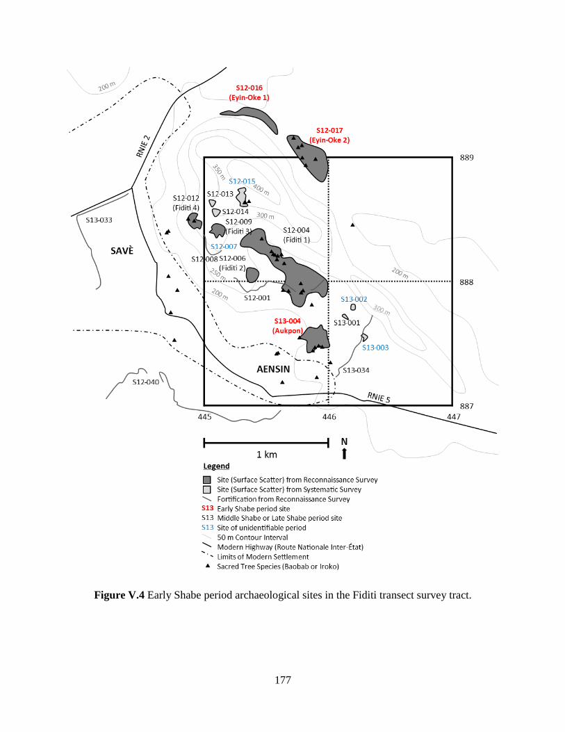
177
Figure V.4 Early Shabe period archaeological sites in the Fiditi transect survey tract.
178
The settlement pattern exhibited during the Early Shabe period appears to cluster in three
distinct parts of the study area, each associated with a distinct topographic feature: the Oke
Agbodo hill in the northeast, the Oke Shabe hill in the center, and an acute bend in the Okpara
River in the southeast. However, it is also clear that Early Shabe period sites are
underrepresented in the reconnaissance survey. As the reconnaissance survey is guided by oral
narratives, there is already a problem in that the Early Shabe is the most temporally distant
period and therefore most prone to having lost information on site locations and histories.
Further, the Early Shabe period is when Shabe migrants move to the area and begin to co-opt or
usurp rights to land and resources held by autochthonous groups. The histories and information
about autochthonous sites are therefore more likely to have been forgotten as autochthons were
forced out, or silenced deliberately even when they have remained. The intent of the transect
survey was to correct for this underrepresentation, but the low sample sizes of decorated sherds,
and the general similarity of ceramics between periods, limits our ability to assign these sites to
oral history periods. Further excavation work to collect suitable sample sizes of decorated pottery
is likely required to improve the temporal resolution of these sites.
Despite current limitations, the known Early Shabe period sites display some interesting
size differences (Table V.1). Atenro is the largest site in the area, 78% larger than the next
largest site. The next four sites are all associated with autochthonous groups. Their mean area is
3.5 ha, with a standard deviation of only 0.8. There are also the smaller sites located through
transect survey, with areas of 0.6 ha and 0.3 ha. In addition, many of the small sites that could
not be positively assigned to any period may be Early Shabe sites, increasing the number of these
sites with areas less than 1.0 ha. This suggests that prior to the foundation of Atenro, there were
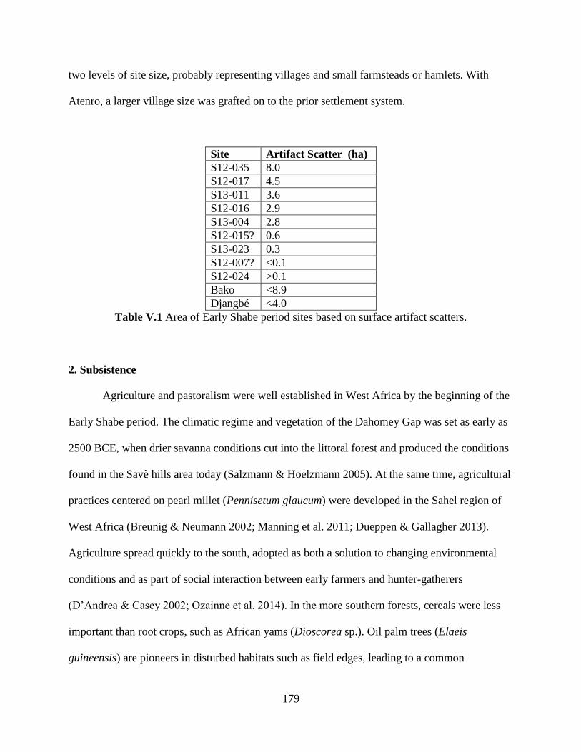
179
two levels of site size, probably representing villages and small farmsteads or hamlets. With
Atenro, a larger village size was grafted on to the prior settlement system.
Site Artifact Scatter (ha)
S12-035 8.0
S12-017 4.5
S13-011 3.6
S12-016 2.9
S13-004 2.8
S12-015? 0.6
S13-023 0.3
S12-007? <0.1
S12-024 >0.1
Bako <8.9
Djangbé <4.0
Table V.1 Area of Early Shabe period sites based on surface artifact scatters.
2. Subsistence
Agriculture and pastoralism were well established in West Africa by the beginning of the
Early Shabe period. The climatic regime and vegetation of the Dahomey Gap was set as early as
2500 BCE, when drier savanna conditions cut into the littoral forest and produced the conditions
found in the Savè hills area today (Salzmann & Hoelzmann 2005). At the same time, agricultural
practices centered on pearl millet (Pennisetum glaucum) were developed in the Sahel region of
West Africa (Breunig & Neumann 2002; Manning et al. 2011; Dueppen & Gallagher 2013).
Agriculture spread quickly to the south, adopted as both a solution to changing environmental
conditions and as part of social interaction between early farmers and hunter-gatherers
(D’Andrea & Casey 2002; Ozainne et al. 2014). In the more southern forests, cereals were less
important than root crops, such as African yams (Dioscorea sp.). Oil palm trees (Elaeis
guineensis) are pioneers in disturbed habitats such as field edges, leading to a common

180
association between them and yams that is still found today. Palynological studies suggest that
oil palm became more widespread in the region around 500 BCE (Sowunmi 1985; Logan &
D’Andrea 2012). This coincides with the widespread adoption of iron production technologies
(Childs & Killick 1993). However, hunting and wild resource gathering remained an important
part of many West African subsistence strategies long after agricultural economies were adopted
(Falola & Adebayo 2000: 14; Logan 2012).
Agriculture is preceded in West Africa by pastoralism. Sheep/goat and cattle pastoralism
were imported from northeast Africa across the Sahara. Pastoralism may have even spread to the
southern forests earlier and farther than agriculture. In Ghana, the Kintampo site has early
evidence for pastoral and agricultural practices. Kintampo subsistence was based on pearl millet
(D’Andrea et al. 2001) and cowpea (D’Andrea et al. 2007), and also included a pastoralism
component of cattle and sheep/goat (Carter & Flight 1972; Stahl 1985: 139; Gautier & Van Neer
2005). In addition, Kintampo groups used wild resources like oil palm (Stahl 1993; D’Andrea et
al. 2006) and game (Stahl 1985). The Punpun occupations that preceded Kintampo already had
domesticated sheep/goat, though did not have domesticated plants and contain less evidence for
plant processing technologies like ceramic jars and grindstones (Stahl 1993, 1994: 77).
From these earlier precursors, we would expect that the subsistence practices of
communities during the Early Shabe period, beginning two millennia after the introduction of
agriculture to the area, included a mixture of agriculture, pastoralism, and wild resource
exploitation. Indeed, the limited evidence from the excavation at the pre-Shabe site of Dikosha
indicates this is the case. Sheep/goat bones were identified in the faunal assemblages. In addition
fish, snake, and rodent bones were also recovered. The large amount of bivalve shell recovered is
also likely the remains of subsistence activities. The baobab trees on the site may be the

181
descendants of the original trees contemporary with the Dikosha settlement, indicating the
management of wild tree species, and likely agricultural practices as well. Though oil palm was
an important economic tree species through much of forested West Africa, it is thought to have
been introduced to the Savè hills area only during the European Colonial period (Palau Martí
1992a: 46). Before this, shea butter was the primary plant-based fat source.
Faunal remains from excavations at Eyin-Oke 2 and Igbo Ilaka are generally limited and
poorly preserved. However, remains from Atenro are more numerous, given the midden context
they came from. Identified taxa include sheep/goat and cow, though analysis of the remains was
only a cursory field inspection and more work remains to be done on these materials. Snake and
rodent remains were also identified. A single fish vertebra was recovered, pointing to dispersed
fishing activities or trade with fishing communities, since Atenro is not located near the Ouémé
or Okpara rivers.
As at Dikosha, the presence of baobab trees on the site points to the intentional
management of tree species, and probably associated field crops. Other indirect evidence for
agriculture comes from the settlement pattern. The presence of small sites less than 1 ha in size
surrounding larger villages is similar to ethnographically known settlement systems of dispersed
agricultural hamlets and farmsteads that connected more remote fields to the central settlement.
This is a form of agricultural intensification that allows inhabitants to more efficiently bring new
fields under cultivation (Morrison 1994). Millstones and ground stone basins are also found,
suggesting a high degree of plant processing. Indirect evidence for the absence of maize (Zea
mays) agriculture comes from the ceramic assemblages. While Middle Shabe and Late Shabe
period assemblages contain potsherd with maize cob impressions, Early Shabe sites do not.
While this simply may be due to aesthetic or technical choices in ceramic decoration, it may also
182
be due to the lack of cobs because maize had not yet been introduced to the area. This is not true
for tobacco (Nicotiana tabacum). Smoking pipe bowl fragments were recovered from
excavations at Atenro and Igbo Ilaka, providing indirect evidence for tobacco consumption. It is
possible that Early Shabe period peoples were growing tobacco rather than directly importing it
from traders on the coast, as the pipe bowls are coarse earthenware in local styles, rather than the
refined white “ball clay” style pipes more common near the coast (Norman 2012: 158).
3. Craft Production
Evidence for craft production practices in the Early Shabe period is derived from
settlement information and artifacts from surface and excavation collections. The general
impression is that craft production was limited to small-scale non-specialized household
production. Our research documented no special purpose sites—e.g., detached pottery
workshops, forges, dying pits—in the study area. Indeed, only village sites, hamlets/farmsteads,
and shrines were identified. Small scale production was what colonial administrators and
ethnographers observed in the 20th century CE as well (Couchard 1911; Palau Martí 1992b). In
addition, most Shabe residents at that time participated in market exchange and a cash economy.
The best evidence for Early Shabe period craft production comes from the recovered
material culture (Table V.2). Coarse earthenware pottery is the most ubiquitous artifact class
among sites, as well as the most numerous. In addition to the decorative differences noted above
between Shabe A Type ceramics and Pupa Type ceramics, there is also a difference in the
ceramic fabrics. Shabe A Type ceramics have paste colors evenly split between brown and dark
gray. Pupa Type ceramics have more variable paste colors dominated by brown, and including
many more red and reddish yellow pastes. This could indicate differences in clay selection and

183
fabric preparation practices between the two contemporary pottery types, as well as differences
in firing practices. This difference is also likely to be one that stems from differences in
techniques or preferences of distinct communities of practices, rather than simply differences in
geography—Atenro and Igbo Ilaka are very close to each other and nearby clay sources would
be similar.
Sit
e
Conte
xt
Cer
amic
s (C
oar
se B
ead)
Cer
amic
s (C
oar
se P
ott
ery)
Cer
amic
s (C
oar
se P
ipe)
Fau
na
(Cow
ry)
Gla
ss (
Bea
d)
Gla
ss (
Ves
sel)
Iron (
Sla
g)
Iron (
Tool)
Lit
hic
s (B
ead)
Lit
hic
s (G
round T
ool)
S12-035 Surface X X X
S12-035 Excavation X X X X X X X X
S12-017 Surface X X
S12-017 Excavation X X X X
S13-011 Surface X
S13-011 Excavation X X X X
S12-016 Surface X X
S13-004 Surface X X X
S12-015? Surface X X
S13-023 Surface X
S12-007? Surface X X X
S12-024 Surface X X
Table V.2 Artifact classes and subclasses present at Early Shabe period sites.
Ground stone tools are also common at Early Shabe period sites. These tools consist
exclusively of hand-sized spheres (“hammers”), oblongs about 30 cm in length (“millstones”),
and oval slabs with concave impressions ranging between 30 cm and 60 cm in length (“basins”).
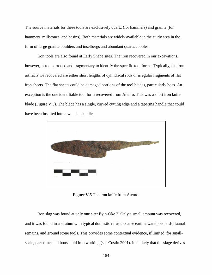
184
The source materials for these tools are exclusively quartz (for hammers) and granite (for
hammers, millstones, and basins). Both materials are widely available in the study area in the
form of large granite boulders and inselbergs and abundant quartz cobbles.
Iron tools are also found at Early Shabe sites. The iron recovered in our excavations,
however, is too corroded and fragmentary to identify the specific tool forms. Typically, the iron
artifacts we recovered are either short lengths of cylindrical rods or irregular fragments of flat
iron sheets. The flat sheets could be damaged portions of the tool blades, particularly hoes. An
exception is the one identifiable tool form recovered from Atenro. This was a short iron knife
blade (Figure V.5). The blade has a single, curved cutting edge and a tapering handle that could
have been inserted into a wooden handle.
Figure V.5 The iron knife from Atenro.
Iron slag was found at only one site: Eyin-Oke 2. Only a small amount was recovered,
and it was found in a stratum with typical domestic refuse: coarse earthenware potsherds, faunal
remains, and ground stone tools. This provides some contextual evidence, if limited, for small-
scale, part-time, and household iron working (see Costin 2001). It is likely that the slage derives
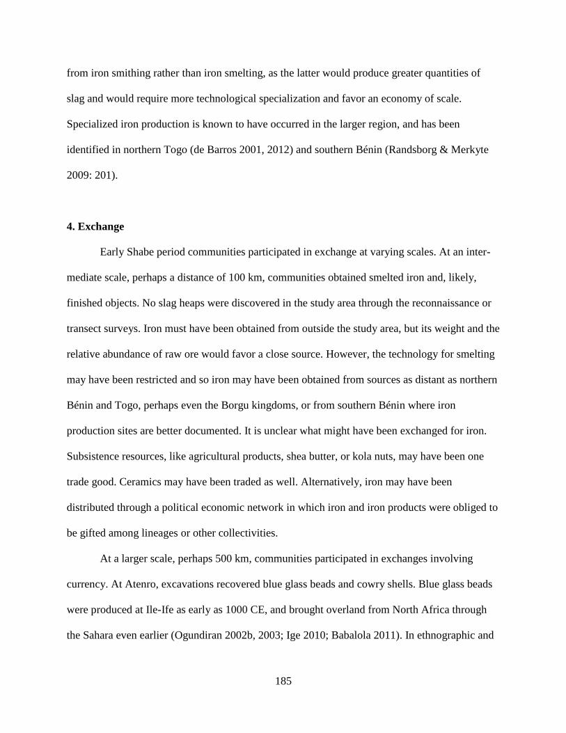
185
from iron smithing rather than iron smelting, as the latter would produce greater quantities of
slag and would require more technological specialization and favor an economy of scale.
Specialized iron production is known to have occurred in the larger region, and has been
identified in northern Togo (de Barros 2001, 2012) and southern Bénin (Randsborg & Merkyte
2009: 201).
4. Exchange
Early Shabe period communities participated in exchange at varying scales. At an inter-
mediate scale, perhaps a distance of 100 km, communities obtained smelted iron and, likely,
finished objects. No slag heaps were discovered in the study area through the reconnaissance or
transect surveys. Iron must have been obtained from outside the study area, but its weight and the
relative abundance of raw ore would favor a close source. However, the technology for smelting
may have been restricted and so iron may have been obtained from sources as distant as northern
Bénin and Togo, perhaps even the Borgu kingdoms, or from southern Bénin where iron
production sites are better documented. It is unclear what might have been exchanged for iron.
Subsistence resources, like agricultural products, shea butter, or kola nuts, may have been one
trade good. Ceramics may have been traded as well. Alternatively, iron may have been
distributed through a political economic network in which iron and iron products were obliged to
be gifted among lineages or other collectivities.
At a larger scale, perhaps 500 km, communities participated in exchanges involving
currency. At Atenro, excavations recovered blue glass beads and cowry shells. Blue glass beads
were produced at Ile-Ife as early as 1000 CE, and brought overland from North Africa through
the Sahara even earlier (Ogundiran 2002b, 2003; Ige 2010; Babalola 2011). In ethnographic and
186
historical contexts, these blue beads were called segi beads and associated with the Ife dynastic
field (Euba 1982; Eluyemi 1987). However, their use was more widespread than among the
highest political elite, as Ifa diviners also wore segi beads (Abiodun 2014: 158). It is likely they
were a more general form of currency that were amassed by wealthy individuals, such as
political elite or ritual specialists. This was the case with cowry shells, which were imported first
from North Africa and then from European traders on the Atlantic coast after 1500 CE. Like
beads, cowries were strung into regular quantities and exchanges as forms of currency (Jones
1958; Johnson 1970).
Interestingly, blue glass beads and cowries were not found at any other Early Shabe
period site. Participation in long-distance exchange was limited to the occupants of Atenro,
likely due to their established connections to Borgu, Oyo, and the Ife dynastic field generally.
Autochthonous communities were more circumscribed in their interactions, either because they
lacked access to exchange routes, products to exchange, or were not interested in acquiring trade
goods. However, blue glass beads were found at Ekudi Oke Odo Akaba, pre-Shabe site
excavated north of the study area by Nestor Labiyi in 2014 (Gurstelle et al. in press). A single
cylindrical, semi-transparent dichroic light blue bead was found at a depth of 140 cm, 20 cm
below a fragment of wood charcoal dated to cal. AD 1311-1434. The date for this bead precludes
the possibility of an Atlantic origin, instead pointing to regional exchange—either with the Sahel
or the Ife dynastic field.
5. Political-Economic Organization
There is little evidence for complex political-economic organization during the Early
Shabe period. The Savè hills landscape was sparsely populated and most settlements are small,
187
less than 5 ha in area. While there is nominal evidence for a three stage site size hierarchy, the
first rank site Atenro is known from oral narratives to have been a community of migrants. Its
large size is not a function of it attracting residents from throughout the Savè hills area, but rather
a function of the size of the group that emigrated from Nikki. The lack of integration between
Atenro and other Early Shabe sites is supported by their distinct ceramic decoration technique
and paste types.
The archaeological evidence from this period largely supports the narrative derived from
oral traditions. Shabe migrants settled in thinly populated frontier, bringing with them a more
complex, hierarchical political system as well as connections to the wider Ife dynastic field.
Indeed, the Amùsù lineage retains a king list of at least eight named kings who ruled prior to
their deposition around 1750 CE (Adediran 1994: 214). Two of these kings who would have
reigned during the occupation of Atenro—Ola Segi and Ola Ileke—have names derived from
types of glass beads associated with royalty in the Ife dynastic field. The presence of
transactional currencies at Atenro demonstrates that at least some Savè hills communities were
participating in social arrangements that allowed for surplus labor to be converted into status
differentials (Guyer 2004).
Status differences at Atenro may have been materialized through exchanged materials,
but they may have necessarily been directly related to exchange or the monopolization of long-
distance networks. Clay and stone beads, which could have been produced locally, were also
recovered from Atenro. These beads may have marked different kinds of status. For example,
stone beads were produced in the recent past at Ilorin and exchanged throughout the Ife dynastic
field (O’Hear 1986: 36). Clay beads are known from archaeological contexts in the region dating
to the West African LSA (Oyelaran 1998: 73).
188
The archaeology of the Early Shabe period is incomplete. Excavations were necessarily
preliminary, and so while providing vital information about Early Shabe material culture, they
are not representative of entire sites. There was almost certainly more variability among Early
Shabe inhabitants than the excavations revealed. Outside of the transect survey areas, sites were
only recorded with the help of present-day oral histories. This invariably leads to a biased picture
of archaeological remains that only includes extant traditions and lineages, and privileges
politically powerful ones. There may be other large sites that date to the Early Shabe period that
were not located as there locations have been forgotten. This may be particularly problematic for
areas that are not actively under cultivation, such as in the southwest portion of the study area
where a national forest preserve has restricted agricultural activities, allowing surface features to
fade from view. These limitations become less problematic for later periods, as there are more
extant lineages to provide oral histories and archaeological features are more visible on the
surface. For the Middle Shabe period, which I turn to now, the conclusions I can draw about the
economic practices and political-economic organization of Savè hills communities are more
substantial.
B. The Middle Shabe Period (1700-1830 CE)
1. Settlement Pattern
The Early Shabe period ended and the Middle Shabe period began with the abandonment
of Atenro and the splitting of the Shabe migrants into two settlements: one at Idadu headed by
the Amùsù lineage, and the other at Kaboua headed by Otólá lineages (Palau Marti 1992a: 87;
Adediran 1994: 93). It is over the course of the Middle Shabe period that the groundwork was

189
laid for the settlement pattern discernible today. The general locations and names of many
villages were fixed, and the Early Shabe and pre-Shabe sites that were abandoned became part of
the ritual landscape of the Savè hills (Figure V.6). The settlement pattern of the Middle Shabe
period is therefore of critical interest in understanding the evolution of the Shabe political
economy.
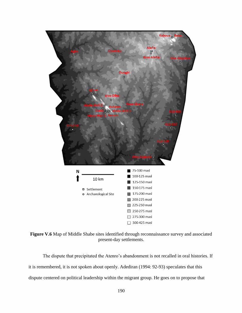
190
Figure V.6 Map of Middle Shabe sites identified through reconnaissance survey and associated
present-day settlements.
The dispute that precipitated the Atenro’s abandonment is not recalled in oral histories. If
it is remembered, it is not spoken about openly. Adediran (1994: 92-93) speculates that this
dispute centered on political leadership within the migrant group. He goes on to propose that

191
these political fissures erupted along pre-existing ethnic lines, with the Amùsù group composed
primarily of Oyo-derived elements within the migrants while the Otólá group was made up of
primarily Boko-derived elements. After leaving Atenro, the Otólá group first settled north of the
study area near Kilibo and established a political system independent of the southern Amùsù. In
various oral narratives, a prince from Kilibo named Baba Guidaï then left and settled near Bako
at the foot of the Oke Agbodo hill. As at Bako, the present-day settlement likely obscures the
extent of the Middle Shabe period settlement, but it is likely smaller than Kaboua’s current
footprint of 20.5 ha.
The autonomy of the Otólá communities that left Atenro was eventually curtailed by
Baba Guidaï at Kaboua. In the same process of fission that led to Kaboua’s formation from
Kilibo, new settlements were founded that fissioned off from Kaboua during the Middle Shabe
period. Oke Akeekee (S12-033) was one such settlement. It was abandoned in the late Middle
Shabe or Late Shabe period, and now is noted by the presence of several baobab trees and a thin
artifact scatter. The size of the site is obscured by thick growth, as it is inside a forest preserve.
The settlement is said to have been abandoned during war, when residents fled to the nearby
eponymous Oke Akeekee for refuge. After the war, the village was abandoned and residents
moved back to Kaboua.
A larger, more permanent settlement was founded at Ouoghi by Yayi Pasi, a grandson of
Baba Guidaï. Unfortunately the balè of Ouoghi did not permit us to investigate nearby
archaeological sites. In 2012 and 2013, it appears the balè was in the midst of an internal
political crisis, and so was not eager have the legitimacy of his office potentially questioned by
appraisals of historical and archaeological sites. The balè was willing, however, to share with the
research team his rendition of Ouoghi’s foundation, as well as to show us a sacred kapok tree
192
that marks the center of the original village. This tree is located within the present-day town, near
the main road RNIE 2. The Middle Shabe period settlement at Ouoghi was likely smaller than
present-day Ouoghi’s area of 20.1 ha.
Derived from Yayi Pasi’s descendants are two more settlements founded in the Middle
Shabe period: Alafia and Diho. The first settlement was Alafia, founded just south of its present-
day location. The community moved to its present location sometime prior to the start of the Late
Shabe period. Ethnographic and historical descriptions of many different agricultural societies in
tropical Africa suggest village locations changed regularly, on the order of a generation or two,
in part to be closer to available land for swidden agriculture (Vogel 1986; Nyerges 1992;
Vansina 1994; Nyerges & Green 2000). Such village movement appears to have happened
repeatedly in the Savè hills area, though at times for defensive reasons rather than ecological.
The original village of woo Alafia (S12-032) is marked by several large baobabs, though the
associated artifact scatter is only near one cluster of trees. The area enclosed by the baobabs is
2.4 ha. Like other Middle Shabe period settlements that are still occupied, the Middle Shabe
period component of present-day Alafia is marked by sacred trees (S12-031). It was likely
smaller than the current footprint of 11.6 ha.
Present-day Diho is north of its original location, now the site woo Diho (S12-030). The
site has an artifact scatter of 1.1 ha with low circular mounds. The site may have been partially
destroyed by the creation of a sports stadium. Though proximal to Idadu, Diho’s place in the
political hierarchy is under Kaboua, as Diho, like Alafia was founded by a descendant of Yayi
Pasi who was a descendant of Baba Guidaï. Though these genealogical links may be fictive, they
express the political relationships between the settlements and their titled officials. The sites
derived from Kaboua are confined to the central and northeastern portions of the study area.

193
These major settlements of Kaboua, Ouoghi, Alafia, and Diho are all located above 200 masl.
Even Oke Akeekee, near the Okpara River, is more elevated than other riverine settlements.
While the group headed by the Otólá lineages left Atenro to the north, the group headed
by the Amùsù lineage left to the south. They eventually settled near Oke Shabe and founded
what is now the town of Shabe-Idadu. These settlements were near the current palace, in the Afin
and Idi-iroko neighborhoods, which total about 16.2 ha. The first palace at Shabe-Idadu was also
constructed during the Middle Shabe period. This palace was called the Afin, the same word
used for the palace of the Oyo monarchy. The form of the earliest palace architecture is largely
unknown due to centuries of occupation at the site. However, a more recent palace was razed by
the French colonial government in 1933 CE. Based on oral history, surviving foundations and
architectural elements, and the stratigraphy visible in road and sewer cuts, the palace’s footprint
was at least 2 ha—similar in size to royal palaces in nearby Dahomey (Monroe 2007a). The
palace was also differentiated in its style of architecture. The remains of a flat-laid potsherd
pavement are visible at the palace’s former site, now a busy marketplace (Figure V.7).
Figure V.7 A flat-laid potsherd pavement at the site of a former palace in Shabe-Idadu.
194
As noted above, however, the hill was already settled by multiple groups when the
Amùsù and other Shabe lineages arrived. Unlike at Oke Agbodo, where oral tradition records
that the Otólá group peacefully integrated with the pre-existing Bako settlement, the Shabe group
killed, expelled, or assimilated the original inhabitants at Oke Shabe (Palau Martí 1992a: 87,
125-126). Though not expelled, the occupants of Eyin-Oke 2 were compelled to move closer to
this new settlement, presumably so that they could be monitored by the dominant Shabe groups.
A king was chosen from the most politically powerful Shabe lineage, the Amùsù, who in turn
delegated lesser offices and titles to other lineages. This marks the beginning of the Shabe polity
as it is known today, and is the beginning of the Amùsù dynasty and their hegemony in the
Shabe political system. Shortly thereafter, Aukpon was re-centered at Aensin, slightly to the
south. Aensin is still occupied, so its Middle Shabe component is likely less than the present-day
21.2 ha. Though settlements were forcibly relocated in both the Eyin-Oke 2 and Aukpon cases, at
least one lineage from Aukpon—the Omo Agbaa—benefited from its relocation. They were
ceded the high ranking office of Olu Osin, or “Lord of the Left,” and control over several
important shrines (S12-034). One of these shrines, Ogu Tani (Figure V.8), is a granite monolith
similar in form, though smaller in scale, to the Opa Oraniyan monolith in Ile-Ife.
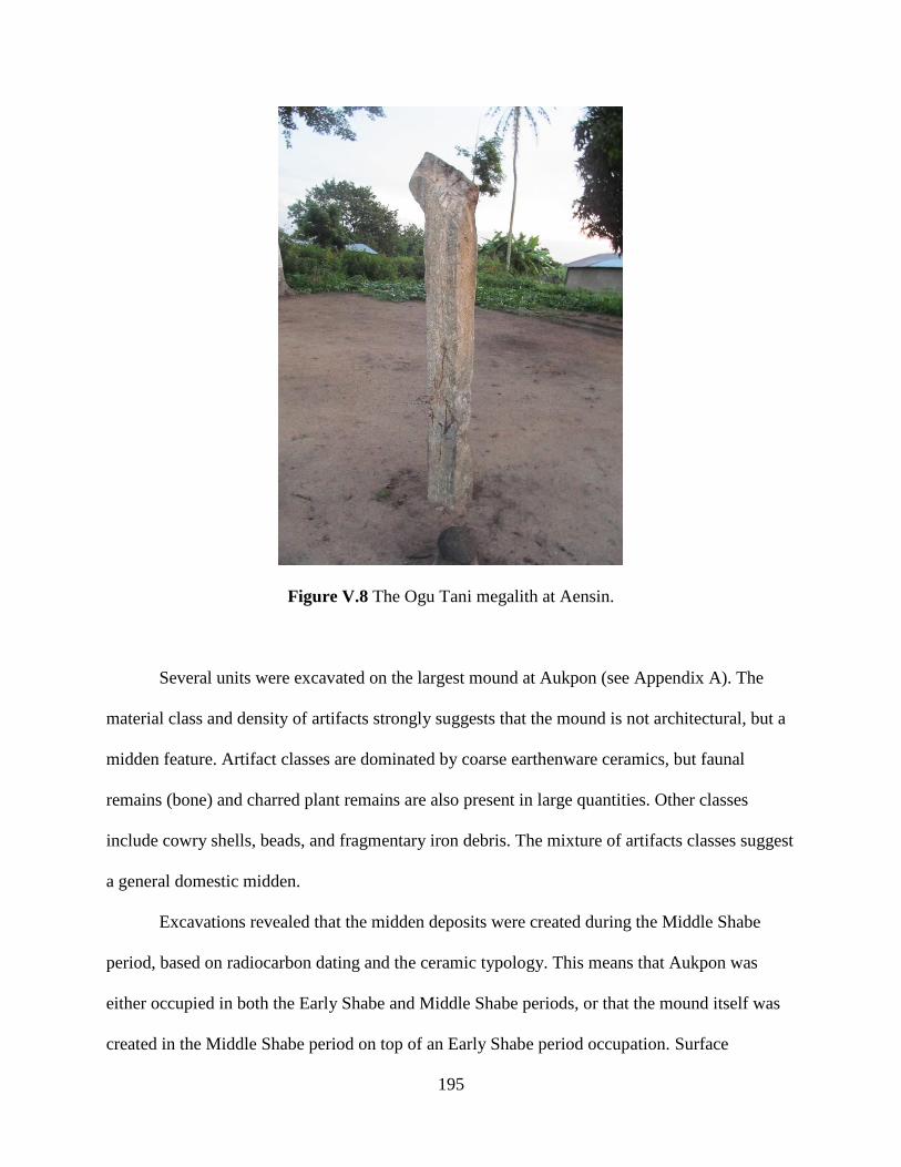
195
Figure V.8 The Ogu Tani megalith at Aensin.
Several units were excavated on the largest mound at Aukpon (see Appendix A). The
material class and density of artifacts strongly suggests that the mound is not architectural, but a
midden feature. Artifact classes are dominated by coarse earthenware ceramics, but faunal
remains (bone) and charred plant remains are also present in large quantities. Other classes
include cowry shells, beads, and fragmentary iron debris. The mixture of artifacts classes suggest
a general domestic midden.
Excavations revealed that the midden deposits were created during the Middle Shabe
period, based on radiocarbon dating and the ceramic typology. This means that Aukpon was
either occupied in both the Early Shabe and Middle Shabe periods, or that the mound itself was
created in the Middle Shabe period on top of an Early Shabe period occupation. Surface

196
collections from elsewhere on the site contain Middle Shabe style artifacts, so it is more likely
that the site was occupied in both periods. The occupation of Aukpon may have even gradually
drifted to the south, rather than being suddenly abandoned, as present-day Aensin is immediately
adjacent to Aukpon.
In addition to the midden deposits, the excavations located a human skeleton (Figure V.9;
see also Chapter IV and Appendix A). The skeleton had been placed in shallow pit dug about 45
cm deep into the mound. The pit was then filled with midden refuse. Another 20-30 cm of
deposition then built up on top of the pit. The skeleton is articulated and nearly complete,
missing only the right hand and the bones below the femur. Additional fragmentary human
tibiae, fibulae, patellae, and a single talus were recovered from the excavated midden fill
adjacent to and immediately above the skeleton, but were not located in situ. These remains
likely were part of the articulated skeleton but disturbed through post-depositional turbation.
Finally, a single human tooth excavated from another part of the mound may not be related to the
skeleton but simply domestic refuse that was deposited in the midden. The skeleton is supine
with its femurs slightly elevated. The body is oriented toward the south-southwest, and the
cranium is facing west. The right arm is flexed so that the distal ends of the radius and ulna touch
the right scapula. The left arm is crossed over the chest with fingers spread over the proximal end
of the right humerus. The bones are stained red, likely due to leaching from the ferruginous soil
matrix. Based on the carefully laid out position of the skeleton and its deposition in a pit, the
skeleton is interpreted as an intentional burial in a pre-existing midden. Several Shabe research
assistants present during the excavation commented that the position of the arms and head is a
colloquial gesture used to indicate sleeping.
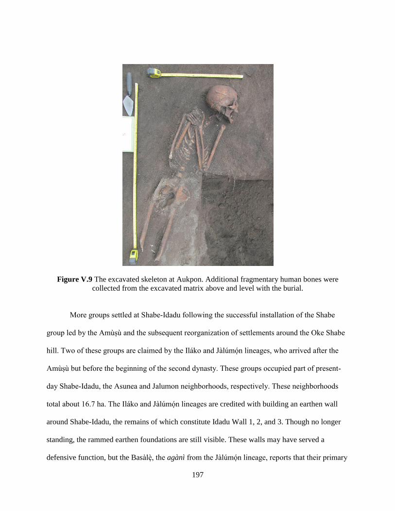
197
Figure V.9 The excavated skeleton at Aukpon. Additional fragmentary human bones were
collected from the excavated matrix above and level with the burial.
More groups settled at Shabe-Idadu following the successful installation of the Shabe
group led by the Amùsù and the subsequent reorganization of settlements around the Oke Shabe
hill. Two of these groups are claimed by the Iláko and Jàlúmón lineages, who arrived after the
Amùsù but before the beginning of the second dynasty. These groups occupied part of present-
day Shabe-Idadu, the Asunea and Jalumon neighborhoods, respectively. These neighborhoods
total about 16.7 ha. The Iláko and Jàlúmón lineages are credited with building an earthen wall
around Shabe-Idadu, the remains of which constitute Idadu Wall 1, 2, and 3. Though no longer
standing, the rammed earthen foundations are still visible. These walls may have served a
defensive function, but the Basàlè, the agànì from the Jàlúmón lineage, reports that their primary

198
function was to collect revenue by forcing travelers to enter Shabe-Idadu through gates where
they could be taxed by the Onishabe.
Though the autochthonous Early Shabe period settlements surrounding the Oke Shabe
hill were dramatically transformed by the Amùsù dynasty, woo Djabata—or “old” Djabata—
remained in its same location. Its residents did, however, participate in the political system of the
growing Shabe kingdom. Though Djabata lineages do not have any agànì and so do not
participate in the ministerial ujoyè oba organization, the balè of Djabata plays an important role
in sanctioning new Onishabes (Palau Martí 1993). This may be a concession to the demands of
autochthons for representation in the king-making process that was established in the Middle
Shabe period.
As at Kaboua, smaller settlements began to fission off from Shabe-Idadu. The Amùsù
dynasty established a royal village and cemetery at Igboe (S12-037) at the foot of Oke Etanetane,
northwest of Shabe-Idadu. The village was abandoned in the late 19th century CE during the Late
Shabe period. The site consists of multiple mounds, baobab trees, and a 3.3 ha surface scatter.
One of the mounds was chosen for excavation to determine if it was architectural. The
excavation revealed several sequential strata, and the classes of artifacts and their density suggest
that the mound is a midden.
Settlers also established woo Gbere (S12-021) to the east of Shabe-Idadu. The residents
of Gbere that claim woo Gbere as their ancestral home are not from titled lineages. Unlike at
Igboe, this site was not founded as a royal enclave but as an agricultural community. Like Igboe,
the site consists of multiple mounds, baobab trees, and a surface scatter, though the scatter at
woo Gbere is only 0.6 ha. A small burned clay feature is visible on the surface at woo Gbere,

199
possibly representing a hearth. However, its unstratified context and proximity to the present-day
village of Gbere makes its provenience questionable.
Many settlements were founded along the Okpara River during the Middle Shabe period.
Three such sites were recorded through the reconnaissance survey—S12-026, S12-027, S12-029.
Though the locations of these sites are remembered, and the fact that they were villages, no other
details about their occupation are recalled. Each site consists of baobab trees and a relatively
small artifact scatter—3.7, 1.1, and 2.3 ha, respectively. The baobab trees may be the reason they
are remembered as being Middle Shabe period villages, as these sacred tree species serve as a
visual index for the presence of past human activity (Gurstelle 2013). What is remembered about
these sites is that they were destroyed during warfare in the Late Shabe period.
A similar site, S13-010, is found along the Ouémé River. Its location is known due to the
presence of large baobabs and a dense surface scatter of 1.2 ha. However, the relative age of this
site was completely unknown to contemporary residents. A 1 m x 2 m excavation unit was
placed near the largest baobab on the site. The ceramic type at S13-010 from both surface and
excavation collections was Shabe B, indicating a Middle Shabe or Late Shabe period site. Like
the other sites without clear oral histories, it is likely that this site was destroyed in the Late
Shabe period. The reason there are no associated oral histories is likely that the inhabitants died
or left the area and did not return. The excavation also exposed a small amount of collapsed
rammed earthen architecture, consistent with other architecture in the Savè hills area.
During the Middle Shabe period, the Amùsù dynasty was driven out in a civil war. The
Otólá lineages from Kaboua, the same that had vied for power with the Amùsù at Atenro, made a
bid for the title of Onishabe and were supported by many of the agànì and untitled lineages
(Palau Martí 1992a: 130-131; Adediran 1994: 98-99). The Amùsù were driven out of Shabe-
200
Idadu and Igboe and initially settled at Opotoku (S12-036). Opotoku was fortified with a large
earthen wall, similar to what was built around Shabe-Idadu. Within the walled enclosure is a thin
artifact scatter and several baobabs. The site is maintained as a sacred grove, and the lack of
agricultural activities has likely obscured the extent of the surface scatter, which was likely
larger than the visible 4.3 ha. An excavation unit was placed near a large baobab tree, revealing
collapsed rammed earthen architecture. As at S13-010, the collapsed architecture produced no
visible topographic change on the surface. This suggests structures were erected in a single
episode, and were not rebuilt or repaired often enough to produce mounding that is characteristic
of collapsed earthen architecture at other West African village sites (McIntosh 1974; Posnansky
2004).
The succeeding Otólá lineages eventually pursued the Amùsù driving them from
Opotoku as well. Some briefly fled to the fortified hilltop refuge of Agba (S13-009). Eventually
all were driven to the far north of the Shabe territory. Agba is the earliest fortified hilltop site in
the study area. The ascent is partially blocked by an uncoursed stone wall. Behind the wall is a
dense 2.7 ha artifact scatter, indicating that a relatively large population lived on top of the hill
for some time. Hilltop refuges are known elsewhere in the Ife dynastic field for later periods, but
not often for the 18th century CE (see Gleave 1963). The animosity between the lineages
subsided and the Amùsù returned to Igboe, though they no longer wore the crown of Onishabe or
held any other major titled office.
As with the Early Shabe period, I am able to date sites of otherwise unknown age that to
either the Middle Shabe or Late Shabe period based on their ceramic type: in this case, Shabe B
Type ceramics. This assemblage type is distinguished by a higher proportion of grid wooden
roulettes, as well as the use of maize cob and/or snailshell lip (or fingernail) impressions. Five
201
sites from the Atenro tract belong to either the Middle Shabe or Late Shabe periods, and 15 sites
have inconclusive ceramic assemblages (Figure V.10). The largest of these sites was located
during the reconnaissance survey, Oke Awè (S13-012), at 1.2 ha. The site has multiple mounds
and a large baobab tree. However, there are no oral histories associated with this site. A 1 m x 2
m excavation unit was placed near the baobab tree on the site. AMS radiocarbon dating was
conducted on wood charcoal from the site, but the results came back as modern. The ceramic
assemblage is Shabe B Type, which along with the dating results suggests a terminal Late Shabe
period or even European Colonial period occupation. The second largest site at 0.7 ha, S13-016,
is also the location of a Fulani camp that was abandoned around a decade before my fieldwork.
Material culture from this recent occupation has mixed on the surface with artifacts from a
potential earlier occupation. Further, a recent borrow pit has likely damaged the integrity of
subsurface deposits and mixed them into the surface scatter. The next three sites, S13-018, S13-
028, S13-032 are smaller, at <0.1 ha, 0.1 ha, and 0.1 ha, respectively.

202
Figure V.10 Possible Middle Shabe period archaeological sites in the Atenro transect survey
tract.
Three sites from the Fiditi tract belong to either the Middle Shabe or Late Shabe periods,
and four sites have inconclusive ceramic assemblages (Figure V.11). Of the three sites with
Shabe B Type ceramics, two are more likely to belong to the Late Shabe period as part of the

203
Fiditi site complex. The other site, S13-001, is a very small artifact scatter of only <0.1 ha.
Though its ceramic assemblage is inconclusive, S13-003 is adjacent to the Idadu Wall 3 site
(S13-034). This suggests the site postdates the wall construction, and may even be associated
with the wall’s construction during the Middle Shabe period.

204
Figure V.11 Possible Middle Shabe period archaeological sites in the Fiditi transect survey tract.
205
The settlement pattern of the Middle Shabe period is distinct from the Early Shabe
period. There are more settlements, and they are more broadly distributed on the landscape. The
same three clusters that characterized the Early Shabe period—around Oke Agbodo, Oke Shabe,
and the Okpara River, continue to be occupied, but their character changed. At Oke Agbodo,
Bako was joined by Kaboua. At Oke Shabe, the settlements ringing the hill are replaced by a
larger, more centralized settlement at Shabe-Idadu. The cluster near the Okpara River is
unchanged, but more settlements appear along the length of the river. In addition, settlements are
established near the Ouémé River, as well as in the highland area between the rivers. This pattern
indicates a population increase between the Early Shabe and Middle Shabe periods. Increasing
population may be due in part to natural accretion through birthrates, but is also likely a product
of migration into the area, potentially to participate in the political economy of the growing
Shabe kingdom. Oral tradition claims that the population of Shabe-Idadu reached as high as
80,000 people during this period (Asiwaju 1973). How this number was recorded or estimated is
not clear, and it is likely too high given that the entire population of the present-day commune of
Savè, including Shabe-Idadu is less than 70,000 people. Writing in the middle of the 19th century
CE, the missionary Bowen (1857: 222) reported the population of the entire Shabe kingdom as
20,000, though this was after a period of intense warfare and depopulation of the region (see
below).
Though many Middle Shabe sites are obscured by present-day settlements, differences in
the area of these sites gives an impression of an elaborated three rank settlement size system
(Table V.3). The largest sites are all occupied today, making the Middle Shabe areas of first rank
sites difficult to estimate. The next rank is slightly smaller than it was during the Early Shabe
period. Excluding S12-036, where the surface scatter is likely significantly larger than what is
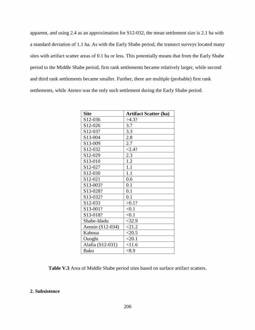
206
apparent, and using 2.4 as an approximation for S12-032, the mean settlement size is 2.1 ha with
a standard deviation of 1.1 ha. As with the Early Shabe period, the transect surveys located many
sites with artifact scatter areas of 0.1 ha or less. This potentially means that from the Early Shabe
period to the Middle Shabe period, first rank settlements became relatively larger, while second
and third rank settlements became smaller. Further, there are multiple (probable) first rank
settlements, while Atenro was the only such settlement during the Early Shabe period.
Site Artifact Scatter (ha)
S12-036 >4.3?
S12-026 3.7
S12-037 3.3
S13-004 2.8
S13-009 2.7
S12-032 <2.4?
S12-029 2.3
S13-010 1.2
S12-027 1.1
S12-030 1.1
S12-021 0.6
S13-003? 0.1
S13-028? 0.1
S13-032? 0.1
S12-033 >0.1?
S13-001? <0.1
S13-018? <0.1
Shabe-Idadu <32.9
Aensin (S12-034) <21.2
Kaboua <20.5
Ouoghi <20.1
Alafia (S12-031) <11.6
Bako <8.9
Table V.3 Area of Middle Shabe period sites based on surface artifact scatters.
2. Subsistence
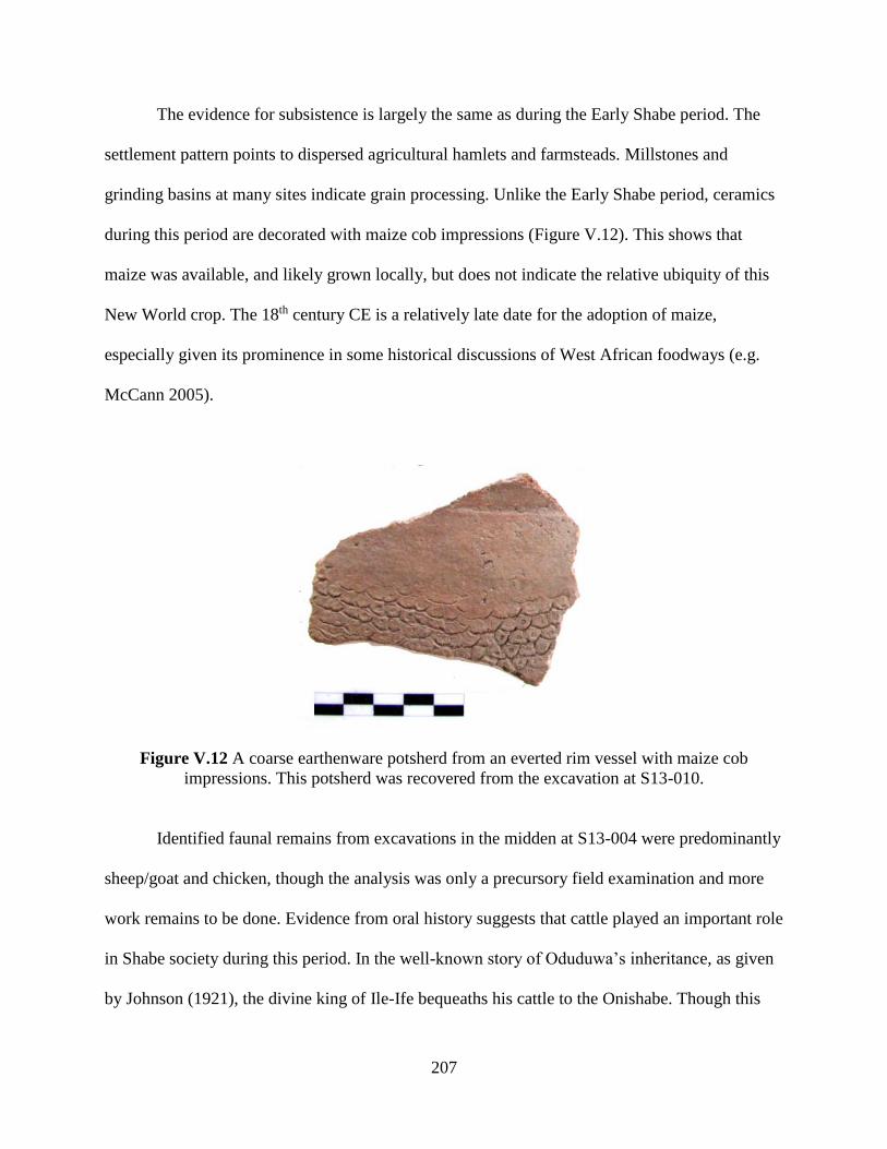
207
The evidence for subsistence is largely the same as during the Early Shabe period. The
settlement pattern points to dispersed agricultural hamlets and farmsteads. Millstones and
grinding basins at many sites indicate grain processing. Unlike the Early Shabe period, ceramics
during this period are decorated with maize cob impressions (Figure V.12). This shows that
maize was available, and likely grown locally, but does not indicate the relative ubiquity of this
New World crop. The 18th century CE is a relatively late date for the adoption of maize,
especially given its prominence in some historical discussions of West African foodways (e.g.
McCann 2005).
Figure V.12 A coarse earthenware potsherd from an everted rim vessel with maize cob
impressions. This potsherd was recovered from the excavation at S13-010.
Identified faunal remains from excavations in the midden at S13-004 were predominantly
sheep/goat and chicken, though the analysis was only a precursory field examination and more
work remains to be done. Evidence from oral history suggests that cattle played an important role
in Shabe society during this period. In the well-known story of Oduduwa’s inheritance, as given
by Johnson (1921), the divine king of Ile-Ife bequeaths his cattle to the Onishabe. Though this
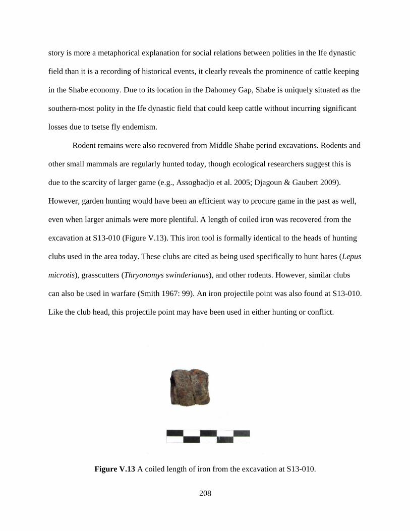
208
story is more a metaphorical explanation for social relations between polities in the Ife dynastic
field than it is a recording of historical events, it clearly reveals the prominence of cattle keeping
in the Shabe economy. Due to its location in the Dahomey Gap, Shabe is uniquely situated as the
southern-most polity in the Ife dynastic field that could keep cattle without incurring significant
losses due to tsetse fly endemism.
Rodent remains were also recovered from Middle Shabe period excavations. Rodents and
other small mammals are regularly hunted today, though ecological researchers suggest this is
due to the scarcity of larger game (e.g., Assogbadjo et al. 2005; Djagoun & Gaubert 2009).
However, garden hunting would have been an efficient way to procure game in the past as well,
even when larger animals were more plentiful. A length of coiled iron was recovered from the
excavation at S13-010 (Figure V.13). This iron tool is formally identical to the heads of hunting
clubs used in the area today. These clubs are cited as being used specifically to hunt hares (Lepus
microtis), grasscutters (Thryonomys swinderianus), and other rodents. However, similar clubs
can also be used in warfare (Smith 1967: 99). An iron projectile point was also found at S13-010.
Like the club head, this projectile point may have been used in either hunting or conflict.
Figure V.13 A coiled length of iron from the excavation at S13-010.
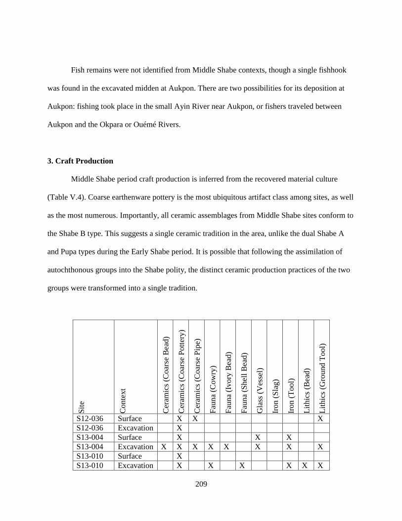
209
Fish remains were not identified from Middle Shabe contexts, though a single fishhook
was found in the excavated midden at Aukpon. There are two possibilities for its deposition at
Aukpon: fishing took place in the small Ayin River near Aukpon, or fishers traveled between
Aukpon and the Okpara or Ouémé Rivers.
3. Craft Production
Middle Shabe period craft production is inferred from the recovered material culture
(Table V.4). Coarse earthenware pottery is the most ubiquitous artifact class among sites, as well
as the most numerous. Importantly, all ceramic assemblages from Middle Shabe sites conform to
the Shabe B type. This suggests a single ceramic tradition in the area, unlike the dual Shabe A
and Pupa types during the Early Shabe period. It is possible that following the assimilation of
autochthonous groups into the Shabe polity, the distinct ceramic production practices of the two
groups were transformed into a single tradition.
Sit
e
Conte
xt
Cer
amic
s (C
oar
se B
ead)
Cer
amic
s (C
oar
se P
ott
ery)
Cer
amic
s (C
oar
se P
ipe)
Fau
na
(Cow
ry)
Fau
na
(Ivory
Bea
d)
Fau
na
(Shel
l B
ead)
Gla
ss (
Ves
sel)
Iron (
Sla
g)
Iron (
Tool)
Lit
hic
s (B
ead)
Lit
hic
s (G
round T
ool)
S12-036 Surface X X X
S12-036 Excavation X
S13-004 Surface X X X
S13-004 Excavation X X X X X X X X
S13-010 Surface X
S13-010 Excavation X X X X X X

210
S12-026 Surface X
S12-037 Surface X X X X X
S13-009 Surface X X
S12-032 Surface X
S12-029 Surface X
S12-027 Surface X X
S12-030 Surface X X
S12-021 Surface X X
S13-003? Surface X
S13-028? Surface X
S13-032? Surface X
S12-033 Surface X X X
S13-001? Surface X
S13-018? Surface X
Table V.4 Artifact classes and subclasses present at Middle Shabe period sites.
Ground stone tools were the second most ubiquitous artifact class. These tools are limited
to hammers, millstones, and grinding basins made of quartz or granite. Worn basins in natural
rock features were also observed at Agba (Figure V.14). Inhabitants invested time to create non-
portable grinding features, suggesting their occupation of the hilltop refuge site was relatively
long. Iron tools and slag were also recovered, but in very limited amounts. No special purpose
tool production sites—quarries or forges—were located. As in the Early Shabe period, the small
quantity of slag that was recovered came from a domestic context—the surface of a mound that
was then tested and revealed to be a general domestic midden context. Despite the increase in
settlements and size during the Middle Shabe period, there is no change in the organization of
craft production, which appears to have remained a small-scale, unspecialized, household
industry.
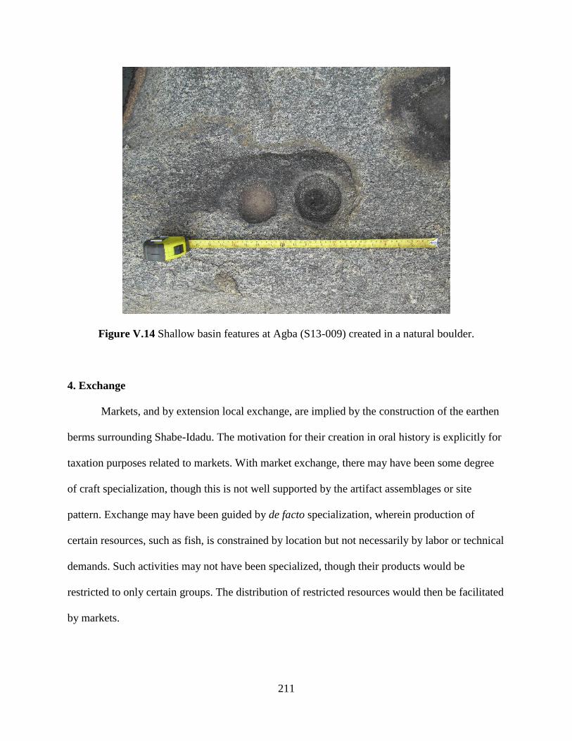
211
Figure V.14 Shallow basin features at Agba (S13-009) created in a natural boulder.
4. Exchange
Markets, and by extension local exchange, are implied by the construction of the earthen
berms surrounding Shabe-Idadu. The motivation for their creation in oral history is explicitly for
taxation purposes related to markets. With market exchange, there may have been some degree
of craft specialization, though this is not well supported by the artifact assemblages or site
pattern. Exchange may have been guided by de facto specialization, wherein production of
certain resources, such as fish, is constrained by location but not necessarily by labor or technical
demands. Such activities may not have been specialized, though their products would be
restricted to only certain groups. The distribution of restricted resources would then be facilitated
by markets.

212
At the regional level, Middle Shabe period communities produced pottery that was
similar to styles and forms found across the larger region. The range of decoration techniques
used in Shabe B type assemblages—grid wooden roulette, twisted cord roulette, shell lip
impression, and maize cob roulette—mirrors the same range found in the Igbomina area (Usman
2003) and the Upper Osun area (Ogundiran 2001, 2002a) of the Ife dynastic field to the east of
the Savè hills. A small number of sherds from thin-walled, slightly everted black bowls are also
found at Middle Shabe period sites. This kind pottery may have been imported from the Oyo
Empire, as it is a very common form at Oyo sites, and found in small amounts at Oyo vassals and
tributaries (Ogundiran & Saunders 2011: 320).
Interestingly, the dominance of grid wooden roulettes in Shabe B type assemblages is
unlike the Ife dynastic field and is much more similar to decoration techniques from
contemporary Dahomey and Ketu to the south (Randsborg & Merkyte 2009: 185-189). These
grid wooden roulettes are by far the most common decorative technique, perhaps indicating more
frequent exchange of pottery or technical potting knowledge with the south than with the east.
There are also ceramic similarities with the far north. Small numbers of potsherds decorated with
folded strip roulettes are found at Middle Shabe period sites. They do not have any analogues
with techniques from either the east or south, but are reported from earlier archaeological sites
near the Niger River (Khalaf & Haour 2013: 108).
As with the Early Shabe period, glass artifacts and cowry shells are the best indicators of
long-distance exchange. No glass beads were recovered from Middle Shabe period contexts,
though some bottle glass was found at several sites. At Igboe (S12-037), bottle glass was found
on the surface and in stratified contexts. However, this site was occupied throughout the Late
Shabe period, and will be considered below. At Aukpon (S13-004), bottle glass was found only

213
on the surface and in topsoil contexts and, given the close proximity to a present-day settlement,
may have been introduced recently. There is no other evidence for bottle glass during this period,
suggesting that participation in the Atlantic trade was limited. Cowry shells are better accounted
for, including at the relatively small site of Oke Akeekee (S12-033). Cowries were likely
imported through down-the-line trading, as they were being used as a medium of exchange
throughout the region.
Shabe communities may have exchanged subsistence and agricultural products for
transactional currencies like cowries. They may have also exchanged cattle, as hinted at by the
story of Odùduwà’s inheritance. Another possibility is that Shabe communities exchanged ivory.
A single ivory bead was recovered from Aukpon, though it is not clear if it was created locally.
Elephants are known to have inhabited the area as recently as the early 20th century CE (Palau
Martí 1992a: 23). Ivory was an important trade good in the region since the early first
millennium CE, both for local use and for export to North Africa and beyond (Insoll & Shaw
1997).
5. Political-Economic Organization
In the oral traditions of the Shabe kingdom, the Middle Shabe period—the time after the
founding of Shabe-Idadu—marks the centralization of the polity. Adediran (1994: 100) cites this
as the development from multiple “city-states” to a single territorial state. However, the term
state may be misleading in this case, as there is no evidence that suggests that a central state
institution was able to establish a monopoly on the legal exercise of force. Indeed, even into
historic times, the Shabe kingdom was largely organized along kinship, with multiple parallel
214
political institutions. While I prefer the term polity for its absence of evolutionary implications, it
also does not convey anything specific about the structure of the Shabe kingdom.
How was the Shabe kingdom during the Middle Shabe period organized? How was
power creatively and instrumentally exercised, and by what institutions? Fortunately the
archaeological evidence to address these questions is more robust for the Middle Shabe period
than earlier periods. There is much stronger evidence for a settlement hierarchy characterized by
three ranks during the Middle Shabe period. In addition, the primacy of Shabe-Idadu over other
first rank settlements may be interpreted as a third tier of administrative hierarchy (Wright &
Johnson 1975). The remains of the palace potsherd pavement are also unique to the area. The
pavement was constructed with the same technique as that at the pre-Shabe period site of Ekudi
Oke Odo Akaba—suggesting long term continuity in architectural practices rather than a shift
toward the edge-laid pavement style found at Ile-Ife. This is an interesting continuity, as the
present-day Shabe monarchy employs many other symbols of authority derived from political
practices centered at Ile-Ife. At the very least then, Shabe political symbols were derived from
both autochthonous and regional influences. It may even be that the appeal to Ile-Ife is a recent
orientation, as Shabe does not appear as an official descendant lineage in the earliest recorded
king lists of Ile-Ife. Like other distant polities, it is not attested to in Ile-Ife’s transcribed oral
histories until the late 19th century CE (Palau Martí 1992a: 61).
There is a strong landscape focus around Shabe-Idadu during the Middle Shabe period.
Not only is it a major settlement occupied by politically dominant lineages, but its gravity drew
in other lineages—through both willing migration and forced relocation. The centrality of Shabe-
Idadu was emphasized through the construction of earthen berms. This strategy is known from
elsewhere in the region, including in Oyo (Soper & Darling 1980; Usman 2004), Ife (Willett
215
1960; Obayemi 1979), Benin (Connah 1967, 1972), Dahomey (Monroe 2012), and Ouidah
(Norman & Kelly 2004). Though they may have had a defensive or ideological purpose, as the
cited examples did, the berms at Shabe-Idadu are linked to control of market access. Markets are
linked to the power of the Onishabe, in that they are directly taxed to support the monarchy’s
retinue, bureaucracy, and its acquisition of status goods. This is one way the Onishabe exercised
instrumental economic power (sensu Robertshaw 2010).
Individuals other than the Onishabe exercised power as well. The best evidence for this is
the burial discovered at Aukpon. The excavation site on the mound was chosen with no advance
knowledge of the burial. Though residents of Aensin were consulted in choosing the excavation
location at Aukpon, none suggested that a human burial would be found within. However, after
discovering the burial, the Olú Òsìn, the high ranking agànì from Aensin’s prominent Omo
Agbaa lineage, consulted with other elders at Aensin and determined the burial belonged to a
high ranking political official, likely another Olú Òsìn. Indeed, the treatment of the body—
lacking associated burial goods, right hand removed, parts of the legs and feet possibly
removed—is consistent with burial practices from recent times in Aensin, as told to the research
team by the Olú Òsìn before the burial was discovered. Such burial practices include removing
the hands, as the deceased will have no need to manipulate their surroundings in the spirit world.
The left hand may have been left intact because an Olú Òsìn (Lord of the Left) may actually need
their left hand in the spirit world. Similarly, the feet are removed as the deceased will be carried
and have no need for walking. Interestingly, the head was also reported as being removed, but
this was said to disempower the corpse and prevent the deceased’s malevolent ghost from
returning and harming the community. Such views are consistent with the Yoruba notion of
spiritual power, or àse, wherein politically powerful individuals are also spiritually powerful
216
(Lawal 1985; Abiodun 1994). Spiritual potency can be both beneficial and destructive,
particularly when unconstrained by human concerns as is the case with passed on spirits. The
lack of burial goods may be due to preservation biases: bodies are wrapped in large quantities of
cloth, representing a substantial expense of the funeral. The location in a midden is very unusual
for the Ife dynastic field. Aleru (2006) reports excavating a single individual in a midden, but
little detail is given. Palau Martí (1993) reports that subfloor burial in the house compound is
considered an ideal burial in recent Shabe, and is a common practice for other Yoruba
communities (e.g., Ellis 1894: 158; Lawal 1977). Relatedly, particularly inauspicious deaths may
not receive a burial at all and bodies may be left in the bush. That the Aukpon individual was
buried in a midden—a public space—may be a function of his/her role as a leader in the public
arena.
The presence of shrines during the Middle Shabe period suggests one of the possible
routes to power within the Shabe political economy. Ritual roles are also indicated by the kinds
of beads recovered, which include beads made of clay, ivory, and stone. A coarse earthenware
bead from Aukpon has alternating white and red stripes (Figure V.15), similar to beads used by
devotees of the oosà Oko in historic times (Peel 2000: 106).
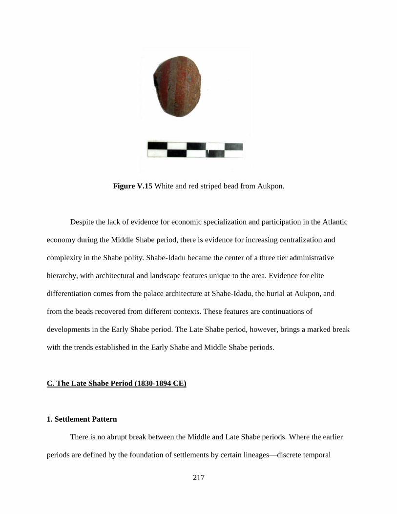
217
Figure V.15 White and red striped bead from Aukpon.
Despite the lack of evidence for economic specialization and participation in the Atlantic
economy during the Middle Shabe period, there is evidence for increasing centralization and
complexity in the Shabe polity. Shabe-Idadu became the center of a three tier administrative
hierarchy, with architectural and landscape features unique to the area. Evidence for elite
differentiation comes from the palace architecture at Shabe-Idadu, the burial at Aukpon, and
from the beads recovered from different contexts. These features are continuations of
developments in the Early Shabe period. The Late Shabe period, however, brings a marked break
with the trends established in the Early Shabe and Middle Shabe periods.
C. The Late Shabe Period (1830-1894 CE)
1. Settlement Pattern
There is no abrupt break between the Middle and Late Shabe periods. Where the earlier
periods are defined by the foundation of settlements by certain lineages—discrete temporal

218
events—the Late Shabe period is marked by increased warfare, with its peak between 1840 and
1860 CE, and the gradual abandonment of most settlements in the area as occupants fled to
hilltop refuge sites (Figure V.16). Shabe histories record prior conflicts, such as the violence
between the Amùsù dynasty and local communities during the Middle Shabe noted above, but
these were between lineages or small coalitions. Late Shabe period conflicts were on a larger
scale, pitting entire Shabe communities against the armies of Dahomey, Egba (a former province
of Oyo), Borgu, and Fulani raiders. Thus, while the Early Shabe and Middle Shabe periods are
defined by settlement growth and centralization, the Late Shabe period is characterized by
dissolution.
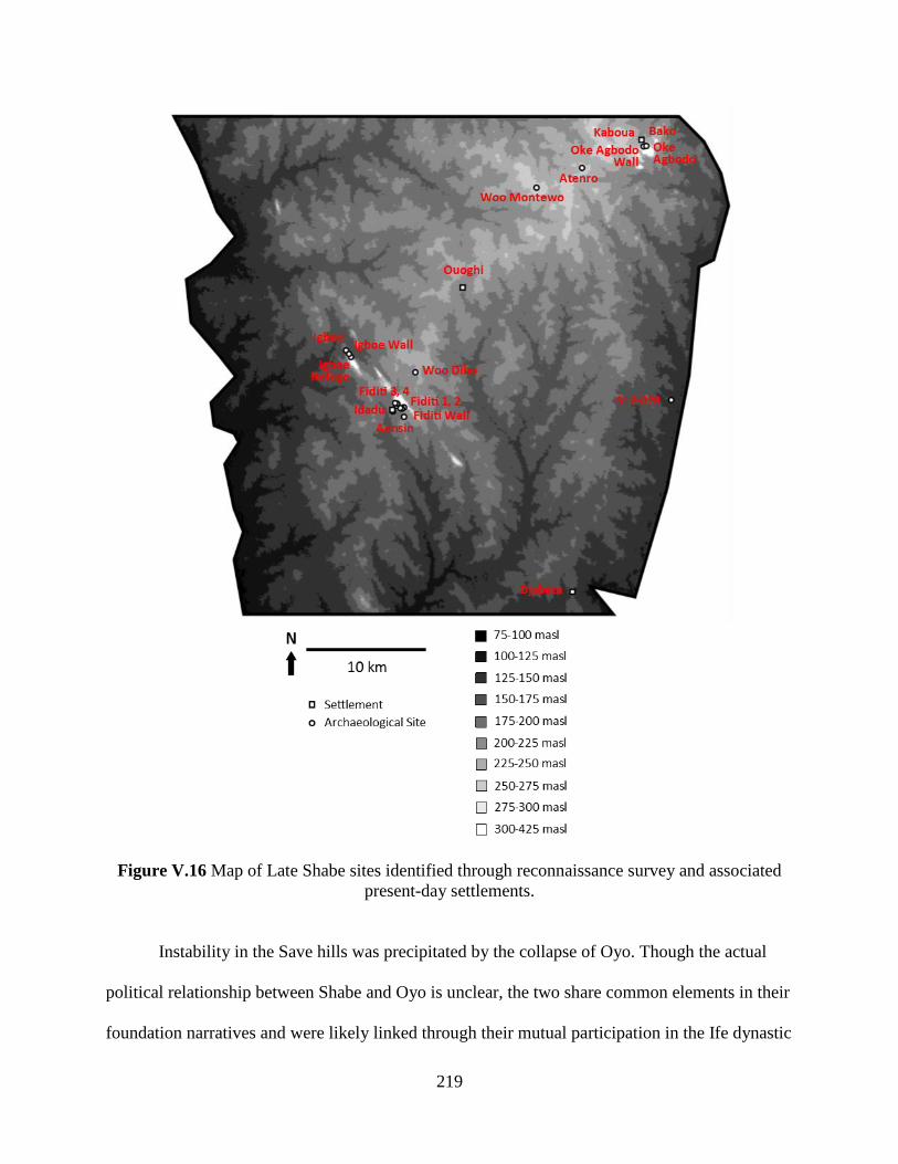
219
Figure V.16 Map of Late Shabe sites identified through reconnaissance survey and associated
present-day settlements.
Instability in the Save hills was precipitated by the collapse of Oyo. Though the actual
political relationship between Shabe and Oyo is unclear, the two share common elements in their
foundation narratives and were likely linked through their mutual participation in the Ife dynastic
220
field (see Chapters II and III). Indeed, following Oyo’s collapse there was an interregnum period
when a suitable successor to the Onishabe office could not be named, perhaps due to a lack of
confirmation from Oyo (Palau Martí 1992a: 193). Shabe’s economy may have been disrupted
too. By the end of the 19th century CE, Shabe merchants used Oyo-controlled trade routes to the
coast to participate in the trans-Atlantic trade (Adediran 1994: 194). In addition, Shabe
communities relied on Oyo to keep the armies of neighboring polities in check. With the buffer
of the Oyo military gone, the Savè area was periodically raided by other polities in the Yoruba-
Edo region as well as by Fulani groups from the north (Palau Martí 1992a: 208-210). Another
concern for Shabe was the growing power of Dahomey as it sought to expand east into the
vacuum left by Oyo’s collapse (Monroe 2014: 71).
Oral histories from both Shabe and Dahomey record a series of battles fought between
the two polities starting around 1820 CE (Duncan 1847: 41-42; Palau Martí 1992a: 196-199).
Though Shabe, backed by Oyo, started as the aggressor, its armies were routed around 1828 CE.
The Dahomean forces eventually marched on Shabe-Idadu around 1834 CE, destroying it.
Shabe-Idadu was a prime target for many of the incursions of the Late Shabe period. Oyo’s
defeat in the Battle of Ilorin in 1837 CE marked the end of its reign and was quickly followed by
the abandonment of its capital at Oyo-Ile. The Sokoto Caliphate that formed along Oyo’s
northern territory started to raid into Shabe territory, though this primarily affected the
communities north of the study area.
The destruction of settlements at the start of the Late Shabe period spurred the foundation
of fortified hilltop refuges. The settlements near Shabe-Idadu fled to the multi-site complex of
Fiditi on the Oke Shabe hill. Four sites are known from oral histories as belonging to Fiditi. The
largest of these sites, Fiditi 1 (S12-004), has a surface scatter of 12.1 ha and is the largest site in
221
the study area. It is located on a level granite plateau between the U-shaped domes of the hill.
The opening of the U-shaped domes is fortified by a paired earthen berm and ditch. These
features abut the sheer face of the granite and run toward the southwest (see Appendix A). A 1 m
x 2 m excavation unit was placed on the berm to investigate its composition and confirmed an
anthropogenic origin. About 70 meters west of the berm is a large earthen mound which conjoins
with an uncoursed dry stone wall (S12-001). A 1 m x 2 m excavation unit was placed on the
mound. The excavation revealed rammed earth debris consistent with collapsed architecture. In
his MPhil thesis, Simon Agani (2015) interprets this structure as a guard house given its
proximity to fortifications and position at the egress point of the Fiditi 1 settlement. Fourteen
baobab trees are associated with the artifact scatter, indicating that the refuge was inhabited long
enough for occupants to manage the early growth of these trees. A 1 m x 2 m excavation was
conducted near the largest baobab on the site, but the integrity of subsurface deposits was badly
disturbed by present-day agricultural activities. In addition, a rockshelter at the northwestern
edge of the site is associated in oral histories with the grave of Oba Otewa, the Onishabe credited
with founding Fiditi.
The three more surface scatter sites make up Fiditi. All three are located on the domes of
the Oke Shabe hill. Fiditi 2 (S12-006) is comprised of a surface scatter with one large mound. It
is also enclosed by the same stone wall that protects Fiditi 1 (Figure V.17). Fiditi 3 (S12-009)
and Fiditi 4 (S12-012) are higher up on the hill and are enclosed by their own uncoursed dry
stone wall (S12-008). Despite their inaccessibility, architectural features were found at both of
these sites, indicating resident investment in the refuge and perhaps a long duration occupation.
Palau Martí (1992a: 225) recorded a narrative stating that the Fiditi sites were destroyed around
1860 CE during a conflict between the Otólá and Amùsù lineages. This version conflicts with

222
narratives offered by both the Onishabe and Ola-Amùsù in 2012 and 2013, which state that Fiditi
was destroyed in a later war against Dahomey. It is possible that both are true, and that Fiditi was
occupied—and destroyed—multiple times.
Figure V.17 The highest point of S12-001. The stone wall continues 0.6 km down the hill,
enclosing S12-004 and S12-006.
Fortified refuges were built at the other two Middle Shabe period settlements adjacent to
granite hills: Igboe and Kaboua. At Igboe, an uncoursed dry stone wall (S12-039) on the dome of
Oke Etanetane protects a small refuge site (S13-006). Unlike at Fiditi, there is no evidence for a
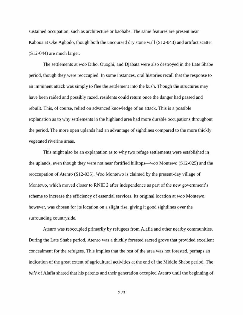
223
sustained occupation, such as architecture or baobabs. The same features are present near
Kaboua at Oke Agbodo, though both the uncoursed dry stone wall (S12-043) and artifact scatter
(S12-044) are much larger.
The settlements at woo Diho, Ouoghi, and Djabata were also destroyed in the Late Shabe
period, though they were reoccupied. In some instances, oral histories recall that the response to
an imminent attack was simply to flee the settlement into the bush. Though the structures may
have been raided and possibly razed, residents could return once the danger had passed and
rebuilt. This, of course, relied on advanced knowledge of an attack. This is a possible
explanation as to why settlements in the highland area had more durable occupations throughout
the period. The more open uplands had an advantage of sightlines compared to the more thickly
vegetated riverine areas.
This might also be an explanation as to why two refuge settlements were established in
the uplands, even though they were not near fortified hilltops—woo Montewo (S12-025) and the
reoccupation of Atenro (S12-035). Woo Montewo is claimed by the present-day village of
Montewo, which moved closer to RNIE 2 after independence as part of the new government’s
scheme to increase the efficiency of essential services. Its original location at woo Montewo,
however, was chosen for its location on a slight rise, giving it good sightlines over the
surrounding countryside.
Atenro was reoccupied primarily by refugees from Alafia and other nearby communities.
During the Late Shabe period, Atenro was a thickly forested sacred grove that provided excellent
concealment for the refugees. This implies that the rest of the area was not forested, perhaps an
indication of the great extent of agricultural activities at the end of the Middle Shabe period. The
balè of Alafia shared that his parents and their generation occupied Atenro until the beginning of
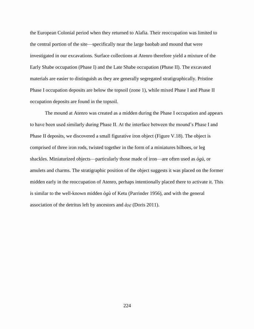
224
the European Colonial period when they returned to Alafia. Their reoccupation was limited to
the central portion of the site—specifically near the large baobab and mound that were
investigated in our excavations. Surface collections at Atenro therefore yield a mixture of the
Early Shabe occupation (Phase I) and the Late Shabe occupation (Phase II). The excavated
materials are easier to distinguish as they are generally segregated stratigraphically. Pristine
Phase I occupation deposits are below the topsoil (zone 1), while mixed Phase I and Phase II
occupation deposits are found in the topsoil.
The mound at Atenro was created as a midden during the Phase I occupation and appears
to have been used similarly during Phase II. At the interface between the mound’s Phase I and
Phase II deposits, we discovered a small figurative iron object (Figure V.18). The object is
comprised of three iron rods, twisted together in the form of a miniatures bilboes, or leg
shackles. Miniaturized objects—particularly those made of iron—are often used as ògù, or
amulets and charms. The stratigraphic position of the object suggests it was placed on the former
midden early in the reoccupation of Atenro, perhaps intentionally placed there to activate it. This
is similar to the well-known midden ògù of Ketu (Parrinder 1956), and with the general
association of the detritus left by ancestors and àse (Doris 2011).
225
Figure V.18 This miniature bilboes is composed if thee separate iron rods twisted together: one
rod forming the shaft and end loop, and two more rods forming each C-shaped restraint.
The Dahomean king Glele ascended the throne in 1858 CE and continued his
predecessor’s bellicose relations with neighboring polities. At the time, Shabe was deep into its
interregnum with no Onishabe or centralized leadership (Palau Martí 1992a: 229-230). Indeed,
much of the area around Shabe-Idadu was abandoned with only small populations remaining
along the Okpara River. Sometime between 1860 and 1865 CE, Dahomey invaded the area and
sacked these remaining settlements (ibid: 231, 240). Oba Otewa’s successor, Boni Akekee was
captured and brought to Abomey as a political prisoner. This event marks the beginning of
Dahomey’s virtual control over Shabe politics. After Boni Akekee’s release, the office of
Onishabe was reconstituted and Shabe-Idadu was reoccupied. However, tribute was paid to
Dahomey, possibly as part of the xwetanu annual customs (see Skertchly 1874; Monroe 2011,
2014: 81-83). By 1885 CE, Dahomey had installed an official minder at Shabe-Idadu to monitor
the Onishabe and ensure compliance with political and economic demands (Palau Martí 1992a:
240; Adediran 1994: 204).
226
The site S12-028 is an outlier in the general settlement pattern. While other settlements in
the Okpara River basin were destroyed and abandoned, this site was settled during the period of
Dahomean rule and was spared destruction. The site consists of a relatively large artifact scatter,
several mounds, and large sacred tree species—identical to typical Shabe and autochthonous
settlement sites. However, the site is claimed as the ancestral village of Oke-Owo, a present-day
settlement nearby. Most lineages at Oke-Owo are not Shabe or autochthon descendants, but are
Mahi from the south. They were ceded land by the Dahomean-controlled Onishabe and
established a thriving settlement at S12-028. Like Djabata, Oke-Owo was significant as a stop in
cross-Okpara River transit routes. Oke-Owo’s success as a settlement may be directly due to
Dahomey’s encouragement of it as a way of controlling, or at least monitoring, regional trade.
Dahomey used resettlement strategies as a means of controlled conquered peoples, particularly
among the Mahi (Anignikin 2001; Monroe 2014: 165-166)
The settlement pattern derived from the Atenro tract transect survey in the Late Shabe
period is identical to that of the Middle Shabe period, as the chronologically sensitive features of
the ceramic assemblages do not discern between the two periods. From the general pattern of
abandonment described above, it might be assumed that many of the small hamlets and
farmsteads were similarly abandoned. However, it may be that rather than completely
depopulating the area, residents remained in the area but dispersed to exactly these kinds of
small-scale settlements. Though possible, such a scenario is not attended to in the oral history,
nor is it commonly observed in cross-cultural studies of settlement responses to warfare (e.g.,
Rowlands 1972; Haas 2001).
In the Fiditi tract, two sites with Shabe B type assemblages likely belong to the Late
Shabe period: S12-013 and S12-014. In both cases, small amounts of rammed earth architectural
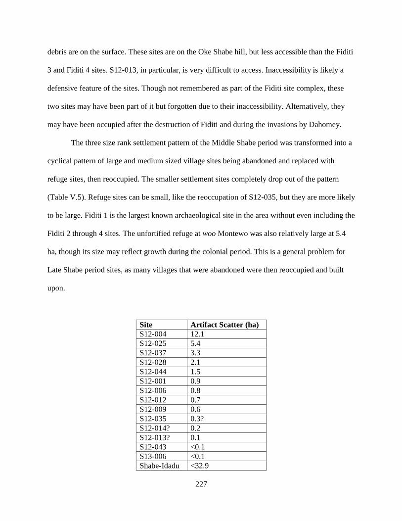
227
debris are on the surface. These sites are on the Oke Shabe hill, but less accessible than the Fiditi
3 and Fiditi 4 sites. S12-013, in particular, is very difficult to access. Inaccessibility is likely a
defensive feature of the sites. Though not remembered as part of the Fiditi site complex, these
two sites may have been part of it but forgotten due to their inaccessibility. Alternatively, they
may have been occupied after the destruction of Fiditi and during the invasions by Dahomey.
The three size rank settlement pattern of the Middle Shabe period was transformed into a
cyclical pattern of large and medium sized village sites being abandoned and replaced with
refuge sites, then reoccupied. The smaller settlement sites completely drop out of the pattern
(Table V.5). Refuge sites can be small, like the reoccupation of S12-035, but they are more likely
to be large. Fiditi 1 is the largest known archaeological site in the area without even including the
Fiditi 2 through 4 sites. The unfortified refuge at woo Montewo was also relatively large at 5.4
ha, though its size may reflect growth during the colonial period. This is a general problem for
Late Shabe period sites, as many villages that were abandoned were then reoccupied and built
upon.
Site Artifact Scatter (ha)
S12-004 12.1
S12-025 5.4
S12-037 3.3
S12-028 2.1
S12-044 1.5
S12-001 0.9
S12-006 0.8
S12-012 0.7
S12-009 0.6
S12-035 0.3?
S12-014? 0.2
S12-013? 0.1
S12-043 <0.1
S13-006 <0.1
Shabe-Idadu <32.9
228
Aensin <21.2
Kaboua <20.5
Ouoghi <20.1
Bako <8.9
Djabata <6.0
Table V.5 Area of Late Shabe period sites based on surface artifact scatters.
2. Subsistence
There is very little archaeological data on subsistence from the Late Shabe period. The
settlement pattern does not support a dispersed agricultural system as during the Early Shabe and
Middle Shabe periods, but it is very likely agricultural activities continued. The forms of ceramic
vessels are unchanged from the Middle Shabe and millstones continue to be used, suggesting that
food preparation methods remained similar. It is likely that agriculture continued but at a less
intensive scale due to the vulnerability of dispersed agricultural settlements, and perhaps because
there was less need for intensification due to lower population densities. There was some faunal
material present in the excavations at Fiditi 1, but it was too fragmentary to identify specific taxa.
It may be that decreases in agro-pastoral production were offset by increased exploitation
of wild resources. During a similar period of prolonged instability in the Banda area of Ghana,
archaeobotanical deposits and oral history show that agricultural communities turned to foraging
(Logan 2012: 283-290). Shabe communities retained extensive knowledge of edible wild plants
in the 1960s, perhaps indicating a similar level of wild resource exploitation in the 19th century
(Palau Martí 1992b: 335-338). Larger scale excavations in the future should help resolves these
questions.
3. Craft Production
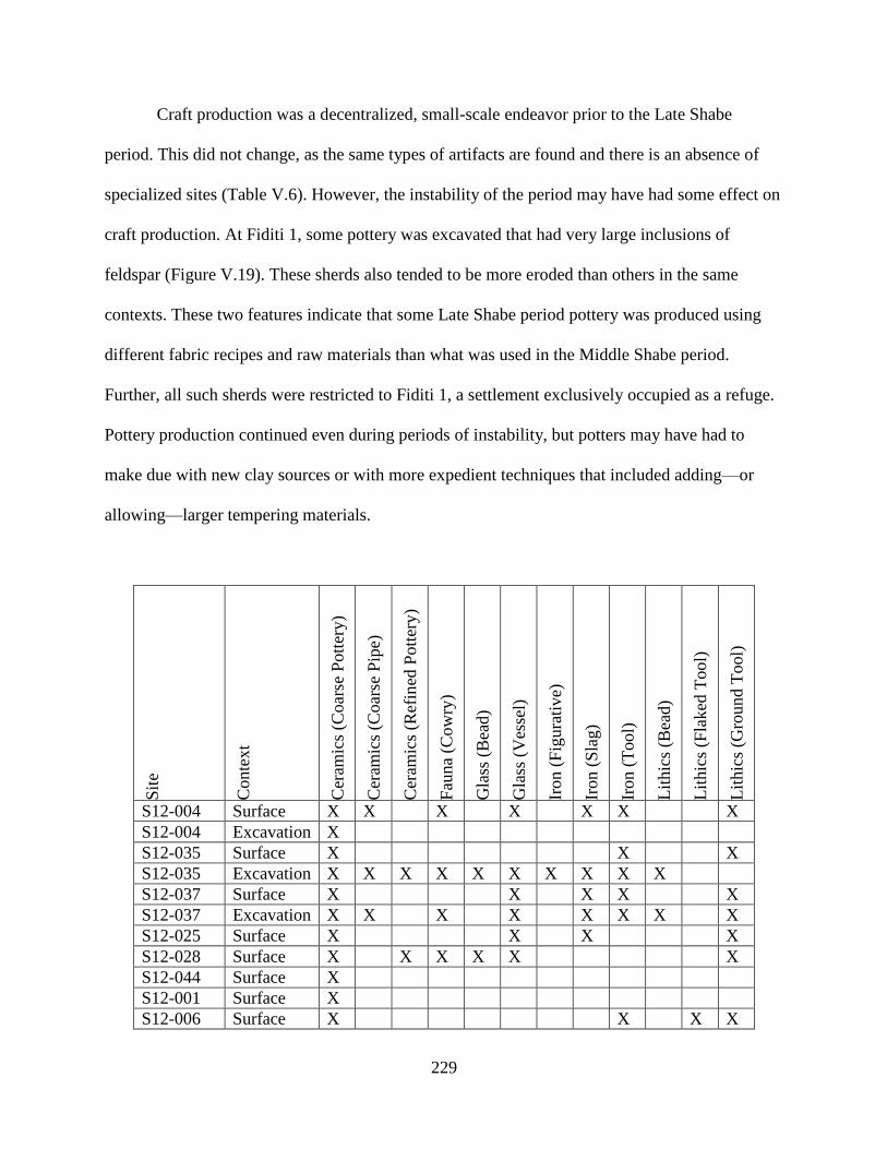
229
Craft production was a decentralized, small-scale endeavor prior to the Late Shabe
period. This did not change, as the same types of artifacts are found and there is an absence of
specialized sites (Table V.6). However, the instability of the period may have had some effect on
craft production. At Fiditi 1, some pottery was excavated that had very large inclusions of
feldspar (Figure V.19). These sherds also tended to be more eroded than others in the same
contexts. These two features indicate that some Late Shabe period pottery was produced using
different fabric recipes and raw materials than what was used in the Middle Shabe period.
Further, all such sherds were restricted to Fiditi 1, a settlement exclusively occupied as a refuge.
Pottery production continued even during periods of instability, but potters may have had to
make due with new clay sources or with more expedient techniques that included adding—or
allowing—larger tempering materials.
Sit
e
Conte
xt
Cer
amic
s (C
oar
se P
ott
ery)
Cer
amic
s (C
oar
se P
ipe)
Cer
amic
s (R
efin
ed P
ott
ery)
Fau
na
(Cow
ry)
Gla
ss (
Bea
d)
Gla
ss (
Ves
sel)
Iron (
Fig
ura
tive)
Iron (
Sla
g)
Iron (
Tool)
Lit
hic
s (B
ead)
Lit
hic
s (F
laked
Tool)
Lit
hic
s (G
round T
ool)
S12-004 Surface X X X X X X X
S12-004 Excavation X
S12-035 Surface X X X
S12-035 Excavation X X X X X X X X X X
S12-037 Surface X X X X X
S12-037 Excavation X X X X X X X X
S12-025 Surface X X X X
S12-028 Surface X X X X X X
S12-044 Surface X
S12-001 Surface X
S12-006 Surface X X X X

230
S12-012 Surface X X X
S12-009 Surface X X X X X X
S12-014? Surface X X X X X
S12-013? Surface X X X X
S13-006 Surface X
Table V.6 Artifact classes and subclasses present at Late Shabe period sites.
Figure V.19 The feldspar granule tempered pottery from Fiditi 1.
Iron and stone tool production is evidenced by finished tools and, in the case of iron,
small quantities of slag. As with earlier periods, slag was recovered from middens where it was
deposited alongside typical domestic refuse: potsherds, faunal remains, and charred plant
material. The only flaked stone tool recovered from the entire study area was found at Fiditi 2.
The tool is bifacially flaked quartz—possibly a small projectile or blade (Figure V.20). Flaked
stone tools are unusual in West African iron-using societies, but not without precedent.
Archaeological excavations in the Hueda kingdom of southern Bénin suggest that enough iron
was produced locally to meet most needs, but quartz knives were still used in domestic contexts
(Kelly 2001: 93).
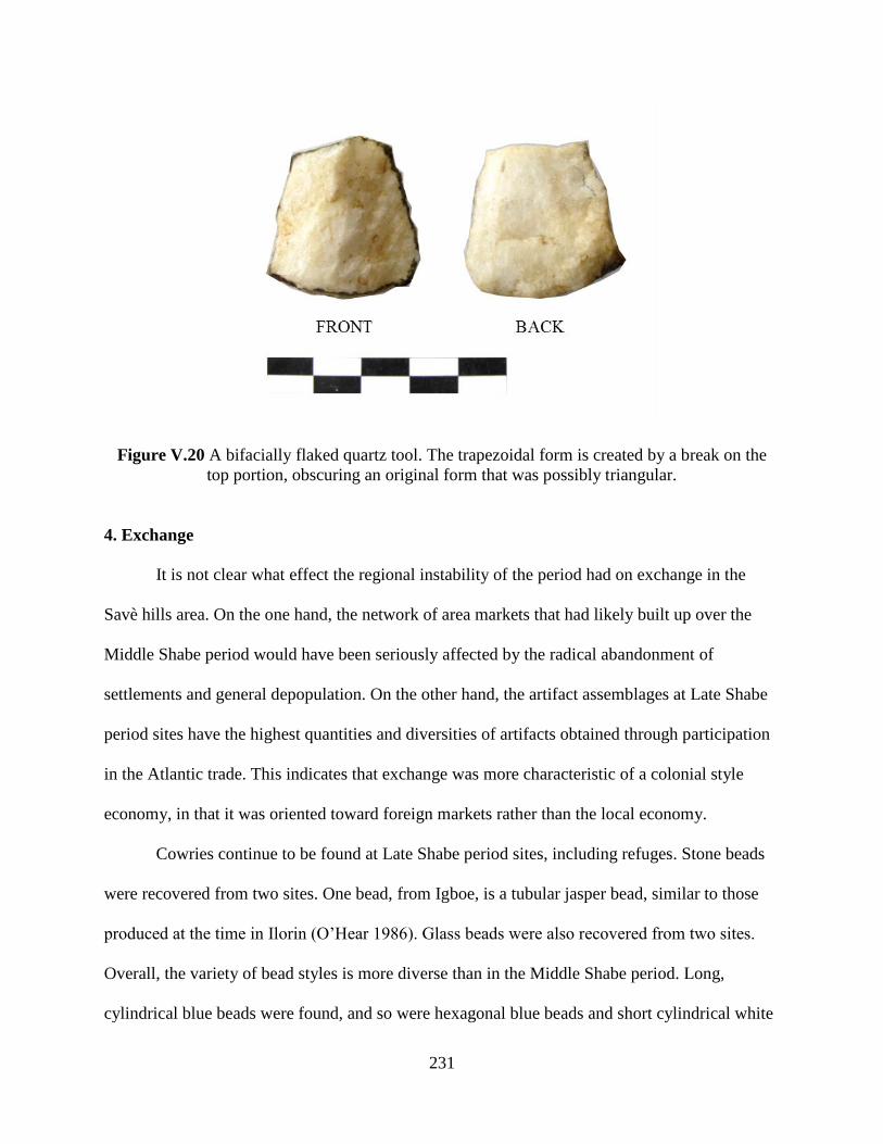
231
Figure V.20 A bifacially flaked quartz tool. The trapezoidal form is created by a break on the
top portion, obscuring an original form that was possibly triangular.
4. Exchange
It is not clear what effect the regional instability of the period had on exchange in the
Savè hills area. On the one hand, the network of area markets that had likely built up over the
Middle Shabe period would have been seriously affected by the radical abandonment of
settlements and general depopulation. On the other hand, the artifact assemblages at Late Shabe
period sites have the highest quantities and diversities of artifacts obtained through participation
in the Atlantic trade. This indicates that exchange was more characteristic of a colonial style
economy, in that it was oriented toward foreign markets rather than the local economy.
Cowries continue to be found at Late Shabe period sites, including refuges. Stone beads
were recovered from two sites. One bead, from Igboe, is a tubular jasper bead, similar to those
produced at the time in Ilorin (O’Hear 1986). Glass beads were also recovered from two sites.
Overall, the variety of bead styles is more diverse than in the Middle Shabe period. Long,
cylindrical blue beads were found, and so were hexagonal blue beads and short cylindrical white
232
beads. These bead styles were brought to West Africa from Europe, often where they were
produced as well (DeCorse et al. 2003).
The two other classes of European-derived material culture are glazed, wheel-made,
refined earthenware ceramics and glass bottles. These are found in very limited quantities at
most Late Shabe period sites. A clear outlier is S12-028, where we recovered 52 sherds of
refined earthenware ceramics from the surface of the site. By comparison, only five such sherds
were recovered from the surface of all sites in the Fiditi complex, despite its being many times
larger. A similar pattern occurs with bottle glass, where 23 shards were recovered from S12-028
and only four at all Fiditi sites. Woo Montewo has the second most glass on the surface of all
sites, with eight shards.
5. Political-Economic Organization
By the admission of its own oral history corpus, the political-economic organization of
the Shabe kingdom dissolved during the Late Shabe period. The number of settlements in the
area was reduced, and the pattern of small dispersed agricultural sites surrounding larger villages
was replaced with one of moderate to large refuges isolated on the landscape. Stone fortifications
are the most conspicuous markers of this period of war and conflict. Despite the threats posed by
instability—or, perhaps, because of them—the Shabe kingdom remained a centralized polity, if
reduced in scale. According to the Onishabe’s oral traditions, labor was organized by the
Onishabe to construct monumental stone walls. The stone walls of Fiditi total one kilometer in
length and remain one meter high in some places, though the original height of the wall is
reported to have been over two meters. Some of the wall material was repurposed during the
European Colonial period to construct the railway and some buildings in Shabe-Idadu (Palau
233
Martí 1992a: 224). The alignment of the wall is perfectly positioned to accentuate the natural
cliff faces of the Oke Shabe hill and encircle the Fiditi complex. The amount of labor required to
build the wall, as well as the planning to lay it out, is indicative of a centralized authority with a
significant labor force.
Though a time of refuge, status differences were not erased during the occupation of
Fiditi. Cowry shells, refined earthenware, and bottle glass are much more prevalent at the hilltop
sites (Fiditi 3 and 4) than they are at those lower down (Fiditi 1 and 2). For example, 20 cowries
were recovered from the surface of the hilltop sites, whereas only one cowry was recovered from
the lower sites, despite their much larger surface area. Cowries were also found at the hilltop
sites S12-013 and S12-014. These hilltop sites were also protected by their own stone wall.
Though the walls undoubtedly served a defensive function, they also restricted access to the
hilltop sites, which served to spatially and, perhaps, symbolically differentiate the Shabe
refugees. Indeed, the hilltop is associated in oral history with the refuge of the Onishabe and
other elite individuals (Palau Martí 1992a: 224-225).
After the Dahomean invasion and subjugation of Shabe, it is unclear how much direct
influence Dahomey had. The relationship may have simply been tributary, as was potentially the
relationship between Shabe and the Oyo Empire. In this case, the Onishabe may have still been a
largely autonomous and relatively centralized authority, as this would be favorable to Dahomey
for maintaining order and the flow of tribute. The installation of a Dahomean minder toward the
end of the Late Shabe period may point to tensions in this relation, as Shabe clearly lost some of
its autonomy.
Concurrent with the Dahomean invasion is the introduction of new forms of material
culture. It is not clear how refined earthenware ceramics and glass from Europe were consumed
234
by Shabe peoples, or if they displaced any previous forms of material culture. Imported ceramics
and glass certainly did not replace local industries, but they may have competed with other
prestige goods, such as stone and clay beads. The prevalence of such goods at S12-028 indicates
that they were available in significant quantities. That they are not found at contemporary sites
may reflect the continued preference of Shabe communities for material culture and symbols
derived from the Ife dynastic field, rather than the new access to European goods that came with
subjugation to Dahomey. Indeed, the presence of an Ilorin-style bead supports the continued
flow of material culture westward to the Savè hills area. European material culture would
become much more available and prevalent in the following period, when Dahomean rule was
abruptly replaced with French rule.
D. The European Colonial Period (1894-1960 CE)
1. Settlement Pattern
The European Colonial period began in 1894 when Oba Akemun signed a treaty with the
French government establishing the Shabe kingdom as a protectorate of France. France had
recently conquered Dahomey, and the general attitude in Shabe was reported to have been
grateful to the French (Palau Martí 1992a: 252). As a protectorate, the Onishabe believed he
would have the support of the French military in rebuilding the kingdom after the devastation of
the 19th century CE. Indeed, the area attracted back many of the refugees that had fled, and many
new settlers came to the area attracted by the availability of arable land and the colonial peace.
Over the European Colonial period, the number of settlements and their distribution would
greatly increase over the preceding Late Shabe period (Figure V.21). The settlement pattern
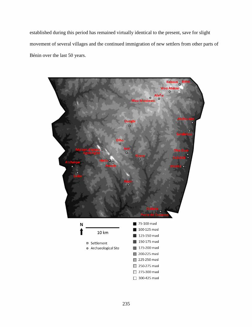
235
established during this period has remained virtually identical to the present, save for slight
movement of several villages and the continued immigration of new settlers from other parts of
Bénin over the last 50 years.
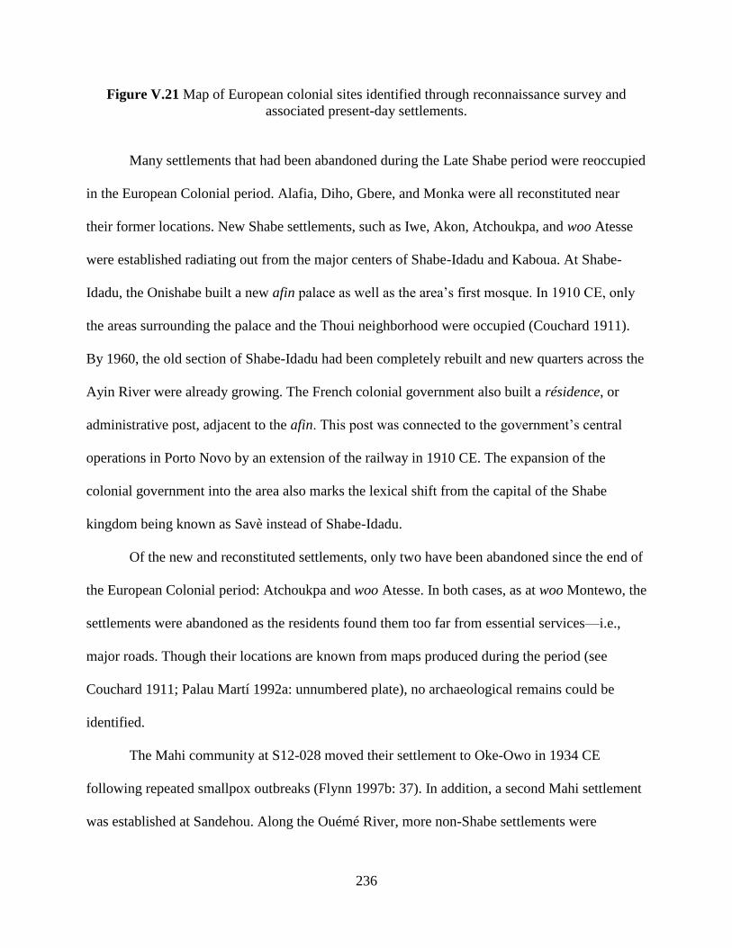
236
Figure V.21 Map of European colonial sites identified through reconnaissance survey and
associated present-day settlements.
Many settlements that had been abandoned during the Late Shabe period were reoccupied
in the European Colonial period. Alafia, Diho, Gbere, and Monka were all reconstituted near
their former locations. New Shabe settlements, such as Iwe, Akon, Atchoukpa, and woo Atesse
were established radiating out from the major centers of Shabe-Idadu and Kaboua. At Shabe-
Idadu, the Onishabe built a new afin palace as well as the area’s first mosque. In 1910 CE, only
the areas surrounding the palace and the Thoui neighborhood were occupied (Couchard 1911).
By 1960, the old section of Shabe-Idadu had been completely rebuilt and new quarters across the
Ayin River were already growing. The French colonial government also built a résidence, or
administrative post, adjacent to the afin. This post was connected to the government’s central
operations in Porto Novo by an extension of the railway in 1910 CE. The expansion of the
colonial government into the area also marks the lexical shift from the capital of the Shabe
kingdom being known as Savè instead of Shabe-Idadu.
Of the new and reconstituted settlements, only two have been abandoned since the end of
the European Colonial period: Atchoukpa and woo Atesse. In both cases, as at woo Montewo, the
settlements were abandoned as the residents found them too far from essential services—i.e.,
major roads. Though their locations are known from maps produced during the period (see
Couchard 1911; Palau Martí 1992a: unnumbered plate), no archaeological remains could be
identified.
The Mahi community at S12-028 moved their settlement to Oke-Owo in 1934 CE
following repeated smallpox outbreaks (Flynn 1997b: 37). In addition, a second Mahi settlement
was established at Sandehou. Along the Ouémé River, more non-Shabe settlements were

237
established. Gobe and Atchakpa were founded by Idaisha refugees from the southwest that had
lost their villages and lands to Dahomean aggression. Under the colonial peace, they were
encourage to settle in the vacant land along the river. Like the Mahi, these Idaisha were
incorporated into the Shabe kingdom by being assigned balè that reported to the Onishabe and
his council.
Colonial rule indirectly affected settlement in the Save hills by reducing instability and
encouraging the foundation of new agricultural communities. Some colonial practices did have a
direct impact. Following Dahomey’s defeat, the French appointed the axosu Agoli-Agbo to its
throne. Agoli-Agbo acted as a puppet for the French until they transitioned from indirect rule to
direct rule in 1900 CE. At this time, he was exiled to Gabon, until being allowed to return in
1910 CE. However, he was viewed as too potent a symbol of opposition to French rule, and so
was detained at a compound just north of Shabe-Idadu (S13-008). This site consists of several
large mounds which may be the remains of collapsed earthen architecture, as well as an artifact
scatter and several baobabs which are kept as shrines by Fon people living in the area. The
French government also set up a customs post at Djabata (S12-023). The cement foundations of
this post are still visible today. Just as the Onishabe was introducing Islam to the area, the French
introduced Catholicism. The first church was built in Shabe-Idadu, using stones pulled from the
ruins of Fiditi, while smaller missions were built in some of the surrounding settlements. One
such mission is said to have been established at woo Montewo, where the foundations of a
square-shaped earthen structure are visible.
2. Subsistence

238
There is very little archaeological data for daily life during the European Colonial period.
Settlement patterning remained stable throughout the period, resulting in very little abandonment
and correspondingly little generation of undisturbed archaeological contexts. Though it is
possible to excavate contemporary middens to find European Colonial deposits, this avenue was
not explored in my project as the emphasis of my targeted excavations was on Early Shabe
through Late Shabe sites.
Fortunately, the lack of archaeological data is countered by written observations and
ethnographies of daily life. The quality of these sources varies and may not always describe the
typical practices of the period, despite their tendency to frame described activities as normative.
Even so, the sources are, at least, factual first-hand accounts of Shabe communities during the
period. In some cases, the written accounts of this period have become the codified version of
Shabe life, as literate Shabe over the past century have used these texts to privilege certain
political narratives as well as define what constitutes “traditional” Shabe culture. This flattened
ethnographic present was described more thoroughly in Chapters II and III.
Cassava (Manihot esculenta) and African yams were the predominant cultivars in the
Savè area at the beginning of the 20th century CE (Couchard 1911: 38). Both foods were cooked
in large earthenware jars (ibid: 36). Couchard (ibid: 38) uses the term akassa in reference to the
cassava, suggesting that the base carbohydrate for this staple fermented dough had not yet been
replaced by maize, as is the case in present-day cuisine. Couchard (ibid) also refers to a dish
made of ground maize or millet called “caké” (original quotation marks), which is likely a
reference to kenkey, a similar fermented dough more common in Ewe-speaking areas of Bénin.
More commonly, however, maize and millet were brewed into shakparo, a kind of beer. Beyond
these staples, Savè area communities also cultivated beans, onions, peppers, peanuts, tobacco
239
and collected palm nuts to produce oil (ibid: 60). Cotton was also grown, though as a cash-crop
encouraged by the French colonial government (ibid).
The same range of crops is reported 50 years later by Palau Martí (1992a: 42-43). Yams
and shakparo were still very common, and were supported by a range of garden cultivars.
However, a notable exception is cassava, which is not reported by Palau Martí as being grown at
all in the area. This is unusual, as cassava is an important crop today. It is also unlikely that Palau
Martí would not have recognized cassava as it has a very distinct presentation, and Palau Martí
extensively studied even the more esoteric elements of Shabe plant use (see 1992b: 335-338). It
may be that cassava fell out of favor in the mid-20th century CE and was replaced by maize,
which Palau Martí (1992a: 42) describes as a much more important resource than Couchard
does. Despite the apparent lack of cassava, akassa was a common dish though it may have now
been conflated with kenkey and made of maize (Palau Martí 1992a: 48). In addition, Palau Martí
notes that bananas, tomatoes, okra, and leafy greens were grown near settlements for local
consumption, and that tobacco, peanuts, and pineapple were grown in large plantations as cash
crops (ibid). Today, maize and cassava are the most common crops, perhaps coming at the
expense of yams which are perhaps less common than described in the European Colonial period
sources. Otherwise, the same range of plants are grown, though the tobacco and pineapple
plantations have been replaced by intensive cashew arboriculture.
Couchard (1911: 60) reported goats, sheep, and cattle as the primary domesticated
animals kept by Savè area communities in the early European Colonial period. He only notes that
these animals were often sold to Hausa traders en route to Lagos (ibid: 57). The situation was
essentially the same at the end of period, though Hausa involvement in the trade of domesticated
animals is not reported. Instead, cattle were kept locally by Fulani herdsmen in conjunction with
240
Shabe landholders (Palau Martí 1992a: 47). Palau Martí (ibid) observed that domesticated
animals were kept primarily for ritual sacrificial purposes, rather than for daily subsistence.
However, as ritual sacrifices often included consumption as part of the practice, the separation of
the two domains is somewhat artificial. Regardless, Palau Martí (ibid: 47-48) notes that the
products of hunting constitute the majority of meat consumption.
Fish were consumed more frequently than either wild or domesticated animals. In the
early European Colonial period, fish were caught and smoked along both rivers, though
Couchard noted distinct differences in the methods of preservation and preparation between
communities on the Okpara River, specifically Djabata, and those on the Ouémé River (1911:
38-39). As noted above, Gobe and Atchakpa near the Ouémé River were both founded by
Idaisha refugees, who apparently brought with them distinct culinary practices. Fish was
commonly consumed in riverine communities; smoked fish was also traded to upland
communities (ibid: 58). Palau Martí (1992a: 48) observed fishing with natural toxins at Djabata,
as it is still practiced today, but noted that most fish was now imported from either Malanville in
the extreme north and Porto Novo in the extreme south.
3. Craft Production
Craft production was a low intensity industry during the European Colonial period. Most
Savè area inhabitants engaged in agriculture, hunting, fishing, or trade (Palau Martí 1992a: 51).
Spinning, weaving, carpentry, potting, and iron production were all known to have been
practiced during the period but were not major economic pursuits (ibid: 53). These occupations
seem to have been practiced within households, lineages, and/or settlements through
unspecialized, small-scale, part-time production. A possible exception to this is iron production,

241
where several lineages are noted as being particularly skilled in mining or the production of iron
tools and charms (Palau Martí 1992b: 167-168, 205-209, 234-236). Iron production may have
been more specialized than other craft activities, though it remained a part-time occupation.
It is likely that the local production of craft goods was supplanted by imports during the
European Colonial period. Though markets in the area were very small and poorly attended at
the beginning of the period (Couchard 1911: 58), the extension of the train to Savè greatly
increased the intensity of commerce, so much so that there were several large periodic markets
and smaller daily markets by the end (Palau Martí 1992a: 52-53).
4. Exchange
The Savè hills area is fully drawn into the colonial world system during the European
Colonial period. The French colonial government was actively involved in shaping exchange
relationships between Savè area communities and national markets, such as with the
establishment of formal trade and production associations (Couchard 1911: 57-58). In addition,
the construction of the railway to Shabe, its terminus until the 1920s, established Savè as a major
market for cattle. Cattle were driven to Savè from the north where they were loaded onto railcars
and shipped to the coast for consumption by residents of the growing colonial cities (Manning
1982: 148).
Growing colonial markets solidified Savè as a regional exchange center. As noted above,
Savè went from having virtually no market presence at the end of the Late Shabe period to
multiple thriving markets at the dawn of independence. Exchange was not limited to the colonial
boundaries, as Savè’s position near Nigeria and intimate connections to many communities along
the border contributed to a flourishing cross-border trade (Flynn 1997a, 1997b).

242
5. Political-Economic Organization
When Oba Akemun signed a protectorate agreement with the French, he ushered in
sweeping changes to the power of the Onishabe and other political institutions of the Shabe
kingdom. At the time, however, we might speculate that Oba Akemun believed that a deal with
the French would restore the sovereignty of the kingdom, as at the close of the Late Shabe period
the Shabe kingdom was subservient to Dahomey. Indeed, allying with the French did restore the
prominence of the Onishabe. As the French operated until 1900 CE through indirect rule, the
Onishabe wielded full authority throughout the kingdom with the backing of the French military.
Even the Amùsù lineage, who had resisted the authority of the Onishabe and had led an attack on
Shabe-Idadu during the instability of the preceding period, resettled at Savè and reconciled with
the Otólá lineages (Palau Martí 1992a: 253).
The French colonial government began levying increasingly burdensome taxes in cash
and forced labor following the colony’s transition to direct rule (Palau Martí 1992a: 254). In
1903 CE, the Onishabe was arrested by the colonial government for undermining its authority
through encouraging local resistance to this “code de l'indigénat.” Oba Akemun was exiled to
Porto Novo until 1910 CE. Before his return, the government established a résidence adjacent to
the palace in order to monitor his actions after release. Such a system of internal exile and
monitoring was a common strategy of the French in subduing African polities, as evidenced by
the treatment of the Dahomean axosu Agoli-Agbo as described above.
After the death of Oba Akemun’s successor in 1933 CE, there was infighting among the
Otólá lineages over which candidate would become the new Onishabe. The conflict was
aggressive enough that the French colonial government stepped in and abolished the position
243
altogether (Palau Martí 1992a: 264). The Otólá lineages were shaken by this, and came together
to nominate a new Onishabe. However, the French had already decided it would be simpler to be
done with the vestiges of indirect rule and outlawed the new king. To make their point, they
demolished the afin, sending the Onishabe into hiding near Okpara River (ibid: 268).
The Onishabe was tolerated for the rest of the European Colonial period, though held no
official authority. Despite this, the Onishabe remained an important political figure, as colonial
law did little to supplant the lineage politics that characterized the Shabe political economy.
Indeed, the French likely feared the Onishabe’s growing influence in the region. The copper-
alloy bracelet found by the current Onishabe, Oba Adetutu (see Chapter III) is the most striking
piece of Ife-style political art associated with kingdom and dates precisely to this period where
the Onishabe is losing its political autonomy.
The French colonial government’s attempt to supplant the Shabe political economy
through its emphasis on restricting the Onishabe ultimately failed: the Shabe retained most
aspects of their lineage system and continued to resist colonial rule by withholding taxes and
engaging in illicit trade (see Asiwaju 1976; Flynn 1997a; Igué 2003). Part of the reason may
have been the colonial government’s single-minded focus on the institution of the Onishabe.
Even with the nominal head of the kingdom in exile, the agànì, balé, balè, and balódè
institutions were left intact. Though the French introduced Catholicism, and later Protestantism,
orísà worship flourished. New forms of ritual practice were also introduced from the Ife dynastic
field, such as the Gèlèdè masquerade (Drewal & Drewal 1983: 277).
The European Colonial period thrust the relatively isolated Shabe kingdom into the
global system. The overall magnitude of the colonial project in Africa was tremendous but it had
a relatively small effect on the Shabe political economy. Yes, the colonial system opened up the
244
Savè area economy to much greater participation in the cash economy and access to imported
goods, but this was more a return to the economic practices of the Middle Shabe period than it
was a radical transformation. Despite the attempts of the colonial government to dismantle the
office of the Onishabe, it survived into national independence. It was not until then that the office
truly transformed into the “traditional” custodian of Shabe culture that it has become today.

245
CHAPTER VI
The Evolution of Shabe Kingship
A. Kingship and Settlement in the Savè Hills
1. Centralizing Power
When the Onishabe Oba Adetutu joined Facebook in 2011, Shabe kingship no longer
functioned as an autonomous political-economic institution. Kingship still existed, and continues
to, but the Onishabe has no ability to command labor, collect taxes, or control the distribution of
wealth in society. Instead, the Onishabe is a representative in the ethnic politics of the modern
Béninese nation-state. As potent a political actor as he is, his position is still categorically
different from the political entity of less than 100 years ago.
Though different in scope, the Onishabe of today retains some similarity to his colonial
and pre-colonial predecessors. Shabe kingship remains a centralized institution, in that the power
to represent Shabe ethnic and cultural interests is concentrated in his office and then delegated to
other cultural and heritage institutions. Any activity deemed to have significant Shabe cultural
content is in some way approved by, at least reported to, the Onishabe. The Onishabe has
remained at the top of a central hierarchy during the transformation from a political-economic to
heritage institution.
246
Key questions this dissertation addresses are when and how did centralized political
institutions form in the Savè hills area. From the archaeological data presented in Chapter V, the
answer to “when” is the Middle Shabe period of 1700 to 1830 CE. Historical sources make it
clear that Shabe kingship was well developed during the European Colonial period, and therefore
centralization must have occurred earlier. Archaeological data for the Middle Shabe period is
lacking, but the remains of the Shabe palace from this period suggest the Onishabe was able to
mobilize labor and resources to support itself. The archaeological evidence is stronger for the
Late Shabe period, where at Fiditi alone there is ample evidence for monumental construction
and spatially restricted differences in wealth related to the Onishabe. It is during the Middle
Shabe period that the first evidence is found for monumental architecture, pronounced wealth
differences between sites, and specialized ritual centers. The developments of the Middle Shabe
period built on the foundations of the Early Shabe period. During this period, there are some
wealth differences between sites, but this appears to be largely a function of differences between
Shabe immigrants and the autochthonous communities.
The data on site size collected during the reconnaissance and transect surveys can be used
to bolster the conclusions on centralization drawn from material culture and architectural
features. Specifically, site size hierarchies can be identified in the settlement patterns of different
periods in the Savè hills. As discussed in Chapters IV and V, the presence of a site size hierarchy
is often taken in archaeology as an indication of a regional political hierarchy (Johnson 1977;
Earle 1987; Peregrine 2004: 285; Duffy 2015).
Using difference in site size as an indicator of political hierarchy turns on the assumption
that decision-making and the coordination of activities tends to occur at larger sites in a regional
settlement system (Wright & Johnson 1975). Thus, site size hierarchies often overlap with and
247
result from political hierarchies, though it is important to note that differences in archaeological
site size can be produced from processes other than administration (Duffy 2015). The absolute
size of sites and their functional variability must be considered in interpreting the significance of
any settlement hierarchy. Where other indicators of complexity exist—oral history, specialized
ritual sites, wealth differences, and monumental architecture in the case of Shabe—site size
hierarchies reference the spatial relationships of different administrative tiers between
settlements.
The rank-size graph is a useful way to visualize the relationship between sites of different
sizes in a settlement system, making it particularly useful for understanding site size hierarchies
(Drennan & Peterson 2004; Peterson & Drennan 2012). In a rank-size graph, the relationship
between settlement rank (with the largest settlement ranked first, the second largest ranked
second, etc.) and settlement size is graphed as a line plot of the logarithms of both variables. A
log-normal line—a representation of an ideal settlement pattern wherein the rank 2 settlement is
half the size of the rank 1 settlement, the rank 3 settlement is one third the size of the rank 1
settlement, etc.—can be plotted on the graph to provide a metric that facilitates comparison
between different graphs. The shape of the lines made by settlement patterns can be compared to
discern site size hierarchies (Drennan & Peterson 2004: 534). For example, a pronounced site
size hierarchy will have a concave or primate shape, with the line of the settlement pattern
dipping below the log-normal line (Haggett 1966). A settlement system without a strong
hierarchy will exhibit a convex or even flat line above the log-normal line. However, such a
pattern might also result from two compounding settlement systems or from sampling only a
portion of a larger system (Johnson 1977; Paynter 1982). Further, complex rank-size lines may

248
result from the effect of new processes, such as colonialization, on pre-existing settlement
systems (Falconer & Savage 1995).
Beyond shape, it is possible to calculate a measurement of deviation from log-normality
(Drennan & Peterson 2004). This coefficient, termed A, represents the area between the
settlement line and the log-normal line. Settlement lines with values primarily above the line will
have positive A coefficients, while those with values primarily below the line will have negative
A coefficients. These values allow the degree of deviation from the log-normal line of different
settlements lines to easily be compared. It is important to note that such comparisons are
heuristic in nature, and not conclusive proof of settlement hierarchies or other spatial
relationships among settlements.
The settlement data from the Save hills can be plotted to discern trends in rank-size
relationship through time, and thus allows insights into trends in regional political complexity.
Settlement size, taken as artifact scatter size, in hectares was plotted against rank for sites
documented through reconnaissance survey for the Early Shabe, Middle Shabe, and Late Shabe
periods. In addition, the A coefficients and their 95% confidence were calculated through the
program RSBoot (Drennan 2012; see Drennan & Peterson 2004). RSBoot calculates the
confidence interval by drawing 1000 samples of the settlement data for each period through
resampling with replacement and then using the distribution of the 2.5th and 97.5th percentiles.
As most sites from the European Colonial periods are obscured by present-day
occupations, this period was omitted from the rank-size analysis. However, it was necessary to
include some sites presently occupied for the other periods. In these cases, their areas were
estimated by halving the present-day limits of the sites. For sites with surface scatter areas of less
than 0.1 ha, 0.05 ha was used as a default estimate. Two other estimates were made. For S12-
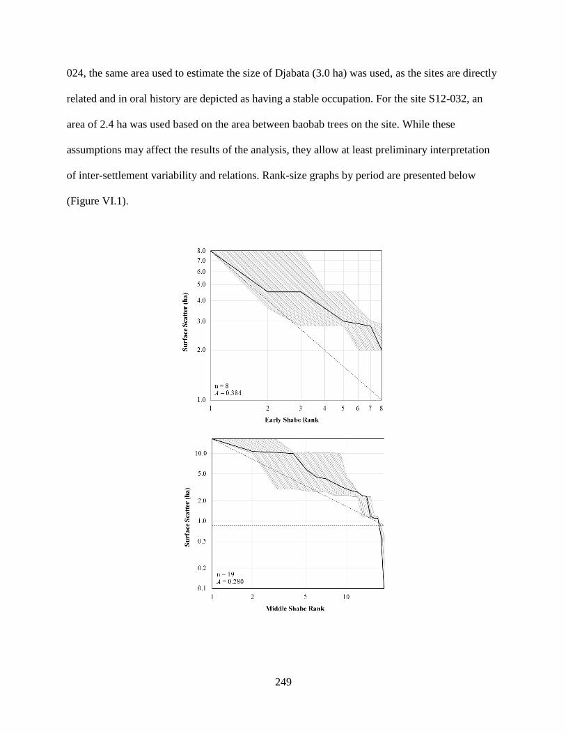
249
024, the same area used to estimate the size of Djabata (3.0 ha) was used, as the sites are directly
related and in oral history are depicted as having a stable occupation. For the site S12-032, an
area of 2.4 ha was used based on the area between baobab trees on the site. While these
assumptions may affect the results of the analysis, they allow at least preliminary interpretation
of inter-settlement variability and relations. Rank-size graphs by period are presented below
(Figure VI.1).
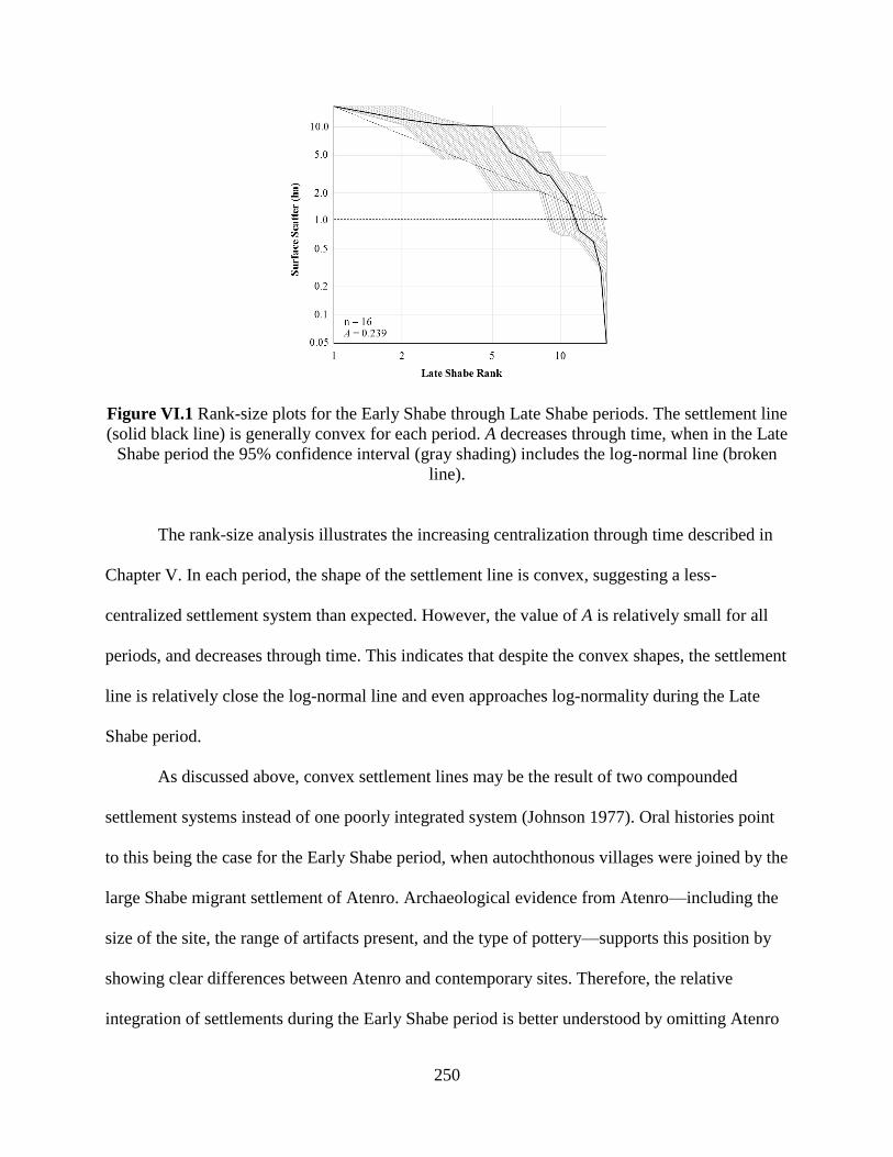
250
Figure VI.1 Rank-size plots for the Early Shabe through Late Shabe periods. The settlement line
(solid black line) is generally convex for each period. A decreases through time, when in the Late
Shabe period the 95% confidence interval (gray shading) includes the log-normal line (broken
line).
The rank-size analysis illustrates the increasing centralization through time described in
Chapter V. In each period, the shape of the settlement line is convex, suggesting a less-
centralized settlement system than expected. However, the value of A is relatively small for all
periods, and decreases through time. This indicates that despite the convex shapes, the settlement
line is relatively close the log-normal line and even approaches log-normality during the Late
Shabe period.
As discussed above, convex settlement lines may be the result of two compounded
settlement systems instead of one poorly integrated system (Johnson 1977). Oral histories point
to this being the case for the Early Shabe period, when autochthonous villages were joined by the
large Shabe migrant settlement of Atenro. Archaeological evidence from Atenro—including the
size of the site, the range of artifacts present, and the type of pottery—supports this position by
showing clear differences between Atenro and contemporary sites. Therefore, the relative
integration of settlements during the Early Shabe period is better understood by omitting Atenro
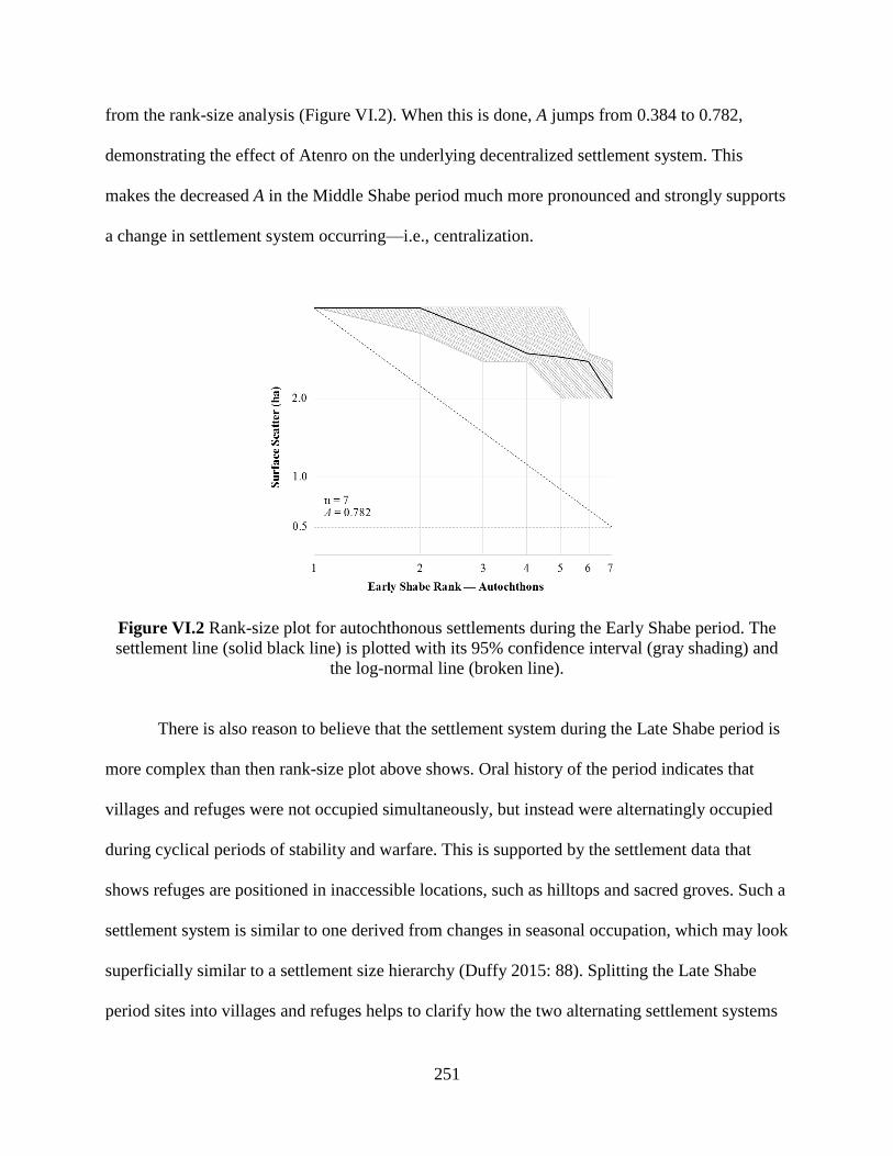
251
from the rank-size analysis (Figure VI.2). When this is done, A jumps from 0.384 to 0.782,
demonstrating the effect of Atenro on the underlying decentralized settlement system. This
makes the decreased A in the Middle Shabe period much more pronounced and strongly supports
a change in settlement system occurring—i.e., centralization.
Figure VI.2 Rank-size plot for autochthonous settlements during the Early Shabe period. The
settlement line (solid black line) is plotted with its 95% confidence interval (gray shading) and
the log-normal line (broken line).
There is also reason to believe that the settlement system during the Late Shabe period is
more complex than then rank-size plot above shows. Oral history of the period indicates that
villages and refuges were not occupied simultaneously, but instead were alternatingly occupied
during cyclical periods of stability and warfare. This is supported by the settlement data that
shows refuges are positioned in inaccessible locations, such as hilltops and sacred groves. Such a
settlement system is similar to one derived from changes in seasonal occupation, which may look
superficially similar to a settlement size hierarchy (Duffy 2015: 88). Splitting the Late Shabe
period sites into villages and refuges helps to clarify how the two alternating settlement systems
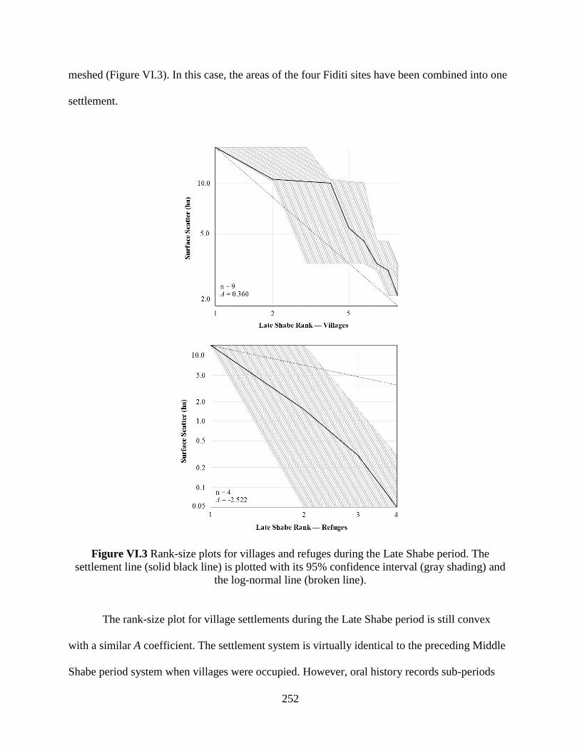
252
meshed (Figure VI.3). In this case, the areas of the four Fiditi sites have been combined into one
settlement.
Figure VI.3 Rank-size plots for villages and refuges during the Late Shabe period. The
settlement line (solid black line) is plotted with its 95% confidence interval (gray shading) and
the log-normal line (broken line).
The rank-size plot for village settlements during the Late Shabe period is still convex
with a similar A coefficient. The settlement system is virtually identical to the preceding Middle
Shabe period system when villages were occupied. However, oral history records sub-periods

253
when villages were abandoned or destroyed and refugees fled to the area or to inaccessible
settlements. During these sub-periods, the settlement pattern is primate, dominated by the large
refuge of Fiditi. The A coefficient is much lower at -2.522. This pattern indicates that during
warfare, Fiditi absorbed the majority of the Savè hills residents, with few residents occupying a
handful of small settlements scattered through the area.
The analyses above include only settlements recorded through reconnaissance survey.
This is a skewed representation of the overall settlement pattern, as it typically excludes small
sites and sites not associated with oral history (see Chapter IV). The transect survey component
of this study provides a correction to these biases, but it is too small to capture the entire
complexity of the settlement system. Still, it provides some insight into how the smallest sites are
regionally integrated. The settlement data from the Atenro survey tract was plotted for rank-size
analysis as described above (Figure VI.4). As many of the small settlements lack clear indicators
of their chronological period, I chose to randomly assign sites of unknown period to either the
Early Shabe or Middle/Late Shabe period. Of the 15 unknown sites, four were assigned to the
Early Shabe period and 11 were assigned to the Middle/Late Shabe period, mirroring the
proportion between sites of known period. Such a strategy is inherently risky in that it may
assign sites incorrectly, in terms of both individual sites and in proportion. Thus, the following
analysis is included only as one possible perspective of how the very smallest sites documented
in the study area relate to the larger settlement system.
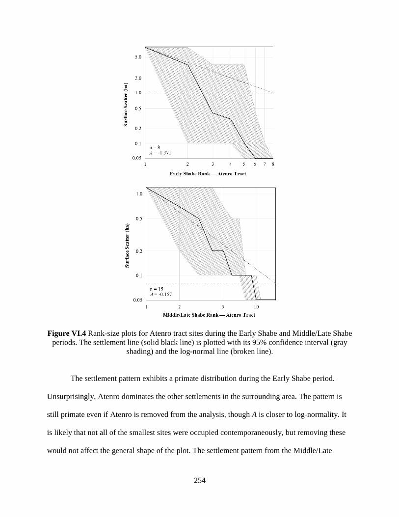
254
Figure VI.4 Rank-size plots for Atenro tract sites during the Early Shabe and Middle/Late Shabe
periods. The settlement line (solid black line) is plotted with its 95% confidence interval (gray
shading) and the log-normal line (broken line).
The settlement pattern exhibits a primate distribution during the Early Shabe period.
Unsurprisingly, Atenro dominates the other settlements in the surrounding area. The pattern is
still primate even if Atenro is removed from the analysis, though A is closer to log-normality. It
is likely that not all of the smallest sites were occupied contemporaneously, but removing these
would not affect the general shape of the plot. The settlement pattern from the Middle/Late
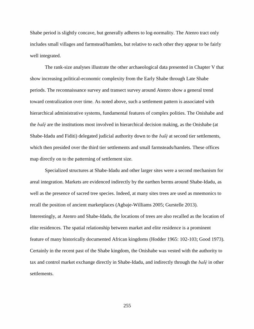
255
Shabe period is slightly concave, but generally adheres to log-normality. The Atenro tract only
includes small villages and farmstead/hamlets, but relative to each other they appear to be fairly
well integrated.
The rank-size analyses illustrate the other archaeological data presented in Chapter V that
show increasing political-economic complexity from the Early Shabe through Late Shabe
periods. The reconnaissance survey and transect survey around Atenro show a general trend
toward centralization over time. As noted above, such a settlement pattern is associated with
hierarchical administrative systems, fundamental features of complex polities. The Onishabe and
the balè are the institutions most involved in hierarchical decision making, as the Onishabe (at
Shabe-Idadu and Fiditi) delegated judicial authority down to the balè at second tier settlements,
which then presided over the third tier settlements and small farmsteads/hamlets. These offices
map directly on to the patterning of settlement size.
Specialized structures at Shabe-Idadu and other larger sites were a second mechanism for
areal integration. Markets are evidenced indirectly by the earthen berms around Shabe-Idadu, as
well as the presence of sacred tree species. Indeed, at many sites trees are used as mnemonics to
recall the position of ancient marketplaces (Agbaje-Williams 2005; Gurstelle 2013).
Interestingly, at Atenro and Shabe-Idadu, the locations of trees are also recalled as the location of
elite residences. The spatial relationship between market and elite residence is a prominent
feature of many historically documented African kingdoms (Hodder 1965: 102-103; Good 1973).
Certainly in the recent past of the Shabe kingdom, the Onishabe was vested with the authority to
tax and control market exchange directly in Shabe-Idadu, and indirectly through the balè in other
settlements.
256
Evidence for ritual specialization also indicates the central location of the Onishabe. In
the Early Shabe period, autochthonous settlements have between zero and five baobab trees
which, as discusses in previous chapters, were likely loci of ritual activity. At Atenro, 49 such
trees are present indicating a higher degree, or intensification, of ritual practice. Controlling for
site size, Atenro still has 6.125 baobabs per hectare, compared to the range of 0 and 1.429
baobabs per hectare at other Early Shabe period sites. During the Middle Shabe and Late Shabe
periods, the ritual centrality of the Oke Shabe area, and by extension the Onishabe, is
emphasized by the Ogu Tani megalith and the many other shrines in the area. The burial at
Aukpon is certainly a departure from normative mortuary practices from at least the early 20th
century (Couchard 1911: 30-31). Though the treatment of the body is consistent with that of an
elite individual vested with ritual power, the placement in a midden is unusual. Cross-cultural
examples of public burials are often attempts to create ritual spaces that cater to large and diverse
groups—the kinds of integrative ritual that are key features of complex polities (e.g., Morris
1992; DeMarrais et al. 1996; Kuijt 2001; Fleisher & Wynne-Jones 2012).
In the Late Shabe period, centralization may have been related to defense, as shown by
the extreme primacy of Fiditi during refuge sub-periods. Further, refuge sites are fortified with
impressive lengths of stone walls, which would require the coordination of a substantial
workforce—particularly if built rapidly under duress. It is important to note that during the
occupation of Fiditi, status differences between elites and non-elites were not quashed, but if
anything manifest more spatially by the occupation of lower-lying, and thus less defensible,
settlements on the Oke Shabe hill and the more inaccessible sites higher up. It is only at the
higher sites that cowries and bottle glass are found, marking the inhabitants as having greater
access to wealth and participation in exchange.
257
The settlement pattern of the European Colonial period was likely different from the
preceding periods, and if estimated and plotted it would likely show a convex shape associated
with the meshing of two separate settlement systems or even the double-convex shape of a
colonially-oriented system. However, the rich written and oral historical sources reveal that
Shabe kingship remained vibrant. The Onishabe was so powerful that it threatened French
political-economic domination, prompting the destruction of the palace by French soldiers in
1933. The diminished role of the Onishabe following this event was likely exacerbated following
independence, as the nation-state’s institutions expanded into more and more areas of political-
economic life (Strandsbjerg 2000, 2005; Amuwo 2003; Bierschenk & de Sardan 2003; le Meur
2006). Yet, the Onishabe and other institutions have remained vital by re-inventing themselves
as the legitimate custodians of tangible and intangible Shabe heritage.
2. Sources of Legitimacy
The legitimacy of the Onishabe in the present day is tied to the sense of a Shabe ethnicity.
In turn, Shabe ethnicity is tied to the idea of a Yoruba tribe. Essentially, to be Shabe is to be
Yoruba or, put in historical terms, part of the Ife dynastic field. This is not unexpected, as the
colonial world system transmogrified pre-colonial political systems into ethnicities throughout
the world (Comaroff 1995; Spear 2003; Posner 2005).Though Shabe communities share many
similarities with other Yoruba groups, how far into the past does this connection extend?
The copper-alloy bracelet discovered in the ruins of the European Colonial period palace
is material proof of participation in the Ife dynastic field by at least the early 20th century CE,
and Johnson’s (1921) account of Oyo and Ife history push back Shabe’s participation to the mid-
258
19th century CE. Archaeological traces provide some evidence for even earlier participation.
Small numbers of segi type glass beads were found at several sites, including the Early Shabe
period levels of Atenro. These beads were produced at Ife and passed along regional trade routes.
Did the legitimacy of Shabe political institutions hinge on their ability to procure and control
wealth through exchange relationships? This exclusionary strategy appears to be at least part of
how Shabe elites sustained the political economy. The higher quantities of refined earthenware
ceramics and bottle glass obtained through the Atlantic trade found at S12-028, an ethnic Mahi
site, further suggest that everyday participation in long-distance exchange was limited, and not a
routine part of Shabe life.
Exchange with other communities in the Ife dynastic field was situated in a broader
context of regional exchange. Cowry shells are more ubiquitous at sites—appearing first at
Atenro in the Early Shabe period, and then at more and more sites through the Late Shabe
period. Cowries were a common currency in the region, including the primary currency of Oyo,
Dahomey, and the trading entrepôts along the Bight of Benin. Cowry shells are found in higher
quantities and at more sites than glass beads, including at relatively small sites. This suggests
that unlike glass beads, cowries were not obtained solely through elite exchange activities. On
the other hand, the distribution of cowry shells at the Fiditi site complex shows that they are
spatially restricted to the smaller, more inaccessible parts of the site. Cowries were likely used in
market exchange in Shabe as they were elsewhere in the region, and their concentration at large
sites and elite areas is indicative that elite power could be derived through marginal gains on
transactions (Guyer 2004).
The Onishabe and other Shabe political elites derived some economic power through
their ability to legitimately monopolize exchange relationships and tax market transactions.

259
However, legitimacy was also derived through local economic transformation. In the Early
Shabe period, the Pupa and Shabe A pottery types coexisted with distinct fabric compositions
and decorative inventories. The diversity in pottery types of the Early Shabe period contrasts
with the following Middle Shabe period, when the Pupa type disappears and the Shabe A type
continues with the addition of several new decorative techniques, constituting the Shabe B type.
Between the Early Shabe and Middle Shabe periods, local practices were abandoned in favor of
Shabe practices. Though this narrowing of pottery production practices could have occurred for a
number of reasons, the result is indicative of a more integrated network of local consumption..
Such a network may have already existed within the Shabe migrants prior to the foundation of
the kingdom, or it may have been an outgrowth of the Onishabe’s conquest of the area
surrounding the Oke Shabe hill.
The displacement of the autochthons is a common theme in West African frontier
dynamics, wherein the legitimate ownership of land is wrested from “first-comers” through ritual
appropriation (Kopytoff 1987). The reorganization of settlements surrounding the Oke Shabe hill
in the Middle Shabe period is a classic indicator of this frontier process. Agricultural
intensification is an outgrowth of the hierarchical structuring of land ownership among
institutions and social groups, such as the Onishabe and èyílé lineage groups in this case (Stone
1994; Earle 2000). A specialized ritual complex was established at Aensin (literally “come to
worship”) during the Middle Shabe period, as well. The transect survey surrounding Atenro
revealed a network of small agricultural sites surrounding larger villages. This pattern first
appeared in the Early Shabe period surrounding Atenro. Even after Atenro was abandoned and
there was no large village in the transect area, the number and spread of agricultural sites
260
expanded. The system of dispersed agriculture continued, if not intensified, between the Early
Shabe and Middle/Late Shabe periods.
Shabe political legitimacy was achieved through appeals to external power structures as
well as control of local economic resources. In both cases, however, legitimacy was fragile.
There is no strong evidence that Shabe was a province of Oyo, Ife, or any other polity. There is
more evidence for the interaction between Shabe elites and these distant polities, but even this is
limited. Similarly, there is no strong evidence for centralized control over the local economy.
There is no evidence of specialized craft production or agriculture for any period, though the
scale of agriculture did increase through time. The Shabe economy, in all periods, is typical of
what might be termed a frontier economy (sensu Kopytoff 1987). In a frontier economy,
migrants replicate the practices of the mature economy that they emigrated from. Subsistence
and craft production practices are intensified, and exchange is maintained between the new
frontier and the homeland. Such economies have been frequently identified in the West African
archaeological record (e.g., Gronenborn 2001; Stahl 2004; Swanepoel 2009; de Barros 2012;
Monroe & Ogundiran 2012). However, the scale of these economic activities appears to have
been limited in the Savè hills.
Economic sources of legitimacy were limited in Shabe. This finding supports the
hypothesis that pre-colonial Shabe political institutions exercised power creatively, rather than
instrumentally (sensu Robertshaw 2010). Shabe elites were able to control labor and resources
through consensus-building and appeals to mutual benefit, rather than coercion, force, or
exclusive access to wealth. Certainly, coercion, force, and access were elements of Shabe
political culture, but these were not the fundamental sources of legitimacy.
261
3. Competing Political Institutions
The Onishabe’s authority was, and is, premised on a legitimate claim to the office
through descent from Baba Guidaï and the consensus of the ujoyè oba, lending support of several
other èyílé lineage groups to the Onishabe. The Onishabe’s power was delegated to the village
balè who facilitated the political-economy that ultimately fed back into the power of the
Onishabe. The origins of this administrative hierarchy is what is inferred from the rank-size
analysis of the Savè hills area settlement pattern above. Yet, this hierarchy was based on the
creative exercise of power and was reliant on the participation of other institutions. Indeed, other
institutions composed of Shabe elites are well attested to in the ethnographic and historical
literature.
The most apparent is the dual claims to the office of Onishabe itself. As discussed in
Chapter III, the present-day Onishabe derives from the Otólá lineages but during the Early Shabe
and early Middle Shabe periods, the Amùsù lineage held the office. The transition from the
Amùsù to Otólá dynasties was precipitated by the ujoyè oba, and presumably some balè, pulling
their support of the Amùsù. This schism is seen in the archaeological record of the Middle Shabe
period by the establishment of the Igboe, Opotoku, and Agba sites. These sites are all located in
the northwest quadrant of the study area. This spatial segregation is indicative of the new Otólá
dynasty’s inability to administrate the territory without consensus.
The problem of political centralization in the Shabe kingdom goes beyond this single
event of dynastic succession. Tension is inherent in the political system, as the administrative
hierarchy intersects at all levels with the political dimensions of the èyílé lineage groups.
Political power is crafted through reciprocity, bargaining, and coercion between the balé heads

262
of these groups, who often fill the ranks of the ujoyè oba, and balè. The ability of the Onishabe
to exercise power is thus dependent, on some level, on the very institutions with the greatest
potential to contest it. The ambivalent construction of power then is perhaps why the dominant
settlement pattern in the rank-size analysis is slightly convex. There is an administrative and site-
size hierarchy, but administration through the lineage groups remained important. For the
autochthonous Early Shabe period settlements, the strongly convex pattern underscores the
importance of settlement-level autonomy.
Several other institutions cross-cut these lineage-based political institutions. The hunting
and war associations are meritocratic organizations based on skill in those domains, led by
balodè and balogun, respectively. As leadership is not inherently based on position in an èyílé,
these institutions provide routes to power for non-elites. Additionally, the services they render
are crucial to the Onishabe. Warfare and the monopoly on force is the most obvious, but in an
economy where wild meat consumption is important, as is inferred from the faunal remain
assemblages of all periods, hunting provides a critical protein subsistence base. Historically,
these two institutions are closely linked to the cult of the oosà Ogun. Ogun is the patron of
smiths and all who use iron products: hunters, warriors, and sometimes agriculturalists. The
presence of iron tools is a possible indication of such organization, but iron production was not
limited in the region to only Ogun worshippers, which may be a more recent manifestation of the
smithing organization in the area. The figurative iron bilboes charm is a better indicator, as Ogun
is specifically linked to the creation of iron charms.
Many more oosà cults and other ritual organizations include non-elite members are
known from historical and ethnographic sources. Some of these have relatively little effect on
centralization, or may even reinforce it, such as the agricultural patron oosà Oko, whose worship
263
in the Middle Shabe period can be inferred from the characteristic red and white clay bead from
Aukpon.
Other institutions, however, could directly oppose the power of the Onishabe. Ifá
practitioners can directly challenge the administrative hierarchy by foretelling the will of the
oosà and encouraging resistance to the Onishabe in accordance with his auspicious divinations.
More often, however, Ifá practitioners arbitrate claims between existing political competitors.
The evidence for Ifá in the Savè hills archaeological record is at once abundant and obscure.
Baobab trees are connected to Ifá practice, but they may also be managed for other reasons.
Cowry shells are also used in Ifá practice, but they were likely used in Ifa only after they became
ubiquitous in the region. The distribution of Ifá practitioners well into southern Bénin and Togo,
however, points to an early date for its spread into the Savè hills.
The oosà Sàngó cult may have also checked the power of the Onishabe. The worship of
Sàngó, a deified Oyo king associated with thunder, spread from Oyo to many other parts of the
Ife dynastic field, and some have hypothesized that these cults acted as semi-formal taxation and
administrative institutions on Oyo’s behalf (Morton-Williams 1964: 255; Law 1977: 31, 140;
Matory 1993). The date of the Sàngó cult’s arrival in the Savè hills is unknown, and may have
been in the Late Shabe period after Oyo’s collapse. This may explain why Sàngó is
reconceptualized in the Savè hills as a female oosà —the wife of Ara, another thunder deity
(Schiltz 1985).
External challenges to the Onishabe were more prevalent during the Late Shabe period.
The settlement pattern of periodically occupying refuge sites and the construction of elaborate
fortifications demonstrates the severity of these challenges. Historical sources indicate that
Dahomey gained control of the Savè hills in the second half of the 19th century CE. The
264
establishment of new settlements with strikingly different material culture supports these
histories by showing the influx of colonists, likely as part of Dahomey’s administrative strategy.
Finally, Dahomean control was replaced by French control during the European Colonial period.
The legacy of this is evident in several archaeological sites, as well as the dense history of the
early 20th century CE. Surprisingly, the underlying hierarchical structure of the Shabe kingdom
proved more durable to these external conquerors than it was to the internal challenges posed by
institutions described above.
B. The Ongoing Transformation of the Shabe Kingdom
1. Archaeology in Northern Shabe
This study of the archaeology and history of the Shabe kingdom focused on the ascension
of centralized political hierarchies and concomitant economic practices. Unfortunately, the study
area could not cover the entire Shabe kingdom. The area of the kingdom is simply too large for
the scope of this dissertation. The study area was therefore selected to include sites that were
most likely related to the process of centralization: the Early Shabe period site of Atenro, the
Middle Shabe through present-day capital of Shabe-Idadu, and the Late Shabe refuge of Fiditi.
These three sites are all closely linked in oral history to elite political institutions, and the
archaeology bore this out as well. Other sites were also politically important. The study area
included the Early Shabe (and possibly earlier) period site of Djabata and the Middle Shabe
period site of Kaboua—the rulers of which have challenged the centralized authority of the
Onishabe.

265
While establishing important foundational knowledge of the kingdom and its
archaeology, the conclusions of this study are limited by its omission of the northern and
southeastern parts of the Shabe kingdom. This area contains many Shabe settlements, as well as
several politically important centers (Figure VI.5). Indeed, Kilibo was founded by Shabe
migrants prior to either Shabe-Idadu or Kaboua (Palau Martí 1992a: 78). The southeastern part
of the kingdom has very few Shabe dominant settlements today. This may be because this area
was most affected by the war and instability of the Late Shabe period. No oral histories support
this hypothesis, and it was not possible to conduct fieldwork in Nigeria to test it
archaeologically. Several abandoned settlements known from oral and written histories are
adjacent to my study area along the Okpara River. None are currently known from outside this
narrow corridor. Future research is required to better understand the long-term development of
the entire Shabe kingdom.
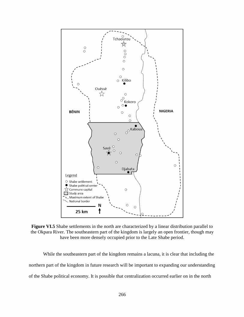
266
Figure VI.5 Shabe settlements in the north are characterized by a linear distribution parallel to
the Okpara River. The southeastern part of the kingdom is largely an open frontier, though may
have been more densely occupied prior to the Late Shabe period.
While the southeastern part of the kingdom remains a lacuna, it is clear that including the
northern part of the kingdom in future research will be important to expanding our understanding
of the Shabe political economy. It is possible that centralization occurred earlier on in the north

267
before the center of power shifted southward. It is also possible that the north was never very
well integrated into the Shabe kingdom and remained relatively autonomous. The presence of
distinct material cultures or settlement patterns may even point to a third possibility that the area
was organized into smaller centralized polities centered at Kilibo and Kokoro.
The environment and landscape of the northern Shabe kingdom is much the same as it is
around Shabe-Idadu. It does grade progressively more into savanna, and this may have impacted
the local economy—perhaps allowing or encouraging more cattle pastoralism. A greater impact
on the northern economy would simply be the distance to market centers and exchange routes.
The linear spatial distribution of northern settlements appears to follow the Hausa caravan route.
This is quite different from the settlement clustering in the south, where the central pull of
Shabe-Idadu and Kaboua is more evident. The linear arrangement in the north may indicate an
economic orientation toward entrepôt Parakou or even the Borgu center of Nikki.
Shabe oral history acknowledges Borgu as the departure point prior to founding Atenro.
Borgu history, however, makes the bolder claim that Shabe is essentially its political descendant,
having been formed by Borgu political elites (Adekunle 1994; Ali Babio 1994; Akinwumi 1999).
This contrasts with the emic Shabe view that their political origins lay in Oyo. It is likely that
both views are political extremes, and that the truth lies somewhere in between. The Borgu
version may relate to its sphere of influence being stronger in the north, while Oyo’s sphere of
influence was stronger in the south. This grading of influence may explain why both Shabe and
Baatombu (or Bariba, the main ethnolinguistic group of Borgu) were described as varieties of the
same race or nationality by 17th century Europeans (Sandoval 1627, in Law 2001: 7-8).
Limited archaeological research has been conducted in northern Shabe. Nestor Labiyi’s
master’s research (2007) surveyed archaeological sites throughout the Shabe kingdom, including
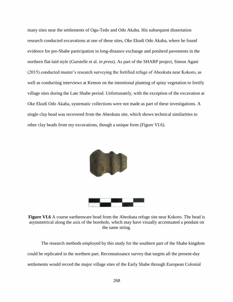
268
many sites near the settlements of Ogu-Tedo and Odo Akaba. His subsequent dissertation
research conducted excavations at one of these sites, Oke Ekudi Odo Akaba, where he found
evidence for pre-Shabe participation in long-distance exchange and potsherd pavements in the
northern flat-laid style (Gurstelle et al. in press). As part of the SHARP project, Simon Agani
(2015) conducted master’s research surveying the fortified refuge of Abeokuta near Kokoro, as
well as conducting interviews at Kemon on the intentional planting of spiny vegetation to fortify
village sites during the Late Shabe period. Unfortunately, with the exception of the excavation at
Oke Ekudi Odo Akaba, systematic collections were not made as part of these investigations. A
single clay bead was recovered from the Abeokuta site, which shows technical similarities to
other clay beads from my excavations, though a unique form (Figure VI.6).
Figure VI.6 A coarse earthenware bead from the Abeokuta refuge site near Kokoro. The bead is
asymmetrical along the axis of the borehole, which may have visually accentuated a pendant on
the same string.
The research methods employed by this study for the southern part of the Shabe kingdom
could be replicated in the northern part. Reconnaissance survey that targets all the present-day
settlements would record the major village sites of the Early Shabe through European Colonial

269
period. Transect survey would provide a useful correction by documenting smaller sites and
those without oral histories. Particularly important would be transect tracts that target areas
directly adjoining the Ouémé and Okpara rivers. Transects that target areas without well-known
sites would also make an important contribution by showing settlement patterns away from
major centers. An expansive survey strategy of widely spaced but very long transects, such as
those employed by the Abomey Plateau Archaeological Project (see Monroe 2014), may be
useful for this purpose. Excavations at key sites in northern Shabe may also refine the
chronology proposed in this dissertation. Centralization may have occurred earlier in the north,
and could be documented through systemic archaeological research and analysis.
2. New Frontiers
The pull of northern influence is still felt in the Shabe kingdom. Parakou, one of Bénin’s
largest cities, draws many Shabe people to it, particularly the young looking for education and
economic opportunities. Even stronger is the pull to Cotonou, Bénin’s coastal metropolis. As in
much of Africa, cities are drawing in great numbers of rural migrants. Indeed, for many
Béninese, the Savè hills are regarded as a rural backwater. The region is one of Bénin’s less
densely populated areas. It is also somewhat underdeveloped by the political elite, having little
infrastructure such as banks, hotels, or telecommunications. The present situation mirrors that of
the Early Shabe period, when migrants found themselves in a political-economic frontier.
Like the Savè hills of 400 years ago, there is competition over the present-day frontier’s
resources. Agricultural products and timber are produced throughout the area to feed the markets
of Parakou and Cotonou, as well to export abroad. The value of land has steadily increased

270
alongside population, which has sparked claims over resources and a renewed interest in the
history of the landscape. Invariably, when these claims cannot be settled through documentation,
they are arbitrated by the Onishabe, agànì, and balè. It is perhaps ironic that the rise of modern
capitalism has reaffirmed the political-economic position of the elite. Yet, this position is not
identical to that of centuries past. Political authority is now cast in the mold of tradition—
compounding the colonial concepts of ethnicity and tribe with Shabe histories and institutions.
Though the nation-state has usurped the Onishabe’s powers to tax, solicit labor, or execute the
condemned, it has carved out room for the Onishabe to become an authority in matters of history.
Where once these issues were more fluid and contested, the twinning of Shabe identity and
Shabe politics has flattened historical discourse.
As mentioned above, history feeds back into the economy. Claims to land are couched in
history, either through autochthony or stewardship. History is given substance through
archaeology. The truth of historical claims is evidenced by reference to settlement sites, artifact
styles, and monumental architecture. As the cultural custodian of the Shabe people, the Onishabe
is deferred to as the authority on these sites. It is possible that the results of my dissertation will
be used in future claims and arbitrations. Indeed, archaeology is wielded as a political weapon
wherever it is practiced, and this has been true in the historical archaeology in Africa before
(e.g., Stahl 2001; Schmidt 2006; see also Schmidt 2010; Stump 2013b). My engagement with the
Onishabe and other stakeholders in the Savè hills is in preparation for this: I believe that more
knowledge of the past will ultimately facilitate the fair arbitration of conflicts over resources.
This dissertation contributes to the growing corpus of West African historical
archaeology. It performs the fundamental task of filling holes in the map—providing new
information on the archaeology of the Savè hills, an area with no prior systematic study of its

271
archaeological remains. It ties the archaeology of the area to the broader political history of the
Bight of Benin in general and the Ife dynastic field in particular. Beyond this, it charts the
trajectory of one of these complex polities, providing an archaeology case study of centralization
in an African frontier—away from the long-distance exchange favored as a prime-mover by
historians and early archaeologists. The evolution of the Shabe kingdom was complex, the
product of both local and regional processes and supported by economic transformations. The
evolution of the kingdom is ongoing. It is becoming less defined by its political-economic
institutions and more by its cultural heritage, of which archaeology is a crucial part. In this way,
my research is one small part of its evolution.

272
APPENDICES
273
APPENDIX A
Site Inventory
The site inventory presents all archaeological sites recorded by the Save Hills
Archaeological Research Project located within the study area. One additional site, S12-022, that
was not located within the study area is also included. Though it falls on the east side of the
Okpara River, this site is still within the territory of the Republic of Bénin, was claimed by the
present-day community of Djabata within the study area, and was the target of excavations by
Labiyi in 2014 with my assistance (see Gurstelle et al. 2015). Other archaeological sites outside
the study area but recorded during the 2012 and 2013 field work are not included in this
inventory, but are described in technical reports on file with the Republic of Bénin’s Directorate
du Patrimoine Culturel. Non-archaeological sites that were recorded, such as shrines, are also not
included here but available in the above technical reports.
Sites are grouped below by how the site was recorded: reconnaissance survey or transect
survey. The sites are then listed by the site number assigned during fieldwork. “S12” sites were
recorded during 2012, and “S13” sites were recorded during 2013. For sites recorded through
reconnaissance survey, the oral history source that led to the site’s documentation is also given.
The office, title, or lineage of the source is given rather than an individual’s name, as typically
the site’s history was described though a collective conversation between multiple people
associated with the source. This colors the narrative as more of an institutional history, rather

274
than a personal one. The oral history period associated with the site is derived from this narrative
(see Chapter IV). The site name is then given, as described in the oral history. In some cases, a
number has been appended to the site name in order to distinguish spatially distinct clusters of
archaeological remains that are part of the same oral historical narrative. The surface features are
given for all sites, regardless of how the site was recorded. Features are reported by the following
general classes: Architecture, Artifact Scatter, Depression, Fortification, Mound, Natural
Feature, Sacred Tree Species, and Shrine. These classes are subdivided as necessary. The
presence of these features at each site is given in Table A.1. The site description gives additional
relevant information about the site, including parts of the associated oral narrative, details of the
surface features, and explanations of excavation and surface collection strategies. The
coordinates give GPS information (using the WGS 1984 grid) for major site features. Finally,
artifact classes give the kinds of archaeological materials recorded and/or recovered from the
site, divided between those artifacts from the surface and those recovered through excavation.
Artifacts are reported by the following general classes: Ceramics, Fauna, Glass, Iron, and Lithics.
These classes are subdivided as necessary. The presence of these artifacts at each site given in
Table A.2. More information on these artifacts is given in the subsequent appendices.
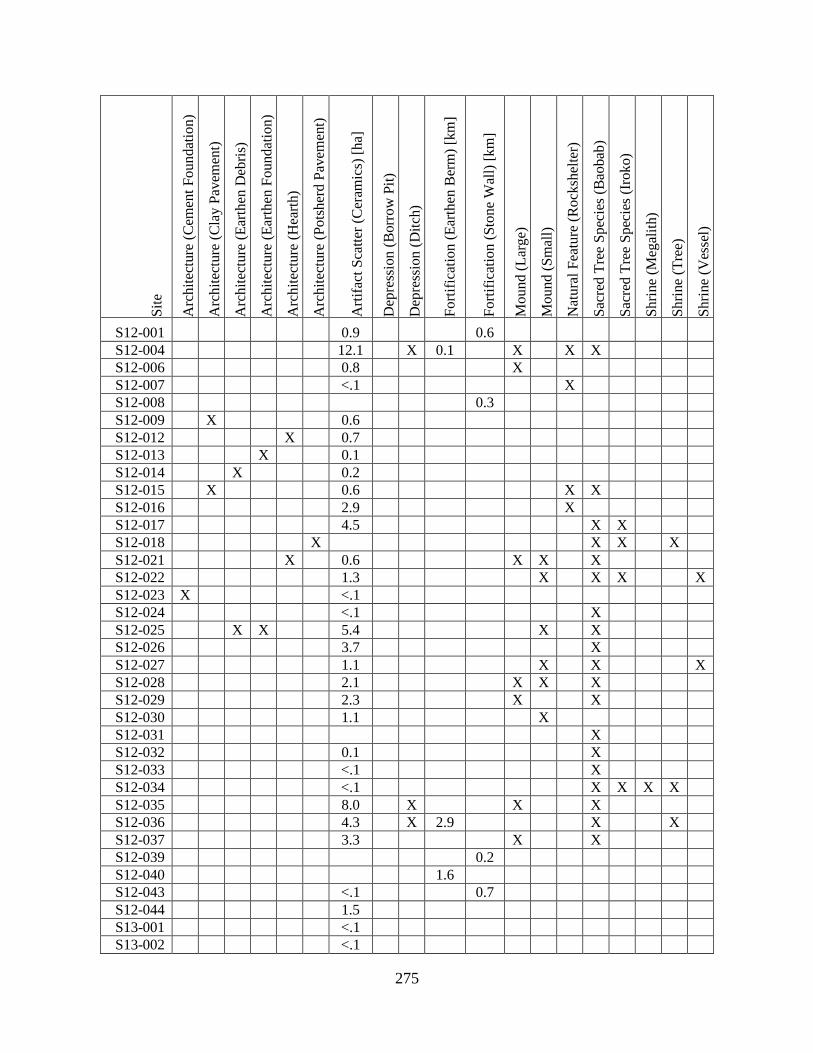
275
Sit
e
Arc
hit
ectu
re (
Cem
ent
Fo
und
atio
n)
Arc
hit
ectu
re (
Cla
y P
avem
ent)
Arc
hit
ectu
re (
Ear
then
Deb
ris)
Arc
hit
ectu
re (
Ear
then
Fo
und
atio
n)
Arc
hit
ectu
re (
Hea
rth)
Arc
hit
ectu
re (
Po
tsh
erd
Pav
emen
t)
Art
ifac
t S
catt
er (
Cer
amic
s) [
ha]
Dep
ress
ion
(B
orr
ow
Pit
)
Dep
ress
ion
(D
itch
)
Fo
rtif
icat
ion
(E
arth
en B
erm
) [k
m]
Fo
rtif
icat
ion
(S
ton
e W
all)
[k
m]
Mo
un
d (
Lar
ge)
Mo
un
d (
Sm
all)
Nat
ura
l F
eatu
re (
Ro
cksh
elte
r)
Sac
red
Tre
e S
pec
ies
(Bao
bab
)
Sac
red
Tre
e S
pec
ies
(Iro
ko)
Sh
rine
(Meg
alit
h)
Sh
rine
(Tre
e)
Sh
rine
(Ves
sel)
S12-001 0.9 0.6
S12-004 12.1 X 0.1 X X X
S12-006 0.8 X
S12-007 <.1 X
S12-008 0.3
S12-009 X 0.6
S12-012 X 0.7
S12-013 X 0.1
S12-014 X 0.2
S12-015 X 0.6 X X
S12-016 2.9 X
S12-017 4.5 X X
S12-018 X X X X
S12-021 X 0.6 X X X
S12-022 1.3 X X X X
S12-023 X <.1
S12-024 <.1 X
S12-025 X X 5.4 X X
S12-026 3.7 X
S12-027 1.1 X X X
S12-028 2.1 X X X
S12-029 2.3 X X
S12-030 1.1 X
S12-031 X
S12-032 0.1 X
S12-033 <.1 X
S12-034 <.1 X X X X
S12-035 8.0 X X X
S12-036 4.3 X 2.9 X X
S12-037 3.3 X X
S12-039 0.2
S12-040 1.6
S12-043 <.1 0.7
S12-044 1.5
S13-001 <.1
S13-002 <.1
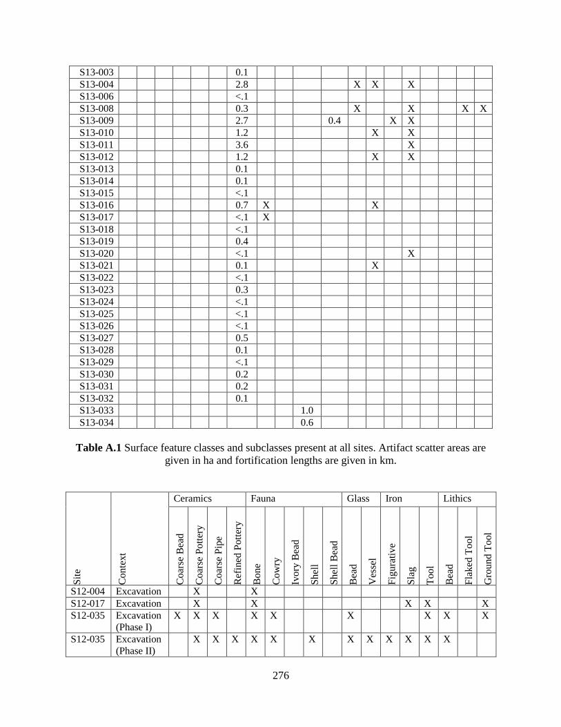
276
S13-003 0.1
S13-004 2.8 X X X
S13-006 <.1
S13-008 0.3 X X X X
S13-009 2.7 0.4 X X
S13-010 1.2 X X
S13-011 3.6 X
S13-012 1.2 X X
S13-013 0.1
S13-014 0.1
S13-015 <.1
S13-016 0.7 X X
S13-017 <.1 X
S13-018 <.1
S13-019 0.4
S13-020 <.1 X
S13-021 0.1 X
S13-022 <.1
S13-023 0.3
S13-024 <.1
S13-025 <.1
S13-026 <.1
S13-027 0.5
S13-028 0.1
S13-029 <.1
S13-030 0.2
S13-031 0.2
S13-032 0.1
S13-033 1.0
S13-034 0.6
Table A.1 Surface feature classes and subclasses present at all sites. Artifact scatter areas are
given in ha and fortification lengths are given in km.
Sit
e
Co
nte
xt
Ceramics Fauna Glass Iron Lithics
Co
arse
Bea
d
Co
arse
Po
tter
y
Co
arse
Pip
e
Ref
ined
Pott
ery
Bo
ne
Co
wry
Ivo
ry B
ead
Sh
ell
Sh
ell
Bea
d
Bea
d
Ves
sel
Fig
ura
tiv
e
Sla
g
To
ol
Bea
d
Fla
ked
To
ol
Gro
un
d T
ool
S12-004 Excavation X X
S12-017 Excavation X X X X X
S12-035 Excavation
(Phase I)
X X X X X X X X X
S12-035 Excavation
(Phase II)
X X X X X X X X X X X X

277
S12-036 Excavation X X X
S12-037 Excavation X X X X X X X X X X
S13-004 Excavation X X X X X X X X X X
S13-010 Excavation X X X X X X X X
S13-011 Excavation X X X X X X
S13-012 Excavation X
S12-001 Surface X
S12-004 Surface X X X X X X X
S12-006 Surface X X X X
S12-007 Surface X X X
S12-008 Surface
S12-009 Surface X X X X X X X
S12-012 Surface X X X X
S12-013 Surface X X X X X
S12-014 Surface X X X X X X
S12-015 Surface X X
S12-016 Surface X X
S12-017 Surface X X
S12-018 Surface X
S12-021 Surface X X
S12-022 Surface X X
S12-023 Surface X
S12-024 Surface X X X
S12-025 Surface X X X X
S12-026 Surface X
S12-027 Surface X X
S12-028 Surface X X X X X X X
S12-029 Surface X X
S12-030 Surface X X
S12-031 Surface
S12-032 Surface X
S12-033 Surface X X X
S12-034 Surface X
S12-035 Surface X X X
S12-036 Surface X X X
S12-037 Surface X X X X X
S12-039 Surface
S12-040 Surface
S12-043 Surface X
S12-044 Surface X
S13-001 Surface X
S13-002 Surface X
S13-003 Surface X
S13-004 Surface X X X
S13-006 Surface X
S13-008 Surface X
S13-009 Surface X
S13-010 Surface X X
S13-011 Surface X
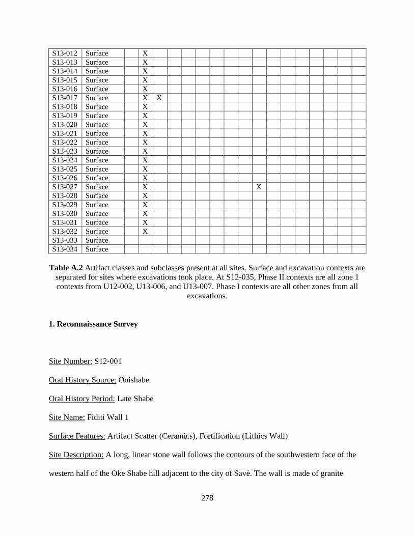
278
S13-012 Surface X
S13-013 Surface X
S13-014 Surface X
S13-015 Surface X
S13-016 Surface X
S13-017 Surface X X
S13-018 Surface X
S13-019 Surface X
S13-020 Surface X
S13-021 Surface X
S13-022 Surface X
S13-023 Surface X
S13-024 Surface X
S13-025 Surface X
S13-026 Surface X
S13-027 Surface X X
S13-028 Surface X
S13-029 Surface X
S13-030 Surface X
S13-031 Surface X
S13-032 Surface X
S13-033 Surface
S13-034 Surface
Table A.2 Artifact classes and subclasses present at all sites. Surface and excavation contexts are
separated for sites where excavations took place. At S12-035, Phase II contexts are all zone 1
contexts from U12-002, U13-006, and U13-007. Phase I contexts are all other zones from all
excavations.
1. Reconnaissance Survey
Site Number: S12-001
Oral History Source: Onishabe
Oral History Period: Late Shabe
Site Name: Fiditi Wall 1
Surface Features: Artifact Scatter (Ceramics), Fortification (Lithics Wall)
Site Description: A long, linear stone wall follows the contours of the southwestern face of the
western half of the Oke Shabe hill adjacent to the city of Savè. The wall is made of granite

279
boulders piled together and is uncoursed (Figure A.2). Artifacts are found adjacent to the wall on
the interior (upslope) side. The wall varies in width and height, but is typically around 110 cm
wide and 130 cm tall. The individual stones that make up the wall also vary greatly, but tend to
be spherical to oblong boulders, about 40 cm in diameter. Oral history associates the wall with
Late Shabe period refuge of Fiditi (S12-004, S12-006). Artifacts were collected opportunistically
within a 5 m width following the contour of the wall.
Coordinates: N08º02’03.4” E002º30’08.0” (endpoint of stone wall); N08º02’02.1”
E002º30’19.6” (gap in stone wall); N08º02’00.4” E002º30’24.3” (endpoint of stone wall)
Artifact Classes from Surface Collections: Ceramics (Coarse Pottery)
Figure A.1 Site map of S12-001.

280
Figure A.2 An endpoint of the stone wall terminating on top of the southwestern summit of the
Oke Shabe hill.
Site Number: S12-004
Oral History Source: Onishabe
Oral History Period: Late Shabe
Site Name: Fiditi 1
Surface Features: Artifact Scatter (Rockshelter), Depression (Ditch), Fortification (Earthen
Berm), Mount (Large), Natural Feature (Rockshelter), Sacred Tree Species (Baobab)
Site Description: A large artifact scatter surrounded on the west, north and east by the Oke Shabe
hill. The entire site is remembered as a refuge occupied during wars in the 19th century CE. This
site is part of the Fiditi complex (S12-001, S12-004, S12-006, S12-007, S12-008, S12-009, S12-
012). There are 14 baobab trees growing on the site. A 1 m x 2 m excavation (U12-001) unit was
placed near the largest baobab tree to test the integrity of subsurface features. No features we
discovered, and the strata appeared to be heavily mixed, likely from agricultural activities. The
excavation was terminated prior to reaching a culturally sterile strata, as wet conditions made
excavation of clay-rich strata very difficult. On the eastern edge of the site, an earthen berm runs
perpendicular to the hill. There are some granite boulders associated with this berm, but the
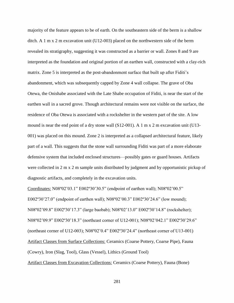
281
majority of the feature appears to be of earth. On the southeastern side of the berm is a shallow
ditch. A 1 m x 2 m excavation unit (U12-003) placed on the northwestern side of the berm
revealed its stratigraphy, suggesting it was constructed as a barrier or wall. Zones 8 and 9 are
interpreted as the foundation and original portion of an earthen wall, constructed with a clay-rich
matrix. Zone 5 is interpreted as the post-abandonment surface that built up after Fiditi’s
abandonment, which was subsequently capped by Zone 4 wall collapse. The grave of Oba
Otewa, the Onishabe associated with the Late Shabe occupation of Fiditi, is near the start of the
earthen wall in a sacred grove. Though architectural remains were not visible on the surface, the
residence of Oba Otewa is associated with a rockshelter in the western part of the site. A low
mound is near the end point of a dry stone wall (S12-001). A 1 m x 2 m excavation unit (U13-
001) was placed on this mound. Zone 2 is interpreted as a collapsed architectural feature, likely
part of a wall. This suggests that the stone wall surrounding Fiditi was part of a more elaborate
defensive system that included enclosed structures—possibly gates or guard houses. Artifacts
were collected in 2 m x 2 m sample units distributed by judgment and by opportunistic pickup of
diagnostic artifacts, and completely in the excavation units.
Coordinates: N08º02’03.1” E002º30’30.5” (endpoint of earthen wall); N08º02’00.5”
E002º30’27.0” (endpoint of earthen wall); N08º02’00.3” E002º30’24.6” (low mound);
N08º02’09.8” E002º30’17.3” (large baobab); N08º02’13.0” E002º30’14.8” (rockshelter);
N08º02’09.9” E002º30’18.3” (northeast corner of U12-001); N08º02’042.1” E002º30’29.6”
(northeast corner of U12-003); N08º02’0.4” E002º30’24.4” (northeast corner of U13-001)
Artifact Classes from Surface Collections: Ceramics (Coarse Pottery, Coarse Pipe), Fauna
(Cowry), Iron (Slag, Tool), Glass (Vessel), Lithics (Ground Tool)
Artifact Classes from Excavation Collections: Ceramics (Coarse Pottery), Fauna (Bone)
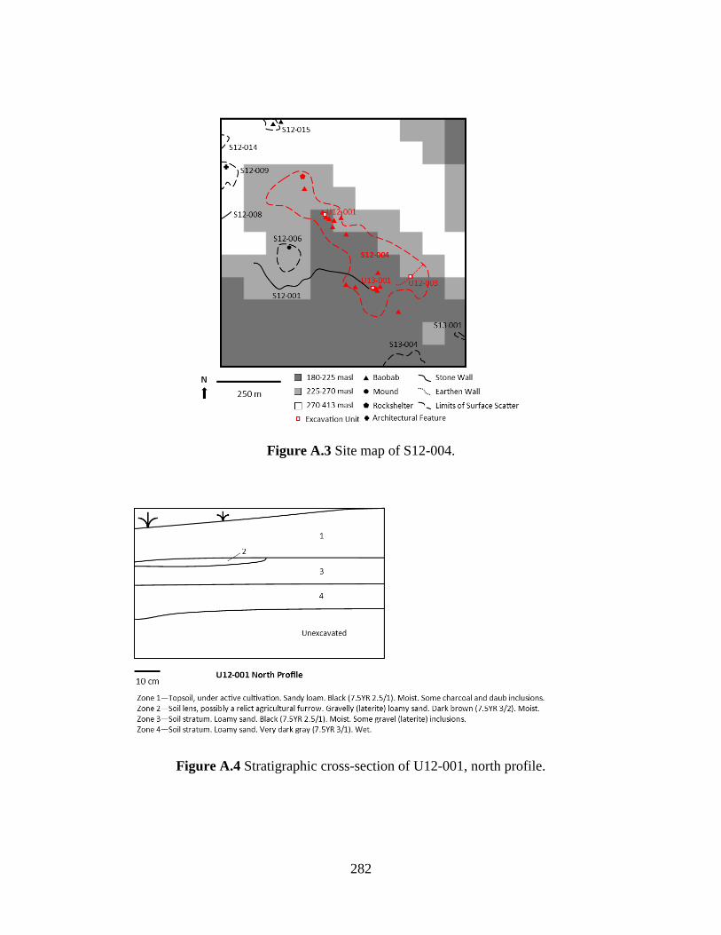
282
Figure A.3 Site map of S12-004.
Figure A.4 Stratigraphic cross-section of U12-001, north profile.
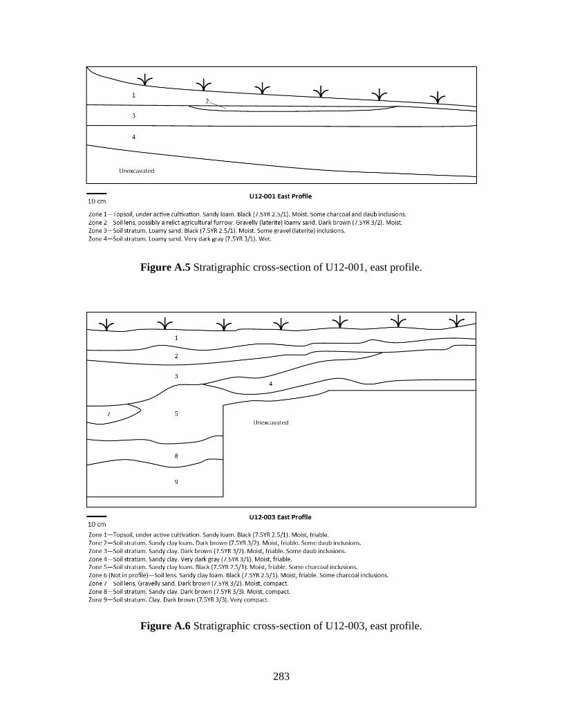
283
Figure A.5 Stratigraphic cross-section of U12-001, east profile.
Figure A.6 Stratigraphic cross-section of U12-003, east profile.
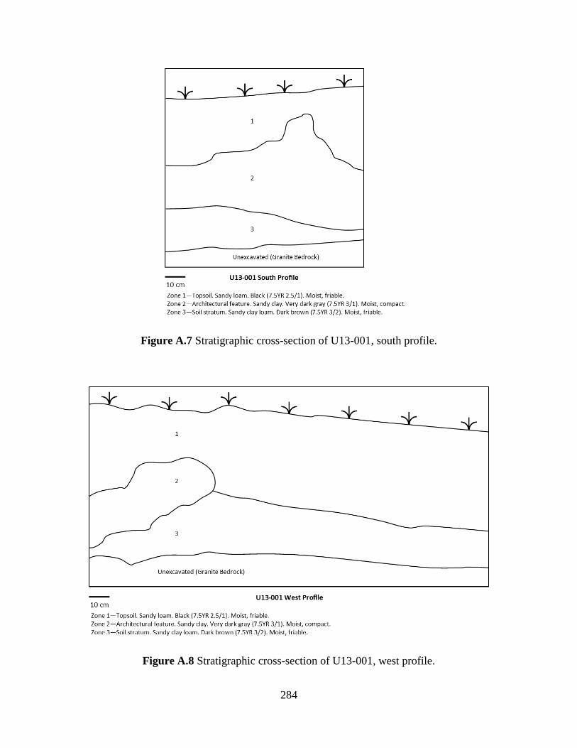
284
Figure A.7 Stratigraphic cross-section of U13-001, south profile.
Figure A.8 Stratigraphic cross-section of U13-001, west profile.
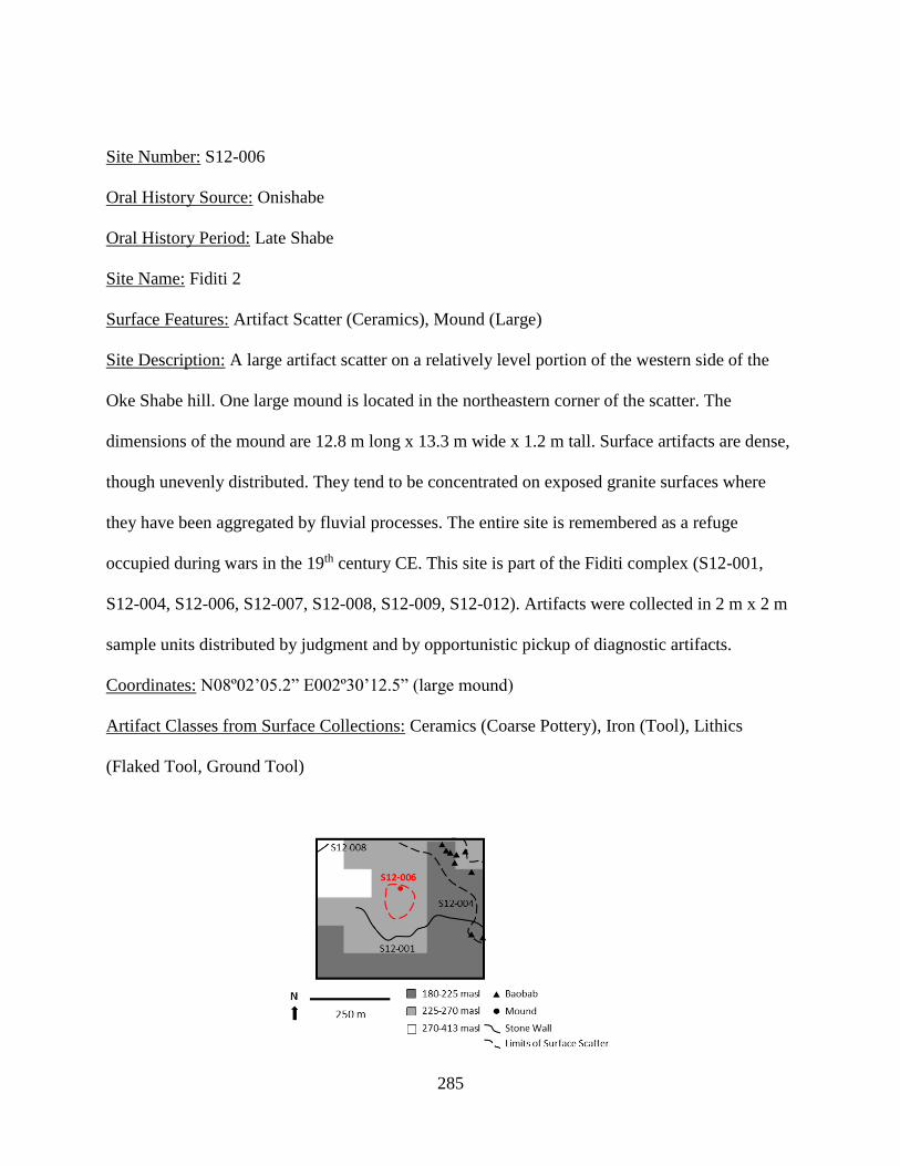
285
Site Number: S12-006
Oral History Source: Onishabe
Oral History Period: Late Shabe
Site Name: Fiditi 2
Surface Features: Artifact Scatter (Ceramics), Mound (Large)
Site Description: A large artifact scatter on a relatively level portion of the western side of the
Oke Shabe hill. One large mound is located in the northeastern corner of the scatter. The
dimensions of the mound are 12.8 m long x 13.3 m wide x 1.2 m tall. Surface artifacts are dense,
though unevenly distributed. They tend to be concentrated on exposed granite surfaces where
they have been aggregated by fluvial processes. The entire site is remembered as a refuge
occupied during wars in the 19th century CE. This site is part of the Fiditi complex (S12-001,
S12-004, S12-006, S12-007, S12-008, S12-009, S12-012). Artifacts were collected in 2 m x 2 m
sample units distributed by judgment and by opportunistic pickup of diagnostic artifacts.
Coordinates: N08º02’05.2” E002º30’12.5” (large mound)
Artifact Classes from Surface Collections: Ceramics (Coarse Pottery), Iron (Tool), Lithics
(Flaked Tool, Ground Tool)
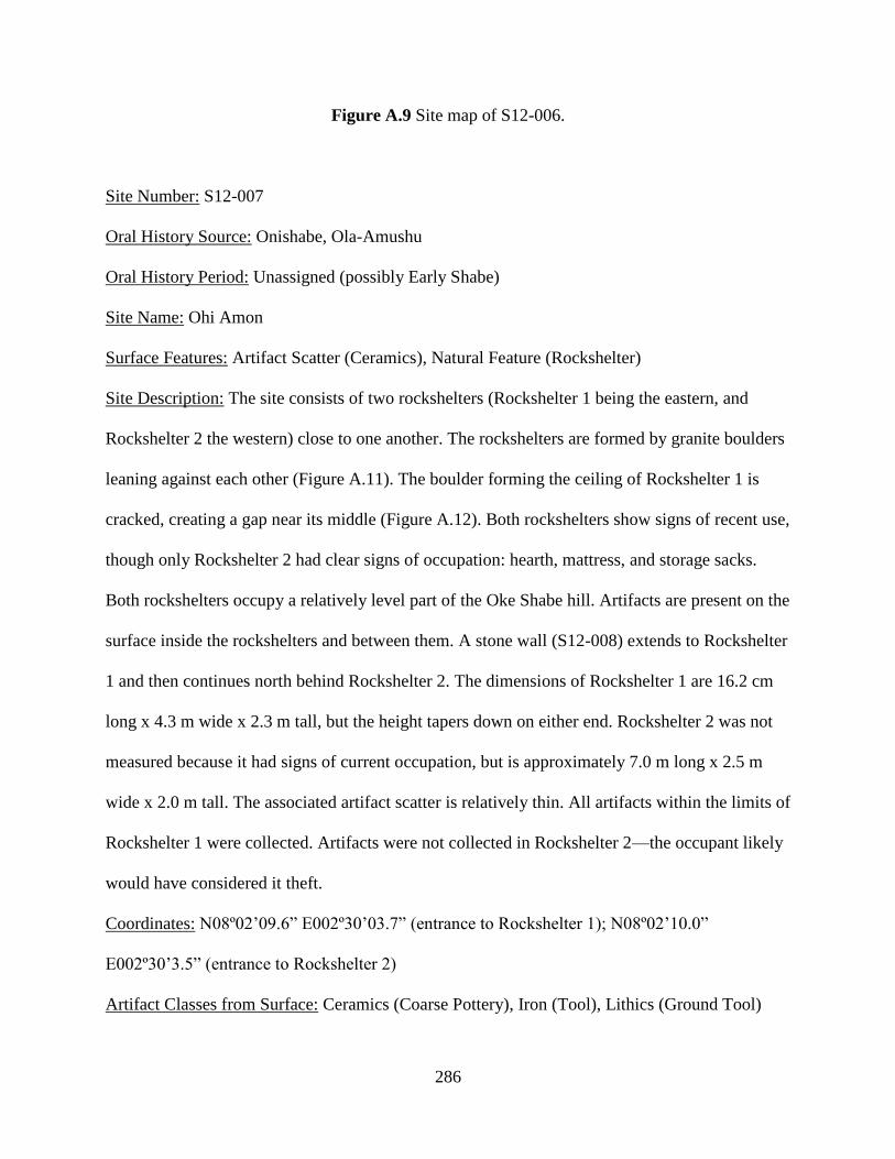
286
Figure A.9 Site map of S12-006.
Site Number: S12-007
Oral History Source: Onishabe, Ola-Amushu
Oral History Period: Unassigned (possibly Early Shabe)
Site Name: Ohi Amon
Surface Features: Artifact Scatter (Ceramics), Natural Feature (Rockshelter)
Site Description: The site consists of two rockshelters (Rockshelter 1 being the eastern, and
Rockshelter 2 the western) close to one another. The rockshelters are formed by granite boulders
leaning against each other (Figure A.11). The boulder forming the ceiling of Rockshelter 1 is
cracked, creating a gap near its middle (Figure A.12). Both rockshelters show signs of recent use,
though only Rockshelter 2 had clear signs of occupation: hearth, mattress, and storage sacks.
Both rockshelters occupy a relatively level part of the Oke Shabe hill. Artifacts are present on the
surface inside the rockshelters and between them. A stone wall (S12-008) extends to Rockshelter
1 and then continues north behind Rockshelter 2. The dimensions of Rockshelter 1 are 16.2 cm
long x 4.3 m wide x 2.3 m tall, but the height tapers down on either end. Rockshelter 2 was not
measured because it had signs of current occupation, but is approximately 7.0 m long x 2.5 m
wide x 2.0 m tall. The associated artifact scatter is relatively thin. All artifacts within the limits of
Rockshelter 1 were collected. Artifacts were not collected in Rockshelter 2—the occupant likely
would have considered it theft.
Coordinates: N08º02’09.6” E002º30’03.7” (entrance to Rockshelter 1); N08º02’10.0”
E002º30’3.5” (entrance to Rockshelter 2)
Artifact Classes from Surface: Ceramics (Coarse Pottery), Iron (Tool), Lithics (Ground Tool)
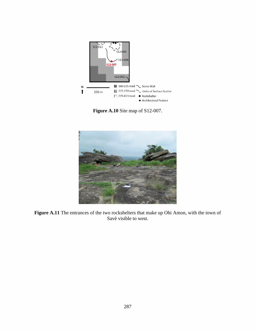
287
Figure A.10 Site map of S12-007.
Figure A.11 The entrances of the two rockshelters that make up Ohi Amon, with the town of
Savè visible to west.

288
Figure A.12 The interior of rockshelter 1 of Ohi Amon.
Site Number: S12-008
Oral History Source: Onishabe
Oral History Period: Late Shabe
Site Name: Fiditi Wall 2
Surface Features: Fortification (Lithics Wall)
Site Description: A long, linear stone wall that follows the contour of a small, but steep, drop
along a southern face of the western side of the Oke Shabe hill. This drop is relatively high up on
the hill, higher than the other stone wall (S12-001). The wall joins with a rockshelter (S12-007),
and continues on north following the contour of the hill. It ends abutting the hill after dipping
down in a saddle. The wall is of a similar dimensions and construction to S12-001. There are no
surface artifacts associated with this wall outside of those near the rockshelters (S12-007).
Coordinates: N08º02’10.2” E002º30’05.1” (endpoint of stone wall); N08º02’09.5”
E002º30’04.0” (wall joins rockshelter S12-007); N08º02’14.1” E002º30’00.5” (endpoint of stone
wall)

289
Figure A.13 Site map of S12-008.
Site Number: S12-009
Oral History Source: Onishabe
Oral History Period: Late Shabe
Site Name: Fiditi 3
Surface Features: Architecture (Clay Pavement), Artifact Scatter (Ceramics)
Site Description: A thick scatter of artifacts on a high point, and then a thinner scatter of artifacts
continues north and down slope into a saddle area. As the hill continues north up out of the
saddle, a hard clay pavement, possibly fired, appears in at least two places extending out of the
hillside (Figure A.15). The pavement was exposed by surface scraping with trowels to ascertain
its extent and integrity, then recovered with soil. The site boundaries are defined by the contour
of the hill to the southeast and northwest, and by the extent of the artifact scatter to the southwest
and northeast. Artifacts were collected in 2 m x 2 m sample units distributed by judgment and by
opportunistic pickup of diagnostic artifacts.
Coordinates: N08º02’16.3” E002º30’03.3” (clay pavement); N08º02’16.1” E002º30’04.1” (clay
pavement)

290
Artifact Classes from Surface: Ceramics (Coarse Pottery, Refined Pottery), Fauna (Bone,
Cowry), Glass (Vessel), Iron (Tool), Lithics (Ground Tool)
Figure A.14 Site map of S12-009.
Figure A.15 One of two hard-packed clay surfaces eroding out of the Oke Shabe hill. The two
surfaces are on the same plane, and are likely part of the same architectural complex.
Site Number: S12-012
Oral History Source: Onishabe
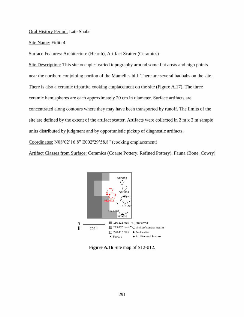
291
Oral History Period: Late Shabe
Site Name: Fiditi 4
Surface Features: Architecture (Hearth), Artifact Scatter (Ceramics)
Site Description: This site occupies varied topography around some flat areas and high points
near the northern conjoining portion of the Mamelles hill. There are several baobabs on the site.
There is also a ceramic tripartite cooking emplacement on the site (Figure A.17). The three
ceramic hemispheres are each approximately 20 cm in diameter. Surface artifacts are
concentrated along contours where they may have been transported by runoff. The limits of the
site are defined by the extent of the artifact scatter. Artifacts were collected in 2 m x 2 m sample
units distributed by judgment and by opportunistic pickup of diagnostic artifacts.
Coordinates: N08º02’16.8” E002º29’58.8” (cooking emplacement)
Artifact Classes from Surface: Ceramics (Coarse Pottery, Refined Pottery), Fauna (Bone, Cowry)
Figure A.16 Site map of S12-012.
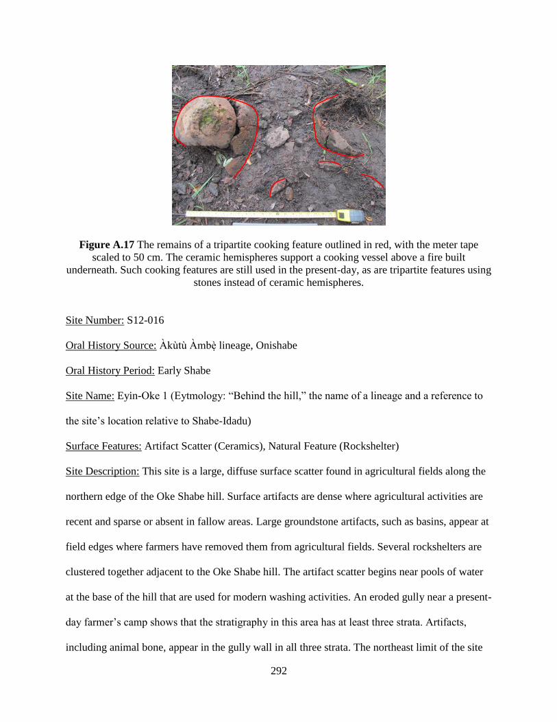
292
Figure A.17 The remains of a tripartite cooking feature outlined in red, with the meter tape
scaled to 50 cm. The ceramic hemispheres support a cooking vessel above a fire built
underneath. Such cooking features are still used in the present-day, as are tripartite features using
stones instead of ceramic hemispheres.
Site Number: S12-016
Oral History Source: Àkùtù Àmbè lineage, Onishabe
Oral History Period: Early Shabe
Site Name: Eyin-Oke 1 (Eytmology: “Behind the hill,” the name of a lineage and a reference to
the site’s location relative to Shabe-Idadu)
Surface Features: Artifact Scatter (Ceramics), Natural Feature (Rockshelter)
Site Description: This site is a large, diffuse surface scatter found in agricultural fields along the
northern edge of the Oke Shabe hill. Surface artifacts are dense where agricultural activities are
recent and sparse or absent in fallow areas. Large groundstone artifacts, such as basins, appear at
field edges where farmers have removed them from agricultural fields. Several rockshelters are
clustered together adjacent to the Oke Shabe hill. The artifact scatter begins near pools of water
at the base of the hill that are used for modern washing activities. An eroded gully near a present-
day farmer’s camp shows that the stratigraphy in this area has at least three strata. Artifacts,
including animal bone, appear in the gully wall in all three strata. The northeast limit of the site

293
is not clearly defined, though it appears the scatter thins near the modern road. However, this
may be the result of modern agricultural and building activities. The limits of the site are defined
by the extent of the artifact scatter. The southeast limit of the scatter is very close to S12-017
(Eyin-Oke 2), a site that is reported in oral history as being occupied by the same group.
Artifacts were collected in 2 m x 2 m sample units distributed by judgment and by opportunistic
pickup of diagnostic artifacts.
Coordinates: N08º02’39.6” E002º30’18.9” (eroded gully); N08º02’45.8” E002º30’10.8”
(entrance to rockshelters)
Artifact Classes from Surface: Ceramics (Coarse Pottery), Lithics (Ground Tool)
Figure A.18 Site map of S12-016.
Site Number: S12-017
Oral History Source: Àkùtù Àmbè lineage, Onishabe
Oral History Period: Early Shabe
Site Name: Eyin-Oke 2
Surface Features: Artifact Scatter (Ceramics), Sacred Tree Species (Baobab, Iroko)

294
Site Description: This site is a large, diffuse surface scatter found in agricultural fields along the
northern edge of the Oke Shabe hill. Surface artifacts are dense where agricultural activities are
recent and sparse or absent in fallow areas. Large groundstone artifacts, such as basins, appear at
field edges where farmers have removed them from agricultural fields. Five baobabs are located
within the limits of the artifact scatter. A 1 m x 2 m excavation unit (U13-013) was excavated
near a large baobab central to the site to test the integrity of subsurface features. This excavation
found some collapsed earthen architectural remains (Zone 2), suggesting that structure
foundations could be located. One iroko is also present, wrapped in cloth as part of contemporary
religious practice. However, this tree is far removed from the artifact scatter, though according to
Àkùtù Àmbè tradition is near the remains of a village site that pre-dates the foundation of Shabe-
Idadu. The northwest limit of the scatter is very close to S12-016 (Eyin-Oke 1), a site that is
reported in oral history as being occupied by the same group. Artifacts were collected by
opportunistic pickup of diagnostic artifacts, and completely in the excavation unit.
Coordinates: N08º02’35.9” E002º30’24.9” (large baobab); N08º02’25.9” E002º30’31.8” (iroko)
Artifact Classes from Surface: Ceramics (Coarse Pottery), Lithics (Ground Tool)
Artifact Classes from Excavation: Ceramics (Coarse Pottery), Fauna (Bone), Iron (Slag, Tool),
Lithics (Ground Tool)
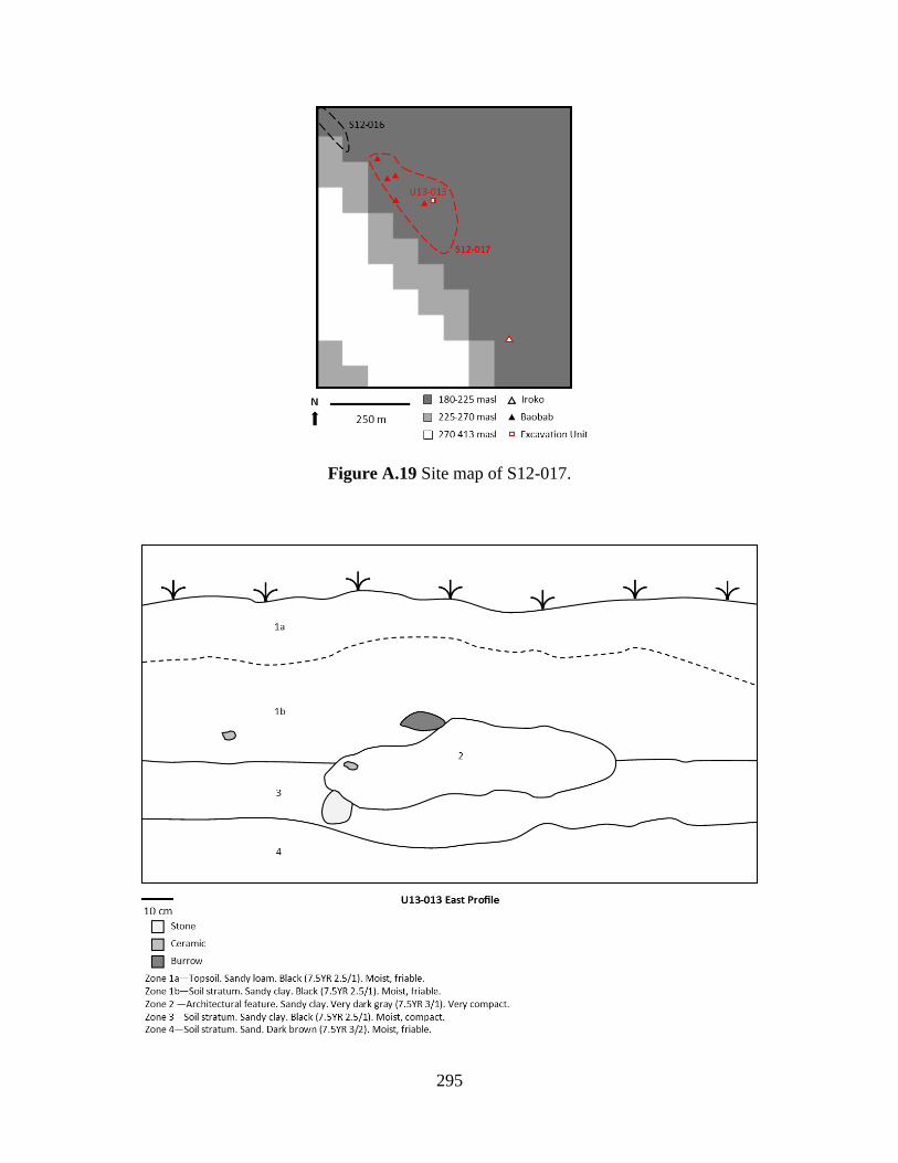
295
Figure A.19 Site map of S12-017.

296
Figure A.20 Stratigraphic cross-section of U13-013, east profile.
Figure A.21 Stratigraphic cross-section of U13-013, north profile.
Site Number: S12-018
Oral History Source: Onishabe
Oral History Period: Middle Shabe to European Colonial
Site Name: Idi-iroko
Surface Features: Architecture (Potsherd Pavement), Sacred Tree Species (Baobab, Iroko),
Shrine (Tree)
Site Description: This site is a potsherd pavement within and beneath the contemporary Idi-Iroko
market in the town of Savè (Figure A.23). It consists of an area of potsherds laid out in a mosaic
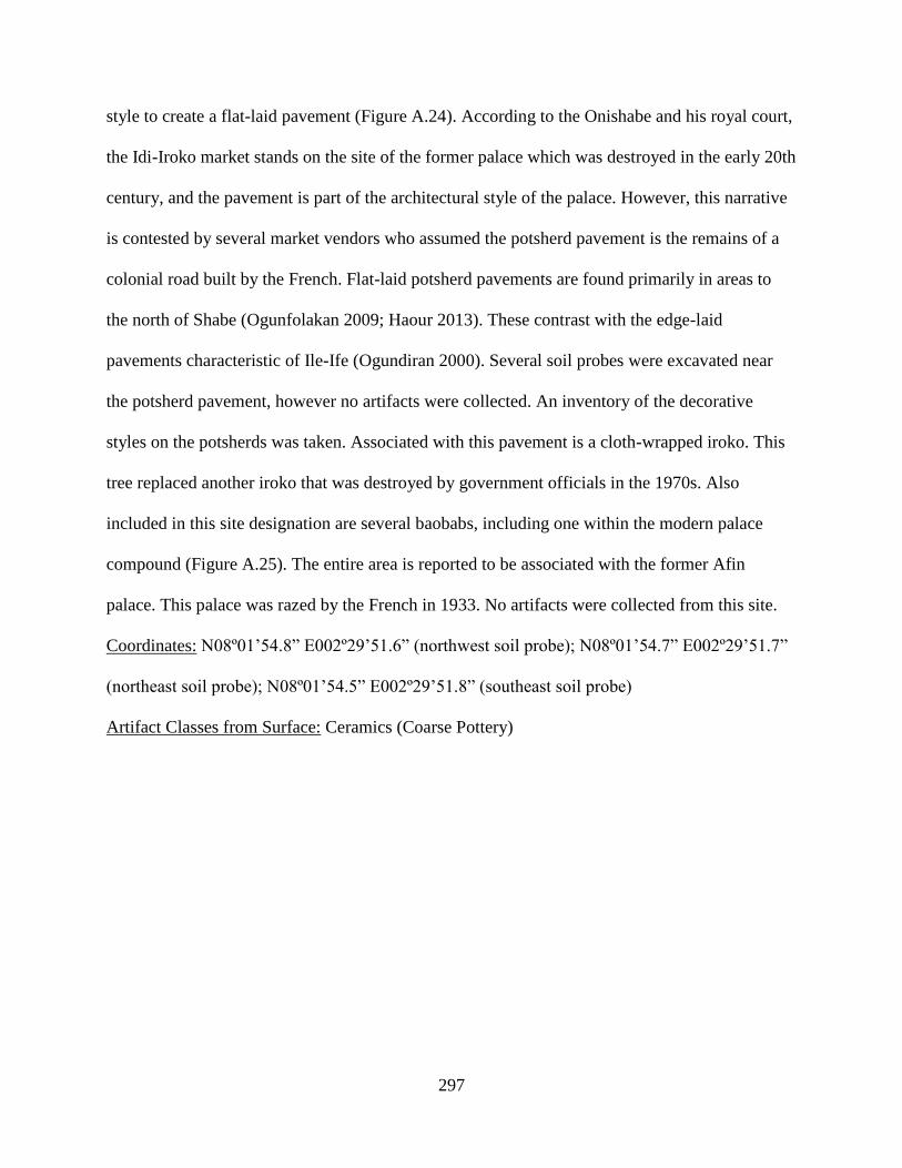
297
style to create a flat-laid pavement (Figure A.24). According to the Onishabe and his royal court,
the Idi-Iroko market stands on the site of the former palace which was destroyed in the early 20th
century, and the pavement is part of the architectural style of the palace. However, this narrative
is contested by several market vendors who assumed the potsherd pavement is the remains of a
colonial road built by the French. Flat-laid potsherd pavements are found primarily in areas to
the north of Shabe (Ogunfolakan 2009; Haour 2013). These contrast with the edge-laid
pavements characteristic of Ile-Ife (Ogundiran 2000). Several soil probes were excavated near
the potsherd pavement, however no artifacts were collected. An inventory of the decorative
styles on the potsherds was taken. Associated with this pavement is a cloth-wrapped iroko. This
tree replaced another iroko that was destroyed by government officials in the 1970s. Also
included in this site designation are several baobabs, including one within the modern palace
compound (Figure A.25). The entire area is reported to be associated with the former Afin
palace. This palace was razed by the French in 1933. No artifacts were collected from this site.
Coordinates: N08º01’54.8” E002º29’51.6” (northwest soil probe); N08º01’54.7” E002º29’51.7”
(northeast soil probe); N08º01’54.5” E002º29’51.8” (southeast soil probe)
Artifact Classes from Surface: Ceramics (Coarse Pottery)
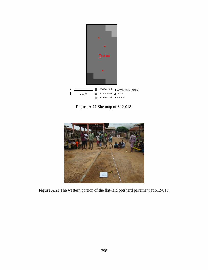
298
Figure A.22 Site map of S12-018.
Figure A.23 The western portion of the flat-laid potsherd pavement at S12-018.
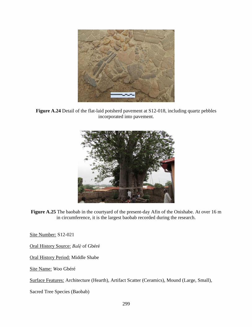
299
Figure A.24 Detail of the flat-laid potsherd pavement at S12-018, including quartz pebbles
incorporated into pavement.
Figure A.25 The baobab in the courtyard of the present-day Afin of the Onishabe. At over 16 m
in circumference, it is the largest baobab recorded during the research.
Site Number: S12-021
Oral History Source: Balè of Gbéré
Oral History Period: Middle Shabe
Site Name: Woo Gbéré
Surface Features: Architecture (Hearth), Artifact Scatter (Ceramics), Mound (Large, Small),
Sacred Tree Species (Baobab)
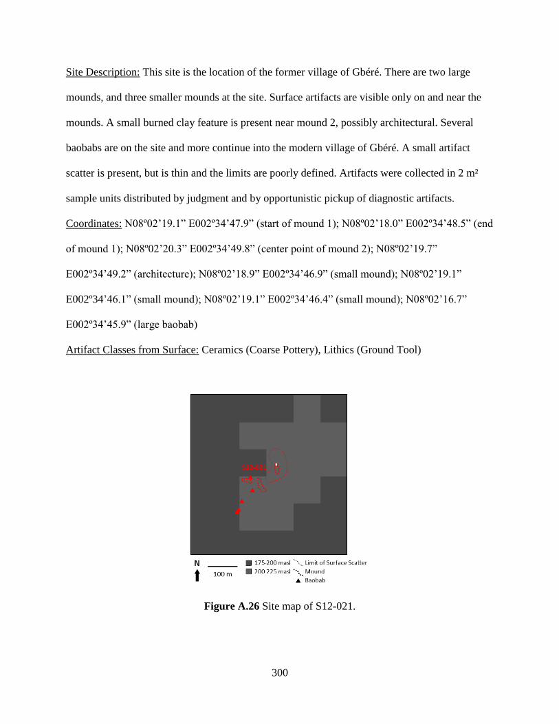
300
Site Description: This site is the location of the former village of Gbéré. There are two large
mounds, and three smaller mounds at the site. Surface artifacts are visible only on and near the
mounds. A small burned clay feature is present near mound 2, possibly architectural. Several
baobabs are on the site and more continue into the modern village of Gbéré. A small artifact
scatter is present, but is thin and the limits are poorly defined. Artifacts were collected in 2 m²
sample units distributed by judgment and by opportunistic pickup of diagnostic artifacts.
Coordinates: N08º02’19.1” E002º34’47.9” (start of mound 1); N08º02’18.0” E002º34’48.5” (end
of mound 1); N08º02’20.3” E002º34’49.8” (center point of mound 2); N08º02’19.7”
E002º34’49.2” (architecture); N08º02’18.9” E002º34’46.9” (small mound); N08º02’19.1”
E002º34’46.1” (small mound); N08º02’19.1” E002º34’46.4” (small mound); N08º02’16.7”
E002º34’45.9” (large baobab)
Artifact Classes from Surface: Ceramics (Coarse Pottery), Lithics (Ground Tool)
Figure A.26 Site map of S12-021.
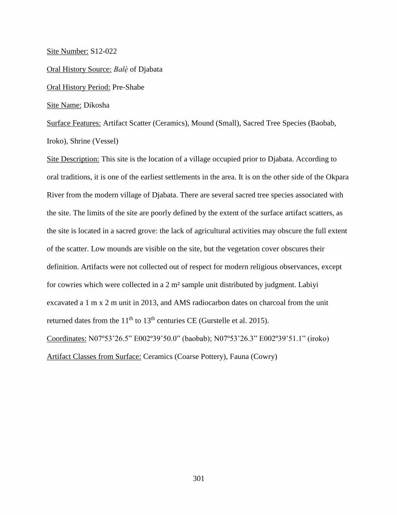
301
Site Number: S12-022
Oral History Source: Balè of Djabata
Oral History Period: Pre-Shabe
Site Name: Dikosha
Surface Features: Artifact Scatter (Ceramics), Mound (Small), Sacred Tree Species (Baobab,
Iroko), Shrine (Vessel)
Site Description: This site is the location of a village occupied prior to Djabata. According to
oral traditions, it is one of the earliest settlements in the area. It is on the other side of the Okpara
River from the modern village of Djabata. There are several sacred tree species associated with
the site. The limits of the site are poorly defined by the extent of the surface artifact scatters, as
the site is located in a sacred grove: the lack of agricultural activities may obscure the full extent
of the scatter. Low mounds are visible on the site, but the vegetation cover obscures their
definition. Artifacts were not collected out of respect for modern religious observances, except
for cowries which were collected in a 2 m² sample unit distributed by judgment. Labiyi
excavated a 1 m x 2 m unit in 2013, and AMS radiocarbon dates on charcoal from the unit
returned dates from the 11th to 13th centuries CE (Gurstelle et al. 2015).
Coordinates: N07º53’26.5” E002º39’50.0” (baobab); N07º53’26.3” E002º39’51.1” (iroko)
Artifact Classes from Surface: Ceramics (Coarse Pottery), Fauna (Cowry)
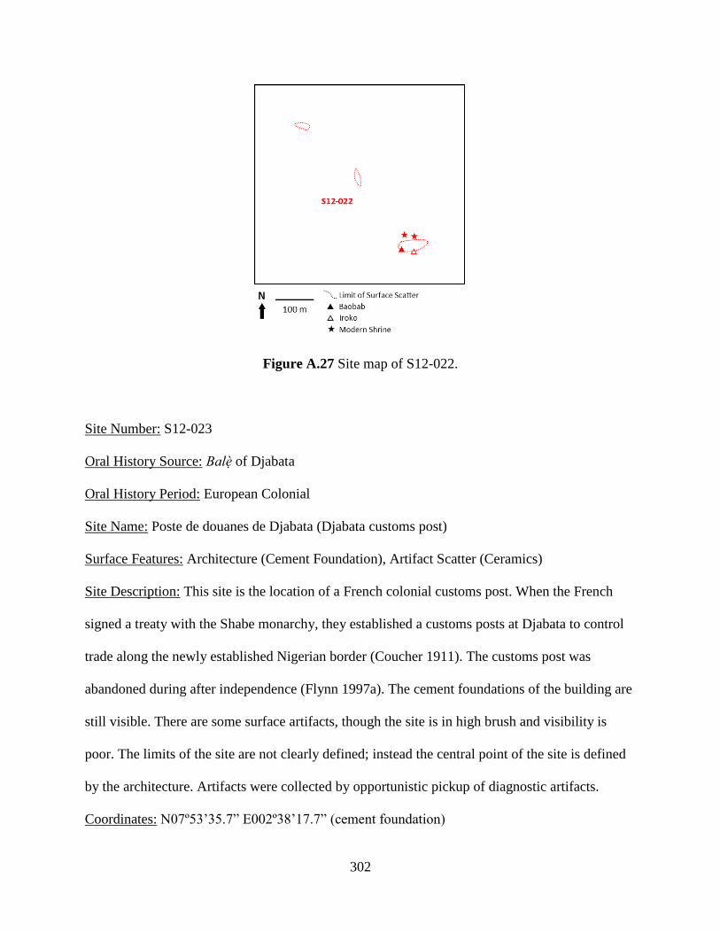
302
Figure A.27 Site map of S12-022.
Site Number: S12-023
Oral History Source: Balè of Djabata
Oral History Period: European Colonial
Site Name: Poste de douanes de Djabata (Djabata customs post)
Surface Features: Architecture (Cement Foundation), Artifact Scatter (Ceramics)
Site Description: This site is the location of a French colonial customs post. When the French
signed a treaty with the Shabe monarchy, they established a customs posts at Djabata to control
trade along the newly established Nigerian border (Coucher 1911). The customs post was
abandoned during after independence (Flynn 1997a). The cement foundations of the building are
still visible. There are some surface artifacts, though the site is in high brush and visibility is
poor. The limits of the site are not clearly defined; instead the central point of the site is defined
by the architecture. Artifacts were collected by opportunistic pickup of diagnostic artifacts.
Coordinates: N07º53’35.7” E002º38’17.7” (cement foundation)
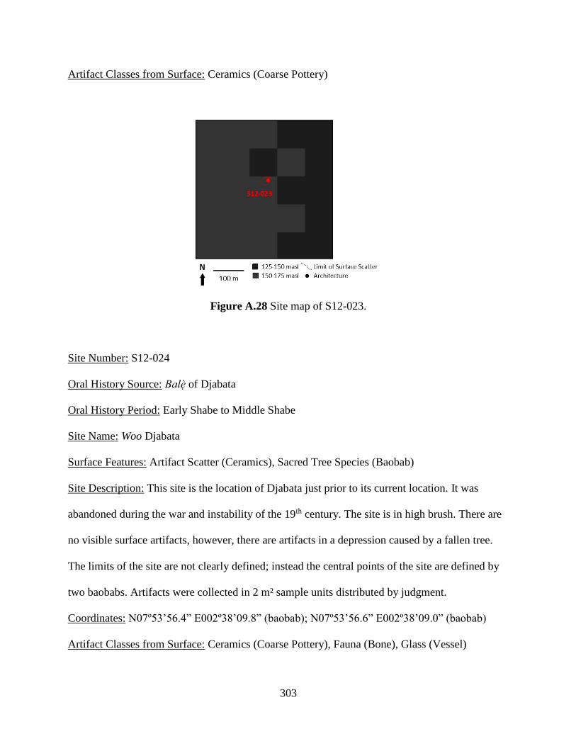
303
Artifact Classes from Surface: Ceramics (Coarse Pottery)
Figure A.28 Site map of S12-023.
Site Number: S12-024
Oral History Source: Balè of Djabata
Oral History Period: Early Shabe to Middle Shabe
Site Name: Woo Djabata
Surface Features: Artifact Scatter (Ceramics), Sacred Tree Species (Baobab)
Site Description: This site is the location of Djabata just prior to its current location. It was
abandoned during the war and instability of the 19th century. The site is in high brush. There are
no visible surface artifacts, however, there are artifacts in a depression caused by a fallen tree.
The limits of the site are not clearly defined; instead the central points of the site are defined by
two baobabs. Artifacts were collected in 2 m² sample units distributed by judgment.
Coordinates: N07º53’56.4” E002º38’09.8” (baobab); N07º53’56.6” E002º38’09.0” (baobab)
Artifact Classes from Surface: Ceramics (Coarse Pottery), Fauna (Bone), Glass (Vessel)
304
Figure A.29 Site map of S12-024.
Site Number: S12-025
Oral History Source: Representative of Montéwo to the Balè of Alafia
Oral History Period: Late Shabe to European Colonial
Site Name: Woo Montéwo
Surface Features: Architecture (Earthen Debris, Earthen Foundation), Artifact Scatter
(Ceramics), Mound (Small), Sacred Tree Species (Baobab)
Site Description: This site is the location of the former village of Montewo. It was first occupied
during the 19th century as a refuge. It was abandoned shortly after independence when the
national government encouraged rural communities to move closer to established roads (in this
case RNIE 2). The site consists of a large artifact scatter and multiple mounds. There are also
large numbers of baobabs. The density of surface artifacts is related to agricultural activities;
artifacts are denser in recently cultivated areas. A rectangular mound at the south limit of the site
was identified according to oral history as a Catholic church. The other mounds on the site are
circular or oblong, and many have mud slab foundations or wall segments on them. The limits of

305
the site are defined by the extent of the artifact scatter. Artifacts were collected in 2 m² sample
units distributed by judgment and by opportunistic pickup of diagnostic artifacts.
Coordinates: N08º12’14.4” E002º36’32.5” (baobab); N08º12’05.9” E002º36’32.6” (Catholic
church); N08º12’10.6” E002º36’31.2” (mound with architecture)
Artifact Classes from Surface: Ceramics (Coarse Pottery), Glass (Vessel), Iron (Slag), Lithics
(Ground Tool)
Figure A.30 Site map of S12-025.
Site Number: S12-026
Oral History Source: Balodè of Monka
Oral History Period: Middle Shabe
Site Name: Not given
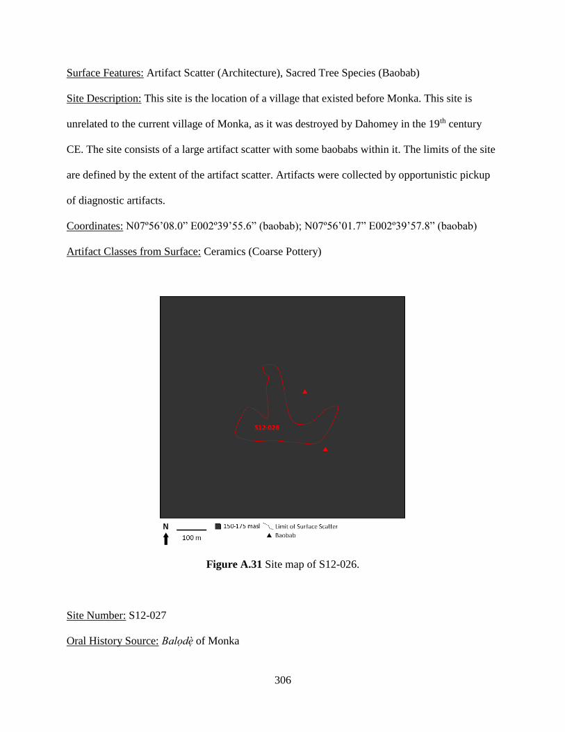
306
Surface Features: Artifact Scatter (Architecture), Sacred Tree Species (Baobab)
Site Description: This site is the location of a village that existed before Monka. This site is
unrelated to the current village of Monka, as it was destroyed by Dahomey in the 19th century
CE. The site consists of a large artifact scatter with some baobabs within it. The limits of the site
are defined by the extent of the artifact scatter. Artifacts were collected by opportunistic pickup
of diagnostic artifacts.
Coordinates: N07º56’08.0” E002º39’55.6” (baobab); N07º56’01.7” E002º39’57.8” (baobab)
Artifact Classes from Surface: Ceramics (Coarse Pottery)
Figure A.31 Site map of S12-026.
Site Number: S12-027
Oral History Source: Balodè of Monka
307
Oral History Period: Middle Shabe
Site Name: Not given
Surface Features: Artifact Scatter (Ceramics), Mound (Small), Sacred Tree Species (Baobab),
Shrine (Vessel)
Site Description: This site is the location of the village that existed prior to Monka. There appear
to be low mounds on the site, but much of the site is in high brush and the landscape could be
naturally undulating. A large hill of granite boulders on the western site of the site is the location
of modern shrine. Throughout the site, there are baobabs, including a very large baobab that was
cut down sometime in the past generation as part of the Oro festival. The limits of the site are
defined by the extent of the artifact scatter. Artifacts were collected in 2 m² sample units
distributed by judgment and by opportunistic pickup of diagnostic artifacts. Artifacts were not
collected near the modern shrine out of respect for modern religious observances.
Coordinates: N08º01’06.7” E002º41’53.0” (north limit of modern shrine) N08º01’09.7”
E002º41’56.2” (large baobab) N08º01’07.7” E002º41’58.0” (fallen baobab)
Artifact Classes from Surface: Ceramics (Coarse Pottery), Lithics (Ground Tool)
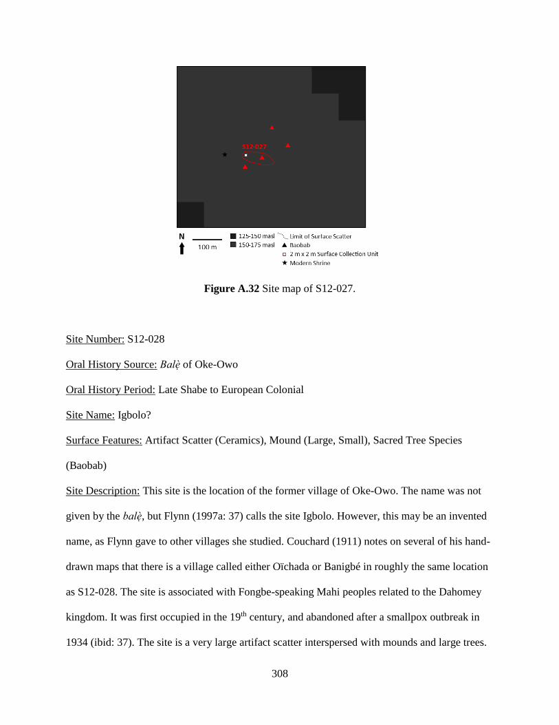
308
Figure A.32 Site map of S12-027.
Site Number: S12-028
Oral History Source: Balè of Oke-Owo
Oral History Period: Late Shabe to European Colonial
Site Name: Igbolo?
Surface Features: Artifact Scatter (Ceramics), Mound (Large, Small), Sacred Tree Species
(Baobab)
Site Description: This site is the location of the former village of Oke-Owo. The name was not
given by the balè, but Flynn (1997a: 37) calls the site Igbolo. However, this may be an invented
name, as Flynn gave to other villages she studied. Couchard (1911) notes on several of his hand-
drawn maps that there is a village called either Oïchada or Banigbé in roughly the same location
as S12-028. The site is associated with Fongbe-speaking Mahi peoples related to the Dahomey
kingdom. It was first occupied in the 19th century, and abandoned after a smallpox outbreak in
1934 (ibid: 37). The site is a very large artifact scatter interspersed with mounds and large trees.
309
The mounds are low and either small and circular or long and rectangular, but are all topped with
a lens of lateritic gravel. The surface density of artifacts varies according to land use, with
recently farmed fields showing higher densities. Where artifacts are present, there is a much
higher density of European ceramics and glass than at other sites. There also is a higher density
of cowries. The limits of the site are defined by the extent of the artifact scatter. Artifacts were
collected in 2 m² sample units distributed by judgment and by opportunistic pickup of diagnostic
artifacts.
Coordinates: N08º02’23.9” E002º42’43.2” (start of rectangular mound); N08º02’24.0”
E002º42’42.8” (end of rectangular mound); N08º02’24.6” E002º42’43.3” (circular mound);
N08º02’23.1” E002º42’46.0” (circular mound); N08º02’24.9” E002º42’47.2” (circular mound);
N08º02’30.2” E002º42’45.8” (twin baobabs)
Artifact Classes from Surface: Ceramics (Coarse Pottery, Refined Pottery), Fauna (Bone,
Cowry), Glass (Bead, Vessel), Lithics (Ground Tool)
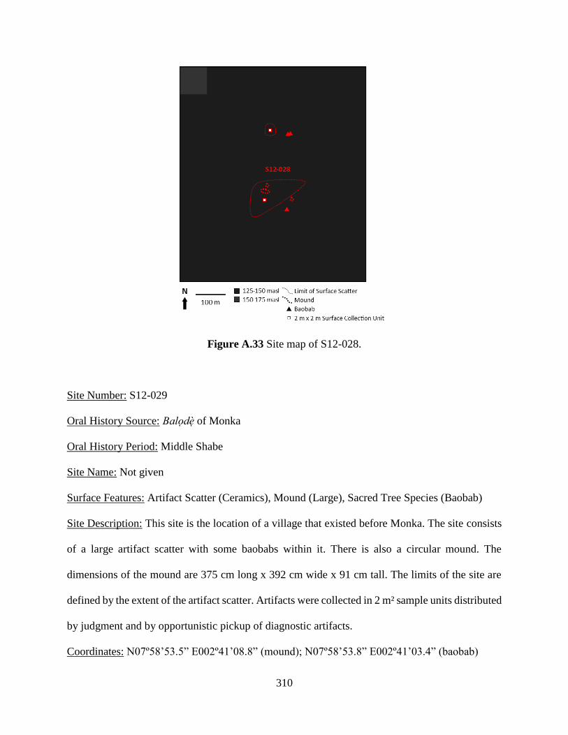
310
Figure A.33 Site map of S12-028.
Site Number: S12-029
Oral History Source: Balodè of Monka
Oral History Period: Middle Shabe
Site Name: Not given
Surface Features: Artifact Scatter (Ceramics), Mound (Large), Sacred Tree Species (Baobab)
Site Description: This site is the location of a village that existed before Monka. The site consists
of a large artifact scatter with some baobabs within it. There is also a circular mound. The
dimensions of the mound are 375 cm long x 392 cm wide x 91 cm tall. The limits of the site are
defined by the extent of the artifact scatter. Artifacts were collected in 2 m² sample units distributed
by judgment and by opportunistic pickup of diagnostic artifacts.
Coordinates: N07º58’53.5” E002º41’08.8” (mound); N07º58’53.8” E002º41’03.4” (baobab)
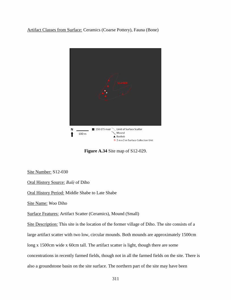
311
Artifact Classes from Surface: Ceramics (Coarse Pottery), Fauna (Bone)
Figure A.34 Site map of S12-029.
Site Number: S12-030
Oral History Source: Balè of Diho
Oral History Period: Middle Shabe to Late Shabe
Site Name: Woo Diho
Surface Features: Artifact Scatter (Ceramics), Mound (Small)
Site Description: This site is the location of the former village of Diho. The site consists of a
large artifact scatter with two low, circular mounds. Both mounds are approximately 1500cm
long x 1500cm wide x 60cm tall. The artifact scatter is light, though there are some
concentrations in recently farmed fields, though not in all the farmed fields on the site. There is
also a groundstone basin on the site surface. The northern part of the site may have been
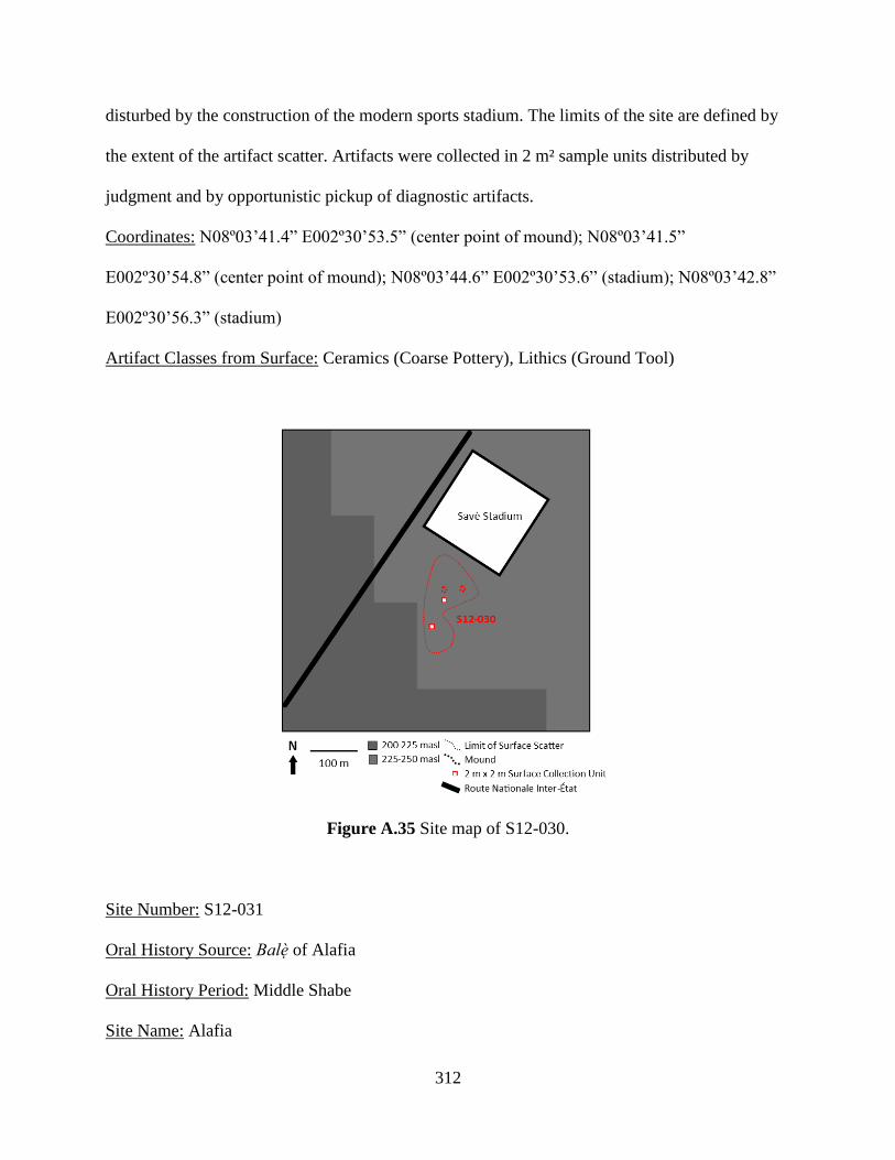
312
disturbed by the construction of the modern sports stadium. The limits of the site are defined by
the extent of the artifact scatter. Artifacts were collected in 2 m² sample units distributed by
judgment and by opportunistic pickup of diagnostic artifacts.
Coordinates: N08º03’41.4” E002º30’53.5” (center point of mound); N08º03’41.5”
E002º30’54.8” (center point of mound); N08º03’44.6” E002º30’53.6” (stadium); N08º03’42.8”
E002º30’56.3” (stadium)
Artifact Classes from Surface: Ceramics (Coarse Pottery), Lithics (Ground Tool)
Figure A.35 Site map of S12-030.
Site Number: S12-031
Oral History Source: Balè of Alafia
Oral History Period: Middle Shabe
Site Name: Alafia

313
Surface Features: Sacred Tree Species (Baobab)
Site Description: This site is the original location of the village of Alafia. AIafia was abandoned
in the early to middle 19th century CE due to war and instability, but was reoccupied in the late
19th century. These trees are said to mark the original village. It is in the middle of the current
site of Alafia, near the mosque. There are two baobabs which are tended to by occupants to mark
the site of the ancient village. There is no distinct scatter of artifacts associated with the site, but
this is likely due to mixing of ancient and modern materials in the current occupation. The limits
of the site are not clearly defined; instead the central points of the site are defined by two
baobabs. Because of the site’s location within the present-day village, artifacts were present but
not collected.
Coordinates: N08º12’00.0” E002º37’50.3” (baobab); N08º12’01.8” E002º37’48.6” (baobab)
Artifact Classes from Surface: Ceramics (Coarse Pottery)
Figure A.36 Site map of S12-031.
Site Number: S12-032
Oral History Source: Balè of Alafia
Oral History Period: Middle Shabe

314
Site Name: Woo Alafia
Surface Features: Artifact Scatter (Ceramics), Sacred Tree Species (Baobab)
Site Description: This site is the location of the village occupied prior to Alafia. It was occupied
by the ancestors of occupants of site S13-031. The site consists of many baobabs in an artifact
scatter. The site was likely disturbed by road construction as there are many artifacts in the
earthen berm adjacent to the modern road. The area is covered in dense brush making identifying
surface artifacts difficult. The limits of the site are not clearly defined; instead the central points
of the site are defined by the baobabs. Artifacts were collected in 2 m² sample units distributed
by judgment and by opportunistic pickup of diagnostic artifacts.
Coordinates: N08º11’44.1” E002º37’43.6” (north baobab); N08º11’32.2” E002º37’44.6” (south
baobab); N08º11’33.4” E002º37’41.2” (west baobab); N08º11’32.7” E002º37’45.1” (east
baobab)
Artifact Classes from Surface: Ceramics (Coarse Pottery)
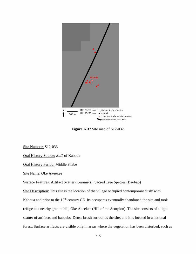
315
Figure A.37 Site map of S12-032.
Site Number: S12-033
Oral History Source: Balè of Kaboua
Oral History Period: Middle Shabe
Site Name: Oke Akeekee
Surface Features: Artifact Scatter (Ceramics), Sacred Tree Species (Baobab)
Site Description: This site is the location of the village occupied contemporaneously with
Kaboua and prior to the 19th century CE. Its occupants eventually abandoned the site and took
refuge at a nearby granite hill, Oke Akeekee (Hill of the Scorpion). The site consists of a light
scatter of artifacts and baobabs. Dense brush surrounds the site, and it is located in a national
forest. Surface artifacts are visible only in areas where the vegetation has been disturbed, such as
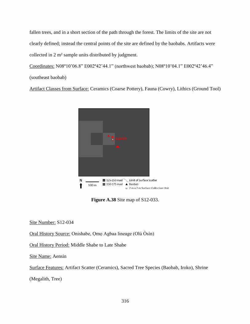
316
fallen trees, and in a short section of the path through the forest. The limits of the site are not
clearly defined; instead the central points of the site are defined by the baobabs. Artifacts were
collected in 2 m² sample units distributed by judgment.
Coordinates: N08º10’06.8” E002º42’44.1” (northwest baobab); N08º10’04.1” E002º42’46.4”
(southeast baobab)
Artifact Classes from Surface: Ceramics (Coarse Pottery), Fauna (Cowry), Lithics (Ground Tool)
Figure A.38 Site map of S12-033.
Site Number: S12-034
Oral History Source: Onishabe, Omo Agbaa lineage (Olú Òsìn)
Oral History Period: Middle Shabe to Late Shabe
Site Name: Aensin
Surface Features: Artifact Scatter (Ceramics), Sacred Tree Species (Baobab, Iroko), Shrine
(Megalith, Tree)
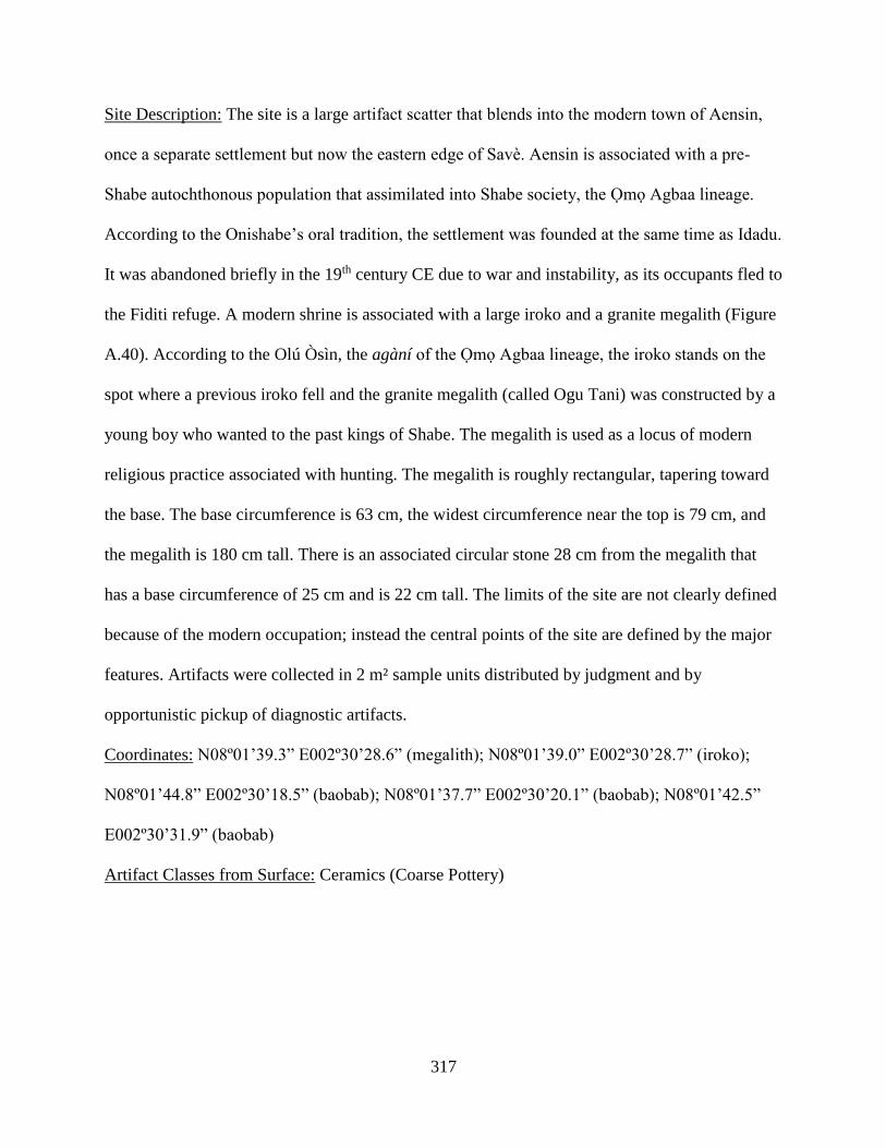
317
Site Description: The site is a large artifact scatter that blends into the modern town of Aensin,
once a separate settlement but now the eastern edge of Savè. Aensin is associated with a pre-
Shabe autochthonous population that assimilated into Shabe society, the Omo Agbaa lineage.
According to the Onishabe’s oral tradition, the settlement was founded at the same time as Idadu.
It was abandoned briefly in the 19th century CE due to war and instability, as its occupants fled to
the Fiditi refuge. A modern shrine is associated with a large iroko and a granite megalith (Figure
A.40). According to the Olú Òsìn, the agàní of the Omo Agbaa lineage, the iroko stands on the
spot where a previous iroko fell and the granite megalith (called Ogu Tani) was constructed by a
young boy who wanted to the past kings of Shabe. The megalith is used as a locus of modern
religious practice associated with hunting. The megalith is roughly rectangular, tapering toward
the base. The base circumference is 63 cm, the widest circumference near the top is 79 cm, and
the megalith is 180 cm tall. There is an associated circular stone 28 cm from the megalith that
has a base circumference of 25 cm and is 22 cm tall. The limits of the site are not clearly defined
because of the modern occupation; instead the central points of the site are defined by the major
features. Artifacts were collected in 2 m² sample units distributed by judgment and by
opportunistic pickup of diagnostic artifacts.
Coordinates: N08º01’39.3” E002º30’28.6” (megalith); N08º01’39.0” E002º30’28.7” (iroko);
N08º01’44.8” E002º30’18.5” (baobab); N08º01’37.7” E002º30’20.1” (baobab); N08º01’42.5”
E002º30’31.9” (baobab)
Artifact Classes from Surface: Ceramics (Coarse Pottery)

318
Figure A.39 Site map of S12-034.
Figure A.40 Granite megalith (Ogu Tani) and associated clothed iroko in Aensin.
Site Number: S12-035
Oral History Source: Onishabe, Ola-Amushu, Balè of Alafia, Balè of Kaboua

319
Oral History Period: Early Shabe, Late Shabe
Site Name: Atenro (also Atunro, Atonho, or Woro)
Surface Features: Artifact Scatter (Ceramics), Depression (Ditch), Mound (Large), Sacred Tree
Species (Baobab)
Site Description: This site is the location of the of the first major Shabe village in the area. The
site is strongly associated with the migration from Nikki narrative. The site was abandoned
following a political dispute, leading to the founding of Kaboua and Idadu. According to the balè
of Alafia, the site was briefly reoccupied in the late 19th and early 20th centuries CE. This
reoccupation (Phase II) was much smaller than the original occupation (Phase I), and is said to
have been confined to the central portion of the site. During the reoccupation, the site was a
sacred grove and the thick vegetation offered protection to refugees. Since then, the site has
ceased to be a sacred grove. This is a large site with at least 40 mature baobabs. There is a large
artifact scatter associated with the baobabs, but the baobabs are found beyond the scatter as well.
The density of this scatter varies according to modern agriculture, with more dense scatters in
recently farmed fields. Areas with dense brush have no visible surface artifacts. The site is likely
very disturbed by road construction, as the site is bisected by the modern road and there are
numerous artifacts in the earthen road berms. Near the northern edge of the surface artifact
scatter is a large, wide ditch, though this may be related to recent hydrological engineering to
feed a nearby reservoir. There is a long, rectangular mound near a large baobab which according
to oral history is the ancient village center and market. A 1 m x 2 m excavation unit (U12-002)
was excavated in 2012 on the eastern part of the mound near the largest baobab on the site
(Figure A.42). In 2013, we excavated four additional 2 m x 2 m units (U13-006, U13-007, U13-
008, U13-009) that tested the integrity of subsurface features in the central and northern parts of
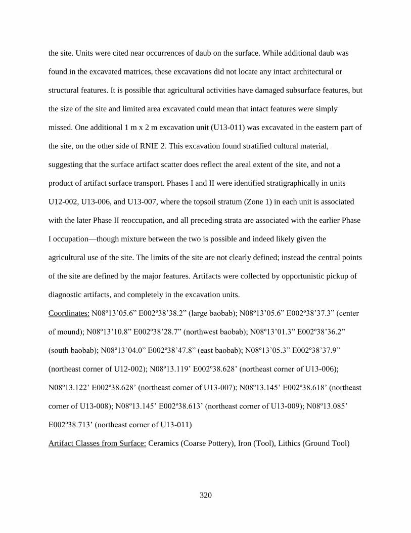
320
the site. Units were cited near occurrences of daub on the surface. While additional daub was
found in the excavated matrices, these excavations did not locate any intact architectural or
structural features. It is possible that agricultural activities have damaged subsurface features, but
the size of the site and limited area excavated could mean that intact features were simply
missed. One additional 1 m x 2 m excavation unit (U13-011) was excavated in the eastern part of
the site, on the other side of RNIE 2. This excavation found stratified cultural material,
suggesting that the surface artifact scatter does reflect the areal extent of the site, and not a
product of artifact surface transport. Phases I and II were identified stratigraphically in units
U12-002, U13-006, and U13-007, where the topsoil stratum (Zone 1) in each unit is associated
with the later Phase II reoccupation, and all preceding strata are associated with the earlier Phase
I occupation—though mixture between the two is possible and indeed likely given the
agricultural use of the site. The limits of the site are not clearly defined; instead the central points
of the site are defined by the major features. Artifacts were collected by opportunistic pickup of
diagnostic artifacts, and completely in the excavation units.
Coordinates: N08º13’05.6” E002º38’38.2” (large baobab); N08º13’05.6” E002º38’37.3” (center
of mound); N08º13’10.8” E002º38’28.7” (northwest baobab); N08º13’01.3” E002º38’36.2”
(south baobab); N08º13’04.0” E002º38’47.8” (east baobab); N08º13’05.3” E002º38’37.9”
(northeast corner of U12-002); N08º13.119’ E002º38.628’ (northeast corner of U13-006);
N08º13.122’ E002º38.628’ (northeast corner of U13-007); N08º13.145’ E002º38.618’ (northeast
corner of U13-008); N08º13.145’ E002º38.613’ (northeast corner of U13-009); N08º13.085’
E002º38.713’ (northeast corner of U13-011)
Artifact Classes from Surface: Ceramics (Coarse Pottery), Iron (Tool), Lithics (Ground Tool)

321
Artifact Classes from Excavation (Phase I): Ceramics (Bead, Coarse Pottery, Coarse Pipe),
Fauna (Bone, Cowry), Glass (Bead), Iron (Tool), Lithics (Bead, Ground Tool)
Artifact Classes from Excavation (Phase II): Ceramics (Coarse Pottery, Coarse Pipe, Refined
Pottery), Fauna (Bone, Cowry, Shell), Glass (Bead, Vessel), Iron (Figurative, Slag, Tool), Lithics
(Bead)
Figure A.41 Site map of S12-035.
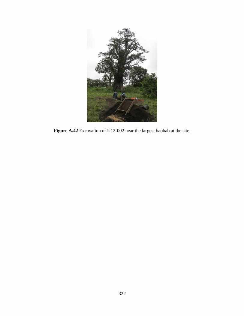
322
Figure A.42 Excavation of U12-002 near the largest baobab at the site.

323
Figure A.43 Stratigraphic cross-section of U12-002, north profile.
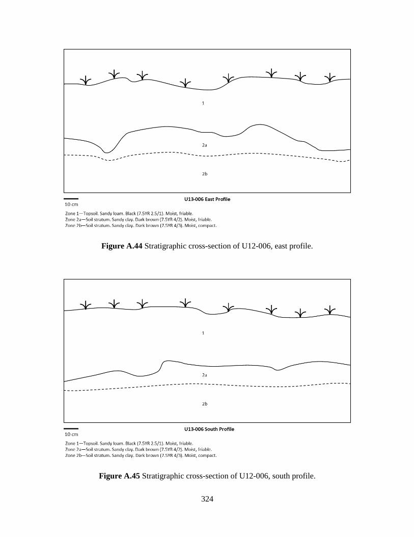
324
Figure A.44 Stratigraphic cross-section of U12-006, east profile.
Figure A.45 Stratigraphic cross-section of U12-006, south profile.
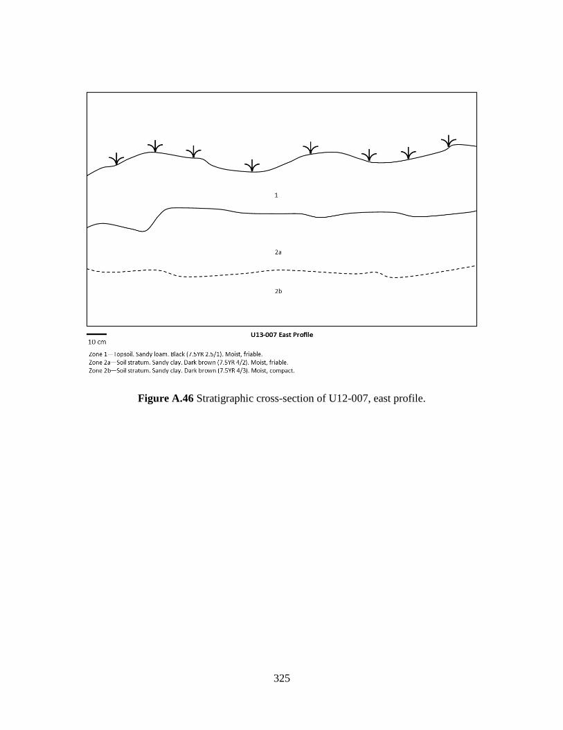
325
Figure A.46 Stratigraphic cross-section of U12-007, east profile.
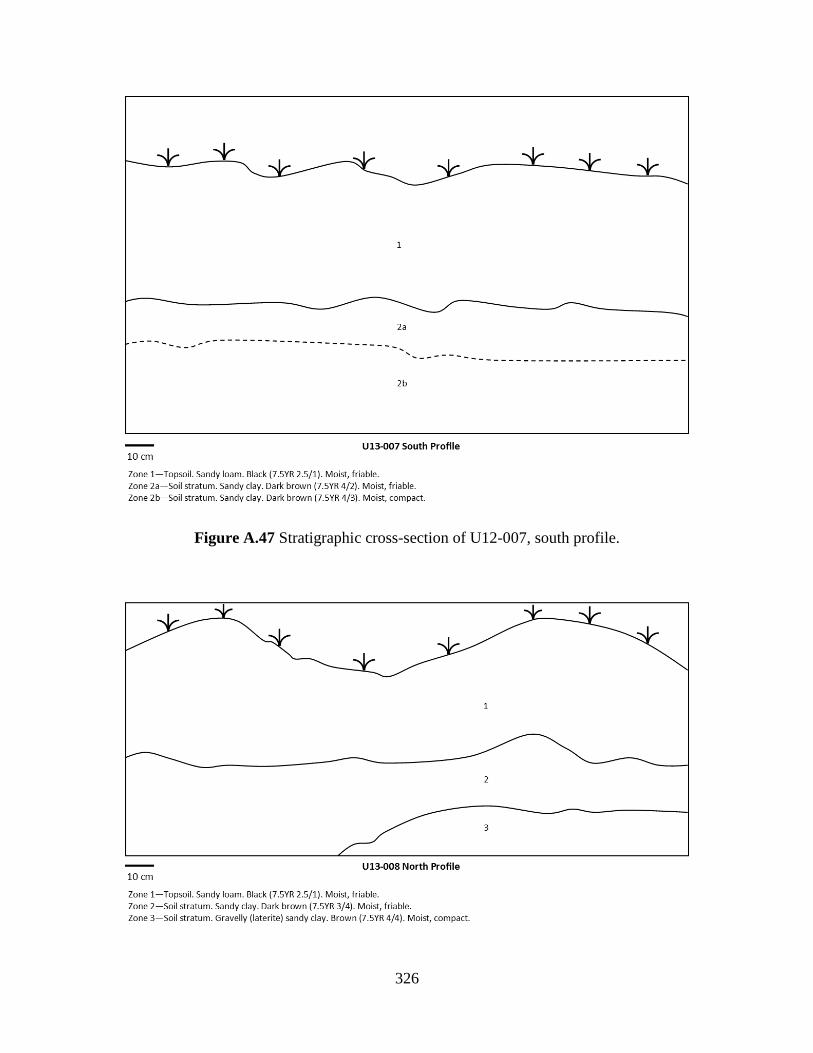
326
Figure A.47 Stratigraphic cross-section of U12-007, south profile.
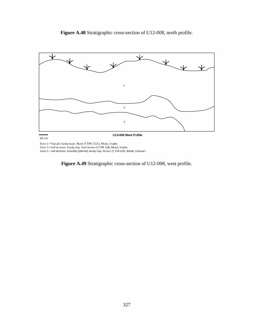
327
Figure A.48 Stratigraphic cross-section of U12-008, north profile.
Figure A.49 Stratigraphic cross-section of U12-008, west profile.

328
Figure A.50 Stratigraphic cross-section of U12-009, north profile.
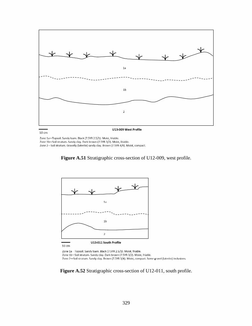
329
Figure A.51 Stratigraphic cross-section of U12-009, west profile.
Figure A.52 Stratigraphic cross-section of U12-011, south profile.
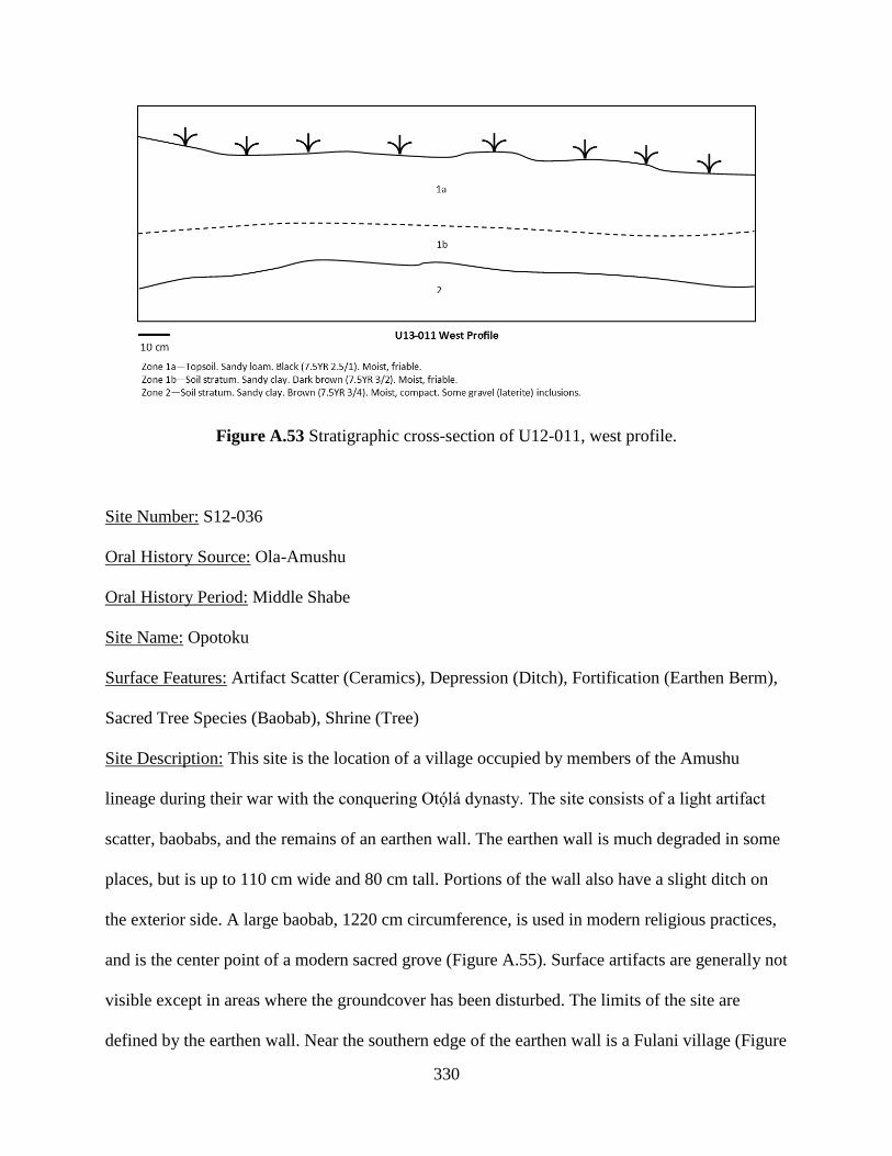
330
Figure A.53 Stratigraphic cross-section of U12-011, west profile.
Site Number: S12-036
Oral History Source: Ola-Amushu
Oral History Period: Middle Shabe
Site Name: Opotoku
Surface Features: Artifact Scatter (Ceramics), Depression (Ditch), Fortification (Earthen Berm),
Sacred Tree Species (Baobab), Shrine (Tree)
Site Description: This site is the location of a village occupied by members of the Amushu
lineage during their war with the conquering Otólá dynasty. The site consists of a light artifact
scatter, baobabs, and the remains of an earthen wall. The earthen wall is much degraded in some
places, but is up to 110 cm wide and 80 cm tall. Portions of the wall also have a slight ditch on
the exterior side. A large baobab, 1220 cm circumference, is used in modern religious practices,
and is the center point of a modern sacred grove (Figure A.55). Surface artifacts are generally not
visible except in areas where the groundcover has been disturbed. The limits of the site are
defined by the earthen wall. Near the southern edge of the earthen wall is a Fulani village (Figure
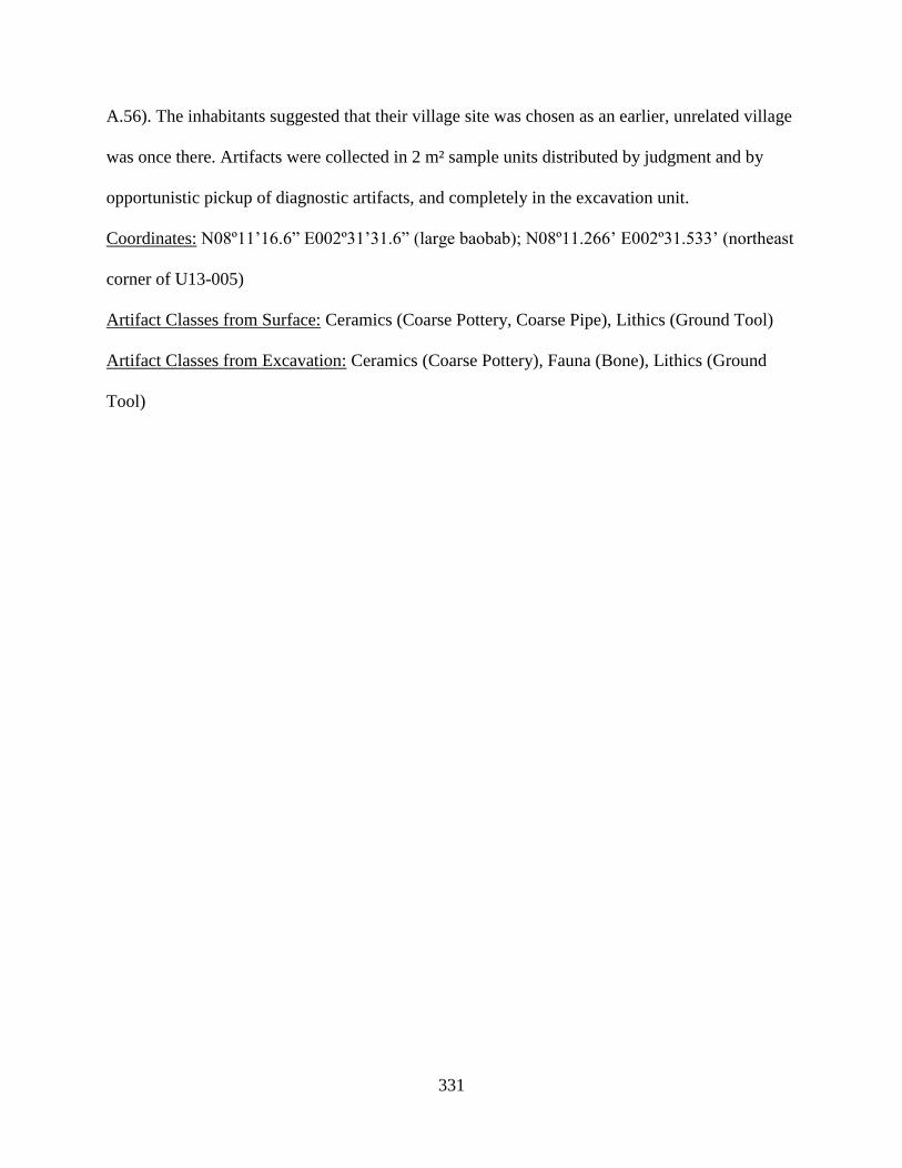
331
A.56). The inhabitants suggested that their village site was chosen as an earlier, unrelated village
was once there. Artifacts were collected in 2 m² sample units distributed by judgment and by
opportunistic pickup of diagnostic artifacts, and completely in the excavation unit.
Coordinates: N08º11’16.6” E002º31’31.6” (large baobab); N08º11.266’ E002º31.533’ (northeast
corner of U13-005)
Artifact Classes from Surface: Ceramics (Coarse Pottery, Coarse Pipe), Lithics (Ground Tool)
Artifact Classes from Excavation: Ceramics (Coarse Pottery), Fauna (Bone), Lithics (Ground
Tool)

332
Figure A.54 Site map of S12-036.
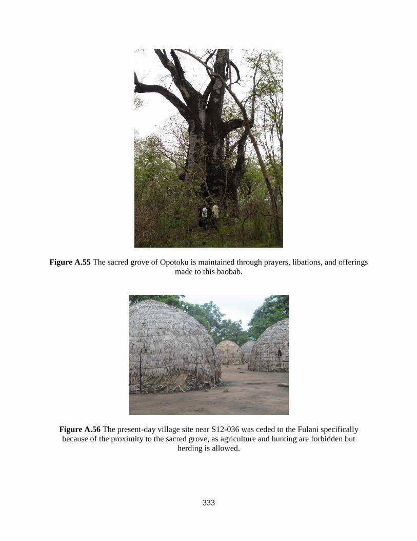
333
Figure A.55 The sacred grove of Opotoku is maintained through prayers, libations, and offerings
made to this baobab.
Figure A.56 The present-day village site near S12-036 was ceded to the Fulani specifically
because of the proximity to the sacred grove, as agriculture and hunting are forbidden but
herding is allowed.

334
Figure A.57 Stratigraphic cross-section of U13-005, north profile.
Figure A.58 Stratigraphic cross-section of U13-005, west profile.
Site Number: S12-037
Oral History Source: Ola-Amushu
Oral History Period: Middle Shabe to Late Shabe
Site Name: Igboe
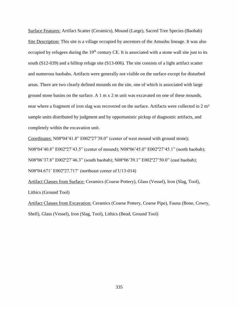
335
Surface Features: Artifact Scatter (Ceramics), Mound (Large), Sacred Tree Species (Baobab)
Site Description: This site is a village occupied by ancestors of the Amushu lineage. It was also
occupied by refugees during the 19th century CE. It is associated with a stone wall site just to its
south (S12-039) and a hilltop refuge site (S13-006). The site consists of a light artifact scatter
and numerous baobabs. Artifacts were generally not visible on the surface except for disturbed
areas. There are two clearly defined mounds on the site, one of which is associated with large
ground stone basins on the surface. A 1 m x 2 m unit was excavated on one of these mounds,
near where a fragment of iron slag was recovered on the surface. Artifacts were collected in 2 m²
sample units distributed by judgment and by opportunistic pickup of diagnostic artifacts, and
completely within the excavation unit.
Coordinates: N08º04’41.8” E002º27’38.0” (center of west mound with ground stone);
N08º04’40.8” E002º27’43.5” (center of mound); N08º06’45.0” E002º27’45.1” (north baobab);
N08º06’37.8” E002º27’46.3” (south baobab); N08º06’39.1” E002º27’50.0” (east baobab);
N08º04.671’ E002º27.717’ (northeast corner of U13-014)
Artifact Classes from Surface: Ceramics (Coarse Pottery), Glass (Vessel), Iron (Slag, Tool),
Lithics (Ground Tool)
Artifact Classes from Excavation: Ceramics (Coarse Pottery, Coarse Pipe), Fauna (Bone, Cowry,
Shell), Glass (Vessel), Iron (Slag, Tool), Lithics (Bead, Ground Tool)
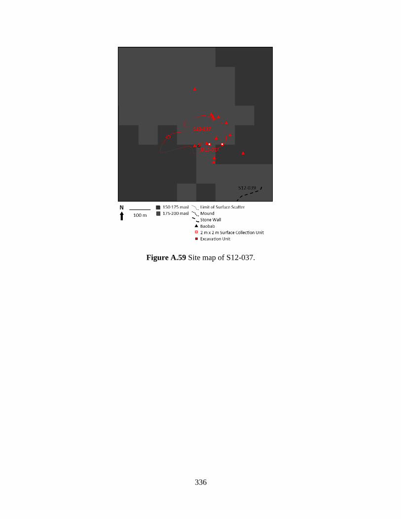
336
Figure A.59 Site map of S12-037.
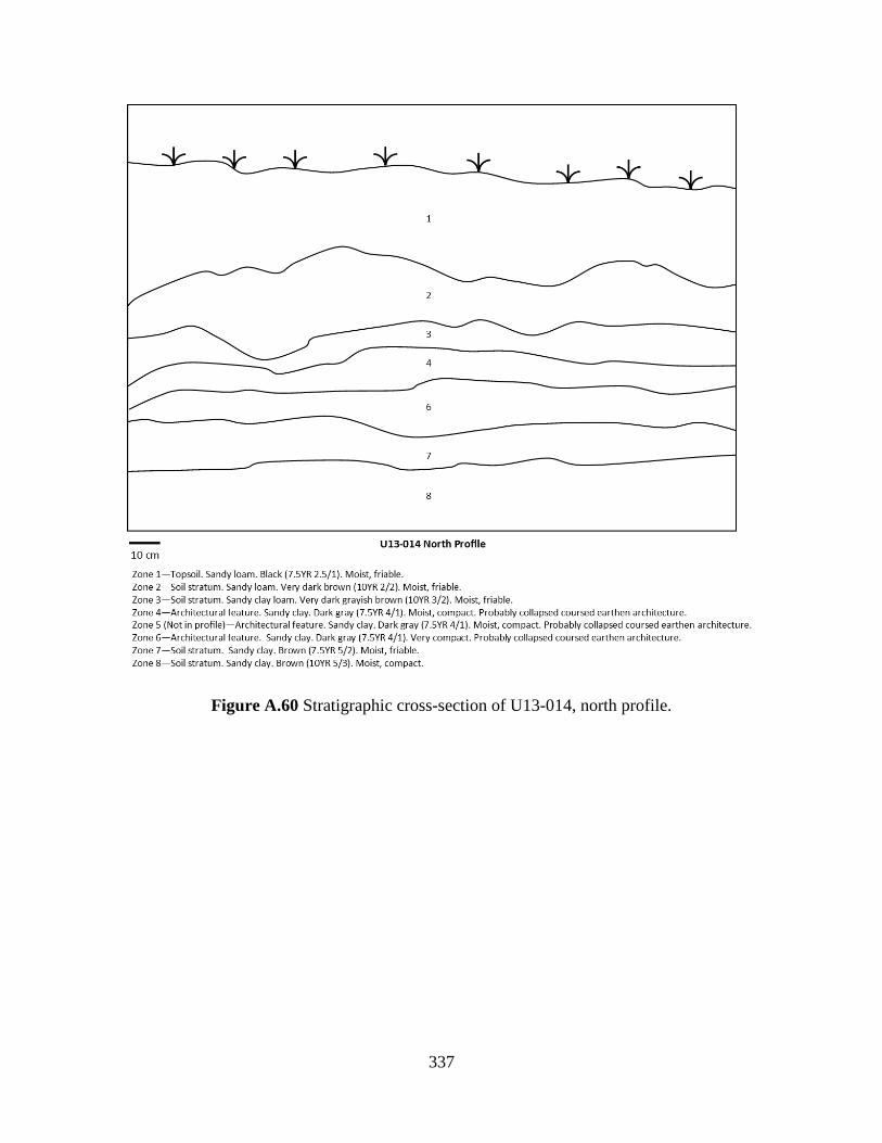
337
Figure A.60 Stratigraphic cross-section of U13-014, north profile.
338
Figure A.61 Stratigraphic cross-section of U13-014, west profile.
Site Number: S12-039
Oral History Source: Ola-Amushu
Oral History Period: Late Shabe
Site Name: Igboe Wall
Surface Features: Fortification (Lithics Wall)
Site Description: This site consists of a defensive structure used for defense during the 19th
century CE. This is a linear stone wall just southeast of and associated with S12-037. The wall is
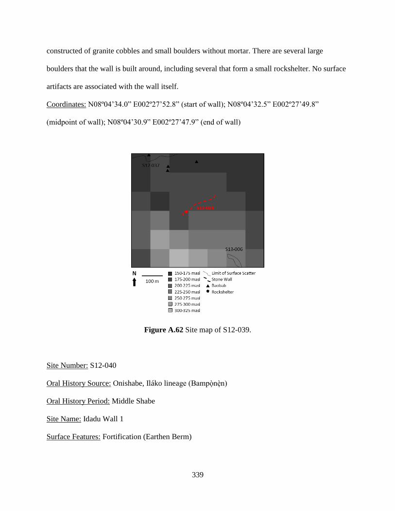
339
constructed of granite cobbles and small boulders without mortar. There are several large
boulders that the wall is built around, including several that form a small rockshelter. No surface
artifacts are associated with the wall itself.
Coordinates: N08º04’34.0” E002º27’52.8” (start of wall); N08º04’32.5” E002º27’49.8”
(midpoint of wall); N08º04’30.9” E002º27’47.9” (end of wall)
Figure A.62 Site map of S12-039.
Site Number: S12-040
Oral History Source: Onishabe, Iláko lineage (Bampònèn)
Oral History Period: Middle Shabe
Site Name: Idadu Wall 1
Surface Features: Fortification (Earthen Berm)

340
Site Description: This site consists of a long, low mound on the southern edge of Savè. It is
reported to be a defensive structure, but was also used to control access to Idadu’s markets. The
Bampònèn (the agàní from the Iláko lineage) reports that his office originally organized the labor
to build the structure. It was part of the same defense system as S13-033 and S13-034. A gap in
the wall accommodates the flow of a large stream that feeds into the Ayin River. No surface
artifacts are associated with the wall.
Coordinates: N08º01’39.6” E002º29’50.7” (start of wall); N08º01’36.7” E002º29’51.9”
(midpoint of wall); N08º01’33.7” E002º29’53.2” (end of wall)
Figure A.63 Site map of S12-040.
Site Number: S12-043
Oral History Source: Balè of Kaboua
Oral History Period: Late Shabe
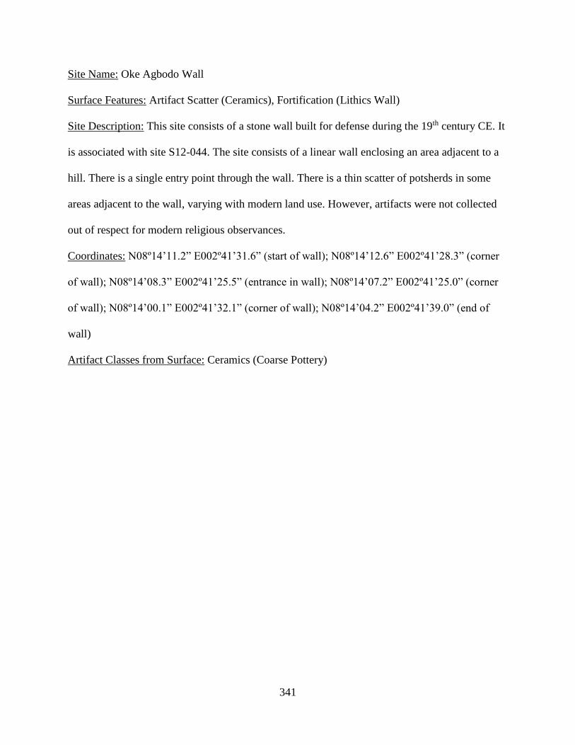
341
Site Name: Oke Agbodo Wall
Surface Features: Artifact Scatter (Ceramics), Fortification (Lithics Wall)
Site Description: This site consists of a stone wall built for defense during the 19th century CE. It
is associated with site S12-044. The site consists of a linear wall enclosing an area adjacent to a
hill. There is a single entry point through the wall. There is a thin scatter of potsherds in some
areas adjacent to the wall, varying with modern land use. However, artifacts were not collected
out of respect for modern religious observances.
Coordinates: N08º14’11.2” E002º41’31.6” (start of wall); N08º14’12.6” E002º41’28.3” (corner
of wall); N08º14’08.3” E002º41’25.5” (entrance in wall); N08º14’07.2” E002º41’25.0” (corner
of wall); N08º14’00.1” E002º41’32.1” (corner of wall); N08º14’04.2” E002º41’39.0” (end of
wall)
Artifact Classes from Surface: Ceramics (Coarse Pottery)
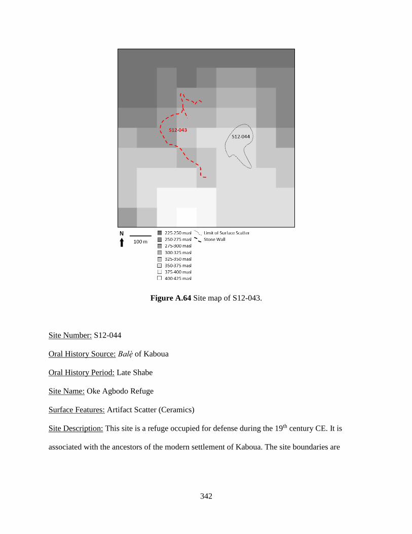
342
Figure A.64 Site map of S12-043.
Site Number: S12-044
Oral History Source: Balè of Kaboua
Oral History Period: Late Shabe
Site Name: Oke Agbodo Refuge
Surface Features: Artifact Scatter (Ceramics)
Site Description: This site is a refuge occupied for defense during the 19th century CE. It is
associated with the ancestors of the modern settlement of Kaboua. The site boundaries are

343
defined by the extent of the artifact scatter. Artifacts were collected in 2 m² sample units
distributed by judgment and by opportunistic pickup of diagnostic artifacts.
Coordinates: N08º14’05.7” E002º41’39.2” (east limit of artifact scatter)
Artifact Classes from Surface: Ceramics (Coarse Pottery)
Figure A.65 Site map of S12-044.
Site Number: S13-004
Oral History Source: Omo Agbaa lineage (Olú Òsìn)
Oral History Period: Early Shabe

344
Site Name: Aukpon
Surface Features: Artifact Scatter (Ceramics), Mound (Large, Small), Sacred Tree Species
(Baobab)
Site Description: This site is a village occupied by ancestors of the village of Aensin (the modern
settlement and the archaeological site S12-034). Many families from Aensin claim
autochthonous status that predates the arrival of Shabe groups. However, Aensin is also claimed
to have been founded contemporaneously with Idadu. There are several baobabs and multiple
clearly defined mounds on the site. Two 2 m x 2 m units were excavated on the largest of these
mounds (U13-002 and U13-003). These excavations showed that the mound was likely a
midden. However, human remains were found in U13-002. The remains appeared to be part of
an articulated skeleton, and so an additional unit (U13-004) was excavated adjacent to U13-002
to reveal the extent, completeness, and positioning of the skeleton (Figure A.67). Artifacts were
not collected from this unit, and it was excavated only to the level of the skeleton. The
excavations revealed an articulated, supine skeleton—likely a primary burial. The skeleton was
relatively complete, though conspicuously missing its right hand and the bones of the legs and
feet below the femur. The human remains were not collected, though some human leg bones
were identified mixed in with the faunal remains collected. Artifacts were collected in 2 m²
sample units distributed by judgment and by opportunistic pickup of diagnostic artifacts, and
completely within the excavation units, except for U13-004.
Coordinates: N08º01.772’ E002º30.469’ (baobab); N08º01.757’ E002º30.460’ (baobab);
N08º01.811’ E002º30.405’ (baobab); N08º01.823’ E002º30.489’ (northeast corner of U13-002);
N08º01.822’ E002º30.489’ (northeast corner of U13-003); N08º01.823’ E002º30.489’ (northeast
corner of U13-004)
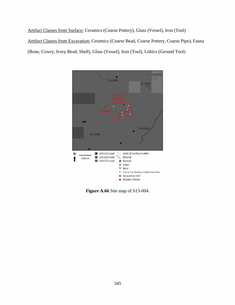
345
Artifact Classes from Surface: Ceramics (Coarse Pottery), Glass (Vessel), Iron (Tool)
Artifact Classes from Excavation: Ceramics (Coarse Bead, Coarse Pottery, Coarse Pipe), Fauna
(Bone, Cowry, Ivory Bead, Shell), Glass (Vessel), Iron (Tool), Lithics (Ground Tool)
Figure A.66 Site map of S13-004.
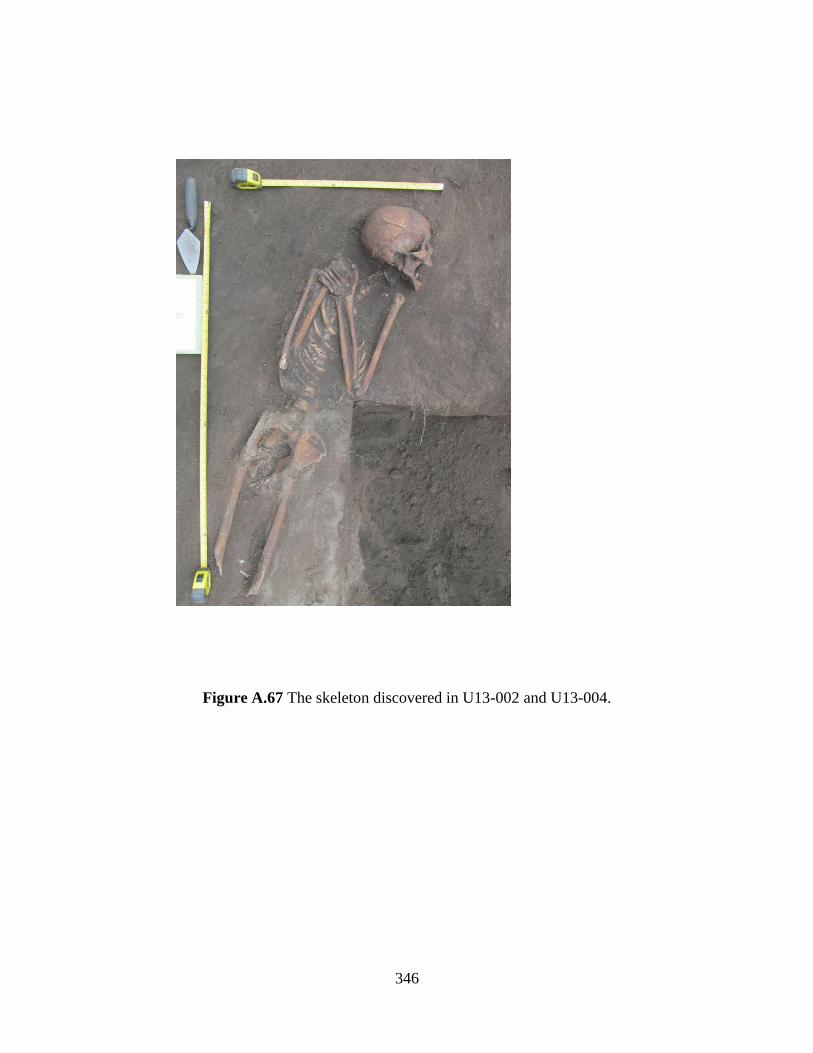
346
Figure A.67 The skeleton discovered in U13-002 and U13-004.

347
Figure A.68 Stratigraphic cross-section of U13-002, south profile.

348
Figure A.69 Stratigraphic cross-section of U13-002, west profile.
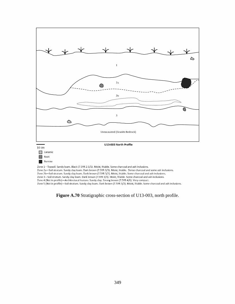
349
Figure A.70 Stratigraphic cross-section of U13-003, north profile.
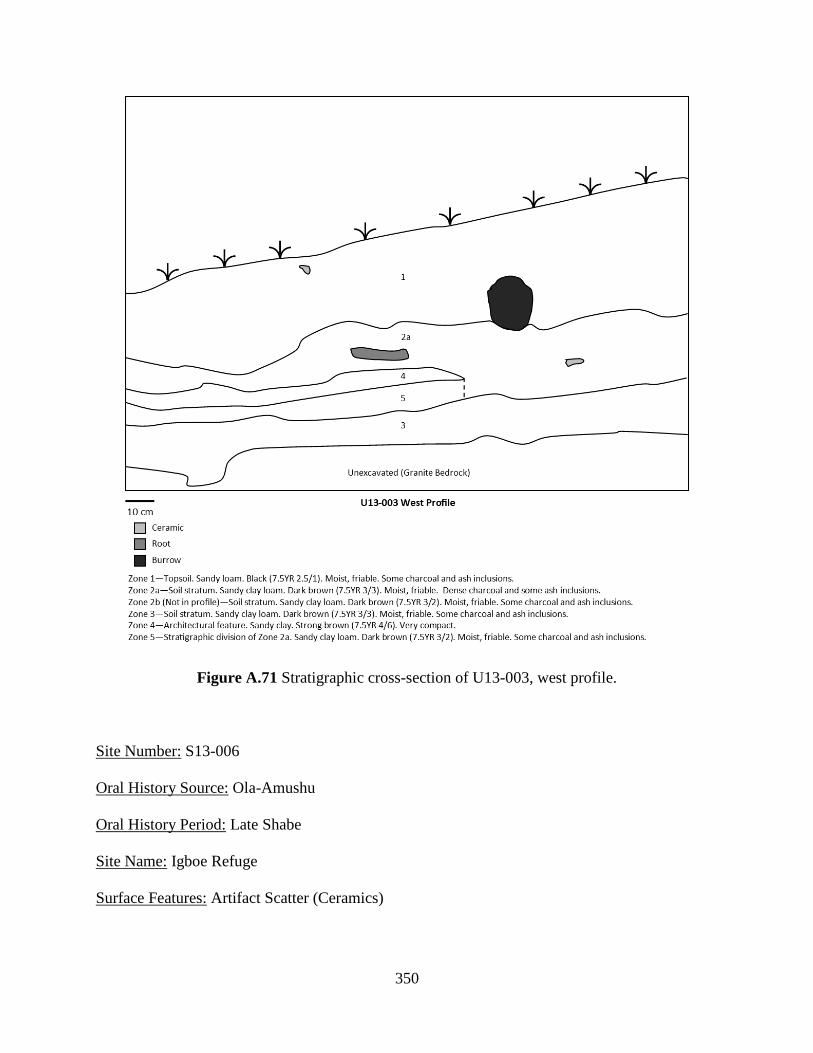
350
Figure A.71 Stratigraphic cross-section of U13-003, west profile.
Site Number: S13-006
Oral History Source: Ola-Amushu
Oral History Period: Late Shabe
Site Name: Igboe Refuge
Surface Features: Artifact Scatter (Ceramics)
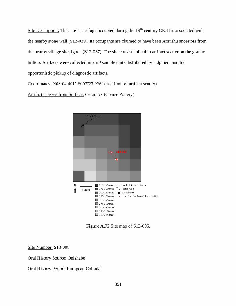
351
Site Description: This site is a refuge occupied during the 19th century CE. It is associated with
the nearby stone wall (S12-039). Its occupants are claimed to have been Amushu ancestors from
the nearby village site, Igboe (S12-037). The site consists of a thin artifact scatter on the granite
hilltop. Artifacts were collected in 2 m² sample units distributed by judgment and by
opportunistic pickup of diagnostic artifacts.
Coordinates: N08º04.401’ E002º27.926’ (east limit of artifact scatter)
Artifact Classes from Surface: Ceramics (Coarse Pottery)
Figure A.72 Site map of S13-006.
Site Number: S13-008
Oral History Source: Onishabe
Oral History Period: European Colonial

352
Site Name: Maison d’axosu Agoli-Agbo
Surface Features: Artifact Scatter (Ceramics), Mound (Large), Sacred Tree Species (Baobab),
Shrine (Tree, Vessel)
Site Description: This site is the compound of the former Dahomean king (ahosu) Agoli-Agbo
after being deposed by the French. Agoli-Agbo was detained at this site by the French from 1910
to 1925 CE. The site may have been occupied prior to this by Dahomean officials that moved to
the area in the late 19th century CE. Fon residents still live in the area and maintain several
shrines at the site. There are many large baobabs on the site. Surface artifacts are not generally
visible except in agricultural fields. A large mound adjacent to the visible artifact scatter may be
collapsed architecture. Artifacts were collected in 2 m² sample units distributed by judgment.
Coordinates: N08º03.745’ E002º28.555’ (baobab and modern shrine); N08º03.677’
E002º28.602’ (mound 1); N08º03.698’ E002º28.568’ (mound 2)
Artifact Classes from Surface: Ceramics (Coarse Pottery)
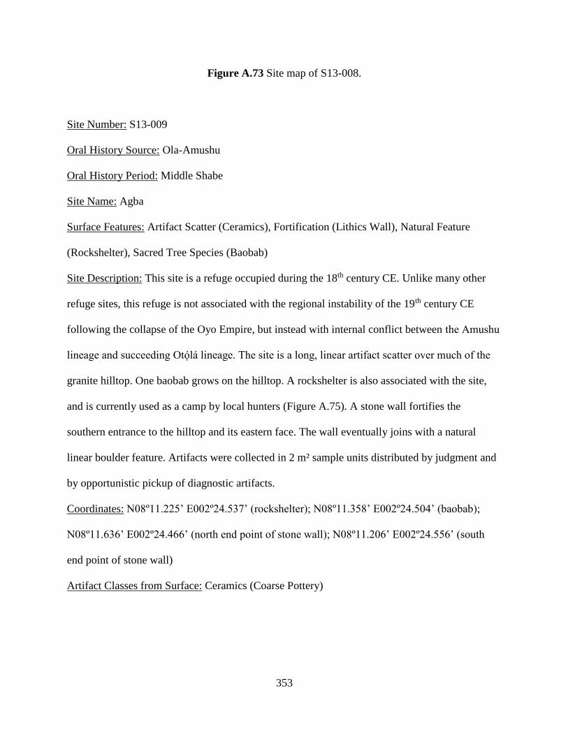
353
Figure A.73 Site map of S13-008.
Site Number: S13-009
Oral History Source: Ola-Amushu
Oral History Period: Middle Shabe
Site Name: Agba
Surface Features: Artifact Scatter (Ceramics), Fortification (Lithics Wall), Natural Feature
(Rockshelter), Sacred Tree Species (Baobab)
Site Description: This site is a refuge occupied during the 18th century CE. Unlike many other
refuge sites, this refuge is not associated with the regional instability of the 19th century CE
following the collapse of the Oyo Empire, but instead with internal conflict between the Amushu
lineage and succeeding Otólá lineage. The site is a long, linear artifact scatter over much of the
granite hilltop. One baobab grows on the hilltop. A rockshelter is also associated with the site,
and is currently used as a camp by local hunters (Figure A.75). A stone wall fortifies the
southern entrance to the hilltop and its eastern face. The wall eventually joins with a natural
linear boulder feature. Artifacts were collected in 2 m² sample units distributed by judgment and
by opportunistic pickup of diagnostic artifacts.
Coordinates: N08º11.225’ E002º24.537’ (rockshelter); N08º11.358’ E002º24.504’ (baobab);
N08º11.636’ E002º24.466’ (north end point of stone wall); N08º11.206’ E002º24.556’ (south
end point of stone wall)
Artifact Classes from Surface: Ceramics (Coarse Pottery)
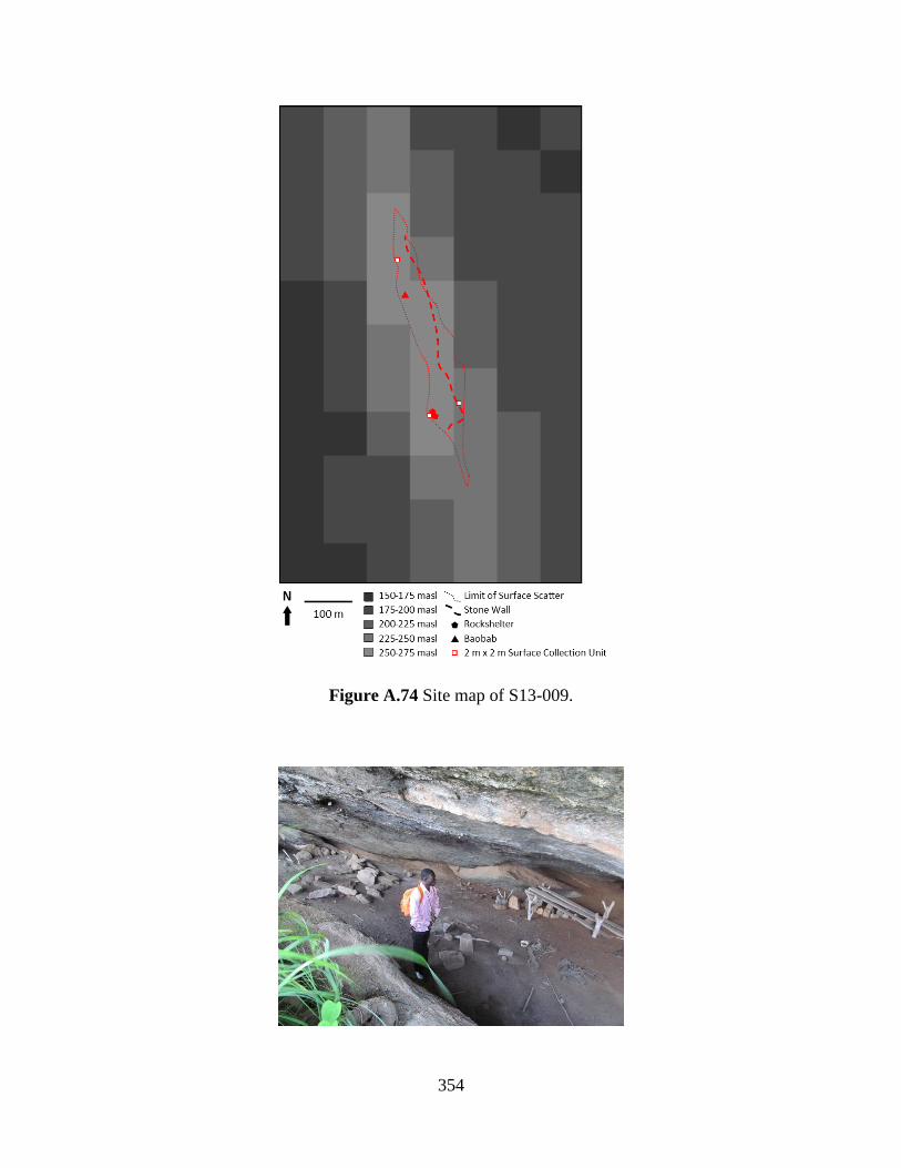
354
Figure A.74 Site map of S13-009.
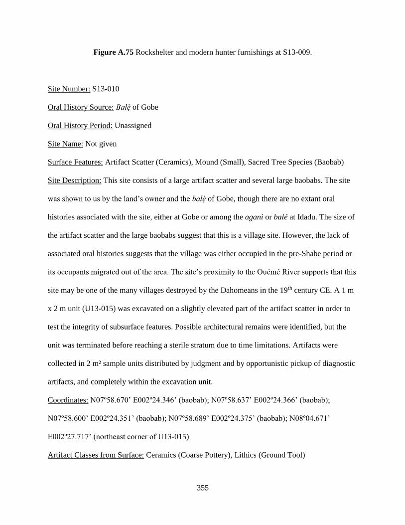
355
Figure A.75 Rockshelter and modern hunter furnishings at S13-009.
Site Number: S13-010
Oral History Source: Balè of Gobe
Oral History Period: Unassigned
Site Name: Not given
Surface Features: Artifact Scatter (Ceramics), Mound (Small), Sacred Tree Species (Baobab)
Site Description: This site consists of a large artifact scatter and several large baobabs. The site
was shown to us by the land’s owner and the balè of Gobe, though there are no extant oral
histories associated with the site, either at Gobe or among the agani or balé at Idadu. The size of
the artifact scatter and the large baobabs suggest that this is a village site. However, the lack of
associated oral histories suggests that the village was either occupied in the pre-Shabe period or
its occupants migrated out of the area. The site’s proximity to the Ouémé River supports that this
site may be one of the many villages destroyed by the Dahomeans in the 19th century CE. A 1 m
x 2 m unit (U13-015) was excavated on a slightly elevated part of the artifact scatter in order to
test the integrity of subsurface features. Possible architectural remains were identified, but the
unit was terminated before reaching a sterile stratum due to time limitations. Artifacts were
collected in 2 m² sample units distributed by judgment and by opportunistic pickup of diagnostic
artifacts, and completely within the excavation unit.
Coordinates: N07º58.670’ E002º24.346’ (baobab); N07º58.637’ E002º24.366’ (baobab);
N07º58.600’ E002º24.351’ (baobab); N07º58.689’ E002º24.375’ (baobab); N08º04.671’
E002º27.717’ (northeast corner of U13-015)
Artifact Classes from Surface: Ceramics (Coarse Pottery), Lithics (Ground Tool)
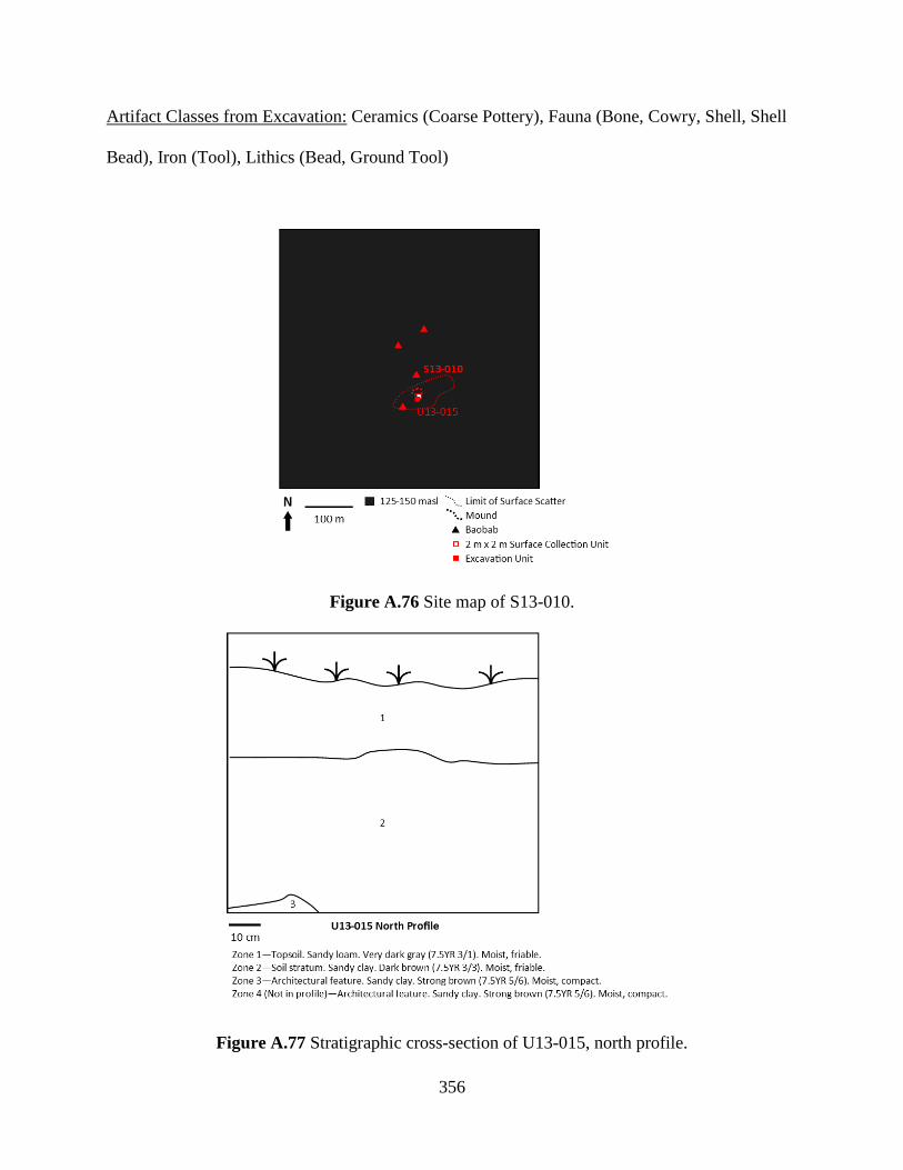
356
Artifact Classes from Excavation: Ceramics (Coarse Pottery), Fauna (Bone, Cowry, Shell, Shell
Bead), Iron (Tool), Lithics (Bead, Ground Tool)
Figure A.76 Site map of S13-010.
Figure A.77 Stratigraphic cross-section of U13-015, north profile.
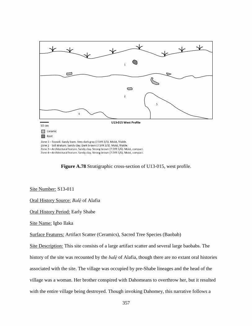
357
Figure A.78 Stratigraphic cross-section of U13-015, west profile.
Site Number: S13-011
Oral History Source: Balè of Alafia
Oral History Period: Early Shabe
Site Name: Igbo Ilaka
Surface Features: Artifact Scatter (Ceramics), Sacred Tree Species (Baobab)
Site Description: This site consists of a large artifact scatter and several large baobabs. The
history of the site was recounted by the balè of Alafia, though there are no extant oral histories
associated with the site. The village was occupied by pre-Shabe lineages and the head of the
village was a woman. Her brother conspired with Dahomeans to overthrow her, but it resulted
with the entire village being destroyed. Though invoking Dahomey, this narrative follows a
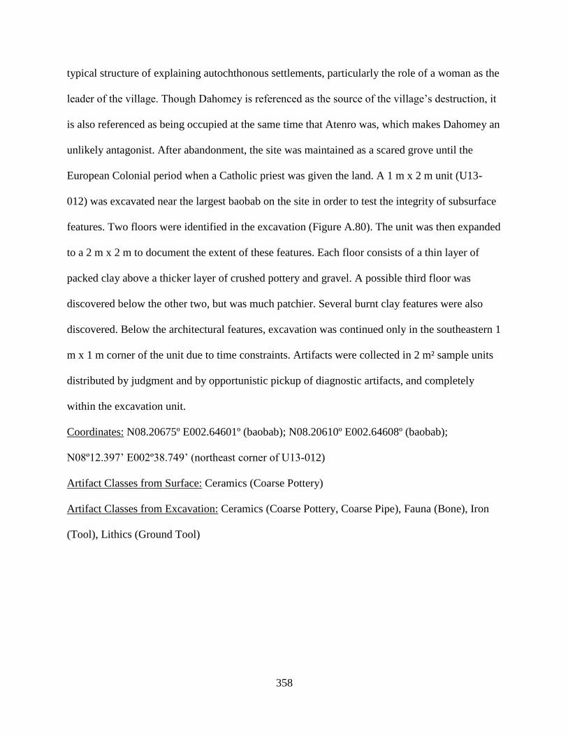
358
typical structure of explaining autochthonous settlements, particularly the role of a woman as the
leader of the village. Though Dahomey is referenced as the source of the village’s destruction, it
is also referenced as being occupied at the same time that Atenro was, which makes Dahomey an
unlikely antagonist. After abandonment, the site was maintained as a scared grove until the
European Colonial period when a Catholic priest was given the land. A 1 m x 2 m unit (U13-
012) was excavated near the largest baobab on the site in order to test the integrity of subsurface
features. Two floors were identified in the excavation (Figure A.80). The unit was then expanded
to a 2 m x 2 m to document the extent of these features. Each floor consists of a thin layer of
packed clay above a thicker layer of crushed pottery and gravel. A possible third floor was
discovered below the other two, but was much patchier. Several burnt clay features were also
discovered. Below the architectural features, excavation was continued only in the southeastern 1
m x 1 m corner of the unit due to time constraints. Artifacts were collected in 2 m² sample units
distributed by judgment and by opportunistic pickup of diagnostic artifacts, and completely
within the excavation unit.
Coordinates: N08.20675º E002.64601º (baobab); N08.20610º E002.64608º (baobab);
N08º12.397’ E002º38.749’ (northeast corner of U13-012)
Artifact Classes from Surface: Ceramics (Coarse Pottery)
Artifact Classes from Excavation: Ceramics (Coarse Pottery, Coarse Pipe), Fauna (Bone), Iron
(Tool), Lithics (Ground Tool)
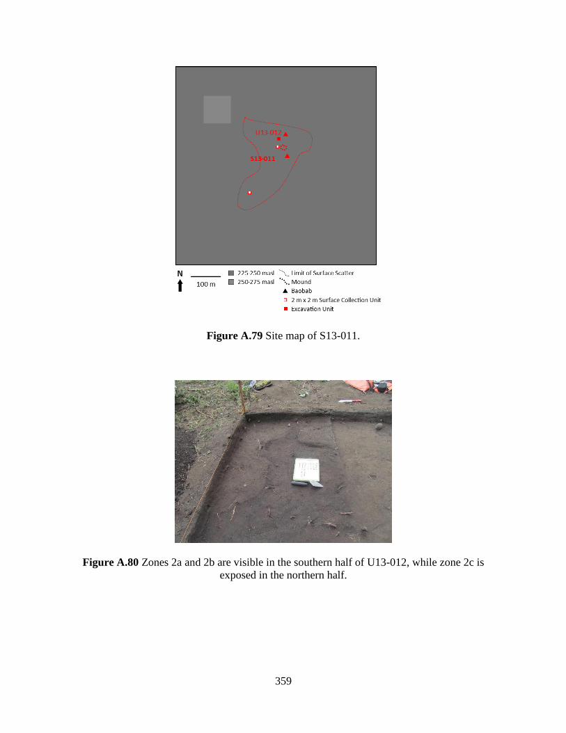
359
Figure A.79 Site map of S13-011.
Figure A.80 Zones 2a and 2b are visible in the southern half of U13-012, while zone 2c is
exposed in the northern half.
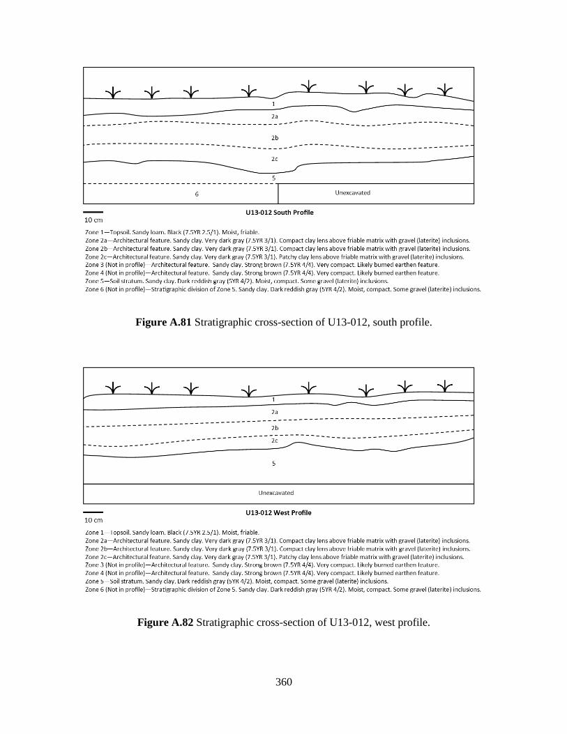
360
Figure A.81 Stratigraphic cross-section of U13-012, south profile.
Figure A.82 Stratigraphic cross-section of U13-012, west profile.
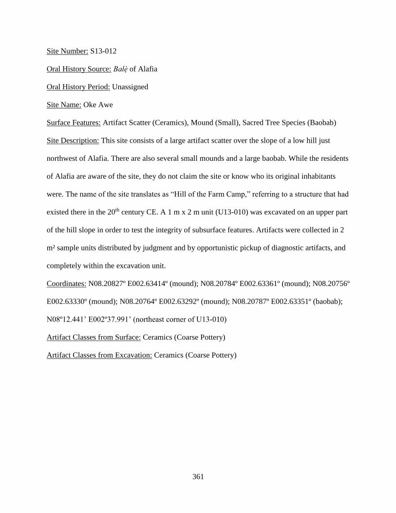
361
Site Number: S13-012
Oral History Source: Balè of Alafia
Oral History Period: Unassigned
Site Name: Oke Awe
Surface Features: Artifact Scatter (Ceramics), Mound (Small), Sacred Tree Species (Baobab)
Site Description: This site consists of a large artifact scatter over the slope of a low hill just
northwest of Alafia. There are also several small mounds and a large baobab. While the residents
of Alafia are aware of the site, they do not claim the site or know who its original inhabitants
were. The name of the site translates as “Hill of the Farm Camp,” referring to a structure that had
existed there in the 20th century CE. A 1 m x 2 m unit (U13-010) was excavated on an upper part
of the hill slope in order to test the integrity of subsurface features. Artifacts were collected in 2
m² sample units distributed by judgment and by opportunistic pickup of diagnostic artifacts, and
completely within the excavation unit.
Coordinates: N08.20827º E002.63414º (mound); N08.20784º E002.63361º (mound); N08.20756º
E002.63330º (mound); N08.20764º E002.63292º (mound); N08.20787º E002.63351º (baobab);
N08º12.441’ E002º37.991’ (northeast corner of U13-010)
Artifact Classes from Surface: Ceramics (Coarse Pottery)
Artifact Classes from Excavation: Ceramics (Coarse Pottery)

362
Figure A.83 Site map of S13-012.
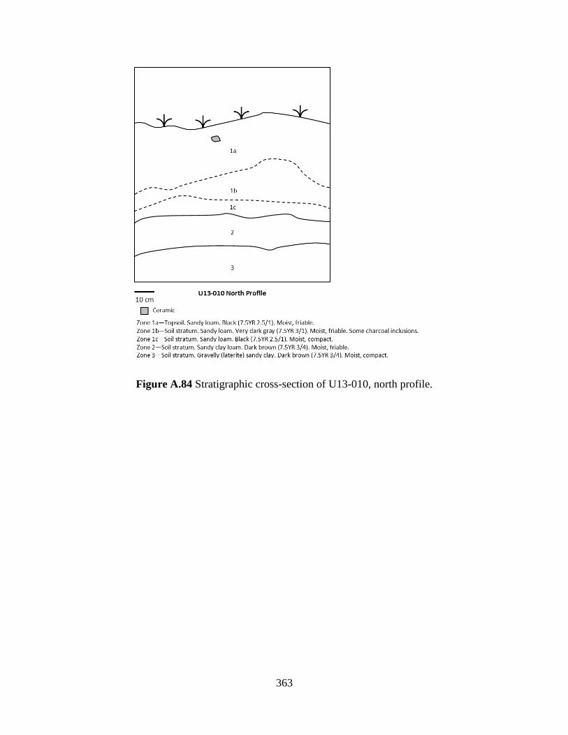
363
Figure A.84 Stratigraphic cross-section of U13-010, north profile.
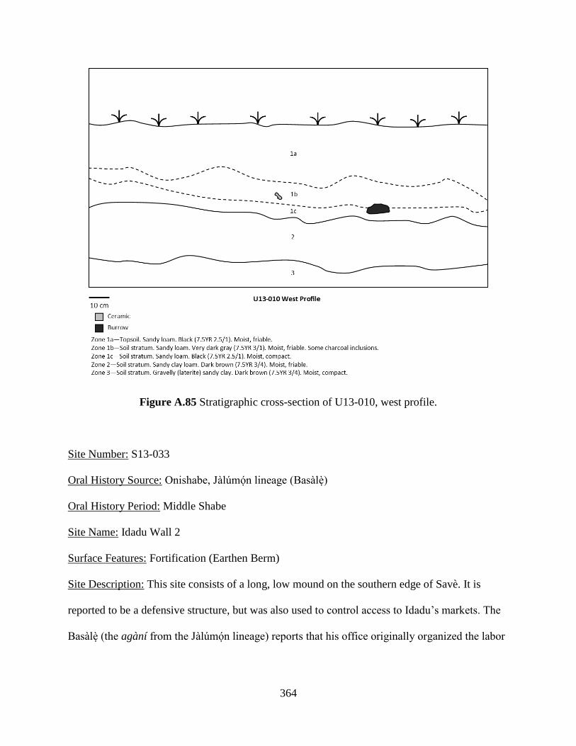
364
Figure A.85 Stratigraphic cross-section of U13-010, west profile.
Site Number: S13-033
Oral History Source: Onishabe, Jàlúmón lineage (Basàlè)
Oral History Period: Middle Shabe
Site Name: Idadu Wall 2
Surface Features: Fortification (Earthen Berm)
Site Description: This site consists of a long, low mound on the southern edge of Savè. It is
reported to be a defensive structure, but was also used to control access to Idadu’s markets. The
Basàlè (the agàní from the Jàlúmón lineage) reports that his office originally organized the labor
365
to build the structure. It was part of the same defense system as S12-040 and S13-034. No
surface artifacts are associated with the wall.
Coordinates: N08.03790º E002.49150º (start of wall); N08.04032º E002.49485º (end of wall)
Figure A.86 Site map of S13-033.
Site Number: S13-034
Oral History Source: Onishabe, Iláko lineage (Bampònèn)
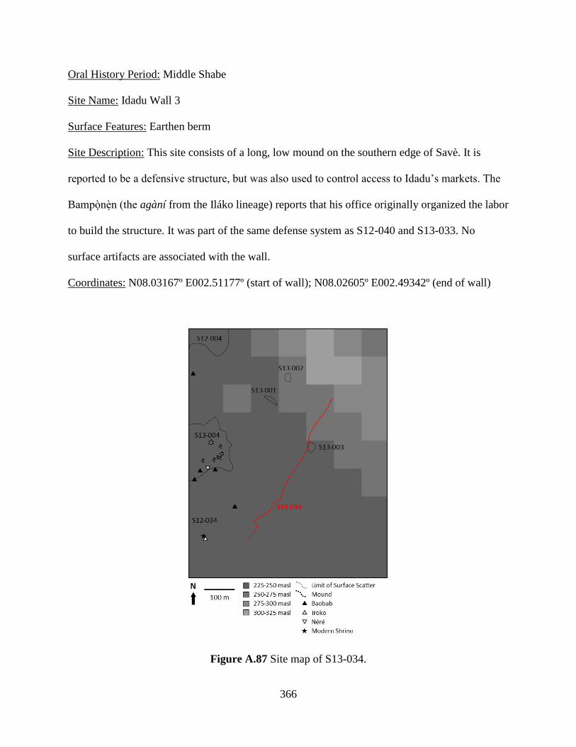
366
Oral History Period: Middle Shabe
Site Name: Idadu Wall 3
Surface Features: Earthen berm
Site Description: This site consists of a long, low mound on the southern edge of Savè. It is
reported to be a defensive structure, but was also used to control access to Idadu’s markets. The
Bampònèn (the agàní from the Iláko lineage) reports that his office originally organized the labor
to build the structure. It was part of the same defense system as S12-040 and S13-033. No
surface artifacts are associated with the wall.
Coordinates: N08.03167º E002.51177º (start of wall); N08.02605º E002.49342º (end of wall)
Figure A.87 Site map of S13-034.

367
2. Transect Survey – Fiditi Tract
Site Number: S12-013
Surface Features: Architecture (Earthen Foundation), Artifact Scatter (Ceramics)
Site Description: This site consists of an artifact scatter on a relatively flat part of the Oke Shabe
hill. It is situated between steep cliff faces that make the only approach from the southwest. The
artifacts are most concentrated near architectural remains on the highest part of the site and in
lower lying channels in the granite rock where rainwater likely transported the artifacts. The
architectural foundations appear as rectangular earthen blocks, measuring 84 cm in length by 8
cm wide (Figure A.89). The tallest point of the remains is 22 cm. Artifacts were collected in 2 m²
sample units distributed by judgment and by opportunistic pickup of diagnostic artifacts.
Coordinates: N08º02’21.4” E002º30’02.9” (architectural foundations)
Artifact Classes from Surface Collections: Ceramics (Coarse Pottery, Refined Pottery), Fauna
(Bone, Cowry), Lithics (Ground Tool)
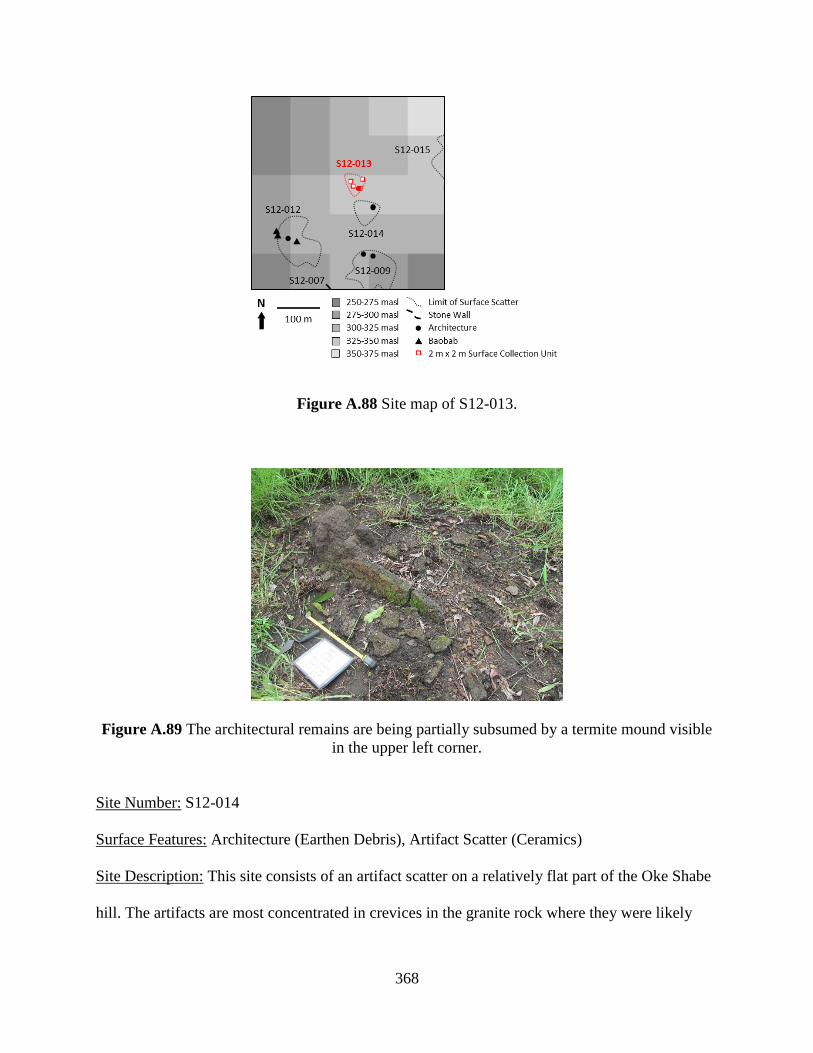
368
Figure A.88 Site map of S12-013.
Figure A.89 The architectural remains are being partially subsumed by a termite mound visible
in the upper left corner.
Site Number: S12-014
Surface Features: Architecture (Earthen Debris), Artifact Scatter (Ceramics)
Site Description: This site consists of an artifact scatter on a relatively flat part of the Oke Shabe
hill. The artifacts are most concentrated in crevices in the granite rock where they were likely
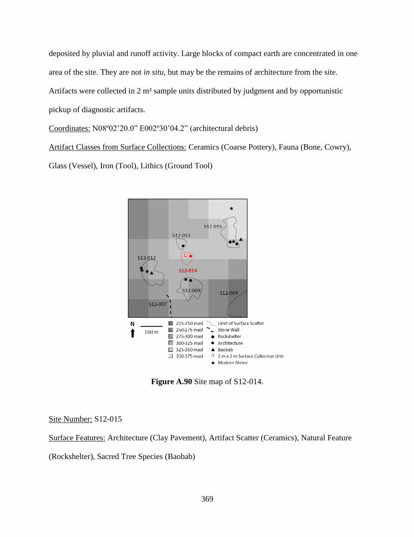
369
deposited by pluvial and runoff activity. Large blocks of compact earth are concentrated in one
area of the site. They are not in situ, but may be the remains of architecture from the site.
Artifacts were collected in 2 m² sample units distributed by judgment and by opportunistic
pickup of diagnostic artifacts.
Coordinates: N08º02’20.0” E002º30’04.2” (architectural debris)
Artifact Classes from Surface Collections: Ceramics (Coarse Pottery), Fauna (Bone, Cowry),
Glass (Vessel), Iron (Tool), Lithics (Ground Tool)
Figure A.90 Site map of S12-014.
Site Number: S12-015
Surface Features: Architecture (Clay Pavement), Artifact Scatter (Ceramics), Natural Feature
(Rockshelter), Sacred Tree Species (Baobab)
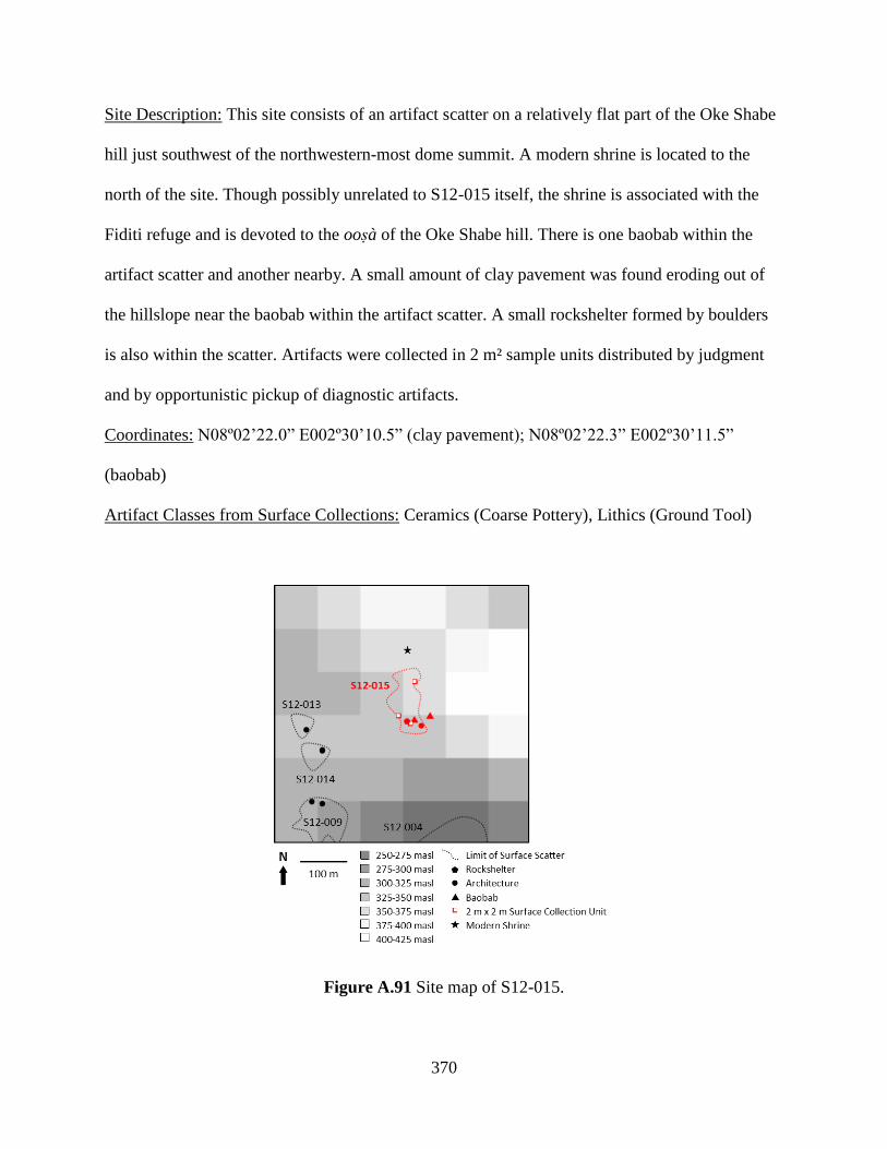
370
Site Description: This site consists of an artifact scatter on a relatively flat part of the Oke Shabe
hill just southwest of the northwestern-most dome summit. A modern shrine is located to the
north of the site. Though possibly unrelated to S12-015 itself, the shrine is associated with the
Fiditi refuge and is devoted to the oosà of the Oke Shabe hill. There is one baobab within the
artifact scatter and another nearby. A small amount of clay pavement was found eroding out of
the hillslope near the baobab within the artifact scatter. A small rockshelter formed by boulders
is also within the scatter. Artifacts were collected in 2 m² sample units distributed by judgment
and by opportunistic pickup of diagnostic artifacts.
Coordinates: N08º02’22.0” E002º30’10.5” (clay pavement); N08º02’22.3” E002º30’11.5”
(baobab)
Artifact Classes from Surface Collections: Ceramics (Coarse Pottery), Lithics (Ground Tool)
Figure A.91 Site map of S12-015.
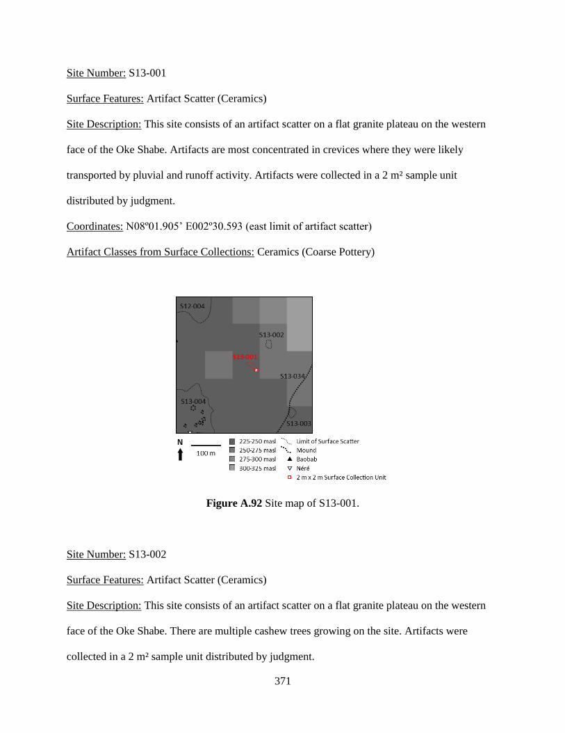
371
Site Number: S13-001
Surface Features: Artifact Scatter (Ceramics)
Site Description: This site consists of an artifact scatter on a flat granite plateau on the western
face of the Oke Shabe. Artifacts are most concentrated in crevices where they were likely
transported by pluvial and runoff activity. Artifacts were collected in a 2 m² sample unit
distributed by judgment.
Coordinates: N08º01.905’ E002º30.593 (east limit of artifact scatter)
Artifact Classes from Surface Collections: Ceramics (Coarse Pottery)
Figure A.92 Site map of S13-001.
Site Number: S13-002
Surface Features: Artifact Scatter (Ceramics)
Site Description: This site consists of an artifact scatter on a flat granite plateau on the western
face of the Oke Shabe. There are multiple cashew trees growing on the site. Artifacts were
collected in a 2 m² sample unit distributed by judgment.
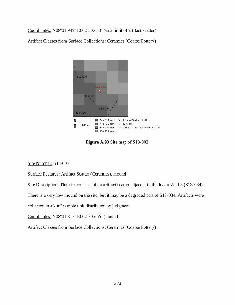
372
Coordinates: N08º01.942’ E002º30.630’ (east limit of artifact scatter)
Artifact Classes from Surface Collections: Ceramics (Coarse Pottery)
Figure A.93 Site map of S13-002.
Site Number: S13-003
Surface Features: Artifact Scatter (Ceramics), mound
Site Description: This site consists of an artifact scatter adjacent to the Idadu Wall 3 (S13-034).
There is a very low mound on the site, but it may be a degraded part of S13-034. Artifacts were
collected in a 2 m² sample unit distributed by judgment.
Coordinates: N08º01.815’ E002º30.666’ (mound)
Artifact Classes from Surface Collections: Ceramics (Coarse Pottery)
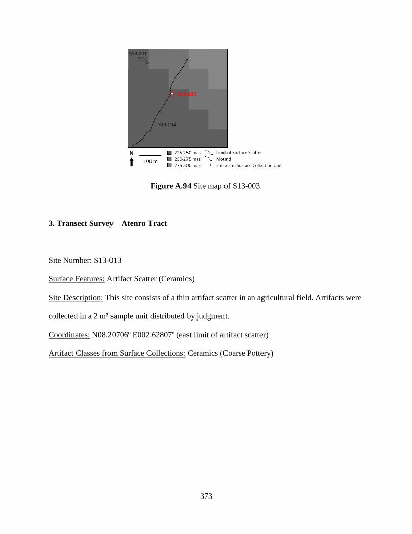
373
Figure A.94 Site map of S13-003.
3. Transect Survey – Atenro Tract
Site Number: S13-013
Surface Features: Artifact Scatter (Ceramics)
Site Description: This site consists of a thin artifact scatter in an agricultural field. Artifacts were
collected in a 2 m² sample unit distributed by judgment.
Coordinates: N08.20706º E002.62807º (east limit of artifact scatter)
Artifact Classes from Surface Collections: Ceramics (Coarse Pottery)
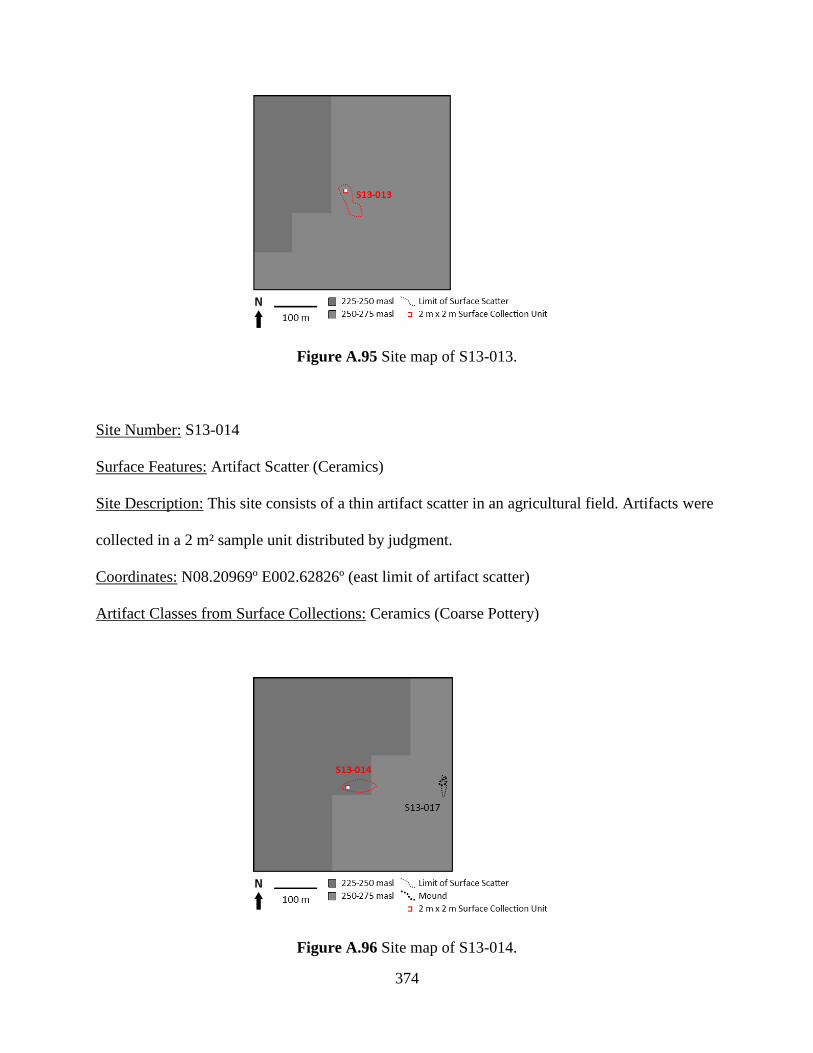
374
Figure A.95 Site map of S13-013.
Site Number: S13-014
Surface Features: Artifact Scatter (Ceramics)
Site Description: This site consists of a thin artifact scatter in an agricultural field. Artifacts were
collected in a 2 m² sample unit distributed by judgment.
Coordinates: N08.20969º E002.62826º (east limit of artifact scatter)
Artifact Classes from Surface Collections: Ceramics (Coarse Pottery)
Figure A.96 Site map of S13-014.
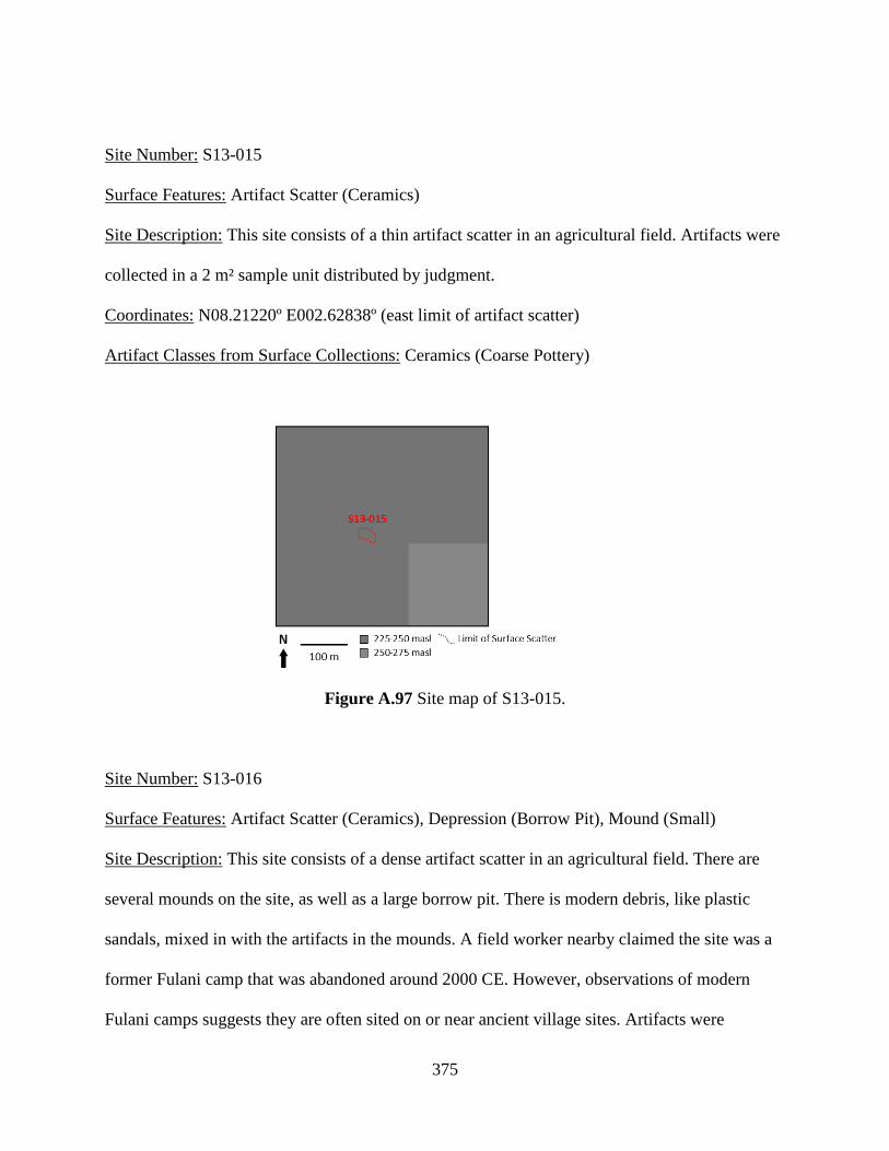
375
Site Number: S13-015
Surface Features: Artifact Scatter (Ceramics)
Site Description: This site consists of a thin artifact scatter in an agricultural field. Artifacts were
collected in a 2 m² sample unit distributed by judgment.
Coordinates: N08.21220º E002.62838º (east limit of artifact scatter)
Artifact Classes from Surface Collections: Ceramics (Coarse Pottery)
Figure A.97 Site map of S13-015.
Site Number: S13-016
Surface Features: Artifact Scatter (Ceramics), Depression (Borrow Pit), Mound (Small)
Site Description: This site consists of a dense artifact scatter in an agricultural field. There are
several mounds on the site, as well as a large borrow pit. There is modern debris, like plastic
sandals, mixed in with the artifacts in the mounds. A field worker nearby claimed the site was a
former Fulani camp that was abandoned around 2000 CE. However, observations of modern
Fulani camps suggests they are often sited on or near ancient village sites. Artifacts were

376
collected in 2 m² sample units distributed by judgment and by opportunistic pickup of diagnostic
artifacts.
Coordinates: N08.22723º E002.62981º (mound); N08.22723º E002.62972º (mound); N08.22695º
E002.62982º (mound); N08.22650º E002.63037º (depression)
Artifact Classes from Surface Collections: Ceramics (Coarse Pottery)
Figure A.98 Site map of S13-016.
Site Number: S13-017
Surface Features: Artifact Scatter (Ceramics), Mound (Small)
Site Description: This site consists of a thin artifact scatter in an agricultural field. There are
several, low mounds clustered together on the site, but it may be a natural topographic feature.
Artifacts were collected in a 2 m² sample unit distributed by judgment.
Coordinates: N08.20997º E002.62997º (mound); N08.20991º E002.63006º (mound)
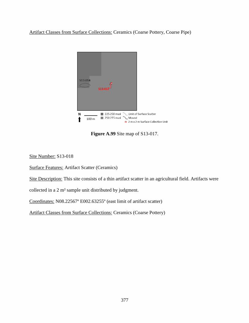
377
Artifact Classes from Surface Collections: Ceramics (Coarse Pottery, Coarse Pipe)
Figure A.99 Site map of S13-017.
Site Number: S13-018
Surface Features: Artifact Scatter (Ceramics)
Site Description: This site consists of a thin artifact scatter in an agricultural field. Artifacts were
collected in a 2 m² sample unit distributed by judgment.
Coordinates: N08.22567º E002.63255º (east limit of artifact scatter)
Artifact Classes from Surface Collections: Ceramics (Coarse Pottery)

378
Figure A.100 Site map of S13-018.
Site Number: S13-019
Surface Features: Artifact Scatter (Ceramics)
Site Description: This site consists of a thin artifact scatter in an agricultural field. Artifacts were
collected in a 2 m² sample unit distributed by judgment.
Coordinates: N08.23214º E002.63241º (east limit of artifact scatter)
Artifact Classes from Surface Collections: Ceramics (Coarse Pottery)
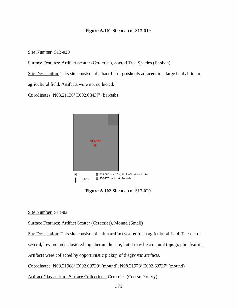
379
Figure A.101 Site map of S13-019.
Site Number: S13-020
Surface Features: Artifact Scatter (Ceramics), Sacred Tree Species (Baobab)
Site Description: This site consists of a handful of potsherds adjacent to a large baobab in an
agricultural field. Artifacts were not collected.
Coordinates: N08.21136º E002.63437º (baobab)
Figure A.102 Site map of S13-020.
Site Number: S13-021
Surface Features: Artifact Scatter (Ceramics), Mound (Small)
Site Description: This site consists of a thin artifact scatter in an agricultural field. There are
several, low mounds clustered together on the site, but it may be a natural topographic feature.
Artifacts were collected by opportunistic pickup of diagnostic artifacts.
Coordinates: N08.21968º E002.63729º (mound); N08.21973º E002.63727º (mound)
Artifact Classes from Surface Collections: Ceramics (Coarse Pottery)
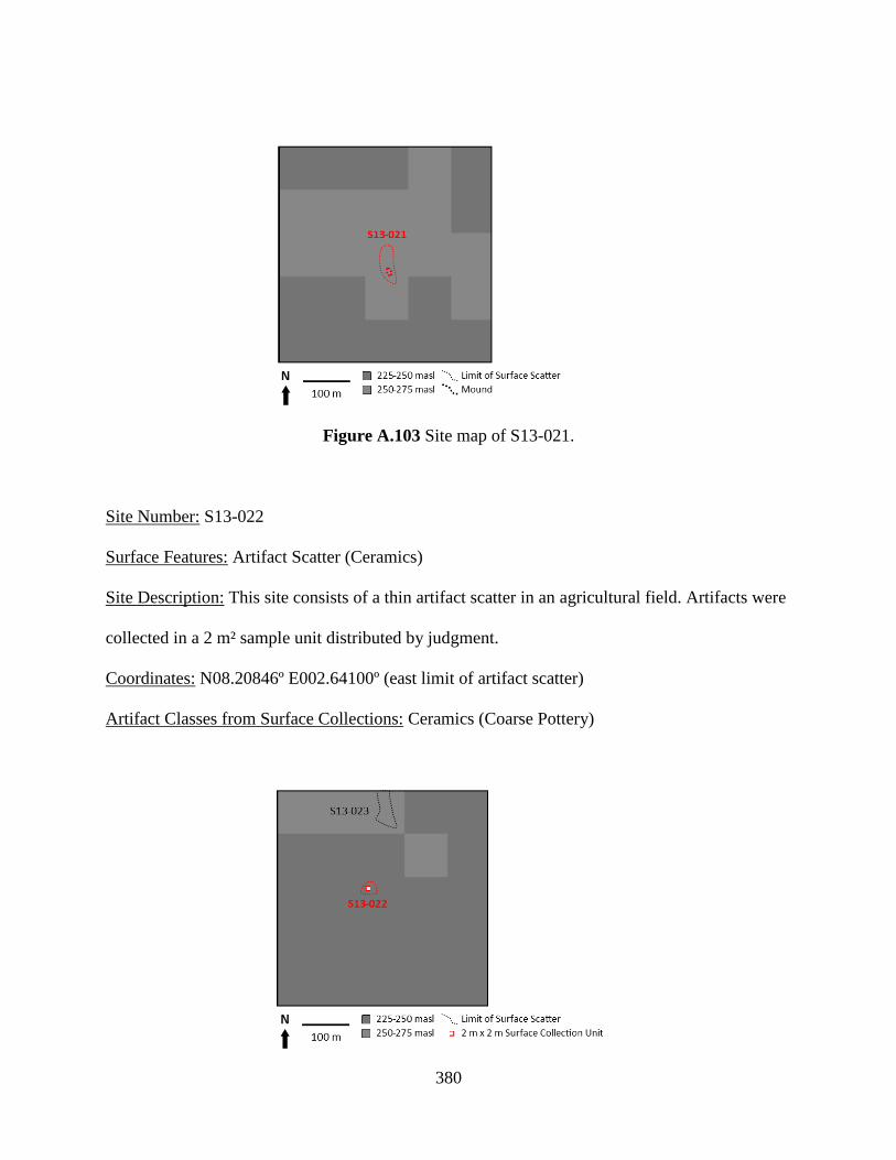
380
Figure A.103 Site map of S13-021.
Site Number: S13-022
Surface Features: Artifact Scatter (Ceramics)
Site Description: This site consists of a thin artifact scatter in an agricultural field. Artifacts were
collected in a 2 m² sample unit distributed by judgment.
Coordinates: N08.20846º E002.64100º (east limit of artifact scatter)
Artifact Classes from Surface Collections: Ceramics (Coarse Pottery)
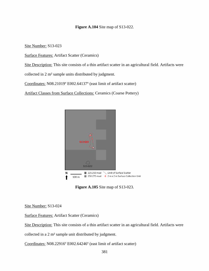
381
Figure A.104 Site map of S13-022.
Site Number: S13-023
Surface Features: Artifact Scatter (Ceramics)
Site Description: This site consists of a thin artifact scatter in an agricultural field. Artifacts were
collected in 2 m² sample units distributed by judgment.
Coordinates: N08.21019º E002.64137º (east limit of artifact scatter)
Artifact Classes from Surface Collections: Ceramics (Coarse Pottery)
Figure A.105 Site map of S13-023.
Site Number: S13-024
Surface Features: Artifact Scatter (Ceramics)
Site Description: This site consists of a thin artifact scatter in an agricultural field. Artifacts were
collected in a 2 m² sample unit distributed by judgment.
Coordinates: N08.22916º E002.64246º (east limit of artifact scatter)
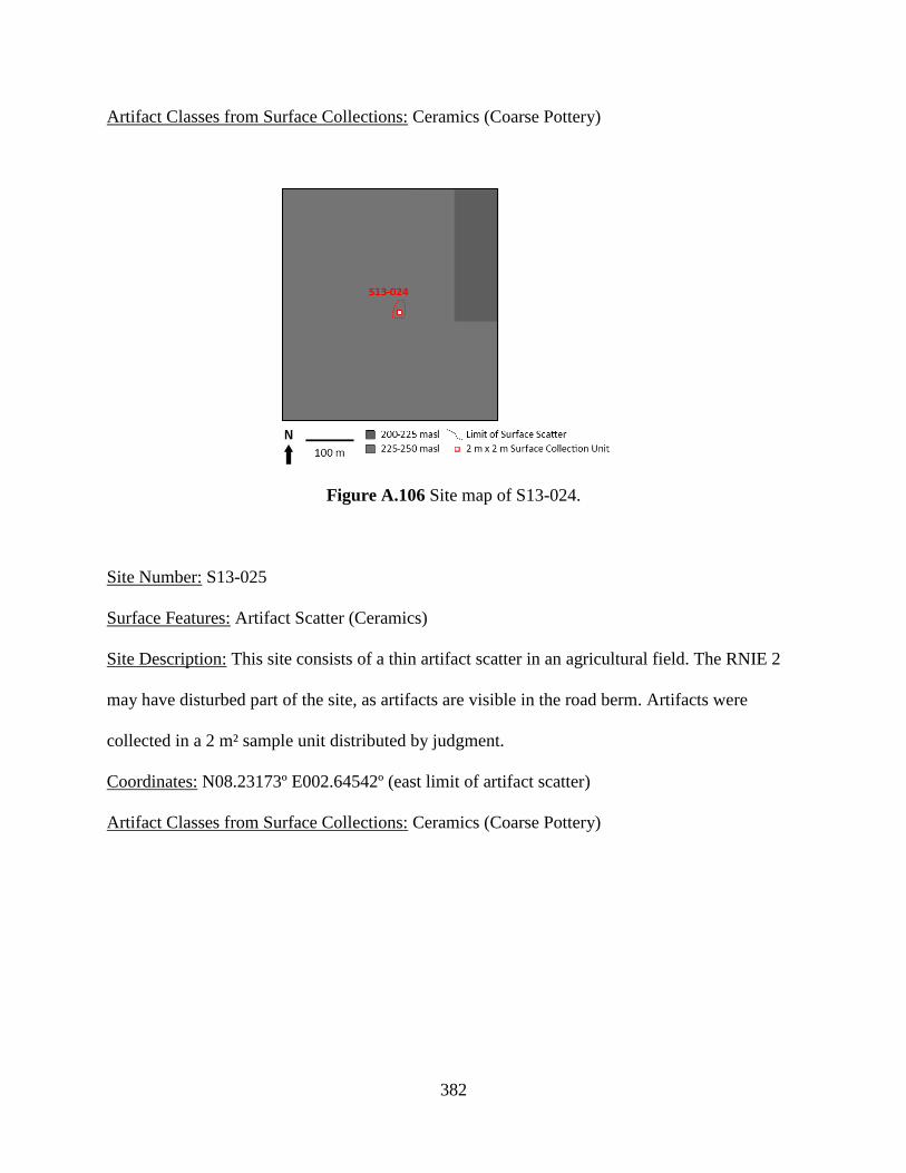
382
Artifact Classes from Surface Collections: Ceramics (Coarse Pottery)
Figure A.106 Site map of S13-024.
Site Number: S13-025
Surface Features: Artifact Scatter (Ceramics)
Site Description: This site consists of a thin artifact scatter in an agricultural field. The RNIE 2
may have disturbed part of the site, as artifacts are visible in the road berm. Artifacts were
collected in a 2 m² sample unit distributed by judgment.
Coordinates: N08.23173º E002.64542º (east limit of artifact scatter)
Artifact Classes from Surface Collections: Ceramics (Coarse Pottery)
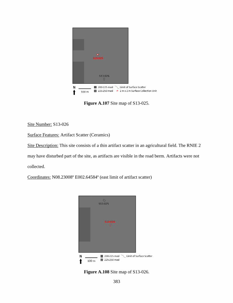
383
Figure A.107 Site map of S13-025.
Site Number: S13-026
Surface Features: Artifact Scatter (Ceramics)
Site Description: This site consists of a thin artifact scatter in an agricultural field. The RNIE 2
may have disturbed part of the site, as artifacts are visible in the road berm. Artifacts were not
collected.
Coordinates: N08.23008º E002.64584º (east limit of artifact scatter)
Figure A.108 Site map of S13-026.
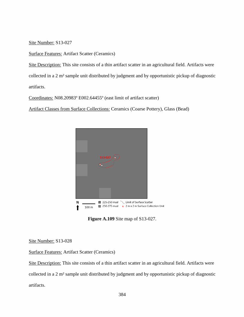
384
Site Number: S13-027
Surface Features: Artifact Scatter (Ceramics)
Site Description: This site consists of a thin artifact scatter in an agricultural field. Artifacts were
collected in a 2 m² sample unit distributed by judgment and by opportunistic pickup of diagnostic
artifacts.
Coordinates: N08.20983º E002.64455º (east limit of artifact scatter)
Artifact Classes from Surface Collections: Ceramics (Coarse Pottery), Glass (Bead)
Figure A.109 Site map of S13-027.
Site Number: S13-028
Surface Features: Artifact Scatter (Ceramics)
Site Description: This site consists of a thin artifact scatter in an agricultural field. Artifacts were
collected in a 2 m² sample unit distributed by judgment and by opportunistic pickup of diagnostic
artifacts.

385
Coordinates: N08.20916º E002.64917º (east limit of artifact scatter)
Artifact Classes from Surface Collections: Ceramics (Coarse Pottery)
Figure A.110 Site map of S13-028.
Site Number: S13-029
Surface Features: Artifact Scatter (Ceramics)
Site Description: This site consists of a thin artifact scatter in an agricultural field. Artifacts were
collected in a 2 m² sample unit distributed by judgment.
Coordinates: N08.22438º E002.64857º (east limit of artifact scatter)
Artifact Classes from Surface Collections: Ceramics (Coarse Pottery)
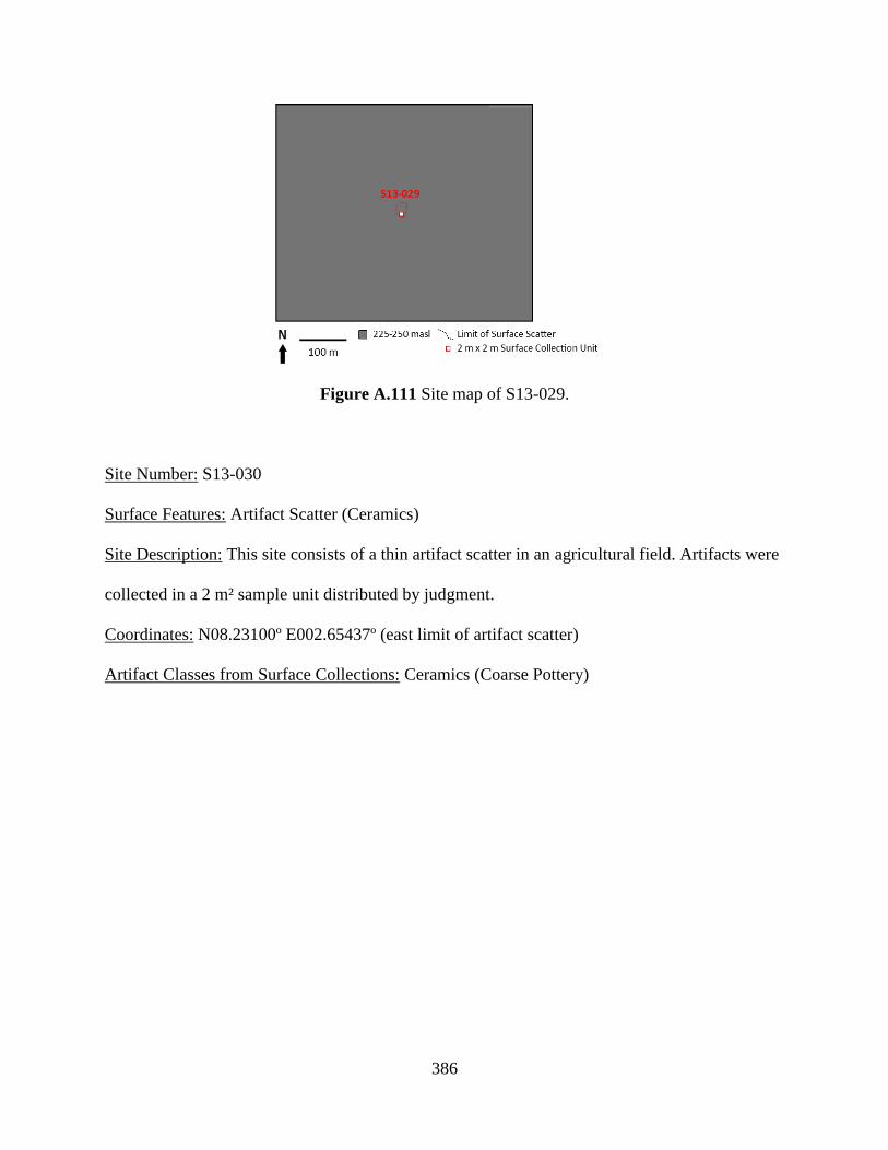
386
Figure A.111 Site map of S13-029.
Site Number: S13-030
Surface Features: Artifact Scatter (Ceramics)
Site Description: This site consists of a thin artifact scatter in an agricultural field. Artifacts were
collected in a 2 m² sample unit distributed by judgment.
Coordinates: N08.23100º E002.65437º (east limit of artifact scatter)
Artifact Classes from Surface Collections: Ceramics (Coarse Pottery)
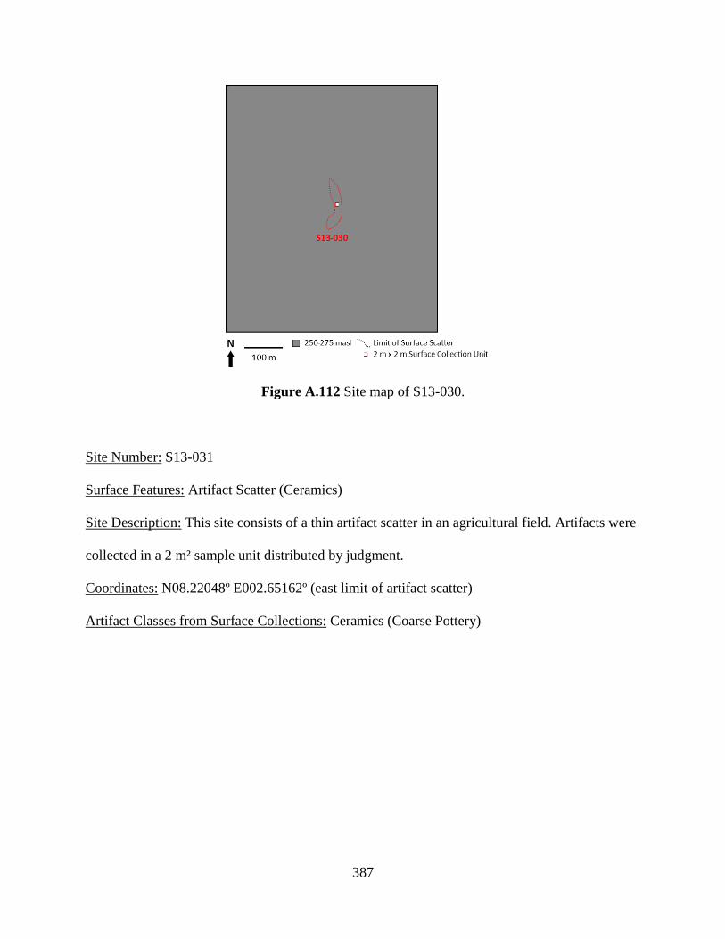
387
Figure A.112 Site map of S13-030.
Site Number: S13-031
Surface Features: Artifact Scatter (Ceramics)
Site Description: This site consists of a thin artifact scatter in an agricultural field. Artifacts were
collected in a 2 m² sample unit distributed by judgment.
Coordinates: N08.22048º E002.65162º (east limit of artifact scatter)
Artifact Classes from Surface Collections: Ceramics (Coarse Pottery)

388
Figure A.113 Site map of S13-031.
Site Number: S13-032
Surface Features: Artifact Scatter (Ceramics)
Site Description: This site consists of a thin artifact scatter in an agricultural field. Artifacts were
collected by opportunistic pickup of diagnostic artifacts.
Coordinates: N08.21199º E002.65158º (east limit of artifact scatter)
Artifact Classes from Surface Collections: Ceramics (Coarse Pottery)
Figure A.114 Site map of S13-032.
389
APPENDIX B
Ceramic Artifacts
Ceramic artifacts are ubiquitous at archaeological sites in the Savè hills area. Their
ubiquity likely reflects the common-place nature of creating clay-based artifacts and their
frequent turnover through breakage. Ceramic artifacts were classified by the general nature of
their paste: coarse or refined. Coarse earthenware artifacts are characterized as pastes with
visible temper, typically combinations of quartz, quartzite, feldspar, mica, and/or laterite, among
other minerals commonly found in granitic formations. Paste colors are typically black, gray, and
a range of shades between brown and red. Refined earthenware artifacts are characterized by no
visible temper. Paste colors for all refined earthenware artifacts were uniformly white. In
addition, all refined earthenware artifacts were coated in a clear or tinted glaze and all are
potsherds. Coarse earthenware artifacts are found at more sites and in vastly greater quantities,
likely representing different origins and consumption patterns that are discussed further below.
Coarse earthenware artifacts were further subcategorized as either pottery (ie, potsherds), beads,
or pipe fragments.
1. Coarse Earthenware Pottery
Coarse earthenware pottery was by the far the most commonly encountered artifact class.
Indeed, sherds were recovered from almost every archaeological site documented. Coarse
390
earthenware ceramics would have been used for a number of activities: food preparation,
cooking, serving, and storage; water collection and storage; potash production; and in ritual
practice. Further, broken pots could be re-used as cooking emplacements, pot lids, or as
construction material. Coarse earthenware ceramics were likely produced locally, as the granite-
dominant geology of the area favors the exploitation of accessible clay beds. In the present day,
pottery production is no longer practiced, though it is remembered as occurring on a local scale
during the European Colonial period and before.
Coarse earthenware pottery collected from archaeological contexts was recorded in the
field with contextual information, bagged, washed, photographed, and catalogued. Sherds were
first categorized according to their diagnostic utility: body sherds or diagnostic parts. Diagnostic
parts were further categorized according to their specific type, based on typical pottery forms
described in archaeological ceramics literature (e.g. Sinopoli 1991): lip, shoulder, neck, base,
foot, handle, or lug. In addition, ceramics discs were also identified, which have variously been
described in African ethnographies and archaeological studies as wall tiles (Ogundiran 2002),
game pieces (Burrett 2007), decoration tools (Marshall et al. 1984), container stoppers (Insoll et
al. 2012: 36), and currency weights or tokens (McIntosh 1995: 217; Compton 2014: 257).
Finally, several examples of small complete vessels were found, interpreted as lamps, which
were given their own designation. No other complete vessels were recovered.
Body sherds were counted by decorative type (Table B.1), described in more detail
below. After counting, body sherds were then weighed in bulk by context. Diagnostic parts were
also counted by decorative type (Table B.2). The temper of the diagnostic part was categorized
based on the presence of quartz/feldspar (and possibly quartzite), laterite/granite, mica and/or
grog (crushed potsherds). Quartz/feldspar and laterite/granite were further categorized by the

391
largest visible grain size, ranging from sand (<2 mm), granules (2-4 mm), and pebbles (>4 mm).
When possible rim sherds were also classified as either everted, open/unrestricted, or restricted.
The lips of these sherds were classified as either rounded, squared, grooved, or shaped in some
other form.
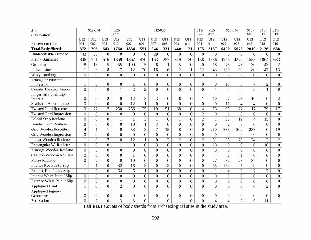
392
Site
(Excavation)
S12-004 S12-
017
S12-035 S12-
036
S12-
037
S13-004 S13-
010
S13-
011
S13-
012
Excavation Unit U12-
001
U12-
003
U13-
001
U13-
013
U12-
002
U13-
006
U13-
007
U13-
008
U13-
009
U13-
011
U13-
005
U13-
014
U13-
002
U13-
003
U13-
015
U13-
012
U13-
010
Total Body Sherds 372 796 643 1768 1834 551 246 331 440 21 175 2157 6400 5673 2010 2136 688
Unidentifiable / Eroded 42 30 0 0 0 0 29 0 0 0 0 0 0 0 0 0 0 Plain / Burnished 306 721 616 1359 1367 470 163 257 349 20 158 1586 4946 4375 1588 1864 633 Grooving 8 13 5 55 100 5 6 1 5 0 0 18 75 48 30 43 2 Incised Line 1 8 8 7 12 20 16 6 2 1 12 43 139 130 80 47 13 Wavy Combing 0 0 0 0 0 0 0 0 0 0 0 0 2 0 0 0 0 Triangular Punctate
Impression 1 0 0 0 1 0 0 0 0 0 0 0 18 5 7 2 0 Circular Punctate Impres. 0 0 0 1 2 2 0 0 0 0 0 1 5 3 3 1 0 Fingernail / Shell Lip
Impress. 0 0 2 0 12 8 3 0 6 0 1 10 27 26 10 0 2 Snailshell Apex Impress. 0 0 0 0 12 1 0 0 0 0 0 0 11 4 4 0 0 Twisted Cord Roulette 9 22 7 250 256 35 19 51 68 0 4 76 95 122 17 179 17 Twisted Cord Impression 0 0 0 0 0 0 0 0 0 0 2 0 1 0 0 0 0 Folded Strip Roulette 0 0 0 1 1 3 1 0 1 0 2 1 25 19 4 15 0 Braided Cord Roulette 0 0 0 0 10 1 3 0 0 0 0 0 2 5 0 0 0 Grid Wooden Roulette 4 1 1 0 53 8 7 15 8 0 0 260 886 802 238 0 19 Grid Wooden Impression 0 0 0 0 0 0 0 0 0 0 0 0 0 0 0 0 0 Linear Wooden Roulette 1 0 7 0 12 1 0 2 2 0 2 61 36 29 24 3 2 Rectangular W. Roulette 0 0 0 1 0 0 3 0 0 0 0 10 0 0 0 10 0 Triangle Wooden Roulette 0 0 0 0 0 0 0 0 0 0 0 0 0 0 0 0 0 Chevron Wooden Roulette 0 0 0 0 1 0 0 0 0 0 0 4 6 1 0 0 0 Maize Roulette 0 2 0 0 10 0 0 0 0 0 0 27 32 28 37 0 0 Interior Red Paint / Slip 1 1 0 82 16 3 0 3 0 0 0 85 184 145 9 9 0 Exterior Red Paint / Slip 1 0 0 64 5 1 0 0 0 0 0 1 4 0 2 2 0 Interior White Paint / Slip 0 0 0 0 0 0 0 0 0 0 0 0 0 0 0 0 0 Exterior White Paint / Slip 0 0 0 0 0 0 0 0 0 0 0 0 0 0 0 0 0 Appliqued Band 1 0 0 2 0 0 0 0 0 0 0 0 0 0 0 2 0 Appliqued Figure /
Geometric 0 0 0 0 0 0 0 0 0 0 0 0 0 0 0 0 0 Perforation 0 2 0 3 3 0 1 0 1 0 0 4 4 2 9 11 1
Table B.1 Counts of body sherds from archaeological sites in the study area.
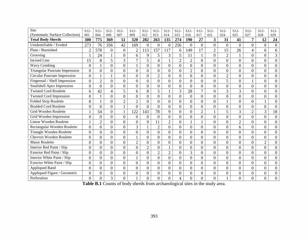
393
Site
(Systematic Surface Collection) S12-
001
S12-
004
S12-
006
S12-
007
S12-
009
S12-
012
S12-
013
S12-
014
S12-
015
S12-
016
S12-
017
S12-
021
S12-
024
S12-
025
S12-
027
S12-
028
S12-
029
Total Body Sherds 300 775 369 51 320 282 263 135 274 190 27 3 31 41 7 12 24
Unidentifiable / Eroded 273 76 356 42 169 0 0 0 256 0 0 0 0 0 0 0 0 Plain / Burnished 2 578 0 0 2 113 157 117 6 149 17 2 15 26 4 6 6 Grooving 1 24 1 0 6 9 5 3 5 11 1 0 2 1 0 0 3 Incised Line 15 8 5 3 7 5 4 1 2 2 0 0 0 0 0 0 0 Wavy Combing 0 1 0 0 1 0 0 0 0 0 0 0 0 0 0 0 0 Triangular Punctate Impression 0 0 0 0 0 0 0 0 0 2 0 0 0 0 0 0 0 Circular Punctate Impression 0 1 1 0 0 0 2 0 0 0 0 0 2 0 0 0 0 Fingernail / Shell Impression 0 2 0 0 0 0 0 0 0 0 0 0 5 0 1 0 0 Snailshell Apex Impression 0 0 0 0 0 0 0 0 0 0 0 0 0 0 0 0 0 Twisted Cord Roulette 6 42 4 5 6 8 5 1 3 28 7 0 3 3 0 0 0 Twisted Cord Impression 0 1 0 0 0 0 0 0 0 0 0 0 0 0 0 0 0 Folded Strip Roulette 8 1 0 2 2 0 0 0 0 0 0 0 1 0 0 1 0 Braided Cord Roulette 0 0 0 1 0 0 0 0 0 0 0 0 0 0 0 0 0 Grid Wooden Roulette 1 54 0 1 122 143 78 9 0 0 2 1 5 3 2 3 18 Grid Wooden Impression 0 0 0 0 0 0 0 0 0 0 0 0 0 0 0 0 0 Linear Wooden Roulette 1 2 0 0 0 9 11 2 0 1 1 0 0 2 0 0 0 Rectangular Wooden Roulette 0 0 0 0 3 1 2 0 0 0 0 0 0 6 0 0 0 Triangle Wooden Roulette 0 0 0 0 0 0 0 0 0 0 0 0 0 0 0 0 0 Chevron Wooden Roulette 0 0 0 0 1 0 0 0 0 0 0 0 0 0 0 0 0 Maize Roulette 0 0 0 0 2 0 0 0 0 0 0 0 0 0 0 2 0 Interior Red Paint / Slip 0 0 0 0 0 2 0 1 0 0 0 0 0 0 0 0 0 Exterior Red Paint / Slip 0 0 0 0 0 0 2 2 0 3 0 0 0 0 0 0 0 Interior White Paint / Slip 0 0 0 0 1 0 0 0 0 0 0 0 0 0 0 0 0 Exterior White Paint / Slip 0 0 0 0 0 0 0 0 0 0 0 0 0 0 0 0 0 Appliqued Band 0 0 0 0 0 0 0 0 0 0 0 0 0 0 0 0 0 Appliqued Figure / Geometric 0 0 0 0 0 0 0 0 0 0 0 0 0 0 0 0 0 Perforation 0 0 3 0 1 0 0 0 4 0 0 0 1 0 0 0 0
Table B.1 Counts of body sherds from archaeological sites in the study area.

394
Site
(Systematic Surface Collection)
S12-
030
S12-
032
S12-
033
S12-
034
S12-
035
S12-
036
S12-
037
S12-
039
S12-
044
S13-
001
S13-
002
S13-
003
S13-
004
S13-
006
S13-
008
S13-
009
S13-
010
Total Body Sherds 31 25 22 5 53 6 66 35 20 8 10 26 110 186 15 87 63
Unidentifiable / Eroded 0 0 0 0 39 0 0 0 0 6 10 22 87 175 12 61 50 Plain / Burnished 29 23 10 4 0 6 40 14 13 0 0 0 0 0 0 0 0 Grooving 0 0 2 0 1 0 3 4 3 1 0 2 2 10 1 0 0 Incised Line 0 1 0 0 4 0 0 0 0 0 0 1 4 1 0 0 2 Wavy Combing 0 0 0 0 0 0 0 0 0 0 0 0 0 0 0 0 0 Triangular Punctate Impression 0 0 0 0 0 0 0 0 0 0 0 0 0 0 0 0 1 Circular Punctate Impression 0 1 0 0 0 0 0 0 0 0 0 0 0 0 0 0 0 Fingernail / Shell Impression 0 0 0 0 0 0 1 0 0 0 0 0 0 0 0 0 1 Snailshell Apex Impression 0 0 0 0 0 0 0 0 0 0 0 0 0 0 0 0 0 Twisted Cord Roulette 1 1 4 1 8 0 3 19 5 0 0 1 6 0 0 24 0 Twisted Cord Impression 0 0 0 0 0 0 1 0 0 0 0 0 0 0 0 0 0 Folded Strip Roulette 0 0 0 0 1 0 0 0 0 0 0 2 0 7 0 0 0 Braided Cord Roulette 0 0 0 0 0 0 0 0 0 0 0 0 0 0 0 0 0 Grid Wooden Roulette 0 0 3 0 0 0 12 0 0 1 0 0 11 0 1 0 6 Grid Wooden Impression 0 0 0 0 0 0 0 0 0 0 0 0 0 0 0 0 0 Linear Wooden Roulette 0 0 3 0 1 0 5 0 0 1 0 0 0 0 0 2 0 Rectangular Wooden Roulette 0 0 0 0 0 0 1 0 0 0 0 0 0 0 0 0 0 Triangle Wooden Roulette 0 0 0 0 0 0 0 0 0 0 0 0 0 0 0 0 0 Chevron Wooden Roulette 0 0 0 0 0 0 0 0 0 0 0 0 0 0 0 0 0 Maize Roulette 1 0 0 0 0 0 0 0 0 0 0 0 0 0 1 0 0 Interior Red Paint / Slip 0 0 0 0 1 0 2 0 0 0 0 0 1 0 0 0 1 Exterior Red Paint / Slip 0 0 0 0 0 0 0 0 0 0 0 0 1 0 0 0 0 Interior White Paint / Slip 0 0 0 0 0 0 0 0 0 0 0 0 0 0 0 0 0 Exterior White Paint / Slip 0 0 0 0 0 0 0 0 0 0 0 0 0 0 0 0 0 Appliqued Band 0 0 0 0 0 0 0 2 0 0 0 0 0 0 0 0 1 Appliqued Figure / Geometric 0 0 0 0 0 0 0 2 0 0 0 0 0 0 0 0 0 Perforation 0 0 0 0 0 0 0 0 0 0 0 0 0 0 0 0 1
Table B.1 Counts of body sherds from archaeological sites in the study area.
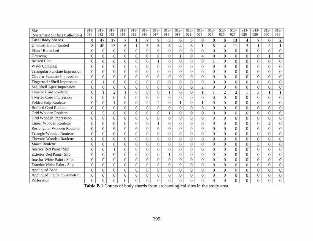
395
Site
(Systematic Surface Collection)
S13-
011
S13-
012
S13-
013
S13-
014
S13-
015
S13-
016
S13-
017
S13-
018
S13-
019
S13-
022
S13-
023
S13-
024
S13-
025
S13-
027
S13-
028
S13-
029
S13-
030
S13-
031
Total Body Sherds 8 47 17 7 1 7 9 5 6 3 8 8 6 13 4 7 6 2
Unidentifiable / Eroded 8 40 13 6 1 5 6 3 4 3 1 6 4 11 3 1 2 1 Plain / Burnished 0 0 0 0 0 0 0 0 0 0 0 0 0 0 0 0 0 0 Grooving 0 0 0 0 0 0 0 0 1 0 4 0 0 0 0 0 1 0 Incised Line 0 0 0 0 0 0 1 0 0 0 0 1 0 0 0 0 0 0 Wavy Combing 0 0 0 0 0 0 0 0 0 0 0 0 0 0 0 0 0 0 Triangular Punctate Impression 0 0 0 0 0 0 0 0 0 0 0 0 0 0 0 0 0 0 Circular Punctate Impression 0 0 0 0 0 0 0 0 0 0 0 0 0 0 0 0 0 0 Fingernail / Shell Impression 0 1 0 0 0 0 0 0 0 0 0 0 0 0 0 0 0 0 Snailshell Apex Impression 0 0 0 0 0 0 0 0 0 0 2 0 0 0 0 0 0 0 Twisted Cord Roulette 0 1 2 1 0 0 0 1 0 0 1 1 2 2 1 3 1 1 Twisted Cord Impression 0 0 0 0 0 0 0 0 0 0 0 0 0 0 0 0 0 0 Folded Strip Roulette 0 0 1 0 0 2 2 0 1 0 1 0 0 0 0 0 0 0 Braided Cord Roulette 0 0 0 0 0 0 0 0 0 0 3 0 0 0 0 0 0 0 Grid Wooden Roulette 0 5 0 0 0 0 0 1 0 0 0 0 0 0 0 0 0 0 Grid Wooden Impression 0 0 0 0 0 0 0 0 0 0 0 0 0 0 0 0 0 0 Linear Wooden Roulette 0 0 0 0 0 0 1 0 0 0 0 0 0 0 0 0 2 0 Rectangular Wooden Roulette 0 0 0 0 0 0 0 0 0 0 0 0 0 0 0 0 0 0 Triangle Wooden Roulette 0 0 0 0 0 0 0 0 0 0 0 0 0 0 0 0 0 0 Chevron Wooden Roulette 0 0 0 0 0 0 0 0 0 0 0 0 0 0 0 0 0 0 Maize Roulette 0 0 0 0 0 0 0 0 0 0 0 0 0 0 0 3 0 0 Interior Red Paint / Slip 0 0 1 0 0 0 0 0 0 0 0 0 0 0 0 0 0 0 Exterior Red Paint / Slip 0 0 0 0 0 0 0 1 0 0 0 0 0 0 0 0 0 0 Interior White Paint / Slip 0 0 0 0 0 0 0 0 0 0 0 0 0 0 0 0 0 0 Exterior White Paint / Slip 0 0 0 0 0 0 0 0 0 0 0 0 0 0 0 0 0 0 Appliqued Band 0 0 0 0 0 0 0 0 0 0 0 0 0 0 0 0 0 0 Appliqued Figure / Geometric 0 0 0 0 0 0 0 0 0 0 0 0 0 0 0 0 0 0 Perforation 0 0 0 0 0 0 0 0 0 0 0 0 0 0 0 0 0 0
Table B.1 Counts of body sherds from archaeological sites in the study area.
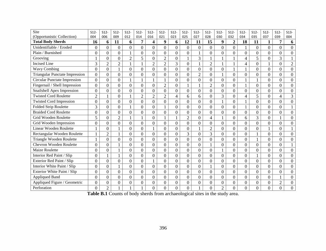
396
Site
(Opportunistic Collection) S12-004
S12-006
S12-009
S12-012
S12-014
S12-016
S12-021
S12-023
S12-025
S12-027
S12-028
S12-030
S12-032
S12-034
S12-035
S12-037
S12-039
S13-004
Total Body Sherds 16 6 11 6 7 4 9 6 12 11 15 9 2 18 11 1 7 6
Unidentifiable / Eroded 0 0 0 0 0 0 0 0 0 0 0 0 0 1 0 0 0 0 Plain / Burnished 0 0 0 1 0 0 0 0 0 1 0 0 0 0 0 0 0 0 Grooving 1 0 0 2 5 0 2 0 1 3 1 1 1 4 5 0 3 1 Incised Line 3 2 2 1 1 2 2 3 0 1 2 1 1 4 0 1 0 2 Wavy Combing 0 0 1 0 0 0 0 0 0 0 0 0 1 1 0 0 0 0 Triangular Punctate Impression 0 0 0 0 0 0 0 0 0 2 0 1 0 0 0 0 0 0 Circular Punctate Impression 0 0 0 1 1 1 1 0 0 0 0 0 0 1 1 0 0 0 Fingernail / Shell Impression 0 0 0 0 0 0 2 0 1 1 2 0 0 1 0 0 0 0 Snailshell Apex Impression 0 0 0 0 0 0 0 0 0 0 0 0 0 0 0 0 0 0 Twisted Cord Roulette 2 1 0 1 2 2 2 4 6 6 0 3 0 4 5 0 4 3 Twisted Cord Impression 0 0 0 0 0 0 0 0 0 0 0 1 0 1 0 0 0 0 Folded Strip Roulette 3 0 0 1 0 0 1 0 0 0 0 0 0 1 0 0 0 1 Braided Cord Roulette 0 0 0 0 0 0 0 0 0 0 0 0 0 0 0 0 0 0 Grid Wooden Roulette 5 0 2 1 1 0 1 1 2 0 4 1 0 6 3 0 1 0 Grid Wooden Impression 0 0 0 0 0 0 0 0 0 0 0 0 0 0 0 0 0 0 Linear Wooden Roulette 1 0 1 0 0 1 0 0 0 1 2 0 0 0 0 1 0 1 Rectangular Wooden Roulette 1 2 1 0 0 0 0 0 3 0 3 0 0 0 1 0 0 0 Triangle Wooden Roulette 1 0 0 0 0 0 0 0 0 0 0 0 0 0 1 0 0 0 Chevron Wooden Roulette 0 0 1 0 0 0 0 0 0 0 1 0 0 0 0 0 0 1 Maize Roulette 0 0 1 0 0 0 0 0 0 0 0 1 0 0 0 0 0 0 Interior Red Paint / Slip 0 1 1 0 0 0 0 0 0 0 0 0 0 0 1 0 0 0 Exterior Red Paint / Slip 0 0 0 0 0 1 0 0 0 0 0 0 0 0 0 0 0 0 Interior White Paint / Slip 0 0 1 0 0 0 0 0 0 0 1 0 0 0 0 0 0 0 Exterior White Paint / Slip 0 0 0 0 0 0 0 0 0 0 0 0 0 0 0 0 0 0 Appliqued Band 0 0 0 0 0 0 0 0 0 0 0 0 0 0 0 0 1 0 Appliqued Figure / Geometric 0 0 0 0 0 0 0 0 0 0 0 0 0 0 0 0 2 0 Perforation 0 2 1 1 1 0 0 0 0 1 0 2 0 0 0 0 0 0
Table B.1 Counts of body sherds from archaeological sites in the study area.
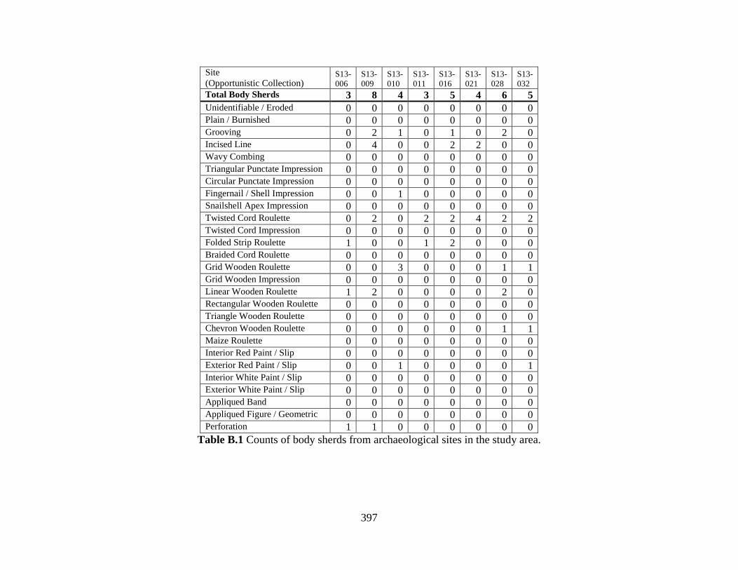
397
Site
(Opportunistic Collection) S13-
006
S13-
009
S13-
010
S13-
011
S13-
016
S13-
021
S13-
028
S13-
032
Total Body Sherds 3 8 4 3 5 4 6 5
Unidentifiable / Eroded 0 0 0 0 0 0 0 0 Plain / Burnished 0 0 0 0 0 0 0 0 Grooving 0 2 1 0 1 0 2 0 Incised Line 0 4 0 0 2 2 0 0 Wavy Combing 0 0 0 0 0 0 0 0 Triangular Punctate Impression 0 0 0 0 0 0 0 0 Circular Punctate Impression 0 0 0 0 0 0 0 0 Fingernail / Shell Impression 0 0 1 0 0 0 0 0 Snailshell Apex Impression 0 0 0 0 0 0 0 0 Twisted Cord Roulette 0 2 0 2 2 4 2 2 Twisted Cord Impression 0 0 0 0 0 0 0 0 Folded Strip Roulette 1 0 0 1 2 0 0 0 Braided Cord Roulette 0 0 0 0 0 0 0 0 Grid Wooden Roulette 0 0 3 0 0 0 1 1 Grid Wooden Impression 0 0 0 0 0 0 0 0 Linear Wooden Roulette 1 2 0 0 0 0 2 0 Rectangular Wooden Roulette 0 0 0 0 0 0 0 0 Triangle Wooden Roulette 0 0 0 0 0 0 0 0 Chevron Wooden Roulette 0 0 0 0 0 0 1 1 Maize Roulette 0 0 0 0 0 0 0 0 Interior Red Paint / Slip 0 0 0 0 0 0 0 0 Exterior Red Paint / Slip 0 0 1 0 0 0 0 1 Interior White Paint / Slip 0 0 0 0 0 0 0 0 Exterior White Paint / Slip 0 0 0 0 0 0 0 0 Appliqued Band 0 0 0 0 0 0 0 0 Appliqued Figure / Geometric 0 0 0 0 0 0 0 0 Perforation 1 1 0 0 0 0 0 0
Table B.1 Counts of body sherds from archaeological sites in the study area.
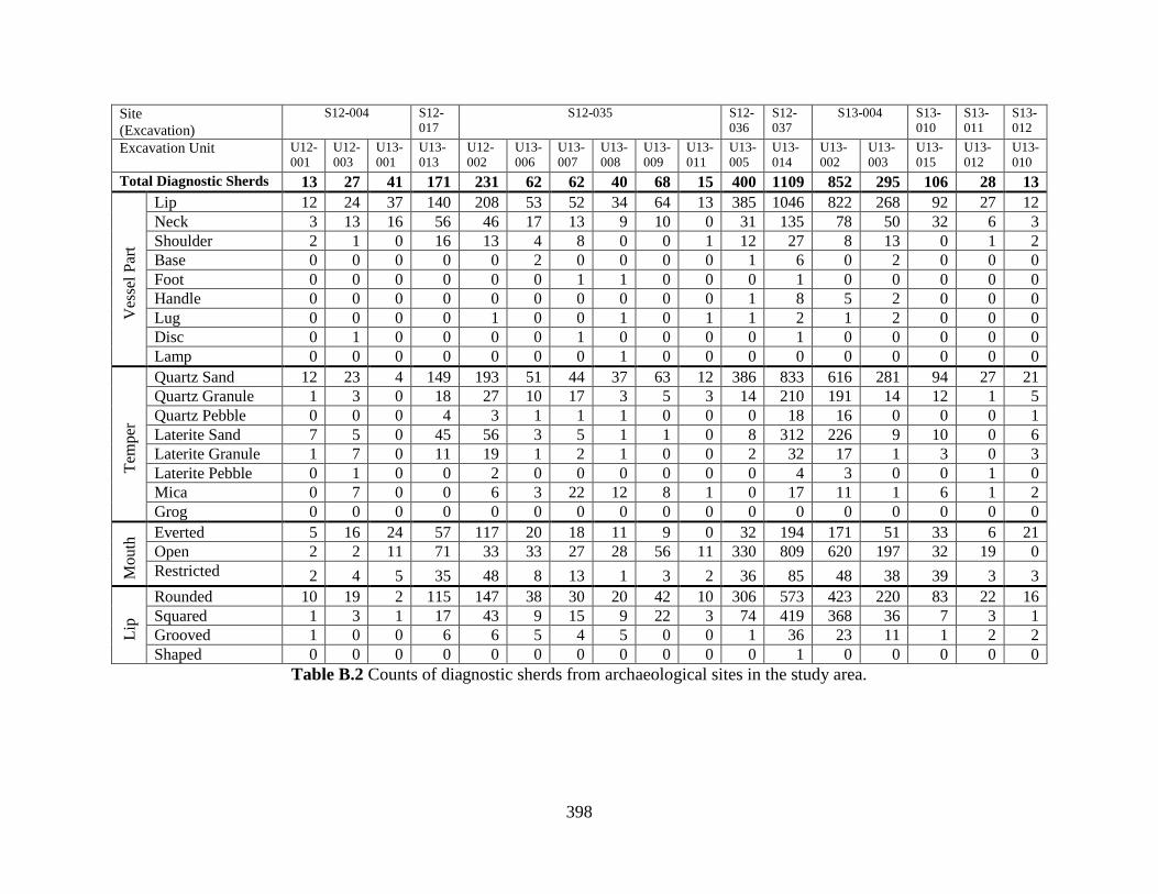
398
Site
(Excavation)
S12-004 S12-
017
S12-035 S12-
036
S12-
037
S13-004 S13-
010
S13-
011
S13-
012
Excavation Unit U12-
001
U12-
003
U13-
001
U13-
013
U12-
002
U13-
006
U13-
007
U13-
008
U13-
009
U13-
011
U13-
005
U13-
014
U13-
002
U13-
003
U13-
015
U13-
012
U13-
010
Total Diagnostic Sherds 13 27 41 171 231 62 62 40 68 15 400 1109 852 295 106 28 13
Ves
sel
Par
t
Lip 12 24 37 140 208 53 52 34 64 13 385 1046 822 268 92 27 12
Neck 3 13 16 56 46 17 13 9 10 0 31 135 78 50 32 6 3
Shoulder 2 1 0 16 13 4 8 0 0 1 12 27 8 13 0 1 2
Base 0 0 0 0 0 2 0 0 0 0 1 6 0 2 0 0 0
Foot 0 0 0 0 0 0 1 1 0 0 0 1 0 0 0 0 0
Handle 0 0 0 0 0 0 0 0 0 0 1 8 5 2 0 0 0
Lug 0 0 0 0 1 0 0 1 0 1 1 2 1 2 0 0 0
Disc 0 1 0 0 0 0 1 0 0 0 0 1 0 0 0 0 0
Lamp 0 0 0 0 0 0 0 1 0 0 0 0 0 0 0 0 0
Tem
per
Quartz Sand 12 23 4 149 193 51 44 37 63 12 386 833 616 281 94 27 21
Quartz Granule 1 3 0 18 27 10 17 3 5 3 14 210 191 14 12 1 5
Quartz Pebble 0 0 0 4 3 1 1 1 0 0 0 18 16 0 0 0 1
Laterite Sand 7 5 0 45 56 3 5 1 1 0 8 312 226 9 10 0 6
Laterite Granule 1 7 0 11 19 1 2 1 0 0 2 32 17 1 3 0 3
Laterite Pebble 0 1 0 0 2 0 0 0 0 0 0 4 3 0 0 1 0
Mica 0 7 0 0 6 3 22 12 8 1 0 17 11 1 6 1 2
Grog 0 0 0 0 0 0 0 0 0 0 0 0 0 0 0 0 0
Mo
uth
Everted 5 16 24 57 117 20 18 11 9 0 32 194 171 51 33 6 21
Open 2 2 11 71 33 33 27 28 56 11 330 809 620 197 32 19 0
Restricted 2 4 5 35 48 8 13 1 3 2 36 85 48 38 39 3 3
Lip
Rounded 10 19 2 115 147 38 30 20 42 10 306 573 423 220 83 22 16
Squared 1 3 1 17 43 9 15 9 22 3 74 419 368 36 7 3 1
Grooved 1 0 0 6 6 5 4 5 0 0 1 36 23 11 1 2 2
Shaped 0 0 0 0 0 0 0 0 0 0 0 1 0 0 0 0 0
Table B.2 Counts of diagnostic sherds from archaeological sites in the study area.
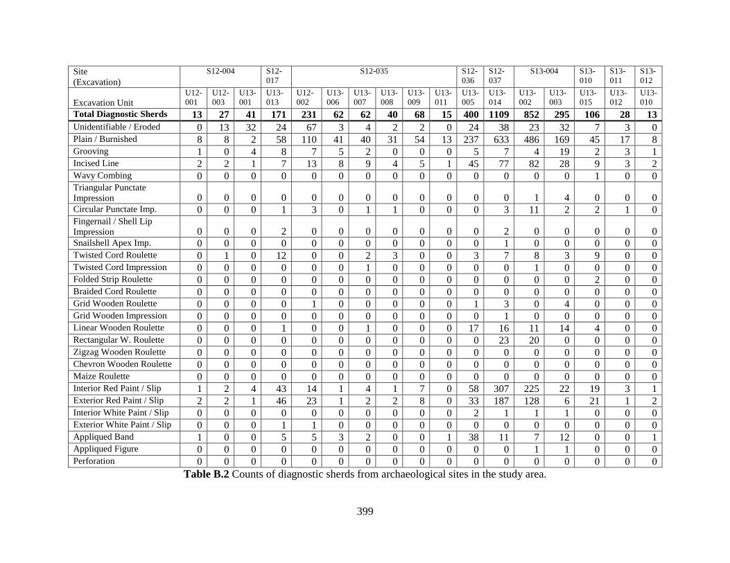
399
Site
(Excavation)
S12-004 S12-
017
S12-035 S12-
036
S12-
037
S13-004 S13-
010
S13-
011
S13-
012
Excavation Unit U12-
001
U12-
003
U13-
001
U13-
013
U12-
002
U13-
006
U13-
007
U13-
008
U13-
009
U13-
011
U13-
005
U13-
014
U13-
002
U13-
003
U13-
015
U13-
012
U13-
010
Total Diagnostic Sherds 13 27 41 171 231 62 62 40 68 15 400 1109 852 295 106 28 13
Unidentifiable / Eroded 0 13 32 24 67 3 4 2 2 0 24 38 23 32 7 3 0 Plain / Burnished 8 8 2 58 110 41 40 31 54 13 237 633 486 169 45 17 8 Grooving 1 0 4 8 7 5 2 0 0 0 5 7 4 19 2 3 1 Incised Line 2 2 1 7 13 8 9 4 5 1 45 77 82 28 9 3 2 Wavy Combing 0 0 0 0 0 0 0 0 0 0 0 0 0 0 1 0 0 Triangular Punctate
Impression 0 0 0 0 0 0 0 0 0 0 0 0 1 4 0 0 0 Circular Punctate Imp. 0 0 0 1 3 0 1 1 0 0 0 3 11 2 2 1 0 Fingernail / Shell Lip
Impression 0 0 0 2 0 0 0 0 0 0 0 2 0 0 0 0 0 Snailshell Apex Imp. 0 0 0 0 0 0 0 0 0 0 0 1 0 0 0 0 0 Twisted Cord Roulette 0 1 0 12 0 0 2 3 0 0 3 7 8 3 9 0 0 Twisted Cord Impression 0 0 0 0 0 0 1 0 0 0 0 0 1 0 0 0 0 Folded Strip Roulette 0 0 0 0 0 0 0 0 0 0 0 0 0 0 2 0 0 Braided Cord Roulette 0 0 0 0 0 0 0 0 0 0 0 0 0 0 0 0 0 Grid Wooden Roulette 0 0 0 0 1 0 0 0 0 0 1 3 0 4 0 0 0 Grid Wooden Impression 0 0 0 0 0 0 0 0 0 0 0 1 0 0 0 0 0 Linear Wooden Roulette 0 0 0 1 0 0 1 0 0 0 17 16 11 14 4 0 0 Rectangular W. Roulette 0 0 0 0 0 0 0 0 0 0 0 23 20 0 0 0 0 Zigzag Wooden Roulette 0 0 0 0 0 0 0 0 0 0 0 0 0 0 0 0 0 Chevron Wooden Roulette 0 0 0 0 0 0 0 0 0 0 0 0 0 0 0 0 0 Maize Roulette 0 0 0 0 0 0 0 0 0 0 0 0 0 0 0 0 0 Interior Red Paint / Slip 1 2 4 43 14 1 4 1 7 0 58 307 225 22 19 3 1 Exterior Red Paint / Slip 2 2 1 46 23 1 2 2 8 0 33 187 128 6 21 1 2 Interior White Paint / Slip 0 0 0 0 0 0 0 0 0 0 2 1 1 1 0 0 0 Exterior White Paint / Slip 0 0 0 1 1 0 0 0 0 0 0 0 0 0 0 0 0 Appliqued Band 1 0 0 5 5 3 2 0 0 1 38 11 7 12 0 0 1 Appliqued Figure 0 0 0 0 0 0 0 0 0 0 0 0 1 1 0 0 0 Perforation 0 0 0 0 0 0 0 0 0 0 0 0 0 0 0 0 0
Table B.2 Counts of diagnostic sherds from archaeological sites in the study area.
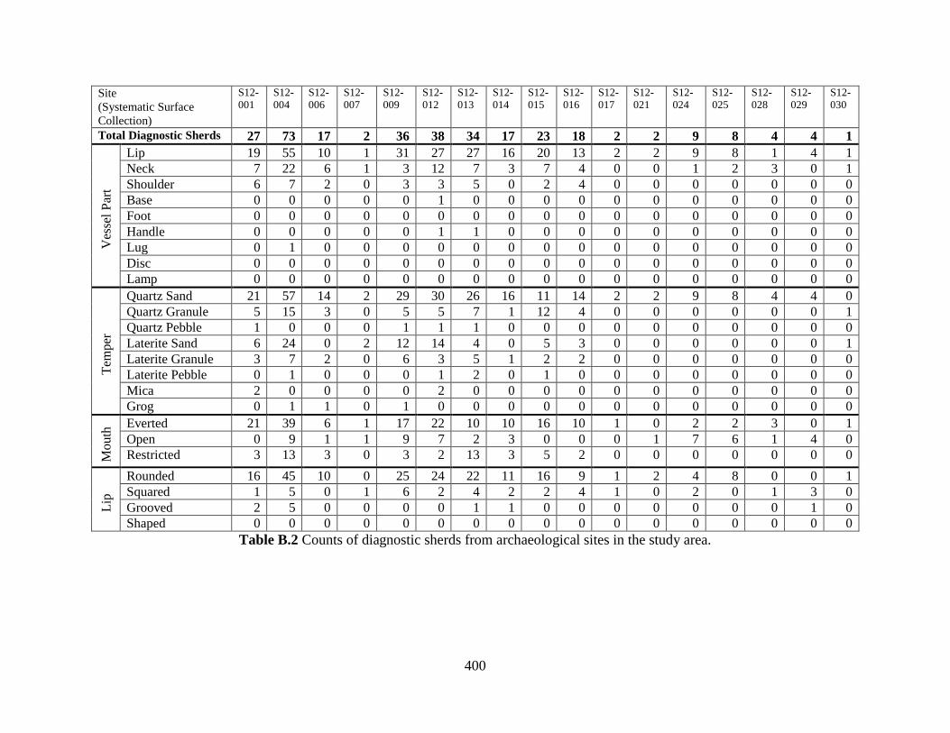
400
Site
(Systematic Surface
Collection)
S12-
001
S12-
004
S12-
006
S12-
007
S12-
009
S12-
012
S12-
013
S12-
014
S12-
015
S12-
016
S12-
017
S12-
021
S12-
024
S12-
025
S12-
028
S12-
029
S12-
030
Total Diagnostic Sherds 27 73 17 2 36 38 34 17 23 18 2 2 9 8 4 4 1
Ves
sel
Par
t
Lip 19 55 10 1 31 27 27 16 20 13 2 2 9 8 1 4 1
Neck 7 22 6 1 3 12 7 3 7 4 0 0 1 2 3 0 1
Shoulder 6 7 2 0 3 3 5 0 2 4 0 0 0 0 0 0 0
Base 0 0 0 0 0 1 0 0 0 0 0 0 0 0 0 0 0
Foot 0 0 0 0 0 0 0 0 0 0 0 0 0 0 0 0 0
Handle 0 0 0 0 0 1 1 0 0 0 0 0 0 0 0 0 0
Lug 0 1 0 0 0 0 0 0 0 0 0 0 0 0 0 0 0
Disc 0 0 0 0 0 0 0 0 0 0 0 0 0 0 0 0 0
Lamp 0 0 0 0 0 0 0 0 0 0 0 0 0 0 0 0 0
Tem
per
Quartz Sand 21 57 14 2 29 30 26 16 11 14 2 2 9 8 4 4 0
Quartz Granule 5 15 3 0 5 5 7 1 12 4 0 0 0 0 0 0 1
Quartz Pebble 1 0 0 0 1 1 1 0 0 0 0 0 0 0 0 0 0
Laterite Sand 6 24 0 2 12 14 4 0 5 3 0 0 0 0 0 0 1
Laterite Granule 3 7 2 0 6 3 5 1 2 2 0 0 0 0 0 0 0
Laterite Pebble 0 1 0 0 0 1 2 0 1 0 0 0 0 0 0 0 0
Mica 2 0 0 0 0 2 0 0 0 0 0 0 0 0 0 0 0
Grog 0 1 1 0 1 0 0 0 0 0 0 0 0 0 0 0 0
Mo
uth
Everted 21 39 6 1 17 22 10 10 16 10 1 0 2 2 3 0 1
Open 0 9 1 1 9 7 2 3 0 0 0 1 7 6 1 4 0
Restricted 3 13 3 0 3 2 13 3 5 2 0 0 0 0 0 0 0
Lip
Rounded 16 45 10 0 25 24 22 11 16 9 1 2 4 8 0 0 1
Squared 1 5 0 1 6 2 4 2 2 4 1 0 2 0 1 3 0
Grooved 2 5 0 0 0 0 1 1 0 0 0 0 0 0 0 1 0
Shaped 0 0 0 0 0 0 0 0 0 0 0 0 0 0 0 0 0
Table B.2 Counts of diagnostic sherds from archaeological sites in the study area.
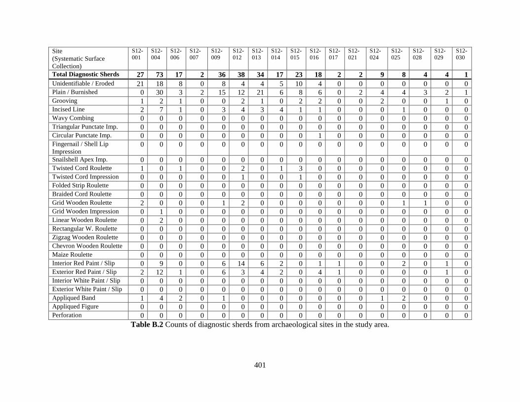
401
Site
(Systematic Surface
Collection)
S12-
001
S12-
004
S12-
006
S12-
007
S12-
009
S12-
012
S12-
013
S12-
014
S12-
015
S12-
016
S12-
017
S12-
021
S12-
024
S12-
025
S12-
028
S12-
029
S12-
030
Total Diagnostic Sherds 27 73 17 2 36 38 34 17 23 18 2 2 9 8 4 4 1
Unidentifiable / Eroded 21 18 8 0 8 4 4 5 10 4 0 0 0 0 0 0 0 Plain / Burnished 0 30 3 2 15 12 21 6 8 6 0 2 4 4 3 2 1 Grooving 1 2 1 0 0 2 1 0 2 2 0 0 2 0 0 1 0 Incised Line 2 7 1 0 3 4 3 4 1 1 0 0 0 1 0 0 0 Wavy Combing 0 0 0 0 0 0 0 0 0 0 0 0 0 0 0 0 0 Triangular Punctate Imp. 0 0 0 0 0 0 0 0 0 0 0 0 0 0 0 0 0 Circular Punctate Imp. 0 0 0 0 0 0 0 0 0 1 0 0 0 0 0 0 0 Fingernail / Shell Lip
Impression 0 0 0 0 0 0 0 0 0 0 0 0 0 0 0 0 0
Snailshell Apex Imp. 0 0 0 0 0 0 0 0 0 0 0 0 0 0 0 0 0 Twisted Cord Roulette 1 0 1 0 0 2 0 1 3 0 0 0 0 0 0 0 0 Twisted Cord Impression 0 0 0 0 0 1 0 0 1 0 0 0 0 0 0 0 0 Folded Strip Roulette 0 0 0 0 0 0 0 0 0 0 0 0 0 0 0 0 0 Braided Cord Roulette 0 0 0 0 0 0 0 0 0 0 0 0 0 0 0 0 0 Grid Wooden Roulette 2 0 0 0 1 2 0 0 0 0 0 0 0 1 1 0 0 Grid Wooden Impression 0 1 0 0 0 0 0 0 0 0 0 0 0 0 0 0 0 Linear Wooden Roulette 0 2 0 0 0 0 0 0 0 0 0 0 0 0 0 0 0 Rectangular W. Roulette 0 0 0 0 0 0 0 0 0 0 0 0 0 0 0 0 0 Zigzag Wooden Roulette 0 0 0 0 0 0 0 0 0 0 0 0 0 0 0 0 0 Chevron Wooden Roulette 0 0 0 0 0 0 0 0 0 0 0 0 0 0 0 0 0 Maize Roulette 0 0 0 0 0 0 0 0 0 0 0 0 0 0 0 0 0 Interior Red Paint / Slip 0 9 0 0 6 14 6 2 0 1 1 0 0 2 0 1 0 Exterior Red Paint / Slip 2 12 1 0 6 3 4 2 0 4 1 0 0 0 0 1 0 Interior White Paint / Slip 0 0 0 0 0 0 0 0 0 0 0 0 0 0 0 0 0 Exterior White Paint / Slip 0 0 0 0 0 0 0 0 0 0 0 0 0 0 0 0 0 Appliqued Band 1 4 2 0 1 0 0 0 0 0 0 0 1 2 0 0 0 Appliqued Figure 0 0 0 0 0 0 0 0 0 0 0 0 0 0 0 0 0 Perforation 0 0 0 0 0 0 0 0 0 0 0 0 0 0 0 0 0
Table B.2 Counts of diagnostic sherds from archaeological sites in the study area.
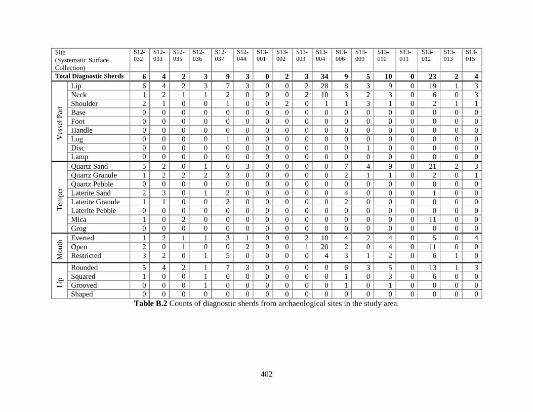
402
Site
(Systematic Surface
Collection)
S12-
032
S12-
033
S12-
035
S12-
036
S12-
037
S12-
044
S13-
001
S13-
002
S13-
003
S13-
004
S13-
006
S13-
009
S13-
010
S13-
011
S13-
012
S13-
013
S13-
015
Total Diagnostic Sherds 6 4 2 3 9 3 0 2 3 34 9 5 10 0 23 2 4
Ves
sel
Par
t
Lip 6 4 2 3 7 3 0 0 2 28 8 3 9 0 19 1 3
Neck 1 2 1 1 2 0 0 0 2 10 3 2 3 0 6 0 3
Shoulder 2 1 0 0 1 0 0 2 0 1 1 3 1 0 2 1 1
Base 0 0 0 0 0 0 0 0 0 0 0 0 0 0 0 0 0
Foot 0 0 0 0 0 0 0 0 0 0 0 0 0 0 0 0 0
Handle 0 0 0 0 0 0 0 0 0 0 0 0 0 0 0 0 0
Lug 0 0 0 0 1 0 0 0 0 0 0 0 0 0 0 0 0
Disc 0 0 0 0 0 0 0 0 0 0 0 1 0 0 0 0 0
Lamp 0 0 0 0 0 0 0 0 0 0 0 0 0 0 0 0 0
Tem
per
Quartz Sand 5 2 0 1 6 3 0 0 0 0 7 4 9 0 21 2 3
Quartz Granule 1 2 2 2 3 0 0 0 0 0 2 1 1 0 2 0 1
Quartz Pebble 0 0 0 0 0 0 0 0 0 0 0 0 0 0 0 0 0
Laterite Sand 2 3 0 1 2 0 0 0 0 0 4 0 0 0 1 0 0
Laterite Granule 1 1 0 0 2 0 0 0 0 0 2 0 0 0 0 0 0
Laterite Pebble 0 0 0 0 0 0 0 0 0 0 0 0 0 0 0 0 0
Mica 1 0 2 0 0 0 0 0 0 0 0 0 0 0 11 0 0
Grog 0 0 0 0 0 0 0 0 0 0 0 0 0 0 0 0 0
Mo
uth
Everted 1 2 1 1 3 1 0 0 2 10 4 2 4 0 5 0 4
Open 2 0 1 0 0 2 0 0 1 20 2 0 4 0 11 0 0
Restricted 3 2 0 1 5 0 0 0 0 4 3 1 2 0 6 1 0
Lip
Rounded 5 4 2 1 7 3 0 0 0 0 6 3 5 0 13 1 3
Squared 1 0 0 1 0 0 0 0 0 0 1 0 3 0 6 0 0
Grooved 0 0 0 1 0 0 0 0 0 0 1 0 1 0 0 0 0
Shaped 0 0 0 0 0 0 0 0 0 0 0 0 0 0 0 0 0
Table B.2 Counts of diagnostic sherds from archaeological sites in the study area.

403
Site
(Systematic Surface
Collection)
S12-
032
S12-
033
S12-
035
S12-
036
S12-
037
S12-
044
S13-
001
S13-
002
S13-
003
S13-
004
S13-
006
S13-
009
S13-
010
S13-
011
S13-
012
S13-
013
S13-
015
Total Diagnostic Sherds 6 4 2 3 9 3 0 2 3 34 9 5 10 0 23 2 4
Unidentifiable / Eroded 0 1 1 3 2 0 0 0 0 14 4 0 1 0 0 0 0 Plain / Burnished 1 1 1 0 5 0 0 0 2 2 2 2 3 0 11 0 3 Grooving 0 0 0 0 0 0 0 0 1 3 0 0 1 0 2 0 0 Incised Line 1 0 0 0 0 0 0 2 0 6 2 1 2 0 4 2 1 Wavy Combing 0 0 0 0 0 0 0 0 0 0 0 0 0 0 0 0 0 Triangular Punctate Imp. 0 0 0 0 0 0 0 0 0 0 1 0 0 0 0 0 0 Circular Punctate Imp. 0 0 0 0 0 0 0 1 0 1 0 2 0 0 1 0 0 Fingernail / Shell Lip
Impression 0 0 0 0 0 0 0 0 0 0 0 0 0 0 0 0 0 Snailshell Apex Imp. 0 0 0 0 0 0 0 0 0 0 0 0 0 0 0 0 0 Twisted Cord Roulette 2 1 0 0 0 0 0 0 0 2 0 0 0 0 1 1 1 Twisted Cord Impression 0 0 0 0 0 0 0 0 0 0 0 0 0 0 0 0 0 Folded Strip Roulette 0 0 0 0 0 0 0 0 0 0 0 0 0 0 0 0 0 Braided Cord Roulette 0 0 0 0 0 0 0 0 0 0 0 0 0 0 0 0 0 Grid Wooden Roulette 0 0 0 0 0 0 0 0 0 1 0 0 0 0 0 0 0 Grid Wooden Impression 0 0 0 0 0 0 0 0 0 0 0 0 0 0 0 0 0 Linear Wooden Roulette 0 0 0 0 0 0 0 0 0 0 0 0 1 0 2 0 0 Rectangular W. Roulette 0 0 0 0 0 0 0 0 0 0 0 0 0 0 0 0 0 Zigzag Wooden Roulette 0 0 0 0 0 0 0 0 0 0 0 0 0 0 0 0 0 Chevron Wooden Roulette 0 0 0 0 0 0 0 0 0 0 0 0 0 0 0 0 0 Maize Roulette 0 0 0 0 0 0 0 0 0 0 0 0 0 0 0 0 0 Interior Red Paint / Slip 1 0 0 0 1 0 0 0 0 8 0 0 1 0 1 1 0 Exterior Red Paint / Slip 1 1 0 0 1 0 0 0 0 6 0 1 2 0 1 0 0 Interior White Paint / Slip 0 0 0 0 0 0 0 0 0 0 0 0 0 0 0 0 0 Exterior White Paint / Slip 0 0 0 0 0 1 0 0 0 0 0 0 0 0 0 0 0 Appliqued Band 0 0 0 0 0 0 0 0 0 1 2 1 0 0 6 1 0 Appliqued Figure 0 0 0 0 0 0 0 0 0 0 0 0 0 0 0 0 0 Perforation 0 0 0 0 0 0 0 0 0 0 0 0 0 0 0 0 0
Table B.2 Counts of diagnostic sherds from archaeological sites in the study area.

404
Site
(Systematic Surface Collection) S13-
023
S13-
027
S13-
029
Total Diagnostic Sherds 2 4 1
Unidentifiable / Eroded 1 2 0 Plain / Burnished 1 0 0 Grooving 0 1 0 Incised Line 0 0 0 Wavy Combing 0 0 0 Triangular Punctate Impression 0 0 0 Circular Punctate Impression 0 0 0 Fingernail / Shell Lip
Impression 0 0 0
Snailshell Apex Impression 0 0 0 Twisted Cord Roulette 0 1 0 Twisted Cord Impression 0 0 0 Folded Strip Roulette 0 0 0 Braided Cord Roulette 0 0 0 Grid Wooden Roulette 0 0 0 Grid Wooden Impression 0 0 0 Linear Wooden Roulette 0 0 0 Rectangular Wooden Roulette 0 0 0 Triangle Wooden Roulette 0 0 0 Chevron Wooden Roulette 0 0 0 Maize Roulette 0 0 0 Interior Red Paint / Slip 0 1 1 Exterior Red Paint / Slip 0 0 1 Interior White Paint / Slip 0 0 0 Exterior White Paint / Slip 0 0 0 Appliqued Band 0 0 0 Appliqued Figure / Geometric 0 0 0 Perforation 0 0 0
Table B.2 Counts of diagnostic sherds from archaeological sites in the study area.
Site
(Systematic Surface Collection)
S13-
023
S13-
027
S13-
029
Total Diagnostic Sherds 2 4 1
Ves
sel
Par
t
Lip 2 3 1
Neck 0 4 1
Shoulder 0 0 0
Base 0 0 0
Foot 1 0 0
Handle 0 0 0
Lug 0 0 0
Disc 0 0 0
Lamp 1 0 0
Tem
per
Quartz/Feldspar Sand 0 4 1
Quartz/Feldspar Granule 1 0 0
Quartz/Feldspar Pebble 1 0 0
Laterite/Granite Sand 0 2 0
Laterite/Granite Granule 0 0 0
Laterite/Granite Pebble 0 0 0
Mica 2 1 1
Grog 0 0 0
Mo
uth
Everted 0 4 1
Open 2 0 0
Restricted 0 0 0
Lip
Rounded 2 3 1
Squared 0 0 0
Grooved 0 0 0
Shaped 0 0 0
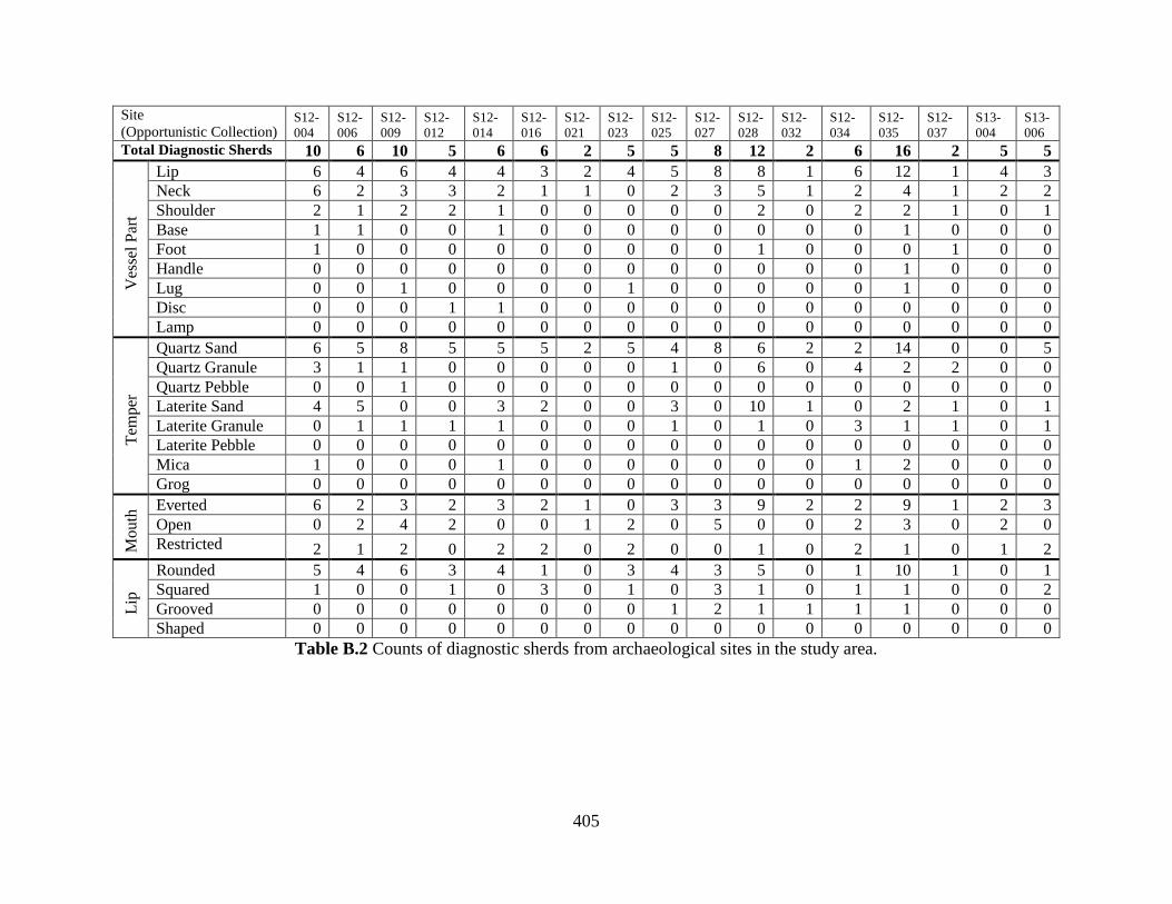
405
Site
(Opportunistic Collection) S12-
004
S12-
006
S12-
009
S12-
012
S12-
014
S12-
016
S12-
021
S12-
023
S12-
025
S12-
027
S12-
028
S12-
032
S12-
034
S12-
035
S12-
037
S13-
004
S13-
006
Total Diagnostic Sherds 10 6 10 5 6 6 2 5 5 8 12 2 6 16 2 5 5
Ves
sel
Par
t
Lip 6 4 6 4 4 3 2 4 5 8 8 1 6 12 1 4 3
Neck 6 2 3 3 2 1 1 0 2 3 5 1 2 4 1 2 2
Shoulder 2 1 2 2 1 0 0 0 0 0 2 0 2 2 1 0 1
Base 1 1 0 0 1 0 0 0 0 0 0 0 0 1 0 0 0
Foot 1 0 0 0 0 0 0 0 0 0 1 0 0 0 1 0 0
Handle 0 0 0 0 0 0 0 0 0 0 0 0 0 1 0 0 0
Lug 0 0 1 0 0 0 0 1 0 0 0 0 0 1 0 0 0
Disc 0 0 0 1 1 0 0 0 0 0 0 0 0 0 0 0 0
Lamp 0 0 0 0 0 0 0 0 0 0 0 0 0 0 0 0 0
Tem
per
Quartz Sand 6 5 8 5 5 5 2 5 4 8 6 2 2 14 0 0 5
Quartz Granule 3 1 1 0 0 0 0 0 1 0 6 0 4 2 2 0 0
Quartz Pebble 0 0 1 0 0 0 0 0 0 0 0 0 0 0 0 0 0
Laterite Sand 4 5 0 0 3 2 0 0 3 0 10 1 0 2 1 0 1
Laterite Granule 0 1 1 1 1 0 0 0 1 0 1 0 3 1 1 0 1
Laterite Pebble 0 0 0 0 0 0 0 0 0 0 0 0 0 0 0 0 0
Mica 1 0 0 0 1 0 0 0 0 0 0 0 1 2 0 0 0
Grog 0 0 0 0 0 0 0 0 0 0 0 0 0 0 0 0 0
Mo
uth
Everted 6 2 3 2 3 2 1 0 3 3 9 2 2 9 1 2 3
Open 0 2 4 2 0 0 1 2 0 5 0 0 2 3 0 2 0
Restricted 2 1 2 0 2 2 0 2 0 0 1 0 2 1 0 1 2
Lip
Rounded 5 4 6 3 4 1 0 3 4 3 5 0 1 10 1 0 1
Squared 1 0 0 1 0 3 0 1 0 3 1 0 1 1 0 0 2
Grooved 0 0 0 0 0 0 0 0 1 2 1 1 1 1 0 0 0
Shaped 0 0 0 0 0 0 0 0 0 0 0 0 0 0 0 0 0
Table B.2 Counts of diagnostic sherds from archaeological sites in the study area.
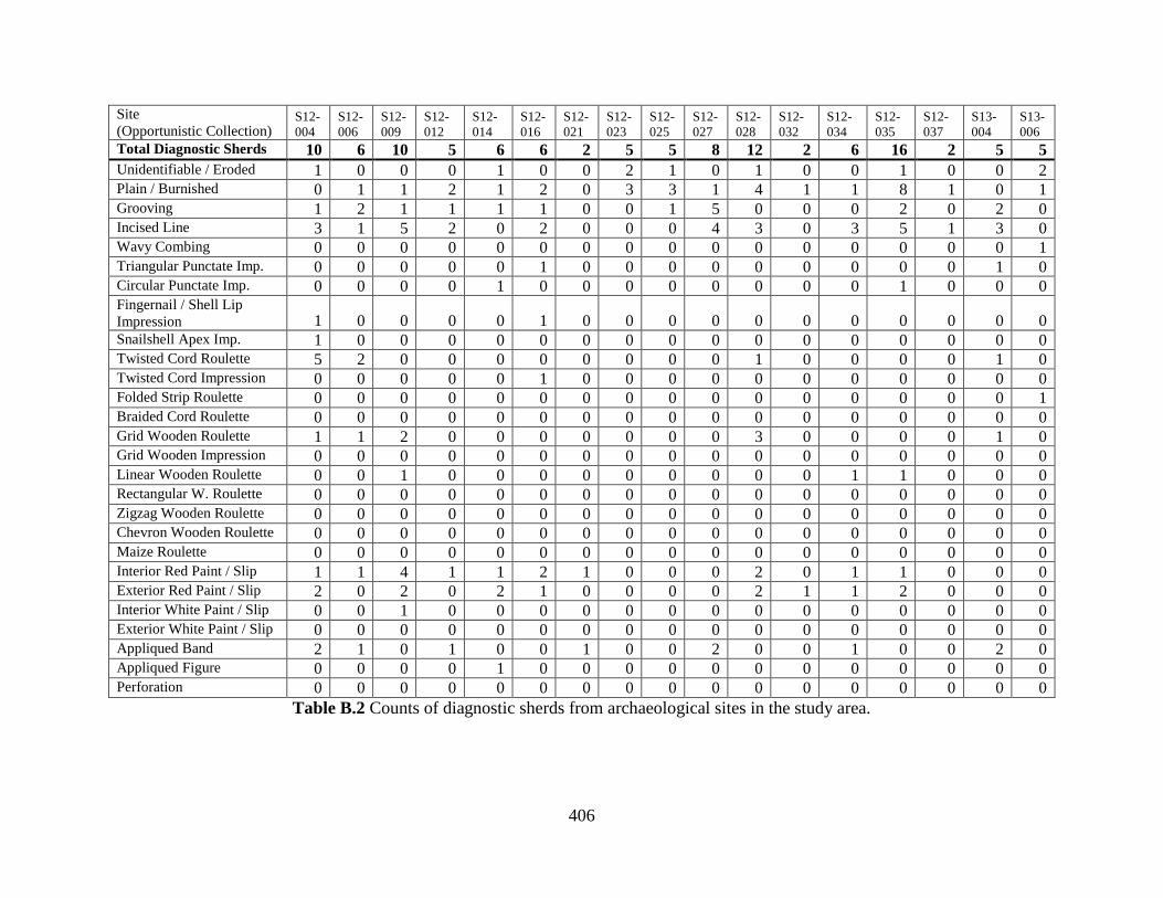
406
Site
(Opportunistic Collection) S12-
004
S12-
006
S12-
009
S12-
012
S12-
014
S12-
016
S12-
021
S12-
023
S12-
025
S12-
027
S12-
028
S12-
032
S12-
034
S12-
035
S12-
037
S13-
004
S13-
006
Total Diagnostic Sherds 10 6 10 5 6 6 2 5 5 8 12 2 6 16 2 5 5
Unidentifiable / Eroded 1 0 0 0 1 0 0 2 1 0 1 0 0 1 0 0 2 Plain / Burnished 0 1 1 2 1 2 0 3 3 1 4 1 1 8 1 0 1 Grooving 1 2 1 1 1 1 0 0 1 5 0 0 0 2 0 2 0 Incised Line 3 1 5 2 0 2 0 0 0 4 3 0 3 5 1 3 0 Wavy Combing 0 0 0 0 0 0 0 0 0 0 0 0 0 0 0 0 1 Triangular Punctate Imp. 0 0 0 0 0 1 0 0 0 0 0 0 0 0 0 1 0 Circular Punctate Imp. 0 0 0 0 1 0 0 0 0 0 0 0 0 1 0 0 0 Fingernail / Shell Lip
Impression 1 0 0 0 0 1 0 0 0 0 0 0 0 0 0 0 0 Snailshell Apex Imp. 1 0 0 0 0 0 0 0 0 0 0 0 0 0 0 0 0 Twisted Cord Roulette 5 2 0 0 0 0 0 0 0 0 1 0 0 0 0 1 0 Twisted Cord Impression 0 0 0 0 0 1 0 0 0 0 0 0 0 0 0 0 0 Folded Strip Roulette 0 0 0 0 0 0 0 0 0 0 0 0 0 0 0 0 1 Braided Cord Roulette 0 0 0 0 0 0 0 0 0 0 0 0 0 0 0 0 0 Grid Wooden Roulette 1 1 2 0 0 0 0 0 0 0 3 0 0 0 0 1 0 Grid Wooden Impression 0 0 0 0 0 0 0 0 0 0 0 0 0 0 0 0 0 Linear Wooden Roulette 0 0 1 0 0 0 0 0 0 0 0 0 1 1 0 0 0 Rectangular W. Roulette 0 0 0 0 0 0 0 0 0 0 0 0 0 0 0 0 0 Zigzag Wooden Roulette 0 0 0 0 0 0 0 0 0 0 0 0 0 0 0 0 0 Chevron Wooden Roulette 0 0 0 0 0 0 0 0 0 0 0 0 0 0 0 0 0 Maize Roulette 0 0 0 0 0 0 0 0 0 0 0 0 0 0 0 0 0 Interior Red Paint / Slip 1 1 4 1 1 2 1 0 0 0 2 0 1 1 0 0 0 Exterior Red Paint / Slip 2 0 2 0 2 1 0 0 0 0 2 1 1 2 0 0 0 Interior White Paint / Slip 0 0 1 0 0 0 0 0 0 0 0 0 0 0 0 0 0 Exterior White Paint / Slip 0 0 0 0 0 0 0 0 0 0 0 0 0 0 0 0 0 Appliqued Band 2 1 0 1 0 0 1 0 0 2 0 0 1 0 0 2 0 Appliqued Figure 0 0 0 0 1 0 0 0 0 0 0 0 0 0 0 0 0 Perforation 0 0 0 0 0 0 0 0 0 0 0 0 0 0 0 0 0
Table B.2 Counts of diagnostic sherds from archaeological sites in the study area.
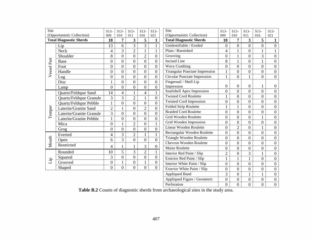
407
Site
(Opportunistic Collection) S13-
009
S13-
010
S13-
011
S13-
016
S13-
021
Total Diagnostic Sherds 18 7 3 5 1
Unidentifiable / Eroded 0 0 0 0 0 Plain / Burnished 4 1 0 1 1 Grooving 0 1 0 3 0 Incised Line 8 1 0 1 0 Wavy Combing 0 0 0 0 0 Triangular Punctate Impression 1 0 0 0 0 Circular Punctate Impression 1 0 1 0 0 Fingernail / Shell Lip
Impression 0 0 0 1 0 Snailshell Apex Impression 0 0 0 0 0 Twisted Cord Roulette 1 0 0 0 0 Twisted Cord Impression 0 0 0 0 0 Folded Strip Roulette 1 1 0 0 0 Braided Cord Roulette 0 0 0 0 0 Grid Wooden Roulette 0 0 0 1 0 Grid Wooden Impression 0 0 0 0 0 Linear Wooden Roulette 0 2 0 1 0 Rectangular Wooden Roulette 0 0 0 0 0 Triangle Wooden Roulette 0 0 0 0 0 Chevron Wooden Roulette 0 0 0 0 0 Maize Roulette 0 0 0 0 0 Interior Red Paint / Slip 2 0 3 1 0 Exterior Red Paint / Slip 1 1 1 0 0 Interior White Paint / Slip 0 0 0 0 0 Exterior White Paint / Slip 0 0 0 0 0 Appliqued Band 3 0 1 1 0 Appliqued Figure / Geometric 0 0 0 0 0 Perforation 0 0 0 0 0
Table B.2 Counts of diagnostic sherds from archaeological sites in the study area.
Site
(Opportunistic Collection) S13-
009
S13-
010
S13-
011
S13-
016
S13-
021
Total Diagnostic Sherds 18 7 3 5 1
Ves
sel
Par
t Lip 13 6 3 3 1
Neck 4 3 2 1 1
Shoulder 8 0 0 2 0
Base 0 0 0 0 0
Foot 0 0 0 0 0
Handle 0 0 0 0 0
Lug 0 0 0 0 0
Disc 1 0 0 0 0
Lamp 0 0 0 0 0
Tem
per
Quartz/Feldspar Sand 14 4 1 4 1
Quartz/Feldspar Granule 3 3 2 1 0
Quartz/Feldspar Pebble 1 0 0 0 0
Laterite/Granite Sand 2 1 0 2 0
Laterite/Granite Granule 3 0 0 0 0
Laterite/Granite Pebble 1 0 0 0 0
Mica 0 1 2 0 1
Grog 0 0 0 0 0
Mo
uth
Everted 4 3 2 1 1
Open 6 3 0 0 0
Restricted 4 1 1 3 0
Lip
Rounded 10 5 3 2 1
Squared 3 0 0 0 0
Grooved 0 1 0 1 0
Shaped 0 0 0 0 0
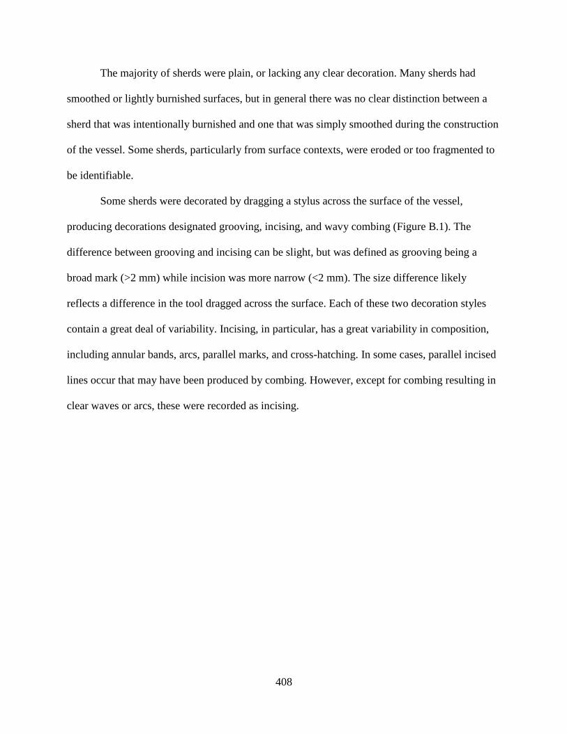
408
The majority of sherds were plain, or lacking any clear decoration. Many sherds had
smoothed or lightly burnished surfaces, but in general there was no clear distinction between a
sherd that was intentionally burnished and one that was simply smoothed during the construction
of the vessel. Some sherds, particularly from surface contexts, were eroded or too fragmented to
be identifiable.
Some sherds were decorated by dragging a stylus across the surface of the vessel,
producing decorations designated grooving, incising, and wavy combing (Figure B.1). The
difference between grooving and incising can be slight, but was defined as grooving being a
broad mark (>2 mm) while incision was more narrow (<2 mm). The size difference likely
reflects a difference in the tool dragged across the surface. Each of these two decoration styles
contain a great deal of variability. Incising, in particular, has a great variability in composition,
including annular bands, arcs, parallel marks, and cross-hatching. In some cases, parallel incised
lines occur that may have been produced by combing. However, except for combing resulting in
clear waves or arcs, these were recorded as incising.
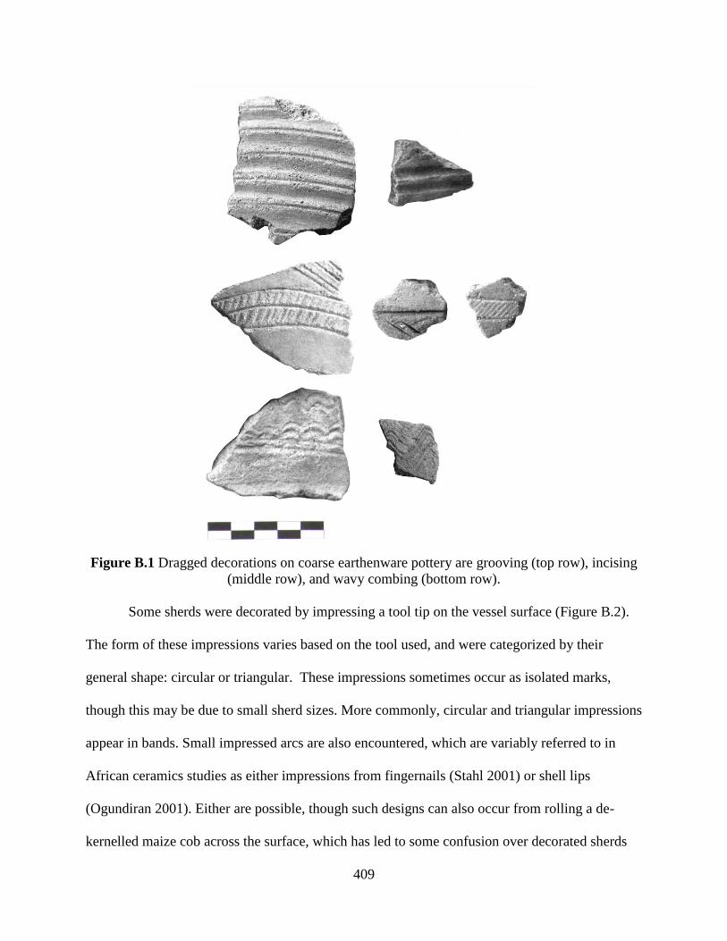
409
Figure B.1 Dragged decorations on coarse earthenware pottery are grooving (top row), incising
(middle row), and wavy combing (bottom row).
Some sherds were decorated by impressing a tool tip on the vessel surface (Figure B.2).
The form of these impressions varies based on the tool used, and were categorized by their
general shape: circular or triangular. These impressions sometimes occur as isolated marks,
though this may be due to small sherd sizes. More commonly, circular and triangular impressions
appear in bands. Small impressed arcs are also encountered, which are variably referred to in
African ceramics studies as either impressions from fingernails (Stahl 2001) or shell lips
(Ogundiran 2001). Either are possible, though such designs can also occur from rolling a de-
kernelled maize cob across the surface, which has led to some confusion over decorated sherds
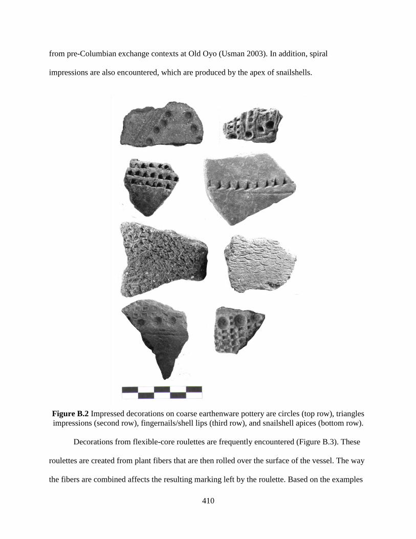
410
from pre-Columbian exchange contexts at Old Oyo (Usman 2003). In addition, spiral
impressions are also encountered, which are produced by the apex of snailshells.
Figure B.2 Impressed decorations on coarse earthenware pottery are circles (top row), triangles
impressions (second row), fingernails/shell lips (third row), and snailshell apices (bottom row).
Decorations from flexible-core roulettes are frequently encountered (Figure B.3). These
roulettes are created from plant fibers that are then rolled over the surface of the vessel. The way
the fibers are combined affects the resulting marking left by the roulette. Based on the examples

411
illustrated in Haour et al. 2011, three general roulette forms are present in the assemblage:
braided, knotted, and twisted cord roulettes. However, there is great variability within each type
stemming from differences in the creation and wear of the roulette.
Figure B.3 Rouletted decorations on coarse earthenware pottery are from braided cords (top
row), knotted strips (middle row), and twisted cords (bottom row).
Decorations from rigid-core roulettes are also common. These are produced by rolling a
carved implement, likely wood, over the surface of the vessel. The carved form produces a
negative-relief in the clay. The majority are simple rectilinear designs (Figure B.4). These are
square grids, rectangles (sometimes referred to as “ladders” or “lozenges”), and parallel linear
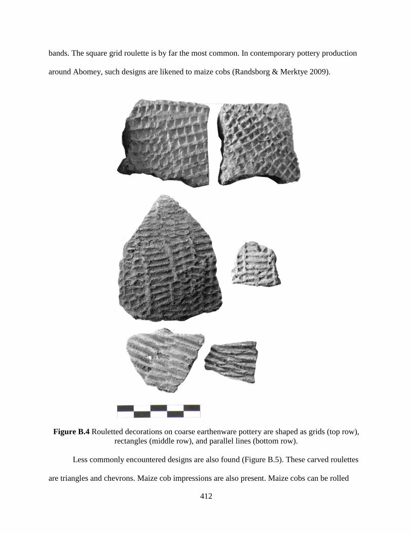
412
bands. The square grid roulette is by far the most common. In contemporary pottery production
around Abomey, such designs are likened to maize cobs (Randsborg & Merktye 2009).
Figure B.4 Rouletted decorations on coarse earthenware pottery are shaped as grids (top row),
rectangles (middle row), and parallel lines (bottom row).
Less commonly encountered designs are also found (Figure B.5). These carved roulettes
are triangles and chevrons. Maize cob impressions are also present. Maize cobs can be rolled
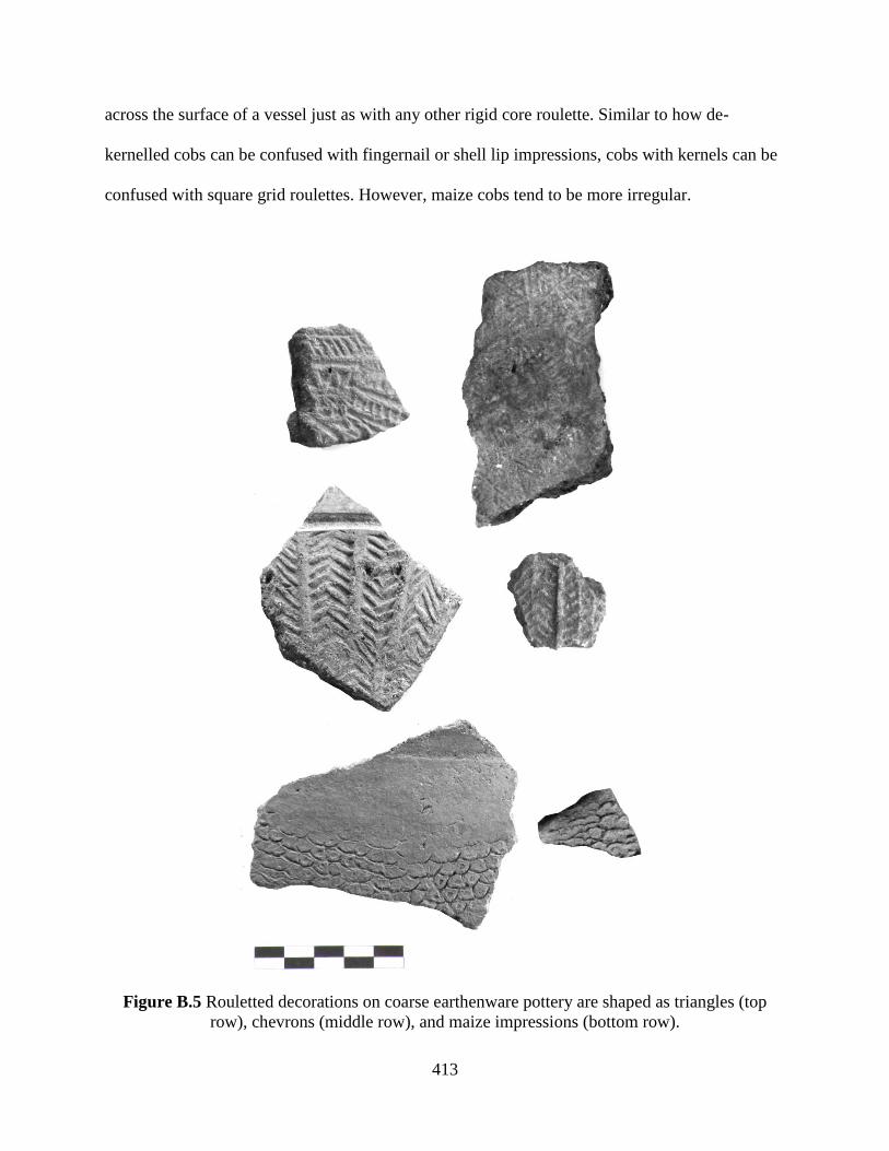
413
across the surface of a vessel just as with any other rigid core roulette. Similar to how de-
kernelled cobs can be confused with fingernail or shell lip impressions, cobs with kernels can be
confused with square grid roulettes. However, maize cobs tend to be more irregular.
Figure B.5 Rouletted decorations on coarse earthenware pottery are shaped as triangles (top
row), chevrons (middle row), and maize impressions (bottom row).
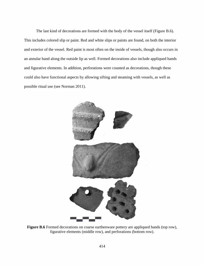
414
The last kind of decorations are formed with the body of the vessel itself (Figure B.6).
This includes colored slip or paint. Red and white slips or paints are found, on both the interior
and exterior of the vessel. Red paint is most often on the inside of vessels, though also occurs in
an annular band along the outside lip as well. Formed decorations also include appliqued bands
and figurative elements. In addition, perforations were counted as decorations, though these
could also have functional aspects by allowing sifting and steaming with vessels, as well as
possible ritual use (see Norman 2011).
Figure B.6 Formed decorations on coarse earthenware pottery are appliqued bands (top row),
figurative elements (middle row), and perforations (bottom row).

415
2. Coarse Earthenware Beads
Three beads were recovered from two sites: S12-035 (Phase I) and S13-004 (Figure B.7).
Each bead is roughly spherical, though have flattened axial faces. The hole is formed by a rolled
tube that the rest of the bead is constructed around, reflecting a two stage construction process.
All three beads have evidence of paint on the surface, including one bead that still has alternating
red and white annular bands. The visible temper of all three beads is a quartz/feldspar sand.
Figure B.7 Coarse earthenware beads from S12-035 (top) and S13-004 (middle and bottom).
3. Coarse Earthenware Pipes
Pipe bowl fragments were recovered from several sites and contexts (Table B.3). The
clay fabrics and surface decoration techniques are drawn from the same range as the coarse
earthenware ceramics (Figure B.8). The bowl fragments are typically too small to identify
specific styles, though some carinated fragments are similar in bowl form to European-inspired

416
designs that developed after the 18th century CE (Philips 1983; Handler 2008). Other bowl forms
are general cylinders as well as slightly everted bowls.
S
ite
Con
text
Bow
l F
ragm
ents
Surface Decoration
Pla
in /
Burn
ished
Gro
ovin
g
Inci
sed L
ine
Tw
iste
d C
ord
Roule
tte
Chev
ron W
ooden
Roule
tte
Inte
rior
Red
Pai
nt
Exte
rior
Red
Pai
nt
Appli
qued
Ban
d
S12-035 Excavation 2 1 1 1
S12-037 Excavation 2 1 1 1 1
S13-004 Excavation 10 3 3 4 4 1 1
S13-011 Excavation 1 1
S12-004 Surface 1 1 1
S13-017 Surface 1 1 1
Table B.3 Pipe bowl fragments from archaeological sites in the study area.
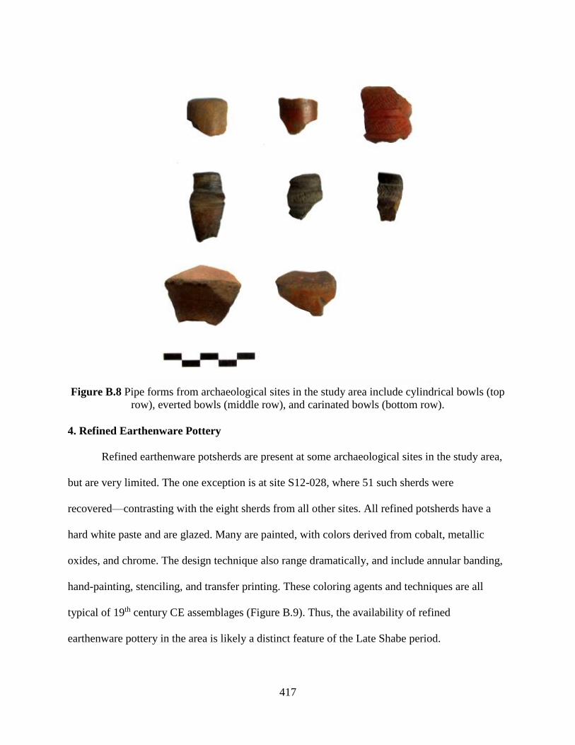
417
Figure B.8 Pipe forms from archaeological sites in the study area include cylindrical bowls (top
row), everted bowls (middle row), and carinated bowls (bottom row).
4. Refined Earthenware Pottery
Refined earthenware potsherds are present at some archaeological sites in the study area,
but are very limited. The one exception is at site S12-028, where 51 such sherds were
recovered—contrasting with the eight sherds from all other sites. All refined potsherds have a
hard white paste and are glazed. Many are painted, with colors derived from cobalt, metallic
oxides, and chrome. The design technique also range dramatically, and include annular banding,
hand-painting, stenciling, and transfer printing. These coloring agents and techniques are all
typical of 19th century CE assemblages (Figure B.9). Thus, the availability of refined
earthenware pottery in the area is likely a distinct feature of the Late Shabe period.

418
Figure B.9 Refined earthenware ceramics from S12-028 demonstrating the range of decoration
techniques (annular banding, hand-painting, stenciling, and transfer printing) and coloring agents
(cobalt, metallic oxides, and chrome).
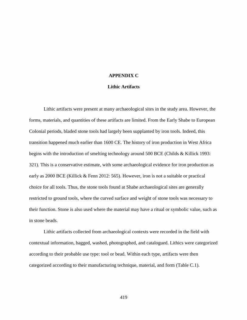
419
APPENDIX C
Lithic Artifacts
Lithic artifacts were present at many archaeological sites in the study area. However, the
forms, materials, and quantities of these artifacts are limited. From the Early Shabe to European
Colonial periods, bladed stone tools had largely been supplanted by iron tools. Indeed, this
transition happened much earlier than 1600 CE. The history of iron production in West Africa
begins with the introduction of smelting technology around 500 BCE (Childs & Killick 1993:
321). This is a conservative estimate, with some archaeological evidence for iron production as
early as 2000 BCE (Killick & Fenn 2012: 565). However, iron is not a suitable or practical
choice for all tools. Thus, the stone tools found at Shabe archaeological sites are generally
restricted to ground tools, where the curved surface and weight of stone tools was necessary to
their function. Stone is also used where the material may have a ritual or symbolic value, such as
in stone beads.
Lithic artifacts collected from archaeological contexts were recorded in the field with
contextual information, bagged, washed, photographed, and catalogued. Lithics were categorized
according to their probable use type: tool or bead. Within each type, artifacts were then
categorized according to their manufacturing technique, material, and form (Table C.1).
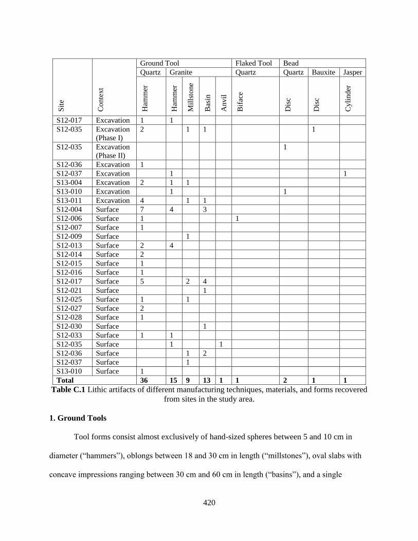
420
S
ite
Co
nte
xt
Ground Tool Flaked Tool Bead
Quartz Granite Quartz Quartz Bauxite Jasper
Ham
mer
Ham
mer
Mil
lsto
ne
Bas
in
An
vil
Bif
ace
Dis
c
Dis
c
Cy
lin
der
S12-017 Excavation 1 1
S12-035 Excavation
(Phase I)
2 1 1 1
S12-035 Excavation
(Phase II)
1
S12-036 Excavation 1
S12-037 Excavation 1 1
S13-004 Excavation 2 1 1
S13-010 Excavation 1 1
S13-011 Excavation 4 1 1
S12-004 Surface 7 4 3
S12-006 Surface 1 1
S12-007 Surface 1
S12-009 Surface 1
S12-013 Surface 2 4
S12-014 Surface 2
S12-015 Surface 1
S12-016 Surface 1
S12-017 Surface 5 2 4
S12-021 Surface 1
S12-025 Surface 1 1
S12-027 Surface 2
S12-028 Surface 1
S12-030 Surface 1
S12-033 Surface 1 1
S12-035 Surface 1 1
S12-036 Surface 1 2
S12-037 Surface 1
S13-010 Surface 1
Total 36 15 9 13 1 1 2 1 1
Table C.1 Lithic artifacts of different manufacturing techniques, materials, and forms recovered
from sites in the study area.
1. Ground Tools
Tool forms consist almost exclusively of hand-sized spheres between 5 and 10 cm in
diameter (“hammers”), oblongs between 18 and 30 cm in length (“millstones”), oval slabs with
concave impressions ranging between 30 cm and 60 cm in length (“basins”), and a single

421
example of a lenticular disc 30 cm in diameter (“anvil”). The source materials for these tools are
quartz (for hammers) and granite (for hammers, millstones, basins, and the anvil). These
materials are widely available in the study area, as granite with large quartz concentrations is
found as large boulders and inselbergs throughout the region. In addition, ground stone tools are
still in use today. Indeed, the inferences between tool form and its probable use are drawn from
my own observations and discussions with lithic-using Shabe informants. However, this also
makes lithics recovered from surface contexts problematic, as they may be recent introductions.
This is particularly problematic for the sites S12-004 and S12-017, where present-day
agricultural camps were observed on the sites that were actively using ground stone tools.
Hammers are the most ubiquitous tool type (Figure C.1). They are produced through
selecting quartz or granite nodules of a similar size to the finished tool and grinding the surface
to a rough spherical shape. Some examples have a pitted texture along one or more face,
indicating pounding—probably through use as a hammer. Most recovered specimens were
fractured, and therefore likely intentionally discarded. Hammers are used for pounding activities,
such as driving stakes, repairing hoes, and blacksmithing. In addition, hammers may be used in
conjunction with basins to grind small quantities of foodstuffs or pigments.
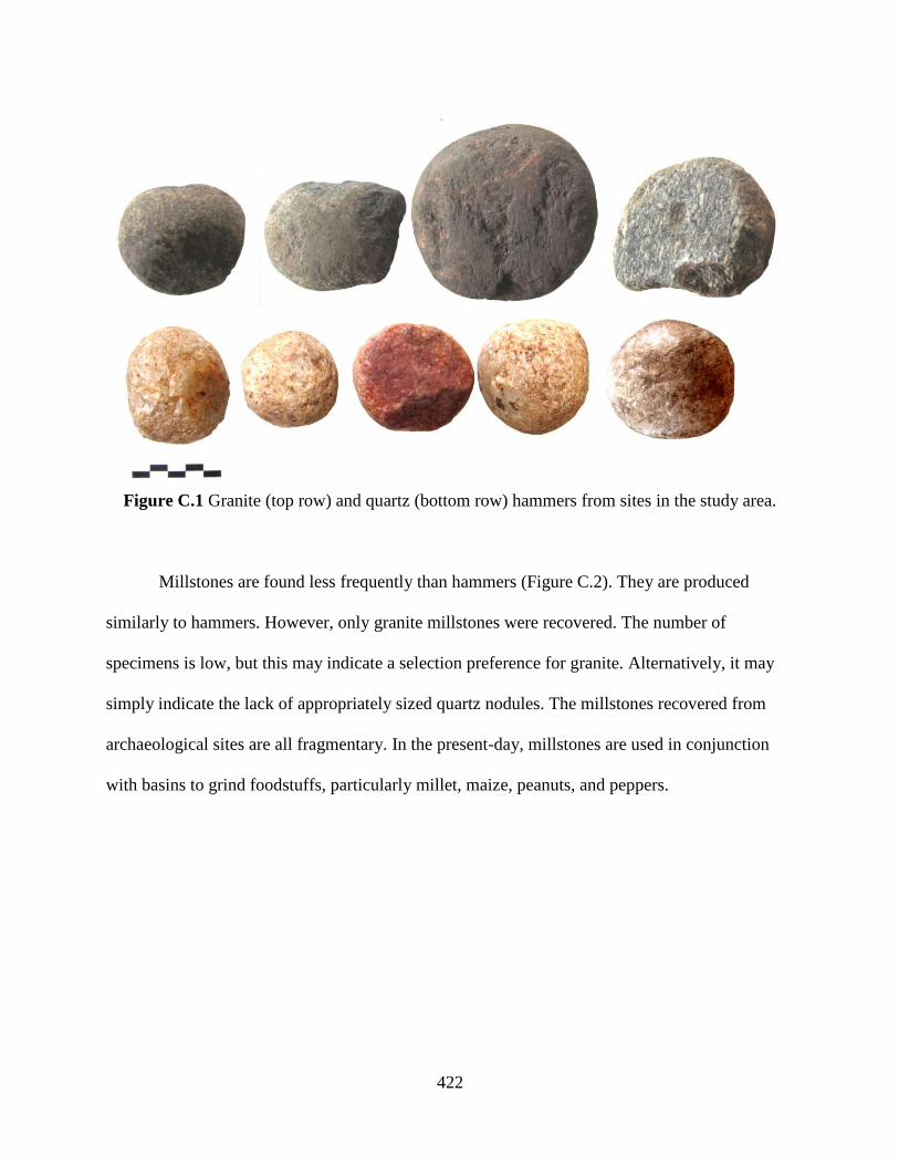
422
Figure C.1 Granite (top row) and quartz (bottom row) hammers from sites in the study area.
Millstones are found less frequently than hammers (Figure C.2). They are produced
similarly to hammers. However, only granite millstones were recovered. The number of
specimens is low, but this may indicate a selection preference for granite. Alternatively, it may
simply indicate the lack of appropriately sized quartz nodules. The millstones recovered from
archaeological sites are all fragmentary. In the present-day, millstones are used in conjunction
with basins to grind foodstuffs, particularly millet, maize, peanuts, and peppers.

423
Figure C.2 Granite millstone fragments from sites in the study area.
Basins are slightly more frequently documented than millstones. However, this applies
only to surface contexts, where it is likely that the much larger basins are simply more visible.
Millstones are produced by selecting appropriately sized slabs of granite and grinding a concave
depression into the surface. This cavity is also elaborated through use. Basins were not collected
from surface contexts due to their size and weight (Figure C.3). Two basin fragments were
recovered from excavation contexts and were collected (Figure C.4). In the present-day, basins
are used in conjunction with millstones or hammers to grind foodstuffs, particularly millet,
maize, peanuts, and peppers.

424
Figure C.3 A concave granite basin from the surface of a fortified hilltop site (S13-009).
Figure C.4 Granite basin fragments recovered from excavation contexts at sites in the study
area.
425
A single granite anvil was recovered from the surface of Atenro, S12-035 (Figure C.5).
The anvil is similar in form and manufacture to a hammer, but larger and more lenticular in
profile, rather than spherical. One surface of the anvil is heavily “pecked,” suggesting a use in
pounding. I observed slightly larger lenticular stones in use among Yoruba-descendant
blacksmiths at Cana in southern Bénin in 2010. These stones were used as anvils for shaping iron
preforms and tools. However, the smaller size, and resultant low inertia, of this stone would be
impractical for sustained iron production. This stone may have instead served as a striking
surface for blade and tool repair, rather than production.
Figure C.5 A possible granite anvil from the surface of Atenro (S12-035).
2. Flaked Tools
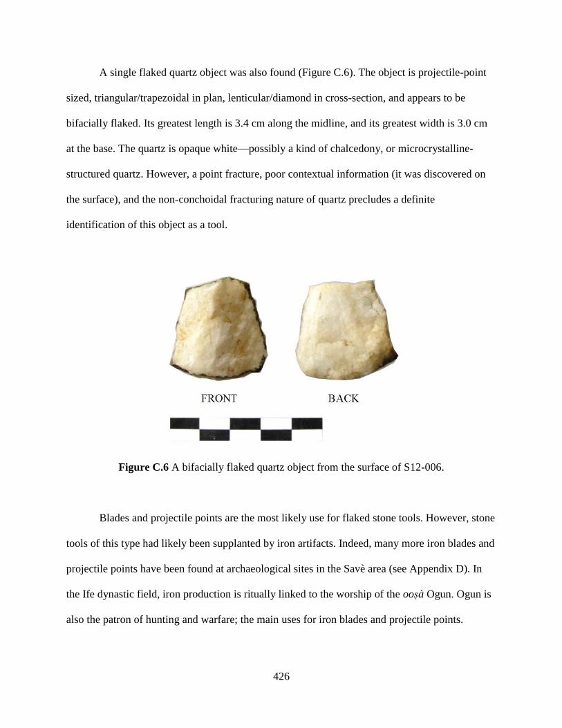
426
A single flaked quartz object was also found (Figure C.6). The object is projectile-point
sized, triangular/trapezoidal in plan, lenticular/diamond in cross-section, and appears to be
bifacially flaked. Its greatest length is 3.4 cm along the midline, and its greatest width is 3.0 cm
at the base. The quartz is opaque white—possibly a kind of chalcedony, or microcrystalline-
structured quartz. However, a point fracture, poor contextual information (it was discovered on
the surface), and the non-conchoidal fracturing nature of quartz precludes a definite
identification of this object as a tool.
Figure C.6 A bifacially flaked quartz object from the surface of S12-006.
Blades and projectile points are the most likely use for flaked stone tools. However, stone
tools of this type had likely been supplanted by iron artifacts. Indeed, many more iron blades and
projectile points have been found at archaeological sites in the Savè area (see Appendix D). In
the Ife dynastic field, iron production is ritually linked to the worship of the oosà Ogun. Ogun is
also the patron of hunting and warfare; the main uses for iron blades and projectile points.
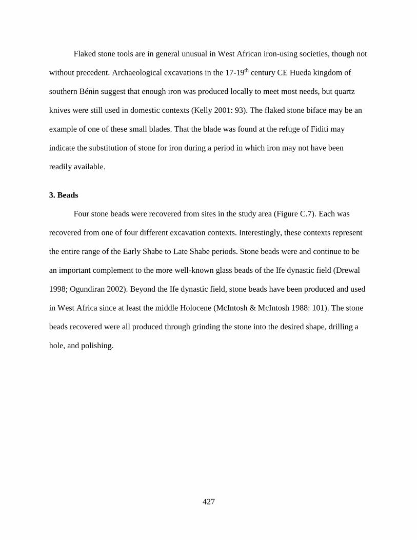
427
Flaked stone tools are in general unusual in West African iron-using societies, though not
without precedent. Archaeological excavations in the 17-19th century CE Hueda kingdom of
southern Bénin suggest that enough iron was produced locally to meet most needs, but quartz
knives were still used in domestic contexts (Kelly 2001: 93). The flaked stone biface may be an
example of one of these small blades. That the blade was found at the refuge of Fiditi may
indicate the substitution of stone for iron during a period in which iron may not have been
readily available.
3. Beads
Four stone beads were recovered from sites in the study area (Figure C.7). Each was
recovered from one of four different excavation contexts. Interestingly, these contexts represent
the entire range of the Early Shabe to Late Shabe periods. Stone beads were and continue to be
an important complement to the more well-known glass beads of the Ife dynastic field (Drewal
1998; Ogundiran 2002). Beyond the Ife dynastic field, stone beads have been produced and used
in West Africa since at least the middle Holocene (McIntosh & McIntosh 1988: 101). The stone
beads recovered were all produced through grinding the stone into the desired shape, drilling a
hole, and polishing.
428
Figure C.7 The four stone beads, from left to right: opaque quartz disc, semi-translucent quartz
disc, bauxite disc, and jasper cylinder (side view).
Two quartz beads were recovered. Both beads are disc-shaped beads with bifacially
drilled holes. However, one is an opaque white quartz and the other is a semi-translucent pinkish
white quartz. These beads may have been produced locally, as quartz is found throughout the
Savè area. The opaque bead is smaller, with a diameter of 9 mm, a hole diameter of 2 mm, and a
length of 3 mm. The semi-translucent bead has a diameter of 11 mm, a hole diameter of 3 mm,
and a length of 7 mm.
A third disc-shaped bead was recovered. It is bifacially drilled, but unlike the quartz
beads the holes are drilled at an approximately 45° angle to the face of the bead. This would
result in the bead resting askew when strung. Its reddish gray brown color, luster, and softness
are characteristic of bauxite. The nearest major source of bauxite is in Ghana, where bauxite has
been used in bead production for at least 500 years (Anquandah 1982, 2006; Kumekpor 1995).
However, small quantities of bauxite may have been exploited closer to or in the area, as bauxite

429
can form through the lateritization of granite where sufficient weathering and drainage is present.
The bead has a diameter of 13 mm, a hole diameter of 4 mm, and a length of 5 mm.
One cylindrical stone bead was recovered. Like the disc beads, it is bifacially drilled. The
stone is a dark red with a pitted surface. The most likely material is jasper, a kind of chalcedony.
The nearby city of Ilorin was a major manufacturing center for jasper beads in the 19th century
CE (O’Hear 1986). However, the manufacture and trade of red chalcedony beads is often linked
to participation in longer-distance exchange networks (e.g., Insoll & Shaw 1997; Insoll et al.
2004; Gliozzo et al. 2014). The bead has a diameter of 5 mm, a hole diameter of 1 mm, and a
length of 12 mm.
430
APPENDIX D
Ferrous Artifacts
Ferrous artifacts were present at some archaeological sites in the study area. Ferrous
artifacts included iron figurative objects, tools, and fragmentary debris. Slag, a byproduct of iron
production, was also present at some sites. The low number of iron artifacts suggests that iron
was not disposed of in the same way as ceramic, or even lithic, artifacts. Despite the ubiquity of
iron in West Africa during the second millennium CE, it may have still been a valuable resource,
particularly in an area, such as the Savè hills, where primary iron production did not occur on a
large scale.
Iron was likely in use in the Savè area well before the Early Shabe period. Large-scale
iron production has been documented prior to 1600 CE in the Bassar area of Togo to the
northwest (de Barros 2001); the Abomey plateau to the south (Randsborg & Merkyte 2009); and
the Ife dynastic field polities to the east (Ogundiran 2005). Mastery of other metalworking
technologies is known in the region from the intricate bronze sculptures of Ile-Ife produced in
the 11-13th centuries CE, and those from Igbo-Ukwu before that (Willett 1960; Chikwendu &
Umeji 1979). More generally, West African iron production begins around 500 BCE, though
there is some evidence for production as early as 2000 BCE (Childs & Killick 1993: 321; Killick
& Fenn 2012: 565).

431
Ferrous artifacts collected from archaeological contexts were recorded in the field with
contextual information, bagged, cleaned, weighed, photographed, and catalogued. Iron artifacts
were categorized according to their product: slag or iron object. Slag artifacts were recorded as
either angular or rounded according to their general appearance. Iron objects were categorized
according to their identifiable tool or figurative types, or general forms if fragmentary (Table
D.1).
Sit
e
Conte
xt
Sla
g
Iron Object F
igura
tive
Tool
Identifiable Fragmentary A
ttac
hm
ent
Bla
de
Clu
b H
ead
Fis
h H
ook
Pro
ject
ile
Rin
g
Rod
Shee
t
S12-017 Excavation 2 1
S12-035 Excavation
(Phase I)
1 1
S12-035 Excavation
(Phase II)
3 1
S12-037 Excavation 1 2 1
S13-004 Excavation 1
S13-010 Excavation 1 2
S13-011 Excavation 1 1 2
S12-004 Surface 1 1 1
S12-006 Surface 1
S12-007 Surface 1
S12-009 Surface 1
S12-014 Surface 2
S12-025 Surface 1
S12-035 Surface 1
S12-037 Surface 1 1
S13-004 Surface 1
Total 8 1 2 2 2 1 2 2 4 8
Table D.1 Ferrous artifacts of different types and forms recovered from sites in the study area.
1. Tools
Several tool types were identified in the iron artifact assemblages. The types are based on
the forms of ethnographically and archaeologically described iron objects (see Smith 1967;
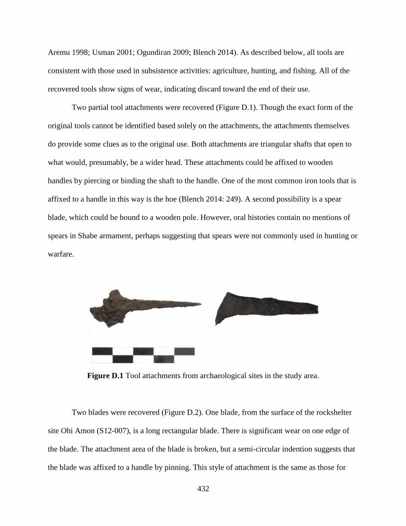
432
Aremu 1998; Usman 2001; Ogundiran 2009; Blench 2014). As described below, all tools are
consistent with those used in subsistence activities: agriculture, hunting, and fishing. All of the
recovered tools show signs of wear, indicating discard toward the end of their use.
Two partial tool attachments were recovered (Figure D.1). Though the exact form of the
original tools cannot be identified based solely on the attachments, the attachments themselves
do provide some clues as to the original use. Both attachments are triangular shafts that open to
what would, presumably, be a wider head. These attachments could be affixed to wooden
handles by piercing or binding the shaft to the handle. One of the most common iron tools that is
affixed to a handle in this way is the hoe (Blench 2014: 249). A second possibility is a spear
blade, which could be bound to a wooden pole. However, oral histories contain no mentions of
spears in Shabe armament, perhaps suggesting that spears were not commonly used in hunting or
warfare.
Figure D.1 Tool attachments from archaeological sites in the study area.
Two blades were recovered (Figure D.2). One blade, from the surface of the rockshelter
site Ohi Amon (S12-007), is a long rectangular blade. There is significant wear on one edge of
the blade. The attachment area of the blade is broken, but a semi-circular indention suggests that
the blade was affixed to a handle by pinning. This style of attachment is the same as those for
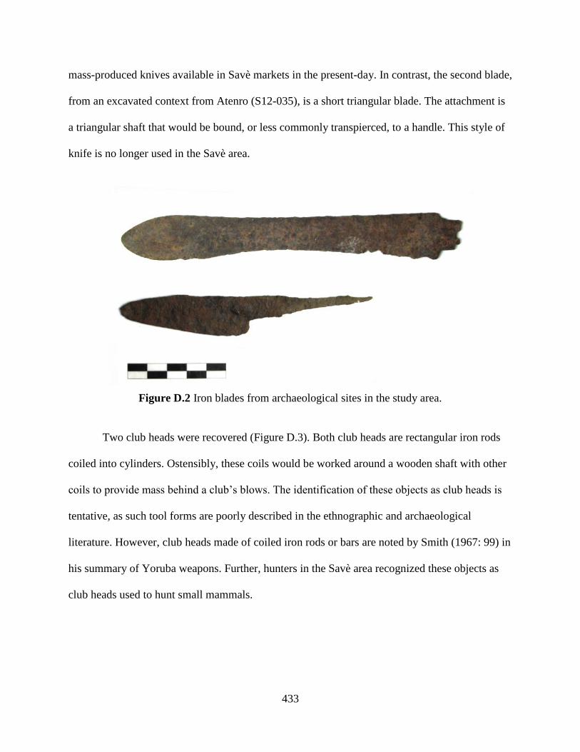
433
mass-produced knives available in Savè markets in the present-day. In contrast, the second blade,
from an excavated context from Atenro (S12-035), is a short triangular blade. The attachment is
a triangular shaft that would be bound, or less commonly transpierced, to a handle. This style of
knife is no longer used in the Savè area.
Figure D.2 Iron blades from archaeological sites in the study area.
Two club heads were recovered (Figure D.3). Both club heads are rectangular iron rods
coiled into cylinders. Ostensibly, these coils would be worked around a wooden shaft with other
coils to provide mass behind a club’s blows. The identification of these objects as club heads is
tentative, as such tool forms are poorly described in the ethnographic and archaeological
literature. However, club heads made of coiled iron rods or bars are noted by Smith (1967: 99) in
his summary of Yoruba weapons. Further, hunters in the Savè area recognized these objects as
club heads used to hunt small mammals.

434
Figure D.3 Iron club heads from archaeological sites in the study area.
One fish hook was recovered (Figure D.4). It is a C-shaped hook with a simple non-
barbed point. Interestingly, this single fish hook was recovered from an excavation context from
Aukpon (S13-004), a site far from the major Ouémé and Okpara rivers which are most associated
with fishing in the present-day and in historical references to the European Colonial period. This
may indicate the greater prevalence of fishing in Savè settlements, regardless of proximity to the
major rivers, in earlier periods. Alternatively, it may indicate the pronounced mobility of
individuals to move between the upland and river basin environments.
Figure D.4 Iron fish hook from Aukpon (S13-004).
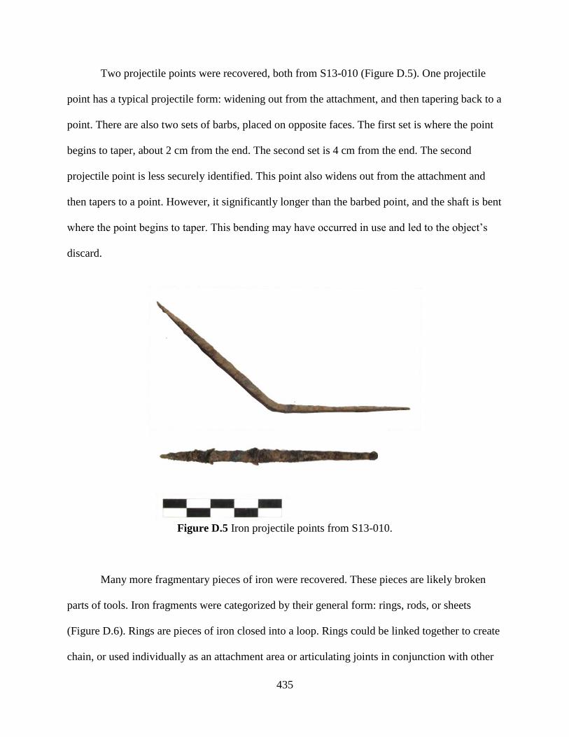
435
Two projectile points were recovered, both from S13-010 (Figure D.5). One projectile
point has a typical projectile form: widening out from the attachment, and then tapering back to a
point. There are also two sets of barbs, placed on opposite faces. The first set is where the point
begins to taper, about 2 cm from the end. The second set is 4 cm from the end. The second
projectile point is less securely identified. This point also widens out from the attachment and
then tapers to a point. However, it significantly longer than the barbed point, and the shaft is bent
where the point begins to taper. This bending may have occurred in use and led to the object’s
discard.
Figure D.5 Iron projectile points from S13-010.
Many more fragmentary pieces of iron were recovered. These pieces are likely broken
parts of tools. Iron fragments were categorized by their general form: rings, rods, or sheets
(Figure D.6). Rings are pieces of iron closed into a loop. Rings could be linked together to create
chain, or used individually as an attachment area or articulating joints in conjunction with other

436
iron or fiber objects. Larger rings could have been used as ornamentation or as a kind of
currency, though no rings large enough were discovered. Rods are linear pieces of iron, either
circular or quadrilateral in cross-section. Some rods may have be the product of tool breakage,
particularly of attachment shafts. However, small iron rods could also serve as pins, nails, or be
the byproduct of tool production. Further, small iron rods are common components of ogù, or
magic charms, and occasionally used as currency. However, all the rods recovered were fairly
small, ranging between 30 and 86 mm. Sheets are flat fragments of any shape, though less than 3
mm in width. Like rods, sheets may be the byproduct of tool production or broken tool parts,
though sheet fragments come from tool blades. Hoes are likely candidates for producing sheet
fragments, as they are regularly used and can chip when coming into contact with rocks in the
soil.
Figure D.6 Iron fragments from archaeological sites in the study area are categorized according
to the general form: rings (left), rods (center), or sheets (right).
2. Figurative Object
One figurative iron object was recovered from a Phase II occupation context at Atenro
(S12-035). The object was placed in a shallow pit dug into an earlier Phase I midden. After this,
the pit was closed and new midden deposits were added. The object has the form of a miniature
pair of bilboes-style manacles (Figure D.7). It is composed of three separate iron rods that have
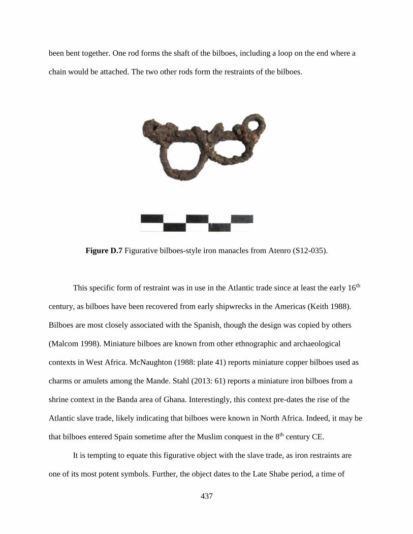
437
been bent together. One rod forms the shaft of the bilboes, including a loop on the end where a
chain would be attached. The two other rods form the restraints of the bilboes.
Figure D.7 Figurative bilboes-style iron manacles from Atenro (S12-035).
This specific form of restraint was in use in the Atlantic trade since at least the early 16th
century, as bilboes have been recovered from early shipwrecks in the Americas (Keith 1988).
Bilboes are most closely associated with the Spanish, though the design was copied by others
(Malcom 1998). Miniature bilboes are known from other ethnographic and archaeological
contexts in West Africa. McNaughton (1988: plate 41) reports miniature copper bilboes used as
charms or amulets among the Mande. Stahl (2013: 61) reports a miniature iron bilboes from a
shrine context in the Banda area of Ghana. Interestingly, this context pre-dates the rise of the
Atlantic slave trade, likely indicating that bilboes were known in North Africa. Indeed, it may be
that bilboes entered Spain sometime after the Muslim conquest in the 8th century CE.
It is tempting to equate this figurative object with the slave trade, as iron restraints are
one of its most potent symbols. Further, the object dates to the Late Shabe period, a time of

438
intense warfare and predation by slave-raiders. In this context, the deployment of an ogù, or
magic charm, to protect against slavery is a compelling explanation. However, ogù are infused
with complex metaphorical associations, and the meaning of such an object is not always
obvious (Parrinder 1961: 156-165; Bascom 1969; Doris 2011). For example, the bilboes form
may be employed to metaphorically invoke the concept of pairing or twinning, which is a
common theme in Yoruba symbolism (Lawal 2008; Peek 2008, 2013).
3. Slag
Slag was recovered from archaeological sites in the study area (Figure D.8). The very
limited quantities of slag and the lack of specialized iron production sites or features in the study
area suggest that iron production was never an organized or full-time craft specialization.
Instead, small amounts of slag were recovered alongside other domestic refuse: potsherds, faunal
remains, charcoal, etc. The presence of slag indicates that some iron production did occur in the
area, but it remained a small-scale industry. Alternatively, it may be that iron production did not
occur locally, and both slag and iron were imported. Slag may have had some ritual or symbolic
associations and employed for these, rather than produced as a byproduct in ironworking.
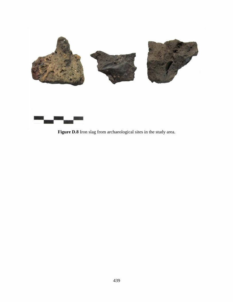
439
Figure D.8 Iron slag from archaeological sites in the study area.

440
APPENDIX E
Vitric Artifacts
Small quantities of vitric artifacts were recovered from archaeological sites in the study
area. Two types of vitric artifacts were recorded: glass vessels and glass beads. There is no
evidence for glass vessel production in precolonial West Africa. Vessels are present in Atlantic
era archaeological sites, but are universally described as an import. Vessels are therefore
indicators of participation in long-distance exchange with either North Africa or Europe, or less
commonly East Africa. Beads, on the other hand, were produced at Ile-Ife as early as the 11th
century CE (Lankton et al. 2006; Babalola 2011). However, beads also entered West Africa by
the same routes that brought glass vessels. Regardless, glass vessels and beads were not created
in the Savè area, but brought in from the Ife dynastic field and beyond.
Vitric artifacts collected from archaeological contexts were recorded in the field with
contextual information, bagged, cleaned, weighed, photographed, and catalogued. Vitric artifacts
were categorized as either shards from vessels or beads based on their form. Glass vessels were
further categorized according to their color, vessel type, and manufacturing technique. Glass
beads were described according to their color, shape, opacity, and manufacturing technique.
1. Vessels

441
Glass vessel shards were recovered from several sites (Table E.1). 43% of the shards
were recovered from the surface of a single site: S12-028. Moreover, 92% of glass shards came
from surface contexts. Of the four shards from excavated contexts, only one came from a
subsurface stratum at S12-037. The distinct lack of vessel shards from excavated contexts
suggests that these objects were a relatively late and rare import to the Savè area.
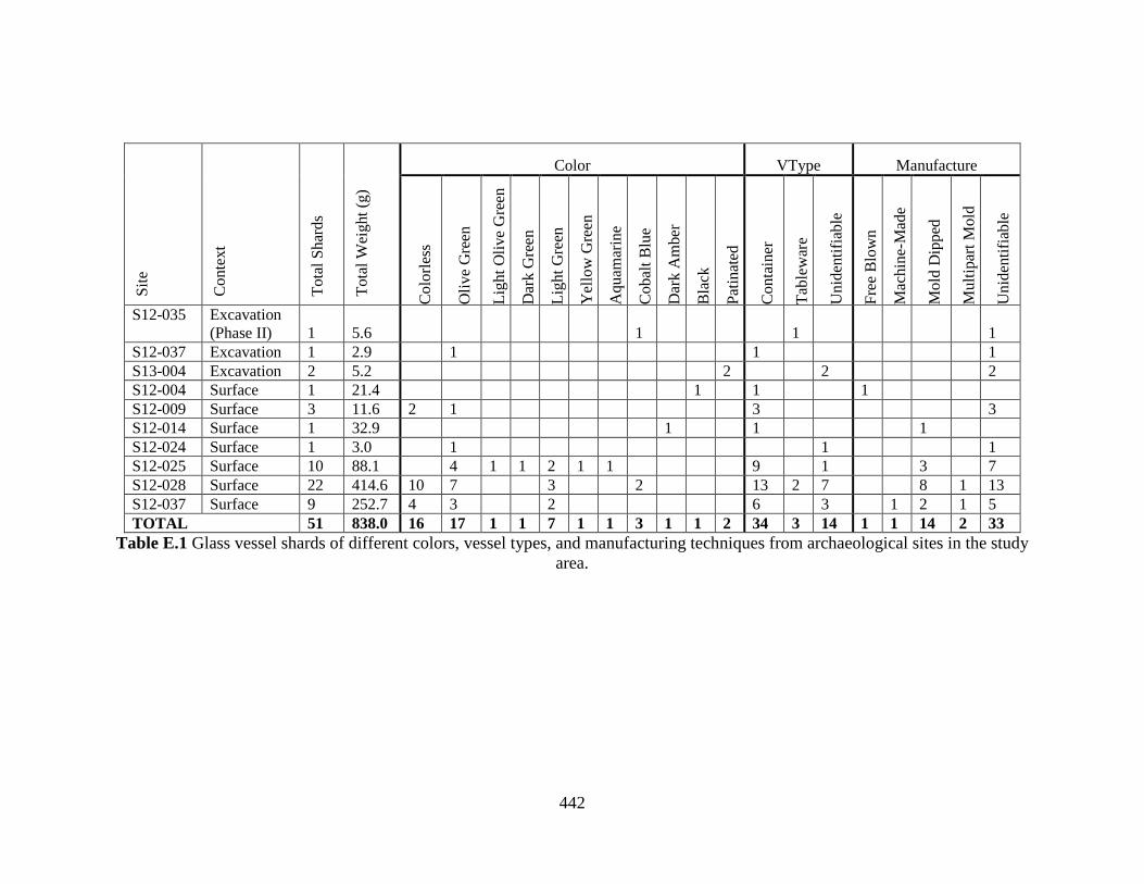
442
S
ite
Conte
xt
Tota
l S
har
ds
Tota
l W
eight
(g)
Color VType Manufacture
Colo
rles
s
Oli
ve
Gre
en
Lig
ht
Oli
ve
Gre
en
Dar
k G
reen
Lig
ht
Gre
en
Yel
low
Gre
en
Aquam
arin
e
Cobal
t B
lue
Dar
k A
mber
Bla
ck
Pat
inat
ed
Conta
iner
Tab
lew
are
Unid
enti
fiab
le
Fre
e B
low
n
Mac
hin
e-M
ade
Mold
Dip
ped
Mult
ipar
t M
old
Unid
enti
fiab
le
S12-035 Excavation
(Phase II) 1 5.6 1 1 1
S12-037 Excavation 1 2.9 1 1 1
S13-004 Excavation 2 5.2 2 2 2
S12-004 Surface 1 21.4 1 1 1
S12-009 Surface 3 11.6 2 1 3 3
S12-014 Surface 1 32.9 1 1 1
S12-024 Surface 1 3.0 1 1 1
S12-025 Surface 10 88.1 4 1 1 2 1 1 9 1 3 7
S12-028 Surface 22 414.6 10 7 3 2 13 2 7 8 1 13
S12-037 Surface 9 252.7 4 3 2 6 3 1 2 1 5
TOTAL 51 838.0 16 17 1 1 7 1 1 3 1 1 2 34 3 14 1 1 14 2 33
Table E.1 Glass vessel shards of different colors, vessel types, and manufacturing techniques from archaeological sites in the study
area.
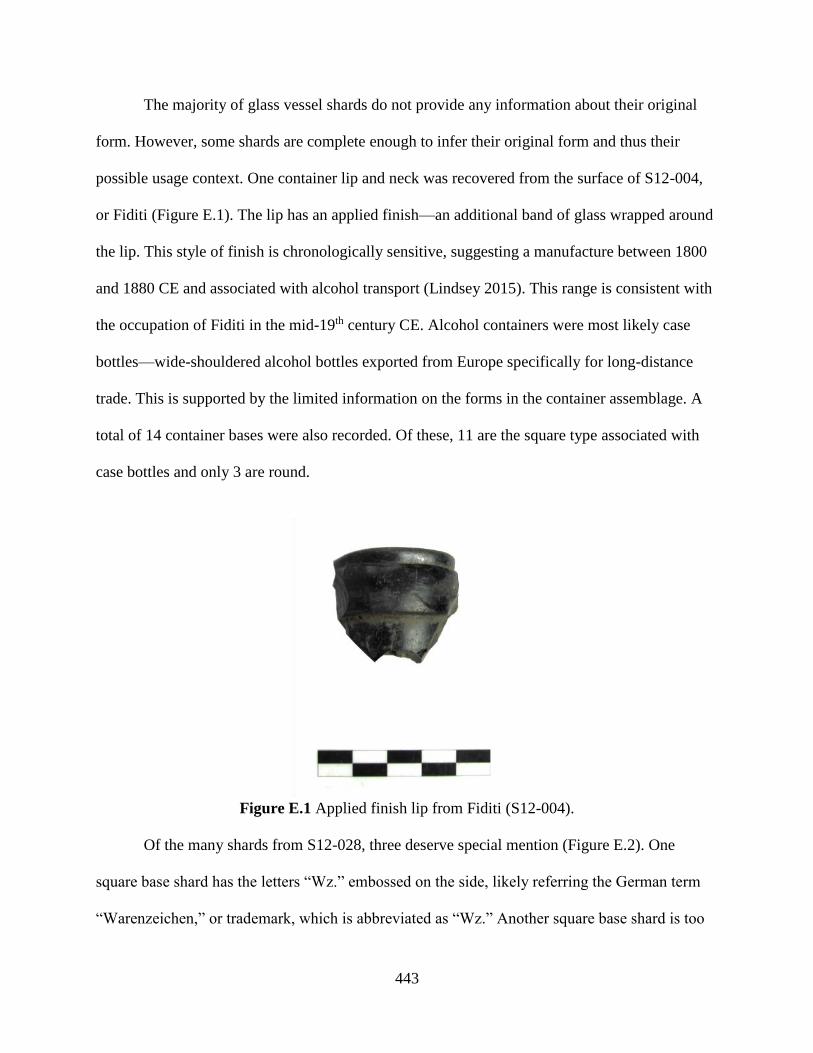
443
The majority of glass vessel shards do not provide any information about their original
form. However, some shards are complete enough to infer their original form and thus their
possible usage context. One container lip and neck was recovered from the surface of S12-004,
or Fiditi (Figure E.1). The lip has an applied finish—an additional band of glass wrapped around
the lip. This style of finish is chronologically sensitive, suggesting a manufacture between 1800
and 1880 CE and associated with alcohol transport (Lindsey 2015). This range is consistent with
the occupation of Fiditi in the mid-19th century CE. Alcohol containers were most likely case
bottles—wide-shouldered alcohol bottles exported from Europe specifically for long-distance
trade. This is supported by the limited information on the forms in the container assemblage. A
total of 14 container bases were also recorded. Of these, 11 are the square type associated with
case bottles and only 3 are round.
Figure E.1 Applied finish lip from Fiditi (S12-004).
Of the many shards from S12-028, three deserve special mention (Figure E.2). One
square base shard has the letters “Wz.” embossed on the side, likely referring the German term
“Warenzeichen,” or trademark, which is abbreviated as “Wz.” Another square base shard is too

444
narrow to be a case bottle and was likely from a smaller bitters bottle. A large circular base shard
has a visible pontil scar as well as concentric embossed circles on the bottom.
Figure E.2 Select bases from S12-028.
Though most vessel shards were either identified as containers or unidentifiable, three
shards were identified as handles from tableware vessels (Figure E.3). Each was colored a
distinct cobalt blue. Interestingly, these shards were found at two different sites, but are almost
identical in color and form.
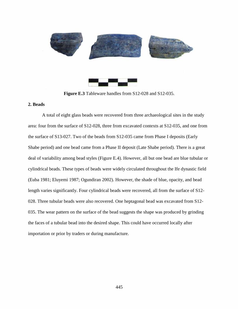
445
Figure E.3 Tableware handles from S12-028 and S12-035.
2. Beads
A total of eight glass beads were recovered from three archaeological sites in the study
area: four from the surface of S12-028, three from excavated contexts at S12-035, and one from
the surface of S13-027. Two of the beads from S12-035 came from Phase I deposits (Early
Shabe period) and one bead came from a Phase II deposit (Late Shabe period). There is a great
deal of variability among bead styles (Figure E.4). However, all but one bead are blue tubular or
cylindrical beads. These types of beads were widely circulated throughout the Ife dynastic field
(Euba 1981; Eluyemi 1987; Ogundiran 2002). However, the shade of blue, opacity, and bead
length varies significantly. Four cylindrical beads were recovered, all from the surface of S12-
028. Three tubular beads were also recovered. One heptagonal bead was excavated from S12-
035. The wear pattern on the surface of the bead suggests the shape was produced by grinding
the faces of a tubular bead into the desired shape. This could have occurred locally after
importation or prior by traders or during manufacture.
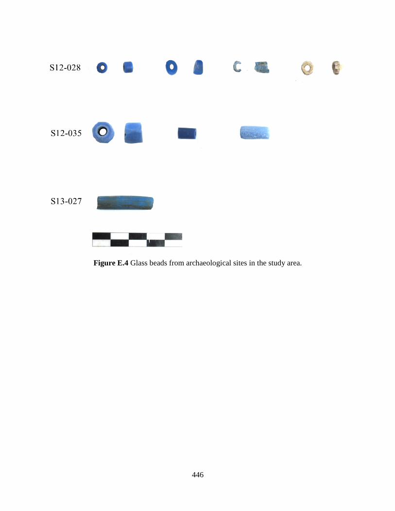
446
Figure E.4 Glass beads from archaeological sites in the study area.
447
APPENDIX F
Faunal Remains
Faunal remains were recovered at many archaeological sites in the study area. Faunal
remains were well represented in excavation contexts, but much less so in surface assemblages.
This likely represents differential preservation processes, wherein bone is preferentially
preserved in oxygen-deprived contexts. Some of the faunal remains represent subsistence
activities in the Savè area, such as pastoralism, hunting, and fishing. However, some remains
were likely deposited from ritual activities that blur into subsistence, or obtained through long-
distance exchange. This is certainly the case for cowry shells, which originate in the Indian
Ocean.
Faunal remains collected from archaeological contexts were recorded in the field with
contextual information, bagged, cleaned, weighed, photographed, and catalogued. Faunal
remains were categorized as either a bone element, fragment of bivalve shell, cowry, or bead
(Table F.1). Human remains were recovered from a burial deposit at Aukpon (S13-004), but
these remains were not collected or analyzed, and so are not reported in this appendix. A full
analysis of the collected animal bone and shell, though within the scope of this dissertation, is
beyond the skills of this analyst. Though potentially identifiably, the remains remain
unidentified. The vast majority of the animal bone consists of fragmentary elements which are
likely to small to identify beyond general size class. Cowries were further subcategorized as
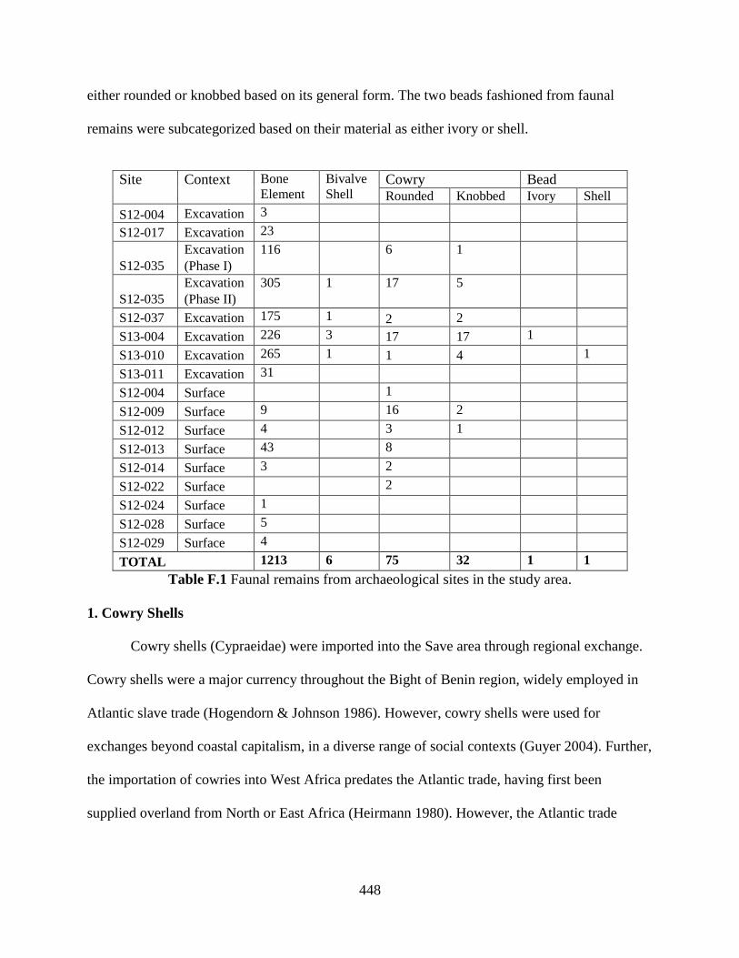
448
either rounded or knobbed based on its general form. The two beads fashioned from faunal
remains were subcategorized based on their material as either ivory or shell.
Site Context Bone
Element Bivalve
Shell Cowry Bead Rounded Knobbed Ivory Shell
S12-004 Excavation 3
S12-017 Excavation 23
S12-035
Excavation
(Phase I)
116 6 1
S12-035
Excavation
(Phase II)
305 1 17 5
S12-037 Excavation 175 1 2 2
S13-004 Excavation 226 3 17 17 1
S13-010 Excavation 265 1 1 4 1
S13-011 Excavation 31
S12-004 Surface 1
S12-009 Surface 9 16 2
S12-012 Surface 4 3 1
S12-013 Surface 43 8
S12-014 Surface 3 2
S12-022 Surface 2
S12-024 Surface 1
S12-028 Surface 5
S12-029 Surface 4
TOTAL 1213 6 75 32 1 1
Table F.1 Faunal remains from archaeological sites in the study area.
1. Cowry Shells
Cowry shells (Cypraeidae) were imported into the Save area through regional exchange.
Cowry shells were a major currency throughout the Bight of Benin region, widely employed in
Atlantic slave trade (Hogendorn & Johnson 1986). However, cowry shells were used for
exchanges beyond coastal capitalism, in a diverse range of social contexts (Guyer 2004). Further,
the importation of cowries into West Africa predates the Atlantic trade, having first been
supplied overland from North or East Africa (Heirmann 1980). However, the Atlantic trade
449
certainly changed the nature of cowry wealth in West Africa by saturating the market with
billions of shells (Ogundiran 2002).
Two specific taxa were used as currency in West Africa: Monetaria moneta and
Monetaria annulus. Both species are endemic to the Indian Ocean, typically harvested from the
Maldives (Hogendorn & Johnson 1986). The use of these shells in currency often led to their
modification—specifically the removal of the dorsal shell to facilitate stringing (Figure F.1). M.
moneta and M. annulus are quite small, with typical shell lengths ranging between 1 and 3 cm.
Both species can have yellow rings on their dorsal faces, though this ring is more pronounced in
M. annulus individuals. Only seven of the 134 cowries recovered show a yellow dorsal ring,
though many individuals were modified to remove part of the dorsal shell and therefore may be
obscuring the ring. M. annulus are also more rounded, while M. moneta can have a knobbed
“club” shape. 33 of the 134 cowries have this distinct knobbed form.

450
Figure F.1 Cowry shells from archaeological sites in the study area. From the top, rows show
knobbed cowries with dorsal modification, rounded cowries with dorsal modification, intact
rounded cowries, and intact rounded cowries with yellow dorsal rings.
2. Beads
Two beads made from faunal material were recovered (Figure F.2). One is a disc bead
made of shell from S13-010. It is similar in size and form to stone disc beads recovered from
other contexts (see Appendix C). Like stone, mollusk shell is available locally, and could be the
source of the bead. The second is a tubular bead made ivory from Aukpon (S13-004). It is the
only ivory object discovered in the study area. Schreger lines are visible running longitudinally
along the length of the bead. The bore hole is bifacially drilled and slightly curved. Oral history
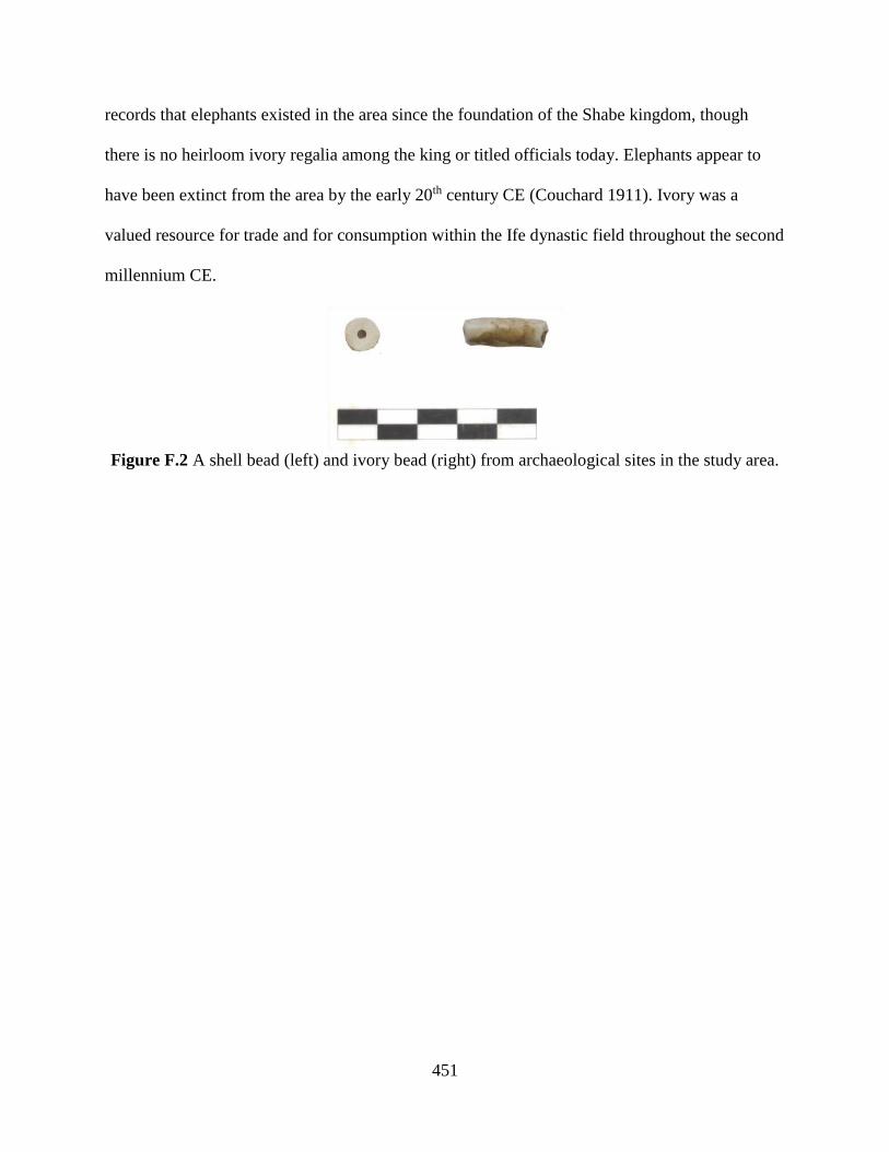
451
records that elephants existed in the area since the foundation of the Shabe kingdom, though
there is no heirloom ivory regalia among the king or titled officials today. Elephants appear to
have been extinct from the area by the early 20th century CE (Couchard 1911). Ivory was a
valued resource for trade and for consumption within the Ife dynastic field throughout the second
millennium CE.
Figure F.2 A shell bead (left) and ivory bead (right) from archaeological sites in the study area.

452
BIBLIOGRAPHY
453
BIBLIOGRAPHY
Abiodun, Rowland
1994 Understanding Yoruba art and aesthetics: the concept of ase. African Arts 27:102-103.
2014 Yoruba Art and Language: Seeking the African in African Art. Cambridge University
Press, Cambridge.
Adam, S.K., L. Afouda, P. Akpona, M. Djagun, A. Elegbe, J.P. Igue, R. Ladikpo, and E.
Soumonni
1996 Notes sur le pays Sàbé. CEDA, Cotonou.
Adandé, Alexis
1984 Togodu-Awute, capitale de l'ancien royaume d'Allada, étude d'une cité précoloniale
d'apres les sources orales, écrites et les données de l'archéologie. Unpublished These 3e
Cycle, Université de Paris I Panthéon- Sorbonne.
Adediran, Biodun
1984 Yoruba ethnic groups or a Yoruba ethnic group? A review of the problem of ethnic
identification. Africa: Revista do Centro de Estudos Africanos 7:57-70.
1994 The Frontier States of Western Yorubaland, 1600-1889. Institute Français de Recherche
en Afrique, Ibadan.
Adekunle, Julius O.
1994 Borgu and Economic Transformation 1700-1900: The Wangara Factor. African
Economic History 22:1-18.
Agani, Simon
2015 Reconnaissance archéologique des structures de fortifications en pays shabe (moyen-
Bénin). Unpublished Mémoire, Université d’Abomey-Calavi.
Agbaje-Williams, Babatunde
1983 A contribution to the archaeology of Old Oyo. Ph.D. dissertation, University of Ibadan,
Nigeria.
1990 Oyo ruins of NW Yorubaland, Nigeria. Journal of Field Archaeology 17:367–373.
1995 Archaeological Investigation of Itagunmodi Potsherd Pavement Site Ijesaland, Osun
State, Nigeria: 1991-1992 Season. IFRA, Ibadan.
2005 Clothed Ritual Trees: An Insight into Yoruba Religious Thought. In Yoruba Religious
Textiles: Essays in Honour of Cornelius Oyeleke Adepedgba, edited by E. Renne & B.
Agabje-Williams, pp. 157-187. Book Builders, Ibadan.
454
Ajayi, J.F.A. and R.S. Smith.
1971 Yoruba Warfare in the Nineteenth Century. University Press, Ibadan.
Akinjogbin, Isaac Adeagbo
1967 Dahomey and its Neighbors, 1708-1818. Cambridge University Press, Cambridge.
Akintoye, S.A.
1969 The north-eastern Yoruba districts and the Benin Kingdom. Journal of the Historical
Society of Nigeria 4:539-553.
Akinwumi, Olayemi
1999 Oral traditions and the political history of Borgu. Anthropos 94:215-221.
Aleru, J.O.
2006 Old Oyo and the hinterland: history and culture in northern Yorubaland, Nigeria.
Textflow Limited, Ibadan.
Aleva, Gerardus Jacobus Johannes
1994 Laterites: concepts, geology, morphology and chemistry. ISRIC, Wageningen.
Ali Babio, Sarate
1994 Contribution a l’étude des rapports historiques entre les Bariba et les Tchabe pendant la
periode précoloniale. Unpublished Mémoire, Université Nationale du Bénin (Université
d’Abomey-Calavi).
Allsworth-Jones, Philip
1996 Continuity and change in Yoruba pottery. Bulletin of the School of Oriental and African
Studies 59:312-322.
Allsworth-Jones, Philip and Kit W. Wesler
1998 Salt boiling on the Egun Coast: Excavation and experiment in Lagos State. In Historical
Archaeology in Nigeria, edited by K. W. Wesler & P. Allsworth-Jones, pp. 41-74. Africa
World Press, Lawrenceville.
Alpern, Stanley B.
1995 What Africans got for their slaves: A master list of European trade goods. History in
Africa 22:5-43.
1998 On the origins of the Amazons of Dahomey. History in Africa 25:9-25.
Ambers, Janet, Keith Matthews, and Richard Burleigh
1985 British Museum Natural Radiocarbon Measurements XVIII. Radiocarbon 27:508-524.
Amuwo, Kunle
2003 The state and the politics of democratic consolidation in Benin, 1990-1999. In Political
Liberalization and Democratization in Africa: Lessons from Country Experiences, edited
by J. O. Ihonvbere & J. M Mbaku, pp. 141-177. Praeger, Westport.

455
Anignikin, Sylvain C.
2001 Histoire des populations mahi. Éditions de l’EHESS 162:243-265.
Anquandah, J.
1993 Urbanization and state formation in Ghana during the Iron Age. In The Archaeology of
Africa: food, metals and towns, edited by B. Andah, A. Okpoko, T. Shaw, & P. Sinclair,
pp. 642-651. Routledge, London.
Appiah, Kwame Anthony
2006 Whose culture is it? New York Review of Books 53:38-52.
Apter, Andrew
1992 Black critics and kings: The hermeneutics of power in Yoruba society. University of
Chicago Press, Chicago.
2013 Yoruba ethnogenesis from within. Comparative Studies in Society and History 55:356-
387.
Asiwaju, A.I.
1973 A Note on the History of Sabe. Lagos Notes and Records IV:17-29.
1976 Western Yorubaland under European rule, 1889-1945: A comparative analysis of French
and British colonialism. Longman Publishing Group, London.
Assogbadjo, Achille Ephrem, Brice Sinsin, and Patrick Van Damme
2005 Caractères morphologiques et production des capsules de baobab (Adansonia digitata L.)
au Bénin. Fruits 60:327-340.
Awe, Bolanle
1973 Militarism and economic development in nineteenth century Yoruba country: The Ibadan
example. The Journal of African History 14:65-77.
Awolalu, J. Omosade
1979 Yoruba beliefs and sacrificial rites. Longman, London.
Babalola, Abidemi Babatunde
2011 Archaeological Investigation at Ile-Ife, Southwest Nigeria: A Preliminary Report on the
2010 Test Excavation. Nyame Akuma 76:33-46.
Bamgbose, Ayo
1966 A grammar of Yoruba. Cambridge University Press, Cambridge.
Barber, Karin
1991 I could speak until tomorrow: Oriki, women, and the past in a Yoruba town. Edinburgh
University Press, Edinburgh.
Barnes, Sandra and Palua Girshick Ben-Amos
456
1997 Ogun, the empire builder. In Africa’s Ogun: Old World and New 2nd edition, edited by S.
Barnes, pp. 39-64. Indiana University Press, Bloomington.
Bascom, William
1962 The Yoruba of Southwestern Nigeria. Holt, Rinehart and Winston, New York.
1969 Ifa Divination: Communication between Gods and Men in West Africa. Indiana
University Press, Bloomington.
Bay, Edna B.
1998 Wives of the Leopard: Gender, Politics, and Culture in the Kingdom of Dahomey.
University of Virgina Press, Charlottesville.
Bayart, Jean-Francois
1993 The State in Africa: Politics of the Belly. Longman Publishing Group, London.
Beck Jr, Robin A., Douglas J. Bolender, James A. Brown, and Timothy K. Earle
2007 Eventful archaeology: the place of space in structural transformation. Current
Anthropology 48:833-860.
Ben-Amos, Paula Girshick
1999 Art, Innovation, and Politics in Eighteenth-Century Benin. Houghton Mifflin Harcourt,
New York.
Berthier, Sophie
1997 Recherches archéologiques sur la capitale de l'empire de Ghana: étude d'un secteur
d'habitat à Koumbi Saleh, Mauritanie: campagnes II-III-IV-V,(1975-1976)-(1980-1981).
British Archaeological Reports, Oxford.
Bierschenk, Thomas and Jean-Pierre Olivier de Sardan
2003 Powers in the village: Rural Benin between democratisation and decentralization. Africa
73:145-173.
Binford, Lewis R.
1964 A consideration of archaeological research design. American Antiquity 29:203-210.
1967 Smudge pits and hide smoking: The use of analogy in archaeological reasoning.
American Antiquity 32:1-12.
Biobaku, Saburi Oladeni
1973 Sources of Yoruba history. Oxford University Press, Oxford.
Blanton, Richard and Lane Fargher
2008 Collective Action in the Formation of Pre-Modern States. Springer, New York.
Blanton, Richard, Gary M. Feinman, Stephen A. Kowalewski, and Peter N. Peregrine
1996 A Dual-Processual Theory for the Evolution of Mesoamerican Civilization. Current
Anthropology 37(1):1–14.
457
Blench, Roger
2006 Archaeology, language, and the African past. AltaMira Press, Lanham.
2007a Endangered languages in West Africa. In Language Diversity Endangered, edited by M.
Brenzinger, pp. 140-162. Walter de Gruyter, Berlin.
2007b The intertwined history of the silk-cotton and baobab. In Fields of Change: Progress in
African Archaeobotany, edited by R. Cappers, pp. 1-20. Barkhuis, Groningen.
Blier, Suzanne Preston
1998 Royal Arts of Africa: The Majesty of Form. Laurence King, London.
2012 Art in Ancient Ife, Birthplace of the Yoruba. African Arts 45:70-85.
Bovill, Edward
1958 The golden trade of the Moors: West African kingdoms in the fourteenth century. Oxford
University Press, Oxford.
Bowen, Thomas Jefferson
1858 Grammar and dictionary of the Yoruba language. Smithsonian Institution, Washington
D.C.
Bower, John
1986 A survey of surveys: aspects of surface archaeology in sub-Saharan Africa. African
Archaeological Review 4:21-40.
Bradbury, Robert Elwyn
1957 The Benin Kingdom and the Edo-speaking peoples of south-western Nigeria.
International African Institute, London.
1973 Benin Studies. International African Institute, London.
Breunig, Peter
2013 Pathways to Food Production in the Sahel. In The Oxford Handbook of African
Archaeology, edited by P. Mitchell & P. Lane, pp. 555-570. Oxford University Press,
Oxford.
Breunig, Peter and Katharina Neumann
2002 From hunters and gatherers to food producers: New archaeological and archaeobotanical
evidence from the West African Sahel. In Droughts, Food and Culture: Ecological
Change and Food Secuirty in Africa’s Later Prehistory, edited by F.A. Hassan, pp.123-
155. Springer, New York.
Brooks, George E.
1993 Landlords and strangers: Ecology, society, and trade in Western Africa, 1000-1630.
Westview Press, Boulder.
Brumfiel, Elizabeth M.

458
1994 Factional competition and political development in the New World: An introduction.
In Factional competition and political development in the New World, edited by E.M.
Brumfiel & J.W. Fox, pp. 3-13. Cambridge University Press, Cambridge.
Brumfiel, Elizabeth M. and Timothy K. Earle
1987 Specialization, exchange, and complex societies: an introduction. In Specialization,
exchange, and complex societies, edited by Elizabeth M. Brumfiel and Timothy K. Earle,
pp. 1-9. Cambridge University Press, Cambridge.
Capo, Hounkpati B.C.
1989 Defoid. In The Niger-Congo Languages: A Classification and Description of Africa’s
Largest Language Family, edited by J. Bendor-Samuel & R.L. Hartell, pp. 275-290.
University Press of America, Lanham.
Carneiro, Robert L.
1970 A theory of the origin of the state. Science 169:733-738.
Carter P. L. and C. Flight
1972 A report on the fauna from the sites of Ntereso and Kintampo Rock Shelter Six in Ghana:
with evidence for the practice of animal husbandry during the second millennium
BC. Man ns 7:277-282
Ceperley, Natalie, Florence Montagnini, and Armand Natta
2010 Significance of Sacred Sites for Riparian Forest Conservation in Central Benin. In Bois et
Forêts des Tropiques 303:5-23.
Childe, V. Gordon
1950 The urban revolution. Town Planning Review 21:3-17.
1951 Social evolution. Watts, London.
Childs, S. Terry and David Killick
1993 Indigenous African metallurgy: nature and culture. Annual Review of Anthropology
22:317-337.
Chouin, Gerard L. and Christopher R. Decorse.
2010 Prelude to the Atlantic trade: new perspectives on southern Ghana's pre-Atlantic history
(800–1500). The Journal of African History 51:123-145.
Clist, Bernard-Olivier
2012 Pour une archéologie du royaume Kongo: la tradition de Mbafu. Azania: Archaeological
Research in Africa 47:175-209.
Clist, Bernard-Olivier, Nicolas Nikis, Alphonse Nkanza Lutayi, Jasmijn Overmeire, Maarten
Praet, Kaat Scheerlinck, and Koen Bostoen
2014 Le projet KongoKing: les prospections et fouilles menées en 2014 à Misenga, Sumbi et
Ngongo Mbata (Province du Bas-Congo, RDC). Nyame Akuma 82:48-56.
459
Comaroff, John L.
1995 Ethnicity, nationalism and the politics of difference in an age of revolution. International
Studies in Global Change 7:243-276.
2010 The end of anthropology, again: on the future of an in/discipline. American
Anthropologist 112:524-538.
Compton, Anne
2014 Shifting Trade Networks: Sub-Saharan to Atlantic Exchange in Central Ghana 1355-
1725 CE. Ph.D. dissertation, University of Michigan.
Connah, Graham
1967 New light on the Benin City walls. Journal of the Historical Society of Nigeria 4:593-
609.
1972 Archaeology in Benin. The Journal of African History 13:25-38.
1975 The Archaeology of Benin: Excavations and Other Researches in and Around Benin City,
Nigeria. Clarendon Press, Oxford.
2001 African Civilizations: An Archaeological Perspective. 2nd edition. Cambridge University
Press, Cambridge.
Costin, Cathy Lynne
2001 Craft production systems. In Archaeology at the Millennium: a sourcebook, edited by
Gary M. Feinman and T. Douglas Price, pp. 273-285. Springer, New York.
Coquery-Vidrovitch, Catherine
1969 Anthropologie politique et histoire de l'Afrique noire. Annales. Économies, Sociétés,
Civilisations 24:142-163.
2005 The history of African cities south of the Sahara: from the origins to colonization.
Markus Wiener Publishers, Princeton.
Couchard, A.
1911 Au Moyen-Dahomey: notes sur le cercle de Savé. Imprimerie commerciale et
industrielle, Bordeaux.
Crowder, Michael
1964 Indirect rule—French and British style. Africa 34:197-205.
Crumley, Carol L.
1995 Heterarchy and the analysis of complex societies. Archeological Papers of the American
Anthropological Association 6:1-5.
Curtin, Philip D.
1972 The Atlantic slave trade: a census. University of Wisconsin Press, Madison.
1984 Cross-cultural trade in world history. Cambridge University Press, Cambridge.
D’Altroy, Terence N. and Timothy K. Earle

460
1985 Staple Finance, Wealth Finance, and Storage in the Inka Political Economy. Current
Anthropology 26:187-206.
D’Andrea, A. Catherine and Joanna Casey
2002 Pearl Millet and Kintampo Subsistence. African Archaeological Review 3:147-173.
D'Andrea, A. Catherine, Marlies Klee, and Joanna Casey.
2001 Archaeobotanical evidence for pearl millet (Pennisetum glaucum) in sub-Saharan West
Africa. Antiquity 75:341-348.
D'Andrea, A. Catherine, Amanda L. Logan, and Derek J. Watson.
2006 Oil Palm and prehistoric subsistence in Tropical Africa. Journal of African
Archaeology 4:195-222.
D'Andrea, A. Catherine, Stefanie Kahlheber, Amanda L. Logan, and Derek J. Watson.
2007 Early domesticated cowpea (Vigna unguiculata) from Central Ghana. Antiquity 81:686-
698.
Dangbegnon, Constant
2005 Land tenure systems and pastoral resources management in Chabe community, Benin.
Cited in Securing Common Property Regimes in a Globalizing World: Synthesis of 41
Case Studies on Common Property Regimes from Asia, Africa, Europe and Latin
America, by A. Fuys, E. Mwangi, & S. Dohrn. International Land Coalition, Rome.
Darling, Patrick J.
1988 Broken sherds: Collections around Kano State, northern Nigeria. Nyame Akuma 30:21-
25.
2008 Baobab Trees and Nigeria's Savannah Zone Archaeology. Nigerian Field 73:25-47.
Davies 2013
de Barros, Philip L.
2001 The Effect of the Slave Trade on the Bassar Ironworking Society, Togo. In West Africa
during the Atlantic slave trade: archaeological perspectives, edited by Christopher R.
DeCorse, pp. 59-80. Leicester University Press, London.
2012 The Rise of the Bassar Chiefdom in the Context of Africa’s Internal Frontier. In Power
and Landscape in Atlantic West Africa: Archaeological Perspectives, edited by J.
Cameron Monroe and Akinwumi Ogundiran, pp. 255-277. Cambridge University Press,
Cambridge.
de Maret, Pierre
2012 From kinship to kingship: an African journey into complexity. Azania: Archaeological
Research in Africa 47:314-326.
DeCorse, Christopher R.
1992 Culture contact, continuity, and change on the Gold Coast, AD 1400-1900. African
Archaeological Review 10:163-196.
461
2001 An Archaeology of Elmina: Africans and Europeans on the Gold Coast, 1400-1900.
Smithsonian Press, Washington DC.
DeCorse, Christopher R., Francois G. Richard, and Ibrahima Thiaw
2003 Toward a systematic bead description system: a view from the Lower Falemme,
Senegal. Journal of African Archaeology 1:77-109.
DeMarrais, Elizabeth, Luis Jaime Castillo, and Timothy Earle
1996 Ideology, materialization, and power strategies. Current anthropology 37:15-31.
Denbow, James
2014 The archaeology and ethnography of Central Africa. Cambridge University Press,
Cambridge.
Denyer, Susan
1978 African traditional architecture: an historical and geographical perspective. Holmes &
Meier Publishers, New York.
Direction des Etudes Démographiques
2002 Troisieme Recensement General de la Population et de l’Habitation. INSAE, Cotonou.
2004 Cahier des villages et quartiers de ville-Departement des COLLINES. INSAE, Cotonou.
2013 Resultats Provisoires du RGPH4. INSAE, Cotonou.
Djagoun, C. A. M. S. and Philippe Gaubert
2009 Small carnivorans from southern Benin: a preliminary assessment of diversity and
hunting pressure. Small Carnivore Conservation 40:1-10.
Doris, David Todd
2011 Vigilant things: on thieves, Yoruba anti-aesthetics, and the strange fates of ordinary
objects in Nigeria. University of Washington Press, Seattle.
Drennan, Robert D.
2012 RSBOOT: A Program to Calculate the A Shape Coefficient for Rank-Size Plots with
Error Ranges for Specified Confidence Levels.
http://www.pitt.edu/~drennan/ranksize.html Accessed 12 February 2015.
Drennan, Robert D. and Christian E. Peterson.
2004 Comparing archaeological settlement systems with rank-size graphs: a measure of shape
and statistical confidence. Journal of Archaeological Science 31:533-549.
Drewal, Henry John, and Margaret Thompson Drewal
1983 Gelede: Art and Female Power among the Yoruba. Indiana University Press,
Bloomington.
Dueppen, Stephen A.

462
2012 From kin to great house: inequality and communalism at Iron Age Kirikongo, Burkina
Faso. American Antiquity 77:3-39.
Dueppen, Stephen A. and Daphne E. Gallagher
2013 Adopting agriculture in the West African savanna: Exploring socio-economic choices in
first millennium CE southeastern Burkina Faso. Journal of Anthropological
Archaeology 32:433-448.
Duffy, Paul R.
2015 Site size hierarchy in middle-range societies. Journal of Anthropological Archaeology
37:85-99.
Duncan, John
1847 Travels in Western Africa, 1845 & 1846: Comprising a Journey from Whydah, through
the Kingdom of Dahomey, to Adofoodia, in the Interior, vol. 2. R. Bentley, London.
Dussubieux, Laure, Peter Robertshaw, and Micheal D. Glascock
2009 LA-ICP-MS analysis of African glass beads: laboratory inter-comparison with an
emphasis on the impact of corrosion on data interpretation." International Journal of
Mass Spectrometry 284:152-161.
Eades, Jeremy Seymour
1980 The Yoruba Today. Cambridge University Press, Cambridge.
Earle, Timothy K.
1987 Chiefdoms in Archaeological and Ethnohistorical Perspective. Annual Review of
Anthropology 16:279-308.
1997 How Chiefs Come to Power: The Political Economy in Prehistory. Stanford University
Press, Palo Alto.
2000 Archaeology, property, and prehistory. Annual Review of Anthropology 29:39-60.
Effah-Gyamfi, Kwaku
1985 Bono Manso: an archaeological investigation into early Akan urbanism. University of
Calgary Press, Calgary.
Ellis, Alfred Burdon
1894 The Yoruba-speaking peoples of the Slave Coast of West Africa: Their religion, manners,
customs, laws, language, etc. With an appendix containing a comparison of the Tshi, Gã,
Ewe, and Yoruba languages. Chapman & Hall, London.
Eluyemi, Omotoso
1987 The technology of the Ife glass beads: evidence from the Igbo-Olokun. Odu 32:200-216.
Eluyemi, A. A., M. O. Olorunfemi, and A. Ogunfolakan
2012 Integrated Geophysical Investigation of Orile-Oje Archaeological Site, Ogbomosho,
Southwest Nigeria. The Pacific Journal of Science and Technology 13:615-630.

463
Euba, O.
1982 Of Blue Beads and Red: The Role of Ife in the West African Trade in Kori
Beads. Journal of the Historical Society of Nigeria 11:109-127.
Eyo, Ekpo
1974 Recent Excavations at Ife and Owo, and their Implications for Ife, Owo, and Benin
Studies. Ph.D. dissertation, University of Ibadan, Nigeria.
Fage, J.D.
1969 Slavery and the Slave Trade in the Context of West African History. Journal of African
History 10:393-404.
Fairhead, James and Melissa Leach
1996 Misreading the African Landscape: Society and Ecology in a Forest-Savanna Mosaic.
Cambridge University Press, Cambridge.
Falola, Toyin, and Akanmu Gafari Adebayo
2000 Culture, politics and money among the Yoruba. Transaction Publishers, New Brunswick.
Falola, Toyin, and Michel R. Doortmont
1989 Iwe Itan Oyo: A Traditional Yoruba History and Its Author. The Journal of African
History 30:301-329.
Faure, Paul and Boris Volkoff
1998 Some factors affecting regional differentiation of the soils in the Republic of Benin (West
Africa). Catena 32:281-306.
Feinman, Gary M.
1995 The emergence of inequality. In Foundations of social inequality, edited by T. D. Price &
G. M. Feinman, pp. 255-279. Springer, New York.
2012 Comparative frames for the diachronic analysis of complex societies: Next steps. In The
Comparative Archaeology of Complex Societies, edited by M. E. Smith, pp. 21-43.
Cambridge University Press, Cambridge.
Ferguson, James, and Akhil Gupta
2002 Spatializing states: toward an ethnography of neoliberal governmentality. American
ethnologist 29:981-1002.
Finnegan, Ruth
1970 Oral literature in Africa. Clarendon, London.
Flannery, Kent V.
1972 The Cultural Evolution of Civilizations. Annual Review of Ecology and Systematics
3:399-426.
464
1998 The Ground Plan of Archaic States. In Archaic States, edited by Gary M. Feinman &
Joyce Marcus, pp. 15–57. School of American Research Press, Santa Fe.
1999 Process and agency in early state formation. Cambridge Archaeological Journal 9:3-21.
Flannery, Kent and Joyce Marcus
2012 The Creation of Inequality. Harvard University Press, Cambridge.
Fleisher, Jeffrey
2010 Swahili Synoecism: Rural Settlements and Town Formation on the Central East African
Coast, A.D. 750–1500. Journal of Field Archaeology 35:265-282.
2012 Geophysical survey at Kilwa Kisiwani, Tanzania. Journal of African
Archaeology 10:207-220.
Fleisher, Jeffrey & Stephanie Wynne-Jones
2010 Authorisation and the process of power: The view from African archaeology. Journal of
World Prehistory 23:177-193.
2012 Finding meaning in ancient Swahili spatial practices. African Archaeological
Review 29:171-207.
Flynn, Donna K.
1997a Borders and Boundaries: Gender, Ideology, and Exchange along the Bénin-Nigeria
Border. Ph.D. dissertation, Northwestern University.
1997b “We are the border”: Identity, Exchange, and the State along the Bénin-Nigeria Border.
In American Ethnologist 24:311-330.
Folorunso, C. A., B. J. Tubosun, and P. G. Ajekigbe
2006 Old Oyo pottery: from the field to exhibition. The African Archaeology Network:
Research in Progress 4:214-223.
Fortes & Evans-Pritchard
1940 African Political Systems. Oxford University Press, Oxford.
Friedman, Jonathan
1992 Myth, history, and political identity. Cultural Anthropology 7:194-210.
Fuller, D. and L. Hildebrand
2013 Domesticating plants in Africa. In The Oxford Handbook of African Archaeology, edited
by P. Mitchell & P. Lane, pp. 507-525. Oxford University Press, Oxford.
Garlake, Peter
1977 Excavations on the Woye Asiri family land in Ife, Nigeria. West African Journal of
Archaeology 7:57–95.
Garrard, Timothy F.
1982 Myth and Metrology: The Early Trans-Saharan Gold Trade. Journal of African History
23:443-461.
465
Gautier, Achilles & Wim Van Neer
2005 The continuous exploitation of wild animal resources in the archaeozoological record of
Ghana. Journal of African Archaeology 3:195-212.
George, John Olawunmi
1895 Historical Notes on the Yoruba Country and Its Tribes. Kaufmann, Baden.
Giblin, J., King, R., & Smith, B.
2014 Introduction: de-centring ethical assumptions by re-centring ethical debate in African
archaeology. Azania: Archaeological Research in Africa 49:131-135.
Gifford-Gonzalez, Diane & Olivier Hanotte
2013 Domesticating Animals in Africa. In The Oxford Handbook of African Archaeology,
edited by P. Mitchell & P. Lane, pp. 491-505. Oxford University Press, Oxford.
Given, Michael
2004 The Archaeology of the Colonized. Routledge, New York.
Gleave, Michael B.
1963 Hill Settlements and their Abandonment in Western Yorubaland. Africa 33:343-352.
Good, Charles M.
1973 Markets in Africa: A Review of Research Themes and the Question of Market Origins.
Cahiers d'Études Africaines 52:769-780.
Goody, Jack
1971 Technology, tradition, and the state in Africa. Oxford University Press, Oxford.
Gronenborn, Detlef
2001 Kanem-Borno: A Brief Summary of the History and Archaeology of an Empire of the
Central bilad al-sudan. In West Africa during the Atlantic slave trade: archaeological
perspectives, edited by Christopher R. DeCorse, pp. 101-130. Leicester University Press,
London.
Gurstelle, Andrew W.
2013 Sacred trees of the Savè Hills cultural landscape. University of Michigan Working Papers
in Museum Studies 10: 1-18.
Gurstelle, Andrew W., Nestor Labiyi, and Simon Agani
n.d. Settlement History and Chronology in the Savè Area of Central Bénin. Azania:
Archaeological Research in Africa.
Guyer, Jane I. 2004
2004 Marginal gains: monetary transactions in Atlantic Africa. University of Chicago Press,
Chicago.

466
Guyer, Jane I. and Samuel M. Eno Belinga
1995 Wealth in People as Wealth in Knowledge: Accumulation and Composition in Equatorial
Africa. Journal of African History 36:91-120.
Haas, Jonathan
1982 The evolution of the prehistoric state. Columbia University Press, New York.
2001 Warfare and the Evolution of Culture. In Archaeology at the Millennium: A sourcebook,
edited by Gary M. Feinman and T. Douglas Price, pp. 329-350. Springer, New York.
Haggett, Peter
1967 Network models in geography. In Models in geography, edited by R. J. Chorley & P.
Haggett, pp. 609-644. Metheun, London.
Hamdun, Said and Noel Q. King
2005 Ibn Battuta in Black Africa. Markus Weiner Publishers, Princeton.
Haour, Anne
2007 Rulers, warriors, traders, clerics: the central Sahel and the North Sea, 800-1500. Oxford
University Press, Oxford.
2013 Mobilité et archéologie le long de l’arc oriental du niger: pavements et percuteurs.
Afriques: Débats, Méthodes et Terrains d’Histoire 4. http://afriques.revues.org/1134
Accessed 29 September 2014.
Haour, Anne, K. Manning, N. Arazi, O. Gosselain, N.S. Gueye, D. Keita, A. Livingstone Smith,
K. MacDonald, A. Mayor, S. McIntosh, and R. Vernet (eds.)
2010 African Pottery Roulettes Past and Present: Techniques, Identification and Distribution.
Oxbow Books, Oxford.
Herbst, Jeffrey
2000 States and Power in Africa. Princeton University Press, Princeton.
Hilton, Anne
1985 The Kingdom of Kongo. Clarendon Press, Oxford.
Hirth, Kenneth G.
1996 Political economy and archaeology: Perspectives on exchange and production. Journal of
Archaeological Research 4:203-239.
Hobsbawm, Eric
1983 Introduction: inventing traditions. In The Invention of Tradition, edited by E. Hobsbawm
& Terence Ranger, pp. 1-14. Cambridge University Press, Cambridge.
Hodder, Bramwell William
1965 Some comments on the origins of traditional markets in Africa south of the
Sahara. Transactions of the Institute of British Geographers 36:97-105.
467
Hodder, B. W. and U. I Ukwu
1969 Markets in West Africa: Studies of Markets and Trade among Yoruba and Ibo. Ibadan
University Press, Ibadan.
Holl, Augustin F.C.
1985 Background to the Ghana empire: Archaeological investigations on the transition to
statehood in the Dhar Tichitt region (Mauritania). Journal of Anthropological
Archaeology 4:73-115.
1993 Transition from Late Stone Age to Iron Age in the Sudano-Sahelian zone: a case study
from the Perichadian plain. In The Archaeology of Africa: Food, Metals and Towns,
edited by B. Andah, A. Okpoko, T. Shaw, & P. Sinclair, pp. 330-343. Routledge,
London.
Hopkins, A. G.
1973 An Economic History of West Africa. Columbia University Press, New York.
Huffman, T. N.
1986 Iron Age settlement patterns and the origins of class distinction in southern Africa.
Advances in World Archaeology 5:291-338.
Idowu, E. Bolaji
1962 Olodumare: God in Yoruba Belief. Longmans, London.
Ige, O. Akin
2010 Classification and Preservation of Ancient Glass Beads from Ile-Ife, Southwestern
Nigeria. In Glass and Ceramics Conservation 2010, edited by R. W. Price, pp. 63-74.
The Corning Museum of Glass, Corning.
Ige, O. Akin, B. A. Ogunfolakan and E. O. B. Ajayi
2009 Chemical characterization of some potsherd pavements from parts of Yorubaland in
southwestern Nigeria. Journal of Archaeological Science 36:90-99.
Igué, Ogunsola John
2003 Les Yoruba en Afrique de l'ouest francophone: 1910-1980. Editions Présence Africaine,
Paris.
2005 Les Sabe-Opara: aperçu historique. Les Editions LARES, Cotonou.
Insoll, Timothy
1997 Iron Age Gao: an archaeological contribution. The Journal of African History 38:1-30.
2003 The archaeology of Islam in sub-Saharan Africa. Cambridge University Press,
Cambridge.
2011 Substance and materiality? The archaeology of Talensi medicine shrines and medicinal
practices. Anthropology & Medicine 18:181-203.
Insoll, Timothy and Thurston Shaw

468
1997 Gao and Igbo-Ukwu: Beads, interregional trade, and beyond. African Archaeological
Review 14:9-23.
Johnson, Gregory A.
1977 Aspects of regional analysis in archaeology. Annual review of Anthropology 6:479-508.
1980 Rank-size convexity and system integration: A view from archaeology. Economic
Geography:234-247.
1982 Organizational structure and scalar stress. In Theory and Explanation in Archaeology,
edited by C. Renfrew, M. Rowlands, & B. A. Segraves-Whallon, pp. 389-421. Academic
Press, New York.
Johnson, Marion
1970 The Cowrie Currencies of West Africa Part I. The Journal of African History 11:17-49.
Johnson, Samuel
1921 The History of the Yorubas. From the Earliest Times to the Beginning of the British
Protectorate. Routledge and Kegan Paul, New York.
Jones, Gwilym Iwan
1958 Native and trade currencies in southern Nigeria during the eighteenth and nineteenth
centuries. Africa 28:43-54.
Kahn, Jeffrey
2011 Policing ‘Evil’: State-sponsored Witch-hunting in the People's Republic of Bénin. In
Journal of Religion in Africa 41:4-34.
Kea, Ray A.
1982 Settlements, trade, and polities in the seventeenth-century Gold Coast. Johns Hopkins
University Press, Baltimore.
Kelly, Kenneth G.
1997 The archaeology of African-European interaction: Investigating the social roles of trade,
traders, and the use of space in the seventeenth- and eighteenth-century Hueda Kingdom,
Republic of Bénin. World Archaeology 28:351–369.
2001 Change and Continuity in Coastal Bénin. In West Africa During the Atlantic Slave Trade:
Archaeological Perspectives, edited by Christopher R. DeCorse, pp.81–100. Leicester
University Press.
2013 Connecting the archaeologies of the Atlantic World: Africa and the African Diasporas. In
The Oxford Handbook of African Archaeology, edited by P. Mitchell & P. J. Lane, pp.
999-1012. Oxford University Press, Oxford.
Kenyo, E. Alademomi
1959 Founder of the Yoruba Nation. Yoruba Historical Research Co., Lagos.
Khalaf, Nadia and Anne Haour
2013 Excavations at Tin Tin Kanza (TTK), Northern Bénin. Nyame Akuma 79:101-111.

469
Kluge, Angela
2011a A sociolinguistic survey of the Gbe language communities of Benin and Togo: Gbe
language family overview. SIL International, Dallas.
2011b A sociolinguistic survey of the Gbe language communities of Benin and Togo Volume 1:
Ede language family. SIL International, Dallas.
2011c A sociolinguistic survey of the Gbe language communities of Benin and Togo Volume 2:
Cabe language area. SIL International, Dallas.
Kopytoff, Igor
1987 The Internal African Frontier: The Making of African Political Culture. In I. Kopytoff
(ed.) The African Frontier: The Reproduction of Traditional African Society, pp. 3-86.
Indiana University Press, Bloomington.
Koriat, Asher, Morris Goldsmith, and Ainat Pansky
2000 Toward a psychology of memory accuracy. Annual Review of Psychology 51:481-537.
Kuijt, Ian
2001 Place, Death, and the Transmission of Social Memory in Early Agricultural Communities
of the Near Eastern Pre‐Pottery Neolithic. Archeological Papers of the American
Anthropological Association 10:80-99.
Kusimba, Chapurukha M., Sibel B. Kusimba, and Laure Dussubieux.
2013 Beyond the Coastalscapes: Preindustrial Social and Political Networks in East Africa.
African Archaeological Review 30:399-426.
Labiyi, Nestor
2007 Reconnaissance archéologique en pays Sabe: contribution a l’histoire du peuplement
ancien et precolonial. Unpublished Mémoire, Université d’Abomey-Calavi, Bénin.
Laitin, David D.
1986 Hegemony and culture: Politics and change among the Yoruba. University of Chicago
Press, Chicago.
Lander, Richard and John Lander
1832 Journal of an expedition to explore the course and termination of the Niger: with a
narrative of a voyage down that river to its termination. J. & J. Harper, New York.
Lane, Paul
2011 Possibilities for a postcolonial archaeology in sub-Saharan Africa: indigenous and usable
pasts. World Archaeology 43:7-25.
Lange, Dierk
1994 From Mande to Songhay: Towards a Political and Ethnic History of Medieval Gao.
Journal of African History 35:275-301.

470
LaViolette, Adria and Jeffrey Fleisher
2005 The archaeology of sub-Saharan urbanism: Cities and their countrysides. In African
archaeology: A critical introduction, edited by A. B. Stahl, pp. 327-352. Blackwell
Publishing, Malden.
Law, Robin C. C.
1973 The heritage of Oduduwa: traditional history and political propaganda among the
Yoruba. The Journal of African History 14:207-222.
1975 A West African cavalry state: the Kingdom of Oyo. The Journal of African History 16:1-
15.
1976 Early Yoruba Historiography. History in Africa 3:69-89.
1977 The Oyo Empire c. 1600-c. 1836: A West African Imperialism in the Era of the Atlantic
Slave Trade. Oxford University Press, Oxford.
1984 How truly traditional is our traditional history? The case of Samuel Johnson and the
recording of Yoruba oral tradition. History in Africa 11:195-221.
1986 Early European Sources Relating to the Kingdom of Ijebu (1500-1700): A Critical
Survey. History in Africa 13:245-260.
1991 The slave coast of West Africa, 1550-1750: the impact of the Atlantic slave trade on an
African society. Clarendon Press, Oxford.
1996 Local amateur scholarship in the construction of Yoruba ethnicity, 1880-1914.
In Ethnicity in Africa: Roots, meanings and implications, edited by L. de la Gorgendiere,
K. King, & S. Vaughan, pp. 55-90. University of Edinburgh Centre of African Studies,
Edinburgh.
1997 Ethnicity and the Slave Trade: “Lucumi” and “Nago” as Ethnonyms in West Africa.
History in Africa 24:205-219.
2001 Contemporary Source Material for the History of the Old Oyo Empire, 1627-1824.
York/UNESCO Nigerian Hinterland Project, Toronto.
2004 Ouidah: the social history of a West African slaving 'port', 1727-1892. Ohio State
University Press, Columbus.
Lawal, Babatunde
1977 The Living Dead: Art and Immortality among the Yoruba of Nigeria. Africa 47:50-61.
1985 Ori: the significance of the head in Yoruba sculpture. Journal of Anthropological
Research 41:91-103.
le Meur, Pierre-Yves
2006 State making and the politics of the frontier in central Benin. Development and change
37:871-900.
Leone, Anna and Farès Moussa
2013 Roman Africa and the Sahara. In The Oxford Handbook of African Archaeology, edited
by P. Mitchell & P. Lane, pp. 765-769. Oxford University Press, Oxford.
Levtzion, Nehemia
1973 Ancient Ghana and Mali. Methuen, London.
471
2000 Islam in the Bilad al-Sudan to 1800. In The History of Islam in Africa, edited by N.
Levtzion & R. Pouwels, pp. 21-36. Ohio University Press, Athens.
Lightfoot, Kent G.
1995 Culture contact studies: Redefining the relationship between prehistoric and historical
archaeology. American Antiquity 60:199-217.
Lloyd, Peter C.
1955 The Yoruba Lineage. Africa 25:235-251.
1960 Sacred kingship and government among the Yoruba. Africa 30:221-237.
1966 Agnatic and cognatic descent among the Yoruba. Man ns 1:484-500.
Logan, Amanda L.
2012 A history of food without history: Food, trade, and environment in west-central Ghana in
the second millennium AD. Ph.D. dissertation, University of Michigan.
Logan, Amanda L. and A. Catherine D’Andrea
2012 Oil palm, arboriculture, and changing subsistence practices during Kintampo times
(3600–3200 BP, Ghana).Quaternary International 249:63-71.
Lonsdale, John
1981 States and social processes in Africa: a historiographical survey. African Studies Review
24:139-225.
Lovejoy, Paul E.
1978 The Role of the Wangara in the Economic Transformation of the Central Sudan in the
Fifteenth and Sixteenth Centuries. The Journal of African History 19:173-193.
1982 The volume of the Atlantic slave trade: a synthesis. The Journal of African History
23:473-501.
1989 The Impact of the Atlantic Slave Trade on Africa: A Review of the Literature. The
Journal of African History 30:365-394.
Lyman, R. Lee and Michael J. O’Brien
2001 The direct historical approach, analogical reasoning, and theory in Americanist
archaeology. Journal of Archaeological Method and Theory 8:303-342.
MacDonald, Kevin C.
1998 Archaeology, Language, and the Peopling of West Africa: a consideration of the
evidence. In Archaeology and Language II: Archaeological Data and Linguistic
Hypotheses, edited by R. Blench & M. Spriggs, pp. 33-66. Routledge, London.
2013 Complex societies, urbanism and trade in the western Sahel. In The Oxford Handbook of
African Archaeology, edited by P. Mitchell & P. Lane, pp. 829-844. Oxford University
Press, Oxford.
MacEachern, Scott
472
2012 Rethinking the Mandara Political Landscape: Cultural Developments, Climate, and an
Entry into History in the Second Millennium A.D. In Power and Landscape in Atlantic
West Africa: Archaeological Perspectives, edited by J. Cameron Monroe and Akinwumi
Ogundiran, pp. 309-338. Cambridge University Press, Cambridge.
Mamdani, Mahmood
1996 Citizen and subject: Contemporary Africa and the legacy of late colonialism. Princeton
University Press, Princeton.
Manning, Patrick
1982 Slavery, Colonialism and Economic Growth in Dahomey, 1640-1960. Cambridge
University Press, Cambridge.
1990 The slave trade: the formal demography of a global system. Social Science History
14:255-279.
Manning, Katie, Ruth Pelling, Tom Higham, Jean-Luc Schwenniger, and Dorian Q. Fuller
2011 4500-year old domesticated pearl millet (Pennisetum glaucum) from the Tilemsi Valley,
Mali: new insights into an alternative cereal domestication pathway. Journal of
Archaeological Science 38:312-322.
Marcus, Joyce
2008 The archaeological evidence for social evolution. Annual Review of Anthropology
37:251-266.
Matory, J. Lorand
1993 Government by seduction. History and the tropes of 'mounting' in Oyo-Yoruba religion.
In Modernity and Its Malcontents: Ritual and Power in Postcolonial Africa, edited by J.
Comaroff & J. L. Comaroff, pp. 58-85. University of Chicago Press, Chicago.
2005 Black Atlantic religion: tradition, transnationalism, and matriarchy in the Afro-Brazilian
Candomblé. Princeton University Press, Princeton.
Mauny, Raymond A.
1954 The question of Ghana. Africa 24:200-213.
McCann, James C.
2005 Maize and grace: a history of maize in Africa. Harvard University Press, Cambridge.
McCaskie, Tom C.
1983 Accumulation, wealth and belief in Asante History: I. To the close of the nineteenth
century. Africa 53:23-43.
2003 State and society in pre-colonial Asante. Cambridge University Press, Cambridge.
McIntosh, Roderick J.
1974 Archaeology and mud wall decay in a West African village. World Archaeology 6:154-
171.

473
2005 Ancient Middle Niger: Urbanism and the self-organizing landscape. Cambridge
University Press, Cambridge.
McIntosh, Susan K.
1999 Pathways to complexity: an African perspective. In Beyond Chiefdoms: Pathways to
Complexity in Africa, edited by Susan K. McIntosh, pp. 1-30. Cambridge University
Press.
McIntosh, Susan K. and Roderick J. McIntosh
1984 The early city in West Africa: towards an understanding. African Archaeological Review
2:73-98.
1986 Recent archaeological research and dates from West Africa. The Journal of African
History 27:413-442.
1993 Cities without citadels: Understanding urban origins along the middle Niger. The
Archaeology of Africa: Food, Metals and Towns, edited by B. Andah, A. Okpoko, T.
Shaw, & P. Sinclair pp. 622-641. Routledge, London.
McLeod, Malcolm D.
1981 The Asante. British Museum Publications, London.
Mitchell, Peter
2005 African Connections: Archaeological Perspectives on Africa and the Wider World.
AltaMira Press, Walnut Creek.
Monroe, J. Cameron
2007a Continuity, Revolution, or Evolution on the Slave Coast of West Africa? Royal
Architecture and Political Order in Pre-colonial Dahomey. Journal of African History
48:349–373.
2007b Dahomey and the Atlantic Slave Trade: Archaeology and Political Order on the Bight of
Benin. In The Archaeology of Atlantic Africa and The African Diaspora, edited by Toyin
Falola and Akin Ogundiran. Indiana University Press, Bloomington.
2010 Power by design Architecture and politics in precolonial Dahomey. Journal of Social
Archaeology 10:367-397.
2011 In the Belly of Dan. Current Anthropology 52:769-798
2012 Building the State in Dahomey: Power and Landscape on the Bight of Benin. In Power
and Landscape in Atlantic West Africa: Archaeological Perspectives, edited by J.
Cameron Monroe and Akinwumi Ogundiran, pp. 191-221. Cambridge University Press,
Cambridge.
2013 Power and agency in precolonial African states. Annual Review of Anthropology 42: 17-
35.
2014 The precolonial state in West Africa: building power in Dahomey. Cambridge University
Press, Cambridge.
Monroe, J. Cameron and Akinwumi Ogundiran
474
2012 Power and Landscape in Atlantic West Africa. In Power and Landscape in Atlantic West
Africa: Archaeological Perspectives, edited by J. Cameron Monroe and Akinwumi
Ogundiran, pp. 1-48. Cambridge University Press, Cambridge.
Morris, Ian
1992 Death-ritual and social structure in classical antiquity. Cambridge University Press,
Cambridge.
Morrison, Kathleen D.
1994
2006 Intensification as Situated Process: Landscape History and the Causes and Consequences
of Change. In Agricultural Strategies, edited by Joyce Marcus and Charles Stanish,
pp.71-91. Cotsen Institute of Archaeology, Los Angeles.
Morton-Williams, Peter
1964 The Oyo Yoruba and the Atlantic Trade, 1670-1830. Journal of the Historical Society of
Nigeria 3:25-45.
Mouléro, Thomas
1964 Histoire et legende de Chabé. Etudes dahoméennes III:51-93.
Munoz, Louis J.
1981 Political Representation in the Traditional Yoruba Kingdoms. Journal of the Historical
Society of Nigeria 10:21-29.
Munson, Patrick J.
1980 Archaeology and the prehistoric origins of the Ghana empire. Journal of African History
21:457-466.
Neumann, Katharina
2005 The romance of farming: plant cultivation and domestication in Africa. In African
archaeology: A critical introduction, edited by A. B. Stahl, pp. 249-275. Blackwell
Publishing, Malden.
Norman, Neil L.
2009 Hueda (Whydah) country and town: archaeological perspectives on the rise and collapse
of an African Atlantic kingdom. The International Journal of African Historical Studies
42: 387-410.
2011 Collective and interpretive openings: perforated Gbe ritual ceramics at local, regional and
Diasporic spheres of interpretation. Azania: Archaeological Research in Africa 46:294-
316.
2012 From the Shadow of an Atlantic Citadel: An Archaeology of the Huedan Countryside. In
Power and Landscape in Atlantic West Africa: Archaeological Perspectives, edited by J.
Cameron Monroe and Akinwumi Ogundiran, pp. 142-168. Cambridge University Press,
Cambridge.

475
Norman, Neil L. and Kenneth G. Kelly
2004 Landscape Politics: The Serpent Ditch and the Rainbow in West Africa. American
Anthropologist 106:98–110.
Nunn, Nathan
2008 The long-term Effects of Africa’s Slave Trades. Quarterly Journal of Economics
123:139-176.
Nyerges, A. Endre
1992 The Ecology of Wealth‐in‐People: Agriculture, Settlement, and Society on the Perpetual
Frontier. American Anthropologist 94:860-881.
Nyerges, A. Endre and Glen Martin Green
2000 The ethnography of landscape: GIS and remote sensing in the study of forest change in
West African Guinea Savanna. American Anthropologist 102:271-289.
Obayemi, Ade
1979 Ancient Ile-Ife: another cultural historical reinterpretation. Journal of the Historical
Society of Nigeria 9:151-185.
Odunbaku, James B. and Raphael A. Alabi
2010 Ditches and Ramparts as Evidence of Warfare Defenses in 19th Century Yorubaland: A
View from Keesi, Southwestern Nigeria. Electronic Document.
http://www.diaspora.uiuc.edu/news0310/news0310.html#2, accessed October 10, 2010.
African Diaspora Archaeology Network Newsletter, March 2010.
Ogundele, Samuel O. and Babatunde A. Babalola
2007 Sociology and Archaeology of Defensive Ditches and Embankments in Orile-Keesi,
Abeokuta, Nigeria. Nyame Akuma 67:60–68.
Ogundiran, Akinwumi
2000 Potsherd pavements in Ilare-Ijesa, Yorubaland: A regional perspective. Nyame Akuma
53:35-41.
2001 Ceramic Spheres and Historical Process of Regional Networks in Yoruba-Edo Region,
Nigeria, A.C. 13th-19th centuries. Journal of Field Archaeology 28:27–43.
2002a Archaeology and History in Ilare District (Central Yorubaland, Nigeria), 1200-1900.
Cambridge Monograph in African Archaeology 55. Archaeopress, London.
2002b Of Small Things Remembered: Beads, Cowries, and Cultural Translations of the Atlantic
Experience in Yorubaland. International Journal of African Historical Studies 35:427-
457.
2003 Chronology, material culture, and pathways to the cultural history of Yoruba-Edo region,
Nigeria, 500 BC-AD 1800. In Sources and methods in African history: spoken, written,
unearthed, edited by T. Falola and C. Jennings, pp. 33-79. University of Rochester Press,
Rochester.
2005 Four Millennia of Cultural History in Nigeria (ca. 2000 B.C.–A.D. 1900): Archaeological
Perspectives. Journal of World Prehistory 19:133–168.

476
2009 Material Life and Domestic Economy in a Frontier of Oyo Empire during the Mid-
Atlantic Age. International Journal of African Historical Studies 43:351-385.
2012 The Formation of an Oyo Imperial Colony during the Atlantic Age. In Power and
Landscape in Atlantic West Africa: Archaeological Perspectives, edited by A. Ogundiran
& J.C. Monroe, pp. 222-252. Cambridge University Press, Cambridge.
2013 Towns and states of the West African forest belt. In The Oxford Handbook of African
Archaeology, edited by P. Mitchell & P. Lane, pp. 855-869. Oxford University Press,
Oxford.
2014 The making of an internal frontier settlement: archaeology and historical process in Osun
grove (Nigeria), seventeenth to eighteenth centuries. African Archaeological Review 31:
1-24.
Ogundiran, Akinwumi and Toyin Falola
2007 Pathways in the archaeology of the TransAtlantic. In Archaeology of Atlantic Africa and
the African Diaspora, edited by A. Ogundiran & T. Falola, pp. 3-45. Indiana University
Press, Bloomington
Ogundiran, Akinwumi and Paula V. Saunders
2011 Potters’ marks and social relations of ceramic distribution in the Oyo Empire. Azania
46:317-335.
Ogunfolakan, A. and A. Olayemi
2008 Preliminary Report of elephant remains in an archaeological site within Idanre Township,
Ondo State, Nigeria. Nyame Akuma 69:31-40.
Ogunfolakan, A., B. Tubosun, and J.O. Aleru
2006 Archaeological survey of Igbo Oje, near Ogbomoso, Oyo State, Nigeria: A preliminary
report. Nyame Akuma 65:47–55.
O’Hear, Ann
1986 Ilorin Lantana Beads. African Arts 19:36-88.
Osasona, C. O. and F. O. Ewemade
2011 Ile Timi: the interface between traditional and vernacular architecture in Ile-Ife. In
Structural Studies, Repairs and Maintenance of Heritage Architecture XII, edited by C.
A. Brebbia & L. Binda, pp. 99-114. WIT Press, Wessex.
Oyelaran, Philip A.
1998 Early settlement and archaeological sequence of Northeast Yorubaland. African
Archaeological Review 15:65-79.
Ozainne, S., L. Lespez, A. Garnier, A. Ballouche, K. Neumann, O. Pays, and E. Huysecom
2014 A question of timing: spatio-temporal structure and mechanisms of early agriculture
expansion in West Africa. Journal of Archaeological Science 50: 359-368.
Palau Martí, Montserrat

477
1964 Le roi-dieu au Bénin: Sud Togo, Dahomey, Nigeria occidentale. Berger-Levrault, Paris.
1992a L’Historie de Sàbé et de ses Rois. Maisonneuve et Larose, Paris.
1992b Nom, Famille et Lignage Chez les Sàbé. Maisonneuve et Larose, Paris.
1993 Société et Religion au Bénin (Les Sàbé-Opara). Maisonneuve et Larose, Paris.
Parrinder, E. Geoffrey
1947 Yoruba-speaking Peoples in Dahomey. Africa 17:122-129.
1956 The Story of Ketu: An Ancient African Kingdom. Ibadan University Press, Ibadan.
Paynter, Robert
1982 Models of spatial inequality: settlement patterns in historical archeology. Academic
Press, New York.
1989 The archaeology of equality and inequality. Annual Review of Anthropology 18:369-399.
Pearsall, Deborah M.
2001 Paleoethnobotany: A Handbook of Procedures. Academic Press, San Diego.
Peel, John David Yeadon
1995 For who hath despised the day of small things? Missionary narratives and historical
anthropology. Comparative Studies in Society and History 37:581-607.
2000 The cultural work of Yoruba ethnogenesis. In Nationalism: critical concepts in political
science, vol. 3, edited by John Hutchinson and Anthony D. Smith, pp. 964-983.
Routledge, London.
2003 Religious encounter and the making of the Yoruba. Indiana University Press,
Bloomington.
Pemberton, John and Funso S. Afolayan
1996 Yoruba sacred kingship: a power like that of the gods. Smithsonian Institute Press,
Washington DC.
Peregrine, Peter N.
1991 Some political aspects of craft specialization. World Archaeology 23:1-11.
2004 Cross-cultural approaches in archaeology: comparative ethnology, comparative
archaeology, and archaeoethnology. Journal of Archaeological Research 12:281-309.
2012 Power and legitimation: political strategies, typology, and cultural evolution. In The
Comparative Archaeology of Complex Societies, edited by Michael E. Smith, pp. 165-
191. Cambridge University Press, Cambridge.
Peterson, Christian E. and Robert D. Drennan
2012 Patterned variation in regional trajectories of community growth. In The Comparative
Archaeology of Complex Societies, edited by Michael E. Smith, pp. 88-137. Cambridge
University Press, Cambridge.
Polanyi, Karl
1966 Dahomey and the slave trade: an analysis of an archaic economy. University of
Washington Press, Seattle.
478
Posnansky, Merrick
1973 Aspects of Early West African Trade. World Archaeology 5:149-162.
1976 Archaeology and the origins of the Akan society in Ghana. In Problems in Economic and
Social Archaeology, edited by G. de G. Sieveking, I. H. Longworth, and K. E. Wilson,
pp. 49-59. Duckworth, London.
1982 African archaeology comes of age. World Archaeology 13:345-358.
2004 Processes of Change—A Longitudinal Ethno-Archaeological Study of a Ghanaian
Village: Hani 1970–98. African Archaeological Review 21: 31-47.
2012 Foreword. In Power and Landscape in Atlantic West Africa: Archaeological
Perspectives, edited by J. Cameron Monroe and Akinwumi Ogundiran, pp. ix-xiv.
Cambridge University Press, Cambridge.
Posnansky, Merrick and Christopher R. DeCorse
1986 Historical Archaeology in Sub-Saharan Africa: A Review. Historical Archaeology 20:1–
14.
Posnansky, Merrick and Roderick J. McIntosh
1976 New radiocarbon dates for northern and western Africa. The Journal of African
History 17:161-195.
Posner, Daniel N.
2005 Institutions and ethnic politics in Africa. Cambridge University Press, Cambridge.
Radcliffe-Brown, A. R. and C. D. Forde
1950 African systems of kinship and marriage. Oxford University Press, Oxford.
Randsborg, Klavs and Inga Merkyte
2009 Bénin Archaeology: The Ancient Kingdoms. Wiley-Blackwell, Oxford.
Ranger, Terence
1993 The invention of tradition revisited: the case of colonial Africa. In Legitimacy and the
State in Twentieth-Century Africa, edited by Terence Ranger and Olufemi Vaughan, pp.
62-111. Macmillan, London.
Renfrew, Colin
1986 Introduction: peer polity interaction and socio-political change. In Peer Polity Interaction
and Socio-political Change, edited by Colin Renfrew and John F. Cherry, pp. 1-18.
Cambridge University Press, Cambridge.
2008 The city through space and time: transformations of centrality. In The Ancient City, New
Perspectives on Urbanism in the Old and New World, edited by Joyce Marcus and
Jeremy A. Sabloff, pp. 29-52. School for Advanced Research Press, Santa Fe.
Richard, François G.
2010 Recharting Atlantic Encounters: Object trajectories and histories of value in the Siin
(Senegal) and Senegambia. Archaeological Dialogues 17:1-27.
479
2012 Political transformations and cultural landscapes in Senegambia during the Atlantic Era:
An alternative view from the Siin (Senegal). In Power and Landscape in Atlantic West
Africa: Archaeological Perspectives, edited by J. Cameron Monroe and Akinwumi
Ogundiran, pp. 78-114. Cambridge University Press, Cambridge.
Robb, John
2010 Beyond agency. World Archaeology 42:493-520.
Robertshaw, Peter
1990 A history of African archaeology. James Currey, Suffolk.
1996 Knowledge and power. African Archaeological Review 13:7-9.
2000 Sibling rivalry? The intersection of archeology and history. History in Africa 27:261-286.
2003 The Origins of the State in East Africa. In East African Archaeology: Foragers, Potters,
Smiths, and Traders, edited by Chapurukha M. Kusimba and Sibel B. Kusimba, pp. 149-
168. University of Pennsylvania Press, Philadelphia.
2010 Beyond the segmentary state: creative and instrumental power in western
Uganda. Journal of World Prehistory 23:255-269.
Rogers, Everett M.
2010 Diffusion of Innovations, 4th ed. The Free Press, New York.
Rowe, John Howland
1966 Diffusionism and archaeology. American Antiquity 31:334-337.
Rowlands, Michael J.
1972 Defence: a factor in the organization of settlements. In Man, settlement and urbanism,
edited by Peter J. Ucko, Ruth Tringham, and G. W. Dimbleby, pp. 447-462. Duckworth, London.
Ryder, A. F. C.
1965 A reconsideration of the Ife-Benin relationship. The Journal of African History 6:25-37.
Sahlins, Marshall
2008 The stranger-king or, elementary forms of the politics of life. Indonesia and the Malay
World 36:177-199.
Salzmann, Ulrich & Philipp Hoelzmann
2005 The Dahomey Gap: An Abrupt Climatically Induced Rain Forest Fragmentation in West
Africa during the Late Holocene. In The Holocene 15:190-199.
de Sandoval, Alonso
1627 Treatise on Slavery: Selections from De Instauranda Aethiopum Salute. Edited by Nicole
von Germeten [2008]. Hackett, Indianapolis.
Saul, Mahir
2006 Islam and West African Anthropology. Africa Today 53:3-33.

480
Sayer, J. A. & A. A. Green
1984 The Distribution and Status of Large Mammals in Benin. In Mammal Review 14:37-50.
Schiltz, M.
1985 Yoruba thunder deities and sovereignty: Ara versus Shango. Anthropos 80: 67-84.
Schlüter, Thomas
2006 Geological Atlas of Africa. Springer, New York.
Schmidt, Peter R.
2006 Historical Archaeology in Africa: Representation, Social Memory, and Oral Traditions.
AltaMira Press, Lanham.
2009 What is postcolonial about archaeologies in Africa? In Postcolonial Archaeologies in
Africa, edited by Peter R. Schmidt, pp. 1-20. School for Advanced Research Press, Santa
Fe.
2010 Postcolonial archaeologies in Africa: Breaking the silence. African Archaeological
Review 27:323-337.
Schmidt, Peter R. and Jonathan R. Walz
2007 Re-representing African pasts through historical archaeology. American Antiquity 72: 53-
70.
Schoenbrun, David
1999 The (in) visible roots of Bunyoro-Kitara and Buganda in the Lakes region: AD 800–1300.
In Beyond chiefdoms: Pathways to complexity in Africa, edited by Susan K. McIntosh,
pp. 136-150. Cambridge University Press, Cambridge.
Schwab, William B.
1955 Kinship and Lineage among the Yoruba. Africa 25:352-374.
Service, Elman R.
1962 Primitive social organization: an evolutionary perspective. Random House, New York.
Shaw, Thurstan
1970 Igbo-Ukwu. Institute of African Studies, Ibadan.
1973 A note on trade and the Tsoede bronzes. West African Journal of Archaeology 3:233-238.
1975 Those Igbo-Ukwu radiocarbon dates: Facts, fictions and probabilities. The Journal of
African History 16:503-517.
1977 In Praise of Interdisciplinary Archaeology. Interdisciplinary Science Reviews 2:92-93.
1989 African archaeology: Looking back and looking forward. African Archaeological
Review 7:3-31.
Sheridan, Michael J. and Celia Nyamweru
2007 African sacred groves: ecological dynamics and social change. James Currey, Suffolk.
Shinnie, Peter L.

481
1988 Excavations at Asantemanso, 1987. Nyame Akuma 30:11-12.
Skertchly, J. Alfred
1874 Dahomey as it is: Being a Narrative of Eight Months' Residence in that Country, with a
Full Account of the Notorious Annual Customs, and the Social and Religious Institutions
of the Fons. Chapman and Hall, London.
Sinopoli, Carla M.
1994 The archaeology of empires. Annual Review of Anthropology 23:159-180.
Smith, Adam T.
2003 The Political Landscape: Constellations of Authority in Early Complex Societies.
University of California Press, Berkeley.
Smith, J. N. Leith
2008 Archaeological survey of settlement patterns in the Banda region, west-central Ghana:
Exploring external influences and internal responses in the West Africa frontier. Ph.D.
dissertation, Syracuse University.
Smith, Michael E.
2004 The Archaeology of Ancient State Economies. Annual Review of Anthropology 33:73-
102.
2009 V. Gordon Childe and the urban revolution: a historical perspective on a revolution in
urban studies. Town Planning Review 80:3-29.
Smith, Robert Sydney
1965 The Alafin in Exile: A Study of the Igboho Period in Oyo History. Journal of African
History 6:57-77.
1967 Yoruba armament. The Journal of African History 8:87-106.
1988 Kingdoms of the Yoruba. 3rd ed. University of Wisconsin Press, Madison.
1989 Warfare and diplomacy in pre-colonial West Africa. University of Wisconsin Press,
Madison.
Soper, Robert
1992 The palace at Oyo Ile, Western Nigeria. West African Journal of Archaeology 22:295-
311.
Soper, Robert and Patrick J. Darling.
1980 The walls of Oyo Ile, Oyo State, Nigeria. West African Journal of Archaeology 10: 61-
81.
Southall, Aidan
1974 State formation in Africa. Annual Review of Anthropology 3:153-165.
1988 The segmentary state in Africa and Asia. Comparative Studies in Society and
History 30:52-82.

482
Sowunmi, M. A.
1985 The Beginnings of Agriculture in West Africa: Botanical Evidence. Current
Anthropology 26:127-129.
Spear, Thomas
2003 Neo-traditionalism and the limits of invention in British colonial Africa. The Journal of
African History 44:3-27.
Spiers, Sam
2012 The Eguafo Polity: Between the Traders and the Raiders. In Power and Landscape in
Atlantic West Africa: Archaeological Perspectives, edited by J. Cameron Monroe and
Akinwumi Ogundiran, pp. 115-141. Cambridge University Press, Cambridge.
Spriggs, Matthew
2008 Ethnographic parallels and the denial of history. World Archaeology 40:538-552.
Stahl, Ann B.
1985 Reinvestigation of Kintampo 6 rock shelter, Ghana: implications for the nature of culture
change. African Archaeological Review 3:117-150
1993 Intensification in the west African Late Stone Age: a view from central Ghana. In The
Archaeology of Africa: food, metals and towns, edited by T. Shaw, P. Sinclair, B. Andah,
and A. Okpoko, pp. 261-273. Routledge, London.
1994 Innovation, diffusion, and culture contact: the Holocene archaeology of Ghana. Journal
of World Prehistory 851-112.
1999 The archaeology of global encounters viewed from Banda, Ghana. African
Archaeological Review 16:5-81.
2001 Making history in Banda: anthropological visions of Africa’s past. Cambridge University
Press, Cambridge.
2004 Political Economic Mosaics: Archaeology of the Last Two Millennia in Tropical Sub-
Saharan Africa. Annual Review of Anthropology 33:145–172.
2007 Entangled Lives: The Archaeology of Daily Life in the Gold Coast Hinterlands, AD
1400-1900. In Archaeology of Atlantic Africa and the African Diaspora, edited by
Akinwumi Ogundiran & Toyin Falola, pp. 49-76. Indiana University Press, Bloomington.
2008 Dogs, pythons, pots, and beads: The dynamics of shrines and sacrificial practices in
Banda, Ghana, 1400–1900 CE. In Memory work: Archaeologies of material practices,
edited by Barbara J. Mills and William H. Walker, pp. 159-186. School for Advanced
Research Press, Santa Fe.
2009 The archaeology of African history. The International Journal of African Historical
Studies 42:241-255.
2013 Archaeological insights into aesthetic communities of practice in the western Volta
basin. African Arts 46:54-67.
Stein, Gil J.
1998 Heterogeneity, Power, and Political Economy: Some Current Research Issues in the
Archaeology of Old World Complex Societies. Journal of Archaeological Research 6:1-
44.

483
Steward, Julian H.
1942 The direct historical approach to archaeology. American Antiquity 7:337-343.
1955 Theory of culture change: The methodology of multilinear evolution. University of
Illinois Press, Champaign.
Stewart, Kearsley A.
1993 Iron Age ceramic studies in Great Lakes eastern Africa: a critical and historiographical
review. African Archaeological Review 11:21-37.
Stoler, Ann Laura
2002 Colonial archives and the arts of governance. Archival Science 2:87-109.
Stone, Glenn Davis
1994 Agricultural intensification and perimetrics: ethnoarchaeological evidence from
Nigeria. Current Anthropology 35:317-324.
Strandsbjerg, Camilla
2000 Kerekou, God and the ancestors: religion and the conception of political power in
Benin. African Affairs 99:395-414.
2005 Continuité et rupture dans les représentations du pouvoir politique au Bénin entre 1972 et
2001. Cahiers d’Études Africaines 177:71-94.
Stump, Daryl
2013a On applied archaeology, indigenous knowledge, and the usable past. Current
Anthropology 54:268-298.
2013b The archaeology of agricultural intensification in Africa. In The Oxford Handbook of
African Archaeology, edited by P. Mitchell and P. Lane, pp. 671-688. Oxford University
Press, Oxford.
Sutton, John E. G.
1982 Archaeology in West Africa: a review of recent work and a further list of radiocarbon
dates. The Journal of African History 23:291-313.
Swanepoel, Natalie
2009 The Practice and Substance of Historical Archaeology in Sub-Saharan Africa. In
International Handbook of Historical Archaeology, edited by David Gaimster and
Teresita Majewski, pp. 565-581.
Thompson, Robert Farris
1970 The Sign of the Divine King: An Essay on Yoruba Bead-Embroidered Crowns with Veil
and Bird Decorations. African Arts 3:8-17+74-80.
1983 Flash of the Spirit. Vintage Books, New York.
Thondhlana, Thomas Panganayi and Marcos Martinón-Torres
2009 Small size, high value: Composition and manufacture of second millennium ad copper-
based beads from northern Zimbabwe. Journal of African Archaeology 7:79-97.
484
Thorbjarnarson, John
1992 Crocodiles: An action plan for their conservation. IUCN, Gland
Thornton, John K.
1983 The Kingdom of Kongo: Civil War and Transition, 1641-1718. University of Wisconsin
Press, Madison.
1988 Traditions, Documents, and the Ife-Benin Relationship. History in Africa 15:351-362.
1992 Africa and Africans in the making of the Atlantic world, 1400-1800. Cambridge
University Press, Cambridge.
2001 The origins and early history of the Kingdom of Kongo, c. 1350-1550. International
Journal of African Historical Studies 34:89-120.
Tishken, Joel E., Toyin Falola, and Akintunde Akinyemi
2009 Sango in Africa and the Africa Diaspora. Indiana University Press, Bloomington.
Todd, Monique
2014 The last kings of Africa. CNN.com. Accessed April 3, 2015.
<http://www.cnn.com/2014/10/27/world/africa/portraits-africas-fading-monarchs/>
Tough, Alistair G.
2009 Archives in sub-Saharan Africa half a century after independence." Archival
Science 9:187-201.
Trigger, Bruce G.
1969 The myth of Meroe and the African iron age. African Historical Studies 2:23-50.
2003 Understanding Early Civilizations: A Comparative Study. Cambridge University Press,
Cambridge.
Trouillot, M. R.
1995 Silencing the past: Power and the production of history. Beacon Press, Boston.
Upham, Steadman
1990 Decoupling the processes of political evolution. In The Evolution of Political Systems:
Sociopolitics in Small-scale Sedentary Societies, edited by Steadman Upham, pp. 1-20.
Cambridge University Press.
Usman, Aribidesi A.
2003 Ceramic Seriation, Sites Chronology, and Old Oyo Factor in Northcentral Yorubaland,
Nigeria. African Archaeological Review 20:149–169.
2004 On the frontier of Empire: Understanding rampart walls in northern Yoruba, Nigeria.
Journal of Anthropological Archaeology 23:119–132.
2009 Empires and Their Peripheries: A Case of Oyo and the Northern Yoruba. In The
Changing Worlds of Atlantic Africa, edited by Toyin Falola and Matt D. Childs, pp. 31-
49. Carolina Academic Press, Durham.
485
2012 The Yoruba Frontier: A Regional History of Community Formation, Experience, and
Changes in West Africa. Carolina Academic Press, Durham.
Usman, Aribidesi A., Robert J. Speakman, and Michael D. Glascock
2005 An initial assessment of prehistoric ceramic production and exchange in northern Yoruba,
north central Nigeria: results of ceramic compositional analysis. African Archaeological
Review 22:141-168.
Vansina, Jan M.
1985 Oral tradition as history. University of Wisconsin Press, Madison.
1994 A slow revolution: Farming in subequatorial Africa. Azania: Archaeological Research in
Africa 29:15-26.
Verger, Pierre
1957 Notes sur le culte des Orisa et Vodun: à Bahia, la Baie de Tous les Saints, au Brésil et à
l'ancienne Côte des Esclaves en Afrique. IFAN, Dakar.
Vernon, James
1994 Who's afraid of the ‘linguistic turn'? The politics of social history and its discontents. Social History 19:81-97.
Vivian, B. C.
1990 Ghana: Origins of the Asante Research Project: 1989-90. Excavations at
Asantemanso. Nyame akuma 34:19-22.
Vogel, Joseph O.
1986 Subsistence settlement systems in the prehistory of southwestern Zambia. Human
Ecology:397-414.
Wheatley, Paul
1970 The significance of traditional Yoruba urbanism. Comparative Studies in Society and
History 12:393-423.
Wilks, Ivor
1989 Asante in the Nineteenth Century: the structure and evolution of a political order.
Cambridge University Press, Cambridge.
Wilks, Ivor, Nehemia Levtzion, and Bruce M. Haight
1986 Chronicles from Gonja: a tradition of West African Muslim historiography. Cambridge
University Press, Cambridge.
Willett, Frank
1960 Ife and its Archaeology. The Journal of African History 1:231–248.
1967 Ife in the history of West African sculpture. McGraw-Hill, New York.
1971 A Survey of Recent Results in the Radiocarbon Chronology of Western and Northern
Africa. The Journal of African History 12:339-370.
486
Willey, Gordon R.
1953 Archaeological theories and interpretation: New World. In Anthropology today: An
encyclopedic inventory, edited by A. L. Kroeber, pp. 361-385. University of Chicago
Press, Chicago.
White, Leslie A.
1959 The Concept of Culture. American Anthropologist 61:227-251.
White, Frank
1983 The vegetation of Africa: a descriptive memoir to accompany the
UNESCO/AETFAT/UNSO vegetation map of Africa. UNESCO, Paris.
Wright, Henry T.
2005 The Polycentricity of the Archaic Civilizations. In A Catalyst for Ideas, edited by Vernon
L. Scarborough. School for Advanced Research Press, Santa Fe.
2006 Early state dynamics as political experiment. Journal of Anthropological
Research 62:305-319.
Wright, Henry T. and Gregory A. Johnson
1975 Population, Exchange, and Early State Formation in Southwestern Iran. American
Anthropologist 77:267-289.
Wrigley, Christopher
1960 Speculations on the economic prehistory of Africa. The Journal of African History 1:189-
203.
Wylie, Alison
1985 The reaction against analogy. Advances in archaeological method and theory 8:63-111.
1988 ‘Simple’ analogy and the role of relevance assumptions: Implications of archaeological
practice. International Studies in the Philosophy of Science 2:134-150.
Wyndham, John
1921 Myths of Ife. Erskine MacDonald, London.
Yoffee, Norman
2005 Myths of the archaic state: Evolution of the earliest cities, states, and civilizations.
Cambridge University Press, Cambridge.