
STUDY PLAN: Project #9183CXD / Tasks 1 - 5
33
STUDY PLAN: Project #9183CXD / Tasks 1 - 5 STUDY PLAN TITLE: Integrated Landscape Monitoring - Prairie Potholes Pilot: Tier II PRINCIPAL INVESTIGATORS: Ned H. Euliss, Jr., Team Lead, U.S. Geological Survey, Northern Prairie Wildlife Research Center, Jamestown, ND Walter E. Dean, Earth Surface Processes, U.S. Geological Survey, Denver, CO Martin B. Goldhaber, Geochemistry, U.S. Geological Survey, Denver, CO Michael J. Starbuck, Mid-Continent Geographic Science Center, Rolla, MO Larry L. Tieszen, Center for Earth Resources Observation and Science, Sioux Falls, SD Shuguang Liu, Center for Earth Resources Observation and Science, Sioux Falls, SD Bruce K. Wylie, Center for Earth Resources Observation and Science, Sioux Falls, SD Kevin C. Vining, North Dakota Water Science Center, Bismarck, ND Thomas C. Winter, National Research Program, Denver, CO R. Sky Bristol, Geospatial Information Office, Denver, CO Ronald A. Wencl, NSDI Partnership Office, Mounds View, MN Skip Hyberg, U.S. Department of Agriculture, Farm Service Agency, Washington, DC S. Diane Eckles, U.S. Department of Agriculture, Natural Resources Conservation Service, Beltsville, MD Dave Walker, Farm Programs Coordinator, U.S. Fish and Wildlife Service, Arlington, VA Patricia J. Heglund, U.S. Geological Survey, Upper Midwest Environmental Sciences Center, for the U.S. Fish and Wildlife Service—Region 3, La Crosse, WI Pauline Drobney, U.S. Fish and Wildlife Service—Region 3, Prairie City, IA
Transcript of STUDY PLAN: Project #9183CXD / Tasks 1 - 5

STUDY PLAN: Project #9183CXD / Tasks 1 - 5
STUDY PLAN TITLE: Integrated Landscape Monitoring - Prairie Potholes Pilot: Tier II
PRINCIPAL INVESTIGATORS:
Ned H. Euliss, Jr., Team Lead, U.S. Geological Survey, Northern Prairie Wildlife Research Center, Jamestown, ND
Walter E. Dean, Earth Surface Processes, U.S. Geological Survey, Denver, CO Martin B. Goldhaber, Geochemistry, U.S. Geological Survey, Denver, CO Michael J. Starbuck, Mid-Continent Geographic Science Center, Rolla, MO Larry L. Tieszen, Center for Earth Resources Observation and Science, Sioux Falls, SD Shuguang Liu, Center for Earth Resources Observation and Science, Sioux Falls, SD Bruce K. Wylie, Center for Earth Resources Observation and Science, Sioux Falls, SD Kevin C. Vining, North Dakota Water Science Center, Bismarck, ND Thomas C. Winter, National Research Program, Denver, CO R. Sky Bristol, Geospatial Information Office, Denver, CO Ronald A. Wencl, NSDI Partnership Office, Mounds View, MN Skip Hyberg, U.S. Department of Agriculture, Farm Service Agency, Washington, DC S. Diane Eckles, U.S. Department of Agriculture, Natural Resources Conservation Service,
Beltsville, MD Dave Walker, Farm Programs Coordinator, U.S. Fish and Wildlife Service, Arlington, VA Patricia J. Heglund, U.S. Geological Survey, Upper Midwest Environmental Sciences Center, for
the U.S. Fish and Wildlife Service—Region 3, La Crosse, WI Pauline Drobney, U.S. Fish and Wildlife Service—Region 3, Prairie City, IA

RATIONALE FOR STUDY PLAN MODIFICATION:
Our original Tier II study plan (BASIS+ Project #9183CXD / Tasks 1 – 5) defined
replicate sites of the larger Prairie Pothole Region (PPR) landscape within our sample of 475
wetlands (Gleason et al., 2007) and outlined a process to extrapolate model forecasts to the entire
PPR. When Tier II was developed, we were aware there were insufficient funds to implement
the full scope of work outlined in the study plan. In fact, our intent was to get the Tier II study
plan through review to satisfy USGS regulations so it could be shared with outside funding
interests to communicate our budget shortfall in hopes of securing the resources needed to fully
implement the project. We did obtain additional funding but not enough to fully implement the
project as described in the original study plan. As a consequence, the project was scaled down to
align overall project funds with USGS and partner agency expectations of the Prairie Pilot
Science Team (PPST). Specifically, the study area was reduced from sites that represented the
PPR to a core study area of 4.8 km X 29.0 km (3 mi X 18 mi) near Jamestown, North Dakota.
All other elements of the study plan remain the same. Focusing the activities of the PPST on a
smaller study area will not make it possible to extrapolate models to the entire PPR, but it will
serve as “Proof of Concept” that we hope will increase funding by our partners to facilitate
regional expansion to the entire PPR. The text that follows is the same as reviewed by the
Research Advisory Committee and approved by the Center Director on February 1, 2008.
Changes to the following text reflect only changes in study area and budget.
1

BACKGROUND AND JUSTIFICATION:
The Integrated Landscape Monitoring (ILM) Prairie Pilot (hereafter referred to as the
Prairie Pilot) is one of four pilots initiated as part of a FY2006 U.S. Geological Survey (USGS)
Science Thrust to achieve a comprehensive natural resource monitoring strategy that supports
integrated landscape management of natural resources.
The goal of each regional pilot is to develop an operational framework to observe,
monitor, understand, and predict landscape change and implications on natural
resources and ecosystem processes at multiple spatial and temporal scales.
The pilots share similarities and will be linked and integrated as needed to develop a
comprehensive national framework to quantify, understand, and predict ecosystem goods and
services. The pilots and the integrated approach will be demonstrated over the 5-year period
(FY2006-FY2010). Although an efficient and integrated approach is required, each pilot will
reflect the unique landscape and natural and anthropogenic drivers of its region.
The Prairie Pilot is focused on developing a modeling and monitoring framework to
quantify the performance of conservation programs and conservation practices administered by
the Departments of Interior (DOI) and Agriculture (USDA) in PPR of the United States (Figure
1). To achieve this goal, the Prairie Pilot has adopted a three tiered approach. In Tier I (BASIS+
Project #83300LJ, Task 6 and BASIS+ Project #9183CXD, Tasks 1-5), the Prairie Pilot formed
an inter-agency science team consisting of representatives of the USGS, the U.S. Fish and
Wildlife Service (USFWS), and the USDA’s Farm Service Agency (FSA) and Natural Resources
Conservation Service (NRCS). This inter-agency team defined a list of specific ecological goods
and services each agency was interested in using as performance outcome measures to evaluate
specific conservation programs, practices, and land management activities (Appendix A). While
2

the immediate objective of each agency is to quantify and report the effectiveness of specific
conservation practices and programs, the over-arching goal is to develop an adaptive monitoring
and modeling framework to facilitate periodic (e.g. yearly) assessments of conservation practices
and program performance to improve ecological sustainability. Ultimately, each agency would
like to develop a consistent means to forecast ecological change attributable to specific
conservation programs, practices, and management activities within the context of anthropogenic
influences, such as land-use and climate change. Further, the inter-agency team is interested in
developing synergistic partnerships among agencies to develop a consistent means to maximize
benefits and improve long-term ecological sustainability in the PPR.
Figure 1. The Prairie Pothole Region of the United States with locations of the
Cottonwood Lake Study Area, 1997 and 2004 extensively studied wetlands, and U.S. Fish and Wildlife Service 4-mi2 plots.
3

The Prairie Pilot also formed an intra-agency team in Tier I, the Prairie Pilot Science
Team (PPST), consisting of representatives of each USGS science discipline (Biology,
Geography, Geology, and Water) and the Geospatial Information Office. The PPST thus
integrated personnel and expertise from each science discipline within the USGS, and was
charged with developing a strategy to achieve the goals of the Prairie Pilot. The list of ecological
goods and services defined by the inter-agency team was presented to the PPST at a workshop in
Rapid City, South Dakota in 2006 (Prairie Pilot Science Team 2007). The PPST evaluated the
feasibility of quantifying and modeling each performance measure identified by the inter-agency
team and developed a strategy to meet partner needs. The most fundamental recommendation of
the PPST was that the monitoring and modeling framework be linked with the unique landscape,
climate, hydrologic, and geologic setting of the PPR. Modeling was emphasized as an
integrating tool to provide assessments of future management options within this region of
highly dynamic inter-annual climate variation.
The PPST concluded that the Aquatic Systems Continuum being developed by the Water
Resources Discipline (WRD) provided the most logical conceptual framework upon which to
base the monitoring framework for the Prairie Pilot. The Aquatic System Continuum links the
Wetland Continuum Concept (Euliss et al. 2004) developed by the Biological Resources
Discipline (BRD) with the Hydrologic Landscapes Concept (Winter 2001) developed by WRD
and the Geochemical Landscapes Concept (Martin Goldhaber, personal communication)
developed by the Geology Discipline (GD). Additionally, the PPST concluded that the
monitoring framework must draw heavily upon the geospatial mapping and remote sensing
capabilities of the Geography Discipline (GEOG) and the information management, data access
and delivery, and online mapping, and querying capabilities of the Geospatial Information Office
4

(GIO). Hence, the proposed approach will be based on the primary hydrogeochemical drivers of
natural ecological function in the pilot region and integrates the unique capabilities of each
discipline within the USGS. To further increase the relevancy of the proposed work, the PPST
was expanded in January, 2007 to include inter-agency team members representing the four
agencies. Hence, each agency is a stakeholder as well as a principal investigator in Tier II of the
ILM—Prairie Pilot. A Memorandum of Understanding to facilitate data sharing among the
agencies represented in the PPST as required to achieve goals of the ILM Prairie Pilot was
finalized at a formal signing ceremony at the North American Wildlife and Natural Resources
Conference in Portland, Oregon on March 22, 2007.
Tier II of the Prairie Pilot will be conducted over a two year timeframe (2007-2008) and
integrates concepts developed in Tier 1 into a hydrologic and geochemical landscape framework
to account for natural spatial and temporal drivers of ecosystem function within the PPR. We
envision Tier II of this work to proceed from a modeling framework developed from over 40
years of process data at the Cottonwood Lake Study Area (CLSA). The wetland continuum
developed by Euliss et al. (2004; Figure 2) provides a conceptual basis for the model, which will
quantify temporal change of hydrogeological conditions in wetlands that span the range of
hydrologic function (e.g., recharge, flow through, and discharge) in the PPR. We propose to
develop this model using a top-down approach (Starfield and Bleloch 1986) and will employ
sensitivity analyses to identify the most influential variables to include in the model. Because
PPR wetlands have been described as specific classes and phases (Stewart and Kantrud 1971,
Cowardin et al. 1979), we intend to explore the use of frame-based models (Starfield et al. 1993)
to relate hydrology (e.g., pool depth, hydroperiod) and geochemical (e.g., solute chemistry,
specific conductance) to conditions that define the basic abiotic and biotic conditions in the
5

Figure 2. Graphical representation of the Wetland Continuum Concept (Euliss et al. 2004) depicting how biotic communities of wetlands are influence spatially by connections to ground water and temporally by drought/deluge climate cycles.
diversity of wetland types described in the wetland continuum model conceptualized by Euliss et
al. (2004). In this scenario the continuum model would consist of several frames (e.g., 4-16) that
would constitute a “cube” of related conditions that influence the performance of other cubes
identified in the wetland continuum. For example, the abiotic conditions of wetlands would be
modeled as frames within three cubes (i.e., hydrology, chemistry, and geomorphology)
represented as layers in the Aquatic Systems Continuum (Winter 2006; Figure 3). Similarly,
waterfowl and amphibian habitats would be modeled as frames within the appropriate biotic
cubes and incorporate influences from each of the abiotic cubes.
6

GEOLOGIC SETTING
LANDFORM
WATER
PLANTS
INVERTEBRATES
FISH
BIRDS
MAMMALS (except humans)
WATER CHEMISTRY
AMPHIBIANS AND REPTILES
FISH
HUMANS
Hydrologic Relation to Atmospheric Water(Euliss et al. 2004)
Hydrologic Relation to Ground Water(Euliss et al. 2004)
Hydrologic Landscape
(Winter 2001)
Biotic Interactions(Hanson et
al. 2005)
Geochemical Landscape(Goldhaber,
personal communication)
Figure 3. The Aquatic System Continuum adapted from Winter (2006). Natural ecosystem
drivers are indicated by blue type.
Using the literature and other sources of data, we will build a prototype model that
contains all the frames and cubes represented in the Aquatic Systems Continuum. The prototype
model will be used to communicate model behavior and output to insure compatibility with
agency needs prior to refinement. Afterwards, simulations would be run to insure that model
outputs reliably predict measured outcomes at CLSA. After these models have been refined and
deemed to satisfactorily explain measured outcomes at CLSA, we initially planned to apply the
7

8
models to a geographical subset of 475 wetland sites evaluated throughout the PPR in 1997 and
2004 (Gleason et al. 2007). Sites selected for model evaluation will include native grassland,
cropland, and wetland catchments restored through USDA and USDI conservation programs.
Because the prototype model will be developed on grassland wetlands, it will first be applied to
native grassland sites. Once calibrated to account for spatial variation in hydrology and
chemistry, the model would have been run against adjacent sites in cropland and conservation
program land uses. We planned to cluster replicate sites by geographic area to account for
variation in inter-annual climate; thus, the difference between model predictions and measured
outcomes would only reflect variations in land use. Because cropland is targeted by
conservation programs, performance of specific conservation programs would be measured as
change in the delivery of specific ecological goods and services from a cropland baseline. A
conceptual model of anthropogenic influences on the delivery of ecological goods and services
(Figure 4) was prepared by the PPST in Tier I and will be used to identify variables responsible
for the change in performance. Sensitivity analyses will be conducted to identify the most
important variables influencing each performance measure to enable agencies administering
conservation programs to adopt an adaptive management framework to implement and improve
effectiveness of conservation programs, practices and management. In this study plan
modification, the PPST will conduct this work on a smaller spatial area to reduce project costs
and still satisfy partner needs to develop models of conservation program performance.
Because the need to quantify federal program performance are becoming increasingly
important, periodic assessments of conservation programs are likely. To facilitate such
assessments, it is critical that cost-effective monitoring systems are developed that yield reliable
performance evaluations. Our work in Tier I has demonstrated the plausibility of using remotely

9
Figure 4. A conceptual model linking major anthropogenic drivers of the prairie pothole ecosystem to potential goods and services
provided by the natural system. Stressors and their effects influence the actual goods and services provided.
Conservation Practices and Management
sensed data to place wetlands into specific classes of hydrologic function (e.g., recharge, flow-through,
discharge) thus offering a potentially useful tool to place wetlands into the Aquatic Systems Continuum
on a regional scale. Concurrent with the modeling exercise described above, we believe it is essential to
continue developing monitoring tools during Tier II. Ongoing work in Tier II by WRD, GD, and GEOG
provides an opportunity to refine the relationships between wetland ecosystem processes and
geochemical characteristics, and relate them to remotely sensed data, facilitating the monitoring effort
we envision in Tier III. Hence, this effort holds promise for quantifying the specific hydrogeochemical
features of wetlands throughout the PPR and could be used to identify factors that affect ecological
goods and services provided by wetlands over the entire region. Further, evaluating the relationships
between Landsat TM images and coarser scale MODIS images would provide an inexpensive means of
detecting near-real time performance of the PPR landscape and habitats.
FUTURE PLANS:
Tier III: The third tier (Tier III) of the Prairie Pilot, proposed for FY2009-FY2010, will incorporate
and validate products from the previous two tiers to develop an ILM framework to observe, monitor,
understand, and predict landscape change and its implications on natural resources at multiple spatial
and temporal scales within the PPR. Tier III will largely consist of connecting and validating
hydrogeochemical drivers of ecological function in the region to information derived from ongoing
monitoring efforts (e.g., USFS 4-square-mile plot surveys) and remotely sensed monitoring systems.
Tier III will be implemented upon satisfactory completion of Tier II and will focus on implementing an
actual monitoring effort and evaluating its ability to satisfy reporting requirements of each agency,
including an evaluation of cost effectiveness. As an example, monitoring might include measures of the
amount and quality of waterfowl courtship, breeding, nesting, brood rearing and/or migration habitats.
This tier also will include evaluating additional monitoring efforts, such as a bird monitoring effort just
1

beginning in Iowa, for inclusion in the ILM framework. Thus, completion of all three tiers will allow
for the overall goal of the Prairie Pilot to be accomplished.
GOALS AND OBJECTIVES:
Overall Goal of the Prairie Pilot:
Develop a monitoring framework for the PPR that can be used to observe, monitor,
understand, and predict landscape change and effects on natural resources and ecosystem
processes at multiple spatial and temporal scales.
Tier II Objectives:
1) Develop hydrology and water-balance models for designated wetlands and wetland complexes.
2) Characterize the spatial distribution of chemical elements in surficial materials of the PPR with a
focus on the processes that lead to the observed geochemical abundance, distribution, and
bioavailability.
3) Develop and refine models to quantify relationships between in situ measurements and specific
ecological goods and services with remotely sensed data.
4) Develop relationships between hydrologic and geochemical landscapes to determine the
hydrologic function of study wetlands for placement into the aquatic systems continuum.
5) Model relationships between natural (e.g., climate) and anthropogenic (e.g., land use) changes in
hydrogeochemistry, and specific ecological goods and services within the context of the aquatic
systems continuum.
STUDY AREA AND DATA AVAILABILITY WITHIN STUDY AREA:
Although the ILM proposes ultimately to develop a national framework for monitoring and
modeling ecological outcomes of land-use change, each pilot will be conducted on specific geographic
areas where data are sufficiently rich to facilitate necessary evaluations. For the Prairie Pilot, the

geographic area of focus is the PPR (Figure 1), an area where Pleistocene glaciations shaped the
topography of the landscape and imported the basic geologic materials that interact with climate to
define the geochemical character of the region. Mid-continental climate extremes of the PPR interact
with the glacial landscape to define a unique set of hydrogeochemical characteristics that provide the
basic abiotic conditions that support the region’s diverse ecology. Given the great importance of the
area to agricultural production, the primary anthropogenic stressors of the region are from various
agricultural practices and programs.
While the area covered by the Prairie Pilot is extensive, each USGS discipline has considerable
experience and expertise within the pilot region. Additionally, data available to facilitate the effort are
rich and represent many significant investments in data collection and research over the past 40 years.
Central to the overall goal of the ILM—Prairie Pilot are the long-term ecological, hydrological, and
climate data collected at the CLSA in east-central North Dakota. Also integral to the Prairie Pilot are
475 sites extensively sampled in 1997 (n=205) and 2004 (n=270) by the USGS in collaboration with the
USFWS, U.S. Army Corps of Engineers, FSA, and NRCS. The 1997 and 2004 efforts were designed to
evaluate conservation practices implemented by USDA on Conservation Reserve Program (CRP) and
Wetland Reserve Program (WRP) lands and help facilitate the USDA’s Conservation Effects
Assessment Project (CEAP). Additionally, the USFWS samples approximately 4,000 wetlands twice
annually in a number of 4-mi2 areas scattered across the pilot region that will provide data useful to the
effort in addition to providing an already well established sampling framework that will be utilized in
Tier III. The ILM initiative presents an opportunity to leverage these and other previous data collection
and research efforts providing even greater scientific and monitoring returns.
Because the project does not currently have sufficient resources to facilitate full project
implementation in Tier II (BASIS+ 9183 CXD, Task 1-5), the work will be scaled down to a 4.8 km X
29.0 km (3 mi X 18 mi) core study area near Jamestown, North Dakota. The study area was sized and
shaped to: 1) contain the CLSA and other intensively studied wetlands within its bounds, 2) contain a

significant number of wetland areas within both the Missouri Coteau and the Drift Plain, and 3) contain
the diversity of land-use types typical of the region. A 8.0 km X 32.2 km (5 mi X 20 mi) buffer plot was
also identified to provide a 1.6 km (1 mi) buffer on all four edges of the core study plot to facilitate
analysis of edge effects; i.e., this larger plot will be used for specific data collection activities (e.g.,
hypsometric mapping) to assure accurate characterization of wetlands located near edges of the core area
(Figure 5).
Fundamental to developing a national monitoring program to evaluate land management
activities is establishing a meaningful linkage across the broad geographic area of interest. Common to
all ILM Pilots are interactions between and among hydrologic, geologic, and climatic factors that drive
all ecosystems and are ultimately responsible for the delivery of ecological goods and services unique to
specific geographic regions. While these key drivers of

Figure 5. Stutsman County, North Dakota and location of 4.8 km X 29.0 km (3 mi X 18 mi) core study plot.

ecological processes are common across broad geographic areas, their relative importance will vary
within the unique ecological setting of individual pilot areas. This is especially true for the PPR where
mid-continental climate extremes interact with the glacial landscape to create harsh and highly variable
ecological conditions on both spatial and temporal scales. Extreme gradients in temperature, hydrology,
and geochemical characteristics interact spatially and temporally to drive the complex ecological
processes responsible for maintaining biological communities in the region. This extreme variability
often confounds ecological studies and a conceptual model was recently developed to provide the
necessary framework to organize and interpret biological observations within an ecological framework
(Euliss et al. 2004).
While the model developed by Euliss et al. (2004) was termed the Wetland Continuum Concept,
it implicitly includes the upland; surface water runoff from upland areas regulates pool volumes in
wetlands and ground water moves solutes to and from upland soils to wetland pools. On a spatial scale,
wetlands in the PPR can be as fresh as rain water or 10 times saltier than the world’s oceans, depending
on their hydrologic function, the chemistry of surrounding upland soils, and the length of the
groundwater flow path (see review in Euliss et al. 2004). Further variation occurs on an inter-annual
time scale. Hence, accounting for these extreme spatial and temporal variations in the Prairie Pilot is
required to develop monitoring plans and assessment strategies that effectively quantify the impact of a
specific federal policy or land management practice on ecological goods and services at site specific or
landscape spatial scales. The geographic variability of hydrologic features throughout the conterminous
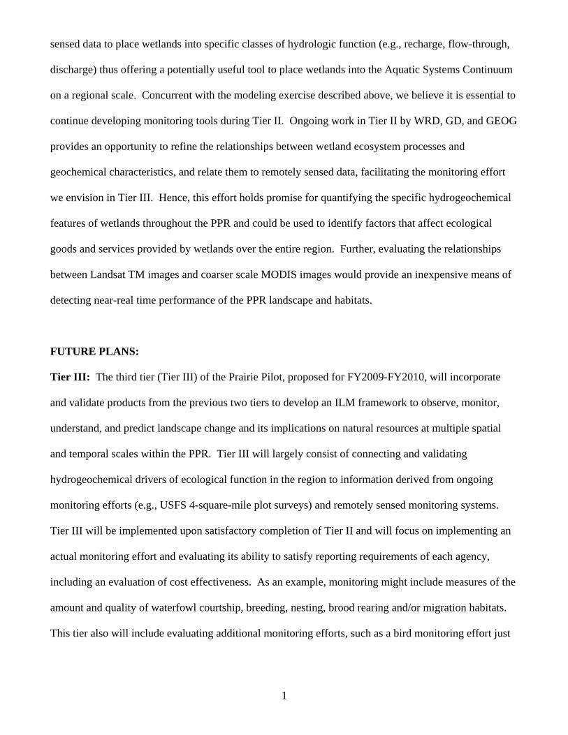
United States has been captured in the National Hydrologic Landscape Map (Wolock et al. 2004)
(Figure 6). The spatial heterogeneity across the United States clearly illustrates the hydrologic
variability throughout the nation. Within the PPR, there is also considerable variability in hydrologic
characteristics that need to be accounted for in the Prairie Pilot (Figure 7). Within the different
hydrologic landscapes depicted, relationships between surface and subsurface water are hypothesized to
be different and hence should exert different influences on ecological processes. Given that the
relationship of prairie wetlands to surface and groundwater has a profound influence on ecological
attributes, an understanding of the spatial variations in hydrologic characteristics is critical to the success
of the Prairie Pilot. While the Hydrologic Landscape is based on hypothesized hydrologic relationships,
in situ field measurements will be used to evaluate hypothesized relationships within the National
Hydrologic Landscape Map.
Figure 6. National Hydrologic Landscape Map (from Wolock et al. 2004).

As with hydrologic landscapes, the spatial distribution of geochemical characteristics is highly
variable across the United States. Also, as with hydrologic landscapes, a national map of geochemical
landscapes has great potential to connect each ILM Pilot to common drivers of ecological function. A
Geochemical Landscape map of the PPR is expected to show extremely strong gradients in the
geochemical characteristics of the region. For example, Gorham et al. (1983) divided the lakes in the
north-central United States into five groups (I-V) on the basis of their major ion concentrations. Figure
8 is a highly smoothed contour plot of total dissolved solids of these lakes showing the general east to
west increase in salinity of about four orders of magnitude that is largely a reflection of increasing
aridity across Minnesota and into the Dakotas (i.e., climate).
Figure 7. Hydrologic Landscape Map of the United States Prairie Pothole Region
(based on Wolock et al. 2004).
An unsmoothed contour plot of total dissolved solids (TDS) shows numerous bull’s eyes, especially in
the Dakotas, that are a reflection of local and regional geology, and hydrology.

Dilute
calcium-magnesium bicarbonate ground waters with <250 mg L-1 TDS are common in Wisconsin and
eastern and central Minnesota. Ground waters in western Minnesota and the Dakotas are of four main
types: calcium-magnesium sulfate, sodium bicarbonate, sodium chloride, and sodium sulfate (Winter
1977). The saline calcium-magnesium sulfate ground waters are derived from glacial drift containing
gypsum and pyrite from underlying Cretaceous sedimentary rocks. The sodium bicarbonate ground
waters are usually deep and are the products of ion exchange. Sodium chloride ground waters occur in
Cretaceous and Paleozoic bedrock aquifers in the Dakotas. Sodium sulfate ground waters are believed
Figure 8. Geographic variation in total dissolved solids of lakes showing a general east to west increase in salinity. (The Prairie Pothole Region is outlined in green.) Data are from Gorham et al. (1983).

to form by mixing of deep sodium chloride waters with sulfate-rich waters in glacial drift. All of these
saline ground waters may move long distances before surfacing to influence lake-water chemistry
(Winter 1977). Group I lakes are small and occur in coarse, noncalcareous sand and gravel or in basins
on exposed igneous rocks in northwestern Wisconsin and northeastern Minnesota. Most have small
drainage areas and no outlets. Group II lakes also occupy drainage basins in noncalcareous substrates in
northern Wisconsin and Minnesota, but many are larger and have active outlets. Their drainage basins
generally have more weathered soils and, therefore, have higher TDS. Group III lakes are mostly in
Minnesota and all but the most dilute of these lakes precipitate CaCO3 (Dean and Gorham 1976). The
empirical boundary for CaCO3 precipitation in these north-central US lakes occurs at a TDS of about
230 mg L-1, or a total cation concentration of about 40 (Dean and Megard 1993). The waters in group
I, II, and III lakes are dominated by calcium, magnesium, and bicarbonate (alkalinity) (Figure 9). Most
ions increase with TDS going from group I to group III lakes. This is analogous to taking a beaker of
group I water and transporting it across the steep aridity gradient in Minnesota, evaporating it, and then
precipitating CaCO3. Lake chemistry starts to get interesting in group IV lakes in western Minnesota
and the Dakotas as precipitation of CaCO3 continues; but as a result, concentrations of calcium and
alkalinity rapidly decrease, and those of sodium and, especially, sulfate increase with increasing salinity
(Figure 8). The group IV lakes occur on calcareous substrates, but ground waters deliver abundant
sodium and sulfate derived from underlying Cretaceous shale (Winter 1977). Sodium and sulfate
dominate strongly over all other ions in the most concentrated waters. The westward increase in
climatic aridity is the main cause of the increase in TDS between group II and group IV lakes and
contributes to the shift in ionic dominance toward sulfate as CaCO3 is precipitated. However, the sharp
increase in sulfate indicates that a geologic boundary is crossed delivering saline ground waters from
underlying Cretaceous shale. Group V lakes are mostly in North Dakota, but some occur in South
Dakota and western Minnesota. Their waters are saline, dominated by sodium and sulfate (Figure 9).

The most saline group V lakes precipitate hydrated sodium sulfate (mirabilite) in winter. The most
saline prairie pothole lakes in North Dakota occur at low elevation in glacial outwash.
Clearly, spatial patterns in the chemical composition and characteristics of any geographic area
exert a major influence on ecological function. In areas such as the PPR where chemical gradients are
especially steep, the impact on ecosystem function is a major factor influencing the composition of
biological communities. As noted earlier, the PPR undergoes marked climate variation with periods of
extended drought followed by long periods of deluge. Wet periods are characterized by visibly
abundant aquatic resources such as lakes and wetlands that are dominant features of the landscape
whereas essentially all wetlands and many lakes can be completely dry during extended drought. This
inter-annual climate plays a critical ecological role by influencing the hydrologic characteristics of the
area and it is also responsible for steep temporal gradients in water chemistry of aquatic habitats, such
as wetlands.
The water budgets of lakes and wetlands in the PPR are largely driven by atmospheric water.
Hence, solutes in lakes and wetlands concentrate during drought because water loss from evaporation
exceeds water inputs from precipitation. As a result, standing water in individual wetlands can be fresh
or saltier than the world’s oceans, depending upon temporal position in the natural climate cycle. The
Wetland Continuum Concept (Euliss et al. 2004) provided the ecological framework to conceptualize
the primary drivers of processes (i.e., climate-driven changes in hydrogeochemical characteristics) to
improve ecological interpretations of biological data from wetlands. Recently, Winter (2006) advanced
the Aquatic Systems Continuum as a means to apply the Wetland Continuum Concept to broad
geographic areas and include other aquatic resources such as rivers. The Geochemical Landscape
Concept being developed by the Geology Discipline will greatly enhance hydrological and biological
applications in evaluations of ecological function and performance over broad geographic landscapes.
Given the highly dynamic nature of the PPR with respect to important spatial and temporal gradients in

geochemistry and hydrology, accounting for the influence of temporal climate shifts on hydrologic and
geochemical drivers is critical to the success of the Prairie Pilot.
Figure 9. Major ion composition of lakes in north-central United States. Data are from Gorham et al. (1983).
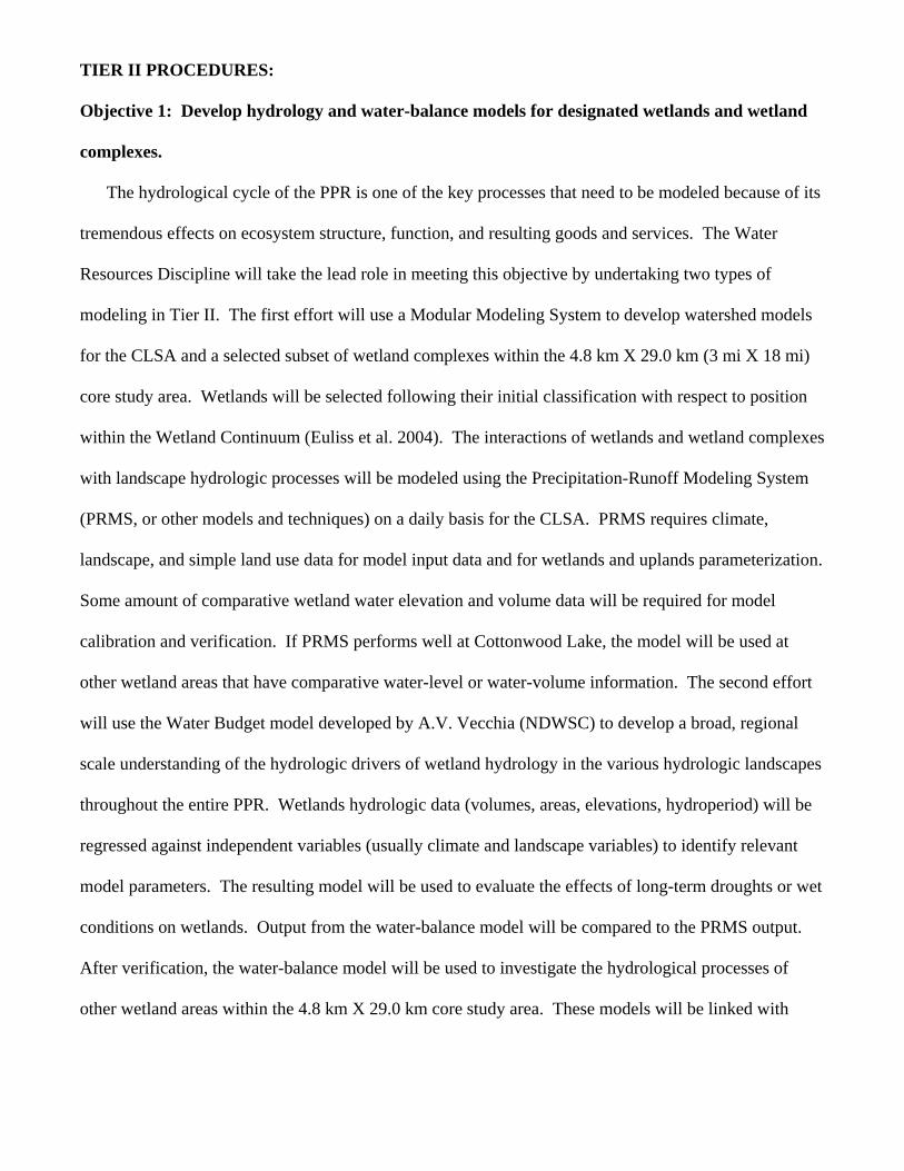
TIER II PROCEDURES:
Objective 1: Develop hydrology and water-balance models for designated wetlands and wetland
complexes.
The hydrological cycle of the PPR is one of the key processes that need to be modeled because of its
tremendous effects on ecosystem structure, function, and resulting goods and services. The Water
Resources Discipline will take the lead role in meeting this objective by undertaking two types of
modeling in Tier II. The first effort will use a Modular Modeling System to develop watershed models
for the CLSA and a selected subset of wetland complexes within the 4.8 km X 29.0 km (3 mi X 18 mi)
core study area. Wetlands will be selected following their initial classification with respect to position
within the Wetland Continuum (Euliss et al. 2004). The interactions of wetlands and wetland complexes
with landscape hydrologic processes will be modeled using the Precipitation-Runoff Modeling System
(PRMS, or other models and techniques) on a daily basis for the CLSA. PRMS requires climate,
landscape, and simple land use data for model input data and for wetlands and uplands parameterization.
Some amount of comparative wetland water elevation and volume data will be required for model
calibration and verification. If PRMS performs well at Cottonwood Lake, the model will be used at
other wetland areas that have comparative water-level or water-volume information. The second effort
will use the Water Budget model developed by A.V. Vecchia (NDWSC) to develop a broad, regional
scale understanding of the hydrologic drivers of wetland hydrology in the various hydrologic landscapes
throughout the entire PPR. Wetlands hydrologic data (volumes, areas, elevations, hydroperiod) will be
regressed against independent variables (usually climate and landscape variables) to identify relevant
model parameters. The resulting model will be used to evaluate the effects of long-term droughts or wet
conditions on wetlands. Output from the water-balance model will be compared to the PRMS output.
After verification, the water-balance model will be used to investigate the hydrological processes of
other wetland areas within the 4.8 km X 29.0 km core study area. These models will be linked with

other model components to quantify the interactions between the water cycle and ecosystem services
(e.g., groundwater recharge, flood water storage, habitat quality, biogeochemical cycles).
Data available to support Objective 1:
• Hydrology data – surface-water elevation and volume information from the CLSA, and other
wetland areas designated for the study.
• Climate data – available from National Weather Service stations near to the areas of study.
• Topography data – DEMs and maps for determining the hydrologic response units of the
model and for parameter development.
• Land use and soils data for parameter development.
Interim Products:
• Watershed models of the CLSA and a subset of wetlands from the 4.8 km X 29.0 km (3 mi X
18 mi) core study area.
Objective 2: Characterize the spatial distribution of chemical elements in surficial materials of
the PPR with a focus on the processes that lead to the observed geochemical abundance,
distribution, and bioavailability.
The geology discipline will take the lead in meeting this objective by conducting a soil survey to
determine the chemical elements in surficial materials of the PPR. At each sample point, 1) a compete
suite of inorganic analyses by total extraction of the sample and analyses by Inductively Coupled Plasma
Atomic Emission Spectrometry (ICPAES) and Inductively Coupled Plasma Mass Spectrometry
(ICPMS) will be conducted, 2) “geoavailable’ and “bioavailable” fractions of the soil by selective
extraction methods will be determined, and 3) selected organic contaminants will be measured. The
chelating agent diethylenetriaminepentaacetic acid (DTPA) is a widely used extractant to determine
bioavailability of elements to plants. However, this test has been found to be problematic when soil pH
is less than about six, so further research may be required if such low pH values are encountered.

Selective extraction data, along with mineralogical characterization, on the very small size fractions of
soil (<50 mm) will also provide information on the amount and bioavailability of elements. Sampling of
soils will involve not only the appropriate selection of sites within a two-dimension (earth surface)
framework, but also evaluation of the variability in the third dimension expressed in the soil profile.
Statistical sampling methodology will be modified by taking into account specific
geologic/geomorphic/geographic features. Another deterministic variable is the comparative impact of
agricultural practice (e.g., crop type, fertilizer type, irrigation, tillage) on the geochemistry of soils
developed in the same geologic and climatic setting. Sampling protocols will involve a very detailed
soil-horizon-based sampling at each site combined with extensive major and trace element chemical
analyses, determination of bioavailability, and analyses of selective organic compounds. An important
aspect of soil characterization in the PPR is that it will use a greater sampling density than will be used
for the national survey.
Interim Products:
• Evaluation of hypothesized relationships among drivers of geochemistry in the various
landscapes defined by the National Geochemical Landscape Map within the 4.8 km X 29.0
km (3 mi X 18 mi) core study area.
Objective 3: Develop and refine models to quantify relationships between in situ measurements
and specific ecological goods and services with remotely sensed data.
The Geography Discipline will continue the identification and refinement of models that use
remotely sensed data to place wetlands into specific classes of hydrologic function (e.g., recharge, flow-
through, discharge). Determining the hydrologic function of wetlands is the most fundamental aspect of
our work that links model outputs of all ecosystem services to monitoring information at the regional
scale. This objective will utilize determinations of hydrologic function based on discipline-specific (i.e.,
WRD, GC, and BRD will provide separate field calls of hydrologic function) determinations to evaluate
relationships with remotely sensed spatial data. Our work in Tier I demonstrated the plausibility of

using remotely sensed data to place wetlands into specific classes of hydrologic function (Rover et al.
2007), offering a useful tool to place wetlands into the Aquatic Systems Continuum to forecast change
in diverse ecosystem services within the 4.8 km X 29.0 km (3 mi X 18 mi) core study area.
Interim Products:
• Report describing the utility of using Landsat data to place study wetlands into specific
hydrologic function categories (i.e., recharge, flow-through, and discharge).
Objective 4: Develop relationships between hydrologic and geochemical landscapes to determine
the hydrologic function of study wetlands for placement into the aquatic systems continuum.
There is obvious synergy between hydrologic and geochemical landscapes because soil
geochemistry largely reflects the interactions of rock/soil materials with soil waters, and these
interactions in turn are a control on surface- and ground-water quality. The Water Discipline has
developed the model of “hydrologic landscapes”. The hydrologic system of a landscape unit consists of
the movement of 1) surface water, which is controlled by slopes and permeability of their surfaces; 2)
ground water, which is controlled by the hydraulic characteristics of its geologic framework; and 3)
atmosphere-water exchange, which is controlled by climate (Winter et al. 1998). Soil processes play
directly into this concept through the interaction of land slope and soil permeability as controls on
ground-water recharge and chemistry. The Geology Discipline will specifically study fluid-rock
interactions in soils to characterize their mutual interactions, and to develop formal linkages between
geochemical landscapes and the application of hydrologic landscape concepts. Research protocols that
identify important natural processes that link hydrologic and geochemical landscapes will be developed
and relationships will be used to assist with the placement of designated wetlands into the aquatic
systems continuum.
Interim Products:
• Placement of study wetlands into the aquatic systems continuum.

Objective 5: Model relationships between natural (e.g., climate) and anthropogenic (e.g., land-
use) changes in hydrogeochemistry, and specific ecological goods and services within the context of
the aquatic systems continuum.
The ecological goods and services we plan to assess can be grouped into 3 broad groupings: 1)
abiotic wetland processes (e.g., flood-water storage, ground-water recharge, carbon sequestration); 2)
abiotic upland processes (e.g., erosion reduction, chemical loading); and 3) biotic goods and services
(e.g., food/fiber production, wildlife habitat). The frame-based models developed under this objective
will be focused on quantifying these goods and services within the framework of the aquatic systems
continuum to measure the performance of conservation programs.

Abiotic Wetland Services: We will combine the hydrologic watershed and water budget models
developed under Objective 1 with known area volume relationships for prairie pothole wetlands and
detailed topographic data to predict flood-water storage and ground-water recharge services. A modeling
system that can be used to account for all three major greenhouse gases (i.e., CO2, N2O, and CH4) in the
PPR at various spatial (field plot to regional) and temporal (daily to decades) scales will also be
developed. The modeling system will be developed on the basis of existing models such as the Erosion-
Deposition-Carbon Model (EDCM), the Denitrification Decomposition Model (DNDC), and the General
Ensemble Biogeochemical Modeling System (GEMS). Extensive flux data collected across the
landscape will be used to calibrate and validate the modeling system at the plot to regional scales. We
will use the modeling system to evaluate the potential for carbon sequestration supply and its spatial
distribution. Food, biomass, and fiber will also be simulated with the ecosystem model. By linking with
the hydrologic models, it is expected that the frame-based ecosystem model can be used to simulate the
dynamics of the Aquatic Systems Continuum on the 4.8 km X 29.0 km (3 mi X 18 mi) core study area.
Abiotic Upland Services: Both wind- and water-induced erosion will be estimated because sample units
are wetland basins and their upland catchment areas. Reduction of water-induced erosion and chemical
loading (C, N, P) from uplands to prairie pothole wetlands will be quantified using existing models such
as USLE, USPED, AGNPS and CREAMS. Models will be calibrated and validated using observations
from the field plots and catchments. Models will be improved if model testing indicates modifications
are necessary. We also propose to collaborate with Dr. Eric Sundquist (WRD, Woods Hole) on
estimating erosion at the regional scale using USDA NRI data. The impacts of erosion and deposition
on the evolution of both uplands and wetlands (e.g., soil profile change, food and fiber production,
greenhouse gas emissions) will be simulated by linking the erosion models with biogeochemical models
such EDCM and GEMS.
Biotic Services: Changes in land use alter wildlife habitat values with individual species responding
differently to changing landscape conditions. Wildlife surveys traditionally have been used to monitor
population change, but this approach is not feasible for monitoring species within diverse taxa (e.g.,
birds, amphibians) simultaneously due to the cost and number of personnel required. Therefore, the
wildlife ecosystem service within the Prairie Pilot will be evaluated using models based on relationships
between select wildlife species or groups of species (e.g., waterfowl, shorebirds, passerine birds,
amphibians) and various spatial and structural habitat measures. A habitat-based approach is based on
the assumption that habitat conditions are a primary determinant of wildlife community composition and
the landscape variables used to assess change are the most appropriate and provide acceptable results.
Numerous models linking bird distributions with habitat assessments already have been developed,
including GIS-based approaches and statistical models (e.g., logistical regression, classification and
regression tree models) derived from empirical data. Additionally, critical habitat requirements of many
amphibians are also known (Semlitsch 2000). This effort will involve the identification of the most
appropriate species-habitat relationships to model, determination of the number and types of spatial and
structural habitat variables to be included as model parameters, and assessments of the most appropriate
spatial scales to evaluate. The goal is to select a group of species (e.g., shorebirds, anurans) that provide
a broad assessment of habitat values over time. Species-habitat relationships for each group will be
obtained from the published literature and existing databases (e.g., Breeding Bird Survey, Monitoring
Avian Productivity and Survivorship Program, Breeding Biology Research and Monitoring Database)
and evaluated for possible inclusion in models.
The amphibian community modeling portion of this effort will be conducted by a North Dakota
State University PhD student as a dissertation research project. Amphibian communities of the PPR are
embedded within a natural system that is driven by external forces such as climate cycles, agricultural
practices, and conservation practices. Within the system, life-history adaptations, competition,

predation, dispersal, recolonization, and other processes influence ultimate community structure. Given
their complexity, the system in which communities are embedded is often ignored by modelers
(Starfield et al. 1993). Also, it is problematic to construct models of ecological systems because
relationships between abiotic and biotic components often are understood only in a rough, qualitative
manner (Starfield et al. 1989). Starfield et al. (1993) offer a frame-based paradigm for dynamic
ecosystem models that facilitates the building of parsimonious system models given the difficulties
noted above. As previously discussed, the wetland continuum concept (Euliss et al. 2004) provides an
intuitive base that will be used for constructing a frame-based model of PPR amphibian communities.
Habitat conditions vary depending on season as it relates to stage in the annual cycle; thus,
multiple parameters will be required for each group. Further, feasibility will require the ability to obtain
habitat information from remotely sensed platforms. Unfortunately, detailed knowledge of exact
features that influence habitat suitability in the PPR is lacking. Thus, information for some parameters
likely will not be available or, if available, may be of uncertain applicability because the research was
conducted in areas dissimilar to the PPR. In these cases, information will have to be estimated and
verified through monitoring or research. The utility of this method is the capability to efficiently
estimate potential wildlife species richness over time to provide a comprehensive assessment of
changing values that provides information that complements values estimated by traditional wildlife
surveys.
CLSA data available to support Objective 5:
• Biotic data (i.e., monthly bird counts, breeding bird surveys, amphibian capture rates, aquatic
invertebrate species composition and biomass, plant community composition, vegetative
zone delineations) are available from 1992 to present, a period of dynamic climate variation
that includes both severe drought and deluge.
• Hydrologic data (i.e., surface-water elevations, ground-water elevations, hydroperiods) are
available since 1979. Data are available from WRD to place the CLSA in the regional
ground-water setting.
• Climate data (i.e., air temperature [over land], air temperature [over water], surface-water
temperature, humidity, wind speed, precipitation at site, precipitation from nearby National
Weather Service stations, Palmer Drought Severity Indices) are available since 1979 or
before.
• Chemistry data (i.e., specific conductance, pH, calcium, magnesium, potassium, sodium,
alkalinity, chloride, sulfate, ammonia, nitrate, nitrite, ortho-phosphate, total phosphate,
kjeldahl nitrogen, silica, iron, and chlorophyll a) are available for five key wetlands (T3, T8,
P1, P8, and P11) from 1984-2002 and for additional wetlands from all wetlands from 1992-
1995.
• Total station and other data are available for the entire site, including wetland basins, to
facilitate estimates of a broad suite of ecological services (e.g., water storage, erosion
reduction, water quality improvement, sediment and chemical filtration, carbon
sequestration, and groundwater recharge).
Interim Products:
• Frame-based model capable of simulating natural changes in hydrogeochemistry on the
delivery of specific ecological goods and services identified as performance measures of
conservation programs in the Departments of Agriculture and Interior.
HAZARD ASSESSMENT:
Most work will be performed in an office setting. Precautions will be used to prevent injuries
due to repetitive motions associated with computer use. The offices will be adequately lighted, heated,
and ventilated. When field work is required, a thorough safety orientation will be provided to all crew

members before beginning field work. Crew members will be trained in First Aid/CPR and first aid kits
and a mobile phone will be provided to enhance our ability to deal effectively with minor and
unanticipated emergencies. Crew members will wear personal flotation devices at all times while
working in or near wetlands. Non-commercial aircraft will not be used in this effort.
ANIMAL WELFARE CONCERNS:
No animals will be used in this effort.
METADATA COMPLIANCE OBJECTIVES:
Metadata will be prepared and maintained in compliance with the NBII biological metadata
standard, the Federal Geographic Data Committee's Content Standards for Digital Geospatial Metadata
and Biological Resources Division Policy Issuance Number 8. Compliant metadata will be submitted to
the NBII Clearinghouse.
LITERATURE CITED:
Cowardin, L. M., V. Carter, F. C. Golet, and E. T. LaRoe. 1979. Classification of wetlands and deepwater habitats of the United States. U.S. Fish and Wildlife Service, Washington, DC. FWS/OBS-79/31.
Dean, W. E., and E. Gorham. 1976. Major components of Minnesota lake sediments. Limnology and
Oceanography 21:259-284. Dean, W. E., and R. O. Megard. 1993. Environment of deposition of CaCO3 in Elk Lake, in Bradbury,
J.P. and Dean, W.E., eds. Elk Lake, Minnesota--Evidence for rapid climate change in north-central United States. Geological Society of America, Special Paper 276:97-114.
Euliss, N. H., Jr., J. W. LaBaugh, L. H. Fredrickson, D. M. Mushet, M. K. Laubhan, G. A. Swanson, T.
C. Winter, D. O. Rosenberry, and R. D. Nelson. 2004. The wetland continuum: a conceptual framework for interpreting biological studies. Wetlands 24:448-458.
Gleason, R. A., M. K. Laubhan, and N. H. Euliss, Jr., Editors. 2007. Ecosystem services derived from
wetland conservation practices in the United States Prairie Pothole Region with emphasis on USDA Conservation Reserve and Wetland Reserve Programs. U. S. Geological Survey, Biological Resources Discipline, Scientific Investigations Report
Gorham, E., W. E. Dean, and J. E. Sanger. 1983. The chemical composition of lakes in the north-
central United States: Limnology and Oceanography 28:287-301.
Prairie Pilot Science Team. 2007. Integrated Landscape Monitoring: Prairie Pilot – 2006 Report. U. S,
Geological Survey, Northern Prairie Wildlife Research Center, Jamestown, ND. Rover, J., C. Wright, and N. H. Euliss, Jr. 2007. Quantifying wetland dynamics and hydrologic
function with Landsat Thematic Mapper. Poster Presentation at the Annual Meeting of the American Geophysical Union, December 10-14, 2007, San Francisco, CA.
Semlitsch, R. D. 2000. Principles for management of aquatic-breeding amphibians. Journal of Wildlife
Management 64:615-631. Starfield, A. M., and A. L. Bleloch. 1986. Building models for conservation and wildlife management.
Interaction Book Company, Edina, MN. Starfield, A. M., D. H. M. Cumming, R. D. Taylor, and M. S. Quadling. 1993. A frame-based paradigm
for dynamic ecosystem models. AI Applications 7:1-13. Starfield, A. M., B. P. Farm, and R. H. Taylor. 1989. A rule-based ecological model for the
management of an estuarine lake. Ecological Modeling 46:107-119. Stewart, R. E. and H. A. Kantrud. 1971. Classification of natural ponds and lakes in the glaciated
prairie region. U.S. Fish and Wildlife Service Resource Publication 92. Winter, T.C., 1977, Classification of the hydrologic settings of lakes in the north central United States.
Water Resources Research 13:753-767. Winter, T. C. 2001. The concept of hydrologic landscapes. Journal of the American Water Resources
Association 37:335-349. Winter, T. C. 2006 The Aquatics System Continuum. Abstracts of the Canadian Geophysical Union
Annual Meeting, 14-17 May 2006, Banff, Alberta, Canada. Wolock, D. M., T. C. Winter, and G. McMahon. 2004. Delineation and evaluation of hydrologic-
landscape regions in the United States using GIS tools and multivariate statistical analyses. Environmental Management 34, Supplement 1, p. S71-S88.


