Spatial DATA Solutions for Mining - esriea.com Data... · ESRI GIS For Mining Seminar, 10th August,...
33
Spatial DATA Solutions for Mining ESRI GIS For Mining Seminar, 10 th August, 2016, Nairobi, Kenya
Transcript of Spatial DATA Solutions for Mining - esriea.com Data... · ESRI GIS For Mining Seminar, 10th August,...

Spatial DATA Solutions for Mining
ESRI GIS For Mining Seminar, 10th August, 2016, Nairobi, Kenya
Spatial Data Solutions for Mining
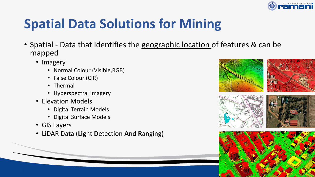
• Spatial - Data that identifies the geographic location of features & can be mapped• Imagery
• Normal Colour (Visible,RGB)• False Colour (CIR)• Thermal• Hyperspectral Imagery
• Elevation Models• Digital Terrain Models• Digital Surface Models
• GIS Layers• LiDAR Data (Light Detection And Ranging)
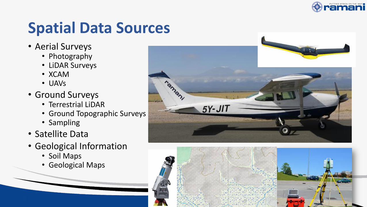
Spatial Data Sources• Aerial Surveys
• Photography• LiDAR Surveys• XCAM• UAVs
• Ground Surveys• Terrestrial LiDAR• Ground Topographic Surveys• Sampling
• Satellite Data• Geological Information
• Soil Maps• Geological Maps

Exploration & Mining Process
Prospecting & Exploration
Planning Development
ExtractionReclamation
& Closure
Increasing Accuracy and Technical Requirements
Low Hig
h

Prospecting & Exploration
Planning Development
ExtractionReclamation
& Closure
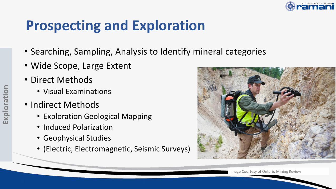
Prospecting and Exploration
• Searching, Sampling, Analysis to Identify mineral categories
• Wide Scope, Large Extent
• Direct Methods• Visual Examinations
• Indirect Methods• Exploration Geological Mapping
• Induced Polarization
• Geophysical Studies
• (Electric, Electromagnetic, Seismic Surveys)
Image Courtesy of Ontario Mining Review
Exp
lora
tio
n

Applications & Requirements
Applications
• Reconnaissance and feasibility study
• Targeted Exploration (Narrow Down Scope)
• Geological Mapping of surfaced deposits
• Hydrological Data
• Lineament Analysis
Spatial Data Requirements
• Low Resolution
• Low Accuracy
• Examples• Satellite Imagery such as
• ASTER (15m -30m) • LANDSAT (30m)• SPOT MAPS (2.5m, 5m))
• Satellite Elevation Products• SRTM (30m, 65m, 90m)• SPOT DEM (20m)• SPOT DEM DTM (10-12m)
Exp
lora
tio
n

Low Resolution Data
ASTER Imagery (15 – 30 m Resolution) SRTM 30 – 90 m Grid Size
Exp
lora
tio
n
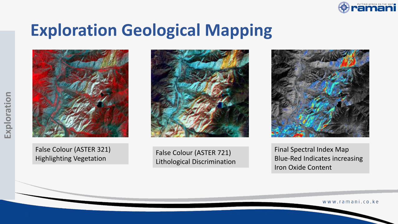
Exploration Geological Mapping
False Colour (ASTER 321)Highlighting Vegetation
False Colour (ASTER 721)Lithological Discrimination
Final Spectral Index MapBlue-Red Indicates increasing Iron Oxide Content
Exp
lora
tio
n

Prospecting & Exploration
Planning Development
ExtractionReclamation
& Closure

Applications & Requirements
• Permissions & Logistics
• Planning & Construction of Mine• Potential Drill Sites
• Access Routes
• Environmental Impact Assessment
• Tailings Management Plan
• Hyrodology and Drainage Management
• Manage Land Titles & Licenses
• Medium-High Accuracy Medium-High Resolution
• Examples• Satellite Imagery such as
• SPOT MAPS (2.5m, 5m))
• Quick Bird,
• World View 1 & 2 (≈ 50 cm)
• Satellite Elevation Products• SPOT DEM DTM (10 - 15m)
• Aerial Photography & LiDAR Surveys
Pla
nn
ing
& D
eve
lop
me
nt

Medium Resolution DataSPOT MAPS 2.5m
SPOT DEM DSM 20m
Pla
nn
ing
& D
eve
lop
me
nt
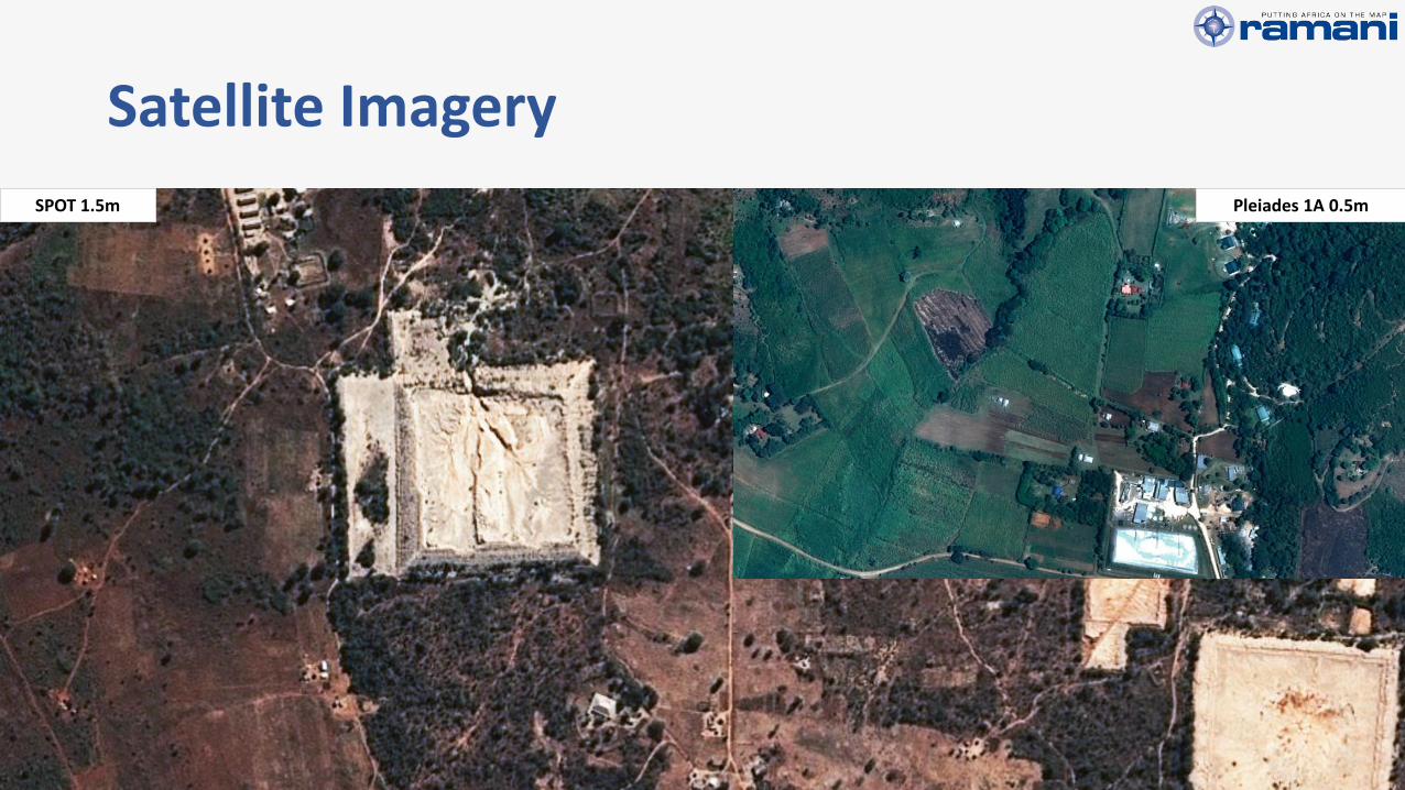
SPOT 1.5m
Satellite Imagery
Pleiades 1A 0.5m

High Resolution Satellite Imagery• World View 1
• World View 2
• Quick Bird
Images courtesy of Digital Globe
Resolution 50cm

Prospecting & Exploration
Planning Development
ExtractionReclamation
& Closure

Applications & Requirements
• Actual Mining and Ore Extraction
• Site management
• Health & Safety
• Tailings Storage Management
• Waste Water management
• Volumetric Analysis• Stock Pile Measurements
• Cut & Fill Computations
• Very High Accuracy
• Very High Resolution
• Large Area
• Examples• Aerial Photography & LiDAR
Surveys
• Terrestrial LiDAR
• Topographic Survey
Extr
acti
on

Aerial Photography5cm Image Resolution

Aerial Photography - Actual Resolution5cm Image Resolution

Elevation Models
• Topography Modelling (Contours, HillShade, SlopeMaps, Viewshed)
• Volumetric Analysis & Stock Pile Computations
2m DSM & DTM
Extr
acti
on
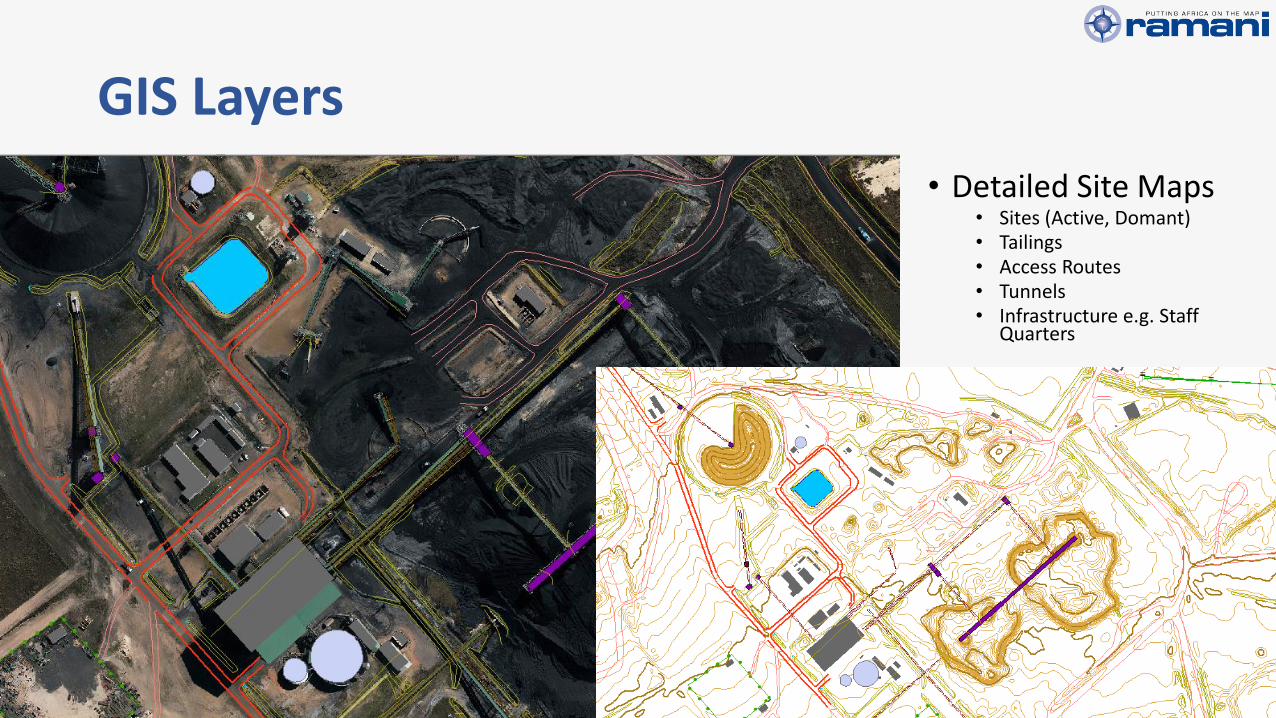
GIS Layers
• Detailed Site Maps• Sites (Active, Domant)• Tailings• Access Routes• Tunnels• Infrastructure e.g. Staff
Quarters

Detailed Contours
Extr
acti
on

Aerial LiDAREx
trac
tio
n

LiDAR Point Cloud
Extr
acti
on

Aerial LiDAR - Very Detailed Terrain Models
Extr
acti
on

Tailings Management
Tailings Epoch 1Tailings Epoch 2 Tailings Difference
Extr
acti
on
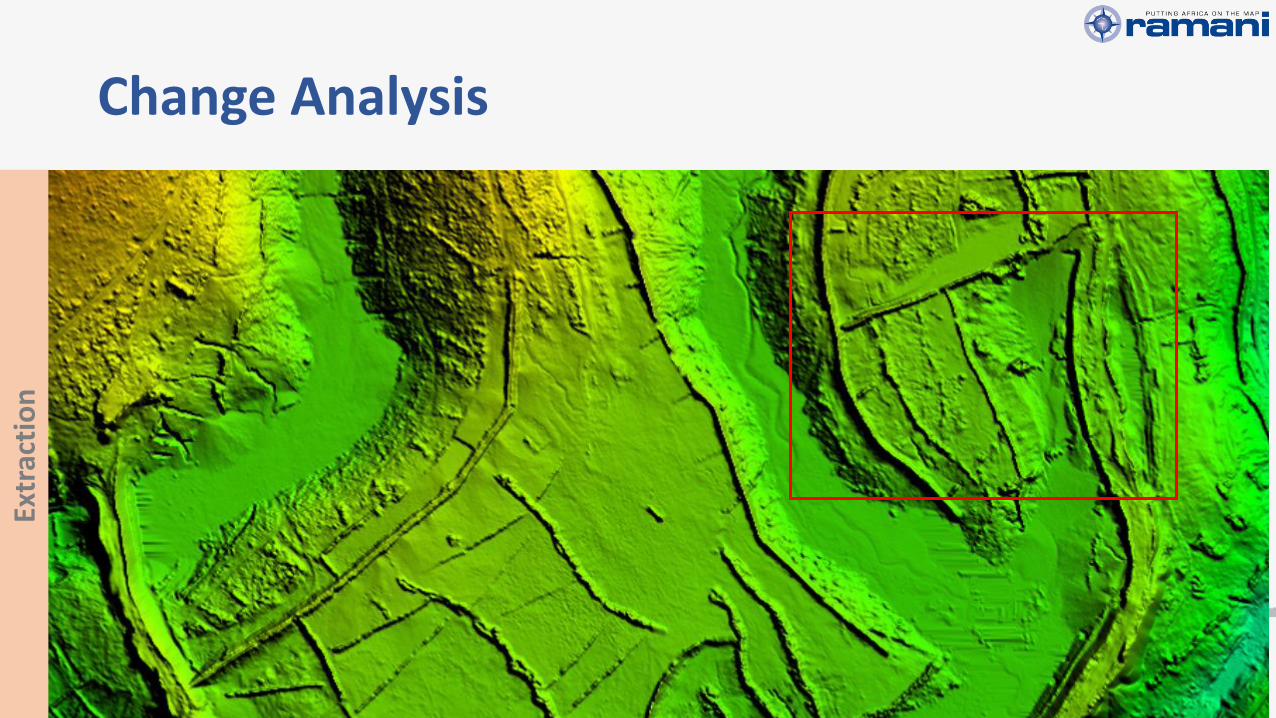
Change Analysis
Extr
acti
on

Terrestrial LiDAR
• Small Sites
• Repetitive Observations
• Applications• Stock Pile
Measurements
• Deformation Analysis
• Tailings Management
Extr
acti
on

Prospecting & Exploration
Planning Development
ExtractionReclamation
& Closure
Clo
sure
& R
ecl
amat
ion

Applications & Requirements
• Develop a Closure & Rehabilitation Plan
• Site Clean Up & Reclamation
• Environmental Monitoring
• Community education
• High – Very High Accuracy
• High – Very High Resolution
• Examples:• Soil and Lithology
• Vegetation
• Hydrology & Ground Water
• Vegetation and Land Cover mapping
Clo
sure
& R
ecl
amat
ion
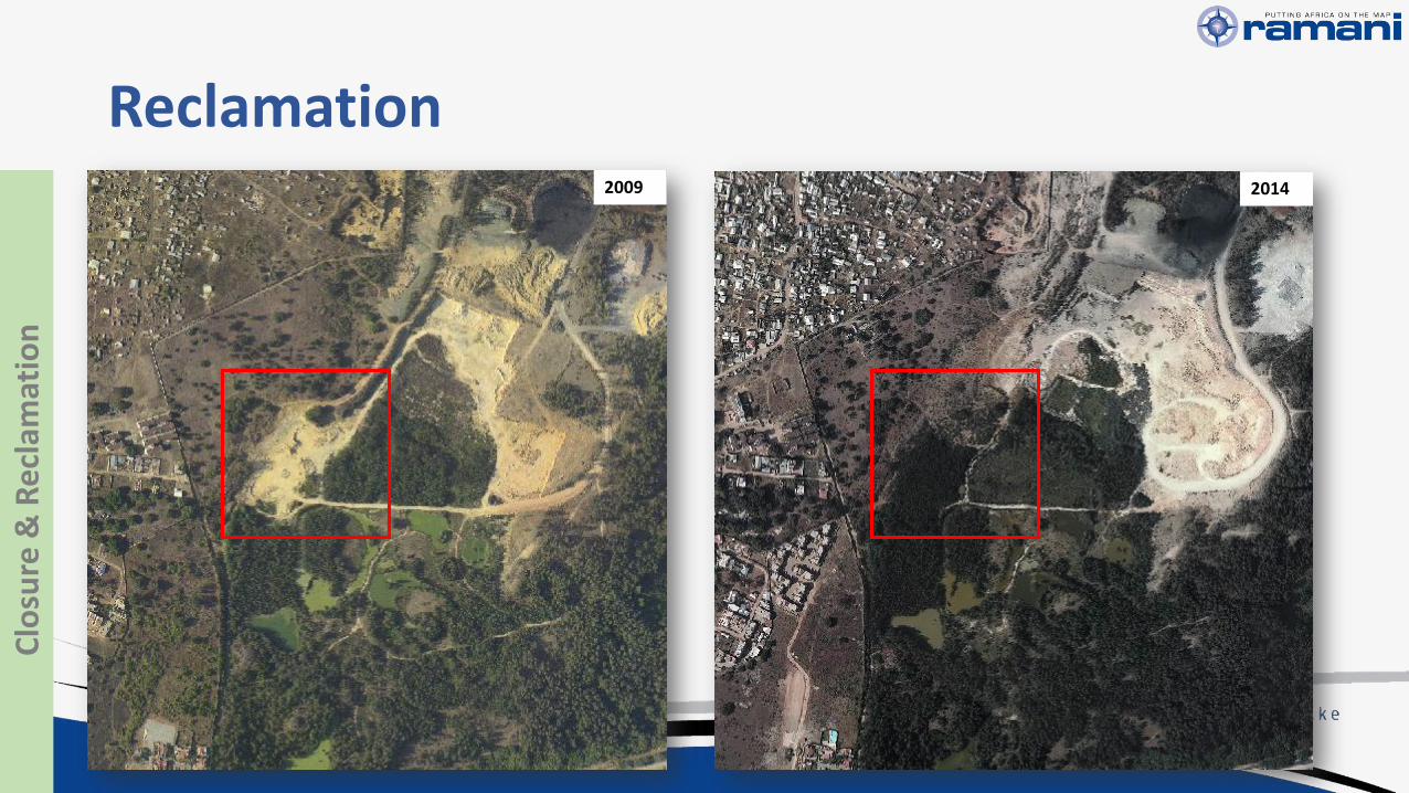
Reclamation2009 2014
Clo
sure
& R
ecl
amat
ion

Conclusion
• Spatial Data Supports:• Mineral Exploration
• Process Control
• Environment Conservation
• Scalable Accuracy and Technical specifications
Increasing Accuracy and Technical Requirements
Low H
igh
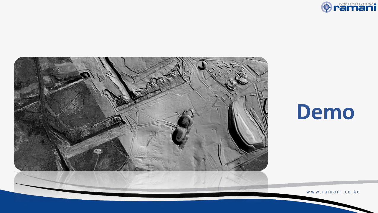
Demo

Need Spatial Data?
www.ramani.co.ke
Wilson Business Park, Foxtrot Building
CONTACT US