[SITE STATUS SUMMARY - MARCH 2007 FOR BANDERA ROAD ... › work › 06 › 215986.pdf · The...
5
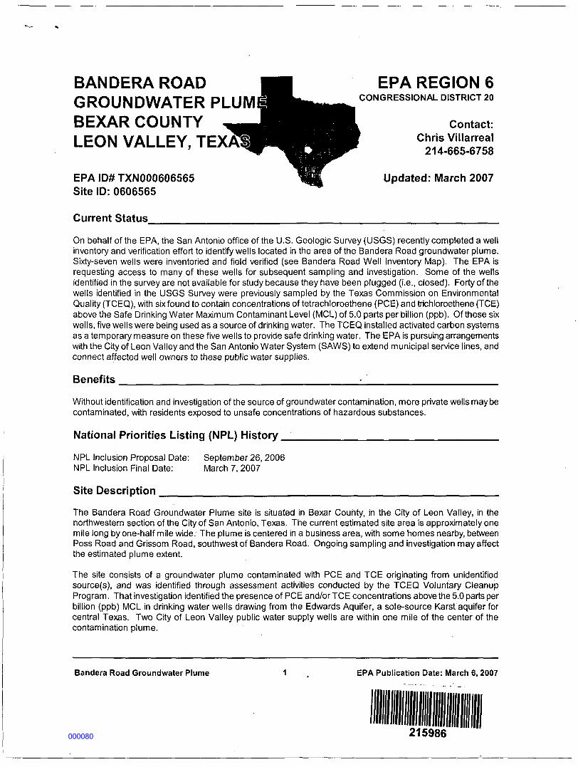
BANDERA ROAD H EPA REGION 6 GROUNDWATER PLUM W^^^^ CONGRESSIONAL DISTRICT 20 BEXAR COUNTY _J^^|HL Contact: LEON VALLEY, EPA ID# TXN000606565 Updated: March 2007 Site ID: 0606565 Current Status On behalf of the EPA, the San Antonio office of the U.S. Geologic Survey (USGS) recently completed a well inventory and verification effort to identify wells located in the area of the Bandera Road groundwater plume. Sixty-seven wells were inventoried and field verified (see Bandera Road Well Inventory Map). The EPA is requesting access to many of these wells for subsequent sampling and investigation. Some of the wells identified in the survey are not available for study because they have been plugged (i.e., closed). Forty of the wells identified in the USGS Survey were previously sampled by the Texas Commission on Environmental Quality (TCEQ), with six found to contain concentrations of tetrachloroethene (PCE) and trichloroethene (TCE) above the Safe Drinking Water Maximum Contaminant Level (MCL) of 5.0 parts per billion (ppb). Of these six wells, five wells were being used as a source of drinking water. The TCEQ installed activated carbon systems as a temporary measure on these five wells to provide safe drinking water. The EPA is pursuing arrangements with the City of Leon Valley and the San Antonio Water System (SAWS) to extend municipal service lines, and connect affected well owners to these public water supplies. Benefits Without identification and investigation of the source of groundwater contamination, more private wells may be contaminated, with residents exposed to unsafe concentrations of hazardous substances. National Priorities Listing (NPL) History NPL Inclusion Proposal Date: September 26, 2006 NPL Inclusion Final Date: March 7, 2007 Site Description The Bandera Road Groundwater Plume site is situated in Bexar County, in the City of Leon Valley, in the northwestern section of the City of San Antonio, Texas. The current estimated site area is approximately one mile long by one-half mile wide. The plume is centered in a business area, with some homes nearby, between Poss Road and Grissom Road, southwest of Bandera Road. Ongoing sampling and investigation may affect the estimated plume extent. The site consists of a groundwater plume contaminated with PCE and TCE originating from unidentified source(s), and was identified through assessment activities conducted by the TCEQ Voluntary Cleanup Program. That investigation identified the presence of PCE and/or TCE concentrations above the 5.0 parts per billion (ppb) MCL in drinking water wells drawing from the Edwards Aquifer, a sole-source Karst aquifer for central Texas. Two City of Leon Valley public water supply wells are within one mile of the center of the contamination plume. Bandera Road Groundwater Plume 1 . EPA Publication Date: March 6,2007 215986 000080
Transcript of [SITE STATUS SUMMARY - MARCH 2007 FOR BANDERA ROAD ... › work › 06 › 215986.pdf · The...
BANDERA ROAD H EPA REGION 6GROUNDWATER PLUM W^^^^ CONGRESSIONAL DISTRICT 20
BEXAR COUNTY _J |HL Contact:
LEON VALLEY,
EPA ID# TXN000606565 Updated: March 2007Site ID: 0606565
Current Status
On behalf of the EPA, the San Antonio office of the U.S. Geologic Survey (USGS) recently completed a wellinventory and verification effort to identify wells located in the area of the Bandera Road groundwater plume.Sixty-seven wells were inventoried and field verified (see Bandera Road Well Inventory Map). The EPA isrequesting access to many of these wells for subsequent sampling and investigation. Some of the wellsidentified in the survey are not available for study because they have been plugged (i.e., closed). Forty of thewells identified in the USGS Survey were previously sampled by the Texas Commission on EnvironmentalQuality (TCEQ), with six found to contain concentrations of tetrachloroethene (PCE) and trichloroethene (TCE)above the Safe Drinking Water Maximum Contaminant Level (MCL) of 5.0 parts per billion (ppb). Of these sixwells, five wells were being used as a source of drinking water. The TCEQ installed activated carbon systemsas a temporary measure on these five wells to provide safe drinking water. The EPA is pursuing arrangementswith the City of Leon Valley and the San Antonio Water System (SAWS) to extend municipal service lines, andconnect affected well owners to these public water supplies.
Benefits
Without identification and investigation of the source of groundwater contamination, more private wells may becontaminated, with residents exposed to unsafe concentrations of hazardous substances.
National Priorities Listing (NPL) History
NPL Inclusion Proposal Date: September 26, 2006NPL Inclusion Final Date: March 7, 2007
Site Description
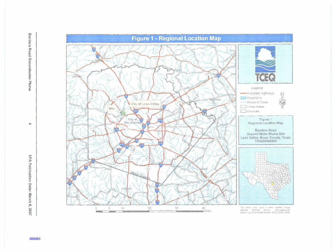
The Bandera Road Groundwater Plume site is situated in Bexar County, in the City of Leon Valley, in thenorthwestern section of the City of San Antonio, Texas. The current estimated site area is approximately onemile long by one-half mile wide. The plume is centered in a business area, with some homes nearby, betweenPoss Road and Grissom Road, southwest of Bandera Road. Ongoing sampling and investigation may affectthe estimated plume extent.
The site consists of a groundwater plume contaminated with PCE and TCE originating from unidentifiedsource(s), and was identified through assessment activities conducted by the TCEQ Voluntary CleanupProgram. That investigation identified the presence of PCE and/or TCE concentrations above the 5.0 parts perbillion (ppb) MCL in drinking water wells drawing from the Edwards Aquifer, a sole-source Karst aquifer forcentral Texas. Two City of Leon Valley public water supply wells are within one mile of the center of thecontamination plume.
Bandera Road Groundwater Plume 1 . EPA Publication Date: March 6,2007
215986000080
Wastes and Volumes
The site is being evaluated as a groundwater plume of unidentified source, containing PCE, TCE and cis-1,2-dichloroethene (cis-1,2-DCE). To date six wells are known to be contaminated with PCE and/or TCE at orabove the 5.0 ppb MCL. The maximum observed concentration in those wells is 111.6 parts per billion (ppb)PCE and 5.76 ppb TCE. One additional well periodically has PCE at more than half of the MCL. Cis-1,2-DCEhas been detected at up to 5.78 ppb, well below the MCL of 70 ppb.
Health Considerations
There is currently no other potable water supply for affected residents. Human exposure is currently preventedthrough groundwater sampling and the use of activated carbon filtration systems on affected wells.
Record of Decision (ROD)
A Record of Decision will be issued following completion of the Remedial Investigation/Feasibility Study. Therewill an opportunity for the community and interested parties to review the data and comment on the preferredremedy identified by the EPA.
Site Contacts
EPA Remedial Project Manager: Chris Villarreal 214-665-6758EPA Site Attorney: Marvin Benton 214-665-2128EPA Regional Public Liaison: Phyllis June Hoey 214-665-8522TCEQ Project Manager Robert Musick 512-239-2243
EPA Superfund Region 6 Toil-Free Number: 1-800-533-3508
Information Repository: Leon Valley Public Library in Leon Valley, Texas
Site Maps
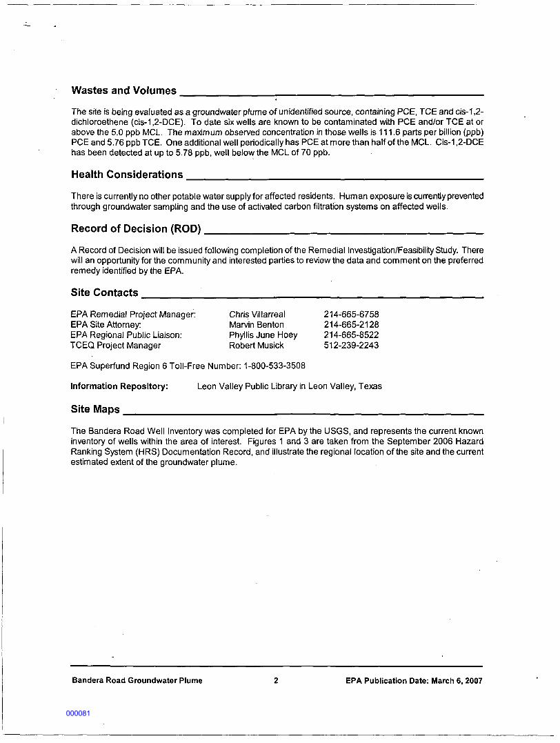
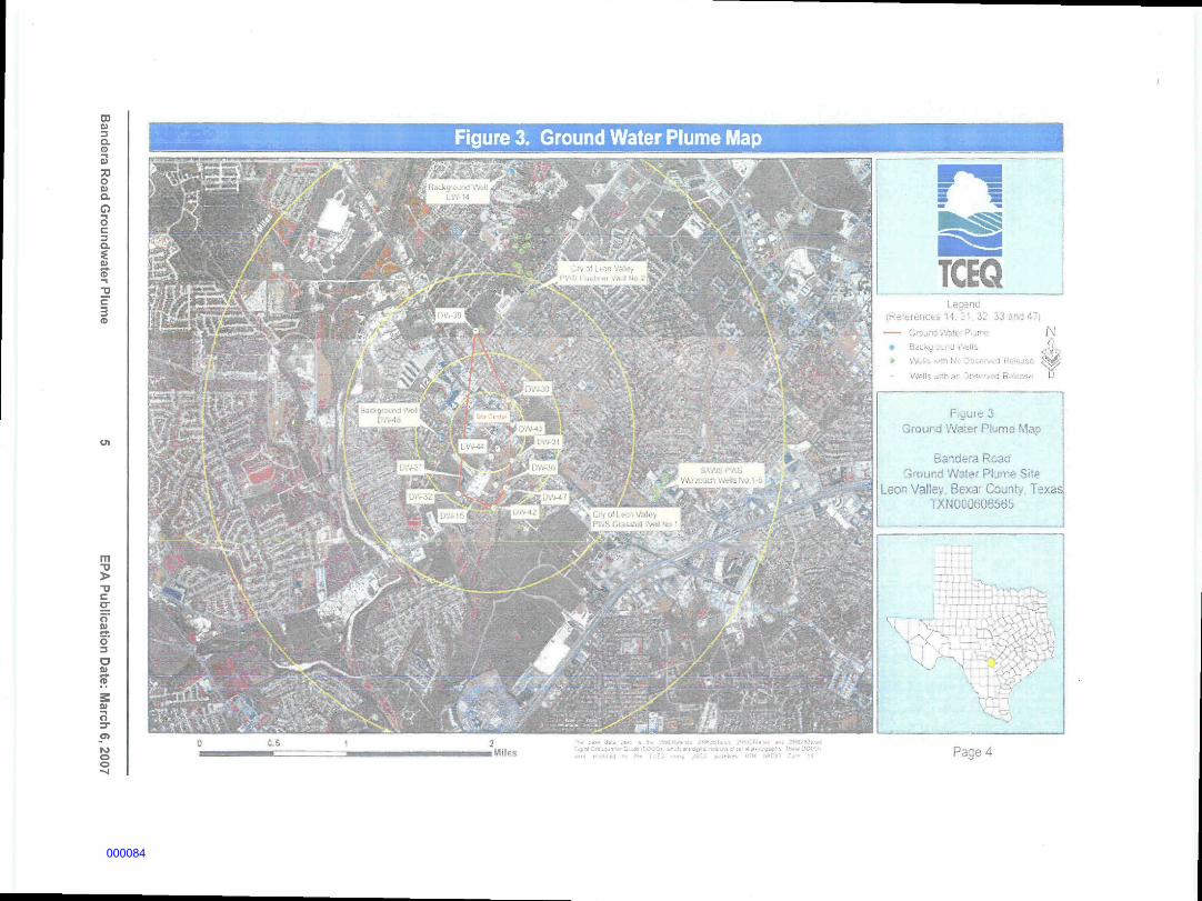
The Bandera Road Well Inventory was completed for EPA by the USGS, and represents the current knowninventory of wells within the area of interest. Figures 1 and 3 are taken from the September 2006 HazardRanking System (HRS) Documentation Record, and illustrate the regional location of the site and the currentestimated extent of the groundwater plume.
Bandera Road Groundwater Plume 2 EPA Publication Date: March 6, 2007
000081
EXPLANATION
,»
';*•
-
j\gyr\ "
BANDERA ROAD WELL INVENTORY! n •-• I" .11 mi (Jin,• . .' ,. J.i. i.Jut..;-<i
ri <t ^ - n i l ; :< .-W-f4
Bandera Road Groundwater Plume EPA Publication Date: March 6, 2007
000082
03E!3Q.(D
73O01D.O33Q.
IB
C
(D
Figure 1 - Regional Location Map
m
T3Co;o'Sio'
DE>
E)—tO
OO-4
Legend
interstate HighwaysResefvoirsRivers ol l:exiis
Figure 1Rogiona! Location Map
Band§ra RoadGround Wstef Plum» Site
Leon Valley, Bexar Coimly, Texas
000083
CDIB
D.(D
73o01C-
oI3a.
a>if-I
31c3
Figure 3. Ground Water Plume Map
m
5-D
CTo'U^>o'DO01
01-io
rooo
C.S
. i • >-'•'••'•
<4*i: • . . : ' . - .
• ] ii... 5
. ,,-_^_—_g_^
.: .\ "JHuL *U '
. . .. . .
• • s- . .-..- . :- ,• ,. , !,,:.,j..;' • •'*?M ^*> - ' . • . : , . , , -
TCEQ•..:nc
• : :: 33 Jnc i"i
Ground Watt 'Iji/-.
• BsiKJ 01 - • JtL
* v'1.'. - • •• . ; - -• i ' i« ^^
iV-!K .•. lhai "J! • IB asa U
f cuie 3Ground Waier Piums Map
Barsdsra RoanGround 'Ai'sle.' Plurrt She
Leon Valley Bexa: Co-jnty. TexasTXHCD0606565
Page 4
000084