SECOND FIVE-YEAR REVIEW REPORT SACO ...Saco Tannery Waste Pits Company Superfund Site TO: Susan...
90
SECOND FIVE-YEAR REVIEW REPORT SACO TANNERY WASTE PITS SUPERFUND SITE SACO, MAINE Prepared by: U.S. Environmental Protection Agency Region I Boston, Massachusetts
Transcript of SECOND FIVE-YEAR REVIEW REPORT SACO ...Saco Tannery Waste Pits Company Superfund Site TO: Susan...

SECOND FIVE-YEAR REVIEW REPORT
SACO TANNERY WASTE PITS SUPERFUND SITE
SACO, MAINE
Prepared by:
U.S. Environmental Protection Agency
Region I
Boston, Massachusetts

UNITED STATES ENVIRONMENTAL PROTECTION AGENCY REGION 1
1 CONGRESS STREET, SUITE 1100 BOSTON, MASSACHUSETTS 02114-2023
MEMORANDUM DATE: December 18, 2003 SUBJ: Five-Year Review
Saco Tannery Waste Pits Company Superfund Site TO: Susan Studlien, Director
OSRR
Summary of Action Attached for your review and signature is the second five-year review report for the Saco Tannery Waste Pits Superfund Site, the ("Site") in Saco, Maine. This review covers the entire Site. EPA Region I conducted this review pursuant to CERCLA section 121(c), National Oil and Hazardous Substances Pollution Contingency Plan (NCP) section 300.430(f)(4)(ii), and OSWER Directives 9355.7-02 (May 23, 1991), and 9355.7-02A (July 26, 1994). This is a statutory review, conducted for post-October 17, 1986 Remedial Actions. The purpose of a five-year review is to ensure that a remedial action remains protective of human health and the environment. Major Issues This review did not find any major issues at the Site. The source control remedy is functioning as intended. Institutional controls are in place and continue to prevent exposure to groundwater. The Maine Department of Environmental Protection (Maine DEP) carries out groundwater and sediment monitoring. EPA deleted the Site from the National Priorities List in September 1999. The Maine Department of Environmental Protection (Maine DEP), in accordance with the 1993 Superfund State Contract, assumed operation and maintenance responsibilities in 1995. This review found that

changes to the Maine DEP's monitoring program and Operations and Maintenance Plan have not been well documented Headquarters Perspective/Involvement There has been no Headquarters involvement for this specific five-year review report. This report was modeled on three five-year reports that were prepared last year by the same contractor and remedial project manager, all of which were reviewed by Headquarters following the June 2001 guidance document "Comprehensive Five-Year Guidance", OSWER No. 9355.7-03B-P. Public Involvement In late May 2003, a public notice announcing the five-year review process was published in the local newspaper. The press notice encouraged public participation. All site-related documents are available at the Saco Public Library in Saco. According to staff at the library there has been limited use of the documents. A notice which briefly summarizes this five-year review will be published in a major local newspaper of general circulation. Media-Congressional Involvement A reporter for the local newspaper accompanied EPA and Maine DEP during the site inspection and the story was published the following day. There has been no congressional involvement regarding the five-year review process. State Coordination Maine DEP has participated in the review process, including the site inspection, interviews, and has provided comments on the draft five-year review report. Project managers for Maine DEP and EPA have agreed to follow up on the documentation process for future monitoring and maintenance activities. Recommendation The selected remedy for the Site is protective of human health and the environment. It is recommended you sign this five-year review. Contact Person Terrence Connelly, Remedial Project Manager 918-1373 Attachment: Five-Year Review Report

-i-
TABLE OF CONTENTS FIVE-YEAR REVIEW
SACO TANNERY WASTE PITS SITE SACO, MAINE
SECTION PAGE ES EXECUTIVE SUMMARY ........................................................................................................... ES-1 1.0 INTRODUCTION ......................................................................................................................... 1-1 2.0 SITE CHRONOLOGY .................................................................................................................. 2-1 3.0 BACKGROUND .......................................................................................................................... 3-1
3.1 Physical Characteristics ................................................................................................... 3-1 3.2 Land and Resource Use ................................................................................................... 3-4 3.3 History of Contamination .................................................................................................. 3-4 3.4 Initial Response ............................................................................................................... 3-5 3.5 Basis for Taking Action ..................................................................................................... 3-5
4.0 REMEDIAL ACTIONS ................................................................................................................. 4-1
4.1 Remedy Selection ............................................................................................................ 4-1 4.2 Alternate Remedy ............................................................................................................ 4-5 4.3 Explanation of Significant Differences ............................................................................... 4-5 4.4 Remedy Implementation ................................................................................................... 4-6
4.4.1 Source Control Remedial Activities ....................................................................... 4-6 4.4.2 Wetlands Compensation ...................................................................................... 4-8 4.4.3 Institutional Controls ............................................................................................ 4-9 4.4.4 Monitoring Activities ............................................................................................. 4-9
4.5 Operation and Maintenance ............................................................................................ 4-12 5.0 PROGRESS SINCE LAST FIVE-YEAR REVIEW .......................................................................... 5-1 6.0 FIVE-YEAR REVIEW PROCESS .................................................................................................. 6-1
6.1 Administrative Components .............................................................................................. 6-1 6.2 Community Notification and Involvement ........................................................................... 6-1 6.3 Document Review ............................................................................................................ 6-2 6.4 Data Review .................................................................................................................... 6-2 6.4.1 Cover System Construction .................................................................................. 6-2 6.4.2 Compensatory Wetlands Monitoring ...................................................................... 6-3 6.4.3 Groundwater Monitoring ....................................................................................... 6-3 6.4.4 Surface Water and Sediment Monitoring ............................................................... 6-7 6.4.5 O&M Inspections ................................................................................................. 6-8
6.5 Site Inspection ................................................................................................................. 6-9 6.6 Interviews ...................................................................................................................... 6-10

-ii-
TABLE OF CONTENTS (cont.) FIVE-YEAR REVIEW
SACO TANNERY WASTE PITS SITE SACO, MAINE
SECTION PAGE 7.0 TECHNICAL ASSESSMENT ..................................................................................................... 7-1
7.1 Question A: Is The Remedy Functioning As Intended By The Decision Documents? ............ 7-1 7.2 Question B: Are The Exposure Assumptions, Toxicity Data, Cleanup Levels And Remedial
Action Objectives (RAOs) Used At The Time Of Remedy Selection Still Valid? .................... 7-3 7.3 Question C: Has Any Other Information Come To Light That Could Call Into Question The
Protectiveness Of The Remedy? ....................................................................................... 7-6 7.4 Technical Assessment Summary ...................................................................................... 7-6
8.0 ISSUES ................................................................................................................................... 8-1 9.0 RECOMMENDATIONS AND FOLLOW-UP ACTIONS ................................................................ 9-1 10.0 PROTECTIVENESS STATEMENTS ........................................................................................ 10-1 11.0 NEXT REVIEW ....................................................................................................................... 11-1
TABLES NUMBER PAGE 2-1 Chronology of Site Events ......................................................................................................... 2-1 6-1 March 1995 Final EPA Interim Monitoring Round Results ............................................................ 6-5 6-2 MEDEP Monitoring Results - April 2002 & April 2003 .................................................................. 6-6
FIGURES
NUMBER PAGE 3-1 Site Location ............................................................................................................................ 3-2 3-2 Waste Pits and Lagoons Location Plan ...................................................................................... 3-3 4-1 Site Features and Monitoring Locations .................................................................................... 4-11

-iii-
TABLE OF CONTENTS (cont.) FIVE-YEAR REVIEW
SACO TANNERY WASTE PITS SITE SACO, MAINE
APPENDICES A Document Review List/References B Site Inspection Report C Interview List D ARARs and TBCs E Maine Legislative Document No. 1682, "Resolve, to Protect and Preserve Certain Property in Saco
Owned by the Finance Authority of Maine" F Conservation Easement, signed September 23, 1991 G MEDEP Comments dated November 25, 2003, on Draft Five -Year Review

-i-
ACRONYMS ACL Alternate Concentration Limit ARAR Applicable or Relevant and Appropriate Requirement AWQC Ambient Water Quality Criteria bgs below ground surface COC Contaminant of Concern CERCLA Comprehensive Environmental Response, Compensation, and Liability Act CFR Code of Federal Regulations CMR Code of Maine Rules CWA Clean Water Act DL Detection Limit EPA Environmental Protection Agency ESD Explanation of Significant Differences ET Ecotox Threshold benchmark value FAME Finance Authority of Maine MCL Maximum Contaminant Level MEDEP Maine Department of Environmental Protection MEGs Maximum Exposure Guidelines mg/kg milligrams per kilogram MRSA Maine Revised Statutes Annotated MW monitoring well ND non detect NPL National Priorities List O&M Operations and Maintenance ppb parts per billion ppm parts per million PRP Potentially Responsible Party QA/QC Quality assurance/quality control RAG Remedial Action Guideline RAO Remedial Action Objective RCRA Resource Conservation and Recovery Act RI/FS Remedial Investigation/Feasibility Study ROD Record of Decision RPM Remedial Project Manager SDWA Safe Drinking Water Act SED sediment

-ii-
ACRONYMS (cont.) SEL Severe Effect Level Site Saco Tannery Waste Pits SW surface water SOW Statement of Work SSC Superfund State Contract SVOC Semi-volatile organic compound SWQC State Water Quality Criteria TBC To be Considered TCL Target Compound List TtNUS Tetra Tech NUS, Inc. USACE U.S. Army Corps of Engineers USGS U.S. Geological Survey µg/L micrograms per liter VOC volatile organic compound

ES-1
ES EXECUTIVE SUMMARY
This is the second five-year review for the Saco Tannery Waste Pits Site (Site). This statutory five-year review is
required since hazardous contamination remains at the Site above levels that allow for unlimited use and
unrestricted exposure. The review was completed in accordance with EPA Guidance OSWER NO. 9355.7-03B-P.
In 1956 a tanning company purchased the Site for disposal of its process wastes. For nearly two decades, until
the late 1970's, tanning process wastes were disposed of on the Site. The process wastes characteristically had
high concentrations of chromium, volatile organic compounds (VOCs), and semi-volatile organic compounds
(SVOCs), and included acids, and leather hides and strips. Wastes were disposed of on-site in two large lagoons
(approximately 2 acres each in size) and 57 smaller disposal pits. By the early 1980's the tanning company went
bankrupt and title transferred to a quasi-state agency, the Finance Authority of Maine (FAME).
Investigations in the early 1980's and the 1983 removal action when EPA remediated three acid pits were
followed by completion of an RI/FS in October 1987. The ROD was signed on September 27, 1989. The ROD set
forth a remedy for the Site that combined a source control cover system with institutional controls to restrict
access and use of the Site. The primary contaminants of concern (COCs) affecting on-site soil, groundwater,
surface water and/or sediment were determined to be arsenic, chromium, lead, and minimal SVOCs and VOCs
(EPA, 1989).
The ROD required that the waste pits, lagoons and two areas beyond the pits (Wet Area One and Seep Area
One) be covered in accordance with the performance standards specified in the ROD to minimize direct contact
with contaminated soils and sludges. Available data indicated that contaminated soils and sludges were confined
to the waste pits and lagoons. Target cleanup levels were set in the ROD for soils in the two areas where
contamination beyond the confines of the pits was found.
The ROD also required the design and installation of a monitoring network and established action levels for the
groundwater/surface water monitoring program. If exceeded, the ROD required a further evaluation of the
remedial action via contingencies described in the ROD. Safe Drinking Water Act Maximum Contaminants Levels
(MCLs) were set as the action levels,

ES-2
or standards, for all groundwater contaminants, except for arsenic at four locations where alternate concentration
limits (ACL) were established.
On May 22, 1989, the Maine state legislature passed a resolution which permanently converted the Site to a
wildlife preserve. The resolution prohibits development for residential or commercial use, excavation that
penetrates the soil cover and/or utilization of the groundwater as a drinking water source. In addition to the
legislative action, a deed restriction in the form of a conservation easement has been implemented on the
property as a further assurance of the restrictions on future land use.
An ESD was signed on January 16, 1993. The ESD allowed water collected from dewatering the pits and lagoons
to be treated onsite and used for dust suppression rather than transported offsite for disposal. The ESD also
changed the compensatory wetland requirement of the ROD to allow for the purchase of an off site wetland area,
the Saco Heath, since insufficient acreage was available on the Site to achieve the ROD objective of creation of
on-site compensatory wetlands.
The source control remedial activities were divided into two phases to accommodate the short construction
season in Maine. Site preparation activities were completed between October and December 1992. Construction
of the soil cover systems was completed from March through October 1993. As specified in the ROD, EPA was
required to conduct source control remedial activities, which included the installation of soil covers over the 57
waste pits, 2 lagoons, 2 wet areas and 2 seeps, the creation of compensatory wetlands and site restoration.
(These numbers include the areas identified after remedial activities began.)
Between April 1990 and March 1995, EPA conducted an interim monitoring program. The program included
quarterly sampling of on-site monitoring wells, bi-annual surface water and sediment sampling and annual
sampling of residential wells on Flag Pond, Jenkins and Hearn Roads. In April 1995, responsibility for continuing
the monitoring program was transferred to MEDEP.
MEDEP and FAME continue operations and maintenance (O&M) under a division of responsibility defined in a
Memorandum of Agreement (1991) and Amended Memorandum of Agreement (2001). The O&M activities have
been modified since MEDEP prepared their 1995

ES-3
O&M Plan. The Plan allows for reevaluation and changes to inspection frequency, and monitoring frequency and
analytes. The MEDEP discontinued surface water monitoring in 1999, since all prior sampling results showed no
detections of any site COCs (MEDEP, 2003a). The MEDEP has reduced the number of monitoring wells sampled,
in some cases due to the poor condition of the wells.
Based on the data reviewed, observations from the site inspection, and interviews, the remedy is functioning as
intended by the ROD. The source control portion of the remedy is complete and inspections have confirmed that
the remedy is functioning as designed and remains protective of human health and the environment. Groundwater
and sediment monitoring continue and maintenance is performed on the Site as necessary. The effective
implementation of institutional controls, including legislation prohibiting development on the Site and use of site
groundwater and fencing to restrict access to the cover system areas have thus far ensured the integrity of the
cover systems and prevented exposure to Site soils and groundwater.
The primary ARARs for groundwater on the Site are the MCLs and 1992 MEGs. While the MCL for arsenic has
been reduced to 10 µg/I, and a number of the monitoring wells exceed this value, the restriction on use of site
groundwater prevents any exposures.
Land use at the Site has not changed and is not expected to change, and there are no additional routes of
exposure.
Five -Year Review Protectiveness Statement:
Because the remedial actions implemented for the Site are protective, the Site is protective of human health and
the environment. The soil cover systems constructed under the source control remedy are functioning as
designed and remain in good condition, thus preventing contact with soils and sludges in the pits and lagoons.
Institutional controls, including the resolution creating a wildlife preserve at the Site, the conservation easement
restricting future use of the Site and its groundwater, and fencing restricting access to the soil cover systems,
prevent exposure to soils and groundwater ensuring the Site remains protective of human health and the
environment. Groundwater and sediment monitoring have shown reductions in concentrations of contaminants of
concern, below many of the target levels established in the ROD. The monitoring results demonstrate that there is
no off-site migration and contamination

ES-4
on-site is identifiable and localized. The monitoring program will continue to ensure that concentrations remain
within acceptable ranges.

ES-5
Five-Year Review Summary Form
SITE IDENTIFICATION
Site name (from WasteLAN): Saco Tannery Waste Pits Superfund Site
EPA ID (from WasteLAN): MED980520241
Region: 1 State: ME City/County: Saco/York
SITE STATUS
NPL status: Deleted from NPL (9/29/99)
Remediation status (choose all that apply): Complete
Multiple OUs?* No Construction completion date: October 1993
Has site been put into reuse? No (Site is a permanent wildlife preserve)
REVIEW STATUS
Lead agency: EPA
Author name: Terrence Connelly
Author title: Remedial Project Manager Author affiliation: EPA Region I
Review period: 4/13/03 to 12/31/03
Date(s) of site inspection: 8/28/03 Type of review: Post-SARA Review number: 2 (second)** Triggering action: First Five-Year Review – 12/31/98
Triggering action date (from WasteLAN): 12/31/98
Due date (five years after triggering action date): 12/31/03 * "OU" refers to operable unit. ** First Five-Year Review was completed in 1998

ES-6
Five-Year Review Summary Form, cont'd.
Issues: - Changes to the State's monitoring program have not been well documented. - Changes to the State's inspection and maintenance plan have not been documented; required inspection and maintenance reports have not been prepared. - Potential for changes to the groundwater gradients on the Site due to installation of new private water supply wells. Recommendations and Follow-up Actions: - Revise the O&M Plan to reflect current and planned future monitoring activities and ensure compliance with the revised plan. - Reassess the frequency of inspections and inspection reporting requirements and revise the O&M Plan accordingly. Ensure compliance with the revised plan. - Develop a groundwater contour map using water level measurements from available monitoring wells and evaluate groundwater flow gradients. Protectiveness Statement(s): Because the remedial actions implemented for the Site are protective, the Site is protective of human health and the environment. The soil cover systems constructed under the source control remedy are functioning as designed and remain in good condition, thus preventing contact with soils and sludges in the pits and lagoons. Institutional controls, including the resolution creating a wildlife preserve at the Site, the conservation easement restricting future use of the Site and its groundwater, and fencing restricting access to the soil cover systems, prevent exposure to soils and groundwater ensuring the Site remains protective of human health and the environment. Groundwater and sediment monitoring have shown reductions in concentrations of contaminants of concern, below many of the target levels established in the ROD. The monitoring results demonstrate that there is no off-site migration and contamination on-site is identifiable and localized. The monitoring program will continue to ensure that concentrations remain within acceptable ranges. Other Comments:

1.0 INTRODUCTION The purpose of this five-year review is to determine if the remedy selected for the Saco Tannery Waste Pits
Superfund Site (Site) in Saco, Maine, is protective of human health and the environment. This report summarizes
the five-year review process, investigations and remedial actions undertaken at the Site; evaluates the monitoring
data collected; reviews the Applicable or Relevant and Appropriate Requirements (ARARs) specified in the
Record of Decision (ROD) for changes; discusses any issues identified during the review; and presents
recommendations to address these issues.
The United States Environmental Protection Agency, Region 1 (EPA) prepared this five-year review pursuant to
the Comprehensive Environmental Response Compensation, and Liability Act (CERCLA) §121 and the National
Contingency Plan. CERCLA §121 states:
"If the President selects a remedial action that results in any hazardous substances, pollutants, or contaminants remaining at the site, the President shall review such remedial action no less often than each five years after the initiation of such remedial action to assure that human health and the environment are being protected by the remedial action being implemented. in addition, if upon such review it is the judgment of the President that action is appropriate at such site in accordance with section [104] or [106], the President shall take or require such action. The President shall report to the Congress a list of facilities for which such review is required, the results of all such reviews, and any actions taken as a result of such reviews."
The EPA interpreted this requirement further in the National Contingency Plan; 40 CPR §300.430(f)(4)(ii) states:
"If a remedial action is selected that results in hazardous substances, pollutants, or contaminants remaining at the site above levels that allow for unlimited use and unrestricted exposure, the lead agency shall review such action no less often than every five years after the initiation of the selected remedial action."
This is the second five-year review for the Site. The first five-year review was completed in December 1998 as a
post-SARA statutory review in accordance with the 1989 ROD. This statutory five-year review is required since
hazardous contamination remains at the Site above levels that allow for unlimited use and unrestricted exposure.
The triggering action for the initial statutory review was initiation of the remedial action. Source control remedial
activities were initiated in 1992 and construction activities were completed in October 1993. An interim
1-1

monitoring program, which included groundwater, surface water and sediment sampling, began in 1990. EPA
conducted the interim monitoring program until March 1995. MEDEP assumed responsibility for monitoring and
O&M activities on April 1, 1995.
EPA has conducted this five-year review of the remedial actions implemented at the Saco Tannery Waste Pits
Site in Saco, Maine. Tetra Tech NUS, Inc. (TtNUS) supported EPA in completion of the review under EPA
Contract No. 68-W6-0045, W.A. No. 132-FRFE-0126. Assistance was provided by Maine Department of
Environmental Protection (MEDEP). Work on this review was performed between April and December 2003. The
review was completed in accordance with EPA Guidance OSWER NO. 9355.7-03B-P.
1-2

2.0 SITE CHRONOLOGY
TABLE 2-1 CHRONOLOGY OF SITE EVENTS
FIVE-YEAR REVIEW SACO TANNERY WASTE PITS SITE
SACO, MAINE
EVENT DATE
A tanning company purchased the property (previously a homestead / farmland) and utilized it for disposal of process wastes.
1956
Waste disposal on-site ceased. Late 1970's Tannery went bankrupt and title passed to a quasi-state agency (FAME).
1981
MEDEP, in conjunction with EPA, began site investigations.
Early 1980's
Removal response action was conducted (included remediation of three acid pits).
July – October 1983
Site placed on NPL. September 1983 MEDEP issued a community relations plan (the starting point of community involvement).
Winter 1984 – 1985
MEDEP and EPA entered into a Cooperative Agreement whereby MEDEP would conduct an initial Remedial Investigation (Phase I RI). (Effective until 1987).
1985
EPA initiated a Phase Il RI and a Feasibility Study. October 1987 EPA notified three Potentially Responsible Parties (PRPs) of their potential liability (to date there have been no negotiations).
June 2, 1988
EPA issued a Proposed Plan (to address on-site contamination).
July 1988
After a lack of support from the MEDEP regarding the Proposed Plan the EPA issued a revised plan and an FS addendum.
June 1989
EPA issued a Wetlands and Floodplains Assessment. June 1989 ROD signed. September 27, 1989 EPA began an interim monitoring program to sample on- site groundwater, surface water and sediment and residential wells adjacent to the Site on a quarterly basis.
April 1990
Maine legislature passed the resolution converting the Site to a permanent wildlife preserve.
May 22, 1989
Memorandum of Agreement between MEDEP and FAME signed.
September 23, 1991
Remedial Design commenced. October 1991
2-1

TABLE 2-1 (cont.) CHRONOLOGY OF SITE EVENTS FIVE-YEAR REVIEW SACO TANNERY WASTE PITS SITE SACO, MAINE PAGE 2 OF 3
EVENT DATE
Conservation easement created by FAME recorded in the York County Registry of Deeds.
June 23, 1992
Remedial Design for Site Preparation phase completed. August 1992
Remedial Design for Soil Cover/Compensatory Wetlands phase completed.
September 1992
Superfund State Contract for Site Preparation signed. September 14, 1992
Explanation of Significant Differences (ESD) signed. January 16, 1993
Superfund State Contract for Soil Cover/Compensatory Wetlands signed.
January 28, 1993
Site Preparation Remedial Action completed. October 6, 1992 – December 15, 1992
Soil Cover/Compensatory Wetlands Remedial Action completed.
March 1, 1993 – October 20, 1993
Superfund Site Preliminary Close Out Report issued. September 30, 1993
Construction inspection. September 1993
Sampling activities continued. This round of sampling established the extent of contamination above the action levels (set forth in the ROD).
January 1993 – February 1994
Superfund State Contract for road repairs with the MEDEP and City of Saco.
April 1994
Operation and Function Period for Soil Covers. October 20, 1993 –.October 1,1994
Operation and Function Period for Compensatory Wetlands. October 20, 1993 – October 1, 1997
O&M for soil covers by MEDEP. October 1, 1994 - ongoing
Restoration plan for excavation (developed by the U.S. Army Corps of Engineers (USACE)) was implemented.
Fall 1994
2-2

TABLE 2-1 (cont.) CHRONOLOGY OF SITE EVENTS FIVE-YEAR REVIEW SACO TANNERY WASTE PITS SITE SACO, MAINE PAGE 3 OF 3
EVENT DATE
Final inspection; transfer of O&M responsibilities from EPA to MEDEP. A determination was made that the soil cover was successfully implemented.
March 24, 1995
EPA, MEDEP and USACE made final inspection and determined that the restored on-site wetlands component of the remedial action was successfully implemented.
July 1996
First Five-Year Review signed. December 31, 1998
EPA conducted sediment sampling in response to a possible re-emergence of seeps from Chromium Lagoon 2 and Wet Area 1.
Spring 1999
Final Site Close-Out Report issued. August 1999
Site deleted from the NPL. September 1999
Remedial Action Report issued. September 1999
Amended Memorandum of Agreement between MEDEP and FAME signed.
July 10, 2001
Second Five-Year Review completed. December 2003 Source: EPA, 1998a, 1999c
2-3

3.0 BACKGROUND
3.1 Physical Characteristics
The Site is located off Flag Pond Road in a rural, residential area of Saco, Maine approximately 15 miles
southwest of Portland, Maine (Figure 3-1). The approximately 212-acre parcel is relatively flat and is surrounded
by forested land. The Site is bounded to the east by the Maine Turnpike, to the west by residential properties and
the Stuart Family cemetery along Hearn Road, to the south by Flag Pond Road, and to the north by the
Saco-Scarborough town line. Tannery process wastes, generated from the tannery's activities in another part of
Saco, were disposed of in two lagoons (approximately 2 acres each in size) and 57 smaller disposal pits (each
typically less than a quarter acre in size) (see Figure 3-2). During initial investigations 53 pits were discovered; 4
additional pits were uncovered in 1993 during the initial source control activities. The majority of the 212-acre Site
is forested, both uplands and wetlands; unforested land consists of disturbed areas, scrub-shrub wetlands, and
bedrock outcrops.
There are two surface water drainage-ways on-site, located in the northern and southwestern portions of the
property. While both originate in a swampy region in the western part of the property near Waste Pits 7, 8, and 9,
orie drainage-way flows in a southerly direction via a poorly defined channel towards Flag Pond Road and
eventually to Cascade Brook. The other drainage-way flows in a northeast direction to form the well-defined
Stuart Brook. Stuart Brook then flows in a southeastern direction beneath the Maine Turnpike. Further
downstream, Stuart Brook joins Cascade Brook, which then flows into Scarborough Marsh. A 100-year flood plain
is located within the property boundaries, but none of the waste pits or lagoons are located within the flood plain.
The Site geology consists of unconsolidated glacial sediments and till which overlie the bedrock at the Site. The
unconsolidated deposits include a glacial marine unit of silt, clay, and sands; and a glacial till unit of dense clay,
silty-sand gravel. The thickness of the glacial deposits ranges from 0 to 55 feet below ground surface (bgs) and
the thickest areas are located along the northern edge of the Site (Halliburton, 1992). Topographically the Site
slopes gently toward the north, west and east in a radial pattern, however the manmade soil covers have
significantly increased the natural slope of the land.
3-1

3-2


3.2 Land and Resource Use
The majority of the 212-acre site is forested; grasses are well established on the soil covers. Surrounding land
uses are comprised primarily of residential areas, an interstate highway, and forest. A review of the current City of
Saco zoning map located in the Saco City Hall indicated that the area around the Site is within a Conservation
District, or Zone C-1. This zoning classification, C-1, is "designed to promote and preserve agriculture and open
space, while permitting low density residential uses that do not conflict with this overall purpose." Examples of
permitted uses include, but are not limited to, cemeteries, single- and two-family dwellings, cluster residential
projects, public parks, and agriculture (Saco, 2003).
Historical records indicate that from the 1800's until the 1950's farming and residential uses were the primary land
uses of the Site and surrounding properties. Although the Site was converted into a commercial disposal area in
1956, the surrounding properties continued to be residential areas and farms. There were approximately 60
single-family homes located within a half-mile radius of the Site at the time the ROD was signed in 1989; the
number has gradually increased as farmland is converted into residential properties. Residential development is
concentrated along Hearn Road and Flag Pond Road. In 2003 a large housing development was constructed off
Jenkins Road, approximately 2 miles southwest of the Site. All of the homes in the area have private wells and
rely on groundwater for their water supply.
The groundwater aquifer in the area of the Site is classified under federal standards as IIB, suitable for use as a
public water supply (EPA, 1999b). While groundwater flows radially outward from the highest point on the Site
(west of Chromium Lagoon 2), toward the streams which border the Site, groundwater also flows from the
residential properties towards the Site. Therefore the potential for site contamination to migrate off-site into the
private water supply wells is unlikely (Halliburton, 1992).
3.3 History of Contamination
In 1956 a tanning company purchased the Site for disposal of its process wastes. Prior to that time the property
was used as a homestead and farm. For nearly two decades, until the late 1970's, tanning process wastes were
disposed of on the Site, although the actual processing activities were conducted off-site, across town. The
process wastes characteristically had high
3-4

concentrations of chromium, volatile organic compounds (VOCs), and semi-volatile organic compounds (SVOCs),
and included acids, and leather hides and strips. Wastes were disposed of on-site in two large lagoons
(approximately 2 acres each in size) and 57 smaller disposal pits. The lagoons are located in the northwestern
and northeastern portions of the property and are identified as "Chromium Lagoon 1" and "Chromium Lagoon 2"
(see Figure 3-2). The smaller 57 disposal pits are located throughout the property along both sides of the road
system. By the early 1980's the tanning company went bankrupt, and title transferred to a quasi-state agency, the
Finance Authority of Maine (FAME).
3.4 Initial Response
In the early 1980's the MEDEP and EPA conducted the first recorded site investigation. During a 1982 EPA
investigation, three acid pits, known as Waste Pits 1, 27 and 30, were identified as areas that posed immediate
and significant human health risks. Soil, groundwater, and sediment contaminants were determined to be lead,
chromium, VOCs, and SVOCs (EPA, 1989). Between July and October 1983, EPA remediated the three acid pits
by removing the liquids, neutralizing the sludge in place with lime, and capping the pits. A fence was erected
along Flag Pond Road (EPA, 1998a). EPA estimated that the total surface area of contamination was
approximately 13 acres (EPA, 1999b). The Site was placed on the National Priority List (NPL) in September 1983.
3.5 Basis for Taking Action
From 1985 through 1987 the MEDEP, under a Cooperative Agreement with EPA, conducted a Phase I Remedial
Investigation (RI) and Baseline Risk Assessment to determine the nature and extent of contamination and
associated health risks at the Site. EPA initiated a Phase II RI and Feasibility Study (FS) in October 1987. The FS
evaluated potential cleanup alternatives for the Site and provided information used to select a remedy.
The RI found that the contaminated soil in the two lagoons and waste pits included high concentrations of
chromium and lead, along with low VOC and SVOC concentrations. The contaminants were found to decrease
significantly immediately below the visibly contaminated waste sludge., Just outside the waste pits and lagoons
these compounds were detected at concentrations two to four times lower than inside the disposal areas. The
primary surface
3-5

water and sediment contaminants found during the RI were chromium and lead. The extent of this contamination
was limited to two discrete areas on the Site, the western berm of Waste Pit 9 and the northern berm of
Chromium Lagoon 2. Standing water in the pits and lagoons contained elevated concentrations of chromium and
lead, and a small number of organic compounds. Groundwater contaminants included arsenic and chlorobenzene
at concentrations that exceeded the MCLs. (The MCL for chlorobenzene was established after the ROD was
signed.) No definitive source of arsenic was identified in the RI; arsenic is not a characteristic of tannery wastes.
The VOC source was identified in the RI as the sludges in the waste pits and lagoons. Water quality data from
residential wells in the immediate vicinity of the Site did not indicate any exceedances of MCLs. The
investigations found no evidence of a hydraulic connection between the residential wells and the Site (EPA,
1998a).
By July 1987 the EPA-preferred cleanup approach was presented to the public in a Proposed Plan. MEDEP did
not concur with the remedial alternative selected by EPA, in part for cost efficiency reasons. Without MEDEP's
financial support, EPA's selected alternative could not be implemented since, as a fund-lead site, MEDEP's
concurrence and agreement to assist with the costs of the remedial action were necessary. In response, EPA
reassessed the alternatives presented in the FS and amended one of the source control alternatives to include
additional protective measures. This amended source control alternative was presented in a FS addendum issued
in June 1989.
Also in June 1989, EPA issued a Wetlands and Floodplains Assessment report and a revised Proposed Plan that
was then accepted by MEDEP. Based on the results of these investigations, ARARs and other guidance, target
cleanup goals were established to protect human health and the environment from the identified risks. On
September 27, 1989, the ROD was signed. The ROD set forth a remedy for the Site that combined a source
control cover system with institutional controls to restrict access to and use of the Site. The primary contaminants
of concern (COCs) affecting on-site soil, groundwater, surface water and/or sediment were determined to be
arsenic, chromium, lead, and minimal SVOCs and VOCs (EPA, 1989).
3-6

4.0 REMEDIAL ACTIONS
This section describes the remedial actions selected for and implemented at the Site.
4.1 Remedy Selection
The September 27, 1989 ROD for the Site specified a multi-component remedy to address contaminated site soils
and groundwater. Based on the RI, the following remedial action objectives (RAOs) were identified for the Site:
• Minimize exposure to contaminants or reduce contaminants to levels that are protective of human health
and the environment;
• Reduce the threat of future leaching of chromium and/or reduce the levels of chromium in the sludge that
could leach into the groundwater in the future;
• Prevent ingestion of contaminated groundwater; and
• Minimize exposure of wildlife to contaminated soil, sediments, and standing water.
The remedy selected in the ROD specified:
• Construction of soil cover systems over the waste pits and lagoons to minimize direct contact with
contaminated soils and sludge;
• Creation of a legislatively-enacted institutional control to convert the Site to a permanent wildlife preserve
within two years of ROD signing;
• Implementation of a groundwater monitoring network to monitor for releases of chromium into the
groundwater;
• Performance of a groundwater, surface water, and sediment monitoring program and contingencies
based on the monitoring results;
• Creation of compensatory wetlands on-site to replace the wetlands lost due to covering the pits and
lagoons; and
• Performance of five-year reviews.
The source control component of the remedy specified construction of cover systems on all the pits and lagoons.
Based on a review of the sampling data and other factors, EPA did not require additional sampling to confirm the
extent of contamination since the available data
4-1

indicated that the contaminated soils and sludges were confined to the waste pits and lagoons. However, two
areas of the Site, located near Waste Pit 9 (e.g. Wet Area One) and a seep area near Chromium Lagoon 2 (e.g.
Seep Area One) (see Figure 3-2), required further investigation prior to construction of the cover system.
Sediments in Wet Area One contained chromium and lead concentrations attributed to a break in the berm
surrounding Waste Pit 9. Sediments from Seep Area One contained high arsenic concentrations. The ROD
established the cleanup target levels shown in the table below to determine the extent of soil cover required for
the areas where contamination was found beyond the confines of the waste pits.
Source: ROD, 1989
The total chromium level is a "To Be Considered" (TBC) action level for sediments based on a risk calculation
from a 1980 stream water quality study associated with a Maine tannery. After this risk-based 2,000 mg/kg action
level was established, EPA began using Ecotox Threshold benchmark values (ETs) for sediment and stream
quality screening, comparing maximum measured contaminant concentrations to an ecotoxicologically-based
benchmark. The ET value for chromium in sediment is 81 mg/kg. As noted in the first five-year review, ETs are
intended for screening; they are not regulatory criteria, site-specific cleanup standards, or remediation goals.
Arsenic is not a characteristic contaminant of tannery waste. Since the levels of arsenic detected in the waste pits
were not significantly different from those outside the waste pits, EPA concluded that the arsenic may be from
former pesticide use on-site or may be naturally occurring in the bedrock beneath the Site and in the neighboring
communities (EPA, 1999b). The target level selected does not pose an unacceptable risk and is close to
background concentrations. EPA did not require remediation of background arsenic concentrations based on the
target cleanup levels established in the ROD (EPA, 1989).
The following components of the source control remedy were specified in the ROD: site preparation; remove
ponded water from all pits and lagoons; install bio-intrusion barriers; cover
4-2
Contaminant Target Cleanup Level(mg/kg)
Antimony 30
Arsenic 60
Total Chromium 2,000
Lead 125

the waste pits and lagoons; cover the wet area and seep area sediments; survey the final cover contours and
install permanent markers; re-establish vegetation on covered and disturbed areas; create compensatory
wetlands; conduct post-closure monitoring; and implement land use restrictions (EPA, 1989). The cover system
for all pits and lagoons included the geotextile barrier, a minimum 1-foot rock layer, a 6- to 8-inch stone layer, a
minimum of 2 feet of till, and a minimum of 18 inches of topsoil. The covers were sloped at no less than three
percent to promote runoff (EPA, 1999c).
The ROD required the design and installation of a monitoring network and established action levels for the
groundwater/surface water monitoring program. If the action levels were exceeded, the ROD required a further
evaluation of the remedial action via contingencies described in the ROD. Safe Drinking Water Act Maximum
Contaminant Levels (MCLs) were set as the action levels, or standards, for all groundwater contaminants, except
for arsenic at four locations. EPA established Alternate Concentration Limits (ACLs) for four site monitoring wells
(MW-101, MW-103, MW-111B, MW-114B) based on the maximum concentrations observed in the four wells
during the RI. The arsenic ACLs for the four monitoring wells are shown in the table below.
Contaminant ACL (µg/L) Where Applicable
Arsenic 123 MW-103
Arsenic 77 MW-114B
Arsenic 64 MW-111B
Arsenic 70 MW-101 Source: ROD, 1989
The MCL (50 µg/L) for arsenic was the standard set for monitoring concentrations at wells along the site boundary
to ensure that arsenic levels greater than MCLs did not migrate off the Site. The ROD required that surface water
on the Site be monitored to determine whether federal ambient water quality criteria (AWQC) are exceeded.
The ROD required quarterly groundwater monitoring for the five COC target compounds (arsenic, lead,
manganese, chlorobenzene, and bis(2-ethylhexyl) phthalate) and annual monitoring for Target Compound List
(TCL) metals, VOCs and SVOCs. (EPA, 1989). Monitoring of residential wells located contiguous to the Site was
also included in the ROD. The
4-3

residential well program included periodic collection and analysis of samples for TCL metals, VOCs and SVOCs
from existing and new wells. Should new residential wells be installed, the ROD required the collection of water
level data using continuous recorders to check for possible changes in groundwater flow patterns (EPA, 1989).
The ROD specified that surface water and sediment samples be collected from on-site streams twice a year
(low/high flow seasons) and analyzed, at a minimum, for the five target compounds.
The groundwater, residential well, surface water and sediment monitoring programs specified in the ROD were
required for at least 3 years following completion of the soil cover systems. At that point, the ROD allowed for an
evaluation of the data and a possible reduction in the monitoring program. Following the initial reassessment, the
monitoring program would be reassessed periodically based on the data and trends. At a minimum the ROD
required a reassessment at the time of each five-year review.
The ROD also included several contingencies to evaluate the need for additional remedial actions based on the
results of the required monitoring. The first contingency was associated with the results of the groundwater
monitoring program. If during groundwater monitoring any of the following circumstances occurred, EPA would
evaluate the need for additional remedial actions:
• Chromium and other site-related groundwater contaminants other than arsenic are detected in on-site
monitoring wells at levels greater than their MCLs;
• Arsenic levels in the four monitoring wells (MW101, MW-103, MW 111B, MW-114B) exceed the specific
ACL established for each well;
• Arsenic concentrations exceed the MCL in any monitoring wells located at or around the Site boundary;
or
• Contaminant concentrations above the AWQC are detected in on-site identifiable streams because of
discharge of site-related groundwater contaminants into surface water.
The second contingency was associated specifically with chromium in groundwater. If chromium was detected in
groundwater from any of the wells along the property boundary at concentrations of 500 µg/L, (i.e. ten times the
MCL for chromium), a source control remedial alternative using a treatment technology would be selected and
implemented.
4-4

Since implementation of the selected remedy would result in contaminants remaining on the Site, the ROD
required that EPA conduct five-year reviews. The reviews are required to assess site data to ensure that the
remedial action continues to be protective of human health and the environment.
4.2 Alternate Remedy
In addition to the selected remedy, the ROD set forth an alternate remedy to be implemented if the State of Maine
failed to enact legislation to limit the future use of the Site as a permanent conservation area
by September 27, 1991 (two years from the date of ROD implementation) (EPA, 1989). The alternate remedy
included most of the source control components as well as the monitoring program specified for the selected
remedy. However, under the alternate remedy, contaminated soils and sludges from the waste pits and lagoons
would be excavated and solidified. A RCRA hazardous waste landfill would then be constructed on-site and the
solidified materials would be deposited there. As an interim remedy, groundwater monitoring would also be
performed.
4.3 Explanation of Significant Differences
On January 16, 1993, EPA signed an Explanation of Significant Differences (ESD) which changed several
provisions of the ROD. Rather than off-site treatment and disposal of the standing water from the waste pits and
lagoons, the approximately 669,000 gallons of water were treated on-site and subsequently used for dust control
on the three miles of dirt roads on the Site. In addition, the ESD changed the ROD requirement for creation of
on-site compensatory wetlands since there was insufficient acreage on the Site to create wetlands to compensate
for the 9.6 acres lost during construction of the remedy. The ESD allowed the MEDEP to purchase wetlands off-
site as the State's ten percent cost share for the remedial action. MEDEP successfully negotiated the purchase of
247 acres of a threatened and unique habitat, the Saco Heath, located within a 2-mile radius of the Site. EPA
deemed that the purchase of Saco Heath was sufficient compensation for the State's requirements under the
ROD.
4-5

4.4 Remedy Implementation
This section describes the responsibilities for and implementation of the components of the remedy specified in
the ROD. The responsibilities of EPA, as the lead agency, and the State of Maine, acting through MEDEP, were
defined in the Superfund State Contract (SSC) for Site Preparation, signed on September 14, 1992; and the
"Superfund State Contract Between the State of Maine and the U.S. Environmental Protection Agency for the Soil
Cover System/Compensatory Wetlands," signed on January 28, 1993 (1993 SSC). The two SSCs defined the
responsibilities of the parties, including response action activities, funding, cost share, and administrative issues,
to ensure compliance with CERCLA.
EPA retained Halliburton NUS Corporation (Halliburton) to perform the site preparation and soil
cover/compensatory wetlands activities. The work was completed by subcontractors procured by Halliburton;
Halliburton provided construction management and resident engineer services. The MEDEP was responsible for
acquisition of off-site wetlands to satisfy the ROD-specified compensatory wetlands requirement. State funds
used to acquire the off-site wetlands were applied to the State's ten percent cost share. Funding for the State's
O&M and other responsibilities under the 1993 SSC was to be provided through the Uncontrolled Hazardous
Substance Sites Bond Account or, if additional funds were required, through the State's budgetary process. The
1993 SSC included provisions for the State to assure continuation of O&M actions for 30 years from the start of
the O&M period. Specific O&M tasks were included in the Operations and Maintenance Plan attached to the SSC
as Appendix C. The August 28, 1991 Memorandum of Agreement between MEDEP and FAME identified the two
agencies' responsibilities for the State's O&M obligations.
4.4.1 Source Control Remedial Activities
The source control remedial activities were divided into two phases to accommodate the short construction
season in Maine. Site preparation activities were completed between October and December 1992; the soil
cover/compensatory wetlands activities were completed between March and October 1993. Site preparation
activities included clearing of brush around the disposal areas, installation of erosion and sediment control
materials, tree and plant protection near the Site boundaries, construction of temporary roadways across the Site,
identification and marking of the Stuart Family cemetery near the northern property border, and the construction
4-6

of temporary and permanent fencing (Halliburton, 1995a). Rather than a continuous perimeter fence, the fencing
was designed as five separate units around the soil cover system areas, with road gates separating each unit
from the next to allow for wildlife corridors. Public meetings were held to inform the residents of the upcoming
source control activities.
As specified in the ROD, EPA was required to conduct the source control remedial activities, which included the
installation of soil covers over the 57 waste pits, 2 lagoons, 2 wet areas and 2 seeps, the creation of
compensatory wetlands, and site restoration. (These numbers include the waste pits, wet and seep areas
identified after remedial activities began). Prior to installation of the geotextile barriers, rock, stone and till in the
disposal areas, land surveys, visual observations and berm excavations were performed to ensure that the
contaminated soil and sludge were safely contained under the soil covers. Initially it was thought that
contamination extended only to the edge of water elevation within the Waste Pits, however after small holes were
dug and sludge was detected at greater depths, the extent of contamination was further defined (Halliburton,
1995a).
Dewatering activities were conducted where ponded water was found and an estimated 569,000 gallons of water
were treated on-site and used for dust control on the Site roadways. Initially the treated water was to be
discharged to Stuart Brook, but regulatory and public concerns resulted in a re-evaluation and ultimately EPA's
approval to use the treated water for dust suppression. During construction of the soil cover systems, an
additional 531,000 gallons of water were brought on-site and used for dust suppression. Approximately 14,000
truckloads of fill material were transported across Flag Pond. and Jenkins Roads to the Site during installation of
the soil cover systems. Reconstruction of these heavily traversed roadways was subsequently conducted.
During remediation of Chromium Lagoon 2, a second seep area, north of the lagoon, was identified, sampled and
dewatered. This area is identified as Seep Area Two on Figure 3-2. The path of contamination followed the
drainage pathway towards Stuart Brook. Since chromium and lead were detected at this location, approximately
10,000 square feet of soil were excavated and placed under the Chromium Lagoon 2 soil cover. Clean topsoil
was placed in this excavated area and the area was subsequently re-vegetated (Halliburton, 1995a).
4-7

Four additional waste pits (Waste Pits 54, 55, 56, and 57) were identified during the site preparation phase in
1993 (see Figure 3-2). At each of these locations brush clearing, visual observations, land surveying and soil
cover construction activities were conducted to ensure proper cover and containment of the contaminated soil and
sludge. All soil covers were covered by topsoil and then hydro-seeded to encourage growth of grass on the
covers to prevent erosion (Halliburton, 1995a). On September 17, 1993, prior to Site restoration and
demobilization, a final inspection was conducted by EPA and MEDEP. At that time the source control remedial
action component of the ROD was declared complete.
4.4.2 Wetlands Compensation
Approximately 9.6 acres of wetlands were lost when the Site access roads were expanded and the soil covers
were installed. Wetlands compensation for the loss caused by the construction of the loop road was restricted to a
small portion of the Site on the interior of the loop road north of Waste Pit 44. This area of less than one acre was
suitable, with some reconstruction of the elevation, for wetlands development.
This on-site wetlands compensation area was cleared of standing trees during the clearing operations in the
spring of 1993, and stumps were removed in September 1993. The remaining work within the compensation area
was also performed in September 1993. The topsoil was temporarily removed and stockpiled. The elevation of the
area was lowered approximately 1.5 feet, and the topsoil was replaced. Red Maple (Acer rubrum), Winterberry
(Ilex verticillata) and Northern Red Oak (Quercus rubia) trees were planted in accordance with the specifications
and drawings. Orchard grass was planted, and random logs were placed in the area as required. An inspection of
the final area was conducted by a wetlands specialist at the completion of the project. The wetlands specialist
returned to the Site in the spring of 1994 to re-examine the compensation area. The survival rate of the trees was
found to be acceptable.
Maine regulations require a 3-year period of "operational and functional" monitoring for restored wetlands. A
USAGE wetlands biologist participated in the restoration plan and evaluated the restored wetlands for EPA.
Following a July 17, 1996 site inspection, the USACE concluded that restoration of the remediated wet areas was
successful. Restoration of areas impacted by site activities (truck scales and access roads expansion) was not as
successful in replicating the existing wetlands, However as these were relatively small areas, one-sixth and
one-third acres,
4-8

respectively, and they were functioning as open water/emergent wetlands, corrective action was not
recommended (EPA, 1999b).
Since there was insufficient acreage on-site to satisfy the requirements for wetlands creation under the ROD, EPA
and MEDEP structured the 1993 SSC to allow the purchase of compensatory off-site wetlands to serve as the
State's cost share for the remedial action. MEDEP negotiated the purchase of 247 acres of a threatened habitat,
the Saco Heath, located within the same watershed in order to fulfill its cost share requirements (EPA, 1998a).
4.4.3 Institutional Controls
On May 22, 1989, the Maine state legislature passed a resolution which permanently converted the Site to a
wildlife preserve (see Appendix E). The resolution prohibits development for residential or commercial use,
excavation that penetrates the soil cover and/or utilization of the groundwater as a drinking water source. in
addition to the legislative action, a deed restriction in the form of a conservation easement was also implemented
on the property as a further assurance of the restrictions on future land use (see Appendix F). Since the resolution
was enacted within the timeframe allotted by the ROD, the Alternate Remedy established in the ROD was not
necessary. MEDEP and FAME signed a Memorandum of Agreement in 1991, amended in 2001, that established
rules and regulations governing the use of the preserve and the agencies' responsibilities for O&M.
4.4.4 Monitoring Activities
Monitoring activities consist of the interim monitoring conducted by EPA during implementation of the source
control remedial action and the ongoing O&M monitoring performed by MEDEP.
Groundwater
This component of the ROD, quarterly on- and off-site groundwater monitoring, began in April 1990, and was
implemented in conjunction with the source control remedial action. Up to 16 monitoring well locations were
sampled quarterly by the EPA until March 1995, when the MEDEP assumed operation and maintenance (O&M)
responsibilities, as required by the ROD (see Section 4.4).
4-9

EPA's interim monitoring indicated that there was an outward flow of contamination from the waste pits towards
the wetlands and forested areas but no flow of contaminants moving off-site. Given the relatively flat topography
and the location of the waste pits, several isolated areas were found with arsenic and chlorobenzene in
groundwater. Th ere was no indication of any hydraulic connection between the residential wells and the Site
(EPA, 1998a), The groundwater flow direction was determined to move from the residential areas toward the on-
site wetlands and streams.
Each monitoring well was sampled for arsenic, chromium, lead, manganese and monochlorobenzene. The results
were then compared to their appropriate standard, either the ACL or MCL, as specified by the ROD. The results
of selected sampling events are discussed in Section 6.4.3.
In May 1995, the MEDEP sampled all 16 locations; over time MEDEP has reduced the number of locations and
frequency of sampling based on a review of previous sampling events and the condition of the monitoring wells.
The list of analytes was reduced to the COCs and used by MEDEP as indicators of the need for more extensive
analysis (MEDEP, 2003a). During the most recent sampling event, April 2003, nine of the original sampling
locations were sampled. Figure 4-1 shows the locations of the monitoring wells routinely sampled by MEDEP
during 2002 and 2003.
New residential wells have been installed near the Site, primarily on Carter Farm Road, off Hearn Road. In the
mid-1990s, the U.S. Geological Survey (USGS), on behalf of EPA, placed continuous recording water level
instruments in the new wells. The monitoring results recorded by the instruments indicated that pumping from the
new wells was not affecting the groundwater flow direction on the Site (EPA, 2003).
Surface Water and Sediment
Bi-annual surface water and sediment sampling as well as annual sampling of residential wells on Flag Pond,
Jenkins and Hearn Roads were also required by the ROD. Surface water and sediment sampling locations are
shown on Figure 4-1. The bi-annual sampling required by the ROD included more downstream locations on Stuart
Brook, including one just above the Maine
4-10


Turnpike, than are shown on Figure 4-1. The number of sampling locations and frequency of sampling have been
modified since the monitoring program began in 1990. The October 1993 round of sediment sampling detected an
area with elevated chromium and lead concentrations west of Waste Pits 9 and 10. Further sampling in December
1993, January and February 1994, indicated that the action levels established in the ROD had been exceeded.
The sampling determined that the area was contaminated by overflow from Waste Pit 18. This area was
designated as Wet Area Two (see Figure 3-2). In July 1994, an approximately 10,000 square foot area of
contaminated sediment was excavated and placed in a containment cell constructed within the cover system for
Waste Pits 9 and 10. The cell was constructed in the same manner as the other cover systems. The excavated
area was backfilled with clean soil (EPA, 1999b). Surface water and sediment monitoring results are discussed in
Section 6.4.4.
4.5 Operation and Maintenance
An Operation and Maintenance (O&M) plan, presented in the September 1992 Remedial Design Report, and
included as Appendix C in the 1993 SSG, was implemented when the MEDEP assumed responsibility for the on-
going O&M activities. MEDEP prepared an O&M Plan, dated April 5, 1995. According to the ROD, the estimated
O&M costs ranged from $2.5 to $3.8 million, depending on the number of monitoring wells. As part of the O&M
activities MEDEP is required to conduct periodic inspection and maintenance, perform semi-annual mowing of
and around the soil covers, perform necessary repairs due to erosion, burrowing animals, off-road vehicles, and
other forms of cover destruction with adequate materials. Since successful restoration of the compensatory
wetlands was concluded prior to implementation of this phase, no wetland monitoring was required under the
O&M Plan. The inspection observations and details of any maintenance and repairs are required to be
documented in an Inspection and Maintenance Report, to be submitted after each site inspection is conducted.
For the first five years of the post-closure period a site inspection, including a site walkover, was required on a
quarterly basis, with annual inspections required each year thereafter. In addition, site inspections were also
required after any severe storm event. The inspections required a check of each cover system for vegetative
growth, evidence of erosion, and permanent hazardous waste warning signs. A check of the condition of the
permanent chain-link fence that surrounds each of the five soil cover system areas, roadways and drainage
systems was also
4-12

required. Documentation of evidence of washouts, erosion, gradient difference in swales and/or ponded water
and depressions was also required.
MEDEP personnel were not able to locate any inspection reports prepared since assuming O&M responsibilities
in April 1995. At MEDEP's request, EPA participated in inspections until 1998. An inspection report was
completed by EPA in October 1998. O&M inspections are discussed further in Section 6.4.5.
4-13

5.0 PROGRESS SINCE LAST FIVE-YEAR REVIEW
This is the second five-year review for the Site. The first five-year review, completed by EPA in 1998, concluded
that the following components of the remedy were protective of human health and the environment:
• The soil cover systems were operating and functioning as designed;
• Institutional controls remain in place; and
• Groundwater COCs were not migrating off-site.
Since sediment sampling results summarized in the first five-year review showed an increase of chromium in two
separate locations in the wetlands, the report recommended further investigation to assess whether the chromium
concentrations indicated: the possible reemergence of seeps; natural processes of flushing and redeposition; or
the possibility that the extent of chromium contamination was not adequately defined during pre-design
investigations. EPA and MEDEP collected 70 additional sediment samples from grids laid out in wetlands near
sample locations SED-204 and SED-104 on March 23-24, 1999 (see Figure 4-1). The sampling transects and
relevant background information were documented by EPA (EPA, 1999a).
Based on the sampling and analytical results, EPA concluded that the soil covers remain functional; no seeps
were identified. The sediment data indicated concentrations similar to those seen during pre-design activities in
the early 1990s. The concentrations were above the current ET screening levels and in some cases above the
ROD target cleanup levels. EPA and MEDEP ecological risk assessors reviewed the data and site inspection
observations. They concluded that the sediment concentrations represented variations commonly associated with
sampling in wetland areas. The forested wetlands where the high chromium concentrations were found were
functioning well. Based on the conclusions of the risk assessment specialists, EPA determined that no further
remedial action was warranted (EPA, 1999b; EPA,1999c).
Following the review of the sediment data and other site-specific monitoring information, EPA, after consultation
with MEDEP, determined that all appropriate response actions had been implemented and deleted the Site from
the NPL effective September 30, 1999.
5-1

6.0 FIVE-YEAR REVIEW PROCESS
6.1 Administrative Components
EPA, the lead agency for this five-year review, notified MEDEP in the spring of 2003 that the five-year review
would be completed. EPA issued a Scope of Work (SOW), WA. No. 132-FRFE-0126, to TtNUS, under EPA
Contract No. 68-W6-0045, on April 13, 2003, to assist EPA in performing the five-year review. The EPA Work
Assignment Manager and Remedial Project Manager was Terrence Connelly. Wayne Paradis of the MEDEP was
part of the review team.
The schedule established by EPA included completion of the review by December 2003.
6.2 Community Notification And Involvement
TtNUS prepared a public notice announcing the five-year review and requesting public participation. After EPA
review and approval, the notice was published in July 2003 in the Journal Tribune, a daily newspaper for York
County, Maine. Since the publication of the public notice there has been no response from the public to either the
MEDEP or EPA regarding the five-year review with one exception. During the August 28, 2003, site inspection,
Chris Churchill, a newspaper reporter from the Journal Tribune, joined the inspection team and subsequently
published an article about the Site in the Friday, August 29, 2003 edition of the newspaper.
In previous years community concern and involvement has been moderate to high. Beginning in 1984
informational meetings were held in the City of Saco at the Dyer Library. During a visit to the Saco City Offices
and Dyer Library on August 28, 2003 representatives from TtNUS briefly described the five-year review process
to the town officials. Site documents were available in the Dyer Library but given their age, were stored in the attic
of the library. According to the library's research librarian, one RI report is available on the open shelves and has
been taken out 23 times in the past year.
6-1

6.3 Document Review
This five-year review included a review of relevant documents including decision documents and monitoring
reports, as specified in the EPA SOW for this review (See Appendix A).
6.4 Data Review
A review was completed of various EPA and EPA-contractor documents and monitoring reports. A limited amount
of monitoring data provided by MEDEP was also reviewed. A summary of relevant data regarding the
components of the Site remedy is presented below.
6.4.1 Cover System Construction
The ROD required that the 53 known waste pits, 2 lagoons and two areas beyond the pits (Wet Area One and
Seep Area One) be covered in accordance with the performance standards specified in the ROD. During the site
preparation phase, four additional pits were discovered (see locations of Waste Pits 53 – 57 on Figure 3-2).
Target cleanup levels were set in the ROD for soils in the two areas where contamination was found beyond the
waste pits (see Section 4.4.1). A sampling program was used to define the extent of contamination above the
cleanup levels in these two areas and the contaminated soils were excavated and placed in the cover system.
A sampling program was performed as part of the completion of the source control remedial action. The program
included: collection of confirmatory soil samples wherever additional contamination was known or suspected and
sampling of backfill soil. During implementation of the remedy, additional contamination was found beyond the
northern berm of Chromium Lagoon 2 (Seep Area Two) as well as in wetland soils west of Waste Pits 9 and 10
(Wet Area Two) (see Figure 3-2). The contaminated soils from these two additional areas were delineated and the
contaminated soils were excavated as described above to meet the soil target cleanup levels. An area of
approximately 10,000 ft2 of contaminated soil from the Chromium Lagoon 2 seep area was excavated and placed
in the lagoon (EPA, I999b). The excavated area was backfilled with clean topsoil. Approximately 10,000 ft2 of
contaminated soil was removed from the wet area and placed in a containment cell constructed in the cover
system of Waste Pits 9
6-2

and 10. The wet area was then backfilled with clean topsoil and wetland vegetation was planted (EPA, 1999b).
Sampling conducted by EPA and MEDEP after the completion of construction of the soil cover systems confirmed
that seeps or transport of contamination into these areas had not recurred.
The sampling program used throughout the remedial action included quality assurance/quality control (QA/QC) to
ensure the results were in conformance with federal and state performance standards. EPA determined that all
analytical results were accurate to the degree needed to assure satisfactory execution of the remedial action
consistent with the ROD, the ESD, and the remedial design plans and specifications (EPA, 1999b).
The Record of Construction, which was maintained by EPA's contractor, Halliburton NUS, included the elements
and requirements of the design specifications. The specifications were developed from the 100 percent design
reports, which in turn were based on the performance standards established in the ROD. Each of the verification
points (construction checklist, milestone charts, material delivery logs) in the Record of Construction was tied
back to the plans and specifications for the project. Therefore, as each component of the source control remedy
was completed, the contractor verified that all elements of the ROD had been met (EPA, 1999b).
6.4.2 Compensatory Wetlands Monitoring
Following the 3-year period of "operational and functional" monitoring for the restored wetlands, as required by
Maine regulations, and the determination that the restoration in the wet areas was successful, no further
monitoring has been required as a component of the O&M Plan (EPA 1999b).
6.4.3 Groundwater Monitoring
The ROD specified a monitoring program to address the threat of migration of chromium, arsenic, and other
contaminants in groundwater (see Section 4.4.4). Between April 1990 and March 1995, EPA conducted an interim
monitoring program which included quarterly sampling of on-site monitoring wells, bi-annual surface water and
sediment sampling and annual
6-3

sampling of residential wells on Flag Pond, Jenkins and Hearn Roads. In April 1995, responsibility for continuing
the monitoring program was transferred to MEDEP.
Data from groundwater monitoring wells sampled during the final EPA interim monitoring event in March 1995 are
shown in Table 6-1. At that time the only exceedance of an MCL/ACL was at MW-103 where the arsenic
concentration (248 µg/I) exceeded the ACL of 123 µg/I. Data from the two most recent spring groundwater
monitoring rounds completed by MEDEP are shown in Table 6-2. Of the 9 wells sampled in April 2002, there was
one exceedance of an arsenic ACL (MW-103); two exceedances of the arsenic MCL (MW-1, MW-114A); the lead
action limit was exceeded in 6 of the 9 wells sampled; and the monochlorobenzene MCL was exceeded in two
wells (MW-103 and MW-114A). There were no MCL or ACL exceedances for any COC in 2003, except for two
exceedances of the arsenic MCL (MW-1, MW-114A). Chromium concentrations have been at either non-detect
(ND) or very low levels for the past 10 years. Historical arsenic data for monitoring wells with established ACLs
are summarized below.
Monitoring Well ACL (µg/l) Concentration History 1995 - 2003 MW-101 70 ACL exceeded in 3 of 19 events (10/95,
10/00 and 10/01) MW-103 123 ACL exceeded in 16 of 19 events; not
exceeded in 4/97, 3/98 and 4/03 MW-111B 64 ACL exceeded in 1 of 19 events (10/95) MW-114B 77 ACL exceeded in 2 of 19 events (7/95
and 10/95) Source: Halliburton, 1995; MEDEP, 2003
Groundwater from MW-103 was below its arsenic ACL for the first time in 5 years in the most recent MEDEP
sampling round (April 2003). The April 2003 arsenic concentrations in the remaining 8 wells were below the MCL
in effect at the time of the ROD signing (e.g 50 µg/L); arsenic concentrations in 4 wells were below the current
MCL (10 µg/L).
It is noted that the ACLs for the four wells were set based on data collected using purge and bail techniques and
filtered samples that were standard procedures at the time of the RI. The Site was one of the first locations in the
country where low-flow sampling with non-filtered samples was piloted. Data from this effort demonstrated that
chromium concentrations decreased to background whereas at some locations the arsenic concentrations
increased.
6-4

TABLE 6-1
MARCH 1995 FINAL EPA INTERIM MONITORING ROUND RESULTS FIVE-YEAR REVIEW
SACO TANNERY WASTE PITS SITE SACO, MAINE
(all concentrations in µg/L)
Monitoring
Well Arsenic
MCL = 50* (see ACLs below)
Chromium MCL = 50*
Lead MCL = 15
(action level)
Manganese No MCL
Monochioro- benzene
MCL = 100*
MW 1 14.4 2.1 UJ 0.9 U 1375 54
MW 3 12.8 4.2 U 0.9 U 616 34 MW 101 ** 49.2 2.1 U 0.9 U 1310 23
MW 103 ** 248 2.1 U 0.9 U 1340 20
MW 111A 50 2.1 U 0.9 U 1720 6 J
MW 111B** 4.1 2.1 U 0.9 U 2650 10 U
MW 112A 44.1 2.1 U 0.9 U 1945 67
MW 113A 2.0 U 2.1 U 0.9 U 7080 3 J MW 114A 30.1 2.1 U 0.9 U 15500 67
MW 114B** 18.2 15.2 1.6 U 824 10 U
MW 4B 10.1 4.1 UJ 0.9 U 1050 10 U
MW 6 NS NS NS NS NS
MW 107 3.2 J 3.8 UJ 0.9 U 768 9 J
MW 113B 2.0 U 2.1 U 0.9 U 1800 10 U MW 203B 3.0 J 2.1 U 0.9 U 341 10 U
MW 203C 3.3 J 2.1 U 0.9 UJ 1.0 UJ 10 U * Arsenic MCL is now 10 µg/l; chromium MCL is now 100 µg/I; monochlorobenzene MCL was established after the ROD was signed. ** ACLs: MW 101 - 70 µg/l; MW 103 - 123 µg/l; MW 111B - 64 µg/I; MW 114E - 77 µg/I Notes:
1. Exceedance of MCL/ACL shown in bold. 2. NS - not sampled; U - not detected at the method reporting limit; J - estimated quantity. 3. Source: Halliburton, 1995
6-5

TABLE 6-2 MEDEP MONITORING RESULTS – APRIL 2002 & APRIL 2003
FIVE-YEAR REVIEW SACO TANNERY WASTE PITS SITE
SACO, MAINE
(all concentrations in pg1L)
Monitoring Well
Arsenic MCL = 10 (see ACLs
below)
Chromium MCL = 100
Lead MCL = 15
(action level)
Manganese No MCL
Monochloro-benzene
MCL = 100
Event Date 4/02 4/03 4/02 4/03 4/02 4/03 4/02 4/03 4/02 4/03 MW 1 11 14 ND 1 17 ND 1300 1400 27.9 35 MW 3 ND 3 ND ND 15 ND 320 390 8.7 18
MW 101 * 46 46 ND ND 20 ND 1000 900 12.7 15 MW 103 * 240 100 3 3 25 ND 1000 1100 112 38 MW 111A ND 4 1 ND 27 ND 64 10 ND ND
MW 111B * 6 7 ND ND 11 ND 12 55 ND ND MW 113A ND 4 1 1 21 ND 4500 4500 10.4 9.9 MW 114A 22 36 1 1 16 ND 7200 6700 106 79 MW 114B* 75 13 36 41 13 ND 1000 450 3.1 1.2
* ACLs: MW 101 – 70 µg/I; MW 103 -123 µg/I; MW 111B – 64 µg/I; MW 114B – 77 µg/l Notes: 1. The following wells have either not been sampled or have no detections since March 1999: MW 4B, MW 6,
MW 107, MW 113B, MW 2036, MW 203C; MW 112A has not been sampled since October 2001. 2. Results in bold exceed the MCL or ACL (for arsenic). 3. ND – not detected at the laboratory detection limit. 4. Source: MEDEP, 2003
6-6

Available data from EPA's interim monitoring rounds indicate no exceedances of MCLs in any of the residential
wells sampled. In most rounds target compound levels were at the method detection limit. Arsenic and lead were
infrequently detected in some residential wells – always at concentrations well below the respective MCL. No
residential well data were available for the MEDEP monitoring rounds completed since 1995. The first five-year
review noted that MEDEP had discontinued residential well sampling (EPA, 1998a). It is likely that based on the
existing residential well data and lack of significant new home construction in areas contiguous to the Site,
MEDEP determined that further residential well sampling was not warranted.
6.4.4 Surface Water and Sediment Monitoring
Surface water and sediment samples were collected by an EPA contractor during the interim monitoring period on
an annual basis. The January 1995 monitoring round was the last round completed by EPA prior to the transfer of
responsibility for monitoring to MEDEP in April 1995.
Lead was detected in 3 of 5 surface water locations (1.1J – 2.8 µg/I). None of the remaining target compounds
were detected (e.g arsenic, chromium, chlorobenzene and bis (2-ethylhexyl) phthlate) (Halliburton, 1995). There
were no exceedances of ambient water quality criteria-in any of the five surface water samples. No surface water
data were available from the MEDEP monitoring rounds during this five-year review.
The target compounds for the sediment samples from the January 1995 monitoring round ranged in concentration
as follows: arsenic from 0.9 mg/kg to 108J mg/kg; chromium from 4.7 mg/kg to 392 mg/kg, lead from 2.6 mg/kg to
39.9J mg/kg; manganese from 46.6 mg/kg to 27,100J mg/kg; and monochlorobenzene at 43J (all others ND or
rejected). The arsenic concentration at SED-301 exceeded the Site cleanup target level of 60 mg/kg (Halliburton,
1995). The highest chromium levels were found at SED-201 (392 mg/kg) and SED-104 (343 mg/kg). These
chromium levels were below the ROD action levels (2,000 mg/kg) but above the ET screening level (81 mg/kg)
and SEL (110 mg/kg).
The sediment data collected by MEDEP continue to show high chromium levels at SED-104; the April 2003
concentration was 110 mg/kg. Chromium levels below the ROD action level but above the ET screening level and
SEL were found at location SED-204 (1,500 mg/kg) and SED-301 (130 mg/kg) in April 2003. The April 2003 data
show arsenic at low, or non-detect levels, at
6-7

all locations except SED-301 where the concentration of 50 mg/kg is just below the ROD target level of 60 mg/kg.
SED-301 is located near Seep Area One. With the exception of SED-102, all sediment locations currently
sampled by MEDEP are beyond the areas that were remediated. The location of SED-204 was moved
downstream to its current location in 1994 after the remediation of Wet Area Two.
6.4.5 O&M inspections
Following completion of the cover system construction activities in October 1993, minor restoration repairs in a
number of areas, and a major repair to the cover on the north side of Chromium Lagoon 2 in summer 1994, a final
inspection was conducted on March 24, 1995. Final maintenance was performed by EPA in September 1995 to
address the punch list items. The MEDEP assumed O&M responsibilities in April 1995.
The soil covers were inspected on a quarterly basis for the three years following completion of construction. After
three years, inspections continued on a bi-annual basis. EPA assisted MEDEP with the inspections from 1995,
when MEDEP assumed responsibility for O&M, until 1998. EPA's report following the October 1998 inspection
noted that the soil cover vegetation was very well established; no bare spots, erosion or sloughing were observed
(EPA, 1998). In a change from the O&M Plan, mowing had been reduced from semi-annual to once in the fall to
better provide ground cover for nesting birds. This change was recommended by U.S. Fish and Wildlife and
Maine Inland Fish and Wildlife (EPA, 1998a). During the October 1998 inspection, the fence, gates, and warning
signs were generally found in good shape and tree trunks and branches were removed from the fence. Clearing
of trees and brush within 10 feet of the fence, as required by the O&M Plan, had not been done and EPA
recommended a change to clearing within 5 feet of the fence (EPA, 1998). The roadways were in good shape and
were passable. As noted in Section 6.4.2, inspection of the wetlands was not required as part of O&M.
Since the 1998 O&M inspection, MEDEP has noted site conditions during their monitoring rounds, but does not
appear to have performed annual inspections. MEDEP personnel were not able to locate any site inspection
reports prepared as specified in the O&M Plan. The O&M Plan prepared by MEDEP states that the schedule for
inspections will be reevaluated, and possibly changed, after three years following construction completion
(MEDEP, 1995). A July 10, 2001 amendment to the Memorandum of Agreement between MEDEP and FAME
6-8

transferred responsibility for the annual inspections to FAME. FAME completed an annual inspection checklist,
which has been approved by MEDEP. FAME did not complete an inspection in 2001; a partial inspection was
completed in 2002 (FAME, 2003).
6.5 Site Inspection
As part of this five-year review, a site inspection was conducted on August 28, 2003, with representatives from
EPA, TtNUS, and MEDEP. A newspaper reporter from the Journal Tribune, a local newspaper, also accompanied
the group during the entire inspection. The inspection included a site walkover, inspection of the lagoon and
waste pits covers, and monitoring wells. Following the site inspection, the TtNUS and EPA representatives drove
around the neighborhoods contiguous to the Site to check for new homes and developments. A Site inspection
report, including site photographs, is included in Appendix B.
The 2 lagoon and 57 waste pit cover systems are secured by chain-link fences and access along the roadway to
these areas is restricted by vehicle and pedestrian locked gates. There was no evidence of woody vegetation
growing on any pit or lagoon covers. Since the annual mowing had not occurred at the time of the site visit the
dense, tall vegetation made it difficult to view the location and assess the condition of the monitoring wells from
the access roads. The MEDEP representative stated that there are nine remaining, functional monitoring wells
located on-site. Three of the wells are outside of the fenced-in area. The remaining six functioning monitoring
wells are located inside the fenced-in areas. Many areas were seen where wildlife had bedded down. There were
no visible signs of erosion. The EPA representative noted that during an earlier visit after a series of torrential rain
events no erosion had been apparent.
Warning signs were visible along the fence line, from inside, as well as outside, the property. There have been
incidents in the past of snow-mobilers damaging and opening the fence to gain access to the properly, but
MEDEP staff reported that this problem is being addressed. The site is checked on a non-routine basis. As noted
above, MEDEP notes site conditions as part of each monitoring event but a full site inspection, as required by the
O&M Plan, does not appear to have been completed since 1998.
There are a number of new residential dwellings along Hearn Road that are visible from Chromium Lagoon 1.
Limited development was evident around Hearn Road and Flag Pond
6-9

Road; several large (over 50 residences) subdivisions have been erected approximately 2 miles southwest of the
Site, off Jenkins Road. The new subdivisions abut the Saco Heath. Private wells are the only means of water
supply for these areas, as public water supply distribution lines do not extend beyond the intersection of Jenkins
Road and Buxton Road, approximately 3 miles southwest of the Site (Carr, 2003). Drawdown from the new
private water supply wells in this large development, however, is not likely to impact the flow regime around the
Site given the distance from the Site. As noted in Section 3.2, the local land use ordinance is “designed to
promote and preserve agriculture and open space, while permitting low density residential uses that do not
conflict with this overall purpose" (Saco, 2003).
6.6 Interviews
General discussions and observations were documented during the site inspection on August 28, 2003. Additional
interviews were conducted via telephone and email. The list of individuals interviewed regarding this five-year
review is shown in Appendix C.
Terry Connelly, EPA RPM, had last been on the Site to perform the March 23 – 24, 1999 seep sampling program.
Since MEDEP and FAME are currently responsible for O&M activities at the Site, EPA's involvement has been
reduced. During the August 28, 2003 site inspection, Mr. Connelly explained the site history and remedial action
to the reporter from the Journal Tribune.
Wayne Paradis, MEDEP Project Manager, recently became involved with the Site and participated in the April
2003 monitoring event. MEDEP is currently responsible for the monitoring program and FAME is responsible for
maintenance, including mowing, brush and tree clearing and fence repair. He mentioned that the monitoring
program has been modified and the current program does not reflect the details of the 1995 O&M Plan, and in
some cases the condition of the monitoring wells precludes sample collection (MEDEP, 2003a). Streams and
seeps have generally been too dry for collection of surface water samples; MEDEP continues to collect
groundwater monitoring well and sediment samples.
Katryn Gabrielson, Assistant Counsel FAME, stated that FAME did not have the capacity to conduct site
inspections and would outsource the work. Negotiations with the City of Saco to perform the 2001 inspection were
not completed before winter when it was too late to complete the inspection. A City of Saco employee began an
inspection in 2002, under contract to FAME,
6-10

but due to site conditions was not able to complete the work. The contract for annual mowing of the cover
systems requires the work to be done by October 1. FAME has established a separate contract for tree and brush
removal along the fence line (FAME, 2003). The annual mowing was completed on October 24, 2003 and the tree
clearing along the fence line the following week (FAME, 2003a) FAME is expecting estimates to repair the breach
in the fence behind Chromium Lagoon 2 and completion of the repairs in December 2003 (FAME, 2003a).
Tom Carr, Biddeford & Saco Water Company, stated that public water supply is not available west of the Maine
Turnpike, along Flag Pond Road, Hearn Road and Jenkins Road, except for one home on the corner of Jenkins
Road and North Street (Buxton Road): Thus the homes in the new development off Jenkins Road are all on
private wells (Carr, 2003). Mr. Carr also stated that there are no requirements to register new wells.
City planning personnel were familiar with the Site. They noted that areas zoned as C-1, as is the Site, can be
built upon. [Note: the legislation creating the wildlife preserve prohibits any building on the Site.] New housing
developments off Jenkins Road have been proposed on lands currently zoned C-1.
The reference librarian at, the Dyer Public Library confirmed that the Site Administrative Record documents are
stored at the library. The only site document in circulation is the RI report.
6-11

7.0 TECHNICAL ASSESSMENT
7.1 Question A: Is The Remedy Functioninq As Intended By The Decision Documents?
Remedial action performance. The first five-year review noted that the remedy had achieved all four RAOs (see
Section 4.1) and that exposures through direct contact or ingestion of soils and groundwater had been eliminated
by the cover systems and restrictions formalized in the legislative resolution and conservation easement. This
continues to be the case. The cover systems remain in good condition, future land and groundwater use is
restricted, and monitoring has shown reductions in concentrations of COCs in groundwater and variations in
sediment concentrations shown to be typical of sampling in wetland environments.
Operations and Maintenance. The required "functional and operational" periods for each component of the Site
remedy have been successfully completed. EPA was responsible for interim monitoring from 1990 to 1995, when
O&M responsibilities were transferred to MEDEP. MEDEP and FAME continue O&M under a division of
responsibility defined in a Memorandum of Agreement (1991) and Amended Memorandum of Agreement (2001).
The O&M activities have been modified since MEDEP prepared the 1995 O&M Plan. The Plan allows for
reevaluation and changes to inspection frequency, and monitoring frequency and analytes. While site inspections
have not been performed on a regular basis, observations made during the August 28, 2003 site inspection
confirm that the cover systems remain in good condition. The MEDEP discontinued surface water monitoring in
1999, since all prior sampling results showed no detections of any site COCs (MEDEP, 2003a). The MEDEP has
reduced the number of monitoring wells sampled, in some cases due to the poor condition of the wells. Data
provided by MEDEP indicate that groundwater sampling is performed in the spring and fall and sediment samples
are collected once a year (MEDEP, 2003). Analysis for monochlorobenzene is used by MEDEP as an indicator for
VOC contaminants (MEDEP, 2003a). The 1998 five-year review noted that MEDEP had repaired a section of
fence and replaced the personnel gate behind Chromium Lagoon 2. Brush and trees were cleared from the fence
line in 1998 and again in October 2003.
The ROD estimated a range of O&M costs based on the number of monitoring wells included in the routine
monitoring. FAME has estimated annual mowing costs at $2,000 and the one-time
7-1

cost for tree and brush removal in October 2003 at $15,000 to $20,000 (FAME, 2003). FAME has not yet received
an estimate to repair the breach in the fence (FAME, 2003a). These cost elements, as well as the breakdown of
costs from MEDEP do not allow for a comparison to the ROD estimate. However, since the inspection and
monitoring frequencies have been reduced over time, the O&M costs have been reduced accordingly.
Opportunities for Optimization. Based on the extensive data collected by EPA during the interim monitoring
program (1990 – 1995) and trends in water quality, MEDEP has modified their 1995 O&M Plan. Residential well
and surface water sampling have been discontinued by MEDEP and the numbers of monitoring wells sampled
and frequency of sampling has been changed from quarterly to semi-annually. Sediment samples are collected
annually. These changes do not appear to have been documented in a revised O&M Plan. The monitoring
program will be evaluated on a continuing basis by MEDEP and further changes made as appropriate. The ROD
also requires a reassessment of O&M at the time of each five-year review.
Indicators of Remedy Problems. The first five-year review noted two locations where the sediment data indicated
a possible reemergence of seeps from waste pits/lagoons. The ROD did not anticipate reemergence of seeps,
therefore no contingencies are in place should monitoring demonstrate an exceedance of the action levels
established for sediments. Additional sediment sampling was conducted in March 1999 (see Section 5.0). EPA
and MEDEP risk specialists evaluated the results and concluded that the variations in chromium and lead
concentrations were commonly associated with sampling in a wetland system. Since the two wetland area plant
communities were doing well and no adverse indications were observed, no further action was taken.
Implementation of Institutional Controls. The State of Maine legislature passed a resolution on May 22, 1989
which designated the Site a wildlife preserve and prohibited development of the property and use of the
groundwater. MEDEP and FAME signed a Memorandum of Agreement on August 28, 1991, which defined the
various responsibilities for operation and maintenance of the wildlife preserve, referred to as the Flag Pond Road
Wildlife Preserve, as well as the institutional controls restricting future use of the Site. The Memorandum of
Agreement was amended on July 10, 2001, to specify how the responsibilities and costs for O&M would be
divided between MEDEP and FAME. A conservation easement that included the restrictions specified in the ROD,
was signed by FAME, as owner of the property, and accepted by MEDEP
7-2

and EPA on September 23, 1991. The easement was recorded in the York County Registry of Deeds (Book 6136,
Page 17) on June 23, 1992.
7.2 Question B: Are The Exposure Assumptions, Toxicity Data, Cleanup Levels An Remedial Action Objectives (RAOs) Used At The Time Of Remedy Selection Still Valid?
Changes in Standards and TBCs. As part of this five-year review, Applicable or Relevant and Appropriate
Requirements (ARARs) and To Be Considered (TBC) guidance for the Site presented in the ROD were reviewed,
and a review of current ARARs was conducted. Since the source control remedy has been completed, the
source-specific ARARs cited in the ROD have been met. ARARs identified in the 1989 ROD and current ARARs
and TBCs applicable to this five-year review are included in Appendix D of this report for reference.
There are no current chemical-specific ARARs that apply to soil contaminants at the Site. TBC guidance that was
written following the 1990 ROD includes the 1997 Maine Remedial Action Guidelines (RAGs). RAGs for three
exposure scenarios were developed, e.g. residential, trespasser and adult worker. With the legislation and other
institutional controls in place on the Site, the only potentially applicable scenario is trespasser. The trespasser
RAG for lead is 700 mg/kg, significantly above the 125 mg/kg target level established in the ROD. The trespasser
RAG for arsenic is 30 mg/kg, or half the 60 mg/kg target level. Since the pits and lagoons have been covered and
the source of arsenic was not associated with the waste sludge, the potential route of exposure for a trespasser
has been eliminated.
The Maine Maximum Exposure Guidelines for Drinking Water (MEGs) are health-based guidelines established by
the Maine Department of Human Services. They have been updated twice since the 1989 ROD. The 1992 MEGS
are chemical-specific ARARs as they have been included by reference in MEDEP regulations; the 2000 MEGs
are TBCs. Some of the 2000 MEGs are lower than MCLs as they are solely health-based guidelines. Arsenic was
the only contaminant present on site at concentrations greater than its MCL (50 µg/I) during the remedial
investigation. The MCL for arsenic was lowered to 10 µg/l effective February 2002. The MCL for chromium was
increased from 50 µg/I to 100 µg/l in 1994. The MCL for monochlorobenzene (100 µg/I) was established after the
ROD was signed. A comparison of the MCLs in effect at the time the ROD was signed (1989), the current MCLs,
and the 1992 MEGs and 2000 MEGs is shown in the table below.
7-3

Contaminant MCL at ROD (µg/I)
Current MCL (µg/I)
1992 MEG (µg/I)
2000 MEG (TBC) (µg/I)
Arsenic 50 10 NS 10
Chromium 50 100 100 40
Lead 15* 15* 20 10
Manganese NS NS 200 500
Monochlorobenzene NS 100 47 140
Bis (2-ethylhexyl) phthalate NS NS 25 NS
NS-No Standard * Action Level
As shown on Table 6-2, while there were exceedances of the MCLs for arsenic, lead and chlorobenzene in 2002,
the only exceedances seen in 2003 were for arsenic. The 2002 and 2003 data show exceedances of the 1992
MEGs for manganese and monochlorobenzene; the 1992 MEG for lead was exceeded in 2002 but not 2003. As
previously noted, use of the groundwater at the Site is prohibited.
The AWQC have not changed since the ROD was signed. While recent surface water quality data are lacking, the
data from EPA's final interim monitoring round in January 1995 showed no COCs above the AWQC. Guidance
applicable to surface water monitoring at the Site introduced since the ROD was signed is the 1998 National
Recommended Water Quality Criteria. This guidance sets forth criteria, but is not promulgated and therefore not
enforceable. On the state level, the Maine Statewide Water Quality Criteria (SWQC) are enforceable
requirements that are by and large the same as the federal guidelines.
There have been no changes in ET values or Severe Effect Levels (SEL) since the last five-year review. EPA
uses the ETs for screening purposes for stream and sediment quality. The ET values in sediment for the target
compounds are: 81 mg/kg for chromium (total); 8.2 mg/kg for arsenic (total); and 47 mg/kg for lead. The SELs are
used by MEDEP for screening and are listed in "Guidelines for the Protection and Management of Aquatic
Sediment Quality in Ontario," March 1993. The SELs are levels at which an impact on sediment biota can be
expected. The SELs for the target compounds are: 110 mg/kg for chromium; 33 mg/kg for arsenic; and 250 mg/kg
for lead. These screening levels have been exceeded on a non-routine basis at SED-
7-4

301 (arsenic, chromium), SED-204 (chromium, lead) and SED-104 (chromium). The cleanup target levels
established in the ROD have not been exceeded.
Changes in Exposure Pathways. The ROD identified the following exposure pathways: ingestion of groundwater
assuming a future residential use; and direct contact with and ingestion of contaminated soils and sludge in the
pits assuming a future residential use. The construction of the soil covers and the legislatively-created institutional
controls prohibiting development of the Site and use of site groundwater have eliminated these exposure
pathways. No new exposure pathways have been identified. Land use around at the Site has not changed and is
not expected to change, and future development of the Site is restricted by the legislation and conservation
easement.
Changes in Toxicity and Other Contaminant Characteristics. As previously noted, ET and SEL values are now
used by EPA and MEDEP, respectively, as screening levels for sediment. Following the first five-year review, an
evaluation of chromium concentrations in sediment from two wet areas was completed. EPA concluded that
chromium and lead concentrations were typical of variations associated with sampling in wetland locations.
Similar variations in sediment sample concentrations continue to be observed. There are no known changes in
toxicity that would impact the protectiveness of the remedy.
Changes in Risk Assessment Methods. The human health and ecological risks discussed in the ROD have been
eliminated by the construction of the cover systems and the institutional controls, including the legislation
prohibiting development of the Site and the use of groundwater. Sediment monitoring has shown no exceedances
of the chromium action level. As noted previously, EPA now uses ET values as a screening tool and MEDEP uses
SELs. These risk-based values will continue to be used as screening TBC guidance. There are no changes that
affect the protectiveness of the remedy. Since the target cleanup levels for groundwater are the MCLs rather than
site-specific risk-based concentrations, changes in risk assessment methods would not affect the protectiveness
of the remedy.
Expected Progress Towards Meeting RAOs. The source control remedy was completed and met the remedial
action objectives. Site-wide monitoring is still on-going, and concentrations of groundwater COCs have almost
always been below the respective MCLs and ACLs, except for the MW-103 arsenic ACL.
7-5

7.3 Question C: Has Any Other Information Come To Light That Could Call Into Question The Protectiveness Of The Remedy?
Since no new ecological targets were identified during this five-year review, monitoring of ecological targets is not
necessary, While a portion of the Site is within a 100-year floodplain, there has been no impact noted on the
cover systems or other areas of the Site due to flooding. No other information has been discovered that would call
into question the protectiveness of the remedy.
7.4 Technical Assessment Summary
Based on the data reviewed, observations from the site inspection, and interviews, the remedy is functioning as
intended by the ROD. The source control portion of the remedy is complete and inspections have confirmed that
the remedy is functioning as designed and remains protective of human health and the environment. Groundwater
and sediment monitoring continue and maintenance is performed on the Site as necessary. The effective
implementation of institutional controls, including legislation and a conservation easement prohibiting
development on the Site and use of site groundwater, and fencing to restrict access have thus far ensured the
integrity of the cover systems and prevented exposure to Site soils and groundwater. The resolution and
conservation easement, included as Appendix E and F of this report, respectively, remain in effect (FAME, 2003).
The primary ARARs for groundwater on the Site are the MCLs and the 1992 MEGs. While the MCL for arsenic
has been reduced to 10 µg/l, and a number of the monitoring wells exceed this value, the restriction on use of site
groundwater prevents any exposures.
Land use at the Site has not changed and is not expected to change, and there are no additional routes of
exposure.
7-6

8.0 ISSUES
The issues identified during this five-year review all relate to the State's O&M activities. As summarized below, the
current O&M activities and schedules do not reflect the details of the O&M Plan included in Appendix C to the
1993 SSC or the details of the MEDEP 1995 O&M Plan. The ROD requires that O&M activities be reassessed, at
a minimum, with every five-year review.
The MEDEP's O&M Plan (1995) states that after October 1996 (3 years after completion of the soil cover
systems), the frequency of sample collection and analytes monitored will be evaluated and possibly reduced.
Following that initial reassessment, "monitoring activities will be reassessed periodically based on sampling
results and observed trends. At a minimum these reassessments will occur during each five year site review..."
(MEDEP, 1995). Discussions with MEDEP personnel have indicated the monitoring program currently performed
differs from that outlined in the O&M Plan. However, these changes have not been well documented.
Similarly, the inspection plan as outlined in the O&M Plan has not been followed and no documentation or reports
of inspections could be located in the MEDEP files. The O&M Plan states that the schedule will be reevaluated
and possibly changed 3 years after construction completion. As with the monitoring program, changes to the
inspection plan and schedule have not been documented.
The last evaluation of potential impacts to the Site's groundwater gradients due to installation of new residential
wells was completed in the mid-1990s. The development of the area has continued. Residential wells are no
longer sampled as part of the O&M Plan. No evaluation of water level data has been completed in almost ten
years to reassess the groundwater flow patterns on the Site.
Although there has been no observed damage to the cover systems, there has been evidence of traditional uses
of the Site, by hunters (tree stands), all-terrain vehicles, and snowmobiles. Tree stands were observed on the Site
in the early 1990s, before the Memorandum of Agreement was in place and the soil cover system area fence was
installed. Some damage to the fence, including removal of a section of fence and a personnel gate north of
Chromium Lagoon 2 has been noted. The lock on the gate had also been removed and replaced by
8-1

MEDEP. Although a recommendation to leave the gate unlocked was made in the first five -year review (EPA,
1998a), the Memorandum of Agreement states that no hunting, fishing or trespassing are allowed. FAME is
responsible for warning signs stating these prohibitions.
The previous five-year review, issued in 1998, noted that mowing had been reduced to once a year in the fall in
accordance with recommendations from the U.S. and Maine Fish and Wildlife agencies. Mowing at the time of the
first five year review was not being routinely conducted. Maintenance of the soil covers is required to reduce the
emergence of woody stem vegetation. At the time of the first five-year review, there was no vegetation of this type
emerging. During the August 28, 2003 site inspection the planned annual mowing had not yet been performed.
However there was no evidence of the emergence of woody stem vegetation.
8-2

9.0 RECOMMENDATIONS AND FOLLOW-UP ACTIONS
MEDEP should revise the 1995 O&M Plan to reflect current and future planned monitoring activities. The revision
to the Plan should also include changes to inspection frequency and other maintenance activities that are the
responsibility of FAME. As part of the revision to the Plan consideration should be given to changes and
improvements to the monitoring network, such as decommissioning or rehabilitation of non-functional wells and
the possible addition of new wells in locations to enhance the value of the data obtained. The frequency of
inspections and maintenance activities, such as mowing, should also be reassessed. The ROD states that such
reassessments should, at a minimum, occur during each five-year review (EPA, 1989).
MEDEP should develop a current groundwater contour map of the Site using available water level measurements
from on-site and off-site wells and reevaluate groundwater flow patterns to ensure that groundwater gradients
have not changed due to the addition of new private water supply wells.
These recommendations should be accomplished by MEDEP and FAME as soon as practicable, with oversight
from EPA. EPA should determine whether the 1993 SSC must be amended to accommodate the revisions to the
state's O&M Plan. Based on the site inspection and available monitoring data, these recommendations do not
affect either the current or future effectiveness of the remedy.
9-1

10.0 PROTECTIVENESS STATEMENTS
Because the remedial actions implemented for the Site are protective, the Site is protective of human health and
the environment. The soil cover systems constructed under the source control remedy are functioning as
designed and remain in good condition, thus preventing contact with soils and sludges in the pits and lagoons.
Institutional controls, including the resolution creating a wildlife preserve at the Site, the conservation easement
restricting future use of the Site and its groundwater, and fencing restricting access to the soil cover systems,
prevent exposure to soils and groundwater ensuring the Site remains protective of human health and the
environment. Groundwater and sediment monitoring have shown reductions in concentrations of contaminants of
concern, below many of the target levels established in the ROD. The monitoring results demonstrate that there is
no off-site migration and contamination on-site is identifiable and localized. The monitoring program will continue
to ensure that concentrations remain within acceptable ranges.
10-1

11.0 NEXT REVIEW
A third five-year review for the Saco Tannery Waste Pits Site will be conducted in 2008. This
review is required since hazardous wastes remain at the Site above levels that allow for
unlimited use and unrestricted exposure. The O&M Plan should again be reassessed at that
time.
11-1

APPENDIX A:
DOCUMENTS REVIEWED/REFERENCES CITED

DOCUMENTS REVIEWED/REFERENCES CITED Carr, 2003. Telephone communication between Tom Carr, Biddeford & Saco Water Company, and Phoebe Call, TtNUS. August 25, 2003. EPA, 1989. Record of Decision, Saco Tannery Waste Pits Site, Saco, Maine. U.S. Environmental Protection Agency, Region 1, Boston, Massachusetts. September 27, 1989. EPA, 1993. Superfund State Contract Between The State of Maine and the U.S. Environmental Protection Agency for the Soil Cover System/Compensatory Wetlands. Saco Tannery Waste Pits Site, Saco, Maine. January 28,1993. EPA, 1995. Pre-Final Inspection Report, Saco Tannery Waste Pits Site, Saco, Maine. U.S. Environmental Protection Agency. June 1995. EPA, 1996. ECO Update – Ecotox Thresholds. Intermittent Bulletin, Volume 3, Number 2, U.S. Environmental Protection Agency, Office of Solid Waste and Emergency Response. EPA 540/F-95/038, January 1996. EPA, 1998. Annual Inspection Memorandum, Saco Tannery Waste Pits Site. Terrence Connelly, U.S. Environmental Protection Agency. October 26, 1998. EPA, 1998a. Five-Year Review Report, Saco Tannery Waste Pits Site, Saco, Maine. U.S. Environmental Protection Agency. December 31, 1998. EPA, 1999. National Recommended Water Quality Criteria for Priority Toxic Pollutants. U.S. Environmental Protection Agency. April 1999. EPA, 1999a. Sediment Sampling Memorandum, Saco Tannery Waste Pits Site, Saco, Maine. Terrence Connelly, U.S. Environmental Protection Agency. May 21, 1999. EPA, 1999b. Final Close-Out Report, Saco Tannery Waste Pits Superfund Site, Saco, Maine. U.S. Environmental Protection Agency. August 1999. EPA, 1999c. Remedial Action Report, Saco Tannery Waste Pits Site, Saco, Maine. U.S. Environmental Protection Agency. September 1999. EPA, 1999d. Notice of Deletion of the Saco Tannery Waste Pits Site from the National Priorities List. U.S. Environmental Protection Agency. September 29, 1999. EPA, 2001. Comprehensive Five-Year Review Guidance. U.S. Environmental Protection Agency, Office of Emergency and Remedial Response. OSWER Directive 9355.7-03B-P. June 2001. EPA, 2002. 2002 Edition of the Drinking Water Standards and Health Advisories. U.S. Environmental Protection Agency - Office of Water. EPA 822-R-02-038. Summer 2002. EPA, 2003. Personal communication between Terrence Connelly, EPA RPM and Phoebe Call, TtNUS. October 3, 2003.
-1-

FAME, 2003. Personal communication between Katryn Gabrielson, Assistant Counsel, Finance Authority of Maine and Phoebe Call, TtNUS. September 24, 2003; October 8, 2003. FAME, 2003a. Personal communication between Katryn Gabrielson, Assistant Counsel, Finance Authority of Maine and Phoebe Call, TtNUS. December 2, 2003. Halliburton, 1992. Draft Technical Memorandum, Hydrogeologic Investigation, Saco Tannery Waste Pits Site, Saco, Maine. Halliburton NUS Environmental Corporation. September 1992. Halliburton, 1993. Draft Technical Memorandum No. 6, Interim Monitoring Program Round 11 (October 1992) and Round 12 (January 1993) Sampling and Analysis Results, Saco Tannery Waste Pits Site, Saco, Maine. Halliburton NUS Corporation. May 1993. Halliburton, 1994. Draft Technical Memorandum No. 7, interim Monitoring Rounds 13 (June 1993) and Round 14 (September 1993), Saco Tannery Waste Pits Site, Saco, Maine. Halliburton NUS Corporation. January 1994. Halliburton, 1995. Draft Technical Memorandum No. 10, Interim Monitoring Round 19 (January 1995) and Round 20 (March 1995), Saco Tannery Waste Pits Site, Saco, Maine. Halliburton NUS Corporation. August 1995. Halliburton, 1995a. Draft Closure Report for Soil Cover/Compensatory Wetlands Construction Activities, Remedial Action, Saco Tannery Waste Pits Site, Saco, Maine. Halliburton NUS Corporation. October 1995. Maine, 1989. "Resolve, to Protect and Preserve Certain Property in Saco Owned by the Finance Authority of Maine." State of Maine Legislature, Document No. 1682, H.P. 1210. May 22, 1989. Maine, 1992. Conservation Easement. Finance Authority of Maine. September 23, 1991, recorded at York County Registry of Deeds June 23, 1992. Maine, 2000. Maine Bureau of Health Maximum Exposure Guidelines for Drinking Water. Department of Human Services, State of Maine. January 20, 2000. MEDEP, 1991. Memorandum of Agreement (between MEDEP and FAME). August 28, 1991. MEDEP, 1995. Operation and Maintenance Plan, Saco Tannery Waste Pits Site, Saco Maine. Maine Department of Environmental Protection. April 5, 1995. MEDEP, 2001. Amended Memorandum of Agreement (between MEDEP and FAME). July 10, 2001. MEDEP, 2003. Monitoring data summary provided by Wayne Paradis, Department of Environmental Protection, Augusta, Maine. August 19, 2003. MEDEP, 2003a. Personal communications between Wayne Paradis, Department of Environmental Protection, Augusta, Maine and Phoebe Call, TtNUS. August 21, 2003; August 28, 2003; October 1, 2003.
-2-

Ontario, 1993. Guidelines for the Protection and Management of Aquatic Sediment Quality in Ontario. Ministry of the Environment, Ontario, Canada. August 1993. Saco, 2003. City of Saco Zoning Ordinance, amended through January 8, 2003.
-3-

APPENDIX B
SITE INSPECTION REPORT

Saco Tannery Waste Pits Superfund Site Inspection – August 28, 2003 Five Year Review, WA# 132-FRFE-0126
Attendees: Terry Connelly – EPA RPM Wayne Paradis – MEDEP, Project Manager Phoebe Call – TtNUS, EPA Contractor, Project Manager Mary Spofford – TtNUS, EPA Contractor, Project Specialist Chris Churchill - Journal Tribune, newspaper reporter The site inspection commenced at approximately 9:30 AM and concluded approximately 1:00 PM. The weather was sunny and clear with a light breeze and the temperature was approximately 80 degrees. Observations made by the EPA contractor and other participants are noted below. Site Inspection Notes: [Note: See Figure 4-1 for the locations of the Areas, wells and roads mentioned below.] Approximately 3 miles of chain link fence surround the five soil cover system areas. There are numerous sets of road gates at various points on the site road system to allow wildlife access within the site bounds. The fence appeared to be in fair condition with some gates difficult to open and covered with vegetation and trees fallen across the fence in some places. Warning placards were observed on the fence, both within the Site and from the surrounding roads (Flag Pond Road, Maine Turnpike). W. Paradis reported that MEDEP is working with FAME to have a contractor repair the fence and gates as needed and clear trees and other vegetation from the immediate vicinity of the fence line. He was not aware of any brush clearing, road maintenance, etc. that had been performed since MEDEP assumed responsibility for O&M in 1995. MEDEP is responsible for the monitoring program and FAME handles maintenance, including mowing. The covered pits and lagoon areas, approximately 13 acres, are mowed on an annual basis in the fall. This is done to ensure woody vegetation does not become established, and possibly impact the integrity of the covers. A single fall mowing is performed each year to mitigate any impacts on birds and other wildlife. Mowing is scheduled to be completed in September 2003. W. Paradis has participated in the two most recent MEDEP-led monitoring events. He commented that seeps and streams have generally been too dry for collection of surface water samples. Groundwater samples are collected from monitoring wells. MEDEP has changed the number of wells and frequency of sampling from that included in the O&M Plan. The MEDEP does not appear to have performed and documented site inspections as specified in the O&M Plan, but notes observations on site conditions in their monitoring program activity trip reports. W. Paradis did not know if an inspection has been performed since FAME assumed responsibility for inspections in 2001. The most recent site inspection report available to date was completed by EPA (T. Connelly) in October 1998, coincident with a MEDEP semi-annual monitoring event. There is a short section of gravel road from the access gate off of Flag Pond Road onto the Site. The remainder of the site roadway was passable but very overgrown. The site has been reported as 213 and 233 acres; the site map provided by MEDEP shows 213 acres. There was no evidence of vandalism. Tree stands used by hunters have been seen within the Site
-1-

boundaries. Also there has been evidence of use of the Site by ATVs; one of the locks on a gate near an ATV trail behind Chromium Lagoon 2 has been cut repeatedly in the past. A cellular telephone tower has been constructed off the right side of the road mid-way between the access gate and Area 1. The tower is outside the Site boundaries on an easement from a private land owner to the City of Saco. The participants stopped at Area 2 and walked around the top of the covered area. The area was densely vegetated. T. Connelly pointed out the location of the seep area along the fence line and the swale and wet area between the two lobes of Area 2. The Stuart family cemetery is located between Area 2 and Area 3. A family member has access to the Site to maintain the family plot. The participants stopped at Area 3 and walked around the covered Chromium Lagoon 1. There was evidence of wildlife bedding down areas where the vegetation was matted down. W. Paradis noted that very little flow was observed in the stream near MW113A/B during the April 29, 2003 monitoring event. We moved on to Area 5 and walked over Chromium Lagoon 2. T. Connelly pointed out the area where the cover was repaired in 1994 after erosion occurred on the fairly steep north slope of the lagoon. Riprap placed to direct surface flow north toward the stream outlet and seep area was seen along the northwest side of the lagoon. Phragmites were established along the east and north edges of the lagoon. A few purple loosestrife plants were noted. Goldenrod was well established along with various grasses throughout the Site. One of the monitoring wells sets was observed (MW111A/B); in general the dense vegetation obscured the well casings. T. Connelly checked the fence along the northeast side of the lagoon and reported trees had fallen and damaged the fence. This will be repaired during the planned September 2003 maintenance activities. The area that had been used for tree stump disposal, south of the road in Area 4, was overgrown with no evidence of stump piles. The interior area of the loop road has generally been a wet area that drained eastward in a culvert to the swale in Area 2. During the inspection, the area appeared dry, no wet areas were seen. The road gates at the east end of Area 4 were almost completely covered by Virginia Creeper. W. Paradis pointed out the location of MW114B between the two gates, but the casing was not visible from the road due to the dense vegetation. Most of the wells used by MEDEP in their groundwater monitoring program were not visible from the access road due to the dense, tall vegetation, and thus their condition could not be assessed. After completing the inspection of the Site, the TtNUS and EPA personnel drove around the surrounding area. Heam Road, east of the Site has 4-5 newer homes but a number of farms and wooded areas remain. Carter Farm Road, off Hearn Road, has 2 new homes and one under construction. This road abuts the Site behind Area 3. No major housing developments were present on Heam Road and Flag Pond Road in the vicinity of the Site. However on Jenkins Road, approximately 2 miles southwest of the Site, there is a large housing development with over 50 new homes. Aerial photographs from April 2003 available at City Hall showed only about 7 houses, thus the majority of the development has been constructed since that time. The development abuts the Saco Heath, which was purchased by the Nature Conservancy as part of the wetlands compensation for the Saco Tannery Waste Pits remedy. All of the homes have private wells.
-2-

Site photographs taken during the Site inspection follow this report.
VISIT TO SACO CITY HALL The Site is in a C-1 conservation zone based on a zoning map on the City's web site. The City of Saco does not require permits for installation of new private water supply wells. City planning personnel were familiar with the Site. They confirmed that the area encompassing the Site has not been rezoned and thus remains as C-1. In addition, they noted that the zoning ordinance allows building on an area zoned C-1 – the building lot must be a minimum of 80,000 square feet. The zoning ordinances are available through the City's web site. TtNUS staff reviewed aerial photographs of the area showing the various zoning designations. The Site and contiguous areas are zoned C-1. The area behind the two lagoons, e.g. off Hearn Road, along the stream that discharges to Stuart Brook, is designated Zone A on the FEMA flood insurance maps. A Zone A is part of the 100-year floodplain.
VISIT TO DYER PUBLIC LIBRARY The Reference Librarian confirmed that the administrative record documents for the Site are stored in the Dyer Library. The only Saco-specific document that has circulated is the Remedial Investigation Report which has been signed out 13 times in 2003. Other older site documents are stored in the attic.
-3-

Saco Site Inspection Photographic Record
Photo No: 1 Date: August 28, 2003 Comments: Main gate at Site entrance off Flag Pond Road.
Photo No: 2 Date: August 28, 2003 Comments: Site fence line along Flag Pond Road - note yellow warning sign.

Saco Site Inspection Photographic Record
Photo No: 3 Date: August 28, 2003 Comments: Standing on top of the left lobe of Area 2 looking north across the swale toward the right lobe of Area 2.
Photo No: 4 Date: August 28, 2003 Comments: Same location as Photo No. 3 but closer to the swale and wet area between the lobes. Note the cattails at the left and goldenrod in the swale.

Saco Site Inspection Photographic Record
Photo No: 5 Date: August 28, 2003 Comments: Standing on the road facing north across Chomium Lagoon 1 (Area 3).
Photo No: 6 Date: August 28, 2003 Comments: Standing on Chromium Lagoon 2 (Area 5) facing north toward the gate and stream outlet. Note the height of the vegetation.

Saco Site Inspection Photographic Record
Photo No: 7 Date: August 28, 2003 Comments: Northwest side of Chromium Lagoon 2. Note riprap placed to direct surface flow toward the stream. Also note phragmites.
Photo No: 8 Date: August 28, 2003 Comments: North side of Chromium Lagoon 2 where cover eroded in 1994. Note riprap placed during slope repair in 1994.

Saco Site Inspection Photographic Record
Photo No: 9 Date: August 28, 2003 Comments: Facing east from the top of Chromium Lagoon 2. Trees are along the fence line, which is slightly visible at right center of the photo.
Photo No: 10 Date: August 28, 2003 Comments: South end of Area 5 near road gate. Unvegetated area is where the water treatment plant was located.

APPENDIX C
INTERVIEW LIST

INDIVIDUALS INTERVIEWED FOR THE SACO TANNERY WASTE PITS SITE FIVE-YEAR REVIEW
Name/Position Organization/Location Date
Terrence Connelly/ EPA RPM
USEPA/Boston, MA 8/28/03 10/3/03 12/4/03
Wayne Paradis/ Project Manager
Maine DEP/Augusta, ME 8/28/03 10/1/03 12/2/03
Katryn Gabrielson/ Assistant Counsel
Finance Authority of Maine/Augusta, ME 9/24/03 10/8/03 12/2/03
Planning Staff Planning Department/Saco, ME 8/28/03 Reference Librarian Dyer Library/Saco, ME 8/28/03
Tom Carr Biddeford & Saco Water Company/ Biddeford, ME
8/25/03
-1-

APPENDIX D
ARARS AND TBCS

IDENTIFICATION OF PROBABLE CHEMICAL-SPECIFIC ARARS AND TO-BE-CONSIDERED CRITERIA, ADVISORIES, AND GUIDANCE
REQUIREMEND/GUIDANCE STATUS REQUIREMENT/GUIDANCE SYNOPSIS GROUNDWATER Federal Regulatory Requirements and Guidance SDWA (Section 1412 – MCLs) (40 CFR Part 141, Subpart B)
Relevant and appropriate
MCLs regulate the concentration of contaminants in public drinking water supplies. MCLs are relevant and appropriate for all site contaminants except where ACLs were established for arsenic at four monitoring wells. The MCL for arsenic is relevant and appropriate at the point of exposure in on-site streams and in monitoring wells at and around the site boundary.
State of Maine Regulatory Requirements and Guidance Maine Hazardous Waste Management Rules, 38 MRSA § 1301 et seq., Chap. 800 - 802, 850, 851, 853-857
Relevant and appropriate
These rules incorporate RCRA hazardous waste regulations, including standards for hazardous waste facilities. "No hazardous waste or constituent or derivative thereof shall appear in ground or surface waters at a concentration above background level, or above current public health drinking water standards for Maine, including the Maximum Exposure Guidelines, or standards for aquatic toxicity, whichever is more stringent (Ch. 854, 58(A)(3)(a)). [Note: per MEDEP, the 1992 MEGS are incorporated by reference in these rules.]
Maximum Exposure Guidelines (MEGS) for Drinking Water (Bureau of Health, Maine Department of Human Services, January 20, 2000)
To be considered MEGs are the Bureau of Health's most recent recommendations for concentrations of chemical contaminants in drinking water. MEGs are health-based guidelines and are not legally enforceable.
Maine Standards for Classification of Groundwater, 38 MRSA §§• 465c & 470
Applicable Site groundwater is classified as GW-A, as defined in this statute.
SEDIMENT Federal Guidance Ecotox Threshold benchmark values (ETs) for chromium
To be considered ETs are federal benchmark values used for sediment screening purposes only. A maximum contaminant concentration is compared with an ecotoxicologically based benchmark.

IDENTIFICATION OF PROBABLE CHEMICAL-SPECIFIC ARARS AND TO-BE-CONSIDERED CRITERIA, ADVISORIES, AND GUIDANCE (CONTINUED)
REQUIREMENT/GUIDANCE STATUS REQUIREMENT/GUIDANCE SYNOPSIS SEDIMENT (Cont.) State of Maine Regulatory Requirements and Guidance Severe Effect Level (SEL) for chromium (Guidelines for the Protection and Management of Aquatic Sediment Quality in Ontario, March 1993
To be considered SELs are levels at which a pronounced disturbance of the sediment-dwelling community can be expected
SURFACE WATER Federal Guidance Federal Ambient Water Quality Criteria To be considered AWQC are health and environment based criteria developed for
carcinogens and non-carcinogens. AWQC are TBCs for monitoring on-site streams.
State of Maine Regulatory Requirements Maine Standards for Classification of Fresh Surface Waters, 38 MRSA §465
Applicable Stuart Brook is a Class B water, as defined in this statute.
IDENTIFICATION OF PROBABLE CHEMICAL-SPECIFIC ARARS AND TO-BE-CONSIDERED CRITERIA, ADVISORIES, AND GUIDANCE
REQUIREMENT/GUIDANCE STATUS REQUIREMENT/GUIDANCE SYNOPSIS GROUNDWATER Federal Regulatory Requirements RCRA Groundwater Protection Standards, 40 CFR, Part 264, Subpart F.
Relevant and Appropriate
The ground water monitoring program will comply with these regulations
RCRA Closure and Post-Closure, 40 CFR, §§ 264.110-264.120, 264.310, Part 264, Subpart F.
Relevant and Appropriate
These regulations include provisions for development of a post- closure plan, maintenance, and groundwater monitoring

IDENTIFICATION OF PROBABLE CHEMICAL-SPECIFIC ARARS AND TO-BE-CONSIDERED CRITERIA, ADVISORIES, AND GUIDANCE
REQUIREMENT/GUIDANCE STATUS REQUIREMENT/GUIDANCE SYNOPSIS GROUNDWATER State of Maine Regulatory Requirements Maine Standards for Classification of Groundwater (38 MRSA, Chapter 3, § 470)
Applicable The groundwater at the Site is classified under the Maine Standards as GW-A (i.e., water shall be of such quality that it can be used for domestic purposes), Degradation of site groundwater is prohibited.
SURFACE WATER State of Maine Regulatory Requirements Maine Standards for Classification of Minor Drainages, 38 MRSA, Chapter 3, § 468
Applicable These regulations prohibit degradation of a Class B water, e.g. Stuart Brook.
Maine Alteration of Rivers, Streams, and Brooks, 38 MRSA, § 425 et seq.
Applicable These regulations prohibit interference with the flow or quality of Stuart Brook.
WETLANDS/FLOODPLAINS Federal Regulatory Guidance Executive Order 11990, Protection of Wetlands (40 CFR Part 6, Appendix A)
Applicable The Wetlands Executive Order requires federal agencies to minimize the destruction, loss, or degradation of wetlands, and preserve and enhance natural and beneficial values of wetlands.
State of Maine Regulatory Requirements
Maine Freshwater Wetlands Act, 38 MRSA, Chapter 3 §§ 405-410
Relevant and Appropriate
These standards regulate activities in the vicinitys of a wetlands.
OTHER NATURAL RESOURCES State of Maine Regulatory Requirements Maine Site Location Act, 38 MRSA Chapter 3 §§ 481 - 490
Applicable These regulations prohibit adverse impacts on certain natural resources.

APPENDIX E
MAINE LEGISLATIVE DOCUMENT No. 1682, "RESOLVE, TO PROTECT AND PRESERVE CERTAIN PROPERTY IN SACO OWNED BY THE FINANCE AUTHORITY OF MAINE"

114th MAINE LEGISLATURE
FIRST REGULAR SESSION –1989
Legislative Document No. 1682 H.P. 1210 House of Representatives, May 22, 1989
Approved for introduction by a majority of the Legislative Council pursuant to Joint Rule 27. Reference to the Committee on Housing and Economic Development suggested and ordered printed.
EDWIN H. PERT, Clerk Presented by Representative GWADOSKY of Fairfield.
Cosponsored by President PRAY of Penobscot, Senator WEBSTER of Franklin and Representative FOSTER of Ellsworth.
STATE OF MAINE
IN THE YEAR OF OUR LORD NINETEEN HUNDRED AND EIGHTY-NINE
Resolve, to Protect and Preserve Certain Property in Saco Owned by the Finance Authority of Maine.
(AFTER DEADLINE)
(EMERGENCY)

1 Emergency preamble. Whereas, Acts and resolves of the Legislature do not become effective until 90 days after 3 adjournment unless enacted as emergencies; and 5 Whereas, the Finance Authority of Maine is the owner of certain property located in Saco between Flag Pond Road, the 7 Maine Turnpike and the Saco and Scarborough town line, which. property was formerly used to deposit wastes from a leather 9 tannery and is commonly known as the Saco Tannery Waste Pits Site; and
11 Whereas, the United States Environmental Protection Agency,
13 EPA, has placed the site on the national priorities list, making the site eligible to receive Federal Superfund money for remedial
15 action; and
17 Whereas, EPA has requested, as a precondition to issuing its record of decision establishing, the remedial action plan for the
19 site, that the Legislature enact necessary controls to assure that the site is not developed or disturbed in any way that might
21 result in the release or exposure of contaminants in the future; and
23 Whereas, legislative action must be taken promptly in order
25 that the EPA record of decision can be issued and remedial action begun as promptly as possible; and
27 Whereas, in the judgment of the Legislature, these facts
29 create an emergency within the meaning of the Constitution of Maine and require the following legislation as immediately
31. necessary for the preservation of the public peace, health and safety; now, therefore, be it
33 Preserve created. Resolved: That the property currently owned
35 by the Finance Authority of Maine and located in Saco is hereby designated a wildlife preserve, upon which no development shall
37 be undertaken and no disturbance of the surface of the ground may take place other than as may be necessary to isolate, protect and
39 remediate the wastes currently located on the property.
41 Emergency clause. In view of the emergency cited in the preamble, this resolve shall take effect when approved.
43 STATEMENT OF FACT
45 This resolve establishes a wildlife preserve in Saco at the
47 site of the Saco Tannery Waste Pits, restricting development or disturbance of the soil which could result in release or exposure
49 of wastes located at the site.
Page 1--LR2420(1)
APPENDIX F
CONSERVATION EASEMENT, SIGNED SEPTEMBER 23, 1991

CONSERVATION EASEMENT
The Finance Authority of Maine, a body politic and corporate
("Owner"), owner of real property in Saco, York County, Maine, on the Flag
Pond Road, so-called, and more particularly described in a Deed from NKL
Tanning Inc. to Maine Guarantee Authority (now, by legislation, the Finance
Authority of Maine), dated May 1, 1981 and recorded in the York County
Registry of Deeds in Volume 2786, Page 187, lees that portion thereof
conveyed by Deed dated December 27, 1985 and recorded in the York County
Registry of Deeds in Volume 3723, Page 166 (the “Site”), for the purpose of
creating a Conservation Easement as defined and permitted by the Uniform
Conservation Easement Act as enacted in the State of Maine, Subchapter VII-A
of Chapter 7 of Title 33 M.R.S.A., §§476 et seq., the provisions of which
and definitions in which are hereby incorporated herein by reference,
releases to The Department of Environmental Protection of the State of Maine
(which, together with its successors and assigns is to be the "Holder" as
defined in said Act), a conservation easement in and to said real property
constituting a non-possessory interest in said real property imposing the
following limitations and affirmative obligations upon the Site and the
owner thereof:
1. Future development of the Site shall be prohibited, except as
approved by the Holder.
2. The use of on-site groundwater or surface water shall be
prohibited, except as approved by the Holder.
J: consease 1

3. Any excavation of the Site or activities which would penetrate or
in any way damage any remediation or containment systems in place
at the Site are prohibited, except as approved by the Holder.
4. Any proposed change in the deed or property ownership must be
approved by the Holder.
5. Any prospective owner or lessee of the Site must be informed of
the fact that hazardous substances are located at the Site, and
agree to abide by the terms and agreements of the Memorandum of
Agreement by and between the Owner and the Maine Department of
Environmental Protection, dated August 28, 1991, the terms and
provisions of which are hereby incorporated herein by reference.
The United States Environmental Protection Agency is hereby granted a “third
party right of enforcement” as defined in said Act.
The said Finance Authority of Maine has caused this instrument to be signed
in its name by Timothy P. Agnew, its Chief Executive Officer, duly
authorized, this
23rd day of September, 1991.
WITNESS : FINANCE AUTHORITY OF MAINE
J : consease 2
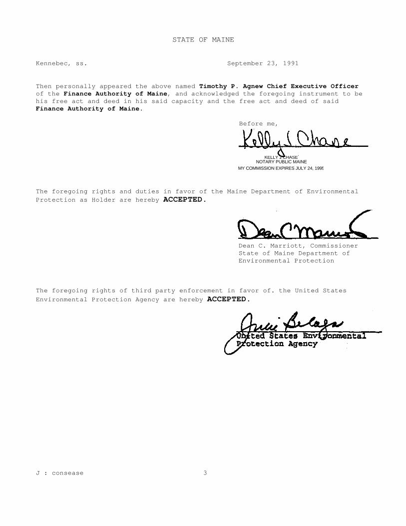
STATE OF MAINE
Kennebec, ss. September 23, 1991 Then personally appeared the above named Timothy P. Agnew Chief Executive Officer of the Finance Authority of Maine, and acknowledged the foregoing instrument to be his free act and deed in his said capacity and the free act and deed of said Finance Authority of Maine.
Before me, The foregoing rights and duties in favor of the Maine Department of Environmental Protection as Holder are hereby ACCEPTED.
Dean C. Marriott, Commissioner State of Maine Department of Environmental Protection
The foregoing rights of third party enforcement in favor of. the United States Environmental Protection Agency are hereby ACCEPTED. J : consease 3
KELLY J CHASE NOTARY PUBLIC MAINE
MY COMMISSION EXPIRES JULY 24, 1995

APPENDIX G
MEDEP COMMENTS DATED NOVEMBER 25, 2003 ON DRAFT FIVE-YEAR REVIEW

STATE OF MAINE DEPARTMENT OF ENVIRONMENTAL PROTECTION
JOHN ELIAS BALDACCI DAWN R. GALLAGHER GOVERNOR COMMISSIONER
November 25, 2003 Tetra Tech NUS, Inc 55 Jonspin Road Wilmington MA 01887 Attn: Phoebe Call
Re: Saco Tannery Waste Pits, 5-Year Review Draft Report Dear Ms. Call: The Maine Department of Environmental Protection has completed the review of the document, "Draft Five Year Review, Saco Tannery Waste Pits Site, Saco, Maine dated October 2003. Comments to this draft document are attached Atch: DEP Comments to Draft Review
AUGUSTA 17 STATE HOUSE STATION BANGOR PORTLAND PRESQUE ISLE AUGUSTA, MAINE 04333-0017 106 HOGAN ROAD 312 CANCO ROAD 1235 CENTRAL DRIVE, SKYWAY PARK 207) 287-7688 BANGOR, MAINE 04401 PORTLAND, MAINE 04103 PRESQUE ISLE, MAINE 04769-2094 RAY BLDG., HOSPITAL ST. (207) 941-4570 FAX: (207) 941-4584 (207) 822-6100 FAX: (207) 822-6303 (207) 764.0477 FAX: (207) 764-1507 web site: www-state.me.us/dep printed on recycled paper

DEP Comments to Draft Five Year Review: Saco Tannery Waste Pits Site, Saco, Maine 1) Section 4.4.4, page 4-9, first paragraph under Groundwater, last sentence. The monitoring wells projected
on Figure 4-1 are not the monitoring wells sampled quarterly as of March 1995. Figure 4-1 is a Maine DEP modified site sketch that depicts monitoring wells routinely sampled in 2002-2003.
2) Section 6.5, page 6-9, first full paragraph. There are only nine remaining, functional monitoring wells at
this site. Three of these are outside of any fenced-in area. The remaining six functioning monitoring wells are located inside the fenced-in areas.
3) Section 6.6, page 6-10, fourth paragraph. The last sentence, "No repairs to the fence are planned" is in
conflict with Appendix B, page 2, fourth paragraph, which states, "This (the fence) will be repaired during the planned September 2003 maintenance activities."
4) Section 8.0, page 8-1, last paragraph (informational only).
a) The tree stands are outside the fenced in areas, but still within the restricted Preserve.
b) The EPA made the suggestion (1998?) to leave unlocked the pedestrian gate north of Chromium Lagoon 2. This suggestion was based on hunters and other outdoorsmen ignoring the warning signs and damaging gates to gain access to the property. Either the gates should remain locked and a means to enforce the restriction of access should be found or the Memorandum of Agreement may require revision to allow some gates be left unlocked.
5) Section 9.0, page 9-1, second paragraph. During the site visit, it was noted that additional homes had been
built on Hearne Road. In response to this, a comment was made that suggested a new area groundwater contour map should be developed. It is the Department's position that a new groundwater contour map is unnecessary as the influence from these residences is negligible, given their relatively small groundwater demand, their distance from the site and the area topography.
6) Appendix B, page 2, sixth paragraph, last sentence. At no time before or during the Site Inspection of
August 28, 2003 did anyone from Tetra Tech or the EPA ask the DEP representative to locate for inspection any monitoring wells. Had someone done so, every functional monitoring well would have been easily located and an inspection made.


![Leons de morale [microforme] · 2018. 8. 9. · On.-•osrr»n •«•»](https://static.fdocuments.net/doc/165x107/60b9452dfe142a08530db212/leons-de-morale-microforme-2018-8-9-on-aosrrn-aa.jpg)