Rural Connections - Drought and Wildfire in the West
44
With an article by Governors Gary Herbert and John Hickenlooper Drought and Wildfire in the West JANUARY 2013 RuralCONNECTIONS A publication of the Western Rural Development Center
-
Upload
utah-agricultural-experiment-station -
Category
Documents
-
view
229 -
download
4
description
Drought in the West is typically accompanied by an increase in wildfire. The 2012 fire season was one of the worst on record as thousands of fires burned millions of acres. To residents of the West, it seemed as if we were living in a perpetual smoky haze throughout the summer. Costs resulting from wildfire are extensive and becoming higher as expanding exurban development results in more homes and other human developments in areas prone to wildfire.
Transcript of Rural Connections - Drought and Wildfire in the West
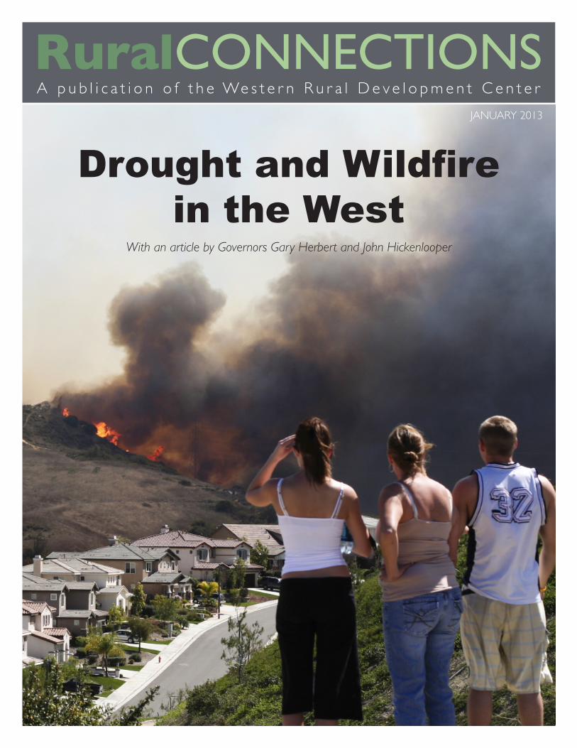
With an article by Governors Gary Herbert and John Hickenlooper
Drought and Wildfire in the West
JANUARY 2013
RuralconnectionsA p u b l i c a t i o n o f t h e We s t e r n R u r a l D e v e l o p m e n t C e n t e r
Ruralconnections Published by the ©Western Rural Development CenterLogan UT 84322-4880
January 2013Volume 7 Issue 1
EDITOR/DESIGNERBetsy H. Newman
DIRECTORDon E. Albrecht
SENIOR COORDINATORTrish Kingsford
CHAIR-BOARD of DIRECTORSNoelle Cockett, Utah State University
NATIONAL PROGRAM LEADERBrent Elrod, USDA-NIFA
IMAGESistockphoto.comContributorsWRDC Staff
The Western Rural Development Center compiles this magazine with submissions from university faculty, researchers, agencies, and organizations from throughout the Western region and nation. We make every attempt to provide valuable and informative items of interest to our stakeholders. The views and opinions expressed by these agencies/organizations are not necessarily those of the WRDC. The WRDC is not responsible for the content of these submitted materials or their respective websites and their inclusion in the magazine does not imply WRDC endorsement of that agency/organization/program.
This material is based upon work supported by competitive funding through the National Institute of Food and Agriculture, U.S. Department of Agriculture. Any opinions, findings, conclusions or recommendations expressed in this publication are those of the authors and do not necessarily reflect the views of the U.S. Department of Agriculture.
The Western Rural Development Center is hosted by Utah State University with generous support from USU’s Cooperative Extension and Utah Agricultural Experiment Station..
WESTERN RURALDEVELOPMENT CENTER Perhaps the most fundamental difference between the West and the
rest of the country is water - or lack thereof. Since initial settlement, westerners have spent vast amounts of time and money seeking solutions
to their water shortage problems. Western water shortages are made more severe by periods of sustained drought. The costs of drought are often in the billions of dollars and born disproportionally by agricultural producers and rural residents. Unfortunately, drought related problems are likely to increase in severity as a result of global climate change. 2012 was the hottest year on record. and models show that much of the West is projected to become not only drier, but also hotter.
Drought in the West is typically accompanied by an increase in wildfire. The 2012 fire season was one of the worst on record as thousands of fires burned millions of acres. To residents of the West, it seemed as if we were living in a perpetual smoky haze throughout the summer. Costs resulting from wildfire are extensive and becoming higher as expanding exurban development results in more homes and other human developments in areas prone to wildfire.
As is generally the case, researchers and Cooperative Extension professionals at western land-grant universities, working with a variety of partners, are at the forefront in seeking understanding and solutions to these perplexing problems. In this issue of Rural Connections, we are pleased to present research findings and outreach programs to assist individuals and communities in the West in coping with drought and wildfire. We especially appreciate the contribution of Governors Herbert (Utah) and Hickenlooper (Colorado) and we are honored to partner with the Western Governors’ Association in addressing drought and wildfire problems. Other articles in this issue describe drought related problems and efforts to address them in the Rio Grande Valley, the Hopi Nation, Wyoming, and even Hawaii. Additional articles provide understanding and approaches to alleviate problems related to wildfire. We at the Western Rural Development Center hope these articles provide assistance and advance dialogue for policy makers, individuals, families, and communities.
--Don E. Albrecht, Director
With an article by Governors Gary Herbert and John Hickenlooper
Drought and Wildfi re in the West
JANUARY 2013
RuralCONNECTIONSA p u b l i c a t i o n o f t h e We s t e r n R u r a l D e v e l o p m e n t C e n t e r

4 drought in the west: how governors Address A slow-Moving disAster Governors Gary Herbert and John Hickenlooper
7 drought on the rio grAnde Zack Guido
11 rAnching, risk, And resilience during drought John Ritten, Christopher Bastian, Michael Smith, and Steven Paisley
15 helping A coMMunity develop A drought iMpActs reporting systeM Alison M. Meadow, Daniel B. Ferguson, and Michael Crimmins
19 Fire And drought in pArAdise—sAy it isn’t so, sMokey Douglas Cram, Susan Cordell, James B. Friday, Christian Giardina, Creighton M. Litton, Eric Moller, and Elizabeth Pickett
23 the econoMic iMpActs oF lArge wildFires Autumn Ellison, Max Nielsen-Pincus, Emily Jane Davis, Cody Evers, and Cassandra Moseley
27 coMMunity wildFire plAnning As A tool to enhAnce trust: cAse studies FroM western MontAnA Paul R. Lachapelle and Stephen F. McCool
31 yellowstone nAtionAl pArk And the suMMer oF Fire Diane Smith
35 extension disAster educAtion network responds to 2012 drought And wildFires Virginia Morgan White, Steve Cain, and E. Kim Cassel
39 About the Authors
41 reFerences
RuralconnectionsA p u b l i c a t i o n o f t h e We s t e r n R u r a l D e v e l o p m e n t C e n t e r
RURAL CONNECTIONS TABLE OF CONTENTS 2
4
7
23
11
!
15
27 31
35 19
“WESTERN GOVERNORS HAVE A HISTORY OF
LEADERSHIP IN THE FACE OF DROUGHT. THAT LEGACY
SPANS BACK TO 1996, WHEN THEY SET AN AGGRESSIVE
GOAL TO CHANGE THE WAY THE NATION PREPARES
FOR AND RESPONDS TO DROUGHT.” PaGe 4.

3 FROM THE EDITOR RURAL CONNECTIONS

RURAL CONNECTIONS DROUGHT IN THE WEST: HOW GOVERNORS ADDRESS A SLOW-MOVING DISASTER 4
By Gov. Gary r. HerBert-UtaH and Gov. JoHn Hickenlooper-colorado chairman and vice-chairman of the Western Governors’ association
Drought in the West: How Governors Address a Slow-Moving Disaster
the widespread drought of 2012 has hurt the entire nation, but it has been particularly devastating in the Western states. Out of the 19 states included in the Western Governors’ Association, only Alaska and Washington were fortunate enough to avoid
last year’s extreme drought conditions. Otherwise, from Oahu to Omaha, the western states have experienced extreme, months-long drought.
Drought is an expensive phenomenon: both the Southern Plains drought of 2011 and 2002’s widespread drought resulted in more than $12 billion of costs and damages (NOAA, 2012).
Last year’s drought could end up with an equally devastating price tag; this time, however, we were much better prepared to mitigate the effects of the disaster than we were a decade ago. Since that time, Western Governors have taken the lead on drought preparedness. Nearly every western state has a drought mitigation and/or response plan. Often, these plans involve drought task forces that bring stakeholder concerns directly to the attention of the governors.
But drought plans are only one part of emergency preparedness. A recent survey of the WGA states found that drought managers want – and need – better early warning information in order to significantly reduce impacts (Steinemann, 2012). Governors are also leading in this respect, pushing for reliable and cutting-edge data for forecasting and management.
Western Governors and Drought: HistoryWestern Governors have a history of leadership in the face of drought. That legacy spans back to 1996, when they set an aggressive goal to change the way the nation prepares for and responds to drought. In 1998, they helped create the National Drought Policy Commission, which identified the need for

5 DROUGHT IN THE WEST: HOW THE GOVERNORS ADDRESS A SLOW-MOVING DISASTER RURAL CONNECTIONS
a comprehensive drought policy and improved observations and forecasting of drought conditions.
In the mid-2000s, then Governors Johanns (NE), Richardson (NM), and Martz (MT) spearheaded regional support for the creation of the National Integrated Drought Information System (NIDIS). NIDIS established a framework for sharing the most up-to-date monitoring and prediction information on drought, available online through the website drought.gov. Since its establishment, state agencies and WGA have provided additional suggestions and guidance to ensure that NIDIS delivers relevant and timely information on drought to western states. Today, NIDIS is up for reauthorization and the WGA has sent a letter voicing the western states’ support for reauthorization. NIDIS is in line with WGA’s 2011 policy on water resources, which states:
“Western Governors believe a comprehensive, integrated response to drought emergencies, including mitigation planning, is critical to the social, environmental and economic well-being of the West…Governors recommend the continued development of the NIDIS program, particularly with respect to implementation of regional drought early warning systems.”
NIDIS helps state and local decision-makers assess the potential impacts of too little water and prepare for – and mitigate the effects of – drought.
What Governors Have Done to Address the Drought of 2012Governors are uniquely poised to address the cross-sector effects of drought, from forest health to water supply, and from agriculture to economic growth. As Gov. Herbert told members of the Utah Farm Bureau last fall, “With drought and fires, Utah had a unique challenge this past summer, far beyond what we experienced in 2007. As the major limiting factor to growth, water is essential to Utah’s success. We must not only conserve what we have; we must find better ways to meet future water challenges.”
One way Governors have addressed the multi-faceted impacts of drought is by establishing drought task forces, uniting state agencies and stakeholders. Last July, for example, South Dakota Governor Dennis Daugaard activated a state task force to facilitate an exchange of information among government agencies.
“Much of South Dakota was struggling with record flooding just a year ago, but conditions have rapidly
reversed,’’ Daugaard said. “We have been closely tracking weather patterns, and the Drought Task Force will give us a forum to exchange facts and data so our citizens can count on having the most up-to-date information as they respond to the drought.’’
Governors have also toured drought-stricken areas to see the impacts for themselves. Last fall, Gov. Hickenlooper visited farms on the Eastern Plains of Colorado, where he surveyed the crop losses to corn farmers in his state. In July, Kansas Governor Sam Brownback toured the drought stricken areas of his state, one of 12 WGA states where the entire state has been recognized by the US Department of Agriculture (USDA) as eligible for assistance as a drought disaster area or a contiguous county.
Governors are uniquely poised to evaluate, understand, and highlight drought impacts in their states. Governors can publicly proclaim a drought disaster in their state, as New Mexico Governor Susanna Martinez did in May of 2012. Alternatively, Governors can connect with federal officials to encourage drought declarations from the USDA in order to free up resources for farmers.
In mid-August, for example, Wyoming Governor Matt Mead successfully requested drought declarations for 22 of 23 counties in his state in light of worsening conditions. “Agriculture producers across the state are reporting severe conditions that impact their ability to feed livestock and produce hay,” Gov. Mead said. “The federal response to our request allows agriculture operators in both primary and contiguous counties to be eligible for assistance.”
Drought and Rural CommunitiesRural communities bear the brunt of drought impacts. This has been painfully evident in Utah, where ranchers have been forced to auction off cattle before their prime because they didn’t have enough water to grow the hay and forage their livestock needed (Fahys, 2012).
Across the West, farmers have experienced disappointing yields, with the US corn crop at its lowest level in six years (Wilson, 2012). Still, the outlook is not altogether bleak: corn prices reached a record $8.49 per bushel in August – 50 percent higher than projected in mid-summer (Wilson, 2012) – and net farm income is expected to reach $122.2 billion in 2012, 3.7 percent more than 2011 and the highest it has ever reached (Covey and Weber, 2012).

Nevertheless, one cannot discount the effects to small communities, especially as the drought adds to woes brought on by the economic recession. Small businesses dependent on farmers for their product base are affected by drought, too. Low-interest loans up to $2 million are available for these businesses from the Small Business Administration (SBA).
Links to WildfireWildfires were remarkably devastating in the West this season: more than 9 million acres across the US had been burned as of November 2012, well above the 10-year average of 7 million acres. This year’s fire season was especially dramatic because several wildfires occurred in populated areas with valuable property. Insurance estimates for the Waldo Canyon fire in Colorado stand at $352.6 million, more than 1.5 times the second-most expensive wildfire in Colorado history.
Drought conditions contributed significantly to wildfire in the West. Low precipitation, high temperatures, and lack of soil moisture created ideal conditions for wildfire. Information about drought can help us make forest management decisions more wisely.
Next Steps for Regional PolicyAs the Western Governors continue to collaborate on drought response, we urge the reauthorization of NIDIS. The good work set forth under the original 2006 authorization should be continued; otherwise, we
will be taking a significant step backwards in drought preparedness.
While we all hope the drought will not continue into 2013, the western states are prepared for such an event. The forecast through February 2013 shows signs of persisting drought across much of the West, which means that we are not likely to see immediate relief. A continued drought would be particularly harmful for cattle ranchers who have already had to reduce herd size to get through this season; we, as Governors, must be particularly ready to speak on behalf of our constituents to the federal government to secure drought relief, as necessary.
Additionally, the Western Governors call for a Comprehensive Drought Approach from the federal government. The various federal agencies that address drought – including the USDA, the SBA, the Bureau of Reclamation, and the Federal Emergency Management Agency – should coordinate their approach so that seeking drought assistance is as easy as possible for constituents. This will involve clarifying the roles of each agency, as well as the roles of branches in the USDA such as the Natural Resources Conservation Service (NRCS) and the Farm Service Agency (FSA).
With continued access to up-to-date information and improved distribution of assistance, the West will continue to be prepared to manage the effects of drought.
pictUred: a reservoir in Western colorado WitH exposed sHoreline, octoBer 2012. istockpHoto.com
RURAL CONNECTIONS DROUGHT IN THE WEST: HOW GOVERNORS ADDRESS A SLOW-MOVING DISASTER 6

Drought on the Rio Grande
7 DROUGHT ON THE RIO GRANDE RURAL CONNECTIONS
By zack GUido
Nearly all the surface water had been drained from Elephant Butte Reservoir by October, and the Rio Grande below the dam flowed at
a trickle. Sandy bars had become exposed where the chocolate-colored river had flowed only weeks before. At Greg Daviet’s pecan farm in the Mesilla Valley outside Las Cruces—about 40 miles downriver from Elephant Butte—the drone of groundwater pumps filled the air. Wells gushed crystalline water onto thirsty orchards.
Despite another dry year—the ninth time in the last decade that farmers received a fraction of the surface water they need to sustain their crops—Daviet’s pecan trees were primed for a healthy harvest thanks to bountiful groundwater. The extra pumping during the dry time, however, comes at a price. Groundwater costs more than surface water and its higher salinity harms crops over the long run.
“Drought will never be as profitable as wet times,” Daviet said. “While, the water is still sufficient in a drought, how we [manage] it needs to change.”
On the Rio Grande—the wellspring for more than five million people living in Colorado, New Mexico, Texas, and Mexico—coping with scarcity is now a reality, and water and agricultural practices may become leading examples of how to adapt to drier times.
Water Use on the Rio Grande From the white-clad peaks of southern Colorado to the Gulf of Mexico, the Rio Grande flows for about 1,800 miles. In New Mexico, the river pauses several times behind dams, including the state’s largest reservoir Elephant Butte, which stores about 2.2 million acre-feet of water. (An acre-foot covers one acre of land in one foot of water and satisfies, on average, the annual water needs of about eight Albuquerque residents.) About 25 miles down river, Caballo Reservoir impounds an additional 350,000 acre-feet. In a good year, these reservoirs release 790,000 acre-feet, with 416,000 acre-feet destined for the Elephant Butte Irrigation District (EBID) in southern New Mexico, and 314,000 and 60,000 acre-feet passed to Texas and Mexico, respectively.
When flows in the river and storage in reservoirs are sufficient, the EBID doles out a full irrigation allotment of 36 inches of water per acre of land. In some years, EBID can allocate more. Recently, allocation has been a lot less.
“In about 1978, we began a 23-year full supply of surface water,” said Gary Esslinger, director of the EBID. “We had plenty of snowpack runoff. The lakes were full. We were just over our heads in surface water.”
In 2003, drought set in. It was a wake-up call, Esslinger said. The last two winters have done little to ease his concerns.
Current ConditionsBack-to-back La Niña events during the 2010 and 2011 winters helped steer storms away from the Upper Rio Grande Basin in Colorado, where most of the water flowing in the Rio Grande originates. Rain and snow totaled less than 82 percent of the 1971–2000 average during these winters, contributing to a decreasing trend in reservoir storage. As of November 30, Elephant Butte stood at about six percent of capacity, and the water available for future irrigation was completely exhausted. For the foreseeable future, the amount of surface water accessible to farmers will depend entirely on the winter’s precipitation and likely will be insufficient to meet demand. To compensate, irrigators will continue to rely heavily on groundwater.
“Around half a million acre-feet of water is the amount of water that needs to be put on the fields [in EBID],” Daviet said. “In wet years, the reservoirs provide plenty of that. In years where we are drier, we supplement that with groundwater pumping.”
A Protective ShieldPorous sediments below the Rio Grande have soaked up river water through geologic time, forming a reservoir vastly larger than Elephant Butte. The aquifer beneath Mesilla Valley is more than 2,000 feet thick in some places (Texas Water Development Board, 2007), providing ample water that safeguards against droughts. On Daviet’s farm, for example, water levels have dropped only 30 feet in the last 10 years despite

RURAL CONNECTIONS DROUGHT ON THE RIO GRANDE 8
ramped up pumping. With many wells in the region penetrating hundreds of feet into the aquifer, concern about running out of water is low.
“Do I think that we will ever see a drought that will deplete 300 feet [dropping water below the wells],” Daviet said. “Probably not in my lifetime.”
The large store of groundwater is not only a savings account that protects crops against inadequate surface water allotments, but it also allows farmers to apply water on demand. In the middle of the summer when demand is high, for example, EBID can move only a fraction of the water needed, and some farmers have to wait for water. This can occur in both wet and dry times, and access to groundwater enables farmers to shield their crops from distribution bottlenecks that would otherwise stress crops and lower yields. Daviet is lucky. His farm sits on a sweet spot for water in the Lower Rio Grande. About 40 miles north, near Hatch, the aquifer is substantially smaller and water
is found at depths less than 200 feet. On Lack Farms, onions, chili, cotton, and other crops cover more than 1,500 acres. Wells there only penetrate 60 feet, and the recent declines in groundwater have caused the water table to dip below the intake valves when the pumps are turned on. This causes water and air to be drawn together, straining the pumps and reducing water flow.
“Our wells are surging; our water level is dropping,” said Rosie Lack sales executive for Lack Farms, noting that continued low surface water allotments will be difficult to overcome.
The Added Costs Even where ample water exists, farmers like Daviet are not immune to drought. Rather than drying out fields, the drought has shriveled savings.
“When we have to pump nearly all of our water, for a pecan farmer it adds 10 to 15 percent to our normal expenditures,” Daviet said.
pictUred: BleacHed rocks tHat line elepHant BUtte, tHe namesake for elepHant BUtte reservoir in soUtHern neW mexico, are a visUal reminder tHat Water stores all nearly exHaUsted. in early JUly WHen tHis pHoto Was taken, elepHant BUtte reservoir contained only aBoUt 12 percent of capacity; storaGe is cUrrently even less. pHoto By zack GUido.

9 DROUGHT ON THE RIO GRANDE RURAL CONNECTIONS
These unwanted costs can skyrocket when large capital improvements need to be made to irrigation systems—added investments that occur more often in times of drought.
“About every 10 feet that our water table drops, I lose about a 100 gallons per minute,” Daviet said.
To overcome this shortfall, Daviet was forced to spend $150,000 on a new well, a significant portion of his operating budget. For profitable farms, these added expenditures can be absorbed. For farms functioning on the margins of profitability, it can push them over the edge.
“Big infrastructure improvements could be as much as 30 to 40 percent [of annual budgets] in years that big improvements need to be done to enable groundwater pumping,” Daviet said. “When you are talking about that level of investment, if you have a farm that is marginal, that could be the straw that breaks them.”
Groundwater also has other, hidden costs. Because the local geologic deposits are rich in salts and groundwater spends long amounts of time in contact with them, salts are extricated from the sediments much like hot water extracts caffeine. Consequently, groundwater carries higher salinity concentrations than surface water, and requires purchasing additives to prevent harm to the crops.
The added costs affect more than pecan growers. In Hatch, the chili pepper is king. Jim Lytle’s family has been farming the valley since the late 1800s and has helped pioneer chili production in the region. A variety of pepper, the one found on most chili relleno dishes,
even bears the name of Lytle’s father—The Big Jim. The drought has been a burden on his family as well.
“We use approximately four feet of water to irrigate one acre of chili,” Lytle said. “We were only allocated [10] inches [this year], so the rest of it we have to pump. That’s going to impact us significantly, and what it comes to is at the tail end, we are going to make, probably, half of what we normally make.”
At Lack Farms, the recent dry conditions have lowered crop yields while also raising production costs.
“I feel like the drought has probably affected the yield potential by at least 40 percent and our expenses are up too,” Lack said.
A History of DroughtWhile the recent dry spell has been severe, it is not unusual for the Southwest. Researchers at the University of Arizona used tree rings to recreate streamflows at Otowi Bridge, about 60 miles north of Albuquerque, for the years 1450–2002. This 552-year record shows five 10-year periods in which flows were less than the lowest historical values measured by stream gauges (Figure 1). The most persistent drought occurred in the late 1800s, when flows measured 73 percent of average during an 11-year period. In other words, the 20th century—especially the wet period near the end—is not representative of streamflow variability in the Rio Grande, said Connie Woodhouse, professor at the University of Arizona’s School of Geography and one of the scientists who reconstructed the streamflow history of Rio Grande.
The record is a warning: the severity, frequency, and duration of naturally occurring droughts in the Rio
fiGUre 1: reconstrUcted streamfloW of tHe rio Grande at otoWi BridGe nortH of alBUqUerqUe, neW mexico. tHe record Was developed UsinG tree rinGs. (WoodHoUse ca, et al. 2012.) data availaBle on tHe WeB at treefloW.info.

RURAL CONNECTIONS DROUGHT ON THE RIO GRANDE 10
Grande watershed may exceed those of recent years. That could mean greater challenges for water management than those the region has faced.
Adapting to DroughtIn many places in the Lower Rio Grande, groundwater has been the saving grace during the last dry 10 years, but relying on groundwater is not a failsafe strategy. The groundwater and river are tethered to each other so that declines in the Rio Grande ultimately reduce infiltration. “The groundwater is hydrologically connected to the river. It’s not magically making water; it’s really borrowing it from future water supplies,” King said.
While groundwater reserves are currently ample, those supplies may eventually lower to where it’s no longer profitable to use groundwater, a prospect that has caught the attention of water managers.
“The greatest uncertainty is the changes that are coming with climate change,” said Filiberto Cortez, manager of the Bureau of Reclamation’s El Paso Field Division.
Developing safeguards against future change also has immediate payoffs. The EBID is exploring new strategies to boost supply, including capturing monsoon torrents by building earthen structures that funnel water spilling from drainages into irrigation canals.
“We’ve been really intense in developing a stormwater management plan to capture the water and use it to recharge our aquifer,” Esslinger said.
Capturing monsoon precipitation, however, cannot completely compensate for reductions in streamflow experienced in the recent decade, King said. Other coping strategies are also needed, including more coordinated management. Daviet, for example, could sell his surface water allocation to farms in Hatch in return for compensation for the added expenditure of pumping more groundwater. This transfer allows water to move from places of abundance to those of scarcity. Water managers also foresee changes in land tenure in order to adapt to drier climates.
“I think what you will see is a change in the crop types,” King said. “Probably, [farmers will] concentrate what little water there is on smaller acreage and grow higher value crops.”
Esslinger agrees. “Farmers here are very progressive, very innovative. Garlic and things that we’ve never thought of may be grown here and may be a new source of agriculture.”
More than 10 years of drought has undoubtedly taken its toll on farmers in the region, and if drought becomes more commonplace in the future, it will likely carry burdens too heavy for some to overcome. Nonetheless, farming will not disappear. Daviet, for one, remains optimistic.
“Drought is not the end of the world,” Daviet said. “We can adjust to it. We do adjust to it, as long as you don’t fight change and try to adapt to it.”
pictUred: rio Grande in neW mexico. istockpHoto.com.

Ranching, Risk, and Res ilience During DroughtBy JoHn ritten, cHristopHer Bastian, micHael smitH, and steven paisley
Livestock producers in Wyoming, and across much of the western United States, are accustomed to dealing with drought. Yet, producers can
always benefit from insight as to how best to cope with the decreases in forage associated with reduced precipitation. Often, these droughts force ranchers to carry smaller herds, increase costs associated with purchased feed, and increase short-term debt, all while dealing with fluctuating cattle markets.
In 2005, researchers in the Department of Agricultural and Applied Economics at the University of Wyoming attempted to answer the tough question of “How can I deal with drought?” A survey of Wyoming cattle producers found operations across the state had tried a number of strategies to deal with drought conditions. The most common responses included some level of herd liquidation and/or purchasing additional feed. However, results showed that a wide variety of strategies had been considered across the state. We analyzed a suite of these alternative strategies across
a wide range of both market and climatic situations to better understand the potential long-term profitability of these strategies.
These analyses required setting up a ranch “on paper” and running the model ranch through various precipitation and price shocks across these different strategies to see how the ranch fared over time. This “paper ranch” was set up to resemble a typical 600-cow ranch in central Wyoming. The ranch used the alternative strategies across a series of 86 years of precipitation data, and 27 different price cycle scenarios. In addition to overall profitability, special attention was given to how each scenario performed across a range of potential periods of drought. This offered the benefit of providing insight into both the current drought and future drought scenarios that might occur.
The base strategy allows partial herd liquidation as a drought mitigation approach, and allows the paper
11 RANCHING, RISK, AND RESILIENCE DURING DROUGHT RURAL CONNECTIONS

RURAL CONNECTIONS RANCHING, RISK, AND RESILIENCE DURING DROUGHT 12
Ranching, Risk, and Res ilience During Droughtranch to choose the most profitable herd size in each year given available forage resources and cattle prices. The second strategy is the same as the base strategy with the added option to purchase additional hay to feed in summer months when requirements traditionally met through grazing are negatively impacted by drought conditions. The option to wean calves early (August 1 as opposed to October 15 in the base model) and subsequently market them earlier than normal, is another strategy aimed at reducing
herd forage requirements in the summer, allowing a producer to minimize culling of breeding stock. All of these strategies are considered to be reactive, as management decisions occur as the drought conditions appear.
A more proactive strategy to deal with forage availability and market signals utilizes later calving dates (June 1 as opposed to April 15 in the base model), but maintains the October 15 weaning date

13 RANCHING, RISK, AND RESILIENCE DURING DROUGHT RURAL CONNECTIONS
and November 1 sale date. As expected, calves born later are sold at lighter weights than traditionally-born calves. However, weights for late-season calves are not assumed to be drastically different from earlier-born calves (previous research at the University of Wyoming suggests that later-born calves usually experience heavier birth weights than early-season calves). This strategy aims to better align herd requirements with growing season forage production, thereby reducing reliance on raised or purchased feed such as hay. Previous research suggests the potential of additional benefits associated with late calving (such as reduced cow costs) that can increase overall profitability (see Younglove et al., 1998, May et al., 1999, and Kruse et al. 2007).
However, as not all operations will likely see all of the proposed benefits, we evaluated two late-calving scenarios. The basic late-calving scenario only alters calving dates (and associated herd requirements), weaning/sale weights, and the prices associated with lighter sale weights. The second late-calving scenario analyzed the additional potential benefits that may or may not be realized by individual producers trying this strategy. Our specific assumptions of the second late-calving strategy include increased breed back, reduction in calf death loss, a reduction in yearly cow costs (due to less calving difficulties and labor costs), less supplementation needs, and a reduction in yearly fixed costs representing cost savings associated with less required buildings for calving (given most calving would take place out of doors).
While not all of these additional benefits may be experienced by all producers (for example, it is unlikely an operation would eliminate existing barn
space due to reduced calving indoors), the analysis included all of these benefits to get an idea of the potential impact of a best-case scenario associated with a conversion to late calving. It should be noted, however, that the model assumes the transition to late calving has already occurred, and none of the conversion costs (transitioning breeding stock, updating grazing strategies, etc.) have been included.
The final strategy analyzed is also proactive in terms of drought management and was modeled as a cow/calf/yearling operation. In this scenario, an operation is expected to retain all weaned steers over the winter with the goal of selling yearling steers the following November. However, in order to accommodate for the reduced forage supply associated with drought, this scenario gave producers the option to sell short yearlings on May 1 in order to reduce herd forage requirements, if needed. As with the late-calving scenario, it is assumed that conversion to a cow-yearling operation has already occurred, and neither the initial loss of revenues associated with a forgone steer-calf crop nor any costs associated with the conversion are included in this analysis.
resultsIn general, summer feeding did improve overall average profitability. However this alternative was only more profitable than the liquidation-only scenario when compared to the remaining management options (Table 1). Also, caution must be used when implementing the summer feeding strategy, as most of the benefits of feeding through a drought are realized post-drought. Often the benefits of increased calf sales associated with maintaining a larger herd size through the drought were matched by the increased
pictUred: cattle GrazinG in WyominG. istockpHoto.com.

RURAL CONNECTIONS RANCHING, RISK, AND RESILIENCE DURING DROUGHT 14
costs of feed during drought years. The major benefit of this strategy is the increased calf sales post-drought when feeding (and associated expense) was no longer required. This strategy was most effective when cattle prices increased after the drought. If cattle prices were expected to decline post-drought, this strategy was not profitable.
Our results indicate late calving may be a promising strategy, but some caution must be exercised when considering this alternative as success is dependent on realizing some potential (but not guaranteed) benefits with this strategy. There are also some potential disadvantages of late calving that were not incorporated such as conflicting labor demands, reliance on public grazing during summer months, as well as the risk of utilizing common grazing allotments.
The scenario that retained all steer calves over the winter with the option to sell in early summer or fall was the most promising strategy to adjust to drought. Generally, retaining ownership of steer calves over the winter, with the option to sell if forage supplies become scarce, outperforms both partial liquidation and summer feeding, and results in lower profit variability than late calving or early weaning with only slightly lower profit overall when compared to late calving with additional benefits across most of the scenarios analyzed (Table 1).
As in most of the West, Wyoming suffered a severe drought this summer, with the effects still being felt. There were many efforts aimed at helping to ease the impacts of drought, ranging from drought planning efforts early in the season, and late-season drought
recovery planning. Our model ranch was used to show the risks and rewards of the alternative strategies we analyzed. Later in the season, we used this ranch as a tool to demonstrate how some alternative strategies may be helpful in making the ranch more resilient in the future, especially given the cattle outlook in the coming years.
The representative ranch was very useful in demonstrating the impacts of price expectation on current year decisions. Given the high cattle prices this year, we were able to show some benefits to increased culling this year in order to maintain future productivity. Given the high cost of hay this year, many producers were in a better position to sell livestock, and minimize the damage to rangelands of excessive grazing, while trying to keep herd costs in check. Also, given the expected increased costs of breeding stock in the coming years with expected herd expansion, many producers are now considering restocking at least part of their herd with yearling animals. Including stockers offers a way to keep costs down in the short term, as well as add flexibility to destocking decisions in case drought carries into the future. Ranches that are more resilient to the risk of drought in the future should also improve the resilience of small rural communities in the West that have economies dependent on agriculture.
Author’s Note: This work has resulted in a series of Extension bulletins and programs. For further information see Ritten et al., 2011a, Ritten et al., 2011b, Ritten et al., 2011c, and Ritten et al., 2011d. For academic papers see Bastian et al., 2009, Ritten et al., 2010a and Ritten et al., 2010b. These are listed at the end of the publication in the ‘References’ section.
!
!!"#$%"&'
(%)*%+"$%,-'.-&/' 0*112#'322+%-4' 5"#&/'62"-%-4' ("$2'7"&8%-4'9':";%<' ("$2'7"&8%-4'=%$>'?++%$%,-"&':2-2@%$;' A2$"%-'0$22#;'
B%-%1*1' "##$%$&'!! "())%*'(!! "+%',+%)-,!! "+%*#'%)-#!! "+%$$&%#'#!! "+%,,-%)**!!
?82#"42' "+%-*,%**$!! "+%+-$%)(#!! "+%,+$%-#(!! "+%$*'%',#!! "+%)+'%,$+!! "+%$(+%'&-!!
B"C%1*1' "+%+'+%,)&!! "+%+#(%*$-!! "+%$,'%#)'!! "+%&,-%((&!! "+%#'&%*-*!! "+%&#*%$-+!!
0$"-+"#+'
D28%"$%,-'"&&%),*!! "&'%+,*!! "#+%($+!! "#-%,-'!! "#*%*-(!! "&$%&(,!!
!
!
!
taBle 1. ranGe and distriBUtion of total net discoUnted retUrns over entire 86-year Horizon.
(adapted from ritten et al., 2011a.)

15 HELPING A COMMUNITY DEVELOP A DROUGHT IMPACTS REPORTING SYSTEM RURAL CONNECTIONS
Helping a Community Develop a Drought Impacts RepoRting SyStemBy alison m. meadoW, daniel B. ferGUson, and micHael crimminsThis project is supported by the NOAA Sectoral Applications Research Program award number NA10OAR4310183 and the University of Arizona.
1Oral and written histories of the region note that many Hopi people migrated to the Rio Grande region in the mid-1800s to escape severe drought. They returned to their traditional homelands once conditions improved (see for example Clemmer).
Can Monitoring the Impacts of Drought Improve Planning for Drought?
Unlike most weather, or climate-related hazards, drought does not have an easy or universal definition. Drought is, of course, simply a
shortage of precipitation, but shortage for whom and by how much? Arguably, those who experience its impacts best define drought. Monitoring for drought, one might then assume, would rely heavily on observations of the impacts of drought. In fact, standard drought monitoring relies primarily on measurements of precipitation and streamflow to determine drought status in a particular region. Most experts in drought monitoring, planning, and response recognize the need for a greater focus on monitoring drought impacts, but such information remains a relatively small portion of drought status assessments due to the complex nature of drought impacts and the difficulty in ascribing a particular impact directly to drought – particularly if the observer is not specifically trained in resource management or monitoring.
Our recent work with the Hopi Tribe’s Department of Natural Resources (HDNR), however, has helped convince us that depending on the circumstances of a particular community, impact observations can be at least as important as hydroclimatic data in determining drought status and selecting appropriate responses.
Community SustainabilityThe Hopi people have lived in the Four Corners
region of the southwest (Figure 1) for at least 1000 years (with some notable periods of absence during previous severe droughts1 ). This region has been experiencing frequent deep drought events over the past several decades with brief excursions back to average or even wet conditions (Figure 2). Overall this pattern of recent climate variability has produced acute short-term drought impacts in certain seasons (e.g., poor forage for livestock) and longer-term impacts to water resources (e.g., drying of near-surface springs) across the region. Persistent drought conditions negatively affect Hopi livelihoods by diminishing crop production from traditional farming, reducing the growth and abundance of culturally significant wild plants, and stressing livestock, which in some cases is driving ranchers to reduce herd size.
In conversations with tribal natural resource managers a clear message has emerged: this region is their home, they have neither the intention or the ability to move away, and they must, therefore, make the best possible resource management decisions to maintain the land and Hopi livelihoods. As one tribal resource manager told us, “We’re not going anywhere, so we need to take care of what we have.”
Over the last three years we have been working with the Hopi Department of Natural Resources to develop a drought status-monitoring program based largely on a diverse set of environmental indicators relevant to the region. In this case, impacts monitoring
RURAL CONNECTIONS HELPING A COMMUNITY DEVELOP A DROUGHT REPORTING IMPACTS SYSTEM 16
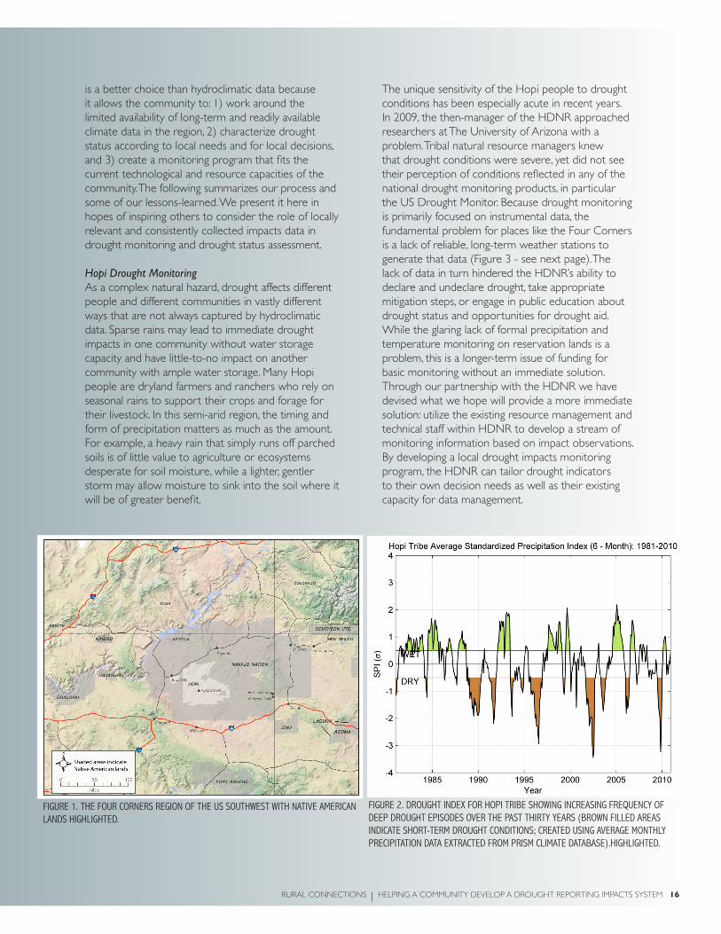
!fiGUre 1. tHe foUr corners reGion of tHe Us soUtHWest WitH native american lands HiGHliGHted.
!fiGUre 2. droUGHt index for Hopi triBe sHoWinG increasinG freqUency of deep droUGHt episodes over tHe past tHirty years (BroWn filled areas indicate sHort-term droUGHt conditions; created UsinG averaGe montHly precipitation data extracted from prism climate dataBase).HiGHliGHted.
is a better choice than hydroclimatic data because it allows the community to: 1) work around the limited availability of long-term and readily available climate data in the region, 2) characterize drought status according to local needs and for local decisions, and 3) create a monitoring program that fits the current technological and resource capacities of the community. The following summarizes our process and some of our lessons-learned. We present it here in hopes of inspiring others to consider the role of locally relevant and consistently collected impacts data in drought monitoring and drought status assessment.
Hopi Drought MonitoringAs a complex natural hazard, drought affects different people and different communities in vastly different ways that are not always captured by hydroclimatic data. Sparse rains may lead to immediate drought impacts in one community without water storage capacity and have little-to-no impact on another community with ample water storage. Many Hopi people are dryland farmers and ranchers who rely on seasonal rains to support their crops and forage for their livestock. In this semi-arid region, the timing and form of precipitation matters as much as the amount. For example, a heavy rain that simply runs off parched soils is of little value to agriculture or ecosystems desperate for soil moisture, while a lighter, gentler storm may allow moisture to sink into the soil where it will be of greater benefit.
The unique sensitivity of the Hopi people to drought conditions has been especially acute in recent years. In 2009, the then-manager of the HDNR approached researchers at The University of Arizona with a problem. Tribal natural resource managers knew that drought conditions were severe, yet did not see their perception of conditions reflected in any of the national drought monitoring products, in particular the US Drought Monitor. Because drought monitoring is primarily focused on instrumental data, the fundamental problem for places like the Four Corners is a lack of reliable, long-term weather stations to generate that data (Figure 3 - see next page). The lack of data in turn hindered the HDNR’s ability to declare and undeclare drought, take appropriate mitigation steps, or engage in public education about drought status and opportunities for drought aid. While the glaring lack of formal precipitation and temperature monitoring on reservation lands is a problem, this is a longer-term issue of funding for basic monitoring without an immediate solution. Through our partnership with the HDNR we have devised what we hope will provide a more immediate solution: utilize the existing resource management and technical staff within HDNR to develop a stream of monitoring information based on impact observations. By developing a local drought impacts monitoring program, the HDNR can tailor drought indicators to their own decision needs as well as their existing capacity for data management.

17 HELPING A COMMUNITY DEVELOP A DROUGHT IMPACTS REPORTING SYSTEM RURAL CONNECTIONS
Process of Establishing an Impacts Monitoring Program Identify community’s needs We began our collaboration with the HDNR with an assessment of their observations, concerns, wishes, and capacity related to drought monitoring. Among the tools we used was a focus group with resource managers that centered on a seasonal calendar to prompt discussion of when during the year precipitation is most important to Hopi livelihoods and whether managers have perceived any changes in the precipitation regime in recent memory. We also discussed pressing concerns about drought conditions including the potential for loss of traditional farming methods and crops; the requirement to reduce herd sizes placing an enormous burden on households with little other income; and the loss of culturally important plants that do not grow well under recent drought conditions.
Identify community goals Our next step was to determine what a Hopi drought monitoring system would be used for. In many agricultural communities in the US, drought status is used as the basis for federal drought assistance. However, our preliminary assessment suggests that Hopi drought monitoring is used internally to guide tribal planning and mitigation activities such as providing financial support for ranchers who need to haul water for their livestock, to determine whether livestock reductions are necessary, and to inform the general public and elected officials about the state of the community’s land and resources.
Identify key impacts for that communityTo guide the development of a drought-monitoring program, we attempted to determine drought impacts that were most detrimental to the community. The concerns about drought consistently raised by HDNR staff included: poor forage for livestock, insufficient water for livestock (in springs or impoundments), and not enough precipitation (or at the wrong time) for the dryland agriculture.
Identify community assets An important consideration in designing a monitoring program was that it fit the capabilities and resources available in HDNR. As with many resource management agencies at all levels of government, the HDNR are financially strapped and lack the technological resources to manage a data-intensive monitoring program. The HDNR is fortunate, though, to have resource technicians who are intimately familiar with the landscape and are regularly surveying
the land as part of the tribe’s resource management and grants reporting responsibilities. Because these technicians were out on the land, collecting ecological status information regularly, and were familiar with the landscape, we determined that implementing a drought impact monitoring program would essentially mean just tweaking the system already in place to incorporate a focus on drought impacts.
What’s already being done in the community? Identify gaps in best practices.Our next step was to engage with the resource technicians and their managers to determine what kind of monitoring they were doing already, how they were recording the information, and how that information was managed and used within HDNR. Through this process we learned that different parts of HDNR were charged with monitoring different resources, collected data in different ways, and had differing levels of expertise. By examining the data collection forms for each branch of DNR, interviewing technicians from each branch, and going out in the field with technicians, we were able to compile a list of resources that are regularly monitored, those that are not, and how that data is used. For example, springs are checked and flow-rates measured monthly, but water levels in earthen dams, which provide water for livestock, were not systematically assessed on the same schedule.
Based on these insights, we are currently in the process of developing a short drought monitoring protocol for HDNR resource technicians. Not all technicians will answer every question (for example, water resources technicians are not expected to contribute rangeland status observations), but the format is the same for all technicians, meaning that the data can be assimilated in one main database by the HDNR. Our recommended drought impacts monitoring protocol for Hopi DNR will draw on their concerns, is based on existing monitoring practices, and fits the resources available within the HDNR.
Consider data management issues A key lesson for our team was the need to carefully assess the data management and technological capacities of our partners. In the case of HDNR, both are limited due to funding and the relative isolation of the community (which limits internet bandwidth and cellular connections). While there are many technological tools that could be applied to monitoring drought conditions in an area with few weather stations—such as remote sensing technology—those were not an effective solution to the problems at

RURAL CONNECTIONS HELPING A COMMUNITY DEVELOP A DROUGHT IMPACTS REPORTING SYSTEM 18
Hopi because they could not be easily integrated into existing technological or data management frameworks. By keeping the impacts monitoring list as short as possible (and still remain useful for decision makers), we hope to allow the HDNR to quickly integrate this data into their management structures.
Provide training to reportersIn addition to the drought impacts monitoring protocols, we are also developing a training module for the technicians who will be collecting the data. Although most are familiar with other ecological monitoring practices, our assessments demonstrated the need to provide some additional background on the importance of consistency in monitoring for drought. We will use a scenario-based approach to training in which the technicians are presented with a range of realistic situations so that we can all come to better understand how drought impacts data could be used to support resource management decisions.We will test the use of these protocols by accompanying resources technicians to the field to see
how they work on-the-ground. We will also work with the data managers to see how information coming from the technicians is being uploaded to the drought database as well as what kinds of reports can and are generated based on the impacts data. Once the monitoring protocols have been implemented in the Hopi DNR, we will periodically return to evaluate how well they are being followed, whether more protocols have been added to the program, and how drought impacts data are being used in decision making.
This collaborative project has provided us with ample opportunities to explore the importance and practicality of monitoring drought through systematic collection of impacts data. We are at a relatively early stage in this experiment. We hope the new monitoring protocols will prove useful to and useable by the Hopi Department of Natural Resources and will strengthen their drought planning and response program. We also hope this work will provide lessons for other communities struggling to better characterize and track drought in their region.
!fiGUre 3. tHis map of WeatHer and streamfloW instrUments across arizona HiGHliGHts tHe relative deartH of instrUmental data availaBle for triBal lands (indicated By yelloW sHadinG). map By zack GUido, climate assessment for tHe soUtHWest, University of arizona.

19 FIRE AND DROUGHT IN PARADISE RURAL CONNECTIONS
The last two summers have resulted in historic wildfire activity on the US mainland – 8.2 and 9.1 million acres burned in 2011 and 2012,
respectively (National Interagency Fire Center 2012). Unfortunately for Smokey Bear, who may be looking for an opportunity to hang up his shovel for a surfboard for a few months, a trip way out west to the Hawaiian Islands would not serve as a vacation. In fact, Smokey would find “paradise” to have a hornet’s nest of fire issues. Indeed, there is fire in paradise even during the “winter” or vacation months, thanks largely to a tropical climate that supports year-round fire potential and a veritable smorgasbord of nonnative plants that provide continuous and highly flammable fuels. Because of the uninterrupted threat for anthropogenic and natural ignitions, which have been compounded by drought conditions over the past five years, Smokey’s message of “Stop wildfires” is welcome in Hawaii. In fact, his widely recognized wildfire awareness campaign may be more appropriate in the Aloha State as compared to western states.
Fire in paradiseFire has always been a part of the Hawaiian Islands and other tropical ecosystems across the Pacific thanks to primal ignition sources of lava and lightning (Picture 1). However, since the introduction of nonnative invasive species and human ignitions sources, the nature of this historic disturbance has been transformed. For example,
Hawaii Volcanoes National Park recorded 35 fires with an average size of ~6 acres per fire between 1924 and 1963. Whereas, 97 fires were recorded with an average size of ~356 acres per fire between 1964 and 1995 (Tunison et al., 2001). This 3- and 60-fold increase in number of fires and average fire size has been contributed to the increased occurrence of nonnative, invasive grasses. Altered fire regimes are also the current storyline in most western forests.
Tropical ecosystems, similar to western forests, have their own “fire storm” brewing, or growing, as it may be better characterized. Comparing Island vs. mainland novel fire regimes reveals certain parallels as well as deviations. Both regions are compromised by a volatile combination of drought, untimely ignitions – natural and otherwise – and a fuel bed that is primed to burn at high intensities. Overgrown western fuel beds are generally characterized by fuel densities and continuities outside the historic range of variability as a result of fire suppression. However, the trees and shrubs that make up the fuel bed are typically native species.
In contrast, the fuel bed of concern across the Pacific is primarily non-native in origin. Dry tropical forests and coastal lowlands, in particular, have been invaded by non-native grasses such as fountain (Cenchrus setaceus), molasses (Melinis minutiflora), and Guinea grass (Megathyrsus maximus). The fact that these grasses
Fire and drought in Paradise—say it isn’t so, smokeyBy doUGlas cram, sUsan cordell, James B. friday, cHristian Giardina, creiGHton m. litton, eric moller, and elizaBetH pickett
The authors comprise the staff and Leadership Team for the Pacific Fire Exchange, and welcome all interested parties concerned with wildfire in the Pacific.

pictUre 1: like no place else on eartH – lava iGnites invasive Grasses in tHe foreGroUnd and creates neW land in tHe BackGroUnd as it releases steam WHen it cools in tHe pacific ocean. pHoto By GreG fUnderBUrk.

21 FIRE AND DROUGHT IN PARADISE RURAL CONNECTIONS
are non-native is significant for two reasons: 1) these species are prolific reproducers following fire due to their adaptations to frequent and often intense fire; and 2) the native species they are competing with in the post-fire environment are less adapted to frequent and intense fire.
For example, it is not uncommon for Guinea grass to out compete all other vegetation and grow in near monotypic stands up to seven feet tall (Picture 2). Lisa Ellsworth, a graduate student at the University of Hawaii at Manoa, recently measured and reported a Guinea grass pasture contained 15 tons of fine fuels per acre. From a management, suppression, and community safety perspective, the fire hazard created by these grasslands approaches the unmanageable. The competitive advantage for non-native grasses is further exacerbated to the detriment of native species following multiple fires in what is commonly referred to as the invasive “grass-fire cycle.” In this process, native trees and shrubs are killed or damaged by fire. During the recovery or re-vegetation period, fire adapted grasses become established. As this process repeats itself, native trees and shrubs are eliminated or outcompeted and in a relatively short period of time these native ecosystems are converted to non-native
fire-prone grasslands. A similar phenomenon has been reported in the southwestern US where ecosystem type conversions are being driven by drought and fire. Specifically, shrublands have replaced over-stocked, fire suppressed ponderosa pine forests that burned at high severities across large spatial scales. As a result, restoration of native communities and control of invasive grasses is a priority in Hawaii, thanks in large part to frequent wildfires over the past several decades (Picture 3).
what is the solution?To help find solutions and answers to pre and post fire challenges, the Joint Fire Science Program, a collaborative, multi-federal agency funding and science delivery partnership, recently awarded the Pacific region with a grant to establish a knowledge exchange consortium. This follows the funding of 13 other regional consortia across the country with similar missions (visit the Joint Fire Science Program on the Web at firescience.gov – find the regional consortia in your area).
The Pacific Fire Exchange is the newly established fire science consortium in the Pacific (visit the website at (pacificfireexchange.org). The vision of the PFX is
pictUre 2: a University of HaWaii at manoa GradUate stUdent WorkinG Her Way tHroUGH a GUinea Grass field on tHe island of o’aHU. pHoto By lisa ellsWortH.
[ ]“LISA ELLSWORTH, A GRADUATE STUDENT AT THE UNIVERSITY OF HAWAII AT MANOA, RECENTLY MEASURED AND REPORTED A GUINEA GRASS PASTURE CONTAINED 15 TONS OF FINE FUELS PER ACRE. FROM A MANAGEMENT, SUPPRESSION, AND COMMUNITY SAFETY PERSPECTIVE, THE FIRE HAZARD CREATED BY THESE GRASSLANDS APPROACHES THE UNMANAGEABLE.”

RURAL CONNECTIONS FIRE AND DROUGHT IN PARADISE 22
pictUre 3: restoration of native trees and sHrUBs at pU’U Wa’aWa’a on tHe BiG island of HaWaii. tHis pictUre provides a strikinG contrast BetWeen a “carpet” of non-native Grass and a 1/10 acre restoration area tHat Has Been cleared of non-native species and replanted WitH native trees and sHrUBs (left side of pHotoGrapH). tHe Green “carpet” in tHis pHotoGrapH is kikUyU Grass (pennisetUm clandestinUm). tHe larGe diameter trees are native o’Hia (metrosideros tremUloides), WHile tHe smootH-Bark trees are native koa (acacia koa) – tHe resUlt of an earlier oUtplantinG effort. pHoto By doUGlas cram.
a reduced threat to ecosystems and communities in the Pacific from wildfire. The mission is to facilitate fire knowledge exchange and enable collaborative relationships among Pacific stakeholders including resource managers, fire responders, researchers, landowners, and communities. To achieve this goal, the PFX has partnered with Hawaii Wildfire Management Organization, the University of Hawaii at Manoa, the Institute of Pacific Islands Forestry of the USDA Forest Service, and other private, local, state, and federal partners. Through education, outreach, and research, these partners will bridge the worlds between researchers and managers through diverse knowledge exchange methods including web-based tools, workshops, and face-to-face site visits. Ultimately, the PFX hopes to facilitate the community of fire managers and researchers to answer the most pressing fire management questions facing Hawaii today, and into the future.
pack your bags smokeyMainland communities located in western forests have increasingly come to appreciate over the last 12 years – sometimes with painful and swift acuity – that while fire behavior can be modified through proactive forest management, wildland fires cannot be “prevented.” The time has come for Smokey to take his campaign to Hawaii and other tropical US affiliated Pacific Islands where non-native fuel beds, frequently ignited by anthropogenic means, are having negative impacts on native ecosystems while threatening communities and visitors to the islands. Ninety percent of Hawaii’s native dry forest has already been lost, in large part due to wildfire. Managing the remaining 10 percent, as well as rehabilitating once forested landscapes, is a high priority. Smokey is needed in paradise.

23 THE ECONOMIC IMPACTS OF LARGE WILDFIRES RURAL CONNECTIONS
By aUtUmn ellison, max nielsen-pincUs, emily Jane davis, cody evers, and cassandra moseley
The 2012 wildfire season was one of the worst on record. As firefighters battled record blazes in many states, the fires disrupted the lives of nearby workers, employers, and families. For affected communities, large wildfires can present a mixed bag of positive and negative impacts. Losses in recreation, tourism, forestry, and other
natural resource industries may occur with large tracts of burnt land (Kent et al., 2003; Butry et al., 2001). In contrast, the money spent on suppression and support services in the communities can contribute to positive growth in local employment and wages, and support existing local business capacity. Federal spending on wildfire suppression in the United States has grown since the 1970s as wildfires have grown in size and cost. During the last decade the federal government spent $1.5 billion annually on wildfire suppression – a 250 percent increase from the decade before (Gebert and Black, 2012). There has been little research on the effect of this growing spending on nearby communities. Our research investigated the impacts of large wildfires and associated spending on the economies located near them.
We looked at 346 wildfires that occurred between 2004 and 2008 and cost more than $1 million each in Forest Service suppression costs to show how large wildfires affected local economic growth. We also examined where wildfire suppression spending was distributed from a subset of 135 of these large wildfires representing $1.2 billion
in suppression expenses to determine whether local spending can help mediate the impacts of wildfires. Finally, we explored the factors that influence county capacity for capturing spending locally.
Local Labor Market Impacts During a WildfireBoth local employment and average wages in affected counties increased when large wildfires occurred. Although the roughly one percent increase in employment and wages appears marginal, it’s enough to make a difference in local unemployment rates. These increases suggest that, in the short term, the local economic impacts of large wildfires are positive as employment and wages tended to grow faster than expected given seasonal trends and statewide business cycles. The wildfire effect spills into neighboring economies too. Counties that were not directly hit by wildfire, but were adjacent to wildfires experienced modest increases in both average wages and employment.
Different types of counties experienced different impacts. Greater increases in employment occurred in counties that were economically reliant on recreation and tourism sectors while employment was negatively affected in counties reliant on traditional service sector jobs. Average wages increased over 2.7 percent during periods of wildfire in counties with a large share of federal and state government employment. Our results suggest that employment added during large wildfires may pay differently depending on the sector where it is added. Wages for fire-associated jobs in government sectors, for instance, may grow, reflecting hazard and overtime pay that may not exist in other sectors.
Wildfire has Persistent Effects on the EconomyAlthough the short-term effects of wildfires on local economies are generally positive, in the medium to longer-term, local economies experienced increased volatility in employment and average wages. Wildfires tended to amplify existing seasonal economic patterns, reducing local economic stability in communities for a year or two after the fire. Similar to other natural disasters (Belasen and Polachek, 2008; Ewing et al., 2009), large wildfires create more drastic seasonal patterns in the years following the event. Although increased employment and wages during wildfires will not likely negate these longer-term impacts, they may indicate increased local capacity to contribute to suppression activities and adapt to growing wildfire risk.
The Effects of Local SpendingThe people, equipment, and skills involved in suppression work may come from nearby communities or from locations much farther away. Overall, just nine percent of all suppression spending in our sample of 135 wildfires was spent in the county of the fire. Between fires, local spending varied from zero to 39 percent of the total fire cost. While the large majority of fires had less than five percent local spending, a handful had more than twenty percent.
After examining where wildfire suppression money was distributed we found that local economic growth was significantly influenced by the amount of suppression expenses spent in the county of the fire. On average, for every million dollars spent locally, local employment increased one percent. In contrast, the total cost of the fire had no effect on the local economy suggesting that local suppression spending is a better indicator for estimating local economic impacts.
what determines how Much local spending occurs?This is an important question that arises from understanding the effect of local spending. We hypothesized that the variability around local spending might be due to differences in local business capacity to provide the types of work needed to engage with suppression efforts. The resources required to manage large wildfires are diverse and include firefighters and equipment needed to serve on fire lines as well as an array of supporting services for fire camps and operations.
During wildfires the Forest Service uses its own workforce, contracts with outside businesses, and enters into agreements with other government entities to perform services. Because suppression contracts are made with private vendors, they represent a central avenue for local businesses to provide services during wildfires and capture spending locally. Contracts for services with private firms made up 39 percent of the total federal suppression spending we analyzed, a greater proportion than wages for federal personnel or governmental agreements.

25 THE ECONOMIC IMPACTS OF LARGE WILDFIRES RURAL CONNECTIONS
Suppression contracts provide potential opportunities for local contractors in sectors that vary from traditional natural resource services to housekeeping and utility services. While some of the highest paid vendors in our sample of wildfires provided line crews and suppression equipment, others provided food catering, janitorial, and other base-camp set up or support services. Whether a community has the capacity to provide some of these services or whether a community’s ability to participate is quickly outpaced may explain whether more suppression spending is awarded locally.
local capacity to capture suppression contractsSimilar to overall local spending, local capture of suppression contracts varied greatly between fires, from zero to 62 percent of the total contracted cost per fire (see Figure 1), suggesting that some counties are more adept in capturing suppression contracts locally than others.
We identified two factors that significantly affected how much contract spending was captured locally. First, the number of federal vendors in the county that have performed services in the past associated with large wildfire occurrences influenced the amount of money captured locally during large wildfires. Counties with more vendors captured a higher proportion of the suppression contract spending. In addition, we also found that counties with a greater number of vendors exhibited greater variability in the amount of suppression contracting captured locally, indicating that the number of vendors is a necessary but not sufficient condition for local capture.
Second, we found that the underlying composition of the local economy affected local capture. Counties with diverse and broad-based economies captured the most contract spending, while counties with more narrow economic specializations, including specializations in services, government, and farming all had lower rates of local capture.
50%
25%
0%
100%
fiGUre 1. local captUre of sUppression contracts. map By Branden risHel, ecosystem Workforce proGram.

RURAL CONNECTIONS THE ECONOMIC IMPACTS OF LARGE WILDFIRES 26
The number of relevant vendors and local economic specialization can be seen as measures of contracting capacity. Local economic specialization influences the types of business present in the county, and counties that have more and diverse suppression-related businesses interfacing with the federal government have more resources for federal suppression work. Together, these two factors accounted for 62 percent of the variance in local capture. Our research suggests that although there are other factors at play, underlying economic structure and the number of vendors with a history of interfacing with the federal government is important predictor of how local economies experience large wildfires.
conclusion Similar to other natural disasters, large wildfires create short-term disruptions and longer-term instability to local economies. How the Forest Service spends suppression money, however, greatly influences how a community experiences a fire. Our research demonstrates that local spending of suppression money can help to at least partially mitigate some negative impacts through an initial burst of spending that creates positive economic gains.
In order to realize these benefits, local businesses and workers must be prepared to participate in wildfire
suppression efforts. Although overall a small portion of spending occurred locally in our sample of fires, some communities were able to capture much more of the spending than others. A greater array of vendors that have contracted with the federal government in the past predicts greater local economic benefits when wildfires happen. In natural resource sectors, this finding highlights the importance of an active local base of businesses capable of performing services like hazardous fuels reduction, thinning, and other services that can easily be translated into wildfire suppression services when needed.
Wildfires will continue to affect the western United States each year and the communities located near them. As federal spending on suppression continues to grow, an understanding of the effects on local economies will help natural resource managers, policymakers, and communities better anticipate and make management and policy decisions that support local economies.
AcknowledgmentsThis research was made possible by funding from the Joint Fire Sciences Program (09-1-10-3), USDA Forest Service, Northern Research Station (09-JV-11242309-069), and the University of Oregon.
to learn more aBoUt tHis researcH and otHer proJects, visit tHe ecosystem Workforce proGram’s WeBsite at eWp.UoreGon.edU.

27 COMMUNITY WILDFIRE PLANNING AS A TOOL TO ENHANCE TRUST RURAL CONNECTIONS
1HFRA, Sec. 103 (b) (1) states, “The Secretary shall consider recommendations under subsection (a) that are made by at-risk communities that have developed community wildfire protection plans.”
Community Wildfire Planning as a tool to enhance trust: Case Studies from Western Montana
Growing accumulations of fuel, changing climates, and residential development in forested landscapes have accelerated
the risk of wildland fire, particularly in the fire-adapted landscapes of the western United States. The magnifying level of risk from fire in the urban-wildland interface requires communities to work together with fire suppression agencies to coordinate fuel management, fire suppression, and community protection activities (McCool et al., 2006). For many communities in the American West, the preparation of Community Wildfire Protection Plans (CWPP), authorized and encouraged through the Healthy Forests Restoration Act (HFRA) of 2003, has become an important mechanism to address wildland fire risk. The act requires the CWPP to be developed through a coordinated, collaborative process that engages a diverse constituency comprised of federal, state and local fire suppression agencies, local community land use planning and emergency agencies, elected officials, and residents of the affected area.
While the CWPPs are defined by statute as “recommendations” for officials to “consider,”1 the community collaboration language in the law is, at least tacitly, an attempt to address what has in the past been an environment characterized by “analysis paralysis” (Kemmis 2004, p. 112), and to increase trust, interdependence, and to reach consensus on actions to reduce risk. In this study, we briefly summarize our research exploring the key role trust plays in preparation of a CWPP.
Trust in Context of Wildland FireIn an era of increased contentiousness, the presence or absence of trust can determine whether residents and agency officials can effectively deliberate on and agree to natural resource management plans. There is general agreement that trust is a foundational element of social relationships (Möllering 2006; Rousseau et al., 1998) and as Schusler et al. (2003, p. 317) argue, such “collaborative relationships require trust.” Trust develops from repeated interactions involving reciprocity, cycles of reliable exchange, and fulfillment
By paUl r. lacHapelle and stepHen f. mccool

RURAL CONNECTIONS COMMUNITY WILDFIRE PLANNING AS A TOOL TO ENHANCE TRUST 28
of expectations thereby allowing each party to act in confidence and with faith in the integrity, capacity or character of individuals, groups or organizations. Consequently, the quality and scale of trust can impede or promote the potential for a collaborative planning process and outcome (Lachapelle and McCool, 2007).
There has been a recent proliferation of studies identifying the significance of trust to wildland fire planning and management (Bright et al., 2007; Liljeblad et al., 2009; Paveglio et al., 2009; Vaske et al., 2007). Several case studies have found trust to be a strong predictor of respondents’ approval of government agencies decisions about the use of various treatments, such as prescribed burning and mechanical fuel reduction (Vogt et al., 2005; Winter et al., 2004). Shindler and Toman (2003) identified waning trust levels in the US Forest Service implementation of responsible and effective fuel reductions programs. Trust has also been related to competence in terms of how an agency implements hazardous fuel reduction treatments (Vogt et al., 2005). In short, trust is increasingly reported to be a critical component of a wildland fire planning process that would ensure broad social and political acceptability, avoid costly litigation, and promote cooperative behavior in the future.
case study background and MethodsIn this study, we explore the role of trust in the Community Wildfire Protection Planning process using case studies in the Bitterroot and Seeley-Swan valleys in West Central Montana (Lachapelle and McCool, 2012). Our case studies exhibit different characteristics, particularly in terms of population, total area, and land ownership. The planning process in the Bitterroot valley occurred in the winter of 2002-2003 and in the Seeley-Swan occurred in 2003-2004. Table 1 shows key demographic and geographic characteristics of the two case studies.
We selected and interviewed 50 respondents with diverse interests, backgrounds, and experiences associated with the CWPP to comment on the factors that impede or promote trust in the process and outcome of wildland fire planning in their communities. Respondents were encouraged to discuss trust related to all aspects of the process and outcome of the CWPP. Trust in this case was defined as trust in the agency, trust in the individual(s) involved in the plan, and trust in the planning process itself. Interviews were recorded and transcribed verbatim amounting to over 1,000 pages of interview data. An iterative review of transcript data allowed major categories to emerge based on specific perspectives, descriptions,
!!!!!!!!!!!!!!!!!!!!!!!!!!!!!!!!!!!!!!!!!!!!!!!!!!!!!!!!!!!!!!!!!!!!!!!!!!!!!""#$%&%'()&*+(*'"" ,*(()&&--(" .))/)01.2%3*"""4-56/%(*-3"75)&8%3)3(9" :;<=>=**"" ?<@;="4-56/%(*-3"7+)%+-3%/9" 63%A%*/%B/)" ?<=:?"C&)%"-D"#E44"7%'&)+9" F<G:@<>F?***"" G;H<==="C&)%"$*I$"&*+J"7%'&)+9" FG=<:H>" :=<>KG"C&)%"$*I$"&*+J"7L9" KMH" GM@"C&)%"5&*A%()<"3-31*3N6+(&*%/"/%3N"-23)&+$*5"7L9" ?:MK" >M;"C&)%"4/68"#&))J"/68B)&"'-85%30*A"7L9" =MG" :=M;"C&)%"D)N)&%/"/%3N"-23)&+$*5"7L9" >?MK" G:MK"C&)%"+(%()"/%3N"-23)&+$*5"7L9" ?MG" ;M@"C&)%"8*+'M"/%3N"-23)&+$*5"7L9" =M:" FMG"!!!!!!!!!!!!!!!!!!!!!!!!!!!!!!!!!!!!!!!!!!!!!!!!!!!!!!!!!!!!!!!!!!!!!!!!!!!!!"" i All figures taken from Seeley-Swan Fire Plan (2008) ii Figures taken from US Census Bureau (2000), www.census.gov iii Montana Natural Resource Information System (2011) iv The Plum Creek Lumber Company recently formed a real estate investment trust but still owns and manages a significant amount of this land.
iAll figures taken from Seeley-Swan Fire Plan (2008)iiFigures taken from US Census Bureau (2000), www.census.goviiiMontana Natural Resource Information System (2011)ivThe Plum Creek Lumber Company recently formed a real estate investment trust but still owns and manages a significant amount of this land.
taBle 1. key cHaracteristics of Bitterroot and seeley-sWan cWpp

29 COMMUNITY WILDFIRE PLANNING AS A TOOL TO ENHANCE TRUST RURAL CONNECTIONS
and meanings emphasized by respondents in the text. The ultimate goal of the data analysis was to define and understand distinct themes and patterns across individuals.
Trust as a Critical Element of Wildfire PlanningFour principal themes emerged: 1) transparency, 2) leadership, 3) framing of risk assessments, and 4) spatial scale. These themes map out the various dimensions of trust in these case studies but their relative importance was not measured.
TransparencyTransparency was described by respondents relating to a host of forest-related planning efforts, both past and present. In the Bitterroot case study, the lack of transparency was described as impeding trust in the Forest Service to organize the current CWPP. Several landowners and members of environmental organizations in the Bitterroot alleged the Forest Service had concealed information from past unrelated planning efforts as well as the current CWPP process. In contrast, the planning process was described by respondents associated with the Seeley-Swan CWPP as an effort where information could be freely and honestly accessed, distributed, and discussed. Trust was described to have been enhanced in the past through proactive invitations to meet and share information and this in turn positively influenced the current plan.
leadershipThe type and quality of leadership was a characteristic identified as critical toward influencing trust. Leadership in the Forest Service in the Bitterroot process was criticized because of previous management decisions including salvage logging sales, forest travel plans, and general forest planning efforts. This example and others described by respondents led many individuals to mistrust the current CWPP process and either not participate or be highly suspect in the planning effort as a result. Respondents in the Seeley-Swan described the sound leadership qualities and resulting positive interactions in the community by officials with the Forest Service and local rural fire departments. Specific individuals in the Forest Service were singled out as providing exemplary leadership, in part due to their proactive role on the local School and Chamber Boards. The leaders were described as proactive, responsive, visionary, and communicative, leading to an ability to build consensus in the wildland fire planning process.
Framing of Risk AssessmentsRespondents in the Bitterroot had mixed views on
the Forest Service’s framing of wildland fire risk and the necessary actions to mitigate danger both for homes in the Wildland Urban Interface (WUI) and in more remote forested locations. Many respondents thought the Forest Service risk assessment and related proposal to thin vegetation many miles from the WUI border was misplaced and actions were only being put forward to increase revenue from logging. Many felt the risk assessment of ‘catastrophic’ fire was exaggerated by the agency in order to exploit fear and “get out the cut.” In the Seeley-Swan, many residents agreed there was a great fire risk from dense vegetation throughout the valley, particularly near the populated areas, and the limited options for emergency evacuation in the event of a large-scale fire. Since many residents agreed on framing the type and extent of risk in the Seeley-Swan Valley, there was concurrent agreement on details in the CWPP regarding the type and scale of hazardous fuel reduction treatments.
spatial scaleThe geographic scale (1,534,712 acres in Bitterroot versus 568,000 acres in Seeley-Swan) of the wildland fire plan seemed to be a critical factor in respondents’ ability to hold trust and collaborate. Many respondents in the Bitterroot Valley described the area as too large geographically and too different culturally for any plan to unite the entire population. The sense of a single community at the foundation of CWPP did not exist for these respondents. For these respondents, the large area tended to discourage significant relationship-building and ensuing trust and, instead many felt frustrated by meetings that tended to focus on the entire planning area, and not their particular drainage or neighborhood. The comparatively smaller area of the Seeley-Swan area was discussed as more conducive to successful community planning. Many respondents felt that the smaller planning area of this CWPP meant that individuals already knew each other well and had established strong relationships as a result of participation in prior planning and social events.
implications and conclusionsAs our respondents indicated, the outcome in these communities is mixed with a number of specific factors influencing the quality of trust in both case studies; in particular, transparency, leadership, framing of risk assessments, and the scale of the plan. The case studies appear to build upon or be affected by historical precedents that influenced the current ability to have trust in the process. Our results suggest the CWPP may not by itself build trust but may serve to intensify its current manifestations. While our research identified
RURAL CONNECTIONS COMMUNITY WILDFIRE PLANNING AS A TOOL TO ENHANCE TRUST 30
four principal factors, it did not assess their relative importance, a gap that could be filled with future assessment.
In addition, our results suggest that CWPP will be most effective when the following conditions occur:
An existing foundation of trust exists. CWPP 1. occurs within a larger social-ecological context that must be accounted for since planning processes like these cannot be taken as an isolated natural resource planning event.
Planning occurs at scales conducive to 2. community participation and engagement. The results suggest that planning tackles geographical sized areas that people can understand and to which they can relate.
Participants acknowledge previous controversy 3. related to local natural resource issues including issues of information sharing, transparency, and effective leadership. Acknowledging prior conflict as well as previous successes helps participants see how the present process can be strengthened.
Planning addresses regional issues and zoning 4. holistically. Piecemeal and event-oriented planning (see Senge 1990) has typified many natural resource decision-making contexts. CWPP exists within a larger context of social-ecological processes.
Proposed actions involve a diversity of 5. fuel reduction, treatment, training, and preparedness strategies. Correspondingly, risk management requires a variety of actions involving different jurisdictions, fire management and suppression agencies, as well as community organizations and individuals. A process that allows for and encourages multiple perspectives including social, political, and technical framing of risk will serve to increase trust in both process and outcome.
The implications of this research illustrate the significance of trust as a critical condition necessary to address complex landscape-scale issues, particularly those functioning across multiple political jurisdictions. Because the Community Wildfire Protection Plan process is collaborative by law and by necessity, trust in one’s neighbors, civil servants, fire-fighters, and emergency services underlies and characterizes the relationships fundamental to working together. Planners, officials, and residents would do well to consider the promotion of trust as a fundamental objective of public engagement in similar efforts, where citizens become integral to the design and implementation of planning processes.
pictUred: Bitterroot moUntains montana. istockpHoto.com.
Ye l l ows tone National ParkBy diane smitH
and the Summer of fire
31 YELLOWSTONE NATIONAL PARK AND THE SUMMER OF FIRE RURAL CONNECTIONS
Because of their close relationships with fires, western forest ecosystems are considered fire dependent. If we hope to sustain the communities of trees, plants, and animals that characterize these wildland forests, we need to understand the natural role of fire, changes brought about by suppressing fire, and alternatives for restoring some reasonable semblance of the natural fire process (Arno and Allison-Bunnell, 2002).
In 2013, Yellowstone National Park will mark the 25th anniversary of the 1988 fires that burned approximately 1.2 million acres in and around the
Greater Yellowstone Ecosystem. In Yellowstone itself, fires covered 793,880 acres or 36 percent of the Park. The largest fire-fighting effort in the US up to that time, the Yellowstone fires cost $120 million to fight, and involved 25,000 people. While firefighters worked around the clock to protect human life and property, the National Park Service later admitted that little could be done to control or stop the fires “because weather and drought made the fires behave in unusual ways” (US Department of Interior, 2008). As research forester Mark Finney explained about Yellowstone and other stand-replacing fires in the West, “these big fires burn until they run out of weather or fuel” (Finney, 2012).
Richard Rothermel, at the time one of the world’s leaders in understanding fire behavior, arrived in Yellowstone the summer of 1988 to help predict worst-case scenarios as the fires spread throughout the Park. Working with a team of Forest Service fire
researchers from the Intermountain Fire Sciences Laboratory (now known as the Missoula Fire Sciences Laboratory), the scientists established a command and control facility in concert with the National Park Service. Using current weather data, ground observations, and the best models available at the time, they attempted to help Yellowstone managers anticipate and prepare for the worst possible outcomes. But each time the team had its predictions ready, the fire exceeded them.
Rothermel later explained that, “We couldn’t come up with a worst-case scenario because … the winds came again and again and again, and the worst case happened almost weekly…. It was an amazing season,” he recalled. “Nobody had seen this combination of weather and fires before” (Wells, 2008). Patricia Andrews, a researcher and colleague of Rothermel in 1988, confirmed that the Yellowstone fires set the standards of “worst case.” However, she added, several fire seasons in the Rocky Mountain West since that time have exceeded the worst cases of 1988, suggesting that Yellowstone may indeed be a harbinger of wildland fires to come (Andrews, 2012).
The wildfires in Yellowstone National Park in 1988 captured the nation’s attention and had a significant impact on the federal agencies assigned to manage public lands. They also ignited a fire of controversy surrounding how these agencies did their job and influenced how the media and, thus, the public viewed wildland fires. National and even international news

pictUre 1: lodGepole pine reGroWtH in yelloWstone. pHoto By ann deUtcH. 1989. RURAL CONNECTIONS 32

33 YELLOWSTONE NATIONAL PARK AND THE SUMMER OF FIRE RURAL CONNECTIONS
media were transfixed, reporting on the Park’s “total destruction” as fires burned through a cultural icon deeply connected to the American identity. With the 25th anniversary of the 1988 Yellowstone Park fires approaching, now is a good time to look back on some of the lessons learned as a result of those fires.
A landscape shaped by FireScientists refer to western forest ecosystems as “fire dependent” because they have evolved in relation to fire. For example, many lodgepole pines, a tree species that commonly dominates Northern Rocky Mountain landscapes, rely on the intense heat of fire to release their seeds. When fires are kept out of forests of fire-dependent species, trees and other plants lack the conditions needed to reproduce, putting the long-term ecological health of the forest at risk. In the Yellowstone region, fires have helped shape the landscape for millennia and yet, in 1886 with the arrival of the US Cavalry to manage the Park, all wildland fires were routinely suppressed. As one military superintendent reported, while the nation assumed that the troops came to the Park to protect the natural curiosities, “the amount of such work performed cuts so small a figure compared with the work on fires as not to be worth mentioning” (Boutelle, 1890).
Few scientists or managers challenged the policy of early detection and suppression of fires until the early 1960s, when an advisory board led by A. Starker Leopold, son of environmentalist Aldo Leopold, submitted a report to Secretary of the Interior Stewart Udall. The report reevaluated how the national parks managed their wildlife and, because fire is essential for maintaining high-quality habitat for many wildlife species, questioned the long-standing tradition of suppressing all fires. Not allowing naturally occurring fires to burn, the report argued, altered park ecosystems through a regime of “unnatural protection from lightning fires.” Fire suppression had a negative effect on park environments and the wildlife that relied on them (Leopold et al., 1963).
Even though the Leopold report eventually resulted in changes to fire policy throughout the National Park Service, leaving some lightning-caused fires to burn if they did not threaten historic structures or the safety of visitors, a century-long commitment to aggressively suppressing all fires had taken its toll. Yellowstone National Park in particular had increasingly uniform, continuous expanses of mature fire-dependent forest—perfect conditions for a large fire. When the first small fire broke out along Storm Creek just north of the Park in June 1988, it encountered dry, windy
conditions that were perfect for fire spread. It could start to burn and keep on burning.
After the fires, however, the Park rebounded in ways that many would have found hard to imagine in the heat of the moment. One of the more remarkable photographs taken in 1989, just one year after the Yellowstone fires, illustrates a fledgling forest already replacing a burned stand (Picture 1). Another from that same year shows a field of wildflowers thriving in a rejuvenated meadow (Picture 2). Thanks to a series of well-placed interpretative panels throughout the Park and the new growth that transformed burned-over areas, the three million people who visit Yellowstone National Park each year could see firsthand the important role fire has played for centuries in the Yellowstone ecosystem. In many ways, the high-profile fires in Yellowstone led to a turning point in interpretation that has the potential to improve the public understanding of the creative role fire has played in the Rocky Mountain West.
A National Model of Exurban DevelopmentThe 1988 fires in Yellowstone became a national demonstration of the power of fire to rejuvenate the land. They also highlighted, by their threats to the Park’s built infrastructure, the potential risks associated with wildland/urban (or “ex-urban”) development.
Throughout the late 19th and early 20th century, access to transportation and natural resources constrained rural development and growth in areas outside of Yellowstone National Park (e.g., see Hansen, 2010). Inside Yellowstone boundaries, however, Park managers attempted to circumvent those constraints, transforming a rectangle drawn on a map in 1872 into a national model of early exurban development. Under the direction of the Department of War and the Secretary of the Interior, the Army Corps of Engineers carved out a well-controlled environment with comfortable housing, stately hotels, graceful lawns, and semi-wild animals on display, much like the larger zoological parks in the East. Government agencies in Yellowstone created the illusion of keeping nature in its place as they developed and sustained a national model of western development that they attempted to keep virtually free from wildland fire for close to a century. But even the US government cannot hold back the forces of nature forever, as the summer of 1988 demonstrated.
global warming, the wildcard in wildland FiresOne additional event from that summer stands out as significant and supports the idea that Yellowstone

RURAL CONNECTIONS YELLOWSTONE NATIONAL PARK AND THE SUMMER OF FIRE 34
may continue to serve as a national model of the risks associated with rural development and wildland fire. In June 1988, physicist James Hansen warned Congress that the Earth had entered a long-term warming trend and that human-made greenhouse gases were almost surely responsible (Shabecoff, 1988). Global warming, Hansen warned again twenty years later, would enhance extremes of the water cycle, resulting in stronger droughts and more severe forest fires, as well as heavier rains and floods (Revkin, 2008).
With large fires in Colorado and other places in the Rocky Mountain West in 2012, the idea that a changing climate might result in more severe wildland fires seems to have struck a chord. “US wildfires are what global warming really looks like, scientists warn,” blared one headline from as far away as England (Guardian, 2012). Even a political blog at the Washington Post featured a story on the Colorado wildfires, highlighting global warming research that predicts an increase in the frequency and duration of large wildfires, and recommends prescribed fires as one way to better manage some fire-dependent lands (Plumer, 2012). Like the improved understanding of fire effects in Yellowstone, this story represents a major change in national media coverage of wildland fires, since neither message – global warming or prescribed fires – played a key role in post-fire discussions of the Yellowstone fires.
From its earliest years, scientists looked to Yellowstone National Park as an open-air laboratory for better understanding the biogeography of the American West. The fires in Yellowstone continue to contribute to that legacy, serving as a national model for research and education while initiating new ways of understanding wildland fire and its effects. With the 25th anniversary of the 1988 fires upon us, now is a good time to reconsider some of these lessons to ensure that they have indeed been learned.
AcknowledgementsMy thanks to Forest Service ecologist Jane Kapler-Smith at the Missoula Fire Sciences Laboratory for her comments and advice as I prepared this paper.
pictUre 2: floWers amonGst BUrned doUGlas firs near toWer JUnction, yelloWstone. pHoto By Jim peaco. late aUGUst 1989.
35 EXTENSION DISASTER EDUCATION NETWORk RESPONDS TO WILDFIRES & DROUGHT RURAL CONNECTIONS
Responds to 2012 Wildfires and DroughtBy virGinia morGan WHite, steve cain, and e. kim cassel
The US Forest Service reported that more than 74,000 wildfires burned more than 8 million acres across the country in 2011. Fires consumed more than a million acres in both Arizona and New Mexico. Texas was the most severely affected, losing nearly 3 million acres, or one-third of the total burned acreage.
Wildfire season began early in 2012. By November 1, 52,053 wildfires had burned more than 9 million acres. All 50 states had wildfires, but Idaho (1,759,241 acres), Montana (1,139,820 acres), and Oregon (1,265,311 acres) lost the most acreage. Thousands of structures were lost. The June wildfire that consumed neighborhoods in Colorado Springs captured the nation’s attention, even while wildfires burned in other parts of Colorado as well as in other states.
Ongoing drought conditions throughout much of the country increased the risk of wildfire and caused other major negative impacts to communities from Ohio to California. This year remains the driest in more than half a century and the hottest since record keeping began. The average temperature for July was 77.6°F, 0.2°F above the previous record set

RURAL CONNECTIONS EXTENSION DISASTER EDUCATION NETWORk RESPONDS TO WILDFIRES & DROUGHT 36
in July 1936 during one of the worst months of the Dust Bowl. The lack of moisture coupled with extreme temperatures—triple digits in some states for weeks at a time—and high winds created the perfect setting for wildfires.
As of October 2012, more than 50 percent of the United States was in severe to exceptional drought. The November drought outlook released by the National Integrated Drought Information System (NIDIS) and the US Seasonal Drought Outlook through January 2013 indicate that drought will persist and/or intensify over much of the nation including areas prone to wildfires.
Drought and Wildfire CostsUntil 2012, the droughts of 1980 and 1988 were two of the most costly weather-related disasters in the United States, according to the National Oceanic and Atmospheric Administration (NOAA). The drought of 2012 will likely join them in the ranks of the five most costly weather disasters (see Table 1 below and NOAA for more information).
It is difficult to compare the costs of disasters because they are borne several ways. Individuals, communities, businesses, insurance companies, and local, state, and federal sources all bear costs. Because no central database collects that information, disaster costs are estimates. Wildfire can be fought and areas limited or contained by humans; whereas, droughts and
hurricanes can affect much larger areas and are not easily contained or mitigated.
To attempt an estimate of damage due to wildfires, consider Colorado, which ranked ninth in acres burned in the United States for the first ten months of 2012. According to the Denver Huffington Post, insurers estimated that the Colorado wildfires cost $449 million. Combined, the 2012 wildfires might cost several billion in damages. Some would say the fires contribute significantly to drought damages.
The other significant cost of wildfires is environmental. According to a Washington Post Health and Science report, the 2012 wildfire season is causing significant environmental, air quality damage leaving some experts to say that staying indoors is not enough. The increased particulate matter, carbon monoxide and nitrous oxide, can infiltrate homes.
eden and extension responseThis year, as in years past, Extension and Extension Disaster Education Network (EDEN) is engaged in disaster response. Unlike first responders such fire fighters and law enforcement agencies, and the Voluntary Organizations Active in Disaster (VOADs), the bulk of EDEN’s response to disaster primarily focuses on providing just-in-time education and information that helps local citizens recover from disasters. In addition to the response and recovery phases, EDEN has provided research-based education
!"#$#%&'( )*#%#("+(,-.,(/*00$'#( 1$+2(
34''"5$+&(6$%'"+$( 7.89(:"00"*+( .(
!'*4;<%=3&$%(>$?&(@@( 7AAB9(:"00"*+( ,(
!'*4;<%=3&$%(>$?&(@-( 7CCB9(:"00"*+( D(
34''"5$+&(E+/'&F( 788BD(:"00"*+( 8(
G"/F&#%(H0**/"+;(.IID( 7DD(:"00"*+( C(
!
taBle 1. costliest WeatHer disasters in tHe Us.
and information on preparedness and planning since 1994. More than 300 delegates, including member points of contact (POCs), represent more than 70 areas of expertise and have access to other experts and resources at their respective land-grant and sea-grant institutions. Background information about disaster topics, including drought and wildfire, can be found on EDEN’s topic pages at www.eden.lsu.edu. The topic pages are updated as specific disasters occur. Work on the Drought page intensified in June and July as the drought spread and the heat intensified over much of the country.
the eden network Delegates from across the country share resources, identify needs, and develop new materials as those needs are expressed. Response to a disaster begins locally with the national support system engaging shortly thereafter. That’s when a disaster-specific, targeted email to the POC(s) in the affected areas is sent offering recovery assistance and providing links to resources on the EDEN and eXtension websites. POCs are also encouraged to use EDEN’s Response Notes system as a way to share and document impacts, updates, and status of Extension employees and facilities. The POCs can use the system to note identified needs, or they can send an email to EDEN leadership or to the entire national email list of EDEN delegates. EDEN also hosts conference calls and webinars to support delegates responding to the disasters.
EDEN topic pages include collected resources and Response Notes. The primary audience for this information is Extension personnel. However, the
website may be freely accessed by the public. Concurrent with identifying and sharing resources, the Extension Disaster Education Network identifies, aggregates, and creates content on eXtension for the general public. In addition to sharing those resources, EDEN also shares relevant information from its national partners such National VOAD, Federal Emergency Management Agency (FEMA), and the Department of Homeland Security (DHS).
Wildfire and DroughtEDEN hosts conference calls as disaster response and recovery get under way. One such disaster call this year addressed wildfire. Glenn Nader, eXtension Wildfire Information Network (eWIN) Community of Practice leader from California, led the EDEN call. Held in June, the call’s goal was to share resources and identify needs of the affected states.
EDEN delegates contributed to the Wildfire page as early as March 2012 when the wildfire season began. In addition to the resources Texas AgriLife shared in March, newly identified resources were posted to the page under Collected Resources. Extension Services in states affected by the wildfires published web pages with state-specific information and education as well as more general content adaptable by other states. These websites and other sites such as www.FireWise.org are highlighted in EDEN’s Resources Collected section of its website.
As the number of states experiencing drought in 2012 continued to grow, EDEN started updating the Drought topic page and offering assistance to POCs. EDEN hosted a conference call
37 EXTENSION DISASTER EDUCATION NETWORk RESPONDS TO WILDFIRES & DROUGHT RURAL CONNECTIONS
for affected states in mid-July. State representatives shared their needs, which led to EDEN’s first call for drought resources. The resulting collection includes university Extension websites, hay hotlines, publications and tools, and blogs and other social media. Because a drought impacts so many different areas, the resources collected are categorized under key and emerging issues. Concurrent with initial updating of the EDEN topic page, an eXtension Drought Resources page was launched July 12. Both websites continue to be updated as new needs and resources are identified.
A few weeks later, the network formed the Drought National EDEN Issue Leader (NEIL) team. Kim Cassel, EDEN POC from South Dakota State University Extension, leads the cross-disciplinary team. Members represent livestock, crops, horticulture (home and landscape), economics, community, and human development areas. The team was represented at each of the three regional drought workshops held in October and hosted by US Department of Agriculture (USDA) and partners in Nebraska, Colorado, and Arkansas. Participants at the workshops identified needs and were introduced to resources currently available. EDEN was also represented at the fourth regional workshop in Ohio on November 27, 2012.
As the drought and wildfires linger, stress on those directly affected increases. With that knowledge, the Drought NEIL hosted two webinars focusing on providing Extension educators with tools to help them recognize the signs of stress in producers and their families, people in related industries,
and Extension colleagues. The webinars were not intended to train Extension educators to be professional counselors, but rather to be able to help individuals talk about the disaster and to recognize when it is time to refer an individual to a professional counselor.
In August 2012, the National VOAD president John Robinson asked EDEN to form and lead the VOAD Drought Task Force. While VOAD members understand and have frameworks for responding to hurricanes, floods, and earthquakes, the VOAD movement had not engaged in a systematic response to droughts and wildfire. The task force is charged with identifying problems and opportunities to serve that align with the VOAD mission, and to design a process of engagement and proposals for action for member organizations and states. National VOAD will partner with other organizations and states to form long-term drought and wildfire recovery committees. In addition, VOAD will share feedback and best practices online.
conclusionThe Extension Disaster Education Network is a premier provider of disaster education resources delivered through the land-grant and sea-grant systems. EDEN specialists and educators have recognized the critical need for continued drought and wildfire response and recovery in 2012 and beyond. The formation of the Drought and Wildfire NEIL provides Extension with a national team focused on responding to the disaster.
RURAL CONNECTIONS EXTENSION DISASTER EDUCATION NETWORk RESPONDS TO WILDFIRES & DROUGHT 38
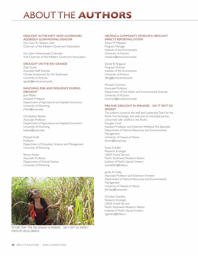
about tHE authORs
39 ABOUT THE AUTHORS RURAL CONNECTIONS
drought in the west: how governors Address A slow-Moving disAsterGov. Gary R. Herbert, UtahChairman of the Western Governors’ Association
Gov. John Hickenlooper, ColoradoVice-Chairman of the Western Governors’ Association
drought on the rio grAndeZack GuidoAssociate Staff ScientistClimate Assessment for the SouthwestUniversity of [email protected]
rAnching, risk, And resilience during droughtJohn RittenAssistant ProfessorDepartment of Agricultural and Applied EconomicsUniversity of [email protected]
Christopher BastianAssociate ProfessorDepartment of Agricultural and Applied EconomicsUniversity of [email protected]
Michael SmithProfessorDepartment of Ecosystem Science and ManagementUniversity of Wyoming
Steven PaisleyAssociate ProfessorDepartment of Animal ScienceUniversity of Wyoming
helping A coMMunity develop A drought iMpActs reporting systeMAlison M. Meadow Program ManagerInstitute of the EnvironmentUniversity of [email protected]
Daniel B. FergusonProgram DirectorInstitute of the EnvironmentUniversity of [email protected]
Michael Crimmins Associate ProfessorDepartment of Soil Water and Environmental SciencesUniversity of [email protected]
Fire And drought in pArAdise – sAy it isn’t so, sMokeyThe authors comprise the staff and Leadership Team for the Pacific Fire Exchange, and welcome all interested parties concerned with wildfire in the Pacific.Douglas CramAssistant Professor and Extension Wildland Fire SpecialistDepartment of Natural Resources and Environmental ManagementUniversity of Hawaii at [email protected]
Susan CordellResearch EcologistUSDA Forest ServicePacific Southwest Research StationInstitute of Pacific Islands Forestry [email protected]
James B. FridayAssociate Professor and Extension ForesterDepartment of Natural Resources and Environmental ManagementUniversity of Hawaii at [email protected]
Christian GiardinaResearch EcologistUSDA Forest ServicePacific Southwest Research StationInstitute of Pacific Islands [email protected]
pictUre from “fire and droUGHt in paradise—say it isn’t so, smokey.” pHoto By lisa ellsWortH.

Fire And drought in pArAdise – sAy it isn’t so, sMokey - con’tCreighton M. LittonAssociate Professor of Forest Ecology and ManagementDepartment of Natural Resources and Environmental ManagementUniversity of Hawaii at [email protected]
Eric MollerDeputy Fire ChiefUS Army Garrison – HawaiiPohakuloa Training [email protected]
Elizabeth PickettExecutive DirectorHawaii Wildfire Management [email protected]
the econoMic iMpActs oF lArge wildFiresAutumn EllisonFaculty Research AssistantInstitute for a Sustainable Environment Ecosystem Workforce [email protected]
Max Nielsen-PincusFaculty Research AssociateInstitute for a Sustainable Environment Ecosystem Workforce ProgramUniversity of [email protected]
Emily Jane DavisFaculty Research AssociateInstitute for a Sustainable Environment Ecosystem Workforce ProgramUniversity of [email protected]
Cody EversFaculty Research AssistantInstitute for a Sustainable Environment Ecosystem Workforce ProgramUniversity of [email protected]
Cassandra MoseleyDirectorInstitute for a Sustainable Environment Ecosystem Workforce ProgramUniversity of [email protected]
coMMunity wildFire plAnning As A tool to enhAnce trust: cAse studies FroM western MontAnAPaul R. LachapelleAssociate ProfessorDepartment of Political ScienceMontana State [email protected]
Stephen F. McCoolProfessor Emeritus of Wildland Recreation ManagementDepartment of Society and ConservationUniversity of [email protected]
yellowstone nAtionAl pArk And the suMMer oF FireDiane SmithIndependent Scholar and Science Writer [email protected]
extension disAster educAtion network responds to 2012 wildFires And droughtVirginia Morgan WhiteEDEN Immediate Past Chair and Administrator IIIAlabama Cooperative Extension SystemAuburn [email protected]
Steve CainEDEN POC and Homeland Security Project DirectorPurdue [email protected]
E. Kim CasselEDEN POC and ProfessorSouth Dakota State [email protected]
RURAL CONNECTIONS ABOUT THE AUTHORS 40
ABOUT THE AUTHORS
pictUre from “droUGHt on tHe rio Grande,” pHoto By zack GUido.
references
41 REFERENCES RURAL CONNECTIONS
drought in the west: how governors Address A slow-Moving disAster NOAA National Climatic Data Center. “Billion Dollar Weather/Climate Disasters.” Retrieved November 5, 2012 from http://www.ncdc.noaa.gov/billions/.
Steinemann, A. 2012. “Drought Preparedness in the Western U.S.: Survey of State Drought Managers.” Scripps Institution of Oceanography. Unpublished; will be submitted for journal publication.
Fahys, J. “Dry as dust: Drought has western Utah in choke hold.” Retrieved November 5, 2012 from http://www.sltrib.com/sltrib/news/54927835-78/drought-dry-utah-ranchers.html.csp.
Wilson, J. “Corn-crop Drought Damage Less than Expected Spurs Price Drop.” Retrieved November 5, 2012 from http://www.businessweek.com/news/2012-09-12/u-dot-s-dot-corn-crop-estimate-larger-than-expected-after-drought.
Covey, T. and Weber, J. “Highlights From the 2012 Farm Income Forecast.” Retrieved November 5, 2012 from http://www.ers.usda.gov/topics/farm-economy/farm-sector-income-finances/highlights-from-the-2012-farm-income-forecast.aspx.
drought on the rio grAndeThe Mesilla Basin Aquifer System of New Mexico, West Texas, and Chihuahua, 2007. Texas Water Development Board: http://www.twdb.state.tx.us/publications/reports/numbered_reports/doc/R356/Report356.asp.
Woodhouse CA, et al. 2012. Rio Grande and Rio Conchos water supply variability over the past 500 years. Climate Research 51:147-158.
rAnching, risk, And resilience during droughtBastian, Christopher T., et al. 2009. “Range Livestock Strategies Given Extended Drought and Different Price Cycles” Journal of the American Society of Farm Managers and Rural Appraisers. 72(1): 168-178.
Kruse, R. E., et al. 2007. “Livestock Management During Drought in the Northern Great Plains. II. Evaluation of Alternative Strategies for Cow-Calf Enterprise.” The Professional Animal Scientist 23: 234-345.
May, G. J., et al. 1999. “Delayed Calving in Wyoming.” Rangelands 21,3: 8-12.
Ritten, John, et al. 2010a. “Long Term Comparison of Alternative Range Livestock Management Strategies Across Extended Droughts and Cyclical Prices.” Journal of the American Society of Farm Managers and Rural Appraisers, 73(1): 243-252.
Ritten, John P., et al. 2010b. “A Multi-period Analysis of Two Common Livestock Management Strategies Given Fluctuating Precipitation and Variable Prices.” Journal of Agricultural and Applied Economics, 42(2): 177-191.
Ritten, John, et al. 2011a. “Comparison of Alternative Cattle Management Strategies Under Long-Term Drought” Bulletin B-1219. Cooperative Extension Service, College of Agriculture, University of Wyoming, Laramie. August 2011.
Ritten, John, et al. 2011b. “Price or Weather – Which Signal Should Livestock Producers Follow?” Bulletin B-1221. Cooperative Extension Service, College of Agriculture, University of Wyoming, Laramie. August 2011.
Ritten, John, et al. 2011c. “Considerations for Preparing a Drought Management Plan for Livestock Producers.” Bulletin B-1220. Cooperative Extension Service, College of Agriculture, University of Wyoming, Laramie. July 2011.
Ritten, John, et al. 2011d. “Two Common Drought Management Strategies and Some Considerations for Wyoming Cattle Producers.” Bulletin B-1218. Cooperative Extension Service, College of Agriculture, University of Wyoming, Laramie. June 2011.
Younglove, G. A., et al. 1998. “Sustainable Rangeland Based Beef Cattle Production Systems.” Reflections, University of Wyoming Cooperative Extension, 1998: 15-17.
Fire And drought in pArAdise – sAy it isn’t so, sMokeyNational Interagency Fire Center. 2012. Year-to-date fire statistics. Retrieved December 5, 2012 from http://www.nifc.gov/fireInfo/nfn.htm.
Tunison, J.T., et al. 2001. Fire and invasive plants in Hawai‘i Volcanoes National Park. Pages 122–131 in K.E.M. Galley and T.P. Wilson (eds.). Fire Conference 2000: the First National Congress on Fire Ecology, Prevention, and Management. Miscellaneous Publication No. 11, Tall Timbers Research Station, Tallahassee, FL.
the econoMic iMpActs oF lArge wildFiresButry, et al. 2001. What is the price of catastrophic wildfire? Journal of Forestry, 99:9-17.
Belasen, et al. 2008. How hurricanes affect wages and employment. American Economic Review: Papers and Proceedings 98: 49-53.
Ewing, et al. 2009. Twister! Employment responses to the Oklahoma City tornado. Applied Economics 41(6): 691-702.
Gebert, et al. 2012. Effect of suppression strategies on federal wildland fire. Journal of Forestry 110(2): 65-73.
Kent, et al. 2003. Social and economic issues of the Hayman Fire. Hayman Fire Case Studies. USDA. RMRS-GTR-114.
coMMunity wildFire plAnning As A tool to enhAnce trust: cAse studies FroM western MontAnABright, A., et al. 2007. Context, beliefs, and attitudes toward wildland fire management: An examination of residents of the wildland-urban interface. Human Ecol.
Kemmis, D. 2004. Re-examining the governing framework of the public lands. U. of Col. Law Rev. 75(4):112-119.
Lachapelle, P.R. and S.F. McCool. 2012. The role of trust in community wildland fire protection planning. Soc. Nat. Resources. 25(4): 321-335.
Lachapelle, P.R. and S.F. McCool. 2007. Claiming “ownership”: A response to Manning and Ginger. Soc. Nat. Resources 20(2):193-198.
Liljeblad, A., et al. 2009. Determinants of trust for public lands: Fire and fuels management on the Bitterroot National Forest. Environ. Manage. 43(4):571-584.
McCool, S., et al. 2006. An event-based approach for examining the effects of wildland fire decisions on communities. Environ. Manage. 37(4):437-450.
Möllering, G. 2006. Trust: reason, routine, reflexivity. New York: Elsevier.
Montana Natural Resource Information System. 2011. Digital atlas of Montana. Retrieved December 12, 2012 from http://maps2.nris.mt.gov/mapper.Paveglio, T., et al. 2009. Understanding social complexity within the wildland–urban interface: A new species of human habitation? Environ. Manage. 43(6):1085–1095.
Rousseau, D., et al. 1998. Not so different after all: A cross-discipline view of trust. Acad. Manage. Rev. 23(3):393-404.
Schusler, T.M., et al. 2003. Social learning for collaborative natural resource management. Soc. Nat. Resources. 15:309–326.
Seeley-Swan Fire Plan. 2008. Update to the 2004 plan. Report prepared for the Seeley-Swan Fuels Mitigation Task Force. Retrieved December 12 2012 from http://www.emri.org/PDF%20Docs/Adobe%20files/SSFirePlan_doc2008_update_final._WEB.pdf.
Senge, P.M. 1990. The fifth discipline: The art and practice of the learning organization. New York: Doubleday Currency.
Shindler, B. and E. Toman. 2003. Fuel reduction strategies in forest communities: A longitudinal analysis of public support. J. of Forestry 101(6):8-15.

Vaske, J., et al. 2007. Salient value similarity, Social trust and attitudes toward wildland fire management strategies. Human Ecol. Rev. 14(2):223-232.
Vogt, C., et al. 2005. Predicting homeowners’ approval of fuel management at the wildland-urban interface using the theory of reasoned action. Soc. Nat. Resources 18(5):337-354.
Winter, G., et al. 2004. Examining social trust in fuels management strategies. J. of Forestry 102(6):8-15.
yellowstone nAtionAl pArk And the suMMer oF FireAndrews, P. (2012). Personal interview, July 15, Missoula, MT.
Arno, S., Allison-Bunnell, S. 2002. Flames in our forests: Disaster or renewal. Washington, DC: Island Press.
Boutelle, Frazier. 1890. Report of the Superintendent of Yellowstone National Park. Washington, DC: Government Printing Office.
Finney, M. (2012). Personal interview, July 15, Missoula, MT.
The Guardian. 2012. US wildfires are what global warming really looks like, scientists warn, June 29, http://www.guardian.co.uk/environment/2012/jun/29/us-wildfires-global-warming-scientists.
Hansen, A.J. 2010. Land-use change in the Greater Yellowstone Ecosystem: Past, Present and Possible Future Patterns and Consequences, in Questioning Greater Yellowstone’s Future Climate, Land Use, and Invasive Species, the 10th Biennial Scientific Conference on the Greater Yellowstone Ecosystem. Retrieved from http://www.montana.edu/hansen/documents/downloadables/hansen_yellowstone.pdf.
Leopold, A. S., et al. 1963. Wildlife management in the national parks. Transactions of the North American Wildlife and Natural Resources Conference, volume 28. Retrieved from http://www.cr.nps.gov/history/online_books/leopold/leopold.htm.
Plumer, B. 2012. Why Western wildfires keep getting worse. Washington Post. Retrieved from http://www.washingtonpost.com/blogs/ezra-klein/wp/2012/06/30/western-wildfires-are-getting-worse-why-is-that/.
Revkin, A. C. 2008. Are Big Oil and Big Coal Climate Criminals? New York Times. Retrieved from http://dotearth.blogs.nytimes.com/2008/06/23/are-big-oil-and-big-coal-climate-criminals/.
Shabecoff, P. 1988. Global Warming has Begun, Expert Tells Senate. New York Times. Retrieved from http://www.nytimes.com/1988/06/24/us/global-warming-has-begun-expert-tells-senate.html.
U.S. Department of the Interior. 2008. The Yellowstone Fires of 1988. Retrieved from http://www.nps.gov/yell/naturescience/upload/firesupplement.pdf.
Wells, G. 2008. The Rothermel fire-spread model: Still running like a champ. Fire Science Digest, 2. Retrieved from http://www.firescience.gov/digest/fsdigest2.pdf
extension disAster educAtion network responds to 2012 wildFires And droughtDenver Huffington Post. 2012. “Colorado Wildfires 2012: Insurers Estimate $449.7M.” Retrieved November 6, 2012 from http://www.huffingtonpost.com/2012/07/17/insurers-estimate-colo-fi_n_1680788.html.
Drought Resources. eXtension website. http://www.extension.org/drought_resources.
Drought Task Force 2012. National Voluntary Organizations Active in Disaster. http://www.nvoad.org/task-forces/drought-task-force-2012
Drought Topic Page. EDEN website. http://eden.lsu.edu/TOPICS/HAZARDS/DROUGHT/Pages/default.aspx
eXtension Wildfire Information Network (eWIN). http://www.extension.org/surviving_wildfire
Fire (Wildfire) Topic Page. EDEN website. http://eden.lsu.edu/Topics/Hazards/Fire/Pages/default.aspx#Module4
Firewise Communities. www.FireWise.org
National Interagency Fire Center. National Year-to-Date Report on Fires and Acres Burned by State. Retrieved November 4, 2012 from http://www.nifc.gov/fireInfo/fireInfo_stats_YTD2012.html.
National Oceanic and Atmospheric Administration, National Climatic Data Center. Billion Dollar Weather/Climate Disasters. Retrieved November 6, 2012 from http://www.ncdc.noaa.gov/billions/.
Palmer, B. 2012. Washington Post Health and Science. “The worst wildfire season in decades is causing significant environmental damage.” Retrieved November 6, 2012 from http://www.washingtonpost.com/national/health-science/the-worst-wildfire-season-in-decades-is-causing-significant-environmental-damage/2012/07/09/gJQAvjFoYW_story.html.
RURAL CONNECTIONS REFERENCES 42
references
pictUred: a reservoir in Western colorado WitH exposed sHoreline, octoBer 2012. istockpHoto.com

WESTERN RURALDEVELOPMENT CENTER
The Western Rural Development Center is hosted by Utah State University with generous support from
USU Cooperative Extension and the Utah Agricultural Experiment Station.
wrdc.usu.edu