Results of Focused Surveys for Unarmored Threespine ...
14
Impact Sciences, Inc., "Results of Focused Surveys for Unarmored Threespine Stickleback and Other Special-Status Fish Species; Castaic Mesa, Castaic Creek, Los Angeles County, California" (June 2003; 2003D)
Transcript of Results of Focused Surveys for Unarmored Threespine ...

Impact Sciences, Inc., "Results of Focused Surveys for Unarmored
Threespine Stickleback and Other Special-Status Fish Species; Castaic Mesa, Castaic Creek, Los Angeles County, California" (June 2003; 2003D)

Oriqinal in Matt Carpenter's Office
Results of Focused Surveys for Unarmored Threespine Stickleback
and Special-Status Fish Species; Castaic Mesa, Castaic Creek
Los Angeles County, California
Prepared for:
Newhall Land and Farming 23823 Valencia Boulevard
Valencia, California 91355
Prepared by:
Impact Sciences, Inc. 30343 Canwood Street, Suite 210 Agoura Hills, California 91301
June 2003
TABLE OF CONTENTS
Section Page
INTRODUCTION.............................................................................................................................. 1
General UTS Background .............................................................................................................. 1 Overview of UTS Habitat Characteristics .................................................................................... 4 Essential Habitat Designation ..................................................................................................... 5
METHODOLOGY .............................................................................................................................. 6 Previous Studies In and Near the Newhall Ranch Project Area ...................................................... 6 SurveyScope and Methods ........................................................................................................... 8
SURVEY RESULTS ............................................................................................................................ 9 CONCLUSION/DISCUSSION ........................................................................................................ 10
REFERENCES................................................................................................................................ 11
LIST OF FIGURES
P i a r e Page
I~npnct Sciences. lnc Res~ilts of Foctrsed Siimey for UTS and Specinl-Stnhls Fish Species June 2003 ' 32-1 10

Results of Focused Surveys for Unarmored Threespine Stickleback
and Special-Status Fish Species
Castaic Mesa, Castaic Creek
Los Angeles County, California
This report presents the findings of focused protocol surveys that were cond~~ctedin May 2003 to
determine the presence/absence of the federally- and state-listed endangered unarmored threespine
stickleback (Gasterosteus aculeatus williamsoni) (herein UTS) in portions of Castaic Creek in Los
Angeles County. This report is intended to provide project specific biological information to Newhall
Ranch Company, US Army Corps of Engineers (ACOE), US Fish and Wildlife Service (USFWS), and
California Department of Fish and Game (DFG) regarding presence/absence of unarmored threespine
stickleback and additional special-status fish species including arroyo chub (Gila orcutti) and Santa
Ana sucker (Catastomus santaanae) identified within the subject survey reaches.
INTRODUCTION
The survey area is located in western Los Angeles County, west of the City of Valencia (Figure 1).
Specifically, the site is situated at R17W, T5N, in Section 25 on the Newhall, California US
Geological Survey (USGS) 7.5-Minute Quadrangle Map (Figure 2). All sample sites selected were
within potentially suitable habitats in portions of Castaic Creek from the Castaic Lagoon outfall,
south (downstream) approximately 5,000 linear feet. The primary purpose of these surveys was to
determine current distribution of the UTS (if present). The secondary purpose was to determine the
presence/absence and current distribution of other special-status fish species including the Santa Ana
sucker and the Arroyo chub.
General UTS Background
Sticklebacks are a small (rarely exceeding 2.4 inches) streamline fish with two isolated dorsal spines,
with a third, smaller spine at the front edge of the soft-rayed portion of the dorsal fin (USFWS 1985).
Additional distinctive features include the unusual pelvic girdle that includes a spine on both sides,
and the bright nuptial coloration of the male. The male stickleback builds a nest of fine plant debris
and algal strands where it courts females that enter its territory. Several females may deposit eggs in
a single nest. The males care for and protect the eggs and young. Sticklebacks are apparently an annual
species, surviving for only one year (USFWS 1985), though some local scientists believe some
individuals may live more than one year.
I m p ~ tSciences, Inc. 1 Restrits of Foctrsed S~lruey for UTS nnd Specini-Stntrrs Fish Species 32-1 1 0 J~rne2003 '

Regional Location

Survey Reach
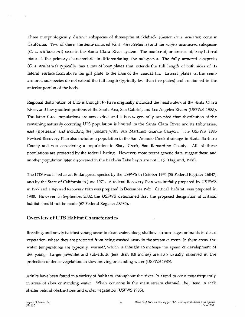
Three morphologically distinct s~lbspecies of threespine stickleback (Gasferosteus aculafus) ocau in
California. Two of these, the semi-armored (G. a. microcephaltis) and the subject unarmored subspecies
(G. a. williamsoni) occur in the Santa Clara River system. The number of, or absence of, bony lateral
plates is the primary characteristic in differentiating the subspecies. The fully armored subspecies
(G. a. actrleafus) typically has a row of bony plates that extends the full length of both sides of its
lateral surface from above the gill plate to the base of the caudal fin. Lateral plates m the semi-
armored subspecies do not extend the full length (typically less than five plates) and are limited to the
anterior portion of the body.
Regional distribution of UTS is thought to have originally included the headwaters of the Santa Clara
River, and low gradient portions of the Santa Ana, San Gabriel, and Los Angeles Rivers (USFWS 1985).
The latter three populations are now extinct and it is now generally accepted that distribution of the
remaining naturally occurring UTS population is limited to the Santa Clara River and its tributaries,
east (upstream) and including the juncture with San Martinez Grande Canyon. The USFWS 1985
Revised Recovery Plan also includes a population in the San Antonio Creek drainage in Santa Barbara
County and was considering a population in Shay Creek, San Bernardino County. All of these
populations are protected by the federal listing. However, more recent genetic data suggest these and
another population later discovered in the Baldwin Lake basin are not UTS (Haglund, 1988).
The UTS was listed as an Endangered species by the USFWS in October 1970 (35 Federal Register 16047)
and by the State of California in June 1971. A federal Recovery Plan was initially prepared by USFWS
in 1977 and a Revised Recovery Plan was prepared in December 1985. Critical habitat was proposed in
1980. However, in September 2002, the USFWS determined that the proposed designation of critical
habitat should not be made (67 Federal Register 58580).
Overview of UTS Habitat Characteristics
Breeding, and newly hatched young occur in clean water, along shallow stream edges or braids in dense
vegetation, where they are protected from being washed away in the stream current. In these areas the
water temperatures are typically warmer, which is thought to increase the speed of development of
the young. Larger juveniles and sub-adults (less than 0.8 inches) are also usually observed in the
protection of dense vegetation, in slow moving or standing water (USFWS 1985).
Adults have been found in a variety of habitats throughout the river, but tend to occur most frequently
in areas of slow or standing water. When occurring in the main stream channel, they tend to seek
shelter behind obstructions and under vegetation (USEWS 1985).
11npncf Sciences, Inc Reslrlfs of Foclrsed Srrrveyfor UTS nnd Special-Sfafirs Fish Specirs 32-110 June 2003

Essential Habitat Designation
Critical habitat is not specifically defined in the Recovery Plan for the species. However, it is stated
that the designated Essential Habitat coincides with the areas proposed by the USFWS as Critical
Habitat (45 Federal Register 76012-76015). In this proposal Critical Habitat is defined as: (1) the
specific areas within the geographic area occupied by a species, at the time it is listed in accordance
with the Endangered Species Act of 1973 as amended, mwhich are found those physical or biological
features (a) essential to the conservation of the species and (b) that may require special management
considerations or protection; and (2) specific areas outside the geographic area occupied by a species a t
the time it is listed, upon a determination that such areas are essential for the conservation of the
species. "Conservation" means the use of all methods and procedures that are necessary to bring an
endangered or a threatened species to the point at which listing under the Act is no longer necessary
(USFWS, 2001).
Critical Habitat was initially proposed for UTS in 1980. However, as a result of a lawsuit by the
Center for Biological Diversity in January 2002, USFWS was forced to evaluate whether or not to
designate Critical Habitat for the UTS and reached a finding that the designation should not be made
(67 Federal Register 58580). In 1985, the USFWS prepared a Revised Recovery Plan identifying three
Essential Habitat zones within the Santa Clara River watershed (Figure 2). They are described in the
Revised Recovery Plan (USFWS 1985) as follows:
1. Del Valle Zone. An area of land and water with the following components (San Bernardino meridian): Santa Clara River within T4N, R16W and R17W, begmning at its confluence with San Martinez Grande Canyon, at a point 0.9 of a mile (1.5 kilometers) southwest of Del Valle settlement, and extending upstream approximately 5.6 miles (8.8 kilometers) to the Interstate Highway 5 Bridge.
San Franciscpito Creek Zone. An area of land and water with the following components (San Bemardino meridian): San Francisquito Canyon watercourse, within T5N, R16W and T6N, R15W, beginning at a point where the Angeles National Forest boundary intersects the San Francisquito Canyon watercourse approximately 2.5 miles southwest of San Francisquito Powerhouse No. 2, and extending upstream in San Francisquito Canyon approximately 8.4 miles (13.5 kilometers) to San Francisquito Powerhouse No. 1, near its junction with Clearwater Canyon.
3. Soledad CanyonZonn. An area of land and water in Los Angeles County, with the following components (San Bernardino meridian): Santa Clara River within T4N, R13W, and R14W, beginning at a point 1.4 miles (2.3 kilometers) upstream in Soledad Canyon from the community of Lang, at the downstream end of the area called River's End Park, at 34" 26' 7" N, 118" 21' 51" W, thence extending upstream approximately 8.5 miles (13.7 kilometers) to its confluence with Arrastre Canyon, at a point located about 0.6 of a mile (1kilometer) southwest of Los Angeles County
hnpnct Sciences, Inc. 5 Resrilts of Foclrsed Slrrveyfor UTS nnd Specinl-Stnhls Fish Species 32-1 10 Ilrne 2003

Rehabilitation Camp, thence upstrean1 in Arrastre Canyon approximately 0.8 of a mile (1.4 kilometers) to 34" 26' 7" N, 118"11' 51" W.
Criteria used by USFWS to select Critical Habitat, and thus Essential Habitat, include evaluation of
an area to determine the presence of primary constituent elements. These elements include physical and
biological features that are essential to the conservation of the species, and that may require special
management and protection (USFWS 1980). Primary constituent elements for UTS include specific
quantity and quality of water and isolation from predators. These elements are specifically outlined in
the Proposed Rule (USFWS 1980) and include:
Permanent Stream Flow. Remaining'streams utilized by this fish have low discharge rates, so tha t relatively minor modifications of ground water levels or channel characteristics could result in elimination of all fishes by desiccation.
Slow Current. Sticklebacks favor shallow water with slow to moderate current, and probably can not reproduce effectively in deep, swift or completely still water.
Low Turbidity and Pollution. Sticklebacks strongly favor clear water, seldom or never being found in turbid water conditions. Specific pollution susceptibilities have not yet been established, but water quality has been found to be high where populations have persisted, and they have disappeared from streams with reduced water quality.
Isolation. Survival and genetic integrity evidently depend on the absence of large aquatic predators, certain potential competitors, and all other subspecies of sticklebacks. The latter are not particularly strong swimmers, and apparently do not move upstream during times of high water. They are excluded from the designated areas at other times by natural barriers in certain segments of the watercourse. These barriers should not be modified or bypassed.
It should be noted that, as with most fish species, UTS are not distributed d o r m l y throughout the
drainages they occur in, and that breeding habitats are patchily distributed. The nature of breeding
habitats is dynamic and may shift in structure and specific location from year to year depending upon
seasonal rainfall and storm cycles. However, most of the breeding habitats identified over the past
several years of study have been concentrated in the same general areas and support the same general
habitat conditions.
METHODOLOGY
Previous Studies In and Near the Newhall Ranch Project Area
Documentation pertinent to the biological resources in the vicinity of the site was reviewed and
analyzed. Information reviewed included: (1) the Revised Recovery Plan for the unarmored threespine
stickleback; (2) literature pertaining to habitat requirements of sensitive species potentially o c m g
In~pnctSciences, Inc. 32-220
6 Reslrlts of Foclrsed S~rmeyfor UTS nnd Specinl-Stntlrs Fish Species 11rne 2003 ,
on the project site; (3) the California Natural Diversity Data Base (CNDDB 2003) information
regarding special-status species potentially ocauring m the project site for the Newhall and Va I
Verde USGS 7.5-Minute Quadrangle Maps, and (4) previous surveys for aquatic resources in the
Newhall Ranch Specific Plan area and vicinity.
The following are sources that provide information regarding special-status fish distribution within
and/or in the near vicinity of the shtdy reach. Each of these sources has identified UTS, Santa Ana
sucker and arroyo chub as ocatrring in and near portions of the respective study areas. The general
consensus of distribution for UTS in the Santa Clara River includes all areas supporting surface water
east (upstream) of the Ventura/Los Angeles County line near San Martinez Grande Canyon.
U.S. Fish and Wildlife Service. Recovery Plan (revised); Unarmored Threesvine Stickleback. Revision approved December 26, 1985 -The first description of the unarmored subspecies was by Girard in 1854 from a specimen collected in Soledad Canyon. Distribution of UTS in the Santa Clara River is described as "...the headwaters of the Santa Clara River and its tributaries, in northern Los Angeles County.
Aquatic Consulting Services, Inc., July 2002. Aquatic Surveys Alonz the Santa Clara River; Part IV: Ventura County Line to Las Brisas Bridge, Ventura County, California -Protocol surveys for special status fish species during 2001. Three of 49 sampling locations identified stickleback as being present. All three were within 1.3 miles of the County boundary. None of the sample da t a indicated the total number of individuals collected and two of the three sample sites indicated sticklebackswere represented as fry or juveniles.
Aquatic Consulting Services, Inc., June2002. Aquatic Surveys Along the Santa Clara River: Part 111: West of Commerce Center Bridge to the Ventura Countv Line, California - Protocol surveys for special status fish species during 2001. Seven of the 56 locations sampled included UTS. None of the sample data indicated the total number of individuals collected and some of the sample sites indicated sticklebacks were represented as juveniles.
Thomas Haglund and Jonathan Baskin, 2000. Fish and Wildlife Survev and Habitat Assessment of the Santa Clara River at Interstate 5 -This project was conducted for the California Department of Transportation for replacement of the Interstate 5 Bridge where it crosses the Santa Clara River. This study included focused special-status fish surveys. Several sites were sampled within 500 meters upstream and downstream of the bridge using a l / B t h inch mesh seine. Arroyo chub, UTS and Santa Ana sucker were detected throughout the survey reach. Large numbers of fry of all threes species were detected and suggest breeding by all three species was occurring in that vicinity in 2000. Identification of UTS was made by morphological characteristics, primarily plate counts.
Thomas Haglund and Jonathan Baskin; December 1995. Final Revort; Sensitive Aauatic S~ec ies Survev, Santa Clara River and San Francisquito Creek, Newhall Land and Farming. Comvanv Provertv, Los An~elesCountv, California - Survey results indicated UTS were "continuously distributed from Bouquet Canyon Road Bridge downstream to the confluence of Castaic Creek". Positive subspecific identification was made through horizontal starch gel electrophoresis.
Thomas Haglund, 1989. Current Status of the Unarmored Threespine Stickleback (Gnsterosteus aculeatus w il linmson i) along portions of the Santa Clara River Draina e - The project reach for this report included the Santa Clara River from near the confluence with Castaic Creek upstream
lmpncf Sciences, Inc. 32-11 0
7 R e s ~ ~ l f sof Fociised S ~ i r v e yfor U T S nnd Specinl-Stntlis Fish Species [nne 2003

to near Saups; Castaic Creek from Lnterstate 5, downstream to SR 126; and the downstream portion of San Francisquito Creek outside the National Forest. Identification methodology included characterization of lateral plate counts and then identification was further verified utilizing electrophoretic methods. The report concluded that stickleback were absent from lower San Francisquito Creek and were rare in Castaic Creek. Distribution of sticklebacks was patchy along the study reach within the Santa Clara River. The report further determined that the sticklebacks sampled throughout the reach were the unarmored G. a. williamsoni.
Irnpact Sciences, Inc. 2003. Results of Focused Surveys For Unarmored Threespine Stickleback and Other Special-Status Fish Species; Newhall Ranch, Valencia California - The reach of this project extended from the Las Brisas Bridge crossing in Ventura County, east (upstream) to the confluence with Castaic Creek. Identification of UTS was accomplished by lateral plate counts. Results of the survey indicated scattered, but regular distribution of UTS east of San Martinez Grande crossing. A few individuals appearing to be UTS based solely m lateral plate counts occurred downstream of San Martinez Grande crossing.
Survey Scope and Methods
Though there are no specific survey protocol for sampling UTS, USFWS developed particular criteria
to determine sub-specific identification when surveying for sticklebacks. The criteria state
"G. a. williarnsoni are readily distinguished from the other two subspecies on the basis of lateral plate
counts alone, provided that at least 25 morphologically mature specimens (i.e., individuals of at least
32mm in standard length [SL], Bell [1981]) are available. Samples of G. a. williamsoni generally
average 0.06 to 0.55 lateral plates per individual and G. a. microcephalus average more than six
lateral plates per individual (Bell 1976b)." Plate counts referred to include total number occ7urring m
both sides of the body.
As previously discussed, it is generally accepted by USFWS and UTS experts that sticklebacks
occurring east (upstream) of San Martinez Grande Canyon, near the Los Angeles/Ventura County
boundary, are the endangered unarmored subspecies. Impact Sciences performed focused surveys for UTS
on the subject portion of Castaic Creek on May 13,14, and 24,2003. Surveys were conducted by Mr. Dave
Crawford under the authority of his individual USFWS Section lO(a)(l)(A) Endangered Species
Recovery permit.
In order to minimize impacts to the species, the survey plan included efforts to collect no more than 25
individuals for subspecific identification purposes at any single sampling location. If 25 individual
UTS were collected, no further sampling was to be conducted at that site. Any fish collected during the
survey effort were released immediately following identification.
Sampling was conducted utilizing a 10x5-foot 1/8-inch woven mesh seine and a small hand net.
Sampling locations were selected based on the presence of typically suitable habitat. However,
I~npnct Sciences, 111~. Reslllts of Foclised Sltrvey for UTS n~ld Specid-Stot~is Fish Species 32-110 jlrtze 2003

additional survey sites were also sampled such that representative locations of all habitat types
present in the survey reach were included. A combined total of 11sites were sampled within the survey
reach. At each sample site, the stream was sampled for fish and general habitat characteristics were
recorded. Any fish present were identified, as were any other special-status aquatic wildlife species
observed.
The portion of Castaic Creek included in the survey is typically not a perennial source of water. Water
occurring in this portion of the drainage is generally a direct result of water being released from Castaic
Dam during storm events, or when other factors require l o w e ~ g the water level in Castaic Lake. The
discharge is relatively inconsistent and often times results in Castaic Creek, as it occurs below the
lagoon, to be either completely dry or supporting only a few scattered remnant pools. As such, these
conditions are not expected to be conducive to regular breeding by UTS or other special-status fish
species. Depending upon the duration of flows in the creek, combined with other factors including
volume and velocity of flows, there is a small potential for UTS and other special-status fish species to
migrate upstream in Castaic Creek from the Santa Clara River. Based an the flow volumes and
characteristics at the time of the survey, and natural barriers such as small cascades along the creek
channel, it is considered unlikely that any of the small special-status fish species occurring in the
Santa Clara River would be able to navigate the stream channel upstream as far as the survey site.
SURVEY RESULTS
No UTS or other special-status fish species were observed during the sampling effort. At the time of
the survey, water was being released, and had been released from Castaic Lagoon for several weeks,
which resulted in a relatively high volume of water that created both large ponded areas in the
northern portion of the survey area, and fast-flowing narrow channels in the southern portions.
The ponded areas below the lagoon had silty, muddy bottoms, but relatively clear water. It appeared
that most of these areas were newly submerged as there were several emergent shrubs, typically
associated with upland habitats. No fish of any kind were observed in any of the ponded areas. The
only aquatic vertebrates observed in any of these areas were tadpoles of native western toad (Bu fo
boreas) and the introduced and highly predatory African clawed frog (Xenopus laevis).
Within the flowing channels of the remaining portions of the survey reach, the only fish species
observed was prickly sculpin (Cotfus asper). Though this species is native to California, the prickly
sculpin is considered introduced to tlus watershed. The only other vertebrate species observed in these
remaining areas of the survey reach were western toad and African clawed frog tadpoles.
Impnct Sciences, 171~. 9 Reslrlts of Foc~~sed Sz~rvryfor UTS find Specini-Stntlts Fish Species 32-110 Jnrle 2003

Nearly all of the Santa Clara fiver, east (upstream) of the San Martinez Grande Canyon is considered
by regulatory agencies and fisheries biologists to be of relatively high quality for UTS as this species
has been identified throughout this reach and because most or all of the primary constituent elements
for UTS habitat are present. However, all tributary streams to the river, including Castaic Creek, do
not support the same conditions. Specifically, flows in Castaic Creek below the Castaic Dam are
limited to large storm events and subsequent releases from the Dam. As such, one of the key primary
constituent elements, permanent flows, is absent from this drainage. Additionally, because of the
volumes and rates of flow that occur during releases and storm events, coupled with the natural barriers
to upstream navigation, small fish such as the special-status species known from the Santa Clara River
are not expected to be able to migrate upstream to, or otherwise occur in, the survey area.
lii~pnct Sciences, Inc. 1 0 Resirlfs of Foc~rsed S~iruey for U T S nnd Specinl-Stohrs Fish Species 32-110 l i m e 2003
REFERENCES
Aquatic Consulting Services. 2002. Aqtratic Surveys Along the Santn Clara River, Part I: Cns ta ic Jt~nction Project Aren, Los Angeles Cozinty, California. Prepared for Newhall Land, Valencia, CA. April 2002.
Aquatic Consulting Services. Aquatic Strrveys Along the Santa Clara River, Part 111: West of Commerce Center Bridge to the Venturn County Line, California. Prepared for Newhall Land and Farming Company. Valencia, CA. June 2002.
Aquatic Consulting Services. Aqtiatic Stirveys Along the Santa Clara River, Part IV: Venttira County Line to Las Brisas Bridge, Ventura County, California. Prepared for Newhall Land and Farming Company, Santa Clarita, CA. July 2002.
Bell, Michael A. 1978. Fishes of the Santa Clara River System. Contributions in Science. No. 295. Natural History Museum of Los Angeles County. Los Angeles. May 15,1978. 20 pp.
Haglund, Thomas R. and Jonathan N. Baskin. 2000. Fish and Wildlife Survey and Habitat Assessment of the Santa Clara River at Interstate 5. Prepared for Paul Caron, Environmental Planning Branch, California State Department of Transportation. October 2000.
Haglund, Thomas R. and Jonathan N. Baskin. 1995. Final Report: Sensitive Aquatic Species Survey , Santa Clara River and Sun Francisquito Creek, Newhall Land and Farming Company Property, Los Angeles County, California. Prepared for Mark Subbotin, Valencia Company. December 1995.
Haglund, Thomas R., Ph.D. 1989. Current Status of the Unarmored Threespine St ickleback (Gasterosfeus aculeatus wi l l iamsoni) along portions of the Santa Clara River Drainage. Prepared for Newhall Land and Farming Company, Valencia, CA. May 1,1989.
Swift, Camm C. et al. 1993. The Status and Distribution of the Freshwater Fishes of Southern California. Bulletin of the Southern California Academv of Sciences. 92(3), Southern California Academy of Sciences. pp. 101-167.
U.S. Fish and Wildlife Service. 2000. Species Account. Unarmored Threespine Stickleback. Ventura Field Office. http://ventura.fws.gov/SpeciesAccount/fish/UTS.htm.
U.S. Fish and Wildlife Service. 1985. Revised Unarmored Threespine Stickleback Recovery Plan. USFWS Portland Oregon. December 26. 80 pp.
U.S. Fish and Wildlife Service, 1980. Proposed Designation of Critical Habitat for the Endangered Unarmored Threespine Stickleback. Federal Register. Part V. Vo1. 45, No. 223. pp. 76012-76015.
lrnpnct Sciences, Inc. 11 Resl~ltsof Focrrsed S ~ ~ r v e yfor UTS rind Specinl-Stnhrs Fish Species 32-110 Irrne 2003