pubs.aina.ucalgary.capubs.aina.ucalgary.ca/gran/39798.pdf · II Subsoil Conditions and Foundation...
31
-
Upload
truongdung -
Category
Documents
-
view
216 -
download
0
Transcript of pubs.aina.ucalgary.capubs.aina.ucalgary.ca/gran/39798.pdf · II Subsoil Conditions and Foundation...


". .
00010
c
.4
. ..
.-
PUBLIC WORKS CANADA
WESTERN REGION
SUPPLEMENTARY REPORT
FOUNDATION INVESTIGATION
PROPOSED WHITESAND CREEK BRIDGE
MILE 459.6, MACKENZIE HIGHWAY
Submitted By R. D. Cook Soils Engineer Special Services Western Region
February 2, 1976
TABLE OF CONTENTS
PAGE
I Preliminary 1
II Subsoil Conditions and Foundation Recommendations - Underwood, McLellan & Associates 2
C. Site 'and Subsoil Conditions 3
D. Conclusions and Recommendations 7
1. P i e r and Abutment Foundation 7
III Evaluation of Additional Borehole Data 13
15 IV Foundation Recommendations
Appendix A
Appendix B
APPENDICES
Site Plan
Borehole Logs
1 Page
10 Pages

- 1 -
I Preliminary
The initial foundation investigation at Whitesand Creek was
undertaken by Underwood McLellan & Associates Ltd. during
the winter of 1973, and summarized in a foundation report
dated April, 1973. Pertinent excerpts from that report have I
been included herein, however this report should be considered
as an addendum to the original report by Underwood McLellan
and reviewed in conjunction with it.
Five test holes were drilled by Public Works Canada at the
proposed crossing site in February, 1975 to augment the
initial subsoil data. A profile of the site showing bore-
holes from both drilling programmes and the inferred sub-
soil stratigraphy has been included on Drawing No. A-1 in
Appendix A, and borehole logs are included in Appendix B.
The proposed gradeline, and the locations of piers and
abutments as recommended by the bridge consultants (Reid,
Crowther & Partners Ltd.) have also been shown on the
profile .
... 2

- 2 -
II Subsoil Conditions and Foundation Recommendations - Underwood, McLellan & Associates
The following 10 pages are taken from the foundation report
by Underwood McLellan and refer only to the subsoil condi-
tions as inferred from boreholes by their crews, and the
foundation recommendations for the bridge structure based
upon that information. I
... 3

- 3 -
C, SITE AND SUBSOIL CONDITIONS
The Whitesand bridge s i t e i s l o c a t e d a t m i l e
459.6 (chainage 880 + 00) on the Mackenzie
Highway i n the Nor thwes t Te r r i t o r i e s . The
Whitesand river f l o w s i n t o the Mackenzie
River from the e a s t h a v i n g a d r a i n a g e b a s i n
which extends t o the F rank l in moun ta ins .
This. s t r eam has a typ ica l sand-grave l bed
which i s p r e s e n t l y i n a state of d e p o s i t i n g
f loodpla in sed iments a t the e n t r a n c e t o t h e
Mackenzie River.
The Whitesand stream b e d e l e v a t i o n i s 280
(DPW datum) w i t h the e s t i m a t e d h i g h w a t e r mark
a t e l e v a t i o n 306 as a r e s u l t of ice jams
along the Mackenzie River. The main valley
of the Whitesand Creek is approximately 400
feet wide, and 50 feet deep. The main s t r eam
f l o w i n r e c e n t y e a r s h a s b e e n a g a i n s t the
n o r t h b a n k i n a t rench approximate ly 100 feet
wide and 15 feet deep.
... 4

- 4 -
c
Two test h o l e s 124A (879 + 70) and 132A (881 + 70)
were d r i l l e d a t the bottom of t h e main v a l l e y t o
dep ths of 40 and 90 feet, r e s p e c t i v e l y . T e s t h o l e
124A d i s c l o s e d a l t e r n a t i n g l a y e r s of sand and
g r a v e l t o t h e t e r m i n a t i o n o f the ho le . These
g r a n u l a r m a t e r i a l s e x h i b i t e d v e r y low mois ture
c o n t e n t s a n d t h e w a t e r t a b l e was i n d i c a t e d a t 22
feet be low ex is t ing g rades which w a s approximately
co inc iden t w i th t he s t r eam wa te r l eve l .
Tes t ho le ' 132A which w a s d r i l l e d t o a depth of
90 feet d i s c l o s e d a l t e r n a t i n g s a n d a n d g r a v e l
l a y e r s t o a depth of approximately 70 feet where
a sandstone and shale bedrock was confirmed. The
b e d r o c k i n the g e n e r a l a r e a of the i n v e s t i g a t i o n i s
b e l i e v e d t o c o n s i s t o f s ed imen ta ry depos i t s of i n t e r -
b e d d e d s h a l e s s i l t s t o n e s and sandstones which were
depos i ted dur ing the Cre taceous Geologic age .
T e s t h o l e 124A d id no t d i sc lose any pe rmaf ros t bu t
t es t h o l e 1 3 2 A i n d i c a t e d p e r m a f r o s t t o a depth of
approximately 30 f e e t where the water table was
encountered. B e l o w t h e w a t e r table, t h e s o i l would
... 5
a
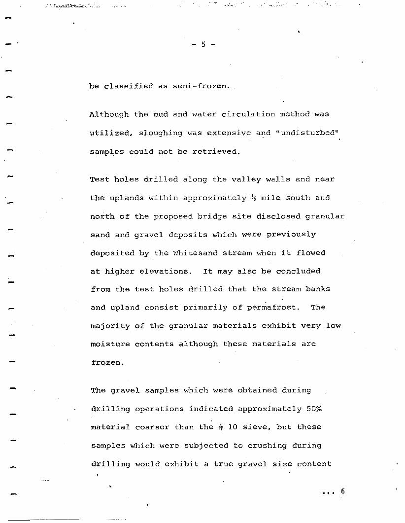
be c l a s s i f i e d a s s e m i - f r o z e n .
Although the mud and water c i r c u l a t i o n method was
u t i l i z e d , s l o u g h i n g was ex tens ive and "undis turbed"
samples could not be r e t r i e v e d .
T e s t h o l e s d r i l l e d a l o n g t h e v a l l e y walls and near
the uplands wi th in approximate ly 1/2 mile south and
n o r t h of the p roposed br idge site d i s c l o s e d g r a n u l a r
sand and grave l depos i t s which were p r e v i o u s l y
d e p o s i t e d by the Whi tesand s t ream when i t flowed
at h i g h e r e l e v a t i o n s . I t may a l s o be concluded
from t h e test h o l e s d r i l l e d t h a t t h e s t r e a m b a n k s
and up land cons i s t p r imar i ly o f pe rmaf ros t . The
m a j o r i t y of t h e g r a n u l a r m a t e r i a l s e x h i b i t v e r y low
mois tu re con ten t s a l t hough t hese ma te r i a l s are
f rozen .
The gravel samples which w e r e ob ta ined du r ing
d r i l l i n g o p e r a t i o n s i n d i c a t e d a p p r o x i m a t e l y 50%
m a t e r i a l c o a r s e r t h a n t h e # 10 s i e v e , b u t t h e s e
samples which were s u b j e c t e d to c rush ing du r ing
d r i l l i n g would e x h i b i t a t r u e g r a v e l s i z e c o n t e n t
6

-6-
h ighe r t han r eco rded .
E x c e p t i o n t o t h e dry g r a n u l a r m a t e r i a l s
w a s i n d i c a t e d i n t es t h o l e 123A (885 + 00)
which has a surface d e p o s i t o f 16 feet o f h i g h
moi s tu re con ten t s i l t and c l a y w i t h excess
ice c o n t e n t s of approximately 5%. The dry
d e n s i t y of t h e s i l t c l a y v a r i e d from 88.7 t o
92 lb /cu . f t . The m a t e r i a l s below t h e 1 6 f o o t
level i n test h o l e 123A c o n s i s t e d of dry sand
wi th some boulders and was f u r t h e r u n d e r l a i n
by a f i r m c l a y till of stiff cons i s t ency ,
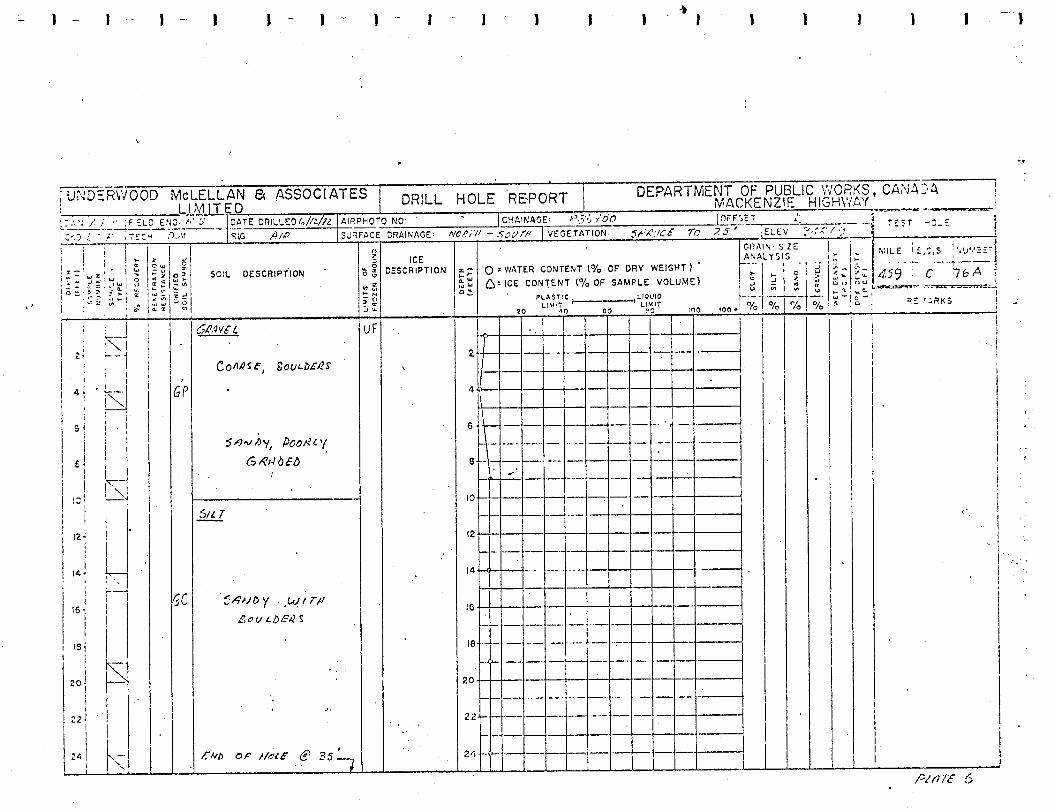
A Soil Profile of t h e b r i d g e v a l l e y s i t e i s
inc luded i n t h e Appendix on P l a t e 2.
0 . . 7

- 7 - c
c
c
c
D. CONCLUSIONS AND RECOMMENDATIONS
On t h e b a s i s o f t h e p r e s e n t i n v e s t i g a t i o n s we wish
t o o f f e r the fo l lowing genera l ized conclus ions and
recommendations r e l a t i v e t o the des ign and cons t ruc t -
i o n of the proposed Whitesand Creek bridge found-
a t i o n s and approaches.
1, P i e r and abutment foundation.
A f o o t i n g f o u n d a t i o n f o r t h e a b u t m e n t s a n d p i e r s
w i l l be founded in t he g rave l and s and depos i t s wh ich
a r e d e s c r i b e d i n t h e p rev ious s ec t ion . These ma te r i a l s
which w e r e s t ream depos i ted have no t been subjec ted
t o p r e c o n s o l i d a t i o n a n d s i g n i f i c a n t s e t t l e m e n t s would
r e su l t unde r founda t ion l oad ings . I n a d d i t i o n ,
c o n s i d e r a b l e d i f f i c u l t y would be e x p e r i e n c e d i n
pe r fo rming excava t ions fo r p i e r s in the
s a t u r a t e d g r a n u l a r soil . Consequently, a d r i v e n
p i l e f o u n d a t i o n s y s t e m i s recommended for a l l s t r u c t u r e s .
The p i l e t y p e s g e n e r a l l y a v a i l a b l e would include
timber, p r e c a s t concrete, s teel H-piles and
pipe p i l e s . The timber p i l e s a r e not recom-
mended as a r e s u l t of t h e i r l o w capac i ty and
... 8

- 8 -
p o s s i b l e damage when d r i v i n g t h r o u g h g r a v e l
s t r a t a . The pre -cas t concrete p i l e s are also
not recommended p r i m a r i l y d u e t o t h e . d i f f i c u l t y
i n e s t a b l i s h i n g u l t i m a t e p i l e l e n g t h s a n d
unless the l e n g t h s c a n be pre-determined
c o n s i d e r a b l e d i f f i c u l t y i n s p l i c i n g r e s u l t s .
S t e e l H - p i l e s o r p i p e p i l e s are, t h e r e f o r e ,
recommended f o r c o n s i d e r a t i o n p r i m a r i l y b a s e d
on h i g h d r i v i n g s t r e n g t h ; h i g h l o a d c a p a c i t y
and r e l a t i v e e a s e i n s p l i c i n g . The g r a n u l a r
s t r a t a at t h i s s i t e will provide adequate
l a t e r a l s u p p o r t s u c h t h a t i n s t a b i l i t y i n the
form of buck l ing of the p i l i n g will n o t be a
problem.
It is recommended t h a t a l l p i l e s be d r i v e n t o
-"refusal". "Refusal" w i l l depend upon the
e n e r g y r a t i n g of t h e hammer b u t is commonly
15,000 f t . 1 b . A s an i n i t i a l g u i d e , p i l e s should
be driven t o blow coun t s of 180 blows/ft. o r
15 b lows/ inch . The p i l e c a p a c i t y i s l a r g e l y
... 9

- 9 -
a f u n c t i o n o f t h e amount of energy expended i n
i n s t a l l i n g t h e p i l e a n d n o t j u s t of the r eco rded
r e s i s t a n c e s . The p i l e which i s d r i v e n t o a
s u s t a i n e d r e s i s t a n c e will perform better than one
which i s t e r m i n a t e d t h e i n s t a n t a g iven resist-
ance is a t t a i n e d . O f cou r se , the p i l e must not
be d r i v e n u n t i l damage occurs and whenever
r e s i s t a n c e i n c r e a s e s g r e a t l y , the d r i v i n g s h o u l d
be te rmina ted .
A t the Whitesand Creek s i te , it is a n t i c i p a t e d
t h a t steel p i p e o r H - p i l e s f o r p i e r s will be
approximately 60 feet long based on data summarized
on test hole l o g 132A where bedrock w a s . encoun-
t e r e d a t e l e v a t i o n 220. The p i e r f o u n d a t i o n s
will be n e a r e r t h e stream channe l t han t es t h o l e
132A a n d t h e " r o t t e n " n a t u r e of the pe rmaf ros t
will l i k e l y be more developed . Di f f icu l ty exists
i n e s t a b l i s h i n g t h e i n s i t u d e n s i t y a n d t h e r e f o r e ,
p r e d i c t i n g t h e " r e f u s a l " d e p t h i n g r a v e l s t ra ta .
S t e e l p i l e s d r i v e n t o re fusa l c a n be expec ted t o
a t t a i n a l l o w a b l e l o a d c a p a c i t i e s i n t h e r a n g e 'of
... 10

. ._
- 10 -
80 tons- depending upon the steel s e c t i o n a r e a .
"False" r e f u s a l may occur whenever extremely large
bou lde r s canno t be p e n e t r a t e d d u r i n g d r i v i n g .
Such boulders w e r e encountered a t t h e 16 foot
level i n test h o l e 132A.
Al though r e fusa l may be a t t a i n e d w h i l e d r i v i n g ,
fundamen ta l r e fusa l bea r ing capac i ty may n o t
c
exist below t h e p i l e t i p . Load tests would be
necessa ry t o e s t a b l i s h a l l o w a b l e p i l e l o a d s i f
t h i s s i t u a t i o n i s r e c o g n i z e d , I n o r d e r t o a t t a i n
p e n e t r a t i o n of t h e s teel p i l e s a r o u n d large
bou lde r s , i t may be necessa ry t o u t i l i z e v i b r a t i o n
t e c h n i q u e s . A l t e r n a t i v e l y , large diameter open
steel p i p e may be u t i l i z e d t o p e n e t r a t e b o u l d e r
s t r a t a b y c r u s h i n g t h e b o u l d e r s w i t h c h u r n - d r i l l
methods within the p i p e p i l e .
Whenever conven t iona l d r iv ing t echn iques are
employed, t h e c a p a c i t y cf a p i l e s h o u l d be
e s t a b l i s h e d i n t h e f i e l d b y s e v e r a l p i l e - d r i v i n g
tests. The u l t ima te capac i ty wou ld be c a l c u l a t e d
... 11

- 11 -
c
c
o n t h e b a s i s of a dynamic p i le -dr iv ing
formulae such as the Hiley, Danish o r
Weisbach, It i s recommended t h a t the
Engineer ing Mews formula not be u t i l i z e d
as a r e s u l t of i ts ex t r eme va r i a t ion i n
factor of s a f e t y .
The south abutment loca t ion i s p r o p o s e d i n
the l a r g e f i l l s e c t i o n a t s t a t i o n 881 + 40.
Wherever t h e embankment c o n s i s t s of com-
pacted g r a n u l a r f i l l as recommended i n
s e c t i o n D3, the abutment may be placed on
a s p r e a d f o o t i n g u t i l i z i n g 4000 pcf
allowable b e a r i n g stress. If i n f e r i o r
m a t e r i a l s o r compact ion techniques are
u t i l i z e d i n the embankment, the foundat ion
must c o n s i s t of d r i v e n p i l e s i n t o the
g r a n u l a r subsoils below. P i l e s d r i v e n
through fills s u b j e c t t o se t t lement mus t
be designed t o ca r ry n e g a t i v e s k i n f r i c t i o n .
... 12

- 12 -
A t the nor th abu tmen t , s t a t ion 883 + 90,
a change from f i l l t o c u t o c c u r s a t the
proposed l oca t ion . The s o i l s t r a t a
c o n s i s t s of c l ayey s i l t and clay perma-
frost a t t h i s elevat ion and would not allow
sa t i s fac tory long- te rm abutment foundat ion
performance. Pi les d r i v e n t o r e f u s a l i n
the g l a c i a l till a t e l e v a t i o n 308 should
be u t i l i z e d b u t s t e a m - j e t t i n g o f the s u r f a c e
materials w i l l l i k e l y be necessa ry t o
a c h i e v e p e n e t r a t i o n .
It i s f u r t h e r recommended that s t a t i c load
tests be performed t o e s t a b l i s h more
a c c u r a t e l y t h e b e a r i n g c a p a c i t y of a t y p i c a l
steel p i l e and the a p p l i c a b i l i t y of dynamic
pile formulae. Data obtained from load tests
on piles d r i v e n i n t o d e e p g r a n u l a r d e p o s i t s
will be of a s s i s t a n c e i n d e s i g n i n g p i l e s
throughout the Mackenzie Highway System.
... 13

- 13 -
III Evaluation of Additional Borehole Data
With reference to Drawing No. A-1 in Appendix A, the 1975
boreholes confirm in general the subsoil stratigraphy as
a
a
inferred from the 1973 boreholes. However there is some
discrepancy in the extent of permafrost below the site.
Hole #132A was drilled by UMA immediately adjacent to the
stream channel on the south and indicated permafrost to a
depth of 90 feet with the exception of a thin (2') thaw zone
at a depth of 30' where free water was encountered. This
hole generally encountered sands and gravels to a depth of
60' with clay-shale below.
Hole #124A was also drilled by UMA some 225' south of the
stream channel and reported no permafrost under 6 feet of
peat with the water table near 22'.
Past experience in permafrost terrain would suggest that,
if continuously frozen ground were to be encountered in
either of these two holes, it would be expected in the hole
farthest from the stream channel and under the insulating
blanket of peat - that is hole #124A. Both holes by UMA
utilized drilling mud which would make absolute confirmation
of permafrost very difficult.
... 14

- 14 -
Three holes were drilled by D.P.W. on the south side of the
channel, and although the holes were relatively shallow - 15 feet - they indicated only surface frost and no permafrost. The upper subsoil adjacent to the stream on the south consists
of very dry, cohesionless deposits and it is very difficult,to
detect the presence or absence of permafrost from drill cut-
tings as there is no visible ice. However the presence of
free water at depth in both holes by UMA would suggest unfrozen
subsoil on the south side of the channel. In addition, White-
sand Creek was not frozen over in mid-February 1975, which
would indicate the water is relatively warm and would provide
a year-round source of heat to promote thawing below the
channel. It is therefore considered likely that there is a
substantial, if not complete, thaw zone below the stream channel.
Unfortunately there were no boreholes advanced immediately
adjacent to the Creek on the north as access would have required
considerable dozer work to prepare a crossing over the open
stream, and,because the D.P.W. rig was not equipped for drilling
with 'mud',the probability of advancing a deep hole was remote.
Boreholes by both UMA and DPW confirm the presence of a basal
till in the lower valley wall on the north, however the nearest
borehole is roughly 100 feet from the stream channel. It is
c
- 15 -
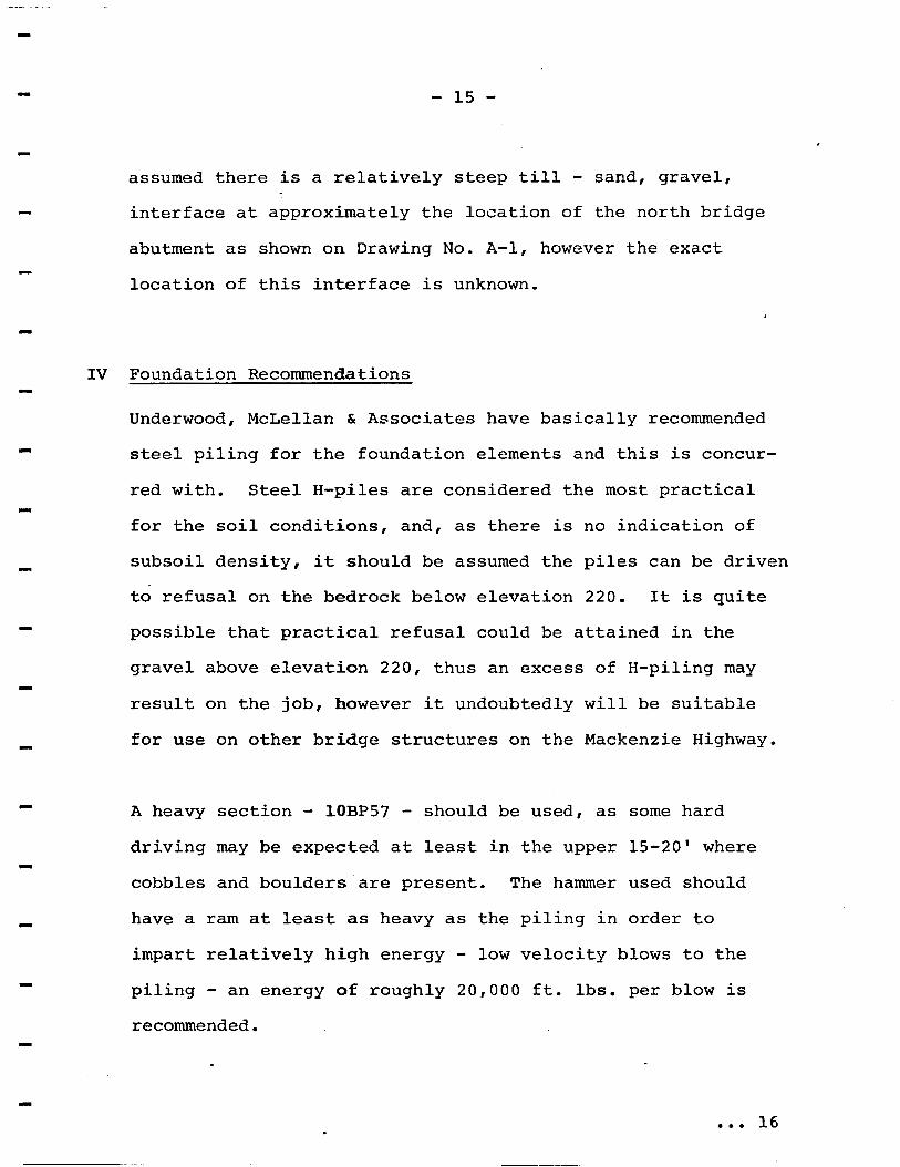
assumed there is a relatively steep till - sand, gravel, interface at approximately the location of the north bridge
abutment as shown on Drawing No. A-1, however the exact
location of this interface is unknown.
IV Foundation Recommendations
Underwood, McLellan & Associates have basically recommended
steel piling for the foundation elements and this is concur-
red with. Steel H-piles are considered the most practical
for the soil conditions, and, as there is no indication of
subsoil density, it should be assumed the piles can be driven
to refusal on the bedrock below elevation 220. It is quite
possible that practical refusal could be attained in the
gravel above elevation 220, thus an excess of H-piling may
result on the job, however it undoubtedly will be suitable
for use on other bridge structures on the Mackenzie Highway.
A heavy section - lOBP57 - should be used, as some hard driving may be expected at least in the upper 15-20' where
cobbles and boulders are present. The hammer used should
have a ram at least as heavy as the piling in order to
impart relatively high energy - low velocity blows to the piling - an energy of roughly 20,000 ft. lbs. per blow is recommended.
... 16

It w i l l be necessary t o d r i l l a t l e a s t o n e a d d i t i o n a l t es t
hole on t h e n o r t h side of t h e creek b e f o r e c o n s t r u c t i o n t o
confirm the subsoi l and permafros t condi t ions below t h e
north pier and abutment , and t o e n s u r e t h a t s u f f i c i e n t
pi l ing equipment i s brought t o t h e s i te t o a d e q u a t e l y i n s t a l l
t h e p i l e s . It i s cons ide red l i ke ly t ha t pe rmaf ros t w i l l be
l a rge ly absen t be low the c ros s ing s i te , however i f pe rmaf ros t
does occur it w i l l probably be p r e s e n t i n t h e c l a y till on
t h e n o r t h side r a t h e r t h a n i n t h e permeable sands and gravels
below the channel and on the south. Any pe rmaf ros t t ha t i s
present should be nea r a temperature of O C , and it m a y be
p o s s i b l e t o g a i n p e n e t r a t i o n t h r o u g h t h e f r o z e n till t o bed-
rock with H-piles and a heavy hammer f o r safe bear ing, a l though
a v a i l a b l e e x p e r i e n c e i n d r i v i n g p i l e s i n t o f r o z e n s o i l s h a s
O
genera l ly been nega t ive . It would l ike ly be imposs ib le t o g a i n
s u f f i c i e n t p e n e t r a t i o n f o r s a f e b e a r i n g i n t o f r o z e n s a n d s a n d
gravels even near a temperature of O C. Thus a d d i t i o n a l t es t
d r i l l i n g would e n s u r e t h a t a d e q u a t e e q u i p m e n t f o r p i l e i n s t a l -
l a t i o n c o u l d be brought t o the cons t ruc t ion s i t e . I f t h e sub-
soil on t h e n o r t h side o f t he c r eek i s g l a c i a l till and perma-
O
f r o s t i s p r e s e n t it w i l l be necessary t o p re -bore p i l e holes
through the permafrost zone, or t o t h e bedrock surface, and
d r i v e t h e p i l e s t o r e f u s a l below t h e base of the lead ho le .
I f t h e s u b s o i l i s f rozen sand and grave ls e i ther p re-bor ing or
pre-steaming could be u t i l i z e d t o e n s u r e a d e q u a t e p e n e t r a t i o n .
.... 17

- 1 7 -
P i l e s d r i v e n t o r e f u s a l as def ined by U.M.A. may be designed
f o r t h e f u l l s t r u c t u r a l s t r e n g t h o f t h e p i l e s e c t i o n a c t i n g
as a column. Underwood, McLellan have recommended a p i l e
load t es t , however t h i s i s considered unnecessary and imprac-
t i ca l a t t h i s s i te because of the small number o f p i l e s '
required and the v a r i a b l e s u b s o i l and permafros t condi t ions .
It is recommended t h e b r i d g e p i e r s and abutments be designed
assuming the bear ing e lements w i l l be H-pi les dr iven t o re-
f u s a l - subsequent t es t bor ings w i l l de te rmine exac t ly how
t h e p i l e s w i l l be i n s t a l l e d t o ensure long term ' r e f u s a l ' .
Addi t iona l bor ings w i l l r e q u i r e a r o t a r y r i g o u t f i t t e d f o r
d r i l l i n g w i t h " d r i l l i n g mud" to ma in ta in an open ho le i n t he
g ranu la r soils, o r a r i g t h a t a d v a n c e s a cased hole , such as
t h e Becker r i g . A dozer w i l l be r equ i r ed t o prepare access
t o t h e n o r t h s i d e of t h e c r e e k .
R. D. Cook, P. Eng. soils Engineer Spec ia l Se rv ices Western Region
c


r DRAfNhCE:
ICE KSCRlPflON
vu
t

I
F 4 -
4
(I
I
!
O0
z
O

SOUTH 3.w Y WH \TE %ND CREak ? I DRILL HOLE REPORT DEPARTME~I ur ruoub Y V L MACKENZIE HIGH
I SolL DESCRIPTION
r t , HSCRIPTION
ICE
?
~
REMARKS

3
o n
I I D
a +
b
V
Y

I I I I I
L
DESCRIPTION ICE
I I I I
I
REMARKS
13'
"- a e >FIAINAGE: I
ICE )ESCRIPTION
1 - - I
SOIL DESCRIPTION .
L
i l L
I' I i
5 / L 7 -
-. L "1
20 - - . -
22" "" - ""
24 - -.
LI J I

\
.
I
l
1
I 1 I d I
i I I l I
i I
i 1 l
i I
! i I
. I
I
I
I
i l ! I !
i l I
i l 6
I
I j I
i i
1
I l I

. ..
,
.- "-.- - """
."."_ "L""
""
"""""
"-
-. "_.._
"""_
"" I
LL

--- . ." '11
L
"
" "-
-- """
"""
"""_
.c
0.3
L
1
-. ."
..
. . ~ _""
" .
.
.

I
c 111
C... .i ..
. ._ "
" ~
.... ..... ......-"."-...I-
"
.. .- ..
. --.A
.
..
..
... '. .
A. i. _*_
"" "C
"" ......- ..""
-.-. . -
.-
...-
-.I
..
... ......, ." .. ---...
"
"_" ".."..__
..... __ ................. "_
._ _
._.- .........
v ."
"""_."_._.
~ ."_ . . _"
."_" "_-
""_"""
. n
"
A"
_. ... -
~" ............
" - .... "
"_ ....
.. "" ..
7
%
""""".." -..-"""."""-.I__
"""_.
q- J3
a:!
rJ e
,"."
""."
. - """"""""
-I "
".__
."" "_."".
"""-
.... " .... ." . .-
. "_"_
.__
... """
....
.. - . .
"
, "_
r-
... , . _
. ....... -. __
, .......
........ .- ."".- V
aJ
Sc
PA
Z3
ly
;:
a P
P
v-
~"-.."----."""-"