PROVINCIAL PARK ADDITION (WATERWAY CLASS) … · JOFFRE TWP HOLLINGER TWP BISCOTASI TWP ARDEN TWP...
1
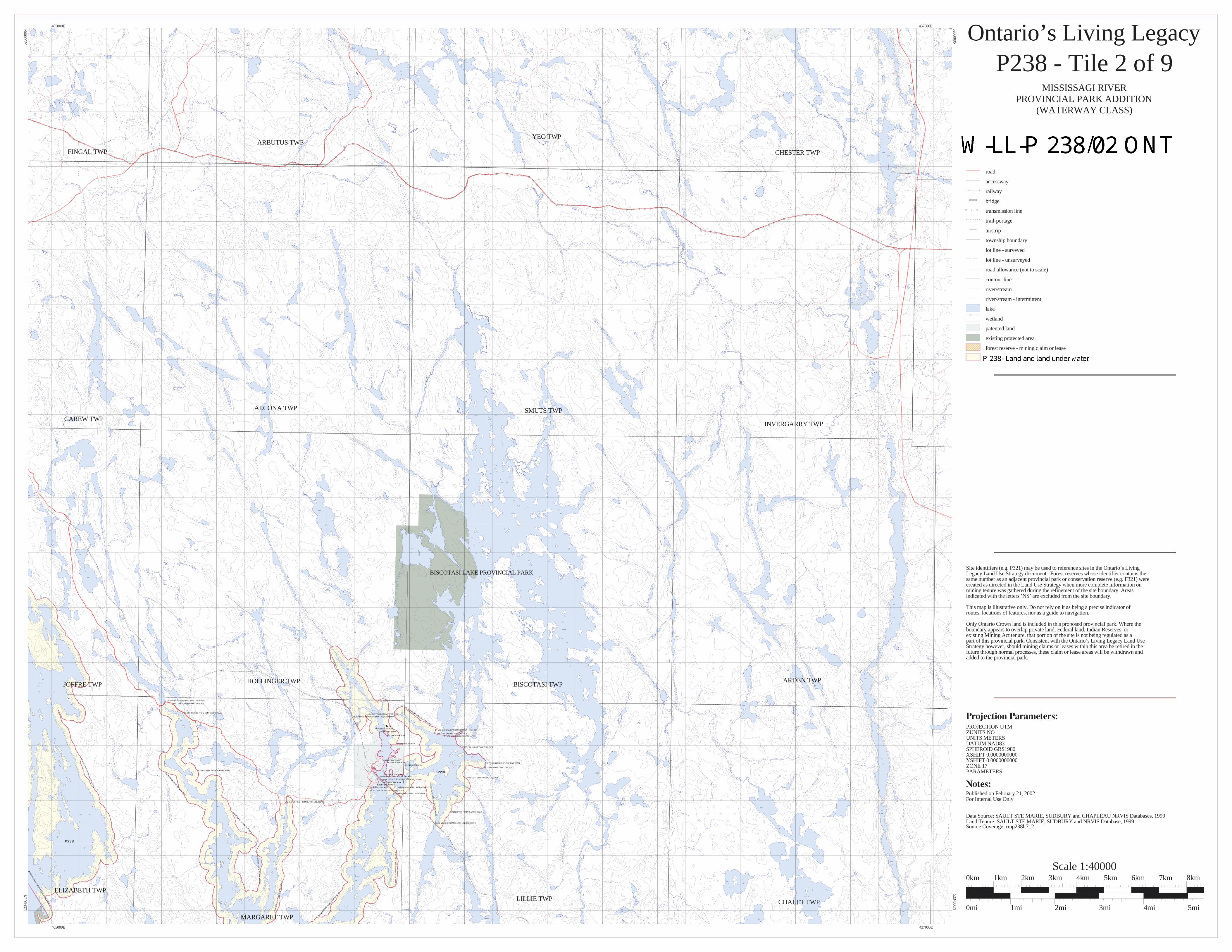
BISCOTASI LAKE PROVINCIAL PARK FINGAL TWP ARBUTUS TWP YEO TWP CHESTER TWP CAREW TWP ALCONA TWP SMUTS TWP INVERGARRY TWP JOFFRE TWP HOLLINGER TWP BISCOTASI TWP ARDEN TWP ELIZABETH TWP MARGARET TWP LILLIE TWP CHALET TWP Paudash Sixth Lake Duke Creek Octave Round Lake Twin Lakes Mollie River Tisdale Lake Chalet Lake Dokis Lake Dead Tisdale Spanish River Houghton Laura Lake Rumsay Lake Rumsay Lake Chalet Lake Eighth Lake Seventh Lake Ninth Lake Eleventh Lake Ramsey Lake Lake Joffre Lake View Lake Lake Bear Roberts Lake East Arm (Ramsey Lake) Ramsey Creek Carew Lake Ramsey Creek Cordes Lake Bithrey Lake (Biscotasi Bay) Deshene Bay Longspur Bay Fox Lake Tower Straight Narrows Biscotasi Lake Crooked Narrows Creek Norton Tassie Creek Creek Tassie Deschene Bay Biscotasi Lake Lost Lake Shanacy Lake Alcona Lake Scarp Lake Alcona Creek Biscotasi Creek Creek Dismal Lake Stony Lake Little Arbutus Lake Biscotasi Creek Little Rush River Metagama Bay Grey Owl Bay Funnybone Lake Rainspot Bolderline Lake Lake Funnybone Creek Rumsay Creek Creek Flying Post Bay Smuts Lake Gowganda Bay Smuts Creek Mollie River Attach Lake Potier Lake Chester Lake Sawpeter Lake Arden Creek Spanish Upper Boot Lake Arden Lake Salome Lake Lake Tenth Lake Azure Lake Paul Lake Cecile Lake Bud Lake Peach Lake Alligator Lake Boot Ray Lake Boot Creek Rene Lake Lakes Duck Dividing Lake George Lake Mollie River Mollie River Delaney Biscotasi Biscotasi Lake Biscotasi Salome River Lake Duke Lake Lake South Arden Norton Arm (Biscotasi Lake) Lake Kane Lake Kabetako Lake Little Dead Lake Dead Lake Eastsand Lake Lake Kolosta Ontario’s Living Legacy P238 - Tile 2 of 9 MISSISSAGI RIVER PROVINCIAL PARK ADDITION (WATERWAY CLASS) MNR Proposed Boundary road accessway railway bridge transmission line trail-portage airstrip township boundary lot line - surveyed lot line - unsurveyed road allowance (not to scale) contour line river/stream river/stream - intermittent lake wetland patented land existing protected area forest reserve - mining claim or lease P238 - Interim Protection Boundary Published on February 21, 2002 For Internal Use Only Data Source: SAULT STE MARIE, SUDBURY and CHAPLEAU NRVIS Databases, 1999 Land Tenure: SAULT STE MARIE, SUDBURY and NRVIS Database, 1999 Source Coverage: rmp238lt7_2 PROJECTION UTM ZUNITS NO UNITS METERS DATUM NAD83 SPHEROID GRS1980 XSHIFT 0.0000000000 YSHIFT 0.0000000000 ZONE 17 PARAMETERS Site identifiers (e.g. P321) may be used to reference sites in the Ontario’s Living Legacy Land Use Strategy document. Forest reserves whose identifier contains the same number as an adjacent provincial park or conservation reserve (e.g. F321) were created as directed in the Land Use Strategy when more complete information on mining tenure was gathered during the refinement of the site boundary. Areas indicated with the letters ’NS’ are excluded from the site boundary. This map is illustrative only. Do not rely on it as being a precise indicator of routes, locations of features, nor as a guide to navigation. Only Ontario Crown land is included in this proposed provincial park. Where the boundary appears to overlap private land, Federal land, Indian Reserves, or existing Mining Act tenure, that portion of the site is not being regulated as a part of this provincial park. Consistent with the Ontario’s Living Legacy Land Use Strategy however, should mining claims or leases within this area be retired in the future through normal processes, these claim or lease areas will be withdrawn and added to the provincial park. 405000E 437000E 405000E 437000E 5234000N 5266000N 5234000N 5266000N Scale 1:40000 0km 1km 2km 3km 4km 5km 6km 7km 8km 0mi 1mi 2mi 3mi 4mi 5mi
Transcript of PROVINCIAL PARK ADDITION (WATERWAY CLASS) … · JOFFRE TWP HOLLINGER TWP BISCOTASI TWP ARDEN TWP...
BISCOTASI LAKE PROVINCIAL PARK
FINGAL TWPARBUTUS TWP
YEO TWP
CHESTER TWP
CAREW TWP
ALCONA TWP SMUTS TWP
INVERGARRY TWP
JOFFRE TWP HOLLINGER TWP BISCOTASI TWPARDEN TWP
ELIZABETH TWP
MARGARET TWP
LILLIE TWP CHALET TWP
Paudash
Sixth
Lake
Duke
Creek
Octave
RoundLake
Twin
Lakes
Mollie
River
Tisdale
Lake
Chalet
Lake
Dokis
Lake
Dead
Tisdale
SpanishRiver
Houghton
Laura
Lake
Rumsay
Lake
Rumsay Lake
Chalet
Lake
Eighth
Lake
Seventh
Lake
Ninth
Lake
Eleventh
Lake
Ramsey Lake
Lake
Joffre
Lake
View
Lake
Lake
Bear
Roberts
Lake
East Arm
(Ramsey Lake)
Ram
sey
Creek
Carew
Lake
Ram
sey
Cree
k
Cordes
Lake
Bithrey
Lake
(Biscotasi Bay)
Deshene
Bay
Longspur
Bay
Fox Lake
Tower
Straight
Narrows
Biscotasi
Lake
Crooked
Narro
ws
Creek
Norton
Tassie
Creek
Creek
Tassie
Deschene Bay
Biscotasi
Lake
Lost
Lake
Shanacy
Lake
Alcona
Lake
Scarp
Lake
Alcona
Cree
k
Bisc
otas
i
Cree
k
Creek
Dismal
Lake
Stony
Lake
Little
Arbutus
Lake
Biscotasi
Creek
Little
Rush River
Metagama
Bay
Grey
Owl
Bay
Funnybone
Lake
Rainspot
Bolderline
Lake
Lake
Funnybone
Creek
Rumsay
Creek
Creek
Flying Post
Bay
Smuts
Lake
Gowg
anda
Bay
Smuts
Creek
Mollie
River
Attach
Lake
Potier
Lake
Chester
Lake
Sawpeter
Lake
ArdenCreek
Spani
sh
UpperBoot
Lake
Arden
Lake
Salome
Lake
Lake
Tenth
Lake
Azure
LakePaul
Lake
Cecile
Lake
Bud
Lake
Peach
Lake
Alligator
Lake
Boot
Ray
Lake
Boot
Creek
Rene
Lake
Lakes
Duck
Dividing
Lake
George
Lake
Mollie
River
Mollie River
Delaney
Biscotasi
Biscotasi Lake
Biscotasi
Salo
me
Rive
r
Lake
Duke
Lake
Lake
South
Arden
Norton
Arm
(Biscotasi Lake)
Lake
Kane
Lake
Kabetako
Lake
Little
Dead
Lake
Dead Lake
Easts
and
Lake
Lake
Kolosta
Ontario’s Living LegacyP238 - Tile 2 of 9
MISSISSAGI RIVERPROVINCIAL PARK ADDITION
(WATERWAY CLASS)
MNR Proposed Boundaryroad
accessway
railway
bridge
transmission line
trail-portage
airstrip
township boundary
lot line - surveyed
lot line - unsurveyed
road allowance (not to scale)
contour line
river/stream
river/stream - intermittent
lake
wetland
patented land
existing protected area
forest reserve - mining claim or lease
P238 - Interim Protection Boundary
Published on February 21, 2002For Internal Use Only
Data Source: SAULT STE MARIE, SUDBURY and CHAPLEAU NRVIS Databases, 1999Land Tenure: SAULT STE MARIE, SUDBURY and NRVIS Database, 1999Source Coverage: rmp238lt7_2
PROJECTION UTMZUNITS NOUNITS METERSDATUM NAD83SPHEROID GRS1980XSHIFT 0.0000000000YSHIFT 0.0000000000ZONE 17PARAMETERS
Site identifiers (e.g. P321) may be used to reference sites in the Ontario’s LivingLegacy Land Use Strategy document. Forest reserves whose identifier contains thesame number as an adjacent provincial park or conservation reserve (e.g. F321) werecreated as directed in the Land Use Strategy when more complete information onmining tenure was gathered during the refinement of the site boundary. Areasindicated with the letters ’NS’ are excluded from the site boundary.
This map is illustrative only. Do not rely on it as being a precise indicator ofroutes, locations of features, nor as a guide to navigation.
Only Ontario Crown land is included in this proposed provincial park. Where theboundary appears to overlap private land, Federal land, Indian Reserves, orexisting Mining Act tenure, that portion of the site is not being regulated as apart of this provincial park. Consistent with the Ontario’s Living Legacy Land UseStrategy however, should mining claims or leases within this area be retired in thefuture through normal processes, these claim or lease areas will be withdrawn andadded to the provincial park.
405000E 437000E
405000E 437000E
5234000N5266000N
5234
000N
5266
000N
Scale 1:400000km 1km 2km 3km 4km 5km 6km 7km 8km
0mi 1mi 2mi 3mi 4mi 5mi