Processing Sentinel data using Orfeo Toolbox, Geospatial ...pmooney/OSGeoIE2018/session2/3.pdf ·...
12
Processing Sentinel data using Orfeo Toolbox, Geospatial Data Abstraction Libraries and pktools for forest monitoring Preethi Malur Balaji; Daniel McInerney May 2018
Transcript of Processing Sentinel data using Orfeo Toolbox, Geospatial ...pmooney/OSGeoIE2018/session2/3.pdf ·...

Processing Sentinel data using Orfeo Toolbox, Geospatial Data Abstraction Libraries and
pktools for forest monitoring
Preethi Malur Balaji; Daniel McInerney
May 2018
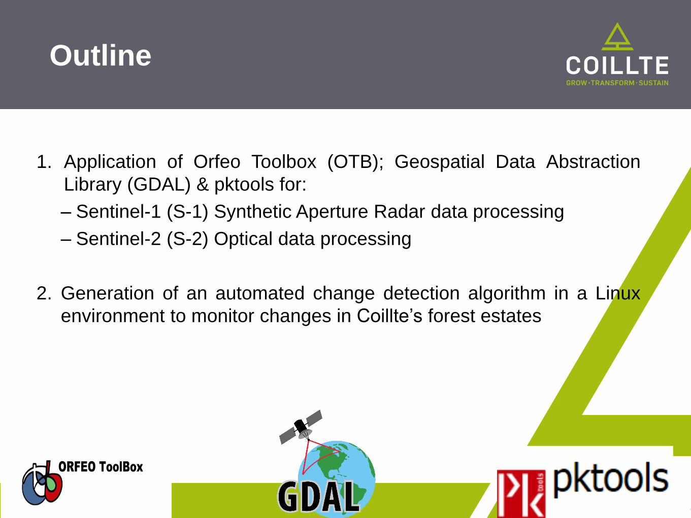
1. Application of Orfeo Toolbox (OTB); Geospatial Data Abstraction
Library (GDAL) & pktools for:
– Sentinel-1 (S-1) Synthetic Aperture Radar data processing
– Sentinel-2 (S-2) Optical data processing
2. Generation of an automated change detection algorithm in a Linux
environment to monitor changes in Coillte’s forest estates
Outline

C-band Synthetic Aperture Radar (SAR)
Level 1.1 Ground Range Detected (GRD);
Interferometric Wide Swath (IW) mode;
Descending pass
Spatial Resolution – 20m; Revisit time – 6 days
Dual Polarisation – VV+VHImage acquisition timeline - February 2015 - April 2017 (Bimonthly data)
S-1 – SAR data

Study Area for S-1 SAR
processing

S-1 Pre-processing Workflow
with OTB and GDAL
S-1 free data download available at
https://scihub.copernicus.eu/
Unzipunzip
Radiometric Calibration (Gamma0 image generation): otbcli_SARCalibration
Terrain Correction otbcli_OrthoRectification
Image Reprojection from EPSG:32629 to
EPSG:2157 (Irish Transverse Mercator
(ITM)) - gdalwarp
Despeckle – Lee filterotbcli_Despeckle
Clip data to Coillte forest propertiesgdalwarp -cutline
Linear to logarithmic scale conversion (in
decibels (dB))otbcli_BandMath
Final productITM projected, speckle filtered, Gamma0
images in dB scale

Output from S-1 SAR
Pre-processing Workflow

S-1 SAR Post-processing
Workflow
Stacking temporal Pre-processed images
otbcli_ConcatenateImages
Image differencing and classification
otbcli_BandMath
Change analysis and Validation – omission and
commission errors

Output from S-1
Post-processing Workflow
Date of image acquisition: 2016-08-21 and 2017-06-29
More commission errors were observed in comparison with thevalidation dataset from Coillte forest inventory.
Overall accuracy – 79%Producer’s accuracy (omission errors) – 77%User’s accuracy (commission errors) – 73%
Conclusions• S-1 C-band with VV+VH polarisation was not optimal for forest
monitoring purposes because of factors such as soil moisture andshorter wavelength (3.8 – 7.5cm).
• Polarisation channels HV+HH tend to be more suitable for forestmonitoring compared to VV+VH polarisation. VV channel is mainlysuitable for Marine applications.
• Subsequent focus on SAR sensors with longer wavelengths such asL-band (15 - 30cm) and P-band (30-100cm) to be considered.
Difference image: otbcli_BandMath

S-2 – Optical Data
Multispectral Instrument (MSI)
Number of reflectance bands – 13; Revisit time – 5 days
Number of tiles covering the entire country - 11
Year of image acquisition - 2017
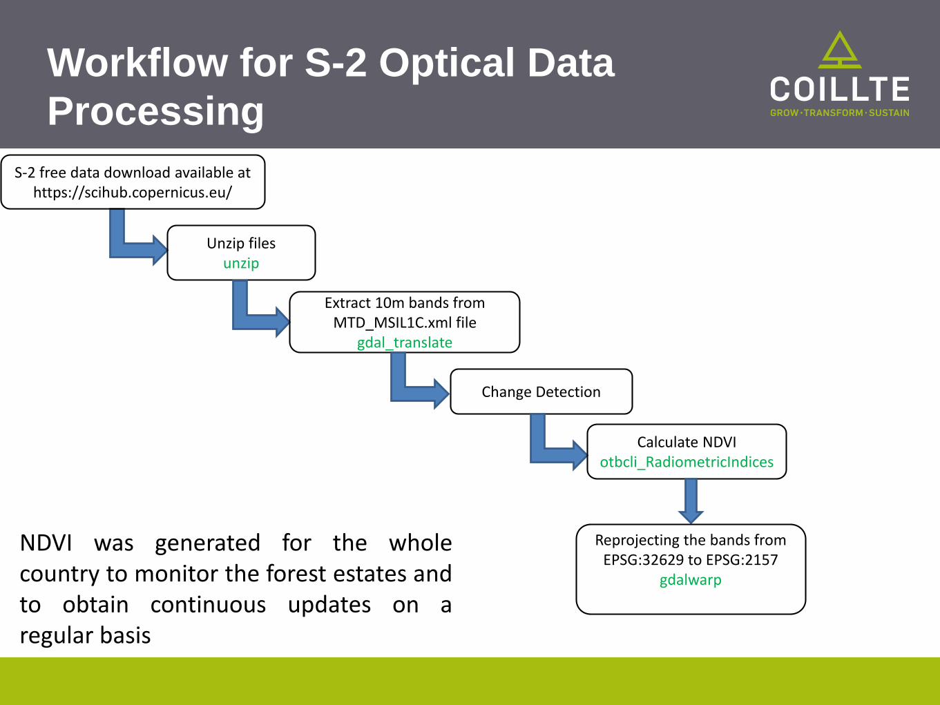
Workflow for S-2 Optical Data
Processing
Unzip filesunzip
Extract 10m bands from MTD_MSIL1C.xml file
gdal_translate
Change Detection
Calculate NDVIotbcli_RadiometricIndices
Reprojecting the bands from EPSG:32629 to EPSG:2157
gdalwarp
S-2 free data download available at https://scihub.copernicus.eu/
NDVI was generated for the wholecountry to monitor the forest estates andto obtain continuous updates on aregular basis

Output from S-2
Workflow
Range of NDVI values

Thank you!!


![ORFEO ToolBox “is not a black box” · Orfeo ToolBox(OTB) [2]: Designed to prepare, support and promote the use of remote sensing images Make the development of new algorithms](https://static.fdocuments.net/doc/165x107/5e697f89e7d31d7e267b1a33/orfeo-toolbox-aoeis-not-a-black-boxa-orfeo-toolboxotb-2-designed-to-prepare.jpg)