
SOUTH ASIA India, Pakistan, Bangladesh, Nepal, Bhutan, Sri Lanka, Maldives.
BANGLADESH AND BASINWIDE MANAGEMENT OF WATERS OF
THE GANGES, THE BRAHMAPUTRA AND THE MEGHNA RIVERS
PRESENTATION ON
ByMIR SAJJAD HOSSAIN
ANDMOHAMMAD HABIBULLAH MAJUMDER
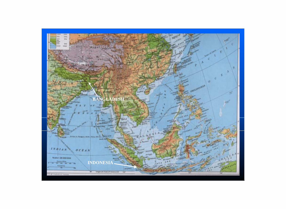
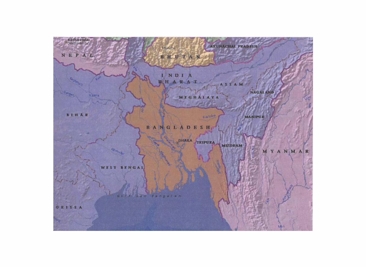
BANGLADESH
INDONESIA
- Located in South Asia between 20o34’ and 26o 38’ North Latitude and between 88o 01’and92o41’ East Longitude
- Has an area of 147,570 sq.km
- India on the west, the north and the north-east,Myanmar on the south-east and Bay of Bengal on the south
- Bangladesh enjoys a sub-tropical monsoon climate
- Lowest temperature comes down to 7o c during winter and rises up to 40o c during summer
Bangladesh at a Glance:
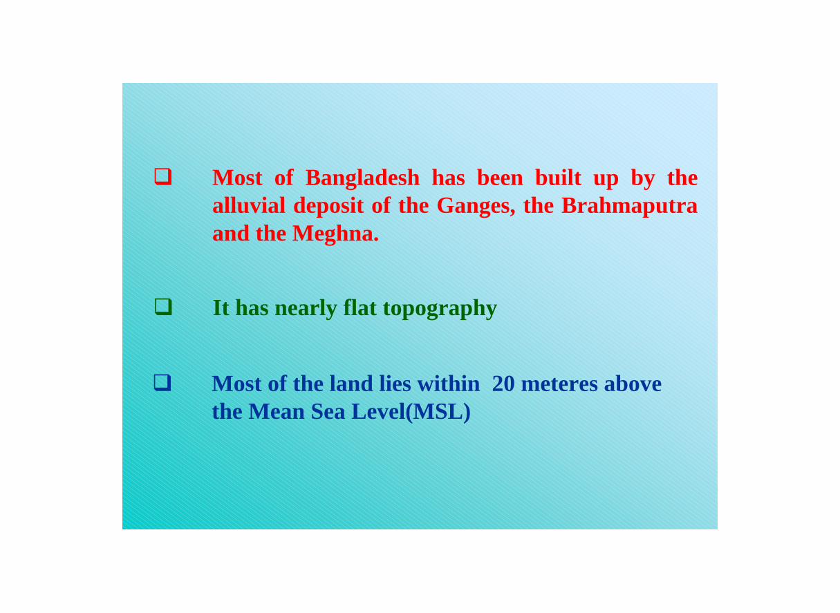
Most of Bangladesh has been built up by the alluvial deposit of the Ganges, the Brahmaputra and the Meghna.
It has nearly flat topography
Most of the land lies within 20 meteres abovethe Mean Sea Level(MSL)
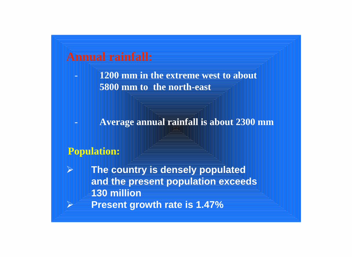
Annual rainfall:- 1200 mm in the extreme west to about
5800 mm to the north-east
- Average annual rainfall is about 2300 mm
The country is densely populatedand the present population exceeds 130 millionPresent growth rate is 1.47%
Population:

The very geographical location of Bangladesh makes it the lowest riparian country of 57 Trans-boundary rivers of which 54 comes from India and 3 from Myanmar

BANGLADESH
COMMON/ BORDER RIVERS
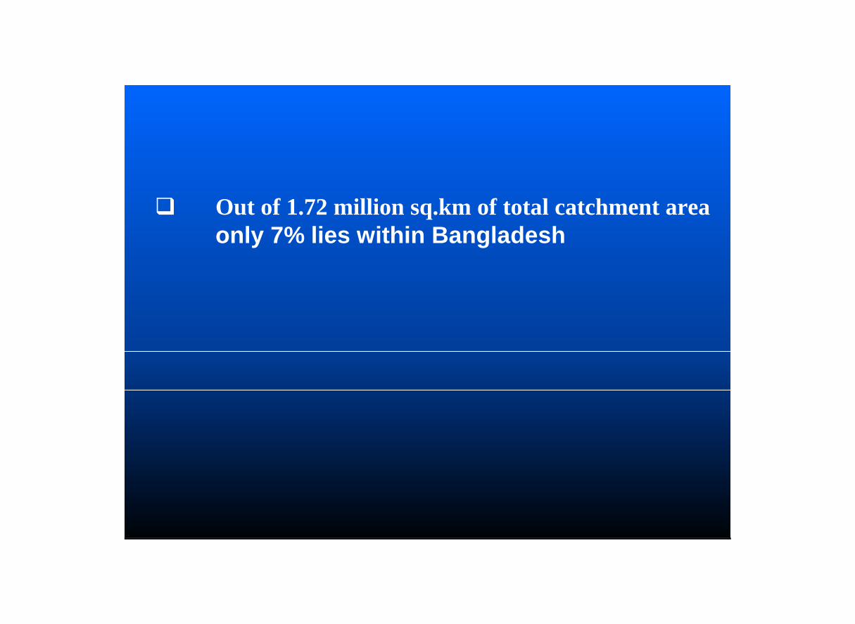
Out of 1.72 million sq.km of total catchment area only 7% lies within Bangladesh
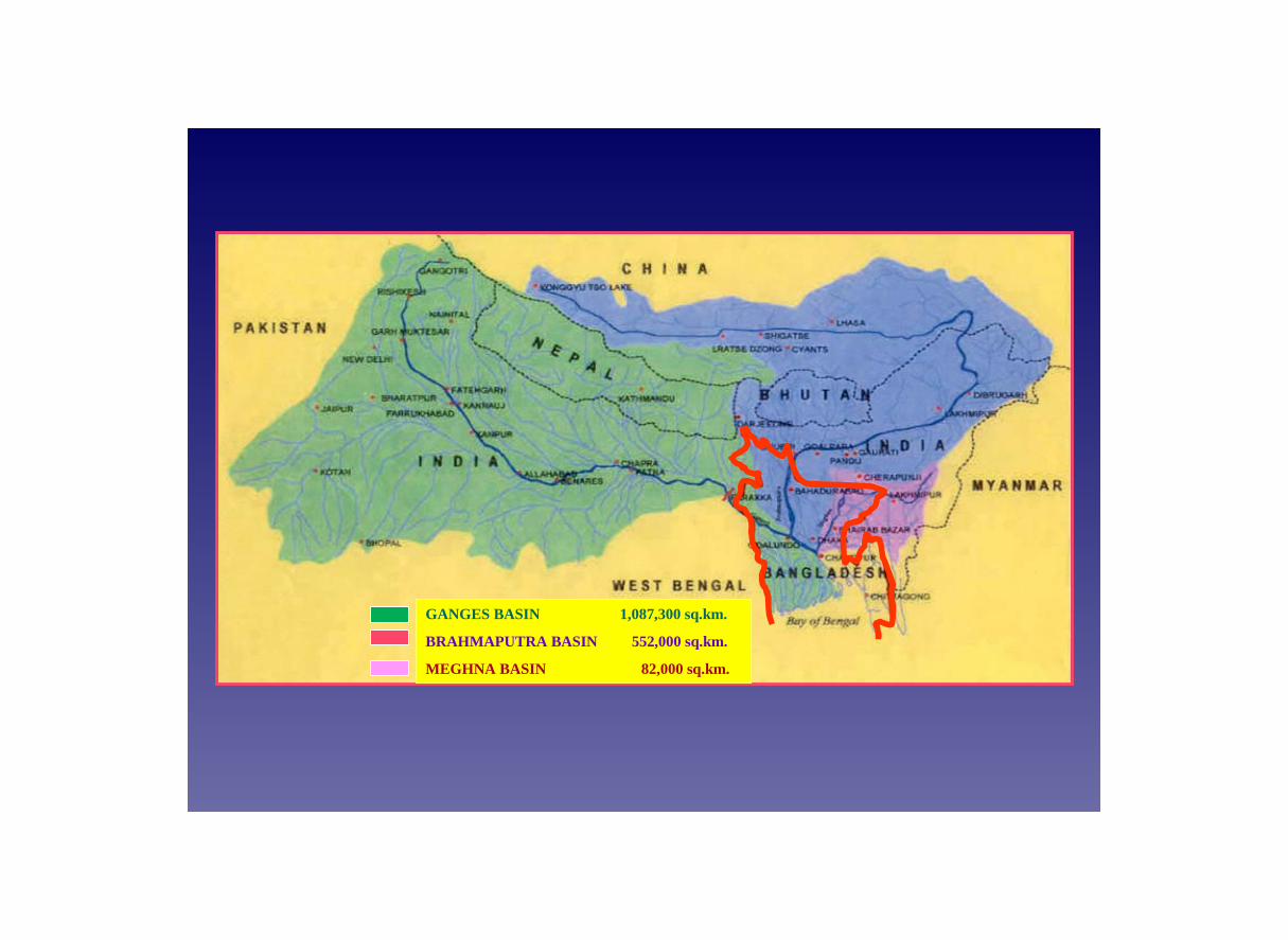
GANGES BASIN 1,087,300 sq.km.
BRAHMAPUTRA BASIN 552,000 sq.km.
MEGHNA BASIN 82,000 sq.km.

Main Features of Major Rivers of Bangladesh
Brahmaputra
Ganges
Meghna
Length of river (km) 2,900 2,550 900
Length within Bangladesh (km) 270 260 400
Total Basin area (km2) 552,000 1,087,001 82,000
Basin area within Bangladesh (km2) 39,100 46,300 35,000
Highest recorded discharge 98,300 (cumec)
at Bahadurabad
76,000 (cumec)
at Hardinge Bridge
19,800(cumec)
at Bhairab Bazar
Lowest recorded discharge 2,860 (cumec)
at Bahadurabad
261 (cumec)
at Hardinge Bridge
Tidal

Being the lowest riparian, the country has no control over the huge cross-boundary flows of about 140,000 cumec (4,944,058 cusec) carried into Bangladesh by these rivers during monsoon.

Bangladesh and IWRMWater, the fundamental need of all living beings, is the single-most important resource for the well-being of the people of Bangladesh .
Floods during monsoon and scarcity of water during the dry seasons are the two extreme characteristics of water availability in Bangladesh.
Both these events cause extreme miseries and hardship to the millions of people.

GANGES AT HARDINGE BRIDGE
(During monsoon)
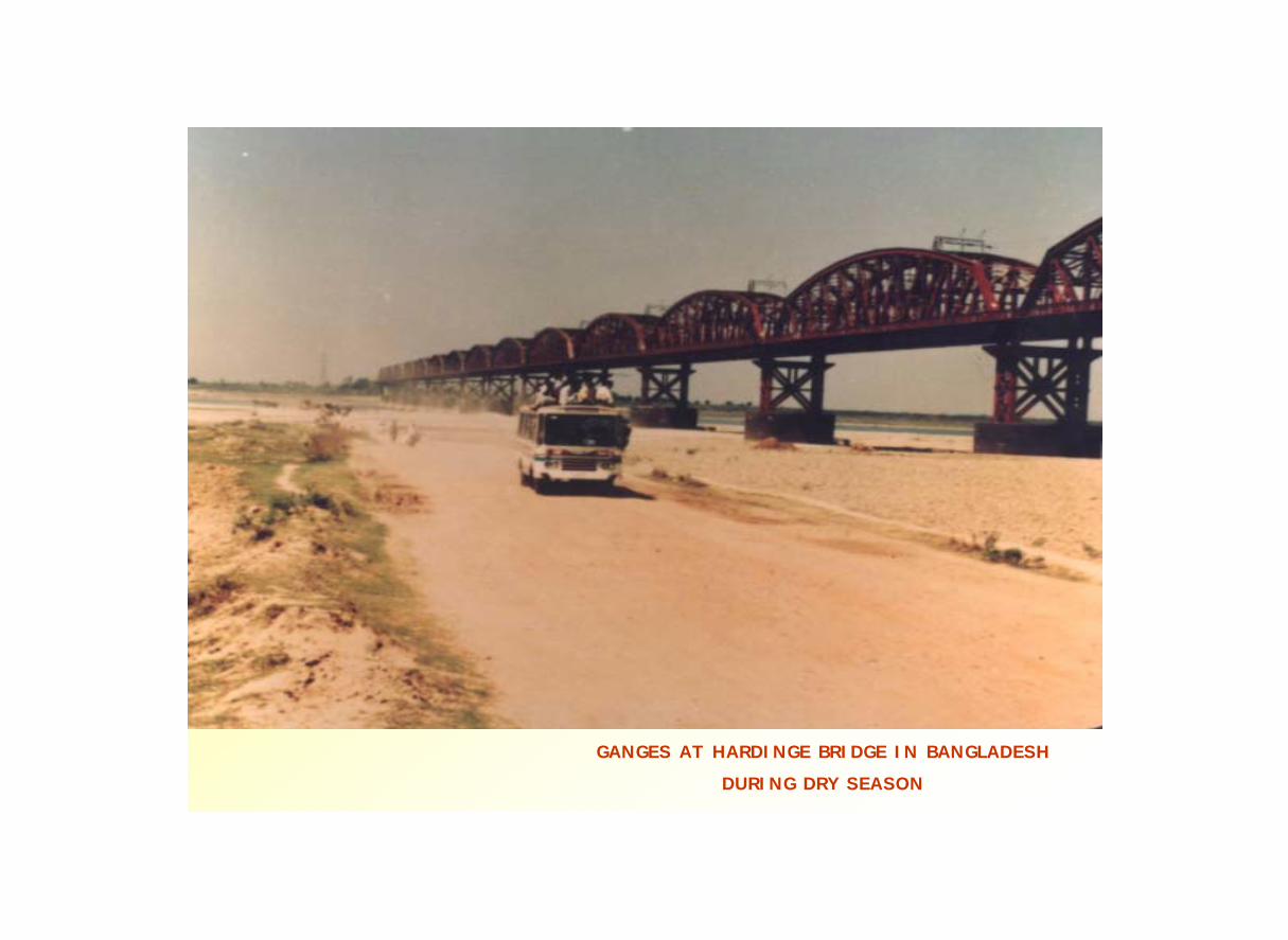
GANGES AT HARDINGE BRIDGE IN BANGLADESH
DURING DRY SEASON

GORAI RIVER,THE MAIN DISTRIBUTARY OF
THE GANGES IN BANGLADESH (During monsoon)
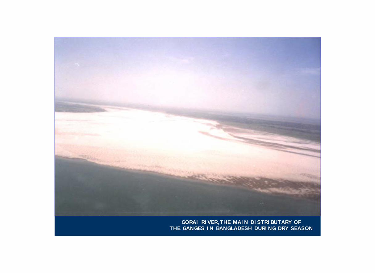
GORAI RIVER,THE MAIN DISTRIBUTARY OF THE GANGES IN BANGLADESH DURING DRY SEASON

Over the decades Bangladesh has been trying to overcome this twin problem by adopting various measures and projects under different water management endeavors.
These measures have brought in significant gains.
Thousands of hectares of lands with agriculture, homesteads and other infrastructures have been protected from the fury of floods in varying degrees.
Examples,
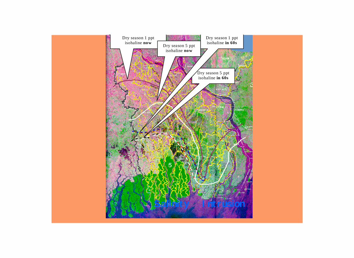
groundwater contaminated with ARSENIC;flood control measures led to reduction of open water fisheries; river erosion of about 9,000 ha of land every year;salinity ingress further inside the southern belt.
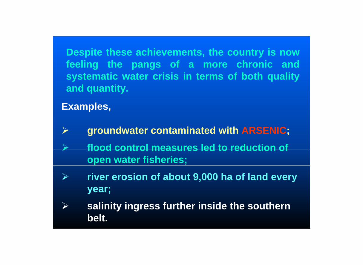
Despite these achievements, the country is now feeling the pangs of a more chronic and systematic water crisis in terms of both quality and quantity.
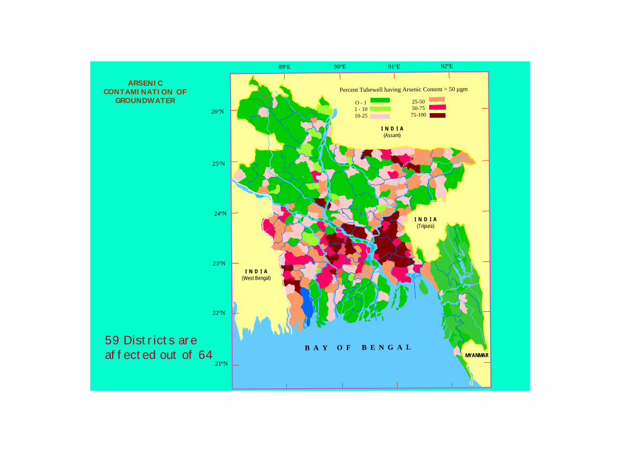
ARSENIC CONTAMINATION OF
GROUNDWATER
22oN
25oN
26oN
24oN
21oN
23oN
90oE 92oE91oE89oE
I N D I A(Tripura)
I N D I A(Assam)
I N D I A(West Bengal)
MYANMARB A Y O F B E N G A L
Percent Tubewell having Arsenic Content > 50 µgm
O - 11 - 1010-25
25-5050-7575-100
59 Districts are affected out of 64


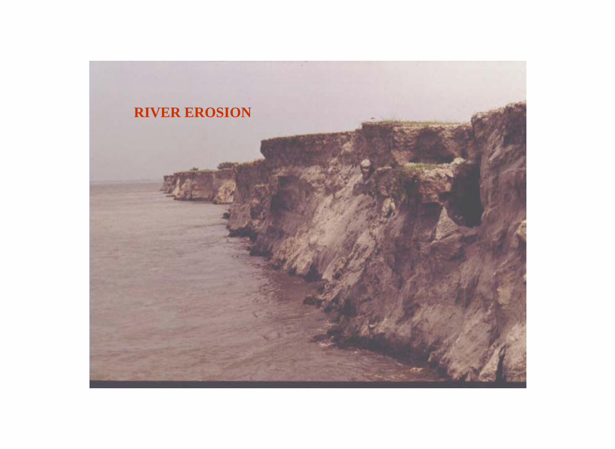
RIVER EROSION
Upper
MeghnaRiver
ChandnaRiverNabaganga R
KumarRiver
Gorai River
JamunaRiver
PadmaRiver
GangesRiver
Dry season 1 pptisohaline now
Dry season 5 pptisohaline now
Dry season 5 pptisohaline in 60s
Dry season 1 pptisohaline in 60s
Salinity Intrusion

In absence of good governance of water much damage has already been done to the bio-diversity of the country.
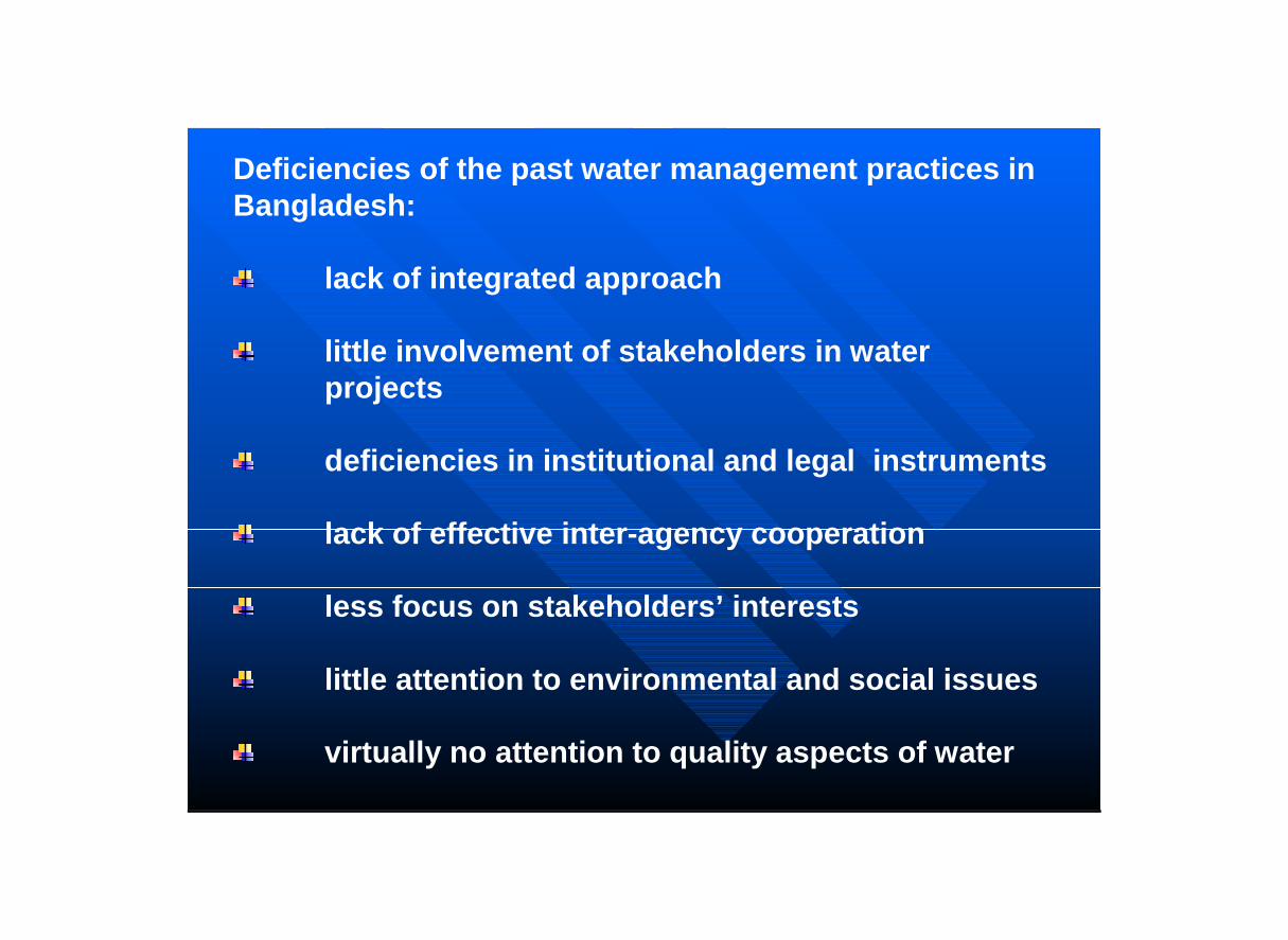
Deficiencies of the past water management practices in Bangladesh:
lack of integrated approach
little involvement of stakeholders in water projects
deficiencies in institutional and legal instruments
lack of effective inter-agency cooperation
less focus on stakeholders’ interests
little attention to environmental and social issues
virtually no attention to quality aspects of water

Due to population boom and associated changing situation, the country would face challenges in future :
in meeting basic needs;
securing the food supply;
protecting the ecosystems;
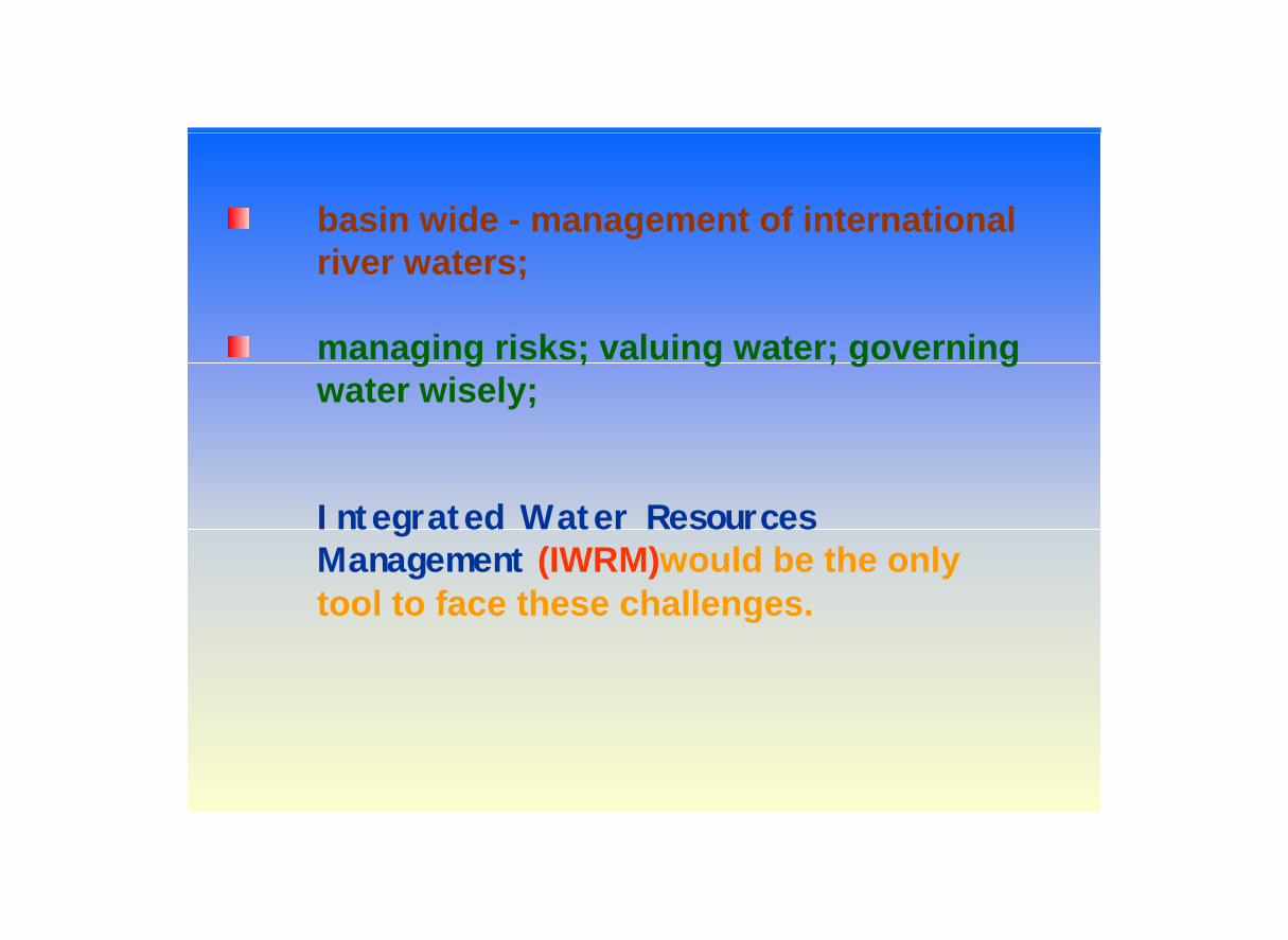
basin wide - management of international river waters;
managing risks; valuing water; governing water wisely;
Integrated Water Resources Management (IWRM)would be the only tool to face these challenges.

In order to realize the goal of IWRM in the country, Government of Bangladesh announced the ‘National Water Policy’ in January, 1999
economic development,poverty alleviation,food security, public health and safety,protection of the natural environment.
The Policy also provides principles for public-private sector and GO-NGO collaboration in water management.
The Policy envisages:

In order to translate the announced Policy into reality Bangladesh has prepared the draft of a 25 year National Water Management Plan(NWMP)
The planning exercises have been primarilyfocussed to technical issues like
arsenic contamination of groundwater;industrial and municipal pollution affecting water supplies;dry season water shortages;river bank erosion;floods, cyclones and droughts.

Transboundary River Waters and Bangladesh
Bangladesh is the lowest riparian of more than 50 transboundary rivers. It has no control over the flows of these rivers. There are problems of sharing the waters of these rivers with the upper riparian.If these problems are not resolved between the riparians through mutual understanding in a spirit of good neighborliness then the IWRM in Bangladesh would remain only a dream.

“the Government will endeavor to enter into agreements with co-riparian countries for sharing the waters of international rivers, data exchange, resource planning and long-term management of water resources under normal and emergency conditions of flood, drought and water pollution”.
With this view the Government in its National Water Policy states that :
The Government of Bangladesh has always made it clear that there will be no dearth of goodwill and efforts on its part to fostering cooperation among the co-basin countries of the Ganges, Brahmaputra and Meghna for basin wide management of water resources of these rivers to the mutual benefit of all.

Indo-Bangladesh Joint Rivers Commission (JRC)
Considering the vital influence and importance of the flows of the Trans-boundary rivers on the life and living of the people, Bangladesh had established with India the Indo-Bangladesh Joint Rivers Commission (JRC) in 1972 for working together for flood control and harnessing the rivers common to both the countries.
JRC was subsequently given the responsibility to assist the two Governments in formulating arrangements for sharing the flows of the Ganges and other common rivers between the two countries.

According to the Statute, the JRC has the following functions in particular;
- to maintain liaison between the participating countries in order to ensure the most effective joint efforts in maximizing the benefits from common river systems to both the countries,
- to formulate flood control works and recommend implementation of joint projects,
- to formulate detailed proposals on advance flood warnings, flood forecasting and cyclone warnings,
- to study flood control and irrigation projects so that the water resources of the region can be utilized on an equitable basis for the mutual benefit of the peoples of the two countries, and
- to formulate proposals for carrying out co-ordinated research on problem of flood control affecting both the countries.
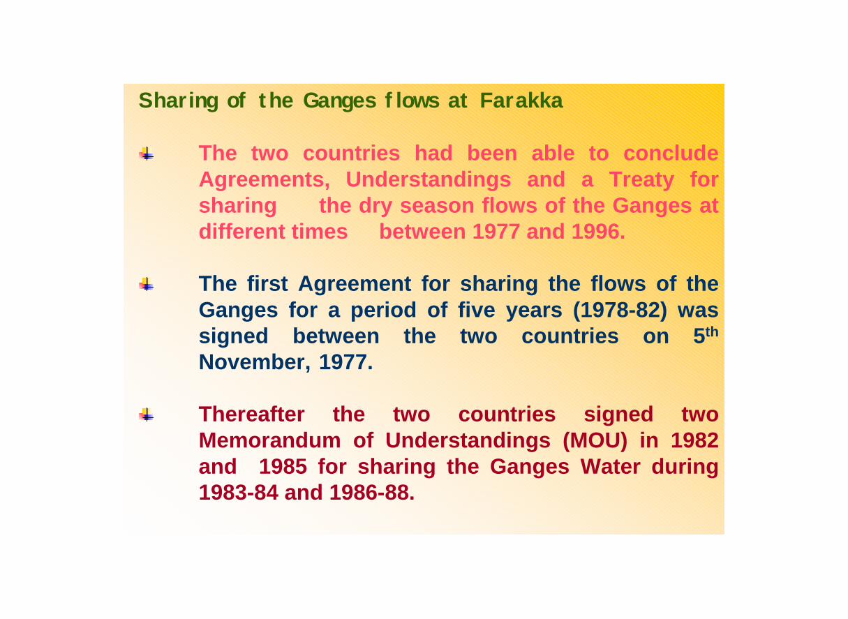
Sharing of the Ganges flows at Farakka
The two countries had been able to conclude Agreements, Understandings and a Treaty for sharing the dry season flows of the Ganges at different times between 1977 and 1996.
The first Agreement for sharing the flows of the Ganges for a period of five years (1978-82) was signed between the two countries on 5th
November, 1977.
Thereafter the two countries signed two Memorandum of Understandings (MOU) in 1982 and 1985 for sharing the Ganges Water during 1983-84 and 1986-88.
Thereafter the two countries signed a Treaty 12th December, 1996 for sharing the dry season flows of the Ganges for a period of 30 years.
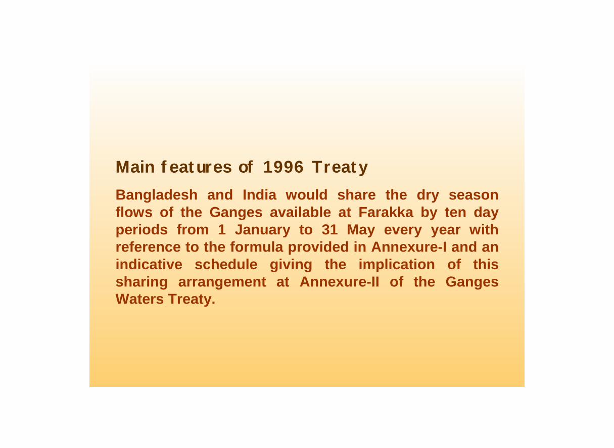
Main features of 1996 TreatyBangladesh and India would share the dry season flows of the Ganges available at Farakka by ten day periods from 1 January to 31 May every year with reference to the formula provided in Annexure-I and an indicative schedule giving the implication of this sharing arrangement at Annexure-II of the Ganges Waters Treaty.
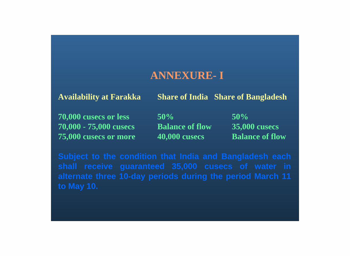
ANNEXURE- I
Availability at Farakka Share of India Share of Bangladesh
70,000 cusecs or less 50% 50%70,000 - 75,000 cusecs Balance of flow 35,000 cusecs75,000 cusecs or more 40,000 cusecs Balance of flow
Subject to the condition that India and Bangladesh each shall receive guaranteed 35,000 cusecs of water in alternate three 10-day periods during the period March 11 to May 10.

Augmentation of the dry season Ganges Flows
The present dry season availability of the Ganges at Farakka is not enough to meet the requirements of both Bangladesh and India.
Bangladesh needs more water in the Ganges during dry seasons to support the socio-economic development for present and future generations.
In Article-VIII of the 1996 Treaty, both Bangladesh and India have recognized the need to cooperate with each other in finding a long- term solution to the problem of augmentation of dry season Ganges flows.

Although there is scarcity of water in the Ganges during dry season, plenty is available in the river during the monsoon.
A portion of the monsoon floods of the Ganges which cause widespread damages in the co-basin countries could be conserved in the upstream storage sites (particularly in Nepal) to mitigate flood intensities downstream.
This in turn would enable significant augmentation of the dry season flows of the Ganges satisfying the reasonable water needs of all the co-basin countries.
In addition, generation of huge hydropower to meet up energy crisis in the regioncreate more job opportunities through industrialization

Bangladesh Proposal for Storage Reservoirs in Nepal

The net augmentation would be 1656 m3/sec
The net augmentation would be 5393 m3/sec if four dams are raised
To that end, Bangladesh, India and Nepal can form the Ganges River Basin Organization
International River Basin Organizations for the Brahmaputra and the Meghna Rivers
The water availability in the Brahmaputra and theMeghna river basins are also highly seasonal like the Ganges
Storage of some parts of the monsoon flows of these rivers can easily meet the dry season water demands in the co-basin countries
China, India, Bhutan and Bangladesh can form theBrahmaputra River Basin Organization.
Similarly India and Bangladesh can consider constituting the Meghna River Basin Organization

CONCLUSION :Water in the Ganges, the Brahmaputra and the Meghna rivers are too precious resource.
It is a tragedy that the people living in these basin areas are still one of the poorest despite the basins’ rich endowments.
The co- basin countries of these rivers can move forward to form the River Basin Organizations of the Ganges, the Brahmaputra and the Meghna towards transforming this region from one of the poorest to one of the most prosperous.

International agencies and Institution like the Asian Development Bank (ADB) and NARBO may have the potential of playing the role of an effective facilitator to forge cooperation amongst the co-basin countries of the Ganges, the Brahmaputra and the Meghna rivers.


![Geopolitics of Bhutan and its Relevance in the Security of ... · 6 ] SAARC was created in 1985 by India, Pakistan, Bangladesh, Nepal, Sri Lanka, Bhutan, and Maldives with the purpose](https://static.fdocuments.net/doc/165x107/5f271fb5e89d5921914f1cf7/geopolitics-of-bhutan-and-its-relevance-in-the-security-of-6-saarc-was-created.jpg)