PLANNING APPLICATION - Enfield
48
D PLANNING APPLICATION REF: 17/03304/HOU Site: South View, Trent Park, Cockfosters Road, Barnet Proposal: Two-storey side extension, including alterations to fenestration and relocation of front entrance door, with re paving driveway and replacement garage involving pitched roof. Site location
Transcript of PLANNING APPLICATION - Enfield

D
PLANNING APPLICATION
REF: 17/03304/HOU Site: South View, Trent Park, Cockfosters Road, Barnet Proposal: Two-storey side extension, including alterations to fenestration and relocation of front entrance door, with re paving driveway and replacement garage involving pitched roof.
Site location

Background The application site comprises a late 19th century/ early 20th century red brick cottage. Commissioned by the Bevan Family to house estate workers, the cottage constitutes a non-designated heritage asset and is located within the Trent Park Conservation Area and Green Belt. Trent Park is also included on the the Register of Parks and Gardens of Special Historic Interest in England. Proposed Development The application is for the erection of a two-storey side extension to the exiting dwelling. The proposed extension is to be constructed in red brick to match existing, with decorative fascia’s and tiling to the new gable ends, together with matching casement windows including decorative lintels and chamfered sills. To the north elevation, 3 no. new windows will be installed, with an additional triple-partite window on the south elevation. 2 no. bipartite windows will be installed on the new east elevation, whilst 3 no. windows on the western elevation (overlooking the communal courtyard between North View and South View) will be blocked with brickwork, to minimise any overlooking between the properties. All new windows are to be double glazed uPVC casement units with decorative lintels and chamfered cills to match existing. The proposed extension features a new gable style roof, which will intersect with the existing gable roof form at a 90-degree angle. The roof is to be finished in clay tiles with a decorative fascia to match existing. In addition, it is proposed to replace the existing garage with a new single-storey pitched roof garage. The garage is to be constructed of red brick with a clay tiled dual-pitch roof over to match the existing house. The existing driveway is also to be repaved under the proposals. Relevant Extract from Trent Park Conservation Area Character Appraisal 2.6.10 Apart from the garden walls, most buildings are cottages built by the Bevans during the late 19th and early 20th centuries (Rookery Lodge, Garden Cottage, the Dower House, the gardener’s bothy, North and South Views), or the Sassoons in the interwar period (Rookery and Shaws Wood Cottages). The exception is the enormous sports hall built for the Sassoons adjacent to Dairy Cottage. The Bevan cottages are typical small buildings of their era. As such, they are unremarkable, but are handsomely proportioned and well detailed, with yellow brick, red gauged brick arches above windows and doors, casement windows and gabled slate roofs: decoration is usually limited to a gabled porch. They survive as recognisable historic buildings associated with the estate during the Bevan era.
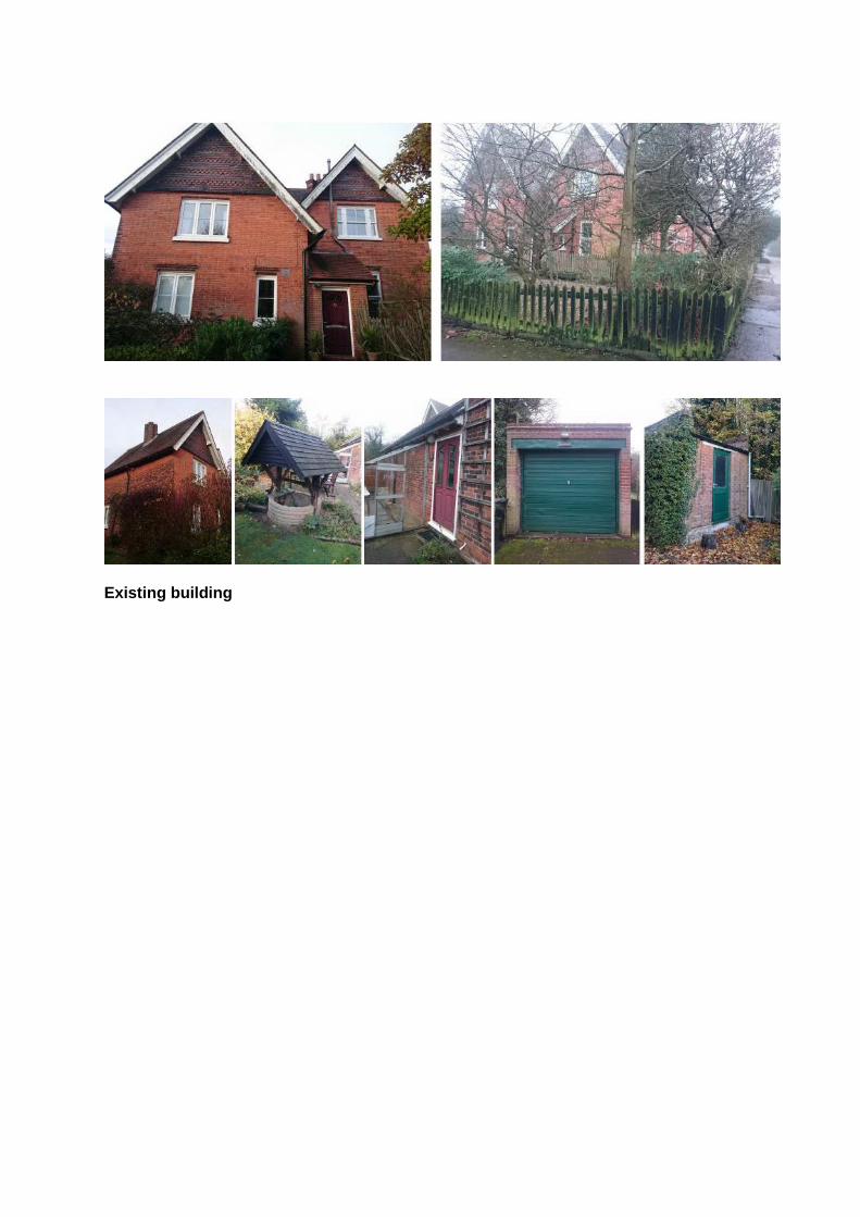
Existing building

Proposed 3D Views

Existing North Elevation
Proposed North Elevation

Existing South Elevation
Proposed South Elevation

Existing East Elevation
Proposed East Elevation

Existing West Elevation
Proposed West Elevation

Proposed site plan

PLANNING APPLICATION
REF: 17/03925/FUL
Proposal: Redevelopment of site involving demolition of existing building and erection of two detached buildings comprising, part 3, part 4-storey 69-bed care home with mansard roof, plant at basement level together with residential facilities including cafe, cinema and Hair Salon and 3 storey block with mansard roof to provide 12 close care self-contained flats (6 x1bed and 6 x2 bed) with associated car parking. Site: Bridge House, 1 Forty Hill, Enfield, EN2 9HT Case officer: C. Williams
Site location
Background Bridge House comprises a 20th century sheltered housing complex. The buildings are of red brick and predominantly of 2 and 3 storeys in height. The site is located within the boundaries of Forty Hill Conservation Area, in the setting of several listed buildings. Proposal The proposal is for the redevelopment of the site involving the demolition of the existing building and erection of two detached buildings comprising, part 3, part 4-storey 69-bed care

home with mansard roof, plant at basement level together with residential facilities including cafe, cinema and Hair Salon and 3 storey block with mansard roof to provide 12 close care self-contained flats (6 x1bed and 6 x2 bed) with associated car parking. Relevant Extract from Character Appraisal
Problems and pressures
2.8.12 While in general this part of the Conservation Area remains in good physical
condition, there is one major detrimental feature and several lesser negative factors that
detract from its special character:
i) The block of flats at 22-68 Forty Hill has been derelict and boarded up for a number of
years. It is serious blight, all the more so as it forms the gateway to the Conservation Area. At
the time of writing (Spring 2013) discussions are taking place between a possible developer
and the Council for a residential redevelopment of the site, although no firm proposals have
yet been agreed. The later 20th century sheltered housing, Bridge House, on the opposite side
of the road (to the south of Forty Hill) is merely utilitarian, but development in this area is
generally of poor quality. [p.56]
Street View: Existing Site

Proposed block plan
Proposed Ground Floor Plan

Proposed First Floor Plan
Proposed Second Floor Plan

Proposed View Along Myddleton Avenue
Proposed View Along Forty Hill
Proposed South West Elevation

Proposed South East Elevation
Proposed North West Elevation

Proposed Elevations For full details of the scheme, please access the supporting plans and heritage statement via the Council’s online public access system.

PLANNING APPLICATION
REF: 17/03651/FUL
Proposal: Subdivision of site and erection of a detached 2-storey 2-bed single family dwelling house at side with vehicular access via Church Hill. Site: The Cottage Church Hill London N21 1JA Case officer: M. Lai
Site location

Aerial View of Site
Street View Background The Cottage comprises a Grade II listed dwelling that is sited within the boundaries of the Winchmore Hill Conservation Area. Other listed buildings in the vicinity include: Church of St Paul, Church Hill (Grade II) ; Devon House, Church Hill (Grade II); Friends Meeting House, Church Hill (Grade II); Graveyard Walls, Friends Meeting House, Church Hill (Grade II) 1 Woodside Cottages, Church Hill (Grade II); The Old School House, Church Hill (Grade II) and 55 Church Hill (Stonehall Lodge) (Locally listed). Winchmore Hill started life as a small rural village, which was transformed into a smart residential suburb in the early 20th century. Together, Winchmore Hill Green and Vicars Moor Lane Conservation Areas encompass the surviving historic settlement, which still retains much of the character of the former village. Winchmore Hill Green was designated as a conservation area in 1968 and extended in 1974. It was extended in 2009 to include part of Station Road. Vicars Moor Lane was designated in 1970.

Proposal Full planning permission and Listed Building Consent is sought for subdivision of site and erection of a detached 2-storey 2-bed single family dwelling house at side with vehicular access to Church Hill. Relevant Planning History A previous application REFS 17/01953/LBD and 17/01520/FUL for the erection of a new dwelling was
refused on Fri 23 Jun 2017. Previous CAG Minutes
17/01953/LBD & 17/01520/FUL: The Cottage, Church Hill, London N2 1JA The Group noted the design intention is to reflect the style of the adjacent cottages. Bridget Pereira stated that the three adjacent cottages appear on the 1801 Enclosure map. Whilst there are evident dangers in trying to mirror such an historic style (weak pastiche etc) the Group considered it was the best design option. WHG&VMLCASG supported the proposal. A vote was taken and the result was 9 in favour of the application and 4 against. The Group stressed that any approval must be closely conditioned to ensure that every component of the elevations (windows particularly) and roof are subject to subsequent approval. No Objections
Existing Listed Cottages

Existing Site
Existing Site

Proposed Block Plan
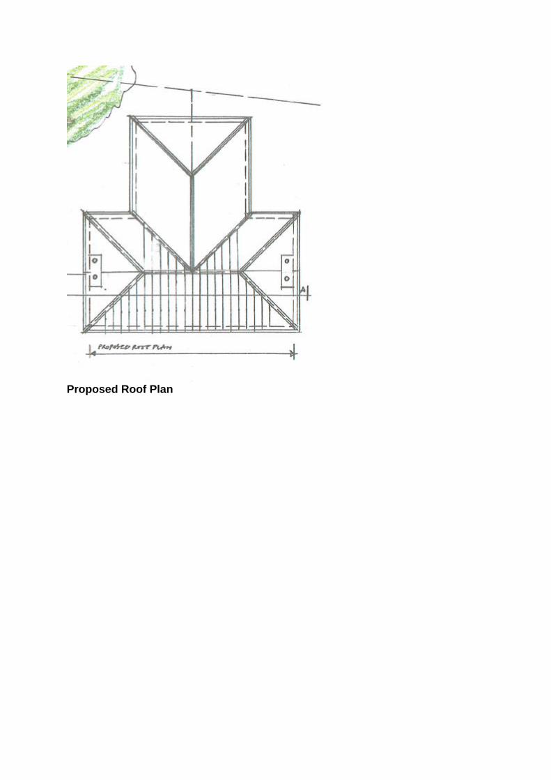
Proposed Roof Plan

Proposed ground floor plan
Existing listed cottage and proposed dwelling

Proposed Section AA
Proposed Front Elevation
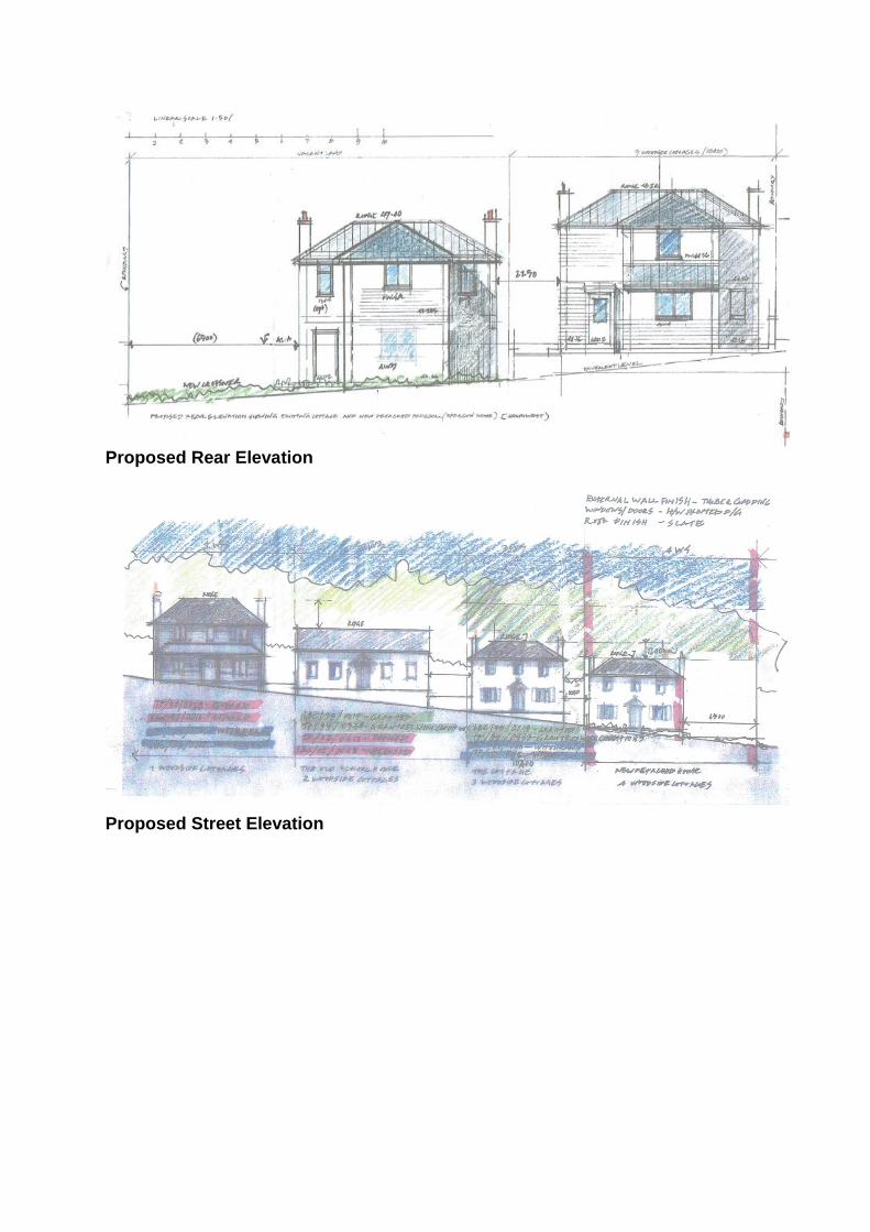
Proposed Rear Elevation
Proposed Street Elevation
Proposed Roof Plan

Proposed Southeast Elevation
Proposed North West Elevation For full details of the scheme, please access the supporting plans and heritage statement via the Council’s online public access system.

PLANNING APPLICATION
REF: 17/02026/HOU
Proposal: Single storey rear extension together with side and rear dormers with front rooflights. Site: 28 Old Park Ridings London N21 2EY Case officer: H. Osman
Site location
Background No. 28, Old Park Ridings comprises an semi-detached dwelling circa. 1897-1920 that is sited within the boundaries of the Grange Park Conservation Area. The dwelling is characteristic of Metherall’s Edwardian speculative housing and its design draws on a strong Arts and Crafts influence; built of red brick/ render featuring a stone mullioned canted bay window (leaded lights) to front elevation with quatre partite window (leaded upper lights) set under shallow cambered arch above. The roof is hipped (clay tiled) with plain terracotta ridge tiles and exposed brick chimney stack over. A recessed porch can also be seen with original half glazed timber door and ‘Oeil-de-boeuf’ window to side. Above, tripartite leaded casements are set under deep overhanging eaves.

Grange Park Conservation Area is formed of a cohesive group of houses and shops initially laid out and partly built between 1910 and 1914 by a single developer, and subsequently completed in the 1920s and 1930s. The design of the existing dwellings draw on strong Arts and Crafts influences and consistently make use of high quality details and materials. The area retains a strong sense of architectural unity which is key to its special character and appearance of the area. The striking Art Deco Methodist Church sited along the road (circa 1938) is currently under consideration for the Local List. Therefore, the impact on its setting should be given due consideration as part of this application. No. 28 is cited in the Conservation Area Character Appraisal as a key building which makes a contribution to the special interest of the area. Views into the site are afforded from rear garden plots of existing dwellings along The Chine and The Grangeway. A nominal view is afforded from the corner of The Chine, where there is a break in the housing. The Conservation Area is also covered by an Article 4 (2) Direction which withdraws certain permitted development rights relating to dwelling houses. Proposal The proposal is for the erection of a single storey rear extension together with side and rear dormers with front rooflights. Planning History 15/02616/HOU Two storey side and front extension with flank window, single storey rear extension with roof light, rear dormer and 3 x front rooflights, construction of front boundary wall. – Refused 03.08.2015
16/00965/HOU Single storey rear extension, loft conversion with side and rear dormer windows and new front boundary wall- Permission Granted subject to conditions 27.04.2016
Ref: 15/00164/HAS Two storey side and front extension with flank window, single storey rear extension with roof light, rear dormer and 3 x front rooflights , construction of front boundary wall. (Relates to Planning Application Reference 15/02616/HOU)- Appeal Dismissed 10.03.2016

Existing Roof Plan

Proposed Roof Plan

Existing Front Elevation
Proposed Front Elevation

Existing Side Elevation
Proposed Side Elevation

Existing Rear Elevation

Proposed Rear Elevation For full details of the scheme, please access the supporting plans and heritage statement via the Council’s online public access system.

PLANNING APPLICATION
REF: 17/03751/HOU
Proposal: Rear and side dormers with front and side rooflights. Site: 40 Old Park Ridings London N21 2ES Case officer: S. Wilson
Site location

Existing Front Elevation Background No. 40, Old Park Ridings comprises an early 20th-century semi-detached dwelling circa 1921-1935, designed in an Arts and Crafts style with vernacular detailing. It is sited within the boundaries of the Grange Park Conservation Area. Stylistically the building is of red brick and pebbledash render with half timbering, projecting gable, oriel window and hipped clay tile roof over.
Proposal The proposal is for the installation of rear and side dormers with front and side rooflights.

Existing Front Elevation

Proposed Front Elevation

Existing Flank Elevation
Proposed Flank Elevation

Existing Rear Elevation

Proposed Rear Elevation

Existing Cross Section AA
Proposed Cross Section AA For full details of the scheme, please access the supporting plans and heritage statement via the Council’s online public access system.

PLANNING APPLICATION
REF: 17/03684/FUL
Proposal: Alterations to existing shop front Site: Park Cafe Town Park Cecil Road Enfield EN2 6LE Case officer: A. Parker
Site location
Background The application site comprises the former pavilion in the Town Park circa 1915-1935. The Pavilion is a focal point and cited as a building making a positive contribution to the character of the area in the Enfield Town Conservation Area Character Appraisal. Proposal The proposal is for alterations to existing frontage including alterations to veranda, fenestration and installation of an external roller shutter. Relevant Extract From Character Appraisal
2.10.1 Town Park occupies the south-west sector of the Conservation Area, and is bounded to the east by the gardens of Raleigh Road, to the north by those of Cecil Road, and to the west and south by the New River and golf course. It is an open area and the

only buildings are the pavilion and ancillary structures in its central area, although there is now an incongruous bright blue fenced ball park area which intrudes on the views, particularly those from the Essex Road gate (Figure 32). Within the park, there are few features of interest and attention is therefore directed to the boundary: this means that the design and materials of fences and boundary walls become very noticeable, and the rear elevations of the large houses in Cecil Road become of some interest. New building has taken place on the south-eastern boundary of the park, where an Evangelical Free Church has been built, and the adjoining vacant Council-owned site, previously a car park, has been sold for residential development. This means that the former view of Town Park from Cecil Road is likely to be lost, although access on foot will be safeguarded.
Existing Ground Floor

Proposed Ground Floor
Existing Rear Elevation

Proposed Rear Elevation
Existing West Elevation
Proposed West Elevation

Existing East Elevation
Proposed East Elevation

Proposed East Elevation
Existing Front Elevation
Proposed Front Elevation For full details of the scheme, please access the supporting plans and heritage statement via the Council’s online public access system.