
PEACE RIVER REGIONAL DISTRICT DEVELOPMENT SERVICES …
29
Page 1 of 3 Printed on: __________________________________ ____________________________ 01-Feb-11 9:43:50 AM Department Head CAO Report prepared by: Jodi MacLean, Land Use Planner PEACE RIVER REGIONAL DISTRICT DEVELOPMENT SERVICES ZONING AMENDMENT REPORT BY-LAW NO. 1925, 2011 1 st and 2 nd Reading OWNER: Paul & Pauline Peterson DATE: January 26, 2011 AGENT: CCS Corporation AREA: Electoral Area D LEGAL: SE¼ Section 31, Township 81, Range 17, W6M, PRD LOT SIZE: 65 ha (160 acres) LOCATION: South Taylor – Tower Lake PROPOSAL To develop a “Treatment, Recovery and Disposal” facility, with a disposal well on site, to service upstream oilfield waste, including produced water. RECOMMENDATION: OPTION 2 THAT the Regional Board approve Zoning Amendment By-law No. 1925, 2011 for First and Second Reading which adds an “M-4 (Oil/Gas Production Zone)” to the Dawson Creek Rural Area Zoning Bylaw No. 479, 1986 and rezones the Southeast ¼ of Section 31, Township 81, Range 17, W6M, PRD from A-2 (Large Agricultural Holdings) to M-4 (Oil/Gas Production Zone); THAT a public hearing be scheduled for March 1, 2011 at 7:00 pm at the Taylor Community Hall in Taylor, BC; THAT the radius for notification of the public hearing be extended to 1.5 km so that it includes those previously notified of the project under the Oil and Gas Activities Act; and THAT the holding of the public hearing be delegated to Director Hiebert. OPTIONS OPTION 1: THAT the Regional Board approve Zoning Amendment By-law No. 1925, 2011 for First and Second Reading which adds an “M-4 (Oil/Gas Production Zone) to the Dawson Creek Rural Area Zoning Bylaw No. 479, 1986 and rezones the Southeast ¼ of Section 31, Township 81, Range 17, W6M, PRD from A-2 (Large Agricultural Holdings) to M-4 (Oil/Gas Production Zone); THAT the holding of a public hearing be waived pursuant to s. 890(4) of the Local Government Act, and authorize performance of public notification pursuant to s. 893 of the Local Government Act. OPTION 2: THAT the Regional Board approve Zoning Amendment By-law No. 1925, 2011 for First and Second Reading which adds an “M-4 (Oil/Gas Production Zone)” to the Dawson Creek Rural Area Zoning Bylaw No. 479, 1986 and rezones the Southeast ¼ of Section 31, Township 81, Range 17, W6M, PRD from A-2 (Large Agricultural Holdings) to M-4 (Oil/Gas Production Zone); THAT a public hearing be scheduled for March 1, 2011 at 7:00 pm at the Taylor Community Hall in Taylor, BC; THAT the radius for notification of the public hearing be extended to 1.5 km so that it includes those previously notified of the project under the Oil and Gas Activities Act; and THAT the holding of the public hearing be delegated to Director Hiebert. Part 26 Participants. Includes all except District of Tumbler Ridge.
Transcript of PEACE RIVER REGIONAL DISTRICT DEVELOPMENT SERVICES …
Page 1 of 3
Printed on: __________________________________ ____________________________ 01-Feb-11 9:43:50 AM Department Head CAO Report prepared by: Jodi MacLean, Land Use Planner
PEACE RIVER REGIONAL DISTRICT DEVELOPMENT SERVICES
ZONING AMENDMENT REPORT BY-LAW NO. 1925, 2011
1st and 2nd Reading
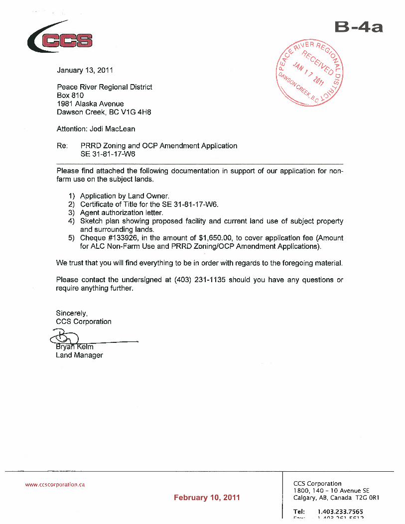
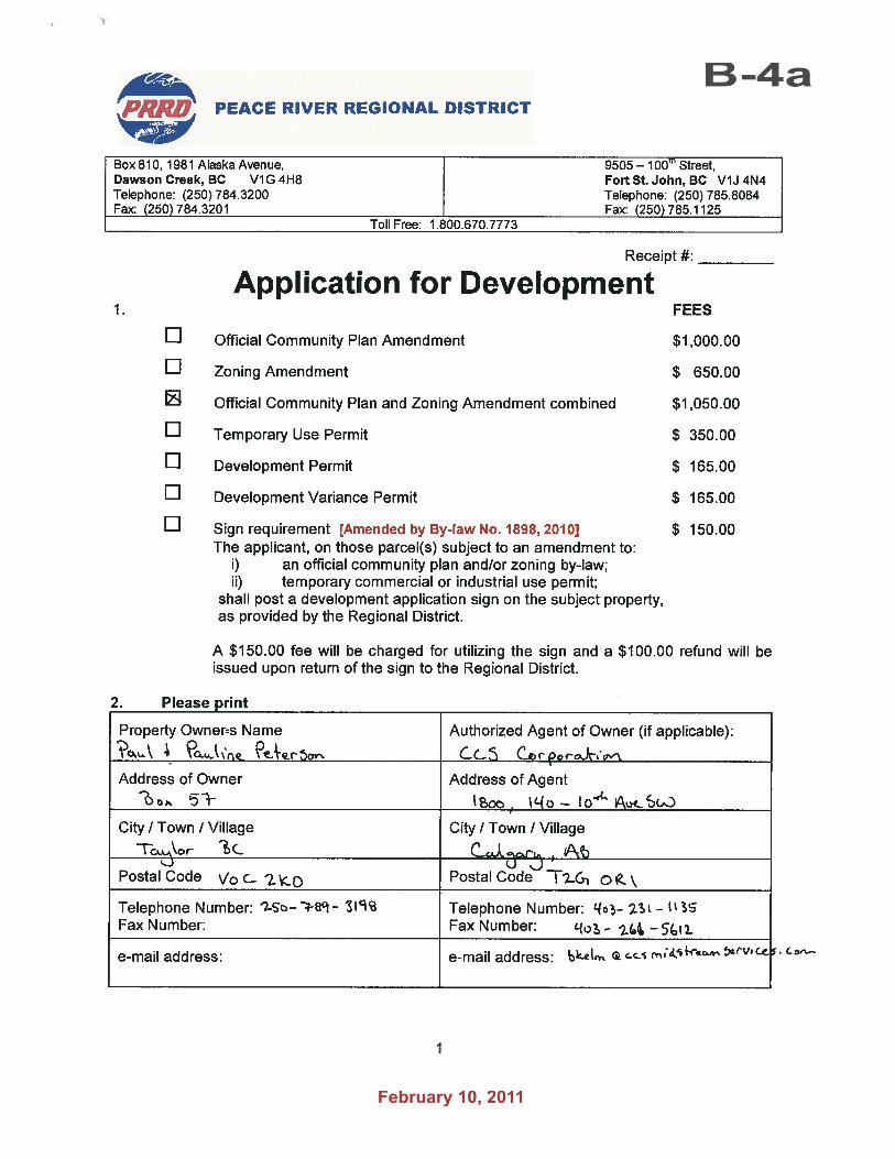
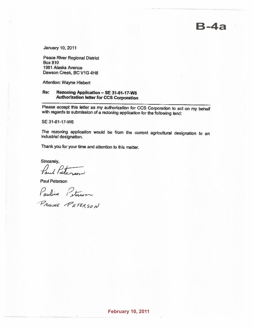
OWNER: Paul & Pauline Peterson DATE: January 26, 2011AGENT: CCS Corporation
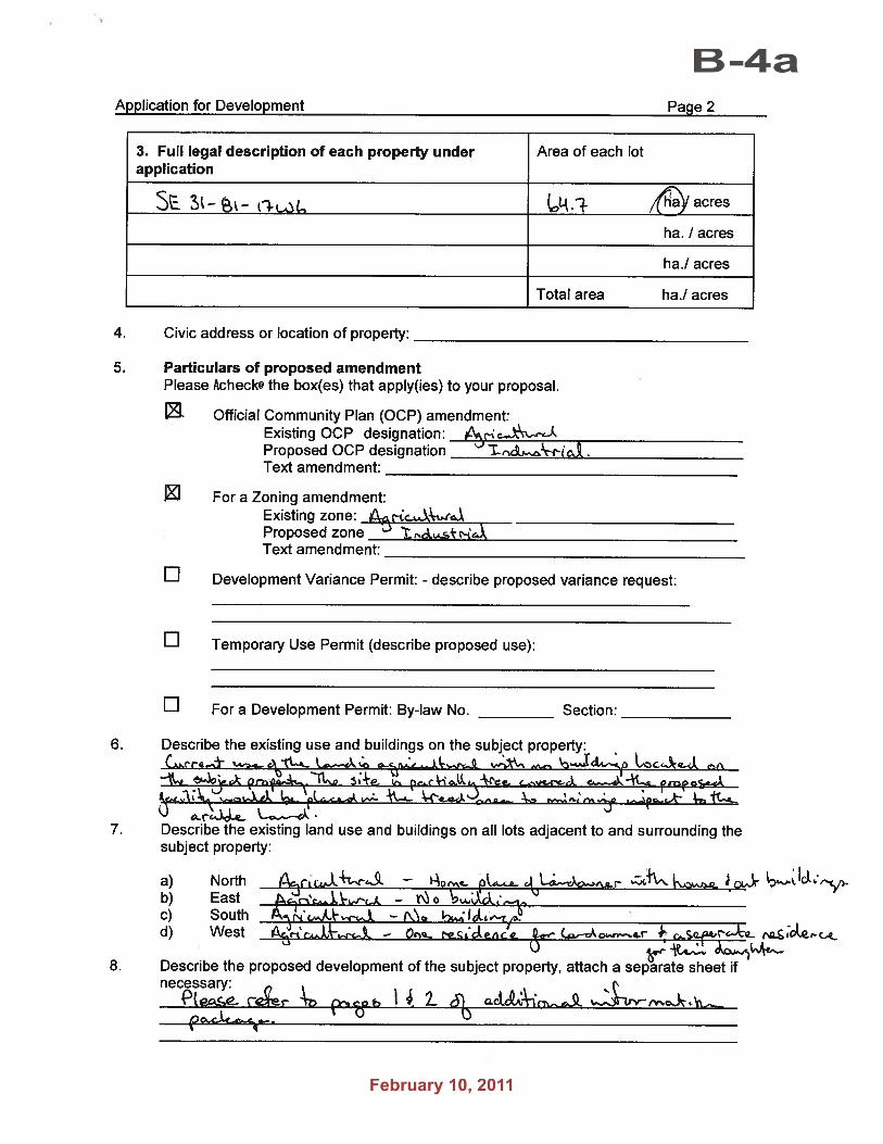
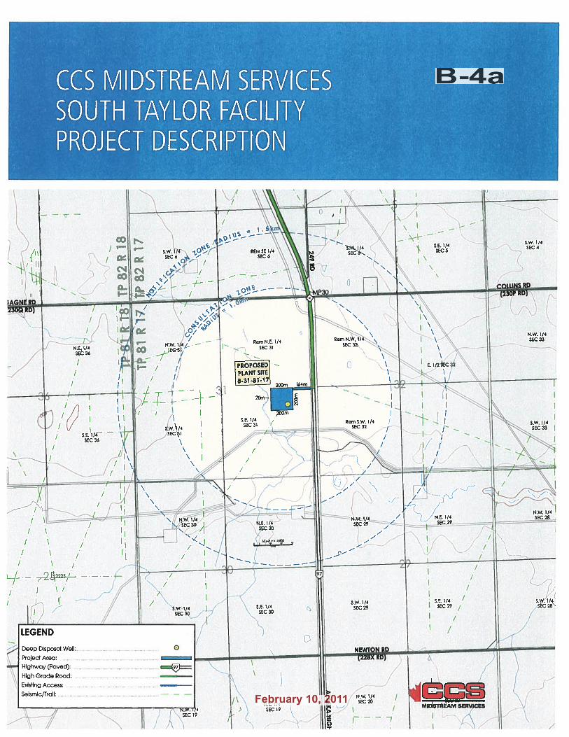
AREA: Electoral Area D LEGAL: SE¼ Section 31, Township 81, Range 17, W6M, PRD LOT SIZE: 65 ha (160 acres) LOCATION: South Taylor – Tower Lake
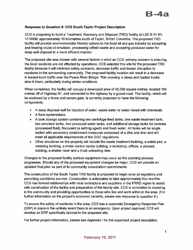
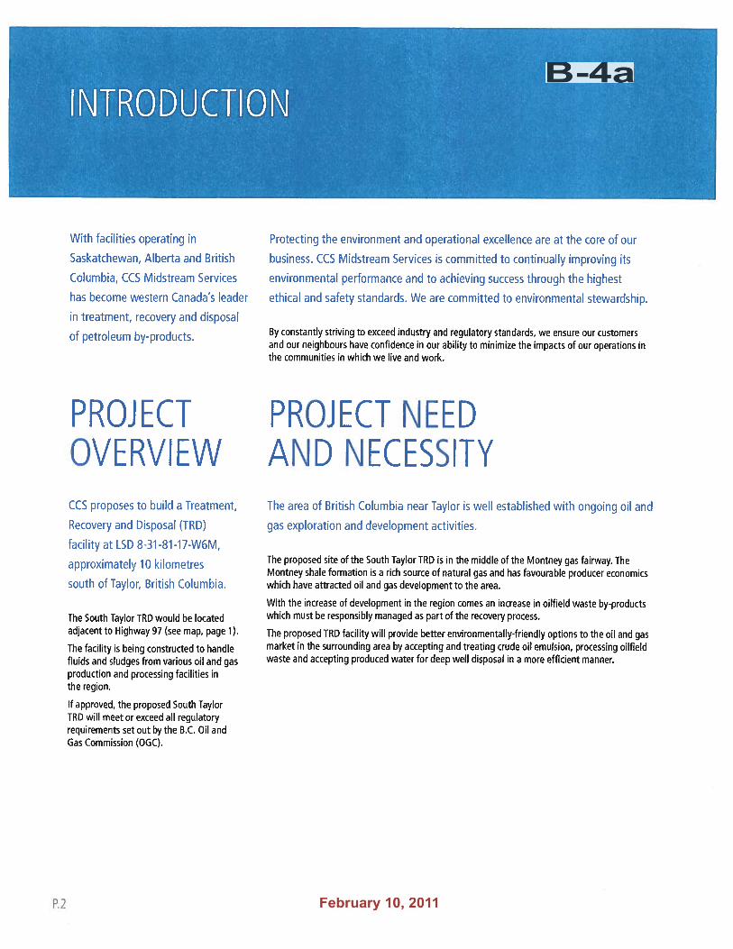
PROPOSAL To develop a “Treatment, Recovery and Disposal” facility, with a disposal well on site, to service upstream oilfield waste, including produced water.
RECOMMENDATION: OPTION 2 THAT the Regional Board approve Zoning Amendment By-law No. 1925, 2011 for First and Second Reading which adds an “M-4 (Oil/Gas Production Zone)” to the Dawson Creek Rural Area Zoning Bylaw No. 479, 1986 and rezones the Southeast ¼ of Section 31, Township 81, Range 17, W6M, PRD from A-2 (Large Agricultural Holdings) to M-4 (Oil/Gas Production Zone);
THAT a public hearing be scheduled for March 1, 2011 at 7:00 pm at the Taylor Community Hall in Taylor, BC;
THAT the radius for notification of the public hearing be extended to 1.5 km so that it includes those previously notified of the project under the Oil and Gas Activities Act; and
THAT the holding of the public hearing be delegated to Director Hiebert.
OPTIONS OPTION 1: THAT the Regional Board approve Zoning Amendment By-law No. 1925, 2011 for First and Second
Reading which adds an “M-4 (Oil/Gas Production Zone) to the Dawson Creek Rural Area Zoning Bylaw No. 479, 1986 and rezones the Southeast ¼ of Section 31, Township 81, Range 17, W6M, PRD from A-2 (Large Agricultural Holdings) to M-4 (Oil/Gas Production Zone);
THAT the holding of a public hearing be waived pursuant to s. 890(4) of the Local Government Act, and authorize performance of public notification pursuant to s. 893 of the Local Government Act.
OPTION 2: THAT the Regional Board approve Zoning Amendment By-law No. 1925, 2011 for First and Second Reading which adds an “M-4 (Oil/Gas Production Zone)” to the Dawson Creek Rural Area Zoning Bylaw No. 479, 1986 and rezones the Southeast ¼ of Section 31, Township 81, Range 17, W6M, PRD from A-2 (Large Agricultural Holdings) to M-4 (Oil/Gas Production Zone);
THAT a public hearing be scheduled for March 1, 2011 at 7:00 pm at the Taylor Community Hall in Taylor, BC;
THAT the radius for notification of the public hearing be extended to 1.5 km so that it includes those previously notified of the project under the Oil and Gas Activities Act; and
THAT the holding of the public hearing be delegated to Director Hiebert.
Part 26 Participants. Includes all except District
of Tumbler Ridge.
PL0001
BS_signature
AD0002
Sig 1
AD0005
B-4a
AD0005
Feb10
File No. 15/2011
Page 2 of 3
OPTION 3: THAT the Regional Board table the application pending the outcome of the associated ALR Non-Farm
Use application.
OPTION 4: THAT the Regional Board refuse the application.
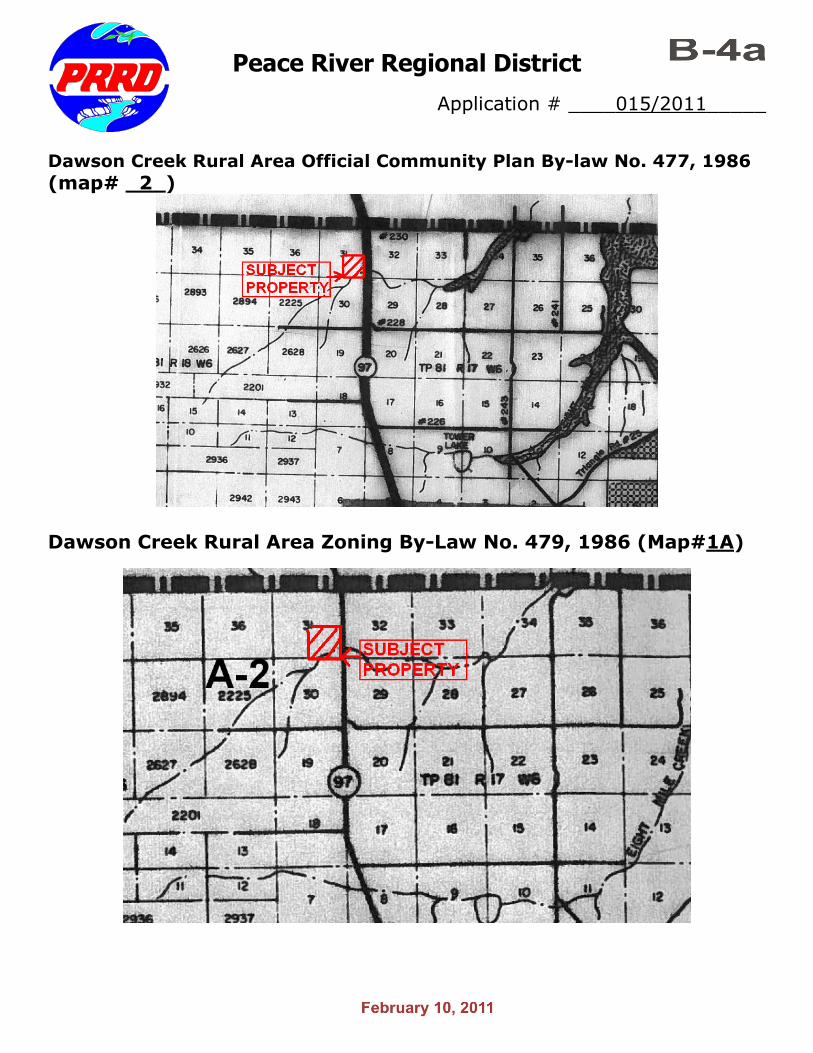
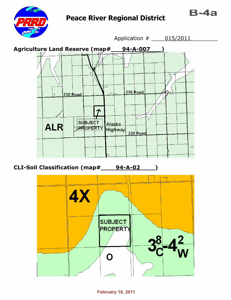
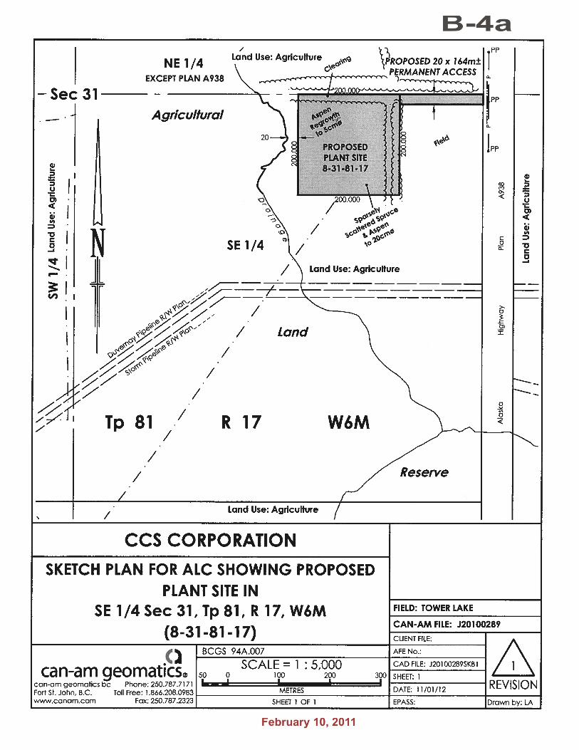
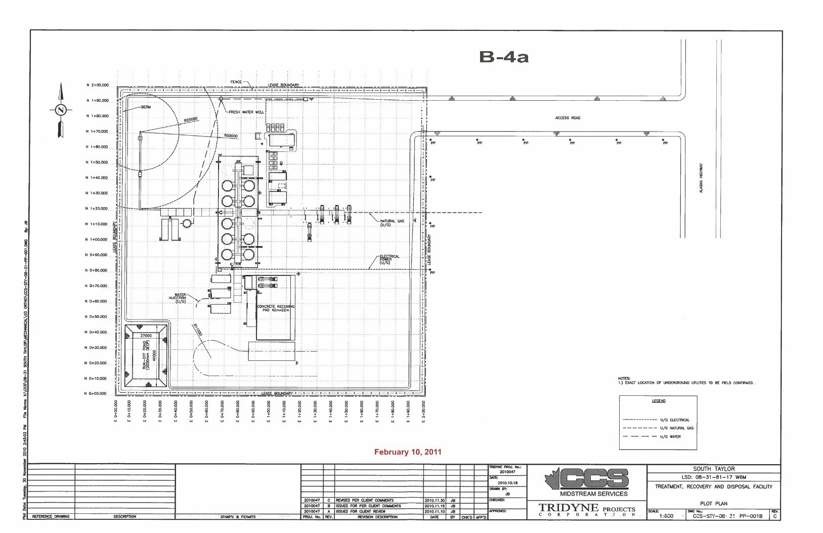
SITE CONTEXT The subject property is located south of the Taylor Hill, along the Alaska Highway (Hwy 97N). It is between South Taylor and Tower Lake; the nearest cross street is 230 Road. The general area is sparsely populated and has a mix of cleared fields and forested land. The area is dominated by quarter, half, and full section sized parcels, with several rural acreages located to the north. There are several wellsites to the south, near a ravine which drains eastwards into the Peace River.
SITE FEATURES LAND: Most of the quarter is forested, but there is a ~6 ha (14 acre) field on the eastern end. STRUCTURES: There are no structures on the subject property. ACCESS: The subject property only has road access off the Alaska Highway. CLI SOIL RATING:
Class 3 -4 ; Class 3 soils have moderately severe limitations that restrict the range of crops or require special conservation practices. Class 4 soils have severe limitations that restrict the range of crops or require special conservation practices. Subclass C denotes an area of adverse climate. Subclass W denotes an area with excess water. These soil classes are present in an 8:2 ratio. There is also an area of “organic soils” which are not placed in capability classes.
FIRE: The subject property is outside all rural fire protection areas.
COMMENTS AND OBSERVATIONS
APPLICANT: It is the intent of the applicants to use a 4 ha (10 acre) portion of the land (plus a 20 x 164 meter access road to Highway 97) for an oilfield waste treatment facility and disposal well.
ALR: The subject property is within the Agricultural Land Reserve and therefore requires the permission of the Agricultural Land Commission as a Non-Farm Use. The applicants have submitted the ALR application and it has been forwarded to the ALC.
OCP: Pursuant to the Dawson Creek Rural Area Official Community Plan Bylaw No. 477, 1986, the subject property is designated “Agriculture – Rural Resource”. This designation permits oil and gas installations. The proposal is consistent with the OCP.
ZONING: The subject property is zoned A-2 (Large Agricultural Holdings) pursuant to Dawson Creek Rural Area Zoning Bylaw No. 479, 1986. In order to permit the proposed use the zoning amendment will:
• Create a new zone titled “M-4 Oil/Gas Production Zone” in which ‘production facilities’ are permitted
• ‘Production facilities’ are defined as including “a battery, oil treater, pumping station, compressor station, dehydrator, gas injection station, line heater, waste processing facility, water disposal facility, water injection station, or upon designation of an authorized BC Oil and Gas Commission employee, any other system of vessels and equipment designated to accommodate production or disposal or both production and disposal of well effluent products and byproducts, but does not include a gas processing plant.”
• The 4 ha lease area on the subject property where the proposed use is proposed is rezoned to this new M-4 zone.
PRODUCTION FACILITIES:
The definition of ‘production facilities’ is derived from the Oil and Gas Handbook (Vol. 2) by the BC Ministry of Employment and Investment. This definition is consistent with other PRRD bylaws.
AD0005
B-4a
AD0005
Feb10
File No. 15/2011
Page 3 of 3
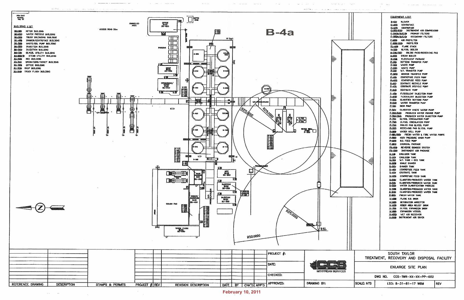
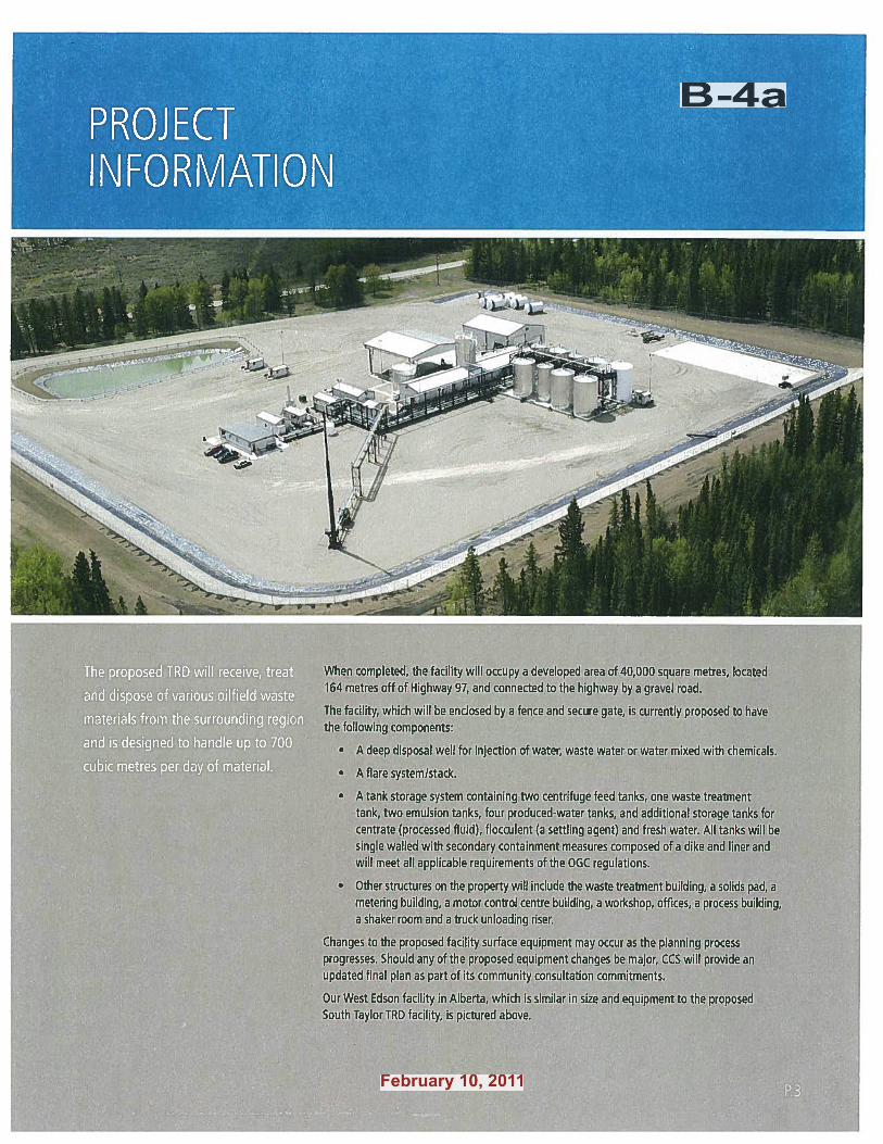
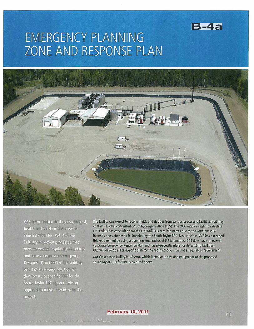
EQUIPMENT: The proposal involves using land for an office, work shop, injection well, flare stack, tank farm, risers, utility buildings, and solids processing building with a receiving pad and centrifuge.
ROAD NETWORK:
The applicant is working with the Ministry of Transportation and Infrastructure to construct a lighted intersection which could include acceleration/deceleration lanes and a turning lane.
FENCING + BUFFER:
CCS Corporation intends to fence the perimeter of lease area and retain existing trees as a buffer between the site and the highway.
LIGHTING + FLARING:
As the facility is intended to be manned 24 hours a day, CCS Corporation intends to provide lighting across the lease area. However, representatives of CCS Corporation have stated they are investigating the use of motion-sensors and other features on some fixtures to reduce light pollution. CCS Corporation intends to construct an intermittent (electronic igniter) flare stack on site with a shrouded hood.
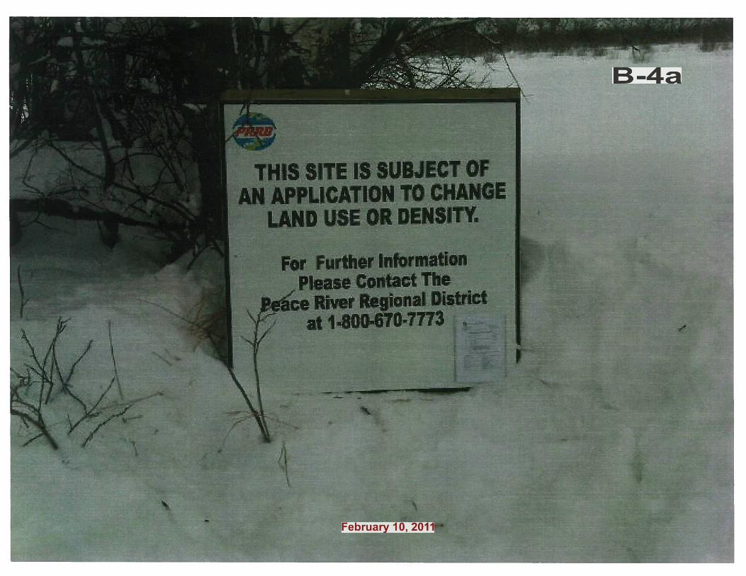
PUBLIC CONSULTATION:
The re-zoning process requires that the Regional District issue a public notification. There is an option to either advertise public notification of the proposed bylaw or to advertise a Public Hearing meeting that can be held at a time and place of the Board’s choosing. The advertisements must reach at least every landowner within 100 meters of the subject property and be published twice in a local newspaper. However, the limits to the notification parameters may be altered if more people or areas are deemed affected by the proposal.
The applicants have followed the Province’s new Oil and Gas Activities Act which requires consultation with landowners within 1 km of the proposed facility and notification of landowners within a 1.5 km radius (which encompasses ~14 unique landowners).
IMPACT ANALYSIS AGRICULTURE: During consultation with the Ministry of Agriculture’s Regional Agrologist during the ALR Non-
Farm Use application, she noted the following concerns: � loss of potentially productive agricultural land (Class 3 and 4 soils) � increased traffic, dust and airborne particulate matter within the surrounding area � increased potential for restricted access to adjacent fields � increased opportunity for conflict between farm and non-farm uses
Parkland Geotechnical Ltd. conducted a site assessment on the lease area and provided CCS Corporation with soil handling and soil monitoring recommendations, among other recommendations.
CONTEXT: The proposed facility is intended to serve upstream oil and gas companies (from drilling to production) who are active in the area. CCS Corporation operates a similar facility in Goodlow (between Fort St. John and the Alberta border), Secure Energy Services operates a similar facility in Rolla (north of Dawson Creek), and there are several other similar facilities in Alberta.
SETBACK: The closest homesite to this leased area belongs to the landowners, whose house is about 0.6 km (0.4 miles) to the north. The closest homesite that does not belong to the landowner is about 1 km (0.6 miles) to the northeast.
TRAFFIC: CCS Corporation proposes to have the lease area to have access from Highway 97. They are working with the Ministry of Transportation and Infrastructure to determine intersection specifications, which could include acceleration/deceleration lanes, a turning lane, and lighting. They expect about 30 trucks per day.
EMPLOYMENT: Representatives from CCS Corporation stated they expect the facility to be continuously manned with the majority of the activity expected between the hours of 7 am and 5 pm, and that it could employ, if successful, up to 15 people in the long term.
AD0005
B-4a
AD0005
Feb10
����������������� ���������
��������������� ���� �������
�
����������� ������������������� ��������������������������� !"�#��$%�&'&(�
��
����������� ������)����*����+��������� ��� !"�#,�$%��(�
AD0005
B-4a
AD0005
Feb10
����������������� ���������
��������������� ���� ����������
������������ �������������������������
����� ��������!����� ���������������"�����
AD0005
B-4a
AD0005
Feb10
AD0005
B-4a
AD0005
Feb10
PL0001
Text Box
application updated to zoning amendment only
AD0005
B-4a
AD0005
Feb10
AD0005
B-4a
AD0005
Feb10

AD0005
B-4a
AD0005
Feb10
AD0005
B-4a
AD0005
Feb10
AD0005
B-4a
AD0005
Feb10
AD0005
B-4a
AD0005
Feb10
AD0005
B-4a
AD0005
Feb10
AD0005
B-4a
AD0005
Feb10
AD0005
B-4a
AD0005
Feb10
AD0005
B-4a
AD0005
Feb10
AD0005
B-4a
AD0005
Feb10
AD0005
B-4a
AD0005
Feb10
AD0005
B-4a
AD0005
Feb10
AD0005
B-4a
AD0005
Feb10
AD0005
B-4a
AD0005
Feb10
AD0005
B-4a
AD0005
Feb10
AD0005
B-4a
AD0005
Feb10
AD0005
B-4a
AD0005
Feb10
AD0005
B-4a
AD0005
Feb10
AD0005
B-4a
AD0005
Feb10
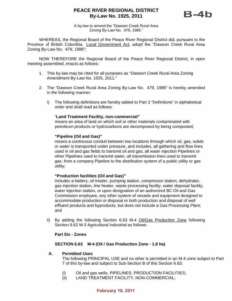
PEACE RIVER REGIONAL DISTRICT By-Law No. 1925, 2011
A by-law to amend the “Dawson Creek Rural Area
Zoning By-Law No. 479, 1986.” WHEREAS, the Regional Board of the Peace River Regional District did, pursuant to the Province of British Columbia Local Government Act, adopt the “Dawson Creek Rural Area Zoning By-Law No. 479, 1986"; NOW THEREFORE the Regional Board of the Peace River Regional District, in open meeting assembled, enacts as follows:
1. This by-law may be cited for all purposes as “Dawson Creek Rural Area Zoning Amendment By-Law No. 1925, 2011." 2. The “Dawson Creek Rural Area Zoning By-Law No. 479, 1986" is hereby amended
in the following manner:
i) The following definitions are hereby added to Part 3 “Definitions” in alphabetical order and shall read as follows:
“Land Treatment Facility, non-commercial” means an area of land on which soil or other materials contaminated with petroleum products or hydrocarbons are decomposed by being composted;
“Pipeline (Oil and Gas)” means a continuous conduit between two locations through which oil, gas, solids or water is transported under pressure, and includes, all gathering and flow lines used in oil and gas fields to transmit oil and gas, all water injection Pipelines or other Pipelines used to transmit water, all transmission lines used to transmit gas, from a company Pipeline to the distribution system of a public utility or gas utility;
“Production facilities (Oil and Gas)” includes a battery, oil treater, pumping station, compressor station, dehydrator, gas injection station, line heater, waste processing facility, water disposal facility, water injection station, or upon designation of an authorized BC Oil and Gas Commission employee, any other system of vessels and equipment designed to accommodate production or disposal or both production and disposal of well effluent products and byproducts, but does not include a Gas Processing Plant; and ii) By adding the following Section 6.63 M-4 Oil/Gas Production Zone following
Section 6.62 M-3 Agricultural Industrial as follows: Part Six - Zones SECTION 6.63 M-4 (Oil / Gas Production Zone - 1.8 ha)
A. Permitted Uses The following PRINCIPAL USE and no other is permitted in an M-4 zone subject to Part 7 of this by-law and subject to Sub-Section B of this Section 6.63;
(i) Oil and gas wells, PIPELINES, PRODUCTION FACILITIES; (ii) LAND TREATMENT FACILITY, NON-COMMERCIAL;
AD0005
Feb10
AD0005
B-4b

Peace River Regional District By-law No. 1925, 2011
The following ACCESSORY uses and no others are permitted in an M-4 zone, subject to Part 7 of this by-law and Sub-Section B of this Section 6.63:
(iii) ACCESSORY buildings and ACCESSORY structure.
B. Regulations Minimum Parcel Size
(i) The minimum parcel size is 1.8 hectares (4.5 acres).
Setbacks (ii) Except as otherwise permitted in this by-law, no building or structure shall
be located within: (a) 7 metres (23 ft) of a FRONT PARCEL LINE; (b) 7 metres (23 ft) of an INTERIOR SIDE PARCEL LINE; (c) 5 metres (17 ft) of an EXTERIOR SIDE PARCEL LINE; or (d) 7 metres (23 ft) of a REAR PARCEL LINE.
iii) Map No. 1-A - Schedule 'A’ is hereby amended by rezoning a 4.0 ha. (10 acre) portion of the Southeast ¼, Section 31, Township 81, Range 17, W6M, PRD, from A-2 “Large Agricultural Holding Zone” to M-4 “Oil / Gas Production Zone”; as shown shaded grey on Schedule “A” which is attached to and forms part of this by-law.
READ A FIRST TIME this day of , 2011. READ A SECOND TIME this day of , 2011. Public Notification held on the day of , 2011. READ FOR A THIRD TIME this day of , 2011. APPROVED by the Ministry of Transportation this ____ day of __________, 2011.
District Highways Manager ADOPTED this day of , 2011. CERTIFIED a true and correct copy of "Dawson Creek Rural Area Zoning Amendment By-law No. 1925, 2011." Fred Banham Chief Administrative Officer
THE CORPORATE SEAL of the Peace River Regional District was hereto affixed in the presence of: Karen Goodings, Chair Fred Banham Chief Administrative Officer
I HEREBY CERTIFY the foregoing to be a true and correct copy of "Dawson Creek Rural Area Zoning Amendment By-law No. 1925, 2011" as read a third time by the Regional Board of the Peace River Regional District on this day of , 2011. Dated at Dawson Creek, B.C. this day of , 2011. ______________________________________ Fred Banham, Chief Administrative Officer
AD0005
Feb10
AD0005
B-4b
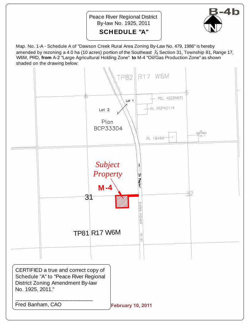
31
TP81 R17 W6M
SubjectProperty
M-4
Peace River Regional DistrictBy-law No. 1925, 2011
SCHEDULE "A"
CERTIFIED a true and correct copy ofSchedule "A" to "Peace River RegionalDistrict Zoning Amendment By-lawNo. 1925, 2011."
_____________________________Fred Banham, CAO
Map. No. 1-A - Schedule A of "Dawson Creek Rural Area Zoning By-Law No. 479, 1986" is herebyamended by rezoning a 4.0 ha (10 acres) portion of the Southeast 1
4 Section 31, Township 81, Range 17,W6M, PRD, from A-2 "Large Agricultural Holding Zone" to M-4 "Oil/Gas Production Zone" as shownshaded on the drawing below:
AD0005
Feb10
AD0005
B-4b


