NOAA Fleet Update - NOAA's Office of Legislative Affairs · NOAA Fleet Update February 2016 ......
24
NOAA Fleet Update February 2016 The following update provides the status of NOAA’s fleet of ships and aircraft, which play a critical role in the collection of oceanographic, atmospheric, hydrographic, and fisheries data. NOAA’s current fleet of 16 ships – the largest civilian research and survey fleet in the world – and nine aircraft, are operated, managed, and maintained by NOAA’s Office of Marine and Aviation Operations (OMAO). OMAO includes civilians, mariners, and officers of the United States NOAA Commissioned Officer Corps (NOAA Corps), one of the nation’s seven Uniformed Services. Find us on Facebook for the latest news and activities.
-
Upload
truongcong -
Category
Documents
-
view
217 -
download
0
Transcript of NOAA Fleet Update - NOAA's Office of Legislative Affairs · NOAA Fleet Update February 2016 ......
NOAA Fleet Update
February 2016
The following update provides the status of NOAA’s fleet of ships and aircraft, which play a critical role in the collection of
oceanographic, atmospheric, hydrographic, and fisheries data. NOAA’s current fleet of 16 ships – the largest civilian
research and survey fleet in the world – and nine aircraft, are operated, managed, and maintained by NOAA’s Office of
Marine and Aviation Operations (OMAO). OMAO includes civilians, mariners, and officers of the United States NOAA
Commissioned Officer Corps (NOAA Corps), one of the nation’s seven Uniformed Services.
Find us on Facebook for the latest news and activities.
Page | 2
Table of Contents Please click on the Table of Contents entry below to be taken directly to a specific ship, center, aircraft, asset, program, or
information. The fleet is listed based on the geographical location of their homeport/base starting in the Northeast and
ending in the Pacific.
Office of Marine and Aviation Operations (OMAO) and the NOAA Commissioned Officer Corps – In the News
...................................................................................................................................................................... 4
OMAO’s Ships and Centers ....................................................................................................................... 6
New Castle, NH ............................................................................................................................................ 6
NOAA Ship Ferdinand R. Hassler ................................................................................................................. 6
Woods Hole, MA (currently docks in Newport, RI) .................................................................................. 7
NOAA Ship Henry B. Bigelow ....................................................................................................................... 7
Davisville, RI ................................................................................................................................................ 7
NOAA Ship Okeanos Explorer ...................................................................................................................... 7
Norfolk, VA ................................................................................................................................................... 8
NOAA Ship Thomas Jefferson ...................................................................................................................... 8
OMAO’S MARINE OPERATIONS CENTER – ATLANTIC (MOC-A) ........................................................... 8
Charleston, SC............................................................................................................................................. 8
NOAA Ship Nancy Foster ............................................................................................................................. 8
NOAA Ship Ronald H. Brown........................................................................................................................ 9
Pascagoula, MS ........................................................................................................................................... 9
NOAA Ship Oregon II .................................................................................................................................... 9
NOAA Ship Pisces ........................................................................................................................................ 9
NOAA Ship Gordon Gunter ......................................................................................................................... 10
San Diego, CA............................................................................................................................................ 10
NOAA Ship Reuben Lasker ........................................................................................................................ 10
Newport, OR............................................................................................................................................... 10
NOAA Ship Rainier ..................................................................................................................................... 10
NOAA Ship Bell M. Shimada ....................................................................................................................... 10
OMAO’S MARINE OPERATIONS .............................................................................................................. 10
OMAO’S MARINE OPERATIONS CENTER – PACIFIC (MOC-P) ............................................................. 11
Ketchikan, AK ............................................................................................................................................ 11
NOAA Ship Fairweather .............................................................................................................................. 11
Kodiak, AK ................................................................................................................................................. 11
NOAA Ship Oscar Dyson ............................................................................................................................ 11
Honolulu, HI ............................................................................................................................................... 12
NOAA Ship Hi’ialakai .................................................................................................................................. 12
NOAA Ship Oscar Elton Sette..................................................................................................................... 12
OMAO’S MARINE OPERATIONS CENTER – PACIFIC ISLANDS (MOC-PI) ........................................... 12

Page | 3
OMAO’s Aircraft ........................................................................................................................................ 13
Tampa, Florida ........................................................................................................................................... 13
WP-3D (N42RF) – “Hurricane Hunter” ........................................................................................................ 13
WP-3D (N43RF) – “Hurricane Hunter” ........................................................................................................ 13
Gulfstream IV (N49RF) ............................................................................................................................... 13
Jet Prop Commander (N45RF) ................................................................................................................... 13
Twin Otter (N46RF) ..................................................................................................................................... 14
Twin Otter (N48RF) ..................................................................................................................................... 14
Twin Otter (N56RF) ..................................................................................................................................... 14
Twin Otter (N57RF) ..................................................................................................................................... 14
King Air (N68RF) ......................................................................................................................................... 14
OMAO’S AIRCRAFT OPERATIONS CENTER (AOC) ............................................................................... 15
Unmanned Systems Support ................................................................................................................... 16
NASA Global Hawk ................................................................................................................................... 16
APH-22 Hexacopter ................................................................................................................................... 16
Puma UAS .................................................................................................................................................. 16
OMAO Partnerships .................................................................................................................................. 17
United States Senate Committee on Commerce, Science, and Transportation ................................. 17
National Science Foundation ................................................................................................................... 17
Department of Defense - U.S. Pacific Command (USPACOM) ............................................................. 17
Department of Defense - U.S. Northern Command (USNORTHCOM) .................................................. 17
Department of Defense - U.S. Navy ......................................................................................................... 17
Department of Homeland Security - U.S. Coast Guard ......................................................................... 18
Consortium for Ocean Leadership .......................................................................................................... 18
Teacher At Sea Program .......................................................................................................................... 19
OMAO - NOAA Dive Program ................................................................................................................... 20
OMAO Small Boat Program ...................................................................................................................... 21
Office of Marine and Aviation Operations .............................................................................................. 22
NOAA Commissioned Officer Corps ....................................................................................................... 24
Page | 4
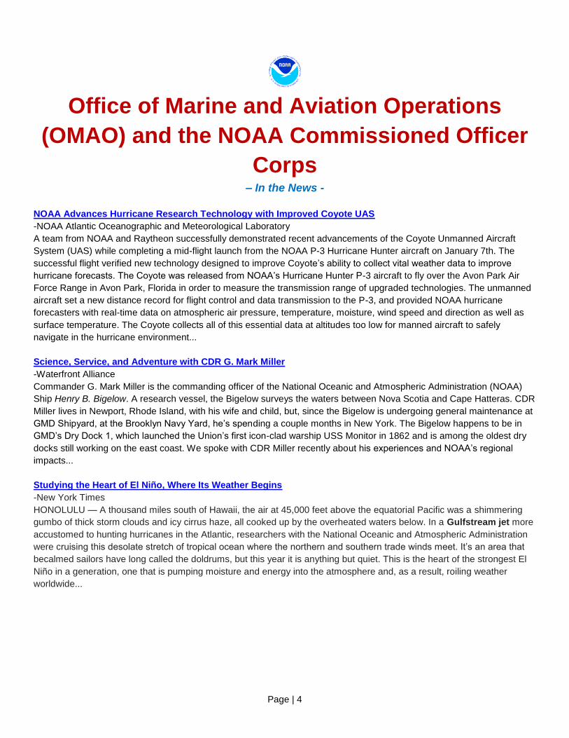
Office of Marine and Aviation Operations
(OMAO) and the NOAA Commissioned Officer
Corps – In the News -
NOAA Advances Hurricane Research Technology with Improved Coyote UAS
-NOAA Atlantic Oceanographic and Meteorological Laboratory
A team from NOAA and Raytheon successfully demonstrated recent advancements of the Coyote Unmanned Aircraft
System (UAS) while completing a mid-flight launch from the NOAA P-3 Hurricane Hunter aircraft on January 7th. The
successful flight verified new technology designed to improve Coyote’s ability to collect vital weather data to improve
hurricane forecasts. The Coyote was released from NOAA’s Hurricane Hunter P-3 aircraft to fly over the Avon Park Air
Force Range in Avon Park, Florida in order to measure the transmission range of upgraded technologies. The unmanned
aircraft set a new distance record for flight control and data transmission to the P-3, and provided NOAA hurricane
forecasters with real-time data on atmospheric air pressure, temperature, moisture, wind speed and direction as well as
surface temperature. The Coyote collects all of this essential data at altitudes too low for manned aircraft to safely
navigate in the hurricane environment...
Science, Service, and Adventure with CDR G. Mark Miller
-Waterfront Alliance
Commander G. Mark Miller is the commanding officer of the National Oceanic and Atmospheric Administration (NOAA)
Ship Henry B. Bigelow. A research vessel, the Bigelow surveys the waters between Nova Scotia and Cape Hatteras. CDR
Miller lives in Newport, Rhode Island, with his wife and child, but, since the Bigelow is undergoing general maintenance at
GMD Shipyard, at the Brooklyn Navy Yard, he’s spending a couple months in New York. The Bigelow happens to be in
GMD’s Dry Dock 1, which launched the Union’s first icon-clad warship USS Monitor in 1862 and is among the oldest dry
docks still working on the east coast. We spoke with CDR Miller recently about his experiences and NOAA’s regional
impacts...
Studying the Heart of El Niño, Where Its Weather Begins
-New York Times
HONOLULU — A thousand miles south of Hawaii, the air at 45,000 feet above the equatorial Pacific was a shimmering
gumbo of thick storm clouds and icy cirrus haze, all cooked up by the overheated waters below. In a Gulfstream jet more
accustomed to hunting hurricanes in the Atlantic, researchers with the National Oceanic and Atmospheric Administration
were cruising this desolate stretch of tropical ocean where the northern and southern trade winds meet. It’s an area that
becalmed sailors have long called the doldrums, but this year it is anything but quiet. This is the heart of the strongest El
Niño in a generation, one that is pumping moisture and energy into the atmosphere and, as a result, roiling weather
worldwide...
Page | 5
Monster El Niño probed by meteorologists; Unprecedented Pacific Ocean campaign aims to improve forecasts
for strong storms
-Nature
Climate scientists this week began a research blitz to study El Niño, the climate trouble-maker that disrupts weather
around much of the globe. For the next two months, US researchers will use specially outfitted planes, a research ship
and hundreds of weather balloons to monitor the region in the tropical Pacific Ocean where El Niño forms. Ultimately, the
scientists say, their measurements could help to improve weather forecasts and unlock secrets about how powerful El
Niño events evolve...To begin the campaign, NOAA sent its Gulfstream-IV research jet to Hawaii, its base for about 20
flights south towards the Equator. Using onboard remote-sensing equipment and dropsondes — packages of instruments
released from the plane — the team will measure winds, temperature, air pressure and moisture from a height of 12–14
kilometers down to the ocean surface...In February, NASA’s unmanned Global Hawk aircraft will join the effort, prowling
the eastern part of the Pacific in 4 flights lasting up to 24 hours each. At the same time, NOAA will launch instrument
packages on weather balloons from Kiritimati, or Christmas Island, an atoll near the Equator in the heart of the region in
which El Niño forms. And researchers will also release balloon-borne instruments from the NOAA Ship Ronald H.
Brown as it conducts a previously planned cruise in the central Pacific...
NOAA Gins Up Major El Niño Field Campaign: Hurricane Pali Spins Southwest of Hawaii
-Weather Underground
Scientists at NOAA will be putting the well-predicted “super” El Niño of 2015-16 under a mammoth microscope over the
next three months. With just enough time to line up some big observing platforms--plus a lot of other things going right--
NOAA/ESRL’s Physical Sciences Division (PSD) has managed to pull together a major field effort that will analyze the
mechanics of this El Niño in truly unprecedented detail...The first platform for the project is NOAA’s Gulfstream-
IV hurricane-hunter aircraft. The high-flying Gulfstream-IV is typically used to monitor the atmosphere around hurricanes,
so it’s an ideal tool for sampling how the El Niño convection is affecting the surrounding air at high altitudes...Another
platform—the NOAA Ship Ronald H. Brown research vessel is part of the project thanks to another happy coincidence.
The Ron Brown was already scheduled to be plying the eastern tropical Pacific from mid-February to mid-March to carry
out maintenance on the dozens of buoys that monitor the atmosphere and ocean across the region (among other things,
helping to detect El Niño itself)...
Page | 6
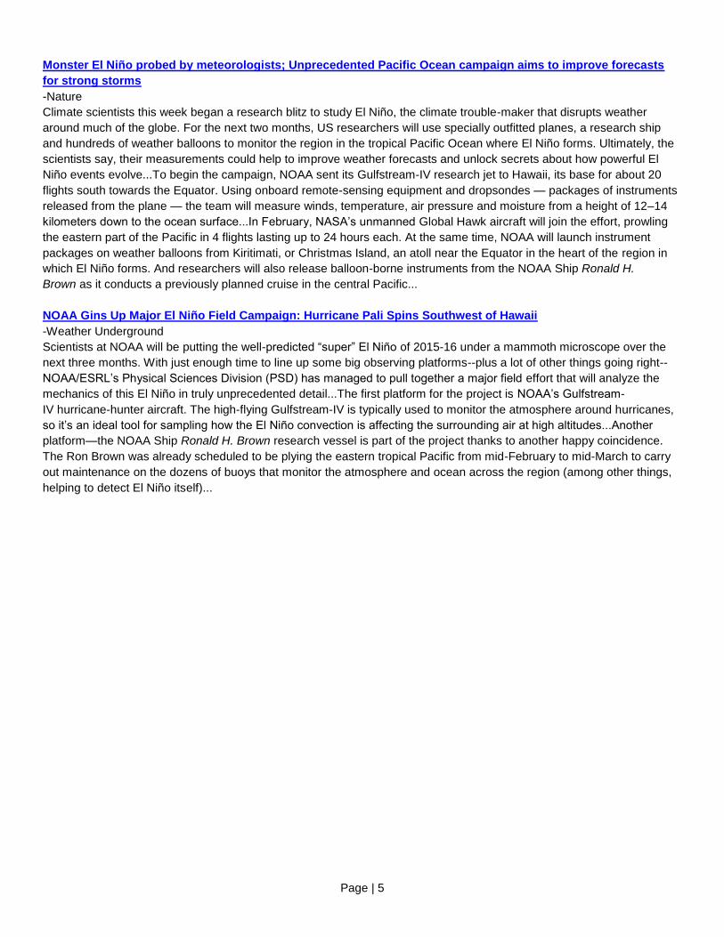
OMAO’s Ships and Centers
OMAO’s Ship Tracker (screen shot below) shows information about the location - present and past - of our fleet of
research and survey ships. Please note: To access Ship Tracker you must create an account with a .gov or .mil email
address. All other access is restricted.
OMAO’s ships and related Marine Centers are listed below based on the geographical location of the vessels’ homeports
starting in the Northeast and ending in the Pacific.
New Castle, NH NOAA Ship Ferdinand R. Hassler
Commanding Officer: LCDR Briana Welton
Primary Mission Category: Hydrographic Surveys
DEPART: Norfolk, Virginia ARRIVE: Norfolk, Virginia
Project: Approaches Chesapeake Bay
Objectives: To support safe navigation through the acquisition and processing of hydrographic survey data for updating
nautical charts and by the identification and dissemination of dangers to navigation, as identified during the course of
survey operations.

Page | 7
NOAA Ship Ferdinand Hassler docked, with United States Coast Guard Barque Eagle in the background.
[Photo: Cheryl Oliver, NOAA]
Woods Hole, MA (currently docks in Newport, RI) NOAA Ship Henry B. Bigelow
Commanding Officer: CDR G. Mark Miller
Primary Mission Category: Fisheries Research
Ship Status: In drydock at GMD Shipyard Corp., Brooklyn, NY, for a scheduled repair period. After repairs, sea trials will
be conducted to measure the vessel’s performance and general seaworthiness, as well as for the calibration of all ship
systems.
Davisville, RI NOAA Ship Okeanos Explorer
Commanding Officer: CDR Mark Wetzler
Primary Mission Category: Oceanographic Exploration and Research
Depart: Alameda, Calif. Arrive: Honolulu, Hawaii
Depart: Honolulu, Hawaii Arrive: Kwajalein, Republic of the Marshall Islands
Project 1: Transit from Shipyard Alameda, Calif. to Honolulu, Hawaii conducting mission tests and calibrating new
mission sonars, equipment, data management infrastructure, and telepresence capabilities, ensuring readiness for the
field season.
Project 2: CAPSTONE
Objectives: CAPSTONE is a three year initiative to collect critical baseline NOAA science and management needs in
largely unknown areas of U.S. waters in the Pacific. Operations conducted during this campaign support NOAA missions
to understand and predict changes in climate, weather, oceans and coasts, and share that knowledge and information
with others. Much of this work associated with CAPSTONE will contribute to and complement Deep Sea Coral Research
and Technology Program’s three-year Pacific Islands Regional Initiative.
Page | 8
Norfolk, VA NOAA Ship Thomas Jefferson
Commanding Officer: CAPT Shepard Smith
Primary Mission Category: Hydrographic Surveys
Ship Status: Alongside NOAA Marine Operations Center - Atlantic, Norfolk, VA, for scheduled maintenance, winter
repairs, scientific data processing, crew rest, and training.
OMAO’S MARINE OPERATIONS CENTER – ATLANTIC (MOC-A)
CAPT Anne Lynch, Commanding Officer MOC-A
MOC-A serves as a homeport for one NOAA ship, and manages the day-to-day operations and provides administrative,
engineering, maintenance, and logistical support for the research and survey ships in NOAA's Atlantic fleet. Each year
these ships conduct dozens of missions to assess fish and marine mammal stocks, conduct coral reef research, collect
seafloor data to update nautical charts, and explore the ocean.
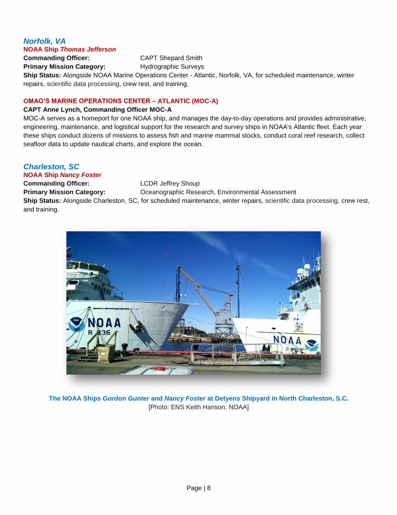
Charleston, SC NOAA Ship Nancy Foster
Commanding Officer: LCDR Jeffrey Shoup
Primary Mission Category: Oceanographic Research, Environmental Assessment
Ship Status: Alongside Charleston, SC, for scheduled maintenance, winter repairs, scientific data processing, crew rest,
and training.
The NOAA Ships Gordon Gunter and Nancy Foster at Detyens Shipyard in North Charleston, S.C.
[Photo: ENS Keith Hanson, NOAA]
Page | 9
NOAA Ship Ronald H. Brown
Commanding Officer: CAPT Robert Kamphaus
Primary Mission Category: Oceanographic Research, Environmental Assessment
DEPART: Honolulu, Hawaii ARRIVE: Honolulu, Hawaii
DEPART: Honolulu, Hawaii ARRIVE: San Diego, California
Project 1: Palmyra Mapping
Objectives: Extended Continental Shelf (ECS) mapping surveys are a key component in developing a U.S. ECS claim,
pursuant to Article 76 of the United Nations Convention on the Law of the Sea (UNCLOS). In addition to considerable
scientific analysis, these surveys will require bathymetry to take place in depths of 1000-5000m. Broadly, the ECS Project
mission is to define and establish limits of the U.S. ECS in concrete geographic terms to provide the specificity and
certainty necessary to protect and use these resources.
Project 2: TAO Maintenance (125°W and 140°W)
Objectives: Maintenance of the TAO moored ocean buoy array along the 125°W and 140°W meridians. The TAO buoy
array is critical to providing real-time data for improved detection, understanding and prediction of El Nino and La Nina
events.
Pascagoula, MS NOAA Ship Oregon II
Commanding Officer: Master Dave Nelson
Primary Mission Category: Fisheries Research
Ship Status: Alongside Pascagoula, MS, for scheduled maintenance, winter repairs, scientific data processing, crew rest,
and training.
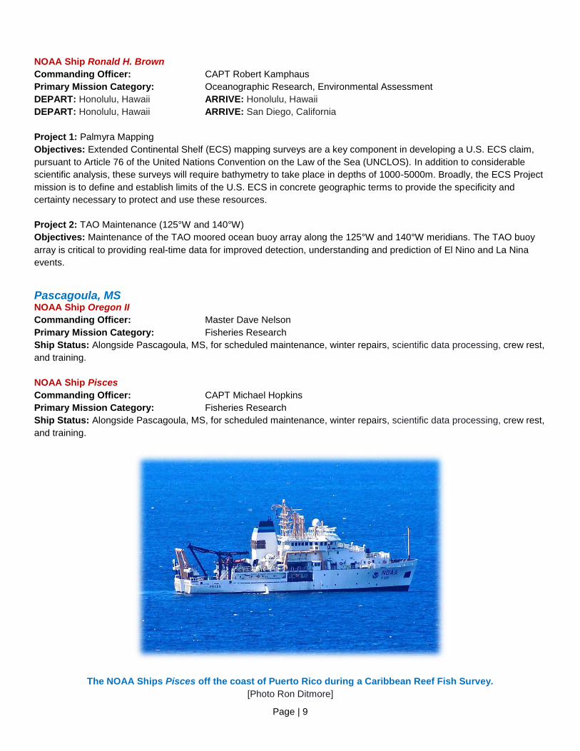
NOAA Ship Pisces
Commanding Officer: CAPT Michael Hopkins
Primary Mission Category: Fisheries Research
Ship Status: Alongside Pascagoula, MS, for scheduled maintenance, winter repairs, scientific data processing, crew rest,
and training.
The NOAA Ships Pisces off the coast of Puerto Rico during a Caribbean Reef Fish Survey.
[Photo Ron Ditmore]
Page | 10
NOAA Ship Gordon Gunter
Commanding Officer: Master Donn Pratt
Primary Mission Category: Fisheries Research
Ship Status: In drydock at Detyens Shipyards Inc. in Charleston, SC, for a scheduled repair period. After repairs, sea
trials will be conducted to measure the vessel’s performance and general seaworthiness, as well as for the calibration of
all ship systems.
San Diego, CA NOAA Ship Reuben Lasker
Commanding Officer: CDR John Crofts
Primary Mission Category: Fisheries Research
Ship Status: Alongside San Diego, CA, for scheduled maintenance, repairs, scientific data processing, crew rest, and
training.
Newport, OR NOAA Ship Rainier
Commanding Officer: CDR E.J. Van Den Ameele
Primary Mission Category: Hydrographic Surveys
Ship Status: Alongside Newport, OR, for scheduled maintenance, winter repairs, scientific data processing, crew rest,
and training and will be transiting to drydock in San Francisco, CA.
NOAA Ship Bell M. Shimada
Commanding Officer: CDR Paul Kunicki
Primary Mission Category: Fisheries Research
DEPART: San Francisco, California ARRIVE: Newport, Oregon
DEPART: Newport, Oregon ARRIVE: Newport, Oregon
DEPART: Newport, Oregon ARRIVE: Newport, Oregon
Project 1: Pacific Hake Spawning Biomass
Objectives: To estimate the biomass, distribution, and biological composition of Pacific hake populations using data from
an integrated acoustic and trawl survey off the west coast of the U.S. and Canada.
Project 2: Northern California Current Ecosystem Survey
Objectives: Make hydrographic measurements such as conductivity, temperature, and depth (CTD), collect water
samples for chemical analyses with a Niskin bottle rosette, and collect zooplankton samples with towed plankton nets at
an array of stations along transect lines extending across the Oregon, Washington, and northern California coast.
Project 3: Southern Resident Killer Whale Critical Habitat Assessment
Objectives: Conduct acoustic and visual surveys of marine mammals and seabirds along the Oregon, Washington,
California, and Canadian coasts in order to determine Critical Habitat in the coastal portion of the range of Southern
Resident killer whales. The collection of predation, fecal, and biopsy samples will be of significant additional value.
Secondary objectives include locating and documenting other cetacean species, in particular the collection of photographs
and audio recordings of other killer whale pods, as well as sea bird counts and oceanographic data.
OMAO’S MARINE OPERATIONS
CAPT Todd Bridgeman, Director of Marine Operations
OMAO’s Marine Operations over-sees operations of the three regional Centers, including the Marine Operations Center-
Pacific, Marine Operations Center-Atlantic, and Marine Operations Center-Pacific Islands.
Page | 11
OMAO’S MARINE OPERATIONS CENTER – PACIFIC (MOC-P)
CDR Brian Parker, Commanding Officer MOC-P
MOC-P serves as a homeport for two NOAA ships, and manages the day-to-day operations and provides administrative,
engineering, maintenance, and logistical support for the research and survey ships in NOAA's Pacific fleet. Each year
these ships conduct dozens of missions to assess fish and marine mammal stocks, conduct coral reef research, collect
seafloor data to update nautical charts, and explore the ocean.
Ketchikan, AK NOAA Ship Fairweather
Commanding Officer: CDR David Zezula
Primary Mission Category: Hydrographic Surveys
Ship Status: Alongside Seattle, WA, for scheduled maintenance, winter repairs, scientific data processing, crew rest, and
training.
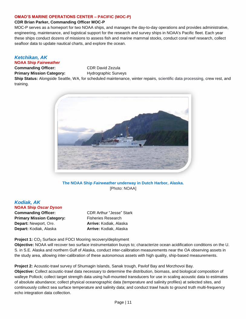
The NOAA Ship Fairweather underway in Dutch Harbor, Alaska.
[Photo: NOAA]
Kodiak, AK NOAA Ship Oscar Dyson
Commanding Officer: CDR Arthur “Jesse” Stark
Primary Mission Category: Fisheries Research
Depart: Newport, Ore. Arrive: Kodiak, Alaska
Depart: Kodiak, Alaska Arrive: Kodiak, Alaska
Project 1: CO2 Surface and FOCI Mooring recovery/deployment
Objective: NOAA will recover two surface instrumentation buoys to; characterize ocean acidification conditions on the U.
S. in S.E. Alaska and northern Gulf of Alaska, conduct inter-calibration measurements near the OA observing assets in
the study area, allowing inter-calibration of these autonomous assets with high quality, ship-based measurements.
Project 2: Acoustic-trawl survey of Shumagin Islands, Sanak trough, Pavlof Bay and Morzhovoi Bay.
Objective: Collect acoustic-trawl data necessary to determine the distribution, biomass, and biological composition of
walleye Pollock; collect target strength data using hull-mounted transducers for use in scaling acoustic data to estimates
of absolute abundance; collect physical oceanographic data (temperature and salinity profiles) at selected sites, and
continuously collect sea surface temperature and salinity data; and conduct trawl hauls to ground truth multi-frequency
echo integration data collection.
Page | 12
Honolulu, HI NOAA Ship Hi’ialakai
Commanding Officer: CDR Daniel Simon
Primary Mission Category: Oceanographic Research, Environmental Assessment
Ship Status: Alongside Honolulu, HI, for scheduled maintenance, winter repairs, scientific data processing, crew rest, and
training.
NOAA Ship Oscar Elton Sette
Commanding Officer: LCDR Keith Golden
Primary Mission Category: Fisheries Research
DEPART: San Francisco, California ARRIVE: Honolulu, Hawaii
DEPART: Honolulu, Hawaii ARRIVE: Pago Pago, American Samoa
Project 1: Transit from Mare Island Shipyard in San Francisco to Honolulu and sea trials will be conducted to measure
the vessel’s performance and general seaworthiness, as well as for the calibration of all ship systems.
Project 2: Samoan Archipelago Fisheries Life History
Objectives: Support deep-slope and shallow-water bottom fish, coastal pelagic fishes, and coral reef fishes bio sampling,
collection of larval and juvenile stage pelagic and bottom fish species, surveys of coral reef ecosystems, and exploration
of seamount benthic species, through 1) collection of adult deep-slope bottom fish, coral reef fish, and coastal pelagic
fishes, 2) collection of pelagic stage (larvae and juveniles) eteline snappers and tuna, 3) daylight coral reefs snorkel
surveys, 4) collection of oceanographic data from routine conductivity, temperature, depth casts, continuous acoustic
doppler current profiler, and thermosalinograph measurements and, 5) collection of fishes and invertebrates at offshore
seamounts using strings of Fathoms Plus traps.
OMAO’S MARINE OPERATIONS CENTER – PACIFIC ISLANDS (MOC-PI)
CDR Matthew Wingate, Commanding Officer MOC-PI
MOC-PI serves as a homeport for two NOAA ships, and manages the day-to-day operations and provides administrative,
engineering, maintenance, and logistical support for the ships in NOAA's Pacific Islands’ fleet.
Page | 13
OMAO’s Aircraft
Tampa, Florida WP-3D (N42RF) – “Hurricane Hunter”
Aircraft Commander: N/A
Temporary Base: Naval Air Station Jacksonville, FL
Current Mission: Scheduled Maintenance - Until May 2016
The aircraft is at the Naval Air Station Jacksonville, Florida undergoing an extensive refurbishment period which will
include replacing the wings and upgrading various components. This effort will extend the useful life of the aircraft for
another 15-20 years.
WP-3D (N43RF) – “Hurricane Hunter”
Aircraft Commander: CDR Price, LCDR Kerns
Temporary Base: NE Canada
Current Mission: Ocean Winds-Winter
Advanced microwave sensors flown aboard the NOAA P-3 aircraft will improve the use of ocean surface wind data
gathered by satellites. This will allow for improvements in active and passive wind measurements and reduce the design
and development risk of future observing systems. NOAA will use the information gathered to provide better surface wind
data over the global oceans. This mission will also provide advanced measurements to support and calibrate satellites
from multiple international organizations.
Gulfstream IV (N49RF)
Aircraft Commander: LCDR Mansour, LT Moyers
Temporary Base: Central Pacific Ocean
Current Mission: El Niño Southern Oscillation (ENSO)
The ongoing El Niño in the tropical Pacific is the second strongest on record for this time of year and is a unique
opportunity to coordinate NOAA’s scientific and research capabilities to anticipate and respond to an emerging climate
extreme and its related impacts. In conjunction with the NASA Global Hawk UAS and the NOAA Ship Ronald H. Brown,
NOAA’s G-IV aircraft will provide an observational foundation to better understand and predict how tropical conditions
related to El Niño contribute to the development and evolution of winter storms affecting the eastern north Pacific and
western US, particularly the risk for intense storms and heavy rainfall affecting California this winter.
Jet Prop Commander (N45RF)
Aircraft Commander: LT Salling/ LTJG Hirsch
Temporary Base: Various locations
Current Mission: Soil Moisture Surveys
NOAA aircraft use specialized detection equipment to make accurate, real-time measurements of snowpack
characteristics and soil moisture across the country. This information is critical for managers and others to make optimal
decisions supporting river, flood, and water supply forecasting, agriculture and forest management, recreation and winter
tourism, and the commerce, industry, and transportation sectors of the Nation’s economy. A single snowmelt flood can
cause billions of dollars in damage and in the western areas of the country spring snowmelt provides over 70% of the
annual water supply. The benefits of accurate snow and soil moisture measurements are immense and NOAA aircraft are
uniquely capable to provide this information.
Page | 14
Twin Otter (N46RF)
Aircraft Commander: LT Evory/LT Norman
Temporary Base: Various locations
Current Mission: Soil Moisture Surveys
NOAA aircraft use specialized detection equipment to make accurate, real-time measurements of snowpack
characteristics and soil moisture across the country. This information is critical for managers and others to make optimal
decisions supporting river, flood, and water supply forecasting, agriculture and forest management, recreation and winter
tourism, and the commerce, industry, and transportation sectors of the Nation’s economy. A single snowmelt flood can
cause billions of dollars in damage and in the western areas of the country spring snowmelt provides over 70% of the
annual water supply. The benefits of accurate snow and soil moisture measurements are immense and NOAA aircraft are
uniquely capable to provide this information.
Twin Otter (N48RF)
Aircraft Commander: N/A
Current Mission: Maintenance (through March 2016)
The aircraft is undergoing scheduled maintenance for inspections and equipment upgrades that will increase capability to
support NOAA science and extend the life of the aircraft.
Twin Otter (N56RF)
Aircraft Commander: LT Marino
Temporary base: Saint Simons Island, GA
Current Mission: North Atlantic Right Whale surveys
North Atlantic right whales are critically endangered and listed under the Marine Mammal Protection Act. Aerial surveys
serve multiple objectives with regard to conservation including providing locations and distribution of right whales to
mariners to avoid collisions with ships, photo identification records on right whales, information on distribution and
abundance of marine mammals and turtles, and provide sightings of dead whales for monitoring mortality.
Twin Otter (N57RF)
Aircraft Commander: LTJG Coker
Temporary base: Florida Keys and Various Locations
Current Mission: Florida Keys National Marine Sanctuary Usage Surveys and TopoBathy LiDAR
The Florida Keys National Marine Sanctuary (FKNMS) encompasses approximately 3,800 square miles. These surveys
will help sanctuary managers better utilize resources and understand usage patterns within the FKNMS and surrounding
waters and are funded by the NOAA Coral Reef Conservation Program. The TopoBathy LIDAR mission will collect data in
the coastal zone used to produce the most up-to-date- and accurate marine navigation charts, FEMA flood plain and
inundation maps, and other Integrated Ocean and Coastal Mapping (IOCM) applications. Data gathered will help ensure
safe and efficient marine transportation and benefit coastal communities with accurate resource management and aid
emergency response efforts.
King Air (N68RF)
Aircraft Commander: LCDR Waddington/LT Sims
Current Mission: Various Locations – Continuous Coastal Mapping
Coastal Mapping is an on-going mission of NOAA’s National Geodetic Survey (NGS) to survey approximately 95,000
miles of United States coastline providing the Nation with an accurate, up-to-date and seamless database of the national
shoreline. This data is used as the baseline for defining America’s marine territorial limits, including its Exclusive
Economic Zone, and for the geographic reference needed to manage coastal resources and support marine navigation.
Stereo photogrammetry and Light Detection and Ranging (LiDAR) are used to produce a digital database. In addition, the
Coastal Mapping Program supports NOAA’s homeland security and emergency response requirements by rapidly
acquiring and disseminating a variety of datasets to federal, state, and local government agencies as well as the general
public

Page | 15
OMAO’S AIRCRAFT OPERATIONS CENTER (AOC)
CAPT Harris Halverson, Commanding Officer AOC
The AOC, located at MacDill Air Force Base in Tampa, Florida, serves as the main base for OMAO’s fleet of nine aircraft
and provides capable, mission-ready aircraft and professional crews to the scientific community. Whether studying global
climate change or acid rain, assessing marine mammal populations, surveying coastal erosion, investigating oil spills,
flight checking aeronautical charts, or improving hurricane prediction models, the AOC flight crews continue to operate in
some of the world's most demanding flight regimes.
NOAA’s Gulfstream-IV and its crew set out from Honolulu on their third mission of the 2016 El Nino Rapid
Response Field Campaign on January 26 around Kribati Island. They achieved their goal of sampling the vertical
profile of the atmosphere using dropwindsondes near the equator in hopes of better understanding poleward
moving air from storm activity near the Intertropical Convergence Zone (ITCZ). This information helps
researchers better understand the impacts of El Nino effects on weather.

Page | 16
Unmanned Systems Support
NASA Global Hawk Location: Edwards Air Force Base (AFB), CA/ NASA Wallops Flight facility
Mission: El Niño Southern Oscillation (ENSO) project
NASA's Global Hawk Unmanned Aircraft System (UAS) is being configured for the NOAA funded El Niño Southern
Oscillation (ENSO) series of flights in February and March 2016. The ENSO flights will be conducted in the Eastern
Pacific Ocean and fall under NOAA’s multi-year Sensing Hazards with Operational Unmanned Technology (SHOUT)
project, which is an ongoing demonstration of utilizing the Global Hawk aircraft for NOAA’s weather observations and
research throughout the Pacific, Atlantic, and Gulf of Mexico. LCDR Neuhaus is supporting as a Project Manager.
APH-22 Hexacopter Location: Everett, Washington
Mission: Levee Setback Environmental Condition Monitoring
The NOAA Northwest Restoration Center (NWRC) seeks to add another layer of information to the monitoring effort on
levees in the Snohomish River estuary in Puget Sound by utilizing data collected by the APH-22 UAS. More broadly, the
NWRC is also interested in what other value UAS data can add to restoration efforts, and how this might lead to further
collaboration opportunities with its partners. The broad goals of the project are to transform the site into a vegetated, self-
sustaining wetland that will 1) maximize the modern, natural ecological potential of the site 2) minimize adverse effects on,
and add socio-economic value to the surrounding community and 3) advance the science and practice of restoration.
Monitoring is critical in realizing and evaluating the performance of the project.
Location: Cape Shirreff, Livingston Island, Antarctica
Mission: Antarctica Marine Mammal Project
NOAA’s Southwest Fisheries Science Center is deploying the APH-22 UAS platform for penguin and fur seal surveys on
Cape Shirreff. This season’s efforts will focus on utilizing the UAS for collection of replicate counts of breeding pairs and
chicks for Gentoo and chinstrap penguins, Antarctic fur seal pup counts and defining the relationship between mass of
leopard seals and their size and shape as determined from vertical aerial photographs. This later goal is especially
important because the other alternative is to drug and capture the animals, which can be dangerous for both the scientist
and the animals studied. In addition to these goals, studies on wildlife response to UAVs will be conducted with Antarctic
fur seals, elephant seals, chinstrap, and Gentoo penguins.
Puma UAS Location: USCGC Polar Star (WAGB10) Mission: Operation Deep Freeze 2016
The USCG and the NOAA UAS Program Office will evaluate the AeroVironment Puma AE during Operation Deep Freeze
2016 on the US Coast Guard Cutter Polar Star. The USCGC (Icebreaker) Polar Star is tasked with opening and
maintaining an open channel for supply and fuel ships that allow research to be conducted at the National Science
Foundation’s McMurdo Station, Antarctica. The PUMA will be hand/catapult launched from the USCGC POLAR STAR,
and recovered using the net capture system. The PUMA AE UAS operational objectives will:
● Assess USCGC Polar Star’s shipboard UAS capabilities.
● Conduct Puma AE operations safely from the USCGC Polar Star while underway in the Antarctic in USAP controlled
airspace including beyond visual line-of-site operations.
● Conduct shipboard recoveries utilizing autonomous square net capture procedures on the USCGC Polar Star flight deck
and develop/refine tactics, techniques, and procedures.
● Conduct Surveillance and Reconnaissance operations.
● The Puma AE will be available to support Search and Rescue (SAR) (emergency response) scenarios.
Page | 17
OMAO Partnerships
United States Senate Committee on Commerce, Science, and Transportation Location: Washington, DC
Detail: LCDR Wendy Lewis, NOAA Commissioned Officer Corps
LCDR Lewis is currently on detail to the Committee with the staff of the Chair, Senator John Thune (R-SD), where she is
assisting on activities pertaining to oceans, atmosphere, and fisheries policy, as well as other matters within the
Committee's jurisdiction.
National Science Foundation Location: Antarctica
Mission: LT Jesse Milton, NOAA Commissioned Officer Corps
Members of the NOAA Commissioned Officer Corps carry out NOAA's mission in remote locations across the globe. LT
Milton is assigned to Antarctica where he serves as the Station Chief for NOAA’s Atmospheric Research Observatory
(ARO) at the Amundsen-Scott South Pole Station. The ARO at the Amundsen-Scott South Pole Station is a National
Science Foundation facility used in support of scientific research related to atmospheric phenomena.
Department of Defense - U.S. Pacific Command (USPACOM) Location: Honolulu, Hawaii
Embedded Liaison: CAPT Barry Choy, NOAA Commissioned Officer Corps
The U.S. Pacific Command (USPACOM) area of responsibility encompasses approximately half the earth's surface and
more than half of its population. The 36 nations that comprise the Asia-Pacific include: two of the three largest economies
and nine of the ten smallest; the most populous nation; the largest democracy; the largest Muslim-majority nation; and the
smallest republic in the world. The region is a vital driver of the global economy and includes the world's busiest
international sea lanes and nine of the ten largest ports. By any meaningful measure, the Asia-Pacific is also the most
militarized region in the world, with seven of the world's ten largest standing militaries and five of the world's declared
nuclear nations. Under these circumstances, the strategic complexity facing the region is unique. CAPT Choy is linked
closely with the activities within the region allowing for identification of opportunities and cooperation between USPACOM
and NOAA, and better overall government function situational awareness in the region.
Department of Defense - U.S. Northern Command (USNORTHCOM) Location: Boulder, Colorado
Embedded Liaison: CAPT Mark Moran, NOAA Commissioned Officer Corps
U.S. Northern Command (USNORTHCOM) partners to conduct homeland defense, civil support, and security cooperation
to defend and secure the United States and its interests. NORTHCOM’s area of responsibility includes air, land, and sea
approaches and encompasses the continental United States, Alaska, Canada, Mexico, and the surrounding water out to
approximately 500 nautical miles. It also includes the Gulf of Mexico, the Straits of Florida, and portions of the Caribbean
region that include The Bahamas, Puerto Rico, and the U.S. Virgin Islands. CAPT Moran serves as the liaison for the
NOAA Corps, helping to plan, organize, and execute homeland defense and civil support missions.
Department of Defense - U.S. Navy Location: Washington, DC
Embedded Liaison: CDR Christiaan van Westendorp, NOAA Commissioned Officer Corps
CDR van Westendorp serves as NOAA liaison to the Oceanographer of the Navy and is an important interface between
the U.S. Navy and other U.S. Federal Agencies, including NOAA. As NOAA Liaison, CDR van Westendorp serves as the
Head of the Interagency Policy Branch of the International and Interagency Policy Division, Office of the Oceanographer
of the Navy, located at the U.S. Naval Observatory. The mission of this Division is to coordinate and execute the
Page | 18
Oceanographer of the Navy functions related to policy and programs involving international and/or interagency
oceanography. Oceanography includes meteorology, oceanography, mapping, charting and geodesy, astronomy, and
precise time and time interval.
Location: Stennis Space Center, Mississippi
Embedded Liaison: LCDR Jonathan French, NOAA Commissioned Officer Corps
Embedded in the Navy’s Naval Oceanography Mine Warfare Center, LCDR French works side by side with Navy officers
operating Unmanned Underwater Vehicles worldwide and is currently deployed to the Arabian Gulf. This collaboration will
provide knowledge and experience that will keep NOAA on the cutting edge of this emerging technology as well as
strengthen the partnership between NOAA and the Navy.
Department of Homeland Security - U.S. Coast Guard Location: Washington, DC
Embedded Liaison: CAPT Scott Sirois, NOAA Commissioned Officer Corps
As the NOAA liaison to the United States Coast Guard (USCG), CAPT Sirois maintains a current and comprehensive
knowledge of interagency activities and policies related to the USCG and NOAA. He identifies potential conflicts or
benefits issues for analysis and evaluation, conducts appropriate assessments and studies, and serves as the interface
between NOAA and the USCG. CAPT Sirois initiates, designs, and implements strategies through federal agency liaison
and coordination that results in cooperative arrangements for maritime security, oceanographic research, hazardous
materials spill response, and many other activities.
Consortium for Ocean Leadership Location: Washington, DC
Embedded Liaison: LCDR Josh Slater, NOAA Commissioned Officer Corps
LCDR Josh Slater serves as the NOAA liaison to the Consortium for Ocean Leadership (COL) and maintains a current
and comprehensive knowledge of activities and policies related to COL’s work and NOAA. The Consortium for Ocean
Leadership represents more than 100 of the leading public and private ocean research and education institutions, aquaria
and industry with the mission to advance research, education and sound ocean policy.
Page | 19
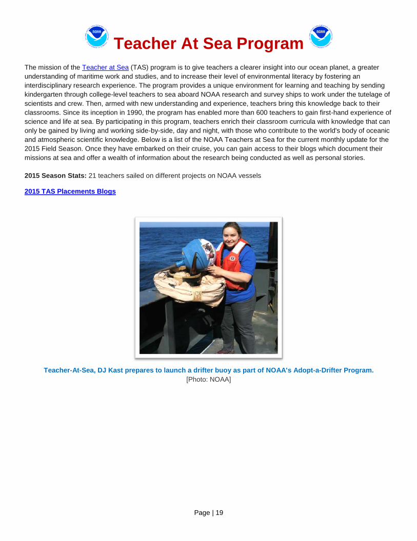
Teacher At Sea Program The mission of the Teacher at Sea (TAS) program is to give teachers a clearer insight into our ocean planet, a greater
understanding of maritime work and studies, and to increase their level of environmental literacy by fostering an
interdisciplinary research experience. The program provides a unique environment for learning and teaching by sending
kindergarten through college-level teachers to sea aboard NOAA research and survey ships to work under the tutelage of
scientists and crew. Then, armed with new understanding and experience, teachers bring this knowledge back to their
classrooms. Since its inception in 1990, the program has enabled more than 600 teachers to gain first-hand experience of
science and life at sea. By participating in this program, teachers enrich their classroom curricula with knowledge that can
only be gained by living and working side-by-side, day and night, with those who contribute to the world's body of oceanic
and atmospheric scientific knowledge. Below is a list of the NOAA Teachers at Sea for the current monthly update for the
2015 Field Season. Once they have embarked on their cruise, you can gain access to their blogs which document their
missions at sea and offer a wealth of information about the research being conducted as well as personal stories.
2015 Season Stats: 21 teachers sailed on different projects on NOAA vessels 2015 TAS Placements Blogs
Teacher-At-Sea, DJ Kast prepares to launch a drifter buoy as part of NOAA's Adopt-a-Drifter Program.
[Photo: NOAA]
Page | 20
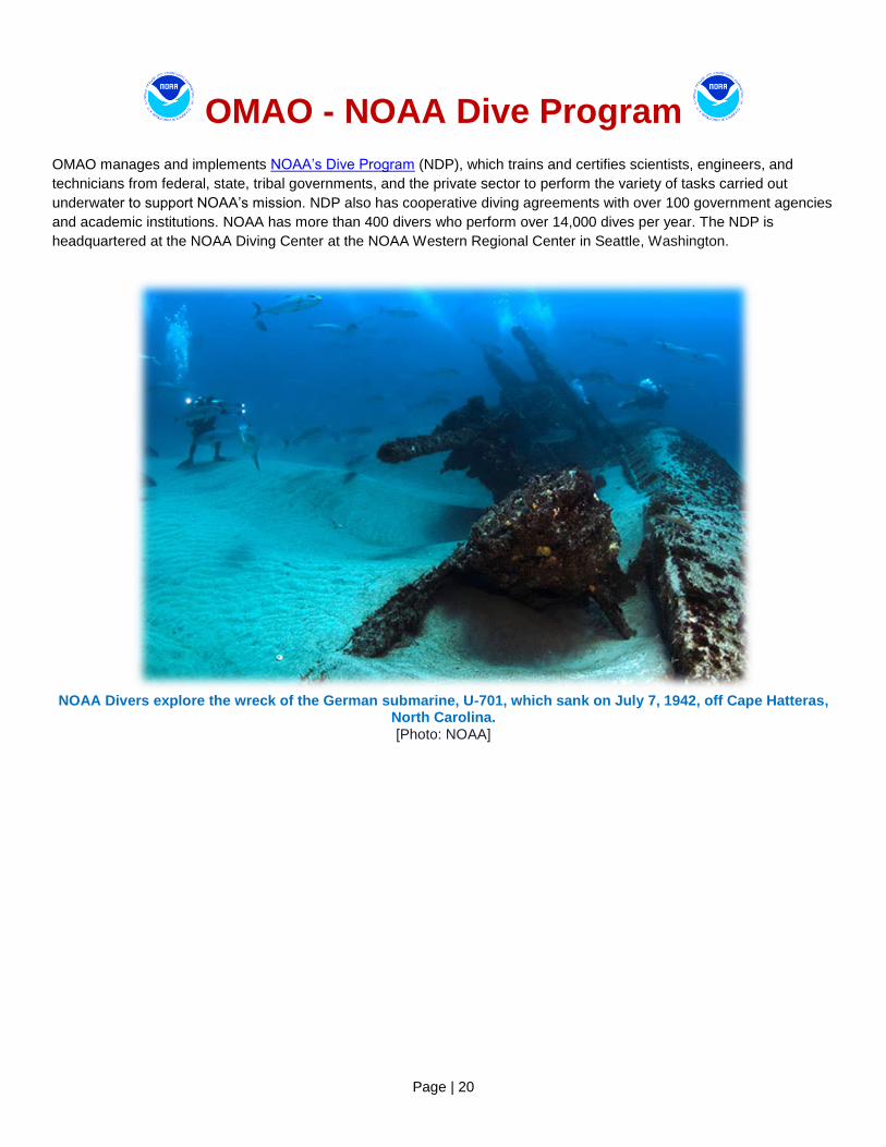
OMAO - NOAA Dive Program
OMAO manages and implements NOAA’s Dive Program (NDP), which trains and certifies scientists, engineers, and
technicians from federal, state, tribal governments, and the private sector to perform the variety of tasks carried out
underwater to support NOAA’s mission. NDP also has cooperative diving agreements with over 100 government agencies
and academic institutions. NOAA has more than 400 divers who perform over 14,000 dives per year. The NDP is
headquartered at the NOAA Diving Center at the NOAA Western Regional Center in Seattle, Washington.
NOAA Divers explore the wreck of the German submarine, U-701, which sank on July 7, 1942, off Cape Hatteras,
North Carolina.
[Photo: NOAA]
Page | 21
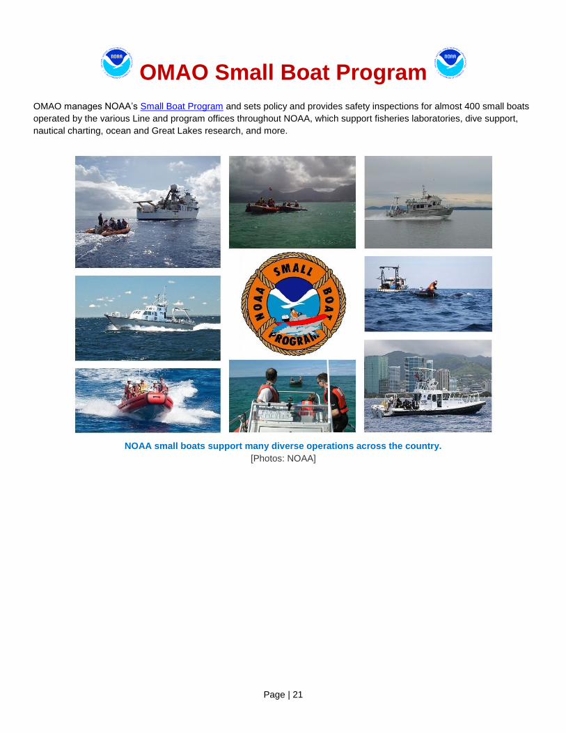
OMAO Small Boat Program
OMAO manages NOAA’s Small Boat Program and sets policy and provides safety inspections for almost 400 small boats
operated by the various Line and program offices throughout NOAA, which support fisheries laboratories, dive support,
nautical charting, ocean and Great Lakes research, and more.
NOAA small boats support many diverse operations across the country.
[Photos: NOAA]

Page | 22
Office of Marine and Aviation Operations
Providing environmental intelligence for a dynamic world
The personnel, ships, and aircraft of NOAA play a critical role in gathering environmental data vital to the nation's
economic security, the safety of its citizens, and the understanding, protection, and management of our natural resources.
The NOAA fleet of ships and aircraft is managed and operated by the Office of Marine and Aviation Operations (OMAO),
an office comprising civilians, mariners, and officers of the NOAA Commissioned Officer Corps, one of the seven
uniformed services of the United States. NOAA's roots trace back to 1807, when President Thomas Jefferson ordered the
first comprehensive coastal surveys. Those early surveys ensured safe passage of ship-borne cargo for a young nation.
As the needs of the nation have grown, so too have OMAO's responsibilities. Today, OMAO civilians and NOAA Corps
officers operate, manage, and maintain NOAA's active fleet of 16 research and survey ships and nine specialized aircraft.
Together, OMAO and the NOAA Corps support nearly all of NOAA's missions.
NOAA has the largest fleet of federal research and survey ships in the nation. The fleet ranges from large oceanographic
ships capable of exploring and charting the world's deepest ocean, to smaller vessels responsible for surveying the
shallow bays and inlets of the United States. The fleet supports a wide range of marine activities including fisheries
surveys, nautical charting, and ocean and climate studies. Based throughout the continental United States, Alaska, and
Hawaii, the ships operate in all regions of the nation and around the world.
NOAA's aircraft provide a wide range of airborne capabilities. Our highly specialized Lockheed WP-3D "Hurricane Hunter"
aircraft are equipped with an unprecedented variety of scientific instrumentation, radars, and recording systems for both in
situ and remote sensing measurements of the atmosphere, the Earth, and its environment. Equipped with both C-band
weather radar and X-band tail Doppler radar systems, the WP-3Ds have the unique ability to conduct tropical cyclone
research in addition to storm reconnaissance. Together with NOAA's Gulfstream IV-SP hurricane surveillance jet, these
aircraft greatly improve our physical understanding of hurricanes and enhance the accuracy of tropical cyclone forecasts.
NOAA's light aircraft also play a vital role in monitoring our environment. Our King Air, Commander and Twin Otter aircraft
support marine mammal population studies, shoreline change assessments, oil spill investigations, and water
resource/snowpack surveys for spring flood forecasts.
Page | 23
The NOAA fleet provides immediate response capabilities for unpredictable events. For example, in November 2014, our
aircraft flew missions over upstate New York after the record snow falls of up to seven feet and conducted airborne Snow
Water Equivalent (SWE) and soil moisture measurements. Airborne SWE measurements are used by NOAA’s National
Weather Service when issuing river and flood forecasts, water supply forecasts, and spring flood outlooks.
After Hurricane Sandy in 2012, NOAA ships Thomas Jefferson and Ferdinand R. Hassler conducted emergency
bathometric surveys to locate possible submerged navigational hazards in the ports of New York and Virginia. These
surveys enabled the ports to reopen quickly. Aerial images of storm-stricken regions, taken by NOAA aircraft, helped
residents and emergency workers to quickly assess the condition of houses, bridges, and vital infrastructure. In 2010, the
NOAA fleet and the NOAA Corps played a major role in the response to the BP Deepwater Horizon oil spill. NOAA's entire
Atlantic fleet and over a quarter of the total strength of the NOAA Corps were deployed to the Gulf following the spill,
developing mission plans and assisting response efforts.
While manned aircraft and sea-going vessels have been, and will continue to be, a primary source of environmental data,
new technology will have a significant role to play in the future NOAA fleet. OMAO, in coordination with other NOAA
offices and federal agencies, is evaluating and deploying remotely piloted underwater and aircraft systems that could
significantly contribute to environmental observations. OMAO's ongoing challenge is to meet the growing demand for in
situ scientific data while providing the highest level of service. To better serve the needs of the nation, NOAA is examining
the composition of the fleet through an exhaustive and critical review of at-sea science and observation requirements. Our
objective is to develop a clear, cost-efficient path forward to ensure that the NOAA fleet can continue to conduct at-sea
surveys and research vital to fisheries management, updating nautical charts, responding to natural and manmade
disasters, and understanding coastal and marine systems more fully. Meeting these requirements is essential to
developing sustainable, science-based management and conservation plans that protect the health and resiliency of
these resources over the long-term.
We continue our efforts to build a civilian and NOAA Corps officer work force that is uniquely qualified to gather critical
environmental intelligence and be adaptive and responsive to a changing world and work to expand our partnerships with
other federal agencies. For example, NOAA Corps officers are currently assigned to work in the Department of Defense,
National Science Foundation, and the U.S. Senate among others where they lend their expertise and service. We also
continue to strengthen our partnership with the U.S. Coast Guard. Our basic NOAA Corps officer training class is held at
the U.S. Coast Guard Academy, where newly commissioned officers train alongside Coast Guard officer candidates,
developing skills and professional relationships that will benefit both services, especially during challenging times. Active
collaboration among the Federal family is critical to ensuring the long-term capability and success of the federal ocean
infrastructure. Our partners' success is our success. The men and women of OMAO and the NOAA Corps provide
environmental intelligence for a dynamic world as they serve our nation every day from the farthest seas to the highest
skies.
Page | 24
NOAA Commissioned Officer Corps – Honor, Respect, Commitment –
The NOAA Commissioned Officer Corps (NOAA Corps) is one of the nation’s seven uniformed services and serve with
the ‘special trust and confidence’ of the President. NOAA Corps officers are an integral part of the National Oceanic and
Atmospheric Administration (NOAA), an agency of the U.S. Department of Commerce. With 321 officers, the NOAA Corps
serves throughout the agency’s line and staff offices to support nearly all of NOAA’s programs and missions. The
combination of commissioned service and scientific expertise makes these officers uniquely capable of leading some of
NOAA’s most important initiatives.
The NOAA Corps is part of NOAA’s Office of Marine and Aviation Operations (OMAO) and traces its roots back to the
former U.S. Coast and Geodetic Survey, which dates back to 1807 and President Thomas Jefferson. In 1970, NOAA was
created to develop a coordinated approach to oceanographic and atmospheric research and subsequent legislation
converted the commissioned officer corps to the NOAA Corps. The NOAA Corps today provides a cadre of professionals
trained in engineering, earth sciences, oceanography, meteorology, fisheries science, and other related disciplines. Corps
officers operate NOAA’s ships, fly aircraft, manage research projects, conduct diving operations, and serve in staff
positions throughout NOAA.
Benefits of the NOAA Corps to the Nation
The combination of commissioned service with scientific and operational expertise, allows the NOAA Corps to provide a
unique and indispensable service to the nation. NOAA Corps officers enable NOAA to fulfill mission requirements, meet
changing environmental concerns, take advantage of emerging technologies, and serve as environmental first
responders. For example:
In November 2014, our aircraft flew missions over upstate New York after the record snow falls of up to seven feet and conducted airborne Snow Water Equivalent (SWE) and soil moisture measurements. Airborne SWE measurements are used by NOAA’s National Weather Service when issuing river and flood forecasts, water supply forecasts, and spring flood outlooks.
After Hurricane Sandy in 2012, NOAA ships Thomas Jefferson and Ferdinand R. Hassler conducted emergency bathometric surveys to locate possible submerged navigational hazards in the ports of New York and Virginia. These surveys enabled the ports to reopen quickly. Aerial images of storm-stricken regions, taken by NOAA aircraft, helped residents and emergency workers to quickly assess the condition of houses, bridges, and vital infrastructure.
After Hurricane Irene in 2011, the NOAA Ship Ferdinand Hassler and team completed 300 lineal nautical miles of
survey work in less than 48 hours providing a Damage Assessment that enabled the U.S. Coast Guard to re-open
ports and restore more than $5M per hour in maritime commerce less than three days after the storm.
In 2010, the NOAA fleet and the NOAA Corps played a major role in the response to the BP Deepwater Horizon oil spill. NOAA's entire Atlantic fleet and over a quarter of the total strength of the NOAA Corps were deployed to the Gulf following the spill, developing mission plans and assisting response efforts.