NEWADA Photos: NEWADA - Plovput · Photos: NEWADA duo Layout: Plovput ... importance (specified in...
60
Transcript of NEWADA Photos: NEWADA - Plovput · Photos: NEWADA duo Layout: Plovput ... importance (specified in...


2
Impressum NEWADA duo project consortium Network of Danube Waterway Administrations – data and user orientation Basic Danube Glossary 2014 Photos: NEWADA duo Layout: Plovput

3
Introduction
Basic Danube glossary contains elementary terminology used by Danube
waterway administrations staff in their daily business of providing safe and
sustainable navigation conditions on the Danube River. This terminology is
related to inland navigation, civil engineering, traffic and transport
engineering, geodesy, hydrography, hydrology, geographic information
systems, river information services, ecology, nature and environmental
protection.
NEWADA duo (Network of Danube Waterway Administrations – data and user
orientation) is a transnational project co‐funded by the EU under the South
East Europe Transnational Cooperation Programme. It gathers waterway
administrations from 7 countries: Austria, Slovakia, Hungary, Croatia, Serbia,
Romania, and Bulgaria, sharing a common vision on the future of
maintenance and development of the Danube waterway.
For more information on the NEWADA duo project, please visit our web site:
www.newada‐duo.eu
For more information on the EU South East Europe Transnational Cooperation
Programme, please visit web site: www.southeast‐europe.net

4

5
A
ADN Regulation annexed to the European Agreement concerning the International Carriage of Dangerous Goods by inland Waterways (UNECE document)
aerial photograph a photograph of the earth’s surface taken with camera mounted in an airplane or similar; used in cartography to provide geographical information for base maps
AGN European Agreement on Main Inland Waterways of International Importance
alluvial made of gravel/mud/silt/sand deposited and formed by rivers or floods
alluvium a fine‐grained deposit, composed mainly of mud and silt, deposited by a river
apron layer of stone, concrete or other material to protect a structure’s toe against scouring
aquatic dredged material placement
dredged material placement options under which the dredged material is submerged under water and remains water‐saturated
aquatic habitat submerged water communities in the sea, rivers, or lakes

6
Automatic Identification System (AIS)
automatic communication and identification system intended to improve the safety of navigation by assisting in the efficient operation of vessel traffic services (VTS), ship reporting, ship‐to‐ship and ship‐to‐shore operations
7
B
backwater water held back in a channel or stream by a dam
ballasting intaking ballast water to enable the vessel to clear a bridge, increasing the draught
bank protection works to protect the bank from eroding
bar (sandbar) elevated region of sediment (sand or gravel) that has been deposited by the flow
barrage facility for damming a river to control its water level
barge vessel without its own motor, it is towed/pulled by a tug
Basel Convention Convention on the control of trans‐boundary movements of hazardous wastes and their deposits (1989)
baseline study an inventory of a natural community or environment to provide a measure of its condition at a point of time, often done to describe the status of diversity and environmental condition
bathymetry a study of underwater depth of water bodies, topography of a water body
bed erosion the deepening of a stream by erosion of its bed

8
bed load the weight or volume of gravel rolled or moved by a stream along its bed in a unit of time
bed load function relationship between bed load and discharge in a given cross‐section of stream
bed profile a curve indicating the elevation and shape of a river bed; may be a longitudinal curve or a transverse curve at a cross‐section
Belgrade Convention Convention regarding the regime of navigation on the Danube; signed in Belgrade on 18 August 1948; see Danube Commission
benchmark a fixed point or mark whose position is known to a high degree of accuracy and is normally marked in some way
bend radius radius of curvature of the fairway
benthos biotic community that lives on the bottom of a body of water, classified according to the size to megalobenthos, macrobenthos, mediobenthos and microbenthos

9
berth anchorage place for vessels in ports, a ship's allotted place at a wharf or dock, a place in the water near the shore where a ship can safely stop
bilge the lowest inner part of a ship's hull
bilge water water containing oil from the engine room area of a ship
biodiversity the range of different species of flora and fauna found in a given region, area, habitat or within the ecosystem
boat master captain of a ship who bears responsibility for the ship
bottleneck sector of the waterway with restricted fairway parameters, due to morphological, hydrological or traffic density related reasons

10
bow front part of a ship
bow thruster located in the front part of the ship, helps steering the ship
branch parallel river stretch or closed river stretch
branch canal a shipping canal branching off from a waterway that forms a "dead end", for connecting cities or industrial zones close to the waterway
Bratislava Agreement Historical agreement concluded between the former state‐run companies operating on the Danube, regulating, among others the legal relationships between the carriers and their partners for the international transport of cargo on Danube
bridge a structure built to span physical obstacles such as a body of water, valley, or road, for the purpose of providing road or rail transportation passage; see vertical clearance
bulk cargo unpacked cargo that is discharged via grabbers, diggers and similar machinery (e.g. coal, ore, grain)
bunker boat ship that is used to supply other ships with fuels, consumables and food (possibly also for waste disposal)
buoy floating device that aids the skippers by marking the fairway to allow ships to navigate safely
11
C
cabotage transport between two ports in the same country
calibration comparing accuracy of an instrument’s measurements to a known standard; setting attributes and computational parameters so that a model properly represents the situation being analyzed
canal mostly artificially created waterway or channel, mainly for the passage of vessels
Carte de Pilotage navigational chart
catchment area of the river (drainage area, drainage basin)
drainage area of a river and its tributaries, overground and ground
CCNR Central Commission for Navigation on the Rhine
Central Danube navigable stretch of the Danube River between the Hungarian port of Gönyü (km 1,794) and the Iron Gate hydropower and navigation system (km 931)
CEVNI European Code for Inland Waterways, document of the UNECE
chainage distance along fairway axis from the mouth of the river in upstream direction.

12
chamber the space enclosed between the upper and lower gate of a lock
chevron u‐shaped structure pointing upstream to divert the river flow along both sides of the structure
clay a fine‐grained earthy deposit, mainly of hydrous aluminum silicates
class certificate Certification from an authorized institution that the ship meets the technical requirements of a particular waterway
closure bund a dam structure in soil or rock to close a branch
coarse‐grained soil a soil in which sand and gravel predominate
container standardized transport unit

13
container vessel motor cargo vessel that has been constructed specifically for transporting containers
convoy formation consisting of one motorized and one or more non‐motorized vessels (towed convoy, a pushed convoy or a side‐by‐side formation)
coordinate system a reference system consisting of a set of points, lines, and/or surfaces, and a set of rules, used to define the position of points in space in either two or three dimensions
coastal waterway sign inland navigation sign placed at the bank of the river

14
coupled formation vessel formation comprising a motor vessel and one or more non‐motorized pushed lighter
crane machine used for moving heavy objects by suspending them from a projecting arm or beam
crane bridge horizontal part of the crane
crest level level of the top of hydraulic structure (e.g. gnoyne, sill, guiding bund, embankment)
critical sector sector/section of the fairway where no sufficient depth/width/vertical clearance is guaranteed and available
cross‐section, profile a plane, generally perpendicular to the centerline of the river or the fairway
cruise ship (cruise liner)
a passenger ship used for pleasure voyages

15
D
dam a massive wall or structure erected across a valley or river for impounding water
Danube Delta the second largest river delta in Europe, after Volga Delta; has a high level of nature protection
Danube the Danube River
Danube Commission (DC)
an international intergovernmental organization established by the Convention regarding the regime of navigation on the Danube signed in Belgrade on 18 August 1948; since 1954 its seat is in Budapest; official languages are German, Russian and French
Danube Commission member states
Germany, Austria, Slovakia, Hungary, Croatia, Serbia, Romania, Bulgaria, Moldova, Ukraine, Russia
Danube day marked each year on the 29th of June, when 14 countries of the Danube Basin jointly celebrate one of Europe's greatest river systems and the people and wildlife that rely on it; established in 2003

16
Danube River Protection Convention
international convention for cooperation on trans‐boundary water management in the Danube River Basin; signed on 29 June 1994 in Sofia and came into force in 1998
Danube Tourist Commission (DTC)
an international tourism marketing association
database one or more structured set of persistent data managed and stored as a unit and generally associated with software to update and query the data
dead water zone a stretch of a river where water is restrained
debris wastes or remains of something broken down, destroyed or detached; any oversized material adversely affecting the hydraulic transport system
depth contour a line on a map connecting points of equal depth below the hydrographic datum
Design High Navigation Level (DHNL)
design navigation level determined with the 1‐D hydraulic model associated with the 1% duration of discharges over the 30 year period
Design Low Navigation Level (DLNL)
design navigation level determined with the 1‐D hydraulic model associated with the 94% duration of discharges over the 30 year period
dike (or dyke) an embankment or a levee for confronting water especially along river banks to prevent flooding of lowlands

17
discharge (Q) the volume rate of water flow, including any suspended solids (e.g. sediment), dissolved chemicals and/or biologic material, which is transported through a given cross‐sectional area (Q=AxV, where A is cross sectional area (m²) and V is the mean velocity of water (m/s))
discharge regime characteristics of the discharge of a water body governed by factors such as climatic conditions, characteristic regional features of the catchment area
dock artificially formed area of water on the bank of the river for reception of ships
downstream direction towards the mouth of the river
draught (draft) the vertical distance between the lowest point of the hull or the keel and the maximum draught line
Drava the Drava River, navigable tributary of the Danube River
dredger device, machine, or vessel that is used to excavate and remove material from the bottom of a water body
dredging excavation of sediment from the riverbed with floating equipment
dredged material material excavated from the riverbed
drought continuous dry weather that is without significant rainfall

18
dry dock an enclosed basin from which the water can be pumped out (a ship gets waterborne into the dock, the dock gates close, water is removed, the ship stays on docking blocks for repairs or cleaning)
duration curve a curve showing frequency with which given values are equaled or exceeded during a certain period

19
E
E port port whose parameters are in line with the UNECE classification of European ports of international importance (specified in AGN)
E waterway waterway whose parameters are in line with the UNECE classification of European waterways of international importance (specified in AGN)
E‐80‐Danube European international waterway E‐80 ‐ Danube River
ECDIS see: Inland ECDIS
echo sounder an instrument for measuring the depth of water by recording times for sounds to be echoed back from the river bed
ecology study of interactions among organisms and their environment, the interactions organisms have with each other and with their abiotic environment
ecosystem a community of living organisms (plants, animals and microbes) in conjunction with the nonliving components of their environment (like air, water and mineral soil), interacting as a system
EFIP European Federation of Inland Ports; gathering nearly 200 inland ports in 19 countries of the European Union, Switzerland and Ukraine
20
EIA Environmental Impact Assessment
Electronic Navigational Chart (ENC)
database, standardized as to content; structure and format, issued for use with ECDIS on the Authority of Government authorized Hydrographic Offices; contains all the chart information necessary for safe navigation and may contain supplementary information in addition to that contained in the paper chart (e.g. sailing directions) which may be considered necessary for safe navigation
embankment а levee, an artificial bank raised above the immediately surrounding land to redirect or prevent flooding by a river, lake or sea
Emerald Areas identified in the Convention on the Conservation of European Wildlife and Natural Habitats (Bern Convention)
ENI European Navigation Identifier
environmental indicator
measure for evaluating a given environmental state as quantitatively as possible
ERI Electronic Reporting International
erosion geological term; process by which particles are removed by the action of wind, flowing water or waves; in the medium to long term, causes a drop in ground water levels
ESPOO Convention on Environmental Impact Assessment in a Trans‐boundary Context (UNECE)

21
Etiage Navigable et de Régularisation (ENR) or Low Navigation Level (LNL)
water level derived from the rating curve, defined for all navigable sections of the river, defined by the 94% duration of discharges over the 30 year period, on days without ice (defined by the Danube Commission)
EUSDR Strategy of the EU for the Danube Region (Danube Strategy), Macro regional strategy of the EU gathering 9 EU member states and 5 non‐member states
evaporation physical change of water into humidity or moisture suspended in the air

22
F
fairway part of the waterway with specific depth, width and vertical clearance which enables continuous navigation
fairway channel the navigable cross‐section of the fairway with the minimum width and depth necessary for continuous navigation
fairway axis center line of the fairway
fairway parameters depth and width of the fairway, vertical clearance and bend radius
FASRB Framework Agreement on the Sava River Basin ‐ international agreement, which integrated all aspects of the water resources management and established the (joint) International Sava River Basin Commission (ISRBC) for the implementation of the FASRB, with legal status of an international organization
ferry а boat service shuttling between two points
FIS (Fairway Information System)
geographical, hydrological and administrative information regarding the waterway (fairway)
fixed costs standby costs
floating crane crane installed on a floating unit

23
floating equipment floating structures carrying machinery used for work on waterways or in harbors (dredgers, elevators, derricks, cranes, etc.)
flood an overflow of water that submerges land which is usually dry; excessive stream flow resulting from precipitation or snowmelt
flood control regulation of flood waters to prevent or minimize inundation of valuable property or land
flood probability the likelihood that a flood of a given magnitude will be equaled or exceeded in a given period; probability of 10% will be a 10‐year flood, probability of 1% would be a 100‐year flood
floodplain (flood plain)
an area of land adjacent to a stream or river that stretches from the banks of its channel to the base of the enclosing valley walls and experiences flooding during periods of high discharge
ford shallow sector of the river that stretches across the whole width of the river

24
G
gates (of the navigation lock)
the watertight doors which seal off the chamber from the upper and lower pounds
gauge zero elevation of the gauging station with respect to the mean sea level
gauging station equipment for measuring the water level of over‐ground water bodies
geodetic survey a survey that takes figure and size of the earth into account, used to precisely locate horizontal and vertical positions suitable for controlling other surveys
georeference to assign coordinates from a known reference system to the page coordinates of an image or a plane map
GIS Geographic Information System

25
GPS Global Positioning System
granulometric riverbed improvement
use of coarse gravel to cover lower zones of the riverbed in order to halt riverbed degradation of a river
granulometry (of the sediment)
size of particles of sediment forming the riverbed
gravel unconsolidated rock fragments that have a general particle size range and include size classes from granule‐ to boulder‐sized fragments
green buoy green floating navigation sign that marks left limit of the fairway

26
ground water all subsurface water that fills voids between highly permeable ground strata comprised of sand, gravel, broken rocks, porous rocks, etc. and move under the influence of gravitation
groyne (groin), Т‐groyne
a rock structure generally at the angle to the river centerline to confine the flow in the fairway
guide bund a transverse river training structure aiming to narrow the riverbed and to divert flow into the fairway in order to maintain sufficient depth by increasing the natural sediment transport capacity

27
H
habitat the sum of environmental conditions in a specific place that is occupied by an organism, population or community
Haut‐Niveau Navigable (HNN) or High Navigation Level (HNL)
water level derived from the rating curve, defined for all navigable sections of the river, defined by the 1% duration of discharges over the 30 year period, on days without ice (defined by the Danube Commission)
hazardous goods materials and objects that can be hazardous to human health and environment in case of traffic accidents
head water stretch of the waterway that is directly above a river power plant
hopper barge open vessel with a hinged bottom for transporting and dumping dredged material
hull watertight body of a ship or boat
Hull Database (European Hull Database ‐ EHDB)
database containing standardized information on vessels, including European Vessel Identification Number
hydraulic modeling application of specialized software packages in order to determine and predict flow velocity patterns of the river
hydrodynamics a sub area of hydraulics, rules on motion of the water

28
and forces acting in the process
hydrodynamic resistance
resistance met by a body when moving through water
hydrographic survey surveying of the riverbed with specialized equipment in order to analyze changes of the riverbed and available water depth
hydrography а branch of applied sciences which deals with the measurement and description of the physical features of oceans, seas, coastal areas, lakes and rivers, as well as with the prediction of their change over time, for the primary purpose of safety of navigation and in support of all other marine activities, including economic development, security and defense, scientific research, and environmental protection
hydrology the study of the movement, distribution, and quality of water, including the hydrologic cycle, water resources and environmental watershed sustainability
hydromorphology physical characteristics of the river, including the riverbed, banks, connections with the landscape, including longitudinal continuity and habitat continuity
29
I
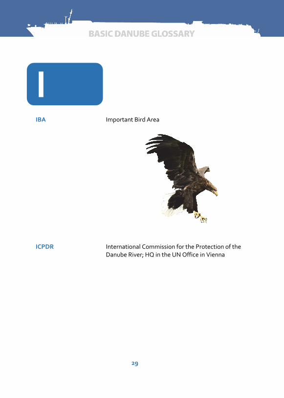
IBA Important Bird Area
ICPDR International Commission for the Protection of the Danube River; HQ in the UN Office in Vienna

30
IENC Inland Electronic Navigational Chart; see: Electronic Navigational Chart
IHO International Hydrographic Organization; established in 1921 as the International Hydrographic Bureau (IHB) with 18 nations as members; HQ in Monaco
impounded river section
section of a river that lies between two consecutive barrages
indicator species biological species serving as an indicators of environmental change; a mean of describing environmental conditions of narrow ecological amplitude with respect to one or more environmental factors
infrastructure costs costs of construction and maintenance of waterway infrastructure
Inland AIS Inland Automatic Identification System ‐ tracking and tracing system for inland navigation

31
Inland ECDIS a standardized system for displaying electronic navigational charts for inland waters and associated information, that displays selected information from proprietary electronic navigational charts for inland waters and optionally information from other sensors of the craft;
intermodal transport transport of goods in one and the same transport unit on two or more transport modes
intermodal transport unit
loading unit standardized for two or more transport modes (container, swap body)
International Commission for the Protection of the Danube River (ICPDR)
transnational body established to implement the Danube River Protection Convention
IPA Important Plant Area
Iron Gate river gorge on the Danube River at the joint Serbian‐Romanian stretch of the river
island (sand) bar overgrown with bushes and trees
ISRBC International Sava River Basin Commission; the first constitutional session of the Sava Commission was held on 27th of June 2005, the permanent Secretariat started to work on 09th of January 2006; HQ in Zagreb

32
J
Joint Statement Joint Statement on Guiding Principles for development of inland navigation and environmental protection in the Danube River Basin; a document jointly accepted by the International Commission for the Protection of the Danube River, the Danube Commission and the International Sava River Basin Commission

33
K
Kazan Small and Big Kazan; located at the Iron Gate Gorge; the deepest part of the Danube River (depth over 90 m)
keel the long supporting piece of a ship’s frame that lies lengthwise along the bottom
34
L
landscape visually perceived natural scenery
left bank left side of the river when moving from the source to the mouth of the river
lightering transshipping or unloading a vessel's cargo (if the vessel is too low) on land or to another ship ‐ primarily in the event of low water levels
lighthouse а tower or other structure containing a beacon light to warn or guide ships at sea
load factor percentage of the maximum possible loading of the cargo vessel
lock (navigation lock) hydraulic system to overcome differences in height along a waterway, in which vessels may be raised or lowered by filling up or emptying out one or more lock chambers
lock chamber a rectangular space located between gates of a lock, in which vessels may be raised or lowered during locking
lock overhaul maintenance or replacement of elements of a lock
longitudinal dike (training wall)
a rock structure parallel to the river centerline to confine the flow in the fairway

35
Low Navigable Water Level (LNWL)
see: Etiage Navigable et de Régularisation (ENR)
Lower Danube navigable stretch of the Danube River between the Iron Gate hydropower and navigation system (km 931) and the estuary of the Danube River into the Black Sea (including the Sulina Canal and the Kilia Arm)
36
M
maintaining to keep in a condition of good repair or efficiency
marking plan plan of the position and other attributes of the all floating and coastal signs for a certain fairway or a stretch of the fairway
mean discharge average quantity of water that flows through a certain cross‐section of the river per unit of time on average over a certain period of time (m³/s)
Mean High Water (MHW)
mean of multi‐year maximum water levels, the average water level measured at a water gauge over a specific period of time
Mean Low Water (MLW)
mean of multi‐year minimum water levels
Mean Water Level (MWL)
mean water level over a multi‐year period
mobile crane crane not fixed that can be moved or driven
morphological modeling
application of specialized software packages in order to determine and predict morphological changes of the riverbed
morphology (of the river bed)
describes the shapes of river channels and how they change over time
37
motor cargo vessel self‐propelled vessel with its own motor drive and cargo hold for transporting goods
motorized vessel craft using its own mechanical means of propulsion, except craft whose engines are used only to cover short distances (in harbors or at loading and unloading points) or to make them easier to handle while being towed or pushed
multibeam specialized equipment for hydrographic surveys, used for precise 3D imaging of the riverbed
multimodal transport transport of goods by using two or more different modes of transport

38
N
NAIADES an EU action programme in support of inland waterway transport
national park a park in use for conservation purposes, area of the highest level of protection (lot of national parks are located along the Danube River, such as Donau Auen National Park, Fruska Gora, Djerdap, Danube Delta, etc.)
Natura 2000 EU nature & biodiversity policy

39
nautical conditions how suitable the waterway is throughout the year and whether available water depth is suited for commercial navigation
navigable waters waters sufficiently deep and wide for navigation by all or specified sizes of vessels
Notices to Skippers (NtS)
information messages that can be sent by or on behalf of a Competent Authority to (inland) ships relating to situations or events that may impact the navigation situation on a fairway

40
O
operating costs variable costs of the waterway transport depending on the travelling and transport performance
orthophoto an aerial photograph geometrically corrected such that the scale is uniform; unlike an uncorrected aerial photograph, an orthophoto can be used to measure true distances, because it is an accurate representation of the Earth's surface

41
P
passenger vessel vessel constructed and equipped for passenger transport
passenger quay quay specialized for passengers, not for cargo transport
PBA Prime Butterfly Areas
PIANC The World Association for Waterborne Transport Infrastructure (former Permanent Association of Navigation Congresses)
point bar a bar attached to the inner bend of the river
polluter pays principle principle recommended by the OECD and the EU that the polluter should carry the costs of measures required to compensate for or clean up pollution
port part of a water body and connected space on the land with facilities and equipment for transshipment and storage of cargo
port fees charges for the use of port or transshipment site

42
port infrastructure quay walls, paved surfaces and railway tracks at a port
port suprastructure port facilities that are erected on the port infrastructure (e.g. cranes, warehouses, etc.)
precipitation rainfall, snowfall or any condensate
public port port owned by the government, use of the port by all navigation companies under the same conditions
pushed barge vessel designed or specially equipped to be pushed (see: barge)
pushed convoy group of vessels, one at least of which is placed in front of the motorized vessel propelling the convoy and is known as a pusher
pusher motorized vessel used to push non‐motorized freight carriers ‐ barges

43
Q
quay a stone or metal platform lying alongside or projecting into water for loading and unloading ships
quay wall constructed vertical or almost vertical wall that can hold waterside cranes

44
R
radar reflector (active) an electronic system that responds to a received radar pulse by transmitting a similar radar pulse; target detection is improved because the actively transmitted pulse is generally more powerful than would be the case with passive reflection
radar reflector (passive)
а device mounted on navigation signs or small crafts that provides a strong radar signature without consuming energy
Ramsar Convention areas identified in the Convention on Wetlands called the Ramsar Convention
reconnection of sidearm
opening of former cut‐off sidearm to a regulated river for supplying of water to ecologically valuable regions
red buoy red floating navigation sign that marks right limit of the fairway
reduced visibility conditions in which visibility is reduced due to fog, snow, rain, smoke or any other reason
revetment see: embankment

45
Rhine‐Danube Corridor
the only waterway among newly established EU Trans‐European transport network
right bank right side of the river when moving from the source to the mouth of the river
riparian zone (riparian area)
the interface between land and a river or stream (Danube riparian countries are Germany, Austria, Slovakia, Hungary, Croatia, Serbia, Romania, Bulgaria, Moldova, Ukraine, Russia)
riprap the term usually applied to armor stone with a combination of the following characteristics: wide gradation; generally bulk placed; often placed as a cover layer and frequently used in riverbank applications
RIS Directive RIS Framework Directive of the European Union (2005/44/EC)

46
river basin the land area that is drained by a river and its tributaries
River Information Services (RIS)
harmonized information services to support traffic and transport management in inland navigation, including interfaces to other transport modes
riverbed the base of a river
rkm river kilometer, chainage

47
S
Sava the Sava River, navigable tributary of the Danube River
scour erosion of the riverbed
SEA Strategic Environmental Assessment
section, reach or sub‐sector
part of the river within sector
sector (of the river) part of the river between two sections
sediment naturally occurring material transported by water, or ice, and/or deposited by the force of gravity acting on the particle itself
sediment load the amount of sediment passing a cross‐section of a river in a specified period of time
sediment transport movement of eroded soil and rock particles in water flow
shipper contracting body of a transport
shipping company company for waterway transport, having its own vessels and sales organization on land
sidearm a branch of a river, where the amount of flow is smaller, than in the main branch

48
sill (bottom sill) underwater structure constructed perpendicular to the fairway axis
siltation pollution of water by fine particulate terrestrial clastic material, with a particle size dominated by silt or clay
singlebeam specialized equipment for hydrographic surveys, used for surveying of cross‐sectional or longitudinal profiles
special port port specialized in the transshipment of certain types of good, for example, oil
species group of related individuals with a common hereditary morphology, chromosomic number and structure, physiological characteristics and way of life, separated from neighboring groups by a barrier, which is generally sexual in nature, and occupying a definable geographic area.
specific weight ratio of the weight and the volume of a body
squat level to which a ship sinks while it is in motion compared to its stationary condition on waterways
stakeholder a person, organization or a subgroup of an organization that have a common interest in a project or activity
stakeholder's participation
ability and enabled possibility of stakeholders to participate in the planning and implementation of infrastructure projects on the river
stakeholder's forum organized and structured mechanism for stakeholders and public participation in planning and implementation of infrastructure projects on the river
standby costs costs for keeping ship on standby without taking

49
operational costs into consideration
stern rear part of a ship
strategic traffic image information affecting decisions of the users of River Information Services, displaying all relevant vessels in the RIS area, including their characteristics, loads and positions
stretch a part of the river
suspended sediment part of the sediment load that is in suspension (which is not bed load)
sustainability utilization of a renewable system in a way that this system is maintained as far as its important characteristics are concerned and its stock level may be regenerated in a natural way

50
T
t ton
tailwater section of the waterway that is directly below a river power plant (see: headwater)
tanker motor cargo vessel for transport of liquid goods
telematics integrated application of telecommunication, automation and information technology
terminal facility with infrastructure and equipment for transshipment of goods
time of lockage time between entering and leaving the lock
ton‐kilometer (tkm) related to transport performance
towed convoy group of vessels towed/pulled by one or more motorized vessels
Tracking and Tracing System
part of the RIS; process of monitoring and recording the past and present whereabouts of a ship shipment, as it passes through different handlers on its way to its destination, through a network; tracing refers to where the product has been, while tracking refers to where it is going next
Tisza River the Tisza River, navigable tributary of the Danube River

51
training wall longitudinal dike
transshipment shifting of transport units or cargo from one to another mean of transport
transshipment site transshipment point located on the bank of the waterway without its own port basin
transponder wireless communication, display or control device that accepts incoming signals and automatically responds to them (combination of the verbs "transmit" and "respond")
transport performance
statistical parameter in transport which takes into account the distance and weight of transported goods, measured in ton‐kilometer (tkm) as a product of the weight in tons (t) transported and the route covered in kilometers (km)
tug motorized or self‐propelled vessel towing non‐motorized freight carriers called barges
Twenty‐foot Equivalent Unit (TEU)
a statistical parameter based on a 20 foot ISO container for describing transport capacities

52
U
UNECE United Nations Economic Commission for Europe
Upper Danube navigable stretch of the Danube River between Kelheim in Germany (km 2,414.72) and the Hungarian port of Gönyü (km 1,794)
upstream direction toward the source of the river
upstream voyage movement of vessel in the direction of the source of the river
53
V
vertical clearance vertical clearance or distance between high navigation level or max regulation level and lowest part of the bridge construction in the navigation opening
vessel inland waterway craft, including small craft and ferry boats, as well as floating equipment
Vessel Traffic Services (VTS)
shore‐side systems which range from the provision of simple information messages to ships, such as position of other traffic or meteorological hazard warnings, to extensive management of traffic within a port or waterway
VHF very high frequency
voyage planning application for planning of voyages in the context of River Information Services

54
W
warehouse a site where raw materials or manufactured goods may be stored prior to their distribution for sale
water gauge (station) see: gauging station
water level (or gauge height or stage)
water height at a certain point in the cross‐section of a water body
water level forecast estimation of water level in the near future
water self‐purification the ability of a body of water to purify itself of pollutants
waterway any navigable water body
weir a dam across a stream of a river, with the purpose of backing up or diverting water flow
WFD Water Framework Directive ‐ EU directive (2000/60/EC) which harmonizes the legal framework for water policy within the EU, related to sustainable and environmentally sound water utilization
wildlife referring to all non‐domesticated living organisms including not only vertebrate animals (mammals, birds, fish, amphibians and reptiles) but also invertebrate animals, vascular plants, algae, fungi, bacteria and all other wild living organisms

55
WLAN Wireless Local Area Network
WWF World Wildlife Fund

56

57
Sources
Dictionary of GIS Terminology (2001), Environmental Systems Research Institute, Redlands, California
Dictionary of Water and Water Engineering (1973), Nelson, A. & Nelson, K.D., Butterworths, London
Glossary of Selected Environmental Terms (2000), Report of Working Group n°3 of the Permanent Environmental Commission, PIANC, Supplement to Bulletin No. 104
Main Report of the Feasibility Study for River training and Dredging Works on Critical Sectors on the Danube River in Serbia (2013), Witteveen+Bos, DHI & Energoprojekt Hidroinzenjering
Manual on Danube Navigation (2013), via donau
http://risdefinitions.org
River Ecology (2011), World Wildlife Fund

58

59

60


![01 SHF01 - Plovput introduction, ENG (20120626).ppt20120626)… · Microsoft PowerPoint - 01 SHF01 - Plovput introduction, ENG (20120626).ppt [Compatibility Mode] Author: lkrivokuca](https://static.fdocuments.net/doc/165x107/5f515e3214e051371776ff84/01-shf01-plovput-introduction-eng-20120626-20120626-microsoft-powerpoint.jpg)