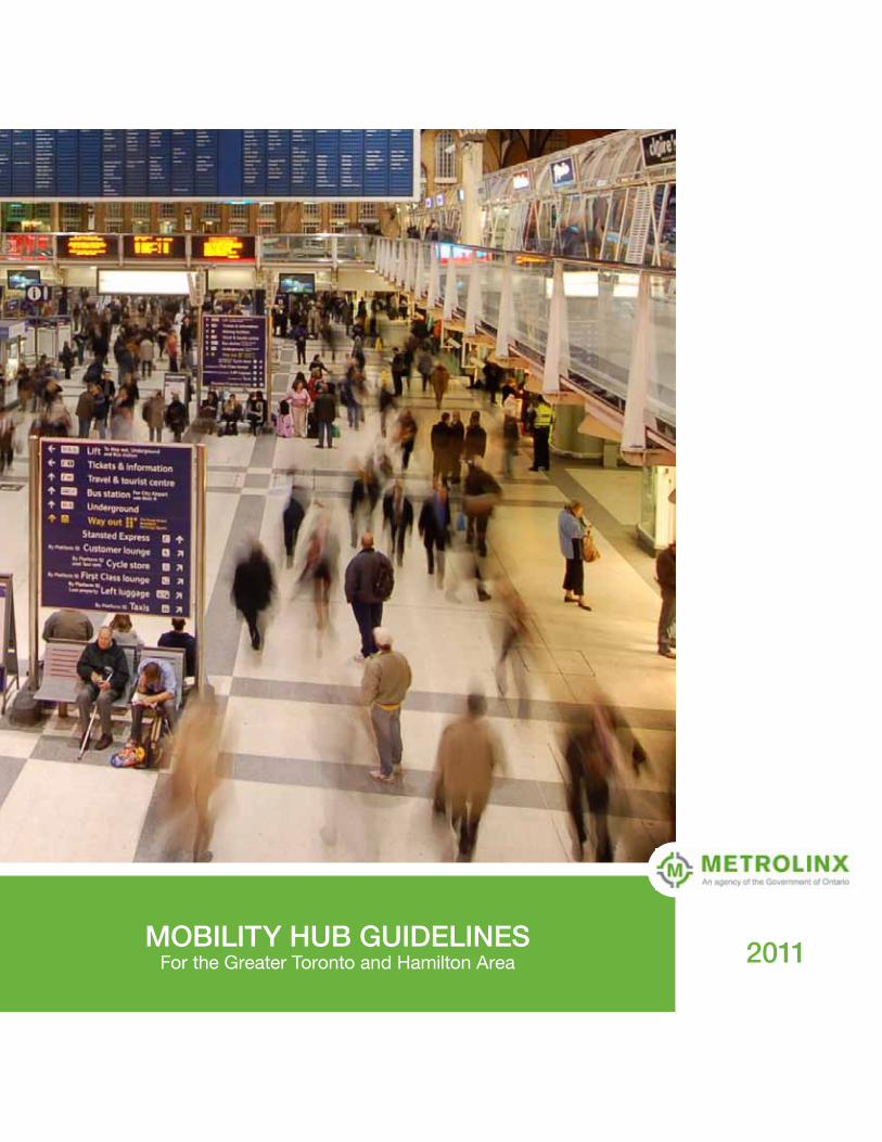
MOBILITY HUB GUIDELINES 2011 For the Greater Toronto and ...The Mobility Hub Guidelines are...
12
MOBILITY HUB GUIDELINES For the Greater Toronto and Hamilton Area 2011
Transcript of MOBILITY HUB GUIDELINES 2011 For the Greater Toronto and ...The Mobility Hub Guidelines are...
MOBILITY HUB GUIDELINESFor the Greater Toronto and Hamilton Area 2011
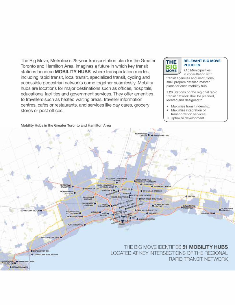
The Big Move, Metrolinx’s 25-year transportation plan for the Greater Toronto and Hamilton Area, imagines a future in which key transit stations become MOBILITY HUBS, where transportation modes, including rapid transit, local transit, specialized transit, cycling and accessible pedestrian networks come together seamlessly. Mobility hubs are locations for major destinations such as offices, hospitals, educational facilities and government services. They offer amenities to travellers such as heated waiting areas, traveller information centres, cafés or restaurants, and services like day cares, grocery stores or post offices.
RELEVANT BIG MOVE POLICIES7.15 Municipalities, in consultation with
transit agencies and institutions, shall prepare detailed master plans for each mobility hub.
7.20 Stations on the regional rapid transit network shall be planned, located and designed to:
• Maximize transit ridership;• Maximize integration of
transportation services;• Optimize development.
Mobility Hubs in the Greater Toronto and Hamilton Area
THE BIG MOVE IDENTIFIES 51 MOBILITY HUBS LOCATED AT KEY INTERSECTIONS OF THE REGIONAL
RAPID TRANSIT NETWORK
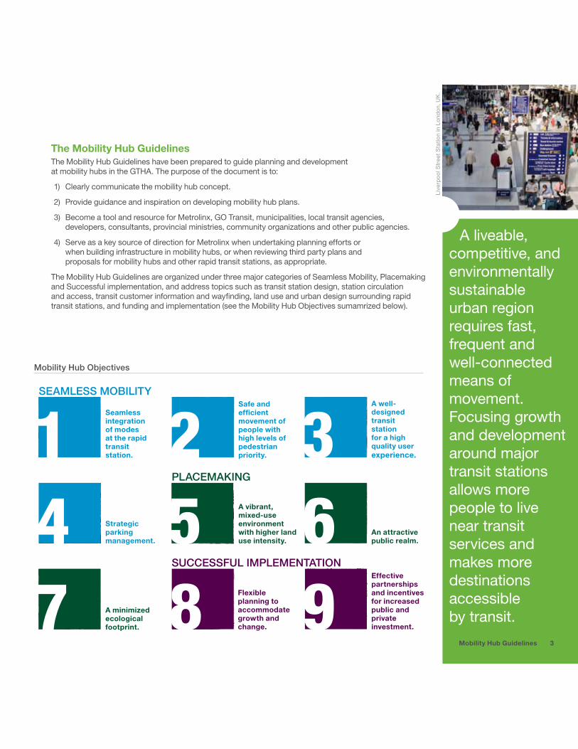
The Mobility Hub GuidelinesThe Mobility Hub Guidelines have been prepared to guide planning and development at mobility hubs in the GTHA. The purpose of the document is to:
1) Clearly communicate the mobility hub concept.
2) Provide guidance and inspiration on developing mobility hub plans.
3) Become a tool and resource for Metrolinx, GO Transit, municipalities, local transit agencies, developers, consultants, provincial ministries, community organizations and other public agencies.
4) Serve as a key source of direction for Metrolinx when undertaking planning efforts or when building infrastructure in mobility hubs, or when reviewing third party plans and proposals for mobility hubs and other rapid transit stations, as appropriate.
The Mobility Hub Guidelines are organized under three major categories of Seamless Mobility, Placemaking and Successful implementation, and address topics such as transit station design, station circulation and access, transit customer information and wayfinding, land use and urban design surrounding rapid transit stations, and funding and implementation (see the Mobility Hub Objectives sumamrized below).
A liveable, competitive, and environmentally sustainable urban region requires fast, frequent and well-connected means of movement. Focusing growth and development around major transit stations allows more people to live near transit services and makes more destinations accessible by transit.
Live
rpoo
l Str
eet S
tatio
n in
Lon
don,
UK
.
3Mobility Hub Guidelines
SEAMLESS MOBILITY
24
Seamless integration of modes at the rapid transit station.
Strategic parking management.
A minimized ecological footprint.
Safe and efficient movement of people with high levels of pedestrian priority.
A vibrant, mixed-use environment with higher land use intensity.
Flexible planning to accommodate growth and change.
A well-designed transit station for a high quality user experience.
An attractive public realm.
Effective partnerships and incentives for increased public and private investment.
1 3
SUCCESSFUL IMPLEMENTATION
PLACEMAKING
98765
Mobility Hub Objectives
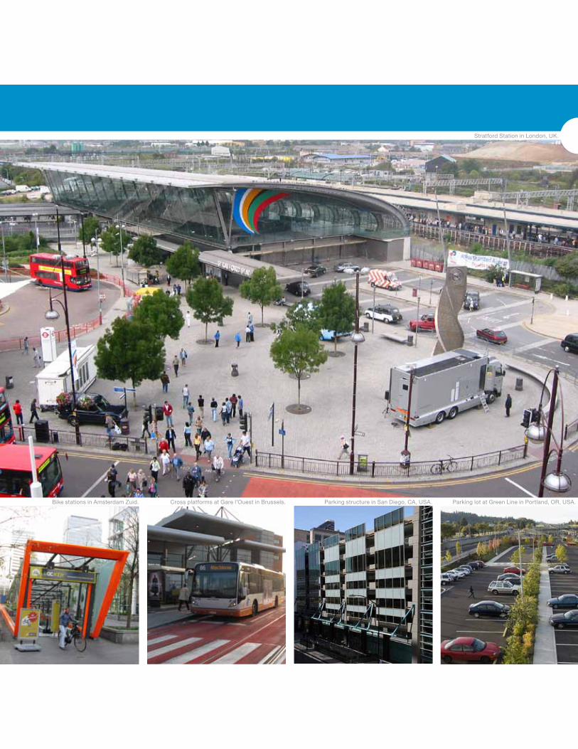
SEAMLESS MOBILITYStratford Station in London, UK.
Bike stations in Amsterdam Zuid. Cross platforms at Gare l’Ouest in Brussels. Parking structure in San Diego, CA, USA. Parking lot at Green Line in Portland, OR, USA.
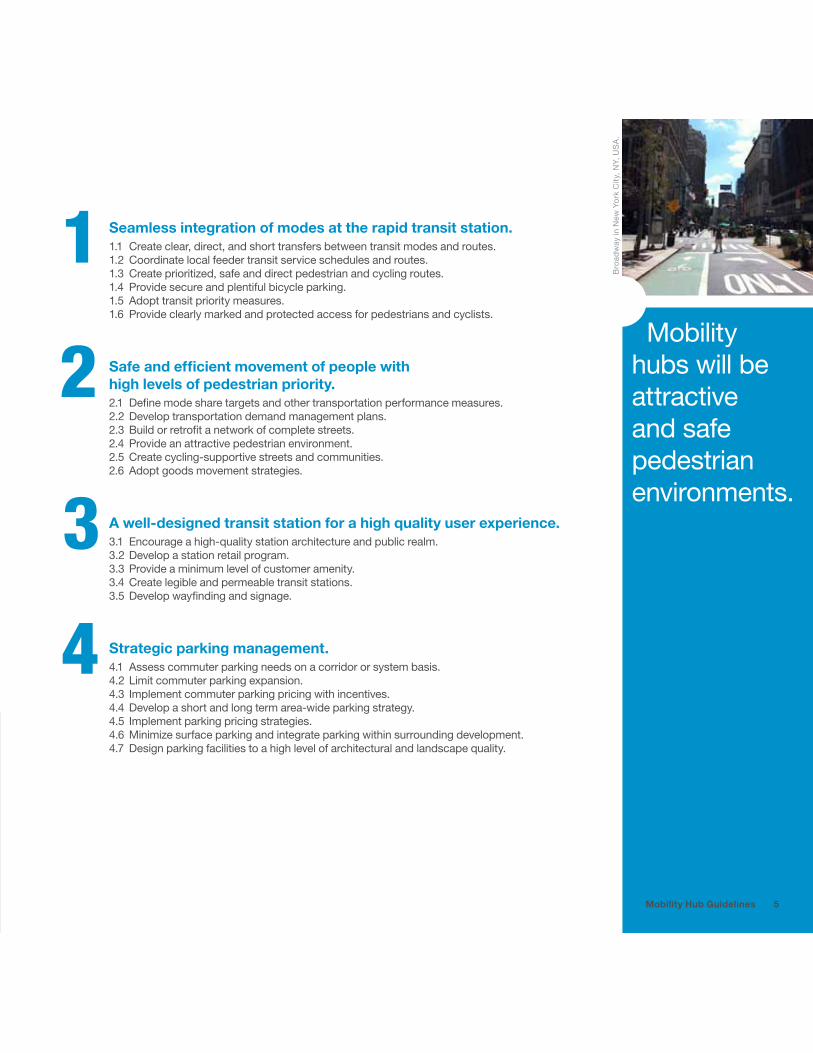
Mobility hubs will be attractive and safe pedestrian environments.
Bro
adw
ay in
New
Yor
k C
ity, N
Y, U
SA
.
Seamless integration of modes at the rapid transit station.1.1 Create clear, direct, and short transfers between transit modes and routes.1.2 Coordinate local feeder transit service schedules and routes.1.3 Create prioritized, safe and direct pedestrian and cycling routes.1.4 Provide secure and plentiful bicycle parking.1.5 Adopt transit priority measures. 1.6 Provide clearly marked and protected access for pedestrians and cyclists.
Safe and efficient movement of people with high levels of pedestrian priority.2.1 Define mode share targets and other transportation performance measures.2.2 Develop transportation demand management plans.2.3 Build or retrofit a network of complete streets.2.4 Provide an attractive pedestrian environment.2.5 Create cycling-supportive streets and communities.2.6 Adopt goods movement strategies.
A well-designed transit station for a high quality user experience.3.1 Encourage a high-quality station architecture and public realm.3.2 Develop a station retail program.3.3 Provide a minimum level of customer amenity.3.4 Create legible and permeable transit stations.3.5 Develop wayfinding and signage.
Strategic parking management.4.1 Assess commuter parking needs on a corridor or system basis.4.2 Limit commuter parking expansion.4.3 Implement commuter parking pricing with incentives.4.4 Develop a short and long term area-wide parking strategy.4.5 Implement parking pricing strategies. 4.6 Minimize surface parking and integrate parking within surrounding development.4.7 Design parking facilities to a high level of architectural and landscape quality.
1
2
3
4
5Mobility Hub Guidelines

PLACEMAKING
MID RISE APARTMENT UNITS IN CLOSE PROXIMITY TO THE TRANSIT STATION ABOVE RETAIL
TRANSPARENT FACADES AND MAXIMIZED FRONTAGES IN THE COMMERCIAL CENTRE
URBAN PLAZA
TRANSIT STATION
RESIDENTIAL TOWNHOMES
Market Common in Arlington, VA, USA.
Street furniture as public art in Mexico City, Mexico. Portico Development in Vancouver, BC, Canada.
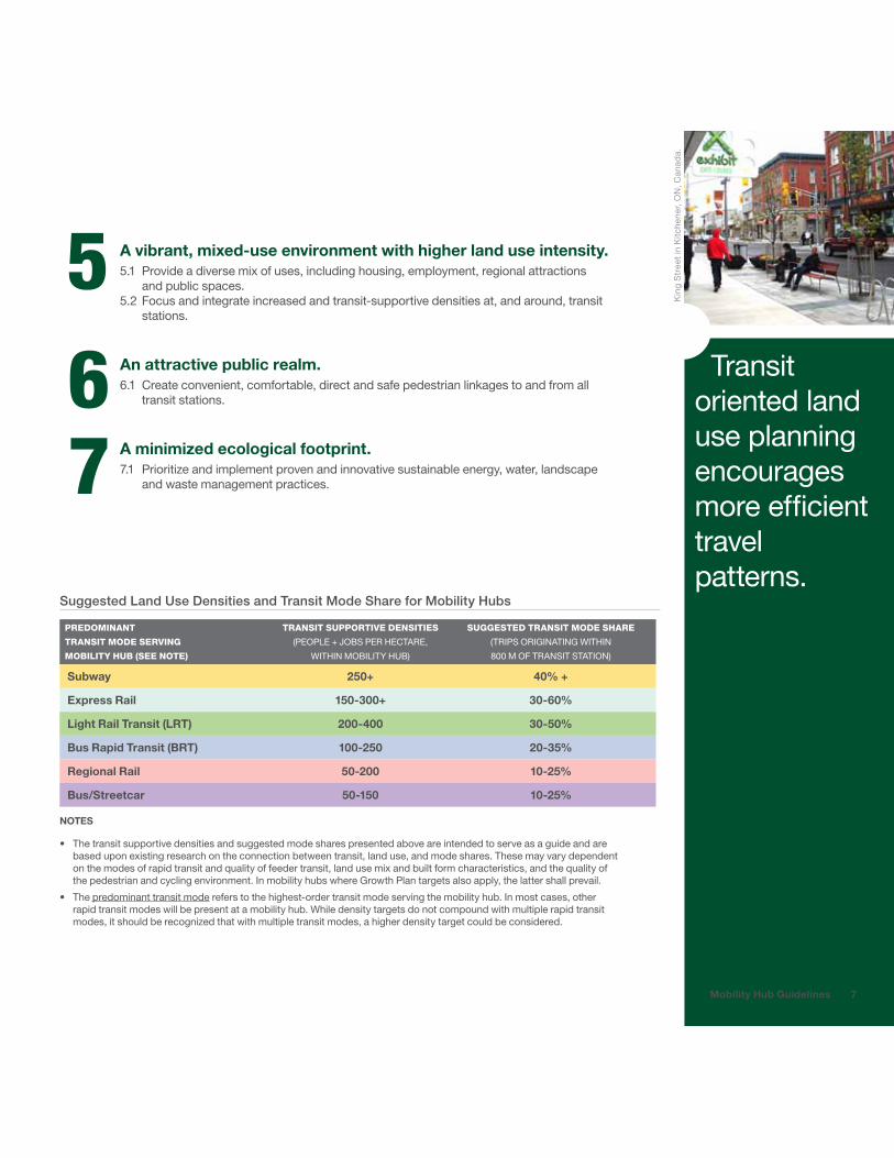
Transit oriented land use planning encourages more efficient travel patterns.
Kin
g S
tree
t in
Kitc
hene
r, O
N, C
anad
a.
7Mobility Hub Guidelines
A vibrant, mixed-use environment with higher land use intensity.5.1 Provide a diverse mix of uses, including housing, employment, regional attractions
and public spaces.5.2 Focus and integrate increased and transit-supportive densities at, and around, transit
stations.
An attractive public realm.6.1 Create convenient, comfortable, direct and safe pedestrian linkages to and from all
transit stations.
A minimized ecological footprint.7.1 Prioritize and implement proven and innovative sustainable energy, water, landscape
and waste management practices.
567
Suggested Land Use Densities and Transit Mode Share for Mobility Hubs
PREDOMINANT
TRANSIT MODE SERVING
MOBILITY HUB (SEE NOTE)
TRANSIT SUPPORTIVE DENSITIES
(PEOPLE + JOBS PER HECTARE,
WITHIN MOBILITY HUB)
SUGGESTED TRANSIT MODE SHARE
(TRIPS ORIGINATING WITHIN
800 M OF TRANSIT STATION)
Subway 250+ 40% +
Express Rail 150-300+ 30-60%
Light Rail Transit (LRT) 200-400 30-50%
Bus Rapid Transit (BRT) 100-250 20-35%
Regional Rail 50-200 10-25%
Bus/Streetcar 50-150 10-25% NOTES
• The transit supportive densities and suggested mode shares presented above are intended to serve as a guide and are based upon existing research on the connection between transit, land use, and mode shares. These may vary dependent on the modes of rapid transit and quality of feeder transit, land use mix and built form characteristics, and the quality of the pedestrian and cycling environment. In mobility hubs where Growth Plan targets also apply, the latter shall prevail.
• The predominant transit mode refers to the highest-order transit mode serving the mobility hub. In most cases, other rapid transit modes will be present at a mobility hub. While density targets do not compound with multiple rapid transit modes, it should be recognized that with multiple transit modes, a higher density target could be considered.
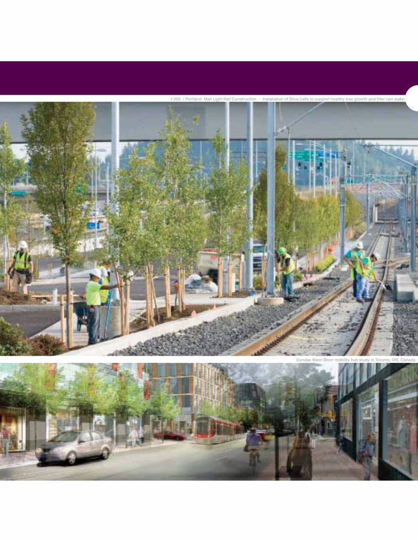
SUCCESSFUL IMPLEMENTATIONI-205 / Portland Mall Light Rail Construction - Installation of Silva Cells to support healthy tree growth and filter rain water
Dundas West-Bloor mobility hub study in Toronto, ON, Canada.

Strategic partnerships will be required to realize the vision of mobility hubs.
WM
ATA
Silv
er S
prin
g Jo
int
Dev
elop
men
t Pro
ject
9
8
9
&PLANNINGDESIGNIMPLEMENTATION
LAND USE TRANSPORTATION
ENVIRONMENT
REAL ESTATEFRAMEWORK
IMPLEMENTATIONSTRATEGY
Mobility Hub Guidelines
Elements of Successful Mobility Hub Implementation
Flexible planning to accommodate growth and change.8.1 Develop detailed phasing strategies connected with infrastructure improvements.8.2 Develop performance measures to evaluate and monitor implementation progress
connected to phasing strategy.
Effective partnerships and incentives for increased public and private investment.9.1 Encourage development by providing developers incentives such as height and density
exchange, flexible zoning and mechanisms like bonds, debentures, and Tax Increment Financing.
9.2 Plan public investment and infrastructure.9.3 Encourage public agencies and various Public-Private Partnership models.94 Establish a development checklist as a tool for new development and retrofits in the
mobility hubs.9.5 Consider design competitions for both public facilities and design review panels.
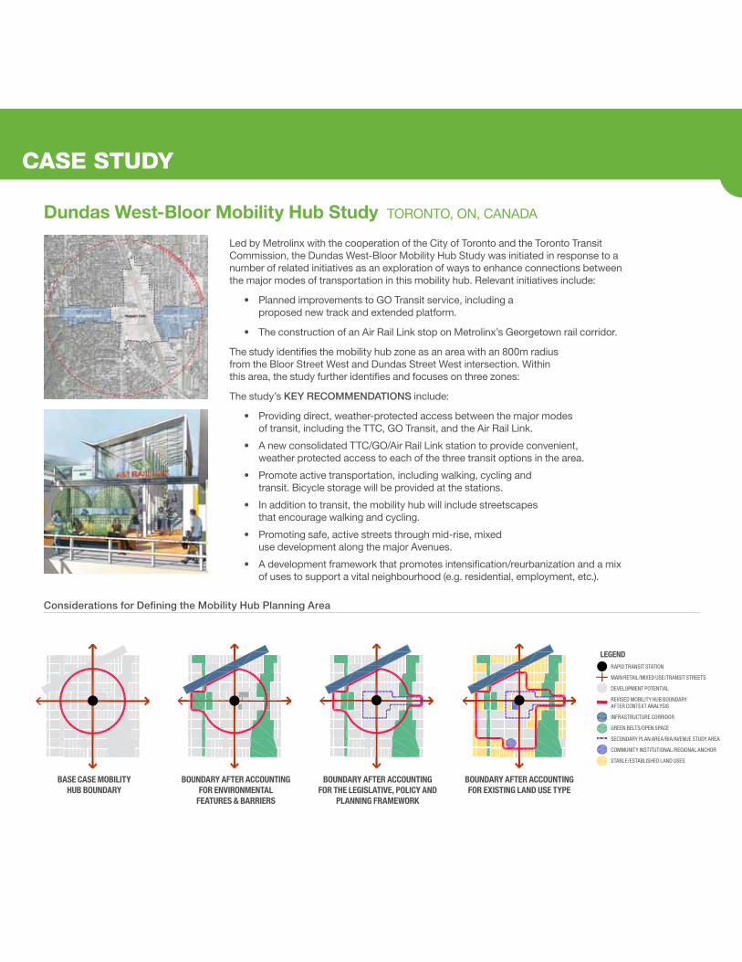
Led by Metrolinx with the cooperation of the City of Toronto and the Toronto Transit Commission, the Dundas West-Bloor Mobility Hub Study was initiated in response to a number of related initiatives as an exploration of ways to enhance connections between the major modes of transportation in this mobility hub. Relevant initiatives include:
• Planned improvements to GO Transit service, including a proposed new track and extended platform.
• The construction of an Air Rail Link stop on Metrolinx’s Georgetown rail corridor.
The study identifies the mobility hub zone as an area with an 800m radius from the Bloor Street West and Dundas Street West intersection. Within this area, the study further identifies and focuses on three zones:
The study’s KEY RECOMMENDATIONS include:
• Providing direct, weather-protected access between the major modes of transit, including the TTC, GO Transit, and the Air Rail Link.
• A new consolidated TTC/GO/Air Rail Link station to provide convenient, weather protected access to each of the three transit options in the area.
• Promote active transportation, including walking, cycling and transit. Bicycle storage will be provided at the stations.
• In addition to transit, the mobility hub will include streetscapes that encourage walking and cycling.
• Promoting safe, active streets through mid-rise, mixed use development along the major Avenues.
• A development framework that promotes intensification/reurbanization and a mix of uses to support a vital neighbourhood (e.g. residential, employment, etc.).
CASE STUDY
RAPID TRANSIT STATION
MAIN RETAIL/MIXED USE/TRANSIT STREETS
DEVELOPMENT POTENTIAL
REVISED MOBILITY HUB BOUNDARY AFTER CONTEXT ANALYSIS
INFRASTRUCTURE CORRIDOR
GREEN BELTS/OPEN SPACE
SECONDARY PLAN AREA/BIA/AVENUE STUDY AREA
COMMUNITY INSTITUTIONAL/REGIONAL ANCHOR
STABLE/ESTABLISHED LAND USES
LEGEND
BASE CASE MOBILITY HUB BOUNDARY
BOUNDARY AFTER ACCOUNTING FOR ENVIRONMENTAL
FEATURES & BARRIERS
BOUNDARY AFTER ACCOUNTING FOR THE LEGISLATIVE, POLICY AND
PLANNING FRAMEWORK
BOUNDARY AFTER ACCOUNTING FOR EXISTING LAND USE TYPE
Considerations for Defining the Mobility Hub Planning Area
Dundas West-Bloor Mobility Hub Study TORONTO, ON, CANADA
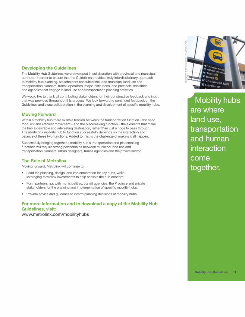
Mobility hubs are where land use, transportation and human interaction come together.
Live
rpoo
l Str
eet S
tatio
n in
Lon
don,
UK
.
Developing the GuidelinesThe Mobility Hub Guidelines were developed in collaboration with provincial and municipal partners. In order to ensure that the Guidelines provide a truly interdisciplinary approach to mobility hub planning, stakeholders consulted included municipal land use and transportation planners, transit operators, major institutions, and provincial ministries and agencies that engage in land use and transportation planning activities.
We would like to thank all contributing stakeholders for their constructive feedback and input that was provided throughout this process. We look forward to continued feedback on the Guidelines and close collaboration in the planning and development of specific mobility hubs.
Moving ForwardWithin a mobility hub there exists a tension between the transportation function – the need for quick and efficient movement – and the placemaking function – the elements that make the hub a desirable and interesting destination, rather than just a node to pass through. The ability of a mobility hub to function successfully depends on the interaction and balance of these two functions. Added to this, is the challenge of making it all happen.
Successfully bringing together a mobility hub’s transportation and placemaking functions will require strong partnerships between municipal land use and transportation planners, urban designers, transit agencies and the private sector.
The Role of MetrolinxMoving forward, Metrolinx will continue to:
• Lead the planning, design, and implementation for key hubs, while leveraging Metrolinx investments to help achieve the hub concept.
• Form partnerships with municipalities, transit agencies, the Province and private stakeholders for the planning and implementation of specific mobility hubs.
• Provide advice and guidance to inform planning decisions at mobility hubs.
For more information and to download a copy of the Mobility Hub Guidelines, visit: www.metrolinx.com/mobilityhubs
11Mobility Hub Guidelines

About Metrolinx
VisionWorking together to transform the way the region moves
MissionTo champion and deliver mobility solutions for the Greater Toronto and Hamilton Area (GTHA)
Metrolinx was created by the Government of Ontario in 2006 to:
• Provide leadership in the coordination, planning, financing, development and implementation of an integrated, multi-modal transportation network that supports a high quality of life, a sustainable environment and a strong, prosperous and competitive economy
• Be responsible for the operation of the regional transit system and the provision of other transit services
20 Bay Street, Suite 600Toronto, Ontario M5J 2W3
T 416.874.5900F 416.869.1794
www.metrolinx.com