

Michigan 3D Elevation Program (3DEP) State Workshop · Proposals may contribute funds toward lidar...
25
+ Charley Hickman National Map Liaison to Michigan and Ohio June 2, 2015 Michigan 3D Elevation Program (3DEP) State Workshop [email protected]
Transcript of Michigan 3D Elevation Program (3DEP) State Workshop · Proposals may contribute funds toward lidar...
+
Charley Hickman
National Map Liaison to Michigan and Ohio
June 2, 2015
Michigan
3D Elevation Program
(3DEP) State Workshop
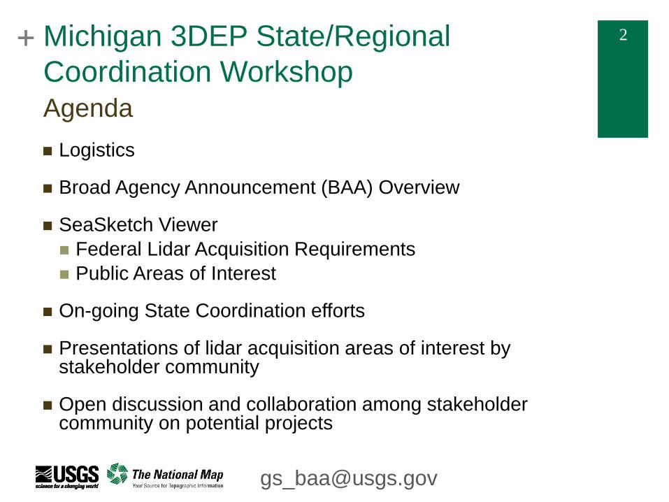
+ 2 + 2 Michigan 3DEP State/Regional
Coordination Workshop
Logistics
Broad Agency Announcement (BAA) Overview
SeaSketch Viewer
Federal Lidar Acquisition Requirements
Public Areas of Interest
On-going State Coordination efforts
Presentations of lidar acquisition areas of interest by stakeholder community
Open discussion and collaboration among stakeholder community on potential projects
Agenda
+ 3 + 3 Michigan 3DEP State/Regional
Coordination Workshop
Historically, National Map Liaisons have been directly engaged in project formulation activities for data acquisition
The BAA was put in place to increase visibility and accessibility of 3DEP partnership opportunities with the USGS. This requires a fair and competitive process. To ensure that no one has an unfair advantage over another, National Map Liaisons must recuse themselves from the formulation and direct coordination of BAA project proposals.
National Map Liaisons can actively promote goals, objectives and accomplishments of 3DEP; we can promote these forums and the SeaSketch viewer, however we are not able to assist with direct project formulation or partnership coordination prior to project awards. Potential partners are encouraged to continue to engage with others with shared geographic areas of interest.
Once projects are selected, National Map Liaisons can assist with partnership agreements needed to support the acquisition process
3DEP BAA Background – National Map Liaison Roles
+ 4 + 4 Michigan 3DEP State/Regional
Coordination Workshop Logistics
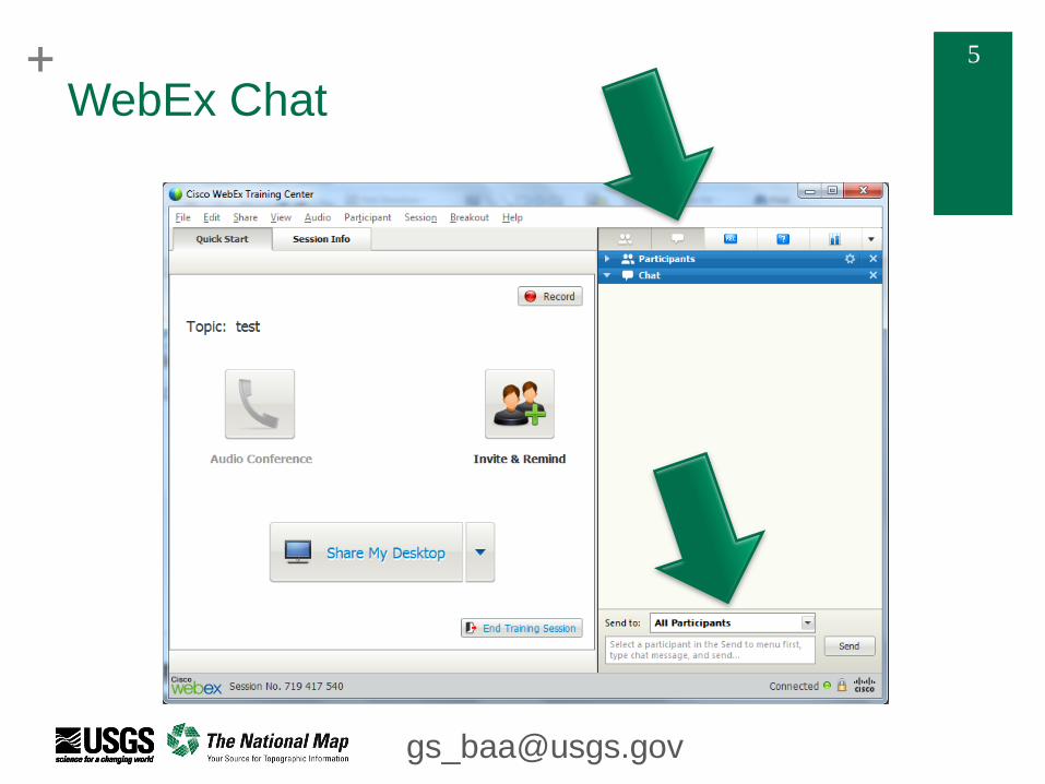
This meeting consists of both in-person and virtual attendees.
To accommodate our virtual colleagues, those in the room are
asked to speak directly into the microphone.
Virtual attendees will make use of the chat feature to submit
questions – see the panel on the right
Submit chat to “all participants”
Chat will be saved to assure a thorough response to all
questions
To maintain a similar record, In-person attendees are asked to
jot down and submit 3DEP and/or BAA program specific
questions on provided index cards
Questions passed to 3DEP program office
+ 6 + 6 Michigan 3DEP State/Regional
Coordination Workshop
3DEP BAA program specific questions will be passed to the
3DEP program office so questions and responses can be
added to the BAA FAQ
FAQs posted on
http://www.geoplatform.gov/elevation/3DEP/PublicMeetings
Program specific BAA questions can also be submitted to the
e-mail address [email protected]
Meeting attendees are encouraged to continue their interaction
subsequent to the meeting by making use of the contact
information provided by the presenters.
Logistics
+ 7 + 7
3D Elevation Program (3DEP)
3D Elevation Program (3DEP) FY15/16 Broad Agency Announcement (BAA) Information Sharing Site https://www.geoplatform.gov/elevation/3DEP 3D Elevation Program (3DEP) Upcoming Public Meetings (Webinars, Workshops) https://www.geoplatform.gov/elevation/3DEP/PublicMeetings
The 3D Elevation Program Initiative – A Call for Action http://pubs.usgs.gov/circ/1399/ USGS NGP Lidar Base Specification V1.2 http://pubs.usgs.gov/tm/11b4/pdf/tm11-B4.pdf For Further Information Contact: 3D Elevation Program: [email protected]
Resources
+ 8 + 8 Michigan 3DEP State/Regional
Coordination Workshop
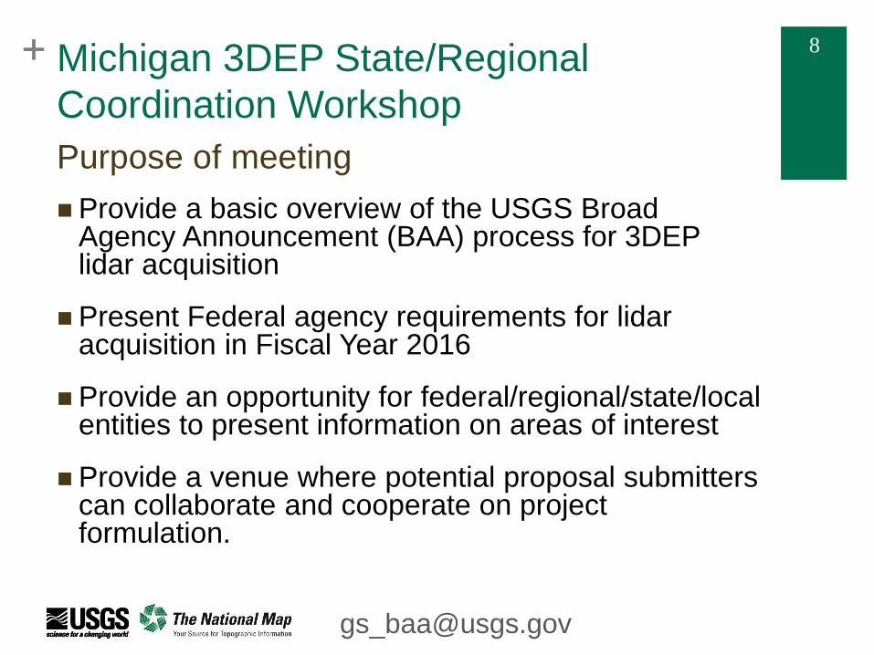
Provide a basic overview of the USGS Broad Agency Announcement (BAA) process for 3DEP lidar acquisition
Present Federal agency requirements for lidar acquisition in Fiscal Year 2016
Provide an opportunity for federal/regional/state/local entities to present information on areas of interest
Provide a venue where potential proposal submitters can collaborate and cooperate on project formulation.
Purpose of meeting
+ 9 + 9
Michigan 3DEP State/Regional
Coordination Workshop
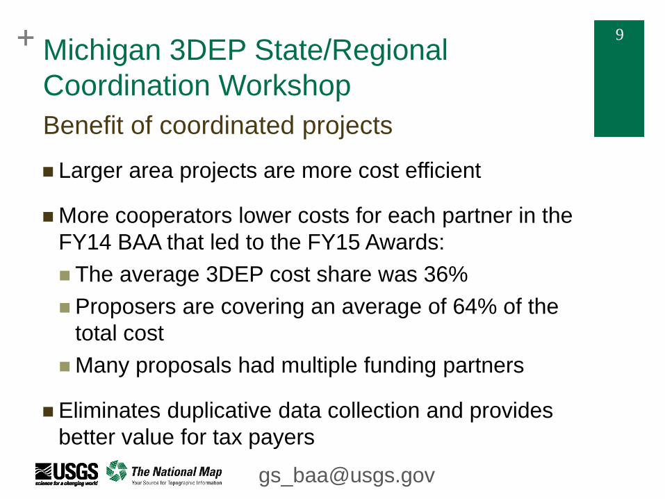
Larger area projects are more cost efficient
More cooperators lower costs for each partner in the
FY14 BAA that led to the FY15 Awards:
The average 3DEP cost share was 36%
Proposers are covering an average of 64% of the
total cost
Many proposals had multiple funding partners
Eliminates duplicative data collection and provides
better value for tax payers
Benefit of coordinated projects
+ 10 + 10 Michigan 3DEP State/Regional
Coordination Workshop
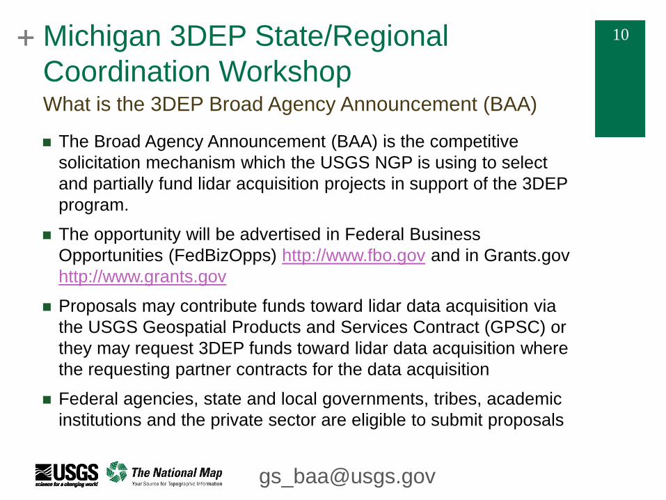
The Broad Agency Announcement (BAA) is the competitive
solicitation mechanism which the USGS NGP is using to select
and partially fund lidar acquisition projects in support of the 3DEP
program.
The opportunity will be advertised in Federal Business
Opportunities (FedBizOpps) http://www.fbo.gov and in Grants.gov
http://www.grants.gov
Proposals may contribute funds toward lidar data acquisition via
the USGS Geospatial Products and Services Contract (GPSC) or
they may request 3DEP funds toward lidar data acquisition where
the requesting partner contracts for the data acquisition
Federal agencies, state and local governments, tribes, academic
institutions and the private sector are eligible to submit proposals
What is the 3DEP Broad Agency Announcement (BAA)
+ 11 + 11
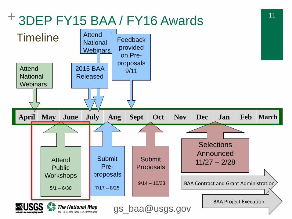
April May June July Aug Sept Oct Nov Dec Jan Feb March
Submit
Proposals
9/14 – 10/23
Submit
Pre-
proposals
7/17 – 8/25
Selections
Announced
11/27 – 2/28
Attend
National
Webinars
2015 BAA
Released
Feedback
provided
on Pre-
proposals
9/11
BAA Contract and Grant Administration
BAA Project Execution
3DEP FY15 BAA / FY16 Awards
Timeline
Attend
National
Webinars
Attend
Public
Workshops
5/1 – 6/30
+ 12 + 12
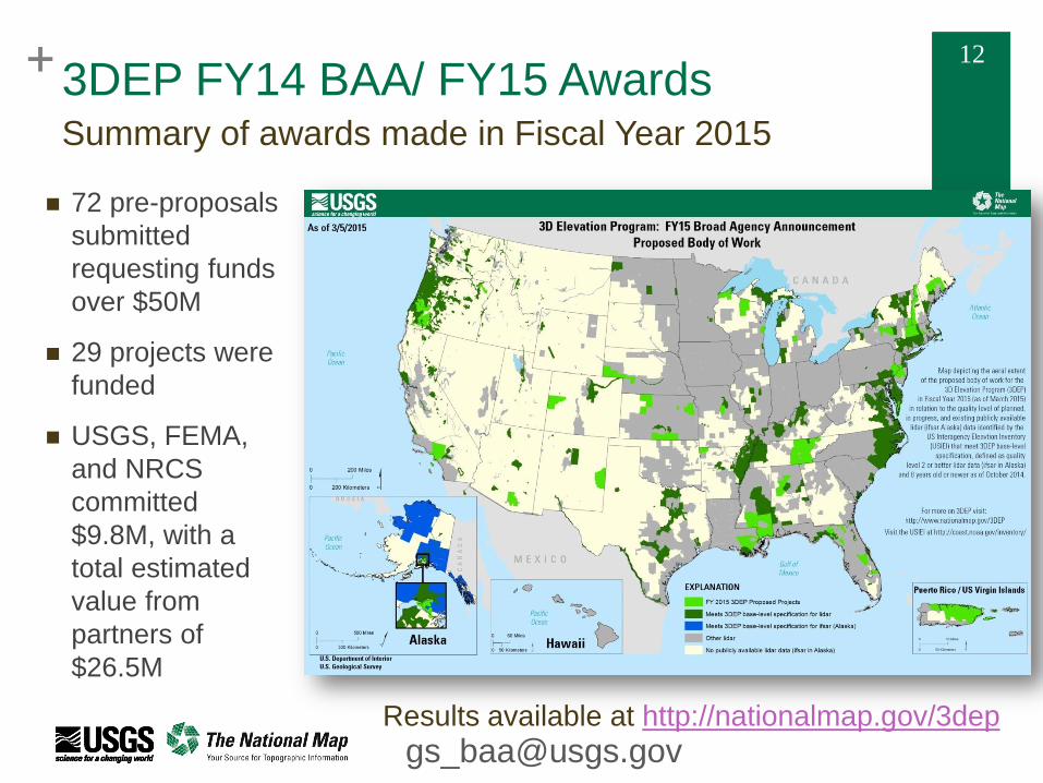
Summary of awards made in Fiscal Year 2015
Results available at http://nationalmap.gov/3dep
72 pre-proposals
submitted
requesting funds
over $50M
29 projects were
funded
USGS, FEMA,
and NRCS
committed
$9.8M, with a
total estimated
value from
partners of
$26.5M
3DEP FY14 BAA/ FY15 Awards
+ 13 + 13
3DEP Program Goals
QL2 data that are 8 years old or newer across the conterminous US
QL5 data in Alaska
Specifications
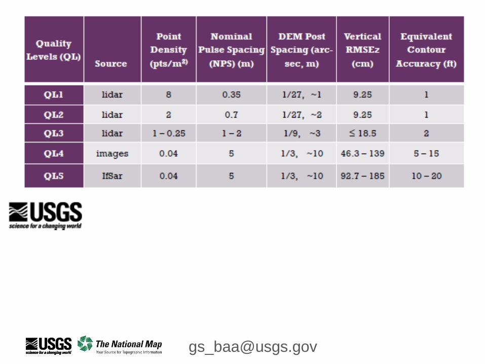
Must at a minimum adhere to the latest USGS Lidar Base Specification (see resources slide)
Higher quality lidar may be acquired through partner buy ups.
Reduce acquisition costs by increasing project area
Specific evaluation criteria will be in the BAA announcement and presented during the second set of public webinars which will be held directly after the release of the BAA
Questions should be directed to [email protected]
From 3DEP – A Call for Action (USGS Circular 1399)
+ 14 + 14
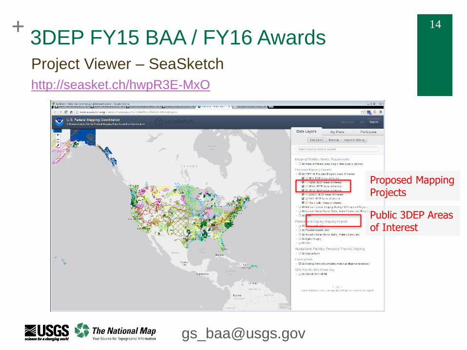
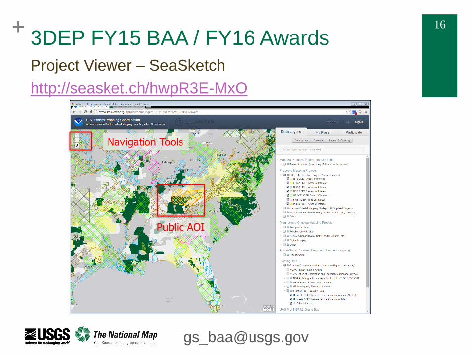
3DEP FY15 BAA / FY16 Awards
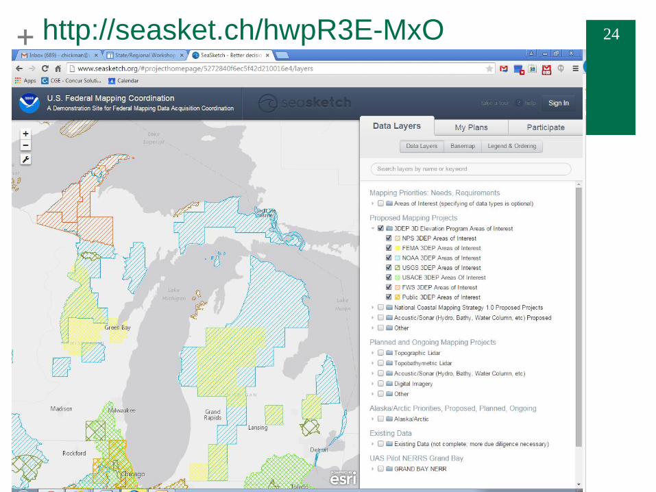
Project Viewer – SeaSketch
http://seasket.ch/hwpR3E-MxO
Proposed Mapping Projects
Public 3DEP Areas of Interest
+ 15 + 15
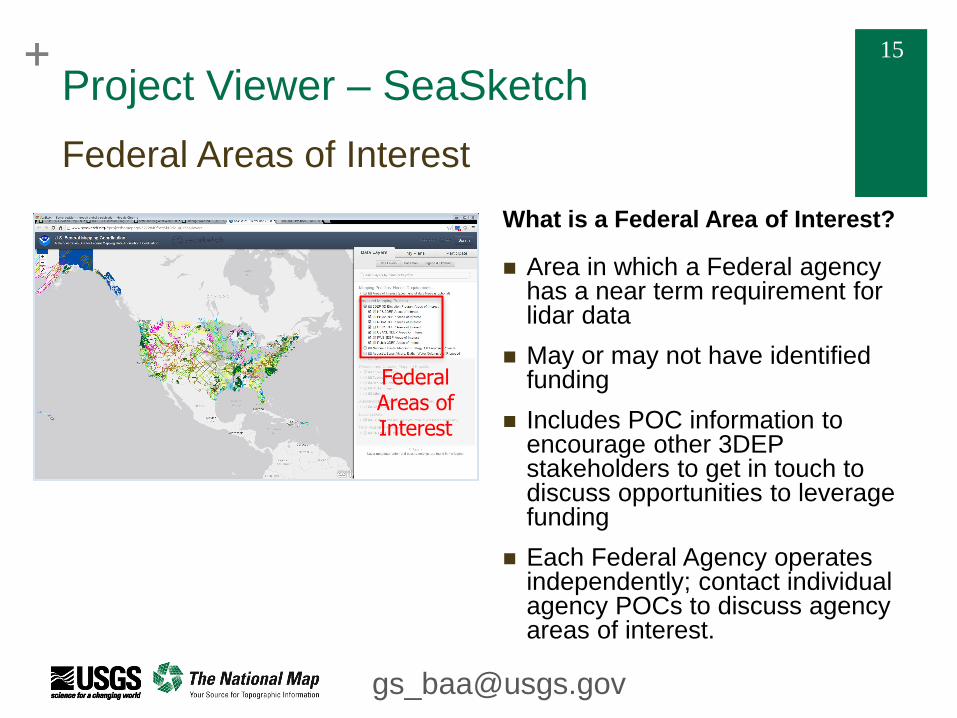
Project Viewer – SeaSketch
Federal Areas of Interest
What is a Federal Area of Interest?
Area in which a Federal agency has a near term requirement for lidar data
May or may not have identified funding
Includes POC information to encourage other 3DEP stakeholders to get in touch to discuss opportunities to leverage funding
Each Federal Agency operates independently; contact individual agency POCs to discuss agency areas of interest.
Federal Areas of Interest
+ 16 + 16
3DEP FY15 BAA / FY16 Awards
Project Viewer – SeaSketch
http://seasket.ch/hwpR3E-MxO
Navigation Tools
Public AOI
+ 17 + 17
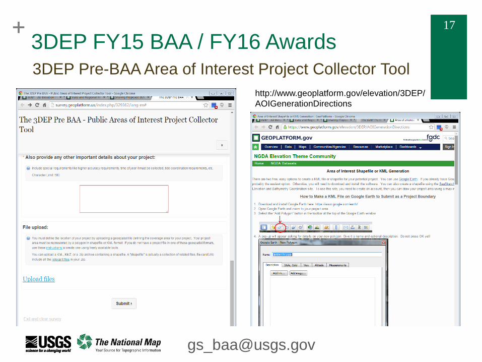
3DEP FY15 BAA / FY16 Awards
3DEP Pre-BAA Area of Interest Project Collector Tool
http://www.geoplatform.gov/elevation/3DEP/
AOIGenerationDirections
+ 18 + 18
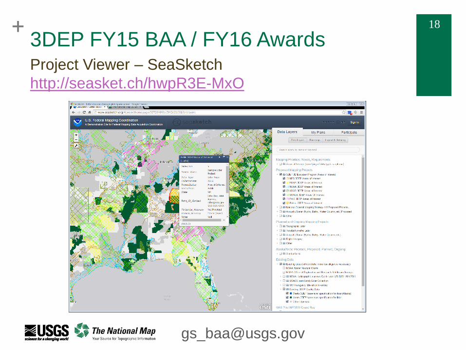
3DEP FY15 BAA / FY16 Awards Project Viewer – SeaSketch
http://seasket.ch/hwpR3E-MxO
+ 20 + 20 Michigan 3DEP State/Regional Coordination Workshop
State of Michigan – Everett Root
On-going State Coordination Efforts - Michigan
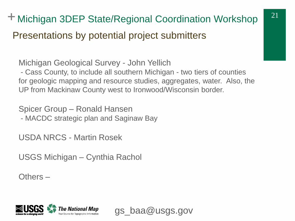
+ 21 + 21 Michigan 3DEP State/Regional Coordination Workshop
Michigan Geological Survey - John Yellich - Cass County, to include all southern Michigan - two tiers of counties
for geologic mapping and resource studies, aggregates, water. Also, the
UP from Mackinaw County west to Ironwood/Wisconsin border.
Spicer Group – Ronald Hansen - MACDC strategic plan and Saginaw Bay
USDA NRCS - Martin Rosek
USGS Michigan – Cynthia Rachol
Others –
Presentations by potential project submitters
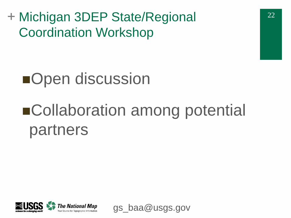
+ 22 + 22 Michigan 3DEP State/Regional
Coordination Workshop
Open discussion
Collaboration among potential
partners
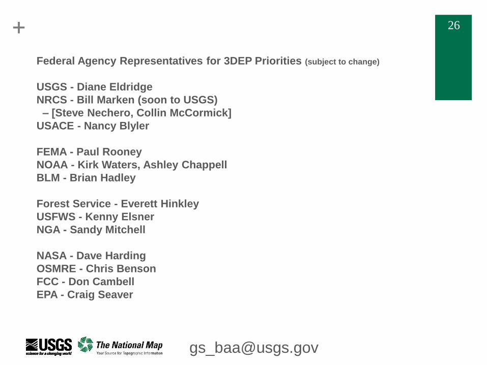
+ 26 + 26
Federal Agency Representatives for 3DEP Priorities (subject to change)
USGS - Diane Eldridge
NRCS - Bill Marken (soon to USGS)
– [Steve Nechero, Collin McCormick]
USACE - Nancy Blyler
FEMA - Paul Rooney
NOAA - Kirk Waters, Ashley Chappell
BLM - Brian Hadley
Forest Service - Everett Hinkley
USFWS - Kenny Elsner
NGA - Sandy Mitchell
NASA - Dave Harding
OSMRE - Chris Benson
FCC - Don Cambell
EPA - Craig Seaver