Encarnacao Alliance Understanding the dynamics of Oral Communication in working among slum dwellers!

SLUM PROFILE
2010
PRODUCED BY
‘Joining hands with the Urban poor’
&
UGANDA SLUM DWELLERS FEDERATION
MBARARA MUNICIPALITY
2 MBARARA | SETTLEMENT PROFILES
FORE WORD
ACTogether Uganda, Uganda Slum Dwellers Federation in partnership with Mbarara Municipal council and Ministry of Lands Housing and Urban Development with support from SDI and Cities Alliance, found it necessary that they collect this information so that the challenges of the urban poor living in these slum settlements can be bought to the fore-front in planning and development of Mbarara Municipality. Our purpose of putting together these profiles is to provide an inner understanding and most uncomfortable truth about the status of the urban slum settlements in Mbarara. The report comprises of a list of slum settlements in Mbarara Municipality and carries the most standardized detail of the informal settlements as provided by slum dwellers them selves.
It‟s paramount to note that the variables were not derived from professionals, academicians or technical people but rather the slum dwellers themselves who most understand the slum conditions simply because it‟s where they live and spend their time. We also found it very necessary to collect the past and present histories of each slum because with experience gained from working in slums, the history of each area has a significant role to play in its upgrading and development. Mbarara Municipal council has put in place necessary legal and regulatory mechanisms to safe guard the rights of people living in slum settlements and ensure that harmony, cohesion and inclusive development is given a priority. There fore it recognizes the presence, potentials and partnerships of people living in slums. Mbarara Municipal council authorities is fully committed to put inclusive urban development and use the slum profile Inventory as a planning basis for the better development of Mbarara into a city . Tumwine Wilson Mayor Mbarara Municipal Council

3 MBARARA | SETTLEMENT PROFILES
EXECUTIVE SUMMARY
Profiling of Mbarara Municipality was done as part of a Cities Alliance supported project for
transforming settlements of the urban poor in partnership with Uganda Slum Dwellers
Federation, ACTogether-Uganda and the Municipality of Mbarara. The exercise was mainly
geared towards identifying the informal settlements within the city and finding out details
about these areas on issues of land, housing, population, basic and social services, economic
activities, governance, community priorities and the historical background of the settlement.
The profiling exercise revealed that Mbarara has got a total of 11 informal settlements with a
population of over 80,000 people living within these areas. The settlements occupy about
3400 acres of land and the majority of the settlers are tenants paying rent ranging between
Ushs 10,000 and 80,000 per month. 90% of the people within the settlements in Mbarara
are low income earners earning an average daily income of 3000 - 5000 shillings.
The sole purpose of carrying out a city profile was to unveil valuable information about those
areas that are often over looked by authorities and yet harbor the people who are part and
partial of the urban fabric. The information gathered during this exercise will therefore go a
long way in influencing the planning for social service delivery and the development of a city
development strategy of Mbarara Municipal council. The exercise is also meant to mobilize
and encourage community participation in developmental activities especially through the
identification of their most urgent needs through community priorities.
Important to note is the fact that the information gathered was collected by communities
through community leaders and elders identified by the community themselves as being
more knowledgeable about their areas.

4 MBARARA | SETTLEMENT PROFILES
ACKNOWLEDGEMENT
This research inventory exercise in Mbarara would not have been possible without the support
of the various individuals whose dedication and commitment influenced the success of the
exercise. These include: the members of the National slum dwellers federation of Uganda
supported by ACTogether- Uganda staff members.
Special thanks also go to Mbarara Municipal Council (Mayor Mr. Tumwine Wilson, Town
clerk, Deputy Town clerk Mr. Mushabe Stratus, Physical planner Mrs. Kiconco Miriam, LC
chairpersons and councilors) which supported the activity from the start to the end and were
always willing to provide information and assistance wherever the need arose.

5 MBARARA | SETTLEMENT PROFILES
TABLE OF CONTENTS
FORE WORD ........................................................................................................................................... 2
EXECUTIVE SUMMARY ........................................................................................................................... 3
ACKNOWLEDGEMENT ......................................................................................................................... 4
TABLE OF CONTENTS ............................................................................................................................ 5
OBJECTIVES ............................................................................................................................................. 6
METHODOLOGY ..................................................................................................................................... 7
LOCATION .............................................................................................................................................. 8
SETTLEMENTS IN MBARARA ............................................................................................................... 9
MBARARA CITY: settlement profiles ................................................................................................... 10
KASHANYARAZE SETTLEMENT .................................................................................................... 10
KISENYI SETTLEMENT ...................................................................................................................... 13
KISWAHILI SETTLEMENT ................................................................................................................ 16
AKACHWAMPARE SETTLEMENT .................................................................................................. 19
KIZUNGU SETTLEMENT .................................................................................................................. 21
BIAFRA (KAJOGO) SETTLEMENT .................................................................................................. 24
KIYANJA SETTLEMENT ................................................................................................................... 26
BUTABIKA SETTLEMENT ................................................................................................................. 28
TANKHILL SETTLEMENT ................................................................................................................. 30
KIREHE SETTLEMENT ...................................................................................................................... 32
KIHANGIRE SETTLEMENT .............................................................................................................. 34
APPENDIX 1: INVENTORY DATA COLLECTION TOOL .................................................................. 36

6 MBARARA | SETTLEMENT PROFILES
OBJECTIVES
In the process of developing towns to create inclusive cities, bridging the gap between the urban poor and the developed communities is an important aspect of the process. The profiling exercise therefore intends;
1. To enable the slum dwellers and the Municipality to gather baseline information such as, Housing, population, infrastructure, basic service provision, livelihoods and governance that can be used for planning and guidance in the delivery of social services in all the informal settlements within Mbarara municipal council
2. To strengthen the working relationship between the urban poor communities and Mbarara municipality as they share information that can be used for the upgrading of informal settlements
3. To enhance the capacities of the slum dwellers involved in the research to collect and appreciate the use of self generated information in addressing the development needs of the their settlements
7 MBARARA | SETTLEMENT PROFILES
METHODOLOGY
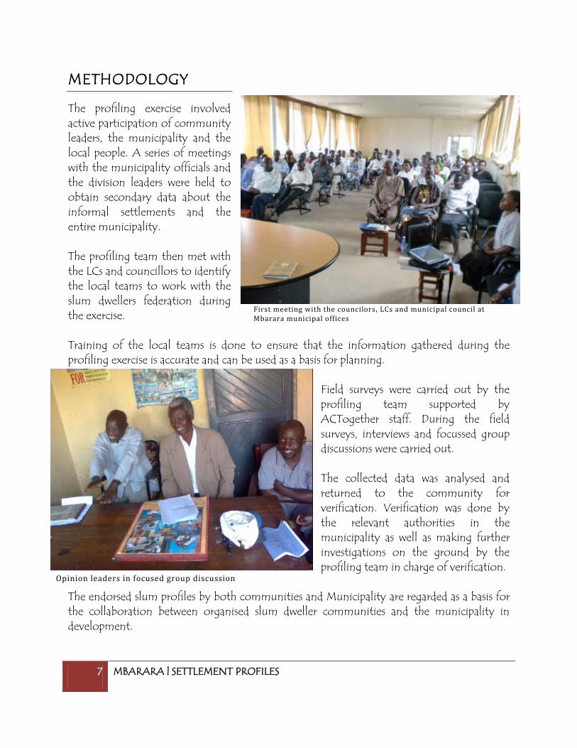
The profiling exercise involved active participation of community leaders, the municipality and the local people. A series of meetings with the municipality officials and the division leaders were held to obtain secondary data about the informal settlements and the entire municipality. The profiling team then met with the LCs and councillors to identify the local teams to work with the slum dwellers federation during the exercise. Training of the local teams is done to ensure that the information gathered during the profiling exercise is accurate and can be used as a basis for planning.
Field surveys were carried out by the profiling team supported by ACTogether staff. During the field surveys, interviews and focussed group discussions were carried out. The collected data was analysed and returned to the community for verification. Verification was done by the relevant authorities in the municipality as well as making further investigations on the ground by the profiling team in charge of verification.
The endorsed slum profiles by both communities and Municipality are regarded as a basis for the collaboration between organised slum dweller communities and the municipality in development.
First meeting with the councilors, LCs and municipal council at Mbarara municipal offices
Opinion leaders in focused group discussion
8 MBARARA | SETTLEMENT PROFILES
LOCATION
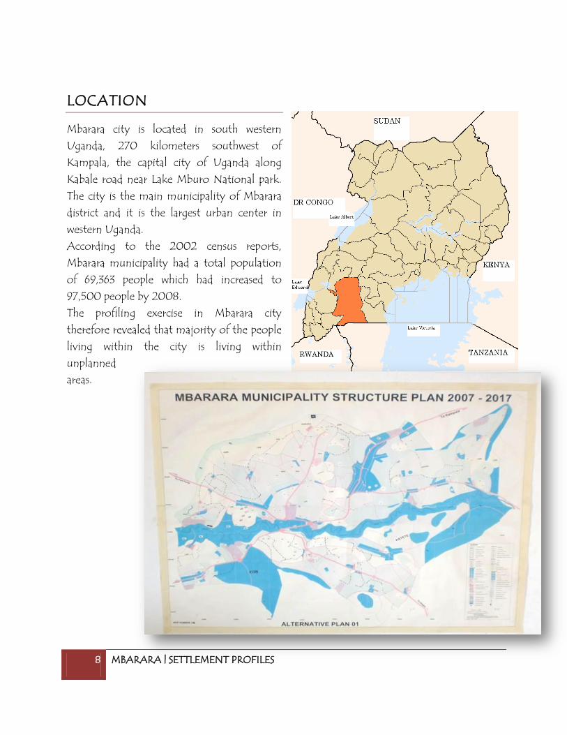
Mbarara city is located in south western
Uganda, 270 kilometers southwest of
Kampala, the capital city of Uganda along
Kabale road near Lake Mburo National park.
The city is the main municipality of Mbarara
district and it is the largest urban center in
western Uganda.
According to the 2002 census reports,
Mbarara municipality had a total population
of 69,363 people which had increased to
97,500 people by 2008.
The profiling exercise in Mbarara city
therefore revealed that majority of the people
living within the city is living within
unplanned
areas.

9 MBARARA | SETTLEMENT PROFILES
SETTLEMENTS IN MBARARA
A total of 12 settlements were identified in Mbarara municipality in three divisions. These include,
Akachwampare, Kihangire, Tankhill, Kirehe, Kiswahili, Kizungu, Kisenyi, Kiyanja, Kashanyalazi,
Biafura-Kiyanja and Kajogo.
DIVISION
SETTLEMENTS
NYAMITANGA
Akachwampare
Kihangire
Tank hill
Kirehe
KAKOBA
Kiswahili
Kizungu
Kisenyi
KAMUKUZI
Kiyanja
Kashanyarazi
Butabika
Biafura-Kiyanja
Kajogo

10 MBARARA | SETTLEMENT PROFILES
MBARARA CITY: SETTLEMENT PROFILES
KASHANYARAZE SETTLEMENT
LOCATION
This settlement is located in Kamukuzi division.
BRIEF HISTORY
The settlement got its name from the power plant which was established in the
area in 1950. The word “kashanyalaze” in Runyankole means Electricity.
LAND AND TENURE SYSTEM
The settlement covers a total area of 12.1 acres of land. This land is owned by
individuals some of whom reside within the settlement.
POPULATION
The total population of the settlement is approximately 3200 people with 650
households. The adult to children ratio is on average 1:4 per household.
HOUSING INFORMATION
The total number of structures was found to be 350 including both houses and
toilet structures. The average room size for the houses is 8ft by 8ft. the rent
structures within the settlement range between 25000 to 80000 shillings a
month.
BASIC SERVICES (UTILITIES)
Kashanyalaze settlement obtains water from both taps and River Rwizi. The
settlement has a total of 20 taps and these are privately owned. At the taps, a 20ltr
jerry can of water costs 150shs.
The people in this area use pit latrines which are privately owned. The area has a
total of 150 pit latrines

11 MBARARA | SETTLEMENT PROFILES
The settlement faces a few threats of flooding mainly caused by its location in a
valley. The drainage channel running within the settlement is poorly built and
lacks proper maintenance.
The garbage collected within the settlement is dumped in a garbage container
provided and maintained by Mbarara municipal council.
The settlement has access to electricity although not all individuals within the
settlement have got electricity.
The settlement has one internal road which connects to the main road.
(University road)
SOCIAL SERVICES
The area has got 2 churches; University bible Baptist church and University catholic
church,1 nursery school and a University; Mbarara University of Science and
Technology.

12 MBARARA | SETTLEMENT PROFILES
ECONOMIC ACTIVITIES
Majority of residents within the settlement are casual laborers who are earning a minimum wage of 1500 shillings per day.
FIGURE 1: SELLING FRESH VEGETABLES, ONE OF THE ECONOMIC ACTIVITIES IN THE SETTLEMENT
GOVERNANCE AND COMMUNITY PARTICIPATION IN DEVELOPMENT
The settlement is governed by the LC system with an LC1 within the
settlement. The community participation in development is limited due to lack of
awareness.

13 MBARARA | SETTLEMENT PROFILES
KISENYI SETTLEMENT
LOCATION
This settlement is located in Kakoba division and it consists of kakoba central cells.
BRIEF HISTORY
The first settlers came in the 1980s. The area at the time was bushy and was a
harbor for robbers due to its location with in the city. Business men from
Kampala named the area
Kisenyi after the Kisenyi in
Kampala which was also
known as a place of
robbers.
LAND AND TENURE SYSTEM
Kisenyi settlement covers a
total of 366.8 acres of land
and this land is owned by
individuals.
POPULATION
The total population of this
area is estimated to be 4000 people in whom there are about 500 households.
HOUSING INFORMATION
The total number of structures is estimated to be 4900 structures with the average
room size ranging from 10ft*12ft .The average housing capacity is 6 people per
household. Most of these houses are owned by landlords who charge about
35,000-40,000 shillings every month as rent. Each house has five households on
average.
BASIC SERVICES (UTILITIES)
Kisenyi settlement obtains its water from taps, spring wells and stand pipes. The
settlement has 1500 taps and stand points where a 10ltr jerry can goes for 100shs.
FIGURE 2: THIS SCHOOL PROVIDES EDUCATION SERVICES TO OVER 50% OF THE CHILDREN IN KISENYI

14 MBARARA | SETTLEMENT PROFILES
The settlement has got Anti- malaria channels which were provided and are
maintained by the municipality. The other drainages are natural drainage channels
created by running water.
The settlement has got a total of approximately 7000 toilets reason being each
house has a toilet attached to it. The area has got 1 sewer line which is maintained
by National water and sewerage cooperation. This sewer system is however not
enough for the entire settlement.
The people within the settlement use electricity, paraffin and candles for lighting,
fire wood and charcoal for cooking.
The settlement has a number of internal roads and external roads. The external roads
include Ruhara, Rwizilane, Katanywa, Kalikone, Kabateraine and Tibayunga roads. The
internal roads are Bulembe mainlink, Kwakwihikire, Sulayiti Musoke, Buchunku road and
Ndahendekire road.
SOCIAL SERVICES
The settlement has 12 drug shops, 5 clinics and 1 health center (Kakoba division
health center). The prevalent medical needs are Malaria, HIV/AIDS, cough and flu.
The area has got a number of
schools ranging from nursery
schools to secondary schools. In
total the settlement has 10
nursery schools, 8 primary
schools and 2 secondary
schools.
The picture on the left is an
example of a service that was
provided without the
community‟s participation. The
community in this area –
Kakoba central needed garbage
skips because their biggest
problem is solid waste management not human waste disposal. As a result the
FIGURE 3: A TYPICAL TOILET FOUND IN THE SETTLEMENT

15 MBARARA | SETTLEMENT PROFILES
government invested a great deal in providing the sanitation unit that is not being
utilized.
COMMUNITY PRIORITIES
The community pointed out the need to improve on hygiene and sanitation by Keeping
the anti malaria channel clean. Support orphans, vulnerable groups. Provide mosquito
nets. Control the sell of „drugs‟ in the area and unplanned pregnancy.
ECONOMIC ACTIVITIES
Majority of the settlers within the settlement are business men, bodaboda cyclists
and traders. The majority earn an average income of 3000 shillings per day.
FIGURE 4: WOMEN MAKING CANDLES FOR SALE AS A SOURCE OF INCOME
GOVERNANCE AND COMMUNITY PARTICIPATION IN DEVELOPMENT
The residents have a local council system as well as a council of elders who
decide on some issues. The community is aware of the 25% Local government
Development funds which they say has been used in road maintenance.

16 MBARARA | SETTLEMENT PROFILES
KISWAHILI SETTLEMENT
LOCATION
Kiswahili
settlement
is located in
Kakoba
division.
BRIEF HISTORY
The
settlement
started in the
1920s.The
first settlers
were Swahili
speaking
people from
Kenya, Tanzania
and Banubi. This place came to be known as Kiswahili because the first settlers were Swahili
speakers.
LAND AND TENURE SYSTEM
Kiswahili settlement covers 20 acres of land all of which is owned by individual
land lords.
POPULATION
The total population of Kiswahili settlement is estimated to be 2700 people
including men, women and children. The ratio of adult to children is 1:3 per
household.

17 MBARARA | SETTLEMENT PROFILES
HOUSING INFORMATION
The area has about 300 households and a total of 450 housing structures. The
average room size is 10ft by 10ft and the structures are mixed semi permanent and
permanent. Majority of the settlers in this area are tenants and on average they
pay 40,000-60,000 shillings per month.
BASIC SERVICES (UTILITIES)
Kiswahili settlement obtains its water from mainly stand pipes although the
settlement also has
a spring well. There
are about 120
standpipes owned
by individuals
within the
settlement. A
10liter jerry can of
water costs 100shs.
The water at the
spring well is free of
charge.
The settlement has
got drainage
channels which are
maintained by the local council 1 of the village. The drainages are however used as
dumping grounds by some members of the settlement. this makes maintenance
rather difficult for the LC1.
People within the settlement use pit latrines for human waste disposal. There are
approximately 400 toilets in the settlement and there is no sewer line within this
area.
The settlement has access to electricity although alternative forms of energy such
as Kerosine ang charcoal are used for lighting and cooking.

18 MBARARA | SETTLEMENT PROFILES
The area has got 2 internal roads and 3 external roads. The internal roads include
Butajura road and high street. The external roads include Ndahendekire, Kifaransa
and Bulemba roads.
SOCIAL SERVICES
The area has a number of social spaces which include playing fields, parks, schools
and health centers.
The area has 1 playing field (prisons play ground), 1 park( independence park) and
3churches; Kiswahili full gospel church, All saints church and Pentecostal church
near the prison.
There are 3 schools within the settlement. 2 nursery schools and 1 primary school
(Municipal school)
The settlement has 4 drug shops and the prevalent medical needs are Malaria, High
blod pressure and HIV/AIDS.
ECONOMIC ACTIVITIES
Majority of people within the settlement are self employed business men and women most of whom own retail shops and small businesses. The average income is 5000 shillings per day.
GOVERNANCE AND COMMUNITY PARTICIPATION IN DEVELOPMENT
The leadership structure in Kiswahili is the Local council system of governance. The community is aware of the 25% local government development fund which they say has been utilized in the development of roads.

19 MBARARA | SETTLEMENT PROFILES
AKACHWAMPARE SETTLEMENT
LOCATION
The settlement is located in Nyamitanga division.
BRIEF HISTORY
The settlement started in 1970.The first settlers came from Buganda and they had come to work for the church (Nyamitanga Cathedral).
LAND AND TENURE SYSTEM
Akachwampare land size is 5.74 acres and is owned by individuals.
POPULATION
The total population of Akachwampare settlement is approximately 300 people
and the ratio of Adult to children is 2:3.
HOUSING INFORMATION
The area has about 55 housing structures; the average room size is 8ft by 8ft. the
houses are made of
wattle, mud and bricks.
The average rent ranges
from 20,000 to
30,000shs per month.
BASIC SERVICES (UTILITIES)
The area obtains water
from stand pipes, taps
and River rwizi. The
water at the taps is
charged at 100shs per
10ltr jerry can. FIGURE 5: A TYPICAL TOILET FOUND IN THIS SETTLEMENT

20 MBARARA | SETTLEMENT PROFILES
The settlement uses pit latrines for human waste disposal and the area has about 15
toilets all of which are owned by individuals. Gabbage is dumped in banana
plantations.
The area has no drainage channels.
The area mainly uses electricity and paraffin for lighting and charcoal for cooking.
The settlement has got 1 internal road Nsikye kyera road which provides access
within the area.
SOCIAL SERVICES
The area does not have schools and recreation spaces. However, it has 1 church and
1 clinic which are privately owned.
COMMUNITY PRIORITIES
The community acknowledged that the place is not clean and that there is need for sensitization on health, hygiene and sanitation issues.
ECONOMIC ACTIVITIES
The main sources of employment within the settlement are Shops, bars, pool and pork joints where on average one earns about 2000shs per day.
GOVERNANCE AND COMMUNITY PARTICIPATION
The area‟s leadership is composed of the local council system and a town agent. The community has not participated in any development activities and is not aware of any development funds.

21 MBARARA | SETTLEMENT PROFILES
KIZUNGU SETTLEMENT
LOCATION
This settlement is located in Kakoba division and it consists of Kabateraine, Agip,
Central and market cells.
BRIEF HISTORY
The settlement started in 1986 when people begun settling within this area. Before
this the area did not have zones/cells but after the NRM government the RC
system was introduced and the municipality divided the area into zones. The zones
include Kabateraine, Agip, Central and Market zones.
LAND AND TENURE SYSTEM
Land in Kizungu settlement is owned by individuals and it covers about 84 acres of
land.
POPULATION
The settlement has a total population of 10,700 people. The ratio of adults to
children is approximately 1:5 per household.
HOUSING INFORMATION
The area has about 1040 housing units with the total number of households at
4800.
The average room size ranges between 8ft by 10ft and 3ft by 3ft being the smallest
room. Majority of the settlers are tenants and the pay an average rent of 30,000
shillings per month.

22 MBARARA | SETTLEMENT PROFILES
BASIC SERVICES (UTILITIES)
ZThe settlement gets water from taps and stand pipes. A 10ltr jerry can is charged
at 100shs per month. The water points are owned by individuals within the
settlement.
The settlement has 1
drainage channel which is
not well maintained and is
at times used as a dumping
site.
The settlement is not
connected to a sewer
system however people
within this area mainly use
pit latrines.
The settlement has got
electricity although there are alternative sources of energy such as charcoal and
firewood which are used for cooking.
The area has got a number of external roads these include; Kabateraine,
Tibamanya,
Buchuku,
Kakwicuire,
Ndahendekire
and Bosco roads.
The roads within
the area include
Kizungu road,
High street and
Akakinyambogo
road.
SOCIAL SERVICES
The settlement has got 3 churches and a mosque as the places of worship.
FIGURE 6: POORLY MAINTAINED DRAINAGE CHANNELS

23 MBARARA | SETTLEMENT PROFILES
The area has got 5 schools: parents nursery and primary school, calvary nursery and
primary school, Mbarara central nursery and primary school, Mbarara modern
school and Little stars nursery school.
The area has 9 clinics, 1 drug shop and 1 health center II. The prevalent medical
needs within the area are malaria and HIV/AIDS.
COMMUNITY PRIORITIES
The community in Kizungu identified the need for sewer lines within the area as
well as public toilets which can be accessed by the community.
ECONOMIC ACTIVITIES
Majority of residents within the settlement are self employed business men and women working in Mbarara town. Their average income ranges between 5000 and 20000shs per day.
GOVERNANCE AND COMMUNITY PARICIPATION
Local representation of the area is through the Local council. 6the residents are aware of the 25%Local Government Development Funds that are given by the municipality but they are not aware of what the funds are meant for or what they have done for their communities.
24 MBARARA | SETTLEMENT PROFILES
BIAFRA (KAJOGO) SETTLEMENT
LOCATION
This settlement is located in Kamukuzi Division.
BRIEF HISTORY
The settlement started in 1967 and the first settler was a man from Tanzania called
Suleiman. The residents of the place used to be drunkards who often fought a lot.
Their fighting was likened to that in the Nigeria-Biafra war hence the name Biafra.
LAND AND TENURE SYSTEM
The settlement lies on 139 acres of land. This land is owned by individuals.
POPULATION
The population within the settlement is estimated to be 1500 people at a ratio of 1
adult: 4 children.
HOUSING INFORMATION
The area has approximately 950 housing structure mostly semi permanent and
permanent. The average room size is 10ft by 12ft and on average each house has
3rooms. Majority are tenants who pay a monthly rent of 50,000 shillings.
BASIC SERVICES (UTILITIES)
The area has got stand pipes where a 10ltr jerry can goes for 100 shillings.
The area has got drainage channels that are maintained by the municipality
council.
The area has got a total of 951 pit latrines of which only 1 is a public toilet
constructed by the municipality council.
The settlement has got access to electricity.

25 MBARARA | SETTLEMENT PROFILES
The settlement has both internal and external roads. They identified Rwizi lane,
Ntare road, Kiswahili close as the external road and 3 internal roads whose names
were not identified.
SOCIAL SERVICES
The area has only 1 education facility which is a nursery school.
Other social spaces within the area include 2 churches and 1 mosque.
The settlement does not have any health services.
COMMUNITY PRIORITIES
The community pointed out the need for sanitation sensitization within the area
due to the poor sanitation conditions.
The area also has no sewer lines and therefore the community expressed the need
for sewer lines in their community.
ECONOMIC ACTIVITIES
The majority of the residents within the settlement are traders and self employed business men and women.

26 MBARARA | SETTLEMENT PROFILES
KIYANJA SETTLEMENT
LOCATION
This settlement is located in Kamukuzi Division.
BRIEF HISTORY
The first settlers in this area came in 1965. The first settler was a lady called Gladys
Twongyeirwe and She come from Bushenyi district. But Before Gladys came , the
ommugabe was the first to own land because he had a butchery and a latrine with
in. In 1969, the then Ankole District administration offered plots to who ever
wanted to develop the area. The place remained vacant.
LAND AND TENURE SYSTEM
The land in Kiyanja area is approximately 15 acres and it is owned by individuals.
POPULATION
The total population of this area is estimated to be about 2000 with a ratio of 1
adult to 5 children.
HOUSING INFORMATION
The area has got 500 housing structures and 1500 household. The average room
size is 10ft by 10ft and the houses are built with bricks, cement and iron sheets
materials. The average rent is 30000 shillings per month.

27 MBARARA | SETTLEMENT PROFILES
BASIC SERVICES (UTILITIES)
The settlement lacks drainage channels, and water taps.
FIGURE 7: ONE OF THE FEW TOILETS IN THE SETTLEMENT
The toilets within the area are few and are owned by some individuals. These toilets
are not open to public use.
COMMUNITY PRIORITIES
The community expressed the urgent need of an improved drainage system because the water
levels a high and the area has become water logged. This is even affecting the toilets within
the area because they have had to close some and yet they are few.

28 MBARARA | SETTLEMENT PROFILES
BUTABIKA SETTLEMENT
LOCATION
This settlement is located in Kamukuzi Division.
BRIEF HISTORY
Butabika settlement started in 1940. The people who used to live there were
drunkards and kept fighting hence the name-Butabika
LAND AND TENURE SYSTEM
The settlement is approximately 2 acres of land and the land is owned by
individuals.
POPULATION
The total population of this settlement is estimated to be 300 people with an
Adult to children ratio of 2:5.
HOUSING INFORMATION
The area has got 80 housing structures and 70 households. The average room size
is 6ft by 10ft. the houses are temporary and semi permanent, constructed using
bricks, mud and wattle. Average rent between 15000-30000 shillings per month.
BASIC SERVICES (UTILITIES)
The settlement has got 3 water stand points which are owned by a few individuals.
The water at the stand points is sold at 100 shillings per jerry can.
The settlement has got no drainage channels.
The settlement has access to electricity
The area has access to roads. It has a total 5 external roads but no internal roads.
SOCIAL SERVICES
The settlement has no social services such as schools, open spaces and places of
worship.

29 MBARARA | SETTLEMENT PROFILES
However, the settlement has 1 drug shop where medication treatment costs
10000-20000 shillings.
COMMUNITY PRIORITIES
The community
identified the need for
a drainage and sewer
system which does not
exist currently.
The area also has poor
roads and poor
sanitation which were
also mentioned as
development priorities
by the people within
this community.
ECONOMIC ACTIVITIES
The majority of people within the settlement are casual laborers and motorcyclists (Bodaboda cyclists) who earn an average daily income of 1000-2000 shillings.
GOVERNANCE AND COMMUNITY PARTICIPATION IN DEVELOPMENT
The settlement has got the local council system of governance where there is an LC1 representing the area. The community is not aware of any development initiatives and therefore has not participated in such activities.
FIGURE 8: AN EXAMPLE OF THE DRAINAGE CHANNELS IN THE REGION

30 MBARARA | SETTLEMENT PROFILES
TANKHILL SETTLEMENT
LOCATION This settlement is located in Nyamitanga Division and it consists of Rwizi market,
Kateera and Ruti wards.
BRIEF HISTORY
The settlement started between 1922 and 1970. The name tank hill came from a
big tank of water which was put here in 1979
LAND AND TENURE SYSTEM
The land in this settlement is approximately 1003 acres of land. This land is owned
by individuals.
POPULATION
The total population within this area is estimated to be 3000 people. The adult to
children ratio is 2: 3.
HOUSING INFORMATION
The area has got 900 housing structures with 670 households. The average room
size is 8ft by 10ft and the houses are generally permanent structures constructed
using bricks, iron sheets and cement. The average rent is 20000 to 30000
shillings per month.
BASIC SERVICES (UTILITIES)
The main sources of water
within this settlement are
taps, spring wells and River
Rwizi. At the taps, a jerry can
of water is charged 50shs
and 100shs in some areas. In
total, the area has about 79
stand points.
The area has no built up
drainage channels. However
it has 3 natural drainages
which are maintained by the
community them selves.
The settlement has 140 FIGURE 9: A POORLY MAINTAINED DRAINAGE CHANNELS

31 MBARARA | SETTLEMENT PROFILES
toilets, all of which are owned individually.
The settlement uses Electricity, firewood, kerosene as the forms of energy for
lighting and cooking
The settlement has access using both internal and external roads. The internal road
is Kabale-Ruti road and the external roads are Katego, Byanyima, Kibaku and
Ntengye roads.
SOCIAL SERVICES
The settlement has got a number of social spaces. These include places of worship:
5 churches and 2 mosques and 2 playing fields.
The area also has access to medical services from a number of health facilities. The
area has 2 health centers owned by the government, 4 drug shops and 1 clinic
owned by individuals. The prevalent medical needs are malaria, HIV/AIDs, cough
and flu.
COMMUNITY PRIORITIES
The community pointed out the need for better roads and improvement of anti
malaria channels
ECONOMIC ACTIVITIES
The majority of settlers within this area are business men and casual labourers. Brick-laying is also one of the economic activities in Tank hill. The average daily income is between 1000 to 3000 shillings per day.
GOVERNANCE AND COMMUNITY PARTICIPATION IN DEVELOPMENT
The area has a number of leaders such as the LC's, Youth, elders, Persons With Disabilities representative and women councils. the community is not aware of any development funds available to them.
32 MBARARA | SETTLEMENT PROFILES
KIREHE SETTLEMENT
LOCATION
This settlement is located in Nyamitanga Division.
BRIEF HISTORY
The settlement started in 1970. The first settler was John Ntengye who originated
from Kabale. The settler found a big tree called Orurehe and thus the place came
to be known as Kirehe.
LAND AND TENURE SYSTEM
The land in Kirehe area is approximately 400 acres and it is owned by individuals.
POPULATION
The total population of this area is estimated to be about 1500 people with a ratio
of 1 adult to 2 children.
HOUSING INFORMATION
The area has got 60 housing structures and 300 households. The average room
size is 10ft by 15ft and the houses are built with bricks, cement and iron sheets
materials. The average rent is 20000 shillings per month.
BASIC SERVICES (UTILITIES)
The settlement has 4 stand points which provide water to the entire area. A jerry
can of water is sold at 100shs.
The settlement lacks drainage channels.
There are 120 toilets within the area. Only 1 of these is a public toilet owned by
the municipality.
The forms of energy used within the settlement include electricity, kerosene,
charcoal and firewood.
The settlement has 1 external road: Kabale road.

33 MBARARA | SETTLEMENT PROFILES
SOCIAL SERVICES
The area has no schools but it has health services. The area has 1 clinic and Ruti
rehabilitation center.
COMMUNITY PRIORITIES
The community identified the need for road maintenance.
ECONOMIC ACTIVITIES
The biggest economic activity in this area is brick making. The income levels are 1000 to 10000 shillings per day.
FIGURE 10: BRICK-LAYING, ONE OF THE ECONOMIC ACTIVITIES CARRIED BY RESIDENTS OF THIS SETTLEMENT
GOVERNANCE AND COMMUNITY PARTICIPATION IN DEVELOPMENT
The area has got an LC1 representative who is responsible for the community in this area.

34 MBARARA | SETTLEMENT PROFILES
KIHANGIRE SETTLEMENT
LOCATION
This settlement is located in Nyamitanga Division.
BRIEF HISTORY
The settlement is said to have started in 1971.
Origin of the name: Two people came from different places, Matayo Gwateza
from Koki and Rwankuiinzirawo from Rwampala Rugando. Matayo was a preacher
while Rwankuinzire was a farmer. They taught people how to live and develop
themselves and the place prospered but when they died, the place became poor
again. That is how the place came to be called Kihangire.
LAND AND TENURE SYSTEM
The land in Kihangire area is approximately 640 acres and it is owned by
individuals.
POPULATION
The total population of this area is estimated to be about 1600 people with a ratio
of 2 adults to 5 children per household.
HOUSING INFORMATION
The area has got 250 housing structures and 2000 households. The average room
size is 10ft by 10ft and the houses are built with Mud, trees, sand mixed with
cement bricks. The average rent is 20000 shillings per month.
BASIC SERVICES (UTILITIES)
The settlement has it sources of water from, River Rwizi, boreholes, taps. Water at
the stand points is sold at 100shs per jerry can.
The settlement uses pit latrines for human waste disposal and in total the toilets
are 350. The toilets are individually owned and there is no price attached to their
usage.

35 MBARARA | SETTLEMENT PROFILES
The settlement uses Electricity, solar system and paraffin for lighting and Charcoal
is for cooking.
The settlement has external access from Kyoga road and internal access from
Kitebero road.
SOCIAL SERVICES
The settlement has got educational spaces, places of worship as well as recreational
spaces. The area has got 1 church and 1 mosque as the places of worship and 2
playing fields for recreation.
The area has got 3 educational facilities that include 2 primary schools and 1
secondary school.
COMMUNITY PRIORITIES
According to the information gathered, the area does not have any health facility
and drainage channels. This if true should be immediately considered as the
priorities for this community.
ECONOMIC ACTIVITIES
The major economic activities in Kihangire area include Brick making, toilet
digging and pancake baking. The average income is 30,000 shillings per month.
GOVERNANCE AND COMMUNITY PARTICIPATION IN DEVELOPMENT
The area is geoverned by the LC system of governance where by the people in
Kihangire have an LC1 who is the lowest authority in government. The
community is aware of the 25%LGDP funds although they are not aware of the
purpose

36 MBARARA | SETTLEMENT PROFILES
APPENDIX 1: INVENTORY DATA COLLECTION TOOL
CITY 1 LOCATION a. Administrative Zone b. Name of slum/ settlement 2. LAND a. Total area/Size of land b. Land Owners
c. Threat of eviction and from whom?
3. POPULATION DETAILS a. Total population (estimates)
b. Number of households/families
c. Adult to children ratio 4. HOUSING a. Total No. of structures b. Total No. of rooms c. Building materials d. Structure/room size e. Rent structures (average rent rate)
5. SERVICES a. Water i. Source of water ii. No. of stand points iii. Price iv. Ownership of water points b. Toilets and sewer i. Description of sewer system and
its maintenance
ii. No. of toilets iii. Ownership of toilets iv. Price of usage c. Drainage i. Type of drains and maintenance
ii. Threat of flooding

37 MBARARA | SETTLEMENT PROFILES
d. Energy
i. Forms of energy ii. Availability of electricity iii. Existence of informal
connections
e. Communication i. Major mode of transmitting
information
ii. Nearest telephone facility f. Road Access i. Internal roads ii. External road g. Waste disposal Description of systems of waste
disposal
h. Social spaces i. community centre ii. Church/ Mosque iii. Playing field iv. Other (specify)
6. EDUCATION i. Nursery school
ii. Primary school
iii. Secondary school
7. HEALTH CARE
i. Health services in the area
ii. Ownership
iii. Cost
iv. Prevalent medical needs
8. ECONOMIC ACTIVITIES
i. Main sources of employment
ii. Income levels 9. GOVERNANCE a. Leadership structures
b. Funds available to the community
and purpose
10. DEVELOPMENT INTERVENTIONS i. Identification of CBO

38 MBARARA | SETTLEMENT PROFILES
More about the settlement:
………………………………………………………………………………………………………………………………………………………………………………………………………………………………………………………………………………………………………………………………………………………………………………………………………………………………………………………………………………………………………………………………………………………………………………………………………………………………………………………………………………………………………………………………………………………………………………………………………………………………………………………………………………………………………………………………
The profiling tool collected information mainly about Land, households, basic services, social
services, community priorities, economic activities and the historical background the
settlement.
ii. Identification of NGOs and
description of their interventions
iii. Experiences of Community Development Funds or other local government funds
11. COMMUNITY PRIORITIES
12. HISTORY OF THE SETTLEMENT When was the settlement started? Who was the first settler and where did the first settlers originate from? What were the reasons for settlement‟s name? Any other important details about the settlement.

39 MBARARA | SETTLEMENT PROFILES
NOTES