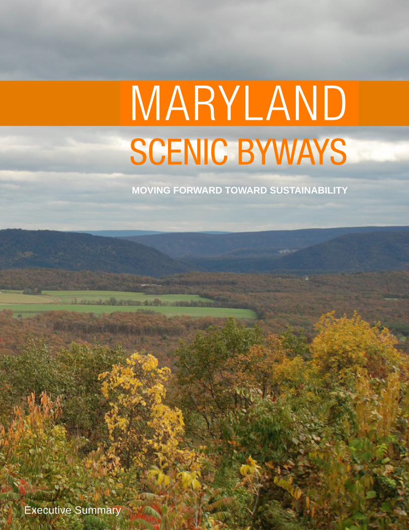
Maryland Scenic Byways Strategic Plan Executive Summary
12
SCENIC BYWAYS MOVING FORWARD TOWARD SUSTAINABILITY MARYLAND Executive Summary
Transcript of Maryland Scenic Byways Strategic Plan Executive Summary
SCENIC BYWAYSMOVING FORWARD TOWARD SUSTAINABILITY
MARYLAND
Executive Summary

- 2 -
1988Original Scenic Routes map and
trailblazer sign created- 432 miles from Ocean City to Oakland and
350 miles of side trips
2000New map & guide published higlighting 31 state scenic
byways covering 1,800 miles.
2000New trailblazing signing
installed with directional and confirmation signs featuring
Black Eyed Susan and byway nameplate
1991Scenic Routes Program updated to include numbered site attractions
signs correlated to the map. System expanded to 1,400 miles.
establishment building period
1999
TIMEL
INE
1991National Scenic
Byways Program established
2002Maryland’s Historic National
Road designated All-American Road and Chesapeake County,
designated National Scenic Byway
period

- 3 -
MARYLAND’S SCENIC BYWAYS
2006Context sensitive solutions
for Maryland’s Byways completed
2007New edition of map &
guide highlights 19 state and national byways
covering 2,487 miles, new thematic focus
2005Catoctin Mountain
Scenic Highway gainsnational designation
2009Maryland recieves
largest NSBP grant for $5.6 M
2010New strategic plan
initiated
2009Charles St., Harriet Tubman Underground
Railroad, and Religious Freedom gain national designation and Catocin Mountain renamed as
part of Journey Through Hallowed Ground
sustaining period
Current
2012The 64-page “Maryland Scenic Byways” map and guide published illustrating 18 byways that cover nearly 2,500 miles of
the state.
Mount Calvert along the Star-Spangled Banner National Historic Trail
TODAY AND YESTERDAYMaryland’s scenic byways program has evolved over the last twenty-four years since the first scenic routes map was published by the State Highway Administration (SHA) in 1988. These scenic and historic roadways have become so much more than just a line on a map—they provide experiences. Maryland’s Scenic Byways program helps communities along these routes enhance their quality of life and pride in their communities. The program adds significantly to the visitor experience by identifying and promoting as well as encouraging responsible management and preservation of the State’s most scenic, cultural and historic roads along with their surrounding resources.
Over the past twenty-four years, the SHA’s Scenic Byways Program has worked collaboratively with its sister agencies and programs—the Maryland Heritage Areas Program (MHAP), the National Park Service (NPS), the Office of Tourism Development (OTD), the Department of Planning (DOP), the Department of Natural Resources (DNR), and Maryland Main Street Program (MMSP)—along with support from the Federal Highway Administration’s National Scenic Byways Program to establish and develop the program into a system of byways that are linked together to create distinctive travel destinations throughout the state.
Today the program is moving forward to determine how best to sustain the qualities that make these routes worthy of the state or national designation —by all modes of travel. Today’s byways provide an opportunity for communities to attract visitors and educate their citizens by showcasing their history and culture. Today’s byways help to preserve a community’s natural and cultural resources and provide opportunities for economic development based on that history or culture by offering opportunities for people to stay and linger and learn about our history and culture.
This executive summary provides a brief overview of the "Maryland Scenic Byways: Moving Forward Toward Sustainability" Strategic Plan. The full plan can be found online at http://www.roads.maryland.gov/Index.aspx?PageId=567.

- 4 -
ACCOMPLISHMENTS OF MARYLAND’SSCENIC BYWAYS PROGRAM
• Established a system of 18 scenic byways encompassing 2,221 miles of beautiful roads offering a taste of Maryland’s scenic beauty, history and culture
• Increased awareness and established the national significance of six routes through the Federal Highway Administration’s National Scenic Byways Program
• Secured more than $17.2 million in direct funding and at least $3.4 million more in matching and leveraged funds and services to implement priority projects aimed at protecting, promoting and enhancing projects along the state’s system of scenic byways
• Secured more than six million in funding to directly support the protection, enhancement and promotion of the Star-Spangled Banner, Harriet Tubman Underground Railroad, Journey Through Hallowed Ground and C & O Canal Byways that are the backbones of three major commemorations occurring from 2011-2015
• Developed (or is in the process of developing) locally initiated management plans to help protect, promote and enhance 14 of the State’s 19 scenic byways
• Partnered with the OTD to produce and distribute hundreds of thousands of copies of byway maps and guides, supported by advertising campaigns, welcome center exhibits and international marketing to help spread the word about Maryland as a travel destination
• Adopted guidelines to help SHA project staff and other stakeholders understand the special qualities of a byway and make project and operational decisions that will reinforce and enhance these qualities—a project that was recognized by American Association of State Highway and Transportation Officials (AASHTO) along with the Federal Highway Administration (FHWA)– in 2007 for national recognition
• Installed outdoor interpretive exhibits along Maryland’s Historic National Road, Chesapeake Country and in 2012 along the Harriet Tubman and Star-Spangled Banner Byways to help tell some of the stories associated with these travel routes in a coordinated way
• Coordinated with DNR, Maryland Environmental Trust and other statewide and regional conservation and preservation organizations to conserve or preserve important landscapes and sites along Maryland’s scenic byways
• Supported market research by the Maryland Office of Tourism Development to gain a keener understanding of the public’s perception of scenic byways and heritage areas, and to guide future investments in scenic byways programs and projects
• Begun the process of upgrading State and National Scenic byway wayfinding signing to meet current Manual of Uniform Traffic Control Devices (MUTCD) standards. Funding includes support for web based navigational interpretive media to complement the upgraded sign system.
Over the past twenty-four years, the Maryland Scenic Byways Program has:

- 5 -
Scenic byways are designated for a variety of purposes:
• Somebywaysarespecificallydesignated to encourage heritage or nature-based tourism and provide a sequence of experiences designed to attract more visitors.
• Otherbywayswereoriginallydesignatedtohelpconservean area or preserve an historic landscapeordistrictandarenotdesignedspecificallytoattractmorevisitors–althoughmore may come due to the high qualityoflifethatisfoundthere.
• Stillotherbywaysweredesignated to protect the qualitiesoftheroaditself,whichmaybehistoricorcloselytiedwithanhistoricsettlementpattern and the sponsoring organizationswouldliketopreserve that historic road over time.
Whatever the purpose for its designation,theendresultisthatthebywayorganizationsneedtoworktogether to preserve or conserve itshistoricorscenicqualities,toguidegrowthanddevelopment,toworkcloselywithSHAandlocalgovernmentsonmakingsurethatfuturechangesfitwithinthecontextoftheroute,andtocollaborateamongsitesandattractionstotellthe byway’s stories and enhance the qualityofthevisitorexperience.
TOURISM OR PRESERVATION
MOVING FORWARD TOWARD
Statewide SystemIdentify, maintain and promote a statewide collection of scenic byways as an integral component of Maryland’s transportation system
Corridor ManagementAssist byway organizations in their efforts to fund and finance the needed conservation, preservation, interpretation, enhancement, and marketing activities to sustain the system of byways over time
Visitor ExperienceFacilitate the enhancement efforts needed to improve the understanding and enjoyment of the intrinsic qualities associated with Maryland’s Scenic Byways
Economic BenefitCollaborate with local, state and federal agencies with an interest in promoting Maryland’s system of scenic byways as a means of increasing economic activity associated with heritage or nature-based tourism
LivabilityUtilize byway planning and development as a means to advance community-based goals for livability and sustainable economic development
SUSTAINABILITYMoving forward, the Maryland Scenic Byways Program, along with its six agency partners and eleven byway sponsoring organizations, seek to work together towards achieving a sustainable system of scenic byways that contribute towards the State’s goals for preserving our natural and cultural heritage, enhancing economic opportunities related to that heritage, and providing the means to experience that heritage in a safe and enjoyable manner. To accomplish this overall vision, the Scenic Byways Program along with its agency partners and supporting organizations will work together to accomplish the following goals:
Horses and Hounds Scenic Byway- Greenspring Valley

- 6 -
VIRGINIA
PENNSYLVANIA
NEWJERSEY
DELAWARE
MARYLAND
£¤219£¤13
£¤30
£¤220
£¤50
§̈¦68
£¤11£¤522
£¤340
§̈¦81
£¤50
£¤29
£¤30
£¤15
£¤40
£¤340
£¤50
£¤50
£¤113
£¤9
£¤1
£¤301
§̈¦95
§̈¦270§̈¦97
§̈¦695
§̈¦83
£¤13
£¤40
£¤1 £¤301
§̈¦95
§̈¦295
§̈¦76
§̈¦95
§̈¦66
§̈¦81
£¤40
!15
!17
!5
!A!18
!1 !11
!B
!16
!A
!E
!4
!13
!3
!8!9
!D
!E
!10
!7
!1 !6
!14
!12
!12
!3
!2
!C
!19
!F
oLardner/Klein Landscape Architects, P.C.Planning Urban Design Landscape Architecture
MARYLAND SCENIC BYWAYS
LegendState Scenic BywayNational Scenic BywayAll American RoadInterstate RouteU.S. RouteState RoutePublic and Protected Lands*MunicipalitiesPriority Funding Area
0 10 205Miles
* Public and Protected Lands include federal, state and local lands, privately conserved lands, agricultural lands, environmental easements, and rural legacy areas.
GIS Sources: MDDNR, MD SHA, ESRI
9. Horses and Hounds10. Lower Susquehanna11.Charles Street12. Star-Spangled Banner13. Booth's Escape14. Roots and Tides15. Religious Freedom Byway16. Chesapeake Country17. Michener's Chesapeake Country18. Harriet Tubman Underground Railroad19. Cape to Cape
Other Regional BywaysA. George Washington Memorial ParkwayB. Brandywine Valley C. Route 9 Coastal Heritage BywayD. Harriet Tubman Underground Railroad (DE)E. Western Sussex BywayF. Bayshore Heritage Byway
Maryland Byways1. Mountain Maryland2. Historic National Road3. Chesapeake and Ohio Canal4. Antietam Campaign5. Journey Through Hallowed Ground6. Old Main Streets7. Mason and Dixon8. Falls Road
Over the next ten years, with the help of each of the byway’s sponsoring organizations and supporters, the Maryland Scenic Byways Program will work towards:• Developing a system of regional, multi-state and thematically related
byways within the Mid-Atlantic States
Maryland Eastern Shore and Delmarva Peninsula: Cape to Cape Byway from Cape Charles in Virginia to Cape Henlopen and Cape May
Chesapeake Country from Crisfield to Chesapeake City Maryland’s Capital Region
Star-Spangled Banner NHT and Byway (Solomon’s Island to Fort McHenry) with Lower Susquehanna and extend to Virginia and the District of Columbia as part of the National Historic Trail
Build upon the themes of leadership, conflict and resolution and natural beauty to establish Frederick as a major destination along the Journey Through Hallowed Ground from Monticello to Gettysburg
Western MarylandThematically connect C&O Canal, Maryland Historic National Road and Mountain Maryland
The Maryland Scenic Byways Program will continue to shape its statewide system of byways to develop a set of regionally based travel experiences that are thematically linked together and offer a more expanded set of destination-oriented experiences associated with those themes.
In Maryland, history and culture provide the strongest themes that hold the greatest potential for expanding the range of visitor experiences—whether it is the maritime heritage of the Delmarva Peninsula, the historic towns and landscapes of the Capital Region, or the many ridge and valley landscapes that climb up to the Allegheny Plateau.
Critical to the success is to build upon the strong foundation of collaboration among agency partners that has been the building block of the successful Maryland Scenic Byways Program and extend that foundation beyond the state to the mid-Atlantic region—so that these regionally-based travel experiences can be developed into destination-oriented experiences.
STATEWIDESYSTEM
Maryland Historic National Road Interpretive Panel at Town Hill Overlook

- 7 -
VIRGINIA
PENNSYLVANIA
NEWJERSEY
DELAWARE
MARYLAND
£¤219£¤13
£¤30
£¤220
£¤50
§̈¦68
£¤11£¤522
£¤340
§̈¦81
£¤50
£¤29
£¤30
£¤15
£¤40
£¤340
£¤50
£¤50
£¤113
£¤9
£¤1
£¤301
§̈¦95
§̈¦270§̈¦97
§̈¦695
§̈¦83
£¤13
£¤40
£¤1 £¤301
§̈¦95
§̈¦295
§̈¦76
§̈¦95
§̈¦66
§̈¦81
£¤40
!15
!17
!5
!A!18
!1 !11
!B
!16
!A
!E
!4
!13
!3
!8!9
!D
!E
!10
!7
!1 !6
!14
!12
!12
!3
!2
!C
!19
!F
oLardner/Klein Landscape Architects, P.C.Planning Urban Design Landscape Architecture
MARYLAND SCENIC BYWAYS
LegendState Scenic BywayNational Scenic BywayAll American RoadInterstate RouteU.S. RouteState RoutePublic and Protected Lands*MunicipalitiesPriority Funding Area
0 10 205Miles
* Public and Protected Lands include federal, state and local lands, privately conserved lands, agricultural lands, environmental easements, and rural legacy areas.
GIS Sources: MDDNR, MD SHA, ESRI
9. Horses and Hounds10. Lower Susquehanna11.Charles Street12. Star-Spangled Banner13. Booth's Escape14. Roots and Tides15. Religious Freedom Byway16. Chesapeake Country17. Michener's Chesapeake Country18. Harriet Tubman Underground Railroad19. Cape to Cape
Other Regional BywaysA. George Washington Memorial ParkwayB. Brandywine Valley C. Route 9 Coastal Heritage BywayD. Harriet Tubman Underground Railroad (DE)E. Western Sussex BywayF. Bayshore Heritage Byway
Maryland Byways1. Mountain Maryland2. Historic National Road3. Chesapeake and Ohio Canal4. Antietam Campaign5. Journey Through Hallowed Ground6. Old Main Streets7. Mason and Dixon8. Falls Road
Maryland’ssystemofscenicbywayshasservedasanationalmodelforlinkingtogetherbestpracticesintransportation infrastructure with best practices in heritage tourism.
• Three hundred thousand copies ofMaryland’s2012ScenicBywayGuidebookandfivehundredthousandScenicBywaysMapswere printed and distributed in the fallof2012.
• Maryland’sOfficeofTourismDevelopmentattributesa27%growthinoverseasvisitors,inpart,tomoreattractivevisitoropportunities captured and promotedusing“fly-drives”thatfeatureMaryland’ssystemofAmerica’sBywaysandincreasedmarketingsupportedbytheNSBfunding investment. Overseas visitors spend more time and moneyinMarylandascomparedwith domestic visitors.
• TheCapitalRegionUSA(CRUSA)websitemarketsMaryland’sscenicbywaysdirectlytointernationalvisitors(whothenfindwhattheyarelookingforandgettheresafelywhiletravelingonMaryland’sScenicBywaysusingthemaps,guidesandroutemarkingsignagefundedthroughtheScenicBywaysprogram(Seecapitalregionusa.org/Trip-Ideas/scenic-Drives).
• Establishing scenic byways as the primary touring routes for Mary-land’s system of state and national heritage areas –(Charles Street and the Baltimore City National Heritage Area; Religious Freedom and the Southern Maryland Heritage Area; Lower Susquehanna Heri-tage Greenway and Byway) and encouraging greater collaboraton where a byway crosses multiple heritage areas (Chesapeake Coun-try with its three heritage areas, and Maryland Historic National Road with its four heritage areas)
• Completing the missing links in the system by supporting byway planning and development efforts associated with the Potomac River (C&O Canal), Mountain Maryland, and potentially with the Patuxent River Watershed
• Repositioning and marketing Maryland’s scenic byways associated with three regional experiences: the Delmarva Peninsula, the Capital Region, and Western Maryland
BEST PRACTICES

- 8 -
BEST PRACTICES:CHESAPEAKE COUNTYNATIONAL SCENIC BYWAY
CORRIDOR MANAGEMENTRecommended Strategies:As the byway system evolves over the next ten years, so too must the tools and techniques utilized to manage those byways. In order to move forward towards sustainability, each byway, with the support of the Maryland Scenic Byways program and its partners will work towards:
• Supporting the funding and development of corridor plans for the three remaining Maryland-designated scenic byways with strong interest in heritage tourism.
• Gaining adoption (by reference to CMP) of all corridor manage-ment plans as part of each local jurisdiction’s (county and city) comprehensive plan and each Maryland and National Heritage Area comprehensive management plans.
• Communicating roadway related scenic byway management objectives to SHA and RPO/MPO, county/city transportation and public works departments utilizing context sensitive solutions and approaches for any work that is undertaken along a designated scenic byway.
• Reestablishing connections with related agencies and programs through the corridor management update process by requiring that plans be updated every ten years and that two-year work plans be prepared and updated annually.
• Linking preservation and conservation priorities for byways with those of other statewide and regional organizations.
Chesapeake Country National Scenic Byway and its private partners in conservation, have used federal funding, in part, to purchase conservation easements that help protect scenic vistas along the byway.
SHA has implemented a number of context sensitive transportation projects along the MHNR including two reconstructed bridges at Little Meadows and Sideling Hill as well as new pedestrian connections between Grantsville and Casselman River Bridge State Park.
Maryland Environmental Trust, Maryland State Highway Administration and the Eastern Shore Land Conservancy teamed up to preserve two farms along the Chesapeake Country Scenic Byway (Browning Creek Farm in Cecil County (right) and Brown's Branch Farm in Queen Anne's County (left).
Work on the Little Meadows Bridge along the Historic National Road

- 9 -
As funding for project implementation gets more competitive for scarcer dollars, there is a critical need to collaborate among byway organizations, heritage areas, greenway and trail groups, conservation and preservation organization, and tourism related businesses and organizations. Collaboration is needed to help visitors to find and follow the byways, tell the byway stories, market and manage the byway experience and enhance the byway to increase the range and quality of visitor facilities.
In 2006, the Tourism Council of Frederick County was awarded its first in a series of grants that led to the new Frederick Visitor Center. Although a stand-alone, independent organization, the Tourism Council of Frederick County is fortunate in that it receives revenue from the state hotel tax.
VISITOR EXPERIENCE
Recommended Strategies:Over the next 10 years the Maryland Scenic Byways program, its sponsoring byway organizations, and partners will work towards:
• Coordinating, installing, and adjusting all the necessary signing that helps byway visitors to find and follow the byways within the system. This will be accomplished by organizing each byway as a primary spine, with branches and sidetracks that lead to specific destinations signed as part of the Tourism Area and Corridor Signing Program.
• Coordinating signing, wayfinding and interpretation with other organizations programs so that all signing associated with a Maryland Scenic Byway presents a coherent and identifiable image, including signing along or visible from the byway associated with Chesapeake Bay Gateways Network sites, the routes or sites associated with National Historic Trails, the system of Civil War Trails markers, as well as local wayfinding programs.
• Coordinating, monitoring and updating inventories of byway related visitor assets to keep visitor information (paper, web-based and mobile) about byway related features and visitor readiness accurate and coordinated among various partner programs.
• Developing a coordinated interpretive framework for Maryland’s scenic byways on a regional basis.
• Incorporating the byway travel experience in appropriate marketing mediums and messages.
• Collaborating among regional partners and heritage tourism related businesses to establish new byway facilities and programs including gaining support for enhancements to existing small museums along byways and for programming coordinated events such as a concert series, living history, or traveling art exhibits along the lines of the trail towns program for Great Allegheny Passage (http://www.atatrail.org/pv/trailtowns.cfm).
This revenue allowed the Council to put up a match for its first grant. Over the course of the next few years, the Council received several grants at the state and federal levels, as well as from non-profit organizations. These included grants from Preserve America, FHWA’s National Scenic Byways Program, the Maryland Heritage Areas Authority, and the Chesapeake Bay Gateways Network (CBGN) of the National Park Service.
By pursuing multiple grants, the Council was able to use state grants as matches for federal grants, federal grants as matches for nonprofit organization grants and so on, leveraging one against another.
BEST PRACTICES:FREDERICK VISITOR CENTER (MARYLAND)
-10-
Recommended Strategies:Over the next 10 years, Maryland’s Scenic Byways Program and its sponsoring byway organizations will work towards:
• Identifying opportunities and establishing cooperative agreements for scenic byway, trail and heritage area management with common interests and goals.
• Streamlining and/or providing clear and straight-forward guidelines for implementing the federally-funded local assistance programs for enhancing Maryland’s system of scenic byways and related projects (Transportation Alternatives as recently authorized in Map-21).
• Establishing an officially designated SHA district-based contact point with charge number and budget to better coordinate the day to day management needs for scenic byways, especially 3R work and local government coordination.
• Using regional planning organizations or resource conservation districts as a means of organizing combined regional scenic byway, trail and heritage area committees to facilitate regional cooperation/coordination and to provide opportunities for public engagement in the scenic byway development process (consolidate existing byway committees into regional committees).
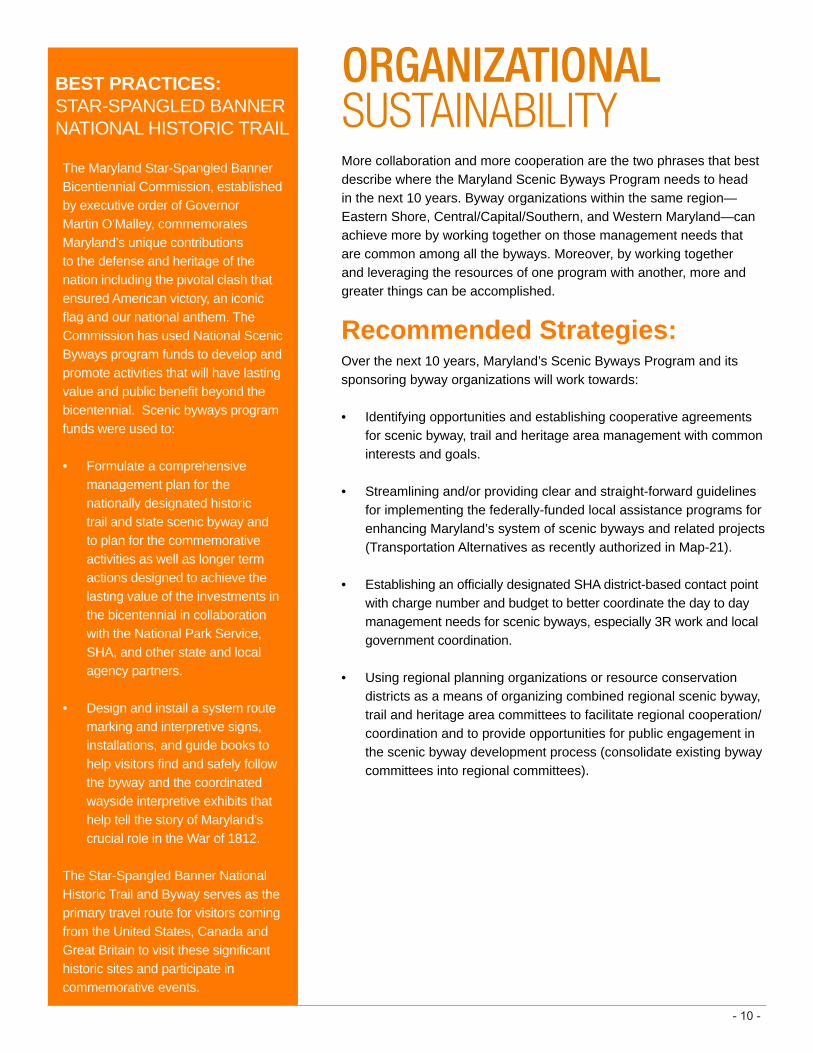
The Maryland Star-Spangled Banner Bicentiennial Commission, established by executive order of Governor Martin O’Malley, commemorates Maryland’s unique contributions to the defense and heritage of the nation including the pivotal clash that ensured American victory, an iconic flag and our national anthem. The Commission has used National Scenic Byways program funds to develop and promote activities that will have lasting value and public benefit beyond the bicentennial. Scenic byways program funds were used to:
• Formulate a comprehensive management plan for the nationally designated historic trail and state scenic byway and to plan for the commemorative activities as well as longer term actions designed to achieve the lasting value of the investments in the bicentennial in collaboration with the National Park Service, SHA, and other state and local agency partners.
• Design and install a system route marking and interpretive signs, installations, and guide books to help visitors find and safely follow the byway and the coordinated wayside interpretive exhibits that help tell the story of Maryland’s crucial role in the War of 1812.
The Star-Spangled Banner National Historic Trail and Byway serves as the primary travel route for visitors coming from the United States, Canada and Great Britain to visit these significant historic sites and participate in commemorative events.
ORGANIZATIONAL SUSTAINABILITYMore collaboration and more cooperation are the two phrases that best describe where the Maryland Scenic Byways Program needs to head in the next 10 years. Byway organizations within the same region—Eastern Shore, Central/Capital/Southern, and Western Maryland—can achieve more by working together on those management needs that are common among all the byways. Moreover, by working together and leveraging the resources of one program with another, more and greater things can be accomplished.
BEST PRACTICES: STAR-SPANGLED BANNER NATIONAL HISTORIC TRAIL

-11-
Duringthesummerof2011,theCityofBaltimoreNationalHeritageArealaunchedatransportation-basedmarketingcampaigntopromoteawarenessofthenationalscenic byway running through the heartofBaltimore.
CraftedbyBaltimore-based,woman-ownedMJACHDesigns,the12-monthcampaigninvolvedabrandedCharmCityCirculatorbuswiththetagline“NotYourOrdinaryScenicByway.”
A well-managed scenic byway is an economic development tool as well as an opportunity for the communities through which it passes to maintain and improve their overall quality of life. Visitors choose to travel on scenic byways for the same reasons that people choose to live there—because of a unique sense of place or identity.
LIVABILITY EMPHASIS
Recommended Strategies:Over the next 10 years the Maryland Scenic Byways program, its sponsoring byway organizations, and partners will work towards:
• Increasing the awareness of local government and stakeholders in the role that active byway management can play to enhance the overall livability of their community (creating more business opportunities and developing more things to see and do in a community as part of the byway planning effort).
• Developing collaborative enhancement projects that link together the management needs of the byway with the needs of each byway community including recreational access, multi-modal transportation opportunities, pedestrian and bicycle safety, environmental quality and economic revitalization.
• Updating corridor management plans and enhancement priorities to more closely link community-based enhancement projects with the byway’s management and development.
Photograph courtesy of the Maryland War of 1812 Bicentennial Commission
TheCirculatorisafreebusserviceoperatingonthreeservicelinesdesigned to encourage the use ofpublictransportationanddrawvisitors and residents to the city’s culturalinstitutionsandhistoricneighborhoods.
Themarketingcampaignusedbright,colorfuldesignsandcontemporaryprofessionalphotographytohighlightthediversity of experiences and placesalongCharlesStreet.AradiocomponentoftheCirculatorcampaignwaslaunchedinspring,2012.
BEST PRACTICES: CHARLES STREET

ACKNOWLEDGEMENTS
Maryland Scenic Byways Program Advisory CommitteeSHA thanks the following Maryland Scenic Byways Strategic Plan Advisory Committee members who helped advise on the development of this plan.
Marty Baker, Maryland Department of Transportation Jeffrey Buchheit, Baltimore City Heritage AreaSuzanne Copping, National Park Service Amanda Fenstermaker, Dorchester County Tourism Christopher Haugh, Frederick County Tourism Richard Hughes, Maryland Department of Planning Jeanette Mar, Federal Highway Administration
Jay Parker, Lower Eastern Shore Heritage CouncilBill Pencek, Office of Tourism Development Roslyn Racanello, Southern Maryland Heritage Area Marci Ross, Office of Tourism DevelopmentAmy Seitz, Department of Housing and Community Development John F. Wilson, Department of Natural Resources
Sponsors and StakeholdersThroughout the strategic planning process, the following byway sponsors and stakeholders contributed ideas, gave presentations and offered suggestions to assist in the development of this strategic plan.
Tiffany Ahalt, Maryland National Road AssociationEllie Altman, Adkins ArboretumMelissa Appler, Maryland Department of PlanningJudy Bixler, Oxford Bellevue Ferry, Oxford Talbot County
Tourism Board Chrm.Bernadette Bowman, Kent County Tourism & Economic
Development, Chesapeake CountryDon Briggs, NPS Potomac Heritage National Scenic TrailCarolyn Brinkley, Town of Centreville, Centreville Main StreetFrank Cavanaugh, Talbot County Village Center BoardJay Corvan, ArchitectDeborah Divins, Dorchester Chamber of Commerce,
Stories of the Chesapeake Heritage AreaFaith Elliott Rossing, Queen Anne’s County Economic
Development and TourismJean Fabi, Queen Anne’s County Planning and ZoningElizabeth Ferguson, Rural Life MuseumJerry Freibaum, Tilghman Village CommitteeWayne Gannaway, America’s Byways Resource Center
(former)Carla Gerber, Kent County Planning, Housing & Zoning,
Chesapeake CountryDonna Glime, Federalsburg Historical SocietyJoe Glime, Federalsburg Historical SocietyDenise Harris, Journey Through Hallowed GroundDawn Hein, Mountain Maryland Gateway to the West
Heritage AreaStephen Hollie, RK&K for SHA/TEDDAnne Kyle, Maryland Office of TourismLynn Lanham, Baltimore CountyMary Ann Lisanti, Lower Susquehanna Heritage GreenwayLisa Ludwig, Lower Eastern Shore Heritage AreaKathy Mackel, Caroline County Office of TourismAaron Marcavitch, Anacostia Trails Heritage Area
James Meredith, Blackwater Paddle & PedalCapt. Frank Newton, Skipjack Nathan of DorchesterJenifer Nugent, Baltimore CountyJohn Ohler, Maryland Park ServiceAmy Owsley, Eastern Shore Land ConservancyKate Patton, Lower Shore Land TrustCurt Pianalto, America’s Byways Resource Center (former)Jennifer Pitts, Southern Maryland Heritage Area ConsortiumDeborah A. Renshaw, Town of St. MichaelsJoanne Richart-Young, Cecil County Economic Development,
Tourism + Agriculture, CCSNCBJennifer Shull, Town of TrappeRyan Sigworth, Maryland Department of PlanningJulie Siler, C&O Canal TrustMartin Sokolich, Talbot County PlanningRobert Stanley, Tree KeepersJason Vaughan, Baltimore National Heritage AreaMary Jo Veverka, C&O Canal TrustJulie Widdowson, Somerset County TourismCheryl Willey, Cambridge LighthouseGeorge Wright, Cambridge LighthouseCate Magennis Wyatt, Journey Through Hallowed Ground
Partnership
SHA Office of Environmental DesignSonal Sanghavi, DirectorTerry Maxwell, Scenic Byways Program CoordinatorDennis Haskins, Planner
Consultant TeamJon Conner, ASLA, JMTJim Klein, ASLA, Lardner/Klein Landscape Architects, PC
Graphic design and layout by Janelle Jackson, JMT