MapAction South Sudan PowerPoint Maps · Duk Uror Akobo Ayod Nyirol Fangak Canal Ayod Akobo...
36
MapAction South Sudan PowerPoint Maps Introduction The aim of this PowerPoint pack to provide you with some simple maps so that you can add your own data and information to them and use in presentations or reports. The maps are saved to the background so that your write or draw over them without touching the map itself. The PowerPoint pack provides all the tools that you would need to produce including symbols, callout boxes, legends and labels. All you need to do is copy and paste. How to guide Select the map you want to use. Add your data In the Labels and Symbology section there are ready made symbols, labels and callout boxes that can be cut and pasted onto your map. With the callout boxes, double click on them and begin typing your information.
Transcript of MapAction South Sudan PowerPoint Maps · Duk Uror Akobo Ayod Nyirol Fangak Canal Ayod Akobo...
MapAction South Sudan PowerPoint Maps
Introduction The aim of this PowerPoint pack to provide you with some simple maps so that you can add your own data and information to them and use in presentations or reports. The maps are saved to the background so that your write or draw over them without touching the map itself. The PowerPoint pack provides all the tools that you would need to produce including symbols, callout boxes, legends and labels. All you need to do is copy and paste.
How to guide Select the map you want to use. Add your data In the Labels and Symbology section there are ready made symbols, labels and callout boxes that can be cut and pasted onto your map. With the callout boxes, double click on them and begin typing your information.
Contents
1. Introduction and How to guide 2. Country Map 3. State Maps 4. County Maps 5. Labels and Symbology 6. Logos 7. Weblinks 8. Data Collection 9. MapAction User Guide
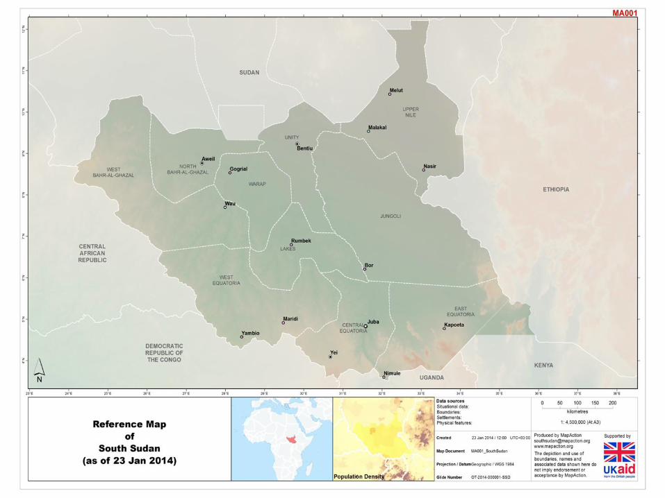
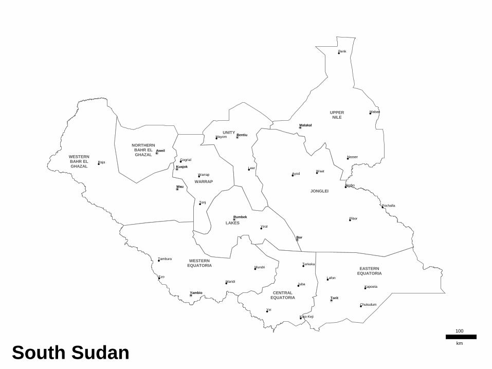
Country Map Showing State boundaries
Contents
There are two types of country map:
• Simple Country Reference Map – Copy and paste labels to map
• Advance Country Reference Map – Admin boundaries colours can be changed. Select admin area, Right Click>>Format Shape>>Fill

Raja Gogrial
Warrap
Tonj
Yirol
Ezo
Mundri
Maridi Juba
Chukudum
Kapoeta
Kajo-Keji
Tambura
Terkeka
Lafon
Renk
Mayom
Maban
Ayod
Leer
Nasser
Akobo
Pochalla
Pibor
Waat
Yei
Aweil
Kuajok
Wau
Rumbek
Yambio
Bentiu
Malakal
Bor
Torit
LAKES
CENTRAL EQUATORIA
EASTERN EQUATORIA
UPPER NILE
WESTERN BAHR EL GHAZAL
UNITY
NORTHERN BAHR EL GHAZAL
JONGLEI
WARRAP
WESTERN EQUATORIA
South Sudan
100
km
Region Maps Showing State boundaries
Contents
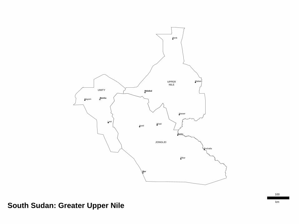
UPPER NILE
UNITY
JONGLEI
Renk
Mayom
Maban
Ayod
Leer
Nasser
Akobo
Pochalla
Pibor
Waat
Bentiu
Malakal
Bor
South Sudan: Greater Upper Nile
100
km
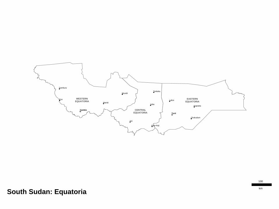
CENTRAL EQUATORIA
EASTERN EQUATORIA
WESTERN EQUATORIA
Ezo
Mundri
Maridi Juba
Chukudum
Kapoeta
Kajo-Keji
Tambura
Terkeka
Lafon
Yei
Yambio
Torit
South Sudan: Equatoria
100
km
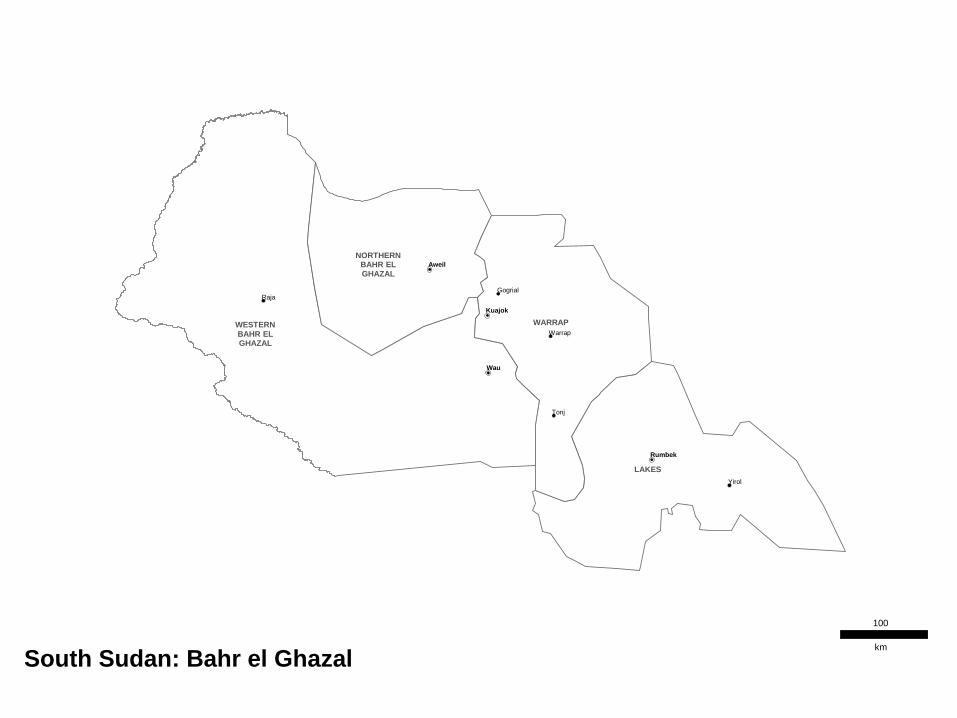
LAKES
WESTERN BAHR EL GHAZAL
NORTHERN BAHR EL GHAZAL
WARRAP
Raja Gogrial
Warrap
Tonj
Yirol
Aweil
Kuajok
Wau
Rumbek
South Sudan: Bahr el Ghazal
100
km

State Maps Showing County boundaries
Contents

Wau
Jur River
Raga Raja
Wau
South Sudan: Western Bahr el Ghazal
10
km

Tonj
South
Tonj
East
Tonj
North
Gogrial
East
Gogrial
West
Twic
Gogrial
Warrap
Tonj
Kuajok
South Sudan: Warrap
10
km
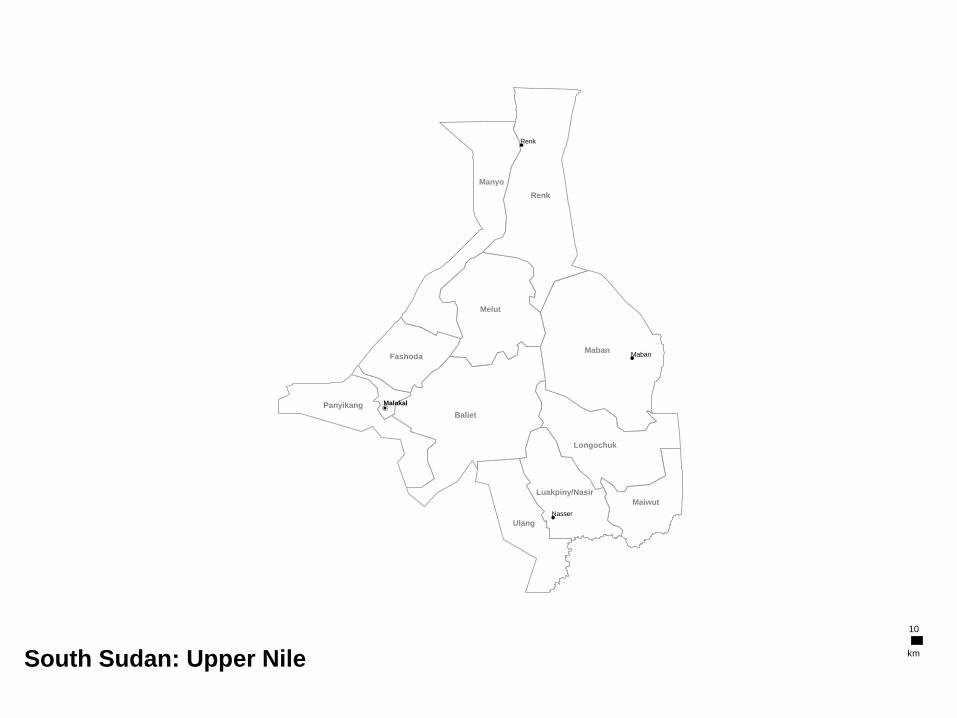
Ulang
Maiwut
Luakpiny/Nasir
Longochuk
Panyikang
Baliet
Fashoda
Melut
Manyo
Renk
Maban
Renk
Maban
Nasser
Malakal
South Sudan: Upper Nile
10
km

Panyijiar
Mayendit
Leer
Koch
Mayom Guit
Rubkona
Abiemnhom
Pariang
Mayom
Leer
Bentiu
South Sudan: Unity
10
km

Aweil South
Aweil Centre
Aweil West
Aweil North
Aweil East
Aweil
South Sudan: Northern Bahr el Ghazal
10
km
Awerial
Yirol West
Wulu
Rumbek East
Cueibet
Rumbek North
Rumbek Centre
Yirol East
Yirol
Rumbek
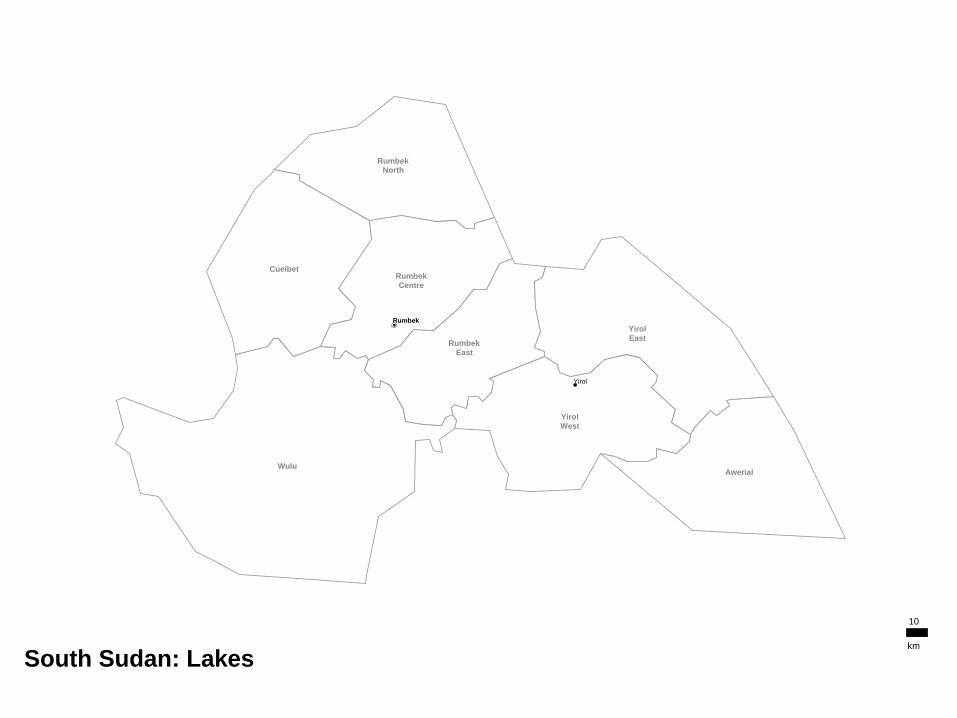
South Sudan: Lakes
10
km
Bor South
Pibor
Twic East
Pochalla
Duk
Uror Akobo
Ayod
Nyirol
Canal Fangak
Ayod
Akobo
Pochalla
Pibor
Waat
Bor
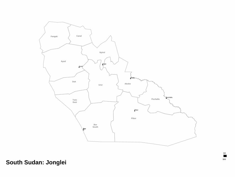
South Sudan: Jonglei
10
km
Magwi
Ikotos
Kapoeta
South
Budi Torit
Kapoeta
North Lafon/Lopa
Kapoeta
East
Chukudum
Kapoeta
Lafon
Torit
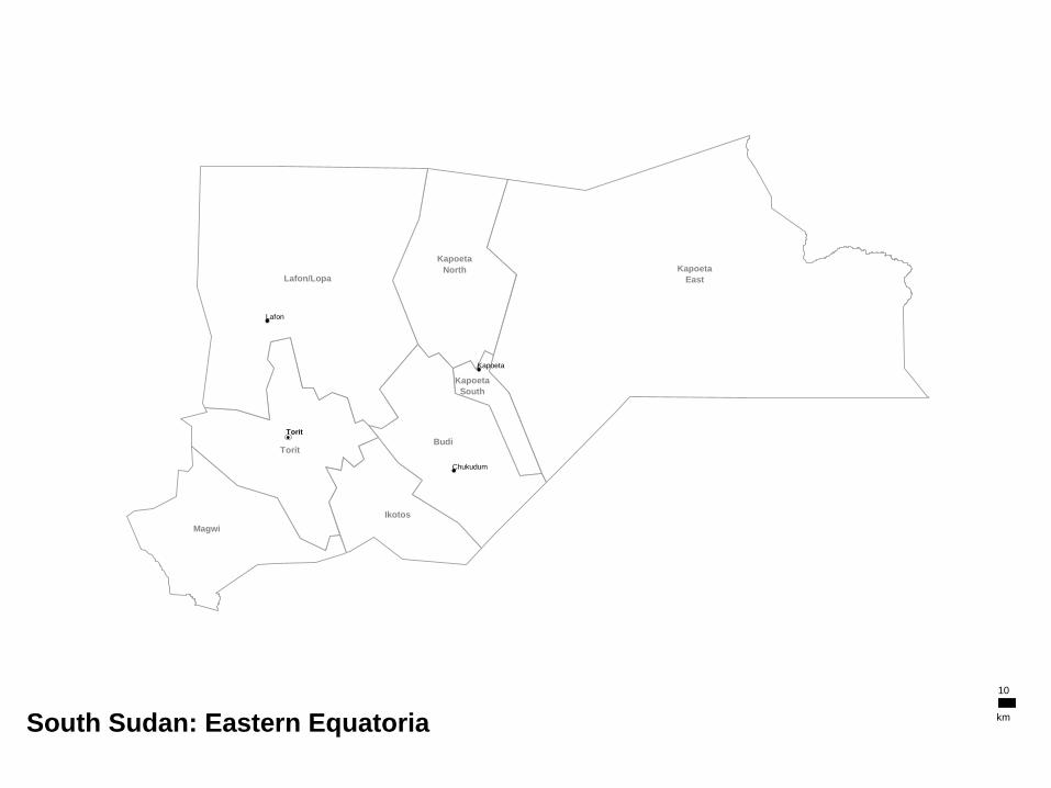
South Sudan: Eastern Equatoria
10
km
Maridi
Mundri West
Mundri East
Ibba Yambio
Nzara
Mvolo
Ezo
Tambura
Nagero
Ezo
Mundri
Maridi
Tambura
Yambio
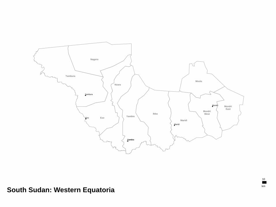
South Sudan: Western Equatoria
10
km

Morobo
Kajo-Keji
Lainya Yei
Juba
Terekeka
Juba
Kajo-Keji
Terkeka
Yei
South Sudan: Central Equatoria
10
km
Labels and Symbology General Symbols
OCHA Symbols
Callout Boxes
Contents
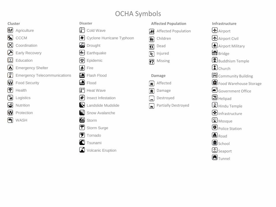
Infrastructure
Airport
Airport Civil
Airport Military
Bridge
Buddhism Temple
Church
Community Building
Food Warehouse Storage
Government Office
Helipad
Hindu Temple
Infrastructure
Mosque
Police Station
Road
School
Seaport
Tunnel
Cluster
Agriculture
CCCM
Coordination
Early Recovery
Education
Emergency Shelter
Emergency Telecommunications
Food Security
Health
Logistics
Nutrition
Protection
WASH
Disaster
Cold Wave
Cyclone Hurricane Typhoon
Drought
Earthquake
Epidemic
Fire
Flash Flood
Flood
Heat Wave
Insect Infestation
Landslide Mudslide
Snow Avalanche
Storm
Storm Surge
Tornado
Tsunami
Volcanic Eruption
OCHA Symbols Affected Population
Affected Population
Children
Dead
Injured
Missing
Damage
Affected
Damage
Destroyed
Partially Destroyed
Health Facilities
Clinic
Health Facilities
Health Post
Hospital
Psychological Support
Camp
Fixed
IDP Refugee Camp
Refugee Registration
Temporary
Transition Sites
Security
Arrest Detention Abduction
Assault
Attack
Forced Entry Office Occupation
Harassment and Intimidation
Hijacking
Murder
Robbery
Security
Threat
Physical Closure
Checkpoint
Cross Border
Earthmound
Military Gate
Observation Tower
Physical Closure
Road Barrier
Road Block
Road Gate
Trench
Armed Troop
Armed Troop
Child Combatant
National Army
Rebel Army
Mine and UXO Presence
Dangerous Areas
Mine UXO Presence
Mined Areas
UXO Spots
Water and Sanitation
Borehole
Latrine
Potable Water Source
Spring Water
Submersible Pump
Tapstand
Water Sources
Well
Relief Materials
Blanket
Bottle of Water
Bucket Jerry Can
Clothing
Food
Kitchen Sets
Matress
Medical Supply
Medicine
Mosquito Net
Non Food Item
Plastic Sheeting
Relief Goods
Stove
Tarpauline
Tent
Telecommunications
Fax
Internet
Mobile Phone
Radio
OCHA Symbols Continue

General Symbols
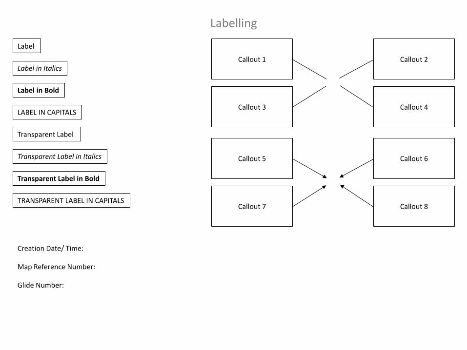
Labelling
Callout 6
Callout 8
Callout 5
Callout 7
Callout 2
Callout 4
Callout 1
Callout 3
Transparent Label
Transparent Label in Italics
Transparent Label in Bold
TRANSPARENT LABEL IN CAPITALS
Label
Label in Italics
Label in Bold
LABEL IN CAPITALS
Creation Date/ Time:
Map Reference Number:
Glide Number:
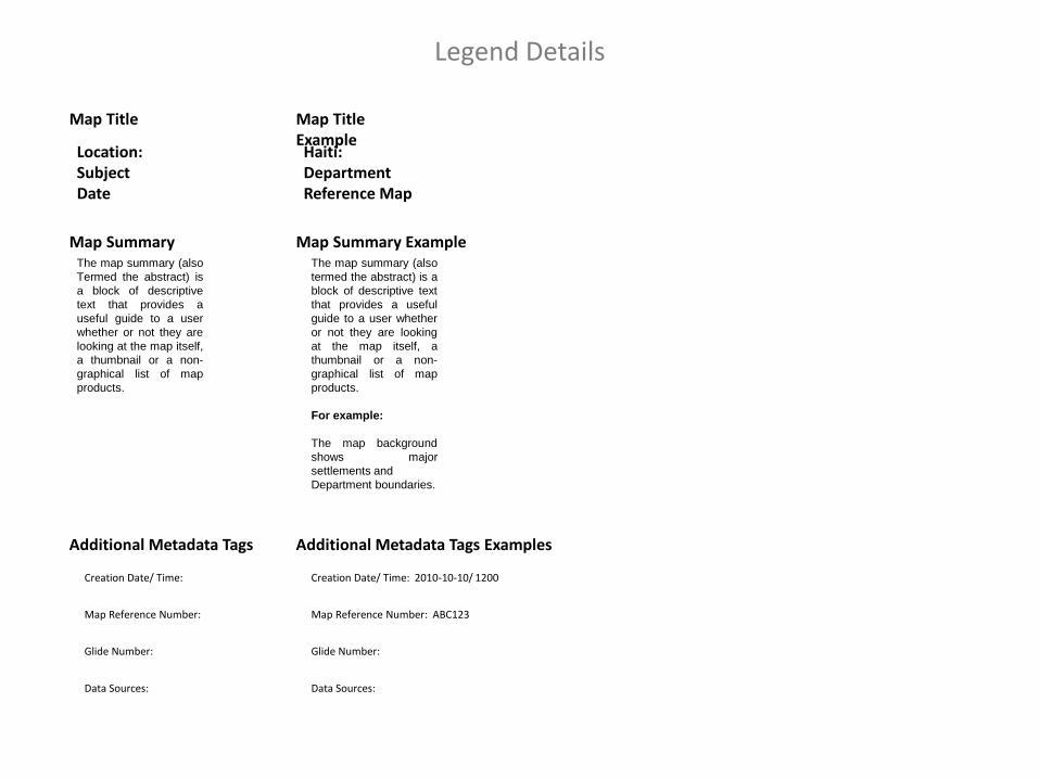
Legend Details
Creation Date/ Time:
Map Reference Number:
Glide Number:
Additional Metadata Tags
Data Sources:
Location: Subject Date
The map summary (also
Termed the abstract) is
a block of descriptive
text that provides a
useful guide to a user
whether or not they are
looking at the map itself,
a thumbnail or a non-
graphical list of map
products.
Haiti: Department Reference Map
The map summary (also
termed the abstract) is a
block of descriptive text
that provides a useful
guide to a user whether
or not they are looking
at the map itself, a
thumbnail or a non-
graphical list of map
products.
For example:
The map background
shows major
settlements and
Department boundaries.
Map Title
Map Summary Map Summary Example
Map Title Example
Creation Date/ Time: 2010-10-10/ 1200
Map Reference Number: ABC123
Glide Number:
Additional Metadata Tags Examples
Data Sources:
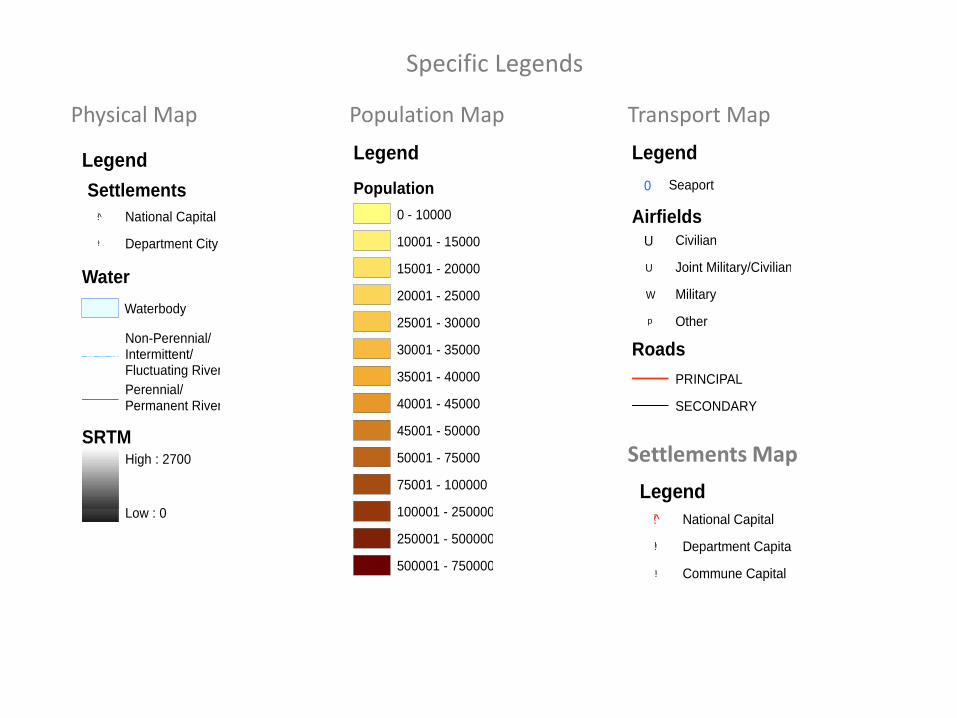
Legend
Population
0 - 10000
10001 - 15000
15001 - 20000
20001 - 25000
25001 - 30000
30001 - 35000
35001 - 40000
40001 - 45000
45001 - 50000
50001 - 75000
75001 - 100000
100001 - 250000
250001 - 500000
500001 - 750000
Legend
SRTMHigh : 2700
Low : 0
Settlements
!!!! Department City
!!̂ National Capital
Water
Waterbody
Perennial/Permanent River
Non-Perennial/Intermittent/Fluctuating River
Population Map Physical Map
Legend
Airfields
U Joint Military/Civilian
W Military
U Civilian
p Other
Roads
PRINCIPAL
SECONDARY
0 Seaport
Transport Map
Legend
!!̂ National Capital
!!! Department Capital
!!!! Commune Capital
Settlements Map
Specific Legends
Logos Logos of key organisations
Contents
Paste your logos here to use in the future
Logos
Weblinks Links to key maps and data sources
Contents
Contents
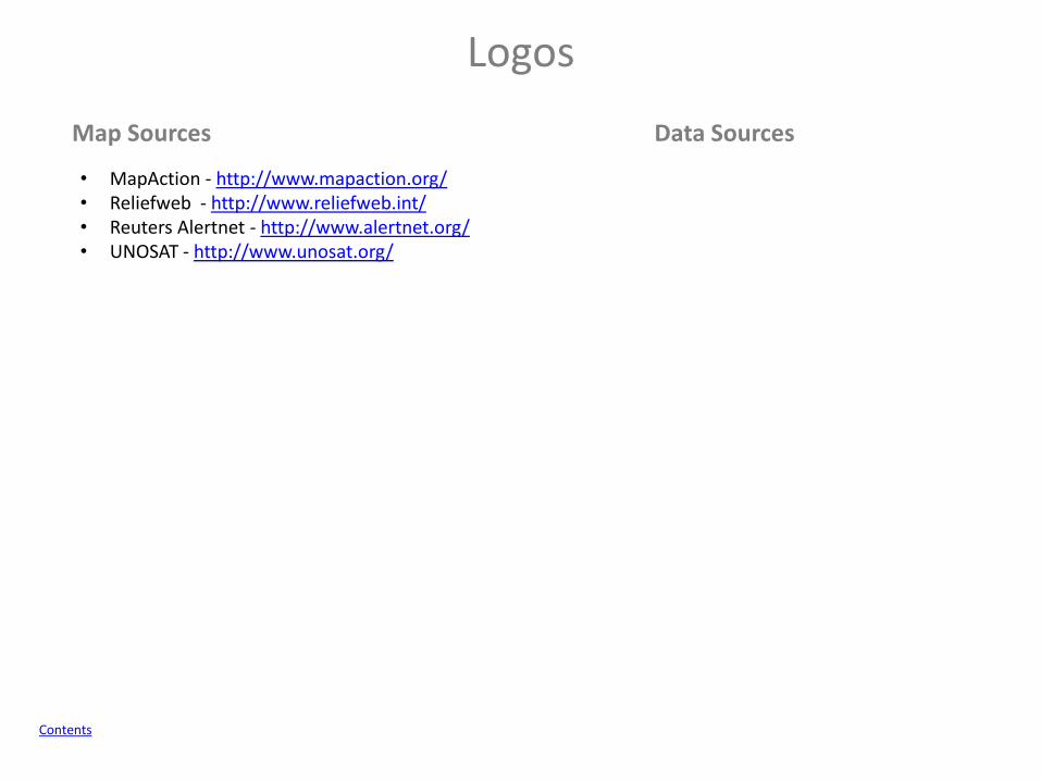
Map Sources Data Sources
• MapAction - http://www.mapaction.org/ • Reliefweb - http://www.reliefweb.int/ • Reuters Alertnet - http://www.alertnet.org/ • UNOSAT - http://www.unosat.org/
Logos
Data Collection Waypoint Collection Sheet
Contents
Waypoint Collection Sheet
How to use
Contents
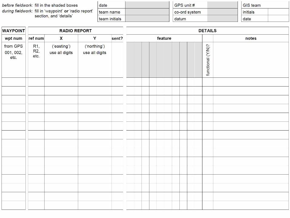
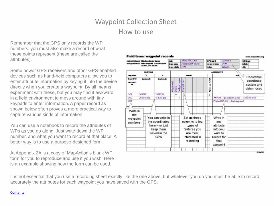
Remember that the GPS only records the WP
numbers: you must also make a record of what
these points represent (these are called the
attributes).
Some newer GPS receivers and other GPS-enabled
devices such as hand-held computers allow you to
enter attribute information by keying it into the device
directly when you create a waypoint. By all means
experiment with these, but you may find it awkward
in a field environment to mess around with tiny
keypads to enter information. A paper record as
shown below often proves a more practical way to
capture various kinds of information.
You can use a notebook to record the attributes of
WPs as you go along. Just write down the WP
number, and what you want to record at that place. A
better way is to use a purpose-designed form.
At Appendix 2A is a copy of MapAction’s blank WP
form for you to reproduce and use if you wish. Here
is an example showing how the form can be used.
It is not essential that you use a recording sheet exactly like the one above, but whatever you do you must be able to record
accurately the attributes for each waypoint you have saved with the GPS.

MapAction User Guide
Contents
PowerPoint Map Creation Basic Maps 1. Create base map in ArcGIS, using the PowerPoint_Map_Template found in - 2011-mm-dd-destination-BLANKv02\GIS\3_Mapping\37_PowerPoint_Maps_Basic. 2. Ungroup metadata properties and edit the Scale. 3. Regroup metadata properties. Set the frame properties as follows - Border - 1.0 point, Gap - X and Y - 5pt; Background - White, Gap - X and Y - 5pt. 4. Export map as JPEG to - 2011-mm-dd-destination-BLANKv02\GIS\3_Mapping\37_PowerPoint_Maps. 5. Open the PowerPoint Pack Template and locate the relevant slide. 6. Right click slide and select format background. 7. Select Fill>> Picture or texture fill>> Insert from>> File and select map jpeg. 8. Before applying check that the stretch options>> Offsets are all at 0%. 9. Click Close. 10. Save PowerPoint. Advance Maps 1. Create base map in ArcGIS, using the PowerPoint_Map_Template found in - 2011-mm-dd-destination-BLANKv02\GIS\3_Mapping\37_PowerPoint_Maps_Advance. 2. Export map as EMF to - 2011-mm-dd-destination-BLANKv02\GIS\3_Mapping\37_PowerPoint_Maps. 3. Open the PowerPoint Pack Template and locate the relevant slide. 4. Select Insert>>Picture>>Select EMF File>>Insert. 5. Resize map approximately. 6. Right Click Image>>Group>>Ungroup A dialog box with the following will show: "This is an imported picture, not a group. Do you want to convert it to a Microsoft Office drawing object?“ 7. Select Yes. 8. Make sure the whole map is selected and resize to fit slide. Each part of the map should now be clickable and editable. 9. Save PowerPoint. Adding a border to the map. 1. Click - Insert>>Shapes>>Rectangle. 2. Draw Rectangle around map 3. Right click rectangle>> Format shape>>Fill>>No Fill 4. In the Shape Format>> Select Line Color - Black or Grey 5. In the Shape Format>> Select Line - Width 2pt 6. Close Shape Format.