Linking Spatial Data from the Web - Where Data Insight ... Spatial Data... · zBBC interlinking...
31
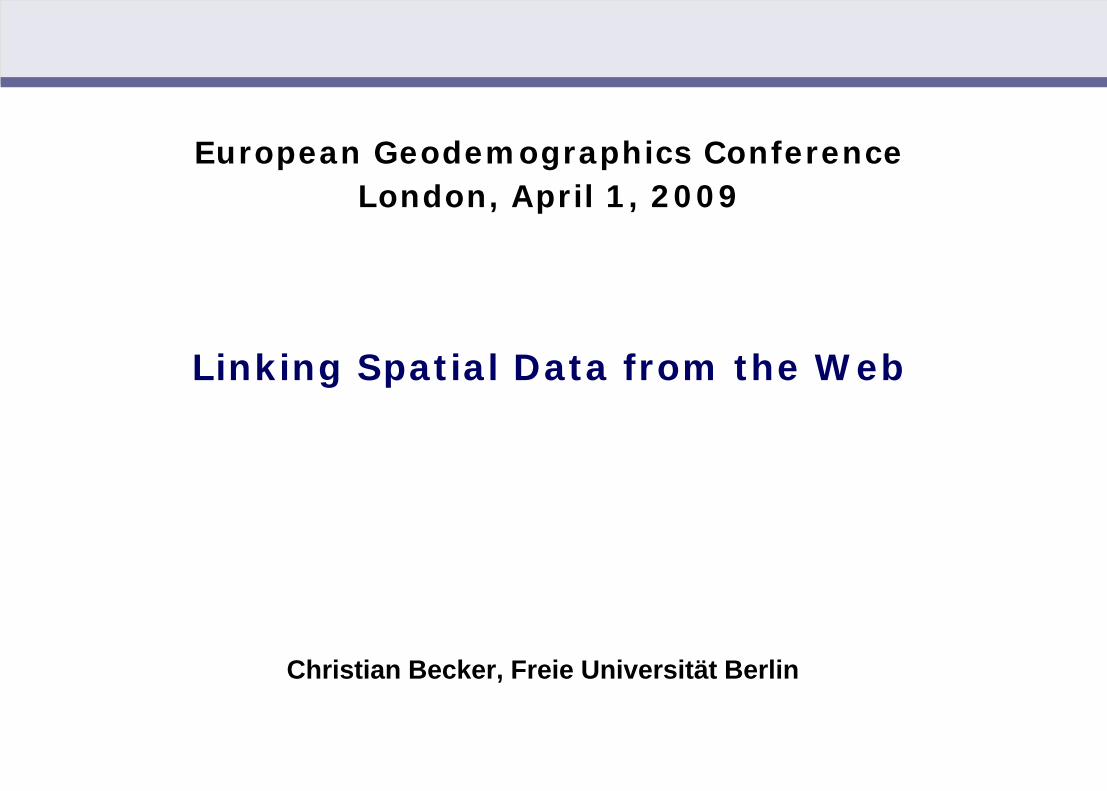
European Geodemographics Conference London, April 1, 2009 Linking Spatial Data from the Web Christian Becker, Freie Universität Berlin
-
Upload
nguyenhanh -
Category
Documents
-
view
216 -
download
1
Transcript of Linking Spatial Data from the Web - Where Data Insight ... Spatial Data... · zBBC interlinking...
Christian Becker: Linking Spatial Data from the Web (London, 04/01/2009)
European Geodemographics ConferenceLondon, April 1, 2009
Linking Spatial Data from the Web
Christian Becker, Freie Universität Berlin
Christian Becker: Linking Spatial Data from the Web (London, 04/01/2009)
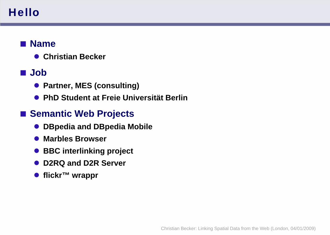
Hello
Name Christian Becker
Job Partner, MES (consulting)PhD Student at Freie Universität Berlin
Semantic Web ProjectsDBpedia and DBpedia MobileMarbles BrowserBBC interlinking projectD2RQ and D2R Serverflickr™ wrappr

Christian Becker: Linking Spatial Data from the Web (London, 04/01/2009)
Overview
1. Linked Data
2. DBpedia as a Geospatial Entrypoint to the Web of (Linked) Data
3. Implications of Linked Data for Geodemographics

Christian Becker: Linking Spatial Data from the Web (London, 04/01/2009)
Linked Data

Christian Becker: Linking Spatial Data from the Web (London, 04/01/2009)
We live in a world of data
http://en.wikipedia.org/wiki/Belgrave_Square
Everything around us is online Things: Wikipedia, Maps, Review sitesPeople: Facebook, LinkedIn, Wikipedia
Many things are uniquely identified:Every Wikipedia articleEvery street cornerEvery social network profile

Christian Becker: Linking Spatial Data from the Web (London, 04/01/2009)
We live in a world of data
Now that we have identified resources, we can link them (to express information)
Linked Data allows to realize this on a global scale
Allows links to be cross-database, cross-organizational and cross-domain, much like links on websites
A concept by Tim Berners-Lee, inventor of the Web
Christian Christian’sTalk
Belgrave Square
Society of ChemicalIndustry
MRS
at located at
organized by
holds
.........

Christian Becker: Linking Spatial Data from the Web (London, 04/01/2009)
Linked Data as part of the Semantic Web
Definition“The Semantic Web is an evolving extension of the World Wide Web in which the semantics of information and services on the web is defined, making it possible for the web to understand and satisfy the requests of people and machines to use the web content.” (Wikipedia)
The term “Semantic Web” encompasses general design principles and standards and has sprouted many different areas of researchLinked Data
Small set of core principlesAims to get actual data published on the WebSemantic Web put to practice
Christian Becker: Linking Spatial Data from the Web (London, 04/01/2009)
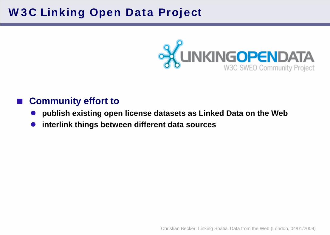
W3C Linking Open Data Project
Community effort topublish existing open license datasets as Linked Data on the Webinterlink things between different data sources

Christian Becker: Linking Spatial Data from the Web (London, 04/01/2009)
LOD Datasets on the Web: May 2007
500 million RDF triples 120,000 data links between data sources

Christian Becker: Linking Spatial Data from the Web (London, 04/01/2009)
LOD Datasets on the Web: September 2008

Christian Becker: Linking Spatial Data from the Web (London, 04/01/2009)
LOD Datasets on the Web: March 2009
4.5 billion triples 180 million data links

Christian Becker: Linking Spatial Data from the Web (London, 04/01/2009)
LOD Datasets on the Web: March 2009
Life Sciences
Publications
Online ActivitiesMusic
Geographic
Cross-Domain
4.5 billion triples 180 million data links

Christian Becker: Linking Spatial Data from the Web (London, 04/01/2009)
DBpedia as aGeospatial Entrypoint
to the Web of (Linked) Data

Christian Becker: Linking Spatial Data from the Web (London, 04/01/2009)
DBpedia
DBpedia.org is a community effort toextract structured information from Wikipediamake this information available on the Web under an open licenseinterlink the DBpedia dataset with other open datasets on the Web
ContributorsFreie Universität Berlin (Germany)Universität Leipzig (Germany)OpenLink Software (UK)

Christian Becker: Linking Spatial Data from the Web (London, 04/01/2009)
Extracting Data from Wikipedia
<http://dbpedia.org/resource/Calgary>
dbpedia:native_name “Calgary” ;
dbpedia:altitude “1048” ;
geo:lat “51.044998” ;
geo:long “-114.057220” ;
dbpedia:population_city “988193” ;
dbpedia:population_metro “1079310” ;
mayor_name
dbpedia:Dave_Bronconnier ;
governing_body
dbpedia:Calgary_City_Council ;
...

Christian Becker: Linking Spatial Data from the Web (London, 04/01/2009)
The DBpedia Dataset
Web-scale identifiers for 2.6 million “things”including at least 213,000 persons 328,000 places
Altogether 274 million pieces of information (RDF triples) 29 million triples extracted from infoboxes609,000 links to pictures3,150,000 links to relevant external web pages4,900,000 links to other LOD datasets
CategorizationsDBpedia Ontology with 170 classes and 940 properties, based on the most frequently used classes415,000 Wikipedia categories75,000 YAGO categories
Christian Becker: Linking Spatial Data from the Web (London, 04/01/2009)
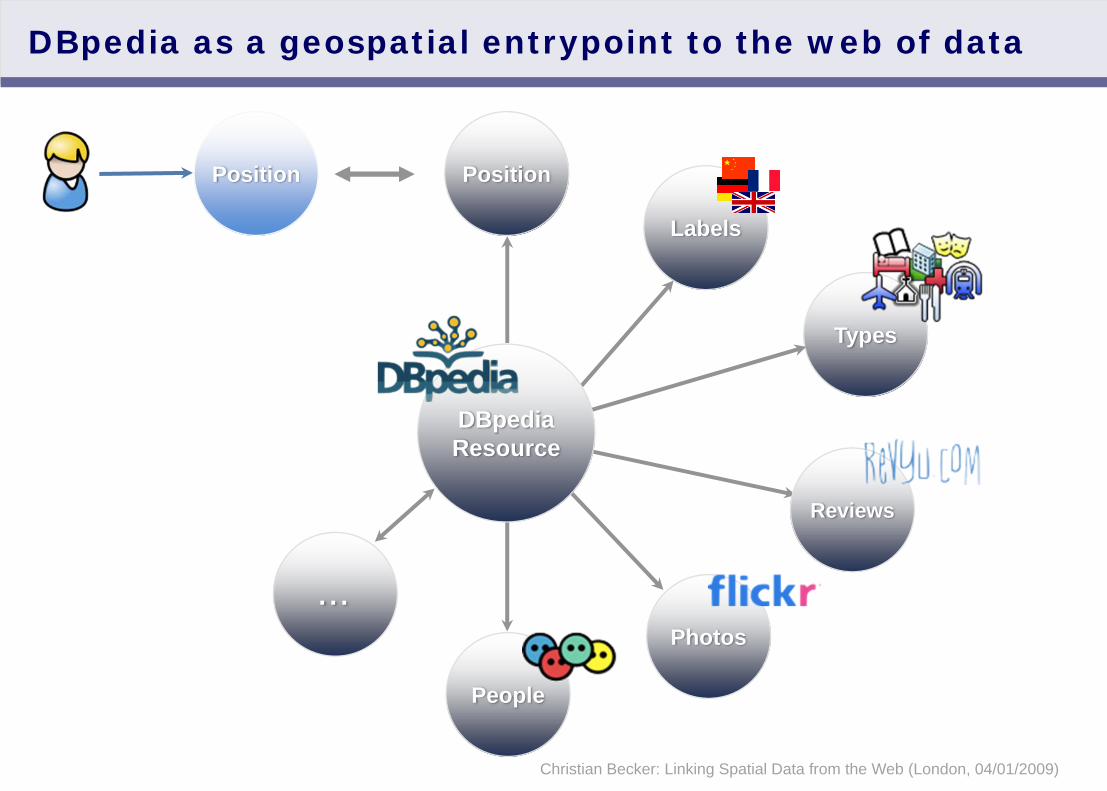
DBpedia as a geospatial entrypoint to the web of data
Labels
Types
Position
Photos
Reviews
People
Position
DBpediaResource
...

Christian Becker: Linking Spatial Data from the Web (London, 04/01/2009)
Potential uses for DBpedia in a mobile context
ActiveExplore the area (DBpedia Mobile) Local searchComplex queries
- e.g. show me the stops of a specific train line
PassiveDetect the user’s location - not simply as coordinates, but as a data resource that can be analyzed and act accordingly
- Museum: Silence the phone- Airport: Show current flights- Pub, concert: Show nearby friends

Christian Becker: Linking Spatial Data from the Web (London, 04/01/2009)
DBpedia Mobile

Christian Becker: Linking Spatial Data from the Web (London, 04/01/2009)
Use DBpedia locations as starting points …

Christian Becker: Linking Spatial Data from the Web (London, 04/01/2009)
Choose between 14 languages …
Christian Becker: Linking Spatial Data from the Web (London, 04/01/2009)
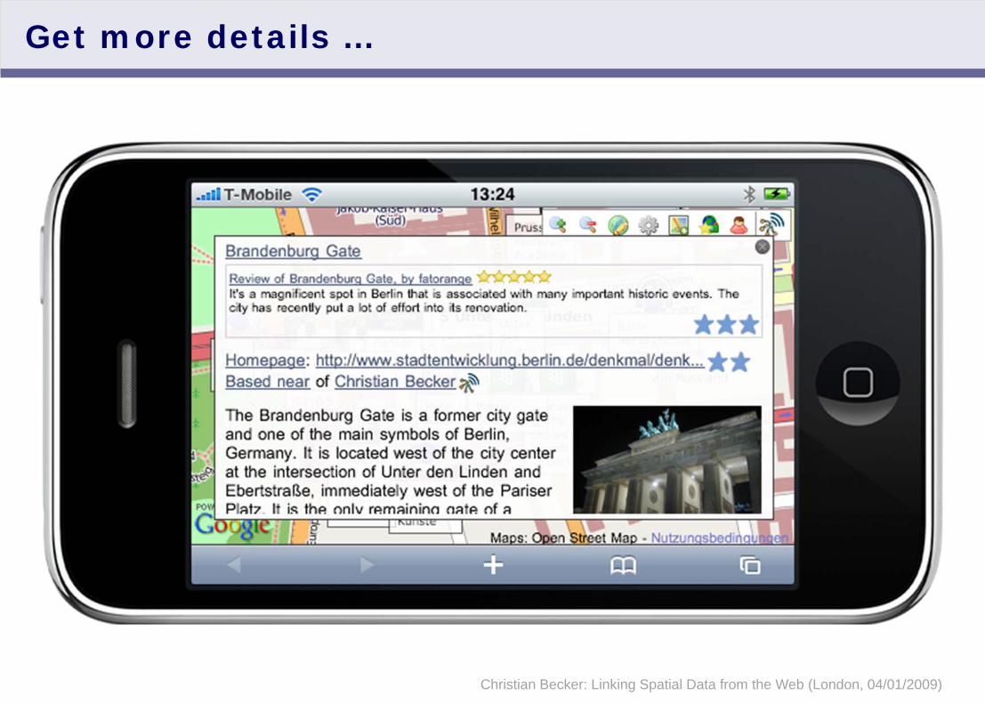
Get more details …
Christian Becker: Linking Spatial Data from the Web (London, 04/01/2009)
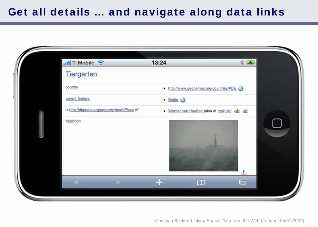
Get all details … and navigate along data links

Christian Becker: Linking Spatial Data from the Web (London, 04/01/2009)
Implications of Linked Data for
Geodemographics
Christian Becker: Linking Spatial Data from the Web (London, 04/01/2009)
Implications of Linked Data
For professional data consumersReduce data integration costsReduce licensing costsCombine with organization-internal dataCross-domain use
- “Find parking spots near UK airports in cities with more than 1 million inhabitants”
- “Find hotels in regions with high disposable income”- “Find competitor locations and reviews”
For end usersRicher, more up to date navigationBetter detection of context Better context-related offerings

Christian Becker: Linking Spatial Data from the Web (London, 04/01/2009)
Complex queries: Find stops of a specific train line

Christian Becker: Linking Spatial Data from the Web (London, 04/01/2009)
Complex queries: Find stops of a specific train line
Text

Christian Becker: Linking Spatial Data from the Web (London, 04/01/2009)Credits: GeoFabrik
OpenStreetMap: England 2006-2008
Christian Becker: Linking Spatial Data from the Web (London, 04/01/2009)
Open Data is growing!
Vast, steadily growing amounts of publicly accessible data
Rich user-generated geo data for Europe due to its vivid editor community, notably in the UK and Germany
Currently available geographic datasets as part of Linking Open Data:
Wikipedia (DBpedia, rich data about 328,000 places)OpenStreetMap (1.2 million points of interest)
- post boxes- traffic lights- ...
GeoNames (administrative hierarchies)US CensusEuroStat (General and Economics datasets)World Factbook
Christian Becker: Linking Spatial Data from the Web (London, 04/01/2009)
Current Status of Linked Data
W3C-approved standards for cross-database, cross-organizational, cross-domain interoperability
Datasets and links are not perfect, but graduating beyond a research stage
Adoption by data providers and support by major playersBBCThomson ReutersCyc FoundationLife Sciences communityW3C
Large amounts of data that are yet untappedOpen government dataUser-generated data such as reviews and locations

Christian Becker: Linking Spatial Data from the Web (London, 04/01/2009)
Thanks
Questions?
ReferencesTim Berners-Lee’s TED Talkhttp://www.ted.com/index.php/talks/tim_berners_lee_on_the_next_web.htmlLinkedData.orgOpenStreetMap.orgLinked Data version: LinkedGeoData.orgDBpedia.orgDBpedia Mobile:http://beckr.org/DBpediaMobile