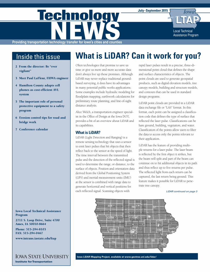
Iowa LiDAR Mapping Project, available at 2015 Jul-Sept_final.… · July–September 2015...
8
July–September 2015 Inside this issue 2 From the director: Be “ever vigilant” 3 Meet Paul LaFleur, FHWA engineer 4 Hamilton County adapts cell phones as cost-efficient AVL system 5 The important role of personal protective equipment to a safety program 6 Erosion control tips for road and bridge work 7 Conference calendar Iowa Local Technical Assistance Program 2711 S. Loop Drive, Suite 4700 Ames, IA 50010-8664 Phone: 515-294-8103 FAX: 515-294-0467 www.intrans.iastate.edu/ltap What is LiDAR? Can it work for you? Often technologies that promise to save us time or give us more and more accurate data don’t always live up those promises. Although LiDAR may never replace traditional ground- based surveying, it does have its advantages in many potential public works applications. Some examples include hydraulic modeling for floodplain mapping, earthwork calculations for preliminary route planning, and line-of-sight distance analysis. Alice Welch, a transportation engineer special- ist in the Office of Design at the Iowa DOT, provides a bit of an overview about LiDAR and its capabilities. What is LiDAR? LiDAR (Light Detection and Ranging) is a remote sensing technology that uses a sensor to emit laser pulses that hit objects that then reflect back to the sensor at the speed of light. The time interval between the transmitted pulse and the detection of the reflected signal is used to determine the range, or distance, to the surface of objects. Position and orientation data derived from the Global Positioning System (GPS) and inertial measurement units (IMU) at the sensor is combined with range data to generate horizontal and vertical positions for each reflected signal. Scanning objects with rapid laser pulses result in a precise, three-di- mensional point cloud that defines the shape and surface characteristics of objects. The point clouds are used to generate geospatial products, such as digital elevation models, tree canopy models, building and structure models, and contours that can be used in standard design programs. LiDAR point clouds are provided in a LiDAR data exchange file or “LAS” format. In this format, each point can be assigned a classifica- tion code that defines the type of surface that reflected the laser pulse. Classifications can be bare ground, building, vegetation, and water. Classification of the points allow users to filter the data to access only the points relevant to their application. LiDAR has the feature of providing multi- ple returns for a laser pulse. The laser beam is reflected by the first object it strikes, but the beam will split and part of the beam can continue on to hit additional objects in its path and thus reflect up to five returns per pulse. The reflected light from each return can be captured, the last return being ground. This feature makes it possible for LiDAR to pene- trate tree canopy. Iowa LiDAR Mapping Project, available at www.geotree.uni.edu/lidar/ LiDAR continued on page 3
Transcript of Iowa LiDAR Mapping Project, available at 2015 Jul-Sept_final.… · July–September 2015...
July–September 2015 Technology News 1July–September 2015
Inside this issue2 From the director: Be “ever
vigilant”
3 Meet Paul LaFleur, FHWA engineer
4 Hamilton County adapts cell
phones as cost-efficient AVL
system
5 The important role of personal
protective equipment to a safety
program
6 Erosion control tips for road and
bridge work
7 Conference calendar
Iowa Local Technical Assistance Program
2711 S. Loop Drive, Suite 4700Ames, IA 50010-8664
Phone: 515-294-8103FAX: 515-294-0467
www.intrans.iastate.edu/ltap
What is LiDAR? Can it work for you? Often technologies that promise to save us time or give us more and more accurate data don’t always live up those promises. Although LiDAR may never replace traditional ground-based surveying, it does have its advantages in many potential public works applications. Some examples include hydraulic modeling for floodplain mapping, earthwork calculations for preliminary route planning, and line-of-sight distance analysis.
Alice Welch, a transportation engineer special-ist in the Office of Design at the Iowa DOT, provides a bit of an overview about LiDAR and its capabilities.
What is LiDAR? LiDAR (Light Detection and Ranging) is a remote sensing technology that uses a sensor to emit laser pulses that hit objects that then reflect back to the sensor at the speed of light. The time interval between the transmitted pulse and the detection of the reflected signal is used to determine the range, or distance, to the surface of objects. Position and orientation data derived from the Global Positioning System (GPS) and inertial measurement units (IMU) at the sensor is combined with range data to generate horizontal and vertical positions for each reflected signal. Scanning objects with
rapid laser pulses result in a precise, three-di-mensional point cloud that defines the shape and surface characteristics of objects. The point clouds are used to generate geospatial products, such as digital elevation models, tree canopy models, building and structure models, and contours that can be used in standard design programs.
LiDAR point clouds are provided in a LiDAR data exchange file or “LAS” format. In this format, each point can be assigned a classifica-tion code that defines the type of surface that reflected the laser pulse. Classifications can be bare ground, building, vegetation, and water. Classification of the points allow users to filter the data to access only the points relevant to their application.
LiDAR has the feature of providing multi-ple returns for a laser pulse. The laser beam is reflected by the first object it strikes, but the beam will split and part of the beam can continue on to hit additional objects in its path and thus reflect up to five returns per pulse. The reflected light from each return can be captured, the last return being ground. This feature makes it possible for LiDAR to pene-trate tree canopy.
Iowa LiDAR Mapping Project, available at www.geotree.uni.edu/lidar/
LiDAR continued on page 3
2 Technology News July–September 2015
About LTAPLTAP is a national program of the FHWA. Iowa LTAP, which produces Technology News, is financed by the FHWA and the Iowa DOT and administered by the Institute for Transportation at Iowa State University:
Institute for Transportation ISU Research Park 2711 S. Loop Drive, Suite 4700 Ames, Iowa 50010-8664 Telephone: 515-294-8103 Fax: 515-294-0467 www.intrans.iastate.edu/
DisclaimersAny reference to a commercial organization or product in this newsletter is intended for informational purposes only and not as an endorsement.
The opinions, findings, or recommendations expressed herein do not necessarily reflect the views of LTAP sponsors. All materials herein are provided for general information, and neither LTAP nor its sponsors represent that these materials are adequate for the purposes of the user without appropriate expert advice.
Iowa State University makes no representations or warranties, expressed or implied, as to the accuracy of any information herein and disclaims liability for any inaccuracies.
NondiscriminationIowa State University does not discriminate on the basis of race, color, age, religion, national origin, sexual orientation, gender identity, genetic information, sex, marital status, disability, or status as a U.S. veteran. Inquiries can be directed to ISU’s Director of Equal Opportunity and Compliance, 3810 Beardshear Hall, 515-294-7612.
Subscribe to Technology NewsSubscriptions to Technology News are free. Subscribe online (www.intrans.iastate.edu/pubs/Newsletter_Re-quest/mailform.cfm) or by contacting the editor (see page 4).
To obtain permission to reprint articles, contact the editor (see page 4). Readers’ comments and article topic suggestions are welcome.
Acronyms and Abbreviations in Technology NewsAASHTO American Association of State High-
way and Transportation Officials
APWA American Public Works Association
FHWA Federal Highway Administration
IHRB Iowa Highway Research Board
InTrans Institute for Transportation (at ISU)
Iowa DOT Iowa Department of Transportation
ISU Iowa State University
LTAP Local Technical Assistance Program
MUTCD Manual on Uniform Traffic Control Devices
NACE National Association of County Engineers
TRB Transportation Research Board
Printed with soy ink
From the director:
I decided to write a different type of column this quarter.
I recently visited Santa Fe, New Mexico, in August. It is one of my favorite places. The high desert in August experiences a “little bit” of heat, but storms can appear quickly over the mountains. The beauty is incredible and often distracting. The changing colors and shadows as the sun moves. But, there is also a danger out there that can’t be ignored. The need for water and certain types of “not so nice” wildlife come to mind. Being who I am, however, as I walked around, all this led me to think about safety.
Whether in the field, shop, or the office, there is a need for that constant vigilance and making safety foremost in everything that happens. And that also led to me to think about the safety courses Iowa LTAP is offering this fall. We have our local road safety series, bridge inspection (both refresher and the two week in 2016), OSHA, MUTCD signing, and excavation safety. We also continue to do our work zone and flagger trainings, and we can assist with safety assessments and audits. The National Rural Safety Center connection with InTrans also has us bringing in a NHI instruc-tor to do four hours on local roadside safety down in St. Joseph, Missouri, after the MINK Conference.
When I was in New Mexico, I also went up to Los Alamos. A place that transformed from a boys school (“that dry air will do you good”) to the Manhattan Project in what sounded like just a few months. That distinction, once again, between the beauty of the landscape and the harsh reality of the job that was being done there. Of course, I found myself thinking about how they accommodated all the public works needs of the people coming up to this remote area and working/playing. One can’t help but note the road into town that hugs the canyon wall.
All of us are constantly building, adjusting, and improving in an attempt to serve the public better. At Iowa LTAP, we are always looking for suggestions about a more efficient and effective process or approach to serve local transpor-tation agencies better. We have gained new capabilities as people have walked through our door. What that means will continue to evolve and change. In addition, by the time this newsletter goes to print I hope we have our Multi-Disciplinary Safety Team (MDST) statewide coordinator or facilitator in place. In addition, we are also attempting to set up a process to loan out our retroreflectometer. We’ll let you know when these are in place.
Also, as ever, if there is something you need, please ask. We’ll see what we can do.
Remain “ever vigilant.”
Keith
Be “ever vigilant”

July–September 2015 Technology News 3
Differences between airborne and terrestrial LiDAR Airborne LiDAR systems consist of a laser source and detector, a scan-ning mechanism and controller, GPS and IMU equipment, as well as computers and data recorders. The aircraft altitude and pulse rate during a LiDAR mission determines the point density and therefore the accu-racy of the point cloud. Airborne LiDAR in helicopters and fixed wing aircraft perform well for large project areas where a bare earth surface is desired.
A recent development in airborne LiDAR systems is the introduction of LiDAR in unmanned aerial vehicles (UAV). The size and weight of the equipment mounted on a UAV is one of the challenges for implementing LiDAR on a UAV platform. A UAV can fly much closer to the ground than a traditional aircraft, which improves the accuracy, but covers a smaller area.
Terrestrial LIDAR uses instruments mounted on a tripod. Because the sensor is on the ground and closer to the intended target, the measure-ments have a different perspective and a higher accuracy than airborne applications. Terrestrial scanning can be used to create 3D models of complex objects such as piping networks, archeological sites, buildings, bridges, etc.
Mobile terrestrial LiDAR uses laser scanning equipment mounted on a vehicle in combination with GPS and IMU to safely collect a highly accurate point cloud along a transportation route (i.e., highway, rail, or water) in a short period of time.
LiDAR resources in Iowa Statewide airborne LiDAR data collection initiated by the Iowa Depart-ment of Natural Resources began in 2006 and continued until 2010. Details about this project are available at www.iowadnr.gov/Environ-ment/GeologyMapping/MappingGIS/LiDAR.aspx.
The statewide dataset is available at www.geotree.uni.edu/lidar/.
Advantages of LiDAR
• Ability to penetrate forest canopy and map the ground beneath trees
• Objects can be measured remotely, making operations such as data collection on roadways under traffic much safer
• Equipment can operate with cloud cover and any sun angle (even at night), which means more hours of operation and greater efficiency with faster results (while minimizing disruption to traffic)
• Data can be captured in a short amount of field time and extracted from the point cloud in the office, which provides designers first hand access to a dense point cloud of the project site and the ability to extract any measurements needed
Disadvantages of LiDAR
• Accuracy on steep slopes and in dense vegetation may not be sufficient for engineering and design applications
• Difficult to map plan features with high accuracy
• Systems produce large amounts of data, requiring additional storage and processing power
Iowa agencies currently using LiDAR The Iowa Department of Natural Resources and the Iowa Natural Resources Conservation Service originally partnered in the collection of the statewide LiDAR data and still actively use it. Cities, counties, engi-neering firms, and utility companies across Iowa all have the potential to use LiDAR.
LiDAR continued from page 1
Meet Paul LaFleur, FHWA engineerI joined the Iowa Division of the FHWA in April as their safety engineer, taking over for Jerry Roche. I also have transportation engineer duties for District 5. This isn’t my first time in Ames though. I graduated from Iowa State University in 2000 and then went off to Chicago, Illinois, to work for the Illinois DOT. I spent five years with them before leaving to work for a private consultant in the Chi-cago area for 1.5 years. Then I settled in at the Kane County DOT as their Assistant Chief of Design. Kane County is located on the edge of the Chicago suburbs. Half the county is suburban while the other half is rural farmland. I spent eight years there doing preliminary and final engineering and some construction engineering.
Originally I am from Carrollton, Texas, a suburb of Dallas. I was born and raised in Texas and left for only one year to live in Singapore when I was 13 years old. As I said before, I came to ISU for college and then spent the last 15 years in Illinois. I spent eight years in the Naval Reserve, enlisted both with the Seabees and as an officer in the Civil Engineer Corps. I am married to a fellow ISU graduate, a teacher, and together we have 10 year old boy/girl twins who will soon be entering the sixth grade. I like to be active in the community, you will often see me at community events, and, in the past, I have served on a county board commission, a park district board of commissioners, and in the par-ent-teacher association. In the spare time I am able to carve out, I enjoy running, biking, and camping
with my family.
Paul LaFleur, FHWA engineer

4 Technology News July–September 2015
Iowa LTAP MissionTo foster a safe, efficient, and environmentally sound transportation system by improving skills and knowledge of local transportation providers through training, technical assistance, and technology transfer, thus improving the quality of life for Iowans.
StaffKeith Knapp Director of Iowa LTAP [email protected]
Paul Albritton Technical Training Coordinator [email protected]
Tom Stoner Local Roads Safety Liaison [email protected]
David Veneziano Safety Circuit Rider [email protected]
Devin Happe Program Assistant [email protected]
Brandy Abraham Editor [email protected]
Advisory BoardDonna Buchwald Iowa DOT, Office of Local Systems 515-239-1051 [email protected]
Adam Clemons Wright County Engineer 515-532-3597 [email protected]
Paul Geilenfeldt Marshall County Engineer 641-754-6343 [email protected]
Shauna Hallmark Director, InTrans 515-294-5249 [email protected]
Tim Herrstrom Road Foreman, Boone County 515-795-2825 [email protected]
Bret Hodne Director of Public Works, City of West Des Moines 515-222-3480 [email protected]
Joe Jurasic Transportation Engineer, FHWA–Iowa 515-233-7321 [email protected]
Ron Knoche City Engineer, City of Iowa City 319-356-5138 [email protected]
Corey Mellies Operations Manager, City of Ames Public Works 515-239-5276 [email protected]
Greg Parker – Chair Johnson County Engineer 319-356-6046 [email protected]
Brad Skinner Montgomery County Engineer 712-623-5197 [email protected]
Wade Weiss Greene County Engineer 515-386-5650 [email protected]
Hamilton County adapts cell phones as cost-efficient AVL systemWhen the Federal Communications Com-mission required land-mobile radio users to change to a “narrowband” format by the start of 2013, many public agencies had to reexam-ine their communication systems.
About Hamilton County In Hamilton County, Iowa, the Secondary Roads Department was one local agency that either had to invest in pricey new radios or change to something new.
The county opted for “something new”—a cellular phone system, which has served the county well, according to Dan Waid, Hamilton
County engineer.
How did they do it? The county uses cell phones and a mobile resource management software package for communication, vehicle location, and data transmission among its vehicle operators and maintenance shop staff. The cell phones are a cost-efficient alternative to standard GPS auto-matic vehicle location (AVL) systems.
“It is primarily a communication system that we can also use for AVL,” says Waid. “We wanted a communication system as good as or better than our radios. That’s when we started looking at cell phones.”
Waid compared several systems, but because the Secondary Roads Department needed to communicate to and from the field and because it has more vehicles than staff, cell phones made sense. “Most GPS systems have a sensor in each vehicle, and there would have been an added expense to have sensors in vehi-cles not in use.”
Benefits The cell phone system, which uses Field Force Manager software, tracks the real-time location of equipment operators and other Secondary Roads Department staff and can transmit data, such as fuel usage or safety and maintenance information. In addition, workers use the phones to check in and check out of their work shifts. The phones also make it easy to send group messages out to workers in text or voice.
Waid is pleased with the AVL system. County staff can view on a computer monitor the loca-tion of all the crews out in the county, which is handy when the need arises to see what crew can most easily be diverted to a different locale. In the winter, county staff can see where snowplows have been to ensure no unplowed gaps exist between routes.
“It’s a way to be more efficient and productive with our time,” says Waid.
Although each vehicle does not have a device to transmit data automatically, operators only have to key in a minimal amount of informa-tion to transmit, for example, fuel usage data back to the maintenance shop.
Cell phones provide another benefit that Waid said he did not think they would use—the cameras. “We can take and send photos out to the field or back to the office, and that has saved us some trips.”
For more information For additional questions regarding how cell phones have been successfully used as an alternative to the standard GPS AVL system in Hamilton County, contact Dan Waid at [email protected].
Mock illustration of cellular phone AVL system

July–September 2015 Technology News 5
The important role of personal protective equipment to a safety program Public works employees are faced with haz-
ardous situations every day, including working
around or operating heavy equipment, deal-
ing with motorists, working with dangerous
products, and exposure to environmental issues
(such as excessive heat or cold, poisonous
plants, ticks, etc.) The number of potential
hazards that road crews and other public works
employees face is extensive, which is why it is
important to have an understanding of common
safety practices, foster a culture of safety, and
have procedures for safe operations in place. The
most important thing to remember in terms of
safety is to use common sense and have the right
attitude. If these two things are present, the rest
will fall into place much easier.
Personal protective equipment (PPE) A basic foundation of any safety program is a
focus on personal protective equipment (PPE).
This includes items such as safety vests, gloves,
hard hats, steel toe work boots, eye protection,
ear protection, dust masks, chaps, and so forth.
From a management standpoint, it is essential
that each employee is provided with training
on who is required to wear PPE and when and
why they are required to wear it.
Common PPE and barriers Most workers appreciate the value of safety,
but they often don’t like the inconvenience of
wearing PPE, or they don’t think an accident will
happen to them. Hearing protection is an item
that some employees balk at. As a supervisor or
manager, you may hear statements such as, “If
I wear it, I can’t hear other workers.” “I’m used
to the noise.” “Protectors are uncomfortable.”
“I’ve already lost some of my hearing.” Explain
that the reality of not wearing hearing protection
can lead to hearing loss—even complete hearing
loss.
In some instances, workers may be required to
wear hard hats. This is another PPE that workers
sometimes balk about wearing. “It makes it hard
to see.” “It’s not really going to help save my life
if something falls on my head.” As a manager,
facts are important here. Educate your employ-
ees about how hard hats resist and deflect blows
to the head, how they act as shock absorbers,
and that they shield the employee’s scalp, face,
neck, and shoulders against splashes, spills, and
drips. Also, remember as a general rule, hard
hats should be replaced every two years if worn
every day. Additionally, if the hard hat has had
direct impact, such as by falling debris, it needs
to be replaced immediately.
Reflective vests and uniforms are another great
By Kim Karr, WV LTAP
Iowa LTAP Workshops/Training The following are workshops and training offered through the Iowa LTAP. Watch for these
sessions in your area on the online calendar at http://www.iowaltap.iastate.edu/. For more
information contact the Safety Circuit Rider, David Veneziano, at [email protected] or 515-
294-8103.
Iowa Local Road Safety Workshops
This series of annual workshops provides the most current information and advice for
improving safety on local agencies’ roads and streets in terms of planning, law enforcement,
education, and engineering. The workshops provide participants, which include planning
agencies, law enforcement, engineering, consulting, and other disciplines from all levels of
government, with an opportunity to meet, learn, interact, and share experiences, opinions,
and suggestions for strengthening and expanding the overall safety program for local roads
and streets in Iowa. One of the results of the workshops is the identification and addressing of
safety concerns in a multi-disciplinary manner.
Work Zone Safety Workshop
This workshop provides training to local agencies, utilities, and contractors in the basic
design, installation, and maintenance of temporary traffic control for construction and main-
tenance activities on streets and roads in Iowa. The major references used include Part 6 of
the MUTCD and Iowa Department of Transportation specifications and road standards. The
information presented is intended to keep attendees current with requirements and recom-
mendations for safe temporary traffic control.
Work Zone Safety and Flagger Training
This workshop presents basic flagging principles and work zone safety. It is intended for
county and city staff that perform flagging on the job or supervise flaggers. The workshop
teaches the basic principles of flagging, its common applications, and demonstrates recom-
mended flagging techniques. The workshop also covers materials from the MUTCD Part 6 on
work zones, including principles, elements, traffic control devices, and pedestrian and worker
safety. The workshops are presented on site at the request of an agency, and it meets the mini-
mum requirements of Iowa Department of Transportation specifications.
PPE, but again, some employees are resistant to
wearing these items. “They’re not comfortable.”
“The lime green color attracts bugs.” “They’re
too hot.” All of these statements may be true,
but the benefits of wearing this PPE outweigh
the potential risks and discomfort. Explain
that by wearing this PPE, motorists and fellow
workers have a better chance of seeing the
PPE continued on page 7

6 Technology News July–September 2015
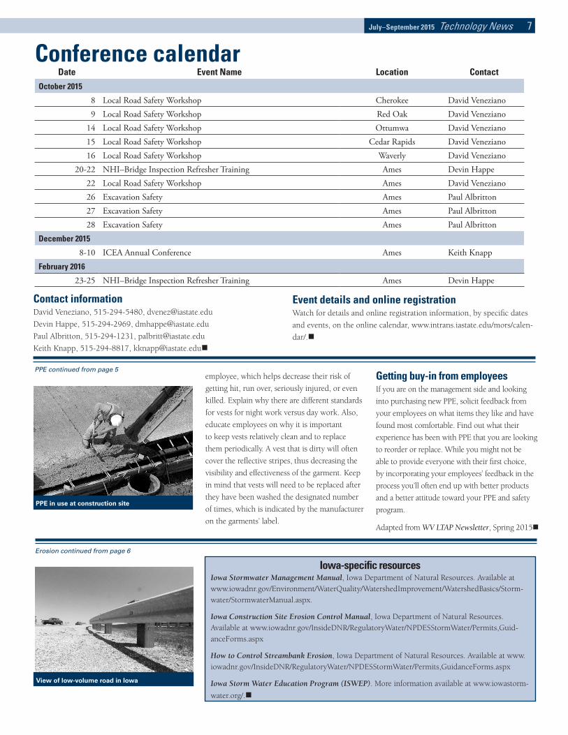
Erosion control tips for road and bridge work Certain road and bridge construction and
maintenance projects require plans for erosion
and storm water control to be prepared by an
engineer or erosion control specialist, according
to federal and state regulations. However, there
are some basic principles to keep in mind, even
for those projects that don’t require a specific
plan or permit. This article will highlight erosion
control methods typically recommended for
use on low-volume roads, culverts, and bridges
and work on shallow slopes (less than 10 ft).
We’ll also provide resources for more detailed
information.
The basics of erosion control The purpose of erosion control is to prevent the
loss of surface soil through proactive measures.
This is a more effective approach than sediment
control that attempts to capture the soil once
it has washed away. The three most common
types of erosion are surface, rill, and gully.
Surface erosion occurs when soil on the surface
is dislodged during rainfall and the water and
soil flow down a slope. Rill erosion occurs
when small, narrow channels form on slopes
not protected from erosion, and gully erosion
is simply rill erosion that combines and erodes
into a gully (Fay, Atkin, and Shi 2012).
Without surface slope protection, slope failure
occurs due to erosion, creating the potential
for both maintenance and safety issues. Factors
such as removing vegetation, topsoil, or other
organic matter without re-covering it; reshap-
ing the land; and allowing gullies to continue
to grow are all contributors to erosion. The
goal of surface slope protection is to minimize
erosion caused by disturbed sites and to limit
sediment washed away from these sites. In gen-
eral, the flatter the slope the less erosion will
occur; sites with steep slopes near waterways
need more controls than flat sites farther away.
General approach to erosion control In general, preserving existing vegetation and
minimizing the amount of land disturbed at one
time will go a long way toward reducing the
impact of any roadway project. Your objective
should be to keep the soil at its original location
if at all possible and, if not, to keep the soil close
By Pat Weaver, Executive Director, Kansas University Transportation Center
to its original location and onsite. For disturbed
soil or mulch, seed bare soil immediately for the
best and cheapest erosion protection (KDOT
Temporary Erosion-Control Manual 2007, Ken-
tucky Erosion Prevention and Sediment Control
Field Guide).
Tips for reducing or eliminating erosion Skorseth and Selim (2000) in their Gravel
Roads Maintenance and Design Manual,
provide some good basic tips for reducing or
eliminating erosion. Here are a few of those
common-sense recommendations:
• Some regions have certain times in the year when frequent and heavy rainfall can be expected. Try to avoid major reshape work during those periods of time.
• Keep disturbed areas small. The more earth you disturb, the greater the risk of soil erosion.
• Set work boundaries and don’t let work crews get outside of them.
• Consider stabilization of disturbed areas. Silt fences, mulching, erosion control blankets, and other means should be considered.
• Removing vegetative cover and topsoil generally increases the amount and speed of runoff. Keep water velocity low by keeping slopes as shallow or gentle as possible. Divert upland runoff around exposed soil. Shorten drainage runs and work to get vegetative cover reestablished as soon as possible after work is finished.
• Keep sediment within work boundaries. Sediment can be retained by filtering water as it flows (as through a silt fence), and ditch checks will retain dirty runoff water for a period of time until the soil particles settle out.
• Protect slopes and channels from gullying. Inspect recent work. This is vital to make sure channels haven’t formed in ditch bot-toms or on slopes, or around and under controls that were used. Be particularly vigilant after heavy rains.
Conclusion The purpose of erosion control is not to delay
construction projects, but to conduct them
in such a way as to minimize the impact on
waterways. Federal laws and regulations require
land disturbance activities (construction) to
control erosion and sediment. Federal and state
regulations require a construction storm water
permit for land disturbance activities when the
disturbed area is one acre or greater, and for
maintenance five acres or greater. Construction
projects near waters of the US of less than one
acre of disturbed area require a Project Water
Pollution Prevention Plan. There are a number
of resources available to you to learn more
about erosion control techniques and associ-
ated regulations. Regardless of the regulatory
requirements for your specific project, the tips
laid out in this article will help minimize the
impacts of your projects.
The following short list includes additional
resources on erosion control that you may find
helpful.
Reprinted with permission from the Spring
2015 issue of the Kansas LTAP Newsletter, a
publication of the Kansas Local Technical Assis-
tance Program (LTAP) at the Kansas University
Transportation Center
Cited resources Fay, L., Akin, M., and Shi, X. 2012. Cost-Effective
and Sustainable Road Slope Stabilization and
Erosion Control, NCHRP Synthesis 430, Wash-
ington, D. C. Available at onlinepubs.trb.org/
onlinepubs/nchrp/nchrp_syn_430.pdf.
KDOT Temporary Erosion-Control Manual.
Available at www.ksdot.org/Assets/wwwksdotorg/
bureaus/burConsMain/Connections/ecm.pdf.
Kentucky Erosion Prevention and Sediment
Control Field Guide. Available at water.epa.gov/
polwaste/npdes/stormwater/upload/esc_guide.pdf.
Skorseth, K. and A. A. Selim. 2000. Gravel
Roads Maintenance and Design Manual, South
Dakota Local Transportation Assistance Pro-
gram. Available at water.epa.gov/polwaste/nps/
upload/2003_07_24_NPS_gavelroads_gravel-
roads.pdf. Erosion continued on page 7
July–September 2015 Technology News 7
Conference calendar
Event details and online registrationWatch for details and online registration information, by specific dates
and events, on the online calendar, www.intrans.iastate.edu/mors/calen-
dar/.
Date Event Name Location ContactOctober 2015
8 Local Road Safety Workshop Cherokee David Veneziano9 Local Road Safety Workshop Red Oak David Veneziano
14 Local Road Safety Workshop Ottumwa David Veneziano15 Local Road Safety Workshop Cedar Rapids David Veneziano16 Local Road Safety Workshop Waverly David Veneziano
20-22 NHI–Bridge Inspection Refresher Training Ames Devin Happe22 Local Road Safety Workshop Ames David Veneziano26 Excavation Safety Ames Paul Albritton27 Excavation Safety Ames Paul Albritton28 Excavation Safety Ames Paul Albritton
December 2015
8-10 ICEA Annual Conference Ames Keith Knapp
February 2016
23-25 NHI–Bridge Inspection Refresher Training Ames Devin Happe
Contact informationDavid Veneziano, 515-294-5480, [email protected]
Devin Happe, 515-294-2969, [email protected]
Paul Albritton, 515-294-1231, [email protected]
Keith Knapp, 515-294-8817, [email protected]
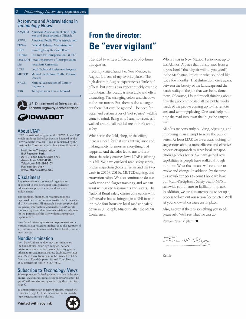
PPE continued from page 5employee, which helps decrease their risk of
getting hit, run over, seriously injured, or even
killed. Explain why there are different standards
for vests for night work versus day work. Also,
educate employees on why it is important
to keep vests relatively clean and to replace
them periodically. A vest that is dirty will often
cover the reflective stripes, thus decreasing the
visibility and effectiveness of the garment. Keep
in mind that vests will need to be replaced after
they have been washed the designated number
of times, which is indicated by the manufacturer
on the garments’ label.
PPE in use at construction site
Getting buy-in from employeesIf you are on the management side and looking
into purchasing new PPE, solicit feedback from
your employees on what items they like and have
found most comfortable. Find out what their
experience has been with PPE that you are looking
to reorder or replace. While you might not be
able to provide everyone with their first choice,
by incorporating your employees’ feedback in the
process you’ll often end up with better products
and a better attitude toward your PPE and safety
program.
Adapted from WV LTAP Newsletter, Spring 2015
Erosion continued from page 6
View of low-volume road in Iowa
Iowa-specific resources Iowa Stormwater Management Manual, Iowa Department of Natural Resources. Available at www.iowadnr.gov/Environment/WaterQuality/WatershedImprovement/WatershedBasics/Storm-water/StormwaterManual.aspx.
Iowa Construction Site Erosion Control Manual, Iowa Department of Natural Resources. Available at www.iowadnr.gov/InsideDNR/RegulatoryWater/NPDESStormWater/Permits,Guid-anceForms.aspx
How to Control Streambank Erosion, Iowa Department of Natural Resources. Available at www.iowadnr.gov/InsideDNR/RegulatoryWater/NPDESStormWater/Permits,GuidanceForms.aspx
Iowa Storm Water Education Program (ISWEP). More information available at www.iowastorm-
water.org/.

8 Technology News July–September 2015P 486-0524
Institute for TransportationIowa State UniversityISU Research Park2711 S. Loop Drive, Suite 4700Ames, IA 50010-8664
RETURN SERVICE REQUESTED
√ Order library materials√ Add a name to our mail list√ Correct your mailing information
Add the name/address below to the Technology News mail list.
Delete the name/address below from the Technology News mail list.
Correct the name and/or address below on the Technology News mail list.
New or corrected mailing information:
Name ____________________________________________________Title _____________________________________________________Organization _____________________________________________Address _________________________________________________City _____________________________________________________ State _________________________Zip ________________________ Send the following library materials to the address above:
Title: _______________________________________________________P-, V-, DVD or CR-number: ____________________________________Title: ________________________________________________________P-, V-, DVD or CR-number: ____________________________________
To make a change to the Technology News mail list or to order library materials, please complete the information below and mail or fax this page (including mail label) to the InTrans address below:
Institute for Transportation2711 S. Loop Drive, Suite 4700Ames, IA 50010-8664Fax: 515.294.0467
LTAP Materials
Subscribe to Technology News online at www.intrans.iastate.edu/pubs/Newsletter_Request/mailform.cfm.