Introduction to Spatial Data Types - University …Introduction to Spatial Data Types Daniel...
47
Overview Data Models Summary Introduction to Spatial Data Types Daniel McInerney Urban Institute Ireland, University College Dublin, Richview Campus, Clonskeagh Drive, Dublin 14. 16th June 2009 Daniel McInerney UII Summer School - 15.06.2009
Transcript of Introduction to Spatial Data Types - University …Introduction to Spatial Data Types Daniel...

OverviewData Models
Summary
Introduction to Spatial Data Types
Daniel McInerney
Urban Institute Ireland,University College Dublin,
Richview Campus,Clonskeagh Drive,
Dublin 14.
16th June 2009
Daniel McInerney UII Summer School - 15.06.2009

OverviewData Models
Summary
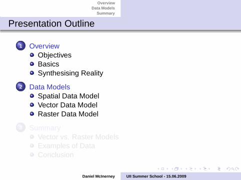
Presentation Outline
1 OverviewObjectivesBasicsSynthesising Reality
2 Data ModelsSpatial Data ModelVector Data ModelRaster Data Model
3 SummaryVector vs. Raster ModelsExamples of DataConclusion
Daniel McInerney UII Summer School - 15.06.2009
OverviewData Models
Summary
Presentation Outline
1 OverviewObjectivesBasicsSynthesising Reality
2 Data ModelsSpatial Data ModelVector Data ModelRaster Data Model
3 SummaryVector vs. Raster ModelsExamples of DataConclusion
Daniel McInerney UII Summer School - 15.06.2009

OverviewData Models
Summary
Presentation Outline
1 OverviewObjectivesBasicsSynthesising Reality
2 Data ModelsSpatial Data ModelVector Data ModelRaster Data Model
3 SummaryVector vs. Raster ModelsExamples of DataConclusion
Daniel McInerney UII Summer School - 15.06.2009
OverviewData Models
Summary
ObjectivesBasicsSynthesising Reality
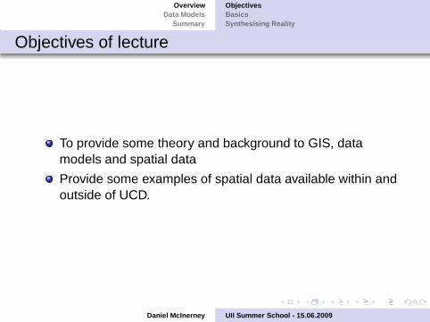
Objectives of lecture
To provide some theory and background to GIS, datamodels and spatial data
Provide some examples of spatial data available within andoutside of UCD.
Daniel McInerney UII Summer School - 15.06.2009
OverviewData Models
Summary
ObjectivesBasicsSynthesising Reality
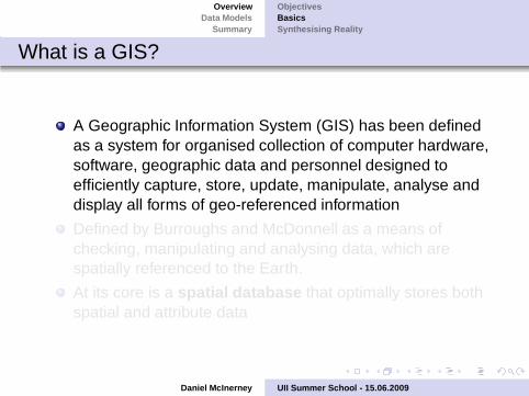
What is a GIS?
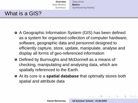
A Geographic Information System (GIS) has been definedas a system for organised collection of computer hardware,software, geographic data and personnel designed toefficiently capture, store, update, manipulate, analyse anddisplay all forms of geo-referenced information
Defined by Burroughs and McDonnell as a means ofchecking, manipulating and analysing data, which arespatially referenced to the Earth.
At its core is a spatial database that optimally stores bothspatial and attribute data
Daniel McInerney UII Summer School - 15.06.2009
OverviewData Models
Summary
ObjectivesBasicsSynthesising Reality
What is a GIS?
A Geographic Information System (GIS) has been definedas a system for organised collection of computer hardware,software, geographic data and personnel designed toefficiently capture, store, update, manipulate, analyse anddisplay all forms of geo-referenced information
Defined by Burroughs and McDonnell as a means ofchecking, manipulating and analysing data, which arespatially referenced to the Earth.
At its core is a spatial database that optimally stores bothspatial and attribute data
Daniel McInerney UII Summer School - 15.06.2009

OverviewData Models
Summary
ObjectivesBasicsSynthesising Reality
Conceptual Overview of a GIS
Daniel McInerney UII Summer School - 15.06.2009

OverviewData Models
Summary
ObjectivesBasicsSynthesising Reality
Representing Reality
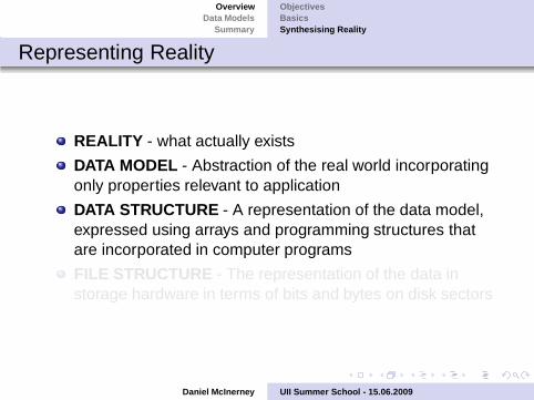
REALITY - what actually exists
DATA MODEL - Abstraction of the real world incorporatingonly properties relevant to application
DATA STRUCTURE - A representation of the data model,expressed using arrays and programming structures thatare incorporated in computer programs
FILE STRUCTURE - The representation of the data instorage hardware in terms of bits and bytes on disk sectors
Daniel McInerney UII Summer School - 15.06.2009

OverviewData Models
Summary
ObjectivesBasicsSynthesising Reality
Representing Reality
REALITY - what actually exists
DATA MODEL - Abstraction of the real world incorporatingonly properties relevant to application
DATA STRUCTURE - A representation of the data model,expressed using arrays and programming structures thatare incorporated in computer programs
FILE STRUCTURE - The representation of the data instorage hardware in terms of bits and bytes on disk sectors
Daniel McInerney UII Summer School - 15.06.2009
OverviewData Models
Summary
Spatial Data ModelVector Data ModelRaster Data Model
The Data Model
Critical decision is the choice of the data model, which isthe basis of a GIS
Different data models are required for spatial and attributedata
They are a set of constructs for describing andrepresenting selected aspects of the real world in acomputer
Models need to cope with: maintaining data, modellingtasks, analysis tasks and presentation.
Daniel McInerney UII Summer School - 15.06.2009
OverviewData Models
Summary
Spatial Data ModelVector Data ModelRaster Data Model
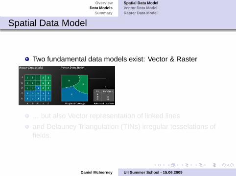
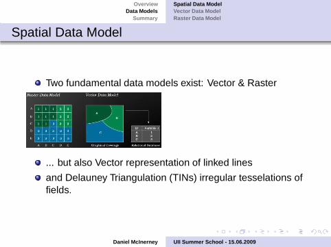
Spatial Data Model
Two fundamental data models exist: Vector & Raster
... but also Vector representation of linked lines
and Delauney Triangulation (TINs) irregular tesselations offields.
Daniel McInerney UII Summer School - 15.06.2009
OverviewData Models
Summary
Spatial Data ModelVector Data ModelRaster Data Model
Spatial Data Model
Two fundamental data models exist: Vector & Raster
... but also Vector representation of linked lines
and Delauney Triangulation (TINs) irregular tesselations offields.
Daniel McInerney UII Summer School - 15.06.2009

OverviewData Models
Summary
Spatial Data ModelVector Data ModelRaster Data Model
What are Spatial Data?
A geographical entity is defined in terms of:
Location (spatial reference)
Dimensions
Attribute
Time
It is common in spatial analysis to refer to places as (spatial)objects.
Daniel McInerney UII Summer School - 15.06.2009
OverviewData Models
Summary
Spatial Data ModelVector Data ModelRaster Data Model
Spatial Reference
Latitude Longitude
National Grid Reference
An address
A postcode
Daniel McInerney UII Summer School - 15.06.2009

OverviewData Models
Summary
Spatial Data ModelVector Data ModelRaster Data Model
Coordinate Reference Systems
A flat map distorts geometry because the Earth is curved.
If you plot lat long coordinates of a Cartesian system − astraight line will appear bent and areas will be distorted.
3D points are projected from the Earth’s surface onto the2D map surface.
Despite these projections, this process can lead todistortions over large areas.
Daniel McInerney UII Summer School - 15.06.2009
OverviewData Models
Summary
Spatial Data ModelVector Data ModelRaster Data Model
Map Projections
Many types of map projections exist, perhaps the mostcommonly used one is:
Universal Transverse Mercator Coordinate System
It divides the Earth into zones that are six degrees inlongitude & from 80 ◦ south latitude to 84◦north latitude
Daniel McInerney UII Summer School - 15.06.2009

OverviewData Models
Summary
Spatial Data ModelVector Data ModelRaster Data Model
Map Projections
Bear in mind that map projections distort five geographicrelationships:
Areas
Angles
Gross Shapes
Distances
Directions
Some projections will preserve local angles but not areasand vice versa!
Daniel McInerney UII Summer School - 15.06.2009
OverviewData Models
Summary
Spatial Data ModelVector Data ModelRaster Data Model
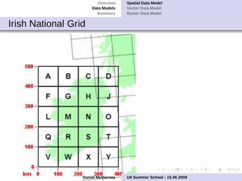
Irish National Grid
Daniel McInerney UII Summer School - 15.06.2009
OverviewData Models
Summary
Spatial Data ModelVector Data ModelRaster Data Model
Zero Dimensional Object Types
Point - as pairs of coordinates in lat/long or some otherreference system
A point feature is a zero-dimensional cartographic object.
It specifies the geometric location and no other meaningfulmeasurement
The size of the point may vary, but the area of thosesymbols is meaningless
Four types of points exist: entity point, label point, areapoint and node
Node
Daniel McInerney UII Summer School - 15.06.2009
OverviewData Models
Summary
Spatial Data ModelVector Data ModelRaster Data Model
One Dimensional Object Types
Line - ordered sequence of points connected by straight lines
Line features are one dimensional features, despiteoccupying two-dimensional space.
A line segment is the direct connection between two points
A line feature is typically represented as a sequence ofvectors
An Arc is the location of points that are defined by amathematical function to form a curve
Link or edge is the connection between two nodes
Daniel McInerney UII Summer School - 15.06.2009

OverviewData Models
Summary
Spatial Data ModelVector Data ModelRaster Data Model
Two Dimensional Object Types
Areas as ordered rings of points connected by straight lines toform polygons
Area is a two dimensional, bounded and continuous object
Interior area is an area not including its boundary
Simple polygon consists of an interior area and an outerring. The boundary does not intersect itself
Typically refers to vector polygons, but also relates to pixels andgrid cells.
Daniel McInerney UII Summer School - 15.06.2009

OverviewData Models
Summary
Spatial Data ModelVector Data ModelRaster Data Model
Attribute Data
Attribute (Aspatial) information is the label / name /categorisation / descriptiong associated with a spatialobject
The attributes can be as important as the spatial datathemselves
May be more complex than the spatial data
May be a simple text label (e.g. town name, river name,county population)
Attributes usually stored in some form of database (i.e.DBF, ORACLE table ...)
Relational or object oriented DBMS used to spatial objectsto complex attribute tables
Daniel McInerney UII Summer School - 15.06.2009
OverviewData Models
Summary
Spatial Data ModelVector Data ModelRaster Data Model
Common types of attribute data
Nominal Attribute that distinguishes between locationswithout any ranking or potential for arithmetic
Ordinal Attribute that implies a ranking, but arithmeticcalculations are nonsensical
Interval Attributes where differences make sense
Ratio Attributes where it makes sense to divide onemeasurement by another
Daniel McInerney UII Summer School - 15.06.2009

OverviewData Models
Summary
Spatial Data ModelVector Data ModelRaster Data Model
Raster Data
Popular means of referencing continuous fields
Designed for rapid response to queries e.g.
What is at a given location?
Where does attribute X occur?
Daniel McInerney UII Summer School - 15.06.2009

OverviewData Models
Summary
Spatial Data ModelVector Data ModelRaster Data Model
Types of continuous fields
Elevation
Air Temperature
Land ownership
Ice thickness
Timber Volume or Biomass
Population density
Daniel McInerney UII Summer School - 15.06.2009
OverviewData Models
Summary
Spatial Data ModelVector Data ModelRaster Data Model
What is a raster?
...A raster is a geographic data set in which values areassigned to a rectangular array of objects (Goodchild,1997)
...A regular grid of cells with a fixed resolution completelycovering an area (Burrough, 1986)
Daniel McInerney UII Summer School - 15.06.2009

OverviewData Models
Summary
Spatial Data ModelVector Data ModelRaster Data Model
Basic raster definition
Space is tesselated at a fixed resolution, the cell size
Cell values are stored in a fixed order (e.g. row by row fromtop left to bottom right)
No need for coordinates of each cell as the scheme isordered and regular
Store the coordinates of one cell and cell size to registerthe raster to an external coorindate system
Daniel McInerney UII Summer School - 15.06.2009
OverviewData Models
Summary
Vector vs. Raster ModelsExamples of DataConclusion
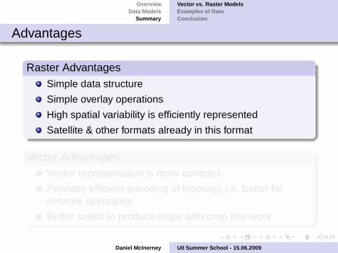
Advantages
Raster AdvantagesSimple data structure
Simple overlay operations
High spatial variability is efficiently represented
Satellite & other formats already in this format
Vector AdvantagesVector representation is more compact
Provides efficient encoding of topology, i.e. better fornetwork operations
Better suited to produce maps with crisp line-work
Daniel McInerney UII Summer School - 15.06.2009

OverviewData Models
Summary
Vector vs. Raster ModelsExamples of DataConclusion
Disadvantages
Raster DisadvantagesRaster data are less compact
Topological relationships difficult to represent
Poorer graphical output (step-like effect / blockyappearance)
Vector DisadvantagesMore complex structure than a simple raster
Overlay operations are more difficult to implement
Representing high spatial variability is inefficient
Handling image data is not possible
Daniel McInerney UII Summer School - 15.06.2009

OverviewData Models
Summary
Vector vs. Raster ModelsExamples of DataConclusion
Demonstration of different types of data
Frequently, access to data is the biggest hinderence tocarrying out spatial analysis
Multitude of data exist, some proprietary others free...
Daniel McInerney UII Summer School - 15.06.2009

OverviewData Models
Summary
Vector vs. Raster ModelsExamples of DataConclusion
Concluding remarksHopefully this lecture has provided you with somebackground and theory to GIS
An understanding of data models and data types willfacilitate your spatial analysis
Type of data model are dependent on your needs andanalysis
Questions, comments?
Daniel McInerney UII Summer School - 15.06.2009