
Introduction to GIS and ArcGIS Online
31
Introduction to GIS and ArcGIS Online Joy Suh Geospatial Resources Librarian ([email protected]) Fall 2020
Transcript of Introduction to GIS and ArcGIS Online
Introduction to GIS and ArcGIS Online
Joy Suh Geospatial Resources Librarian
Fall 2020

What will cover today? • Geospatial Data
• Basic Concepts of GIS and its
applications
• Data Resources
• Software Access & Training
• Hands-On with ArcGIS Online

Geographical Information Systems (GIS)
A computer-based data management systems to help
create, visualize, store, manipulate and analyze
information that is tied to a geospatial data (location
data).
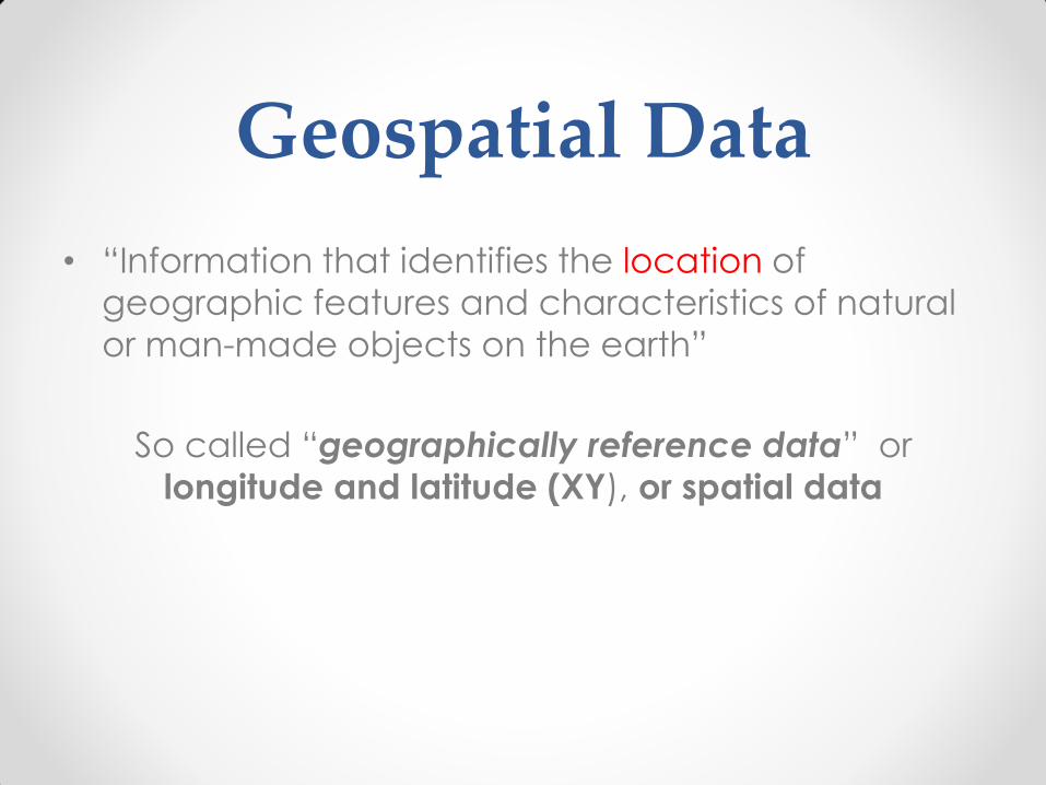
Geospatial Data
• “Information that identifies the location of
geographic features and characteristics of natural
or man-made objects on the earth”
So called “geographically reference data” or
longitude and latitude (XY), or spatial data
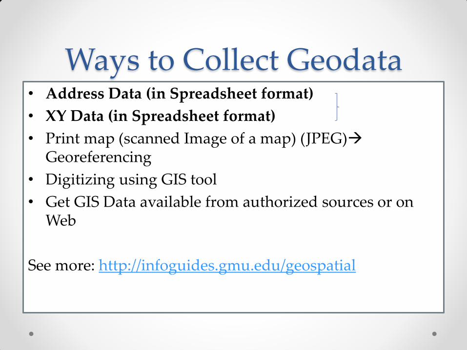
Ways to Collect Geodata • Address Data (in Spreadsheet format)
• XY Data (in Spreadsheet format)
• Print map (scanned Image of a map) (JPEG) Georeferencing
• Digitizing using GIS tool
• Get GIS Data available from authorized sources or on Web
See more: http://infoguides.gmu.edu/geospatial
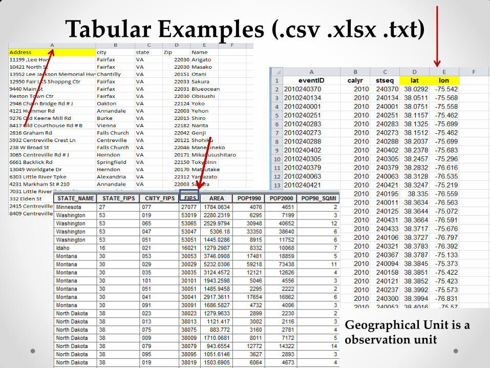
Tabular Examples (.csv .xlsx .txt)
Geographical Unit is a observation unit

Which one is a geospatial dataset?

Two Types of Geospatial Data
Vector Data Raster Data
• Represent “Real Word
View” based on:
Point, Line and Polygon
• Data format: Shape file
(.shp)—Zip format
• Example: US Census
Tiger files
• Represent “Real World View” based on: Grid (Pixel)
• Data format: Digital Image File
(. geoTiff, tiff, jpg, etc)
• Example: USGS Digital
Elevation (DEM or DOQQ) & NGA’s Satellite Images, NOAA
“Feature Based Data”
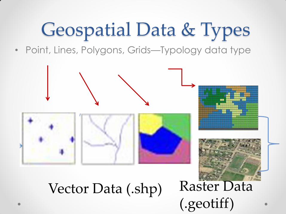
Geospatial Data & Types • Point, Lines, Polygons, Grids—Typology data type
Vector Data (.shp) Raster Data (.geotiff)
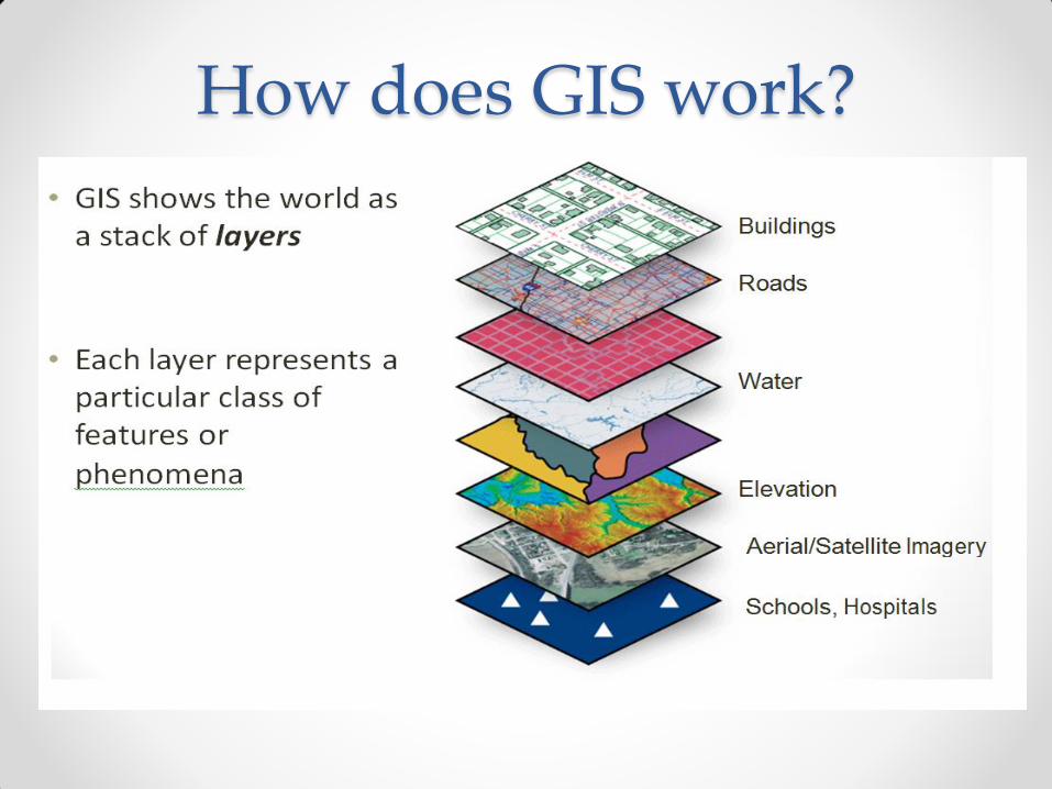
How does GIS work?

Capability: Overlay Layers

Capabilities: Data Overlay
Create a new layer through overlay (with the same location and the same
coordinate system)
Example: Overlay different data formats and create a new layer.
11

Geographic Coordinates
• Latitude= North (+) or South (-) from 0 (Equator) to 90 at the N/S Poles
• Longitude = East (+) or West (-) from the Prime Meridian
3 Dimensions

Geographic Coordinates
X
Fairfax, VA Lat(Y)= 38.8505 Long(X)= -71.3032
Units= Degrees, Minutes, Second or Decimal Degrees.
• can convert between the two
2 Dimensions

Projections & Coordinate Systems
• Geographic Coordinate System (GCS) - Location on a sphere (latitude/longitude, 3 dimension)
• Datum (goes along with the GCS) - An estimate of Earth’s actual shape fit into a spheroid
(World Geodetic Survey (WGS) 83, NAD27(83)
• Projected Coordinate System - Location on a flat map from a defined 0,0 origin
See more at:
http://egsc.usgs.gov/isb/pubs/MapProjections/projections.html
10
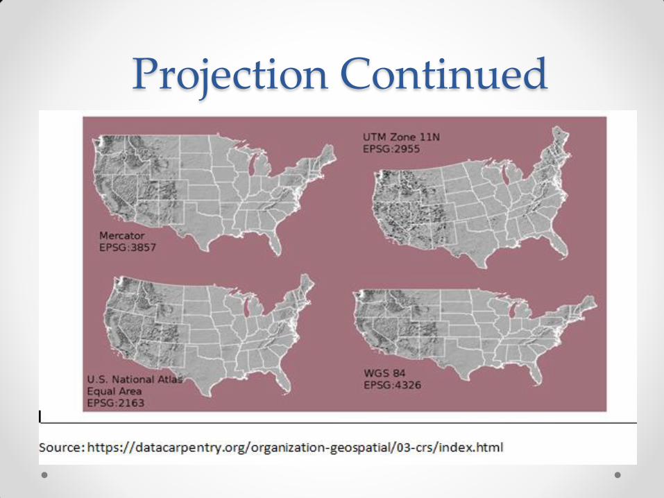
Projection Continued
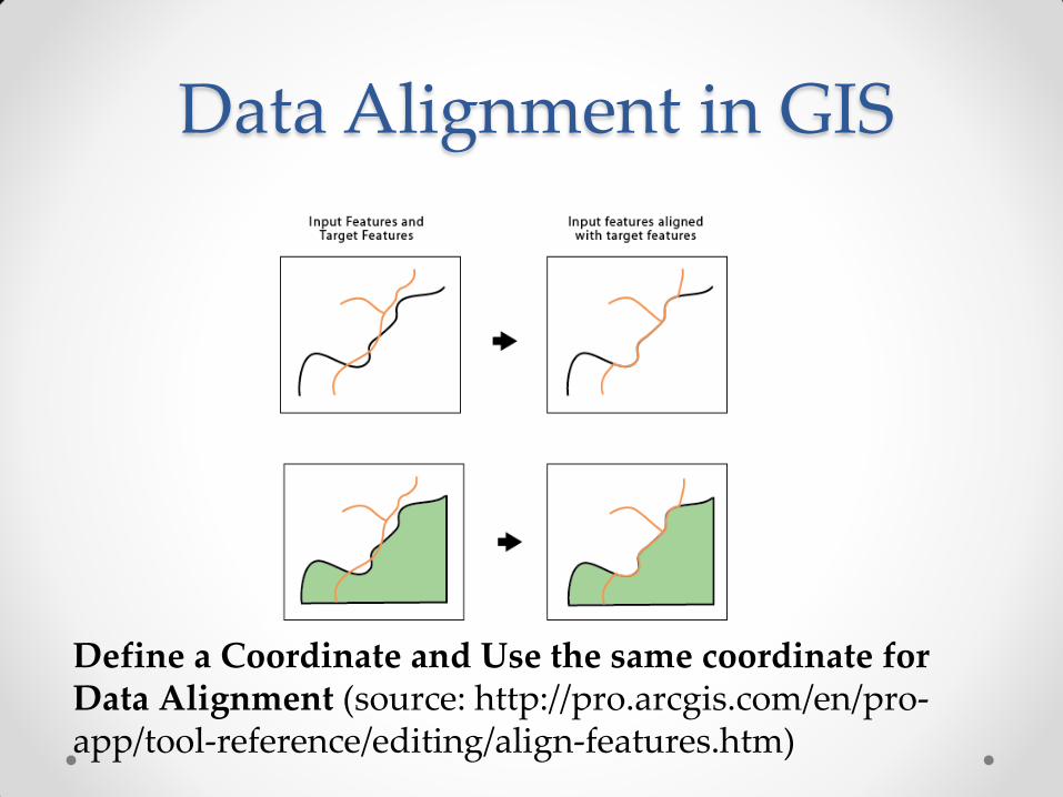
Data Alignment in GIS
Define a Coordinate and Use the same coordinate for Data Alignment (source: http://pro.arcgis.com/en/pro-app/tool-reference/editing/align-features.htm)

No Spatial Information
Spatial Information Spatial Reference needs to be defined in GIS
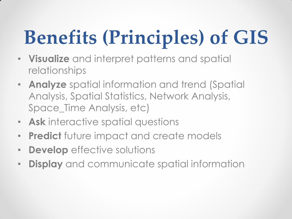
Benefits (Principles) of GIS • Visualize and interpret patterns and spatial
relationships
• Analyze spatial information and trend (Spatial
Analysis, Spatial Statistics, Network Analysis,
Space_Time Analysis, etc)
• Ask interactive spatial questions
• Predict future impact and create models
• Develop effective solutions
• Display and communicate spatial information

1

1
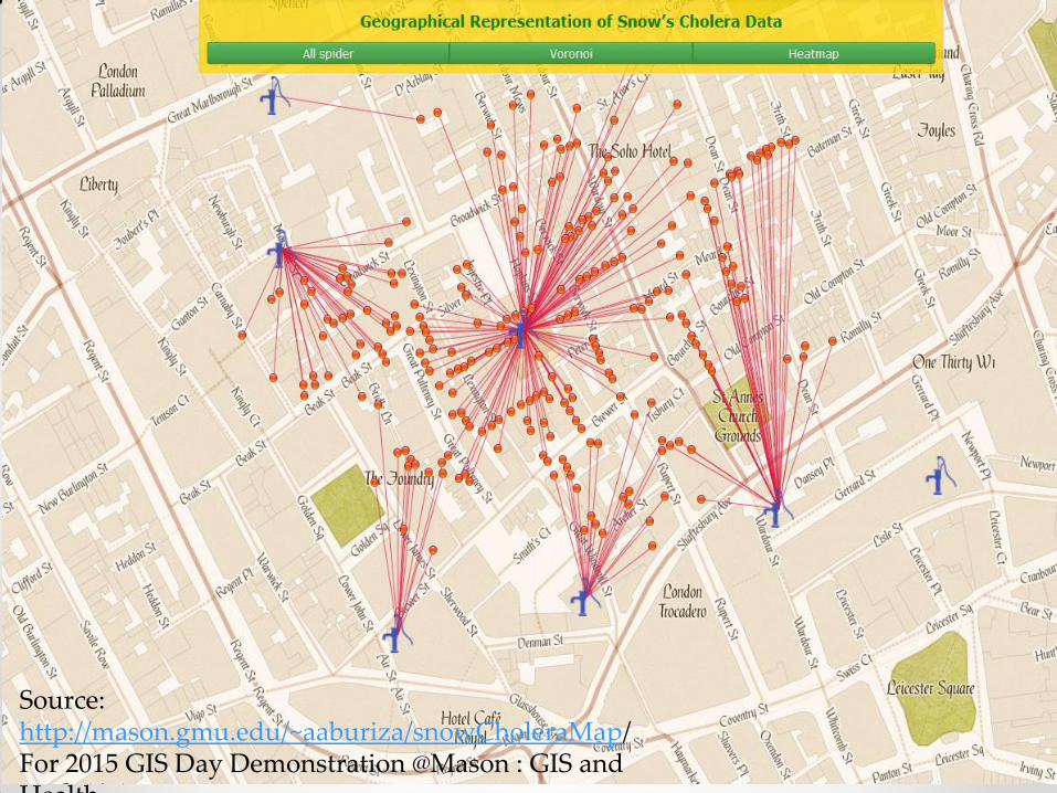
Source: http://mason.gmu.edu/~aaburiza/snowCholeraMap/ For 2015 GIS Day Demonstration @Mason : GIS and Health
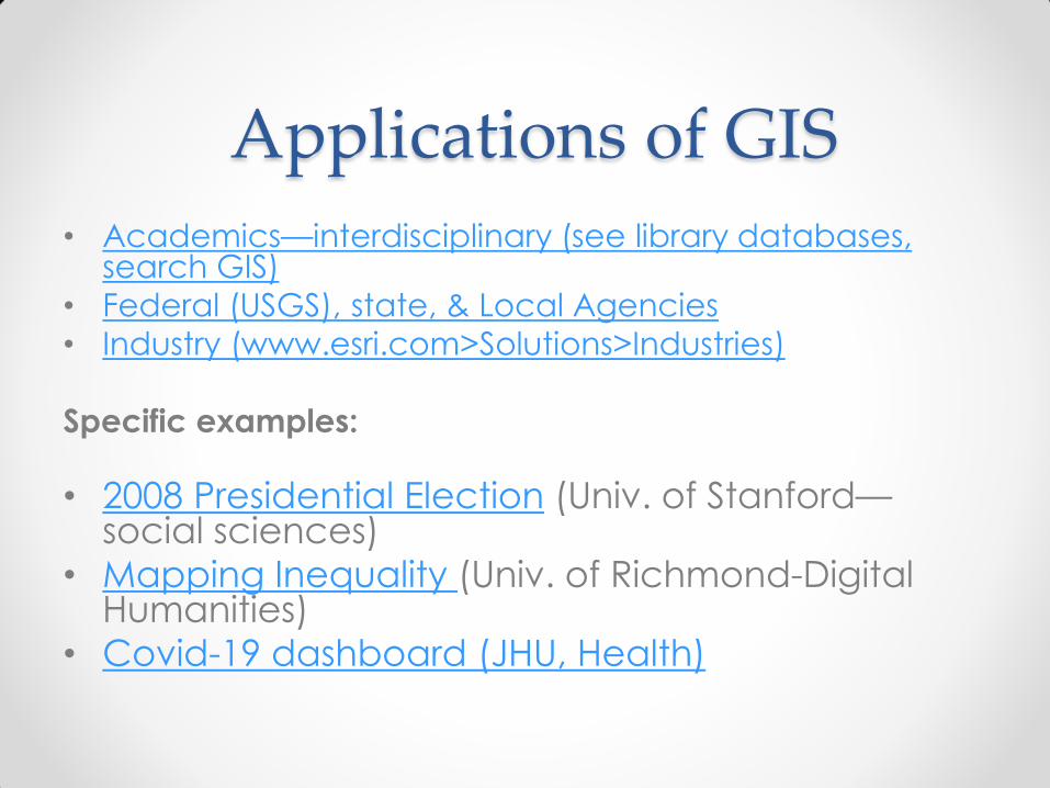
Applications of GIS
• Academics—interdisciplinary (see library databases, search GIS)
• Federal (USGS), state, & Local Agencies
• Industry (www.esri.com>Solutions>Industries)
Specific examples:
• 2008 Presidential Election (Univ. of Stanford—social sciences)
• Mapping Inequality (Univ. of Richmond-Digital Humanities)
• Covid-19 dashboard (JHU, Health)

Finding Geospatial Data
Library Infoguides—Geospatial Data & GIS
http://infoguides.gmu.edu/geospatial/data
• Data.gov (US Federal Agency Data) • ArcGIS Hub (Organizations and US local
governments) • DIVA (Global) • Natural Earth (Global) • Geodata@Mason
19

Access to GIS Software &
Training
• Desktop—ArcGIS 10.7, QGIS (Open Source)
• Online: ArcGIS Online (AGOL),
• ArcMap ArcGIS Pro (Install via the Desktop version
or individual download from Online
• See more: infoguides.gmu.edu/geospatial/software
• See more:
https://infoguides.gmu.edu/geospatial/workshop
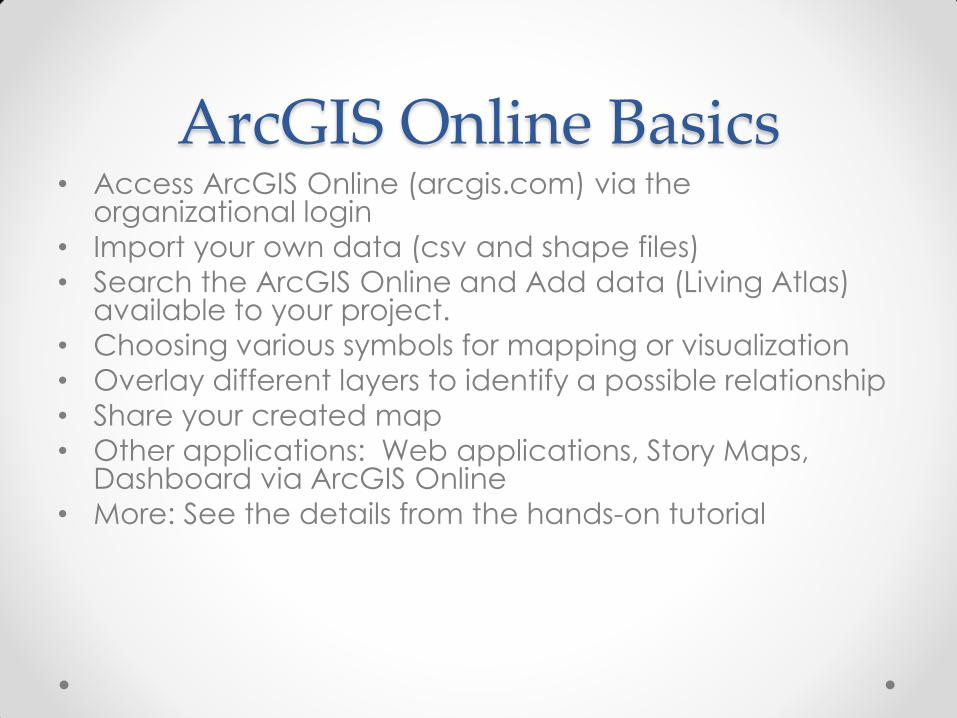
ArcGIS Online Basics • Access ArcGIS Online (arcgis.com) via the
organizational login
• Import your own data (csv and shape files)
• Search the ArcGIS Online and Add data (Living Atlas) available to your project.
• Choosing various symbols for mapping or visualization
• Overlay different layers to identify a possible relationship
• Share your created map
• Other applications: Web applications, Story Maps, Dashboard via ArcGIS Online
• More: See the details from the hands-on tutorial