Introduction to ArcGIS - National Centre of Excellence in...
53
Introduction to ArcGIS
Transcript of Introduction to ArcGIS - National Centre of Excellence in...
Introduction to ArcGIS
2
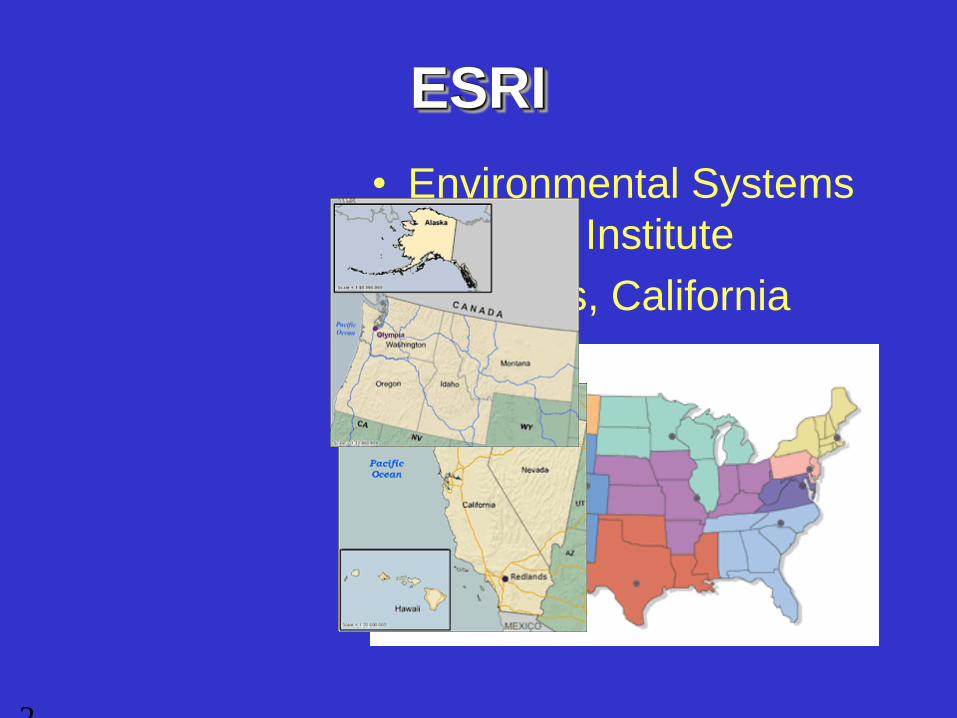
ESRI
• Environmental Systems
Research Institute
• Redlands, California
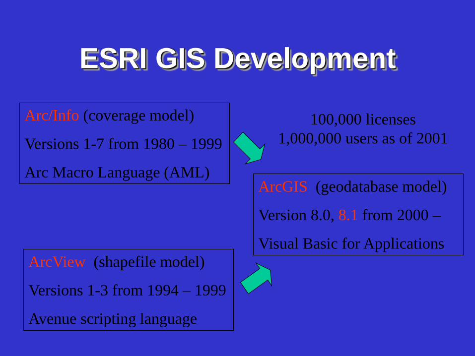
ESRI GIS Development
Arc/Info (coverage model)
Versions 1-7 from 1980 – 1999
Arc Macro Language (AML)
ArcView (shapefile model)
Versions 1-3 from 1994 – 1999
Avenue scripting language
ArcGIS (geodatabase model)
Version 8.0, 8.1 from 2000 –
Visual Basic for Applications
100,000 licenses
1,000,000 users as of 2001
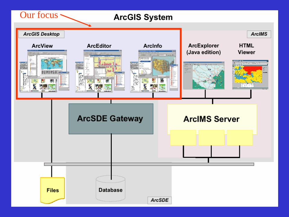
Our focus
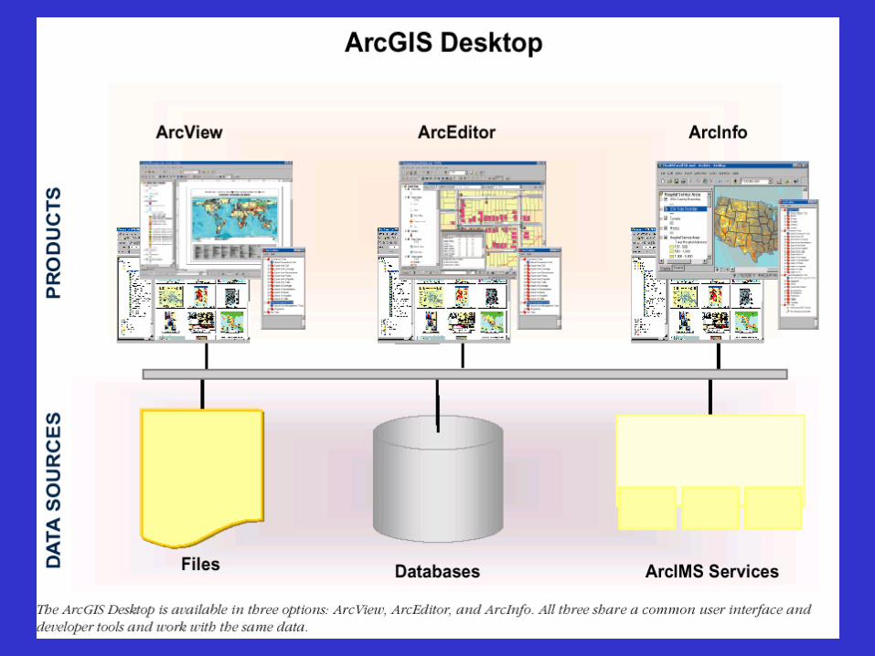
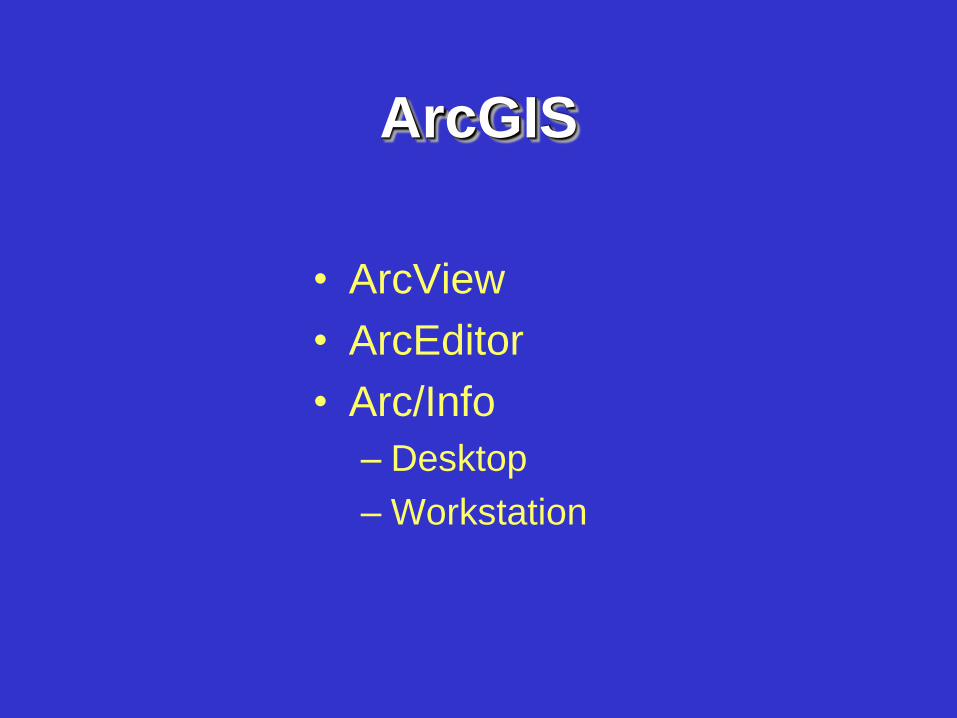
ArcGIS
• ArcView
• ArcEditor
• Arc/Info
– Desktop
– Workstation
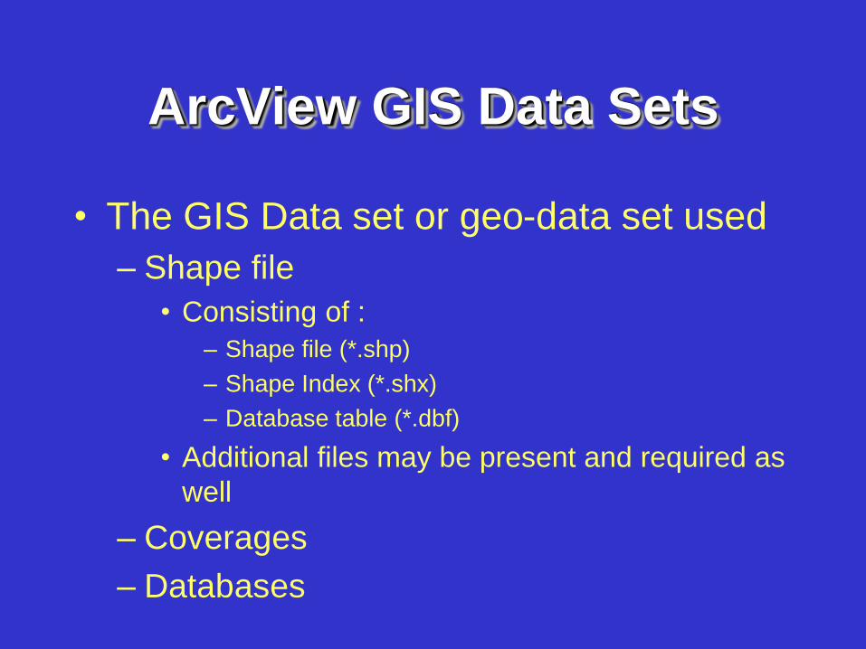
ArcView GIS Data Sets
• The GIS Data set or geo-data set used
– Shape file
• Consisting of :
– Shape file (*.shp)
– Shape Index (*.shx)
– Database table (*.dbf)
• Additional files may be present and required as
well
– Coverages
– Databases
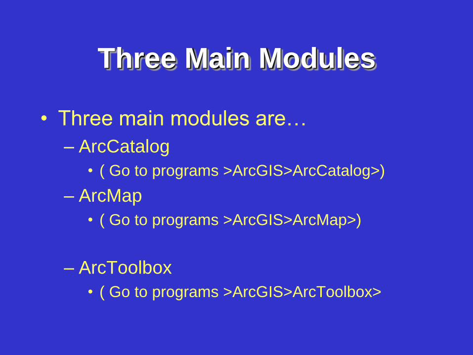
Three Main Modules
• Three main modules are…
– ArcCatalog
• ( Go to programs >ArcGIS>ArcCatalog>)
– ArcMap
• ( Go to programs >ArcGIS>ArcMap>)
– ArcToolbox
• ( Go to programs >ArcGIS>ArcToolbox>
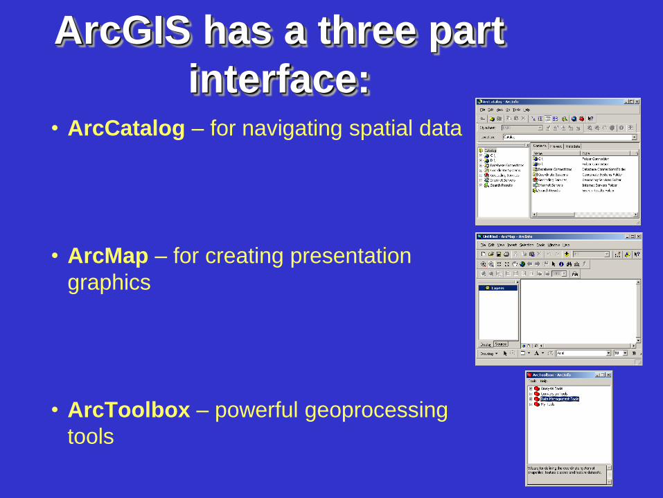
ArcGIS has a three part
interface:
• ArcCatalog – for navigating spatial data
• ArcMap – for creating presentation
graphics
• ArcToolbox – powerful geoprocessing
tools
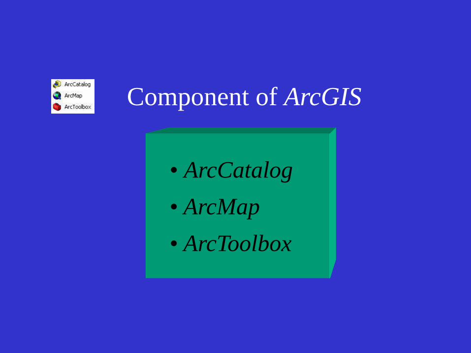
Component of ArcGIS
• ArcCatalog
• ArcMap
• ArcToolbox
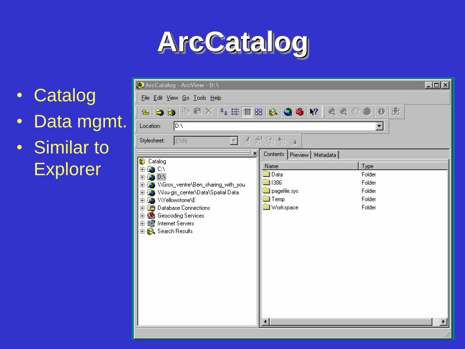
ArcCatalog
• Catalog
• Data mgmt.
• Similar to
Explorer
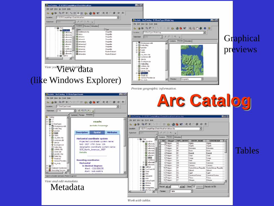
Arc Catalog
View data
(like Windows Explorer)
Graphical
previews
Metadata
Tables
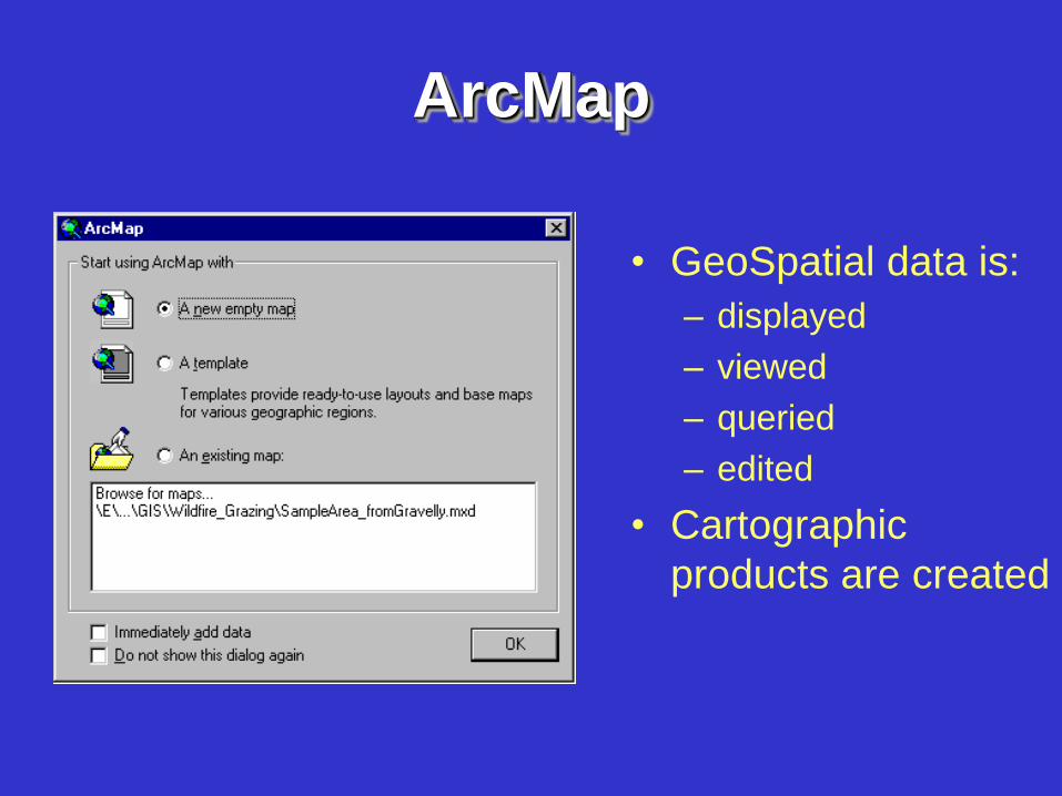
ArcMap
• GeoSpatial data is:
– displayed
– viewed
– queried
– edited
• Cartographic
products are created
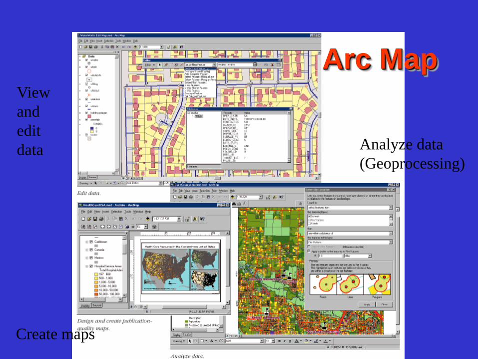
Arc Map
Create maps
View
and
edit
data Analyze data
(Geoprocessing)

ArcMap GUI
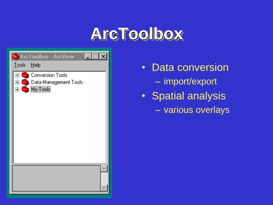
ArcToolbox
• Data conversion
– import/export
• Spatial analysis
– various overlays
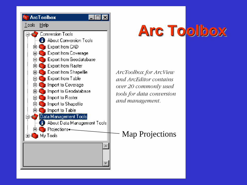
Arc Toolbox
Map Projections
Principles of GIS
• We will use each of these modules
• Focus on ArcMap
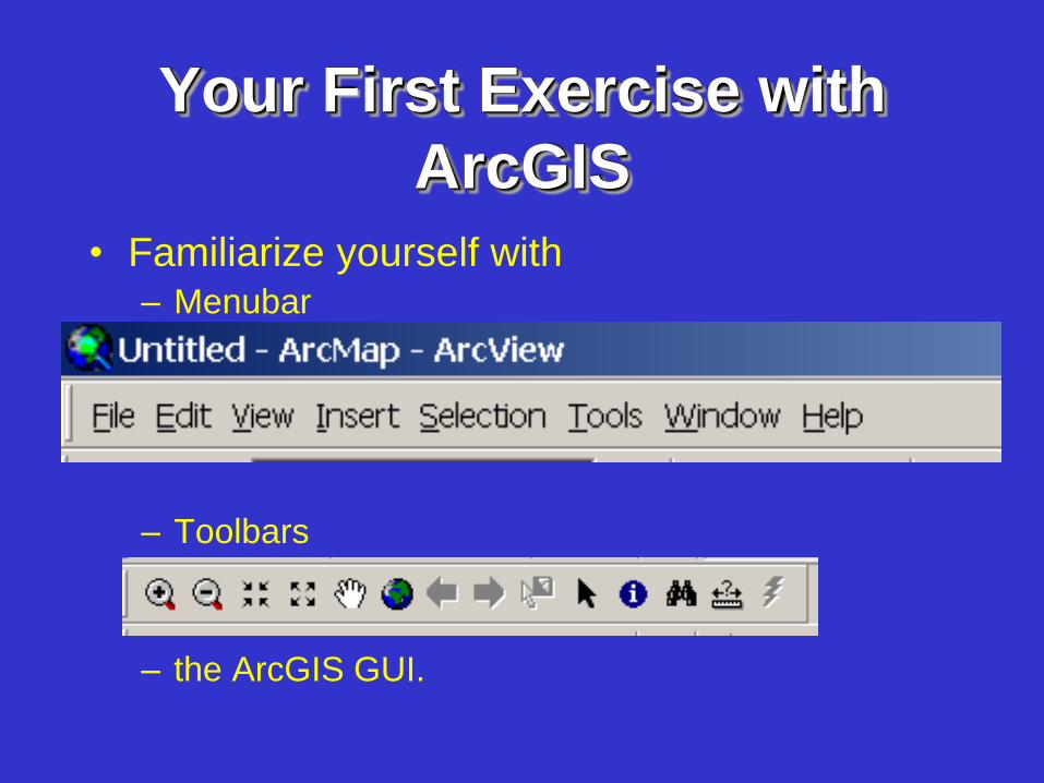
Your First Exercise with
ArcGIS
• Familiarize yourself with – Menubar
– Toolbars
– the ArcGIS GUI.
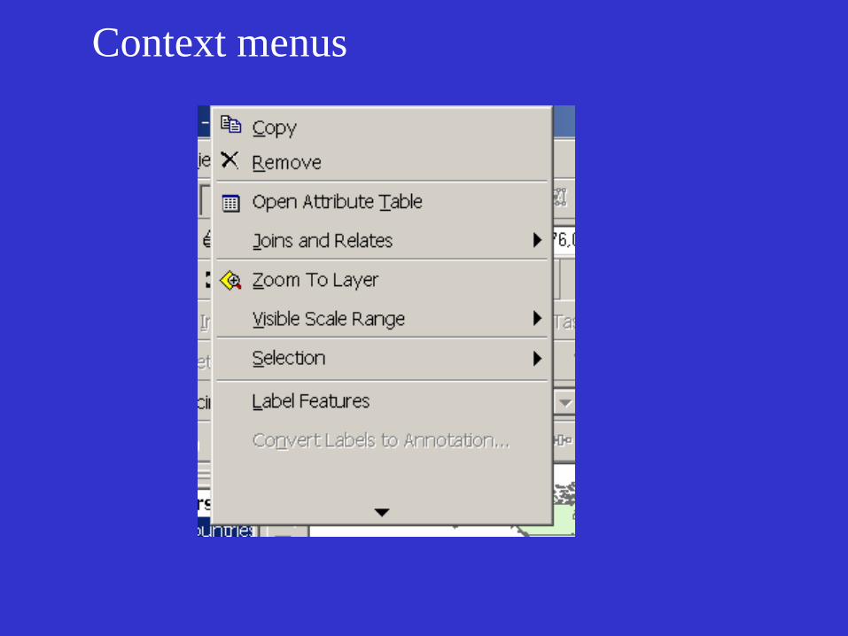
Context menus
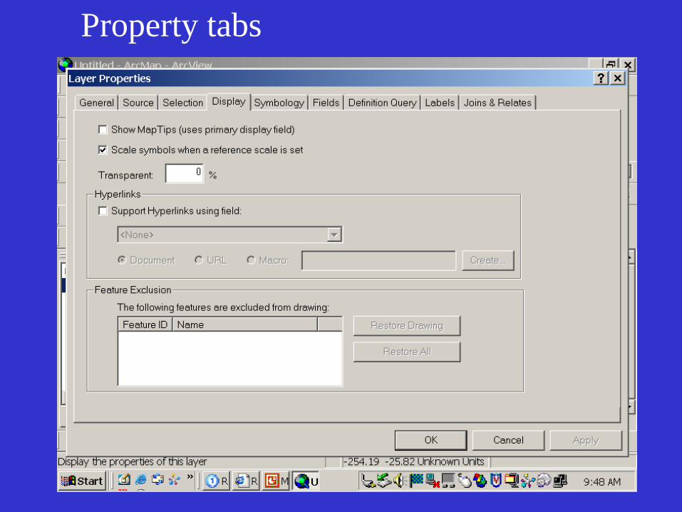
Property tabs
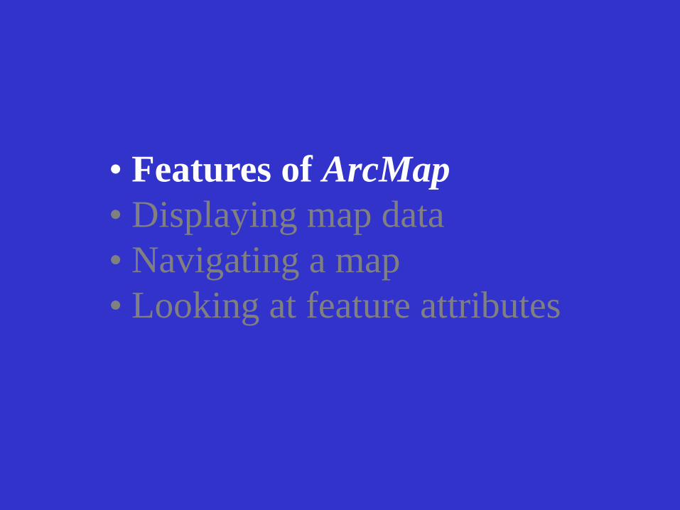
• Features of ArcMap
• Displaying map data
• Navigating a map
• Looking at feature attributes
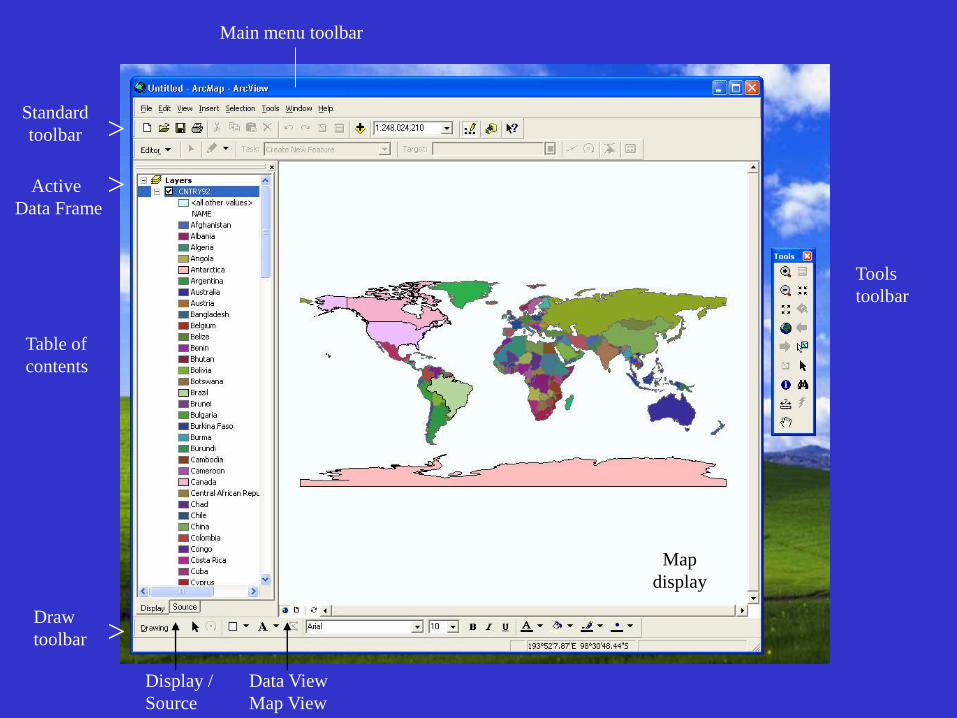
Main menu toolbar
Standard
toolbar
Table of
contents
Draw
toolbar
Tools
toolbar
Map
display
Data View
Map View
Active
Data Frame
>
>
>
Display /
Source
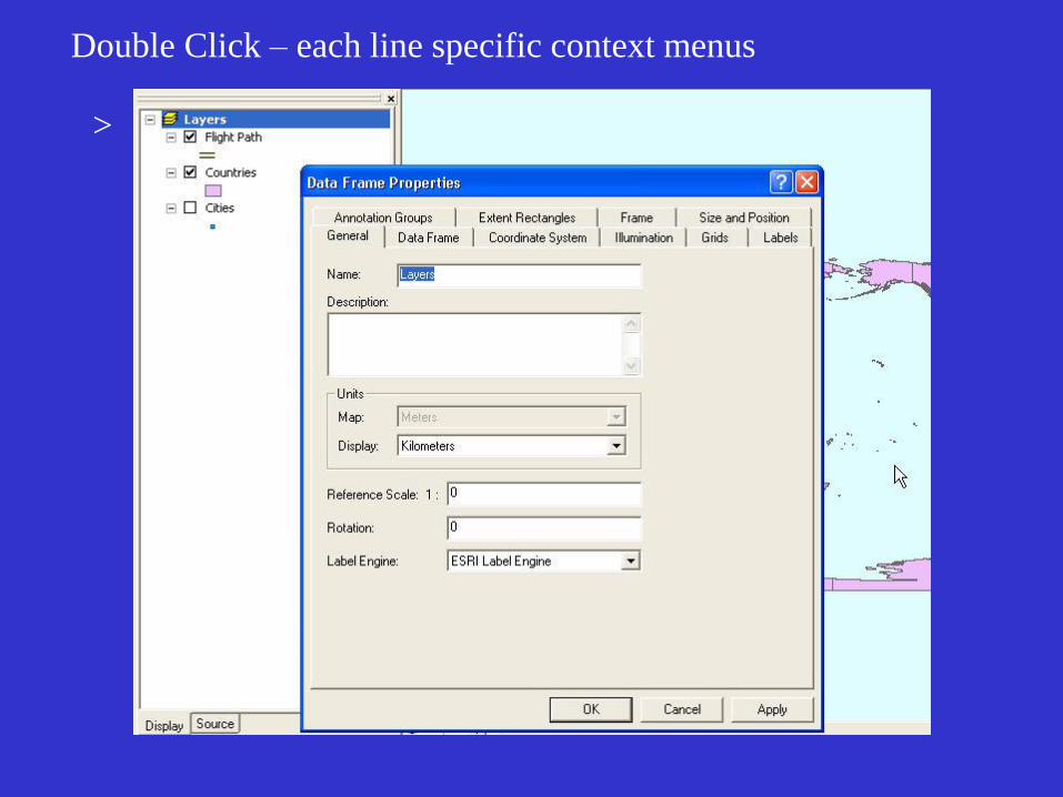
Double Click – each line specific context menus
>
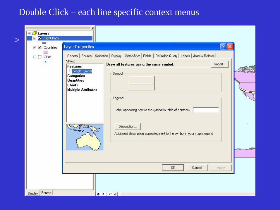
Double Click – each line specific context menus
>
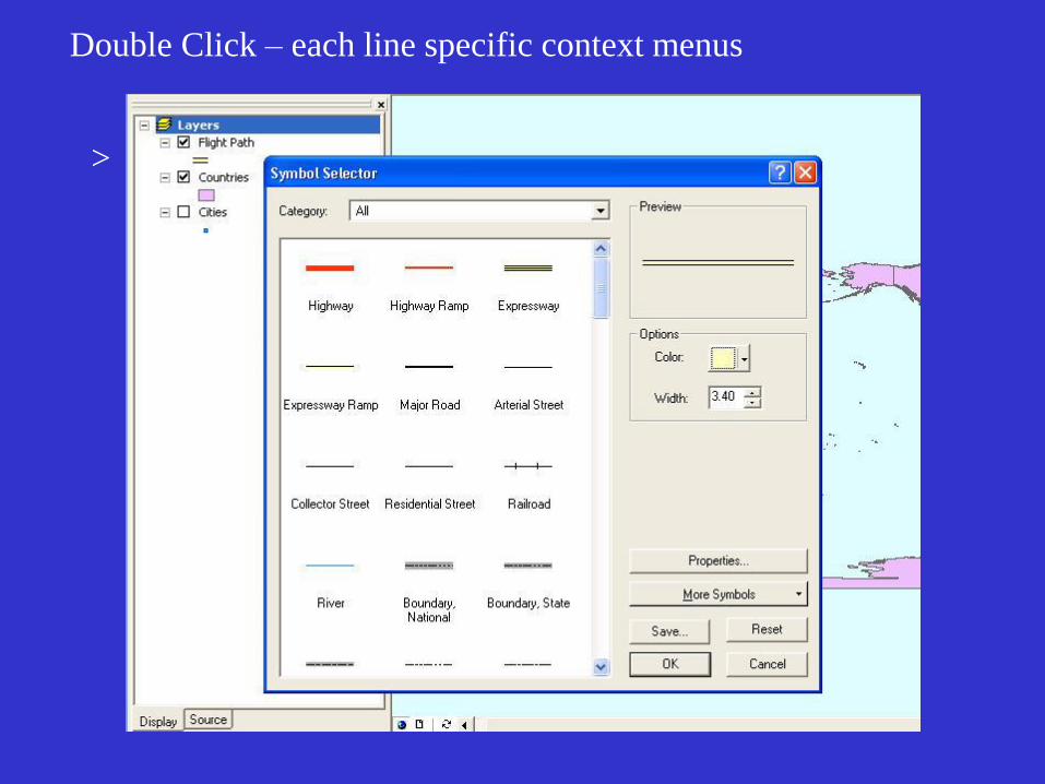
Double Click – each line specific context menus
>
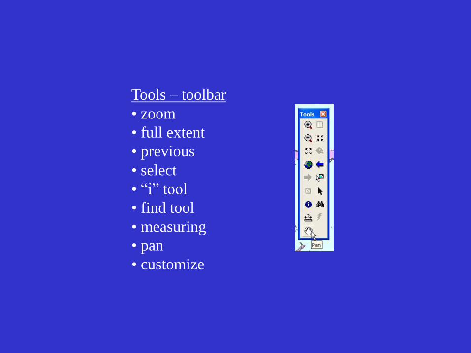
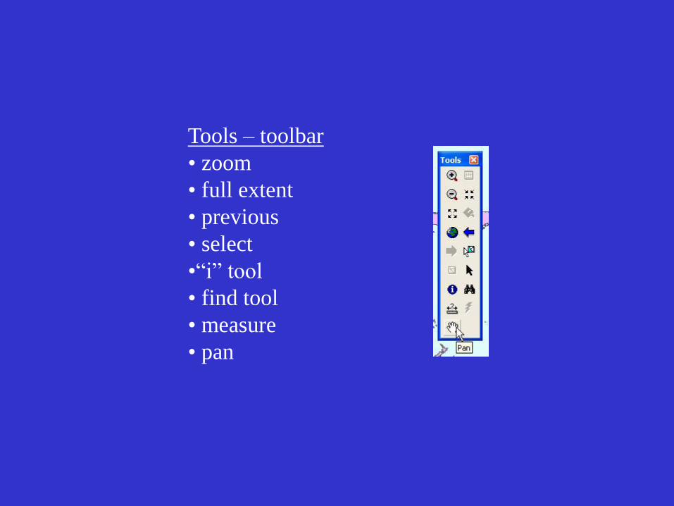
Tools – toolbar
• zoom
• full extent
• previous
• select
• “i” tool
• find tool
• measuring
• pan
• customize
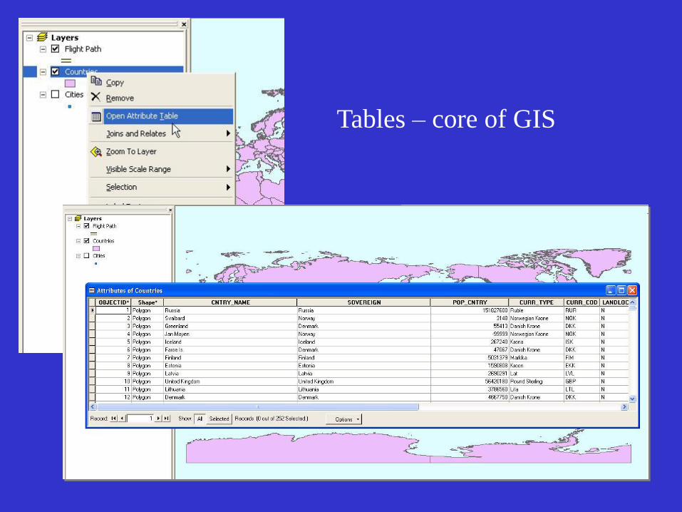
Tables – core of GIS
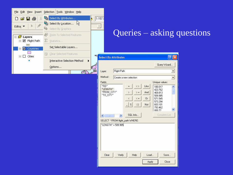
Queries – asking questions
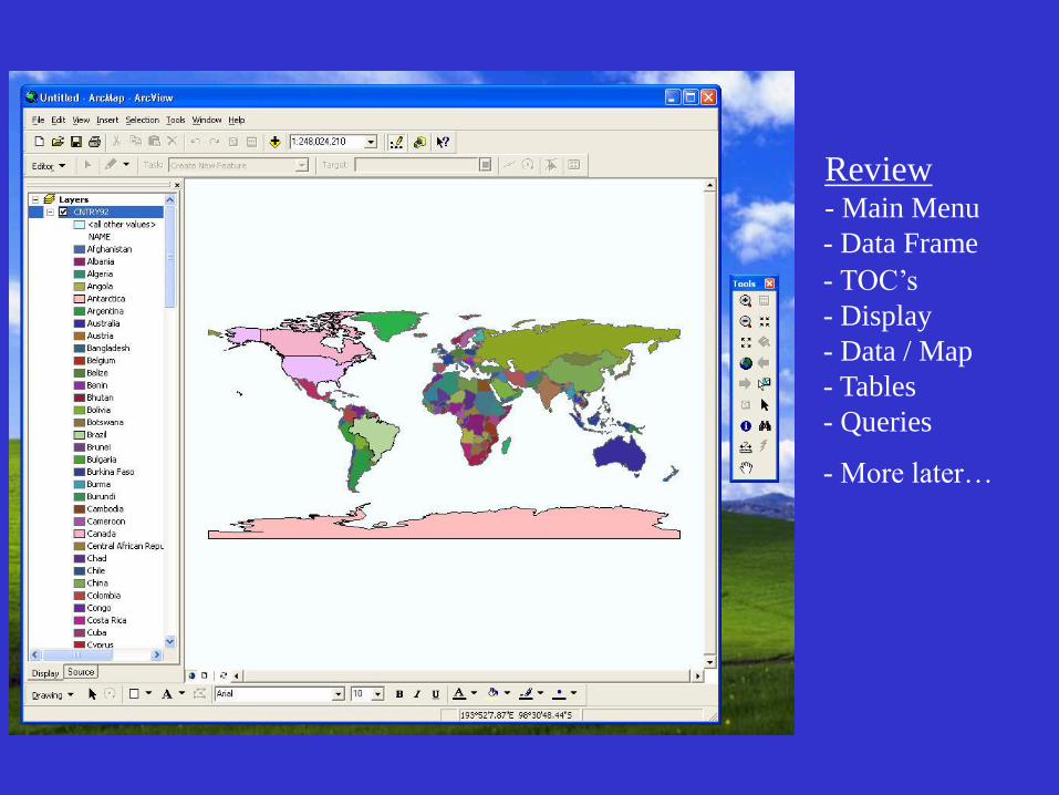
Review - Main Menu
- Data Frame
- TOC’s
- Display
- Data / Map
- Tables
- Queries
- More later…
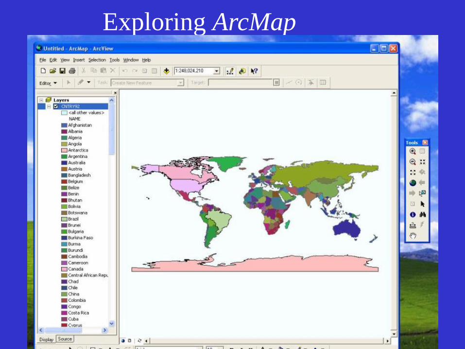
Exploring ArcMap
• Features of ArcMap
• Displaying map data
• Navigating a map
• Looking at feature attributes
Displaying map
data
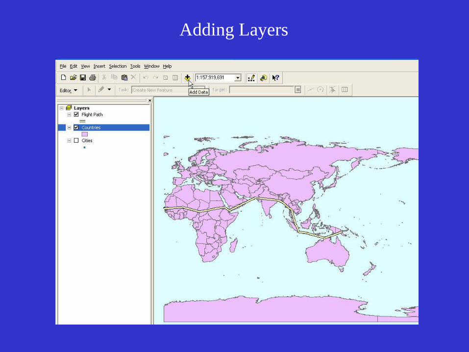
Adding Layers
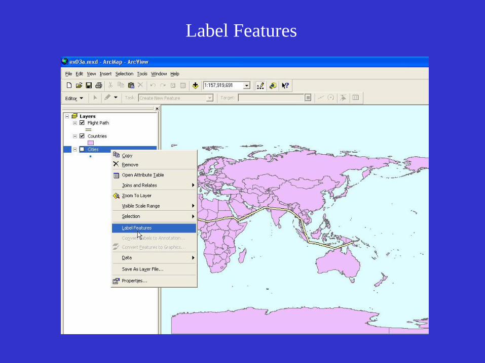
Label Features
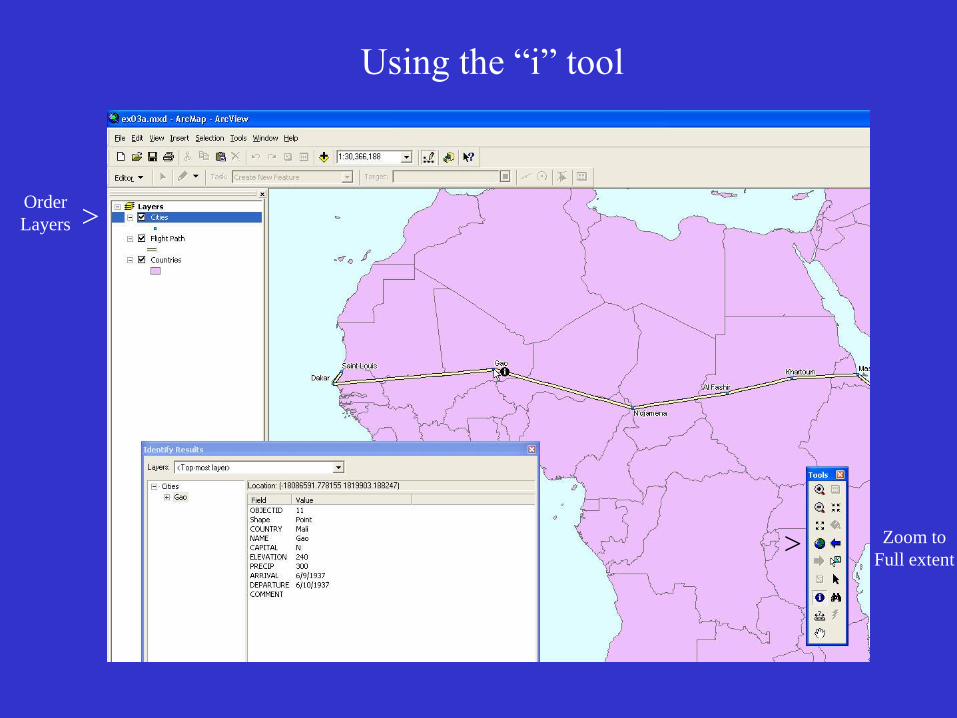
Using the “i” tool
Order
Layers
Zoom to
Full extent >
>
Navigating a map
Tools – toolbar
• zoom
• full extent
• previous
• select
•“i” tool
• find tool
• measure
• pan
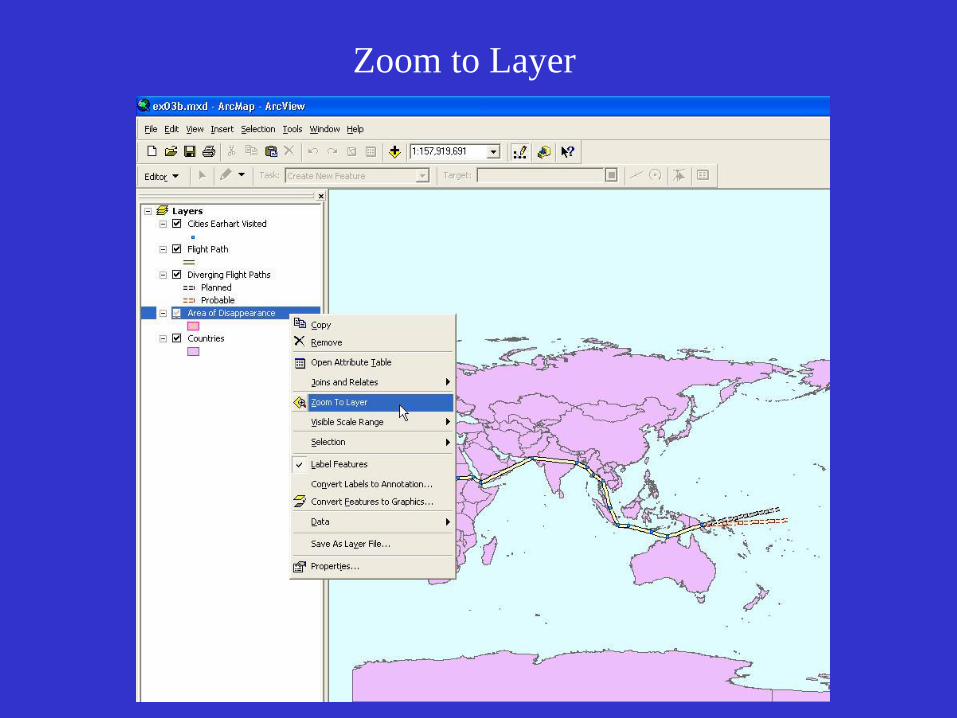
Zoom to Layer
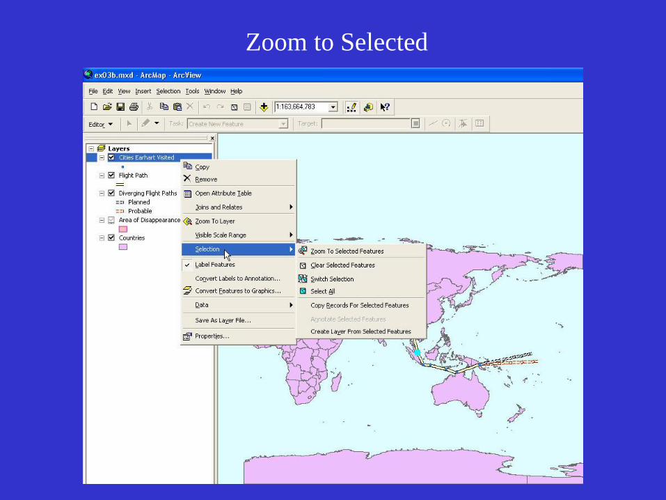
Zoom to Selected
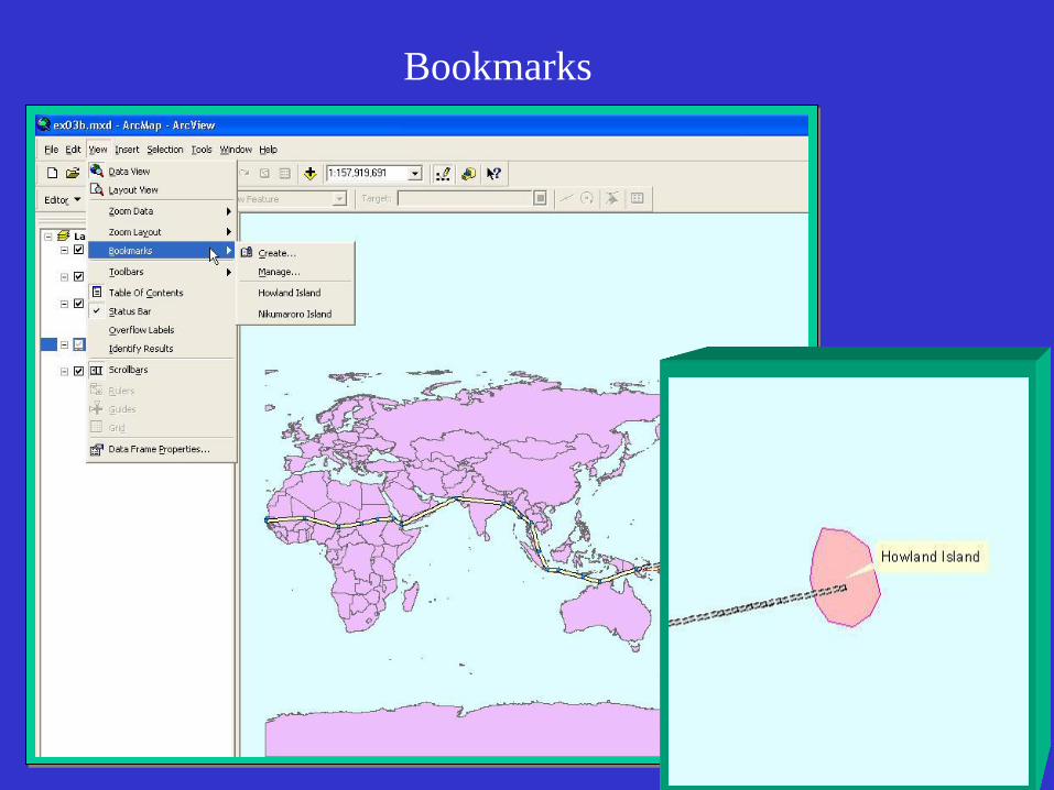
Bookmarks

Looking at
feature attributes
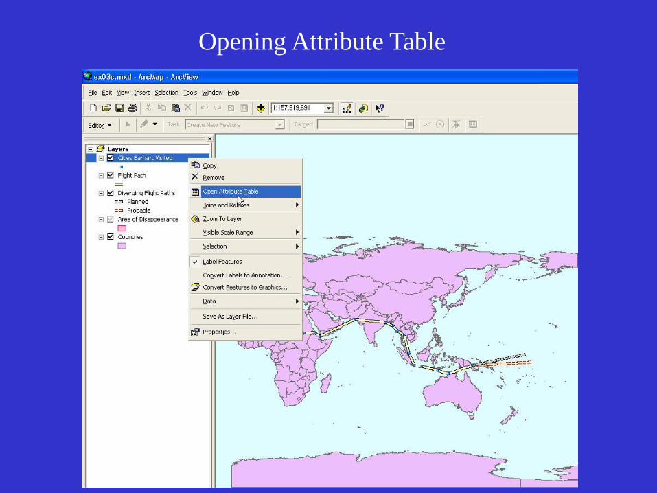
Opening Attribute Table
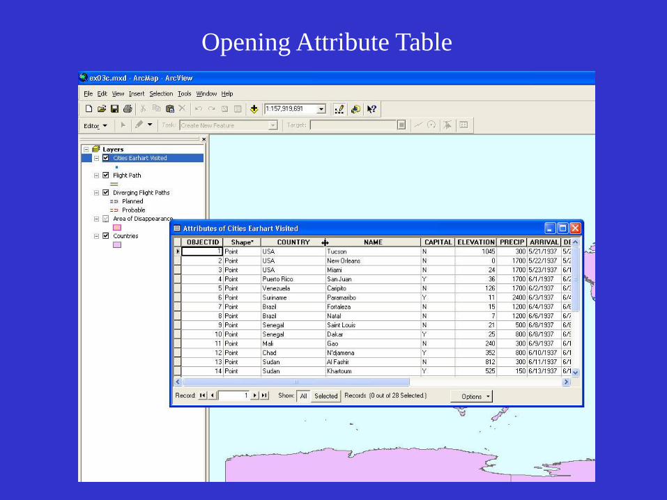
Opening Attribute Table
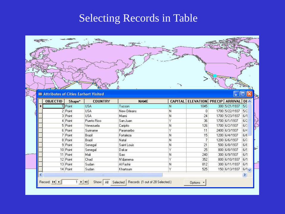
Selecting Records in Table
>
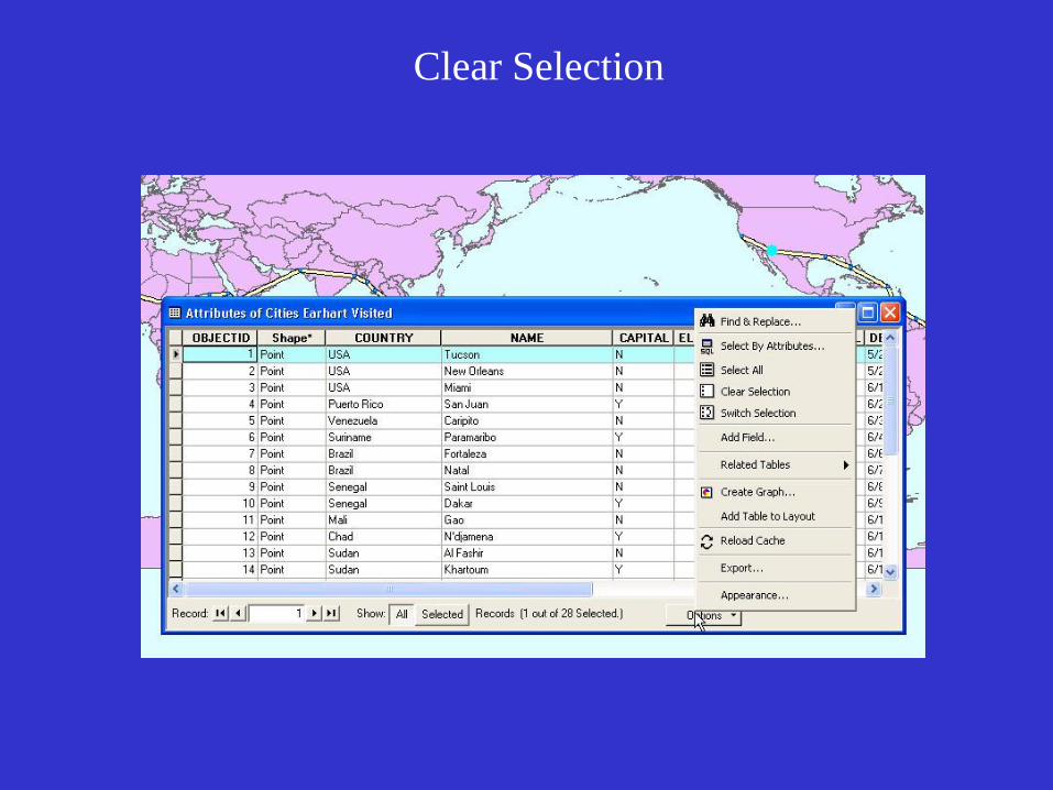
Clear Selection
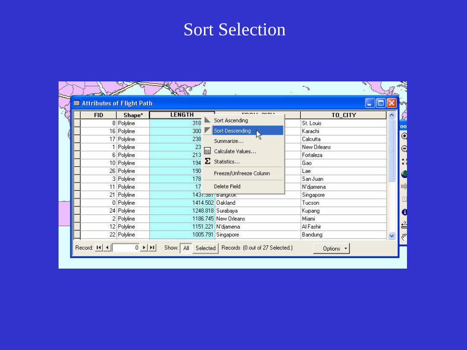
Sort Selection
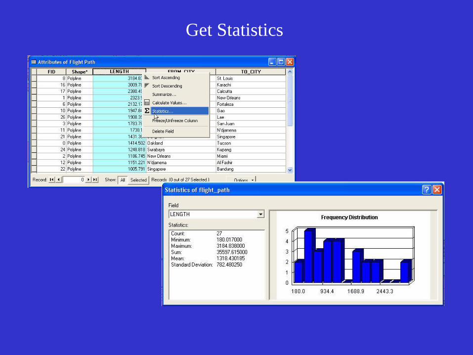
Get Statistics
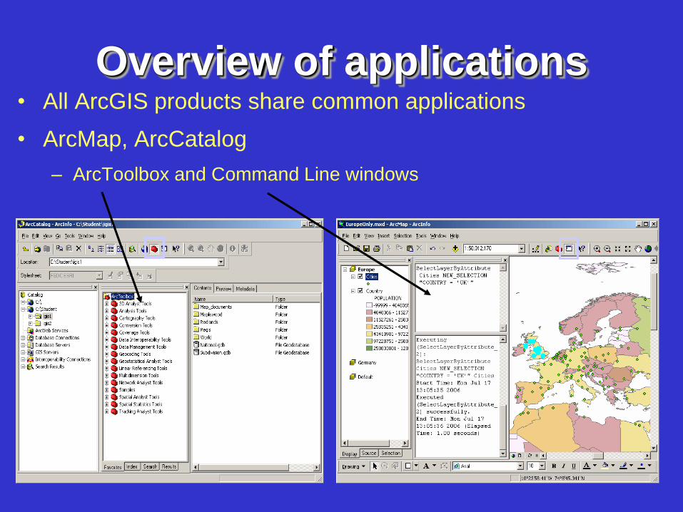
Overview of applications • All ArcGIS products share common applications
• ArcMap, ArcCatalog
– ArcToolbox and Command Line windows
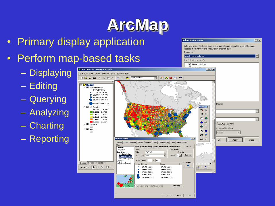
ArcMap • Primary display application
• Perform map-based tasks
– Displaying
– Editing
– Querying
– Analyzing
– Charting
– Reporting
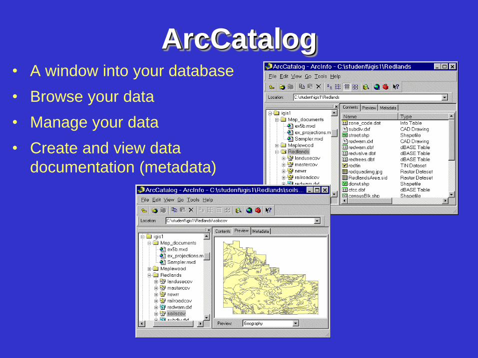
ArcCatalog • A window into your database
• Browse your data
• Manage your data
• Create and view data
documentation (metadata)
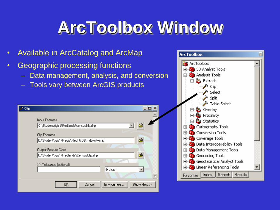
ArcToolbox Window
• Available in ArcCatalog and ArcMap
• Geographic processing functions
– Data management, analysis, and conversion
– Tools vary between ArcGIS products
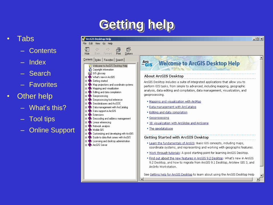
Getting help • Tabs
– Contents
– Index
– Search
– Favorites
• Other help
– What’s this?
– Tool tips
– Online Support