Integrated flood modelling and mitigation analysis -...
36
www.csiro.au Integrated flood modelling and mitigation analysis 8 th Australasian Natural Hazards Management Conference (ANHMC2015) Raymond Cohen | Mahesh Prakash | James Hilton | Yunze Wang | Fletcher Woolard 3:45-4:15pm Wednesday 14 October 2015
Transcript of Integrated flood modelling and mitigation analysis -...
www.csiro.au
Integrated flood modelling and mitigation analysis 8th Australasian Natural Hazards Management Conference (ANHMC2015)
Raymond Cohen | Mahesh Prakash | James Hilton | Yunze Wang | Fletcher Woolard
3:45-4:15pm Wednesday 14 October 2015

Background
ANHMC | Perth 2015 | Raymond Cohen
Motivations
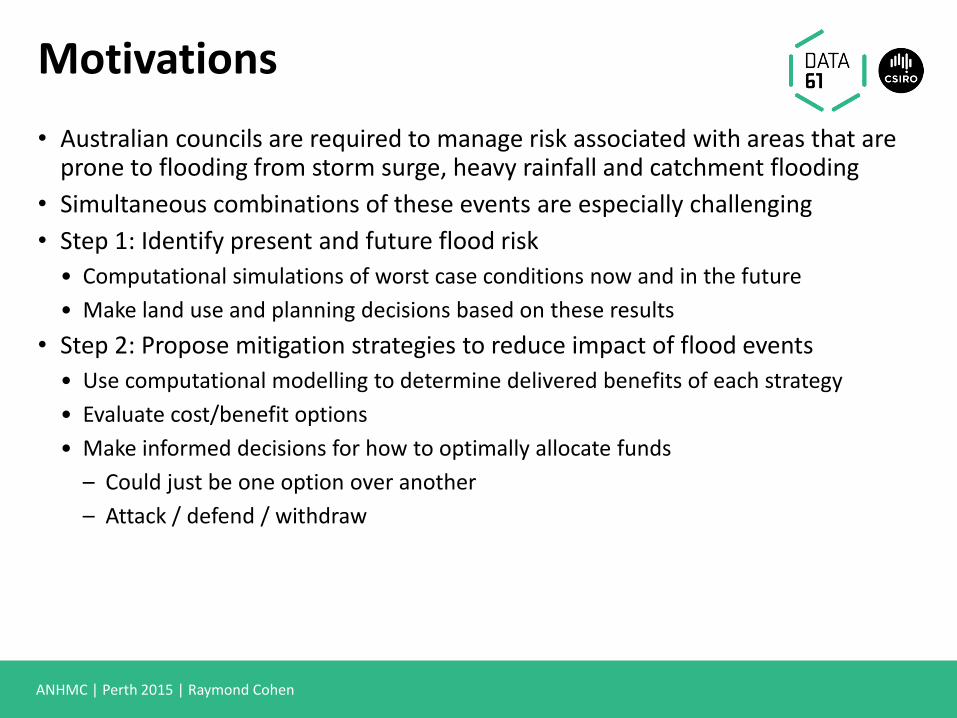
• Australian councils are required to manage risk associated with areas that are prone to flooding from storm surge, heavy rainfall and catchment flooding
• Simultaneous combinations of these events are especially challenging
• Step 1: Identify present and future flood risk
• Computational simulations of worst case conditions now and in the future
• Make land use and planning decisions based on these results
• Step 2: Propose mitigation strategies to reduce impact of flood events
• Use computational modelling to determine delivered benefits of each strategy
• Evaluate cost/benefit options
• Make informed decisions for how to optimally allocate funds
– Could just be one option over another
– Attack / defend / withdraw
ANHMC | Perth 2015 | Raymond Cohen
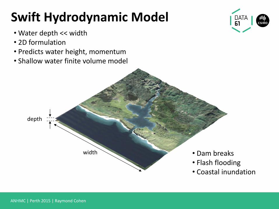
• Water depth << width • 2D formulation • Predicts water height, momentum • Shallow water finite volume model
Swift Hydrodynamic Model
width
depth
• Dam breaks • Flash flooding • Coastal inundation

ANHMC | Perth 2015 | Raymond Cohen
Drainage flow direction
Normal conditions:
• Pressure head-based pipe network model • Assume sound speed >> gravity wave speed • Pipe network both helps and hinders flooding:
Swift Hydraulic Model
Storm tide
Drainage flow direction
Drainage reversal:
= =
ANHMC | Perth 2015 | Raymond Cohen
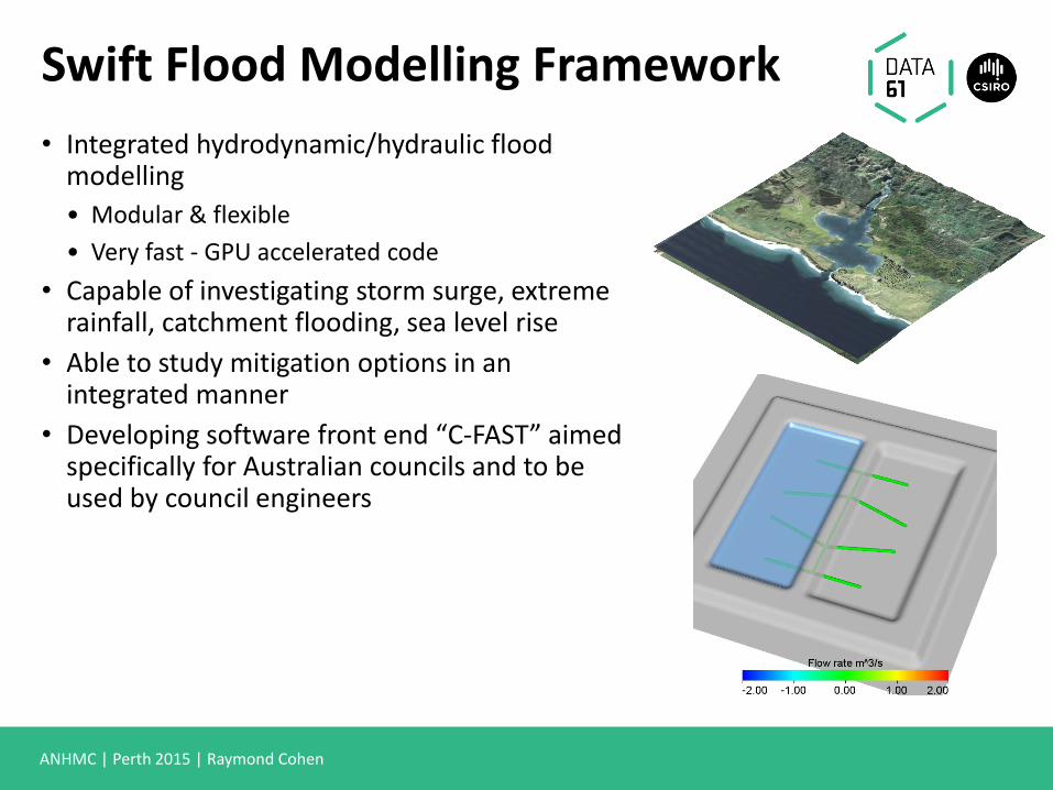
Swift Flood Modelling Framework
• Integrated hydrodynamic/hydraulic flood modelling
• Modular & flexible
• Very fast - GPU accelerated code
• Capable of investigating storm surge, extreme rainfall, catchment flooding, sea level rise
• Able to study mitigation options in an integrated manner
• Developing software front end “C-FAST” aimed specifically for Australian councils and to be used by council engineers
ANHMC | Perth 2015 | Raymond Cohen
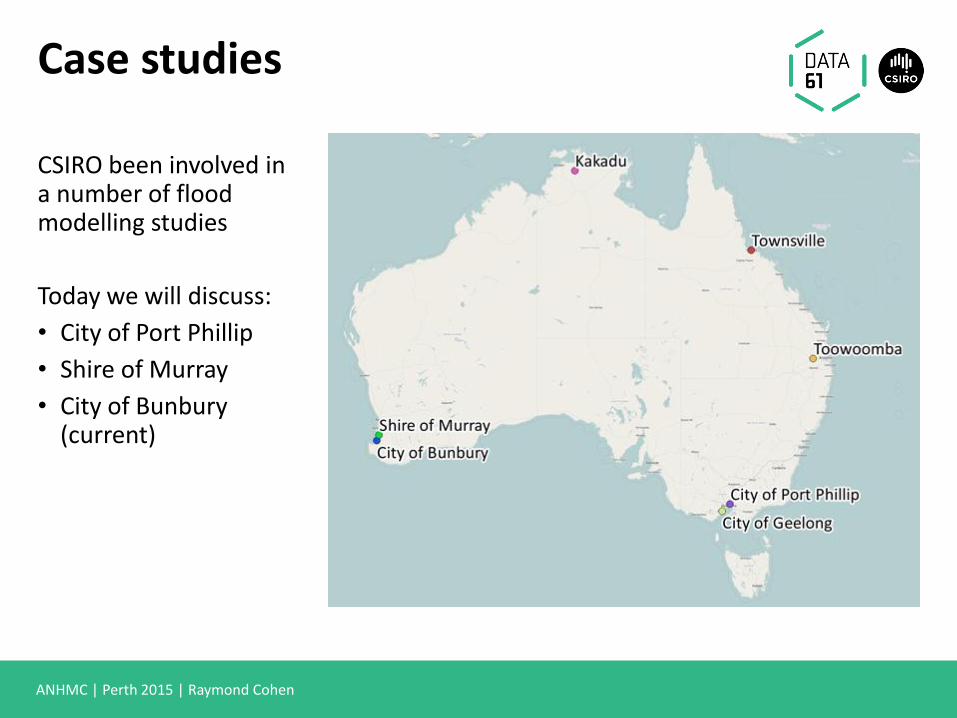
Case studies
CSIRO been involved in a number of flood modelling studies
Today we will discuss:
• City of Port Phillip
• Shire of Murray
• City of Bunbury (current)

City of Port Phillip (CoPP)
ANHMC | Perth 2015 | Raymond Cohen
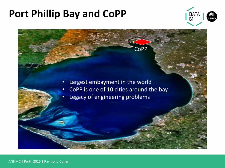
Port Phillip Bay and CoPP
• Largest embayment in the world • CoPP is one of 10 cities around the bay • Legacy of engineering problems
CoPP

ANHMC | Perth 2015 | Raymond Cohen
CoPP
Structural mitigation options: • Levees, basins and dams • Drainage networks
Elwood Swamp 1886
• 100,000 residents and over 22,000 businesses. • Population likely to double in next 15-20 years
due to development at Fishermans Bend
ANHMC | Perth 2015 | Raymond Cohen
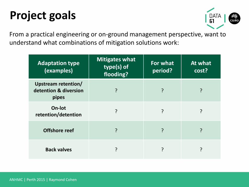
Project goals
Adaptation type (examples)
Mitigates what type(s) of flooding?
For what period?
At what cost?
Upstream retention/ detention & diversion
pipes ? ? ?
On-lot retention/detention
? ? ?
Offshore reef ? ? ?
Back valves ? ? ?
From a practical engineering or on-ground management perspective, want to understand what combinations of mitigation solutions work:
ANHMC | Perth 2015 | Raymond Cohen
Model inputs
• Council wide terrain and bathymetry (LiDAR)
• Hydraulic and Hydrological (eg. drainage network)
• Storm surge with a peak of 1.3 m
• 1 in a 100 ARI rainfall for 3 hrs (also 1 in 5 and 1 in 10 ARI)
• Total simulation time = 24 hrs
• Rainfall starts at peak storm surge
• No upstream storm water reception (except in main drains)
• Sea level rise (SLR) = current day, 0.4, 0.8 and 1.1 m
ANHMC | Perth 2015 | Raymond Cohen
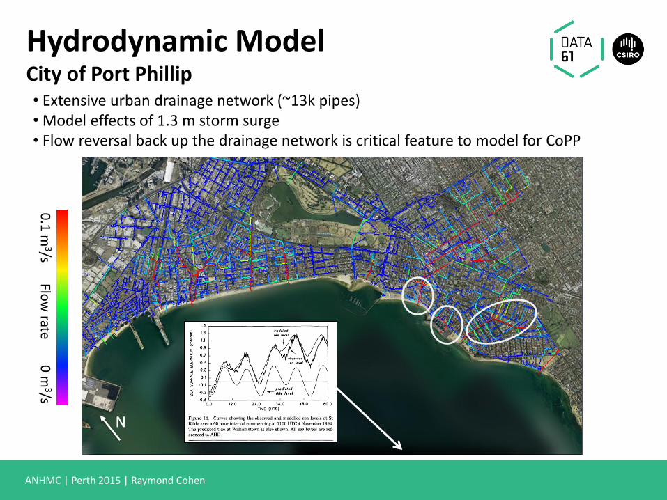
• Extensive urban drainage network (~13k pipes) • Model effects of 1.3 m storm surge • Flow reversal back up the drainage network is critical feature to model for CoPP
0.1
m3/s
0
m3/s
Flo
w rate
N
Hydrodynamic Model City of Port Phillip
ANHMC | Perth 2015 | Raymond Cohen
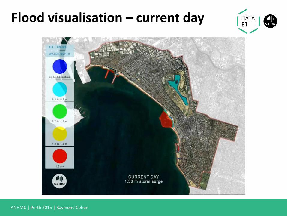
Flood visualisation – current day
ANHMC | Perth 2015 | Raymond Cohen
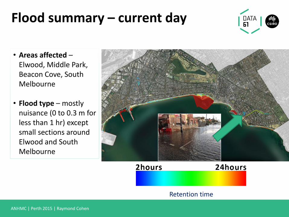
Flood summary – current day
• Areas affected – Elwood, Middle Park, Beacon Cove, South Melbourne
• Flood type – mostly
nuisance (0 to 0.3 m for less than 1 hr) except small sections around Elwood and South Melbourne
Retention time

ANHMC | Perth 2015 | Raymond Cohen
Flood visualisation – SLR 1.1 m

ANHMC | Perth 2015 | Raymond Cohen
• Areas affected – Elwood, Middle Park, Beacon Cove, South Melbourne
• Flood type – severe flooding in all parts affected including very alarming long lived flooding (> 12 hrs+) around most parts of Elwood canal, South Melbourne and Middle Park
Retention time
Flood summary – current day
ANHMC | Perth 2015 | Raymond Cohen
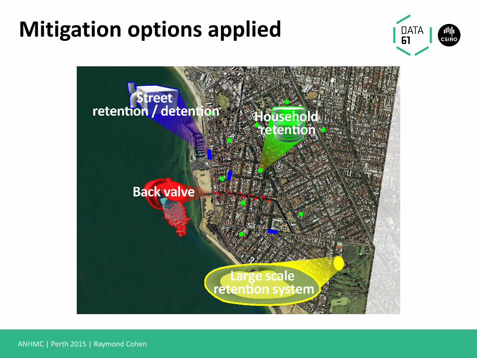
Mitigation options applied
ANHMC | Perth 2015 | Raymond Cohen
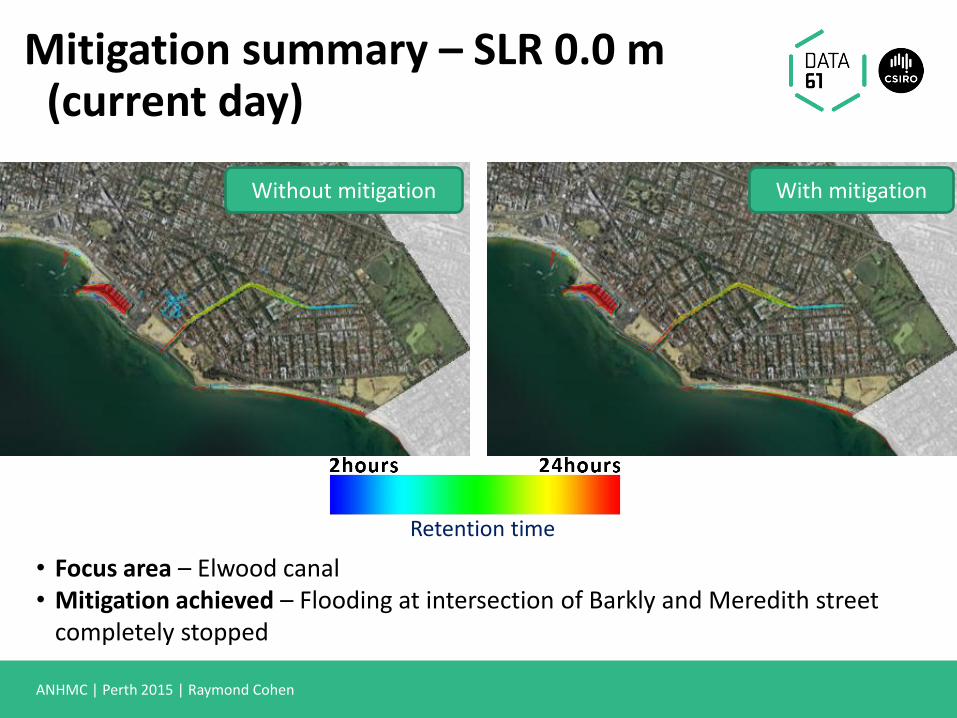
Mitigation summary – SLR 0.0 m (current day)
• Focus area – Elwood canal • Mitigation achieved – Flooding at intersection of Barkly and Meredith street
completely stopped
Retention time
With mitigation Without mitigation

Shire of Murray (SoM)
ANHMC | Perth 2015 | Raymond Cohen
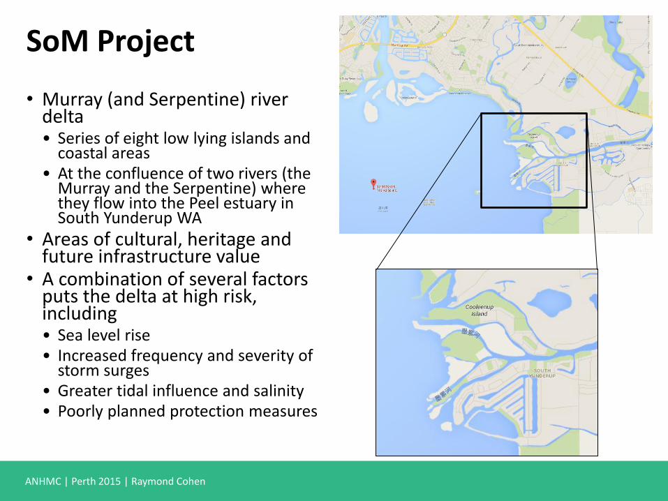
SoM Project
• Murray (and Serpentine) river delta • Series of eight low lying islands and
coastal areas • At the confluence of two rivers (the
Murray and the Serpentine) where they flow into the Peel estuary in South Yunderup WA
• Areas of cultural, heritage and future infrastructure value
• A combination of several factors puts the delta at high risk, including • Sea level rise • Increased frequency and severity of
storm surges • Greater tidal influence and salinity • Poorly planned protection measures
ANHMC | Perth 2015 | Raymond Cohen
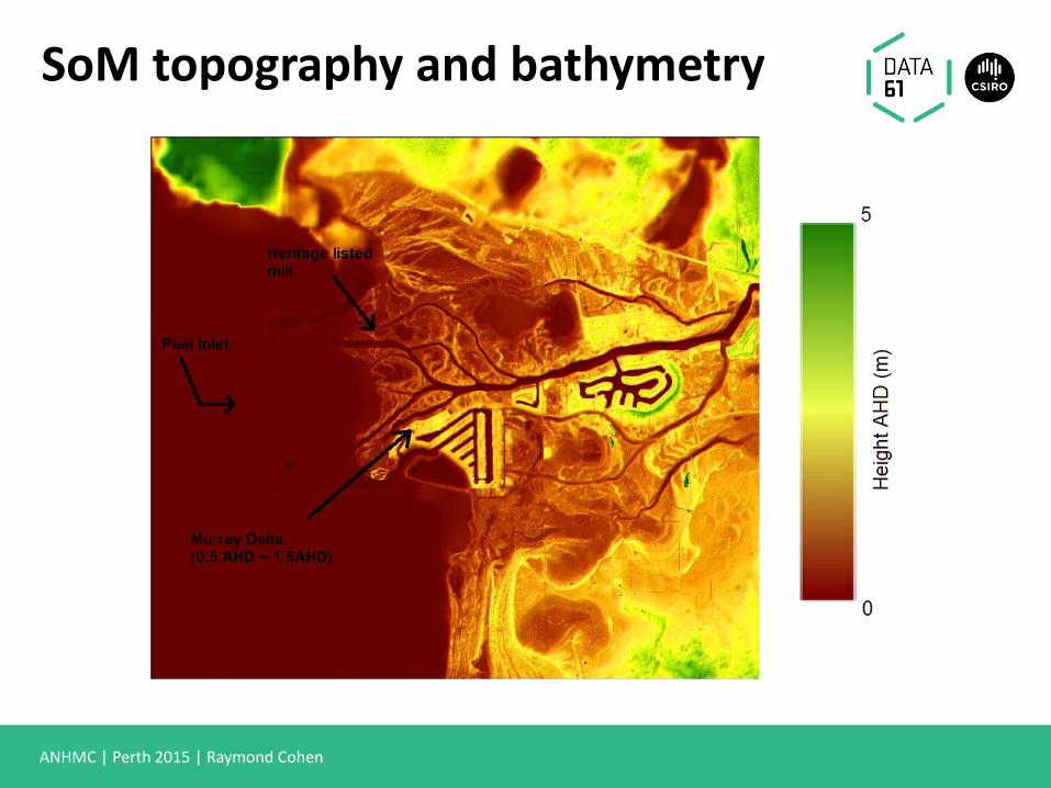
SoM topography and bathymetry
ANHMC | Perth 2015 | Raymond Cohen
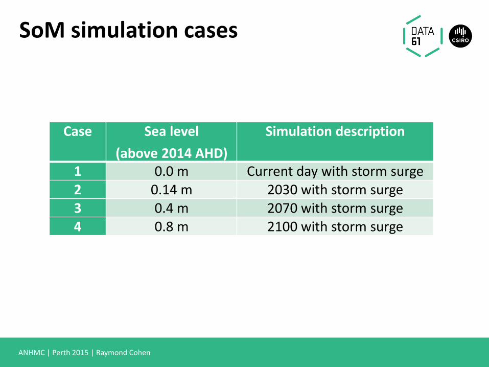
SoM simulation cases
Case Sea level
(above 2014 AHD)
Simulation description
1 0.0 m Current day with storm surge 2 0.14 m 2030 with storm surge 3 0.4 m 2070 with storm surge 4 0.8 m 2100 with storm surge
ANHMC | Perth 2015 | Raymond Cohen
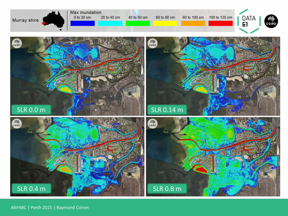
SLR 0.0 m SLR 0.14 m
SLR 0.8 m SLR 0.4 m
ANHMC | Perth 2015 | Raymond Cohen
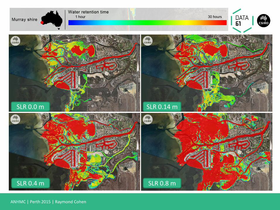
SLR 0.0 m SLR 0.14 m
SLR 0.8 m SLR 0.4 m
ANHMC | Perth 2015 | Raymond Cohen
Findings
• Heritage listed Mill on the western Tip of Culeenup
• SLR 0.0 m - only nuisance flooding
• SLR 0.14 m - significantly flooded - 0.6 m persisting for 8+ hours
• Money would be better spent protecting the Mill prior to investing in restoration
• Homes in the Murray Delta in the three inhabited islands
• SLR 0.0 m, 0.14 m - inundation minimal
• SLR 0.4 m - 40% homes inundated
• SLR 0.8 m - whole of Yunderup Island is inundated
• Mitigation options prove ineffective from a cost/benefit perspective due to the scale and extent of flooding. Might be some benefit in investigating basic mitigation such as a levee or barrier perhaps for Yunderup Island where the extent of flooding is less dramatic

City of Bunbury (CoB)
ANHMC | Perth 2015 | Raymond Cohen
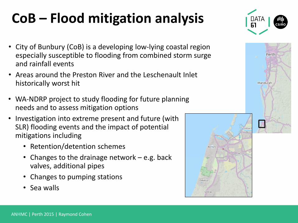
• City of Bunbury (CoB) is a developing low-lying coastal region especially susceptible to flooding from combined storm surge and rainfall events
• Areas around the Preston River and the Leschenault Inlet historically worst hit
• WA-NDRP project to study flooding for future planning needs and to assess mitigation options
• Investigation into extreme present and future (with SLR) flooding events and the impact of potential mitigations including
• Retention/detention schemes
• Changes to the drainage network – e.g. back valves, additional pipes
• Changes to pumping stations
• Sea walls
CoB – Flood mitigation analysis
ANHMC | Perth 2015 | Raymond Cohen
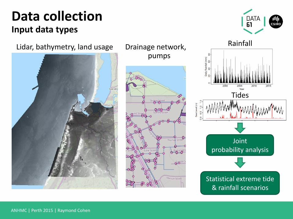
Lidar, bathymetry, land usage Drainage network, pumps
Rainfall
Tides
Joint probability analysis
Statistical extreme tide & rainfall scenarios
Data collection Input data types
ANHMC | Perth 2015 | Raymond Cohen
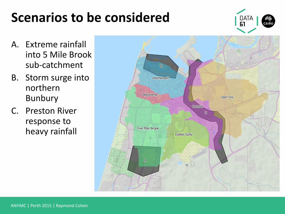
Scenarios to be considered
A. Extreme rainfall into 5 Mile Brook sub-catchment
B. Storm surge into northern Bunbury
C. Preston River response to heavy rainfall
ANHMC | Perth 2015 | Raymond Cohen
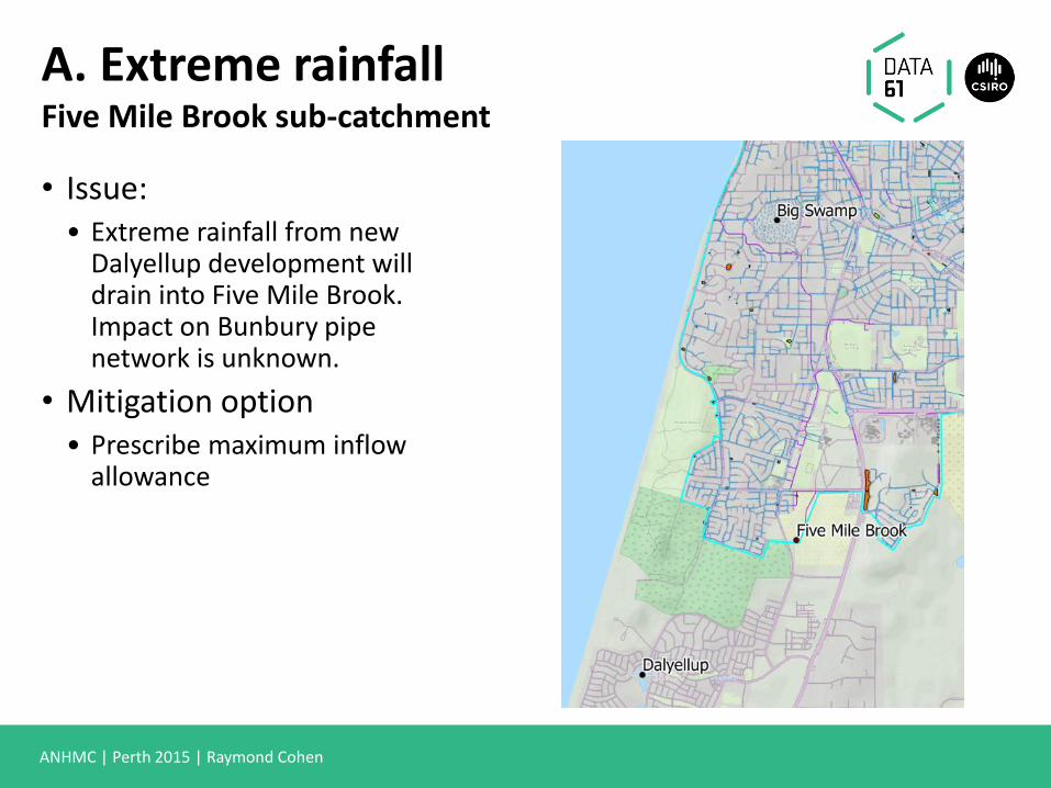
A. Extreme rainfall Five Mile Brook sub-catchment
• Issue: • Extreme rainfall from new
Dalyellup development will drain into Five Mile Brook. Impact on Bunbury pipe network is unknown.
• Mitigation option • Prescribe maximum inflow
allowance
ANHMC | Perth 2015 | Raymond Cohen
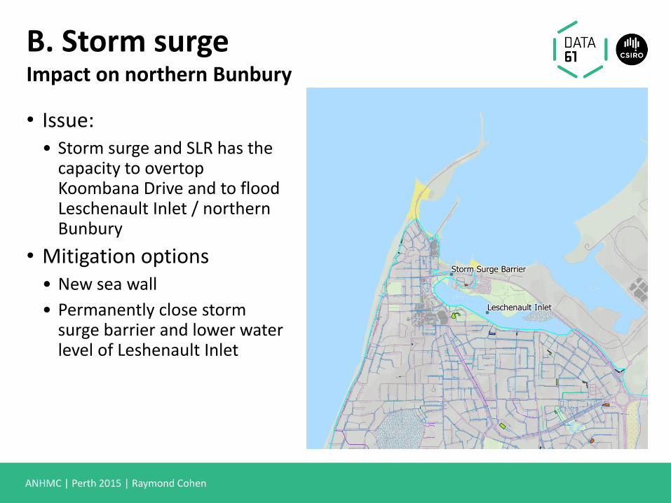
B. Storm surge Impact on northern Bunbury
• Issue: • Storm surge and SLR has the
capacity to overtop Koombana Drive and to flood Leschenault Inlet / northern Bunbury
• Mitigation options • New sea wall
• Permanently close storm surge barrier and lower water level of Leshenault Inlet
ANHMC | Perth 2015 | Raymond Cohen
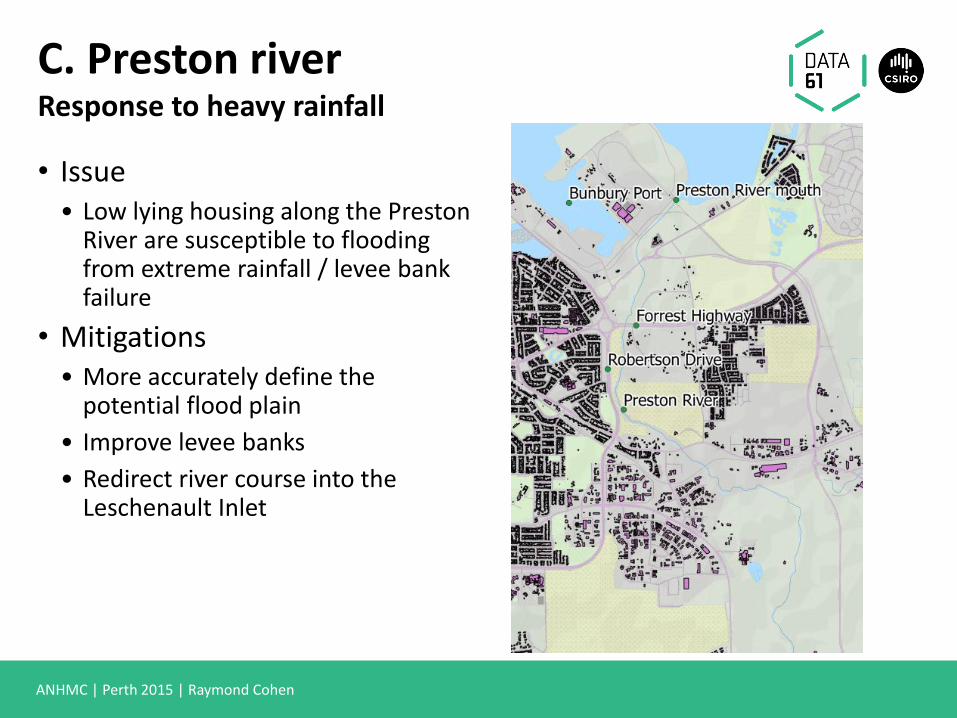
C. Preston river Response to heavy rainfall
• Issue • Low lying housing along the Preston
River are susceptible to flooding from extreme rainfall / levee bank failure
• Mitigations • More accurately define the
potential flood plain
• Improve levee banks
• Redirect river course into the Leschenault Inlet

Future directions
ANHMC | Perth 2015 | Raymond Cohen
Swift
• CSIRO is developing a tool “C-FAST” based on Swift which can model urban flooding
• A number of case studies have been undertaken which have provided detailed requirements from a diverse range of councils across Australia
• In the next 18 months the intention is to deploy the tool for use internally by the early adopter councils we have already worked with
• Council engineers will be empowered to run new simulations with incrementally updated input data and to rapidly experiment with proposed mitigation options
www.csiro.au
Computational Modelling & Simulation Dr. Raymond Cohen Research Scientist
t +61 3 9545 8064 e [email protected] w www.csiro.au/data61
Thank you