
Insat 3d Brochure
6
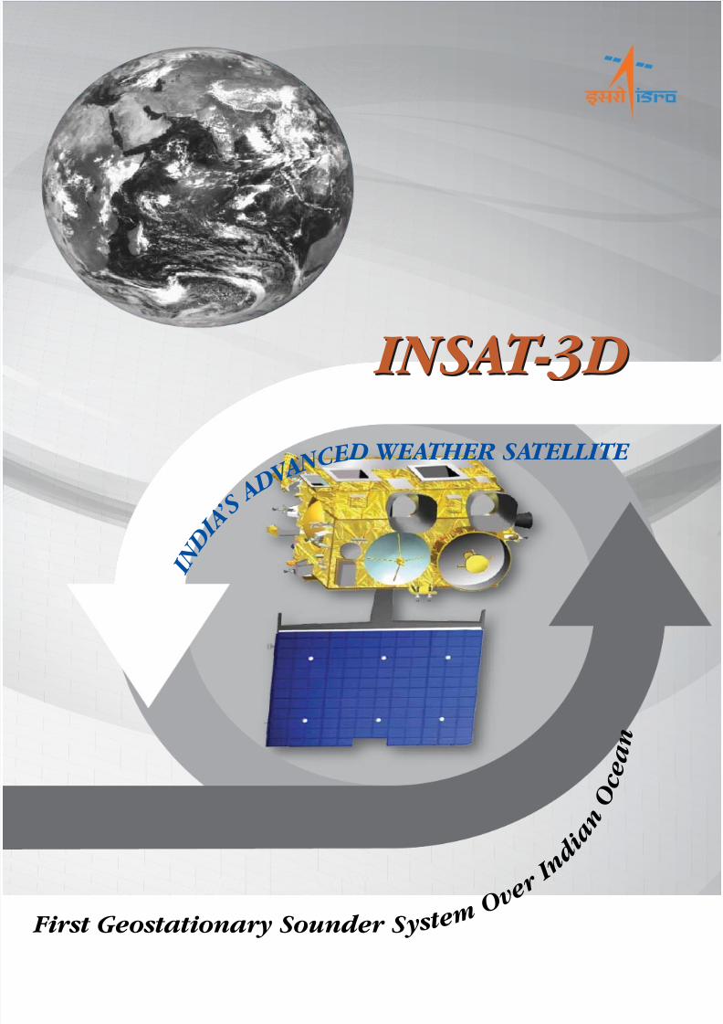
INS A T -3D INS A T-3D First Geostationary Sounder S y s t e m O v e r I n d i a n O c e a n I N D I A ’ S A D V A N C E D WEA THER SATELLITE
-
Upload
nambi-harish -
Category
Documents
-
view
229 -
download
0
Transcript of Insat 3d Brochure
7/27/2019 Insat 3d Brochure
http://slidepdf.com/reader/full/insat-3d-brochure 1/6
INSAT-3D INSAT-3D
First Geostationary Sounder S y s t e m O v e
r I n
d i a n
O c e a n
I N D I A
’ S A D V
A N C E D WEATHER SATELLITE
7/27/2019 Insat 3d Brochure
http://slidepdf.com/reader/full/insat-3d-brochure 2/6
INSAT-3D is an advanced weather satellite of India configured with improved imaging System and
Atmospheric Sounder.
The Imaging System of INSAT-3D has significant improvements over that of KALPANA and INSAT-3A :
• Imaging in Middle Infrared band to provide night time pictures of low clouds and fog.
• Imaging in two Thermal Infrared bands for estimation of Sea Surface Temperature
(SST) with better accuracy.
• Higher Spatial Resolution in the Visible and Thermal Infrared bands.
Also, INSAT-3D carries a Data Relay Transponder and Search and Rescue Transponder.
INSAT-3D will provide continuity to earlier missions and further augment the capability to provide various
meteorological as well as search and rescue services.
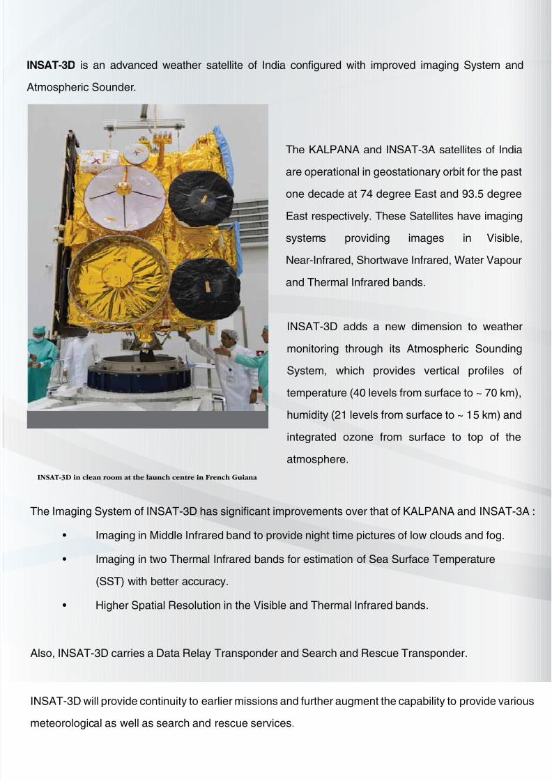
INSAT-3D in clean room at the launch centre in French Guiana
The KALPANA and INSAT-3A satellites of India
are operational in geostationary orbit for the past
one decade at 74 degree East and 93.5 degree
East respectively. These Satellites have imaging
systems providing images in Visible,
Near-Infrared, Shortwave Infrared, Water Vapour
and Thermal Infrared bands.
INSAT-3D adds a new dimension to weather
monitoring through its Atmospheric Sounding
System, which provides vertical profiles of
temperature (40 levels from surface to ~ 70 km),
humidity (21 levels from surface to ~ 15 km) and
integrated ozone from surface to top of the
atmosphere.
7/27/2019 Insat 3d Brochure
http://slidepdf.com/reader/full/insat-3d-brochure 3/6
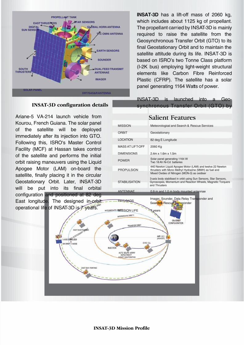
Salient Features
MISSION Meteorological and Search & Rescue Services
ORBIT Geostationary
LOCATION 82 deg E Longitude
MASS AT LIFT-OFF 2060 Kg
DIMENSIONS 2.4m x 1.6m x 1.5m
POWERSolar panel generating 1164 WTwo 18 Ah Ni-Cd batteries
440 Newton Liquid Apogee Motor (LAM) and twelve 22 Newtonthrusters with Mono Methyl Hydrazine (MMH) as fuel andMixed Oxides of Nitrogen (MON-3) as oxidiser
PROPULSION
STABILISATION
3-axis body stabilised in orbit using Sun Sensors, Star Sensors,
Gyroscopes, Momentum and Reaction Wheels, Magnetic Torquersand Thrusters
ANTENNAE 0.9 m and 1.0 m body mounted antennae
MISSION LIFE 7 years
PAYLOADSImager, Sounder, Data Relay Transponder and
Search & Rescue Transponder
INSAT-3D has a lift-off mass of 2060 kg,
which includes about 1125 kg of propellant.
The propellant carried by INSAT-3D is mainly
required to raise the satellite from the
Geosynchronous Transfer Orbit (GTO) to its
final Geostationary Orbit and to maintain the
satellite attitude during its life. INSAT-3D is
based on ISRO’s two Tonne Class platform(I-2K bus) employing light-weight structural
elements like Carbon Fibre Reinforced
Plastic (CFRP). The satellite has a solar
panel generating 1164 Watts of power.
INSAT-3D is launched into a Geo-
synchronous Transfer Orbit (GTO) by
Ariane-5 VA-214 launch vehicle from
Kourou, French Guiana. The solar panel
of the satellite will be deployed
immediately after its injection into GTO.
Following this, ISRO‘s Master Control
Facility (MCF) at Hassan takes control
of the satellite and performs the initial
orbit raising maneuvers using the Liquid
Apogee Motor (LAM) on-board the
satellite, finally placing it in the circular
Geostationary Orbit. Later, INSAT-3Dwill be put into its final orbital
configuration and positioned at 82 deg
East longitude. The designed in-orbit
operational life of INSAT-3D is 7 years.
INSAT-3D configuration details
DIGITALSUN SENSOR
EAST THRUSTERS
PROPELLANT TANK
STAR SENSORS
GLOBAL HORN ANTENNA
TTC OMNI ANTENNA
EARTH SENSORS
SOUNDER
IMAGER
SOLAR PANEL
SOUTHTHRUSTERS
DUAL FEED TRANSMIT
ANTENNAE
DRT/SAS&R ANTENNA
INSAT-3D Mission Profile
7/27/2019 Insat 3d Brochure
http://slidepdf.com/reader/full/insat-3d-brochure 4/6
PAYLOADS:
Imager
For meteorological observations, INSAT-3D carries a multi-spectral Imager (optical radiometer) capable
of generating the images of the earth in six wavelength bands significant for meteorological
observations, namely, visible, shortwave infrared, middle infrared, water vapor and two bands in
thermal infrared regions. The Imager will generate images of the earth disk from geostationary altitudeof 36,000 km every 26 minutes and provide information on various parameters, namely, outgoing
long-wave radiation, quantitative precipitation estimation, sea surface temperature, snow cover, cloud
motion winds, etc. Imager payload is an improved version of VHRR flown on INSAT-3A and Kalpana-1
satellites with significant improvements in spatial resolution, number of spectral channels and
functionality.
Sounder
INSAT-3D also carries a newly developed 19 channel sounder, which is the first such payload to be
flown on an ISRO satellite mission. The Sounder has eighteen narrow spectral channels in shortwave infrared, middle infrared and long wave infrared regions and one channel in the visible region. It will
provide information on the vertical profiles of temperature, humidity and integrated ozone. These
profiles will be available for a selected region over Indian landmass every one hour and for the entire
Indian Ocean Region every six hours.
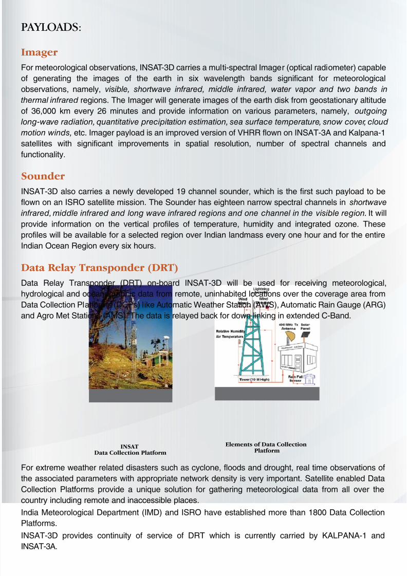
Data Relay Transponder (DRT)
Data Relay Transponder (DRT) on-board INSAT-3D will be used for receiving meteorological,
hydrological and oceanographic data from remote, uninhabited locations over the coverage area from
Data Collection Platforms (DCPs) like Automatic Weather Station (AWS), Automatic Rain Gauge (ARG)and Agro Met Stations (AMS). The data is relayed back for down linking in extended C-Band.
For extreme weather related disasters such as cyclone, floods and drought, real time observations of
the associated parameters with appropriate network density is very important. Satellite enabled Data
Collection Platforms provide a unique solution for gathering meteorological data from all over the
country including remote and inaccessible places.India Meteorological Department (IMD) and ISRO have established more than 1800 Data Collection
Platforms.
INSAT-3D provides continuity of service of DRT which is currently carried by KALPANA-1 and
INSAT-3A.
INSATData Collection Platform
Elements of Data CollectionPlatform
7/27/2019 Insat 3d Brochure
http://slidepdf.com/reader/full/insat-3d-brochure 5/6
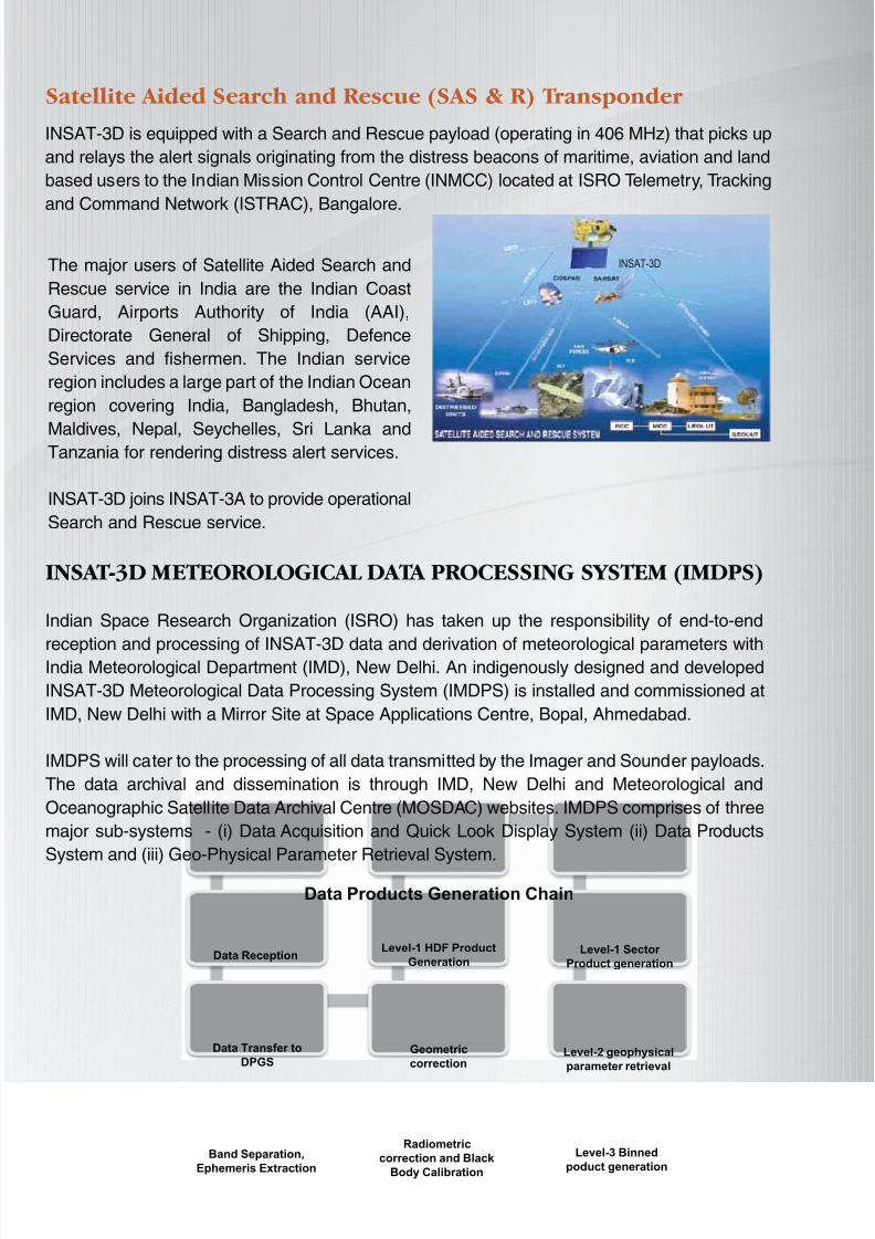
INSAT-3D is equipped with a Search and Rescue payload (operating in 406 MHz) that picks up
and relays the alert signals originating from the distress beacons of maritime, aviation and land
based users to the Indian Mission Control Centre (INMCC) located at ISRO Telemetry, Tracking
and Command Network (ISTRAC), Bangalore.
Satellite Aided Search and Rescue (SAS & R) Transponder
INSAT-3D METEOROLOGICAL DATA PROCESSING SYSTEM (IMDPS)
Indian Space Research Organization (ISRO) has taken up the responsibility of end-to-end
reception and processing of INSAT-3D data and derivation of meteorological parameters withIndia Meteorological Department (IMD), New Delhi. An indigenously designed and developed
INSAT-3D Meteorological Data Processing System (IMDPS) is installed and commissioned at
IMD, New Delhi with a Mirror Site at Space Applications Centre, Bopal, Ahmedabad.
IMDPS will cater to the processing of all data transmitted by the Imager and Sounder payloads.
The data archival and dissemination is through IMD, New Delhi and Meteorological and
Oceanographic Satellite Data Archival Centre (MOSDAC) websites. IMDPS comprises of three
major sub-systems - (i) Data Acquisition and Quick Look Display System (ii) Data Products
System and (iii) Geo-Physical Parameter Retrieval System.
The major users of Satellite Aided Search and
Rescue service in India are the Indian Coast
Guard, Airports Authority of India (AAI),
Directorate General of Shipping, Defence
Services and fishermen. The Indian service
region includes a large part of the Indian Ocean
region covering India, Bangladesh, Bhutan,
Maldives, Nepal, Seychelles, Sri Lanka andTanzania for rendering distress alert services.
INSAT-3D joins INSAT-3A to provide operational
Search and Rescue service.
Data Products Generation Chain
Data Reception
Geometric
correction
Data Transfer to
DPGS
Band Separation,
Ephemeris Extraction
Radiometric
correction and Black
Body Calibration
Level-3 Binned
poduct generation
Level-2 geophysical
parameter retrieval
Level-1 HDF Product
GenerationLevel-1 Sector
Product generation
7/27/2019 Insat 3d Brochure
http://slidepdf.com/reader/full/insat-3d-brochure 6/6
These Geophysical parameters and products will be derived and ingested into the operational weather
forecasting activities at IMD. In addition, some of these parameters, particularly the AMVs from the
imager, as well as the temperature and humidity profiles from the Sounder will be ingested in numerical
weather forecast models in real time for accurate weather prediction.
PAYLOAD Geo-Physical Parameters and Derived Products
IMAGER Outgoing Long wave Radiation (OLR)
Quantitative Precipitation Estimate (QPE)
Atmospheric Motion Vector (AMV)
Upper Troposphere Humidity (UTH)
Sea Surface Temperature (SST)
Land Surface Temperature (LST)
Water Vapor Wind Vector
Insolation
Snow Cover
Fog, Forest Fire, Smoke and Aerosol Identification
Tropical Cyclone Position and Intensity Estimation
SOUNDER Temperature, Humidity profiles and Integrated Ozone
Geo-potential Height (GH)
Layer Precipitable Water
Total Precipitable Water
Lifted Index (LI)
Wind Index (WI)
Dry Microburst Index (DMI)
Potential Temperature Dierential
Ozone estimate
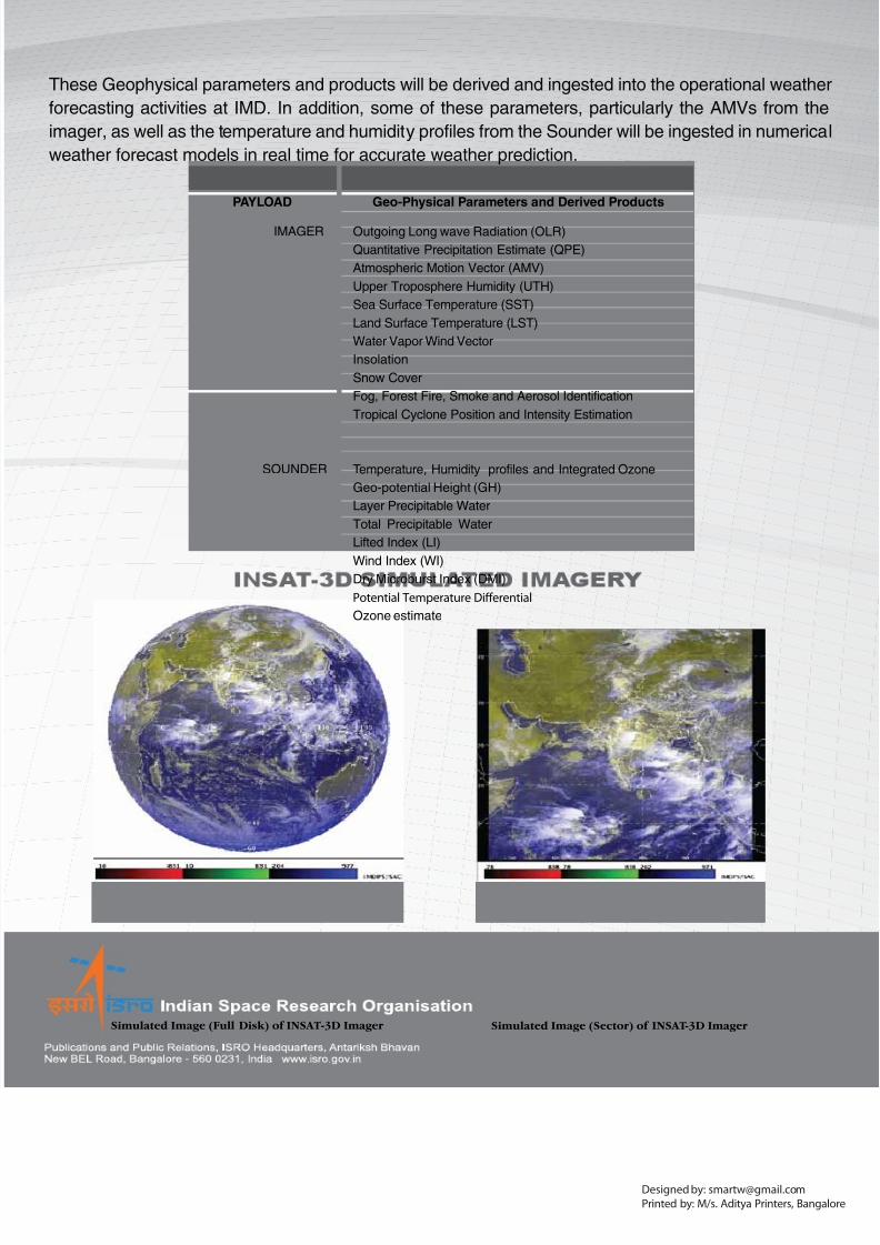
Simulated Image (Full Disk) of INSAT-3D Imager Simulated Image (Sector) of INSAT-3D Imager
Designed by: [email protected]
Printed by: M/s. Aditya Printers, Bangalore