InCORS Indiana Real Time Network - · PDF fileInCORS Indiana Real Time Network. What is the...
27
InCORS Indiana Real Time Network
Transcript of InCORS Indiana Real Time Network - · PDF fileInCORS Indiana Real Time Network. What is the...
InCORS
Indiana Real Time Network

What is the InCORS Network?Indiana Continuously Operating Reference Station Network
• Network of 45 geodetic quality GPS (GNSS) receivers and antennas, permanently installed, located across the state – INDOT & ISP sites
• Continuously collects GPS data
• Transmits thru Internet to central servers
• Data archived for future use, available for download by users
• Data processed by server software to generate network corrections-available via internet in real-time

Advantages of a CORS• Why it make sense now?
• Uniform mapping systems
• Easier for end users (do not have to set up base stations)
• Cheaper for end users (not required to man the station)
• Issues in the Past:• Difficulty in adequately covering regions – too many reference
stations required to cover an area. Significant infrastructure cost…
• Why is it emerging now?• Better receivers
• Better processing algorithms
• Internet communications through IOT & cellular connections
• IOT managed servers and network

InCORS Components
GNSS Spider
Software
Communication
Data Links
Monumentation
Installation
GNSS
HardwareGNSS Networks
comprise of 4 main
parts:
GNSS Hardware
GNSS Software
Monumentation
Communication
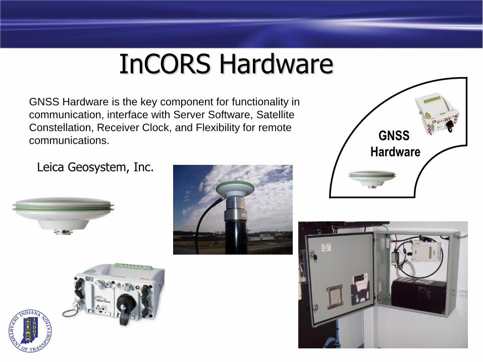
InCORS Hardware
GNSS
Hardware
GNSS Hardware is the key component for functionality in
communication, interface with Server Software, Satellite
Constellation, Receiver Clock, and Flexibility for remote
communications.
Leica Geosystem, Inc.
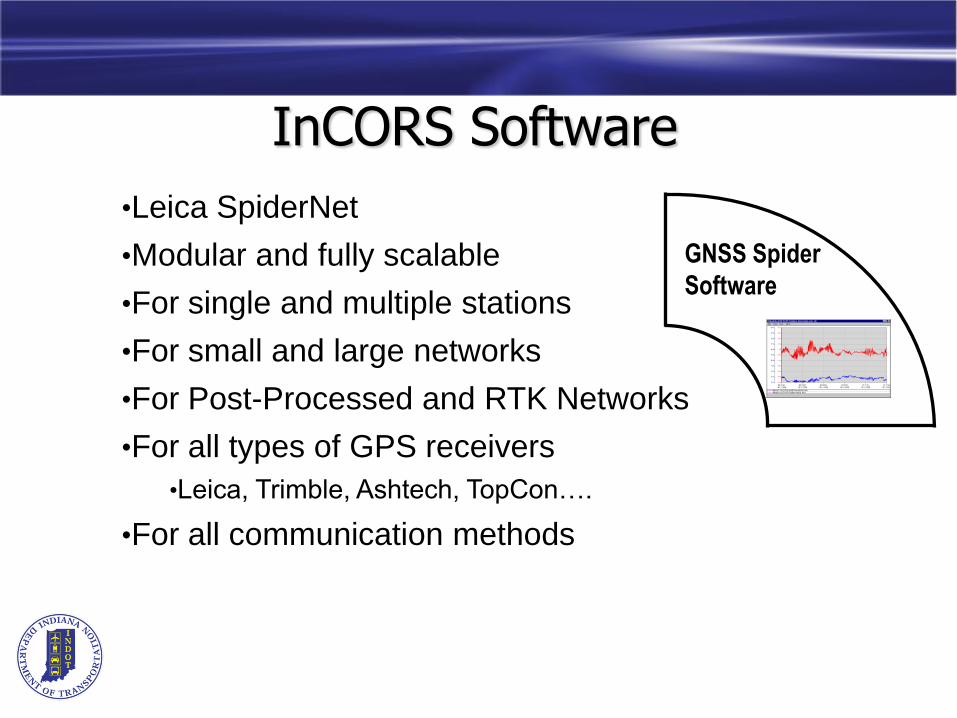
InCORS Software
GNSS Spider
Software
•Leica SpiderNet
•Modular and fully scalable
•For single and multiple stations
•For small and large networks
•For Post-Processed and RTK Networks
•For all types of GPS receivers
•Leica, Trimble, Ashtech, TopCon….
•For all communication methods
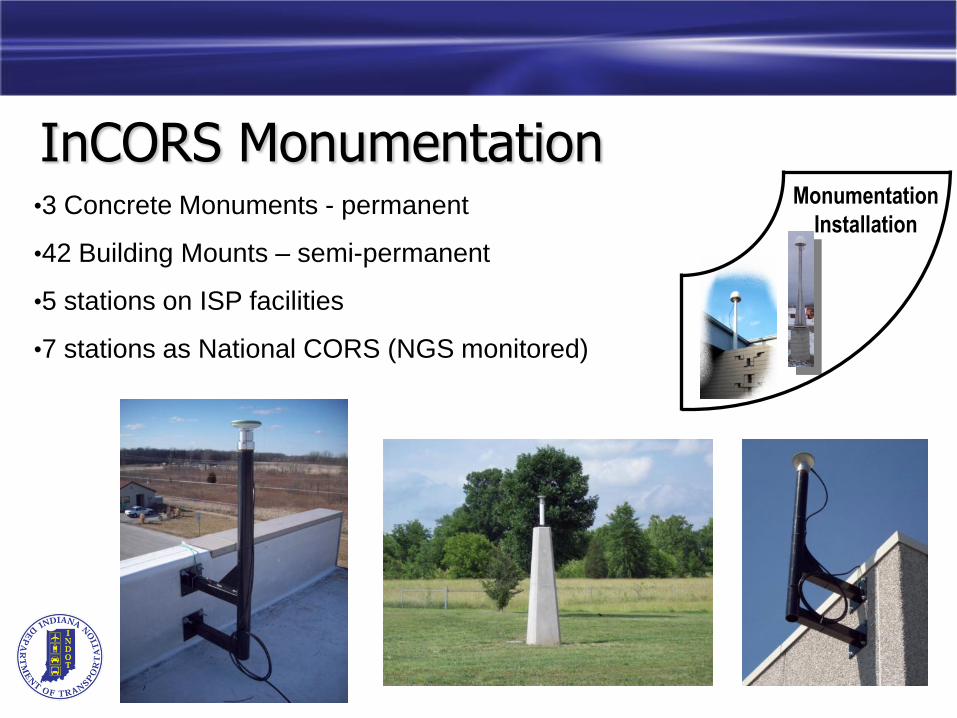
InCORS MonumentationMonumentation
Installation•3 Concrete Monuments - permanent
•42 Building Mounts – semi-permanent
•5 stations on ISP facilities
•7 stations as National CORS (NGS monitored)

InCORS Communication
Communication
Data Links
GSM/GPRS Repeaters
Cell Phones w/ data
plan
GSM/GPRS & CDMA
Modems
MiFi Device
GPS Signals
Antenna
Receiver Box
IOT Network
INDOT Servers
Cellular Network
Cellular Receiver
End User
Network RTK – Advantages• Operational range from short baseline lengths
increased to long baseline lengths
• Improvement of position accuracy on longer distances
• Increased speed of initialization time over long distances
• Strong redundancy in the network because of the use of multiple reference stations
• Robust against failures of single reference stations
• Robust against hardware failures
• Robust against communications problems
• No restriction in network
• Support of multiple rover users and applications

InCORS Network Details• DOT-Owned and Managed
• Office of Aerial Engineering (OAE)
• Base Station Installations
• 40 Located on DOT Facilities
• 5 Located on ISP Facilities
• Utilizes state IOT Communications Network
• Utilizes state IOT Server Facility
• Free Access to Public & Private Sector

Additional InCORS Features• Statewide Coverage
• Accuracy (1cm Hor.; 2 cm Vert.)
• Precision (2 sigma)
• Open Architecture
• (RTCM 2.3,3.0,3.1,CMR,CMR+)
• Base Station Redundancy
• Use of Cellular Communications for Corrections
• INDOT crews using since August 2009
• Public use started on February 1, 2010
• Currently have created about 325 accounts
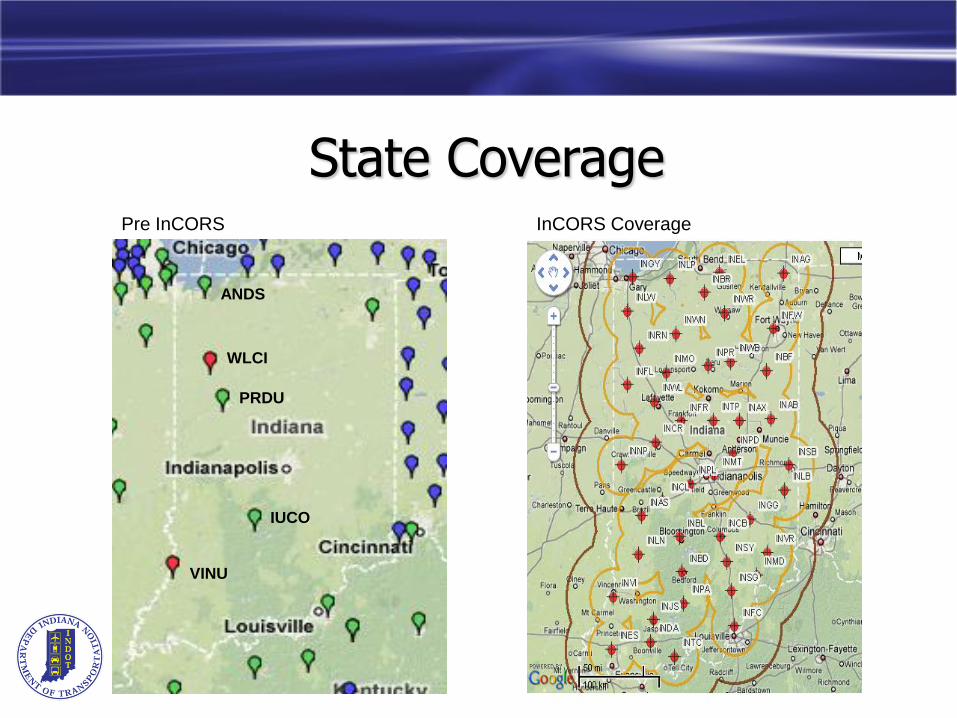
State Coverage
ANDS
WLCI
PRDU
IUCO
VINU
Pre InCORS InCORS Coverage

Network Adjustment Summary
Precision± 0.5 cm Horiz. & ± 2.0 cm Vert. @ 95% (2-sigma)
Adjusted vs. Published values± 0.8 cm Horiz. & ± 2.0 cm Vert.
Consistent w/ NAD83 (CORS96) (Reference Epoch 2002.0)± 1 cm Horiz. & ± 2 cm Vert.

HARN Test Points

Indiana DOT Web Site(http://www.in.gov/indot/)

Office of Aerial Engineering Web Site(http://www.aerialengineering.indot.in.gov)

InCORS Web Site(http://incors.in.gov)
Welcome Page Contains:
• Brief description
• Links to:
• Station Location Map
• Data Page
• RTK info & instructions
• System Status page
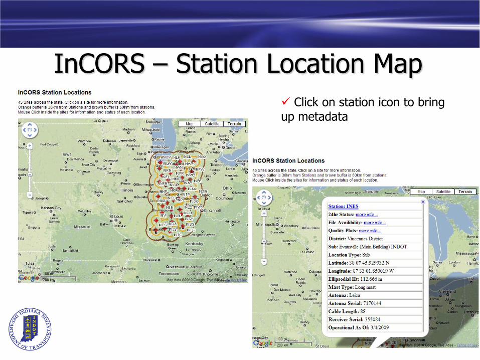
InCORS – Station Location Map
Click on station icon to bring up metadata
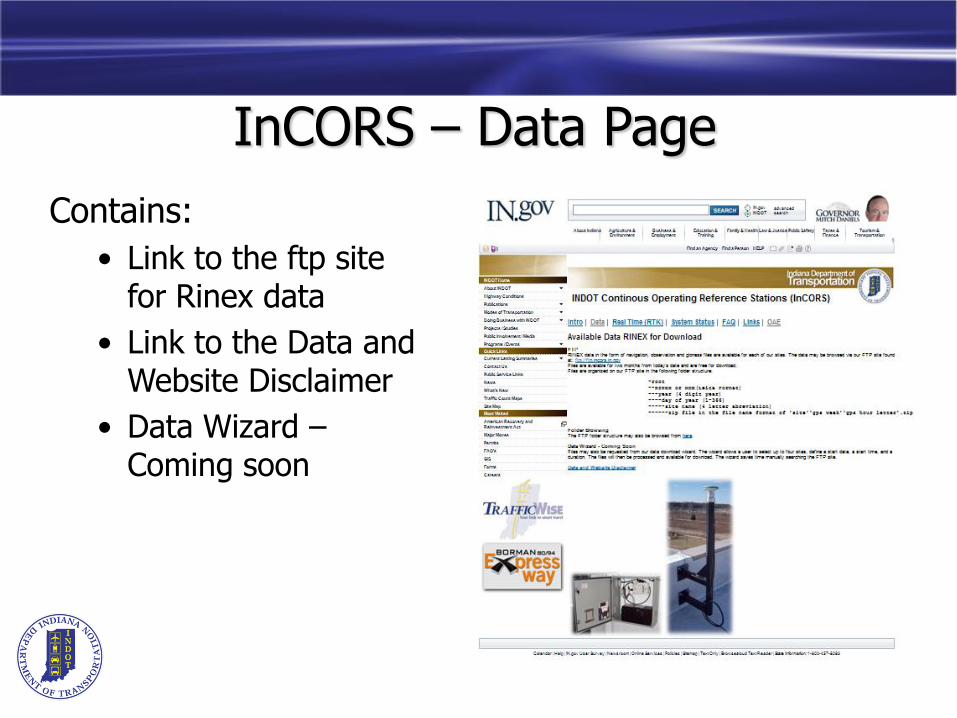
InCORS – Data Page
Contains:
• Link to the ftp site for Rinex data
• Link to the Data and Website Disclaimer
• Data Wizard –Coming soon

InCORS – Data WizardComing Soon
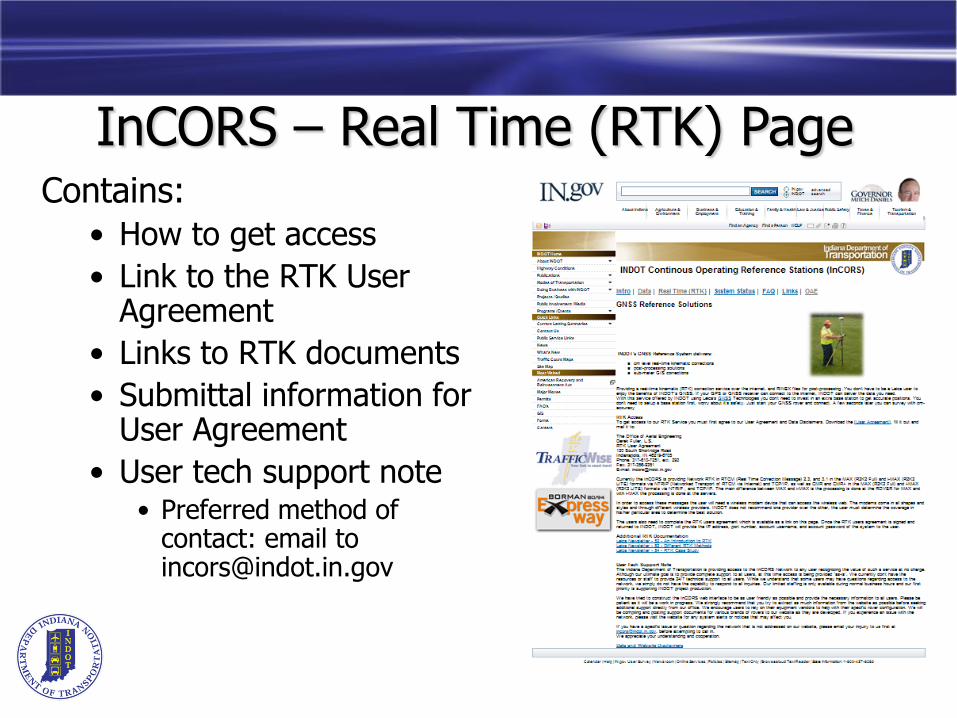
Contains:
• How to get access
• Link to the RTK User Agreement
• Links to RTK documents
• Submittal information for User Agreement
• User tech support note• Preferred method of
contact: email to [email protected]
InCORS – Real Time (RTK) Page

InCORS – RTK User Agreement
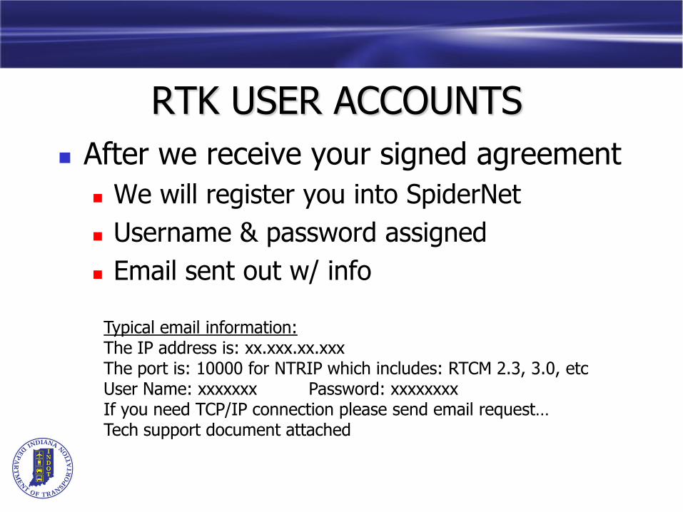
RTK USER ACCOUNTS
After we receive your signed agreement
We will register you into SpiderNet
Username & password assigned
Email sent out w/ info
Typical email information:The IP address is: xx.xxx.xx.xxxThe port is: 10000 for NTRIP which includes: RTCM 2.3, 3.0, etcUser Name: xxxxxxx Password: xxxxxxxxIf you need TCP/IP connection please send email request…Tech support document attached
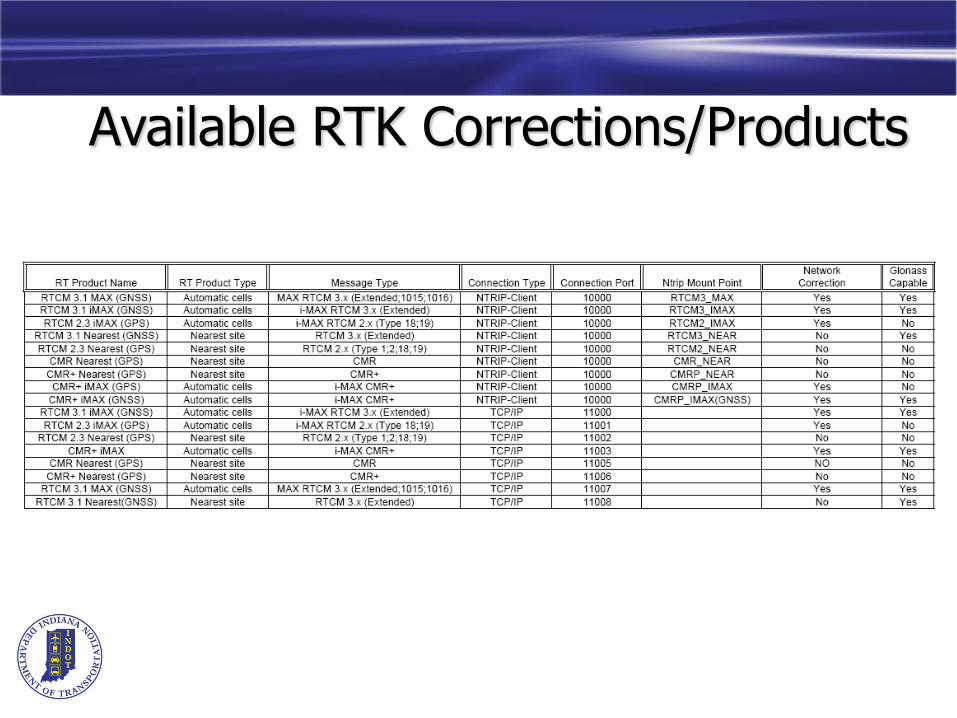
Available RTK Corrections/Products

InCORS – System Status Page
26
What You Need to Use a RTK Network
• Need a rover that at a minimum, can:
• Connect to the internet via cell phone or cell modem
• Network is independent of cell service provider, select the provider with best service in the area you work in!
• Send a NMEA message with account username and password, or has NTRIP functionality
• Can utilize RTCM 2.3, RTCM 3.x, CMR, CMR+ or Leica message formats
• Strongly encourage all users to run the most recent firmware for the rover they are using.
• For Construction/Ag machine control or project areas in cell service voids, solutions exist to provide on-site radio broadcast of baseline and network solutions.

Contact Information• For Questions/Issues e-mail:
• Eric Banschbach, LS
• Manager – Office of Aerial Engineering
• 317-610-7251, ext. 205
• Derek Fuller, LS
• Survey Program Director
• InCORS Project Leader
• 317-610-7251, ext. 293