Module 4: The Early Middle Ages - Florida State University ...

The Freducci Map of 1514-1515Ihtat it Discloses of Early Florida History
by DAVID O. TRUE
A T FIRST GLANCE, the old map partially reproduced in this issue
of Tequesta, would not excite the average reader very much. Ifirst read of it in an article by Dr. Cisco in the Bulletin of the
American Geographical Society, 1913, in his version of the Ponce deLe6n landings and route. The fact that this map was issued at suchan early date, according to Eugenio Canova, and that it was based inpart on data obtained from the Ponce expedition, made me most anx-ious to see a copy.
Fortunately, full information is available at the Library of Con-gress. The original map is located in the Royal Archives at Florence,Italy, and is called the "Carta Nautica di Conte Ottoananno Freduccid'Ancona". In 1894 a brochure was issued by this institution, describ-ing the map and containing a reproduction of the original at abouthalf scale. One of these brochures is owned by the Library of Congress,and they made the photostatic copy accompanying this article. Areproduction is also contained in Konrad Kretschmer's Die Entdeck-ung Amerika's in ihrer Bedeutung fiir die Geschichte des Weltbildes,Berlin, 1892. Dr. Cisco states that the outlines of Florida in Kretsch-mer's reproduction are so conventionalized that their historical sig-nificance is destroyed. There is also a tracing in Harrisse's Decou-verte et Evolution Cartographique de Terre Neuve, p. 81.
From this remarkable map, assuming that the estimated date isapproximately correct, one finds four major contributions to Floridahistory. It is probably the first map to bear the name Florida. Herealso is the earliest appearance of any city of North America on amap, the present city of Miami. It also shows that the Herrera desig-nations of latitude readings in connection with landings at variousplaces by Ponce de Le6n were interpolated from much later sources.Furthermore, it helps to verify Sebastian Cabot's statement that herounded the Cape of Florida.
5o
LISLjQ^ S^Li

Erratum: The top two and one-half lines of page 51 should read as follows:"On the Freducci map of Florida I Florda is the top name, where Florida isdesignated as an island, as was done by some other cartographers also in thoseearly days." The only explorer fully authenticated to have cruised the Floridashores before Ponce was Sebastian, and possibly John Cabot. Their evidence seem-ingly is of coasting some thousand miles of continuous shoreline. Relatively fewmap-makers portrayed Florida as an island.-D.O.T.
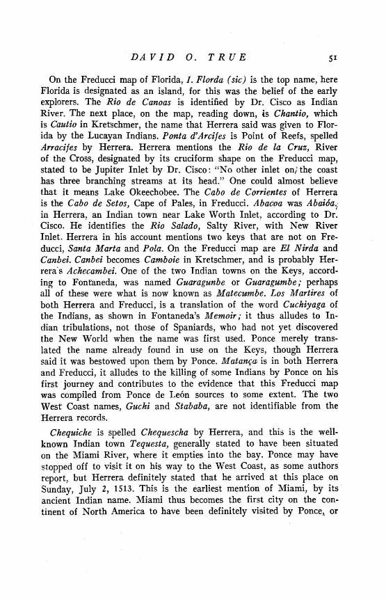
DAVID O. TRUE 51
On the Freducci map of Florida, I. Florda (sic) is the top name, hereFlorida is designated as an island, for this was the belief of the earlyexplorers. The Rio de Canoas is identified by Dr. Cisco as IndianRiver. The next place, on the map, reading down, is Chantio, whichis Cautio in Kretschmer, the name that Herrera said was given to Flor-ida by the Lucayan Indians. Ponta d'Arcifes is Point of Reefs, spelledArracifes by Herrera. Herrera mentions the Rio de la Cruz, Riverof the Cross, designated by its cruciform shape on the Freducci map,stated to be Jupiter Inlet by Dr. Cisco: "No other inlet on' the coasthas three branching streams at its head." One could almost believethat it means Lake Okeechobee. The Cabo de Corrientes of Herrerais the Cabo de Setos, Cape of Pales, in Freducci. Abacoa was Abaida.:in Herrera, an Indian town near Lake Worth Inlet, according to Dr.Cisco. He identifies the Rio Salado, Salty River, with New RiverInlet. Herrera in his account mentions two keys that are not on Fre-ducci, Santa Marta and Pola. On the Freducci map are El Nirda andCanbei. Canbei becomes Camboie in Kretschmer, and is probably Her-rera's Achecambei. One of the two Indian towns on the Keys, accord-ing to Fontaneda, was named Guaragunbe or Guaragumbe; perhapsall of these were what is now known as Matecumbe. Los Martires ofboth Herrera and Freducci, is a translation of the word Cuchiyaga ofthe Indians, as shown in Fontaneda's Memoir; it thus alludes to In-dian tribulations, not those of Spaniards, who had not yet discoveredthe New World when the name was first used. Ponce merely trans-lated the name already found in use on the Keys, though Herrerasaid it was bestowed upon them by Ponce. Matanga is in both Herreraand Freducci, it alludes to the killing of some Indians by Ponce on hisfirst journey and contributes to the evidence that this Freducci mapwas compiled from Ponce de Le6n sources to some extent. The twoWest Coast names, Guchi and Stababa, are not identifiable from theHerrera records.
Chequiche is spelled Chequescha by Herrera, and this is the well-known Indian town Tequesta, generally stated to have been situatedon the Miami River, where it empties into the bay. Ponce may havestopped off to visit it on his way to the West Coast, as some authorsreport, but Herrera definitely stated that he arrived at this place onSunday, July 2, 1513. This is the earliest mention of Miami, by itsancient Indian name. Miami thus becomes the first city on the con-tinent of North America to have been definitely visited by Ponce, or

45
' \ -\! \ .. " I 45°
Florida, the Bahamas and Cuba. Scale
approximately 9/10 of original map.
Flria e m an
a oa' /1 o oina m

DAVID O. TRUE 53
by any other discoverer of note, and to have been identified by asubstantiating map. The name Miami came from Mayaimi, equallyas old at the name Tequesta. It was the Calusa name for Lake Okee-chobee, meaning "big water."
Dr. Cisco states that the Freducci map did not show "any indicatedlatitudes", but it can be readily seen that the line that Freduccidrew, cutting through the Strait of Gibraltar, represents 350 north,while the same position on a modern map is 360. Following this linewestward, one notes that it runs about half way between Cuba andFlorida. On this map the tip of Florida below Chequiche,, is at 390north and this is an error of more than 13 degrees! On a modernmap 390 is off the coast of Delaware. Most of the other early mapsand charts contain similar errors; rarely was one drawn which didnot have the Tropic of Cancer south of Cuba, instead of north whereit belongs. The Freducci map was based to some extent on Ponce'sdata, and if Ponce had a map or chart on which latitudes were asrelatively exact as they are given in Herrera, it seems strange thatno cartographer knew about it for many years afterward. If Poncehad decided to go ashore and dig a well at 280 8' north, it would havebeen located on the very southernmost tip of the Island of Cuba,according to this contemporary map of Freducci.
To me there seems to be but one conclusion: Herrera interpolatedall these locations very much later from what, in his day, were mod-ern charts. As far as they are used by themselves to verify Ponce'slandings, they are without value. They express Herrera's opinion writ-ten nearly a century later. Anyone interested in tracing Ponce's jour-ney will find the writings of Charles B. Reynolds in accord with theopinions advanced by Dr. Cisco. The reasons for believing that alandfall was made in the vicinity of St. Augustine, are presented byMr. T. Frederick Davis in the Ponce de Le6n number of the FloridaHistorical Quarterly for July, 1935. Some investigators are interestedin the theory that he sailed far to the north on the west coast of Flor-ida; the Freducci map with its two additional names should interestthem.
One must admit that Herrera was an indefatigable worker, for wehave Mufioz' testimony that he probably took his data about thefabulous River of Youth from Fontaneda. One of his other interpola-tions is shown in his use of the name Carlos for the chief of the Calusasin the time of Ponce de Le6n. The second chief to assume this name

54 TEQUESTA
was about 25 years of age in 1566; his father Senquene had beenthe first to take it, because he had been told that it was the name ofthe greatest King of the Christians (Charles V). Charles V did notcome to the throne until after Ponce's first voyage, and it is unlikelythat Senquene heard of him until after 1545, the date of the Fontanedawreck, when some 200 Spaniards were taken captive by the Indians.*
This question of latitude has a bearing on the testimony of Sebas-tian Cabot. Peter Martyr, reporting a conversation with Cabot in1512, wrote of it in the 3rd decade of his history:
"Thus seeing such heapes of yce before him, he was enforcedto turne his sailes and follow the West, so coasting still by theshore, that he was thereby brought so farre into the South, byreason of the land bending so much Southwards, that it was therealmost eqyal in latitude, with the sea Fretum Herculeum, havingthe Northpole elevate in manner in the same degree. He sailedlikewise in this tract so farre towards the West, that he had theIsland of Cuba on his left hand, in manner in the same degreeof longitude. As hee travelled by the coastes of this great land(which he named Baccalaos) he said that hee found the likecourse of the waters toward the West, but the same to runnemore softly and gently than the swift waters which the Span-iards found in their navigations Southward. . . . Cabot is myfriend, whom I use familiarly, and delight to have him some-times keepe me company in mine own house."
Three compelling reasons for believing that Sebastian Cabot re-ported in 1512 of having rounded the Cape of Florida, either withhis father on one of his two trips, or on an expedition of his ownin 1508, as advanced by Williamson in his Voyages of the Cabots, arecontained in this account by Peter Martyr. If Cabot had not knownof Florida, he would not have been able to state that by followingthe coastline he "had the Island of Cuba on his left hand." To knowof currents counter to the Gulf Stream off the South Florida shoresbefore Ponce ever saw the country, took competent first hand in-formation. This is a remarkable detail that too many Cabot historiansoverlook.
The third reason is the one to which the Freducci map makes another
contribution. Cabot said that he sailed as far south as to be parallelwith Fretum Herculeum (Strait of Gibraltar) and of returning from
*See Connor's trarfslation of de Meris' Pedro Menindez de Avils.

DAVID O. TRUE 55
that latitude to England. On a modern map, this would be from thecoast of North Carolina. So the Cabot experts state that Cabot sailedsouth to Carolina and returned from there, instead of realizing that360 at his time was, on the charts and maps, in the Straits of Florida.
Other readers will probably find more interesting facts from theFreducci map. To me it has been thoroughly exciting, even to seethe East Coast line veering so far westward as it leaves Miamiand swings toward Jacksonville. Freducci knew his Florida and con-tributed more to our knowledge than we might expect from any suchsingle document.