I-35 Future Transportation Corridor Planning and ...
68
I-35 Future Transportation Corridor Planning and Environmental Linkages Study Final Report TxDOT, Austin District
Transcript of I-35 Future Transportation Corridor Planning and ...

I-35 Future Transportation
Corridor Planning and
Environmental Linkages
Study
Final Report TxDOT, Austin District


I-35 Future Transportation Corridor Planning and Environmental Linkages Study Report i
Table of Contents
Introduction .............................................................................................................................. 1
What is a Planning and Environmental Linkages Study? ....................................................... 3
Focus and Benefits of the I-35 Future Transportation Corridor PEL Study ........................... 4
Study Area ................................................................................................................................. 5
Existing Corridor Conditions ..................................................................................................... 5
Previous Studies ....................................................................................................................... 7
1987 Feasibility Study .............................................................................................................. 7
1989 TxDOT Austin District I-35 Major Investment Study ..................................................... 7
2011 I-35 Corridor Advisory Committee Plan (My35) ............................................................ 8
2011 Mobility35 Program / 2014 I-35 Capital Area Improvement Program Corridor
Implementation Plan ...................................................................................................... 8
Purpose and Need .................................................................................................................... 9
Purpose of the FTC .................................................................................................................. 10
Need for the FTC ..................................................................................................................... 10
Public Involvement and Agency Coordination ................................................................... 10
Affected Environment and Environmental Consequences ............................................... 12
Alternatives ............................................................................................................................ 12
Lane Type Alternatives............................................................................................................ 13
Lane Type Alternatives Evaluation Process........................................................................... 13
Phase One: Preliminary Screening ......................................................................................... 15
Phase Two: Detailed Analysis ................................................................................................. 15
Segments of Independent Utility ......................................................................................... 19
Recommendations ................................................................................................................. 19
List of Appendices
Appendix A: Planning and Environmental Linkages Questionnaire


I-35 Future Transportation Corridor Planning and Environmental Linkages Study Report 1
Introduction
The Interstate 35 (I-35) corridor is one of the state’s primary freight and passenger vehicle
corridors. As a system, the segments of I-35 represent important elements in a statewide
network, which moves significant volumes of people and freight daily. Recognizing the
statewide importance of the I-35 corridor, the Texas Transportation Commission launched
My35 as a way to increase citizen participation in the transportation planning process for
the I-35 corridor (see Previous Studies, 2011 I-35 Corridor Advisory Committee Plan (My 35)
for more details). My35 consists of five planning regions, one of which is the Capital Area,
that includes Hays, Travis and Williamson Counties.
In the Capital Area, improvements to the existing I-35 facility have not kept pace with
increasing population and traffic demand. Previous improvement studies and
recommendations for I-35 in this region have focused primarily on large-scale, long-term
solutions that have presented numerous financial, environmental, and political challenges
to implementation. Many of these large-scale “ultimate” projects were extremely costly and
difficult to implement due to the extensive right-of-way acquisition that would be needed,
construction time required, and potential impacts to the community. Delay in
implementation of these long-term solutions has resulted in severe congestion for many
sections of I-35 in the Capital Area. In fact, the section of I-35 between US Highway 183 (US
183) and State Highway 71 (SH 71) is currently the second most congested roadway in the
State. 1
Given this history, the City of Austin began Mobility35 efforts in August 2011 with a focus on
Travis County. The city sought to develop a plan that focused on short- to mid-term
strategies within the existing right-of-way to improve mobility and connectivity for all modes
of transportation, including pedestrians, bicycles, autos, transit, trucks and emergency
vehicles. The plans also included unprecedented engagement with transportation partners
and the public.
Building upon these planning efforts and in an attempt to alleviate some of the congestion
and provide better reliability for travelers on I-35 in Travis County, the Texas Department of
Transportation (TxDOT) initiated the I-35 Future Transportation Corridor (FTC) Planning and
Environmental Linkages (PEL) Study. The purpose of the I-35 FTC PEL Study is to develop a
purpose and need, determine lane type/mode choice for the FTC, and determine segments
of independent utility for future National Environmental Policy Act (NEPA) studies. Figure 1
shows the relationship between the My35, Mobility35, and the I-35 FTC PEL study areas.
1 TxDOT. 2014. 100 Congested Roadways. http://www.txdot.gov/inside-txdot/projects/100-congested-roadways.html

I-35 Future Transportation Corridor Planning and Environmental Linkages Study Report 2
Figure 1. Relationship Between My35, Mobility35, and I-35 FTC PEL Study
Areas

I-35 Future Transportation Corridor Planning and Environmental Linkages Study Report 3
The I-35 FTC PEL Study Report describes the process and key technical findings supporting
the recommended lane type alternatives that could be studied in future environmental
analyses under the NEPA process. Multiple technical reports provide additional, detailed
analyses or explanations of the concepts summarized in this report. The Purpose and Need
Report provides detailed information supporting the purpose of and need for the project.
The Public Involvement and Agency Coordination Plan and Public Meeting Summary Reports
contain documentation of the agency coordination and public involvement efforts that have
taken place throughout the I-35 FTC PEL Study. The environmental resource technical
reports—including archeology, biology, hazardous materials, historic resources, land use,
socioeconomics, and water resources—provide baseline environmental conditions. The
Alternatives Analysis Technical Report documents the lane type/mode alternatives
identification and evaluation process. The Segments of Independent Utility Technical Memo
provides the description of segments of independent utility identified in the study area.
Appendix A contains the I-35 FTC PEL Study Questionnaire.
What is a Planning and Environmental Linkages Study?
A PEL study fosters a collaborative and integrated transportation decision-making process. A
PEL study is generally executed early in the transportation planning process when decision-
makers consider environmental, community, and economic goals. These goals carry through
to the project development and environmental review process and ultimately through
design, construction, and maintenance. The goal of PEL is to create a seamless decision-
making process that minimizes duplication of effort, promotes environmental stewardship,
and reduces delay from planning through project implementation.
Many PEL studies can be classified as corridor or subarea studies because they are more
focused than regional planning efforts typically conducted by a metropolitan planning
organization (MPO), but broader than traditional project-specific environmental analyses
conducted during the NEPA process. Corridor and subarea studies can be used to produce a
wide range of analyses or decisions for Federal Highway Administration (FHWA) review,
consideration, and possible adoption during the NEPA process for an individual
transportation project, including:2
Purpose and need or goals and objective statement(s);
General travel corridor and/or general mode(s) definition;
Preliminary screening of alternatives and elimination of unreasonable alternatives;
Basic description of the environmental setting; and/or
Preliminary identification of environmental impacts and environmental mitigation.
To be seamlessly incorporated into the NEPA process, all corridor and subarea studies
utilizing the PEL study approach must adhere to certain standards and must include
2 FHWA. 2008. Planning and Environmental Linkages Implementation Resource Guide.

I-35 Future Transportation Corridor Planning and Environmental Linkages Study Report 4
extensive public involvement and agency coordination. The regulations for a PEL study are
formalized in Title 23 Code of Federal Regulation (CFR) Part 450 (23 CFR 450) - Statewide
Transportation Planning; Metropolitan Transportation Planning; Final Rule. This regulation
details how results or decisions of transportation planning studies may be used as part of
the overall project development process consistent with NEPA. Appendix A to 23 CFR 450
describes how information, analysis, and products from transportation planning can be
incorporated into and relied upon in NEPA documents under existing laws.3 Some of the key
criteria that an agency must consider in deciding whether to adopt planning-level analyses
or decisions in the NEPA process include:4,5
Involvement of interested state, local, tribal, and Federal agencies;
Public review;
Reasonable opportunity to comment during the development of the corridor or subarea
planning study;
Documentation of relevant decisions in a form that is identifiable and available for
review during the NEPA scoping process and can be appended to or referenced in the
NEPA document; and
Review by FHWA and the Federal Transit Administration (FTA), as appropriate.
FHWA has developed a PEL Questionnaire to help maximize the utility of the results from
subarea or corridor plans to inform NEPA. The questionnaire is intended to act as both a
guide and summary of the planning process and ease the transition from planning to NEPA
analysis. The questionnaire is consistent with the planning regulations contained in 23 CFR
450 and other FHWA policies on the PEL process. The I-35 FTC PEL Study was conducted in
accordance with the regulations provided in 23 CFR 450 and the completed FHWA PEL
Questionnaire is found in Appendix A.
Focus and Benefits of the I-35 Future Transportation Corridor PEL Study
The I-35 FTC PEL Study provided opportunities to bring together transportation planning and
environmental considerations early in the FTC planning process. There were three focuses
for the study and three anticipated benefits.
The three focuses of the I-35 FTC PEL Study were to:
Develop a Purpose and Need Statement;
Determine Lane Type/Mode Choice for the FTC; and
Determine Segments of Independent Utility.
3 Ibid. 4 FHWA. 2011. Guidance on Using Corridor and Subarea Planning to Inform NEPA. 5 AASHTO. 2008. Using the Transportation Planning Process to Support the NEPA Process.

I-35 Future Transportation Corridor Planning and Environmental Linkages Study Report 5
The anticipated benefits of the I-35 FTC PEL Study were to:
Identify projects for possible inclusion in the Capital Area Metropolitan Planning
Organization (CAMPO) Regional Transportation Plan (RTP);
Potentially expedite the NEPA process for identified projects; and
Further progress design and operational analysis of the FTC.
Study Area
The I-35 FTC PEL Study focuses on the Travis County portion of I-35. The study limits extend
approximately 28 miles along existing I-35 from SH 45 North (45N) within Round Rock,
Texas, to SH 45 Southeast (45SE) outside of Buda, Texas.
Figure 2 provides a map of the study area. In the Austin area, improvements to the existing I-
35 facility have not kept pace with increasing population and traffic demand. Previous
improvement studies and recommendations for I-35 in this region have focused primarily on
large-scale, long-term solutions that have presented numerous financial, environmental, and
political challenges to implementation. Delay in implementation of these long-term solutions
has resulted in severe congestion for many sections of I-35 in the Austin area.
Existing Corridor Conditions
The existing I-35 facility is located within urban and suburban areas, and both commercial
and residential properties are found along the study area. I-35 is an access-controlled
interstate highway that typically has three mainlanes in each direction separated by a
median, a continuous frontage road in each direction, and inside and outside shoulders.
Improvements to I-35 have been unable to keep pace with the rapid growth in population
and employment in the Austin area. This growth has led to a corresponding increase in
vehicular traffic on I-35, ever-increasing congestion during morning and evening peak hours
and slower travel speeds. As defined in the Highway Capacity Manual6, Level of Service
(LOS) is a qualitative measure used to analyze highways by categorizing traffic flows into
letter designations that characterize the operational conditions within a traffic stream and
how the conditions are perceived by the users of the facility. Six levels of service are defined
using letter designations from A to F for capacity analysis, with LOS A representing the best
operating conditions and LOS F the worst. Within the study area, approximately 33 percent
of the northbound and 44 percent of the southbound traffic in the AM peak hours currently
experience LOS E and F. During the PM peak hours, approximately 67 percent of
northbound traffic and 33 percent of southbound traffic experience LOS E and F. The
Purpose and Need Report provides additional information about the current corridor
conditions and the purpose of and need for the I-35 FTC PEL Study.
6 2010. Transportation Research Board of the National Academy of Sciences. Highway Capacity Manual.

I-35 Future Transportation Corridor Planning and Environmental Linkages Study Report 6
Figure 2. Study Area for the FTC PEL Study

I-35 Future Transportation Corridor Planning and Environmental Linkages Study Report 7
Previous Studies
By the mid-1980s, TxDOT identified the need to address congestion on I-35 through Austin.
Since then, several studies have been conducted by TxDOT to explore potential mobility
solutions on I-35; those studies are described in the following sections.
1987 Feasibility Study
In 1987, TxDOT hired a consultant to perform a feasibility study to determine how best to
upgrade I-35 from Martin Luther King Boulevard to Ben White Boulevard. In 1988, the study
was terminated because of concerns that the concepts under development would not
effectively address the transportation needs and would not be accepted by the community
due to the extensive use of elevated structures and the large amount of right-of-way that
would be required to implement the concepts.
1989 TxDOT Austin District I-35 Major Investment Study
In 1989, TxDOT began an in-house feasibility study to determine how to upgrade I-35 and
address public concerns more effectively than the 1987 study. The study limits were along I-
35 from US 183 to Ben White Boulevard. With the passage of the Intermodal Surface
Transportation Efficiency Act of 1991 (ISTEA), the study expanded into a Major Investment
Study (MIS) to satisfy the requirements of ISTEA. The expanded study included all of the
Austin Transportation Study (ATS) area, which included Williamson, Travis, Hays, Caldwell,
and Bastrop Counties, and added High Occupancy Vehicle (HOV) lanes as a possible design
feature.7 The I-35 MIS was included in the ATS plan adopted in December 1994. Eleven
possible strategies were studied. Of the eleven strategies studied, the MIS recommended
three possible strategies be carried forward for detailed engineering and environmental
analysis. These three strategies were:
Strategy 1 – No Action Alternative.
Strategy 5-B1 – Major construction of new HOV lanes within the existing I-35 corridor,
assuming construction of light rail as proposed by Capital Metro, and providing travel
demand measures in the ATS area.
Strategy 6-E – Major reconstruction of I-35 between certain limits within the ATS area,
integrating transportation system mobility improvements, assuming construction of light
rail as proposed by Capital Metro, and providing travel demand measures in the ATS
area.
The MIS process was completed in 2004.8 Due to funding limitations and other hurdles to
implementation, none of the major improvements identified in the MIS were advanced.
7 The Austin Transportation Study was the precursor to CAMPO.
8 2014. TxDOT I-35 Capital Area Improvement Program (Mobility35), Corridor Implementation Plan SH 130 to Posey Road,
Williamson, Travis & Hays Counties, Texas.

I-35 Future Transportation Corridor Planning and Environmental Linkages Study Report 8
2011 I-35 Corridor Advisory Committee Plan (My35)
The Texas Transportation Commission established the I-35 Corridor Advisory Committee
(CAC) to engage Texas citizens and develop a plan to address transportation challenges
along the I-35 corridor from Oklahoma/Texas border to the Texas/Mexico border. CAC
members included business professionals, environmental planners, rail advocates,
professors, local officials, and residents that lived and did business in the I-35 corridor. In
order to engage and better understand the needs of the public, the Texas Transportation
Commission enlisted assistance from four I-35 Corridor Segment Committees (CSCs) located
along the I-35 corridor to develop recommendations to improve mobility on I-35. The CAC
considered the recommendations of the CSCs and developed the I-35 Corridor Advisory
Committee Plan (My35 Plan) to address mobility challenges along I-35. The plan identifies
and prioritizes projects and makes general recommendations for the I-35 corridor in Texas,
including:
Freight and passenger rail projects to alleviate freight demands on roadways;
Roadway design to separate cars and trucks to increase safety;
Managed lanes to ease congestion and provide relief to transportation funding; and
Integrated, real-time traffic information systems that alert drivers to delays and provide
alternate routes.
In the Capital Area, the My35 Plan recommended re-designating and renaming parts of I-35
to divert interstate traffic away from metropolitan areas and onto SH 130.
2011 Mobility35 Program / 2014 I-35 Capital Area Improvement Program Corridor
Implementation Plan
TxDOT, in partnership with the City of Austin and other local stakeholders, initiated the
ongoing Mobility35 program (also known as the I-35 Capital Area Improvement Program
[CAIP] for Hays, Travis, and Williamson Counties) in 2011. Mobility35 focuses on feasible
and effective short- and mid-term strategies that can be implemented to improve mobility
and connectivity along and across the I-35 corridor. The program attempts to maintain
consideration of long-term corridor needs while developing the short- and mid-term potential
strategies. Using past I-35 studies as background, partner agencies and stakeholders are
working together to develop mobility solutions that are implementable, cost-effective, and
generally do not require wholesale reconstruction of the corridor or substantial additional
right-of-way. Efforts for the ongoing Mobility35 program are separated into five phases
including: Phase 1-Conceptual Planning; Phase 2-Implementation Plan; Phase 3-Schematic
and Environmental Coordination; Phase 4-Construction Plans, Right-of-Way, and Utility
Coordination; and Phase 5-Letting and Construction. The I-35 CAIP Corridor Implementation
Plan for Travis County, which identifies various improvements for I-35 including the FTC as a
key improvement, was originally released in 2013 and updated in 2014. Because the
Implementation Plan is a living document, several iterations will be developed. The I-35 FTC

I-35 Future Transportation Corridor Planning and Environmental Linkages Study Report 9
PEL Study was conducted under the Mobility35 program and falls between Phase 2 and
Phase 3 of the program.
The I-35 CAIP divided the I-35 corridor through Travis County into eight segments. It
suggests separate improvements for each segment. Each improvement, including the FTC,
was developed to help improve mobility and relieve congestion..
General guiding considerations for the Mobility35 Program include:
Increase capacity;
Better manage traffic;
Enhance safety;
Optimize existing facility;
Minimize need for additional right-of-way;
Improve east/west connectivity;
Improve compatibility with neighborhoods; and
Enhance bicycle, pedestrian and transit options.
Adding mainlane capacity, identified specifically as the FTC, is a primary goal of Mobility35.
The FTC is a proposed additional freeway lane in each direction of I-35. Although this lane
would require widening the footprint of the interstate mainlanes, it would not require
substantial additional right-of-way, which is a guiding consideration for Mobility35 and is a
primary goal of any improvements that are recommended as part of the I-35 FTC PEL Study.
The FTC would provide the single largest mobility gain for I-35, while also respecting the
community input which has indicated that the potential impacts associated with
improvements that would require substantial amounts of right-of-way are incompatible with
community desires and the likelihood of feasible implementation. Potential lane types for
the FTC include general purpose lanes, express lanes, transit-only lanes, HOV lanes or a
combination of lane types. The I-35 FTC PEL Study will help determine how this lane will be
used. The I-35 FTC PEL Study will also determine the purpose and need and logical
segments for the FTC.
Purpose and Need
A Purpose and Need Statement is a fundamental requirement of NEPA. Clarity of purpose
and confirmation of need are sound practices when developing large-scale projects requiring
public expenditure.
The Purpose and Need Statement is intended to clarify the expected outcome of public
expenditure and to justify that expenditure (i.e. purpose - what is to be accomplished and

I-35 Future Transportation Corridor Planning and Environmental Linkages Study Report 10
need - why it is necessary). The statement is used to guide the development of alternatives,
and is a fundamental element when developing criteria by which alternatives will be
evaluated.
Purpose of the FTC
The purpose of the proposed FTC project is to:
Improve operational efficiency and manage congestion;
Provide more reliable travel times; and
Create a more dependable and consistent route for transit, emergency responders, and
other motorists.
Need for the FTC
Improvements to the I-35 corridor are needed for the following reasons:
Current congestion levels are causing inefficient operations;
Travel times will increase as population and employment grow; and
Congestion-related delays prevent efficient use of I-35 by transit, emergency responders,
and other motorists.
The Purpose and Need Technical Report provides detailed information supporting the
purpose of and need for the FTC including population trends and current and projected
traffic data.
Public Involvement and Agency Coordination
Public and stakeholder involvement was a fundamental part of the I-35 FTC PEL Study
process. Public input was sought throughout the study process on the Purpose and Need
Statement, lane type alternatives, evaluation criteria, recommended alternatives, and
segments of independent utility. The Public Involvement and Agency Coordination Plan
details the involvement strategy that was implemented for the study.
Agency and stakeholder meetings were held throughout the study. Agency meetings
included representatives from TxDOT, FHWA, the City of Austin and CAMPO, and served as
an opportunity for the agencies to coordinate and collaborate on the I-35 FTC PEL Study
effort. TxDOT also coordinated with Capital Metro to discuss their interests in the I-35
corridor and to get input on potential transit access points. Additionally, TxDOT presented
information on the I-35 FTC PEL Study to the Mobility35 Technical Steering Committee and
CAMPO Policy Board at project milestones.
The study team also conducted three rounds of public meetings to provide citizens
information about the study’s progress and to solicit input about the purpose and need,

I-35 Future Transportation Corridor Planning and Environmental Linkages Study Report 11
range of alternatives, recommended lane type alternatives, and segments of independent
utility for the FTC. Each round of public meetings was held in northern, central, and southern
locations along the study area for a total of nine meetings. Each meeting was compliant with
the requirements of the Americans with Disabilities Act and offered accommodations for
persons with special needs (such as hearing impairments or limited English proficiency) if
requested. Court reporters were also available to record verbal comments during the
meetings. In addition to the physical meetings, a virtual public meeting was held to
supplement each round of public meetings for a total of three virtual public meetings. The
virtual public meetings were accessible through the Mobility35 website.
The schedule for the public meetings was as follows:
June 2014: The team presented the draft I-35 FTC PEL Study Purpose and Need
Statement and the initial list of lane type alternatives.
(June 3) Kealing Middle School
(June 4) Akins High School
(June 5) Frank Fickett Scout Training and Service Center and Conference Center
September 2014: The team presented the results from the Phase One alternatives
screening process, which included comparing the alternatives to the purpose of the FTC,
as described in the Alternatives section of this report. Lane type alternatives
recommended for detailed analysis were also presented.
(September 9) Akins High School
(September 10) Frank Fickett Scout Training and Service Center and Conference
Center
(September 11) Kealing Middle School
November 2014: The team presented the results of the Phase Two detailed alternatives
analysis evaluation and the recommended lane type alternatives and preliminary
segments of independent utility, as described in the Alternatives section of this report.
(November 10) Kealing Middle School
(November 12) Akins High School
(November 13) Frank Fickett Scout Training and Service Center and Conference
Center
The public meeting venues included locations in the north, central, and southern areas of
the project limits to give the public a better opportunity to attend a meeting in their area.
Additional information about the study’s public meetings can be found in the Public Meeting
Summary Reports.

I-35 Future Transportation Corridor Planning and Environmental Linkages Study Report 12
Other stakeholder involvement included approximately 40 stakeholder meetings with
agencies, neighborhood associations, and businesses along the corridor to discuss the
Mobility35 Program and concepts under study including those for the I-35 FTC PEL Study.
The study team used input from stakeholder involvement to help define the purpose of and
need for the I-35 FTC, the alternatives considered and the evaluation criteria used in the I-
35 FTC PEL Study alternatives analysis, and to determine segments of independent utility
for any future NEPA studies of the I-35 FTC.
Affected Environment and Environmental Consequences
The consideration of environmental resources was an integral part of the I-35 FTC PEL
Study. Environmental resources and issues considered in this study include the following:
Archeology;
Biological Resources;
Hazardous Materials;
Historic Resources;
Land Use;
Socioeconomics; and
Water Resources.
Resource-specific technical reports were prepared that document the existing conditions for
each of the seven resources listed above. Based on the environmental technical studies
completed to date, there are several locations along the I-35 corridor in Travis County where
environmental constraints exist. Site-specific studies based on project-specific designs
would be required to determine if these constraints would be problematic for TxDOT in terms
of constructing new improvements or acquiring additional ROW. The information provided in
the resource-specific technical reports will serve as the environmental baseline condition for
consideration in future NEPA studies. A more detailed summary of potential environmental
constraints that would need to be considered in future NEPA studies is provided in Appendix
A.
Alternatives
Detailed descriptions of the alternative concepts screening, evaluation methodology, results,
and recommendations are provided in the Alternatives Analysis Technical Report. The
following sections briefly describe the alternatives and the screening process.

I-35 Future Transportation Corridor Planning and Environmental Linkages Study Report 13
Lane Type Alternatives
The I-35 FTC PEL Study developed and analyzed potential lane type alternatives for the FTC.
These alternatives helped determine how the FTC would function on I-35 through the study
area. Below is the initial list of lane type alternatives.
No Build: The FTC is not built but future conditions include the preservation of the
existing transportation network and any programmed transportation improvements that
were in the approved CAMPO 2035 RTP.
Managed (express toll) lane: Lane with use restrictions that could include tolls and/or
occupancy or vehicle type that would be accessed similarly to the current I-35
mainlanes.
Managed (express toll) lane with transit focus: Lane with use restrictions that could
include tolls, occupancy, and/or vehicle types with access designed specifically for
restricted vehicles and enhancing transit services.
Managed (transit-only) lane: Lane used only for transit vehicles.
Managed (freight-only) lane: Lane used for commercial trucks and freight trucks.
Managed (High Occupancy Vehicle) lane with transit focus: Lanes dedicated to vehicles
with two or more passengers and transit vehicles.
Rail lane: Tracks and a rail line for a passenger rail system in lieu of an additional vehicle
lane.
Managed (through) lane: Lane from SH 45N to SH 45SE with no entrance or exit points
in between.
General purpose lane: Lane for all I-35 motorists with no restrictions.
Lane Type Alternatives Evaluation Process
To determine the feasibility of each alternative lane type on the I-35 FTC, , the study team
used several different evaluation criteria in a two-phased evaluation process. The first phase
evaluated the alternatives against the purpose of and need for the FTC and the second
phase included a detailed analysis of the alternatives using specific evaluation criteria.
Figure 3 provides a graphic representation of the evaluation process.

I-35 Future Transportation Corridor Planning and Environmental Linkages Study Report 14
Figure 3. Two Phase Alternatives Process

I-35 Future Transportation Corridor Planning and Environmental Linkages Study Report 15
Phase One: Preliminary Screening
The initial evaluation of the alternatives for the FTC included evaluating the alternatives
against the purpose of and need for the FTC. Of the eight lane type alternatives, the general
purpose lane, rail, managed (freight only) lane, and managed (through) lane options for the
FTC failed to pass the Phase One Preliminary Screening. These alternatives did not move
forward to the detailed analysis phase. The No Build alternative also does not meet the
purpose of and need for the FTC, but would be carried forward into future NEPA studies. The
results of Phase One are depicted in Table 1. More detailed information about the Phase
One screening results is found in the Alternatives Analysis Technical Report.
Table 1. Phase One Screening Results
ALTERNATIVES
Rail General
Purpose
Managed Lanes
Freight
Only Through
Transit
Only
Express
Toll
Express
Toll with
Transit
Focus
HOV +
Transit
PU
RP
OS
E O
F T
HE
FTC
Improve operational
efficiency and
manage congestion
Provide more reliable
travel times
Create a dependable
and consistent route
for transit,
emergency
responders, and
other motorists
Phase Two: Detailed Analysis
Phase Two of the alternatives evaluation process involved detailed analyses of the
remaining alternatives. The remaining alternatives were evaluated using average speed,
travel time, LOS, and Passenger Miles Traveled (PMT). Figures 4 through 7 show the results
of these criteria. As indicated, a Managed Lane FTC would increase average speeds through
the corridor while providing an improved LOS compared to the other alternatives. The higher
average speed combined with an improved LOS simply allows for more passengers traveling
in vehicles to pass through the corridor during the peak period as compared to the other
alternatives during the same time period. This increase in passenger travel is typically
measured by passenger miles traveled or PMT and represents the amount of throughput for

I-35 Future Transportation Corridor Planning and Environmental Linkages Study Report 16
each alternative. Generally, an increase in PMT indicates that a decrease in congestion has
occurred. The result of the Phase Two analyses was that the managed (express toll) lane
and managed (express toll) lane with transit focus were recommended to move forward to
the NEPA process. The Alternatives Analysis Technical Report contains more detailed
information about the Phase Two screening results.
Figure 4. Average Speed Results

I-35 Future Transportation Corridor Planning and Environmental Linkages Study Report 17
Figure 5. Average Travel Time Results

I-35 Future Transportation Corridor Planning and Environmental Linkages Study Report 18
Figure 6. Level of Service Results
Figure 7. Passenger Miles Traveled Results

I-35 Future Transportation Corridor Planning and Environmental Linkages Study Report 19
Segments of Independent Utility
Three preliminary segments of independent utility (SIU) were identified for the FTC. These
SIUs are consistent with FHWA guidelines (Title 23 CFR section 771.111(f)) because they:
Connect logical termini and are of sufficient length to address environmental matters on
a broad scope;
Have independent utility or independent significance, i.e., are usable and are a
reasonable expenditure even if no additional transportation improvements in the area
are made; and
Do not restrict consideration of alternatives for other reasonably foreseeable
transportation improvements.
The three preliminary SIUs limits are identified as:
SH 45N to US 183;
US 183 to Riverside Drive; and
Riverside Drive to SH 45SE.
The details of the SIUs are included in the Segments of Independent Utility Technical Memo.
Each of the SIUs serves independent transportation purposes and provides transportation
benefits for each section of the corridor.
Recommendations
Based on the results of the PEL Study, the following recommendations are made:
1. The Managed (Express Toll) Lane or Managed (Express Toll) Lane with Transit Focus
should be included in the CAMPO 2040 RTP;
2. The purpose and need, defined through the PEL and vetted through public outreach, be
adopted for the purposes of future NEPA analysis;
3. The two managed lane alternatives (identified in recommendation one) be further
evaluated in future NEPA studies along with the No Build alternative. Collectively, these
three alternatives would entail the range of alternatives on which the NEPA alternatives
analysis will focus; and
4. The FTC be developed in three SIUs (SH 45N to US 183, US 183 to Riverside Drive, and
Riverside Drive to SH 45SE) with each segment subject to a project-specific NEPA
evaluation.

Appendix A – Planning and Environmental Linkages Questionnaire

I-35 Future Transportation
Corridor Planning and
Environmental Linkages
Study
Final PEL Questionnaire TxDOT, Austin District


I-35 Future Transportation Corridor Planning and Environmental Linkages Study Questionnaire i
Table of Contents
1. Study Overview .............................................................................................................. 1
2. Purpose of the Federal Highway Administration PEL Questionnaire ......................... 3
3. Responses to the PEL Questionnaire .......................................................................... 3
Background ................................................................................................................... 3
Methodology Used ........................................................................................................ 7
Agency Coordination ................................................................................................... 11
Public Coordination ..................................................................................................... 12
Purpose and Need for the PEL Study ........................................................................ 12
Range of Alternatives .................................................................................................. 13
Planning Assumptions and Analytical Methods ........................................................ 22
Environmental Resources Reviewed ......................................................................... 25
Environmental Resources Not Reviewed .................................................................. 33
Cumulative Impacts .................................................................................................... 33
Mitigation ..................................................................................................................... 34
Availability of Information to the Public ..................................................................... 34
Foreseen Future Issues .............................................................................................. 34
List of Appendices
Appendix A: Study Team and Agency Team Members


I-35 Future Transportation Corridor Planning and Environmental Linkages Study Questionnaire 1
1.0 Study Overview
In the Capital Area, improvements to the existing Interstate 35 (I-35) facility have not kept
pace with increasing population and traffic demand. Previous improvement studies and
recommendations for I-35 in this region have focused primarily on large-scale, long-term
solutions that have presented numerous financial, environmental, and political challenges
to implementation. Delay in implementation of these long-term solutions has resulted in
severe congestion for many sections of I-35 in the Capital Area. In fact, the section of I-35
between US Highway 183 (US 183) and State Highway 71 (SH 71) is currently the second
most congested roadway in the State. 1
To alleviate some of the congestion and provide better reliability for travelers on I-35 in
Travis County, the Texas Department of Transportation (TxDOT) initiated the I-35 Future
Transportation Corridor (FTC) Planning and Environmental Linkages (PEL) Study. The
objective of this study is to: (1) define the purpose of and need for one new mainlane in
each direction within the existing I-35 right-of-way (ROW); (2) identify the lane type and mode
choice for the new mainlanes; and (3) identify segments of independent utility (SIUs) within
the Travis County section of I-35. The results of this study will be used to recommend
projects for inclusion in the Capital Area Metropolitan Planning Organization (CAMPO)
Regional Transportation Plan (RTP); inform and, potentially, shorten the time it takes for
future National Environmental Policy Act (NEPA) studies conducted for specific FTC projects;
and further progress design and operational analysis of the FTC.
Specifically, the I-35 FTC PEL Study focuses on the Travis County portion of I-35. As depicted
in Figure 1, the study limits extend 28 miles along existing I-35 from State Highway 45 North
(SH 45N) just within the southern city limits of Round Rock, Texas, to State Highway 45
Southeast (SH 45SE) located just north of Buda, Texas.
1TxDOT. 2014. 100 Congested Roadways. http://www.txdot.gov/inside-txdot/projects/100-congested-roadways.html

I-35 Future Transportation Corridor Planning and Environmental Linkages Study Questionnaire 2
Figure 1. Study Area for the FTC PEL Study

I-35 Future Transportation Corridor Planning and Environmental Linkages Study Questionnaire 3
2.0 Purpose of the Federal Highway Administration PEL Questionnaire
The Federal Highway Administration (FHWA) developed a questionnaire to serve as a guide
for PEL studies. The questionnaire is intended to act as a summary of the planning process
and ease the transition from planning to NEPA analysis. The questionnaire is consistent with
23 Code of Federal Regulations (CFR) Part 450 and FHWA policies regarding the PEL
process.
3.0 Responses to the PEL Questionnaire
This section provides the responses to the PEL questionnaire for the I-35 FTC PEL Study. The
responses below provide a comprehensive statement on how the I-35 FTC PEL Study
developed lane type alternatives for the identified needs of the corridor and facilitated the
analysis of each identified alternative for the NEPA process.
Background
(a) Who is the sponsor of the PEL study? (State DOT, local agency, or other)?
The I-35 FTC PEL Study is a collaborative effort between TxDOT, the City of Austin, and
CAMPO.
(b) What is the name of the PEL study document and other identifying project information
(e.g. sub-account or STIP numbers, long-range plan or transportation improvement
program years)?
This study is known as the I-35 Future Transportation Corridor (FTC) Planning and
Environmental Linkages (PEL) Study. CAMPO’s 2035 RTP, in conjunction with Mobility35’s I-
35 Capital Area Improvement Program Corridor Implementation Plan for Travis County,
provided baseline information for the study. Upon completion of the I-35 FTC PEL Study,
projects will be identified for inclusion in CAMPO’s 2040 RTP.
(c) Who was included on the study team (Name and title of agency representatives,
consultants, etc.)?
The study team consists of TxDOT, the City of Austin, CAMPO, and FHWA. The I-35 FTC PEL
Study consultant team was led by Michael Baker International, and included Alliance
Transportation Group, Inc. and Hicks & Company. Oversight was provided by HNTB
Corporation. A listing of key staff that participated in the study and a list of agency team
members are found in Appendix A.
(d) Provide a description of the existing transportation facility within the corridor, including
project limits, modes, functional classification, number of lanes, shoulder width,

I-35 Future Transportation Corridor Planning and Environmental Linkages Study Questionnaire 4
access control and type of surrounding environment (urban vs. rural, residential vs.
commercial, etc.)
The I-35 FTC PEL Study limits include 28 miles between SH 45N to SH 45SE as shown in
Figure 1. The existing I-35 facility is located within urban and suburban areas, and both
commercial and residential properties are found along the study area. I-35 is an access-
controlled interstate highway that typically has three mainlanes in each direction separated
by a median, a continuous frontage road in each direction, and typically consists of inside
and outside shoulders.
(e) Provide a brief chronology of the planning activities including the year(s) the studies
were completed.
Previous planning activities within the study area are listed below.
1987 Feasibility Study (terminated 1988)
TxDOT Austin District I-35 Major Investment Study (completed 1994)
I-35 Corridor Advisory Committee Plan (My 35) (completed 2011, updated 2012)
I-35 Corridor Segment 3 Committee Recommendations (2010)
Mobility35 / I-35 Capital Area Improvement Plan (completed 2013, updated 2014)
The I-35 FTC PEL Study was initiated in Spring 2014. A timeline of major I-35 FTC PEL Study
activities and milestones is found in Figure 2.

I-35 Future Transportation Corridor Planning and Environmental Linkages Study Questionnaire 5
Figure 2. I-35 FTC PEL Study Timeline
(f) Are there recent, current or near future planning studies or projects in the vicinity?
What is the relationship of this project to those studies/projects?
Planning Studies
The Lone Star Rail District (LSRD) is planning commuter rail service and a freight rail
bypass project between Austin and San Antonio. The corridor being studied is parallel to
the I-35 corridor but does not intersect it within the I-35 FTC PEL Study Area. In October
2014, the LSRD initiated the federal environmental process by publishing a Notice of
Intent to prepare an Environmental Impact Statement in the Federal Register.
The Mobility35 program is planning projects for I-35 through the I-35 Capital Area
Improvement Program Corridor Implementation Plans for Williamson and Hays Counties.
Plans for the counties are anticipated to be released in Fall 2015.
Project Connect is a partnership between Central Texas transportation agencies aimed
at implementing the high-capacity transit component of the CAMPO 2035 RTP. The
CAMPO RTP was adopted by regional government representatives in 2010, after a nine-
month public outreach process involving policy makers and community stakeholders.
The initial Project Connect partnership includes the City of Austin, Capital Metro, the
LSRD and CAMPO. The purpose of Project Connect is to build consensus on regional
high-capacity transit and answer the following questions: SYSTEM: How will high-capacity
transit components in the CAMPO 2035 RTP work as a system? ORGANIZATION: How will
our region organize to develop and operate the system? FUNDING: How will we pay for
the system over the long term? The Project Connect study is expected to produce a final
report that will provide answers to the three questions posed above, and a high-capacity

I-35 Future Transportation Corridor Planning and Environmental Linkages Study Questionnaire 6
transit system vision map showing where MetroRail, Regional Rail, Urban Rail, Bus Rapid
Transit and Express Bus on Express Lanes services will potentially be developed for the
Central Texas area.
Projects
Anticipated projects for I-35 in Travis County are listed in Table 1 below. The projects are
part of the Mobility35 program.
Table 1. Travis County Anticipated Projects for I-35
Project Limits Current
Phase Funding Source
Estimated
Construction
Cost
Upcoming Milestone
Future Transportation
Corridor Planning &
Environmental Linkages
Study
SH 45N to
SH 45SE
2 TxDOT, City of
Austin and
State of Texas
(Rider 42)
N/A Stand-alone projects will
be recommended for
inclusion in the CAMPO
Long Range Plan and
advanced into
environmental/design
studies
Northbound Collector-
Distributor (C-D) Road
Howard
Lane to
Parmer
Lane
5 TxDOT and
private
$3M Construction completion
anticipated 2015
Direct Connectors I-35 at US
183
3 TxDOT funding
Phase 3
Construction
not currently
funded
$105M Public Open Houses
anticipated early 2015
Mainlane, Frontage Road &
Intersection Operational
Improvements
US 290 to
US 183
3 TxDOT funding
Phase 3
Construction
not currently
funded
$65M Public Open Houses
anticipated early 2015
Southbound Frontage Road
& Intersection
Operational Improvements
I-35 at
51st St.
3 TxDOT and City
of Austin
funding Phase
3
Construction
not currently
funded
$13M Analyze feedback from
February Open House
Northbound Frontage Road
& Intersection
Operational Improvements
I-35 at
53rd St.
5 2010
Transportation
Bond - primary
source for
construction
$3M Construction completion
anticipated by the end of
2015

I-35 Future Transportation Corridor Planning and Environmental Linkages Study Questionnaire 7
Initial Concept
Development
I-35
through
the Decks
2 TxDOT funding
Phase 2
Construction
not currently
funded
N/A Ongoing neighborhood
and stakeholder
outreach
Initial Concept
Development
I-35
through
Downtown
2 TxDOT funding
Phase 2
Construction
not currently
funded
N/A Ongoing neighborhood
and stakeholder
outreach
Mainlane, Frontage Road
& Intersection Operational
Improvements
I-35 at
Riverside
Drive
3 TxDOT funding
Phase 3
Construction
not currently
funded
$84M Public Open Houses
anticipated 2015
Mainlane, Frontage Road &
Intersection Operational
Improvements
I-35 at
Oltorf
Street
3 & 4 TxDOT funding
Phase 3, 4
Construction
not currently
funded
$39M Final design underway
Mainlane, Frontage Road &
Intersection Operational
Improvements
I-35 at
William
Cannon
Drive
and
Stassney
Lane
3 & 4 TxDOT funding
Phase 3, 4
Construction
not currently
funded
$61M Final design underway
Methodology Used
(a) What was the scope of the PEL study and the reason for completing it?
The scope of the I-35 FTC PEL Study was to:
Define the purpose of and need for one new mainlane in each direction within the
existing I-35 ROW;
Identify the lane type and mode choice for the new mainlanes; and
Identify segments of independent utility (SIUs) within the Travis County section of I-35.
The reason for completing the I-35 FTC PEL Study was to document the decision-making
process, thereby linking planning to NEPA and streamlining the overall project development
process.
(b) Did you use NEPA-like language? Why or why not?

I-35 Future Transportation Corridor Planning and Environmental Linkages Study Questionnaire 8
Yes, NEPA terminology was used throughout the I-35 FTC PEL Study to link NEPA and
planning.
(c) What were the actual terms used and how did you define them? Provide examples or
list.
Study Area: “As depicted in Figure 1. Study Area for the FTC PEL Study, the study limits
extend 28 miles along existing I-35 from State Highway 45 North (SH 45 N) just within
the southern city limits of Round Rock, Texas, to State Highway 45 Southeast (SH 45 SE)
located just north of Buda, Texas.” (I-35 FTC PEL Study Alternatives Technical Report)
Purpose and Need: “The purpose of the meeting is to discuss the preliminary purpose of
and need for additional capacity on I-35 within the study limits, to present a range of
potential lane types for the proposed added capacity and to gather public input.” (I-35
FTC PEL Study June Public Meeting Media Advisory)
Alternatives: “All interested citizens are invited to attend these meetings and to express
their views on the lane alternatives being considered.” (I-35 FTC PEL Study September
Public Meeting)
Environmental Justice: “EO 12898 requires each federal agency to ‘make achieving
environmental justice part of its mission by identifying and addressing, as appropriate,
disproportionately high and adverse human health or environmental effects of its
programs, policies, and activities on minority populations and low-income populations.”
(I-35 FTC PEL Study Socioeconomics Technical Report)
Limited English Proficiency (LEP): “According to 2002 LEP guidance issued by the
Department of Justice, LEP persons are defined as those ‘who do not speak English as
their primary language and who have a limited ability to read, write, speak, or
understand English.” (I-35 FTC PEL Study Socioeconomics Technical Report)
Affected Environment: “Existing environment within the Study Area.” (I-35 FTC PEL Study
Report)
Segments of Independent Utility: “Consistent with these principles, the project team has
identified three preliminary segments of independent utility for the I-35 FTC PEL Study
which represent a planning-level assessment of where the limits of independent
transportation projects could be proposed by future studies to address distinct
transportation issues…” (I-35 FTC PEL Study Segments of Independent Utility Technical
Memo)
(d) How do you see these terms being used in NEPA documents?
The terms used in the I-35 FTC PEL Study are consistent with those used in the NEPA
process and should be easily incorporated into future NEPA documents. Further, the I-35
FTC PEL Study used a NEPA-like process by involving the public with the purpose and need

I-35 Future Transportation Corridor Planning and Environmental Linkages Study Questionnaire 9
statement, lane alternatives, and evaluation criteria. FHWA and CAMPO were also involved
throughout the study process.
(e) What were the key steps and coordination points in the PEL decision-making process?
Who were the decision-makers and who else participated in those key steps? For
example, for the corridor vision, the decision was made by state DOT and the local
agency, with buy-in from FHWA, the USACE, and USFWS and other resource/regulatory
agencies.
Meetings with the study team and the public were organized around the three key PEL
decision points: Purpose and need, lane type alternatives, and segments of independent
utility. Coordination points occurred monthly with the agency team and at three public
meetings for the public. Below is the public meeting schedule for the study. The public
meeting venues included locations in the north, central, and southern areas of the project
limits to give the public a better opportunity to attend a meeting in their area.
June 2014: The team presented the draft I-35 FTC PEL Study purpose and need
statement and the initial list of lane type alternatives.
(June 3) Kealing Middle School, 1607 Pennsylvania Avenue, Austin, TX 78702
(June 4) Akins High School, 10701 First Street, Austin, TX 78701
(June 5) Frank Fickett Scout Training and Service Center and Conference Center,
12500 North I-35, Austin, TX 78753
September 2014: The team presented the results from the Phase One alternatives
screening process, which included comparing the alternatives to the purpose of the FTC.
Lane type alternatives recommended for detailed analysis were also presented.
(September 9) Akins High School
(September 10) Frank Fickett Center
(September 11) Kealing Middle School
November 2014: The team presented the results of the Phase Two detailed alternatives
analysis evaluation and the recommended lane type alternatives.
(November 10) Kealing Middle School
(November 12) Akins High School
(November 13) Frank Fickett Center
Monthly agency team coordination meetings provided key decision-makers, including TxDOT,
the City of Austin, FHWA, and CAMPO, with an opportunity to discuss and comment on study
information. Below is a list of coordination points throughout the study.

I-35 Future Transportation Corridor Planning and Environmental Linkages Study Questionnaire 10
Agency Kickoff Meeting
March 25, 2014: Study team members were introduced to one another and the
project.
Monthly Agency Coordination Meetings
April 23, 2014: Introduction of the study, Purpose and Need Statement,
environmental technical reports, and public involvement schedule.
May 28, 2014: Discussion of the Purpose and Need Statement, Public
Involvement and Agency Coordination Plan, and traffic analysis.
June 25, 2014: Discussion of lane type alternatives analysis, first public meeting
materials, stakeholder meetings, Purpose and Need Statement, and schedule
progress and potential adjustments.
July 23, 2014: Discussion of the Phase One alternatives screening results,
second public meeting materials review, stakeholder outreach and meetings, and
final Purpose and Need document.
August 26, 2014: Discussion and review of second public meeting materials,
stakeholder outreach and meetings, and final Purpose and Need document.
September 24, 2014: Discussion of second public meetings, Phase Two
alternatives screening criteria, and potential segments of independent utility.
October 22, 2014: Discussion of third public meeting materials including Phase
Two alternatives screening criteria, and potential segments of independent utility.
October 29, 2014: Review of third public meeting materials.
Traffic Analysis Agency Coordination Meeting
May 8, 2014: Discussed methodology for traffic analysis.
Capital Metro Coordination Meeting
June 11, 2014: Discussed potential Capital Metro use of the FTC including transit
access points and Park and Ride facilities.
(f) How should the PEL information be presented in NEPA?
The information produced and decisions made in the PEL study can serve as a starting point
for more detailed, project-specific analyses in NEPA. The purpose of and need for the FTC
established as a result of the PEL study will be used for subsequent project-specific NEPA
documents pertinent to individual segments of the FTC. The PEL does not limit the range of
reasonable alternatives that may be considered in NEPA but rather provides recommended
alternatives. Therefore, the recommended alternatives and those included in the CAMPO

I-35 Future Transportation Corridor Planning and Environmental Linkages Study Questionnaire 11
RTP will be considered subsequent in NEPA analyses of FTC projects. Other reasonable
alternatives not consistent with the CAMPO RTP may be considered under NEPA as required.
Future NEPA studies will focus on FTC projects with independent utility and project limits
matching the segments of independent utility determined through the PEL process. The
technical environmental reports produced during the I-35 FTC PEL Study will be incorporated
in future NEPA documents as appendices, referenced in the text, included as part of the
project record, and serve as part of the history of the decision-making process. The Public
Meeting Summary Reports generated from the public and stakeholder outreach activities
will provide context for the public’s role in the decision-making process and will also be
incorporated by reference into future NEPA studies.
Agency Coordination
(a) Provide a synopsis of coordination with federal, tribal, state and local environmental,
regulatory and resource agencies. Describe their level of participation and how you
coordinated with them.
In the beginning of the I-35 FTC PEL Study, the study team developed a Public Involvement
and Agency Coordination Plan to determine a strategy for coordination with the public and
pertinent agencies. Two letters were sent to local elected officials who represent study area
constituents in Travis County, as well as Hays County, Williamson County, and the cities of
Pflugerville, Buda, Georgetown, Kyle, Round Rock, San Marcos, and Austin. The letters
introduced the I-35 FTC PEL Study, provided updates on the study, and encouraged officials
to attend public meetings. The I-35 FTC PEL Study team provided Federal, state, and local
agencies with the opportunity to provide feedback on the study. Agencies involved in the
I-35 FTC PEL Study included TxDOT, FHWA, CAMPO, and the City of Austin. Coordination with
Capital Metro also occurred during the study. Section 3.2.e includes a list of key agency
coordination points throughout the study and Appendix A provides a list of participating
agencies.
(b) What transportation agencies (e.g. for adjacent jurisdictions) did you coordinate with
or were involved during the PEL study?
The City of Austin’s Transportation Department, CAMPO, Capital Metro, FHWA, and TxDOT
were involved with the I-35 FTC PEL Study.
(c) What steps will need to be taken with each agency during NEPA scoping?
Each agency will be provided with a copy of the I-35 FTC PEL Study Report at the conclusion
of the study. The NEPA scoping would be done in consideration of the recommendation of
the I-35 FTC PEL Study. During the NEPA process, agencies would be reengaged in
accordance with their regulatory jurisdiction.

I-35 Future Transportation Corridor Planning and Environmental Linkages Study Questionnaire 12
Public Coordination
(a) Provide a synopsis of your coordination efforts with the public and stakeholders.
The study team developed a Public Involvement and Agency Coordination Plan to determine
a strategy for coordination with the public and pertinent agencies. The public involvement
strategy included utilizing local and social media, postings on the Mobility35 and TxDOT
websites, emails to the Mobility35 mailing list, correspondence to local officials, and
frequent agency and stakeholder outreach.
Three rounds of public meetings (nine meetings total) were held as part of the I-35 FTC PEL
Study to provide the public with an opportunity to review exhibits and materials related to
the project; talk to project staff; and to provide comments. All public outreach was
advertised in a manner consistent with NEPA public meetings. Meetings were advertised
through legal notices, media releases, email blasts, and the I-35 FTC PEL Study website and
social media pages. In addition to the physical public meetings, there were three virtual
public meetings to allow those unable to attend physical meetings to view the meeting
materials online. The results of the public meetings are found in the I-35 FTC PEL Study
Public Meeting Summary Reports.
Purpose and Need for the PEL Study
(a) What was the scope of the PEL study and the reason for completing it?
The scope of the I-35 FTC PEL Study was to:
Define the purpose of and need for one new mainlane in each direction within the
existing I-35 ROW;
Identify the lane type and mode choice for the new mainlanes; and
Identify segments of independent utility (SIUs) within the Travis County section of I-35.
TxDOT completed the PEL study for the following reasons:
To provide an opportunity for the public to provide input into the early planning phase of
the FTC.
To collaborate with other agencies on I-35 improvements and how those improvements
can enhance other on-going transportation initiatives in the City of Austin and Travis
County.
To identify any potential environmental issues associated with developing FTC projects in
the future.

I-35 Future Transportation Corridor Planning and Environmental Linkages Study Questionnaire 13
To link the planning and NEPA processes through public involvement, agency
collaboration, and creating planning products that can be used to streamline subsequent
NEPA studies.
(b) Provide the purpose and need statement, or the corridor vision and transportation
goals and objectives to realize that vision.
The purpose of the proposed FTC project is to:
Improve operational efficiency and manage congestion;
Provide more reliable travel times; and
Create a more dependable and consistent route for transit, emergency responders, and
other motorists.
Improvements to the I-35 corridor are needed for the following reasons:
Current congestion levels are causing inefficient operations;
Travel times will increase as population and employment grow; and
Congestion-related delays prevent efficient use of I-35 by transit, emergency responders,
and other motorists.
(c) What steps will need to be taken during the NEPA process to make this a project-level
purpose and need statement?
The Purpose and Need Statement was developed in accordance with Appendix A to 23 CFR
450, which details how information, analyses, and products from transportation planning
can be incorporated into the project-level NEPA process. The I-35 FTC PEL Study’s Purpose
and Need Statement was a collaborative effort using public involvement and agency
coordination in its development. In addition, detailed data and analyses were used for
population trends and projections, major traffic generators, historic and future traffic
projections, and roadway design and safety conditions, all of which support the need for
improvements along the I-35 corridor within the study area. The Purpose and Need
Statement will be used as a framework for identifying individual project-level purpose and
need statements and validating project-level alternatives during the NEPA decision-making
process.
Range of Alternatives
Planning teams need to be cautious during the alternative screening process; alternative
screening should focus on purpose and need/corridor vision, fatal flaw analysis and possibly
mode selection. This may help minimize problems during discussions with resource
agencies.

I-35 Future Transportation Corridor Planning and Environmental Linkages Study Questionnaire 14
Alternatives that have fatal flaws or do not meet the purpose and need/corridor vision
cannot be considered viable alternatives, even if they reduce impacts to a particular
resource. Detail the range of alternatives considered, screening criteria and screening
process.
(a) What types of alternatives were looked at? (Provide a one or two sentence summary
and reference document.)
Below are the nine alternatives, including No Build, that were reviewed during the I-35 FTC
PEL Study process. Each of the alternatives below include the base improvements outlined
in the I-35 Capital Area Improvement Program (Mobility35) Corridor Implementation Plan for
Travis County.
Managed (express toll) lane: Lane with use restrictions that could include tolls and/or
occupancy or vehicle type that would be accessed similarly to the current I-35
mainlanes.
Managed (express toll) lane with transit focus: Lane with use restrictions that could
include tolls, occupancy, and/or vehicle types with access designed specifically for
restricted vehicles and enhancing transit services.
Managed (transit-only) lane: Lane used only for transit vehicles.
Managed (freight-only) lane: Lane used for commercial trucks and freight trucks.
Managed (High Occupancy Vehicle) lane with transit focus: Lanes dedicated to vehicles
with two or more passengers and transit vehicles.
Rail lane: Tracks and a rail line for a passenger rail system in lieu of an additional vehicle
lane.
Managed (through) lane: Lane from SH 45N to SH 45SE with no entrance or exit points
in between.
General purpose lane: Lane for all I-35 motorists with no restrictions.
No Build: The FTC is not built but future conditions include the preservation of the
existing transportation network and any programmed transportation improvements.
Detailed information about the alternatives and the alternative evaluation process is found
in the Alternatives Analysis Technical Report.
(b) How did you select the screening criteria and screening process?
The I-35 FTC PEL Study had a two-phase screening process depicted in Figure 3. Lane type
alternatives that met the purpose and need advanced to the second phase.

I-35 Future Transportation Corridor Planning and Environmental Linkages Study Questionnaire 15
Evaluation criteria for the second phase were determined to characterize and provide a
distinction between lane type alternatives. Public involvement efforts and input from other
agencies also helped to determine what evaluation criteria were used in the study. The
initial list of criteria used to compare the alternatives for the Phase Two included:
Environmental
Right-of-way (ROW)
Land Use of Affected Parcels
Vehicle Emissions
Impervious Surface
Mobility
Average Speed
Travel Time
Vehicle miles traveled (VMT)
Vehicle hours traveled (VHT)
Passenger miles traveled (PMT)
Passenger hours traveled (PHT)
Reliability
Feasibility
New Pavement Area
Structure
Utility Conflicts
Total Cost
After reviewing the results of the initial list of criteria, the study team, in conjunction with the
participating agencies, determined that the environmental and feasibility categories did not
have a discernable difference in the results. Therefore, only average speed, travel time, and
passenger miles traveled were used as evaluation criteria. The remaining criteria could be
used in subsequent studies.

I-35 Future Transportation Corridor Planning and Environmental Linkages Study Questionnaire 16

I-35 Future Transportation Corridor Planning and Environmental Linkages Study Questionnaire 17
Figure 3. I-35 FTC PEL Study Screening Process
(c) For alternative(s) that were screened out, briefly summarize the reasons for
eliminating the alternative(s). (During the initial screenings, this generally will focus on
fatal flaws)
The lane type alternatives evaluation process involved two phases. The first phase
evaluated the alternatives against the purpose of the FTC and the second phase included a
detailed analysis of the alternatives using detailed criteria. Of the eight lane types
alternatives, the general purpose lane, rail, managed (freight only) lane, and managed
(through) lane options for the FTC failed to meet the purpose of the FTC. Table 2 provides a

I-35 Future Transportation Corridor Planning and Environmental Linkages Study Questionnaire 18
broad overview on how the alternatives performed during the initial screening phase. The
managed (freight only) was not chosen because other motorists would not benefit from the
lane, and it would not provide a reliable alternatives to the other motorists. The rail lane was
eliminated because it would not provide a reliable lane for emergency vehicles. The general
purpose lane did not meet the purpose and need because would not provide more reliable
travel times due to the overloaded system utilizing the added capacity and transit and
emergency vehicles would not be able to rely on the corridor as a consistent route. The
managed (through) lane would not benefit the majority of motorists and would limit
emergency vehicle and transit use. Although the No Build alternative would not meet the
study purpose and need, it was carried forward through the Phase Two analysis as a
benchmark for comparison against the other alternatives.
Table 2. Overview of Phase One Alternatives Screening Results
ALTERNATIVES
Rail General
Purpose
Managed Lanes
Freight
Only Through
Transit
Only
Express
Toll
Express
Toll
with
Transit
Focus
HOV +
Transit
PU
RP
OS
E O
F T
HE
FTC
Improve
operational
efficiency and
manage
congestion
Provide more
reliable travel
times
Create a
dependable and
consistent route
for transit,
emergency
responders, and
other motorists
Phase Two of the alternatives evaluation process involved a detailed analysis of the
remaining alternatives. The evaluation criteria were divided into three categories:
environmental, mobility, and engineering feasibility. Tables 3 through 6 provide information
on the Phase Two evaluation criteria and how the remaining alternatives performed. Only

I-35 Future Transportation Corridor Planning and Environmental Linkages Study Questionnaire 19
average speed, travel time, and passenger miles traveled were used as evaluation criteria in
the PEL study.
Table 3. Environmental Screening Results
Scenario ROW
(Acre) Land Use
Emissions
(CO2)
(Million g)
Impervious
Surface
(Square Feet)
No Build 0 N/A 71,186 0
Managed Lane 21.34 Same 70,535 13,987,000
ML Transit Access 27.56 Same 70,375 14,687,000
Transit Only 27.56 Same 70,510 14,687,000
HOV 2+ 27.56 Same 71,126 14,687,000
Table 4. Feasibility Screening Results
Scenario New Pavement
(Square Feet)
Structures
(Square
Feet)
Utility
Conflicts
(Number)
Total Cost
(Dollars)
No Build 0 0 0 0
Managed Lane 31.4M 2.42M 342 $851M
ML Transit Access 35.8M 2.96M 356 $1.071B
Transit Only 35.8M 2.96M 356 $1.071B
HOV 2+ 35.8M 2.96M 356 $1.012B

I-35 Future Transportation Corridor Planning and Environmental Linkages Study Questionnaire 20
Table 5. AM Peak Corridor Mobility Screening Results
Scenario
Average
Speed
(mph)
(managed
lane)
Travel Time
(min.)
(managed lane)
PMT
(managed
Lane)
PHT
(managed
lane)
LOS
(managed
lane)
No
rth
bo
un
d
No Build 22.26 67.19 309,941 13,926 F
Managed Lane 24.79 (37.58)
61.12 (36.47)
316,630 (71,301)
12,775 (1,897)
F (B)
ML Transit
Access 24.95 (39.29)
60.67 (35.47)
316,505 (69,073)
12,687 (1,758)
F (C)
Transit Only 23.70 (55.00)
63.51 (NA)*
333,058 (1,127)
14,052 (27)
F (A)
HOV 2+ 23.12 (56.25)
65.08 (27.64)
340,800 (11,883)
14,743 (211)
F (A)
So
uth
bo
un
d
No Build 21.72 67.22 327,870 15,095 F
Managed Lane 24.54 (38.79)
61.76 (36.68)
344,546 (84,902)
14,039
(2,189) F
(C)
ML Transit
Access 24.71 (39.30)
61.32 (36.15)
342,817 (80,645)
13,875 (2,052)
F (C)
Transit Only 23.93 (55.00)
62.92 (NA)*
355,113 (1,454)
14,842 (37)
F (A)
HOV 2+ 23.46 (56.79)
64.21 (27.56)
361,772 (12,457)
15,421 (219)
F (A)

I-35 Future Transportation Corridor Planning and Environmental Linkages Study Questionnaire 21
Table 6. PM Peak Corridor Mobility Screening Results
Scenario
Average
Speed
(mph)
(managed
lane)
Travel Time
(min.)
Main Lane
(managed lane)
PMT
(managed
lane)
PHT
(managed
lane)
LOS
(managed
lane)
No
rth
bo
un
d
No Build 21.95 68.40 308,490 14,051 F
Managed Lane 23.60 (46.34)
65.59 (32.02)
318,278 (87,545)
13,488 (1,889)
F (C)
ML Transit Access 23.76 (47.13)
65.09 (31.53)
316,308 (85,605)
13,313 (1,816)
F (C)
Transit Only 23.27 (55.00)
65.89 (NA)*
320,491 (1,454)
13,772 (37)
F (A)
HOV 2+ 22.95 (56.58)
66.89 (27.63)
327,697 (22,513)
14,279 (398)
F (A)
So
uth
bo
un
d
No Build 21.47 71.27 306,602 14,277 F
Managed Lane 22.70 (50.59)
68.07 (29.99)
326,440 (70,170)
14,381 (1,387)
F (C)
ML Transit Access 22.83 (51.90)
67.71 (29.48)
325,652 (68,620)
14,264 (1,322)
F (C)
Transit Only 22.27 (55.00)
69.11 (NA)*
332,951 (1,127)
14,952 (27)
F (A)
HOV 2+ 21.97 (51.79)
70.18 (27.92)
341,960 (19,793)
15,568 (382)
F (A)
As Table 5 and Table 6 illustrate, a Managed Lane FTC would increase speed, decrease
travel time, and provide a better LOS compared to the I-35 mainlanes. In addition, the
alternatives increase speed and decrease travel times in the I-35 mainlanes when
compared to the No Build Alternative. All alternatives provide a consistent route for transit,
emergency responders, and other FTC users.
The second phase of screening, along with public and agency input, determined the
recommended lane type alternatives for the I-35 FTC PEL Study.
(d) Which alternatives should be brought forward into NEPA and why?
Based on the results of the lane type alternatives evaluation process, the managed (express
toll) lane and the managed (express toll) lane with transit focus will move forward to Phase 3
of the Mobility35 program, which entails environmental and schematic work. These

I-35 Future Transportation Corridor Planning and Environmental Linkages Study Questionnaire 22
alternatives were chosen because they meet the Purpose and Need Statement and provide
the best additional travel option for users. FTC users would have the option of paying a toll
to avoid congestion in the mainlanes, or, potentially, utilize transit services to avoid driving.
Providing the option for potential transit access and utilization maximizes the benefits of the
FTC and should be considered in subsequent planning stages.
(e) Did the public, stakeholders, and agencies have an opportunity to comment during
this process?
The public, stakeholders, and agencies provided input at every decision point of the project
including choosing lane type alternatives, evaluation criteria, and comments on alternatives
screening during the three rounds of public meetings and agency meetings. The final public
meeting allowed stakeholders to comment on the alternative recommended for future study
under NEPA.
(f) Were there unresolved issues with the public, stakeholders and/or agencies?
There were no unresolved issues after the last round of public involvement was complete.
However, the public was made aware that issues of funding were beyond the scope of the
I-35 FTC PEL Study.
Planning Assumptions and Analytical Methods
(a) What is the forecast year used in the PEL study?
2035 is the forecast year for the I-35 PEL Study, which is consistent with the horizon-year
forecasts produced by CAMPO as adopted in the 2035 RTP.
(b) What method was used for forecasting traffic volumes?
The approved 2035 CAMPO Regional Travel Demand Model (TDM), which covers Bastrop,
Caldwell, Hays, Travis, and Williamson Counties, was used for this study. This model is the
currently approved 24-hour travel demand model that can output data to post-processing
routines to evaluate peak travel characteristics. TxDOT Transportation Planning and
Programming Division (TPP), TxDOT Austin District, and the I-35 FTC PEL Study Team
collaborated to choose the study model after deliberation among three available versions of
the CAMPO TDM, including: the 2035 CAMPO TDM, the Interim 2035 CAMPO TDM, and the
2040 CAMPO TDM. The primary reason for choosing the 2035 CAMPO TDM was that the
Interim and 2040 CAMPO TDMs had not been released for use and to conform to the
timeline and milestones for the I-35 FTC PEL Study.
The 2035 CAMPO TDM is a traditional four-step model with several advanced features. It is
an update of the model CAMPO developed in 1997 that was recalibrated for demographic

I-35 Future Transportation Corridor Planning and Environmental Linkages Study Questionnaire 23
and travel patterns observed in 2005. The geography of the model was also expanded to
include the entirety of Bastrop, Caldwell, Hays, Travis, and Williamson Counties. It exists as a
standard TransCAD drop-down menu, uses TransCAD 5.0 r3 build 1815, and is pre-loaded to
include demographic information and transportation networks for the years 2005, 2008,
2010, 2015, 2025 and 2035. The model has the ability to analyze 17 different trip
purposes. These purposes include trip generation, trip distribution, mode choice, route
assignment, and demographic inputs. Model limitation, calibration and validation, and
sensitivity testing are discussed in detail in the Alternatives Analysis Technical Report.
(c) Are the planning assumptions and the corridor vision/purpose and need statement
consistent with the long-range transportation plan?
The I-35 FTC PEL Study Purpose and Need Statement is consistent with, and in many cases
directly supports, the corridor vision and goals from the CAMPO 2035 RTP. This consistency
is illustrated in Table 7.

I-35 Future Transportation Corridor Planning and Environmental Linkages Study Questionnaire 24
Table 7. I-35 FTC PEL Study's Consistency with the 2035 CAMPO RTP
2035 CAMPO MTP Goal/Vision I-35 FTC PEL Study Purpose and Need
Vision
Develop a comprehensive multimodal regional transportation
system that safely and efficiently addresses mobility needs
over time, is economically and environmentally sustainable,
and supports regional quality of life.
The purpose of the proposed FTC project is to:
Improve operational efficiency and
manage congestion;
Provide more reliable travel times; and
Create a more dependable and
consistent route for transit, emergency
responders, and other motorists.
Goals
Safety: Increase the safety of the transportation system. The purpose of the proposed FTC project
is to:
Improve operational efficiency and
manage congestion;
Provide more reliable travel times;
and
Create a more dependable and
consistent route for transit,
emergency responders, and other
motorists.
By incorporating aspects into the project
that make transit or ridesharing an
attractive modal choice, a reduction in
congestion can be realized and can
improve the traffic stream for all users.
Due to projected population and
employment growth, the entire corridor is
anticipated to experience decreasing
Level of Service and increasing traffic.
Without addressing the congestion
problem through improvements and the
FTC, the corridor will worsen.
The FTC is an additional lane in both
directions in the center portion of the
existing corridor to minimize the need for
additional ROW.
Mobility and Access: Maintain and enhance mobility and
access of goods and people within the region.
Connectivity: Improve connectivity within and between the
various transportation modes for goods and for people of all
ages and abilities.
Efficiency: Improve the efficiency and performance of the
transportation system.
System Preservation: Ensure that the transportation system
can be maintained and operated over time.
Economy: Maximize the economic competitiveness of the
region.
Land Use and Economic Development: Support economic
development and efficient use of land.
Cost Effectiveness: Maximize the affordability of the
transportation system.
Air Quality, Climate Protection, and Energy: Minimize air
pollution, greenhouse gas emissions and energy consumption
related to the transportation system.
Environment, Noise, and Neighborhood Character: Minimize
negative impacts to environmental resources, noise, and
neighborhood character.
Social Equity: Ensure that the benefits and impacts of the
transportation system are equitably distributed regardless of
income, age, race, or ethnicity.
Security: Increase the security of the transportation system
and the region.

I-35 Future Transportation Corridor Planning and Environmental Linkages Study Questionnaire 25
(d) What were the future year policy and/or data assumptions used in the transportation
planning process related to land use, economic development, transportation costs
and network expansion?
Future year policy and/or data assumptions used in the PEL Study are based on the
assumptions and data used in the adopted fiscally-constrained CAMPO 2035 RTP, with a
few assumptions related to transportation costs modified by the project team to more
accurately model travel behavior on the FTC.
Land use and economic development assumptions relied on the adopted CAMPO 2035
demographic forecasts for population, households and employment by type that were used
in development of the CAMPO 2035 RTP. The CAMPO demographic forecasts use county
control totals based on population projections produced by the Texas State Data Center
(SDC) using an average between the SDC “high-growth” scenario and “moderate growth”
scenario. The county control totals were then allocated to the Traffic Analysis Zone (TAZ)
level by a CAMPO Demographics Committee through an iterative process of statistical
analysis, stakeholder workshops and public forums.
Assumptions related to transportation costs included toll and value of time functions
associated with the 2035 CAMPO travel demand model. Results from sensitivity testing
conducted by the modeling team indicated that the model’s values of time for personal
vehicles and trucks were reasonable and consistent with values reported in other studies in
Central Texas. Based on this sensitivity testing, CAMPO’s default toll rates were modified to
more accurately model the effects of variable pricing on travel behavior on the FTC for the
managed lane alternatives.
In terms of network expansion assumptions, each scenario included all projects in the
CAMPO region that are included in the fiscally constrained 2035 RTP. The No Build Scenario
left CAMPO’s current model network unaltered (i.e. no additional capacity-changing projects
or other operational changes beyond those proposed in the 2035 RTP were added). Any
additions in highway capacity, transit service or base improvements such as ramp and
intersection modifications to support the FTC were considered part of and included in the
build scenarios. These base improvements are detailed further in the Traffic Analysis
Report, which is included as an appendix to the Alternatives Analysis Technical Report.
Environmental Resources Reviewed
For each resource or group of resources reviewed, provide the following:
(a) In the PEL study, at what level of detail was the resource reviewed and what was the
method of review?

I-35 Future Transportation Corridor Planning and Environmental Linkages Study Questionnaire 26
The I-35 FTC PEL Study identified and documented baseline environmental information in
resource-specific technical reports. Resources were reviewed using existing datasets,
studies, and plans, as well as windshield surveys. All listed resources were reviewed
following the most up-to-date guidelines available at the time of research.
Archeology:
Database searches were conducted to identify historic-age resources,
cemeteries, State Antiquities Landmarks (SALs), and heritage farms within 300
feet of the existing ROW, the Area of Potential Effect (APE) of the study area. A
technical report with detailed evaluation of the identified resources and the
historic context of the area was drafted in accordance with the Programmatic
Agreement between FHWA, the State Historic Preservation Officer, the Advisory
Council on Historic Preservation, and TxDOT. A preliminary likelihood of the
occurrence of undiscovered archeological resources in the study area was
determined.
Biology
A biological assessment pertaining to land use, natural settings, vegetation,
wildlife, and farmland were researched within the study area. Information was
gathered in a technical report using database searches. Future coordination
efforts with the Texas Parks and Wildlife Department were also outlined.
Hazardous Materials:
A comprehensive list of Federal and state hazardous materials records databases
with readily available data was presented, along with the results of a current
internet search of these databases, showing hazardous materials sites
occurrence in the study area. Field verification of database search results was not
performed. NEPA-level hazardous materials assessment procedures and
documentation requirements were also presented.
History
Baseline-level potential historic resources were identified throughout the study
area through research of existing databases, previous studies, and a historic
resources literature review. No historic resource surveys or field investigations
were conducted for this assessment.
Land Use
Existing and future land uses were identified in the study area. Data sources used
in the development of the existing land use inventory included existing and future
land use maps and databases from the City of Austin (COA), COA zoning
information, and aerial photography. Additional information regarding a particular
portion of the study area was obtained through desktop-level verification of

I-35 Future Transportation Corridor Planning and Environmental Linkages Study Questionnaire 27
existing land uses. Local land use plans, policies, and initiatives were collected
from publications by various COA departments, CAMPO, Capital Metro, and other
local entities, as appropriate.
Socioeconomics:
Data collected from the U.S. Census Bureau include: population estimates, race
and ethnicity, age, English proficiency, median household income, poverty status,
housing tenure, median rental rates and median property value. Census data for
the housing trend analysis was from key points and conclusions in the COA’s
2014 Comprehensive Market Study as well as the 2013 Homestead Preservation
Report. Data regarding historic population trends was gathered from COA
Planning Department reports, the Texas State Historical Association and the
Historic Round Rock Collection. Population projections were collected from the
Texas Water Development Board (TWDB) website. Finally, data sources for the
community resources section of this analysis included official neighborhood plans
from the COA, neighborhood association and utility district websites and future
land use maps, as well as recent aerial and street-level photography from Google
Earth.
Water Resources
Surface and groundwater resources were identified using previous studies
conducted for the I-35 corridor (including the I-35 Mobility35 Environmental
Technical Report [ETR]), recent aerial photography (2011), U.S. Geologic Survey
(USGS) topographic maps, Texas Commission on Environmental Quality (TCEQ)
Edwards Aquifer maps, National Wetland Inventory (NWI) maps, National
Hydrologic Dataset (NHD) maps, the U.S. Department of Agriculture (USDA) soil
survey for Travis County, the U.S. Army Corps of Engineers (USACE) List of
Navigable Waters of the United States, Federal Emergency Management Agency
(FEMA) floodplain maps, and various COA and Travis County databases.
(b) Is this resource present in the area and what is the existing environmental condition
for this resource?
The listed resources have been described, including regulatory context, in resource-specific
technical reports as is appropriate for a corridor-level study. The information below briefly
summarizes existing conditions for the resources.
Archeology:
A total of 34 archeological surveys have been previously conducted within the
study area, 23 of which are aerial surveys and 11 of which are linear surveys.
According to the Atlas, there are 28 previously recorded archeological sites
located within the study area. Of these, two sites are listed on the National

I-35 Future Transportation Corridor Planning and Environmental Linkages Study Questionnaire 28
Register of Historic Places (NRHP) and as SALs, one site was noted as being
potentially NRHP/SAL eligible, and four sites were determined NRHP/SAL
ineligible. The eligibility status of the remaining 21 sites is currently
undetermined.
Cemeteries: There are five cemeteries within the study area, two of which have
been designated as SALs and/or are listed on the NRHP: the Walnut Creek
Cemetery and the Oakwood Cemetery.
Unsurveyed areas: The vast majority of the study area is within a highly developed
portion of the I-35 corridor; however, according to the Atlas, only moderate
percentages of each segment have been previously surveyed. To maximize future
planning and coordination efforts, a baseline probability model was developed for
the previously unsurveyed areas of each of the eight segments of the study area.
Biology
Ecoregion: The general study area occurs in the Blackland Prairies Ecoregion of
Texas.
Vegetation: In accordance with the 2013 TxDOT-TPWD Memorandum of
Understanding (MOU), the Ecological Mapping Systems of Texas (EMST) GIS
database (TxDOT 2014) was utilized to assess vegetation within the general study
area. Several types of vegetation were found throughout the study area. Unusual
vegetation features were identified within the general study area throughout all
eight segments. These features include unmaintained vegetation, fencerow
vegetation, riparian vegetation, trees that are ecologically significant or locally
important, and isolated stands of vegetation.
Species: The general study area occurs in an ecotonal transition zone of the
Balconian and Texan biotic provinces. Vertebrate species known to occur within
Williamson, Travis, and Hays Counties include 55 mammals, 37 snakes, 19
lizards, 13 turtles, 22 frogs and toads, and 11 salamanders. Additionally, 327
species of birds have been documented to occur within the Blackland Prairie
Ecoregion. There are 79 endangered, threatened, and rare species that may be
potentially found within the three-county area.
Farmland Protection Policy Act (FPPA): Portions of the study area fall within the
U.S. Census Bureau 2010 Urbanized Area for Austin; therefore, future projects
within these segments would be exempt from the provisions of the FPPA during
the NEPA process. Soils considered to be prime farmland occur within the
southern portion of the study area.
Hazardous Materials:
The following were identified within the study area: 21 reported spills, 74
petroleum storage tanks for which there is no documentation of removal from the

I-35 Future Transportation Corridor Planning and Environmental Linkages Study Questionnaire 29
site, 78 leaking petroleum storage tanks, 105 Austin Historical Underground
Storage Tanks, and four other types of sites. No oil wells were identified within the
study area. Four natural gas transmission lines, a non-highly volatile liquid line,
and one crude oil transmission line were discovered in the study area.
History
A total of 134 historic resources were identified throughout the study area. These
resources included residential and commercial properties and cemeteries that
were COA Historic Landmarks, contributing to an eligible historic district,
potentially historic, or recommended for further survey.
Land Use
Urban development within the general study area is primarily commercial, with
residential neighborhoods located both east and west of I-35. Development is
concentrated within the urban core and becomes less dense in the northern and
southern portions of the corridor. Portions of the southern end of the general
study area remain partially rural, with some undeveloped tracts adjacent to I-35.
Socioeconomics:
With the exception of the urban core, all other areas within the study area have
minority populations that exceed 50 percent. The dominant minority group in the
data collection area is Hispanic or Latino, which makes up approximately half of
the entire study area population. The data collection area in each segment
contains some residents below the poverty line, with percentages ranging from
13 to 31 percent. Population forecasts for geographies in the region surrounding
the study area predict continued growth for the cities of Austin and Round Rock
as well as Travis County through 2070.
Water Resources
Surface Water: The study area lies predominantly within the Colorado River
drainage basin, with the northern end of the study area extending into the Brazos
River drainage basin. One stream reach, Onion Creek, is identified by TPWD as
having unique ecological value within the study area. Potential wetland features
were identified parts of the study area. Search concluded that three 303(d)
impaired assessment units intersect or are downstream of the study area.
Approximately 287 acres of floodplain are found within the study area.
Groundwater: Portions of the subcrop of the Edwards Aquifer and Trinity Aquifer
underlie the study area. Northern portions of the study area are located within the
Edwards Aquifer Transition Zone; therefore, the Edwards Aquifer Rules would
apply to future projects in these segments. A total of five springs were
documented within the study area. A total of 19 water wells are found within or
adjacent to the study area.

I-35 Future Transportation Corridor Planning and Environmental Linkages Study Questionnaire 30
(c) What are the issues that need to be considered during NEPA, including potential
resource impacts and potential mitigation requirements (if known)?
The resource-specific technical reports identify issues that may need to be further examined
in NEPA, as warranted, depending on project-level impacts identified during the NEPA phase
of project development. The following includes protocol for resource categories determined
during NEPA to be potentially impacted by a proposed alternative. A brief summary is
provided below:
Archeology
Any future projects within the corridor will require coordination with the
appropriate agencies and could potentially require field investigations once a
project-specific area of potential effects is established.
Biology
Future transportation projects within the I-35 corridor would require field
investigations and coordination with the appropriate agencies, as necessary.
Completion of a Biological Evaluation form, including a Tier I Site Assessment,
would be required during the NEPA compliance process of future projects
Hazardous Materials
Phase I assessment to ASTM standards would be conducted on a preferred
alternative during NEPA. Phase II site investigations could be required, depending
on the results of the Phase I database search, project design, and locations of
proposed ROW location. Any mitigation requirements for hazardous materials
sites would be discussed.
History
Any effects (direct and indirect) to historic resources identified and evaluated in
the PEL Study and during the NEPA study (including any ROW proposed for
acquisition) would be summarized in a Historic Resources Survey Report (HRSR);
coordination with the State Historic Preservation Officer (SHPO) in accordance
with the MOU regarding HRSR findings would be undertaken. As warranted,
project design would be modified to avoid adverse impacts to historic resources.
Land Use
Any direct effects to businesses or residences (takes) and associated
displacement assistance under the provisions of the Uniform Relocation
Assistance and Real Property Acquisition Policies Act of 1970 would need
consideration during a NEPA-level study. Any indirect effects stemming from
access alteration due to the project with associated land use and development
effects (induced development; alteration of land development patterns) would

I-35 Future Transportation Corridor Planning and Environmental Linkages Study Questionnaire 31
also be considered to ensure future projects are compatible with the prospective
CAMPO regional growth scenario (TOD/Infill). The consistency of the proposed
projects with other local city planning would also need to be ensured throughout
the NEPA process.
Socioeconomics
Any impacts to low income and minority populations would need to be assessed
in accordance with EO 12898 Federal Actions to Address Environmental Justice
in Minority Populations and Low-Income Populations and mitigation would be
provided if warranted. Findings from the system level toll analyses for toll impacts
to environmental justice (EJ) populations included in the 2035 RTP would be
presented, and a project level toll analysis and any associated impacts to EJ
populations would be included in the NEPA study. The NEPA study would also
include measures to ensure the opportunity for participation and input of LEP
persons in the project development process.
Water Resources
Surface Water: A NEPA-level study would need to consider impacts to
jurisdictional streams and wetlands, including permit and potential mitigation
requirements. Design requirements to prevent floodplain impacts would also
need to be considered, along with appropriate coordination requirements with
local FEMA floodplain officials.
Groundwater: Potential indirect impacts to Edwards Aquifer recharge zone from
project-induced development north/west of the project area would need to be
considered. Location and proper plugging of abandoned or acquired water wells
would also need to be considered.
(d) How will the data provided need to be supplemented during NEPA?
The data collected at the corridor-level in the I-35 FTC PEL Study will serve as starting point
for NEPA analysis, but may need to be refined to a greater level of specificity for project-level
alternatives. A brief summary of data that may need to be supplemented in NEPA includes:
Archeology
NRHP and SAL databases will need to be reviewed during the NEPA process to
ensure no additional resources were added since the PEL study. Future
assessments of potential impacts to archeological sites should consider the most
up-to-date research paradigms when determining the relative significance of a
particular site. Coordination with the Texas Historical Commission (THC), TxDOT,
and/or other consulting parties will also be necessary.

I-35 Future Transportation Corridor Planning and Environmental Linkages Study Questionnaire 32
Biology
Databases, such as EMST, would be re-checked to ensure that any listing
changes occurring since the PEL study are captured. A site visit would be
conducted to document any occurrence of listed species, Natural Resource
Conservation Service (NRCS) soil types, and parklands.
Hazardous Materials
The Phase I database search would be updated to capture any hazmat issues
occurring since the PEL Study. Additional Phase I environmental site assessment
activities would include field verification of sites identified in the database
searches; review of additional environmental record sources such as topographic
maps; review of reasonably ascertainable historical land use research sources
such as Sanborn maps; landowner/government official interviews; and Phase I
survey documentation such as the TxDOT Initial Site Assessment form.
History
A field historical-age resource and archeological survey would be conducted for
the APE and any additional ROW acquired for the proposed project. Field
identification of cemetery locations and boundaries would be performed to
determine potential impacts. The listing of historic resources compiled in the PEL
study would be updated to include resources which had become NRHP-listed or
eligible since the PEL study. Qualified historians would draft an HRSR and
undertake formal consultation with the SHPO regarding potential impacts to
historic resources from the preferred alternative and appropriate mitigation.
Land Use
Appropriate agencies would be contacted for the most recent versions of land use
planning documents and would be obtained, if available, to ensure inclusion of
data compiled since the PEL Study. Additional windshield surveys would be
conducted to document recent land use changes since the PEL study.
Socioeconomic
Population trends and demographic data would be reviewed to ensure the most
up-to-date information is included in the NEPA analysis. Future projects would
also include more reviewed Census data, typically to the Census Block, as
available.
Water Resources
Surface Water: Determinations and delineations would be performed for streams
and wetlands and impacts quantified for the preferred alternative. The most
recent impairment status (updated annually) of affected stream segments (within

I-35 Future Transportation Corridor Planning and Environmental Linkages Study Questionnaire 33
five miles downstream of project) would also be checked. Appropriate USACE
coordination with respect to permitting would be conducted.
Groundwater: The location of any water wells within the study area and the
associated aquifer would be determined, in the event such wells might require
plugging in conjunction with the proposed project.
Environmental Resources Not Reviewed
(a) List environmental resources you are aware of that were not reviewed in the PEL study
and why? Indicate whether or not they will need to be reviewed in NEPA and explain
why.
The list of resources reviewed in the PEL study is comprehensive, and is consistent with
resources typically considered in a NEPA analysis. The level of analysis detail would be
greater in a NEPA study for all resources. Resources which would receive more detailed
analysis in NEPA are listed below, along with explanatory notes.
Air Quality / Area Emissions
This resource was not examined during the PEL study because TxDOT
Transportation Planning and Programming (TPP) traffic forecast numbers are
required for required air quality analysis. The NEPA study would report any
updated attainment status for National Ambient Air Quality Standards, to
determine if transportation conformity rules would apply. Traffic Air Quality
Analysis for carbon monoxide will be included if modeled projected traffic is
>140,000 vehicles per day (vpd).
Noise Analysis
This issue was not examined during the PEL study because exact final design
alignments and TxDOT TPP traffic forecasts are required for Traffic Noise Model
(TNM) analysis. For NEPA analysis, modeled receiver locations would need to be
determined. Existing ambient noise levels would need to be recorded as
appropriate in the field. Existing and projected future traffic data would be
obtained from TxDOT TPP for use in TNM traffic noise analysis modeling. Areas
where noise abatement would potentially be feasible would be identified.
Cumulative Impacts
(a) Were cumulative impacts considered in the PEL study? If yes, provide the information
or reference where it can be found.
Cumulative impacts were not considered in the I-35 FTC PEL Study. The schematic design
and project details necessary to adequately assess cumulative impacts of proposed

I-35 Future Transportation Corridor Planning and Environmental Linkages Study Questionnaire 34
alternatives were not available at the PEL-level of analysis and will be appropriately studied
during the NEPA process.
Mitigation
(a) Describe any mitigation strategies discussed at the planning level that should be
analyzed during NEPA.
The 2035 CAMPO RTP presents environmental issues and mitigation strategies regarding
impacts to water quality, floodplains, wildlife habitat, agricultural land, the Edwards Aquifer,
environmental justice, and threatened and endangered species. These strategies emphasize
avoidance through project alignment and design, as well as a regional approach to land
preservation, generally consisting of in-kind preservation of resources unavoidably impacted
by a project. The I-35 FTC PEL Study addresses many of the concerns under NEPA, and the
strategies discussed are consistent with those proposed in the RTP. Planning-level decisions
regarding mitigation strategies includes activities and concepts that may be adopted or
incorporated into NEPA.
Availability of Information to the Public
(a) What needs to be done during NEPA to make information from the PEL study available
to the agencies and the public? Are there PEL study products that can be used or
provided to agencies or the public during the NEPA scoping process?
The NEPA document will be informed by a full spectrum of planning decisions derived from
the PEL process. The I-35 FTC PEL Study Report and all supporting PEL decision documents
will be incorporated into the NEPA process by reference and become part of the
administrative record and history of the decision-making process. Further, the I-35 FTC PEL
Study Report, including associated technical reports, will be integrated into the NEPA
process and made available to the public, agency team members, stakeholders, and
agencies that were involved during the I-35 FTC PEL Study. Additionally, the I-35 FTC PEL
Study Report will be available on the Mobility35 website.
Foreseen Future Issues
(a) Are there any other issues a future project team should be aware of? Examples
include: controversy, utility problems, access or ROW issues, encroachments into
ROW, problematic land owners and/or groups, contact information for stakeholders,
special or unique resources in the area, etc.
Tolling, particularly affordability, could be a controversial issue for future project team(s).
Specific financing options for the proposed action, including tolling were not part of the PEL
scope; therefore, public comment on these issues would need to be sought during the NEPA
process.

I-35 Future Transportation Corridor Planning and Environmental Linkages Study Questionnaire 35
Design of the proposed action was not part of the PEL scope; therefore, public comment on
specific project design features, including the need for additional ROW, is still an
outstanding issue and would be addressed in the NEPA process.


Appendix A: I-35 FTC PEL Study Team and Agency Team Members 1
Appendix A
The following sections list the Study Team and Agency Team Members.

I-35 FTC PEL Study Team Texas Department of Transportation – Environmental Affairs Division 118 East Riverside Drive Austin, TX 78704 Lindsey Kimmitt, Project Manager Sonya Hernandez, Project Delivery Team Lead Lisa McClain, Project Manager Texas Department of Transportation – Transportation Planning and Programming 118 East Riverside Drive Austin, TX 78704 Roger Beall, Advanced Project Development Director Karen Lorenzini, Project Development Manager Texas Department of Transportation – Austin District 7901 North I-35 Austin, TX 78753 Stacey Benningfield, Mobility35 Program Manager Mary Anne Griss, Project Manager HNTB Corporation 701 Brazos Street, #450 Austin, TX 78701 Steve Miller, Program Manager Dustin Elliott, Project Manager Susan Chavez, Principal Planner Casey Carlton, Environmental Manager Michael Baker International 810 Hesters Crossing, Suite 163 Round Rock, TX 78681 Tim Smith, Project Manager Matt Barkley, Environmental Manager Ken McHenry, Engineering Manager Ken Mobley, Public Involvement Manager
Appendix A: I-35 FTC PEL Study Team and Agency Team Members 2
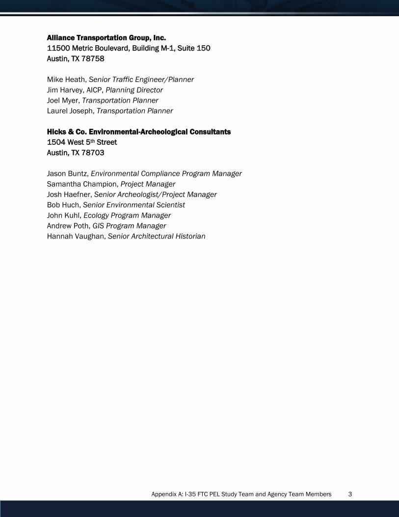
Appendix A: I-35 FTC PEL Study Team and Agency Team Members 3
Alliance Transportation Group, Inc.
11500 Metric Boulevard, Building M-1, Suite 150
Austin, TX 78758
Mike Heath, Senior Traffic Engineer/Planner
Jim Harvey, AICP, Planning Director
Joel Myer, Transportation Planner
Laurel Joseph, Transportation Planner
Hicks & Co. Environmental-Archeological Consultants
1504 West 5th Street
Austin, TX 78703
Jason Buntz, Environmental Compliance Program Manager
Samantha Champion, Project Manager
Josh Haefner, Senior Archeologist/Project Manager
Bob Huch, Senior Environmental Scientist
John Kuhl, Ecology Program Manager
Andrew Poth, GIS Program Manager
Hannah Vaughan, Senior Architectural Historian

Appendix A: I-35 FTC PEL Study Team and Agency Team Members 4
Agency Team Members
TxDOT
Roger Beall, Advanced Project Development Director, Transportation Planning and
Programming
Karen Lorenzini, Project Development Manager, Transportation Planning and Programming
Lindsey Kimmitt, Project Manager, Environmental Affairs
Stacey Benningfield, Mobility35 Program Manager, Austin District
Sonya Hernandez, Project Delivery Manager, Environmental Affairs
Mary Anne Griss, Program Coordinator, Austin District
Doise Miers, Public Involvement Specialist, Communications
City of Austin
Robert Spillar, Transportation Director
Gary Schatz, Assistant Transportation Director (former)
Allison Dietzel, Project Manager
Alan Hughes, Project Manager
FHWA
Tom Bruechert, Environmental Team Leader
Justin Ham, Urban Engineer
Jose Campos, Planning Team Leader
CAMPO
Ashby Johnson, Executive Director
Cathy Stephens, Planning and Environmental Program Manager