
HYDROELECTRIC PLANT RELICENSING
27
HYDROELECTRIC PLANT RELICENSING PROPOSED STUDY PLAN MEETING December 13, 2016
Transcript of HYDROELECTRIC PLANT RELICENSING

HYDROELECTRIC PLANT RELICENSING PROPOSED STUDY PLAN MEETING
December 13, 2016
AGENDA
• Introductions
• Goals for the meeting
• Ground rules
• Relicensing process
• Responses to additional information requests
• Proposed Study Plan
• Recap and next steps

GOALS FOR THE MEETING
• Review relicensing process
• Review schedule
• Discuss Proposed Study Plan
• Take comments
• Answer questions
• Review next steps
GROUND RULES
4
• Mute cell phones
• Be mindful of the meeting goals
• The Parking Lot
• Allow everyone an opportunity to speak
• No talking when others are talking
• Stay focused on the issues - No “grandstanding”
• We’ll take breaks as needed
5
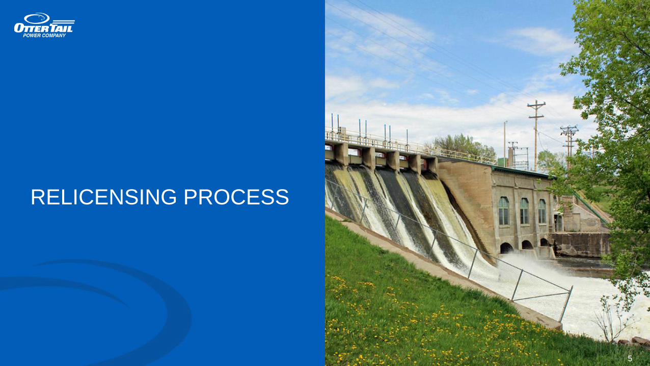
RELICENSING PROCESS
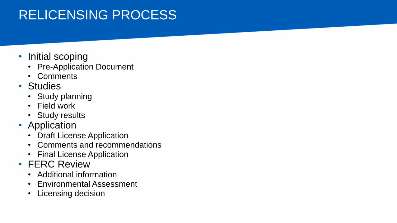
RELICENSING PROCESS
• Initial scoping • Pre-Application Document • Comments
• Studies • Study planning • Field work • Study results
• Application • Draft License Application • Comments and recommendations • Final License Application
• FERC Review • Additional information • Environmental Assessment • Licensing decision
STUDY PLANNING
• Proposed Study Plan
• Study Plan Meeting
• Comments
• Revised Study Plan
• FERC’s Study Plan Determination
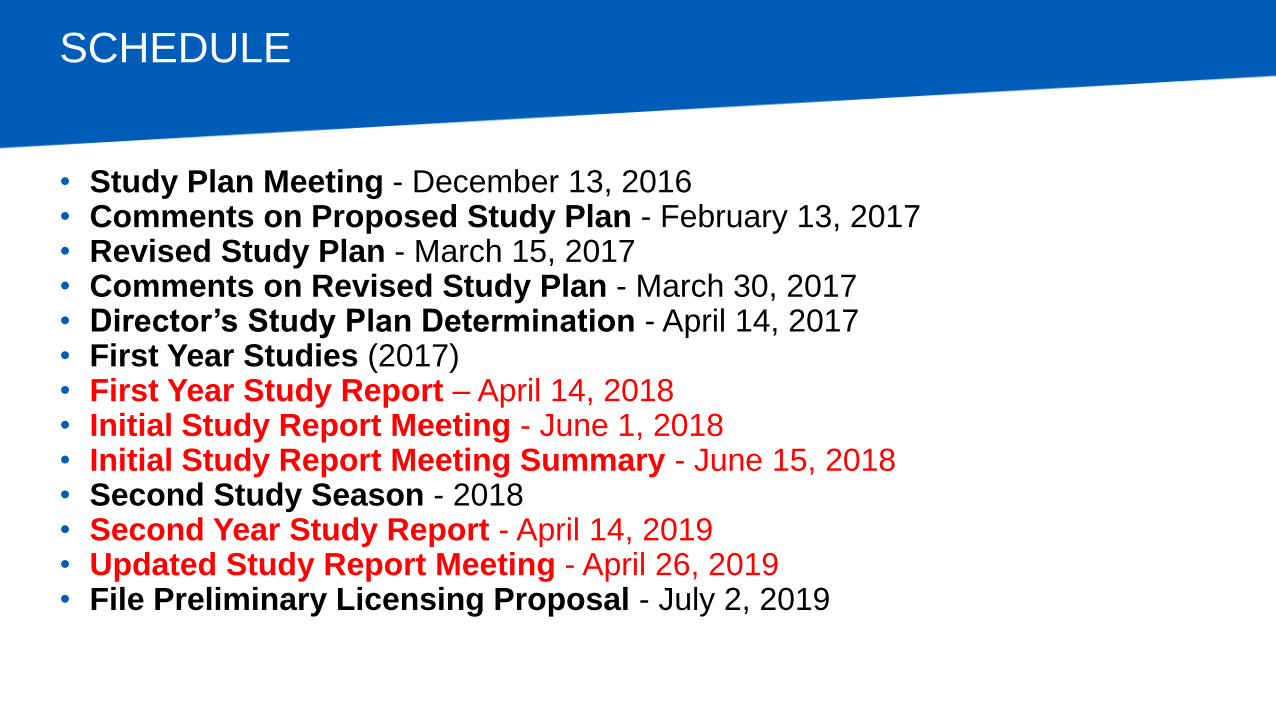
SCHEDULE
• Study Plan Meeting - December 13, 2016 • Comments on Proposed Study Plan - February 13, 2017 • Revised Study Plan - March 15, 2017 • Comments on Revised Study Plan - March 30, 2017 • Director’s Study Plan Determination - April 14, 2017 • First Year Studies (2017) • First Year Study Report – April 14, 2018 • Initial Study Report Meeting - June 1, 2018 • Initial Study Report Meeting Summary - June 15, 2018 • Second Study Season - 2018 • Second Year Study Report - April 14, 2019 • Updated Study Report Meeting - April 26, 2019 • File Preliminary Licensing Proposal - July 2, 2019
RESPONSES TO ADDITIONAL INFORMATION REQUESTS
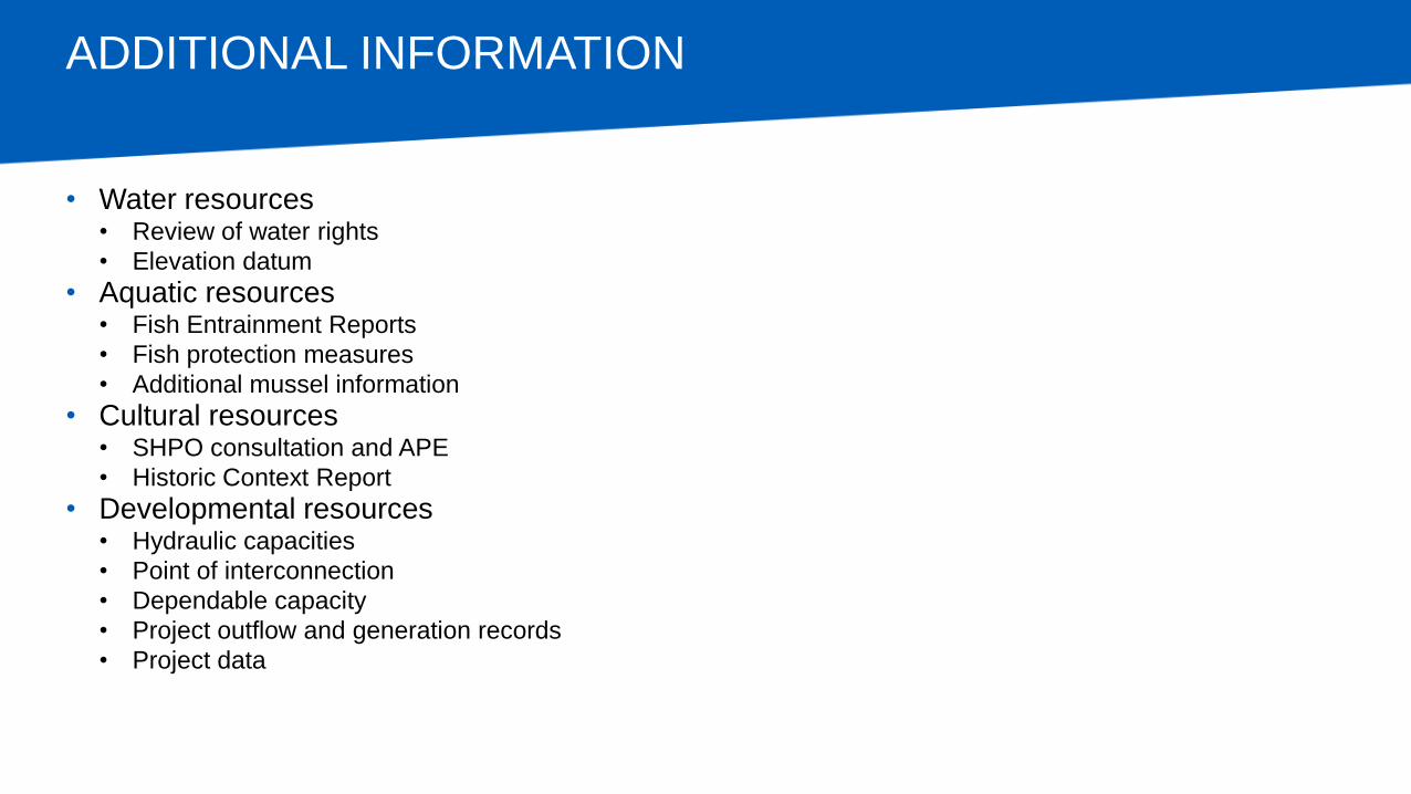
ADDITIONAL INFORMATION
• Water resources • Review of water rights
• Elevation datum
• Aquatic resources • Fish Entrainment Reports
• Fish protection measures
• Additional mussel information
• Cultural resources • SHPO consultation and APE
• Historic Context Report
• Developmental resources • Hydraulic capacities
• Point of interconnection
• Dependable capacity
• Project outflow and generation records
• Project data
PROPOSED STUDY PLAN
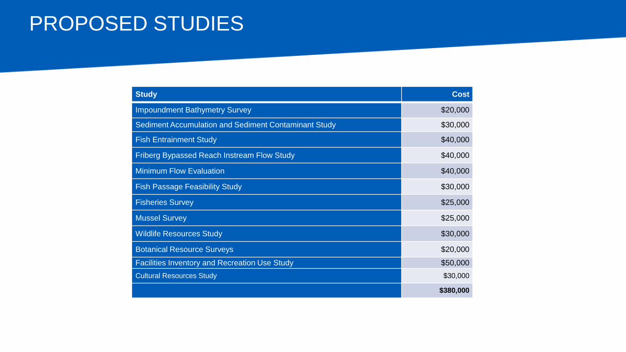
PROPOSED STUDIES
Study Cost
Impoundment Bathymetry Survey $20,000
Sediment Accumulation and Sediment Contaminant Study $30,000
Fish Entrainment Study $40,000
Friberg Bypassed Reach Instream Flow Study $40,000
Minimum Flow Evaluation $40,000
Fish Passage Feasibility Study $30,000
Fisheries Survey $25,000
Mussel Survey $25,000
Wildlife Resources Study $30,000
Botanical Resource Surveys $20,000
Facilities Inventory and Recreation Use Study $50,000
Cultural Resources Study $30,000
$380,000
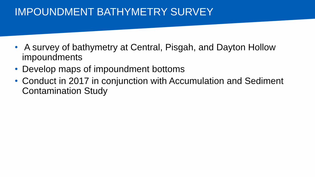
IMPOUNDMENT BATHYMETRY SURVEY
• A survey of bathymetry at Central, Pisgah, and Dayton Hollow impoundments
• Develop maps of impoundment bottoms
• Conduct in 2017 in conjunction with Accumulation and Sediment Contamination Study
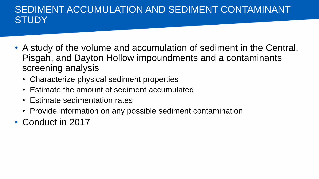
SEDIMENT ACCUMULATION AND SEDIMENT CONTAMINANT STUDY
• A study of the volume and accumulation of sediment in the Central, Pisgah, and Dayton Hollow impoundments and a contaminants screening analysis
• Characterize physical sediment properties
• Estimate the amount of sediment accumulated
• Estimate sedimentation rates
• Provide information on any possible sediment contamination
• Conduct in 2017
FISH ENTRAINMENT STUDY
• A desktop fish turbine entrainment mortality study
• Estimate entrainment rates of target species at each development
• Estimate turbine passage survival of target fish at each development
• Conduct in 2018
FRIBERG BYPASSED REACH INSTREAM FLOW STUDY
• A study of flows in relation to available aquatic habitat and recreation opportunities in the Friberg development bypassed reach
• Collect measurements of water depth, velocity, and substrate at a series of flow releases from the Friberg dam
• Compare the data to habitat suitability indices for select target species
• Evaluate the navigability of the reach at several releases from the dam
• Conduct in 2017
MINIMUM FLOW EVALUATION
• A re-evaluation of the existing minimum flows and the associated schedule at the Hoot Lake Diversion Dam development
• Perform a flow demonstration in the diversion channel
• Conduct observations and measurements of water depth, velocity, and substrate at a series of flow releases
• Compare the data to habitat suitability indices for select target species
• Evaluate the navigability of the reach at several releases from the dam
• Conduct in 2017
FISH PASSAGE FEASIBILITY STUDY
• A conceptual evaluation of fish passage and alternatives at all five development locations
• Upstream
• Downstream
• Conduct in 2017
FISHERIES SURVEY
• Fishery surveys to examine the current fish assemblage in Otter Tail River Project waters
• Perform fishery surveys using gill nets with a range of mesh sizes to catch fish of different species and life stages
• Identify and enumerate all fish and obtain length and weight measurements on target species
• Develop a better understanding of the size and age structure of lake sturgeon in the Otter Tail River Project area during the fall and spring
• Conduct in 2017
MUSSEL SURVEY
• Mussel surveys above, within, and below the Otter Tail River Project area to characterize the mussel community composition
• Conduct in 2017
WILDLIFE RESOURCES STUDY
• Reconnaissance level field survey of wildlife resources and habitat in the Otter Tail River Project area, including for rare, threatened or endangered (RTE) species or unique habitat
• Desktop review of habitat
• Field verification
• Conduct in 2017
BOTANICAL RESOURCE SURVEYS
• Reconnaissance-level field survey of botanical resources within the Otter Tail River Project area, including for RTE and non-native invasive botanical species
• Study in conjunction with wildlife survey
• Conduct in 2017
FACILITIES INVENTORY AND RECREATION USE STUDY
• A recreation facilities inventory and survey of existing recreation opportunities and use • Inventory and map existing public recreation sites and access areas within the
immediate project vicinity
• Identify who owns, operates, and maintains each recreation site
• Evaluate the condition of the recreation sites within and adjacent to the project boundary
• Identify and photograph any areas that have characteristics of erosion, slumping, or other forms of instability due to recreational use
• Estimate current recreation use and the current and projected use capacity at each Project recreation site
• Conduct visitor surveys during the recreation season
• Conduct in 2017
CULTURAL RESOURCES STUDY
• A literature review inventory within the Area of Potential Effect (APE)
• Confirm the APE
• Assess Natural Register-eligibility of resources within the APE
• (If necessary) conduct Phase I reconnaissance survey
• Evaluate effects of project on cultural resources
• Assess condition of relevant sites
• Conduct in 2017
REQUESTED STUDIES NOT ADOPTED
• Recreation Safety Study
• Pisgah Dam Safety Reclassification Study
• Economic Impact Study

RECAP AND NEXT STEPS
otpco.com/Hydro


![[0] final - report hydroelectric power plant](https://static.fdocuments.net/doc/165x107/5478bbd1b479599f098b4587/0-final-report-hydroelectric-power-plant.jpg)
