How to use ACS Geodatabase Files and ArcMap - Census · Survey (ACS) Geodatabase Files and ArcMap...
35
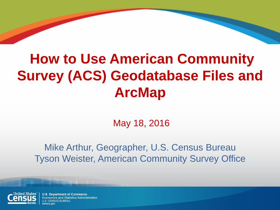
How to Use American Community Survey (ACS) Geodatabase Files and ArcMap May 18, 2016 Mike Arthur, Geographer, U.S. Census Bureau Tyson Weister, American Community Survey Office
Transcript of How to use ACS Geodatabase Files and ArcMap - Census · Survey (ACS) Geodatabase Files and ArcMap...
How to Use American Community
Survey (ACS) Geodatabase Files and
ArcMap
May 18, 2016
Mike Arthur, Geographer, U.S. Census Bureau
Tyson Weister, American Community Survey Office
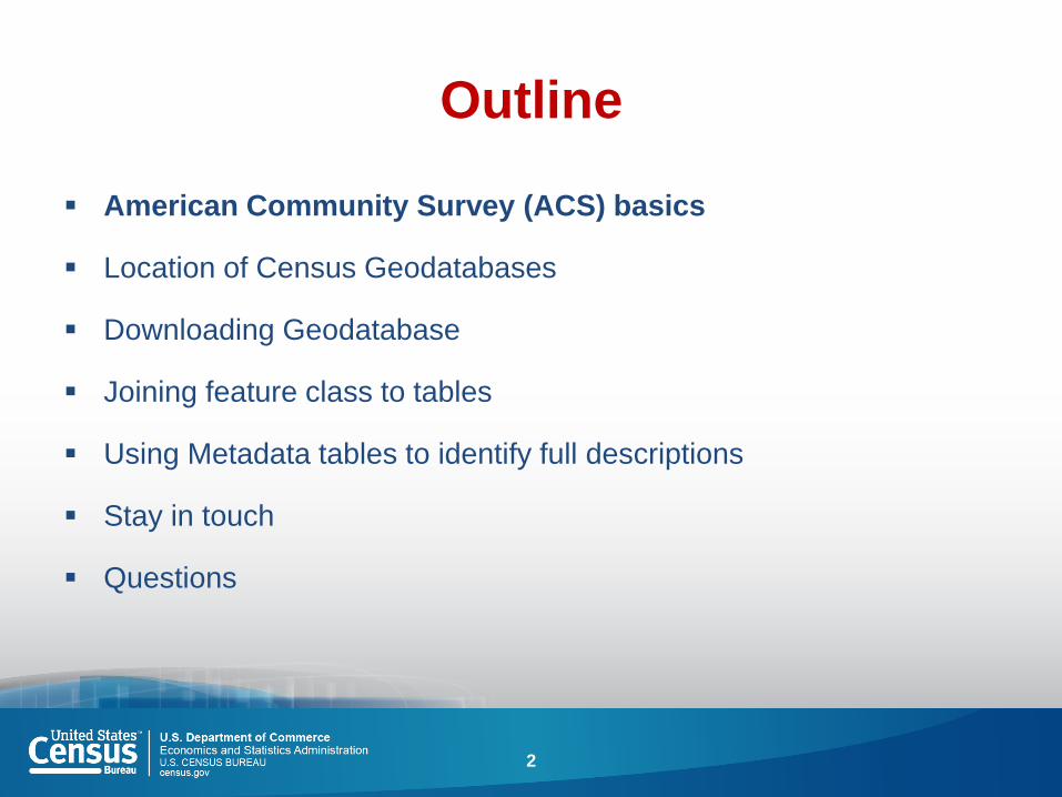
Outline
American Community Survey (ACS) basics
Location of Census Geodatabases
Downloading Geodatabase
Joining feature class to tables
Using Metadata tables to identify full descriptions
Stay in touch
Questions
2

ACS Basics
• Ongoing monthly survey sent to 3.5 million
addresses per year to produce detailed
population and housing estimates each year
• Visit 20,000 Group Quarter facilities and sample
approximately 194,000 residents each year
• Designed to produce critical information on
small areas and small population groups
previously collected on the decennial long
form
• Covers 35+ topics and supports over 300
known Federal Government uses
• Data released twice annually
• 1-year estimates (12 months of data)
• 5-year estimates (60 months of data)
3

Census / ACS History
1790-1930 Census one form to all households
1940-2000 Census short form & long form
1996-2004 ACS demonstration period
2005-present ACS/PRCS annual estimates for all geographies
2010 Census and future short form only
1790
1800 1810 1820 1830 1840 1850 1860 1870 1880 1890 1900 1910 1920 1930 1940 1950 1960 1970 1980 1990 2000 2010 2020
1996
2000
2005
2020
2010
4
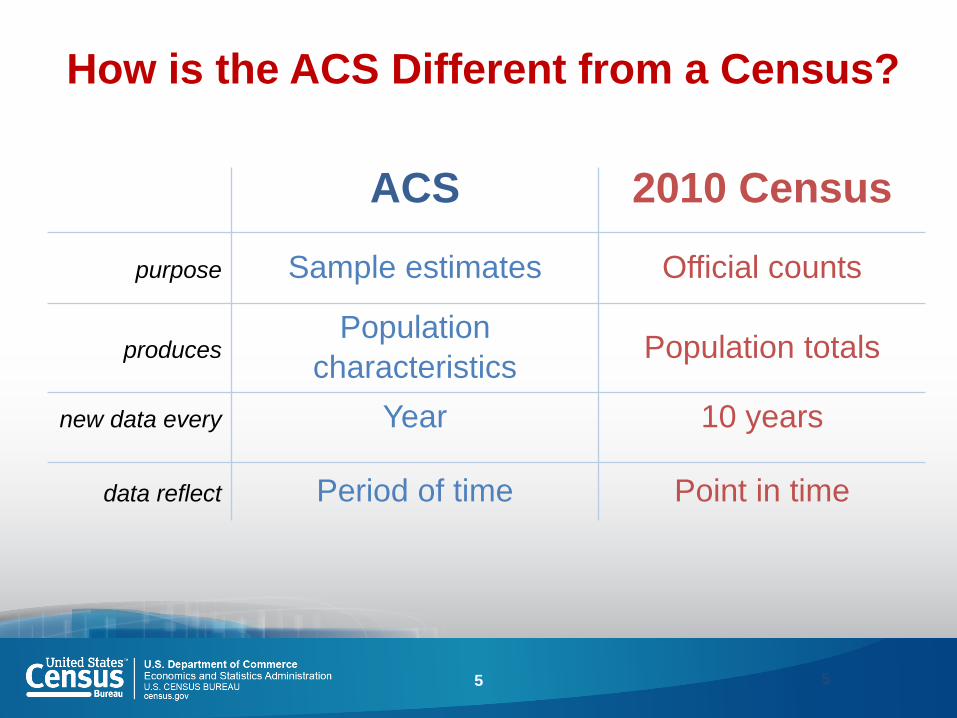
How is the ACS Different from a Census?
ACS 2010 Census
purpose Sample estimates Official counts
produces Population
characteristics Population totals
new data every Year 10 years
data reflect Period of time Point in time
5 5
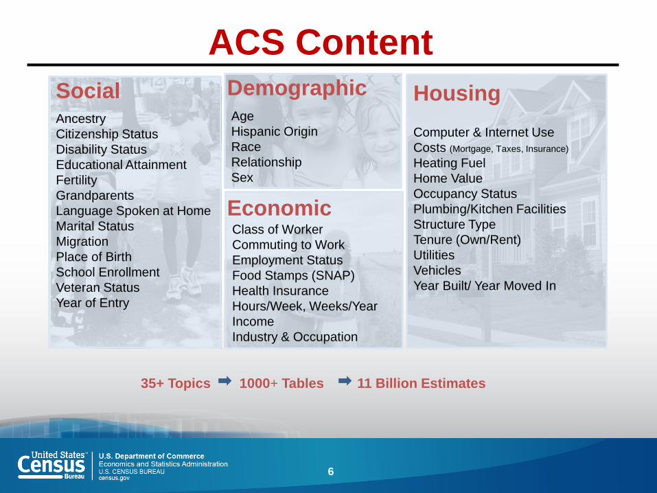
ACS Content
Ancestry
Citizenship Status
Disability Status
Educational Attainment
Fertility
Grandparents
Language Spoken at Home
Marital Status
Migration
Place of Birth
School Enrollment
Veteran Status
Year of Entry
Social
Class of Worker
Commuting to Work
Employment Status
Food Stamps (SNAP)
Health Insurance
Hours/Week, Weeks/Year
Income
Industry & Occupation
Age
Hispanic Origin
Race
Relationship
Sex
35+ Topics 1000+ Tables 11 Billion Estimates
Economic
Demographic
Computer & Internet Use
Costs (Mortgage, Taxes, Insurance)
Heating Fuel
Home Value
Occupancy Status
Plumbing/Kitchen Facilities
Structure Type
Tenure (Own/Rent)
Utilities
Vehicles
Year Built/ Year Moved In
Housing
6
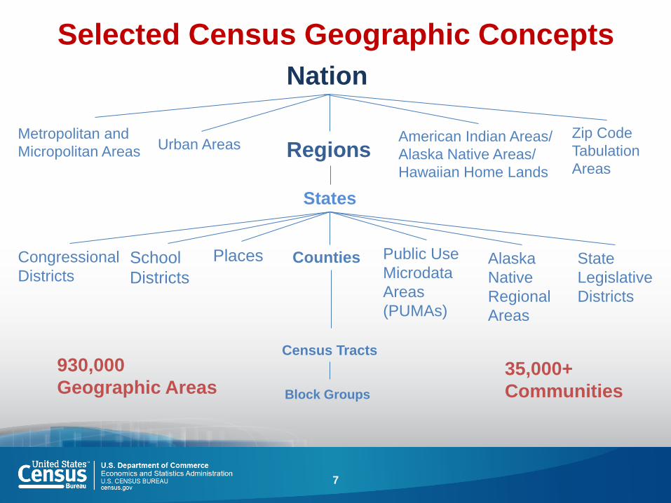
Selected Census Geographic Concepts
Nation
Regions
States
Counties
Census Tracts
Block Groups
Congressional
Districts
American Indian Areas/
Alaska Native Areas/
Hawaiian Home Lands
Urban Areas Metropolitan and
Micropolitan Areas
Zip Code
Tabulation
Areas
Places School
Districts
Public Use
Microdata
Areas
(PUMAs)
Alaska
Native
Regional
Areas
State
Legislative
Districts
930,000
Geographic Areas 35,000+
Communities
7
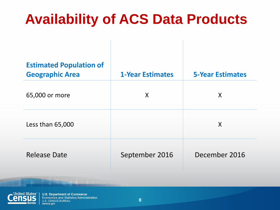
Availability of ACS Data Products
8
Estimated Population of Geographic Area 1-Year Estimates 5-Year Estimates
65,000 or more X X
Less than 65,000 X
Release Date September 2016 December 2016
Outline
American Community Survey (ACS) basics
Location of Census Geodatabases
Downloading Geodatabase
Joining feature class to tables
Using Metadata tables to identify full descriptions
Stay in touch
Questions
9
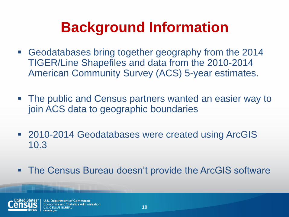
Background Information
Geodatabases bring together geography from the 2014 TIGER/Line Shapefiles and data from the 2010-2014 American Community Survey (ACS) 5-year estimates.
The public and Census partners wanted an easier way to join ACS data to geographic boundaries
2010-2014 Geodatabases were created using ArcGIS 10.3
The Census Bureau doesn’t provide the ArcGIS software
10

Census.gov
11
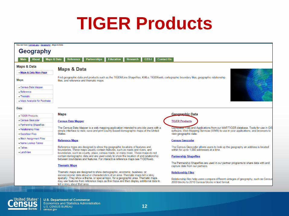
TIGER Products
12
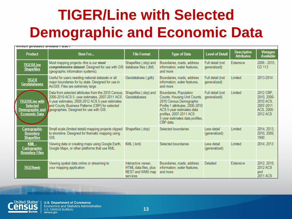
TIGER/Line with Selected
Demographic and Economic Data
13
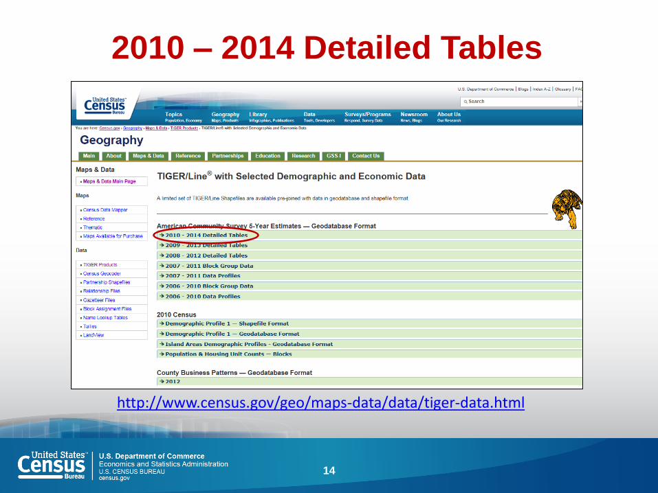
2010 – 2014 Detailed Tables
http://www.census.gov/geo/maps-data/data/tiger-data.html
14
Outline
American Community Survey (ACS) basics
Location of Census Geodatabases
Downloading Geodatabase
Joining feature class to tables
Using Metadata tables to identify full descriptions
Stay in touch
Questions
15
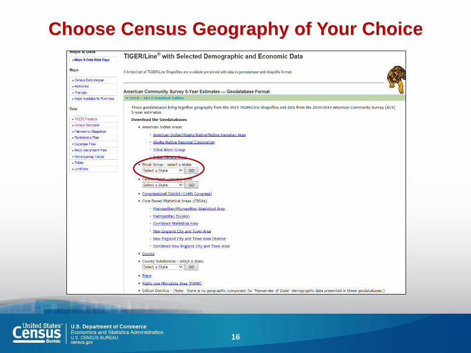
Choose Census Geography of Your Choice
16

Zipped Files Once Download is
Complete
17

Outline
American Community Survey (ACS) basics
Location of Census Geodatabases
Downloading Geodatabase
Joining feature class to tables
Using Metadata tables to identify full descriptions
Stay in touch
Questions
18

Add Data Button to Upload GDB
19

Choose Feature Class and Tables
20
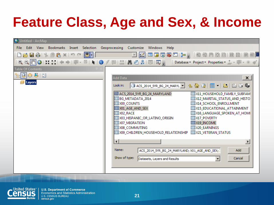
Feature Class, Age and Sex, & Income
21
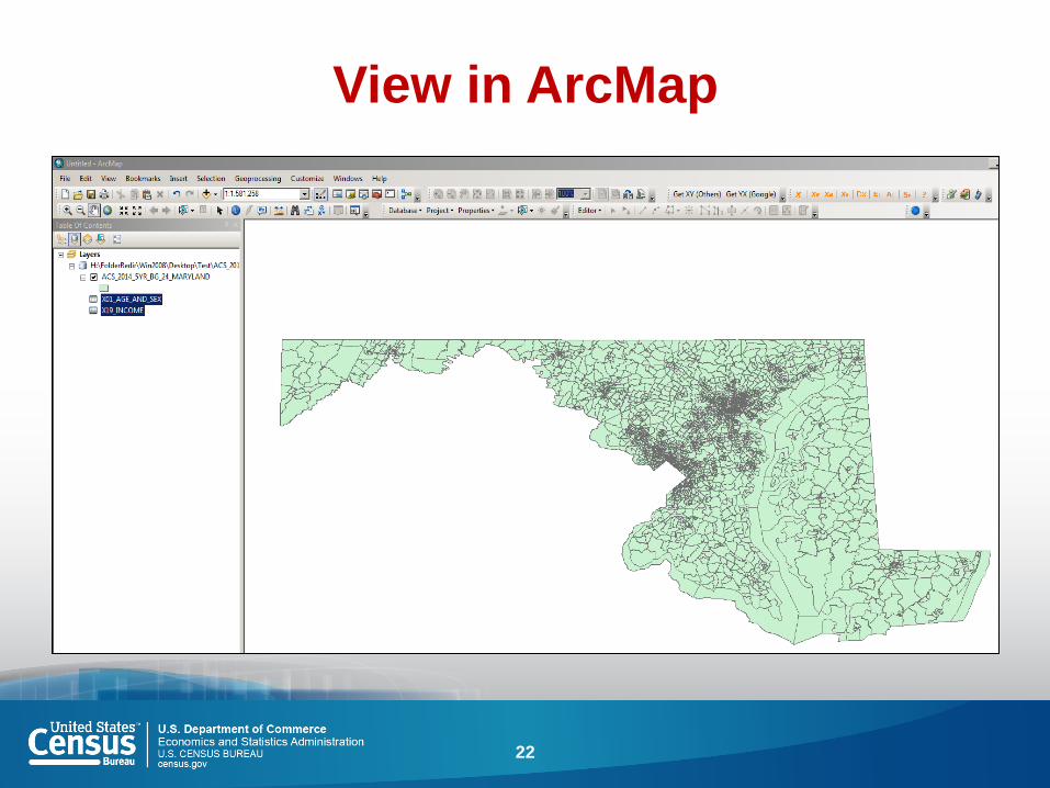
View in ArcMap
22

Joining the Table to the Feature
Class
23

Validation Check
24
Outline
American Community Survey (ACS) basics
Location of Census Geodatabases
Downloading Geodatabase
Joining feature class to tables
Using Metadata tables to identify full descriptions
Stay in touch
Questions
25

Attribute Table When Join
Successfully Occurs
26
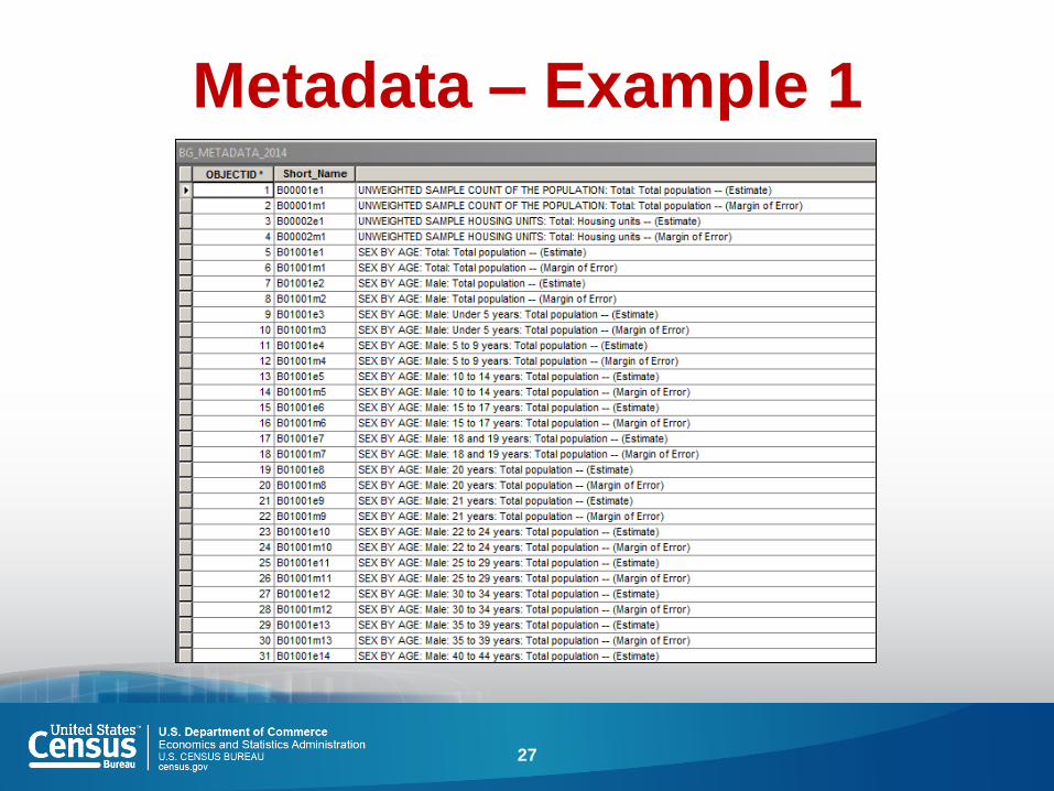
Metadata – Example 1
27
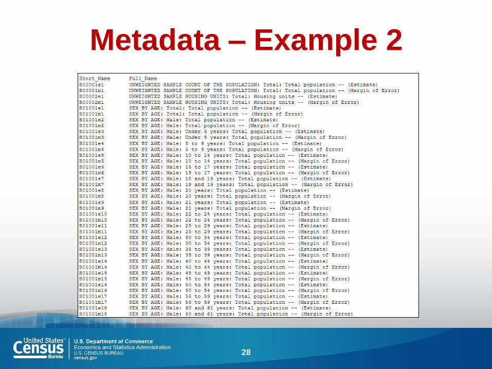
Metadata – Example 2
28
Common Mistakes
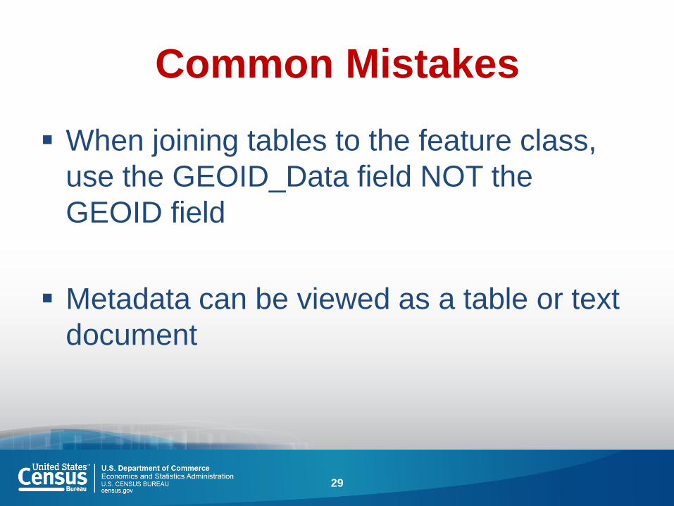
When joining tables to the feature class,
use the GEOID_Data field NOT the
GEOID field
Metadata can be viewed as a table or text
document
29
Outline
American Community Survey (ACS) basics
Location of Census Geodatabases
Downloading Geodatabase
Joining feature class to tables
Using Metadata tables to identify full descriptions
Stay in touch
Questions
30

Source Us! U.S. Census Bureau’s [YYYY-YYYY] American Community
Survey [1/3/5]-year [estimates/statistics/data release]
31

Sign up for and manage alerts at https://public.govdelivery.com/accounts/
USCENSUS/subscriber/new
More information online: https://www.census.gov/geography.html
http://www.census.gov/acs
facebook.com/uscensusbureau
twitter.com/uscensusbureau
youtube.com/user/uscensusbureau
instagram.com/uscensusbureau
pinterest.com/uscensusbureau
Continue the Conversation
#CensusGeo #ACSdata
(800) 923-8282 (Census)
(301) 763-1128 (Geography questions)
(301) 763-1405 (ACS questions)
32
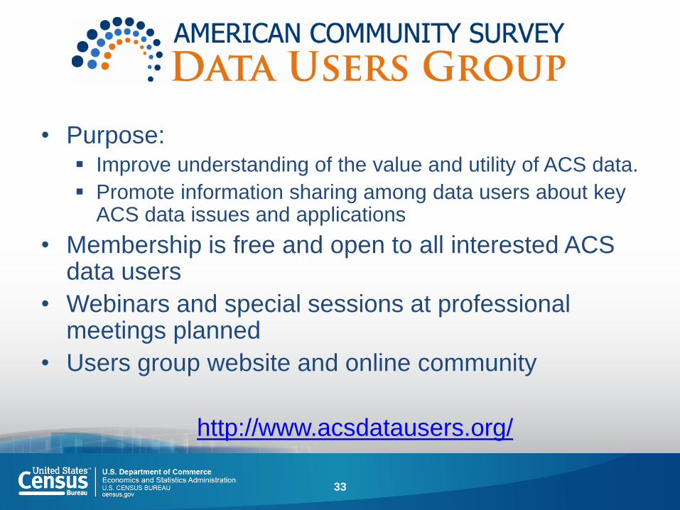
• Purpose: Improve understanding of the value and utility of ACS data.
Promote information sharing among data users about key ACS data issues and applications
• Membership is free and open to all interested ACS data users
• Webinars and special sessions at professional meetings planned
• Users group website and online community
http://www.acsdatausers.org/
33
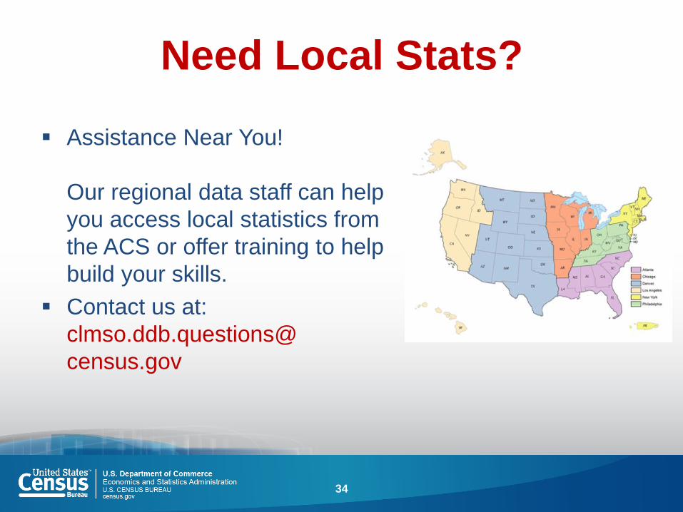
Need Local Stats?
Assistance Near You!
Our regional data staff can help
you access local statistics from
the ACS or offer training to help
build your skills.
Contact us at:
clmso.ddb.questions@
census.gov
34
Questions?
35